
High in the San Gabriel Mountains, just north of Los Angeles, Big Tujunga Creek has over the centuries carved a deep and beautiful canyon. The creek and its smaller tributary (aptly named Little Tujunga Creek) eventually end up in the Los Angeles “river.” (One of the implausible aspects of Los Angeles is that its namesake river carries far less water than the creeks that feed it.) Today I decided to head up into the mountains and explore the Tujungas. Now, I realize that there’s a shelter-in-place order in effect, but this was a necessary trip that could save a life. As in, Karen was going to kill me if we spent another full day in the house together.
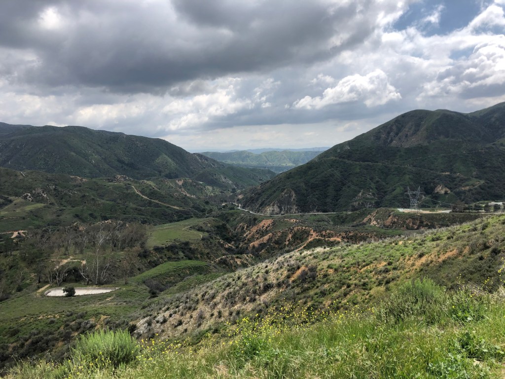
It was good to get up into the mountains. It never ceases to amaze me how you’re transported to an entirely different world with just a 20 minute drive from downtown. (Well, 20 minutes these days, with the traffic attenuated by Covid 19.) I got up a few thousand feet above sea level, and enjoyed commanding views of the mountains.
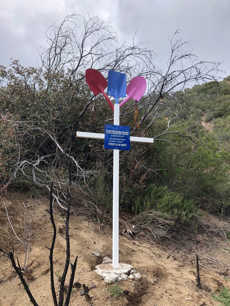
Of course, these views don’t come for free. I passed several makeshift markers that commemorated roadside deaths. One memorialized someone named Kevin Alexander Arnold, who’d succumbed last October at age 38. The marker was constructed from three shovels, each painted a different color, making me wonder if he was involved in road work. Whatever the circumstances, it was a tragedy for someone so young, and a “husband and father,” to have died.
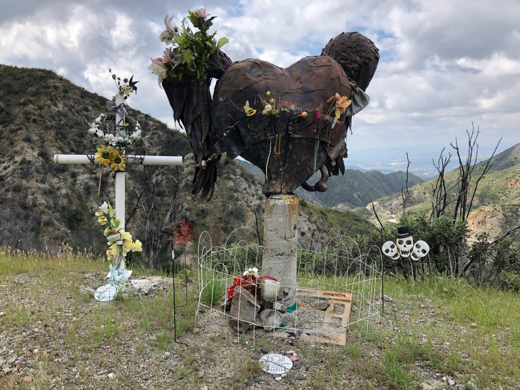
I encountered a more disturbing memorial some miles later. It reminds me of a steam punk sculpture, constructed of metal plates welded together into the shape of a girl’s head, with pigtails and an enormous earring, mounted on a concrete pillar. There is no name or dates in evidence. But there is a Halloween decoration with three jolly skulls looking on.
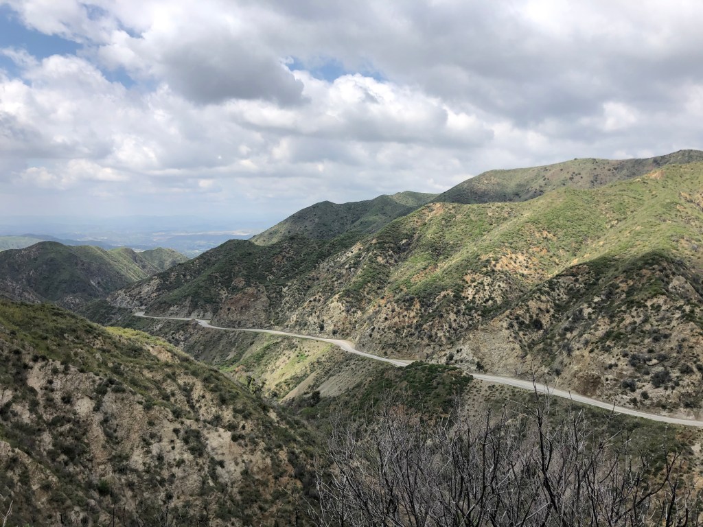
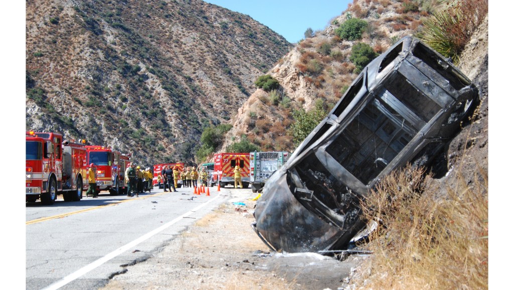
You figure there’s been a lot of accidents on this winding two-lane road through the mountains, especially in the winter with the added dangers of snow and ice. I tried to research the story behind the makeshift memorials I encountered, but to no avail. I did, however, find an online photo depicting the road’s hazards.
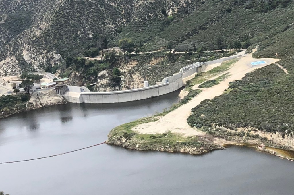
As I continued along the Big Tujunga, I thought about how the ecosystem up here in the San Gabriels is so different from the LA Basin to the south, and from the Mojave Desert to the north. The San Gabriels are high enough to get snow, and the runoff feeds the creeks and, ultimately, the LA “River.” Los Angeles has always had a love-hate relationship with water. There’s always too little or too much. So LA, like many cities in the early 20th century, undertook various hydro projects to store water, produce electricity, and control floods. I encountered a good example of this infrastructure in the form of the Big Tujunga Dam, which stands over 200 feet high at the bottom of the canyon. The dam was completed in 1931 by the Los Angeles Department of Water and Power.
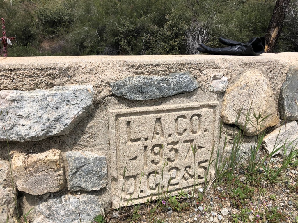
Much of LA’s far-flung infrastructure was constructed in the early 20th century. Even the Big Tujunga Canyon Road on which I was traveling had markers cast into the retaining walls with dates from the 1930s.
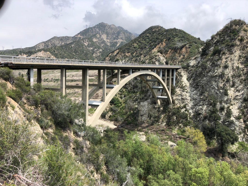
This next structure is more modern, having been built in 1958. It’s a concrete arch bridge that takes the Big Tujunga Canyon Road across Big Tujunga Creek. There’s something about these arch bridges that I find to be graceful and mesmerizing.
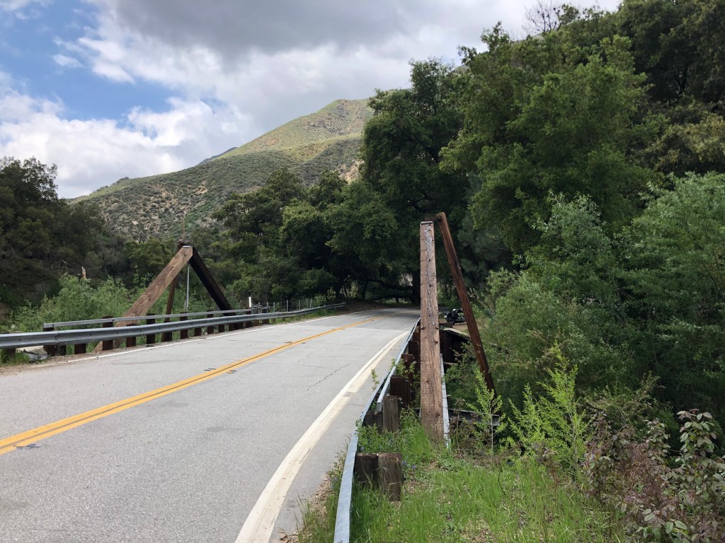
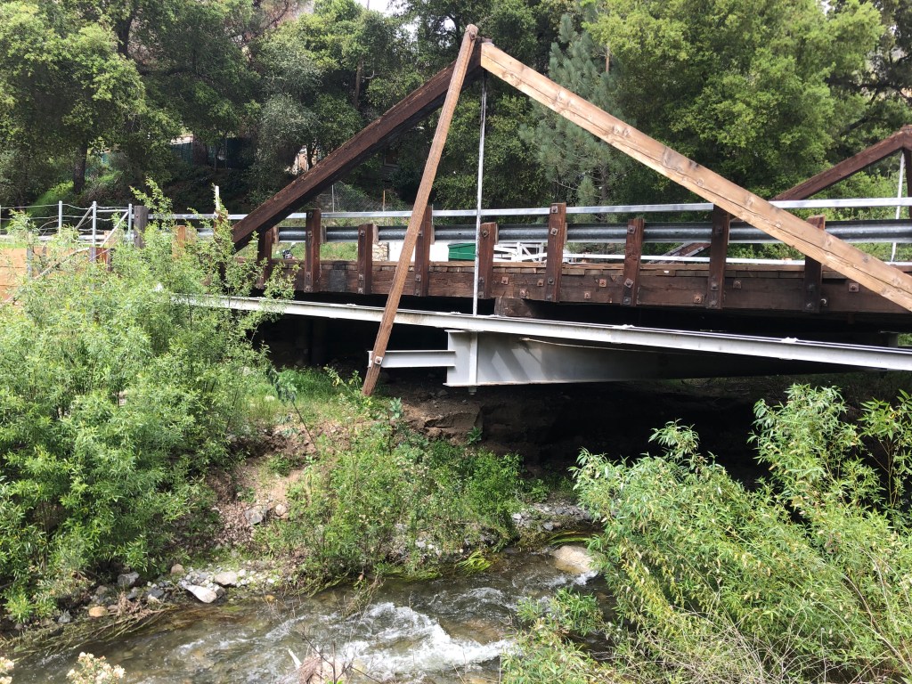
Most of the other bridges on today’s trip were less impressive. For example, I crossed two or three timber truss bridges that looked like they’d been designed by high school students using old telephone poles. But while they’re inelegant, they have their own kind of simple charm.
All in all, it was an enjoyable outing. I’m hoping to get deeper into the mountains during another trip in a week or two. Meanwhile, I hope you’re all getting a chance to engage in some socially-distant activities during the lockdown. Stay safe.
sdb

Gorgeous photos and a great story. Thanks for sharing the interlude.
LikeLike