
To get from Northern to Southern California (or vice versa) by car, you have a number of viable options. If you’re in a hurry you can take I-5 straight up the middle of the state. If you want a leisurely drive along the coast, the Pacific Coast Highway awaits. US 101 offers a somewhat faster route with views of the ocean. Route 99 will take you through scores of small central valley towns. And then there is CA Route 33, which you’ve probably never heard of. (The motorheads at Jalopnik have put together a video to explain why 33 remains so obscure.)
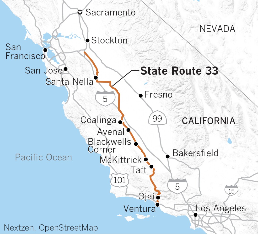
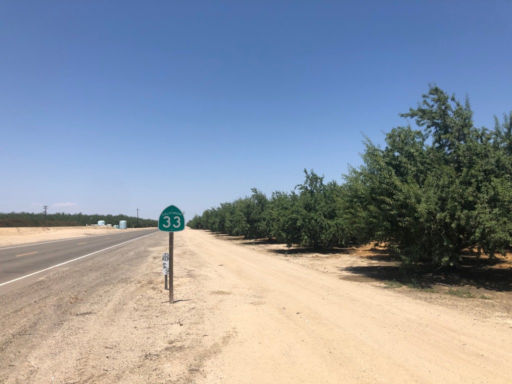
CA-33 runs about 300 miles along the western central valley, starting a few blocks from the beach in Ventura and terminating at a nondescript road east of Tracy, south of Stockton. I can’t think of very many scenarios that would cause a person to want to travel between these two points. And yet, there I was, setting out on that very mission late last week. It was time for a road trip.
CA-33 was the brainchild of California Governor Hiram Johnson in 1910. Desiring to reduce the power of the railroads, Johnson sought to connect all of the state’s county seats by roadway. One major part of that plan was highway 33. The route was opened in 1934 and has been modified and expanded over the years, with its current configuration being solidified about 50 years ago.
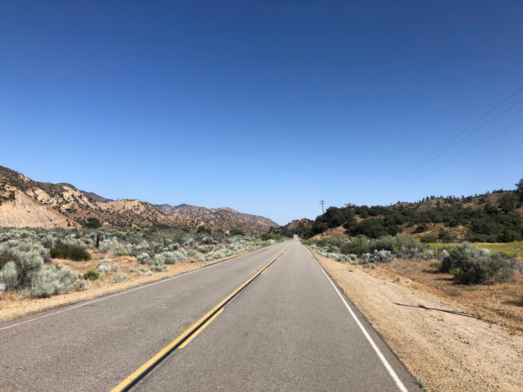
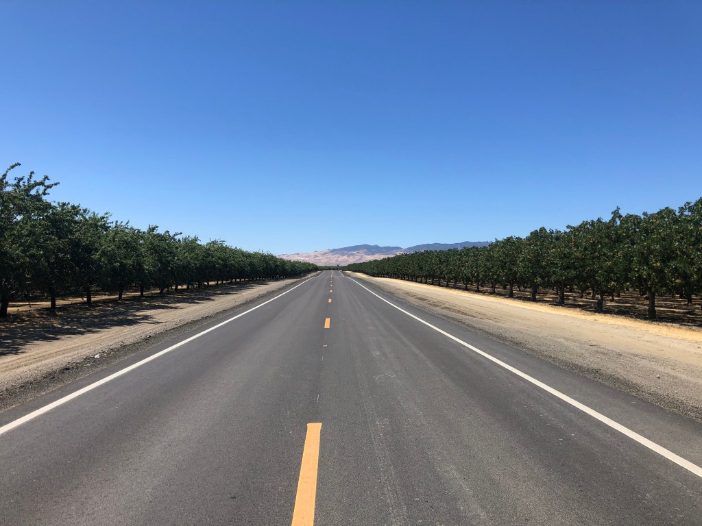
Route 33 is a study in the contrasts that are California. The road connects sunny beaches with 5,000-foot mountains and fertile valleys. It runs through forests, orchards, cropland, sagebrush, and oilfields. It’s home to ranchers, farmworkers, aging hippies, oil roughnecks, and warehouse workers. It’s all the parts of California that you don’t see on The Real Housewives of Orange County. And best of all, you can experience it all rolling along a narrow, two-lane road with almost no traffic.
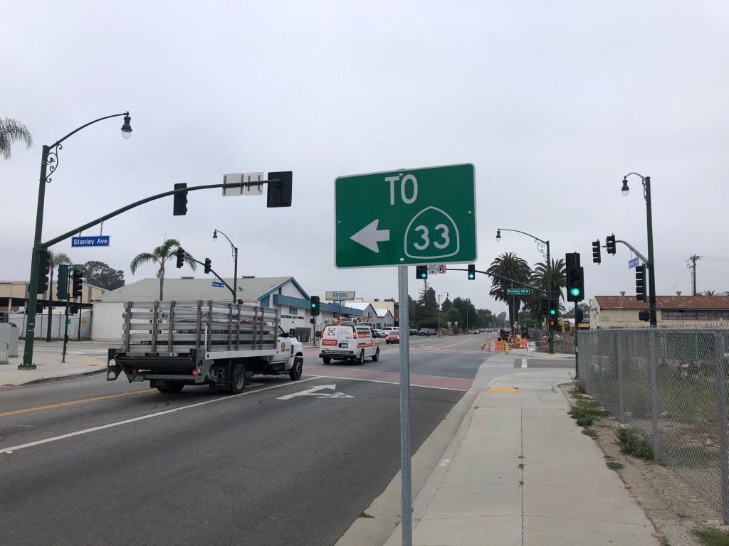
So Thursday morning I saddled up the Triumph and headed through the typical spring fog to Ventura (pop: 111,000), which is a coastal city that lies between Los Angeles and Santa Barbara. A little rooting around near the San Buenaventura Mission and I was able to find the beginning of Route 33.
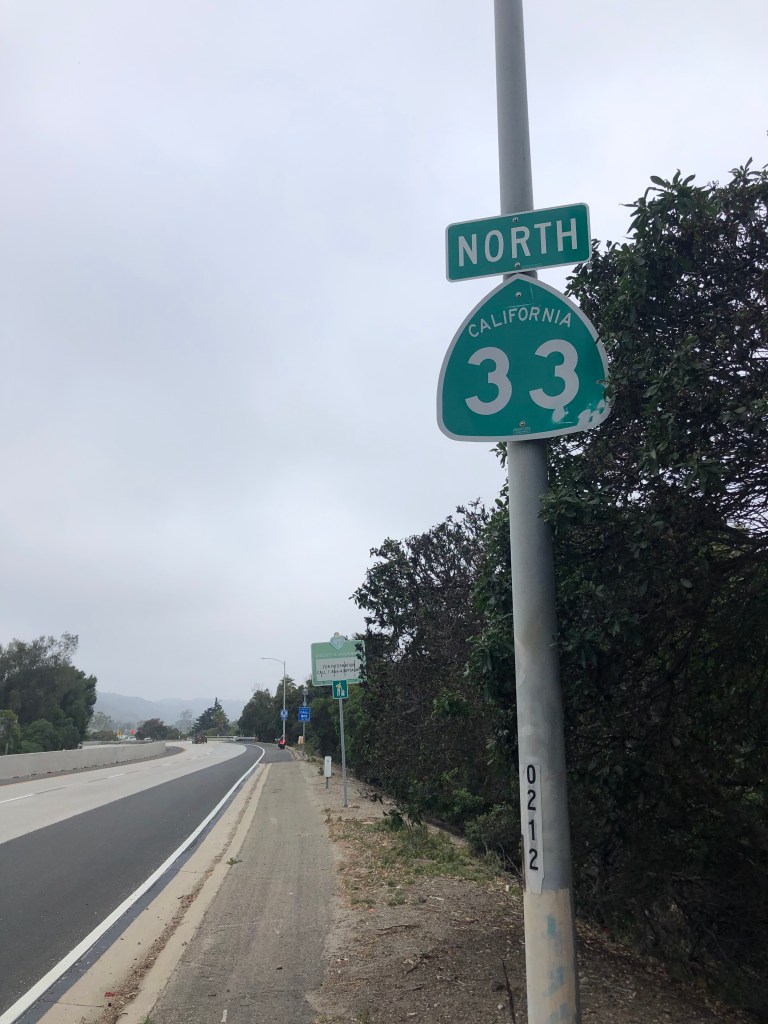
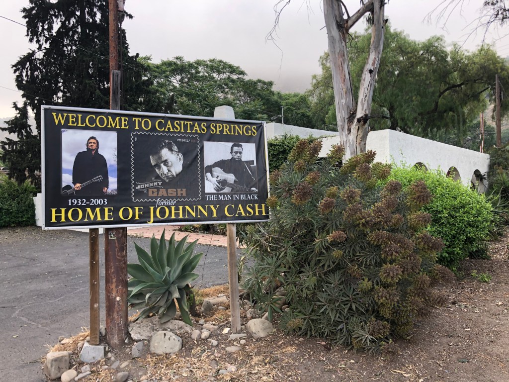
The first 10 miles or so take the form of a divided freeway named the Ojai Freeway. But before long 33 climbs into the Topatopa Mountains and becomes a winding two-lane road. Soon I was passing through the town of Casitas Springs, (pop: 1,000) which advertises itself as the “former home of Johnny Cash.” (Cash lived there from 1961 to 1967, until he divorced the mother of his children to be with June Carter.)
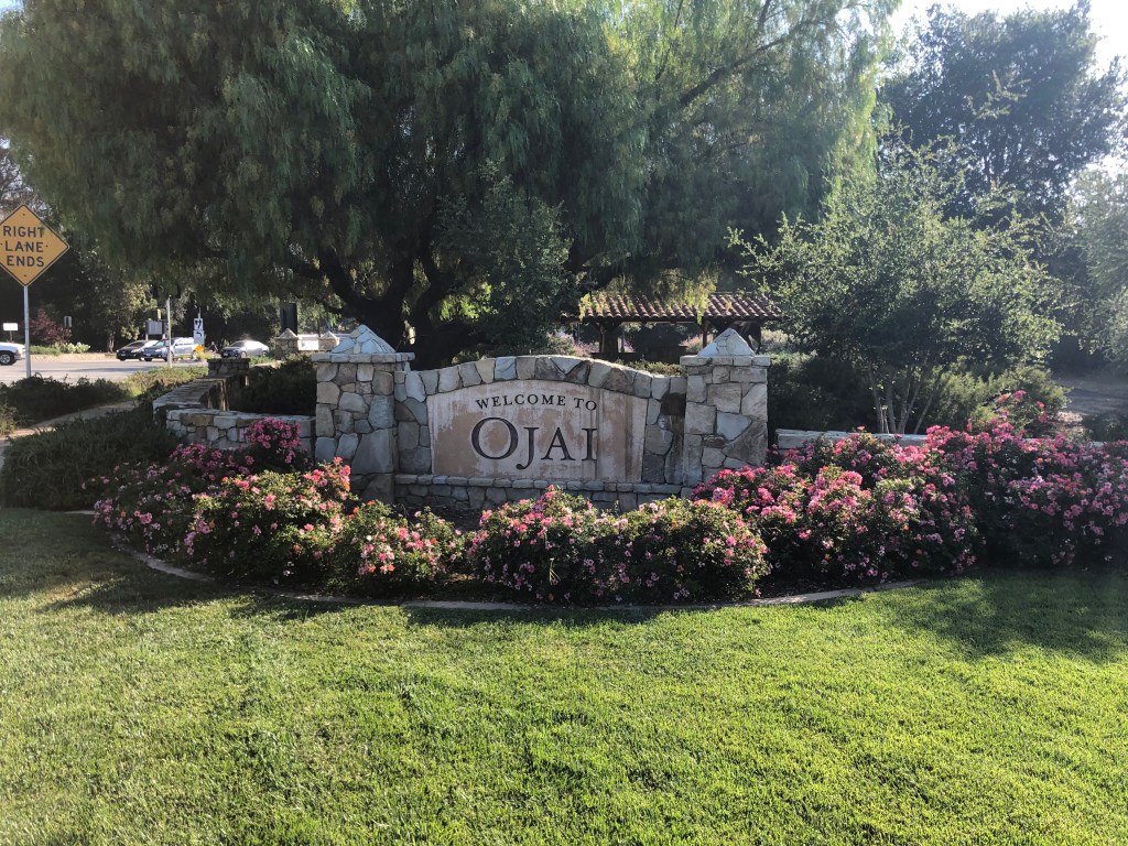
After Casitas Springs I entered Ojai (pop: 7,500), which is a famed New Age enclave in the Ojai Valley. It’s an idyllic setting, and it portrayed Shangri-La in Frank Capra’s Lost Horizon in 1937. (If you haven’t already seen that movie, you should.)
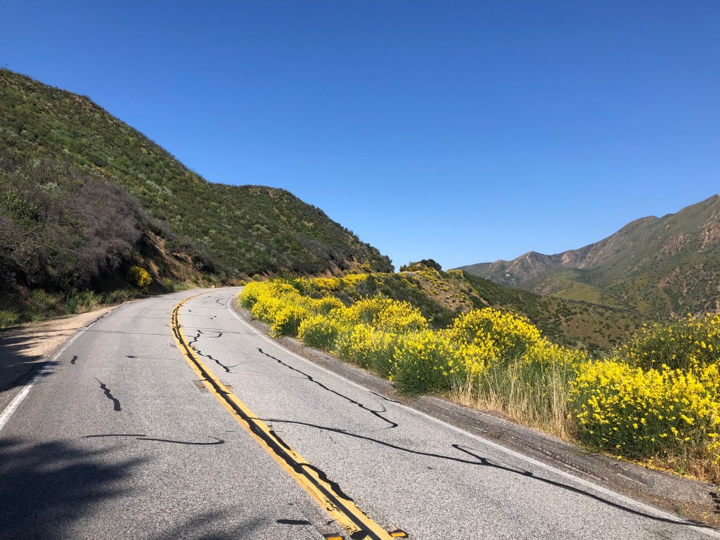
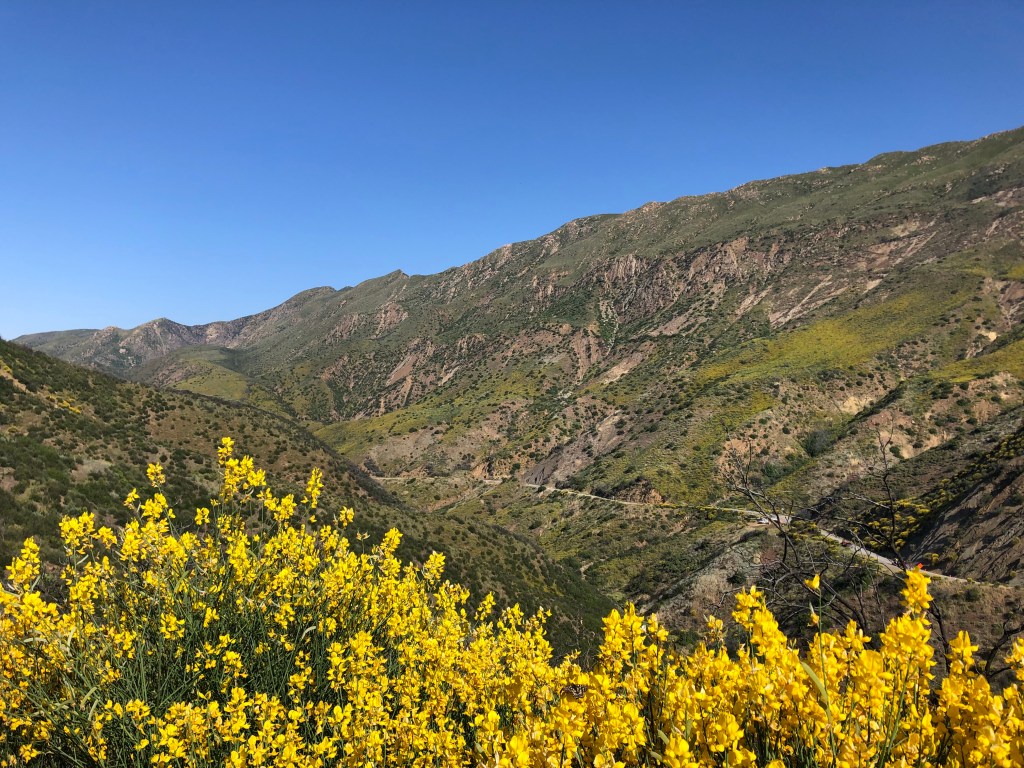
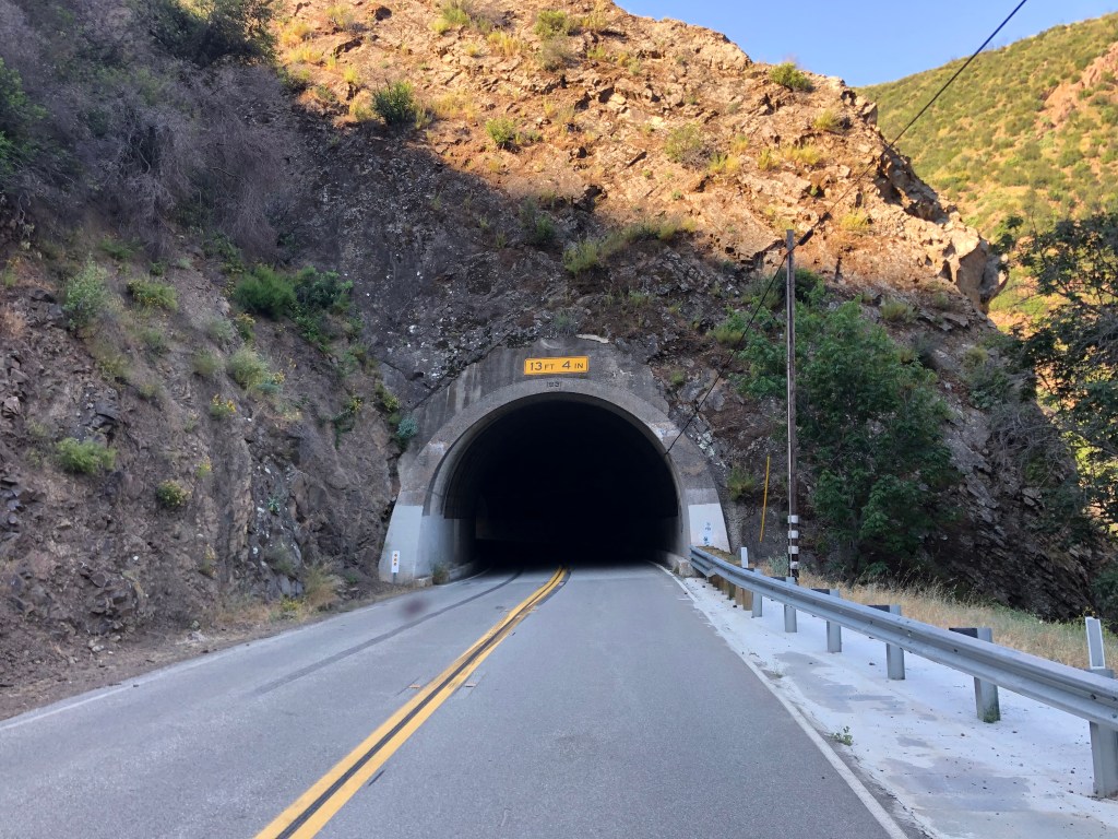
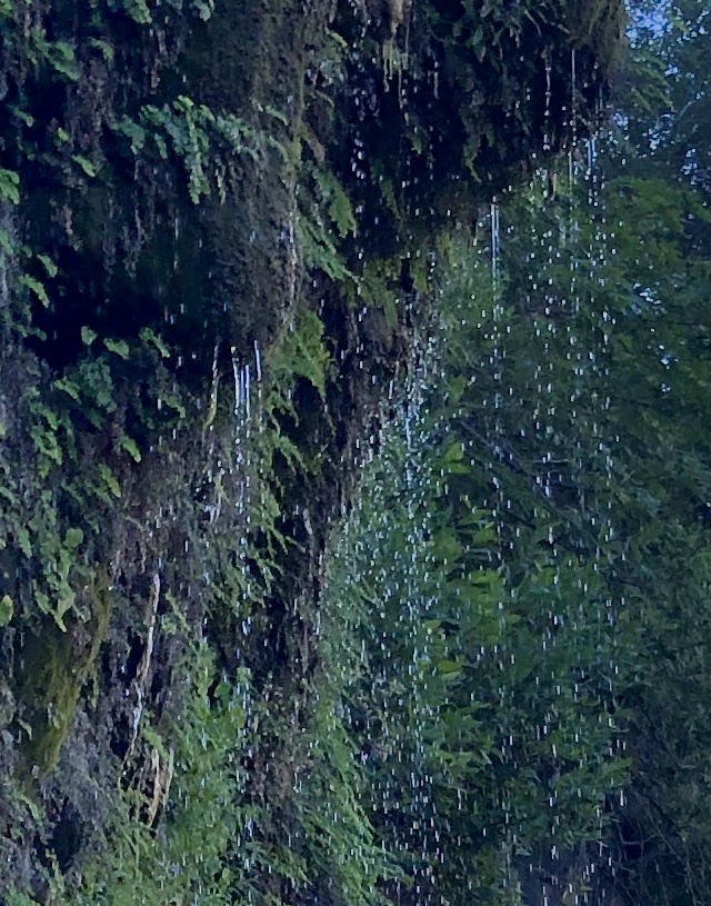
As I climbed out of the Ojai Valley, I found myself crossing the Transverse Ranges, so named because they run east-west, in opposition to the more typical north-south orientation of California’s coastal mountains. This was the most beautiful scenery of the trip: winding switchbacks, wildflowers, tunnels, and views of the ocean behind me.
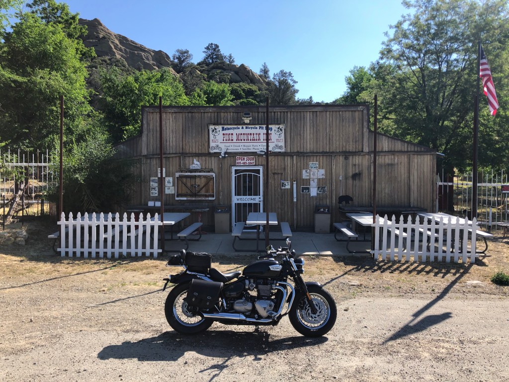
Eventually, as my stomach was demanding tribute, I happened upon a friendly-looking tavern named the Pine Mountain Inn. It advertises itself as a “motorcycle and bicycle pit stop,” offering food, drink, restrooms, and other comforts. The white front door read “welcome,” and the American flag was flying. But on closer inspection the open sign actually read “open soon.” It turns out that a tavern has operated on this site since 1939, and the current owner bought it in 1976. It’s been a favorite stop for bikers, hunters, and others for decades, until Ventura County shut it down in 2007 as a result of a zoning change. The owner, Tom Wolf, has been engaged in legal battles with the county ever since. At the front door, he has even provided petitions for a visitor to sign, demanding the county allow the place to reopen. The place has attracted attention from property rights advocates, libertarians, and conspiracy theorists from far and wide.
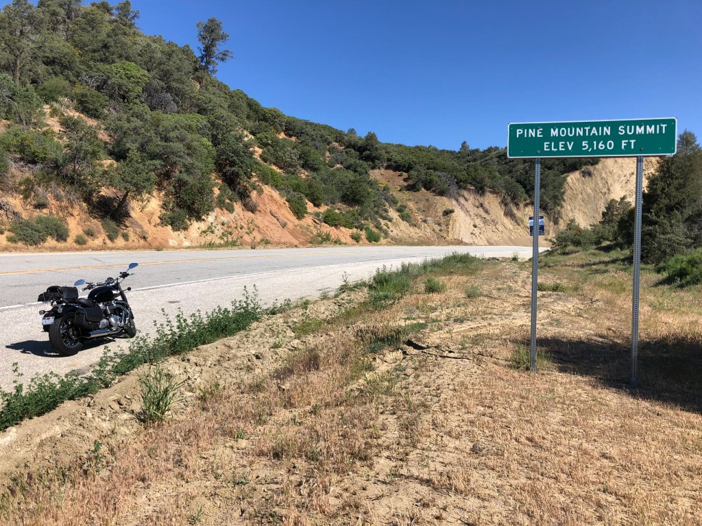
My interest in the place was much more prosaic, involving victuals. So after determining there was no hope of getting a burger at this place, I got back on the road, and soon crossed the summit.
As I descended toward the Cuyama Valley, the greenery of Pine Mountain was replaced with scrub brush and a broad, dry wash.
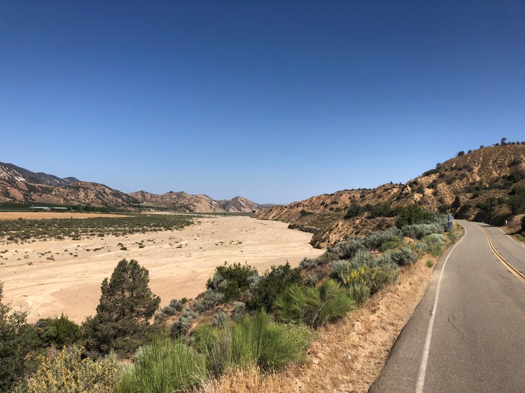
This kind of stark desolation has its own beauty. Particularly for someone who spends most of his time in the Los Angeles metro area.
After awhile I crossed into Kern County. Kern is responsible for three quarters of California’s oil production, and a tenth of the country’s oil production. And the county is very proud of this distinction, having dubbed its stretch of Route 33 “The Petroleum Highway” in 2004.
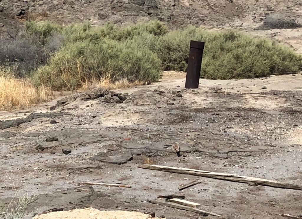
Near the southern end of The Petroleum Highway is the site of “Lakeview Gusher No. 1,” which in 1910 was a major oil blowout that destroyed the derrick and resulted in a continuous uncontrolled oil flow for the next 18 months. A total of nine million barrels of oil were lost. Today, the ground is still saturated with dried oil and a small stub of pipe remains poking out of the ground. A plaque was placed here in 1952 to commemorate the disaster, though the narrative sounds more like it’s bragging about the scale rather than bemoaning the environmental damage. “Lakeview #1 produced an estimated 9 million barrels of oil, a record not yet equaled by any other well in California.”
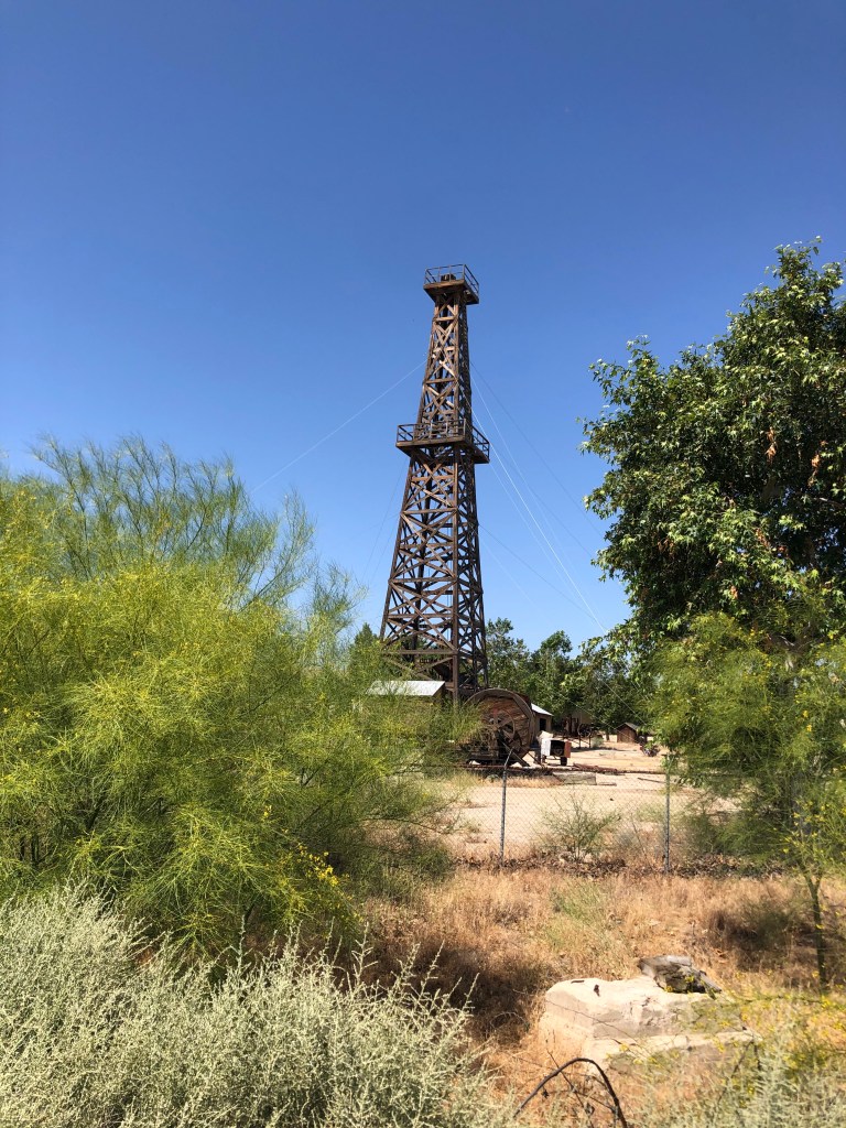
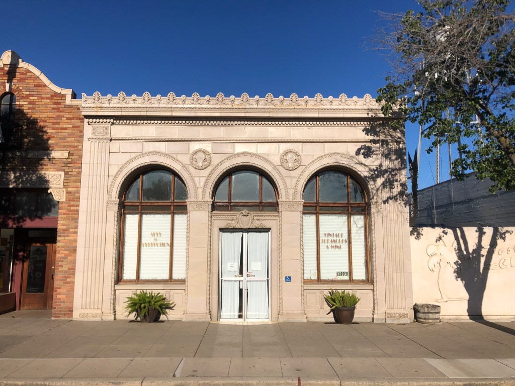
A nearby museum in the town of Taft (pop: 9,500) even includes a replica of the derrick:
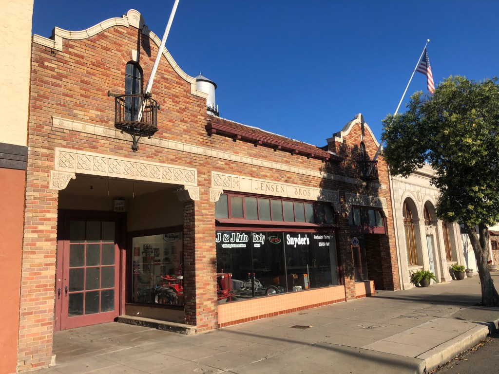
The city of Taft was not always so named. When it was just an unnamed small stop on the Sunset Railroad, the residents asked the railed to christen it “Moro.” Railroad officials felt that the name could be confused with Morro Bay, so they instead assigned the name Moron. I am not making this up. After a major fire burned much of the town in 1909, the name of the rebuilt city was changed to Taft, after the recently-elected 27th president of the United States.
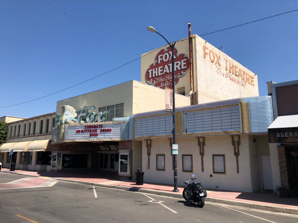
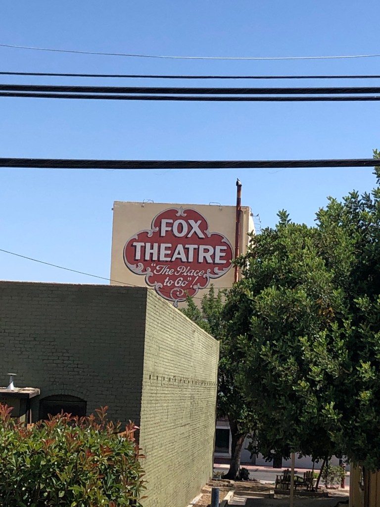
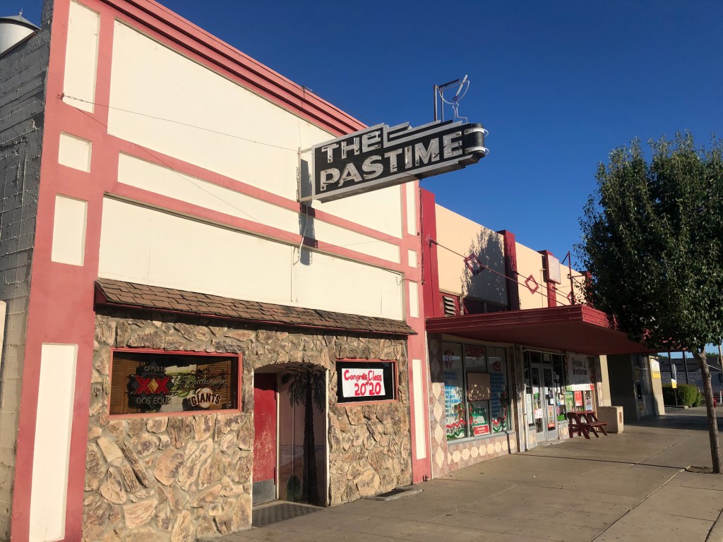
Taft boasts a well-preserved historic movie theater that still shows movies and liver performances. Originally built in 1918 as the Hippodrome, the theater was renamed the Fox Theater in 1952.
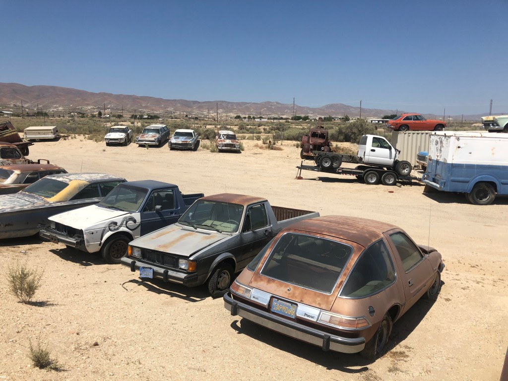
Just outside of Taft I came across a large collection of old cars. What caught my eye was the Studebaker Lark. You get points if you can pick it out.
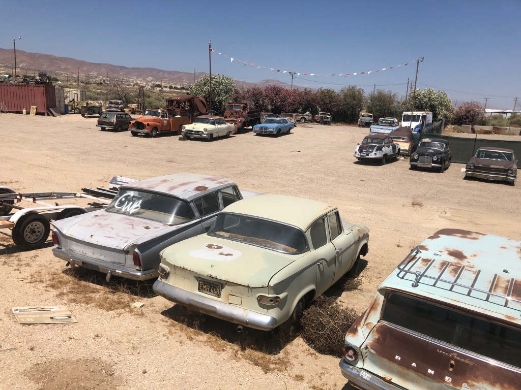
The other notable car was the AMC Pacer, which was one of most maligned cars in automotive history. At least until one appeared as Garth Algar’s car in Wayne’s World.
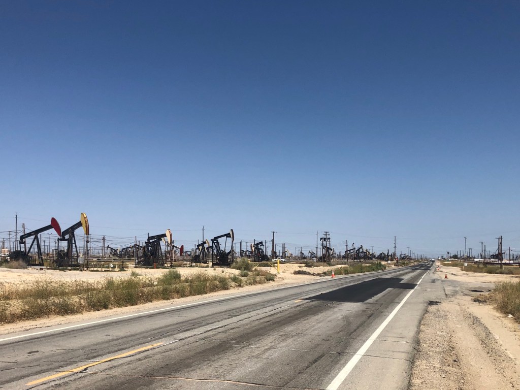
Now, Route 33 passes through 10 counties in all. So far I’d been through Ventura, Santa Barbara, and San Luis Obsipo, and was now making my way through Kern. Each county seems to have its own distinct approach to zoning and infrastructure. For example, as we noted at Pine Mountain with Tom Wolf’s situation, Ventura County places a premium on open space and “viewsheds.” But now, as I moved deeper into Kern County, it was clear the locals value oil production over natural beauty. Check out the landscape as seen from CA 33:
Oh, whoops. Wrong photo. Here’s what it actually looks like:
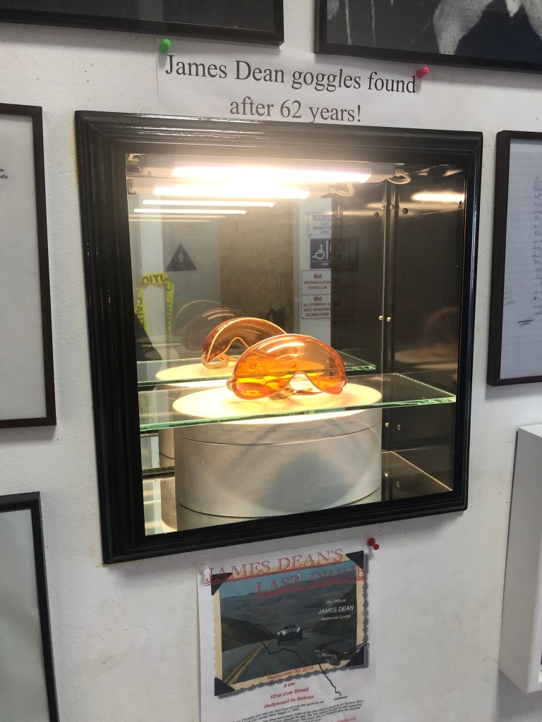
One bright spot along the Petroleum Highway in Kern is Blackwell’s Corner. Since 1921 it’s been a traveler’s oasis at the intersection of CA-33 and CA-46. With food, gas, drinks, and restrooms, it’s the kind of place the Pine Mountain Inn might have been. But Blackwell’s Corner is famous as the last stop James Dean made before he crashed his convertible Porsche head-on into a Ford about 20 minutes later, in September 1955. Trivia fact: The name of the man Dean hit was Donald Turnupseed. Turnupseed survived; Dean didn’t.
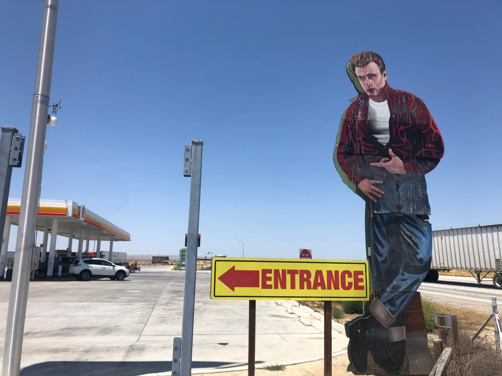
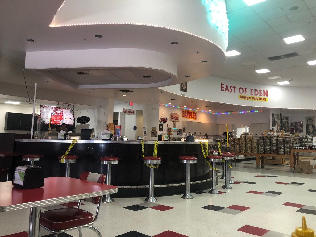
Blackwell’s plays up the James Dean connection, with a larger-than-life cutout of Dean beckoning drivers to stop, and with a small display of Dean memorabilia. They’ve also got a 1950s-themed diner, where I got the best pastrami sandwich I’ve ever eaten.
After the relative buzz of activity at Blackwell’s, it was back to the desolation of Route 33 in Kern County. At least the oil wells had given way to orchards.
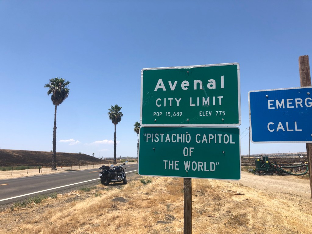
Soon I was crossing another county line. Kings County is another agricultural region. Which generally means that, in addition to lots of farms and fields, it has a couple of prisons. Route 33 passes through the city of Avenal (pop: 15,600) is home to one of these prisons. But Avenal doesn’t boast about that; they’re rather be known for their pistachios.
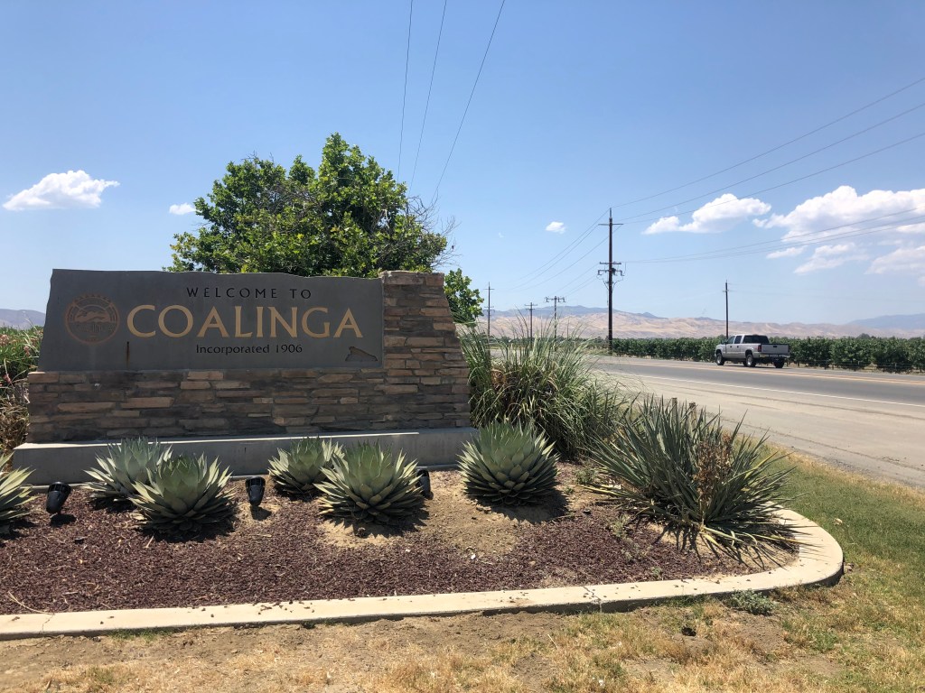
Soon I was approaching Coalinga (pop: 12,000). With large cattle ranches, Coalinga is the kind of place you smell before you see it. For me, the most interesting thing about Coalinga is its name. The place was established as a coaling station by the Southern Pacific Railroad in 1888. They called it “Coaling Station A,” which frequently got abbreviated to “Coaling A.” Before long, CoalingA was born.

Now, let me just get out on the table that I should have stopped for gas in Coalinga. My gas gauge was getting low, but gas stations seemed to be pretty plentiful in these parts, so I figured I’d go a bit further. For reasons we don’t need to go into here, I found myself in the middle of nowhere with an empty gas tank. No problem, I thought. I’ll call roadside assistance. Unfortunately, the robot on the other end of the phone thought I wanted to sign up for insurance, and kept offering to send me quotes. Somehow I managed to get connected with a human being, who informed me that they’d be happy to deliver a gallon of gas to me for $177.50. I declined their generous offer, and decided to just get an uber to take me to the nearest gas station, which according to google was about 8 miles away. Alas, there were “no cars available” from either Uber or Lyft. After a bit longer a cop stopped for me, but once he saw I was OK he said he was on his way to a call and didn’t have time to help. Just as I was regretting not paying the $177.50, and was now figuring I’d just walk the 8 miles to the gas station, a Scion pulled up next to me and the driver offered to take me to the gas station. Crisis averted.

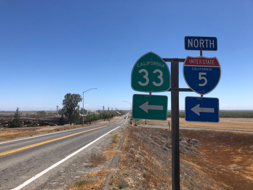
So, back to the road trip: A dozen miles after passing through Coalinga, CA-33 becomes concurrent with Interstate 5 for 13 miles. Clogged with semis, this is the only part of the road that isn’t fun on a motorcycle.
Upon exiting I-5, I was firmly planted in the workaday world of the San Joaquin Valley. Which means, of course, more prisons. It also means long, flat stretches and lots of orchards lining the road.
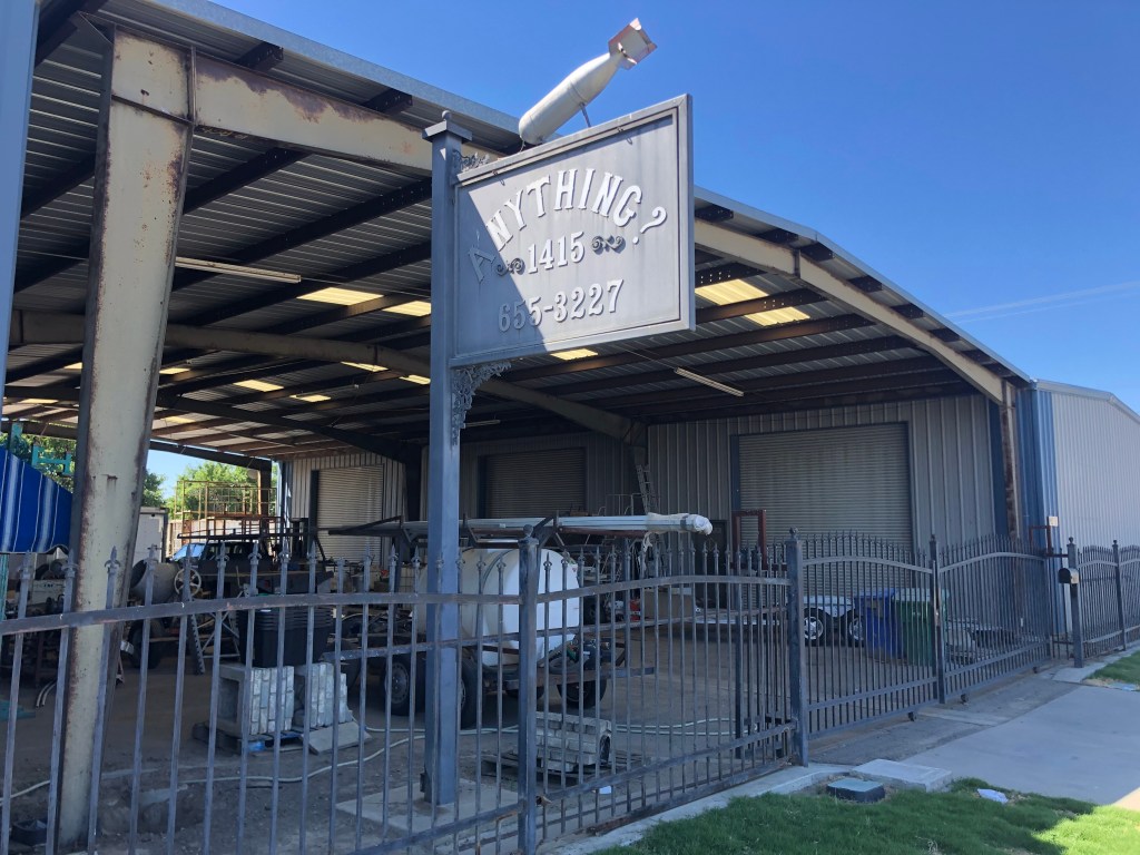
Towns along this northern portion of CA-33 seem to be located closer together. Could it be the proximity to the spillover-sprawl from the Bay Area? Mendota (pop: 11,000) is a typical town along this stretch, with tidy homes, leafy streets, and historic downtowns. Mendota claims to the “The cantaloupe center of the world.” (Take that, Avenal!) But I was most intrigued by this business that calls itself “Anything,” but then adds a question mark to perhaps qualify their range of business. And they added a bomb, just for good measure.
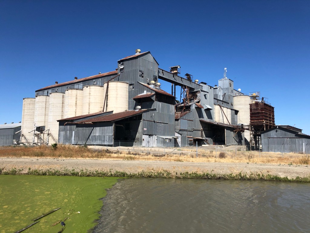
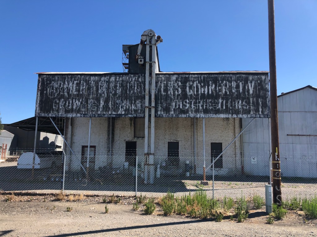
More common than unexploded ordnance mounted on mysterious signs are silos and granaries. Here are a couple of picturesque specimens from Dos Palos.
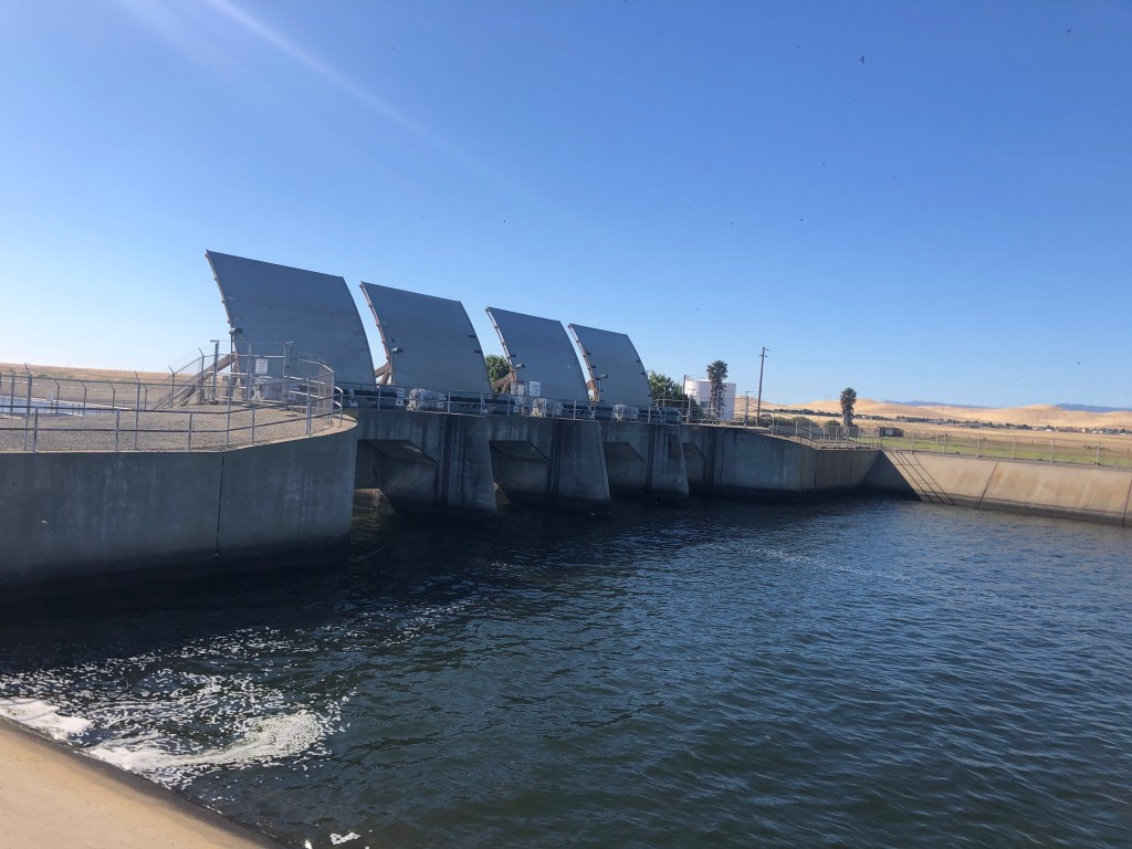
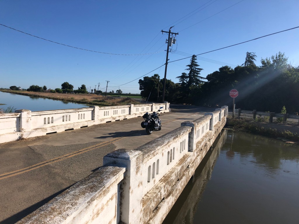
One other feature that figures prominently into CA-33’s landscape is water infrastructure. This isn’t surprising, given the agricultural presence all along the road. The California Aqueduct and the Delta-Mendota canal cross the road at various points.
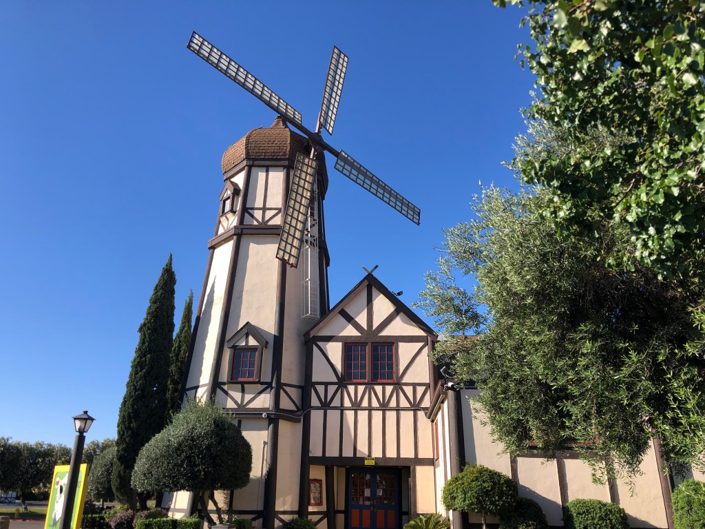
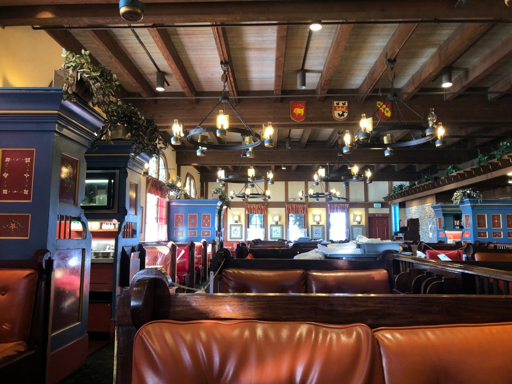
Regular travelers along I-5 or US 101 are familiar with the iconic Pea Soup Andersen’s, which has locations at Santa Nella and Buellton, respectively. In 1924 Anton and Juliette Andersen opened the Buellton location, which was originally named Andersen’s Electric Cafe to emphasize their fancy-pants electric stove. The Santa Nella location was opened in 1976. The two locations are kitchy Danish themed, with restaurants, bakeries, and hotels on site. For years the restaurants have been heavily advertised on billboards along the two freeways, enticing travelers with the promise of split pea soup in only 157 more miles.
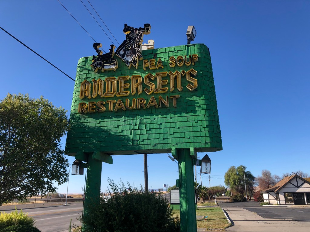
For the first time in my life, I stopped for a meal at the Santa Nella location. During this Covid pandemic, I was the only customer. The food was tolerable.
My favorite town of the entire drive arrived near the end. Gustine (pop: 5,500) seems largely untouched by developments since the Eisenhower administration. It’s remains a very small town with many old buildings, but somehow exudes an air of viability, if not prosperity. It has a charm that seems lacking in many of the other central valley small towns.
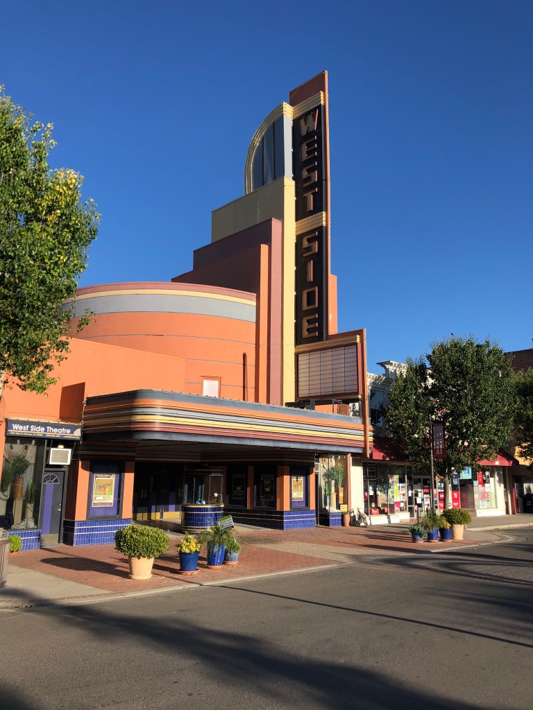
Just up the road from Gustine is the town of Newman (pop: 10,000). It also seems to be holding on to its past, which includes the historic West Side Theater. The streamline moderne theater was built in 1940, and fell into disrepair in the 1980s. The city bought the property in 1996, and launched a major effort to have it fully renovated. Today it hosts live entertainment.
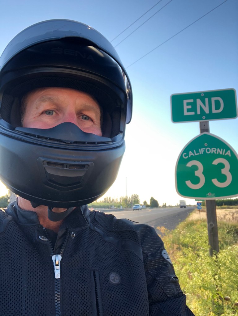
I was getting used to exploring these well-maintained, historic towns, but after a few more miles I reached the end of CA-33, at a nondescript junction with I-5.
So ends another journey on California’s blue highways. CA-33 is certainly not the most glamorous, but it sure gives you a lot of exposure to forgotten aspects of California. For those of you hunkered down at home, I hope this gave you some vicarious fresh air. Except for that part in Coalinga.
Stay safe!

Hi Steve,
I wanted to comment regarding a familial connection to Pea Soup Andersen’s – my grandma (Gwen) actually worked at the Buellton location when she was growing up! As a result this restaurant always had extra meaning for our family when we would regularly drive south on I-5 when going to visit my great aunt in Santa Ynez and my great grandparents in Santa Barbara. Funny enough, since it took until my college years for me to finally visit the Buellton location, when I was little I always pictured her working at the Santa Nella location.
Katelyn
LikeLike