
Editor’s note: Given limited travel opportunities these days, I decided each Thursday to post travel stories I’d written prior to starting this blog. The following is from a cross-country trip I made along the length of US 50 in the spring of 2018. I hope you might vicariously enjoy this trip while we’re all hunkering down at home. Because this is a longer trip (a week and a half), I’m going to post each of the daily entries over each of the next 10 days.
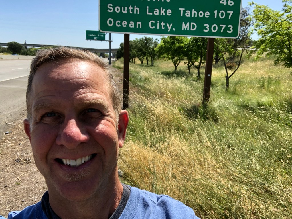
The inspiration for this trip comes from the sign at the western terminus of US Route 50, in West Sacramento, which I have passed many a time over the years. The sign tantalizes me with the vision of “Ocean City, MD 3,073” miles away.
Day 1
My US 50 trip began early this morning with a flight from LAX to Sacramento, where I picked up my rental car. Now, many people had urged me to rent a “fun” car for this trip. And I thought about that. But in my normal, everyday life I drive a “fun” car, and this trip is about connecting with the “backbone of America,” not blasting across the country in luxurious, steel cocoon surrounding me with infotainment options and various gadgets.
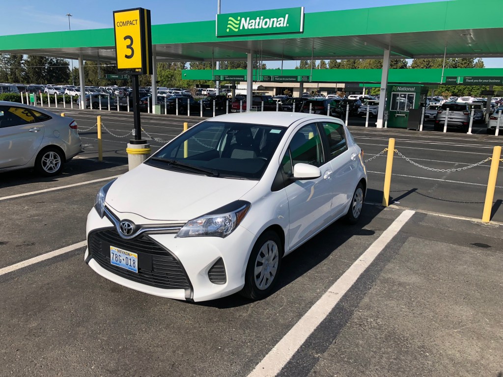
So I’m driving a Toyota Yaris. And not just any Yaris, but a no-frills Yaris. I know you think that’s redundant, but there are actually blank plastic plugs in the dash where available options –like power mirrors, cruise control, or even FM radio – might go in the “loaded” version. I’ll say this much for it: The car won’t be distracting me from the sights the US 50.
My first stop was on the side of the freeway where eastbound Interstate 80 branches north, leaving, as the straight part of the branch, the beginning of US 50 . (The photo below was taken just before I was almost hit by a drifting truck.)
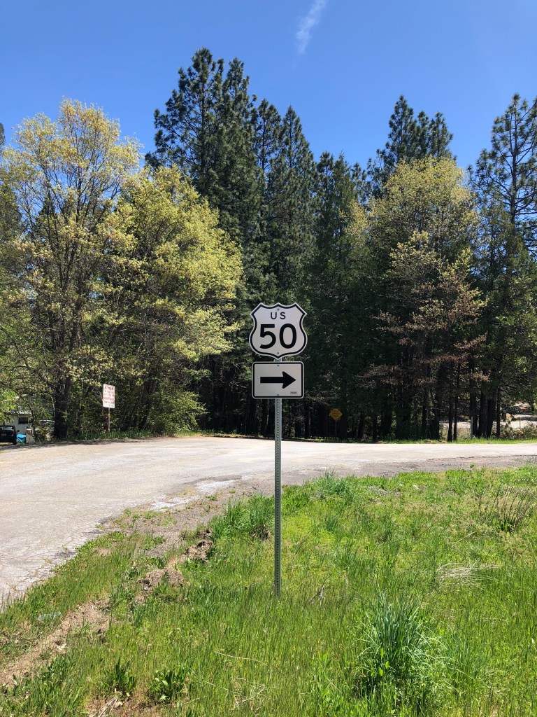
After narrowly escaping a Peterbilt’s front grille, I hopped back in the Yaris and headed east on US 50. The first half hour of driving was old hat. I’ve driven that stretch of US 50 many, many times. But after passing Placerville, I moved beyond my usual haunts and drove on pavement I haven’t experienced too many times. You can feel the metropolis of Sacramento, and the poor air quality of the central valley, melt away as you head into the foothills. It’s a very freeing feeling. Every time I’ve driven out towards Tahoe in the past, I’ve told myself I should do this more often. But somehow I almost never have found the time. Until now.
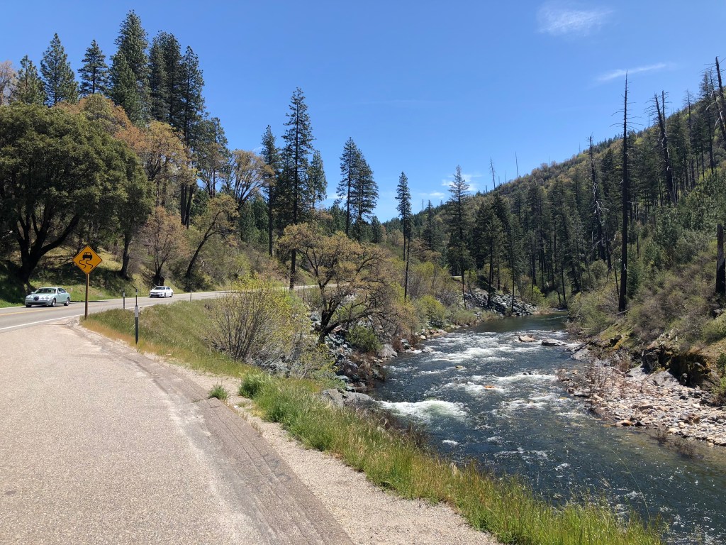
As I wended up towards the Sierra, I spotted the South Fork of the American River. It’s just beautiful this time of year.
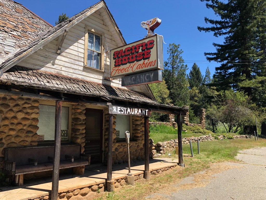
I encountered a couple of abandoned buildings. Maybe the economic recovery hasn’t caught up with this part of California? I love how the “restaurant” sign was painted freehand, almost as an afterthought. And I doubt that parking meter has seen a coin since Buffalo nickels went out of fashion. Land out here is so cheap that buildings just stand vacant for years, and some eventually just crumble. I’ll rejoin this theme in a few paragraphs, when I describe the motel room I’m writing this from right now….
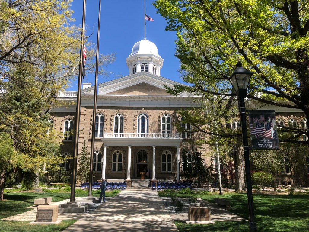
After a bit more driving I re-encountered civilization at South Lake Tahoe. And then, in the blink of an eye, I left California behind. A few buildings greeted me as I entered Nevada, but it was a half-hearted greeting. Unlike Reno or Vegas, Stateline, NV barely tries to entice gamblers from California. You just pass a faded casino or two, and then the town disappears. The vast expanse of Nevada beckons, interrupted by only a couple of cities. One is Carson City, the State Capital. I made a brief visit to the Capitol building. It’s a contrast to California’s, not only in terms of architecture, but also to the paucity of visitors, employees, and legislators. I suppose when your entire state’s population is only about 3 million souls, there’s no need for major legislative activity.
The last town of any size at all I went through today was Fallon (pop: 8,606). I stopped for dinner at Jerry’s Diner, which has supposedly been “a Fallon original since 1966.” (I learned later, though, that it’s now owned by the same people who own Black Bear Diner, so I inadvertently violated my “no restaurant chains” rule for this trip.)
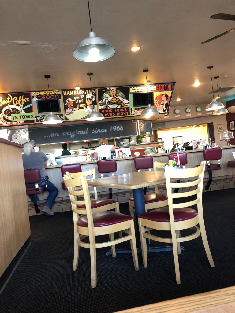
My waitress was very authentic and friendly, though. She saw me consulting my Rand McNally atlas at the table and asked me about my trip. It turns out that she is from Sacramento, and has noticed the same US 50 sign and wondered about Ocean City, MD as well. But here in Fallon is as far as she ever got. She’s raising an 11 year old, and hopes that, after he’s graduated from high school, she can do some travelling. By which she means getting an hour or two out of Fallon.
After leaving Fallon, I became one of the few people remaining on the highway. It’s this stretch of US 50 that earned the moniker “America’s Loneliest Road.”
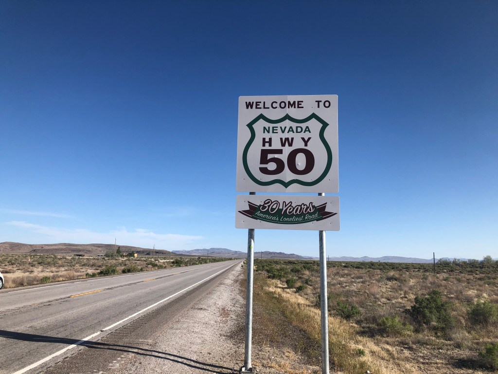
In an hour I passed only a handful of cars. And I was covering lots of ground in that hour — about 90 miles, actually. (You do the math.) At one point I looked down and the speedometer showed 100 mph. I had no idea the Yaris could move that fast. But you just don’t feel the speed out here. Partly it’s because there are almost no landmarks to highlight your speed. And partly it’s because the road surface is flat, straight, and in good shape. Evidently Nevada takes much better care of its roads than California does. Someone once told me that Nevada doesn’t have speed limits, which is demonstrably false, because I saw signs posted with a 70 mph limit. I’ve also heard that, even if there are limits in Nevada, they aren’t enforced. I hope I don’t encounter evidence to the contrary.
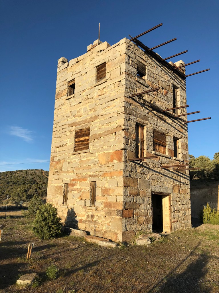
I ended today’s leg of my US 50 journey in the town of Austin, NV (pop: 192), at the base of the Toiyabe range. There’s something very eerie about this town, which alternately feels abandoned and haunted. The first thing you see, high up on a hill as you enter the town on US 50, is an ancient stone tower. A short drive up this hill reveals the tower to be something called Stokes Castle, which was constructed by a silver and railroad magnate named Anton Phelps Stokes in 1897. After completion, it was only inhabited for a couple of months, and has been vacant ever since. As you can see, even the local kids have been afraid to spray graffiti on it for over a century.
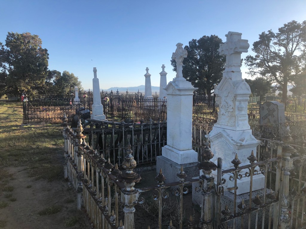
Complementing the sense of doom and abandonment, just a short hike from Stokes Castle, is a Civil War-era cemetery. I walked the cemetery for awhile, and not a single car passed by on US 50. All was silent except for a faint rustling of the leaves in the trees.
Now, you should know that, back in Fallon, I had phoned the “Cozy Mountain Motel” in Austin to make reservations for the night. I knew nothing about this place, other than it had a vacancy. When I turned into the driveway, right off US 50, this is what greeted me:
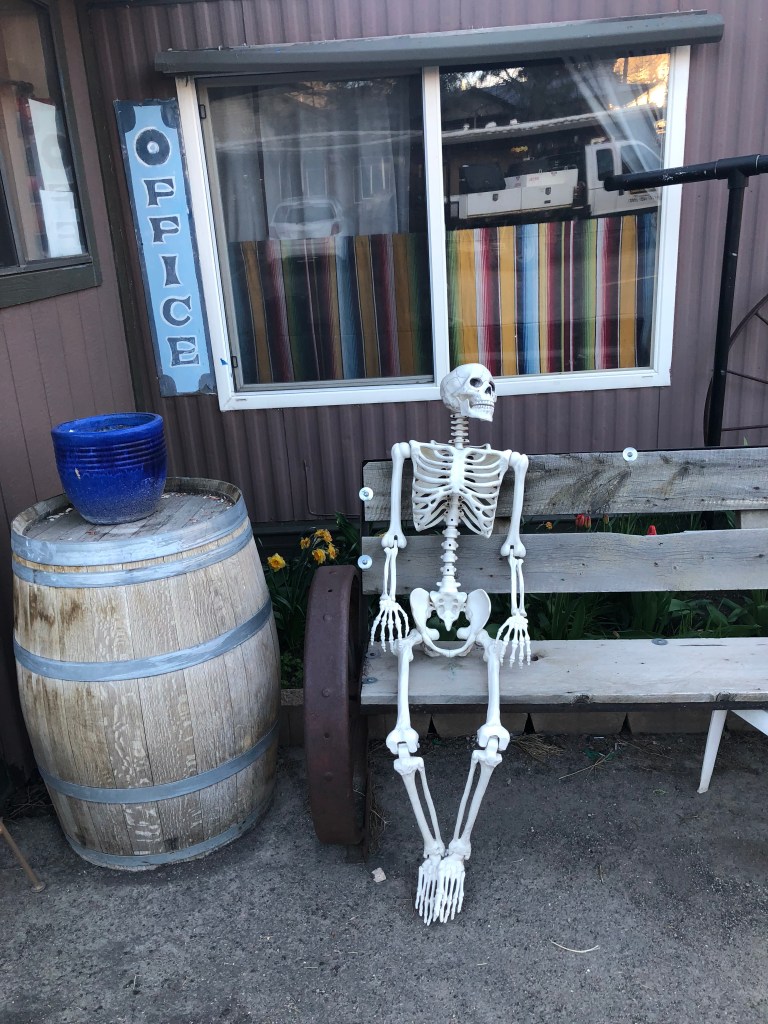
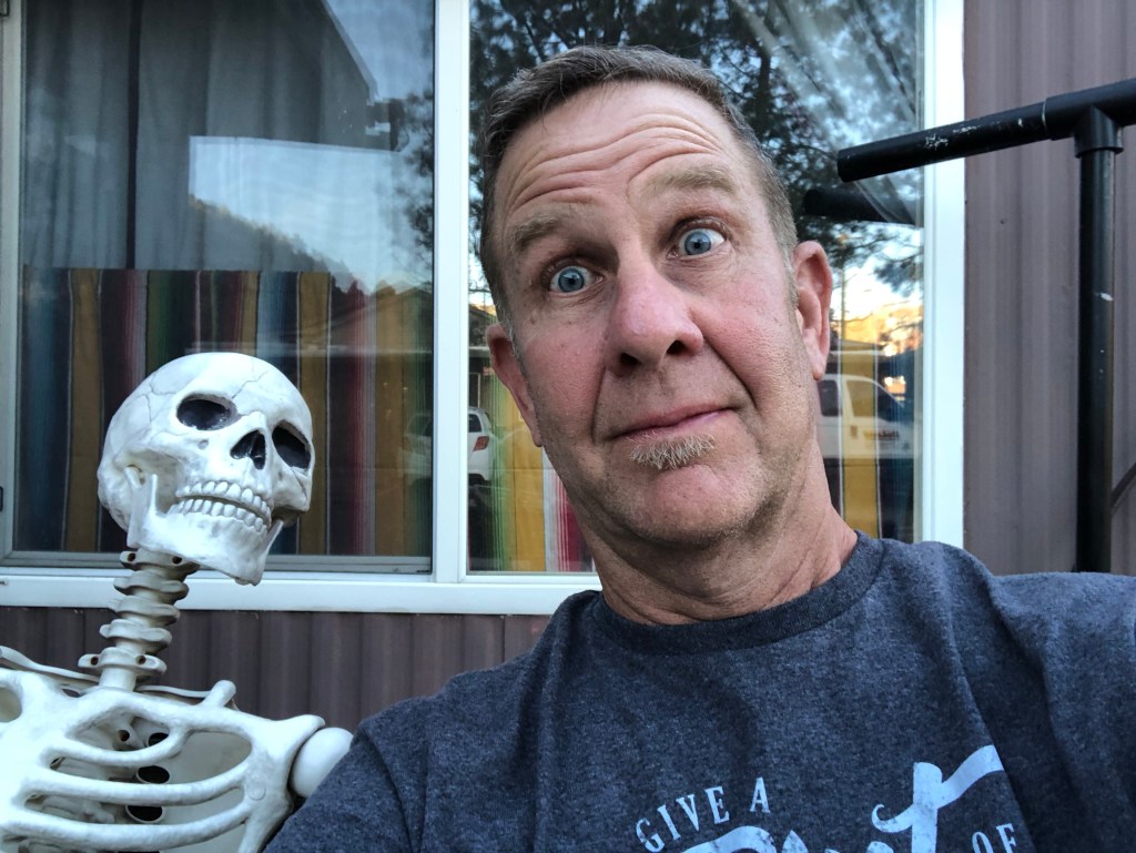
When I checked in, I asked the desk clerk what was up with the skeleton on the front bench. Without missing a beat, she said “he’s been waiting for the shower in his room to get hot.” I told her I didn’t get it, and she looked down and muttered “you will.”
I suspect tomorrow’s shower will be bracing.
Until then, I’m going to try to get some shut-eye. Here in this doomed town.

Old Travelers Proverb: the journey of a thousand miles begins with a single car rental…
>
LikeLike