cemeteries · churches · movie theaters · Road trips · trains

Driving Into Natchez

One of my favorite songs is “Don’t Think About Her When You’re Trying To Drive,” recorded by Little Village on their first and only album in 1991. Little Village was a collaboration of four established musicians: John Hiatt, Ry Cooder, Nick Lowe, and Jim Keltner. Their musical style was heavily blues-influenced, and the group’s name is a reference to a famous foul-mouthed diatribe by Sonny Boy Williamson, whose name keeps showing up at the blues museums I’ve been visiting.

Anyway, I’ve been thinking about that song because one of its lines is “Driving out of Natchez/You drive her back and forth across your mind.” And the reason I’m thinking about that is because I’m driving into Natchez.

Anyway, here’s the song, if you’re interested: (the song starts at 8:40)

With that out of the way, let’s turn to today’s trip, whose theme is “southern ruins.”

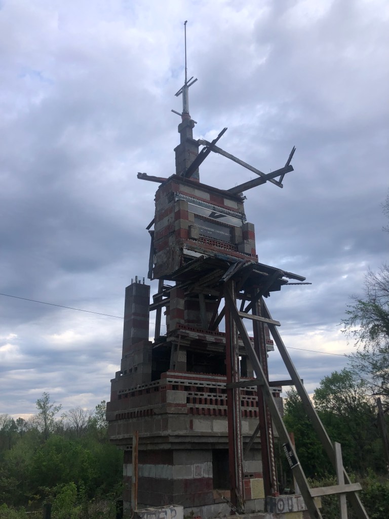
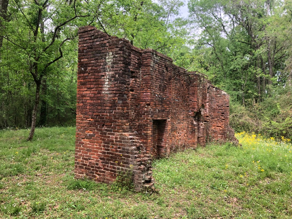
On my way out of Vicksburg I passed these ruins within sigh of the Mississippi:

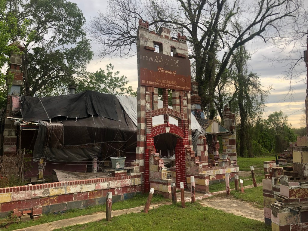
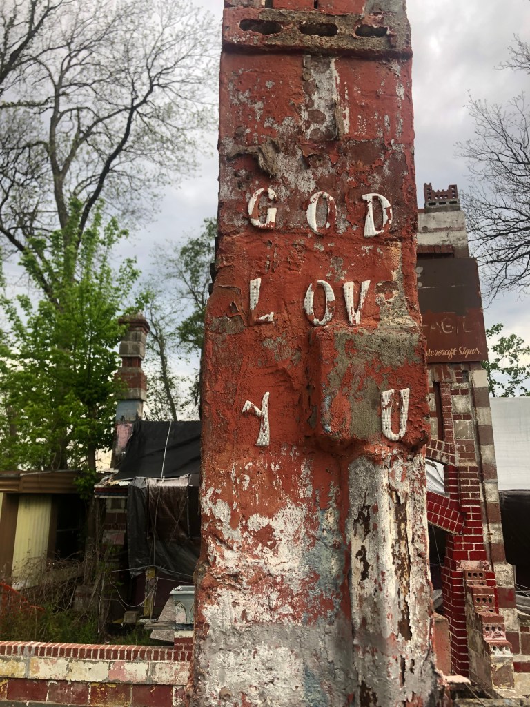
The background on this place is a little sketchy, but it seems that Margaret Rogers, who was born in the area in 1906, ran a general store on this site for many years. It’s said that throughout the 1960s and 1970s it was the only store along Route 61 that was run by an African American woman. In the late 1970s Margaret’s husband was shot and killed in a robbery. A few years later Martha met Rev. H.D. “Preacher” Dennis, who promised to build her “a castle to our love” if she would marry him. She accepted and for the many years Preacher Dennis spent each day working on this structure.

Preacher Dennis, Margaret, and their “castle.”

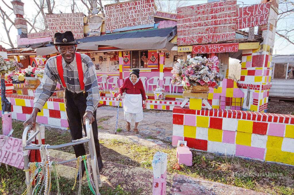
Margaret died in 2009 and Preacher Dennis died in 2012 (age 96). The structure has been deteriorating ever since. Many locals consider it to be a good example of folk art and there’s a group actively raising funds to restore the structure. They’ve set up a gofundme page. I’m going to make a small contribution when I get to a secure internet connection.

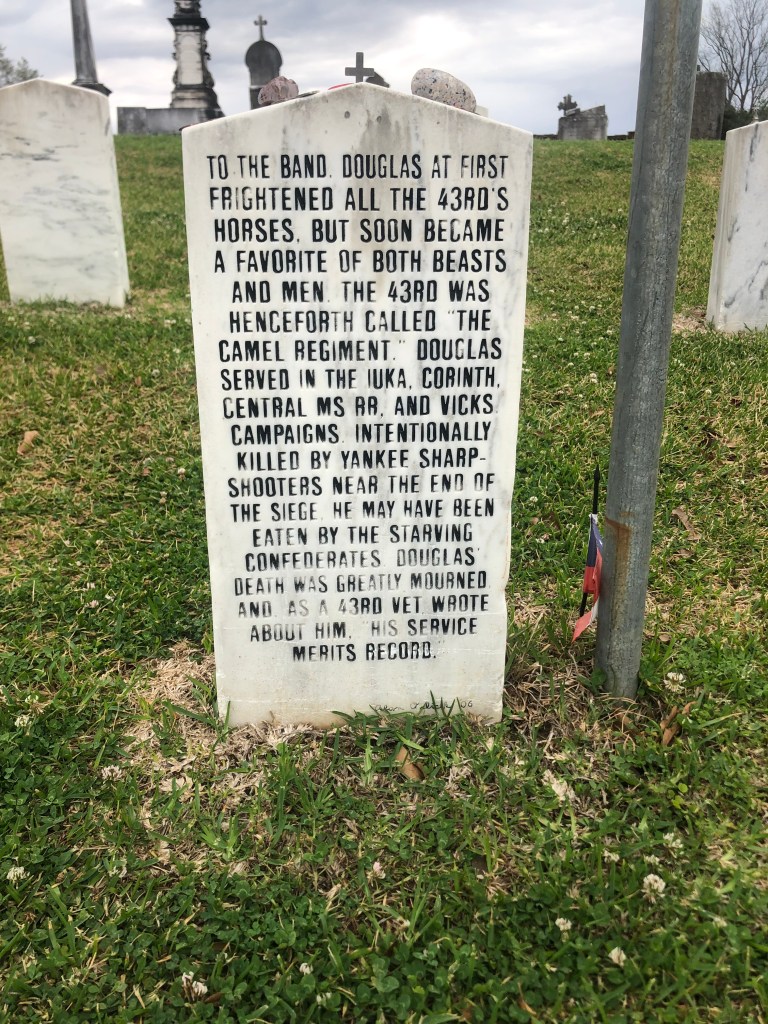
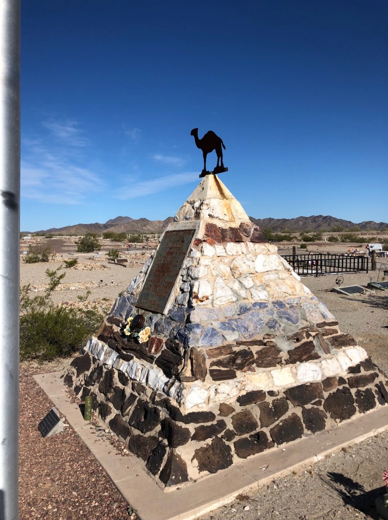
Continuing my way out of town I stopped at the historic Cedar Hill Cemetery which contains the mortal remains of a camel that was buried with military honors.

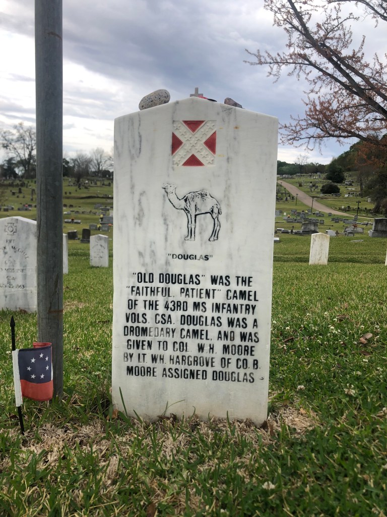
Here’s the story of the Confederate camel:

In the 1850s the War Department experimented with a “Camel Corps,” employing camels as pack animals in the arid southwest regions of the continent. The US Secretary of War at the time was one Jefferson Davis. Davis of course would become the president of the Confederacy a few years later, and so it’s not surprising that his armies would try using camels as pack animals in the Civil War. Old Douglas was a much-loved member of the 43rd infantry, but he was shot and killed by a Union sharpshooter.

The back of Old Douglas’ headstone is full of bad news.

As a footnote, attentive readers will recall one of my earlier road trips where I visited the grave of Hi Jolly, one of main camel drivers of the US Army’s Camel Corps.

Hi Jolly’s tomb in Quartzite, AZ. (Photo from my Route 60 Blog, 2019)
Quartzite really ran with the camel theme. (Photo from my Route 60 blog, 2019.)

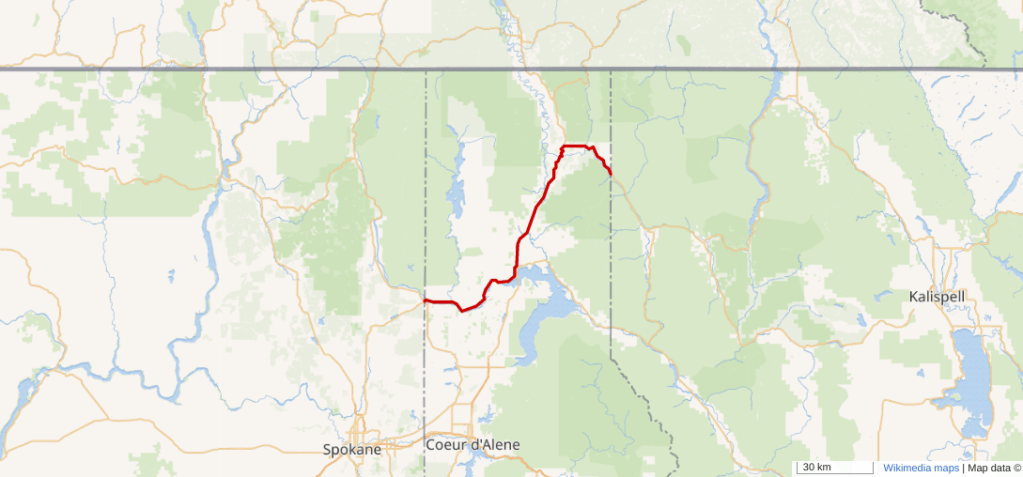
Anyway, back to today’s drive. After leaving the cemetery I got back on US Route 61, heading south to Natchez. Along the way I stopped at a decimated city named Port Gibson (1,500). For the first half of the 20th century Port Gibson was the home base of an influential, traveling minstrel show called the Rabbits Foot Company. It’s been credited with influencing and advancing blues music in the Delta. There’s a placard to this effect on the site of the old Rabbits Foot offices.

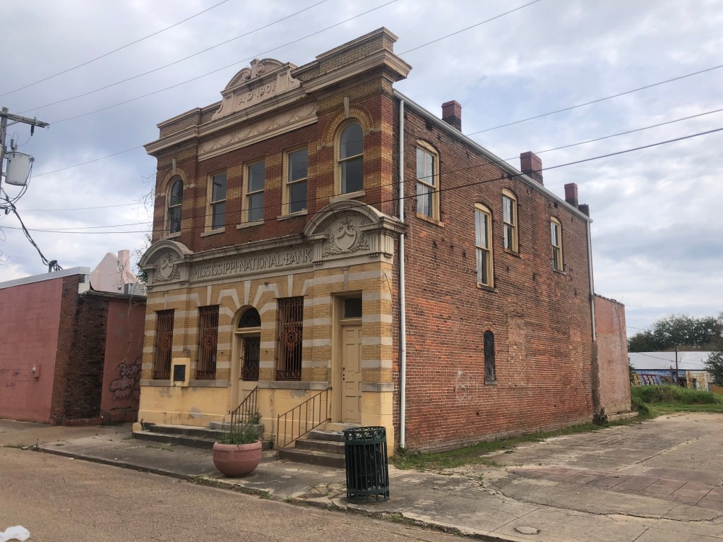
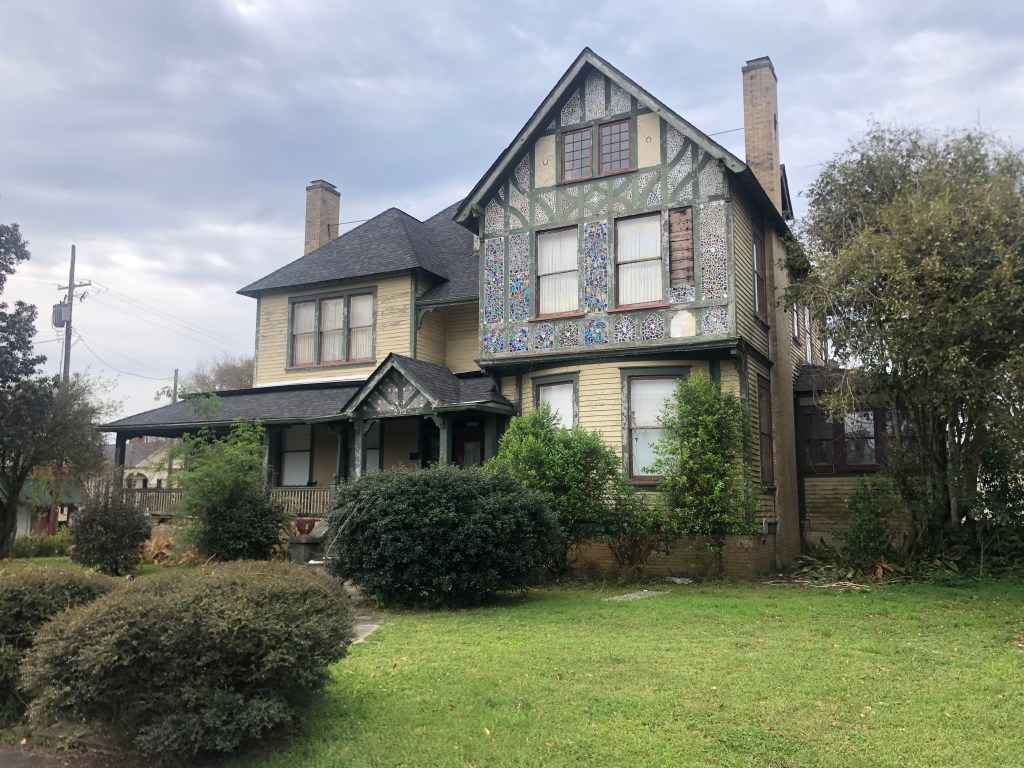
The town’s economy relied on labor-intensive agricultural jobs, which largely disappeared in the post-World War II era. Since then the population has been declining and poverty is pervasive. Today I was struck by a number of historic buildings that speak of a more prosperous time. Most have been simply abandoned.

Mississippi National Bank building, built in 1901. Currently vacant.
Rollins Funeral Home building, abandoned. Structure dates to 1899.
The Trace Theater, originally built in 1870 and remodeled in Art Deco style in 1940. It closed in 1968 and sat vacant for almost 50 years (!) The inside was refurbished in 2017 and it reopened as a night club. Sadly, it suffered a fire in 2020.
2011 (?) photo from Cinema Treasures website.
This is the interior of the Trace Theater today. I took this photo through the glass front doors. At least they’ve cleaned up the debris from the 2020 fire, and they appear to have installed a new set of doors on the front.
Port Gibson still has a few pockets of relative prosperity.

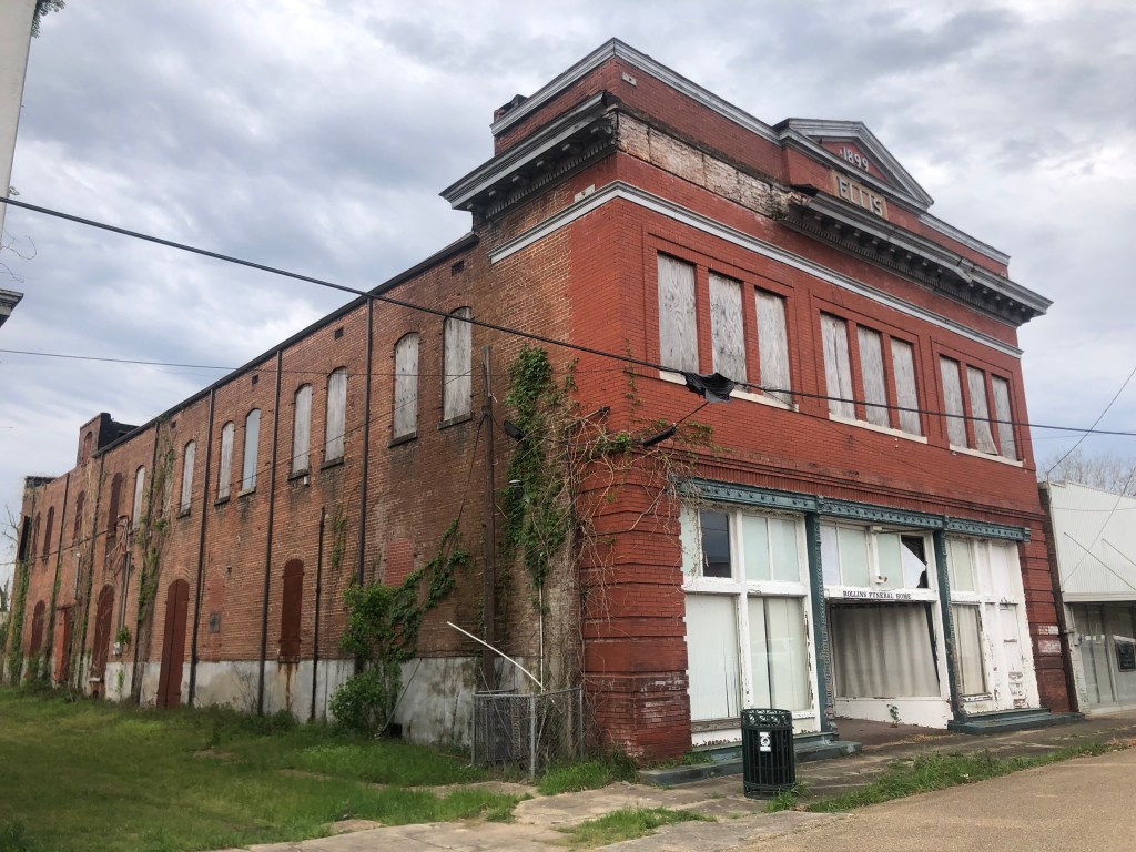
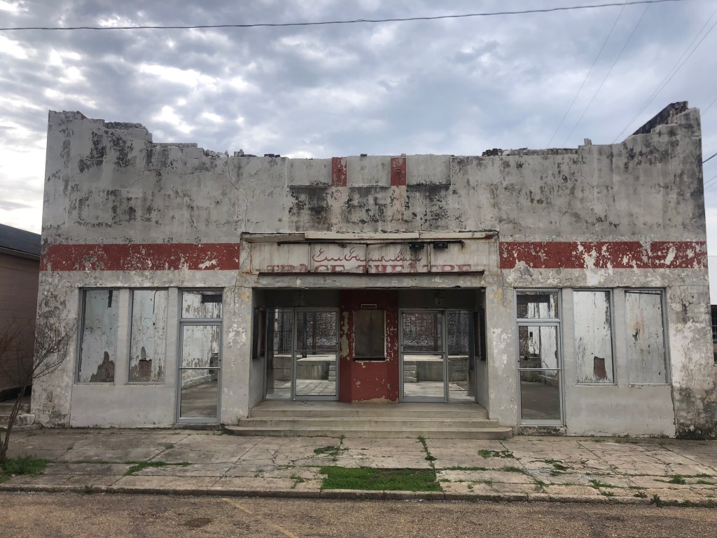
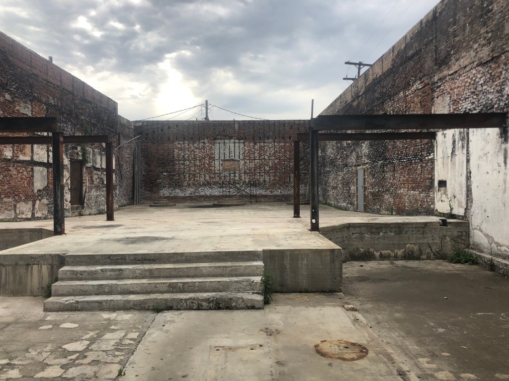
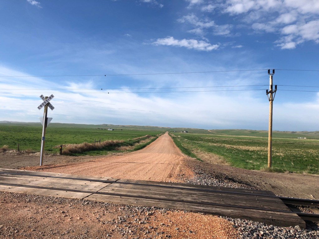
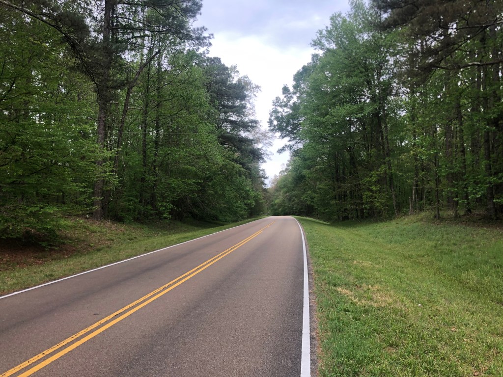
It was eerie walking among these vacant buildings on these empty streets. Eventually I got back in the car and continued down the Blues Highway. A few miles south of town the the highway intersects with the Natchez Trace Parkway. I recalled that my good friend Victor R had recommended I drive along that route if I had the opportunity.

The Natchez Trace runs from Nashville to Natchez, roughly following the Cumberland, Tennessee and Mississippi Rivers. It began as an ancient trail used by Indians (themselves following trails created by grazing and migrating animals. The general contours of the trace became more firmly established over time, and it eventually became a network of major trails used by traders, emigrants, and others. In 1938 President Roosevelt signed legislation that created the Natchez Trace Parkway, a paved road built by the Civilian Conservation Corps. This is what I drove on today (or the last 40 miles of it). It’s a verdant, gracefully-meandering, low-key road that is almost entirely devoid of signage, signals, intersections, and other signs of civilization. It’s just a narrow two-lane ribbon of asphalt cutting through the woods.

The Natchez Trace Parkway.

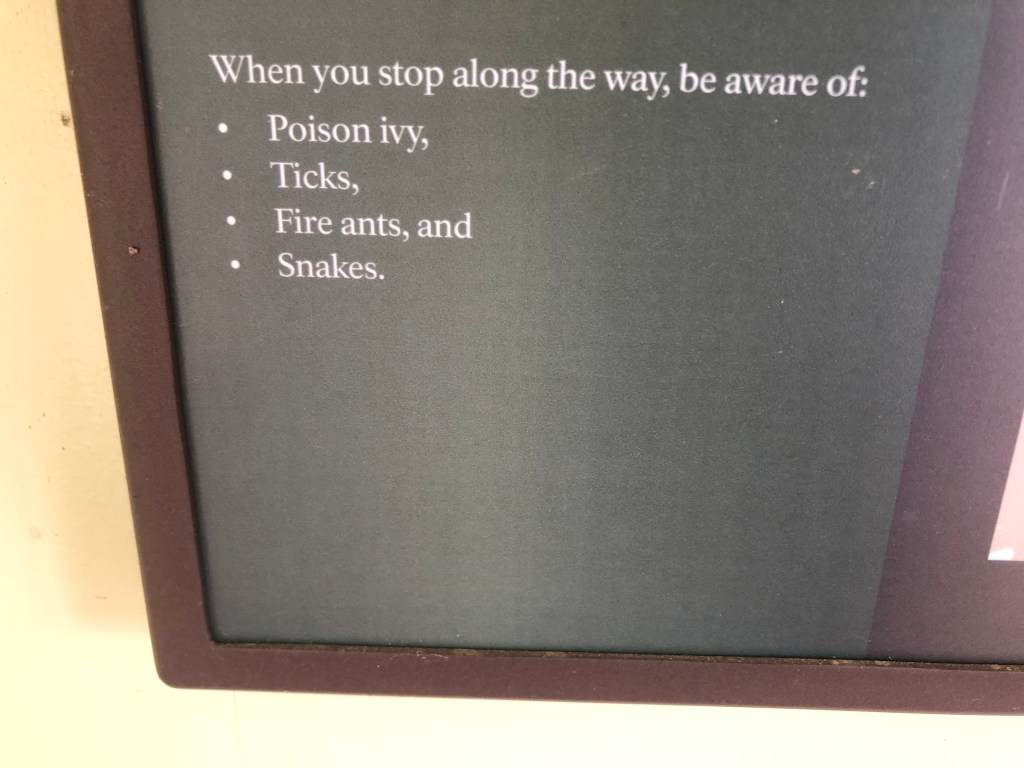
Of course, being out in nature has its drawbacks, as detailed on this “welcome” sign along the route:

It’s enough to make you stay in the car.

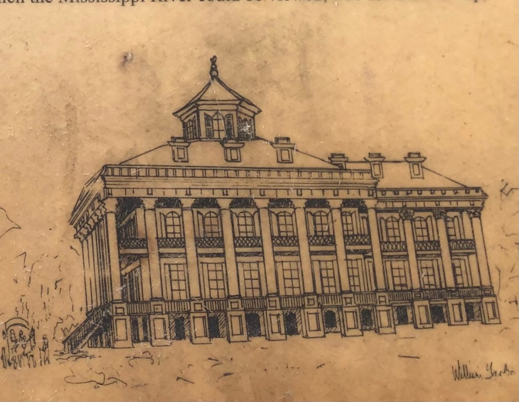
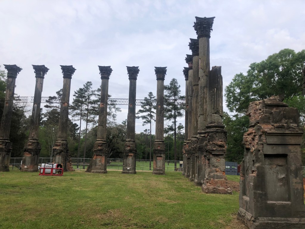
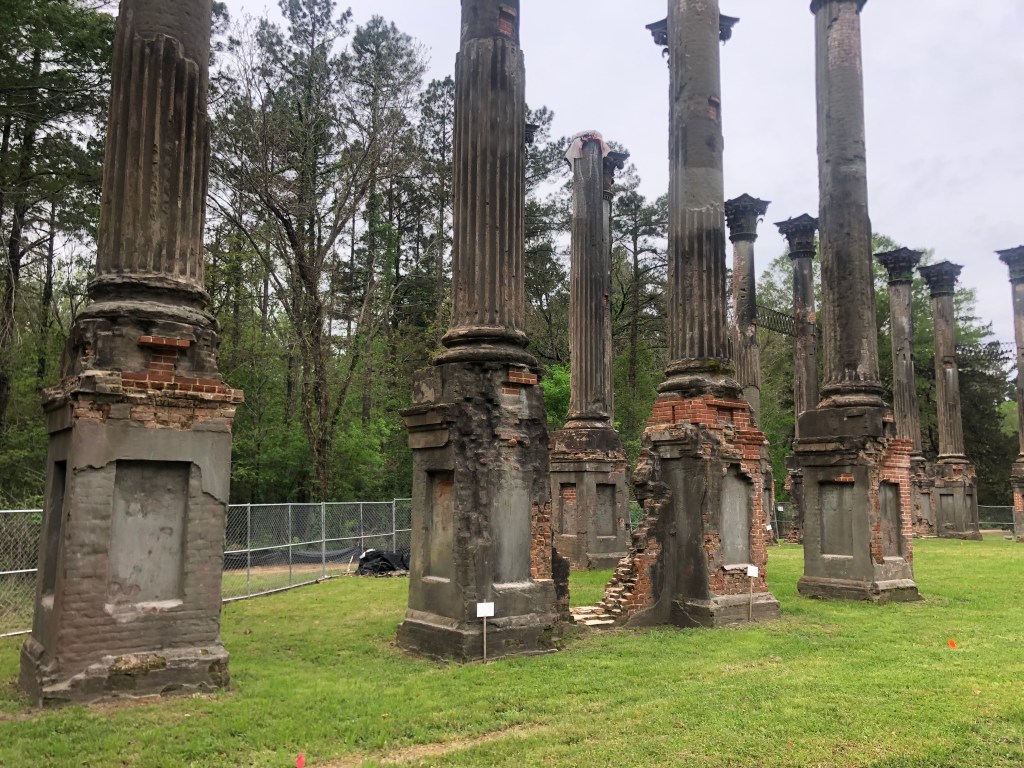
I did leave the car and risk being swarmed by fire ants and the other plagues a few times. First, I followed a side road to the “Windsor Ruins.” I had no idea what it was, but it seemed to fit within today’s theme of Southern ruins. A few miles later I was standing in a clearing from which rose an impressive display of 27 corinthian (?) columns. It used to be a plantation home, and a placard illustrated what the place used to look like:

The becolumned mansion was built in 1861 by a wealthy planter by the name of Daniell, who owned the Windsor cotton plantation. Unfortunately for him, he died just a few weeks after his home was finished. The mansion somehow survived the Civil War, but it burned to the ground in 1890. All that remains are these columns. When I arrived today, the ruins were surrounded by temporary fencing, as the state (which now owns the ruins) is working to stabilize them from damage by the elements.
Best laid plans of mice and men…

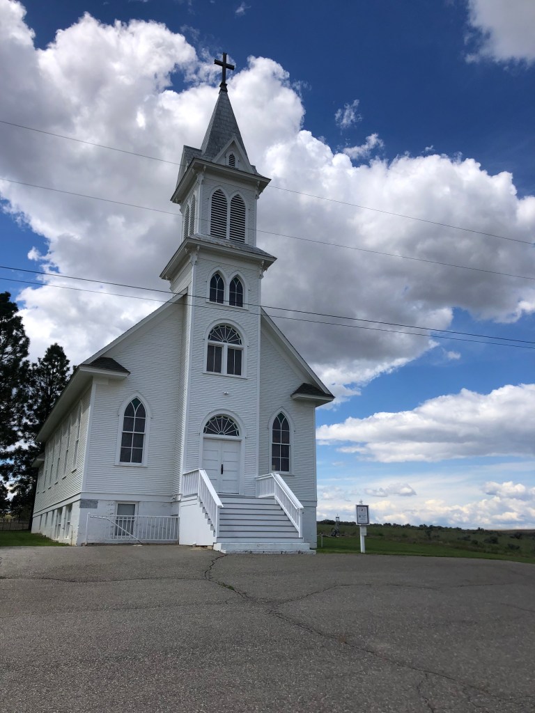
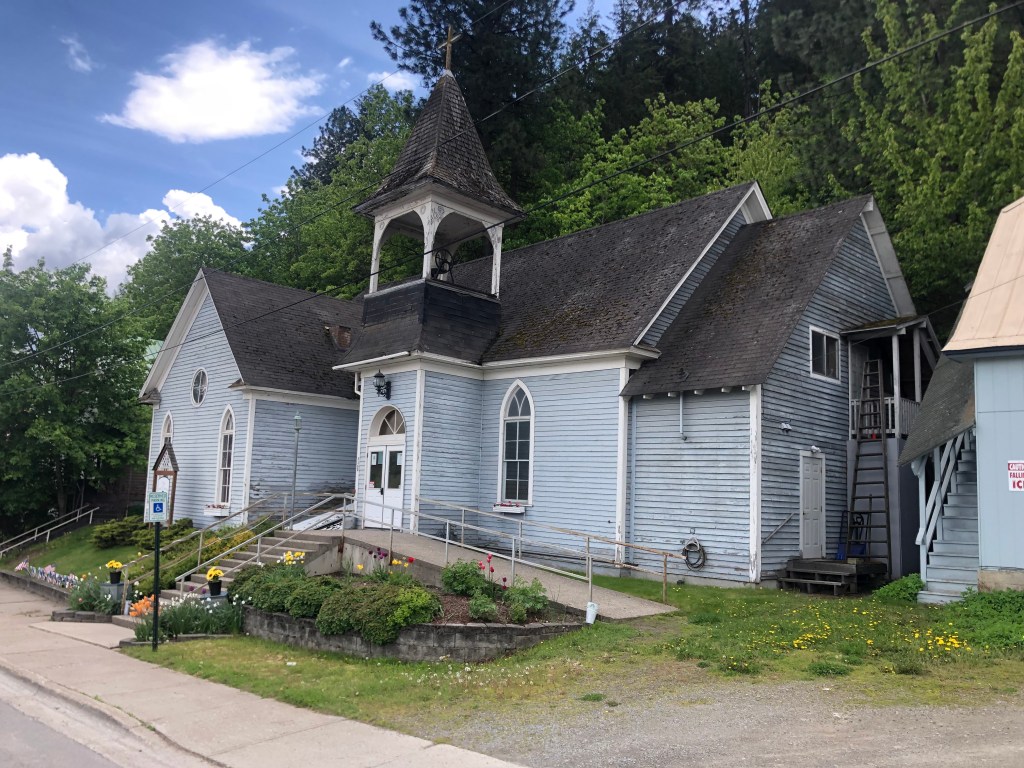
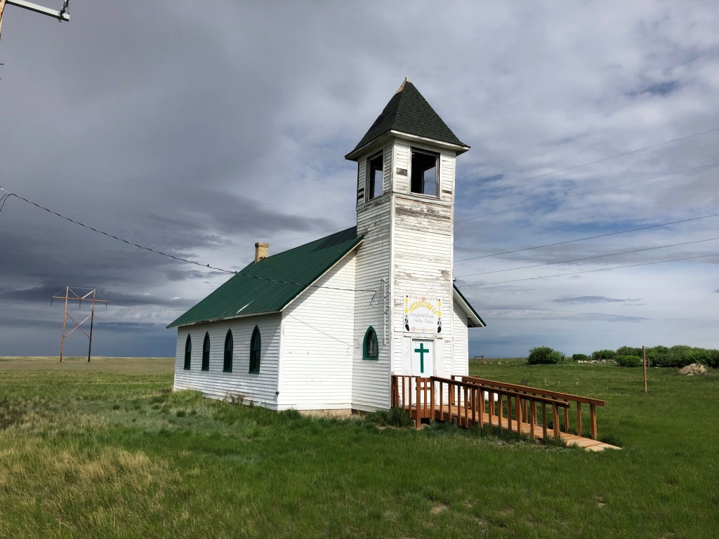
On my way back to the Natchez Trace I passed this 200-year-old Presbyterian church.

Bethel Presbyterian Church, built in 1842.

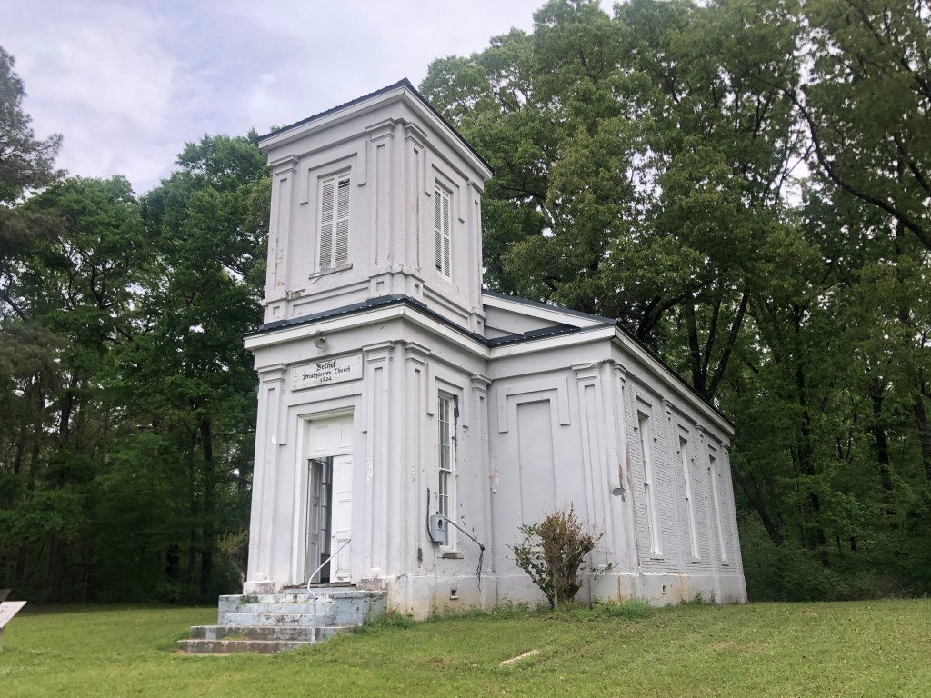
The church has been standing for over 180 years. A tornado in 143 (when the church was 101 years old) did major damage, notably tearing of its tall, pointed steeple. The church was rebuilt, but the steeple was omitted from the new design. Why tempt fate? Over the years the congregation dwindled, until it was no longer classified as an active church by the Presbyterian leadership.

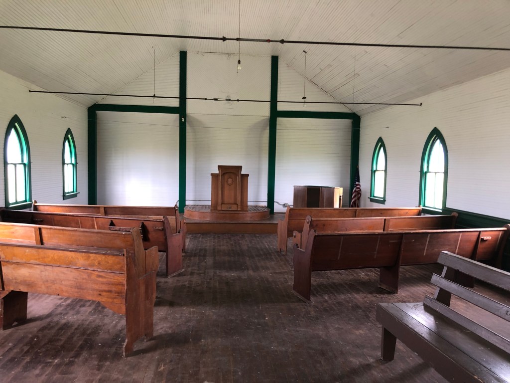
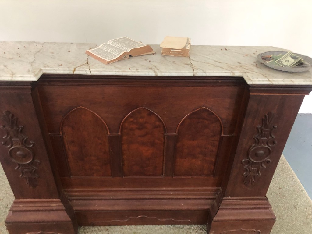
But what’s this? An open door? I poked my head inside:

Looks like you could still hold a service in here.
Open Bible and full collection plate.

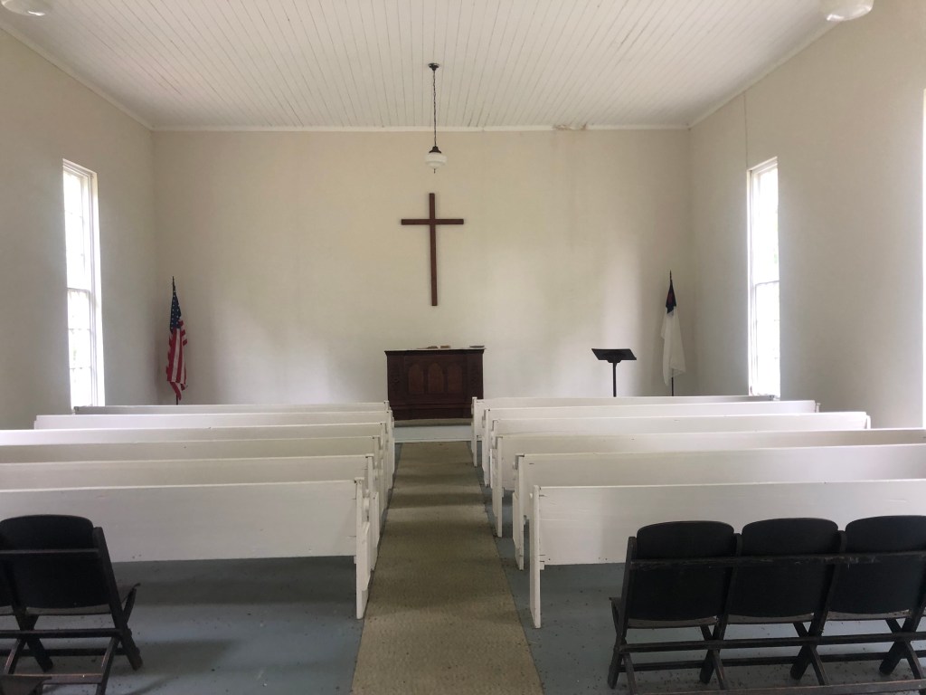
A little research informed me that the church can still be used as a chapel by whomever wants to to do. And a nearby church in Port Gibson (!) conducts a two services here each year, in the spring and the fall.

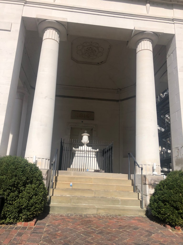
A final set of ruins I encountered on the way to Natchez was something called the Elizabeth Female Academy. Opening in 1818, it was Mississippi’s first higher education institution for women. For a short time, the faculty included a drawing instructor by the name of John James Audubon (yes, the Audubon). The academy closed in 1845 due to declining enrollment (linked to a shrinking population in the area). The building burned in the late 1870s, and these ruins were all that remained.

And you know what’s striking about all these ruins and abandoned buildings I saw today? I didn’t spot a single bit of graffiti. The elements are certainly taking their toll on the Delta’s history, but it seems that, by and large, the residents of the region either appreciate the value of these historical treasures…or maybe they just ignore them.

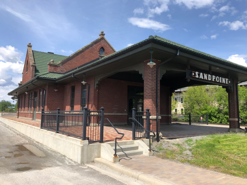
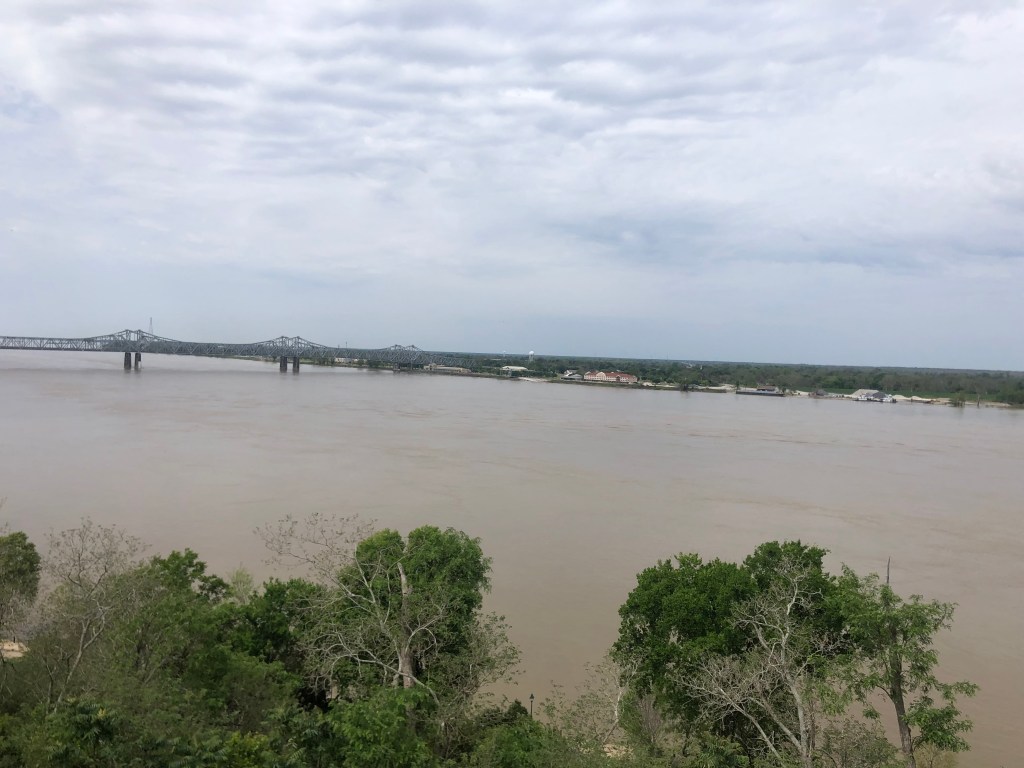
Finally I arrived at the end of the Natchez Trace, appropriately enough in the city of Natchez (pop: 14,500). The city, which for a short time had been the Mississippi state capital, reminds me of Vicksburg. Both are historic and seemingly prosperous towns located on the east bank of the Mississippi.

View of the Mississippi from downtown Natchez.

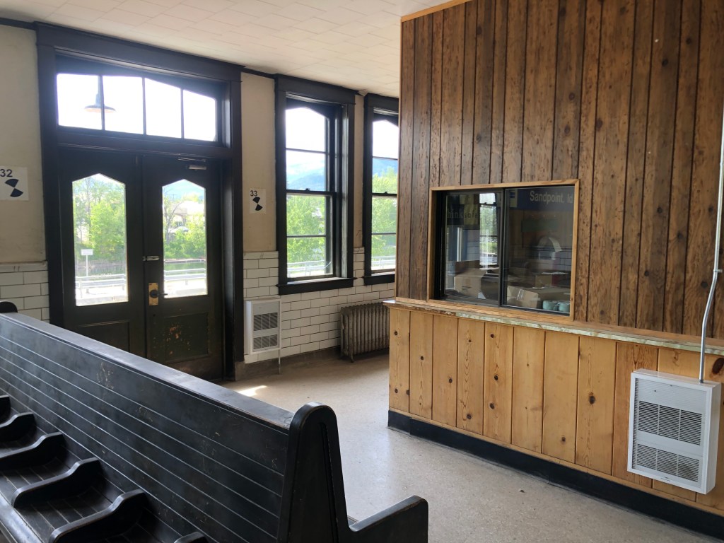
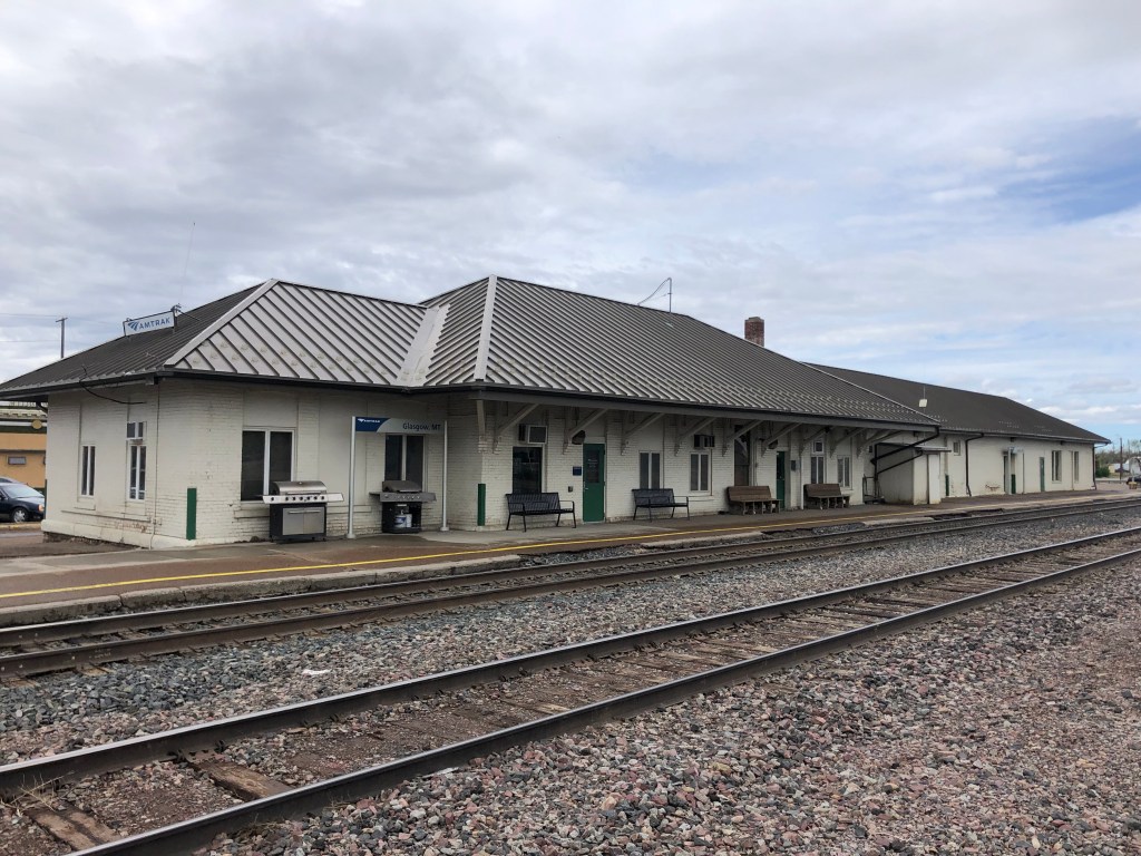
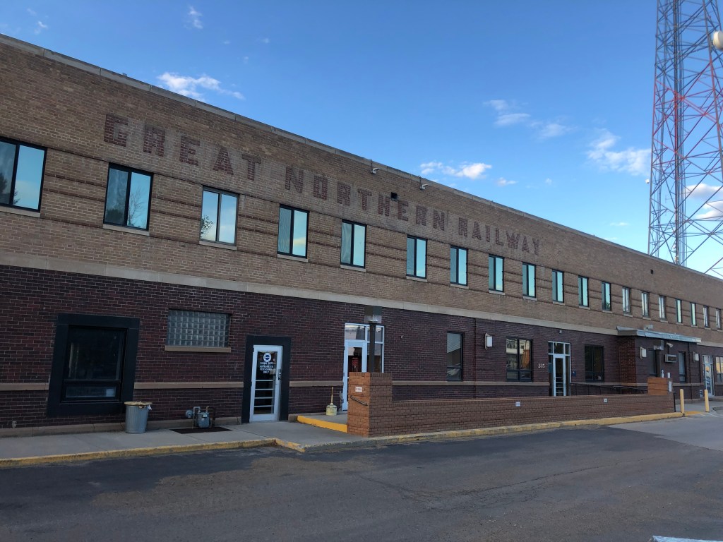
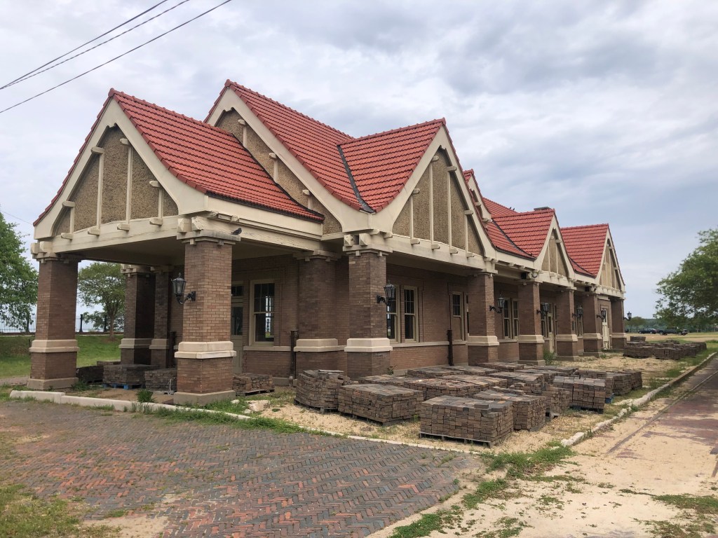
And, like Vickburg, Natchez seems to place value on its historic resources. For example, the 1915 Yazoo &Mississippi Valley Railway depot has been restored–at least on the outside. The inside is gutted, awaiting a tenant (like a restaurant) to lease it out.

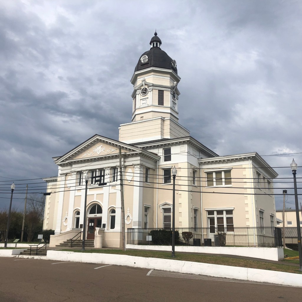
The city hall building will have its hundredth birthday next year, and it looks great as well.

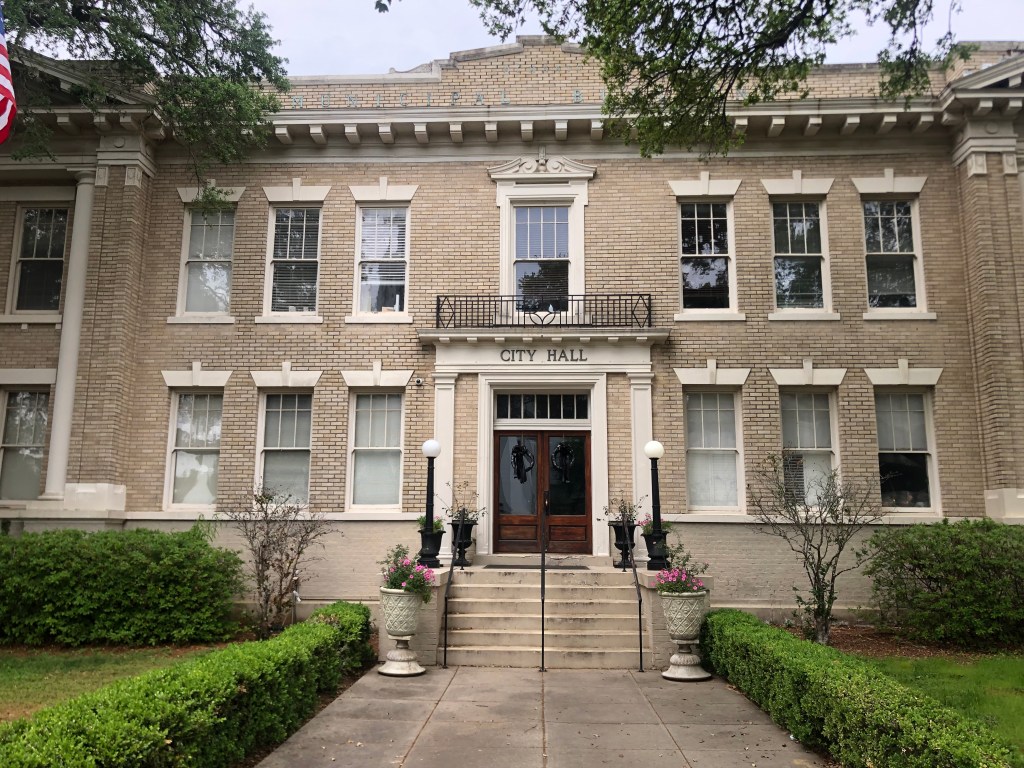
On the front lawn I noticed a small grave marker for “Tripod,” who was a feral, three-legged cat that showed up at City Hall in 1979 and never left. Literally. When he died four years later the city held a full memorial service and placed him under this marker.

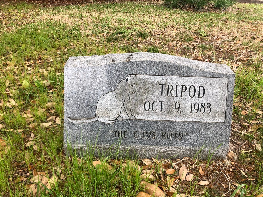
Evidently Tripod was more beloved than some of the humans around City Hall. One of the city Aldermen–Hal Wilson–was allergic to cats and made a motion Tripod be banned from the building. The motion failed to get a second, and the Mayor then moved to have Wilson banned from the building. (That motion failed as well. But still.)

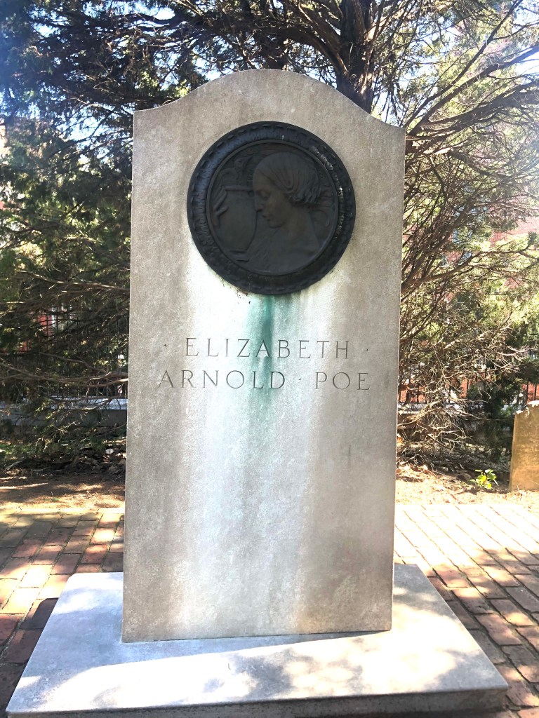
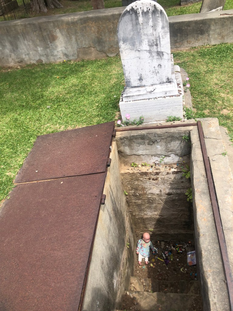
Speaking of graves, Natchez Cemetery had this unusual specimen:

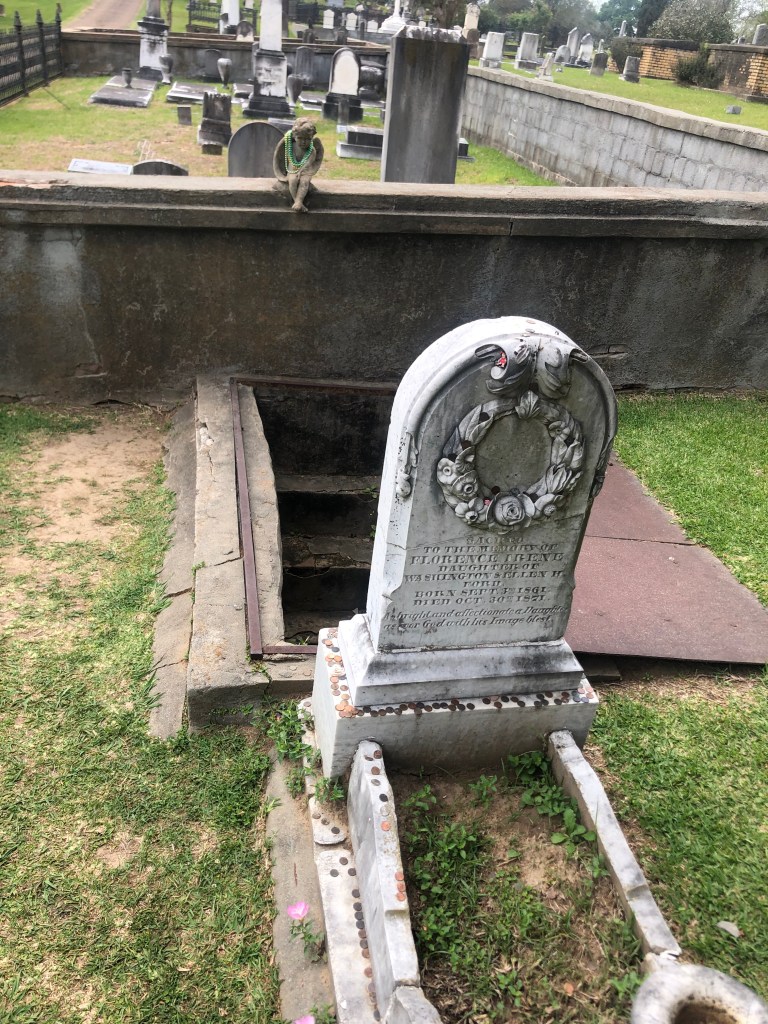
Florence Irene Ford was only 10 years old when she died of yellow fever in 1871. The story goes that she always sought comfort from her mother during a storm. So when she died her parents had a staircase built into the ground of her grave so that her mother could descend to a specially outfitted window and comfort the spirit of her daughter during storms. That’s not creepy, is it?

There used to be a glass window with a view of the Florence’s coffin, but this was cemented over in the 1950s–long after Florence’s mother had herself died.

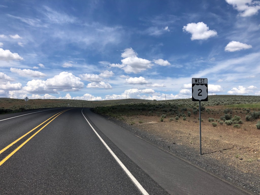
After leaving Natchez I departed from the Blues Highway and headed southeast to the city of Hattiesburg (pop: 49,000). Hattiesburg is on US route 49–which I’d encountered way back in Clarksdale. (Recall the possibly literally damned crossroads of Route 61 and Route 49 where Robert Johnson sold his soul to the Devil.) Highway 49 essentially forms the hypotenuse of the right triangle formed by my route (Highway 61 south to Highway 84 east).

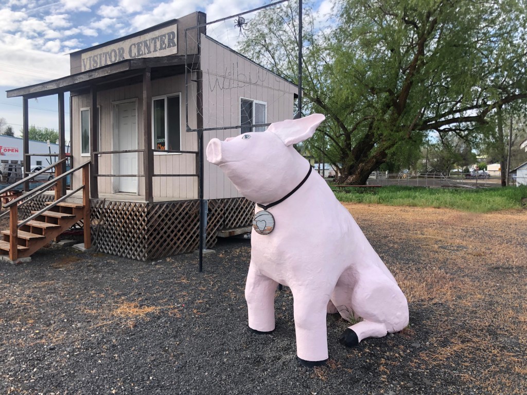
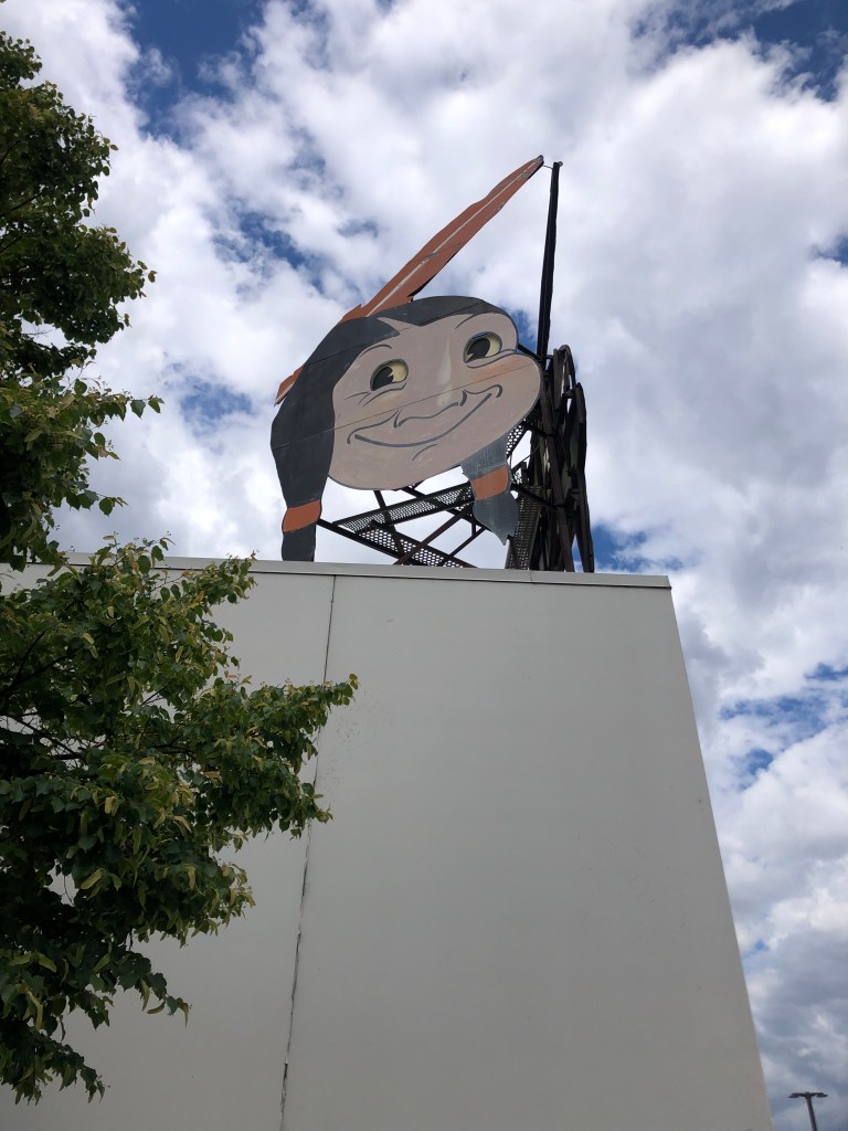
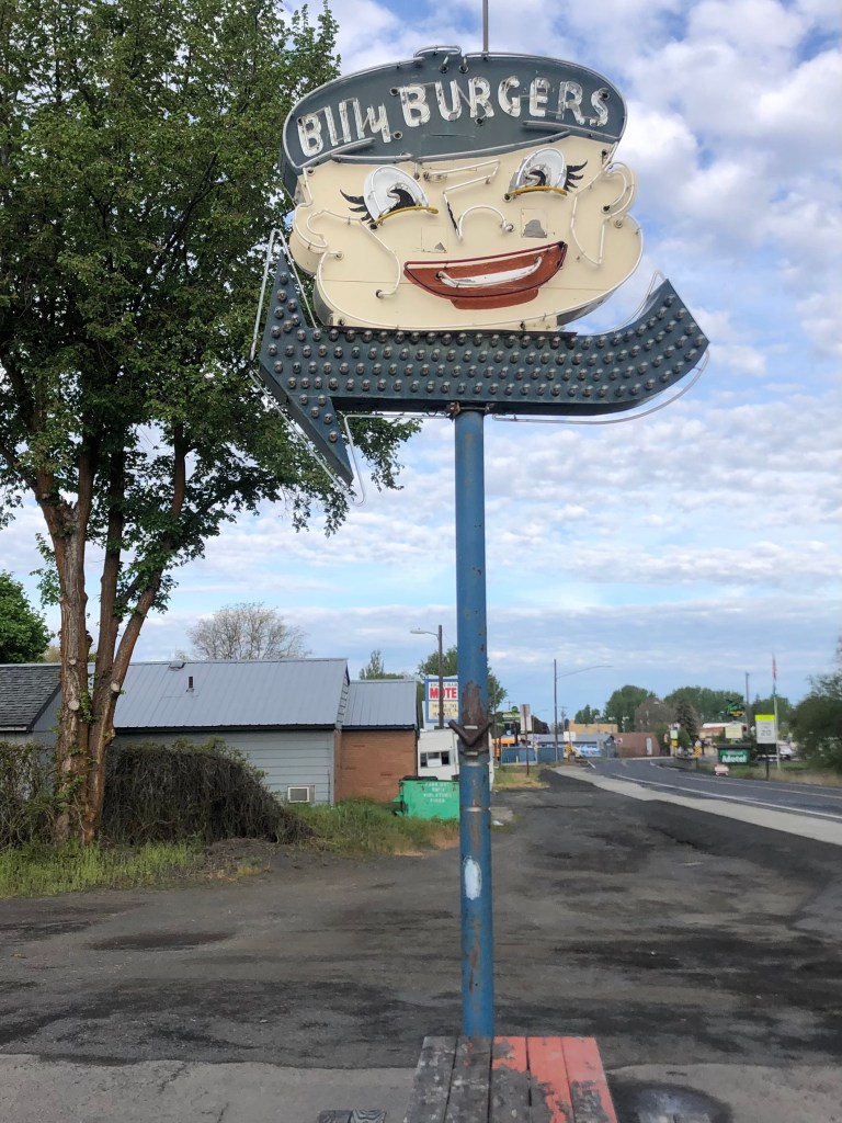
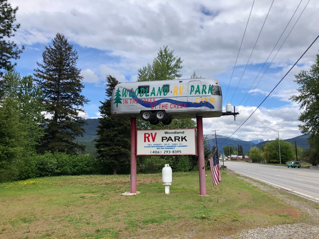
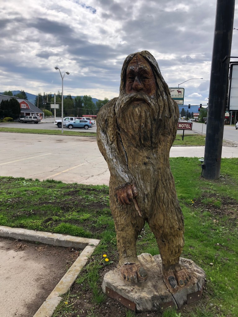
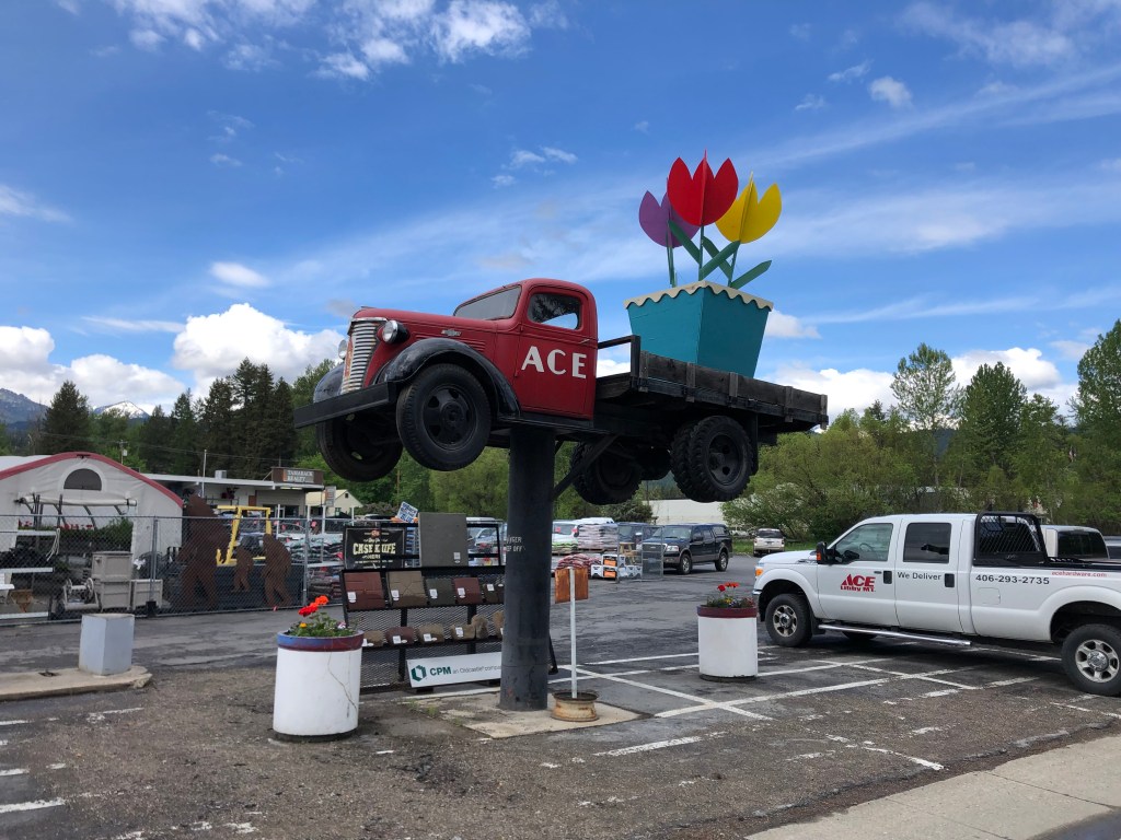
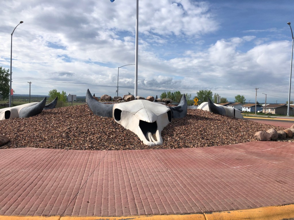
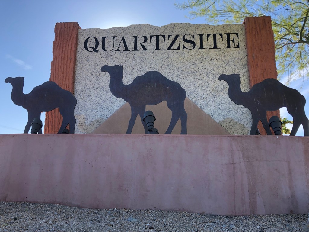
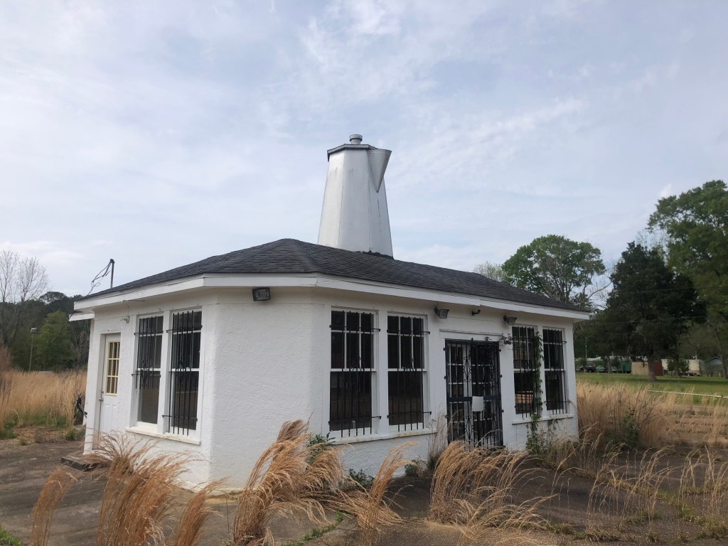
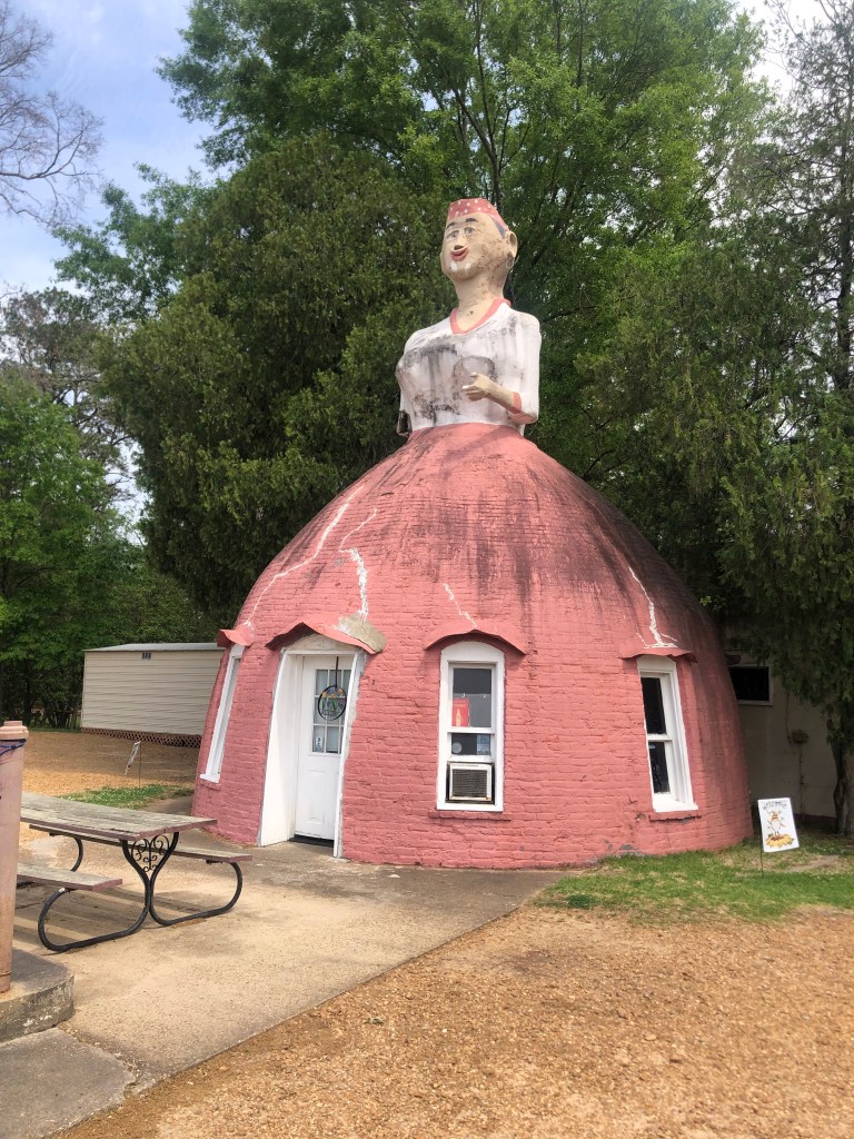
Along the way to Hattiesburg I encountered two notable pieces of historic roadside kitch:

The Coffee Pot Inn was built in 1931 as the first drive-in restaurant in Brookhaven, MS.
Mammy’s Cupboard is a roadside restaurant that was built at the outskirts (ha!) of Natchez in 1940. It’s still open for lunch daily except Sundays. And today is Sunday, sadly.

Tonight I’m spending the night in Hattiesburg. Tomorrow it’s off to New Orleans!
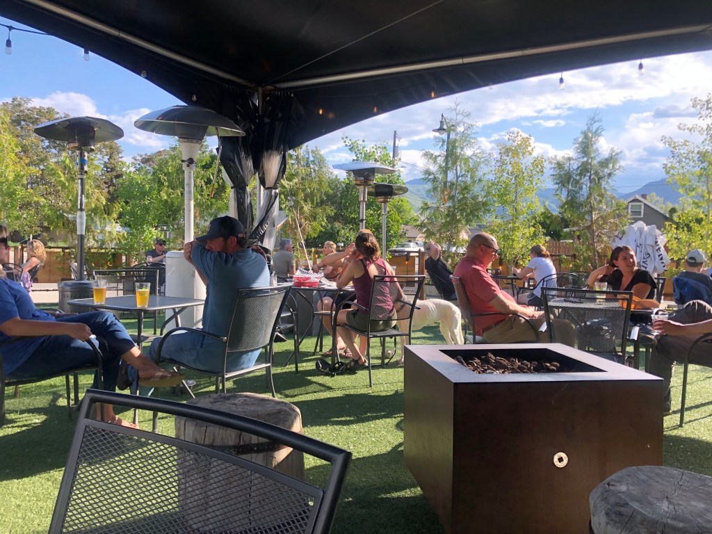
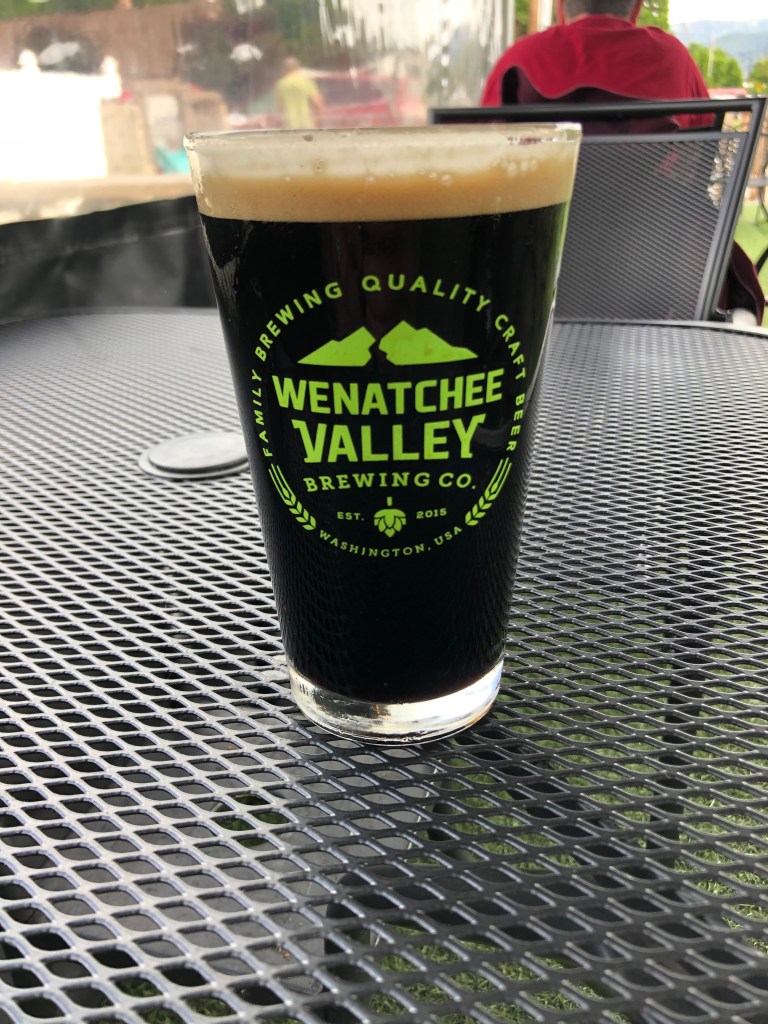
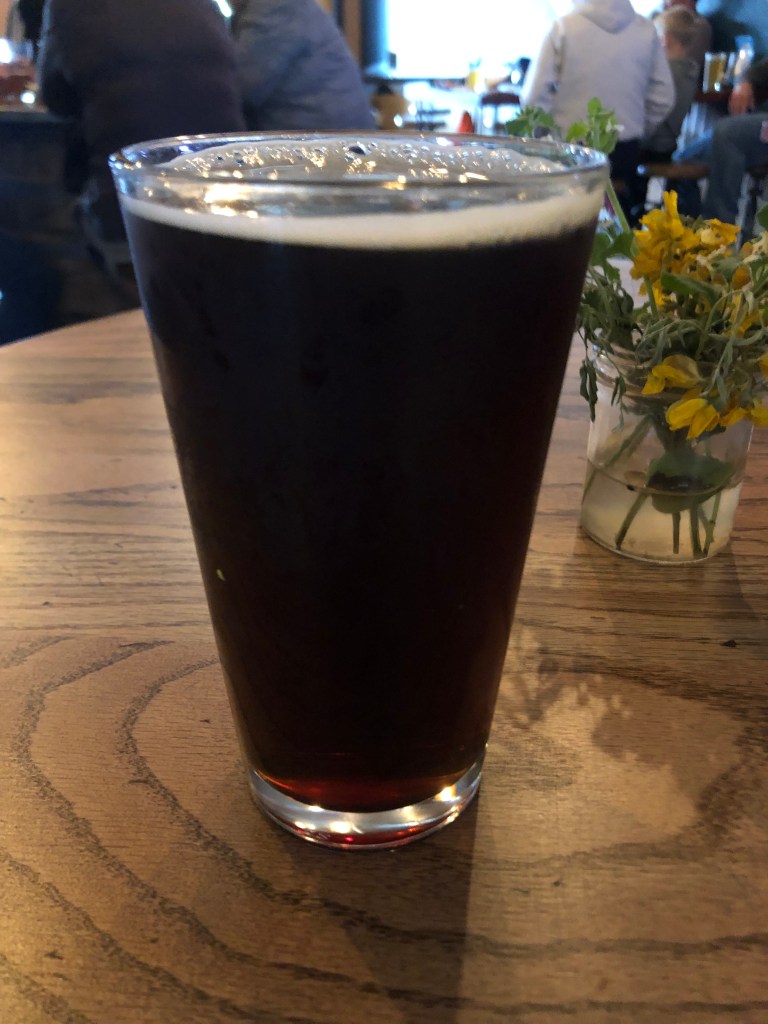
Beer of the Day

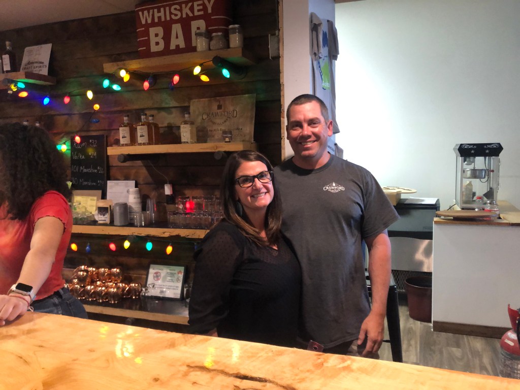
I went into Natchez Brewing Company, where owners Lisa and Patrick Miller were working hard to handle the lunch crowd. I ordered a “Smorish Imperial Stout” and a calzone the size of a Frisbee.

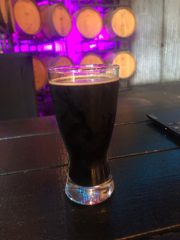
I think “Smorish” is supposed to evoke s’mores. Indeed the description claims it’s got chocolate, graham cracker, and marshmallow notes.

I’m not so sure about all that. The malt has a seriously roasted taste, to the point of charring. It’s as if the marshmallow of your s’more caught on fire. I don’t taste much sweetness. The dominant taste is bitter dark chocolate and black coffee. 

The mouthfeel isn’t that creamy, but it is smooth. It’s also what I call a Sleepy Hollow Beer (i.e., headless).

The ABV is 10.3 percent, which is pretty standard for an imperial stout. Overall, it’s quite drinkable, though the s’more reference is false advertising.

3.5 stars (out of 5)

cemeteries · churches · Halloween Cocktails · trains

Poe-tober 2022

Chartreuse? Nevermore!

We interrupt this month of Halloween cocktails to bring you breaking news that I’m in Virginia for an Edgar Allan Poe pilgrimage. I will give you the gory details in a moment, but first let me share some other breaking news:

The Twentieth Anniversary Edition of the Dome of Foam is live!

Uncle Edward’s Fever Dream

I am aware that a number of my readers respond positively to any railroad-themed content from my road trips, so they will be especially heartened by this news. The Dome o’ Foam, for those of you not already familiar, is a quirky, hard-to-define, and entirely mesmerizing collection of railroad history and miscellanea, focusing in particular on the Southern Pacific Railroad. The Dome is the brainchild of my Uncle Edward — E.O. Gibson, to you. Alert readers will recall that Uncle Ed has periodically made appearances in this blog. The new, 20th anniversary edition of his site contains a dizzying array of new content, updates on old content, photographs, personal stories, and cartoons. You owe it to yourself to check it out here.


So, on to my Poe trip. As everyone should have learned as a school child, Edgar Allan Poe lived in various cities of the East during the 19th century, focused largely on Richmond, VA (where he grew up) and Baltimore, MD (where he died under mysterious circumstances). Three years ago (before Covid shut down public gatherings) my friend Chris and I attended the International Edgar Allan Poe festival, held literally in Poe’s old neighborhood in Baltimore, MD. Today Chris and I bookended that trip with a visit to Poe’s old neighborhood in Richmond VA.

Before beauty filters.

The main Poe attraction in Richmond is the Poe Museum on E. Main Street. You may recall that I drove right by the museum on my Route 50 trip in 2018, as Route 50 becomes Richmond’s Main Street and takes you right through the neighborhood. Alas, the museum was closed when I passed it. So this time, I was finally able to darken its doorstep.

Better late than never.

It’s a remarkable museum, with the world’s largest collection of authentic Poe memorabilia: His bed, writing desk, walking cane, various letters, articles of clothing, photographs and daguereotypes, books, other personal effects, and even the staircase and fireplace mantel from prior Poe residences. It also has a meditation garden and major shrine to Poe.

Two cats–Edgar and Pluto–roam the museum grounds like the own the place…which in a way they do.

Edgar and Pluto…or is that Pluto and Edgar?

In front of the museum is a large granite block with Poe’s name and birth and death years inscribed on it. No, it’s not a giant tombstone; it’s the pedestal base for a Poe statue that was created in the mid-1950s–when Richmond finally decided to embrace Poe.

Channeling my inner Dobie Gillis

For reasons that aren’t entirely clear, the pedestal base was discovered in a local landfill by some kids many years later (in 1973, to be exact). It seems that it had been rejected by the city, and a new one had been cut. This “new” base sits, with the statue atop it, in Richmond’s capitol park.

Poe statue in Capitol Park

After the museum, Chris and I visited a number of other Poe-related sites in Richmond, as depicted below.

Grave marker for Poe’s mother–an English actress who died of tuberculosis in Richmond at age 24, when Poe was only 2.
Richmond’s Monument Church, where John and Frances Allan were parishioners. The Allans took in the orphaned Edgar Poe (as his father had abandoned the family before Eliza Poe’s death). This is how Edgar Poe became Edgar Allan Poe.
The house of Elmira Shelton. Poe became engaged to Elmira at the tender age of 16, just before leaving for UVA. Her father disapproved of the courtship, and intercepted Poe’s letters to Elmira. Thinking that Poe had forgotten about her, Elmira married another man. Later, Poe famously married his own 13-year-old cousin. But after she died of tuberculosis and Elmira’s husband also died, Poe and Elmira again became engaged. To complete the tragedy, Poe himself died at age 40 just a week and a half before he and Elmira were to be married.
Skeleton in a local bookstore. It’s not directly Poe-related, but somehow it’s appropriate.
And to round out our Poe-themed day, the receptionist at our hotel is named “Raevyn” (as in, Raven).I’m not making this up.

I hope that all this explains why I wasn’t able to prepare a Halloween cocktail for the blog today. I promise to double-up my cocktail posts when I get home.

churches · Hydrology · Road trips

Dam Detour

So, here we are in the final state of this two-week odyssey. Not only have we traveled through 11 states (VT, NY, PA, OH, MI, WI, MN, ND, MT, ID, WA), but along the way we’ve seemingly experienced most of the types of terrain this country has to offer. For example, today I left behind the green mountains of western Montana and Idaho, and entered the flat, arid, scrub brush-covered badlands of eastern Washington.

The parched landscape of eastern Washington.

There’s not a lot of settlements out in this part of the country. One of the isolated towns I drove through this morning was Wilbur (pop: 900). It’s worth quoting Wikipedia about how the town got its name:

Just prior to the construction of the Central Washington Railroad line in 1889, no towns existed west of Davenport in Lincoln County. One place along the line, “Wild Goose Bill’s Ranch,” run by Samuel Wilbur Condit, was assigned a post office by the Federal government. Condit was 62 years old and known throughout the region as Wild Goose Bill when he and another man shot each other to death on Jan. 21, 1895. Condit platted the town that bears his middle name “Wilbur,” though he didn’t have anything to do with the naming. Goosetown was a consideration, until the blacksmith’s wife complained that she would never live in a place with such a silly name. Instead, the name Wilbur was chosen by town surveyors.

OK, so knowing that, check out this mascot next to the visitor’s center:

I won”t comment on the unusual shape of the anorexic pig, but I will note that a wire spiderweb (barely visible in the below photo) bears the name Wilbur. Clearly the Chamber (or whoever is responsible for this pig) doesn’t know the true origin of the town’s name. But E. B. White must be smiling.

A little past Wilbur on Route 2 is the town of Coulee City (pop: 550). With all due respect, it’s not much of a town…but it is home to “the world’s largest waterfall.” The only catch is there’s no water. Let me explain.

Waterless waterfall.

Scientists have determined that at the end of the last ice age, an ice dam blocked a river in Idaho, which gradually created an enormous lake that reached into Montana. Eventually the ice dam failed, and the stored water rushed westward toward the Pacific, scouring the landscape along the way. This evidently happened a number of times, and the hydraulic activity created these “coulees” (deep ravines), which in turn produced enormous falls when the next flood occurred. The falls at Coulee City were over 400 feet high and 3.5 miles across.

All this reminded me of a cul-de-sac near my childhood home named Grand Coulee Court. It’s where Phillip Waters lived. (I’m not making up that serendipous surname.) Did this ravine I was now taking photos of–called a “coulee”–relate in some way to “Grand Coulee”? Then, somewhere in the back of my mind, I remembered there’s a “Grand Coulee Dam,” though I didn’t know any details about it. A quick consultation of my trusty road atlas (that I’ve been carrying around since 2010) informed me that the Grand Coulee Dam was a short 20-minute detour from Coulee City. So off I went.

I won’t bore you with the details, but the basic points are these: The US Bureau of Reclamation built the Grand Coulee Dam in the decade leading up to World War II. The dam is on the Columbia River, creating a reservoir (Lake Roosevelt) from which water is pumped to irrigate farms in central Washington. In addition, water passing through the dam powers generators which produce the largest amount of hydroelectric power in the US (about 21 billion kilowatt hours each year.) I learned all this on a guided tour, which took me into the pump stations and onto the top of the dam.

The Grand Coulee Dam, viewed from downstream on the Columbia River.
On top of the dam with my tour group.

And if you’re interested, here’s a short video showing my view looking over the edge of the dam, on the downstream side.

Around noon I wound up this educational detour and reconnected with that familiar friend, Route 2. Along the way I drove through “Electric City” (pop: 1,000), whose name relates to the nearby Grand Coulee Dam’s generating capacity. But what struck me about Electric City was not its proximity to someone else’s generators, but rather a large collection of homemade windmill sculptures in a “windmill garden” next to a park.

Positively mesmerizing in person.

The sculptures were created by a hobbyist metalworker named Emil Gehrke, and they’ve supposedly been featured in National Geographic magazine. Gehrke created the sculptures from scrap that he collected from all over the world. He displayed the sculptures in his yard for years, but after his death in 1979 (at age 95) most of them were moved to this park.

Soon I reconnected with Route 2 and returned to my westward trek. I came to the town of Waterville, where I encountered the daily, obligatory former church building. Today’s ex-church started out as St. Paul’s Lutheran Church in 1915. It closed in 1968, when the congregation built a new church along with another Lutheran congregation. The old building was purchased by the local historical society in 2006, and it’s now used as a community center and wedding venue. The historical society did an impressive job of restoring the structure.

Look familiar?

I am spending the night in Wenatchee (pop: 35,000, which is one of the largest towns on this trip). Wenatchee is a comfortable, seemingly prosperous town at the confluence of the Wenatchee and Columbia Rivers, with lots of outdoor venues for enjoying the great weather. It calls itself “the apple capital of the world,” in reference to its many apple orchards.

I’ll end my description of today’s travels with these two semi-creepy floating faces that evidently had been employed for advertising purposes in the middle of the last century.

Atop an Office Depot in Wenatchee. (The sign was grandfathered in from the prior business on this site.)
Hamburger joint in Wilbur.

Tomorrow I’m planning to reach the end of Route 2, in Everett.

Brew(s) of the Day

Today’s BOTD comes courtesy of the good folks at Wenatchee Valley Brewing Company in Wenatchee, Washington. It’s the usual modern, western brew pub, with the brewery and service counter in a warehouse-like space, lots of outdoor seating with views of the busy street, and the ubiquitous corn hole game set up on the lawn. Wenatchee Valley Brewing is located on the bank of the Columbia River, which makes for a pleasant environment.

The usual setup.

I ordered the Trout Stout on nitro. (“Nitro” is a dispensing process for some draft beers–particularly stouts–which uses nitrogen rather than carbon dioxide, lending a creamier mouthfeel.) I have to say that it was a good presentation, and a tasty brew. The beer is a dark-chocolate brown, with a thick, creamy, tan head. The taste is remarkably smooth and balanced. It manages to avoid the bitterness that plagued the last few stouts that I’ve drunk. The main flavors that come through are roasty ones: espresso, burnt toast, maybe a little bit of roasted chestnut. And at only 6% ABV, this is a very drinkable beer. Recommended. I give it four stars.

Powered by nitro.

Now, recall that I couldn’t find a BOTD yesterday, so I’m making up for that by having a second BOTD today. Loyal reader Ron P. sugested I have a hazy IPA, but there are none to be found at this place. So instead I had a “Hopcicle Double IPA.”

Not hazy, but definitely boozy.

This is a good summer brew, made all the more enjoyable because I’m sitting outside in the warm sunshine with it. It’s pretty sweet for an IPA, with hints of honey and marmelade. Hops balance out that sweetness, but it doesn’t taste bitter. It’s got a light body, which makes it go down pretty easy. But it’s 9.2 percent ABV, so they serve it in a smaller (12-oz) glass. Which is a good thing, I’m sure. I give it 4.5 stars, but that might be alcohol talking…

bridges · churches · Road trips · trains

Potatoland

This morning after an unhealthy breakfast I left Kalispell and headed west toward the Idaho border. This is beautiful country–the many small lakes, the Kootenai River, several national forests, the Purcell and Cabinet Mountains… The towns out here are much more vibrant than the towns along the Hi-Line (a term which no longer is used west of Glacier National Park). The towns also feel a bit more optimistic and playful, which shows up in the extensive roadside art installations.

Trailer-On-a-Stick in Libby, Montana
Cross between a Sasquatch and Jerry Garcia?
What is it about Montana and these stick-mounted vehicles?
Giant fishing pole with the catch of the day.
A Clockwork Moose

Along this scenic stretch of northwestern Montana, somewhere between the towns of Libby (pop: 2,800) and Troy (pop: 800), I saw a large number of vehicles parked in a roadside parking lot, with lots of activity as couples and families walked toward a trailhead. I figured I’d park and see what all the fuss was about. It turns out the approximately 3/4-mile-long trail leads to the Kootenai Falls Swinging Bridge.

What could go wrong?

It’s a simple suspension footbridge, 210 feet long, strung 100 feet above the rushing waters of the Kootenai River. Now “swinging” is not generally considered to be a desirable characteristic of a bridge, but the lateral movement is limited by heavy cables, so it sways rather than swings. Plus, you have to admit it’s kind of fun to watch the people ahead of you freaking out. At great personal risk, I took a video of myself crossing the bridge, for the benefit of you, my loyal readers.

Yes I know I’m holding the camera wrong…

After surviving that ordeal, I got back on Route 2 and eventually entered the Potato State. (Idaho actually calls itself the Gem State, but what non-Idahoan has ever called it that?) The first Idaho town I encountered was Bonners Ferry (pop: 2,700). Bonners Ferry calls itself “Idaho’s Most Friendly Town” and that’s a plausible claim. The people seemed warm and welcoming, the motorists waved and yielded the right-of-way, and even the teenagers made eye contact and said hello while passing on the sidewalk. Of course, I’m told that Idaho is beset with an influx of expatriat Californians who are seeking lower taxes, cheaper housing, and fewer wildfires. So we’ll see just how friendly these Idahoans remain.

It was in Bonners Ferry that I saw my daily, obligatory converted church. This particular one looks like it could be haunted. It was built as a Roman Catholic church in 1894, and has been operating as the Pearl Theater since 2012. It seems to be a well-used facility judging by the list of events which shows something (poetry reading, music programs, language classes, belly dancing, movies) happening most days.

Tim Burton would love this place.

Although I left the Great Northern’s Hi-Line behind in Glacier, Route 2 continues westward alongside a set of railroad tracks. I clambered down a hillside to take a photo of the trains’ right-of-way beside the river. This would make a great rail journey!

Speaking of trains, when I got to Sandpoint ID (pop: 8,700) I noticed a historic railroad depot on the other side of Route 2, which runs on an elevated roadbed as it cuts through the downtown. It took me half an hour to find a way to get to the depot, and once I did I was rewarded with this beautiful 1916 structure.

Shockingly this is the only operating Amtrak station in the entire state of Idaho. It is served by two passenger trains a day (one from each direction). As I was taking photos I was greeted by Maggie, who was locking up the station. Maggie had been the station’s first female station agent (I hope I have that title right; Maggie, please correct me if you’re reading this) and is now retired from that position. But she still does contract work for Amtrak, which includes opening and closing the station, as well as some other property management tasks. She generously showed me around the station, which still has much of its original interior woodwork.

Maggie (L) with helper Vickie
Sandpoint’s waiting room

The city of Sandpoint sits on Lake Pend Orielle and is flanked by mountain ranges. As such, it is a major tourist destination. It even has its own miniature version of the Statue of Liberty.

“Bring me your huddled masses yearning for potatoes.”

By the late afternoon I was already leaving Idaho, since US 2 just cuts along the state’s northern panhandle for about 80 miles.

Red line is Route 2 through Idaho. Today’s drive went from Kalispell in the east to Spokane.

I crossed into Washington and I’m spending the night near Spokane. The only notable photo I took in downtown Spokane was of the 1913 Sunset Boulevard Bridge. (Route 2 travels on a more modern bridge paralleling this bridge, but I figured it was worthy of inclusion since it’s a feature you see while traveling Route 2.)

Golden Arches

And for fun, check out this historic photo of the bridge under construction:

With that excitement out of the way, I had great hopes of getting a beer at Iron Goat Brewing. But when I got there I encountered a locked door and a sign saying that they’re closed for Memorial Day. (One wishes Google Maps had been made aware of the closure.) Two other brewpubs were similarly closed. So no BOTD today. I guess I’ll just have to have two beers tomorrow.

churches · Golden Bear signs · Road trips · trains

Dem Bones

Back in Devils Lake I took a photo of an art deco sign for a chain called “Home of Economy.” (It didn’t make my cut for that day’s blogpost, though.) “Home of Economy” is a small chain of discount stores in North Dakota. It’s said to be America’s first discount chain. The story is here. Well, it turns out there’s another one of these signs in Williston. And when I came into town last night it was illuminated. I thought I’d share it with you, so you can get the whole effect:

Welcome to 1952. I love how garish this sign is–especially when it’s promoting “economy.”

I was back on the road this morning around 7 am, and before long I crossed the state line into Montana. The flat plains and distant horizon reminded me that they call Montana “Big Sky Country.” My dad (rest his soul) used to complain that the sky is the same size wherever you go; what right does Montana have to claim it as their distinctive characteristic? But a few hours on Montana’s roads convinced me that Dad was wrong and Montana is right. Sorry, Dad.

Size matters

Anyway, today’s theme seems to be bones. For starters, Montana is well known for its dinosaur fossils. There are some good specimens at the “interpretive center” at Fort Peck.

Jurassic Denticles

Second, Montana seems to have adopted the cow skull as some kind of a mascot. I see it everywhere, from storefront logos, to ranchhouse decorations, and even to art installations in the roundabouts on Route 2.

Skeletal streetscape

Third, there are actual skulls scattered about on the landscape, the inevitable result when Montana’s extensive wildlife clashes with predators.

At least the crows are well fed.

Throughout the day I drove about 300 miles. A goodly portion of Route 2 between Wiliston and Havre follows the Missouri River, and, not coincidentally, it tracks with the Lewis and Clark route.

“Over there–is that an obelisk?”

My favorite town on today’s drive was Glasgow, MT (pop: 3,300). It was named by Great Northern Railroad magnate James Hill, who supposedly picked the name by spinning a globe and randomly dropping his finger on Glasgow, Scotland. Glasgow, MT embraces its Scottish connection by depicting plaid color schemes, bagpipes, and Scottie dogs on various buildings and logos. And to contrast with Rugby, ND’s “geographical center of North America” claim, Glasgow proudly calls itself “The Middle of Nowhere.”

I went into a Glasgow coffee shop (“The Loaded Toad”), which, surprisingly for a town this size, offers honest-to-goodness espresso drinks, and I asked what’s up with the “middle of nowhere” slogan. The barista didn’t really have an answer, but one of the patrons (a guy named Nick) told me that it’s actually a scientific fact. It seems that a team of researchers at Oxford University collected data from all towns in the continental US with populations of up to 1,000 residents, and then determined which one of these is the farthest from any city of at least 75,000 residents. The answer: Glasgow, MT. You can read about it here.

Nick: Master of Glasgow trivia.

For such a small and demonstrably isolated town, Glasgow has a lot to offer. Not only does it have hipster quality coffee, but it also has a healthy, historic downtown, centered on the recently-renovated Rundle Hotel that dates back to 1915.

The Rundle Building, age 107.

Glasgow also has an operating, historic depot with daily passenger service. As I noted in an earlier post, trains no longer stop at many of the small towns along the Hi-Line.

Your portal to the Middle of Nowhere.

And as if that’s not enough for a town of 3,300 souls, Glasgow has a well-curated, large Pioneer Museum of Valley County, which covers the history of the region. It has displays on the railroads, schools, agriculture, industries, domestic life, government, and many other aspects of life in northeast Montana. The staff was very welcoming and opened up a frozen-in-time 1924 home for me. They even let me take a selfie with them.

Steve’s Angels.

Although Glasgow was founded as a railroad town, much of its growth occurred in the 1930s, when a major influx of workers and their families came to build the nearby Fort Peck Dam. It was an monumental undertaking, and the completed dam created a 134-mile-long lake in the course of the Missouri River. The flood control, electrical generating, and recreational benefits of the project were enormous (not to mention the economic stimulus during the Great Depression).

To parallel my earlier visit to the headwaters of the Mississippi, here I’m overlooking the point where the Missouri resumes its course after passing through Fort Peck Dam.

Sadly, though, 60 men died in the course of construction, and six bodies couldn’t be recovered. They are forever entombed deep in the dam.

Requiescat in pace.

Naturally, churches made another appearance today. My eye was once again caught by the classic Prairie architecture of an old, whitewashed, clapboard church with that distinctive belfry. Built in 1904, this particular church has some real history behind it. It was attended by some of the Sioux Indian band that was once led by Chief Sitting Bull. (Some of that band had converted to Christianity.) There are also some urban legends about a “goat man” occasionally seen jumping from the church’s belfry. A little info is here.

If I were a supernatural being, I’d probably hang around a church like this too.
Inside the Chelsea Church. Pretty minimalist.

I wound up today’s travels in Havre (pronounced “HAVE-er), Montana (pop: 9,500). It’s one of the larger towns on Route 2, and it seems to have a pretty vibrant economy. Once again I encountered a functioning railroad station, with some impressive art installations (if I can call them that).

Havre Train Station, built in 1904 and significantly remodelled (in streamline moderne fashion) in 1949. Is it just me, or is it intended to look like a railroad passenger coach?
Great Northern’s #2584 was built in 1930, retired in 1957, and has been on display at the Havre station since 1964.
Even if you’re not into trains, you have to find this piece of machinery impressive, right?
Statue of James J. Hill, Great Northern’s founder and CEO. He was called “The Empire Builder.”

Not far from the station I spotted what seems like it could be a Laughing Bear. (For a refresher on what I’m talking about, click here.) It has the same outline and expression, but inexplicably it’s blue rather than gold. Please let me know whether you think this was originally a proper laughing bear, or just a coincidental doppelganger.

YOU make the call.

BREW OF THE DAY

In honor of my visit to Glasgow, I had the Aberdeen Scotch Ale at Triple Dog Brewing Company in Havre. Triple Dog is a hip brewery with the usual industrial-chic vibe, and it’s populated by 20-somethings (both employees and clientele). The only reason that I didn’t significantly increase the average age is because this place was packed. I mean, for such a small town, this place was hopping (brewing related pun unintended). They don’t have a kitchen, but a food truck in the front parking lot supplied me with a wonderful concoction called Irish Nachos. I love this place, and if you’re interested in the back story, here’s an interview with the young founder:

Anyway, as I mentioned, I ordered a Scotch Ale. I had fully intended to get myself an imperial stout, but evidently the folks out here in northern Montana aren’t manly enough for this kind of beer. (Note to the guys sitting behind me here at the brewery, who look like they could snap me in two: I’m just joshin’.)

Not exactly a kilt-lifter.

Scotch ale is a difficult beer to do right. You really need to get your hands on some good peated malt, so that the resulting drink evokes Scotch whisk(e)y. The other key characteristics of a good Scotch ale (in my humble opinion) are a malty-sweet backbone and a boozy ABV. Sadly, this beer had none of these characteristics. (The ABV clocked in at 6 percent.) That said, and in contrast with last night’s beer, this Scotch ale got better the more sips I took. I’m thinking that the first sips were disappointing because they didn’t match my expectations for a Scotch ale. But with further sips, I was able to appreciate it for what it was: Essentially, a good brown ale. Judged by that standard, this was flavorful, suitably hopped, and pleasantly fresh and, dare I say, bright. I give it a 2.5 as a Scotch ale, but 4.0 as a brown ale.

BONUS: DISTILLERY SIGHTED IN HAVRE

After dinner I was driving to my hotel when I spotted the Crawford Distillery. It’s an awesome place: they hand-craft their own whiskies, vodkas, and rums. It’s not the kind of place I’d expect to find in a small Montana town along the Hi-Line; the attention to quality, enthusiastic atmosphere, and craft cocktails would seem more common in a place like San Diego. So I wasn’t surprised when I learned that the owners (Alyssa and Neil Crawford) are transplants from San Diego. Alyssa’s mom also helps out behind the bar and offers humorous, Shirley Booth-like commentary. I felt welcomed and their cocktails were first-rate. Alyssa even burned wood chips to make me a smoked whiskey. You can buy their spirits online. Just sayin’.

Alyssa and Neil Crawford–owners of my new favorite bar.

Tomorrow I cross the Rockies.