As you will recall from my last post, I recently flew out east to visit family and friends for a few days, after which I would travel the entire western segment of US Route 2, from St. Ignace, Michigan to Everett, Washington. The visits have been made, and I have now arrived at St. Ignace. I will be traveling Route 2 over the next 8 days. Be looking for daily posts on this site.
I did manage to drive a small portion of Route 2’s eastern segment while I was visiting as I left Cousin Bonnie’s in Vermont. That segment terminates (or begins, depending on your direction) at Rouse’s Point, NY. And (drum roll please) here it is:
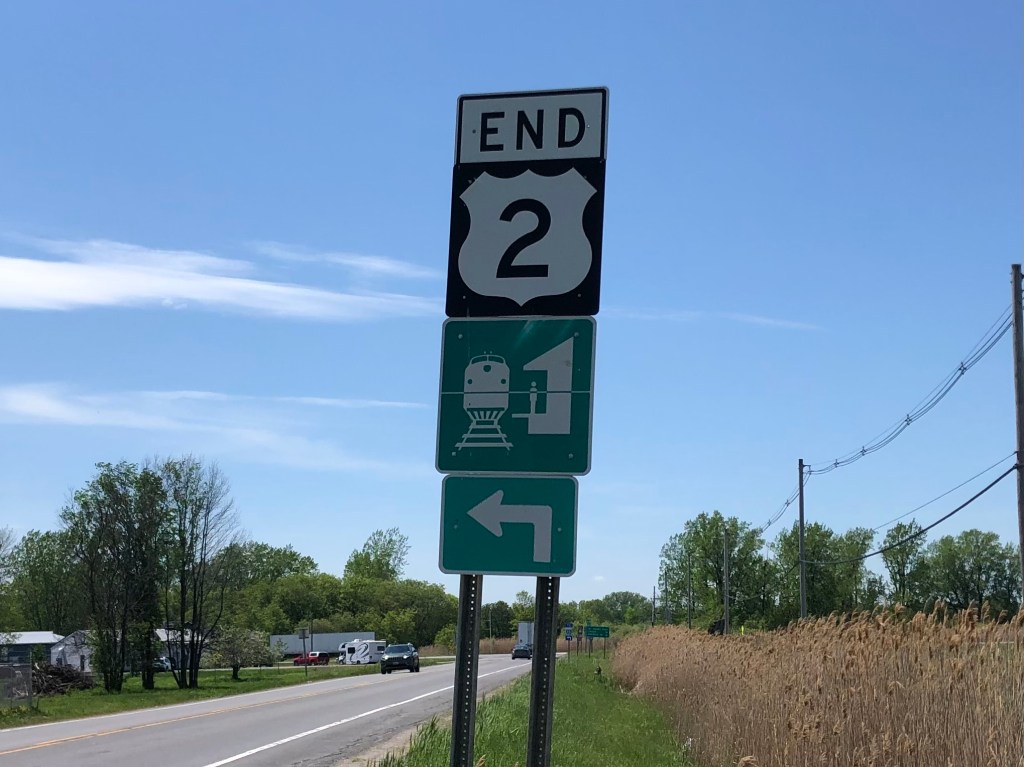
All good things must come to an end.
I then spent the next two days making my way across Route 2’s lacuna. (Along the way I stopped at a Greek restaurant for a little moussaka. Ah, Lacuna Moussaka–what a wonderful phrase!)
Anyway, although I was technically not on Route 2 during this time, I did encounter a few noteworthy roadside oddities. And here they are:
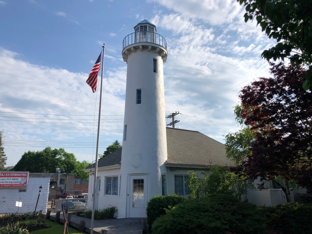
We start with this awesome, restored, historic building in Endicott, NY which was once part of the Lighthouse Service Station chain that supposedly served much of New England. It now appears to be some kind of private office or business, though there are no signs indicating what, exactly, they do.
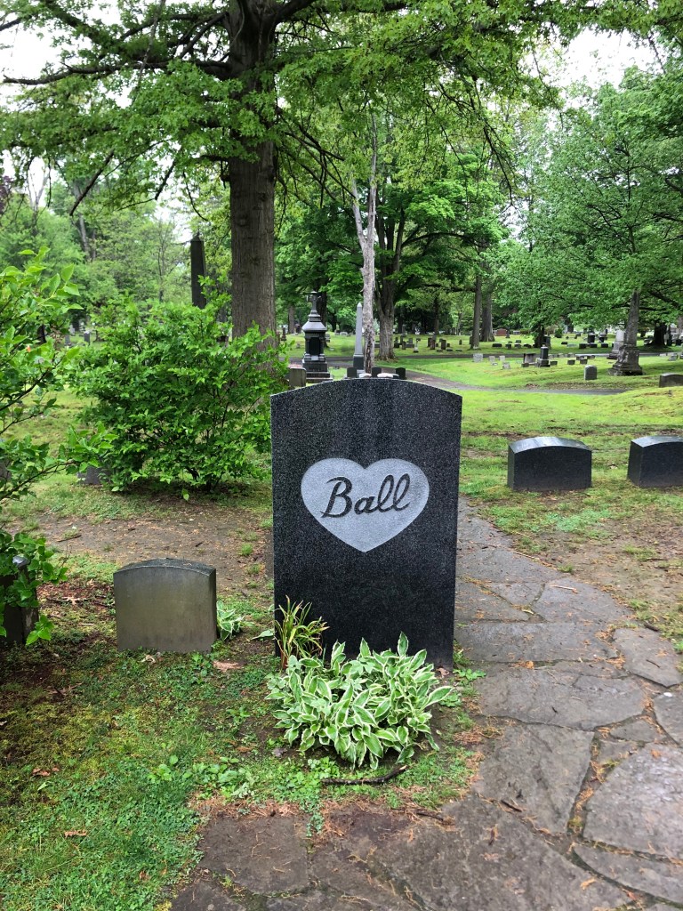
I also stopped a number of cemeteries (the east is lousy with ’em!), and found some notable gravesites:
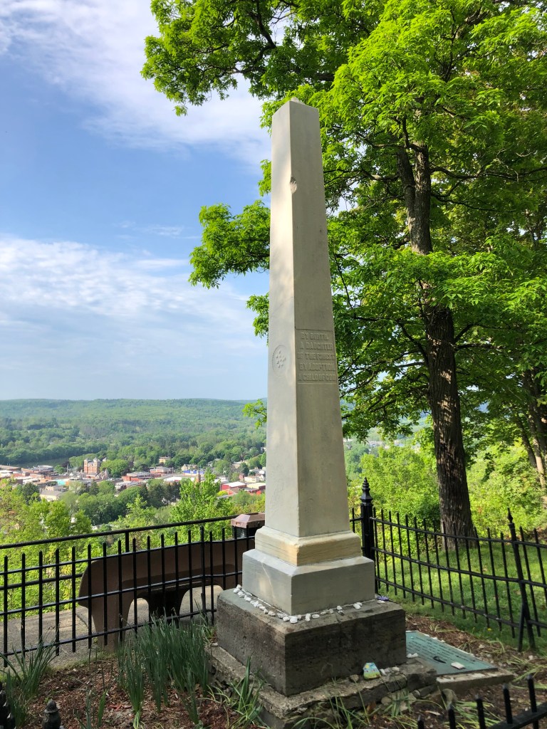
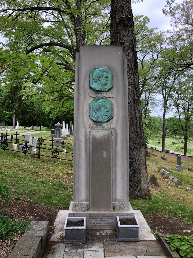
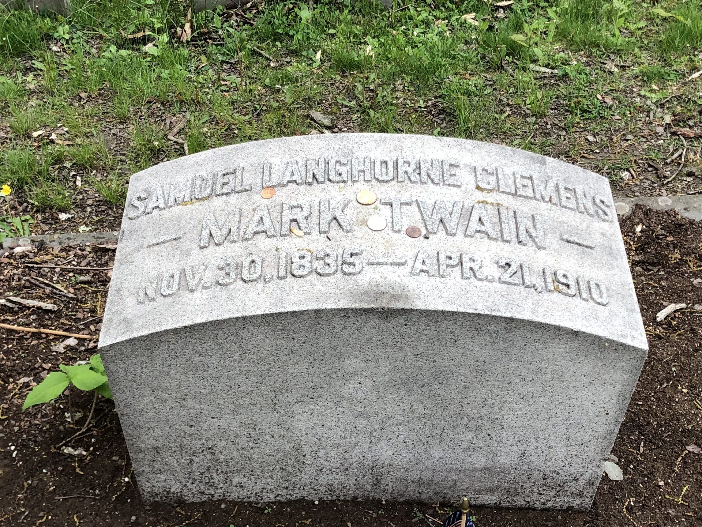
Lucille Ball’s grave (along with other famly members), in Jamestown, NY. Lucy was born in Jamestown, don’t you know.Obelisk alert! Here, in Owego NY, lie the remains of Sa Sa Na Loft, who was killed by a runaway freight train in 1852. It’s supposedly the “oldest white-sponsored grave tribute to a Native American woman.”In Elmira, NY: Family plot marker for Mark Twain and his son-in-law, Ossip Gabrilowitsch. Elmira was Twain’s wife’s hometown.
Let me note here my favorite Mark Twain factoid: When he was born in 1835, Halley’s Comet appeared in the sky. It was known that the comet passes earth every 75 years or so. And so, as the next encounter with the comet approached in 1910, Twain made this comment:
I came in with Halley’s Comet… It is coming again … and I expect to go out with it… The Almighty has said, no doubt: ‘Now here are these two unaccountable freaks; they came in together, they must go out together.’
And they did. Twain died the day after the comet emerged from the far side of the sun.
Hitched to Halley.
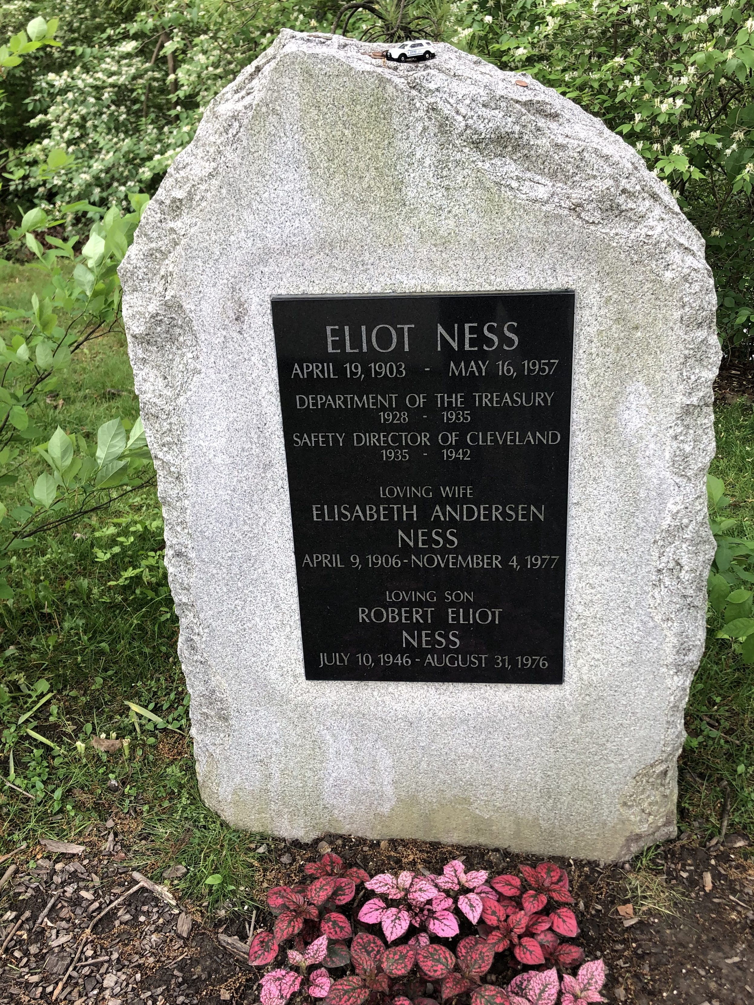
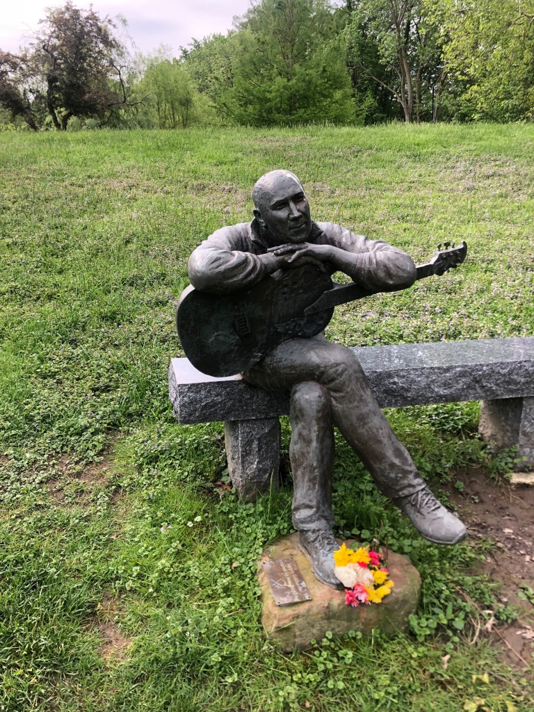
The most impressive cemetery I encountered during my Drive of the Lacuna was Lake View Cemetery, in Cleveland, Ohio. It includes these notable figures and impressive works of art:
Marker for Untouchable Elliott Ness. His ashes were scattered over a pond just behind the marker.Very touching sculpture over the grave of local musician Sergei Gaidaenko. He’s of Ukrainian background.
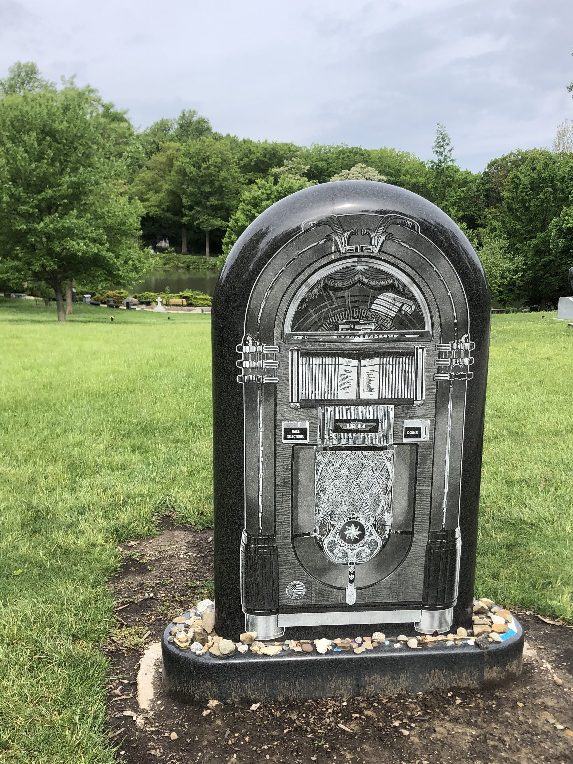
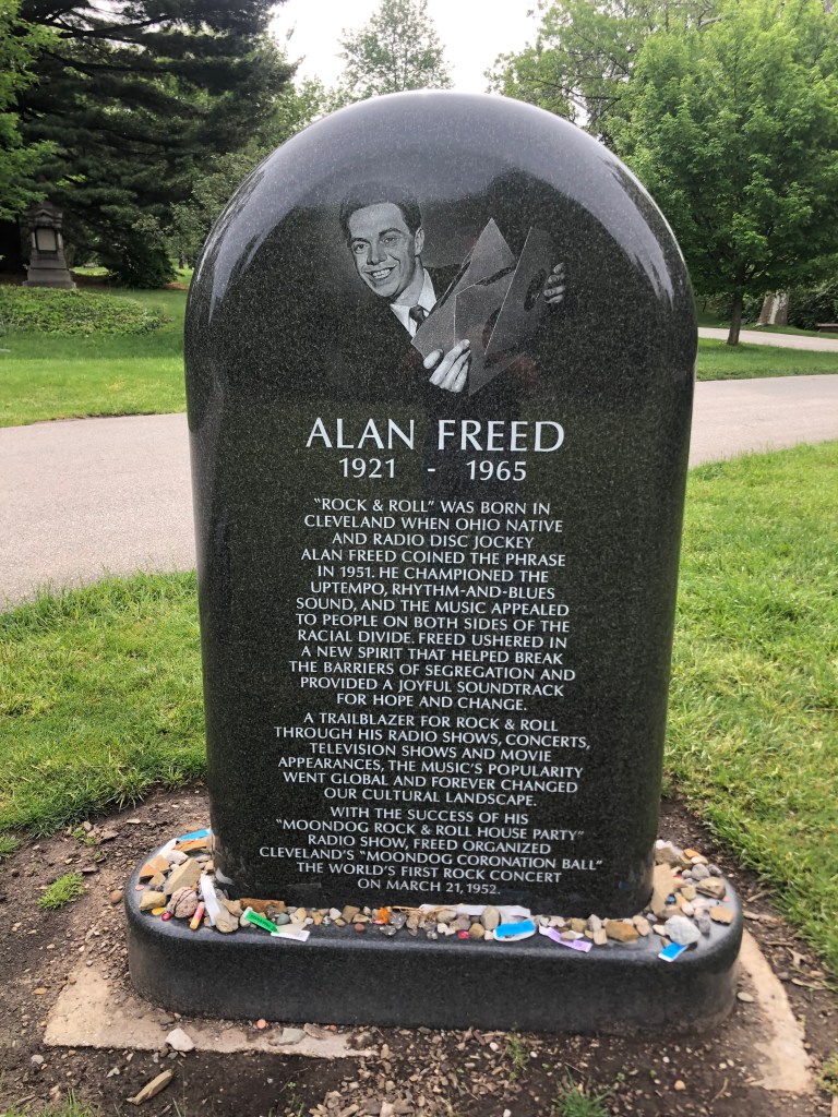
It’s well worth 45 seconds of your time to watch this video, with Sergei’s music in the background. I never met him but I miss him.Here’s something you don’t see every day: A jukebox tombstone. It belongs to local disk jockey Alan Freed, who supposedly coined the term “rock and roll” in 1951.
If you’re interested in what all the fuss was about, check this out:
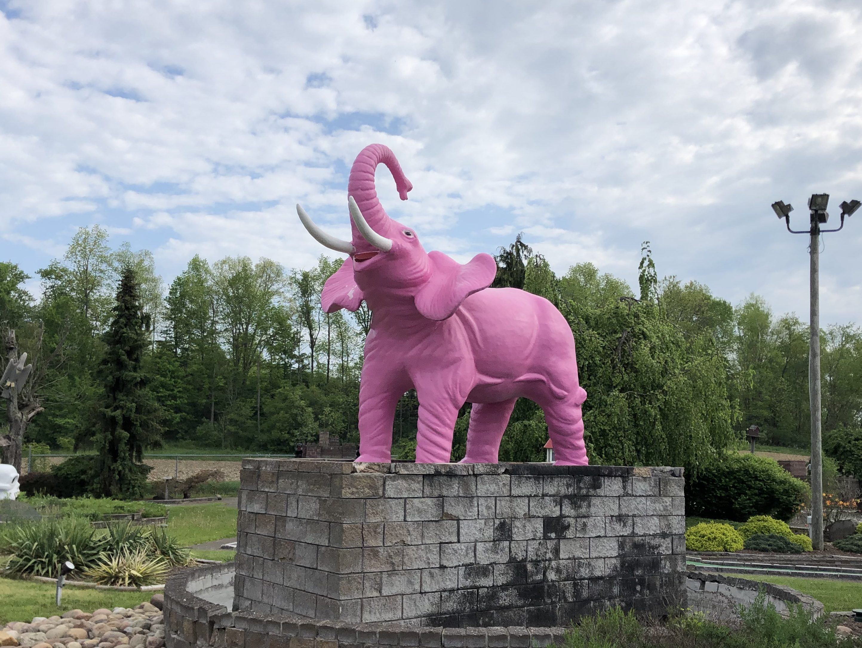
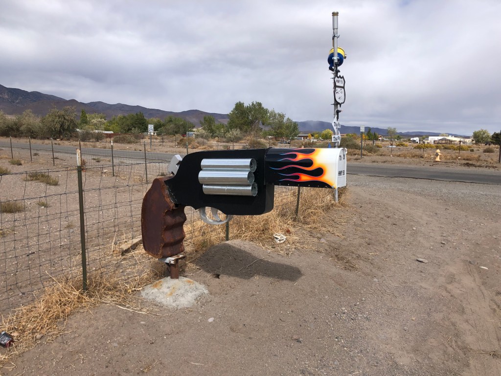
At a miniature golf course in Owego, NY. Alert readers will recall a number of Pink Elephant sightings on my earlier trips; see here for a refresher.
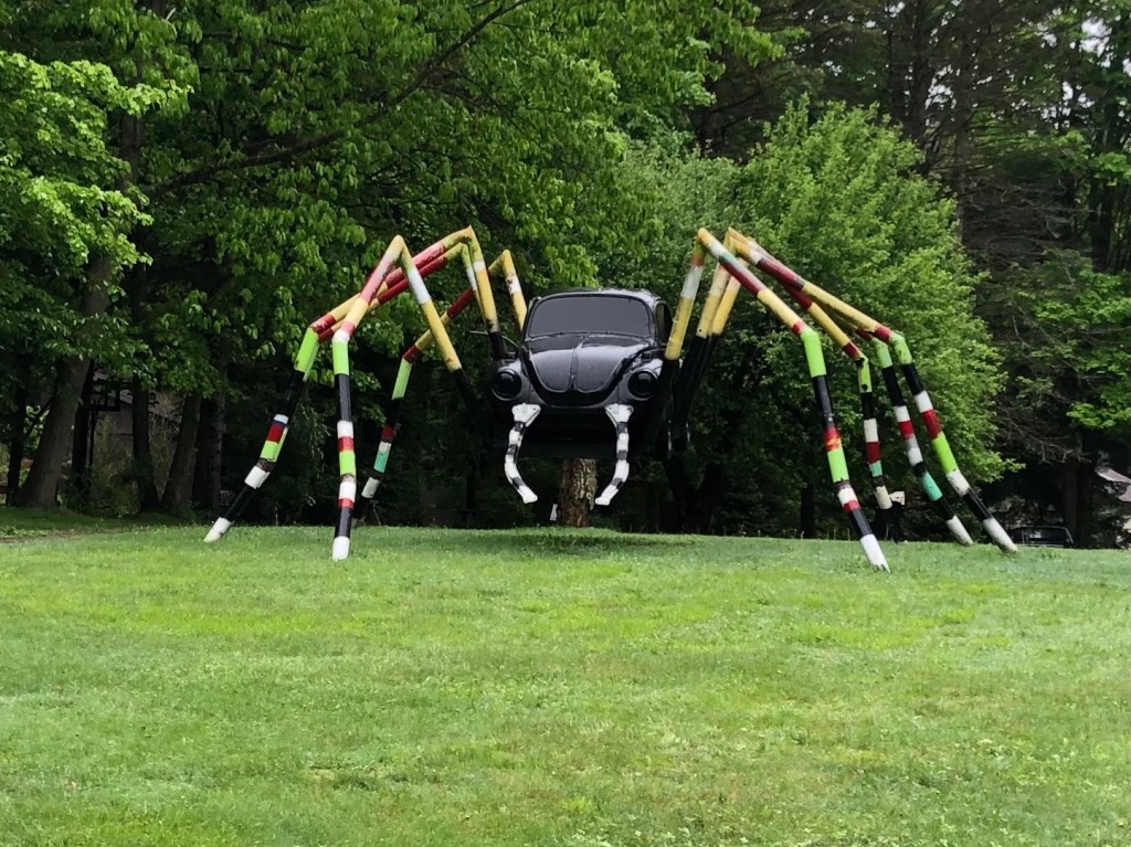
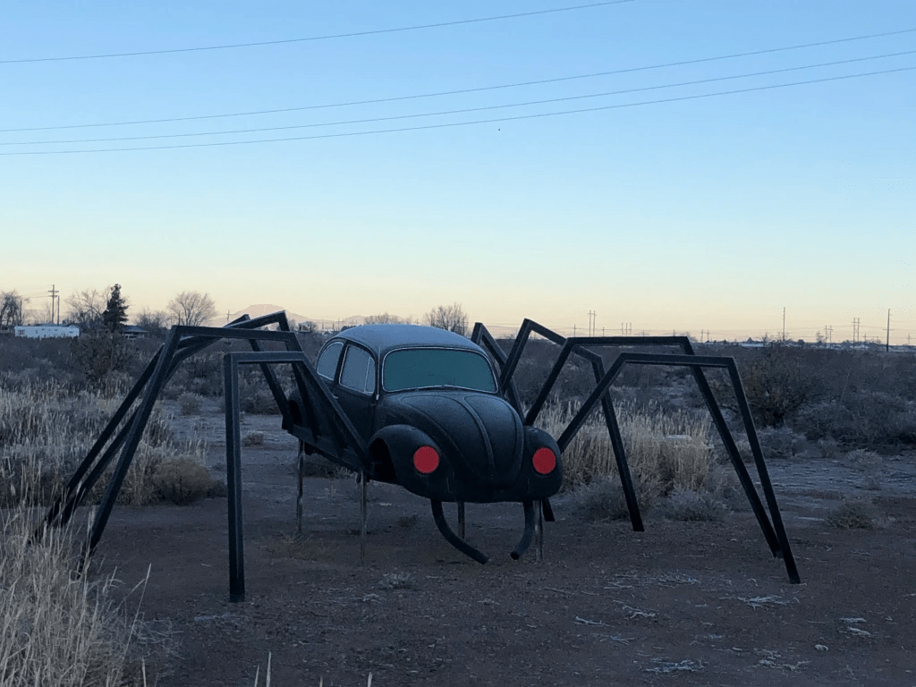
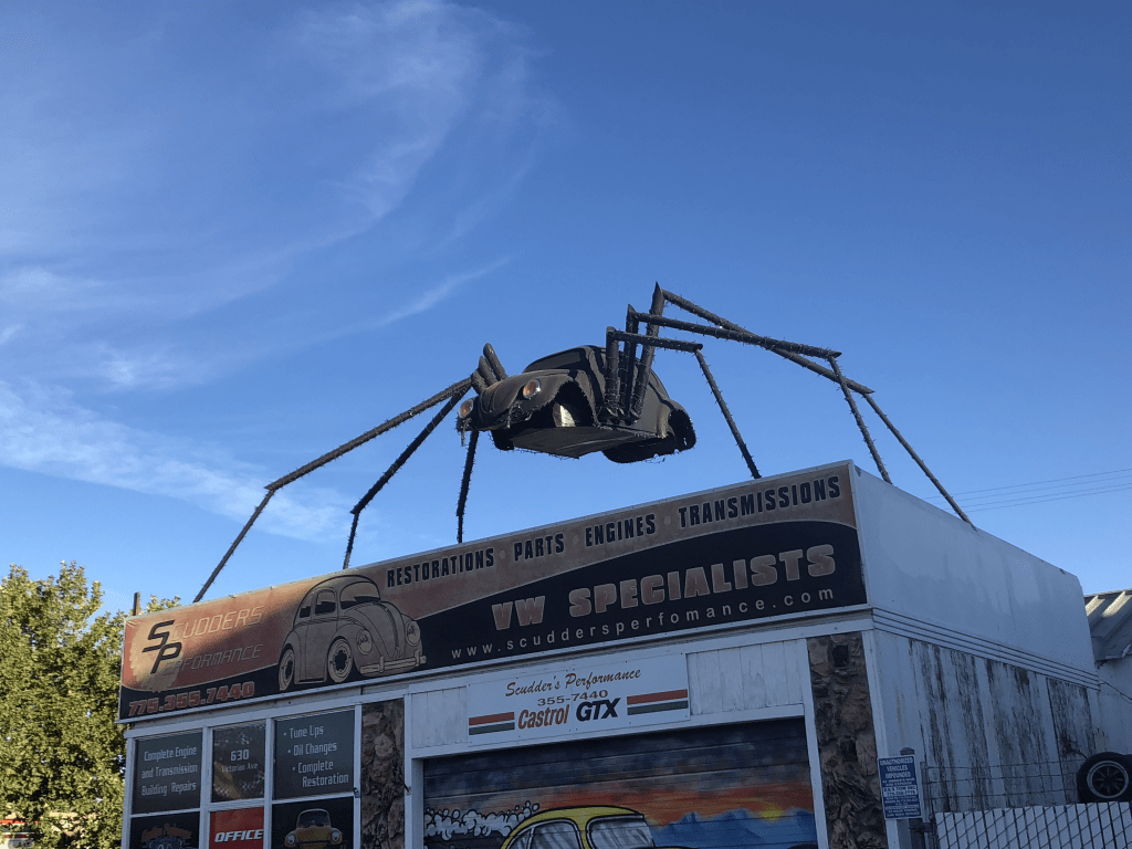
And speaking of recurring creatures, this Beetle/Spider in Erie, Pennsylvania very much resembles earlier encounters. Observe:
Erie, PennsylvaniaSomewhere in New MexicoReno, NV
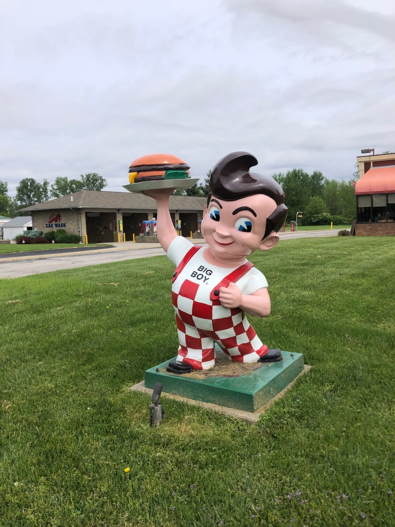
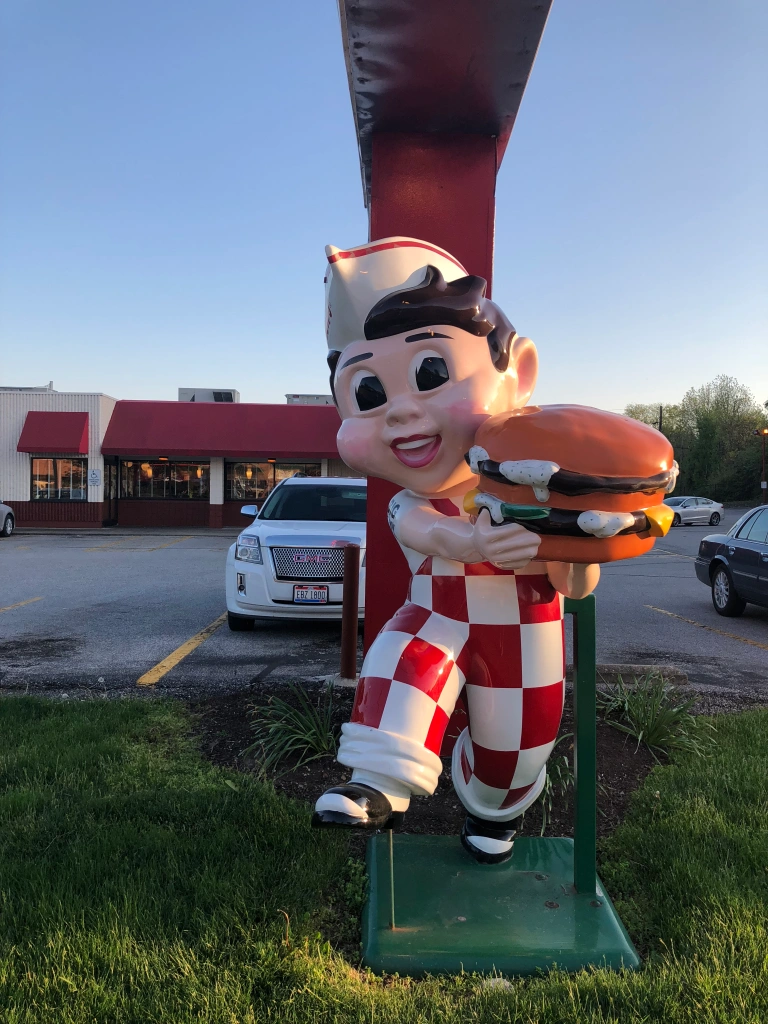
And of course, there’s this recurring fellow:
Fremont, OHMilford, OH (from a prior trip). Full story about the Big Boys is here.
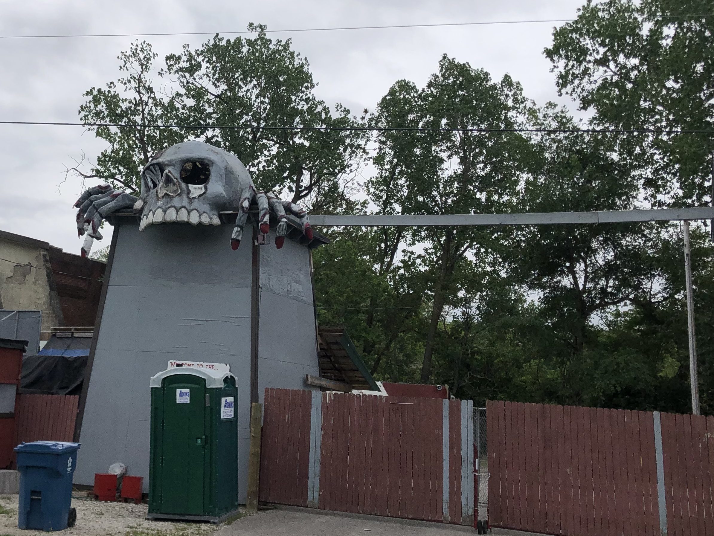
Finally, I bring you the Haunted Hydro, a so-called “Dark Attraction Park” that is open during the Halloween season.
Scary juxtaposition of skull and portapotty….
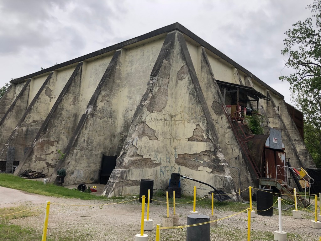
The place looks pretty run down, even abandoned. But I’m told that it’ll be resurrected in time for Halloween. The main part of the attraction is a century-old hydroelectric power plant (hence the “hydro” part of the name). You can see it in action here.
The 1911 Hydro
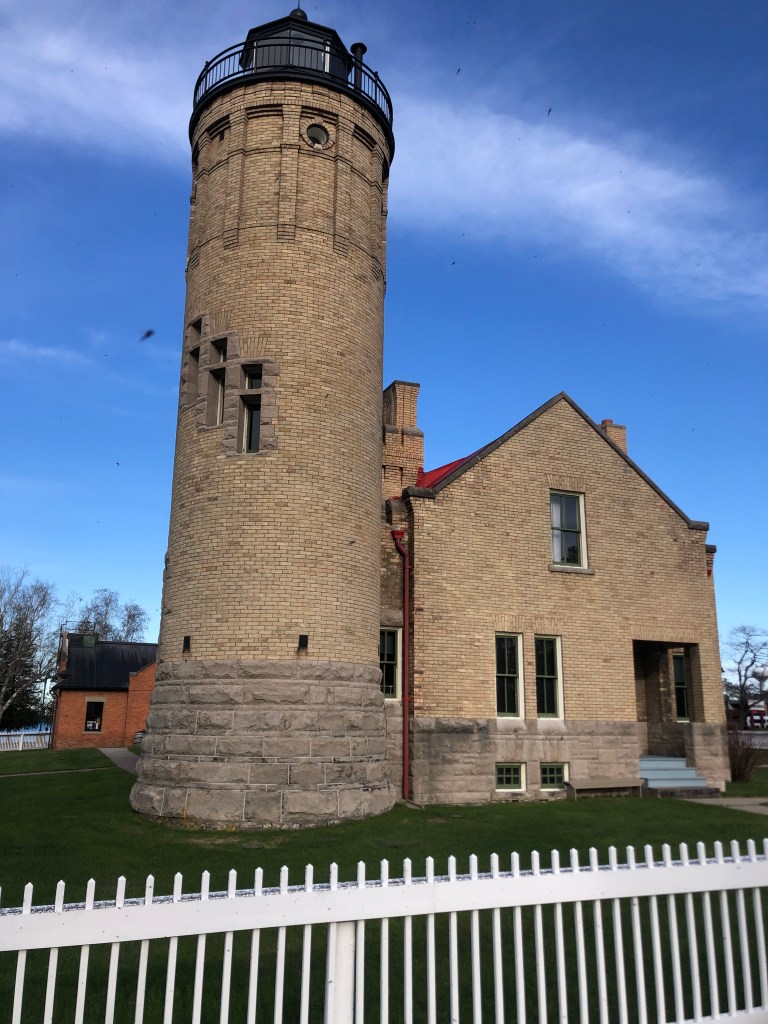
Finally, this afternoon I arrived in St. Ignace, Michigan, where I’ll start the western segment of Route 2 tomorrow morning. By the way, the the Lacuna ended as it began, with a lighthouse–this time a real one:
For the past six months I’ve been editing my late grandmother’s unpublished memoir, with the goal of having it posthumously published. In the course of that work, I’ve burrowed into that gargantuan rabbit hole known as Ancestry.com, digging up ancestors (figuratively) and realizing the innumerable questions I should have asked Grandma while she was alive. As a result of this overdue epiphany, I’ve resolved henceforth to be better about connecting with my existing relatives, learning the family stories, and passing along family lore.
It’s for this reason that I’m currently on a plane to Vermont, to spend some time with my dad’s half-sister and my cousins–people I didn’t even know existed until a few years ago. (I’ve mentioned this long-lost branch of the family in an earlier post, and discuss it in more detail in my memoir.)
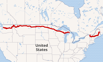
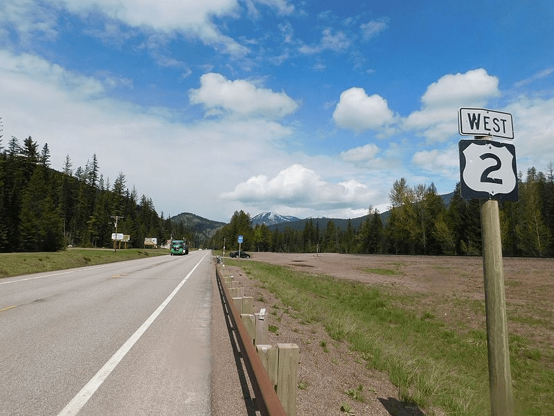
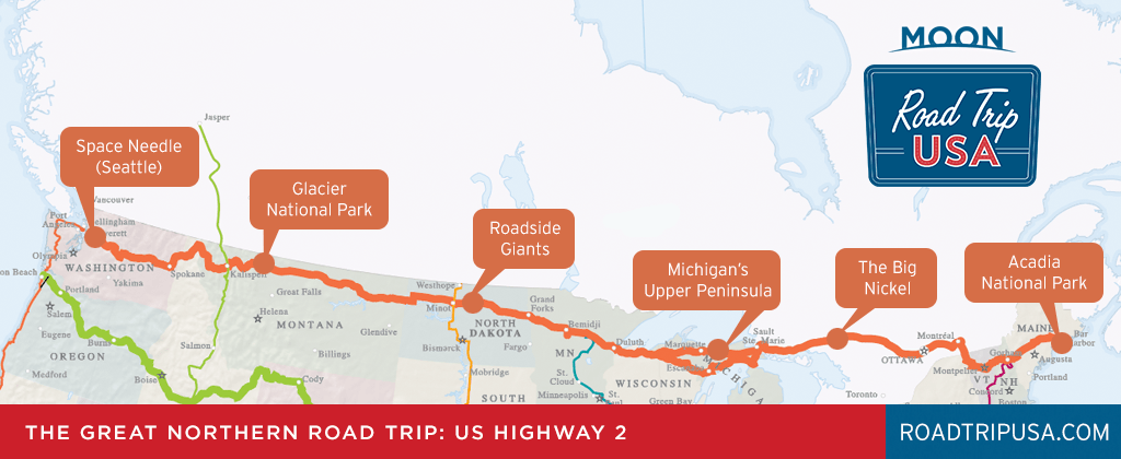
Anyway, the reason I raise all this is because Cousin Bonnie lives just off US Route 2, which is the country’s northernmost transcontinental route. Route 2 runs from Everett, Washington to Houlton, Maine, flirting dangerously with the Canadian border for most of the route. (For this reason it’s sometimes called “The Highline.”) Route 2 is actually a discontiguous highway, with the great lakes creating a watery lacuna between St. Ignace, MI and Rouses Point, NY. Observe:
The highest of the American highways.
Cousin Bonnie lives near the western edge of the eastern segment of Route 2 (got that?), in Vermont. So, I figured that rather than fly home after visiting her, why not rent a car and drive home along Route 2’s western segment, from Michigan to the west coast? (There’s actually a number of good answers to that question, but I’m ignoring them for now.) The route has a lot going for it:
Not a heavily trafficked route. (Photo stolen from Wikipedia.)
–It generally follows the route of the historic Great Northern Railway (today’s Burlington Northern and Santa Fe Railway).
–It passes through seven states and covers 2,100 miles
–It’s a historic auto trail that began as the Theodore Roosevelt International Highway in 1919.
–It will likely be unnecessary to run the air conditioner
So, I’ve decided to add Route 2 to my collection of transcontinental US highway trips, which so far includes US Routes 50, 60, and 70. Astute observers will note that all those transcontinental routes are numbered as multiples of 10, with the numbers becoming smaller as you move from south to north. (For those desiring a refresher on the numbering convention, look here. Highway nerds should look here.)
Anyway, US Route 2 runs to the north of US Route 10, so the numbering convention would have required that it be deemed “Route 0.” The feds evidently thought that was too weird, and decided instead to call it Route 2. For real.
Map showing the more obvious, less interesting landmarks.
Anyway, having decided to traverse the country on Route 2, the key question confronting me was: How should I traverse the Great Lakes Lacuna and arrive at St. Ignace, MI? The most direct route would be to cut through Canada, but I’ve opted instead to cut under Lake Superior and Lake Erie, and come up through Michigan. My logic is that a good friend from graduate school, Ross, lives just north of the New York City metropolitan area, and a former neighbor who’s also a good friend–Pam–now lives in Ohio on the south shore of Lake Erie. So I’ve planned a route that takes me by both of their homes…whether they like it or not.
My plan is to arrive at the eastern end of Route 2’s western segment (in St. Ignace, Michigan) on Sunday eve. Then I’ll be making daily posts of my trip for the following eight days, at which point I will arrive in Everett, WA. You won’t want to miss any of my reports! If you haven’t already done so, you can sign up to receive my blogs immediately below:
I awoke early in Hawthorne, got a decent breakfast at Mr. Beane’s coffee shop, and got back on the road. A short distance from Hawthorne US 95 takes a jog eastward, but otherwise today’s ride was looking a lot like yesterday’s.
Deja vu
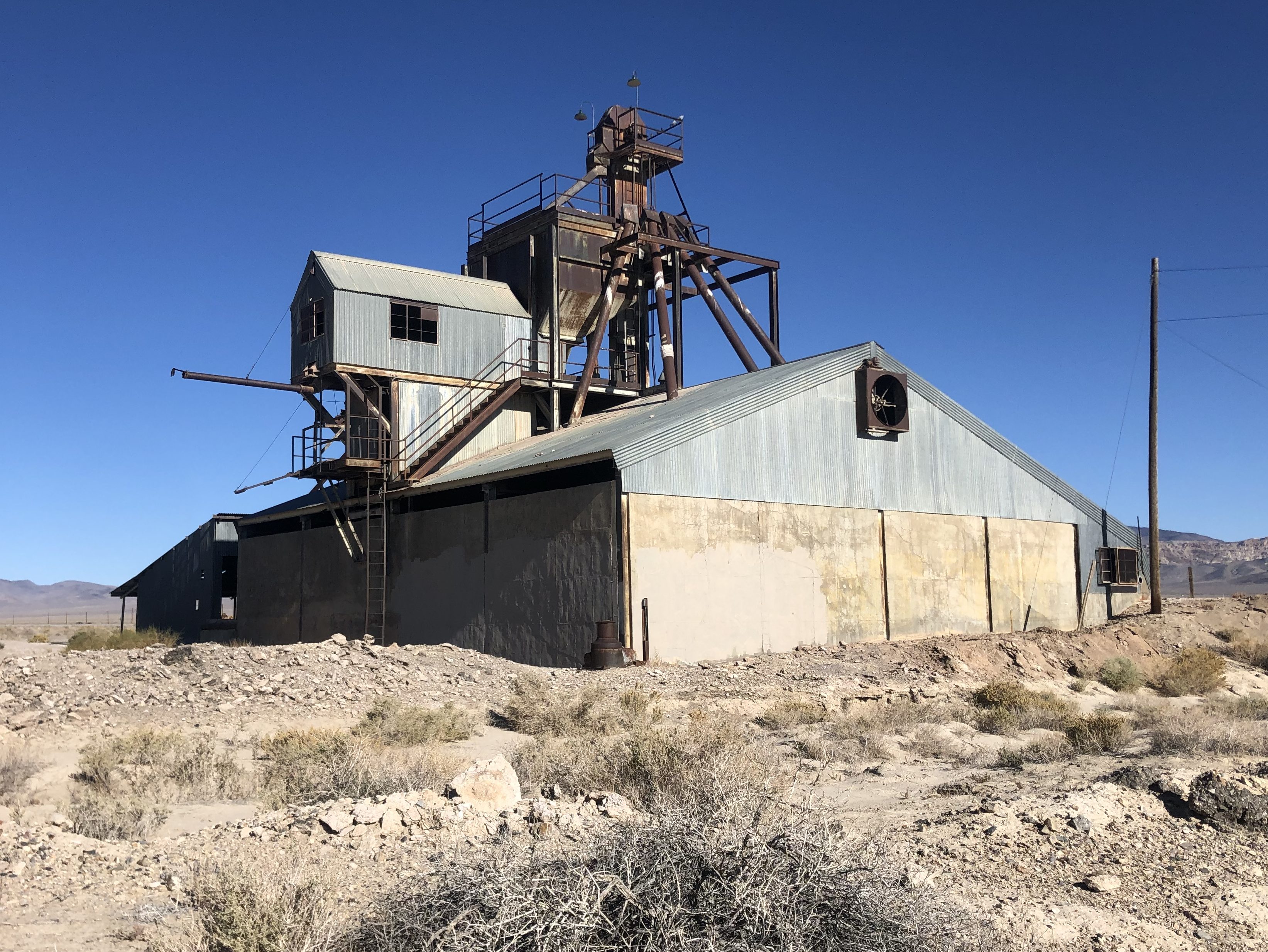
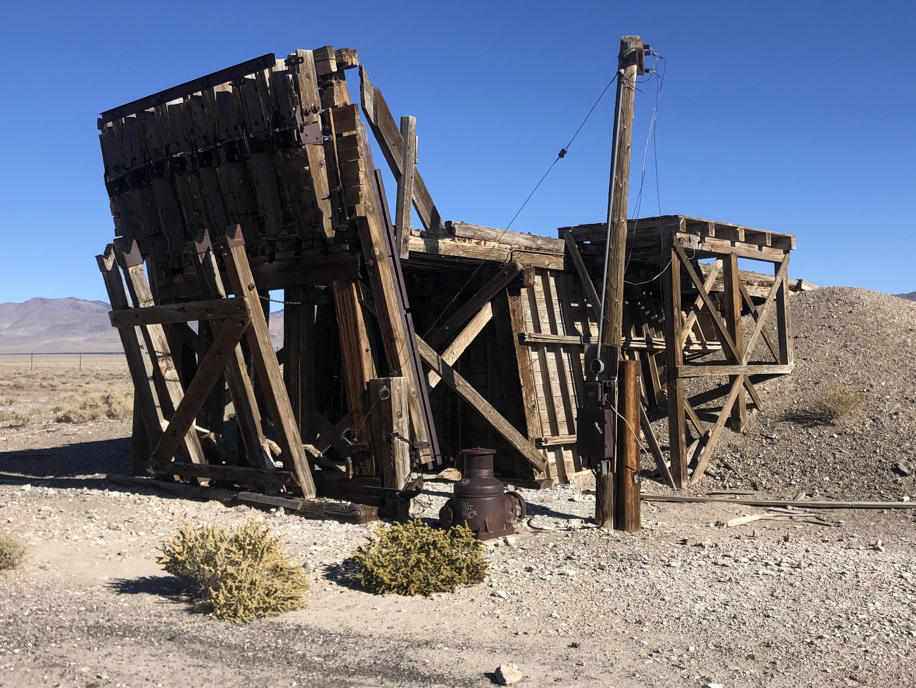
Then suddenly I found myself passing through another (nearly dead) town. Luning (pop: 87) was established in 1884 as a railroad town, with a trackside facility for loading magnesium ore onto freight cars. The once-active facility has long since shut down, but the main structures still stand, and I suspect the ghosts of long-since-passed stevedores still walk their creaky floors on moonlit nights.
Luning’s obsolete raison d’etre.
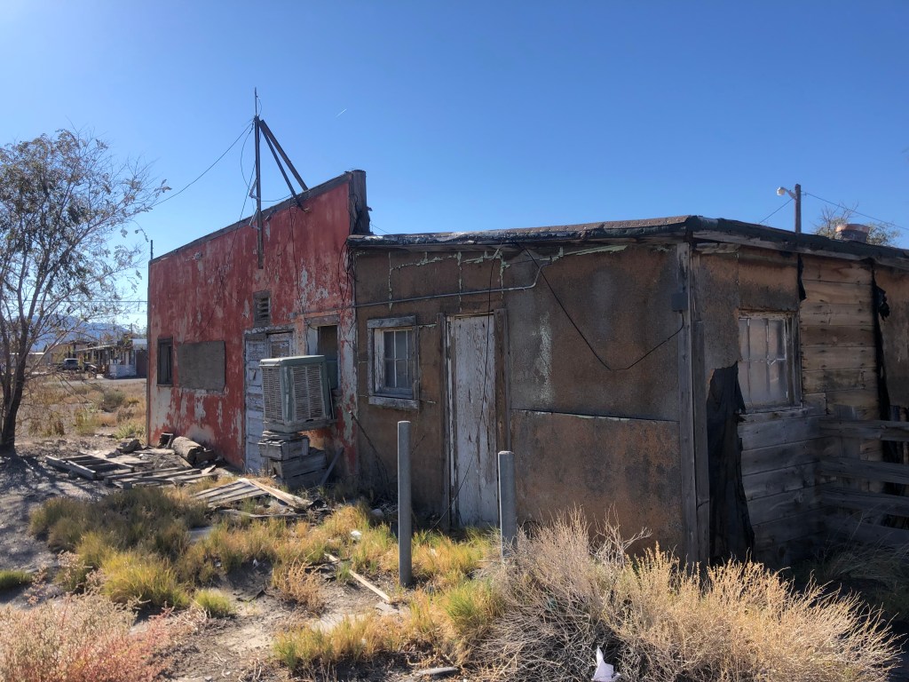
One wonders why 87 people still remain in this ghost town. From what I saw, the housing stock isn’t especially covetable.
Still inhabited.
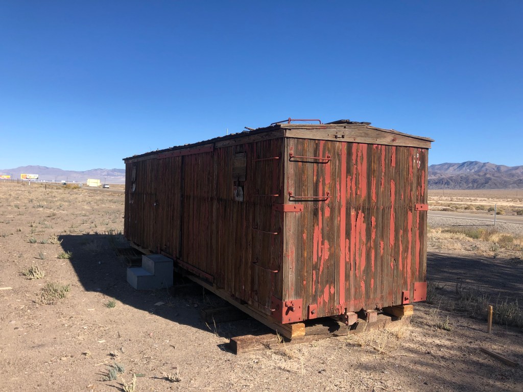
Some time after leaving Luning I came to a similar town. Like Luning, Mina (pop: 150) was founded as a railroad town over a century ago. As with so many Nevada towns, Mina owed its existence to mining operations. But the mines eventually played out, the residents began to move away, and the trains stopped coming through town.
Ancient railcar in Mina, now used for storage, apparently.
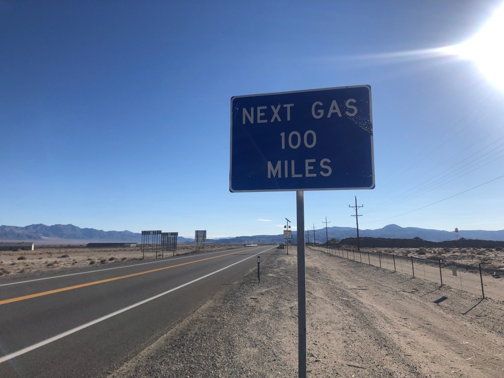
You’ve really got to wonder why anyone stays in this godforsaken place, with no working infrastructure to speak of, no job opportunities, and, to my eye at least, no pleasant surroundings. On top of all that, the nearest town with a gas pump and a mini mart is well over an hour away.
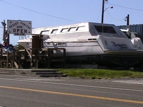
As far as I can tell, Mina is only known for two things. First, it used to have a restaurant named The Desert Lobster that was definitely unique. Owner Bob Eddy bought an old, damaged yacht he’d found in Texas and had it shipped to Mina, and this served as the front of his restaurant. But here was the genius of Bob’s plan: He would raise lobsters in greenhouses out in the desert, fed with water from a nearby spring. Sadly, wildlife officials eventually put an end to the lobster farm, and as of a few years ago the restaurant closed.
The Desert Lobster, back in the day. (Photo credit: Tom M., on Yelp)
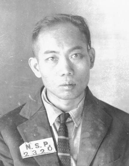
The other thing Mina is known for is its role in shaping America’s death penalty. In 1921 a Chinese immigrant by the name of Gee Jon was convicted of killing a laundry proprietor in Mina. He was sentenced to death, and was the first person to be executed by lethal gas. You can read the whole sordid tale here.
Gee Jon
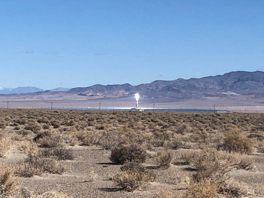
As I drove away from Mina I began to notice an intense point of light ahead of me on the left. For many miles the light kept getting brighter and closer. Finally I stopped at a rest stop near the light’s source and I learned that the light was coming from the Crescent Dunes Solar Energy Project. The project is essentially a huge array of mirrors sitting in the desert that concentrates sunlight at one point, creating enough heat to superheat liquid salt that is then used to produce steam and turn generators. (Think of it as frying an ant with a magnifying glass, on steroids.) Only about 6 years old, the plant has been beset with technical troubles and lawsuits. It was eventually shut down, but it appears to have been restarted by the time I drove by.
Not such a bright idea after all.
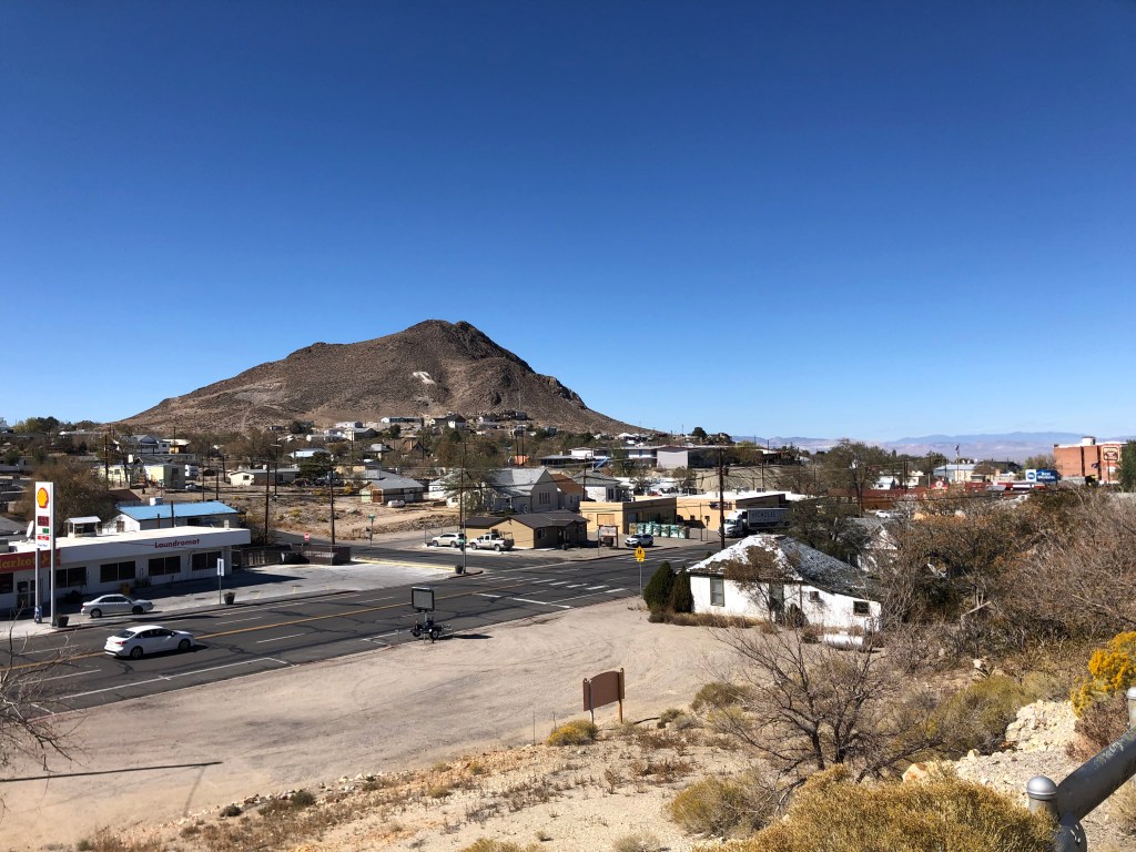
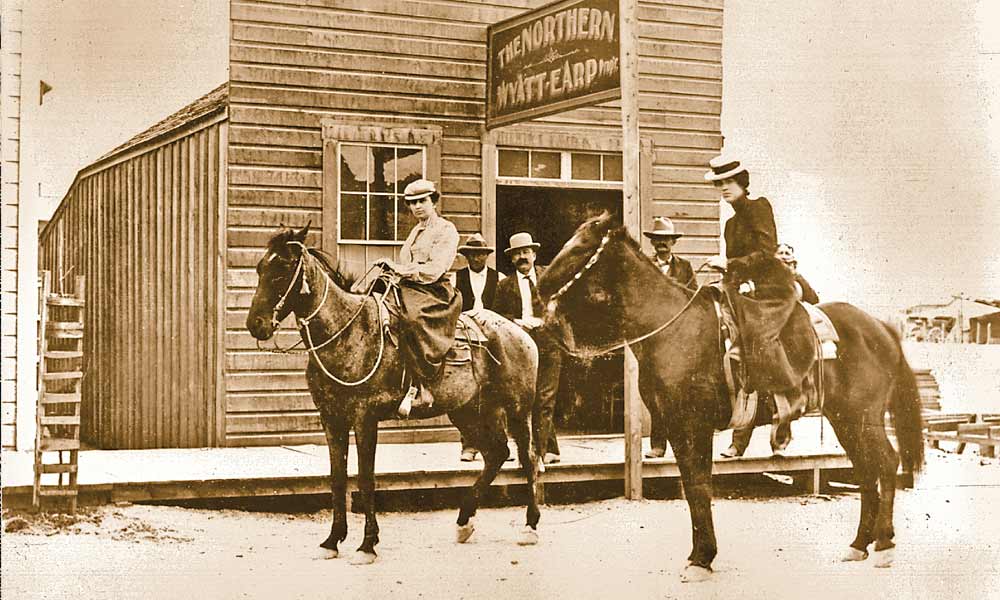
About an hour and half later I came upon the (relative) metropolis of Tonopah (pop: 2,500). Once the place that Wyatt Earp called home, Tonopah started out as a mining town around the turn of the 20th century. Like all the other mining towns it declined in the mid-century, but its location about halfway between Reno and Las Vegas seems to have helped it to survive as a convenient stopover location for those traveling between the two cities.
Downtown TonopahWyatt Earp’s bar in Tonopah
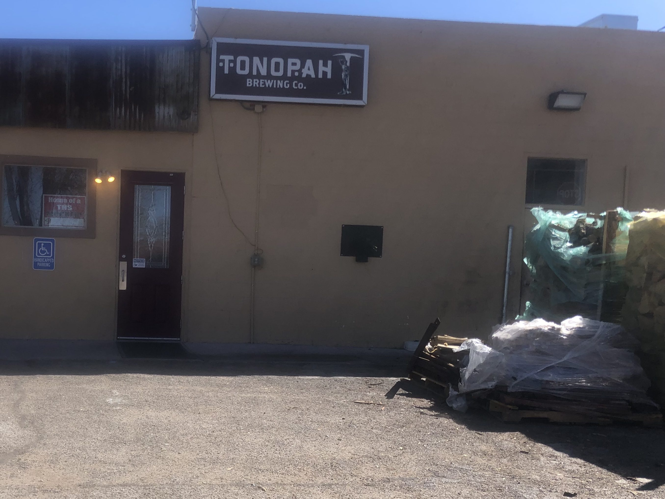
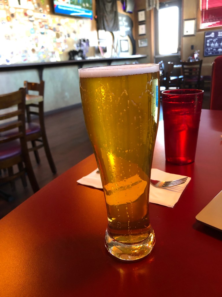
I stopped for lunch at the Tonopah Brewing Company, whose motto is “blood, sweat & beers” (seriously). I ordered their Double IPA, but managed to knock it over it before I’d had more than a sip. (The waitress was not happy with my clumsiness.) So I really can’t say much about the beer. But I can say that Tonopah Brewing Company is the absolute best brew pub in Tonopah. Of course, it’s also the absolute worst brew pub in Tonopah…because it’s the only brew pub in Tonopah. Perhaps because it’s the only game in town, the place seems to cater to every conceivable taste. The music is an unlikely combination of death metal, country&western, 1970s pop, and the Beastie Boys. And the television is tuned to a Spanish-language station.
Tonopah Brewing Company. Not much to look at from the outside.BOTD, moments before The Big Spill
They do have their own small-batch brewing setup, and they have their own smoker for in-house barbecue preparation. I had a decent pulled pork sandwich.
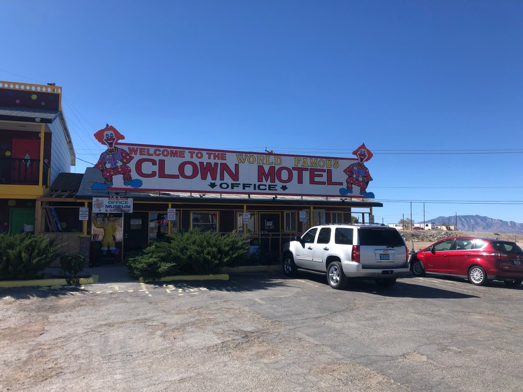
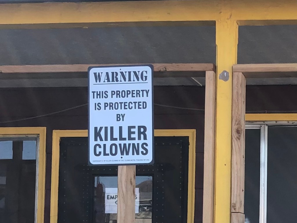
Thus fortified with smoked, cooked, dead animals and a sleeve soaked with beer, I got back on the familiar Route 95 and soon encountered what is surely the scariest part of this trip: Tonopah’s Clown Motel.
Please don’t kill me, Please don’t kill me….
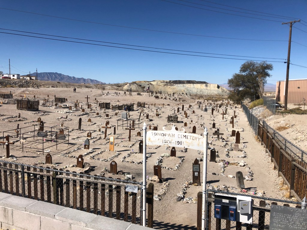
The hotel was originally opened in 1985, and it seems that the intent was innocent enough. The original owners, Leroy and Leona David, say they wanted to honor their late father who’d amassed a collection of about 150 clown figures (as one frequently does). The clown figures were used to decorate the property, and that’s about it. But over time the “creepy clown” trope became a thing, and books and movies like “It” pushed clowns into the realm of the truly scary. So the motel seems to have decided to swim with the tide and play up the creepy aspects of their clown theme. Oh, and did I mention that the motel sits right next door to an ancient cemetery? I’m not making this up.
Sign in front of parking lot. Way to reassure the kids whose parents take them here!
Over the years, the place has developed something of a cult following. Many people have sent in their own clown memorabilia, which now numbers over 2000 items. Many of the pieces are on display in the lobby, which doubles as a “clown museum.” The motel has also been featured on the television show “Ghost Adventures” in 2015. Supposedly a clown doll was caught on film moving by itself. You can judge for yourself!
In the lobby, which doubles as a “Clown Museum.”
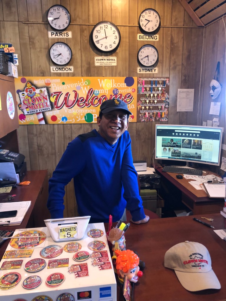
The current owner, Vijay Mehar, told me that Covid has really put a dent in business, but he’s making a go of it. He’s even amping up the scary clown vibe, decorating a few of the rooms with themes such as the “Halloween” room, the “Friday the 13th” room, and the “Exorcist” room. Again, I’m not making this up.
The man behind the clowns.
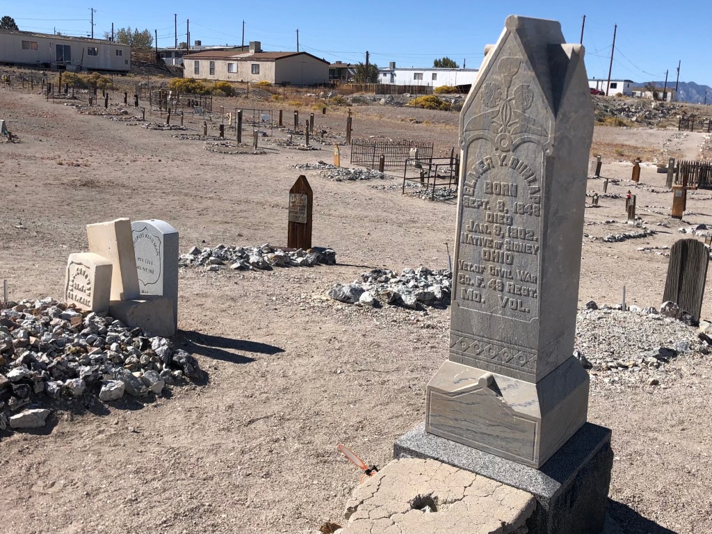
Vijay encouraged me to go take a walk through the neighboring graveyard, which butts up against the Clown Motel’s parking lot. It’s one of those desert cemeteries which lack trees, grass, or any other signs of life. I was surprised that Vijay hadn’t placed a few zombie clowns around the cemetery, in order to further advance the creepy clown vibe of his property.
Having pretty much exhausted the coulrobic aspects of Tonopah, I once again hit the road. Within 45 minutes I encountered the remarkably well-maintained, historic town of Goldfield (pop: 250). As the name suggests, Goldfield had started out as a gold mining encampment. The mines produced about $1 billion in gold (in today’s dollars.) The rich gold veins turned Goldfield into a boom town, and for a time it was Nevada’s largest city. Goldfield boasted some 20,000 residents at its peak in 1906. One of those residents in 1904 and 1905 was Virgil Earp (Wyatt’s brother), who was the town’s deputy sheriff.
A fire in 1923 destroyed much of Goldfield. Since gold production had become much less profitable by that point, there wasn’t much reason for people to rebuild their homes in the town. Those who did remain steadily declined until only a few hundred people were left in 1950, and Goldfield has limped along ever since.
Today Goldfield has just a handful of residents, but the town exudes a strength and robustness that belies its scant population. This is town that clearly values its history. The Goldfield Historical Society is a local nonprofit organization that actively works to preserve and restore Goldfield’s buildings and to promote its history. They’ve erected markers and plaques, organized walking tours, and held various fundraisers. You can see evidence of their work on almost every block.
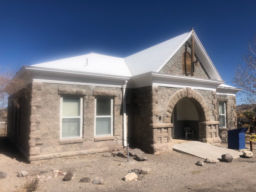
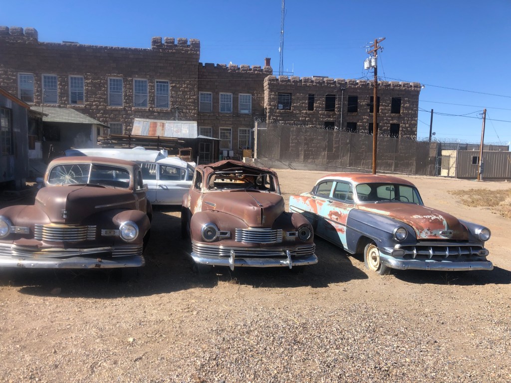
Originally Goldfield’s elementary school, this building is now the town’s public library. The grounds (on the other side) serve as a “historic equipment park.”A few cars that look like they haven’t moved in awhile. (Goldfield’s courthouse is in the background.)
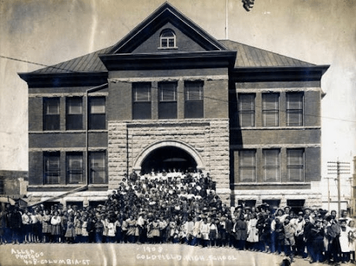
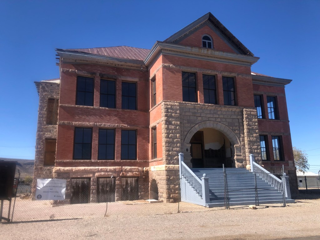
Goldfield High School is one of the historical society’s biggest projects. It was built in 1907, and its three stories served up to 450 high school students. The school closed in 1952, and it’s been shuttered ever since. After a half-century of neglect, the south wall collapsed, and efforts to save the structure finally began in earnest. The historical society has received grants and donations toward a full restoration of the building, which is ongoing.
Goldfield High School, back in the day.
Goldfield High School today.
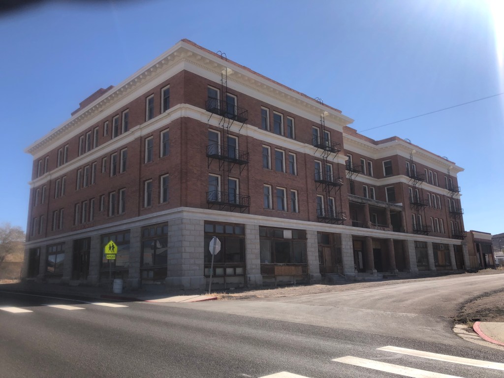
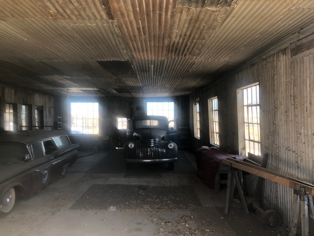
Another major restoration effort focuses on the Goldfield Hotel. It’s a huge structure, and in surprisingly good shape considering it was built in 1907, survived a flood and a fire, and has been vacant since World War II.
The Goldfield Hotel.
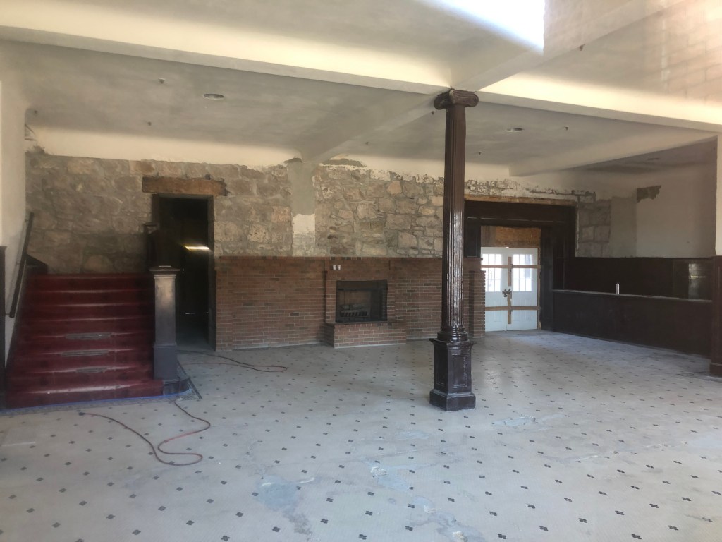
Inside the Goldfield Hotel. Don’t ask how I got this photo.
Ownership of the hotel has changed several times in recent years, and plans to make it into a boutique hotel seem to have fallen through. But I saw clear evidence of active restoration work when I visited. Oh, and that same Ghost Adventures show that went to the Clown Motel also has been to the Goldfield Hotel, and claim that they’ve seen evidence of hauntings. A local resident told me that the Ghost Adventures team had recently come back just a few months ago to do another feature on the hotel.
Anyway, it feels like there are historic structures all over this town. And I’m told that every single one of them has a current owner who’s either restored it or is planning to do so. Why does Goldfield have all this energy and civic pride, while towns like Luning and Mina have essentially disappeared?
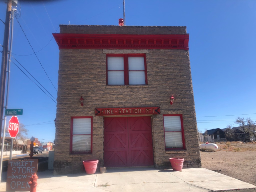
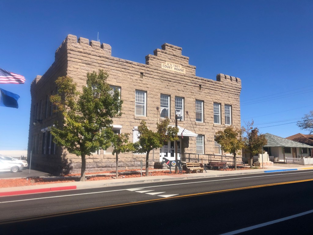
Goldfield’s fire station, from 1908. Beautifully restored, and now a museum (that’s only open by appointment).The Esmeralda County Courthouse in Goldfield, constructed in 1907Old filling station and garage, built around 1935. Inside the garageOf course, not everyone in Goldfield is on board with the historical society’s pleas for historical authenticity.
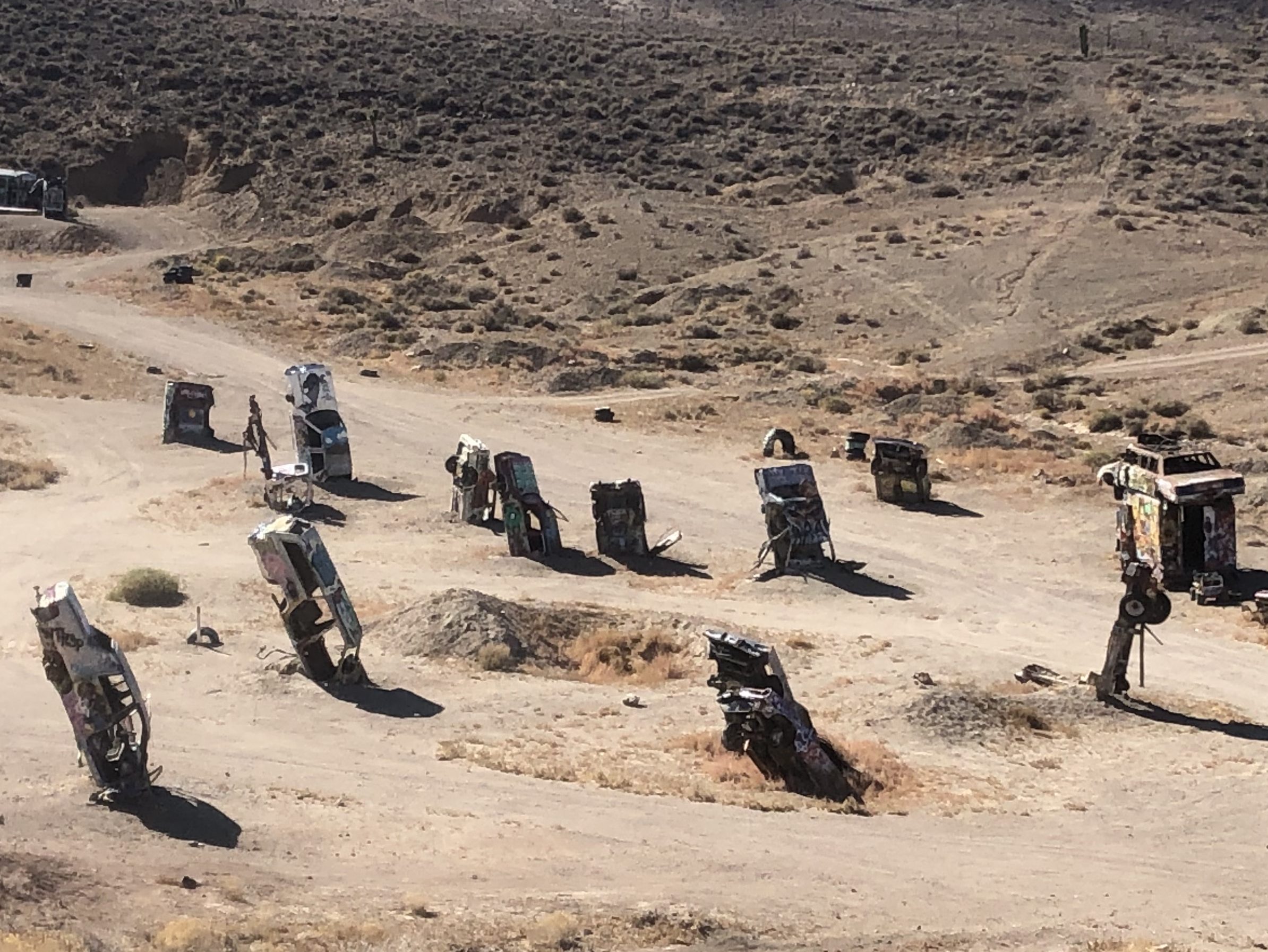
On the outskirts of town is a quite different type of attraction. The International Car Forest of the Last Church is a public art installation (I guess). It started when local resident Mark Rippie for some reason decided to stand a car on its nose in the desert outside Goldfield. This “art installation” was noticed by artist Chad Sorg as he was passing along Route 95, and Sorg was so taken by the piece that he settled in Goldfield to help Rippie expand the single car into a “forest” of abandoned cars. (I’m assuming that controlled substances played a part in the decisionmaking.) Today the “forest” includes over 40 vehicles, all of which are regularly covered and re-covered with graffiti by visitors. (The International Car Forest of the Last Church in fact encourages that behavior.) I hate to sound like a Philistine, but isn’t this all highly derivative of the much more famous and whimsical Cadillac Ranch?
Just a portion of the forestWon’t get fueled again
Yes. Well. So, after studying each vehicle with my arms behind my back and muttering “I can feel what the artist is trying to say,” like a hippie version of Woody Allen, I left the Forest and got back on US 95. After my enjoyable and engaging visit to Goldfield, I was back in the mode of speeding along endless miles of desert and an unchanging horizon. After a little over an hour I saw a large yellow sign ahead and, as I was about due for a break, I figured I’d make a stop.
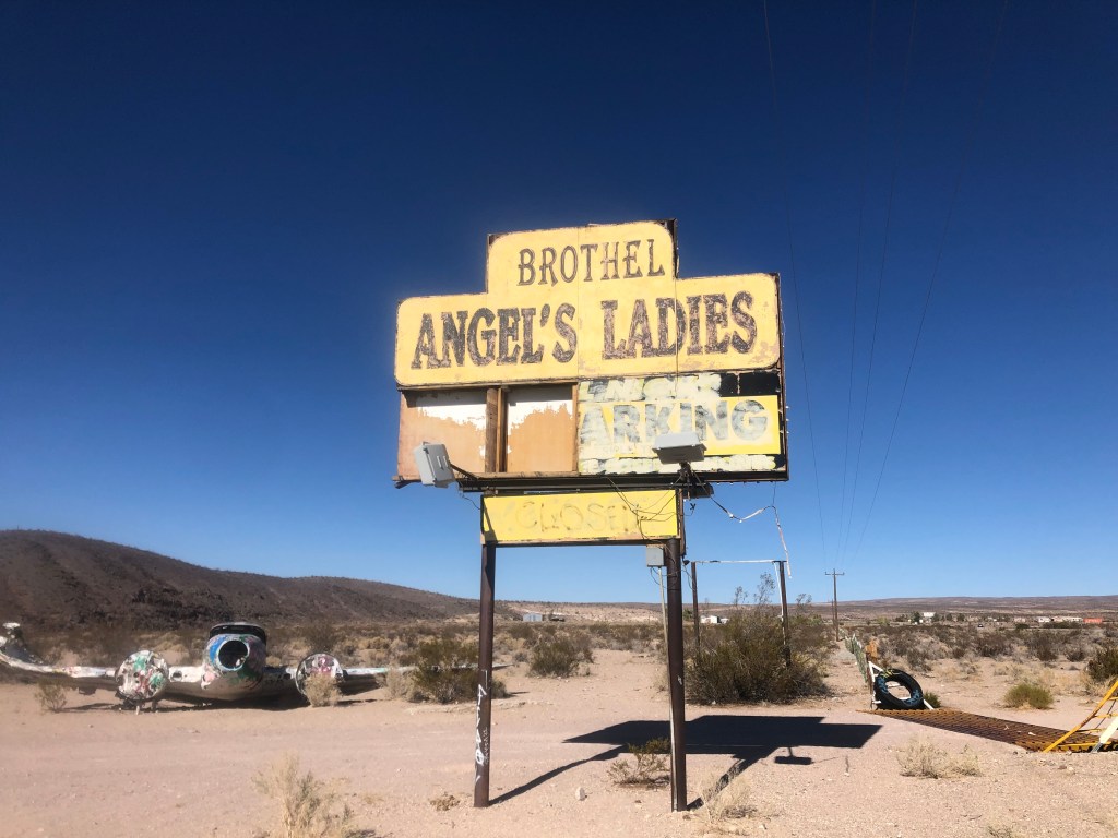
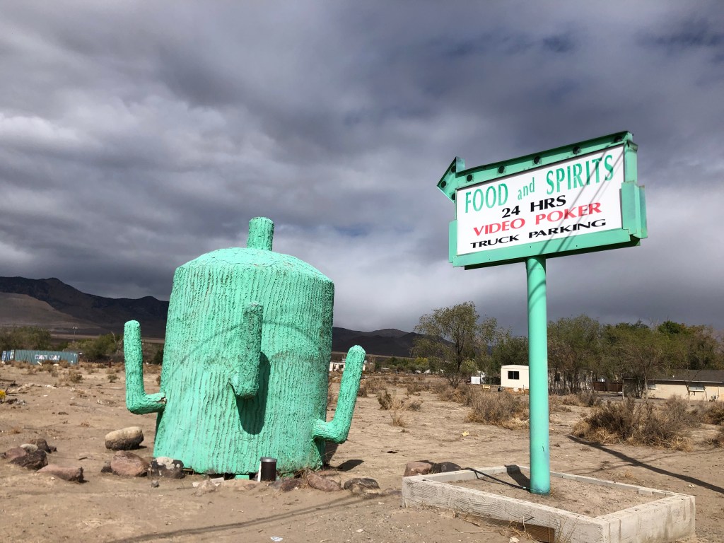
You at least have to admire the bluntness. No “Gentlemen’s Club” or similar euphemisms here!
As we all know, prostitution is legal in Nevada. Has been since 1971. You just have to conduct your activity in a licensed brothel. So, here we have the confusingly-punctuated “Angel’s Ladies” brothel, which has been around (under various names) for over a century. (Yes, evidently it operated illegally until 1971.) The place has been closed since 2014.
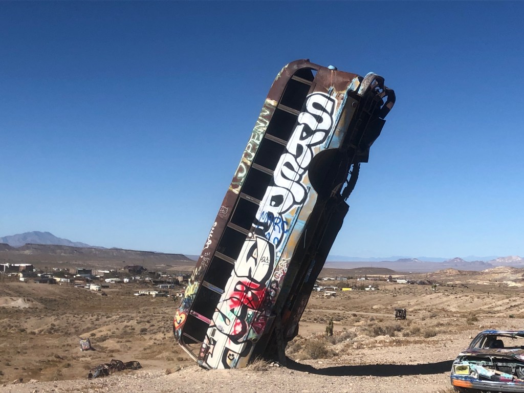
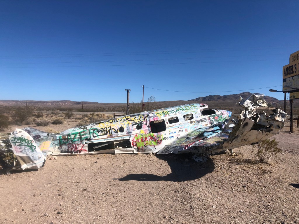
Alert readers might notice the wreckage of a small plane not far from the sign.
Well, there’s a story to it. It seems the brothel’s owners decided to run a promotion in 1978: They got this plane, and let volunteers parachute out of the plane from a low altitude over the property. If the jumper managed to land on a mattress that had been put on the ground, they won a free night at the brothel with the woman of their choice. Unfortunately, the pilot had some trouble during the promotion and crashed the plane right where you see it today. The owners evidently figured that it was worth more as a roadside attraction than as scrap, so they left it where it crash-landed. (News reports say that no one was hurt in the crash.)
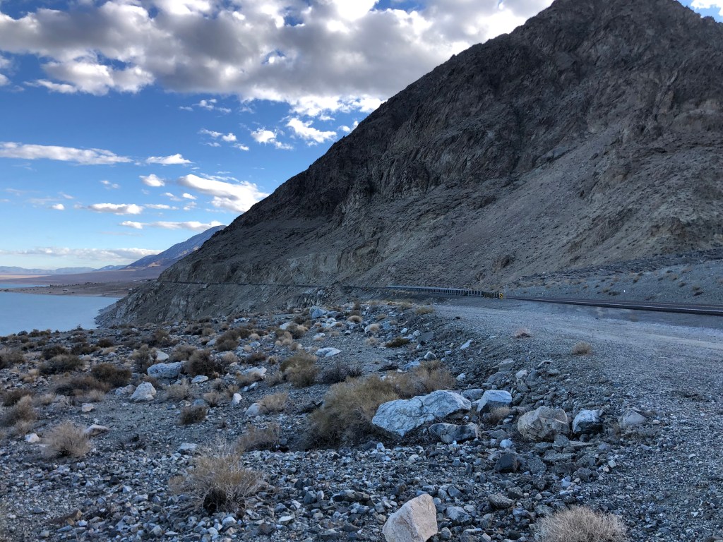
Angel’s Ladies Brothel is just north of the town of Beatty, which is otherwise not notable. After passing Beatty, I started to plan (better late than never) on the remainder of my route. I decided that I didn’t want to go all the way to Las Vegas, as it really isn’t the kind of city that I’ve been seeking out on these trips. So I made a last-minute decision to leave US 95 and cut northwest through Death Valley and then take US 395 home. Those segments have been the subject of other blogs (like this and this), so I won’t detail the rest of the trip, except to say that Death Valley in the fall is stunning, and US 395 always affords awesome views of the eastern Sierras.
I’d also say that US 95 — at least the segment of it that I took through Nevada — is an interesting, stress-free, pleasant enough highway for those looking for such things. And I’m sure there were plenty of roadside attractions and stories that I missed, so I’d encourage you go out there and find some more!
In mid-October I snuck in a short road trip on the Triumph. But with the self-imposed task of reviewing 31 Frankenstein movies over the course of the month, I didn’t have time to write about it. Now, with that Frankenfoolery behind me, I can tell the story. (For those of you who missed any of the Frankenstein reviews, the full list of movies with links to the reviews is available here.)
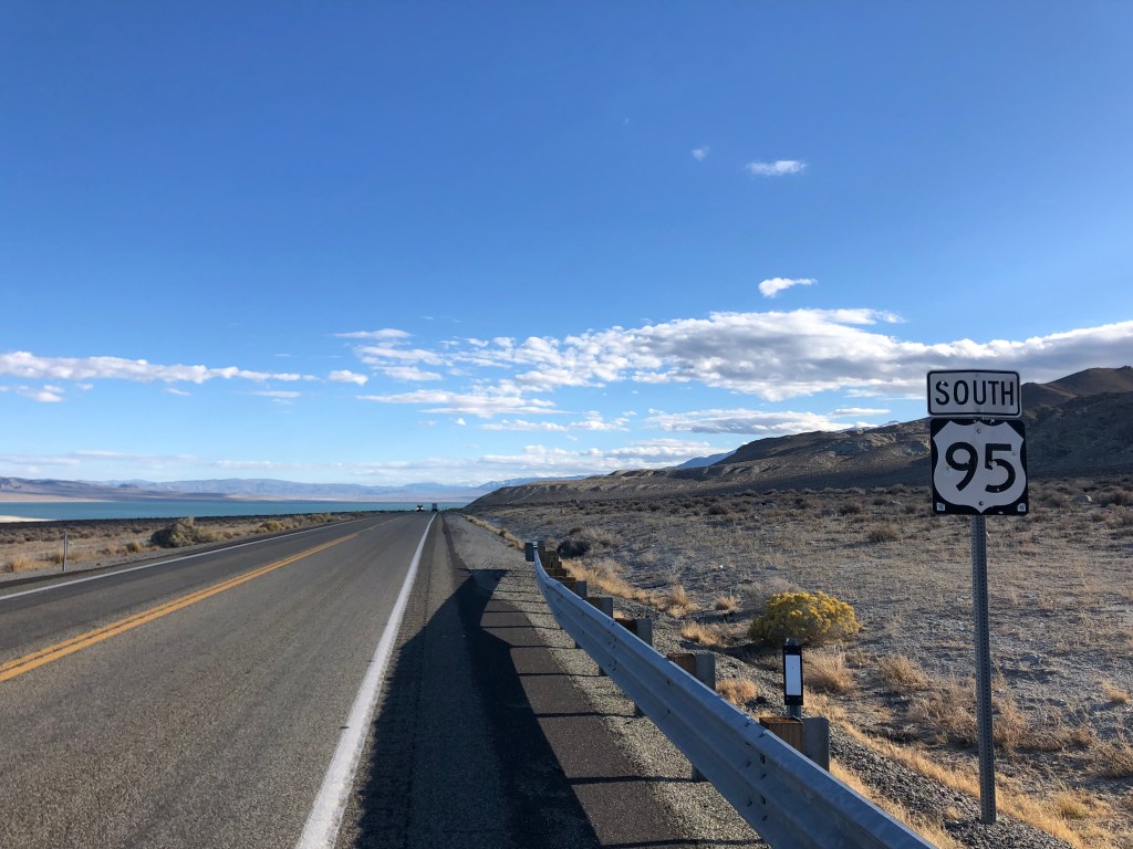
The route I took came at the recommendation of my friend Chris P, who travels a couple of times a year between his homes in Lake Tahoe and in San Diego. (Life can be hard.) US 95 is a north-south highway, mostly with one or two lanes each direction, that runs from the Canadian border in western Idaho down to the Mexican border in western Arizona. I wish I’d had the time and inclination to ride the entire length, but it was getting late in the season, the days were short, and the temperatures were low. So I just took the segment of the highway that runs through the Nevada desert from Fallon to Las Vegas.
I wish I knew how to highlight highway 95 on this map. The segment I took runs along the western edge of Nevada, beginning just east of Reno.
Since I now call the Sacramento area my home, getting to US 95 means heading east on US 50 across the Sierras and skimming under south Lake Tahoe, then crossing about 75 miles of Nevada’s Great Basin Desert before connecting with US 95. The first leg of the trip provided dismal scenery, with evidence of the recent Caldor fire made manifest in large swaths of blackened forest. I encountered snow flurries going over Echo Summit, which reinforced my decision to make this the last road trip of the year. Thankfully, when I got into Nevada things warmed up a bit. I passed through Carson City (Nevada’s capital, pop. 55,000), after which US 50 palpably earns its moniker “The Loneliest Road in America.”
Along this road you encounter scant traffic, and so you’re inclined to stop at virtually every one of the scarce, isolated towns just to remain connected with humanity. One such stop is the hamlet of Stagecoach (pop: 1,800).
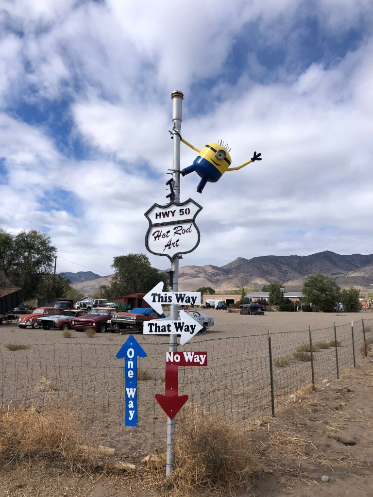
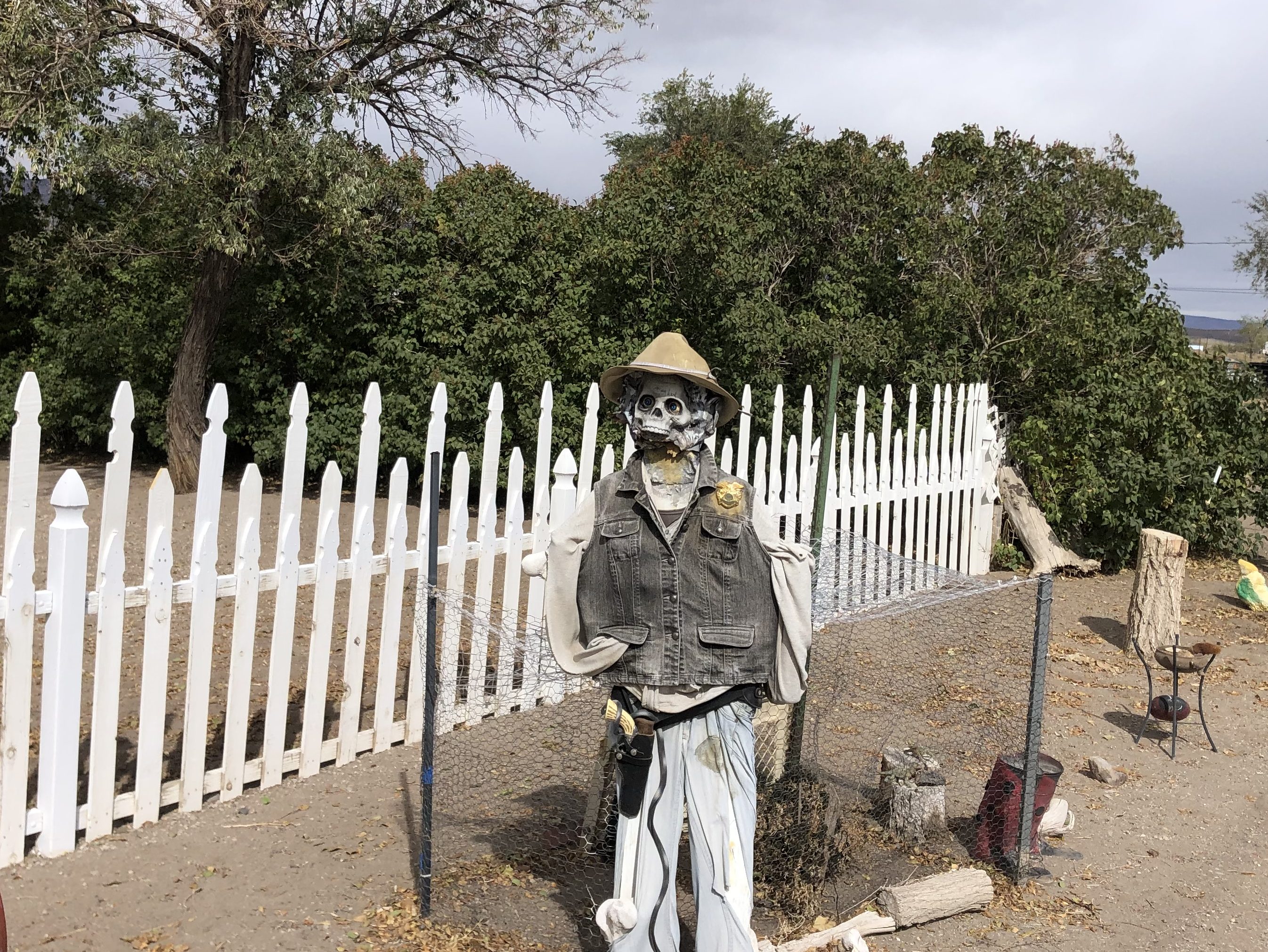
Stagecoach, NV is one of those outposts that either attract or trap individuals who hang their hat outside the mainstream. This is often evident in their roadside folk art installations, of which Stagecoach boasts several.
I advise against stealing this guy’s mail.Yes way.The town’s law enforcement relies on a skeleton crew.
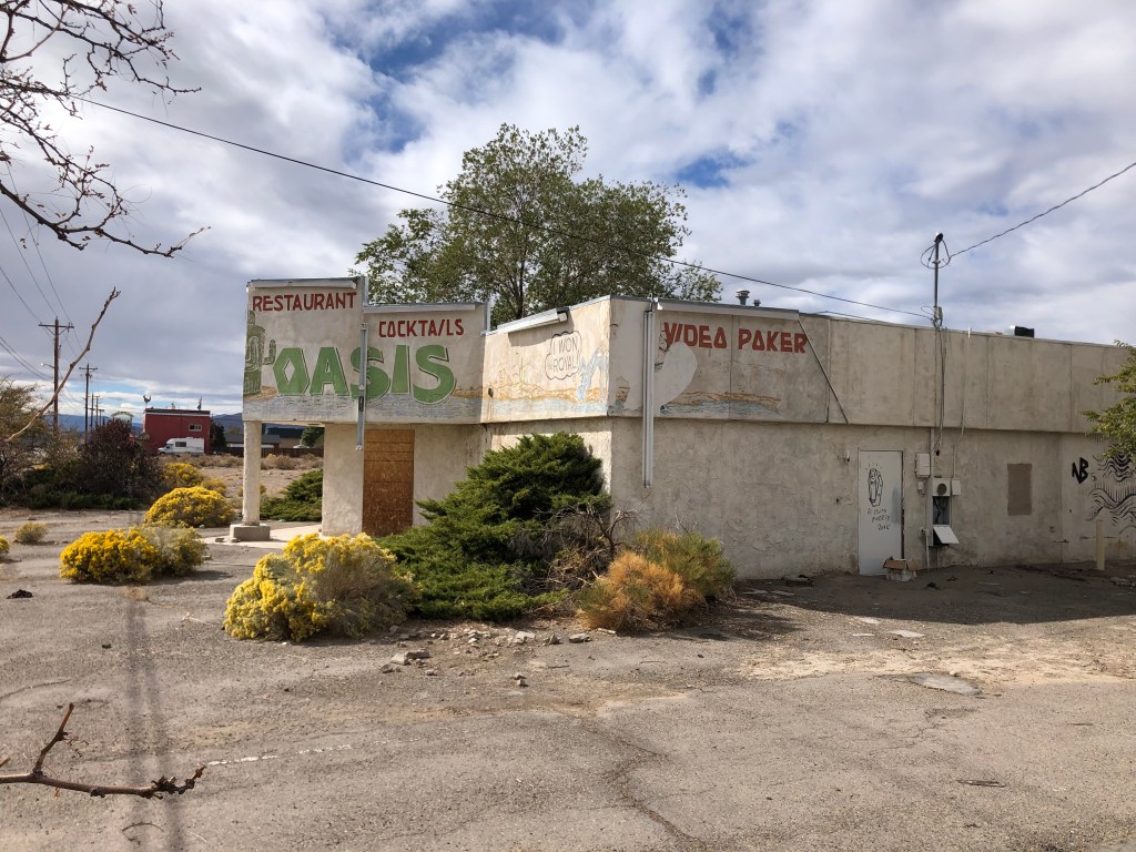
Stagecoach, as you might imagine, used to be a stagecoach stop (as well as a Pony Express stop). For many years, one of the main attractions was the Oasis Restaurant. Sadly, the Oasis seems to have fallen on hard times, and was not just closed but apparently abandoned.
The oasis has dried up
Road trippers along US 50 have long admired the odd, cactus-shaped water tank (?) on the Oasis’ property. Admittedly, it’s not especially well executed, and it’s not especially attractive. But out here there’s not a lot of competition for best-dressed water tank. So somehow I have admiration for this spearmint-colored cactus. I guess it’s because out here, in the middle of nowhere, with presumably no code enforcement and no competition from nearby businesses, there’s little reason to gussy up a water tank. But the good folks at the Oasis took it upon themselves to do so. I’ve commented before that there’s something about the desert that brings out this kind of whimsy.
Lookin’ “sharp”
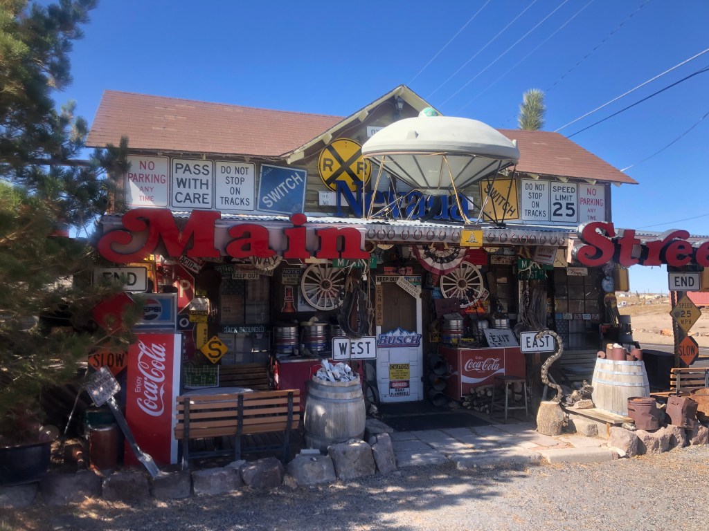
Finally I connected with US 95 at the town of Fallon (pop: 8,600). By Nevada standards, Fallon is a decent-size city (#26 in population, out of 131 Nevada cities listed). The town’s main street is named “Maine Street.” At first I thought it was just a hilarious misspelling, but I later learned that the name is a reference to the home state of the town’s founder.
I spent an hour or so at the city’s history museum (whose collection is drawn from the entire county). According to the museum displays, Fallon was largely settled by would-be 49ers who stopped short of California’s gold fields. Fallon grew after the turn of the 20th century as a dam and various irrigation projects allowed the desert town to support farming and a larger population. Around World War II Fallon acquired a naval air station.
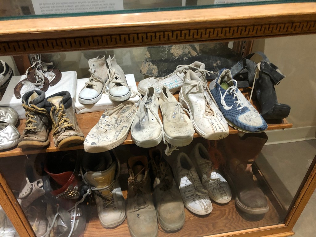
More recently, Fallon was home to the storied Fallon Shoe Tree. Ian and I managed to see it when we took a road trip through here some years back. Sadly, some miscreant cut town the tree. What a heel that guy was!
The Shoe Tree of yesteryear
The museum even has a display case with a small selection of shoes removed from the fallen tree.
The sole survivors
The museum’s docent, Brianna, was friendly and helpful, perhaps because the museum had until recently had only 2 visitors during the Covid era. Brianna originally hails from northern California, but the man she married originally comes from Fallon, and they had a kid and made a home here.
Docent Brianna
For a docent at the Fallon museum, she didn’t come across as a huge town booster. She prefers the coastal areas of northern California. “Someday I’ll move back to the west coast,” she said. Funny, her sense of being stuck sounds a lot like the waitress I talked to when I came through Fallon on my US 50 trip a few years ago. Here’s what I wrote at that time:
My waitress was very authentic and friendly, though. She saw me consulting my Rand McNally atlas at the table and asked me about my trip. It turns out that she is from Sacramento, and has noticed the same US 50 sign and wondered about Ocean City, MD as well. But here in Fallon is as far as she ever got. She’s raising an 11 year old, and hopes that, after he’s graduated from high school, she can do some travelling. By which she means getting an hour or two out of Fallon.
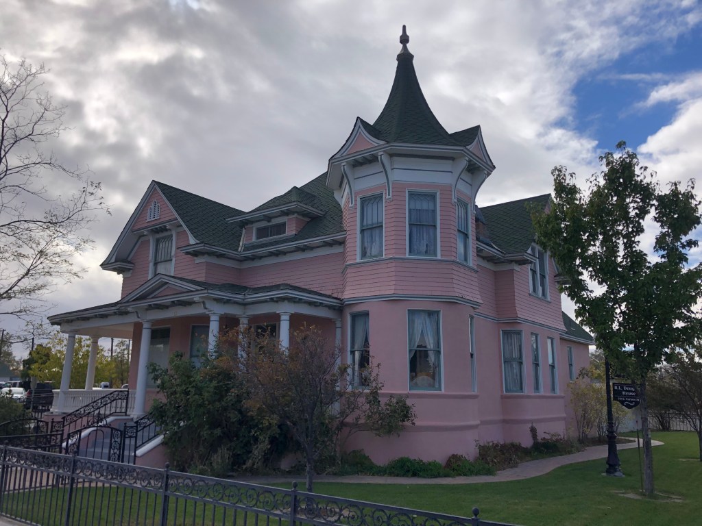
I did find that Fallon has some notable architecture. The Douglass Mansion is especially impressive. Built in 1904, it’s a classic example of Queen Anne style.
The Douglass Mansion
The house once had a detached garage, which the second owner (a physician) had outfitted with a turntable, much like the one in Batman’s Batcave, I imagine. Sadly (for me) that garage and turntable were torn down and replaced with a small hospital.
The house really hasn’t changed a lot in over 117 years.
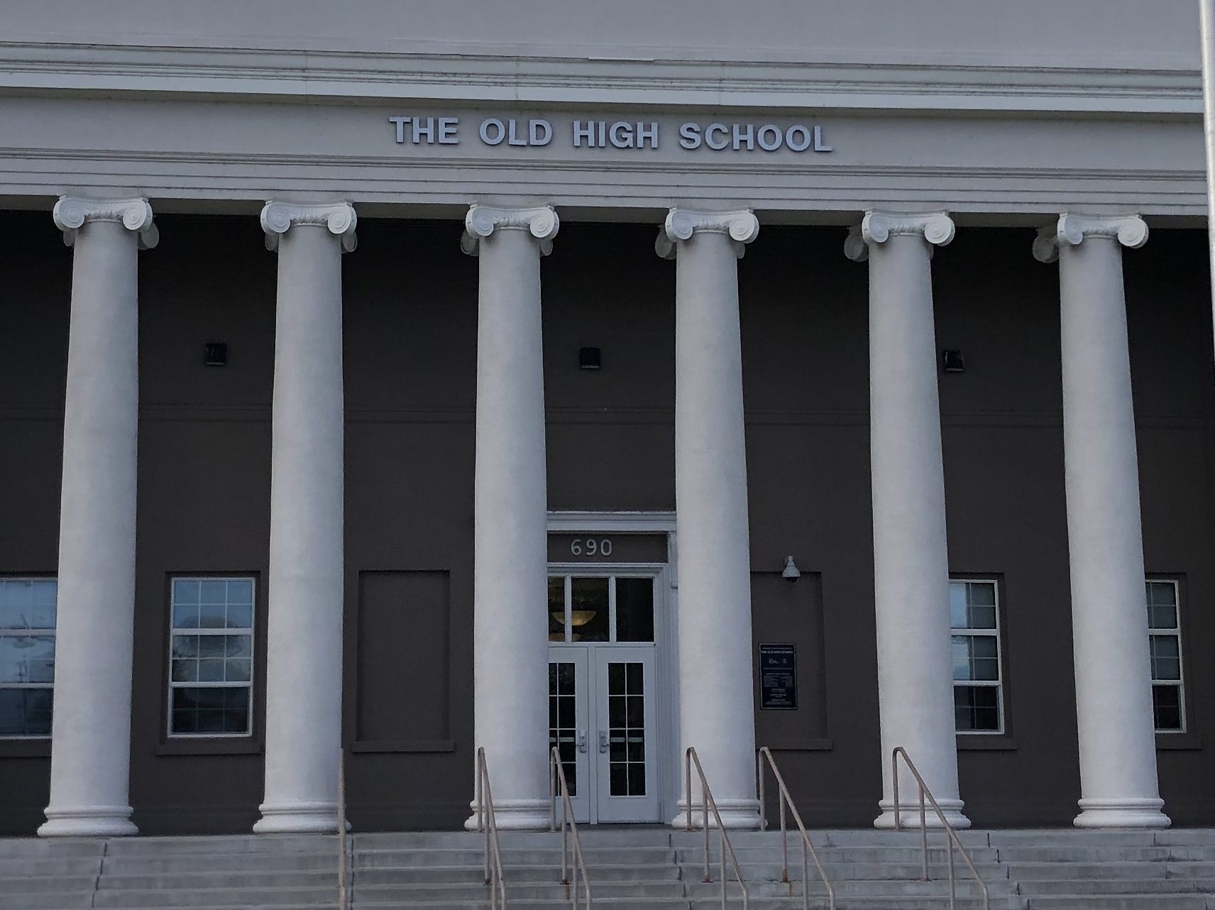
Not far from the Douglass Mansion is the old high school. I know this because the building is helpfully labeled as such. The building dates back to 1917, so it has earned the moniker.
I wonder at what point they changed the lettering from “New” to “Old”?
Overall, the town feels well cared for, pleasant, and hardy. The same cannot be said for most of the other encampments along US 95.
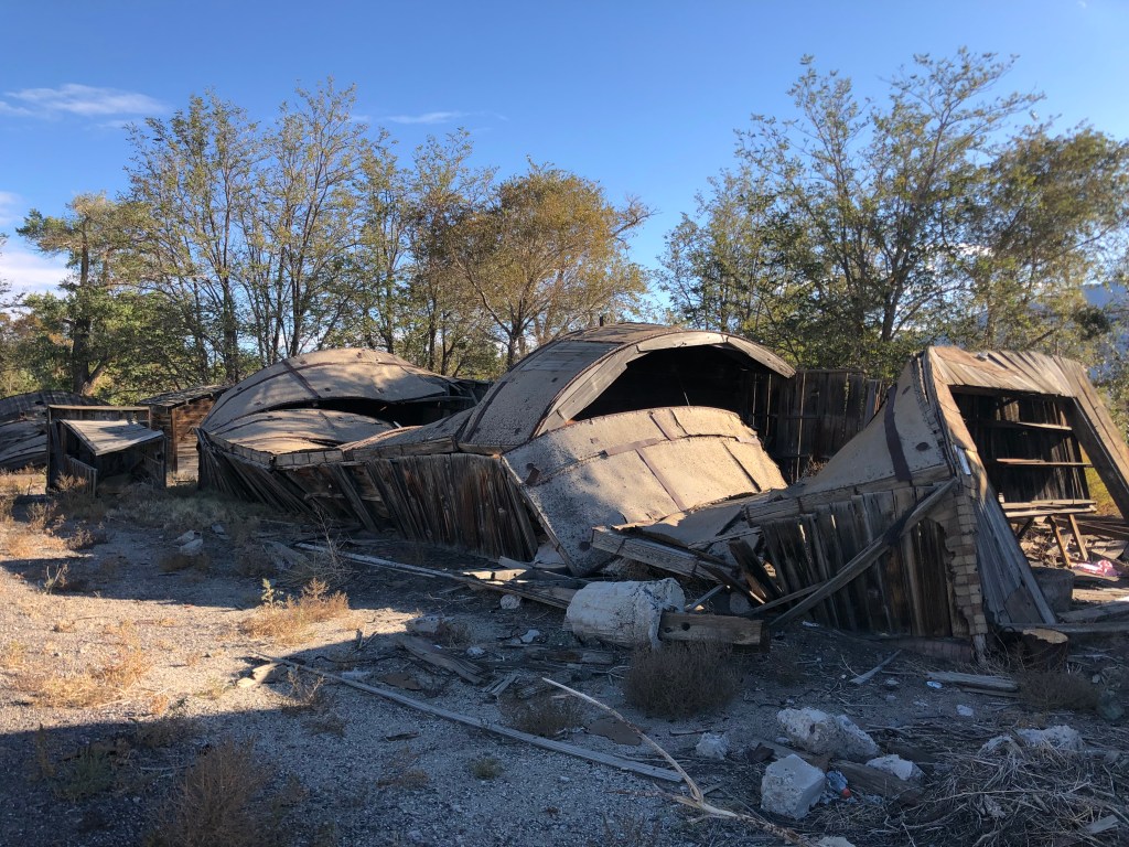
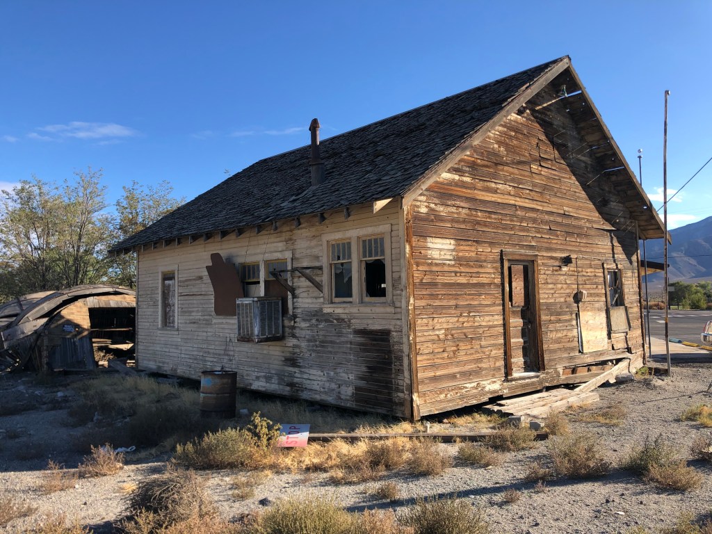
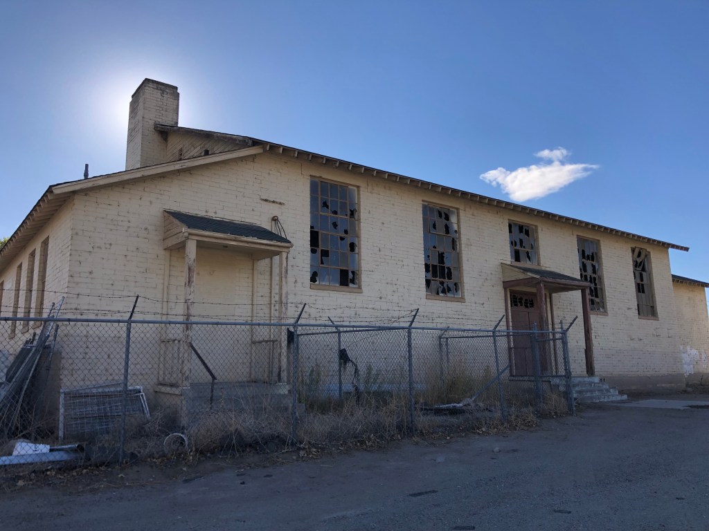
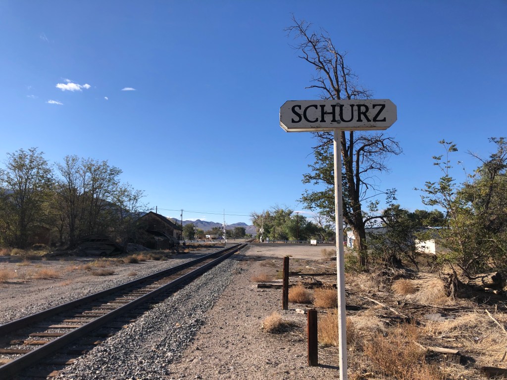
Take, for example, the town of Schurz, named (for some reason) after the then-US Secretary of the Interior in 1891. Located within a Paiute Indian reservation, Schurz was once a viable town near Walker Lake, with homes, community buildings, parks, and services. Today is practically a ghost town. (Coincidentally, the town is the birthplace of the Paiute spiritual leader, Wovoka, who established the Ghost Dance movement in the late 1800s.) Everywhere you see abandoned or badly neglected buildings. And I didn’t see a single living soul on the streets.
I’ll bet the owners of these structures lost their Schurz.
Traveling a little further south along US 95 takes you along the steep shore of Walker Lake, which is Nevada’s second-largest natural lake (after Lake Tahoe).
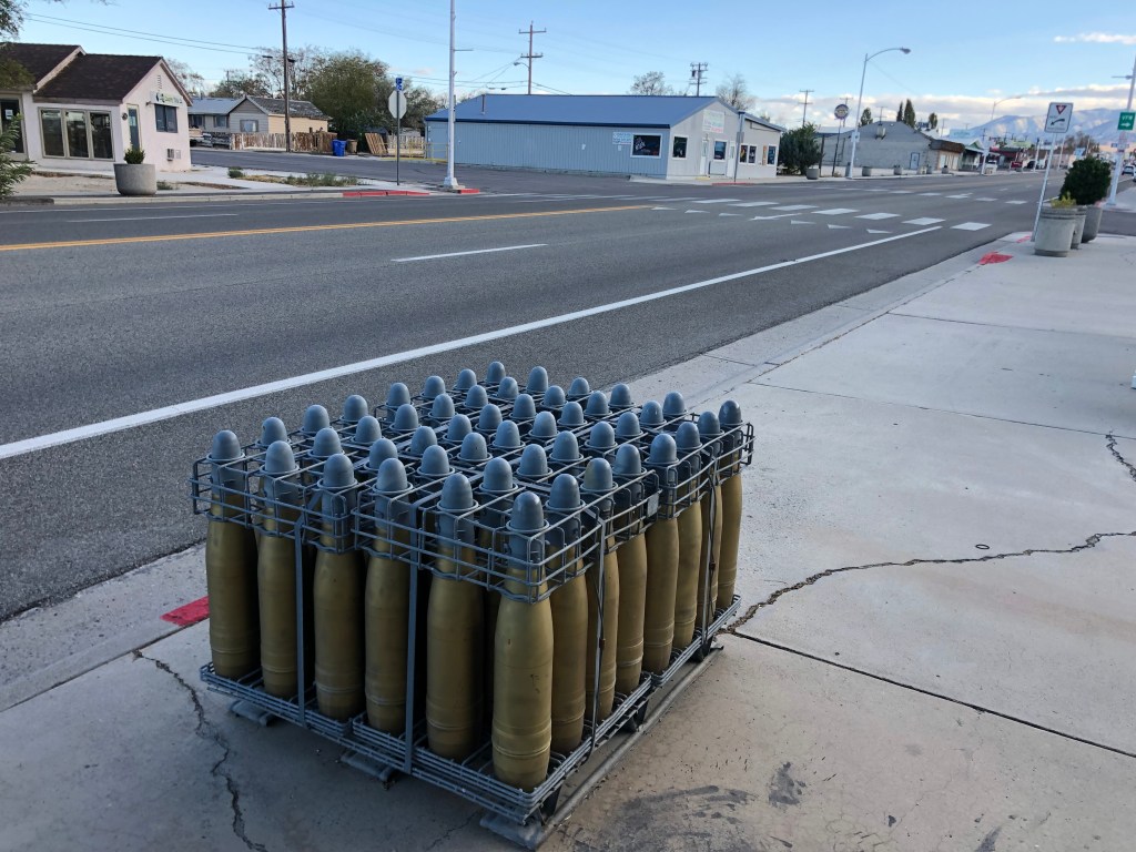
About five miles past Walker Lake is the town of Hawthorne (pop: 3,300), which touts itself as “America’s Patriotic Home” (a claim which might rightly be challenged by any number of cities). Hawthorne’s claim is based on its hosting the US Army’s largest ammunition storage facility. From US 95 you can see some of the 2,500 bunkers which are used to store ammunition.
Naturally, most of the town’s households are connected in some way with the ammo storage facility. There’s an ordnance museum (which unfortunately was closed when I got there), and even the local park has playground equipment made out of bomb casings.
Hawthorne is da bomb
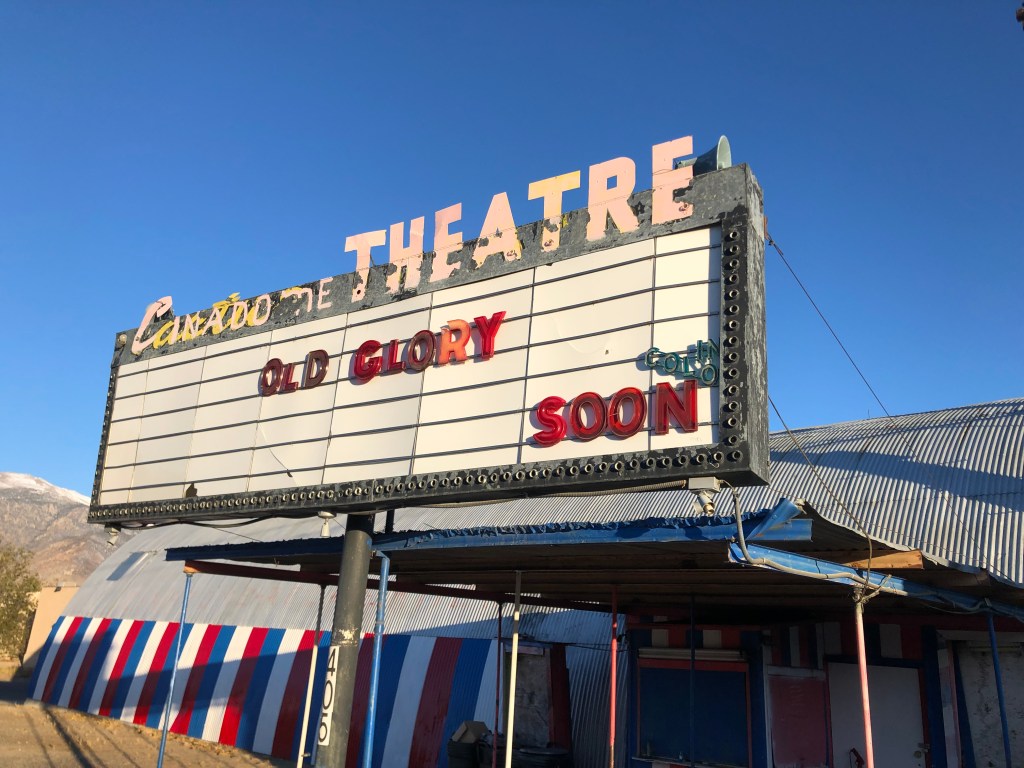
Other than zillions of tons of ammo and a faded casino, the only other notable sight in Hawthorne was the derelict Cactus Theatre. Built in the late 1940s out of a quonset hut, the 300-seat venue achieved notoriety in 1972 as one of only two theaters in the state of Nevada to show the pornographic film, Deep Throat. The theater closed in 1997, but reopened in 2005 as the Cinadome Theatre. (Look closely at the sign, and you can make out both its old and new names.) The Cinadome closed in 2012, but the waitress at the local pizza joint told me that there’s an effort to get it open again.
Speaking of the local pizza joint, I had one of the best pizzas of my life at Old Nevada Pizza. Seriously, their sweet and spicy pizza is to die for, with a perfect and unlikely balance of jalapenos, pineapple, bacon, and barbecue sauce.
[Special Update: As I write this, my son Ian is taking his own trip through western Nevada and he just passed through Hawthorne. He reports, and I quote, “Everyone there looked like they wanted to leave.”]
Hawthorne is where I laid my head for the night. Part II comes tomorrow!
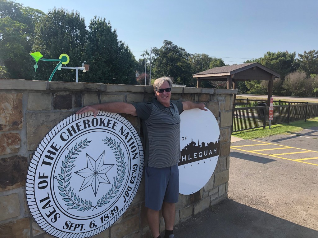
Today Scott and I ended our journey along the Trail of Tears at Tahlequah, Oklahoma, where the bedraggled and exhausted survivors of the original ordeal arrived 182 years ago. As we’ve learned, some 16,000 Cherokees had been forced from their homeland in and around Georgia after the federal government passed the Indian Removal Act of 1830. The idea was to free up the Indian lands for the use of white settlers. The forced march of the Cherokees took place between 1838 and 1839, and up to 4,000 of them died during or immediately after the forced removal.
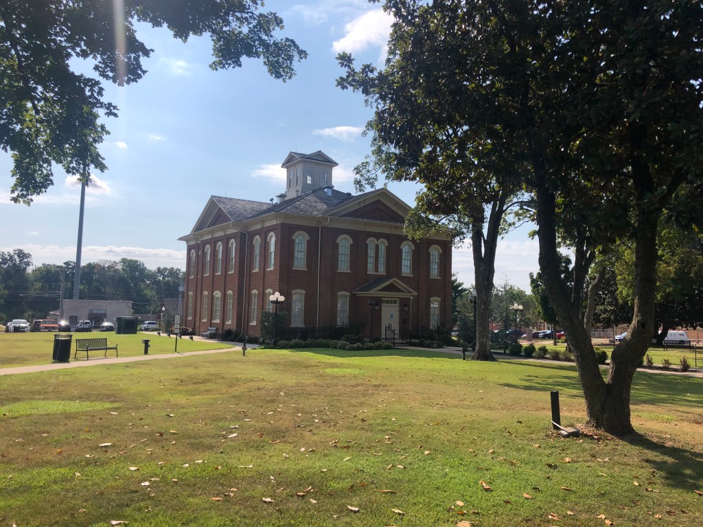
The survivors then went about the business of re-establishing their nation on these new lands. They chose Tahlequah as their new capital, and began planning streets, government buildings, homes, and other facilities. The Cherokees had adopted many aspects of the European Americans’ society, including western dress, a written language, democratic governance, agriculture, Christianity, and frame architecture. In fact, even in its early years, Tahlequah very much resembled any other small American town. Today the town is tidy, respectable, and generally quiet, though we had breakfast at a bustling downtown cafe next to a jazz club. Afterwards we walked through the historic district, which stands alongside a clear and gently-flowing creek.
The old Cherokee Capitol building, in Tahlequah’s town square. Not that different from many small, old American towns.
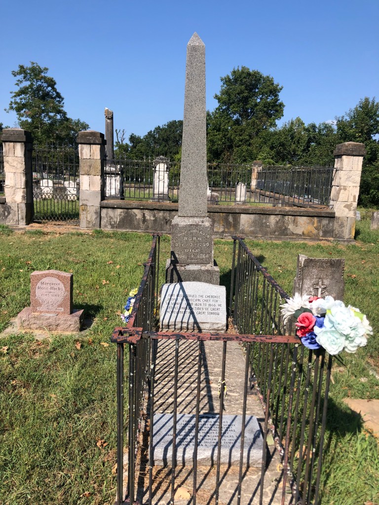
You’ll remember John Ross, who had been Principal Chief of the Cherokee Nation since 1828. He had fought the diaspora for years, desperately lobbying the Congress in Washington, DC, appealing to President Jackson, and even taking the State of Georgia to the Supreme Court (not literally, of course). After exhausting all avenues, and after a cabal of other Cherokee leaders surreptitiously signed a separate treaty with the federal government giving up the Cherokee lands, Ross resignedly helped manage the movement of his people out west to present-day Oklahoma. He joined them on the Trail of Tears, and his wife Quatie died along the way, in Arkansas. Ross helped to establish the new capital in Tahlequah, and was re-elected principal chief until his death in 1866. Today, Tahlequah (pop: 17,000) remains the Cherokee national capital. The Cherokee nation has jurisdiction over most of the land in northeastern Oklahoma. About 300,000 people belong to the nation.
Grave of John Ross (1790-1866), in Tahlequah. Note the obelisk!
So, while it’s not exactly a story of triumph, the Trail of Tears and its aftermath constitute a story of survival. Still, it’s notable to me that few of the people we met along the way had much knowledge of or interest in the TOT. Even the hotel clerk in Tahlequah didn’t seem much to care when we informed her that we’d just finished covering the entire route. “Did you walk it?” she asked, unimpressed. To be fair, ours wasn’t much of an accomplishment when compared to that of the original travelers.
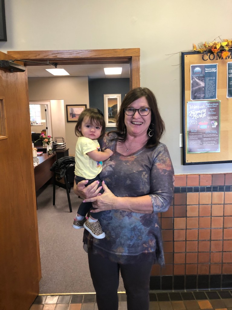
We did, though, receive genuinely enthusiastic responses from precisely two individuals along the route. One was Amy, who managed the visitors center in Hopkinsville, KY. The other was Gena, who we met today at Tahlequah’s Chamber of Commerce. Gena is the director of tourism for Tahlequah, and like Amy, she’s well suited to the role. She clearly loves this town, having moved here from Mt. Shasta, CA. (It’s a long story.) Gena patiently answered our questions about the town’s history, gave us directions to several historic sites, and hooked us up with some Tahlequah swag.
Gena and her Granddaughter, Ellis
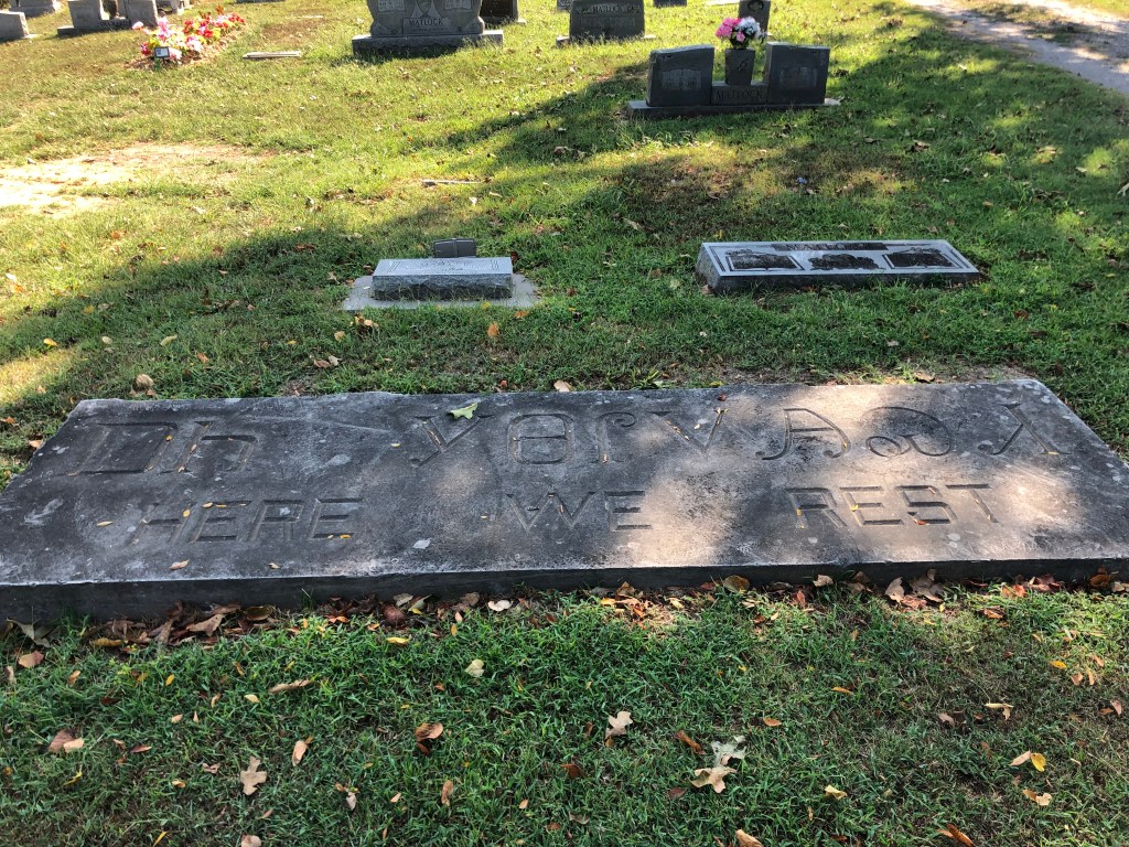
On our way out of town we stopped at two cemeteries. The Ross Cemetery is the final resting place for John Ross and many of his relatives. (It had originally been the homesite of one of Ross’s nephews.)
“Here We Rest,” at the Ross family cemetery.
The other was the Caney Cemetery, which holds the remains of many figures from this area, including a handful who had survived the Trail of Tears. Scott and I were struck by the number of graves of children and infants, which may speak to the state of healthcare among the nation, or to other issues. On the other end of the spectrum, though, were graves from individuals who had walked this earth for many, many years. One such long-lived individual was Betsey Snaketail, a Trail of Tears survivor who died in 1881. She was born in 1771, before the American Revolution.
Little could stop Betsey Snaketail, God bless her.
We lingered a bit at this place where a handful of the TOT survivors have finally found their rest. Then we got in the car and headed for Tulsa to catch our flights home. Those of you who know me well are aware that I’m not normally given to sentimentality or mawkishness. But I’m left with an enduring sadness about the treatment of these people by our government. And even if you take the government out of it, it’s distressing to be reminded how individuals can mistreat other individuals, sometimes harshly. I recognize that mistreatment of others is not unique to any time or place, and that it goes on even today. But I wonder if the experience of the Trail of Tears holds any answers that might help us to do better, even as individuals.