This morning Scott and I set out early from Louisville. With flights to catch on Monday afternoon, we realized that we were running a bit behind on our schedule, so we were facing almost 600 miles of driving today.
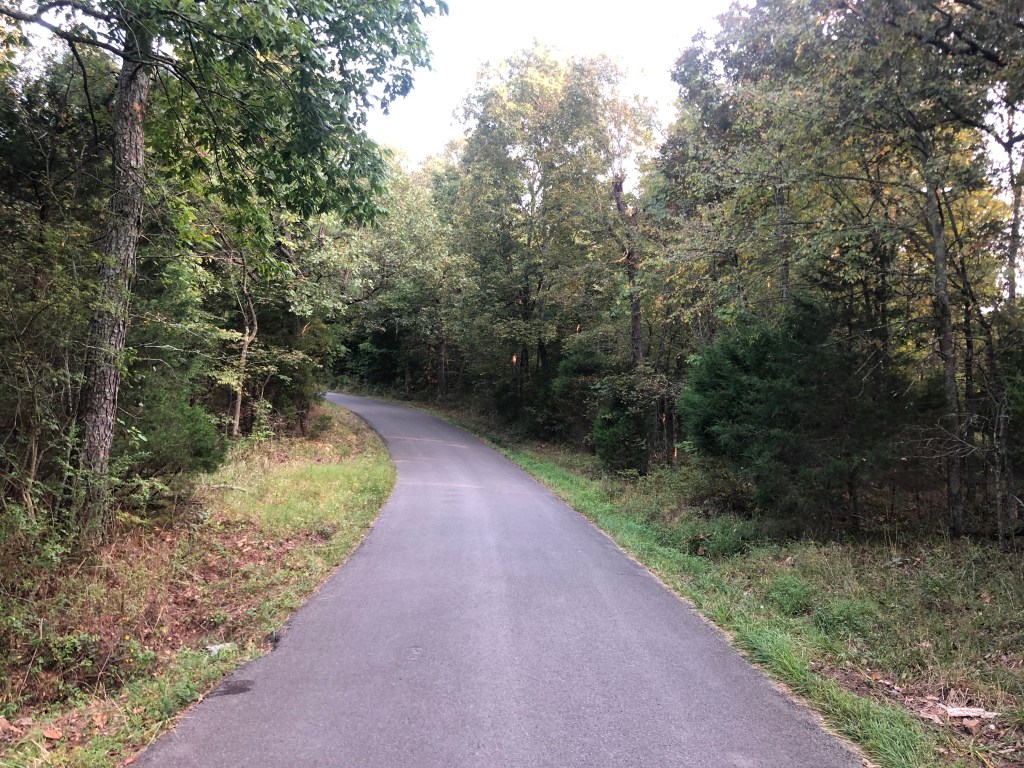
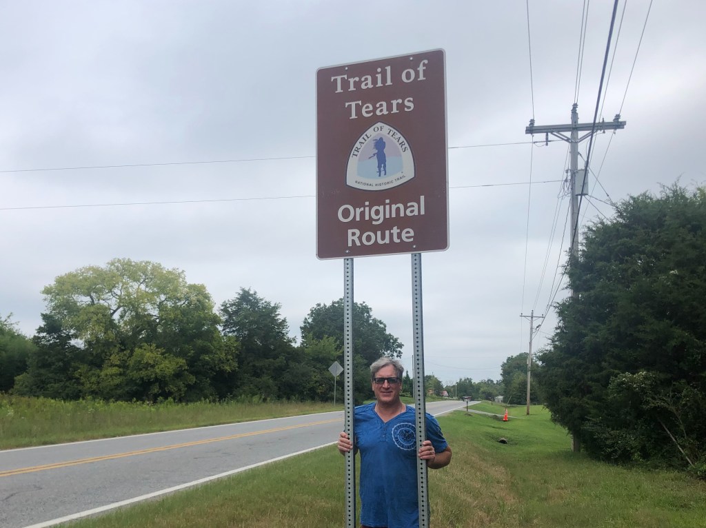
The first 100 miles or so was needed just to drive south from Louisville to reconnect with the Trail of Tears. Once that was accomplished, we were back on the hilly, windy green hills of Kentucky, roughly following the original route that the Cherokees walked.
It’s a nice travel experience….if you aren’t being driven out of your homes by the U.S. Government.
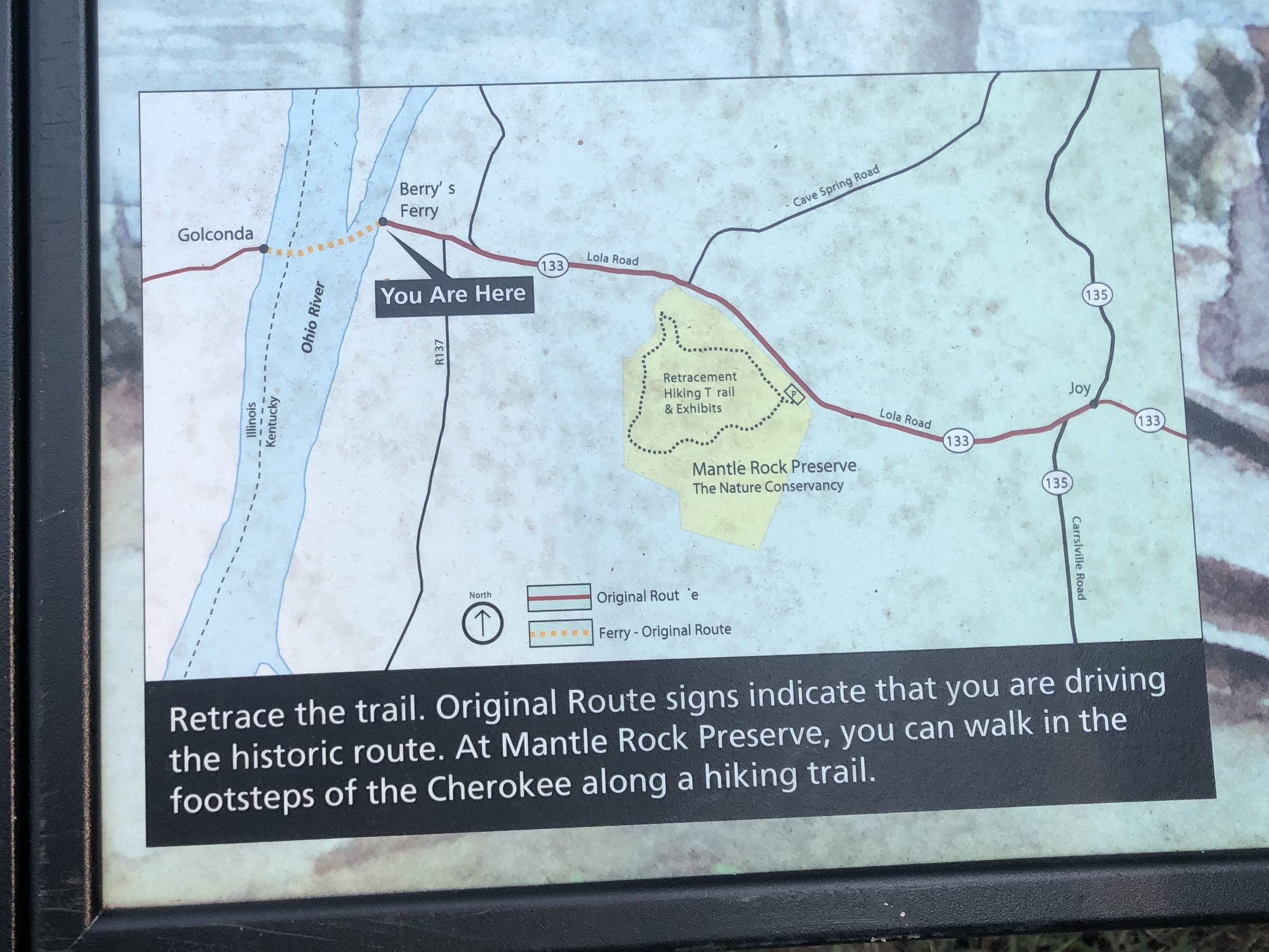
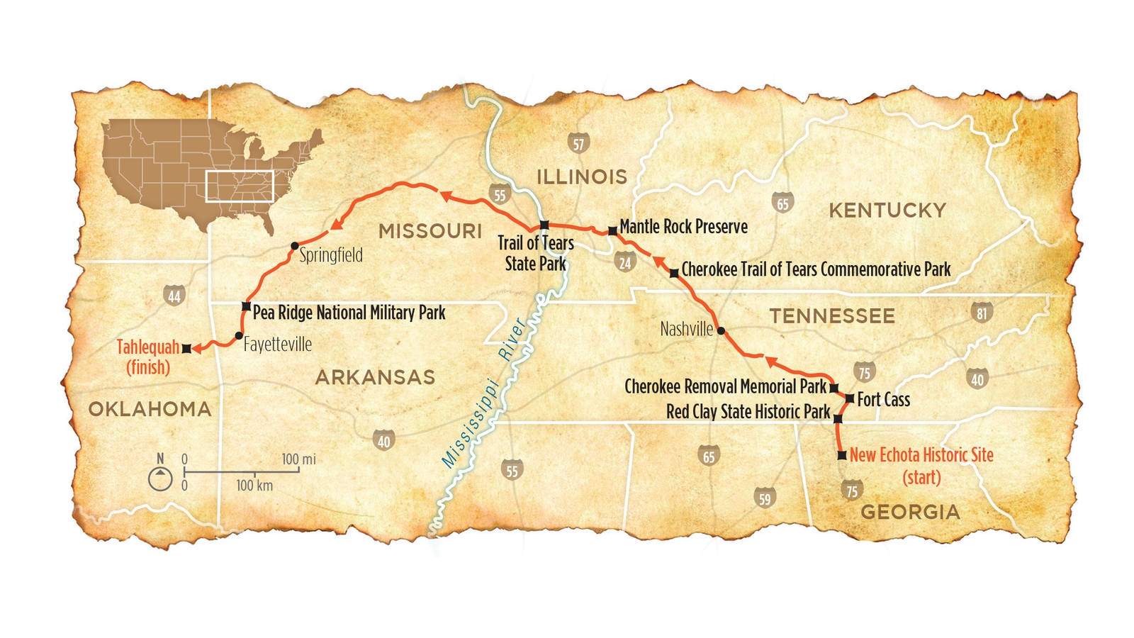
The day’s trip would involve driving west from Hopkinsville, KY to Tahlequah, OK. Our route (which is essentially the Cherokees’ northern route) would take us from Kentucky through Illinois Missouri, and Arkansas, before we crossed the border into the old Indian Territory of Oklahoma.
It’s not a great map, but you get the basic idea.
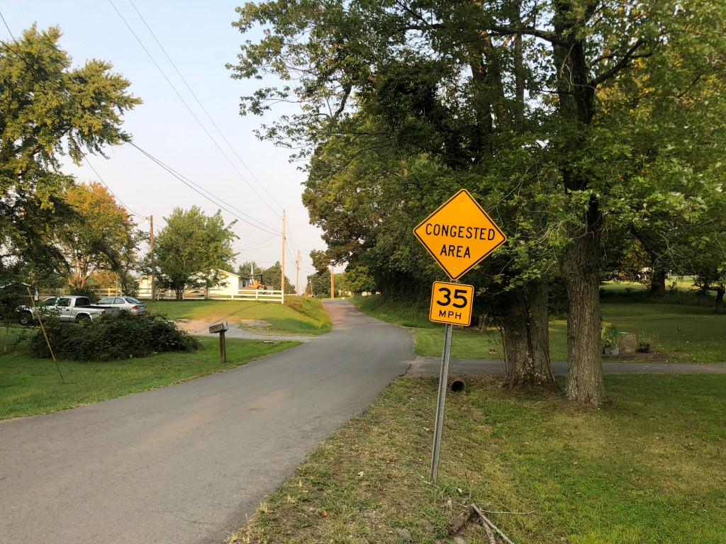
It was still early in the morning on a Sunday in rural Kentucky, so we were pretty much the only ones on the road. As two California boys, we had to chuckle at the Kentuckians’ idea of congestion.
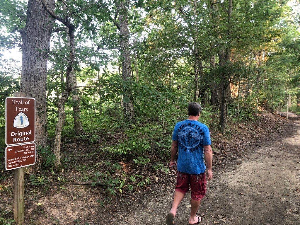
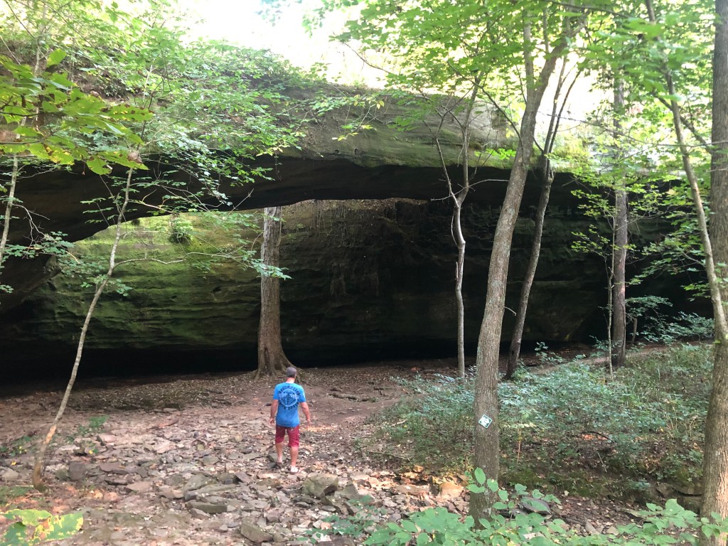
Mid-morning we arrived at Mantle Rock, near the bank of the Ohio River. This is where the Cherokees camped (some for up to two weeks) while waiting for ice on the river to break up enough to permit a ferry crossing. We hiked a short section of trail to get to Mantle Rock.
Only 485 more miles to go….Mantle Rock, where some of the Cherokees took (inadequate) shelter from the rain and cold.
I get the sense that this was one of the more commodious stops along the TOT. It’s hard to imagine the pain, discomfort, and danger of spending three months out on the trail like this.
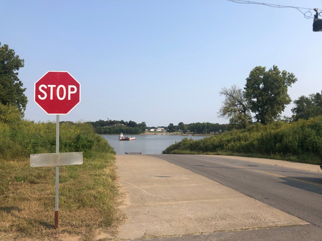
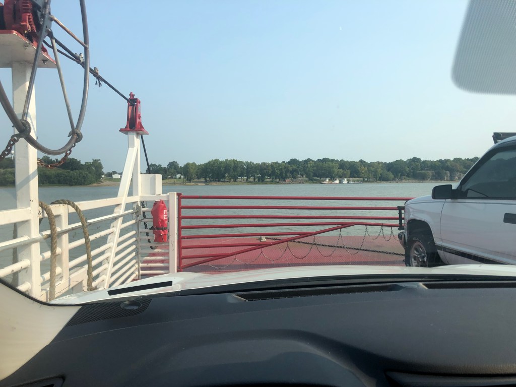
After we got back to the car, we made a short drive to the river and took a ferry across the Ohio River to Golconda, Illinois, and continued in the Cherokees footsteps.
Don’t pay the ferryman.As Spartan as it is, this ferry is a Princess Cruise compared to what was available to the Cherokees.
It was now close to noon, and we settled in for a long drive along the rest of the route, taking in the scenes of rolling hills and endless forests in Illinois Missouri, and Arkansas. About 10 pm we finally crossed the state line into Oklahoma, which at the time of the TOT was the Indian Territory, and the new home for the Cherokees. Tomorrow morning we will explore their national capital of Tahlequah, and complete the trip.
BREW OF THE DAY
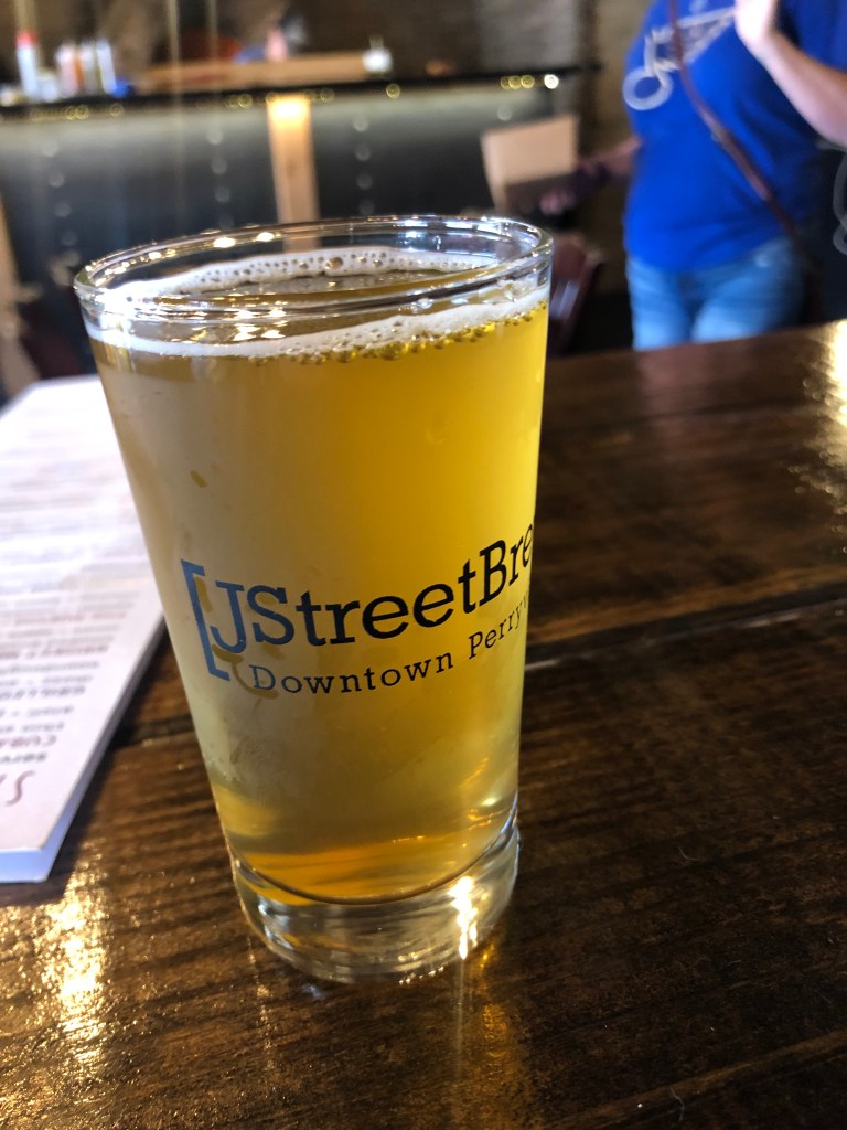
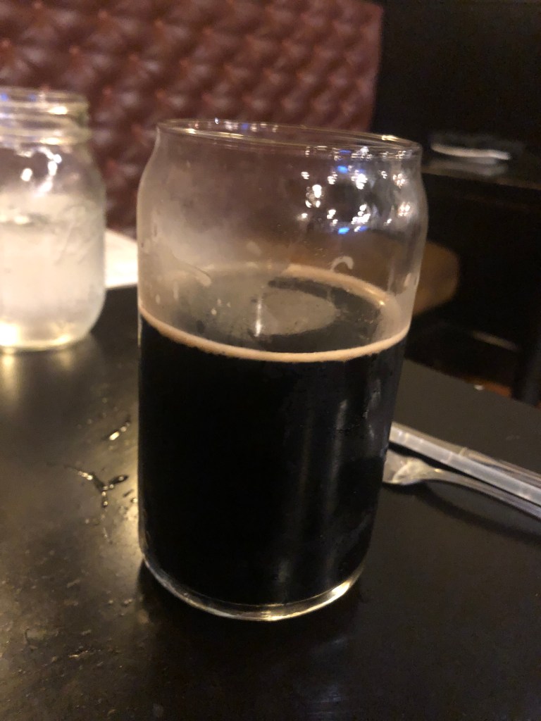
Today’s BOTD comes from the J Street Brew Company in Perryville, Missouri. Perryville is another of the many quaint, quiet, historic towns we passed along our journey. I had a Pineapple Habanero Saison. It’s lighter than I normally drink, but this place seems to specialize in pepper-infused beers. (They also had a Mango Chile IPA, a Jalapeno Lime Lager, and a Poblano Pale Ale). The saison is an uncommon style of beer these days, but it’s refreshing as an afternoon beer in summer. This one tasted somewhat sour, coming, I think, from the combination of the pineapple and peppers. The body is quite light. It’s very fizzy, almost like champagne. The ABV of 5.8 is friendly for a mid-day driving stop.
Today Scott and I stuck around Louisville. This city, perched on the bank of the Ohio River, is very much a city of the past, with ancient structures, deep historical connections, and enduring traditions.
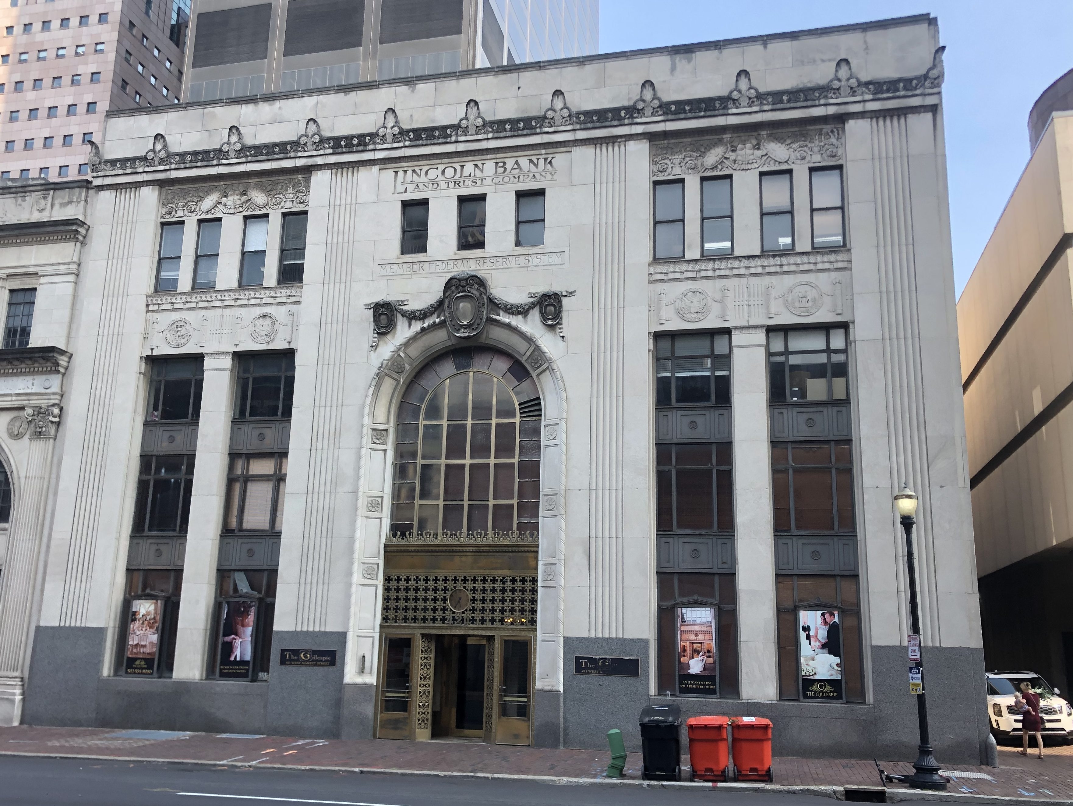
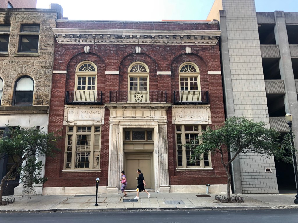
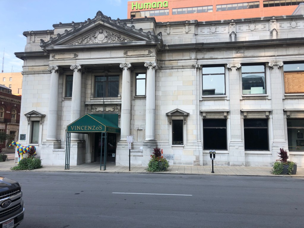
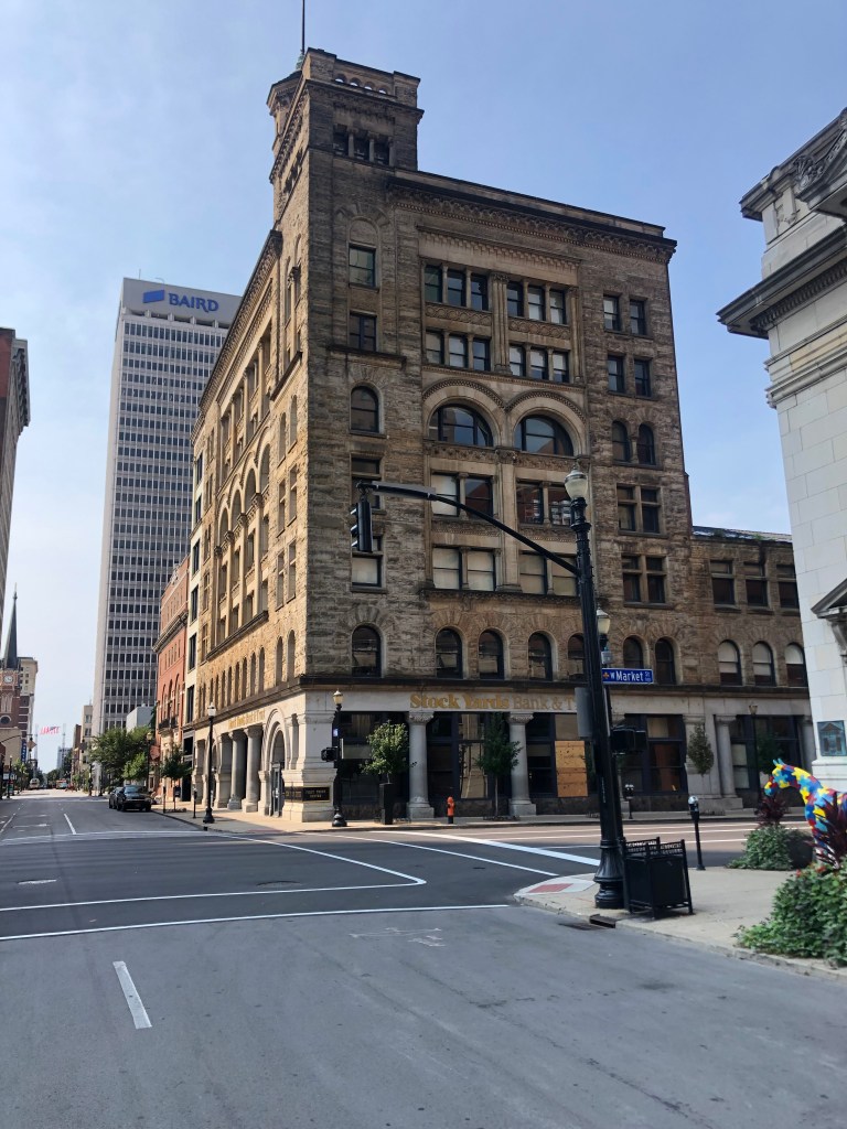
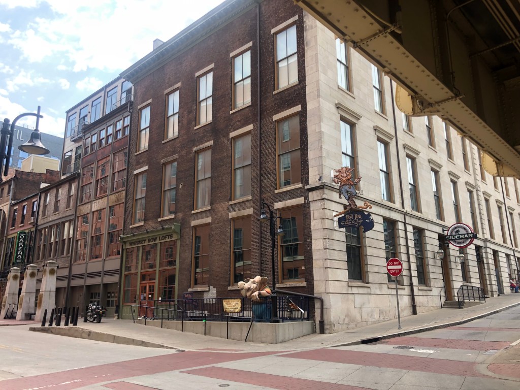
We spent the morning walking around downtown Louisville’s old financial district. It’s lined with looming, imposing banks and stock exchanges from the turn of the century. Most of these are now serving other purposes, such as art galleries or lofts or restaurants. They’re impressive and anomalous in the 21st century, and very much give Louisville a unique, historic vibe that you just can’t get from a hipster urban renewal project.
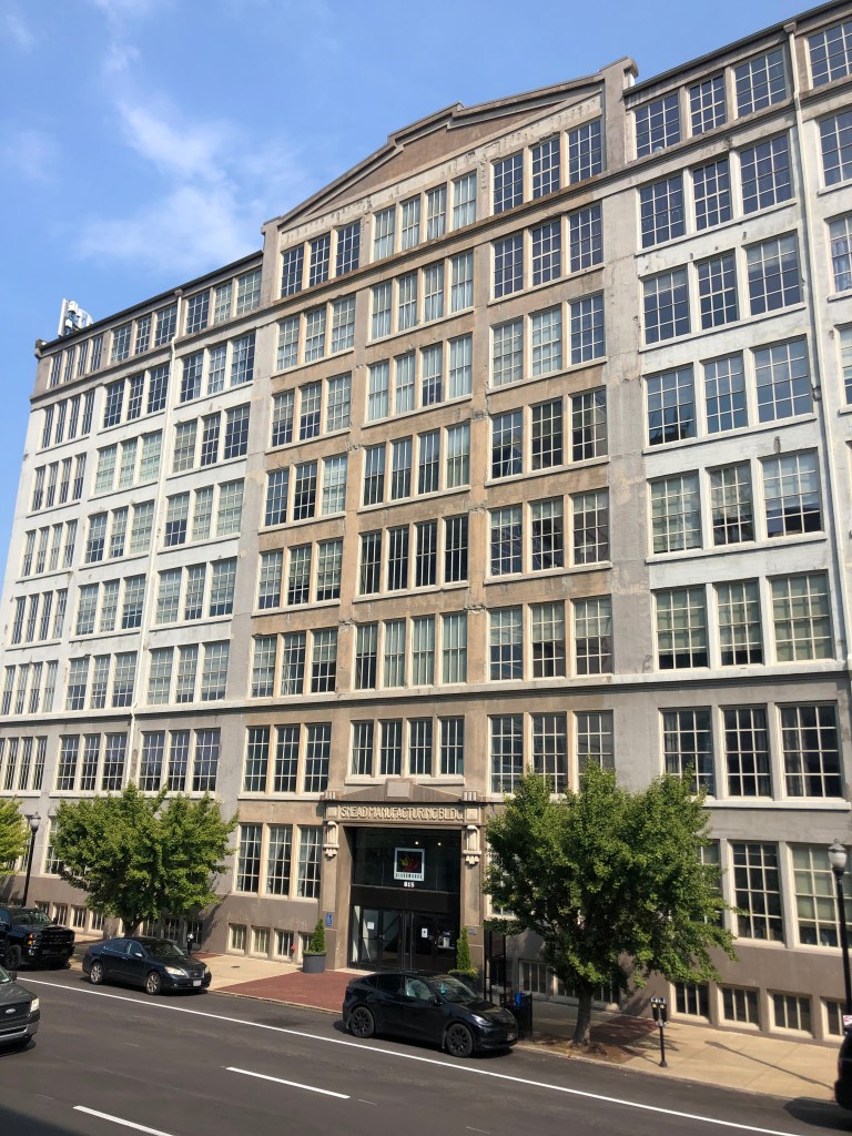
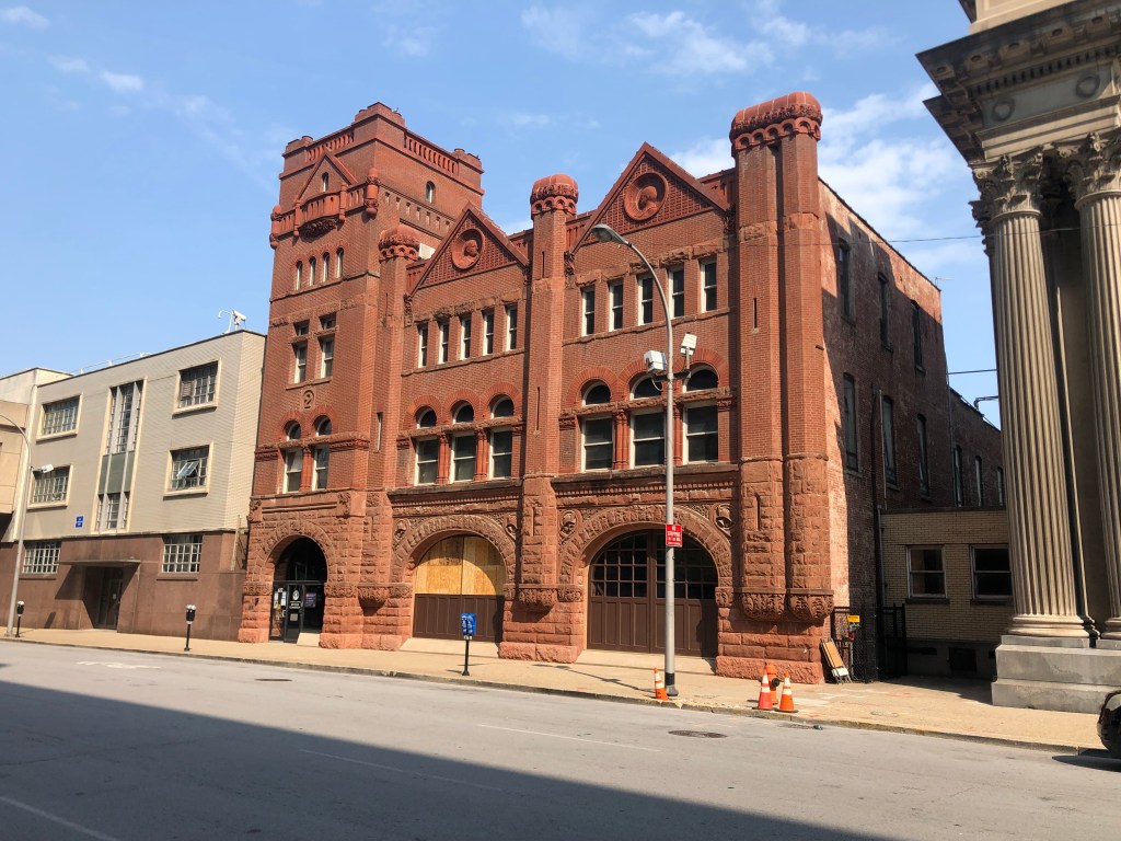
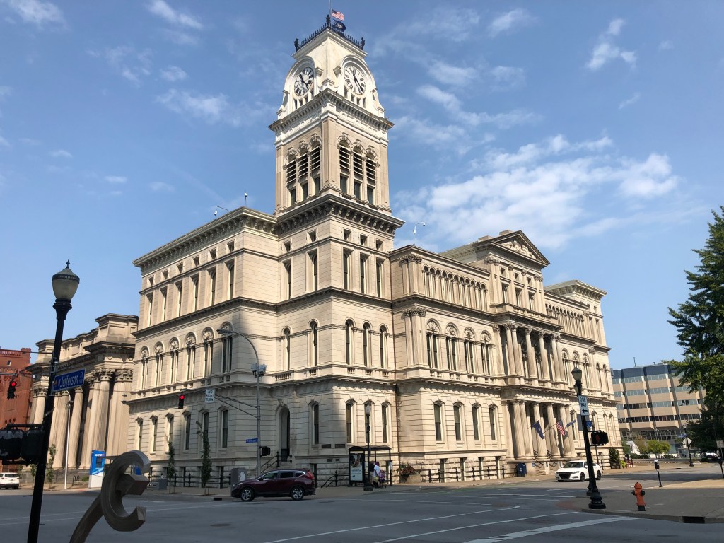
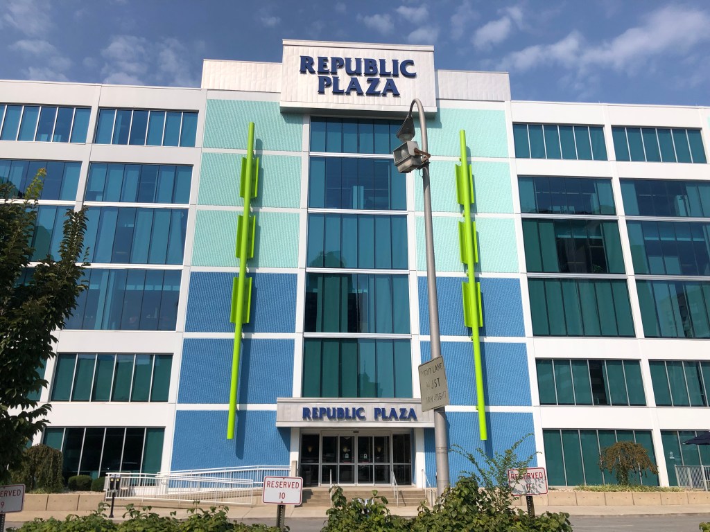
Lincoln Bank and Trust Co. building, constructed in 1929…right at the onset of the Great Depression. It remained a bank until 2005, and now serves as a reception venue.First National Bank – Kentucky Title building, from 1927.The German Bank Building, constructed in 1914. Four years later it was renamed Louisville National Bank. (Like many institutions, it was renamed during World War I to disassociate itself with the Germans.) Today it’s an Italian restaurant…thus associating itself with a different Axis power…Stock Yard Bank and Trust building, of unknown age.The Snead Manufacturing building was constructed in 1909, as a glassworks. In its later years it was widely regarded as one of Louisville’s ugliest buildings. (It also has one of the ugliest names.) It closed in 2012. Today it’s been converted to lofts and office space, and retains an artists glass studio.Historic fire station (Steam Engine Company #2), built in 1890. Now the Metro Revenue Commission building.The awesome City Hall building, from 1873.And, just for contrast, check out this more recent abomination from the so-called “modern” era. What was the architect thinking?? “I know! Let’s flank the doors with giant neon swizzle sticks!”
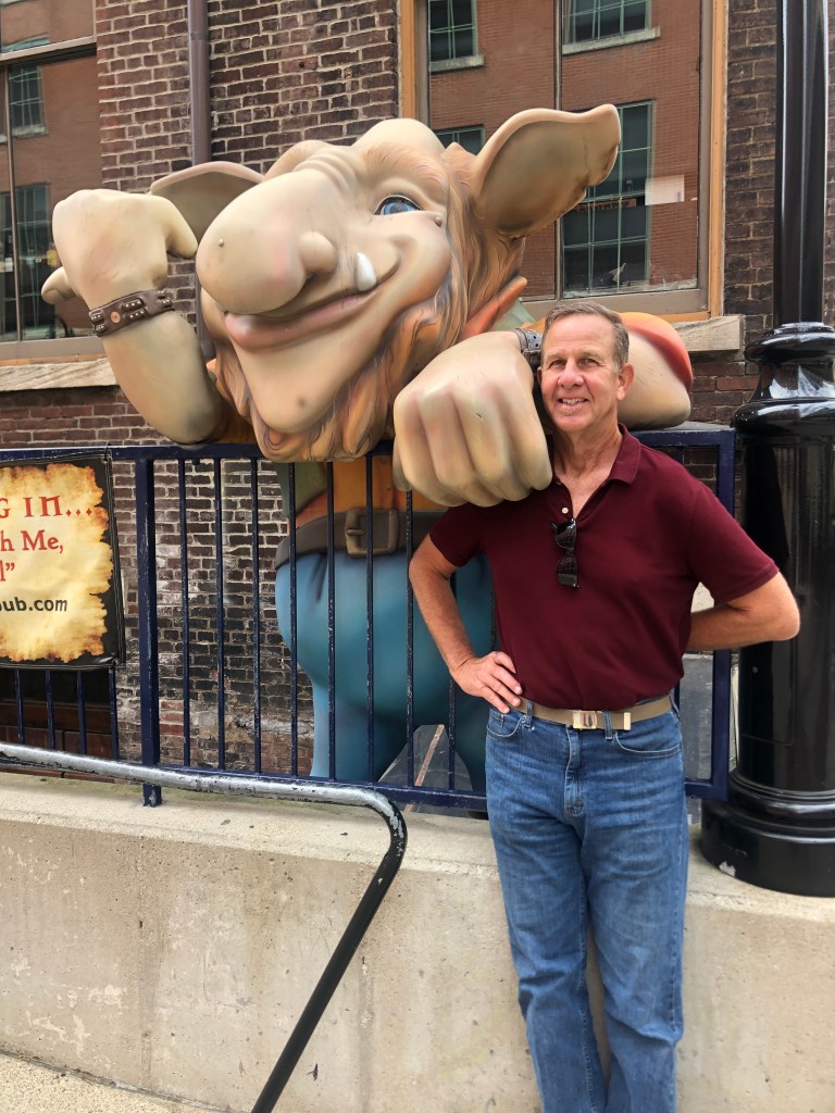
For lunch, we thought we would try the (slightly) celebrated Troll Pub. The name comes from the Three Billy Goats Gruff, since the pub sits under a bridge (Louisville’s Clark Bridge, which crosses the Ohio River into Indiana). The pub is in yet another of Louisville’s historic structures; this one was the headquarters of the Louisville and Nashville Railroad in the late 1800s.
Alas, the pub’s kitchen didn’t open until 1 pm (which seems like an odd time to start serving the lunch crowd), so we left and I got a stale corn dog at a gas station. But at least we were able to get this cool picture with the troll.
“Who’s that tripping over my bridge?!”
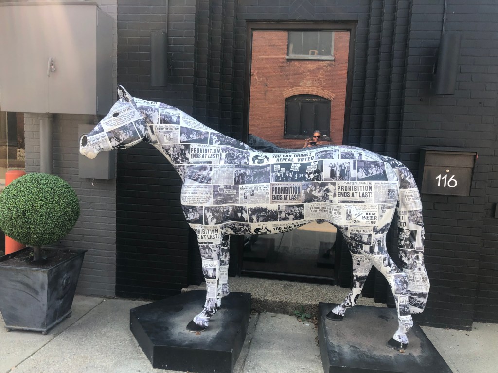
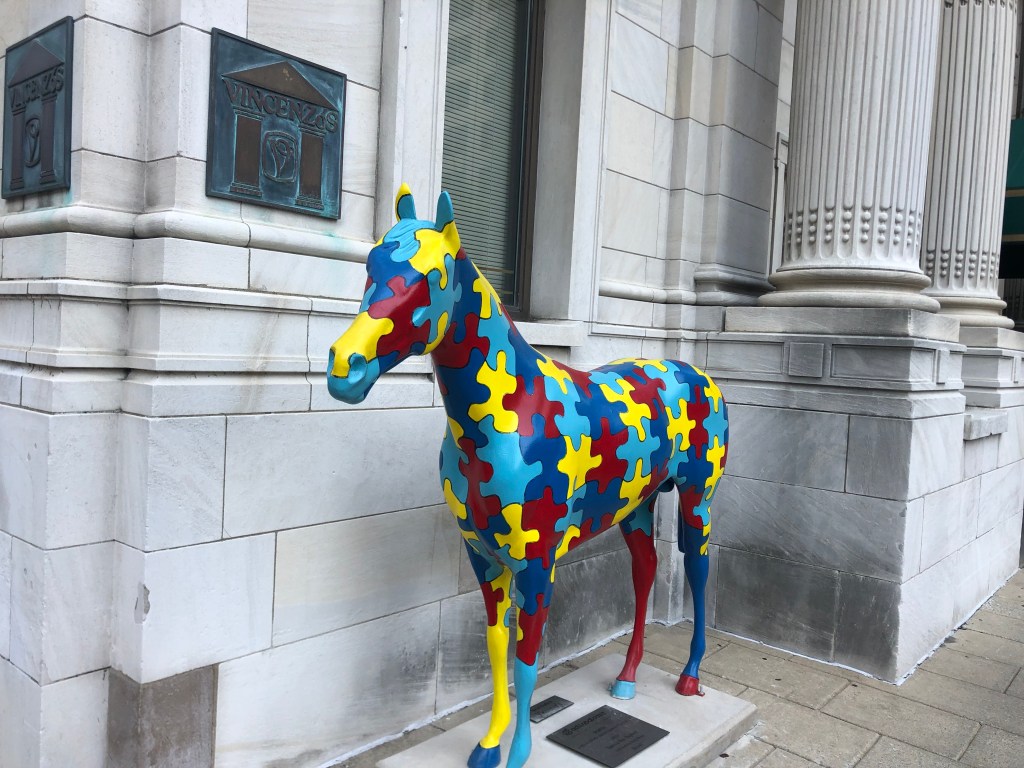
I addition to its cool architecture, Louisville has a strong sense of civic pride. A tangible example is the city’s Gallopalooza, which was a fundraising project whereby businesses and other groups bought and decorated fiberglass horses that were then placed around town. (This followed a popular trend adopted by a number of other towns in the early 2000s.) We encountered a handful of these horses today.
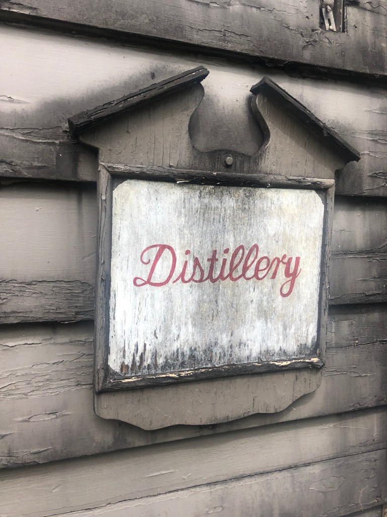
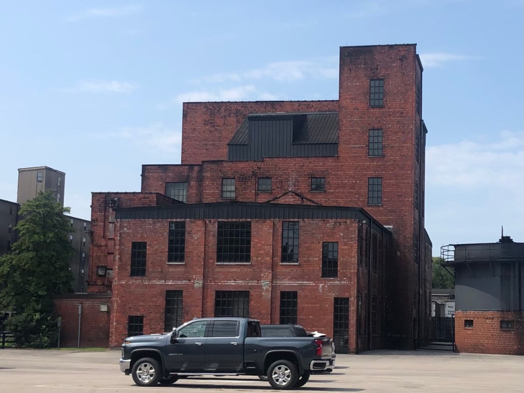
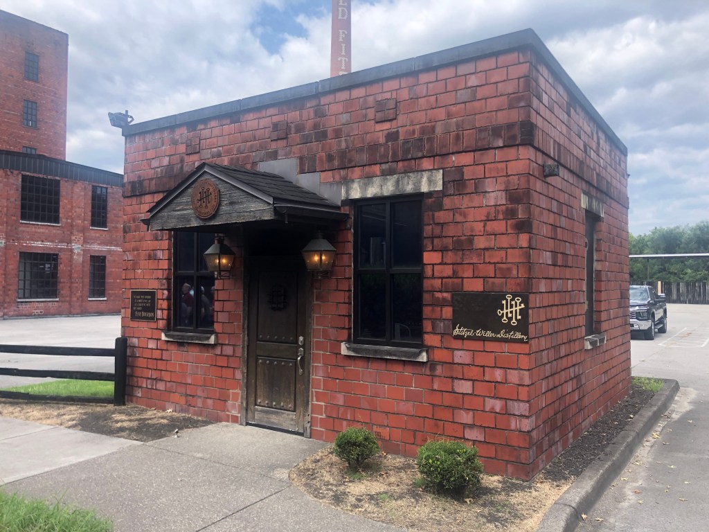
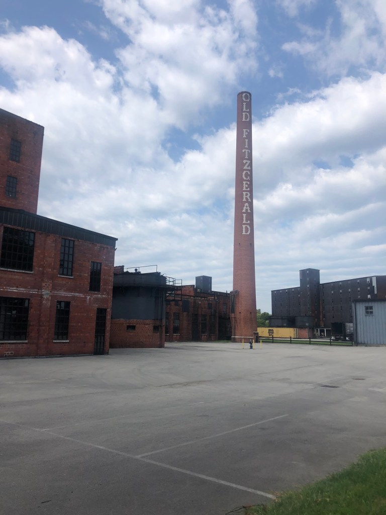
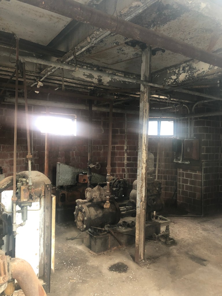
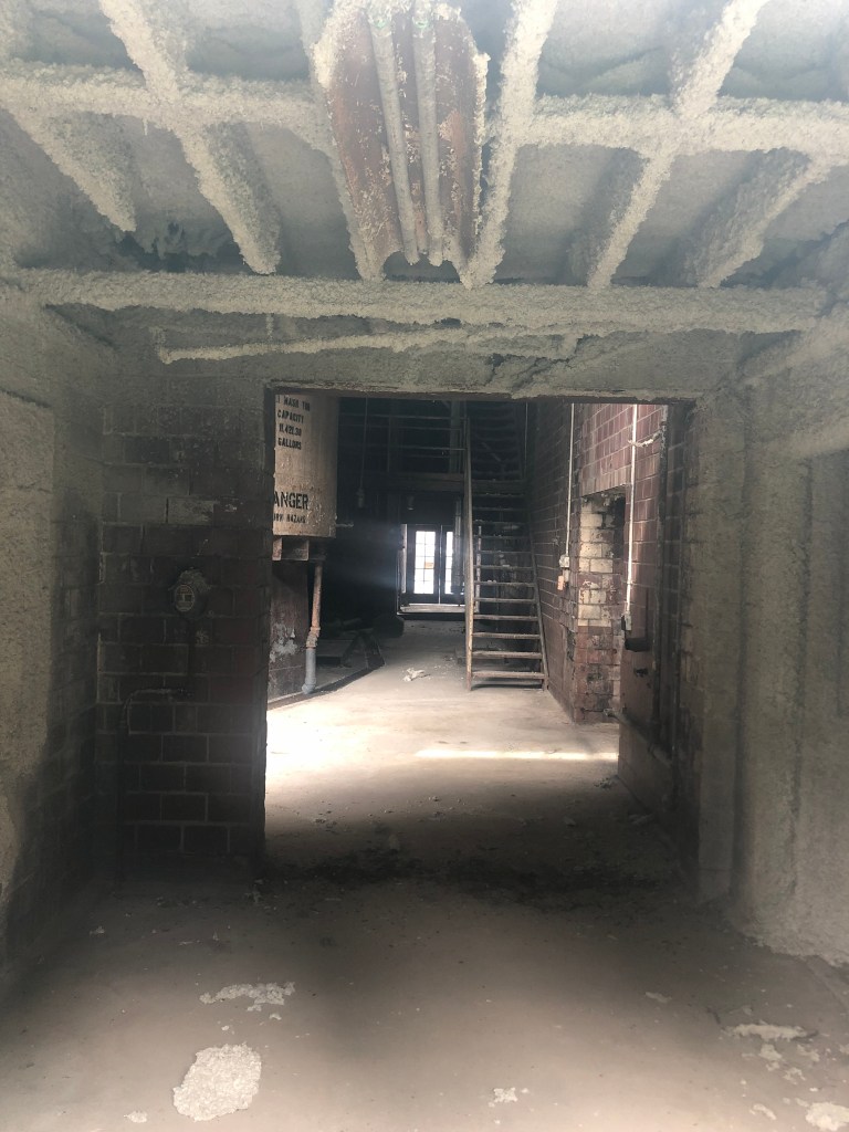
After lunch, we headed out for one final distillery tour, at Stitzel-Weller. The facility, which was constructed in 1935, was both fascinating and depressing.
When we arrived, we were struck by the picturesque, historic setting with ancient trees, rambling old rick houses, an enormous brick smoke stack, and a tidy prewar administrative building in a state of arrested decay. It’s exactly the kind of place that I want to imagine my bourbon comes from: historic, well-worn, traditional, slow-paced, and unpolished.
(Old Fitzgerald had been one of Stitzel-Weller’s labels.)
We were soaking up the atmosphere (quite literally in Kentucky’s summer humidity) and enjoying the tour when it became clear that this distillery has not produced whisky in over a quarter of a century. The family that owned it since its inception sold it in 1972, and it fell into the hands of a mega-corporation which shifted production to more efficient plants. The distillery’s buildings are now mainly just used to store barrels from other distilleries, and to conduct tours and tastings. It was somewhat eerie to walk through these buildings that once saw round-the-clock activity, but which now are inhabited mainly by ghosts.
Just imagine what asbestos abatement would cost…
Furnished with this story of commercial quietus and exposed to this setting of decline and decay, we feel properly equipped to return to the Trail of Tears in the morning.
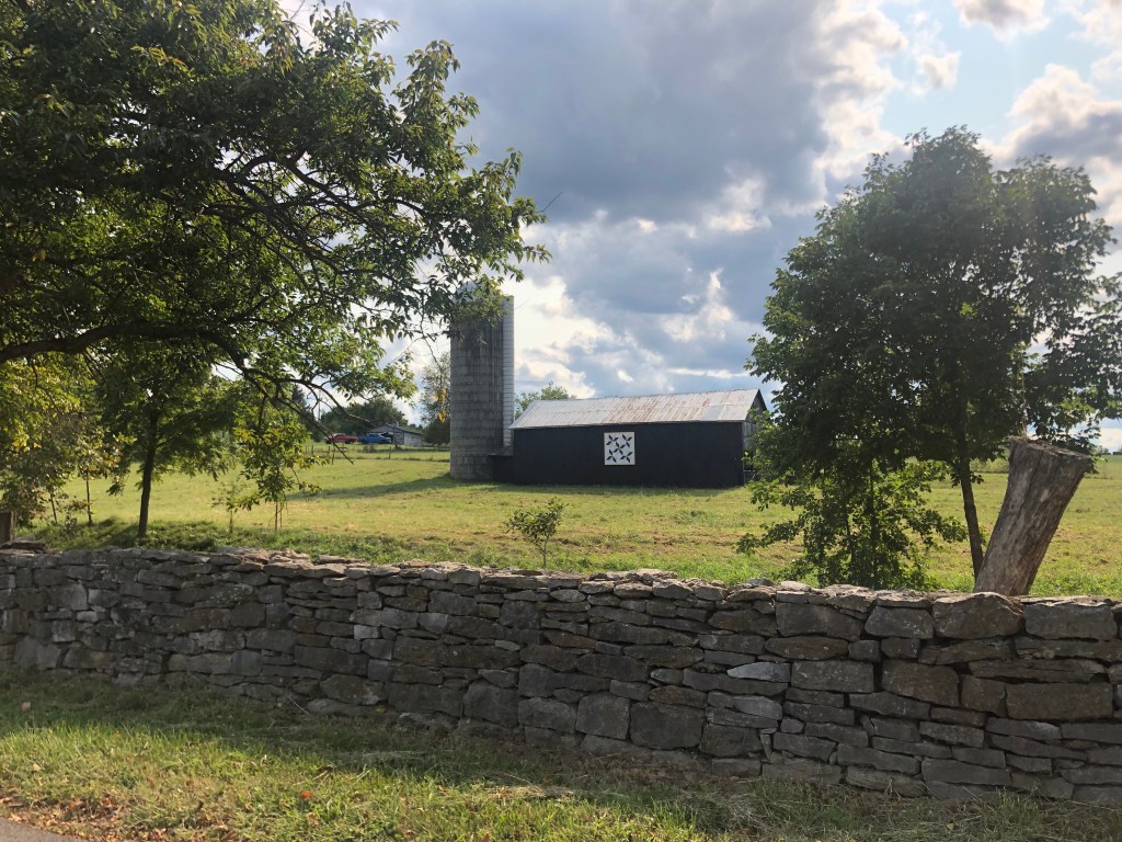
[Delayed posting from Friday] Today we took a break from our tear-y travels and spent a day in Kentucky’s bourbon country. As many of you know, Kentucky is a beautiful state, with rolling green hills, expansive maple and poplar forests, picturesque horse and tobacco farms, and some of the nicest damn people you’d ever want to meet.
Idyllic countryside of the Bluegrass State
Most of Kentucky’s distilleries are clustered between Louisville and Lexington. Each has its own story to tell, but pretty much all of them try to convince you that their particular bourbon is the best.
Of course, all bourbons are remarkably similar in that they all must follow the same stringent guidelines to be marketed as bourbon. Let’s review those requirements:
The majority (i.e., 51%) of grains used must be corn.
It must be produced in the United States. (Note that it does not have to be produced in Kentucky, although about 95 percent of all bourbon happens to be made in Kentucky.)
It must be distilled at 160 proof (i.e., 80% alcohol by volume) or less. This will not be the final ABV, of course. Water will be added later to cut the ABV.
It must be stored in new (i.e., not previously used) barrels that have been charred inside. (You’ll recall that Scotch Whisky is stored in used bourbon barrels.)
It must enter the barrels at no more than 125 proof.
There is no absolute requirement as to how long it ages, but to be called “straight bourbon” it must be aged at least two years.
It must not have any additives or coloring agents.
Once it is bottled, it must be at least 80 proof.
So, working within those constraints, distilleries essentially just take a bunch of corn (and a smaller amount of other grains), cook it in water, ferment the resulting soup with yeast, distill the alcohol from it, and put the resulting alcohol distillate in barrels. If you want it to taste any good, you’ll let it age in those barrels for some years.
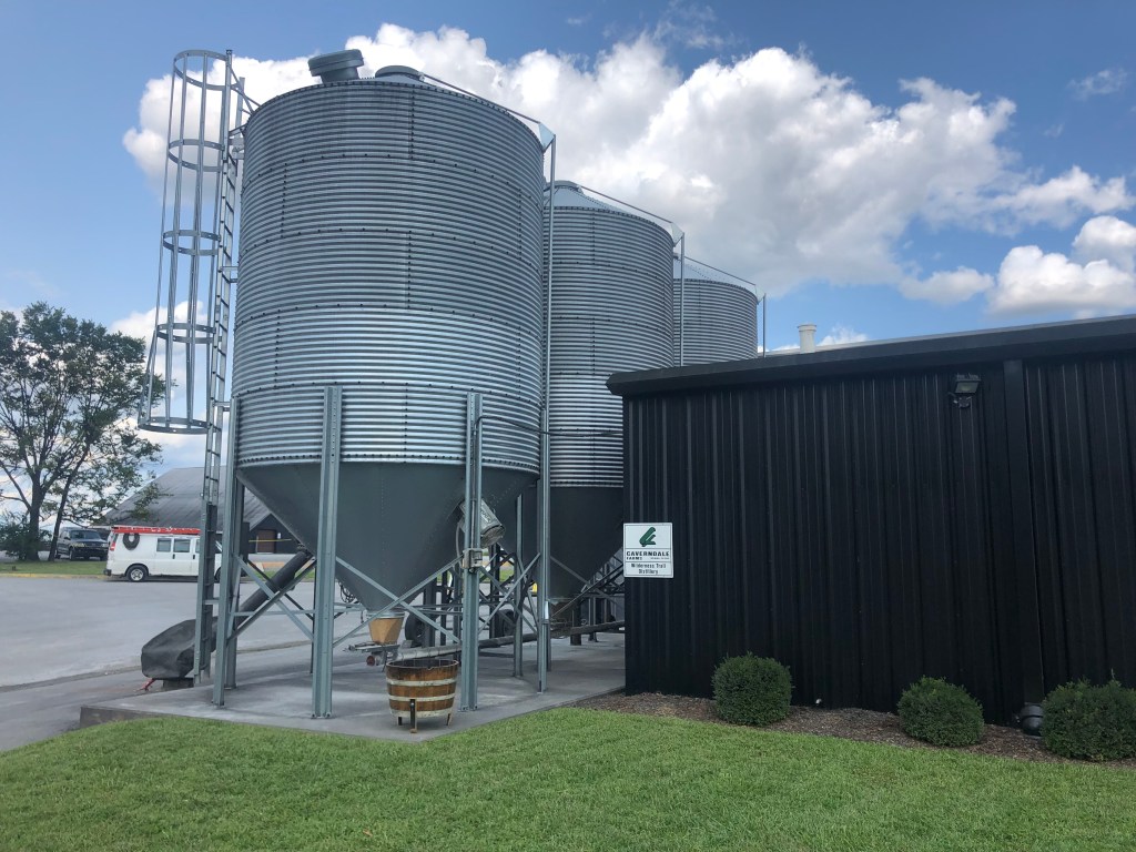
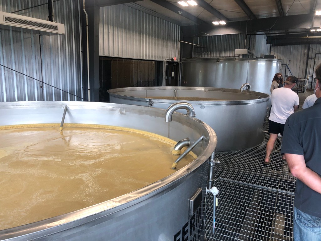
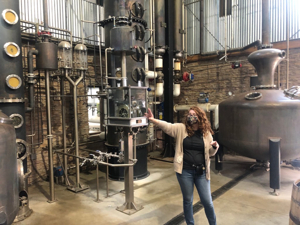
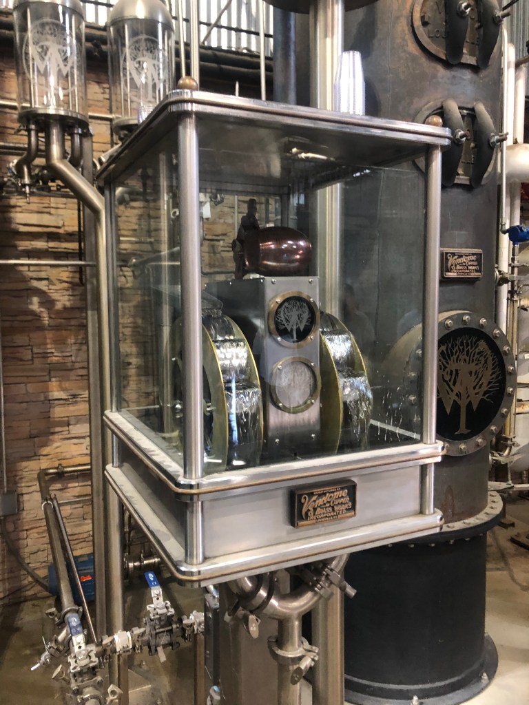
Scott and I went to two distilleries today: Four Roses in Lawrenceburg, and Wilderness Trail in Danville. They represent a rather old and a very new distillery, respectively. Here are a few photos from Wilderness Trail.
A place to store the grains.Fermenting the mash.Distilling the wort. Doesn’t this look like Frankenstein’s laboratory?
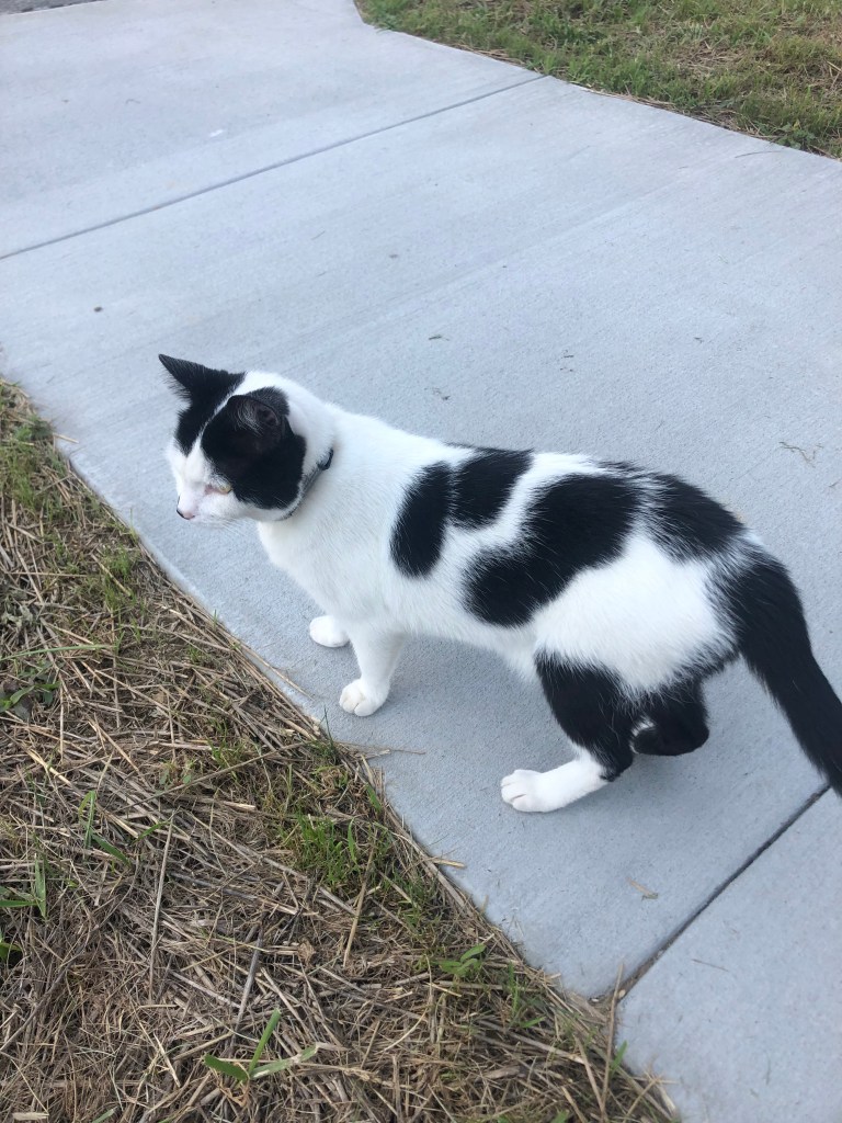
Distillate (the results of the distillation process) flowing like a spring.Cooper, the distillery’s cat, leading our tour group.
After visiting the distilleries, we got dinner in downtown Louisville, where we plan to do some exploring tomorrow, before returning to the Trail of Tears on Sunday. Which leads us to the…
BREW OF THE DAY
We went to the improbably-named Mussel and Burger Bar on 7th Street. Feeling a need to stick with the day’s vibe, I ordered a Goodwood Bourbon Barrel Stout. Goodwood Brewing Company is based right here in Louisville.
As the name suggests, this is an imperial stout that’s been aged in bourbon barrels. The barrels impart a rich and smoky flavor that nicely complements a stout. It probably deepens the color as well.
I’m trying to imagine how this particular stout tasted before it was barrel aged. I suspect it’s one of the less complex stouts, with a pretty straightforward malty character. They probably chose a simple recipe in order to allow the barrel’s flavors to shine through. This is an imperial stout, meaning that it has a somewhat higher ABV (8%, which is actually on the low side for an imperial), and a somewhat stronger finish. You definitely get some hints of bourbon on the nose and the finish, but they’re not overwhelming. I’m not a guy who likes subtlety, though, and I would have preferred a bolder bourbon taste in this beer. Of course, maybe my taste buds were inured to bourbon after a day at the distilleries….
I’d give this beer a 3.5 out of 5 stars, but if I had an option, I would have chosen a competitor brand, Kentucky Bourbon Barrel Stout, where the stout is made with coffee, and then aged in bourbon barrels. This is not a drink for the timid.
Tomorrow (Saturday) we’ll spend the day checking out Louisville, then it’s back to the TOT on Sunday morning.
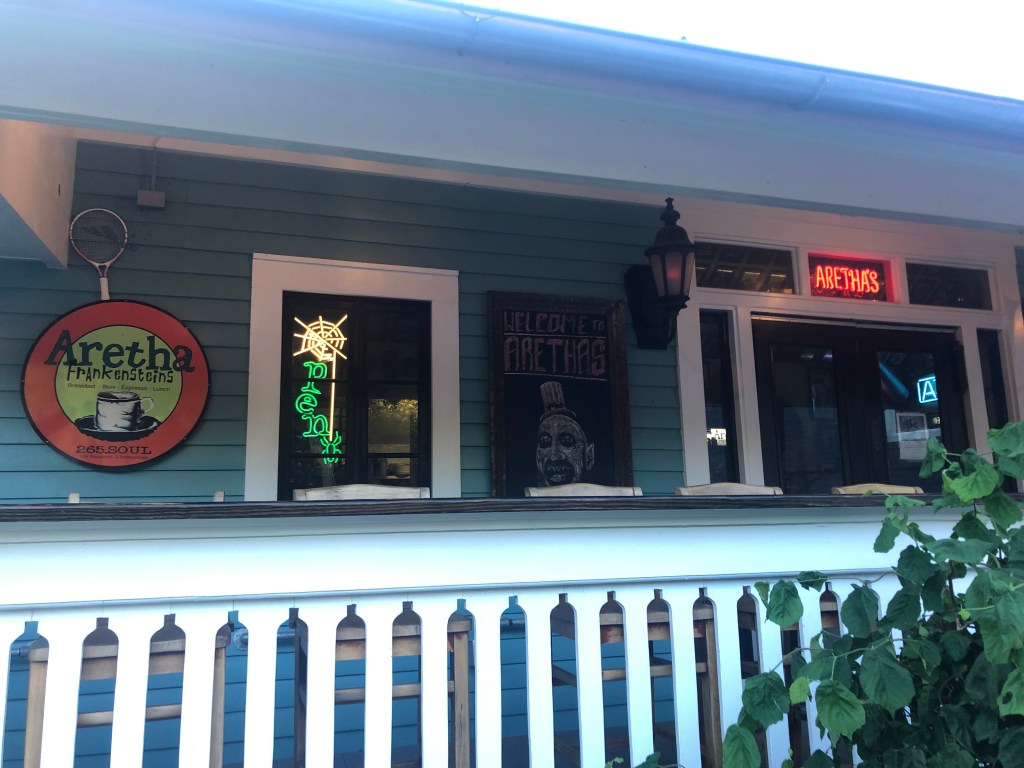
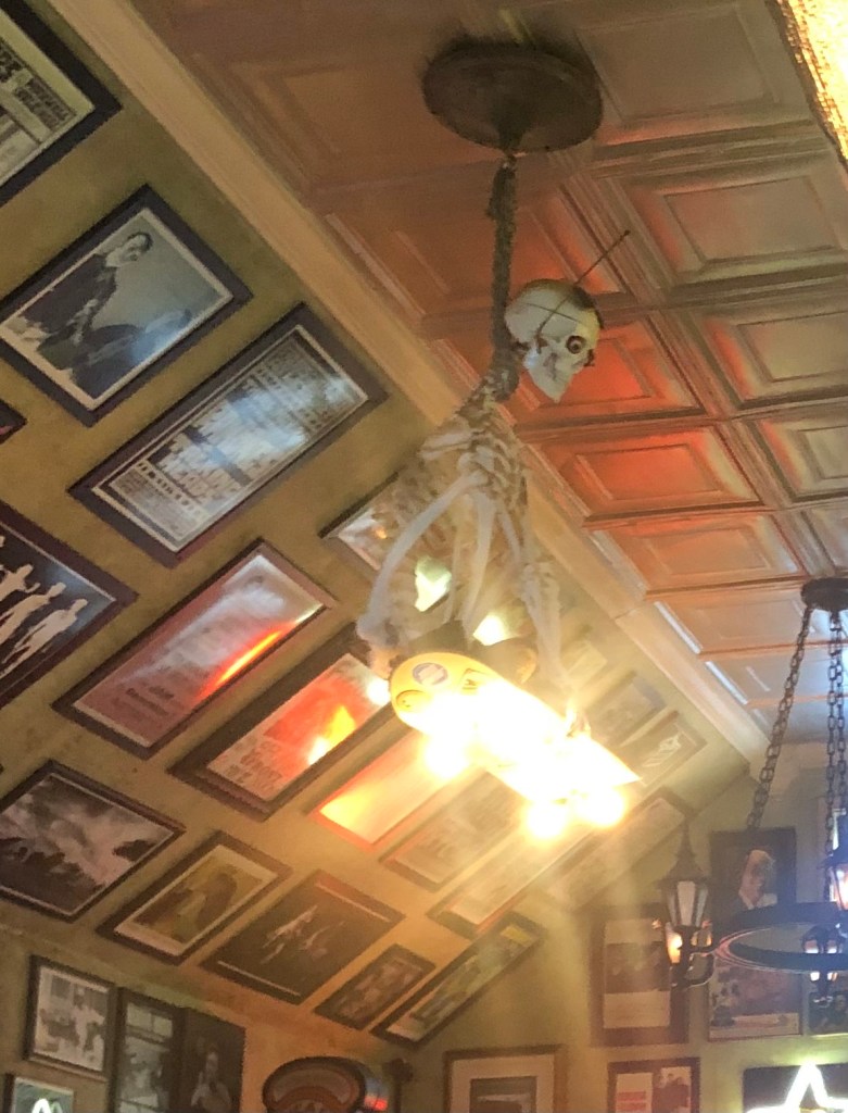
This morning we awoke in Chattanooga, and got a good, greasy breakfast at a place called Aretha Frankensteins. The restaurant is in a tidy house on a residential street, where the cook was smoking a doobie out on the porch.
R.E.S.P.E.C.T. the zoning ordinances…
The interior is a mish-mash of horror movie stills, plastic skeletons, and various Halloween props. The biscuits were, um, to die for.
I say a little prayer…
Suitably fortified, we headed out eastward to Red Clay State Historic park, just over the border from Georgia. This served as the Cherokee’s national seat of government from 1832 to 1837. But wait, you say: Wasn’t New Echota, Georgia (that we visited yesterday) the Cherokee capital? Indeed it was, but in the early 1830s Georgia passed a state law making it illegal for the Cherokees to gather and officially vote on anything. In order for their national Council to convene, therefore, they moved across the state line into Tennessee. See the two points at the right-hand end of the Trail of Tears, below.
The state park at Red Clay includes the reconstructed Council meeting house, as well as other structures. It’s much less impressive than New Echota, and clearly served as a makeshift site for a government-in-exile.
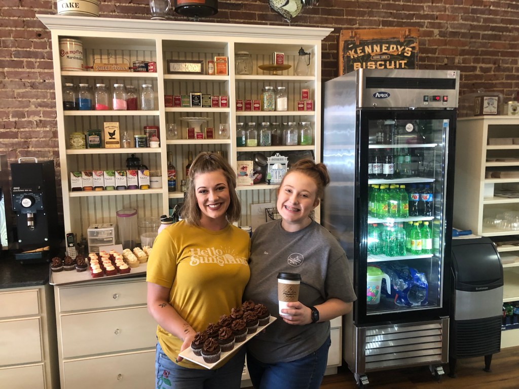
From Red Clay, we roughly followed the northern route that the Cherokees took when they were forced from Georgia to Oklahoma. We passed through a number of small, out-of-the way Tennessee towns, and skirted around the west side of Nashville. Along the way we stopped in McMinnville, TN (pop: 14,000) for lunch. We tried the Vanilla Bean Bakery, which hooked us up with baked goods an coffee. (I never said it was going to be a healthy lunch.)
The girls at The Vanilla Bean put together our to-go order…
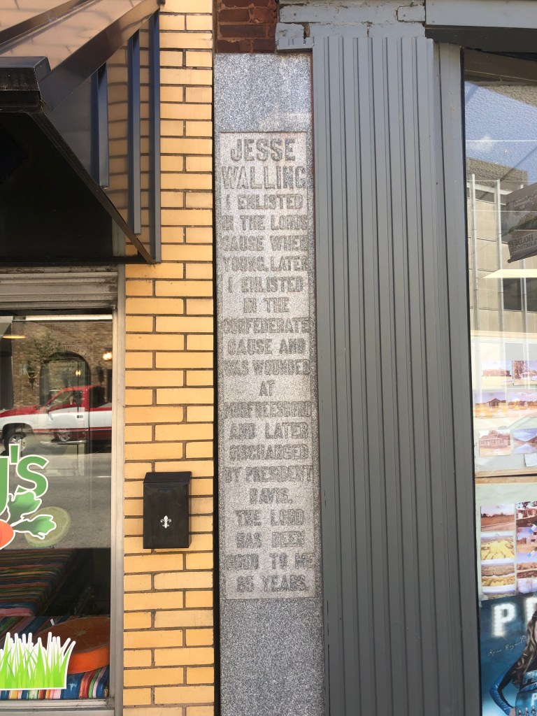
On the way out of The Vanilla Bean we passed a narrow, granite monument of sorts that was squeezed between two buildings. The monument reads: “JESSE WALLING. I enlisted in the Lord’s cause when young. Later I enlisted in the Confederate cause and was wounded at Murfreesboro and later discharged by President Davis. The Lord has been good to me 85 years.”
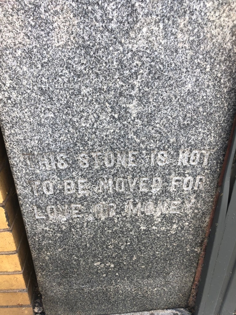
And just beneath the monument is an engraved notation: “This stone is not to be moved for love or money.” So evidently, Jesse’s wishes have been honored.
It turns out that Jesse Walling had been mayor of McMinnville, and he’d founded a bank, a power company, and a cotton mill. He died in 1930 at the age of 89. The Lord had been good to him, indeed.
He collected properties like a Monopoly player.
A little later along our route, in Goodlettsville, Tennessee, we encountered this Transformer-like yard art.
“I will never stop fighting for our freedom.” –Optimus Prime
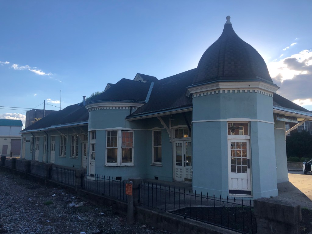
Eventually we entered Kentucky at roughly the same point that the Cherokees did 183 years ago. We headed up the “Dixie Beeline Highway,” and eventually found ourselves in the quaint town of Hopkinsville (pop: 32,000). It’s home to an unusual 1892 depot of the Louisville and Nashville Railroad.
The architect may have been suffering from “turrets” syndrome.
Hopkinsville was one of the few towns in the region permitting alcohol sales. It’s said that Hopkinsville was often referred to as “Hoptown,” because it was only station between Evanston, IL and Nashville, TN where a passenger could “hop off” and get a drink. I’m not making this up.
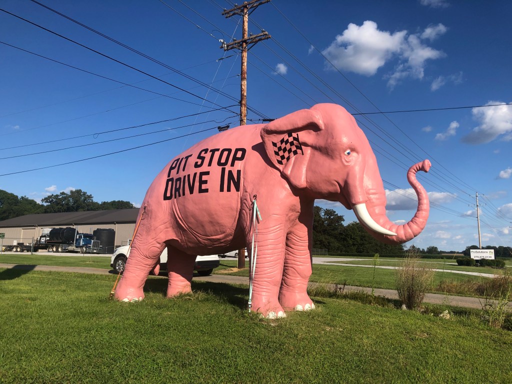
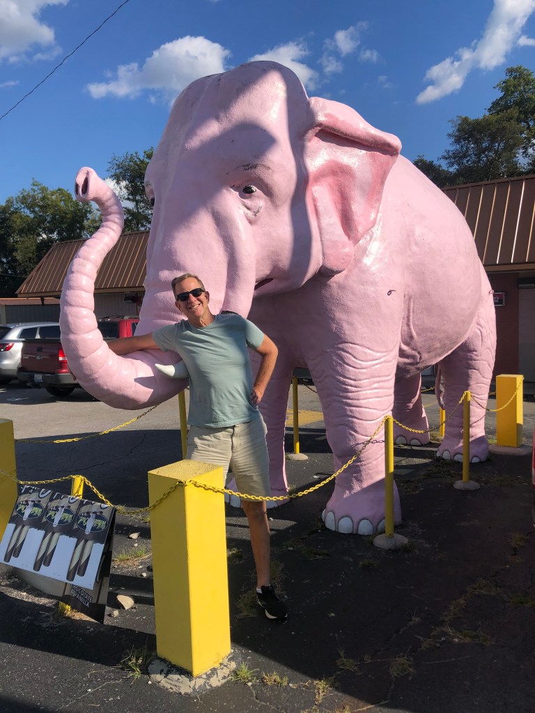
Speaking of drinks, on today’s drive we encountered a few pink elephants. Though located in different cities, they appear to have been manufactured out of fiberglass from the same mold. Alert readers will recall that I’ve run into a couple of similar (though slightly different) pink elephants on my Route 70 trip (see near the end of this post and this post.)
Outside a liquor store (of course) in Hopkinsville, KYOutside a gas station in Guthrie, KY
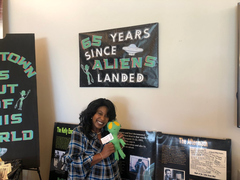
Finally, just three minutes before its 5 pm closing time, we arrived at the Hopkinsville-Christian County Visitors Center. It was on this land that Cherokees on the Trail of Tears camped, were reprovisioned, and (for a couple of them at least) died. We were greeted by Amy, who was the only person so far who’s showed any enthusiasm for our trek. In fact, Amy seems to show enthusiasm for everything, including a story about aliens landing in the area in 1955. It seems that the Lankford-Sutton family, which lived in a farmhouse a few miles up the road, watched a spaceship land on an adjoining field on the night of August 21, 1955. Little silver beings emerged from the ship and converged on the farmhouse. Some of the menfolk in the house fired shots at the beings (as one does), but the shots had no effect on them. The police were called out, but they could find no evidence of an alien invasion. The story was largely forgotten until 2005, when some townsfolk figured a 50th anniversary celebration would be a good way to draw tourists. There’s been an annual “Little Green Men” festival ever since. (Never mind that the men were originally claimed to have been silver, not green.)
Amy hawks an Alien doll, that she’s named Cletus.“”Flying saucer” at the scene where the alien invasion “happened” some 66 years ago. (Yes, Scott and I felt compelled to drive out to the field and check it out.)
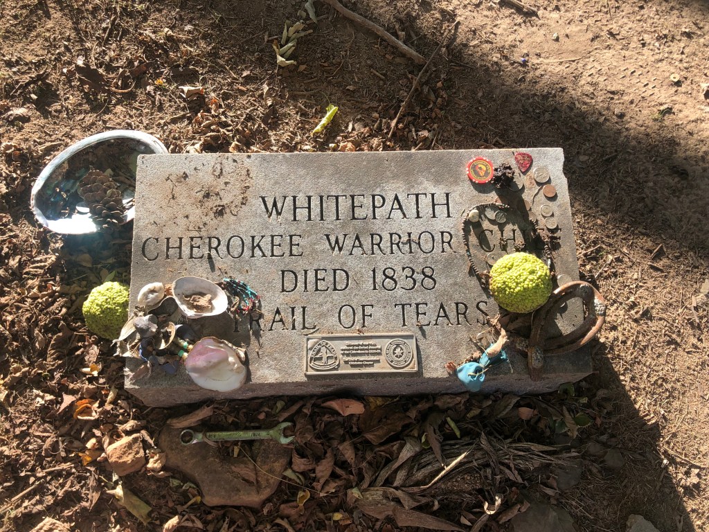
We spent some time chatting with Amy about her job (the Lord answered her prayers and led her to it two months ago), her home (on her parents’ 150-acre farm), the Trail of Tears (there’s going to be a big commemorative meeting of Indians at the Visitors Center this weekend), and various other topics. Sensitive that we were keeping her at her job well past closing time, we let her lock up while we moved outside to the area where the Cherokees had camped. Next to a creek were the graves of two Cherokee chiefs who had succumbed during the forced march. These are among the very few verified graves along the Trail of Tears.
After a quick trip to a nearby field to view the “flying saucer” that commemorates the invasion (see above), it was time for us to take a long detour off the Trail of Tears, and head to Louisville for a day or two on Kentucky’s Bourbon Trail. But before we could start that detour, we got clipped by a maroon Dodge Caravan, which shot across four lanes to make a turn while we waited patiently at a stoplight. We tried to catch up with this hit-and-run driver, but lost him/her. Let us know if you see this vehicle!
You bastard.The damage.
Eventually we did make it to Louisville. It was now quite late, so there was no time for a BOTD. In fact, we barely had time to get a drive-though sandwich from Subway just as they were closing. Notably, Michelle (the cheerful southern belle who was working the take-out window) insisted she could guess our occupations based strictly on our voices when we ordered through the microphone. “One of you is in insurance, and the other is in the ministry.” She didn’t indicate who was the minister. But either way, she’s zero for zero.
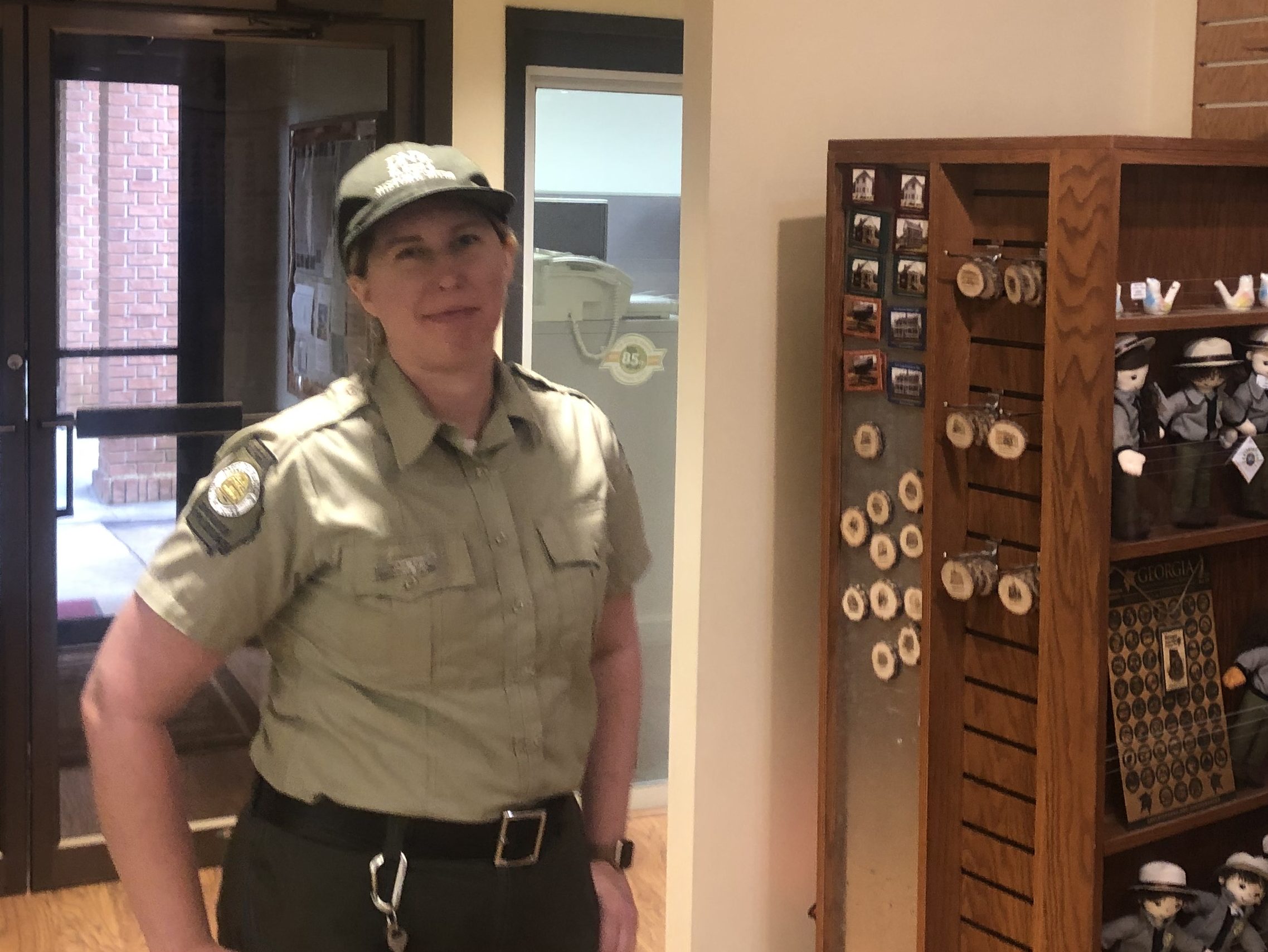
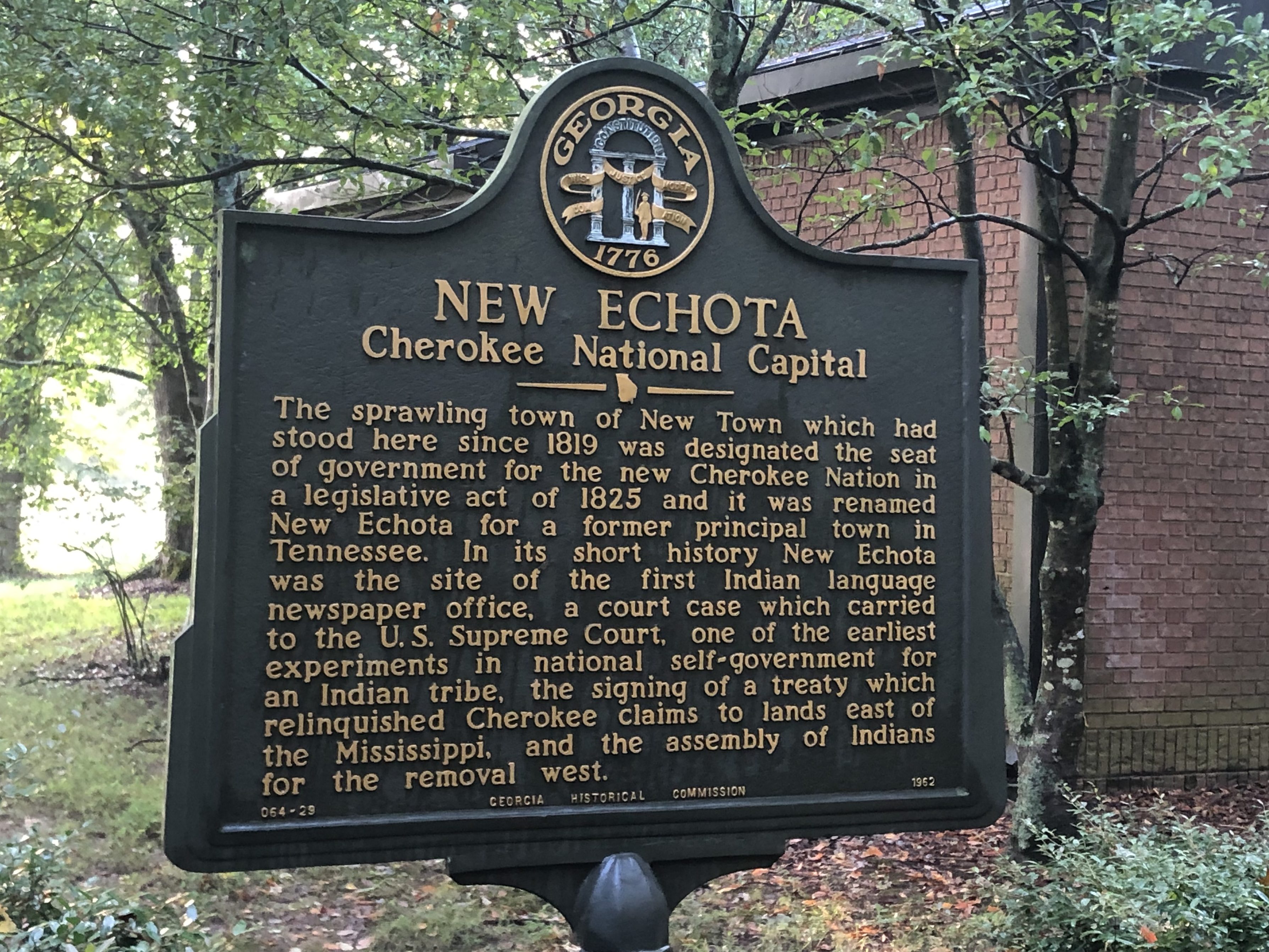
This morning Scott and I began our Trail of Tears Tour (T3) with a visit to New Echota, Georgia. This was the short-lived capital of the Cherokee nation before everyone was rounded and up and driven out to the new “Indian Territory” in Oklahoma in 1838. New Echota is now a Georgia State Park, and the exceedingly helpful Ranger Jackie gave us a valluable orientation about the Cherokees and the Trail of Tears.
Ranger Jackie, enlightening us.
The Cherokees, we learned, had a remarkably progressive and European-influenced culture, especially when compared with other Native American groups (let alone the stereotypes of western movies). They adopted a written constitution that reflected many of the features of the US Constitution. They build their economy on farming and trade, and they constructed hewn-wood cabins and clapboard buildings. They developed a written alphabet, and produced their own Cherokee newspaper. Their government operated as a democratic republic, with separate executive, legislative, and judicial branches. Some intermarried with whites, and generally maintained good relations with the white authorities.
At the same time, the Cherokees were not above criticism by today’s standards. For example, they kept African Americans as slaves, and generally harbored what today would be considered racist views about blacks.
Yet Scott and I felt only sorrow for the Cherokees as we learned more about their treatment on the Trail of Tears. Here was a people who, by all accounts, tried to assimilate into a young United States — despite the fact that they were here hundreds of years earlier. They sought mutually beneficial trade relations with the American settlers, and when conflicts arose, they turned to the American courts, rather than violence, to gain their due. Despite this, as Georgia’s appetite for land increased (and as it became clear that Cherokee land included some rich gold deposits), it was decided that the Cherokees had to go and the land handed over to white settlers.
Some 16,000 Cherokees forced to make the westward trek along the Trail of Tears. Only a portion of them passed through New Echota, but the town is important for its role as the political center of the Cherokee nation. After the Cherokees had been relocated, New Echota was left to fall into disrepair. But in the early- to mid-twentieth century, various groups worked to restore and rebuild the structures. Today, about a dozen of these buildings bear mute testimony to the Cherokee way of life in 19th-century Georgia.
It strikes me that the story of the Trail of Tears carries two separate tragedies. One is the the brutal treatment of these human beings, pushed, often at the point of a bayonet, along an 800-mile trek without adequate food or clothing. As many as 4000 Cherokees died during that forced march. But the second tragedy is the very fact that they were pushed out of their homes and off their ancestral lands. That is, even if the “relocation” (as it was sometimes euphemistically called) was conducted much more civilly, with comfortable transportation and good provisions, the entire enterprise would still be tainted as unjustified and cruel.
With these sobering thoughts, we set out along one of the routes (the northern one) taken by the hapless Cherokees. This part of the country is exceedingly green and alive with the sounds of cicadas, and we could imagine the ragtag groups struggling along the way.
Scott doing his Edward G Robinson impersonation
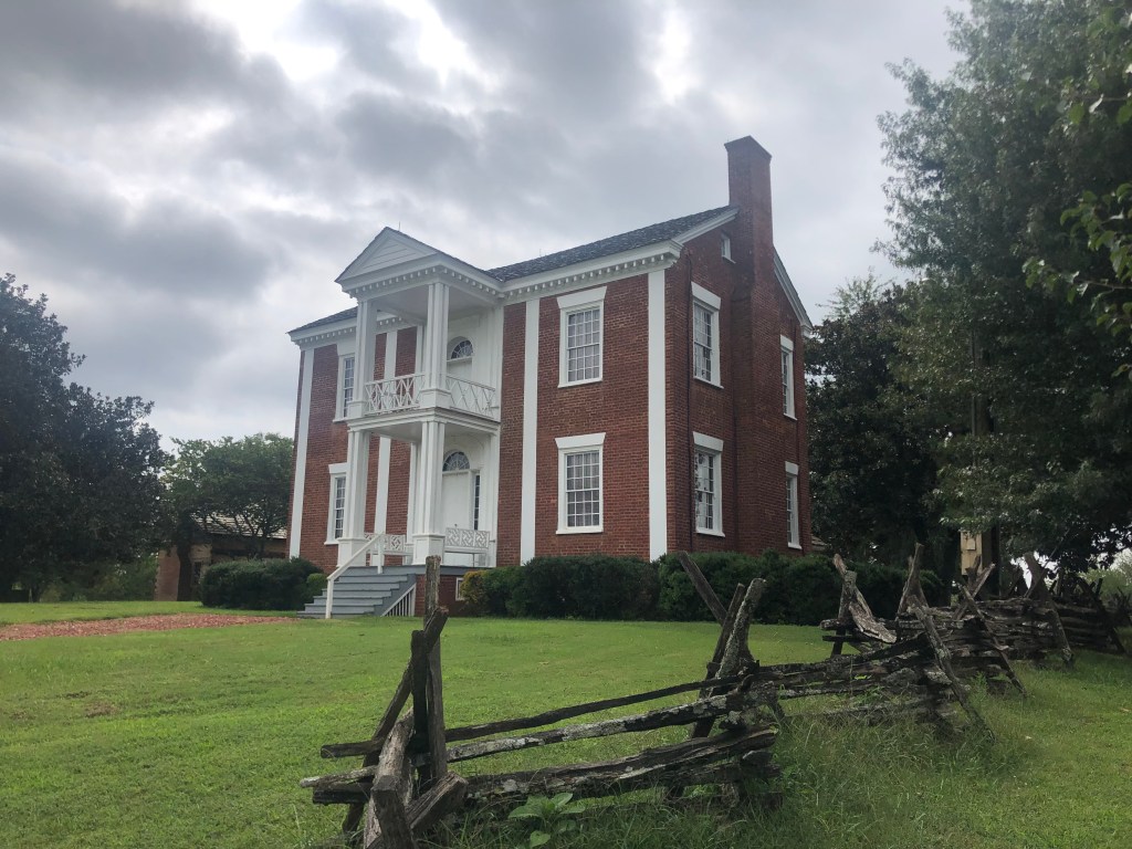
Along the drive today we passed two homes that had belonged to important Cherokee Chiefs. The first is the home of Chief James Vann, a wealthy Cherokee leader and businessman. Vann’s family lost the home when they were forced with the others to the Oklahoma in 1838. It now belongs to the Georgia State Parks System.
Far cry from a tipi.
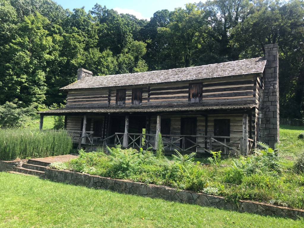
We also came upon the home of Chief John Ross. Ross, who was only one-eighth Cherokee, nevertheless served as the nation’s principal chief for almost 40 years–longer than any other Cherokee chief. He presided over the nation all through the events leading up to the Trail of Tears, the actual relocation, and the aftermath. His is a complicated but fascinating story.
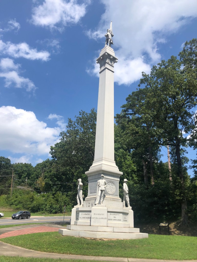
There were plenty of other notable sites along today’s drive, many of which related to the Civil War (which took place a quarter century after the Trail of Tears). For example, there was this monument in Chatanooga, which commemorates Ohio soldiers who fought at the Battle of Missionary Ridge. I’m no Civil War historian, but I find it somewhat surprising that a Union state (Ohio) was able to erect a monument to its soldiers in a Confederate state (Tennesee). The monument also includes an 80-foot obelisk, to add to our collection.
Not to rub it in, but we won.
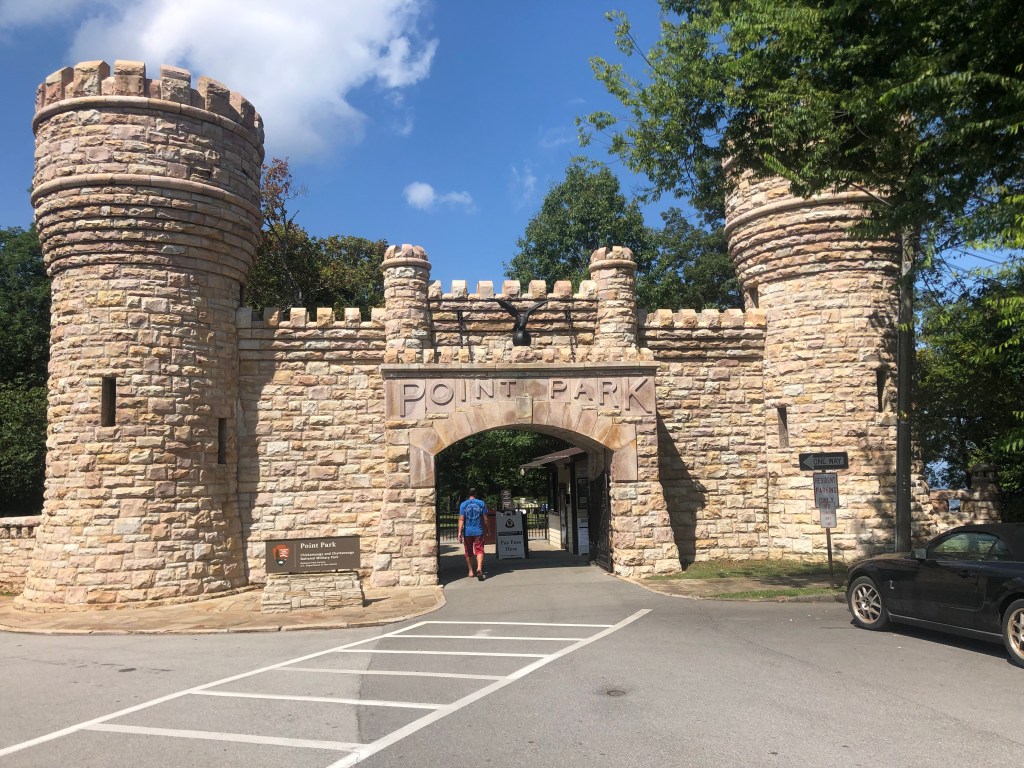
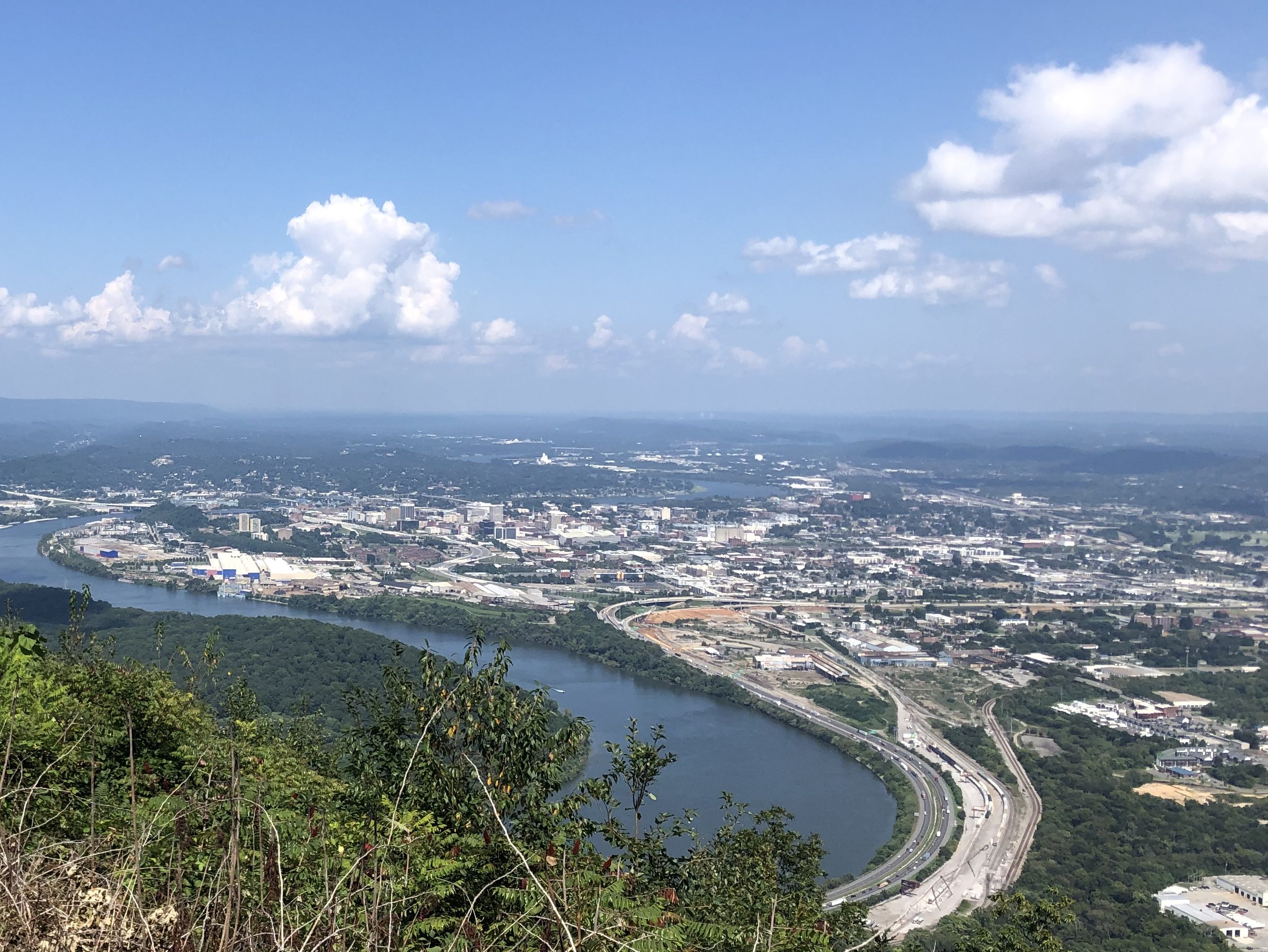
Not far from Ohio’s monument is Point Park, on Lookout Mountain. Scott remembered visiting the mountain as a school child a half-century ago, when he was living near Atlanta. Point Park is a national park that commemorates a Civil War battle. More importantly for us, it has a great view of the Tennessee River snaking through Chattanooga.
Yes, the entrance to Point Park feels a bit like Disneyland……but what a view!
It turns out that Lookout Mountain has a number of other attractions, including a cable car that claims to be the “world’s steepest railway.” It was constructed in the late 1800s, and still runs today, taking passengers up and down the side of Lookout Mountain.
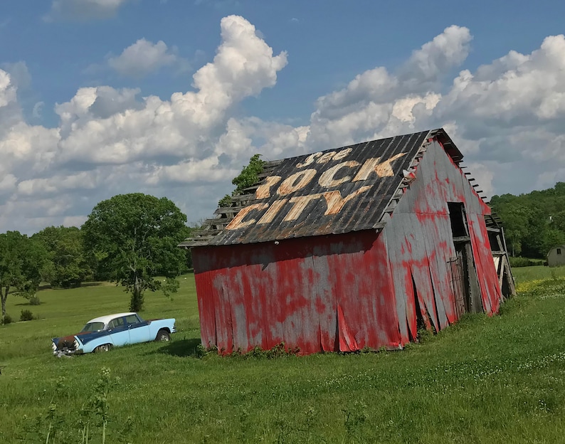
But more enticing, to me a least, is Rock City. Doubtless you’ve seen, or at least heard of, the multitudinous advertisements painted on barn roofs along Route 66 and other highways, urging travelers to “See Rock City.” Here is an example, stolen from the Internet:
I’ve seen plenty of the barn-emblazoned advertisements, but I’ve never seen Rock City. In fact, I can’t say that I ever had much desire to see Rock City. But let’s back up a bit. About 100 years ago, a fellow named Garnet Carter (you may know him as the inventor of miniature golf, but that’s another story) decided to turn an unusual outcropping of rocks on Lookout Mountain into a tourist attraction. He purchased a large parcel (about 700 acres) of land, with this “rock city” in the middle of it. He developed a network of trails, and added statutes of gnomes for good measure (as one does). He then paid to have advertisements for Rock City painted on barns across the midwest and south. It’s said that over 900 barns across 19 states were eventually painted with the advertisements. The advertisements, especially linked with the picturesque old barns, became iconic. Rock City has been open to the public since 1932.
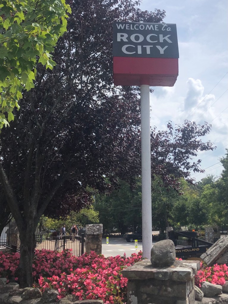
Well, it turns out that Rock City is just a few miles from Lookout Point, so Scott and I went to see what all the fuss is about. I can’t say that it’s an impressive phenomenon. But I can say that, finally, I’ve followed the injunction to See Rock City.
Didn’t Starship have a song about this in 1985?
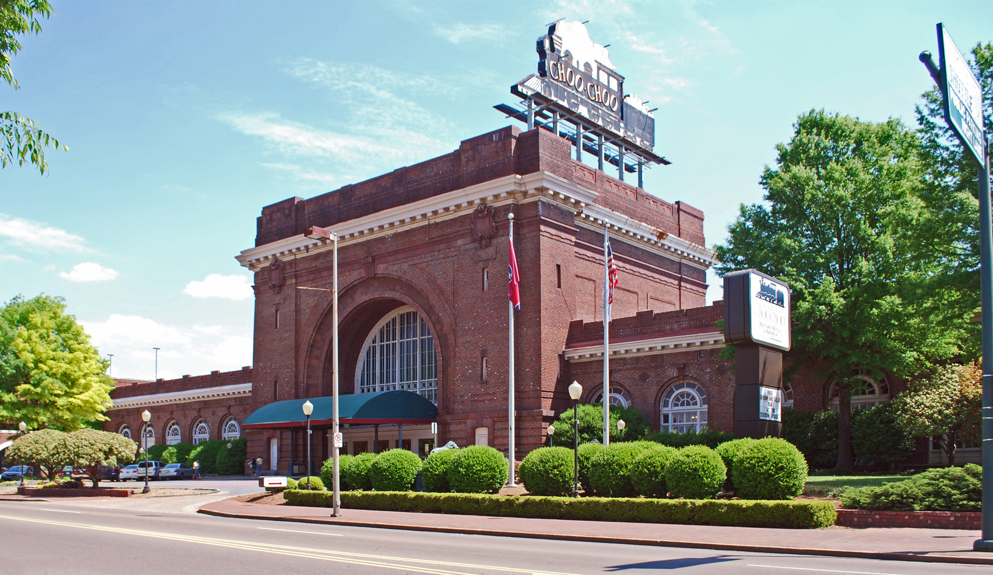
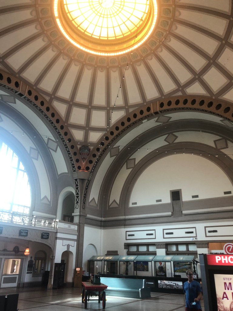
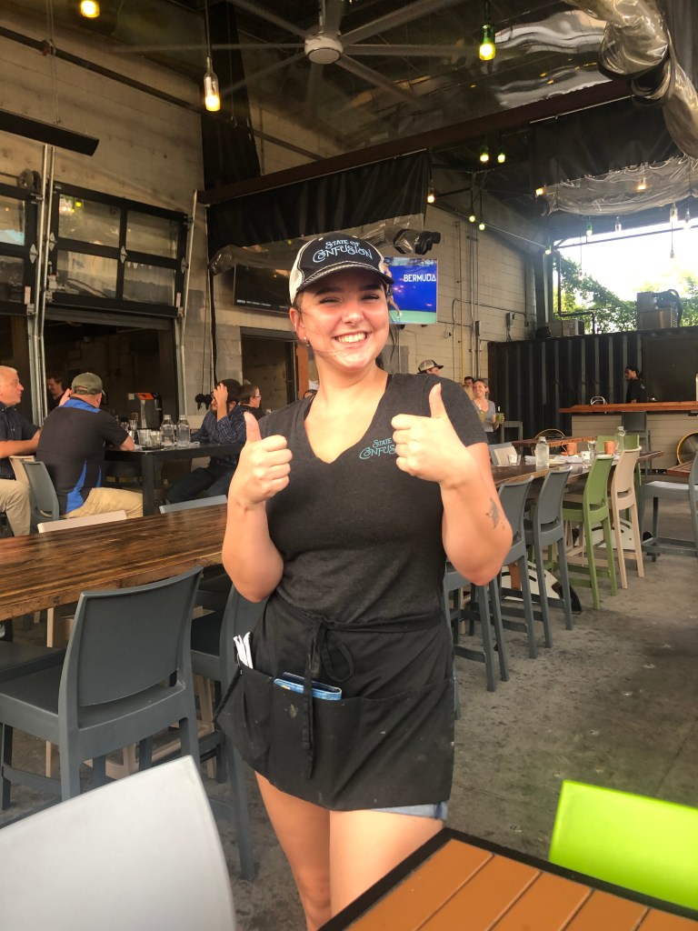
As we drove down from Lookout Mountain, we realized we’d worked up an appetite. So we repaired to a restaurant called State of Confusion. The restaurant is next to Chattanooga’s historic Terminal Station, which had been constructed in 1909, and was restored to its former grandeur in the 1970s.
Not bad for 110 years old.Interior of Terminal Station’s lobby.Our server, Jolie, in a State of Confusion.
So, having driven about 75 miles of the Trail of Tears, seeing Rock City, and fortifying ourselves with greasy food, all that was left was to get a Brew of the Day….
BREW OF THE DAY
Today’s BOTD came from American Draft, which is a beer bar situated in a historic railroad car parked at Terminal Station. It’s a cool setting. Evidently, it was conceived as another one of the beer automats like the one we went to the previous evening. Check out their webpage. But tonight there was no serve-yourself option, and we instead were served by a charming and helpful young woman. After a half-dozen “could I just have a taste?” pours, I finally settled on the O’Fallon Salted Caramel Pumpkin Ale.
Now, I know what you’re thinking: Isn’t that a little bit girly for a manly guy like yourself? And you’d be right. But I guess I was feeling in touch with my feminine side. Plus, as we walked around Terminal Station, Scott and I had already stopped at not one but two distilleries, and had sampled a few bourbons and gins. So I needed to throttle back the alcohol intake a bit. The pumpkin concoction is only 5.4 percent ABV.
I have to admit, though, it’s a well-balanced beer. It’s not just a cynical attempt to go after the Starbucks Pumpkin Spice Latte crowd. This is quality stuff, with caramel malts, pink Himalayan sea salt, a “proprietary blend” of spices, and a little lactose to suggest a pumpkin puree mouthfeel. There’s none of that cloying aftertaste you get from artificially-flavored beers. With the calendar moving towards fall, I suggest you try a pint….if you’re man enough to do so.