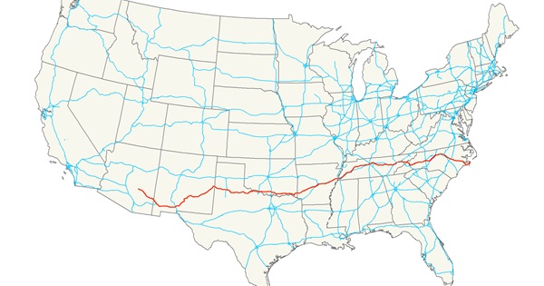
On this dawn of a new year, I’ve set out on my latest cross-country road trip. This one travels the entire length of US Route 70, sometimes known as the Broadway of America. Like US 50 and US 60 (which I drove in 2018 and 2019, respectively), US 70 is a transcontinental road that connects many small, forgotten towns. Along most of the way, the route is a lightly-traveled two-lane road, but when it enters a town it often becomes the main boulevard . Hence, the “Broadway of America” sobriquet.
2,381 miles of southern fun!
US 70 was conceived as a southern counterpart to the north’s Lincoln Highway. (The Lincoln Highway, established in 1913, ran from Lincoln Park in San Francisco to Times Square in New York.) US 70 was originally known as the Lee Highway, presumably as a political response to the northern route’s being named after the Confederacy’s nemesis. Both the Lincoln Highway and the Lee Highway were among the first transcontinental automobile routes in the United States.
US 70 no longer extends all the way to the west coast. It now begins in Globe, Arizona (population: 7,532). So, this afternoon I drove the 481 miles from Los Angeles to Globe, pretty much without stopping, since this first leg of my trip doesn’t really “count” as part of the intended journey.
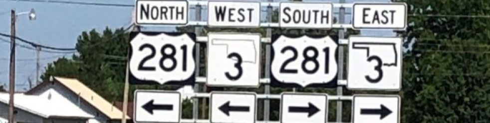
I write this from a cheap motel in Globe. I’m reminded that I came through this town last spring, while driving the length of US 60. It is here that US 70 branches off southward from US 60, giving the good residents of Globe (as well as the not-so-good ones, of course) a second option for driving to the east coast. I’m looking forward to seeing how this southern route differs in scenery and culture from its mid-country sister route.
Starting tomorrow, I’ll spend a week driving the length of US 70 through Arizona, New Mexico, Texas, Oklahoma, Arkansas, Tennessee, and North Carolina, ending up in the town of Atlantic, NC. I’ll then drop off the rental car and fly home. For tomorrow, though, I should end up somewhere in New Mexico. (As is known by those of you who’ve followed my earlier blogs, I have no definite mileage planned for each day; the only fixed deadline is my flight home on January 9.)
I’ll be posting about my travels daily. Until then, I wish you all a Happy New Year.
Last weekend, Karen and I were driving to Sacramento “International” Airport. We had spent the previous evening at a raucous Oktoberfest party In El Dorado Hills, and then in the morning visited friends in Sutter Creek. We had originally planned to spend a couple of days in Amador County tasting wine and checking out the fall colors. But PG&E decided to shut off all power in the region as a fire prevention measure, so the wineries were all closed, and even our hotel was without electricity. So we decided I’d drop off Karen at the airport a day early, and I’d go to Davis to check in on the in-laws.
As we approached Sacramento, a large plume of smoke became visible just north of the city., And almost immediately after we noticed this, traffic on I-5 began grinding to a halt. We quickly made for the exit, avoiding the gridlock that no doubt was caused by a fire-related closure, and took a circuitous route around the closed portion of the freeway. (Truth be told, I think we weren’t supposed to re-enter the freeway where we did. We were virtually the only vehicle on that part of the freeway, except for a couple of fire engines whose crews were battling an oleander blaze in the median. Perhaps PG&E wasn’t entirely wrong to think today might be prone to wildfires.)
After depositing Karen at the airport, I took a little-traveled two-lane road that parallels I-5 along the Sacramento River, figuring that I shouldn’t press my luck with the freeway. It was an enjoyable drive with views of the river and fields and orchards. Suddenly, out of the corner of my eye, I spied the blurred image of what appeared to be a tall obelisk on the side of the road. I had never noticed it before — but then, I’d hardly ever taken this road before. Driven by curiosity, I turned the car around and returned to the site. It was indeed an obelisk, like a miniature version of the Washington Monument. It looked to be ancient, like it belonged in a Gold Rush-era cemetery. But here it was alongside a quite road, in the middle of nowhere.
Now, let us go back in time 163 years, to 1856. In February of that year, the paddle-wheel steamer Belle was making its way north from Sacramento with about 40 passengers and crew on board. It was a foggy morning, as is still typical for Sacramento in the winter. The Belle left Sacramento Landing around 7 am, slowly making its way along the fog-shrouded river. And then, at 7:45 am, the was a terrific explosion as the boat’s boiler burst, destroying the stern-wheeler and killing many of the people on board.
One of the people presumably killed in the explosion was a young man from Philadelphia named Leonidas Taylor. His body was never found, despite his family having offered a $500 reward for the recovery of his mortal remains. And so, in lieu of a grave, a monument was erected in his memory near the spot of the explosion. It was this monument that I stumbled across on my drive from the airport. It’s been standing here as a silent and largely forgotten reminder of the tragedy, and of that young man’s life, for well over a century and a half.
For those of you (foolishly) reading this blog on your cellphone rather than on a proper computer screen, here’s the text inscribed in the weathered, white marble obelisk:
ERECTED
To the memory of
Leonidas Taylor
born in the city of
Philadelphia on the
3d day of July 1832
He grew to manhood in the
city of St. Louis and was
killed by the explosion of the
Steamer Belle opposite this
spot on the 5th , of Feb.
1856;
His body was never found.
Far distant from those who
loved him, the waters of the
Sacramento will rollover
him till that day when the
sea shall give up its dead.
A few observations:
First, it’s notable how much effort went into this monument for one young man, who wasn’t even a resident of these parts. Did we have a greater regard for human lives then? Or is it because there were so few people in Sacramento at the time, and thus a smaller, less numbing number of deaths? Who was it that decided to erect this memorial? (It went up about 8 months after the explosion.)
Second, you have to admire the poetry that comprises the final paragraph of the inscription. It adds to the mystery and romance of the Sacramento River — a riparian feature that the people of Sacramento tend to ignore as they go about their daily lives. How many other secrets does the river hold?
Finally, it’s remarkable that this marker has lasted as long as it has. Sure, it’s a little worse for wear, but if I hold up that well at 163 years, I’ll be very pleased. There are some evident signs of vandalism, but at least it hasn’t been destroyed, or removed in the name of “progress.” I’m sure being located along a little-traveled road helps.
Rest in Peace, Leonidas Taylor. We hardly knew ye.
Happy Halloween
And now, the final post of the Mr. SpookyBones anthology. I hope you enjoyed his antics. He may be back next year…one never knows.