
Livin’ La Vida Ulna
Discovering the ghosts of California and beyond, one road trip at a time.

A long time ago in a ZIP code far, far away, I discovered the deeper meaning of October. That meaning eludes most of us who are native to the west, particularly those whose range is limited to California. Not only is the meaning of October obscured by our perpetual sunshine, but the month never manages to get across the Sierras from the east. In California, September overflows the banks of its calendar page, bleeding into the following weeks until, one day, it’s suddenly Christmas. Sure, we are obligated to pretend that it’s October, writing a “10” on the date of our checks, but that signifier is just an arbitrary demarkation between two identical territories, much like the sign that announces you’ve just left Downey and entered Bell Gardens. If not for the sign, you’d have no idea you were in a different city.
My epiphany came shortly after I graduated from college, when I moved to northern Virginia to serve an internship in Washington, DC. It was there that the scales fell from my eyes and I beheld the magic that is October.
October occupies the liminal space not just between summer and fall, but between cheerfulness and melancholy. It’s the fulcrum between life and the onset of gradual death. (Thus wrote the man who recently retired and is staring 60 in the face…) You feel it back east in a way you don’t in the west. It’s the turning of the leaves, of course, but it’s also a hundred other things, both tangible and intangible: the gradual disappearance of birds and other wildlife; the insuperable encroachment of darkness upon the ever-shortening days; the felt need to remain cloistered in one’s house to avoid the bitter cold and the angry elements, hiding behind storm windows and bracing for the ruthless storms off the Atlantic. For all appearances, the trees, ponds, and the ground itself become still, cold, bare, and dead.
October’s dread role as September’s exterminator is accentuated, of course, by the build-up to Halloween. People who were perfectly friendly and well-adjusted earlier in the year now decorate their homes with skeletons, vampires, and ghouls. Our collective consciousness turns to the macabre. Sure, Halloween is celebrated in the western states as well as the eastern ones. But somehow the season takes on a deeper, more organic meaning amid cities dating back to the era of witch trials and grave robbing. The old churchyards I kept encountering in my travels around Alexandria, with their lichen-blotched headstones and ancient trees, helped to move Halloween from the realm trick-or-treating to a much more atmospheric season when it’s harder to convince ourselves that we’ve successfully expunged the fears of our ancestors.
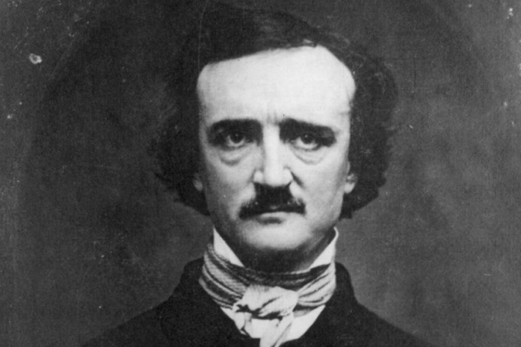
That single October that I spent in Virginia changed forever how I look at October. The Philosopher’s Stone at the center of this alchemy was a book of stories by Edgar Allan Poe that I purchased at an antiquarian bookstore in Alexandria. It was in October, of course, and the owner — a tall, wizened man with a black coat and a bolo tie — urged me to read the book in properly atmospheric places, and let the mood overtake me. Alone in a strange city, with little else to do, I figured I’d take his advice.
Notably, Poe was not exclusively an author of macabre stories, though that’s what he’s now known for. Still, most of his writing has a touch of the lugubrious. And sitting there at a coffee shop near Christ Church (est. 1773) in Old Alexandria, with dead leaves stirring in the wind and the iron-grey sky placing the whole city in a shadow, I found myself “letting the mood overtake me,” as the bookseller had urged. For me, that mood returns every October, even though I’ve now returned to the less melancholy climes of southern California.
Poe died in Baltimore 170 years ago this Monday. And so Poephiles in that city have organized a “Poe-tober” festival this weekend. I will be attending, along with my good friend Chris, who, in addition to being a fellow devotee of Conan Doyle’s Sherlock Holmes, is also well acquainted with Poe’s writings. This weekend I will be reporting on the festival events in this blog.
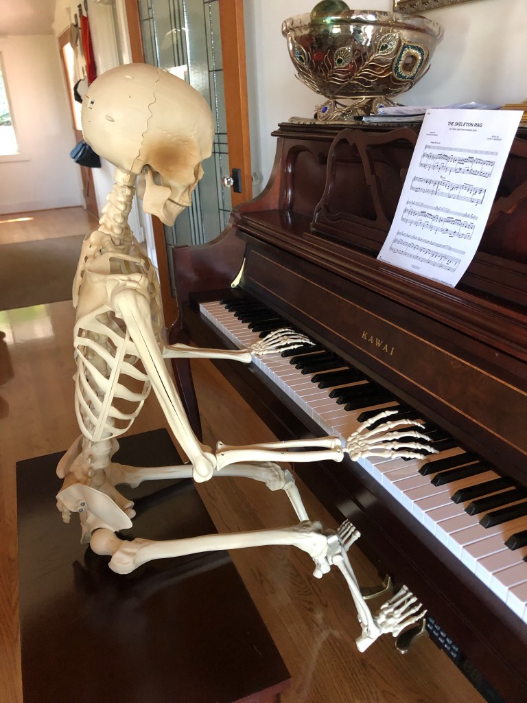
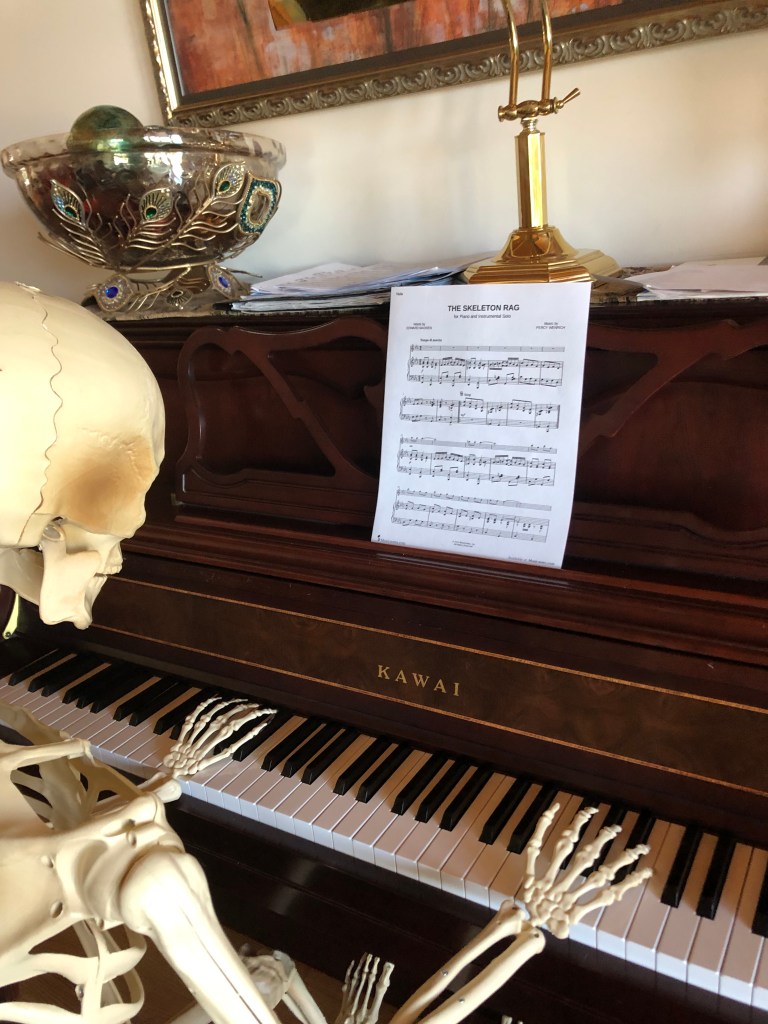
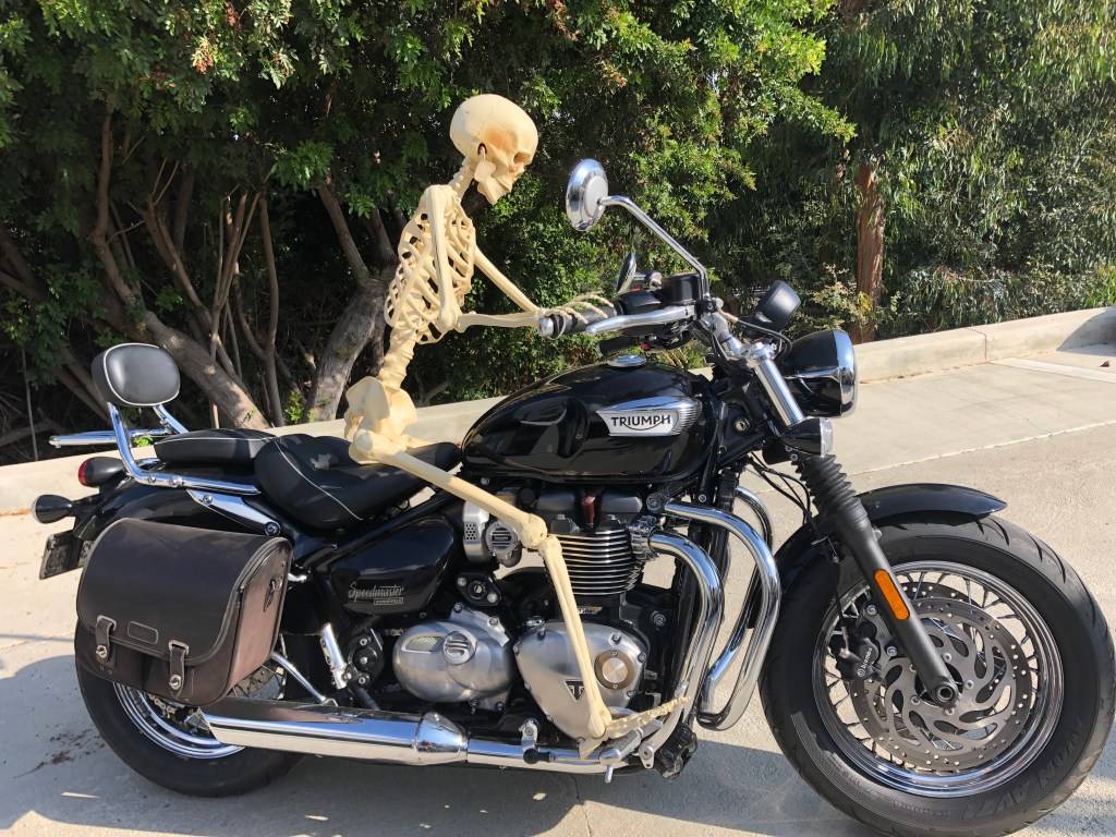
Meanwhile, to more fully commemorate the uncanny nature of this month, I have enlisted the help of Mr. SpookyBones. Starting today, and each day throughout October, this blog will include a photo of Mr. SB enjoying the month as my alter ego.
I hope you enjoy these daily mementos mori.
This morning I awoke in Lone Pine, feeling ready to sew this trip up. After making it to the headwaters of the LA Aqueduct yesterday, my ticket’s been pretty much punched.
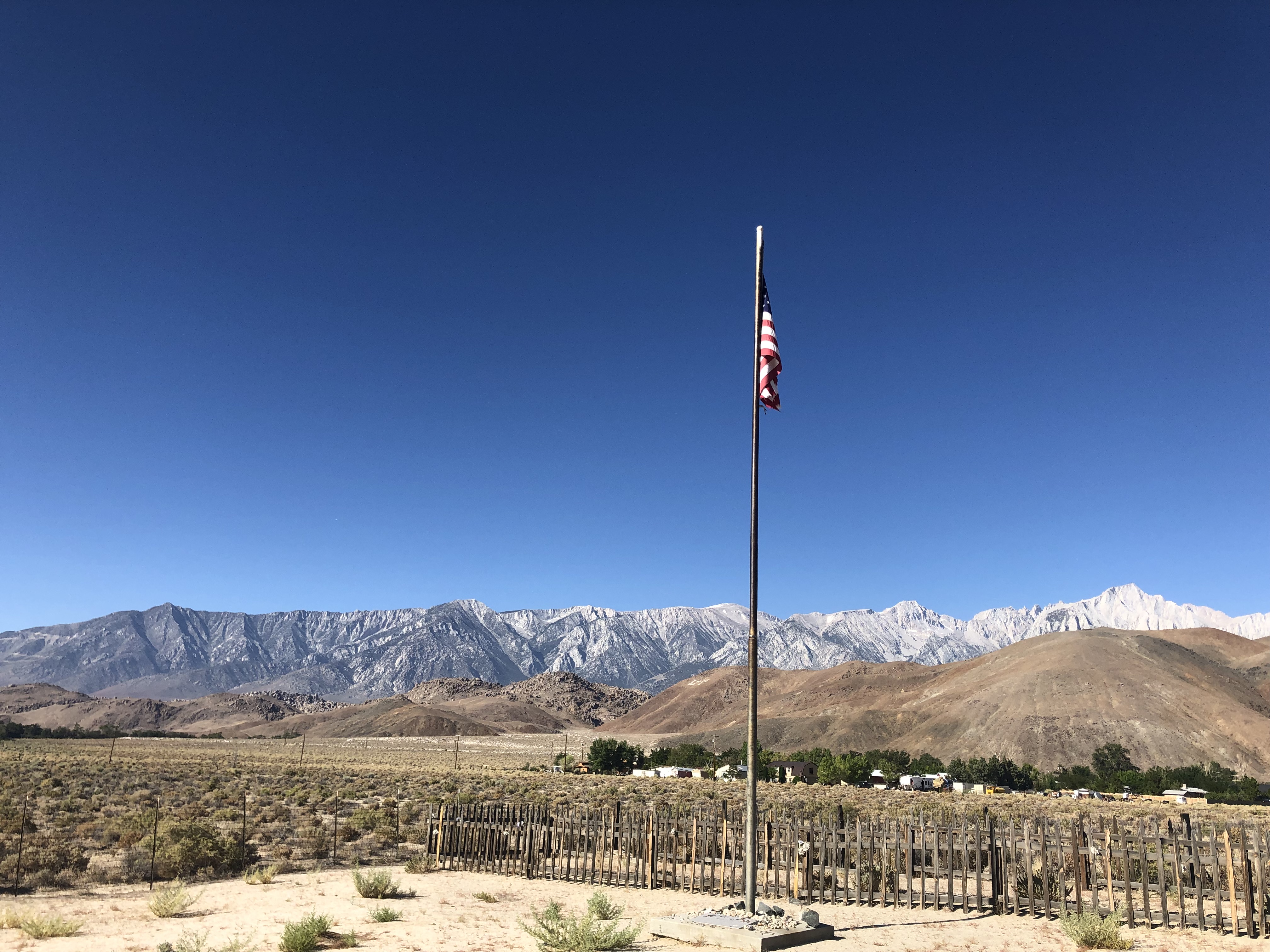
Still, there were a few more things to see today. As you may know, Lone Pine sits directly in the shadow of Mt. Whitney, which is the tallest mountain in the contiguous United States. And my motel was on the edge of town, right next to the mountain range. I spent a few minutes taking it in, when I noticed a tall American flag on a hill near the motel. It turned out to be part of a memorial to Lone Pine residents who had been killed in the big earthquake of 1872. Lone Pine was virtually leveled (52 of its 59 buildings were destroyed), and 27 people were killed. Sixteen of those people were buried in a common grave, which is where I was standing as I read a plaque near the flag.
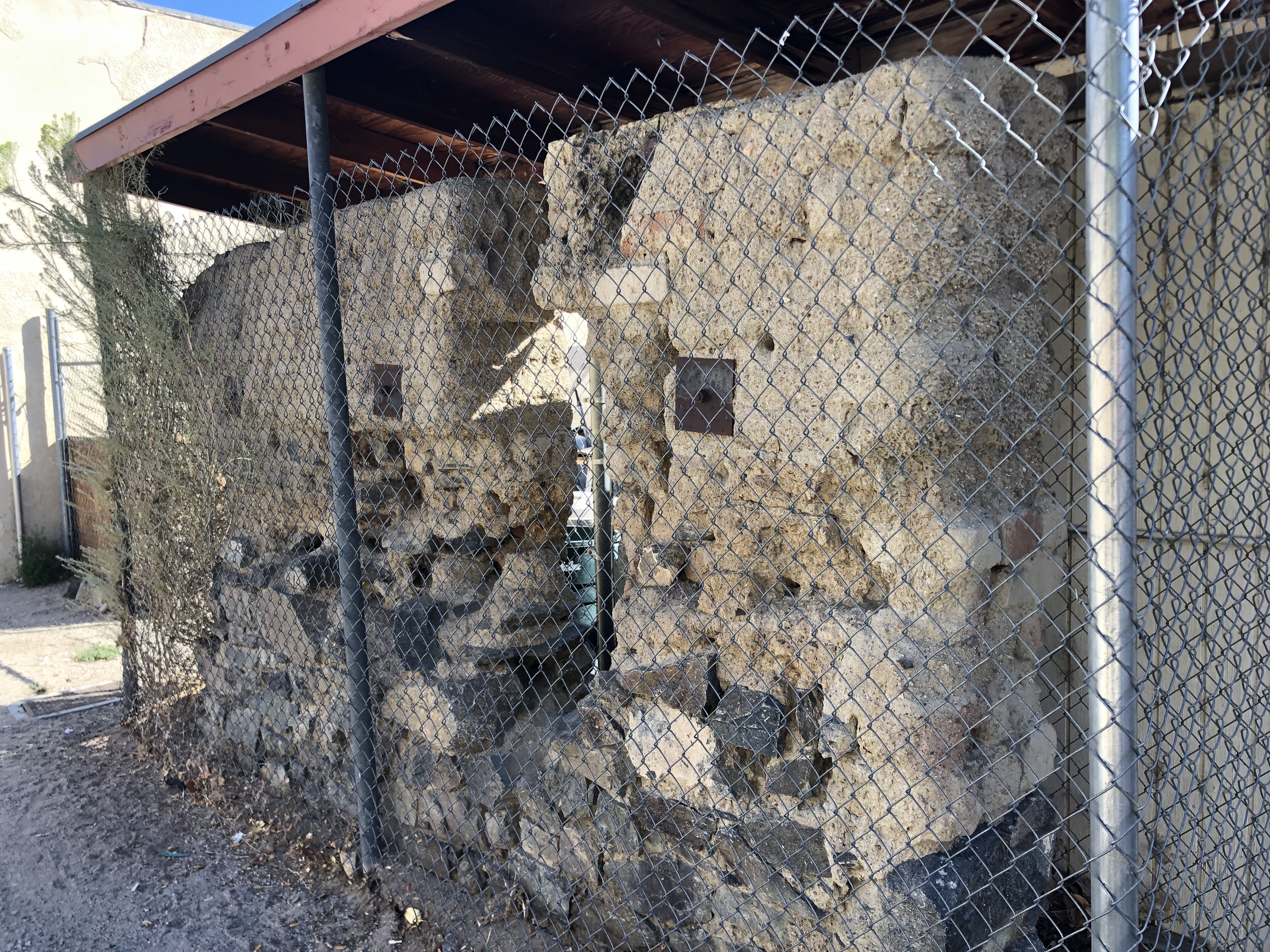
The reason so many buildings were destroyed in the earthquake is that most of them were constructed from unreinforced adobe. This morning I happened by the one adobe wall that remains. It had been part of the general store, built in 1869.
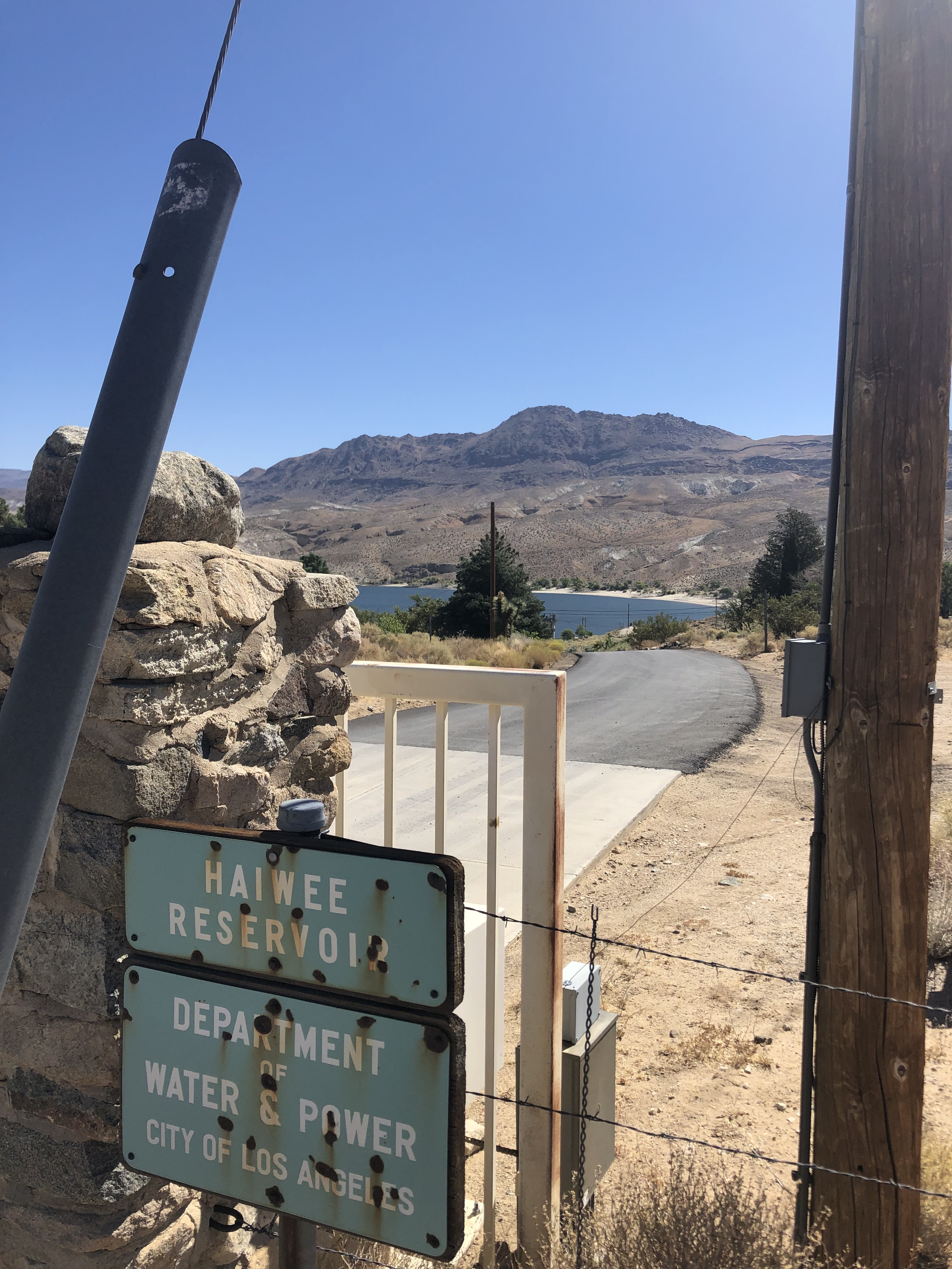
After getting some coffee from the Lone Star cafe, I headed south on US 395. Even though I didn’t really have anything left on my list, I did notice a sign for the Haiwee Reservoir, just off to the east. I remembered reading about it in the Mulholland biography. This was a major part of the Los Angeles Aqueduct infrastructure, with water storage and a DWP power plant. After traveling down a rutted road for a few miles, I encountered the familiar DWP fencing and yellow “no trespassing” signs. I was barely able to catch a glimpse of the reservoir beyond the locked gate.
I did a little research on this reservoir, and it appears that for decades now there’s been a legal war waged between local fishermen and DWP. The fishermen assert that the state constitution guarantees public fishing rights on all public lands. Newspaper articles over the years that I’ve looked at record times when fishing was allowed, and times when it wasn’t. Evidently right now is one of the times that the courts are not on the side of the fishermen.
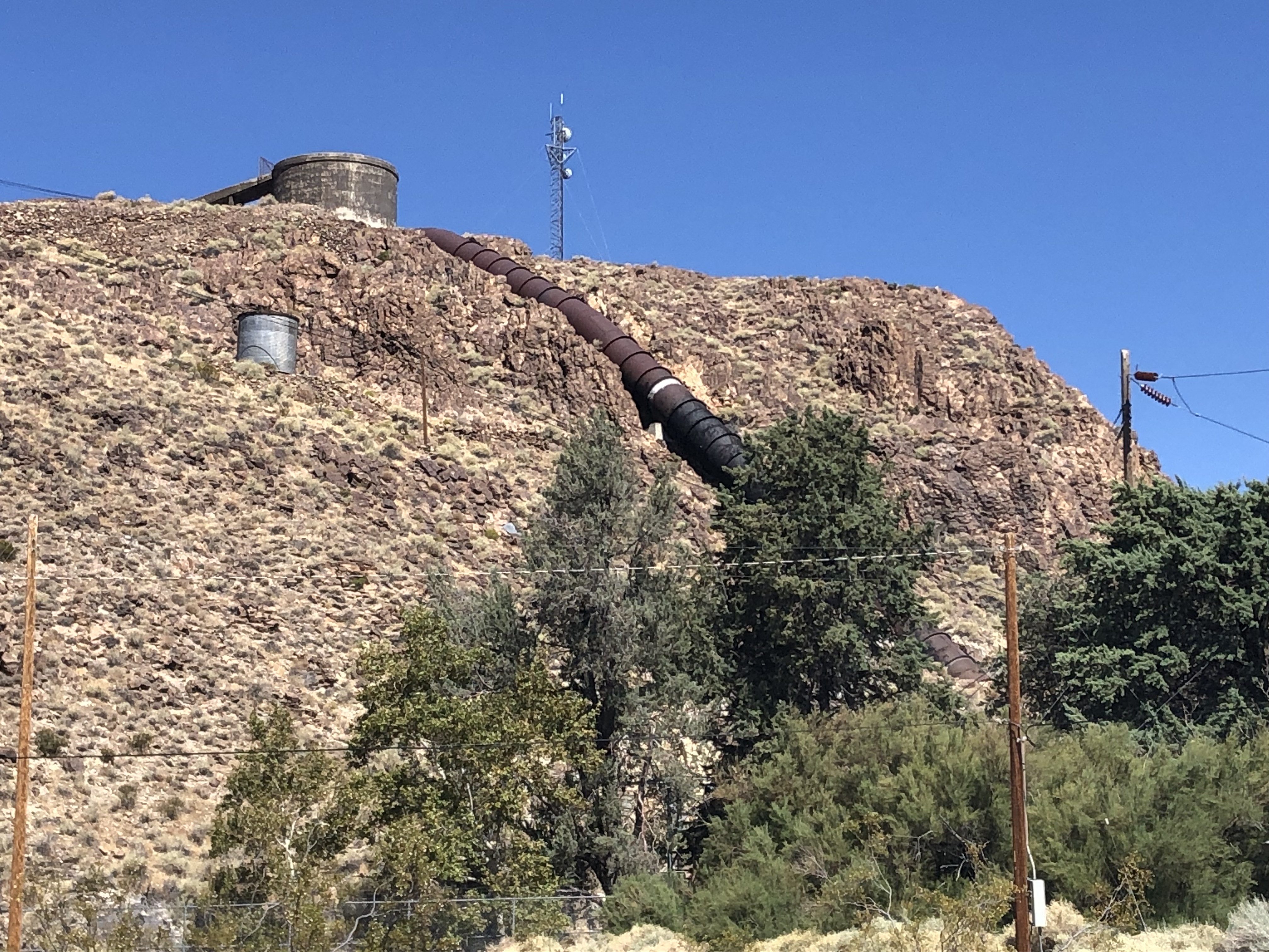
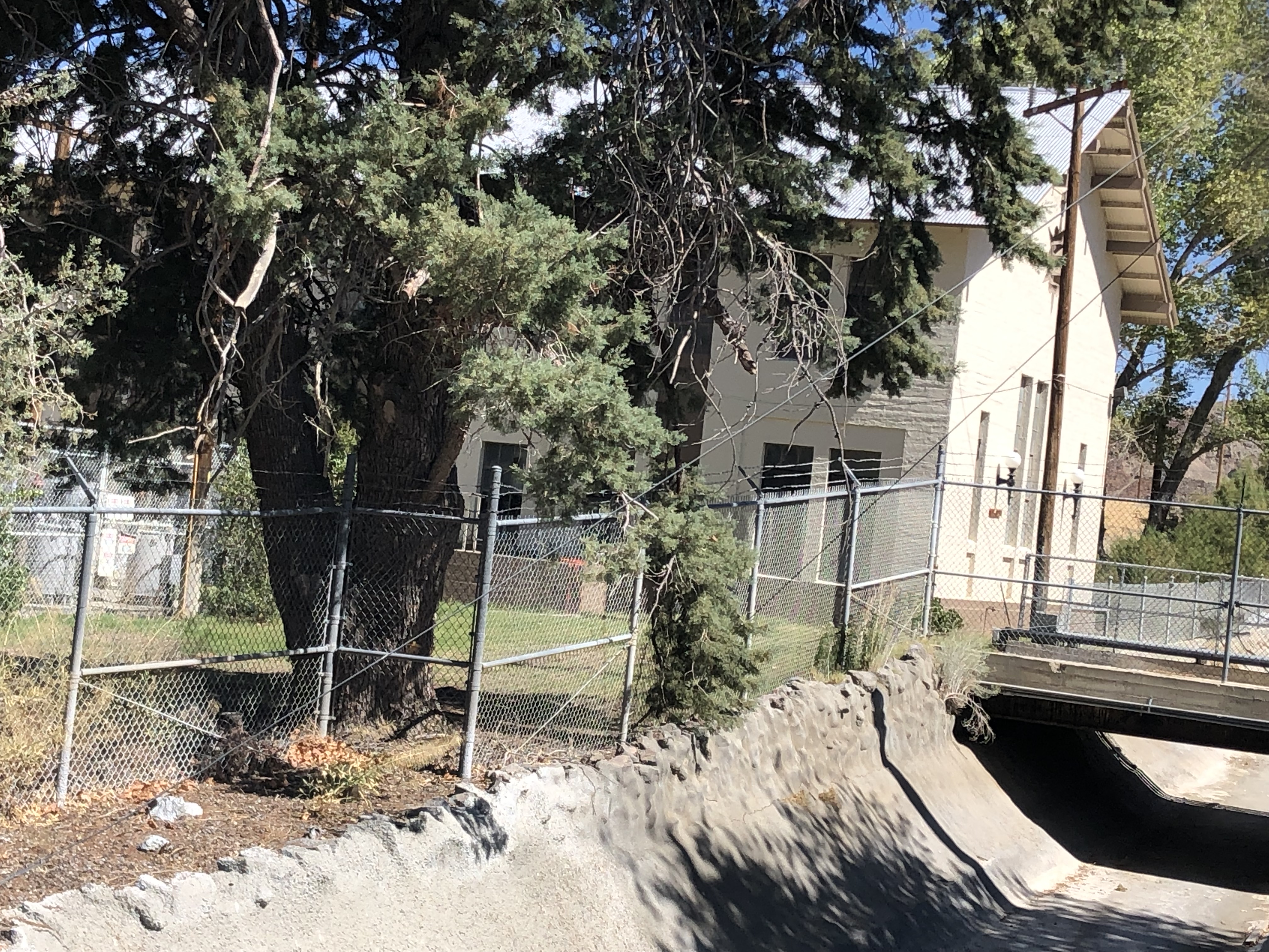
After jumping back on the road, I almost immediately encountered another sign, this one pointing to the Haiwee Power Plant. It’s located at the south end of the reservoir. Again I took the signed turnoff, and again I encountered a locked gate. I did get a few photos of the pipeline feeding the plant, and a glimpse of the building itself, from behind a fence.
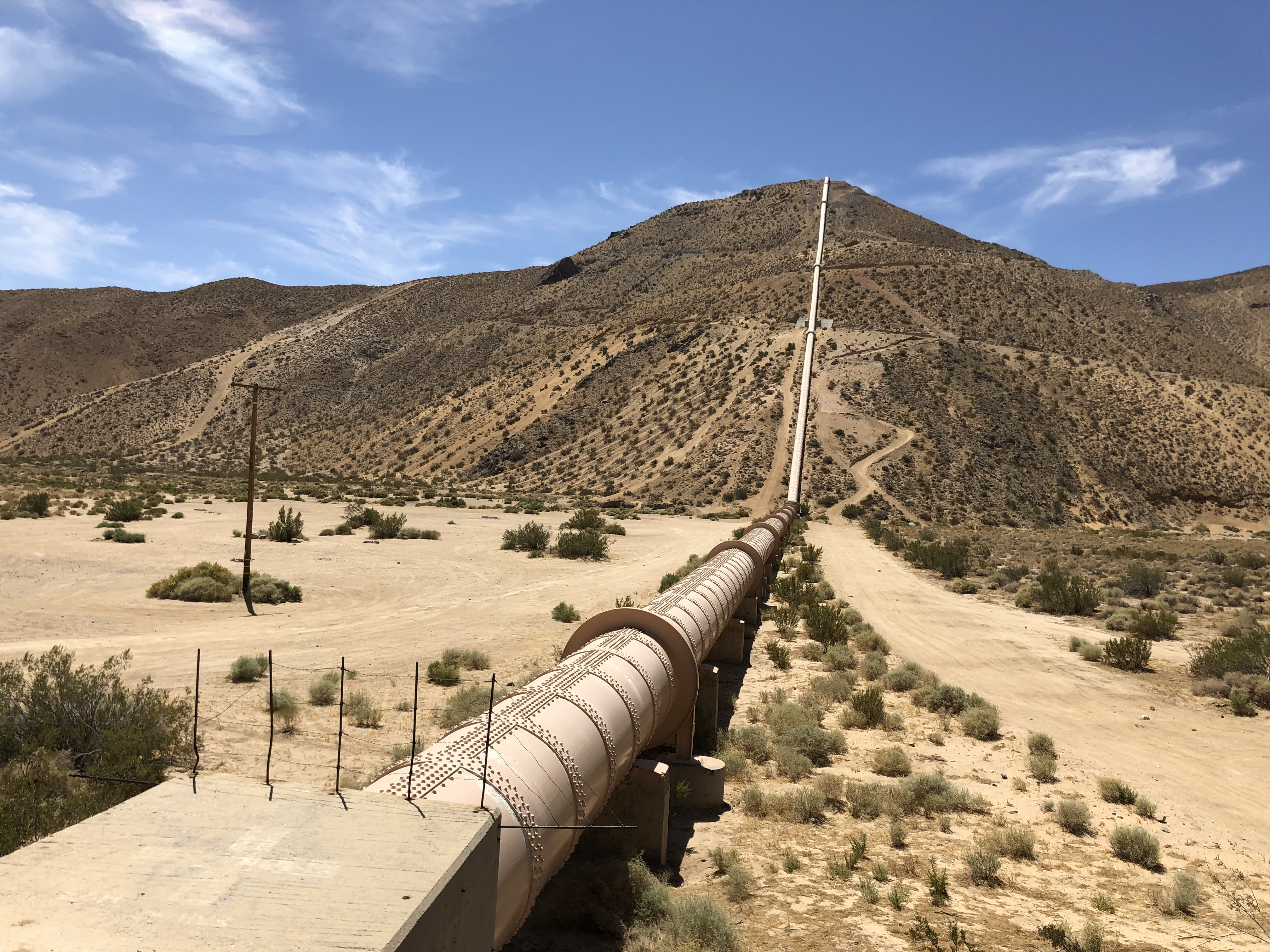
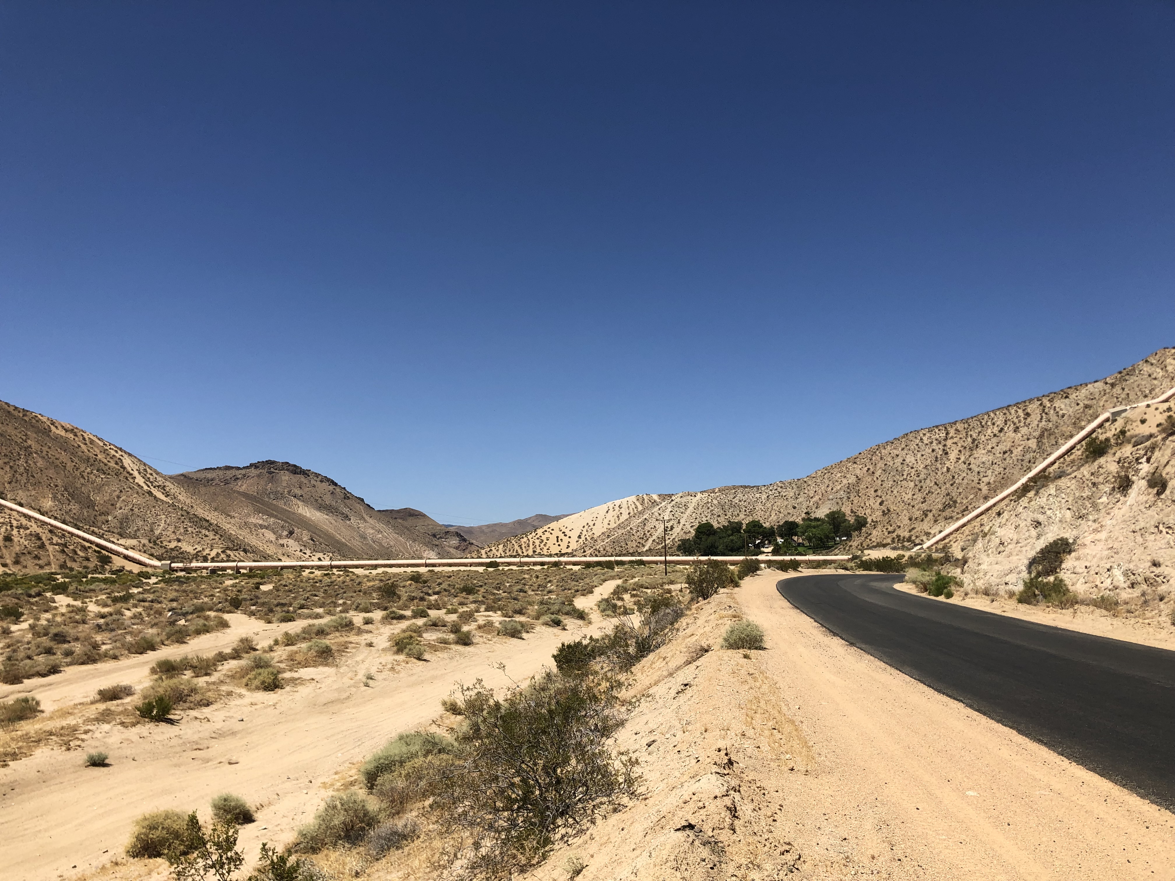
Some miles later, in the Mojave, I saw a sign for Jawbone Canyon. Again, I remembered mention of this in Mulholland’s biography. Traversing the canyon with the aqueduct pipeline was a major engineering undertaking. This is where the “inverted siphons” show their stuff. Water drops down one side of the canyon through a pipe, and then goes up the other side. And this is simply siphon action, based on gravity. No pumps are used. It’s fascinating. I took the turnoff, and found the inverted siphons amid a federal OHV park.
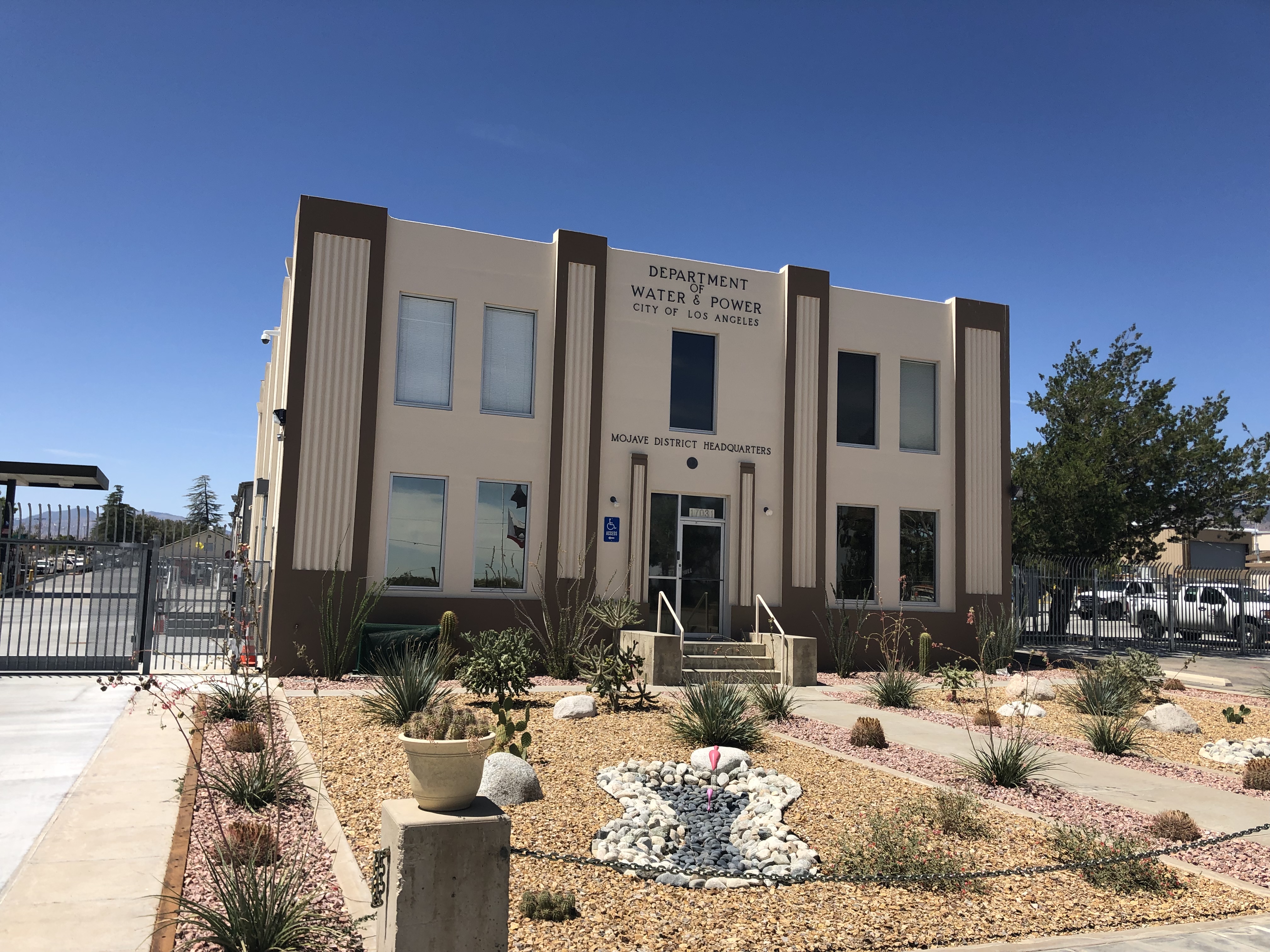
OK, I promise that this next photo is the last one related to the LA Aqueduct. I stumbled across the DWP’s Mojave headquarters while driving home on CA 14. It’s got that classic “DWP” architecture. The front of the building was flanked with antique equipment from the digging of the aqueduct.
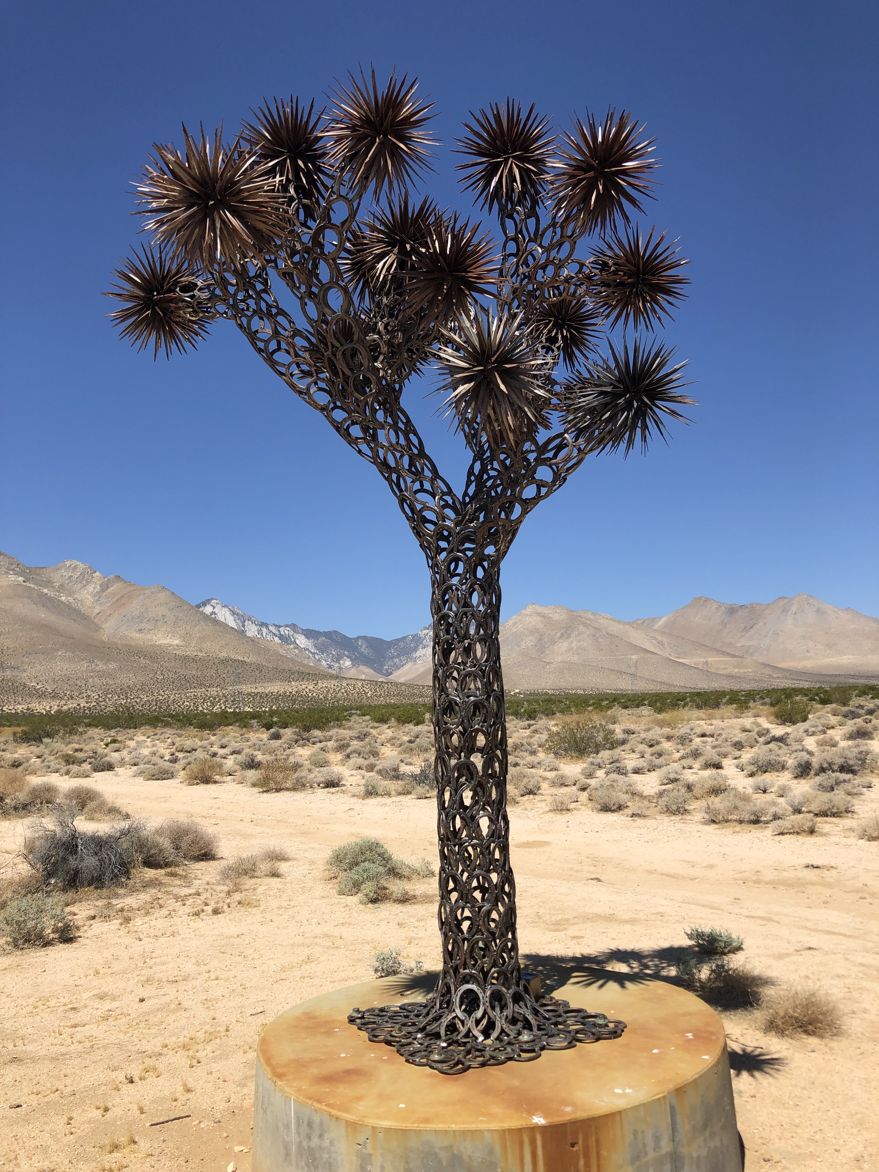
But my favorite sight from today’s travels was this Joshua Tree sculpture immediately off 395, near the town of “Inyokern” (which presumably borders Inyo and Kern counties). Note that the trunk is made from welded horseshoes. What I especially liked about this is that it’s simply sitting out in the desert, alongside the highway. It’s not in someone’s front yard, where it would aggrandize the home’s owner. That would be a vanity statement. Instead, this sculpture is completely anonymous. There isn’t so much as a plaque or sign explaining it. It’s just there to provide a little whimsy for passersby. Would that we all had the motivation to simply and unselfishly take small actions to make the world a little more fun.
Soon, I was back in the Los Angeles basin, fighting 4 lanes of traffic to get home. Nothing much remarkable to report in those final miles. But what a great trip the last week and 1,100 miles have been. Thanks to all those who gave feedback about the blog, and to those who simply read it and followed my meanderings. It was good to have you along.
Stay tuned for the big Edgar Allan Poe trip in October!
sdb
BREW OF THE DAY
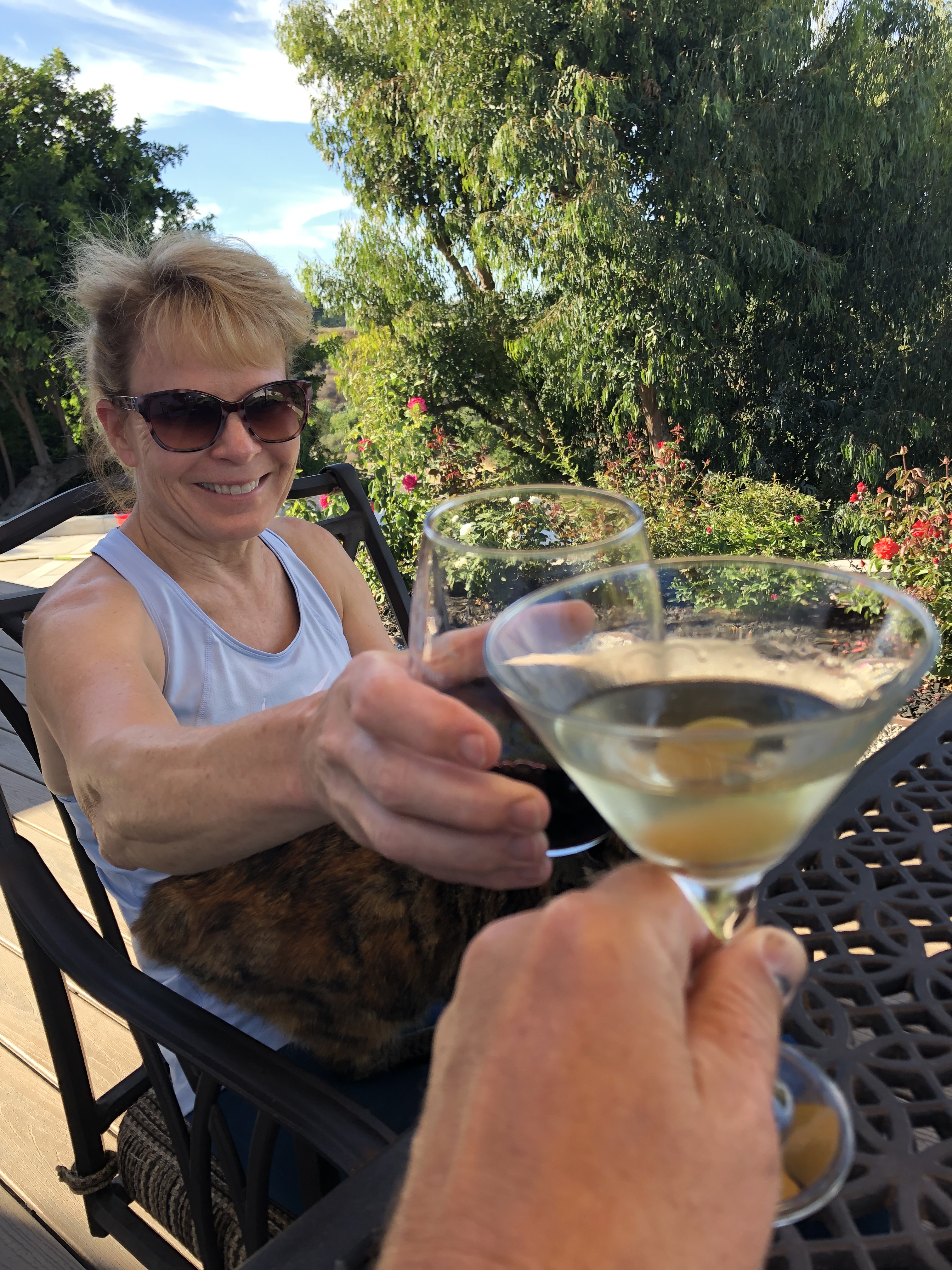
I had cocktails with Karen on the deck. Can’t beat that.
Some of you may recall that I’d recently read a book on William Mulholland that got me interested in the Los Angeles Aqueduct. And that earlier this summer I made the trip a few miles north of downtown LA to visit the terminus of the aqueduct, where the water cascades into the LA river. Here’s a picture of the cascades (that someone else took; I don’t have my own photo handy):

Recall that this is at the end of the water’s 233-mile journey from the Owens Valley, through an aqueduct that was built over 100 years ago, and which exclusively uses gravity to get it from there to here. (That is, there are no pumps to get the water over the mountains. Instead, it employs “inverted siphons.” You may want to read up on this fascinating technology.)
Anyway, after seeing this end of the operation in the flesh, I decided to try to find the place where it starts out. That was one of the goals of this whole road trip that I’m taking this week. And thus I found myself crossing the Sierras on Route 4, with the goal of getting to the Owens Valley.
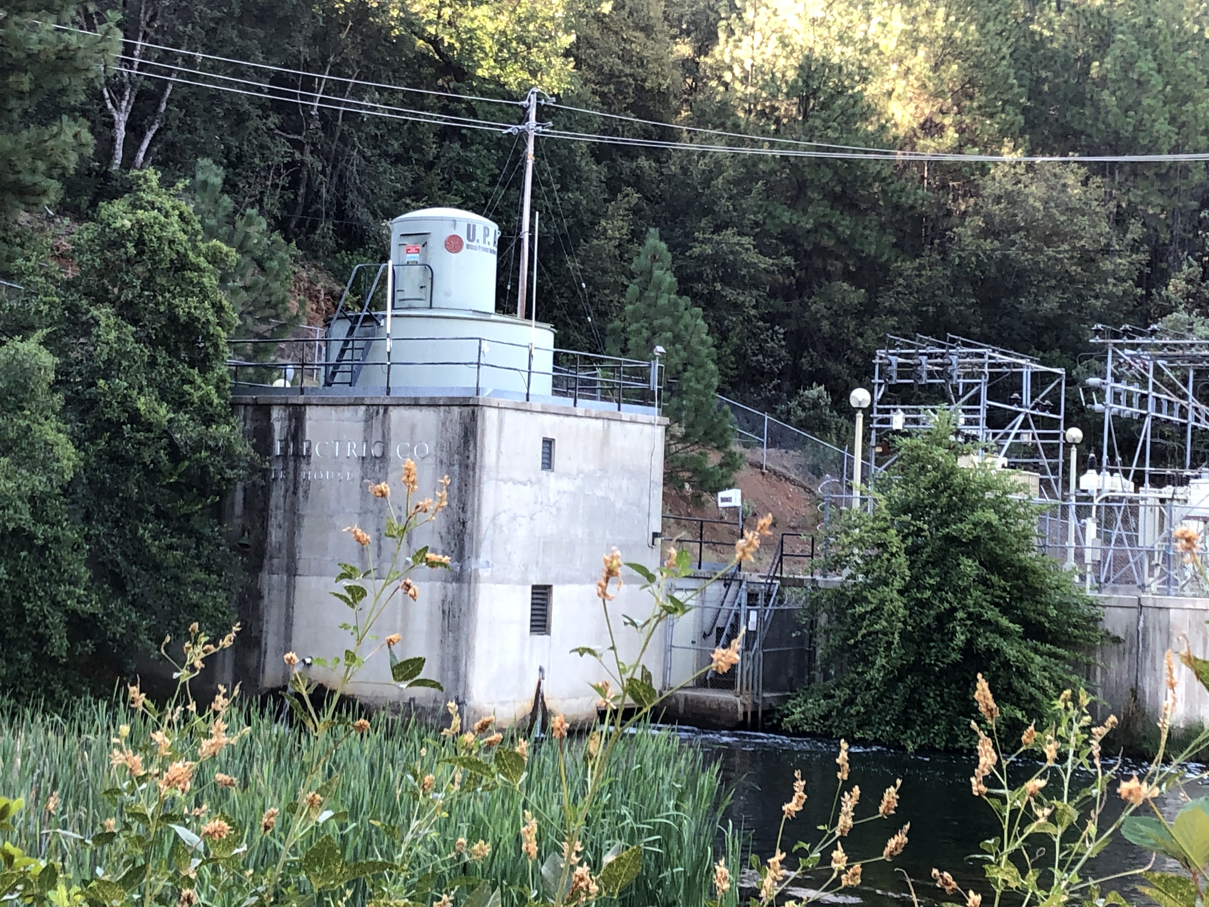
On my way, I encountered a small water and power operation near Murphys. A sign told me it was the property of the Utica Power and Water Authority. Based in Angels Camp, the tiny UPWA dates back to the gold rush, when water was routed to run hydraulic mining operations, and the channeled water was employed to produce power.
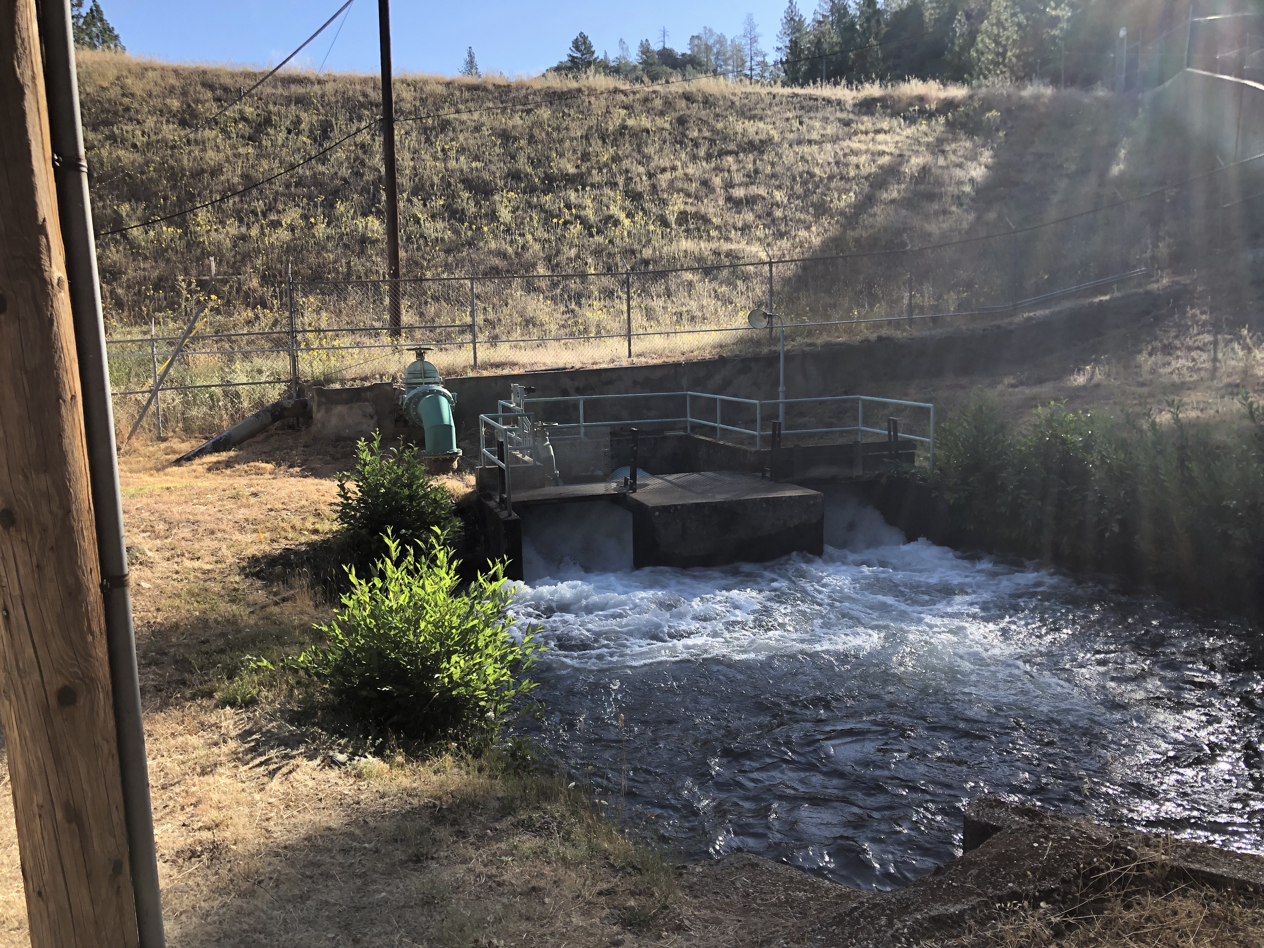
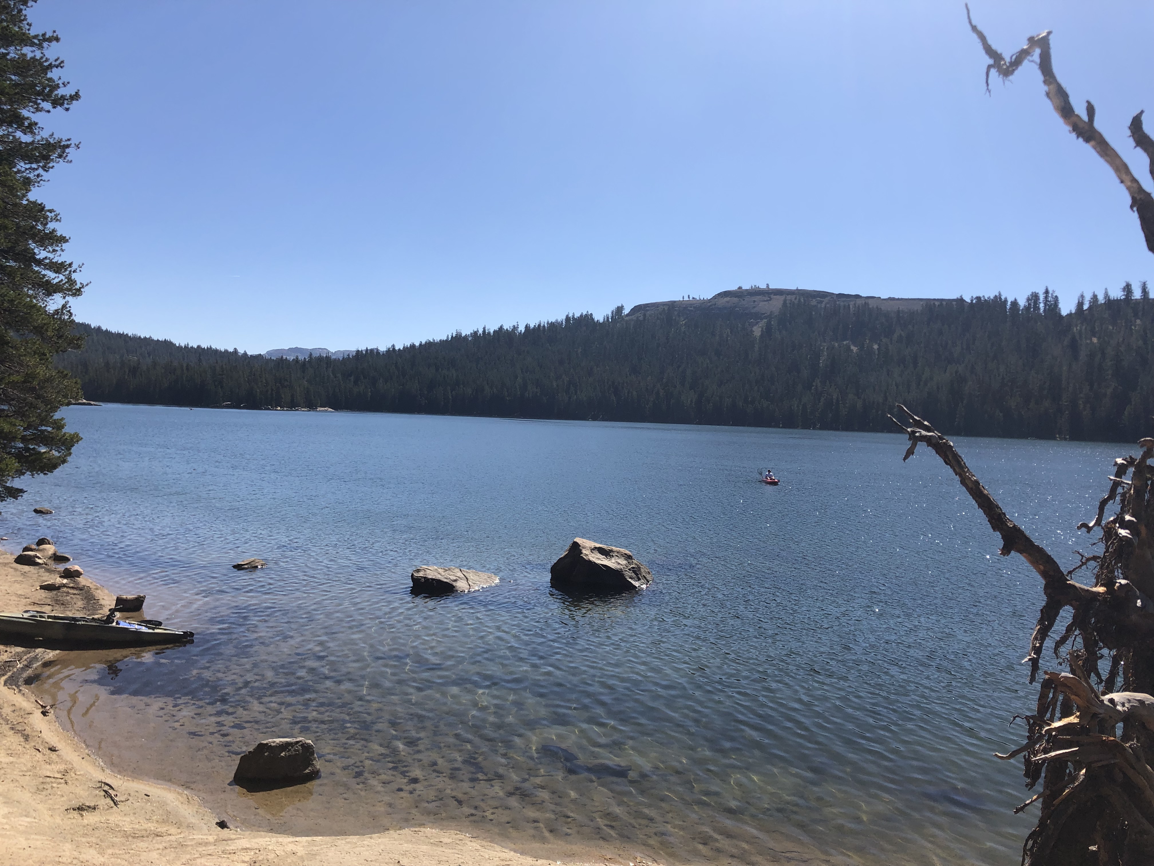
Continuing along Route 4, I arrived at beautiful Lake Alpine. As I stood there admiring it, I noticed a sign. Turns out that this, too, is a hydroelectric project of the Utica Power and Water Authority. Maybe they’re not as tiny as I’d thought. The notable point, though, is that much of our built environment, and even some of the natural environment, are inextricably linked to our power and water infrastructure. These are probably only rivaled by our transportation infrastructure.
But as much as this interests me, my quest is not so much to explore local water and power arrangements as it is to find the place were William Mulholland reached up into the eastern Sierra to divert water over 200 miles to the thirsty, nascent metropolis of Los Angeles. And for this, I had to get past the end of Route 4, and onto the US 395 highway. So, I did.
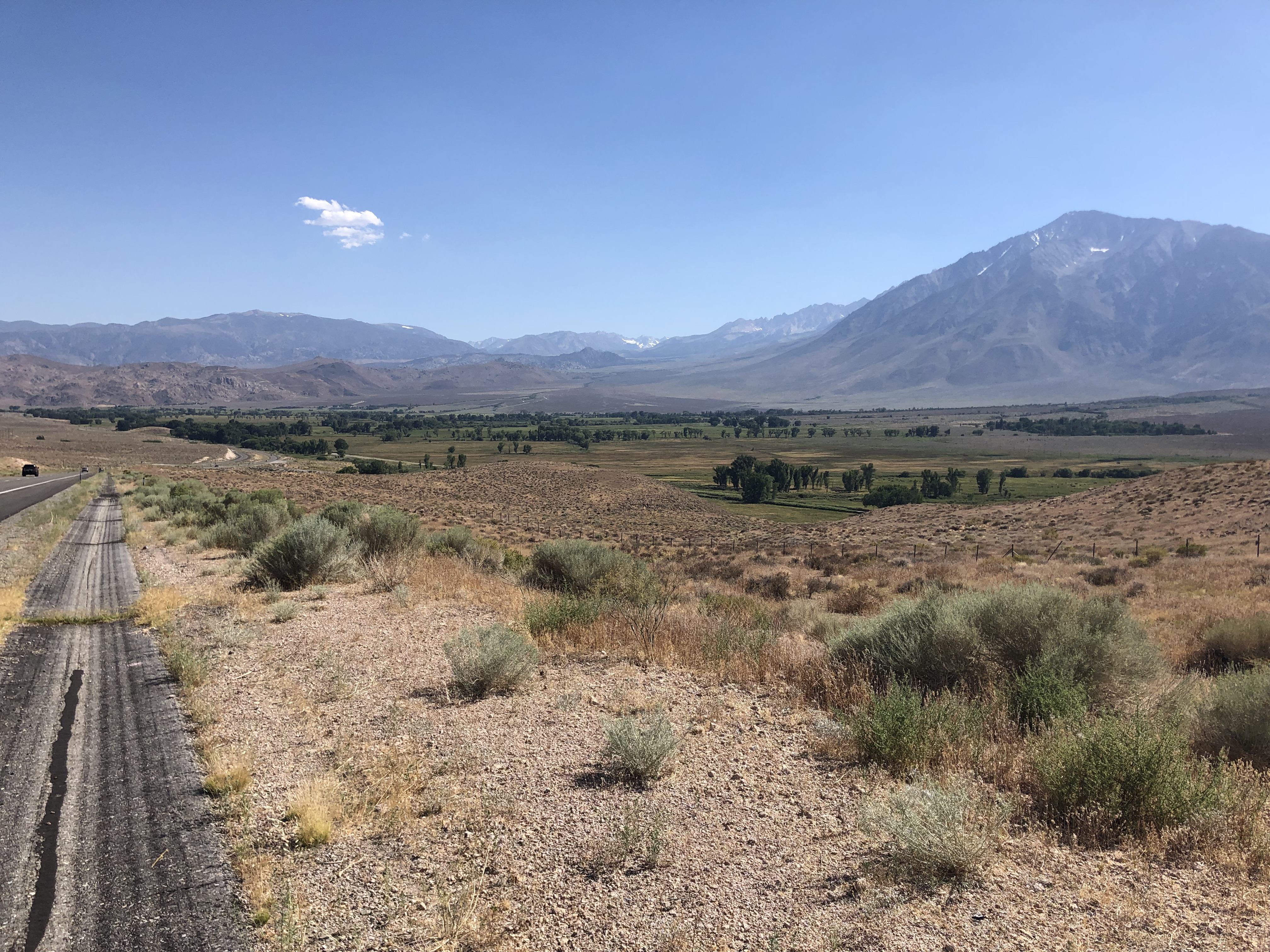
Cruising down 395 in the shadow of the Sierras is a meditative experience. The landscape has completely changed from that of Route 4, in that vegetation becomes scarce and the ground becomes rocky. The road is largely flat and much less curvy than on Route 4. And you look up at the mountains, rather than drive over them. Traffic is a little more present on 395, but you’re still usually by yourself.
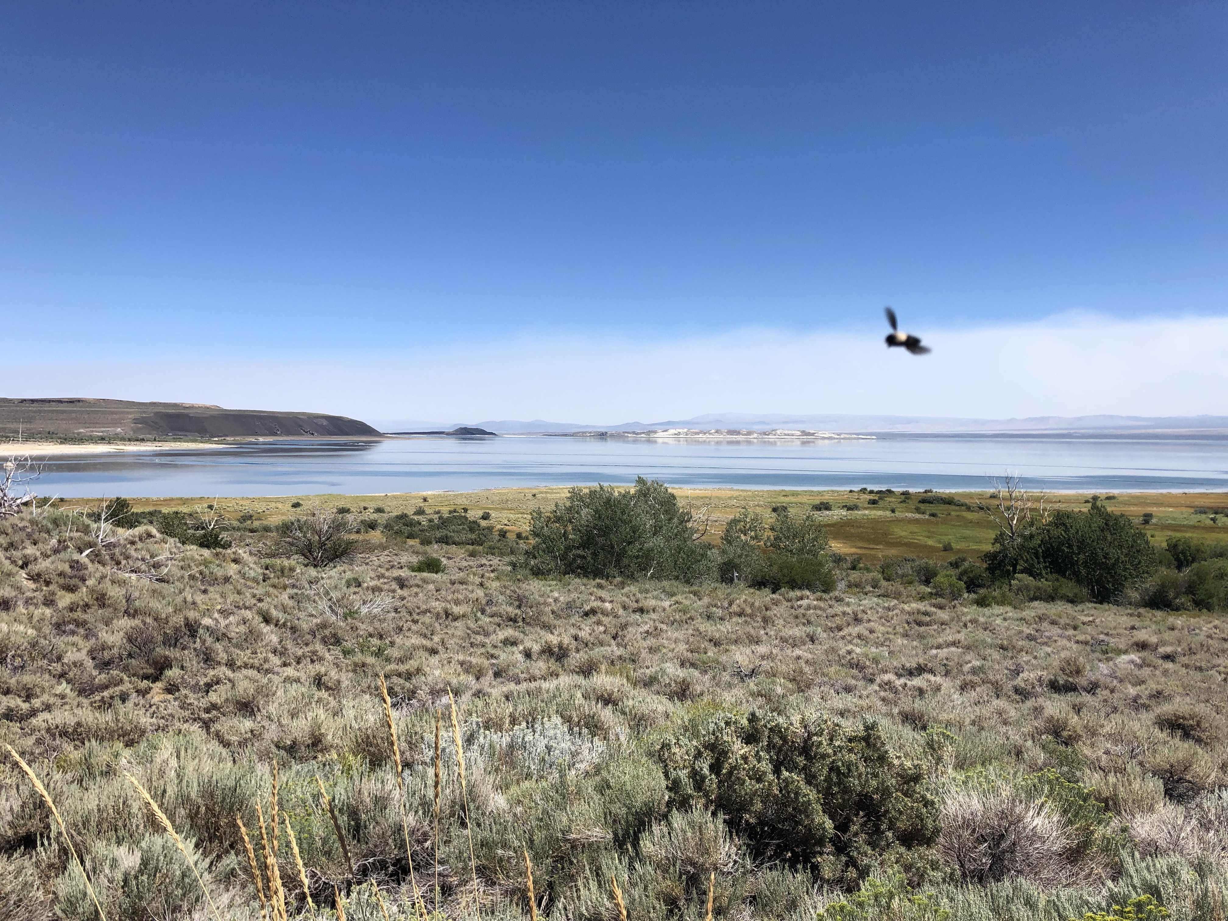
After a bit I saw the looming presence of Mono Lake. I know there’s a link between the lake’s level and the LA aqueduct. In fact, environmental and business groups in Mono County successfully sued Los Angeles for imperiling the lake by taking water from the tributaries that feed it.
I went into a local visitors bureau and asked where I might find the aqueduct. The young woman got riled up about the whole concept of the thing, and started lecturing me about how Los Angeles has been stealing their water. Yes, but can I actually see the facilities they use to steal it? She wasn’t aware of anything that was visible, speculating that it’s all underground. I thanked her and went to the Mono County museum, and asked the young man there the same question. He listed the three creeks that were being robbed of water, but similarly didn’t think any evidence of the dastardly activity was visible.
Disappointed, I got back on 395 and tried to think this through. In the book I’d read about Mulholland, there was mention of open channels and exposed pipelines. Surely something is visible. And at that moment, on the eastern side of the highway, I saw an enormous, 6-foot diameter pipeline snaking parallel of the road. I found a dirt access road and went to check it out.
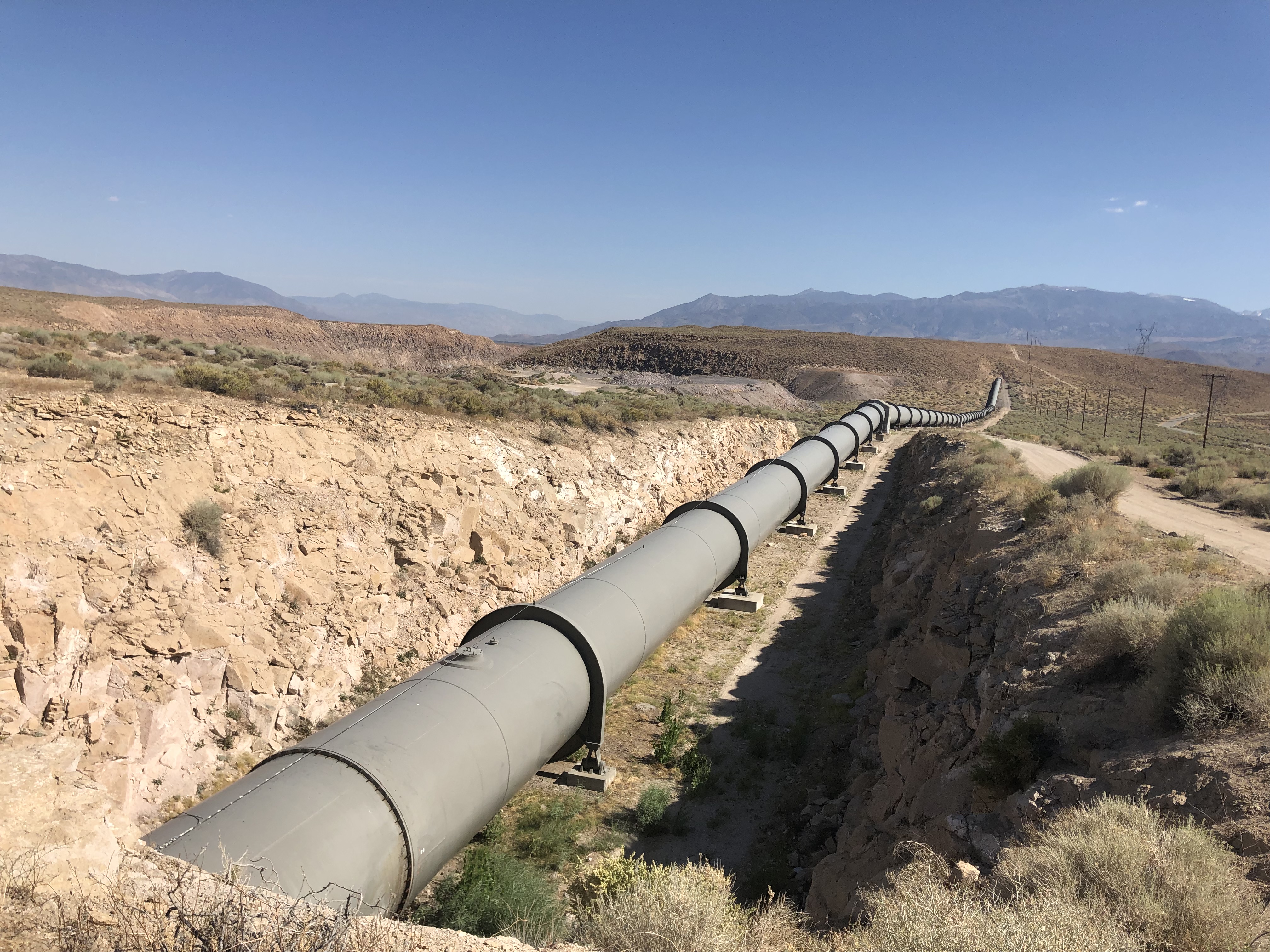
A sign said this was the property of LADWP [Los Angeles Department of Water and Power], so surely this was the pipeline. I put my ear up to the metal wall of the pipe and heard running water. I had expected the metal, which had been baking in the arid, 90-degree heat, to be hot to the touch. But it was refreshingly cool. Stopping to think about it, that makes sense since they’re running zillions of gallons of snowmelt through the insides.
The pipeline segment depicted in this picture is the furthest north I could trace it. At this point, it goes underground. I suspect it goes a little further north to draw water from the creeks near Lee Vining.
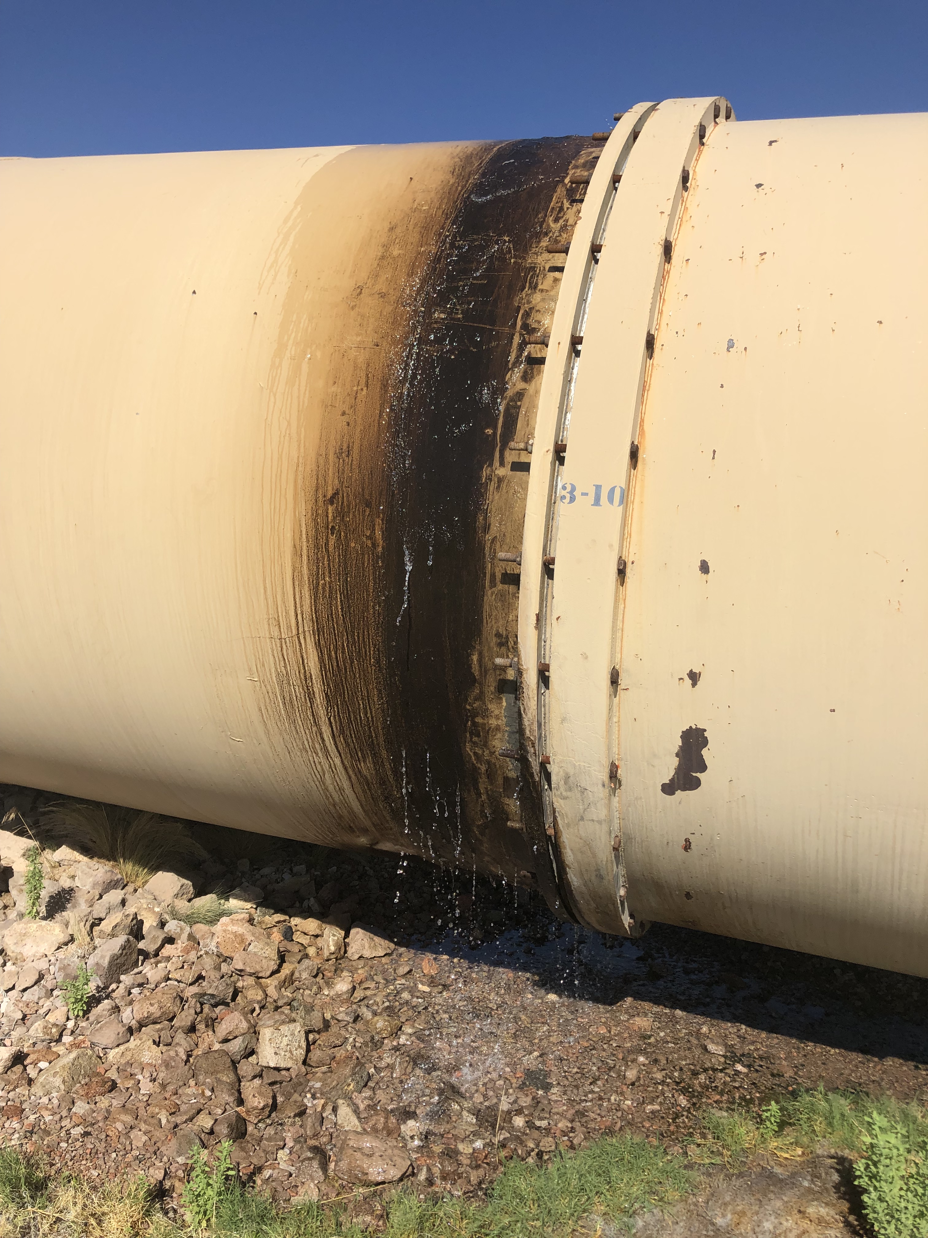
If any other evidence were needed to confirm that this is indeed a water pipeline, I found a significant leak a couple of miles to the south:
By the way, check out this 15-second video of the leak in action:
So, I’d finally found the aqueduct. But wait–there are actually two Los Angeles Aqueducts. The original aqueduct, built by Mulholland, only got as far north as the Owens Valley, in Inyo County. The spot I was standing on was some 100 miles further north. It is part of the so-called “Mono Extension” which wasn’t completed until 1940. What I really wanted to see was the headwaters of Mulholland’s aqueduct. So I got back on 395 and headed for the Owens Valley.
The pipeline I’d seen earlier had long since disappeared. I was surrounded by an endless, semi-arid valley. How would I be able to find the aqueduct? In desperation, I simply asked Siri. And she told me to take a dirt road near the town of Independence. Knowing that Siri is only as good as the Internet, and thus could be sending me on a wild goose chase, I wasn’t getting my hopes up. But I figured it was worth a try. I found the dirt road, and immediately encountered a gate.
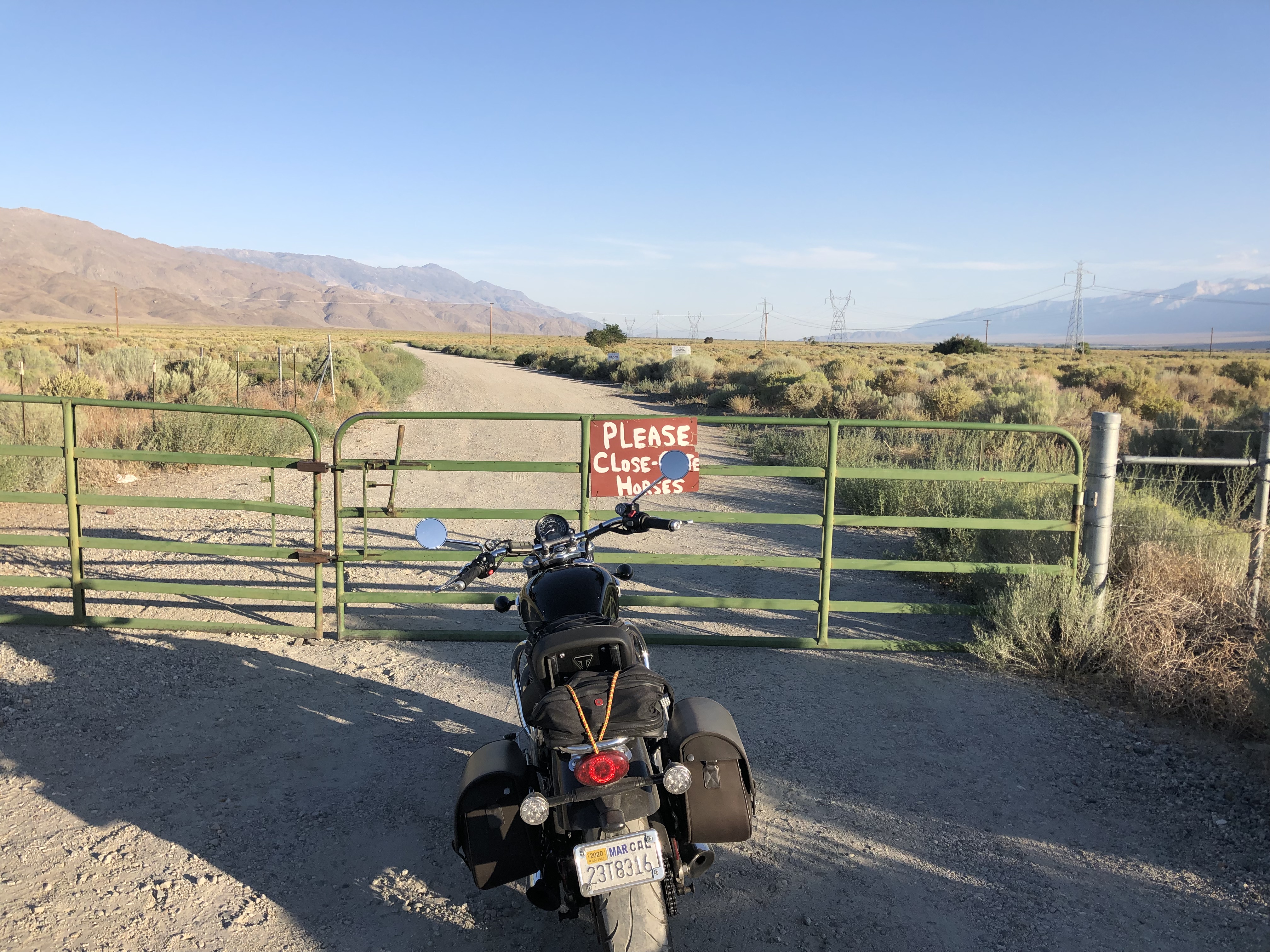
I could see no sign that prohibited trespassing. There was only a sign on the gate, saying “Please close gate–Horses.” I thought it was impressive that the horses could make a sign. Anyway, by asking me to close the gate, the sign implied that I could open the gate first. So I did.
I short distance past the gate was a marker set on the side of the dirt road:
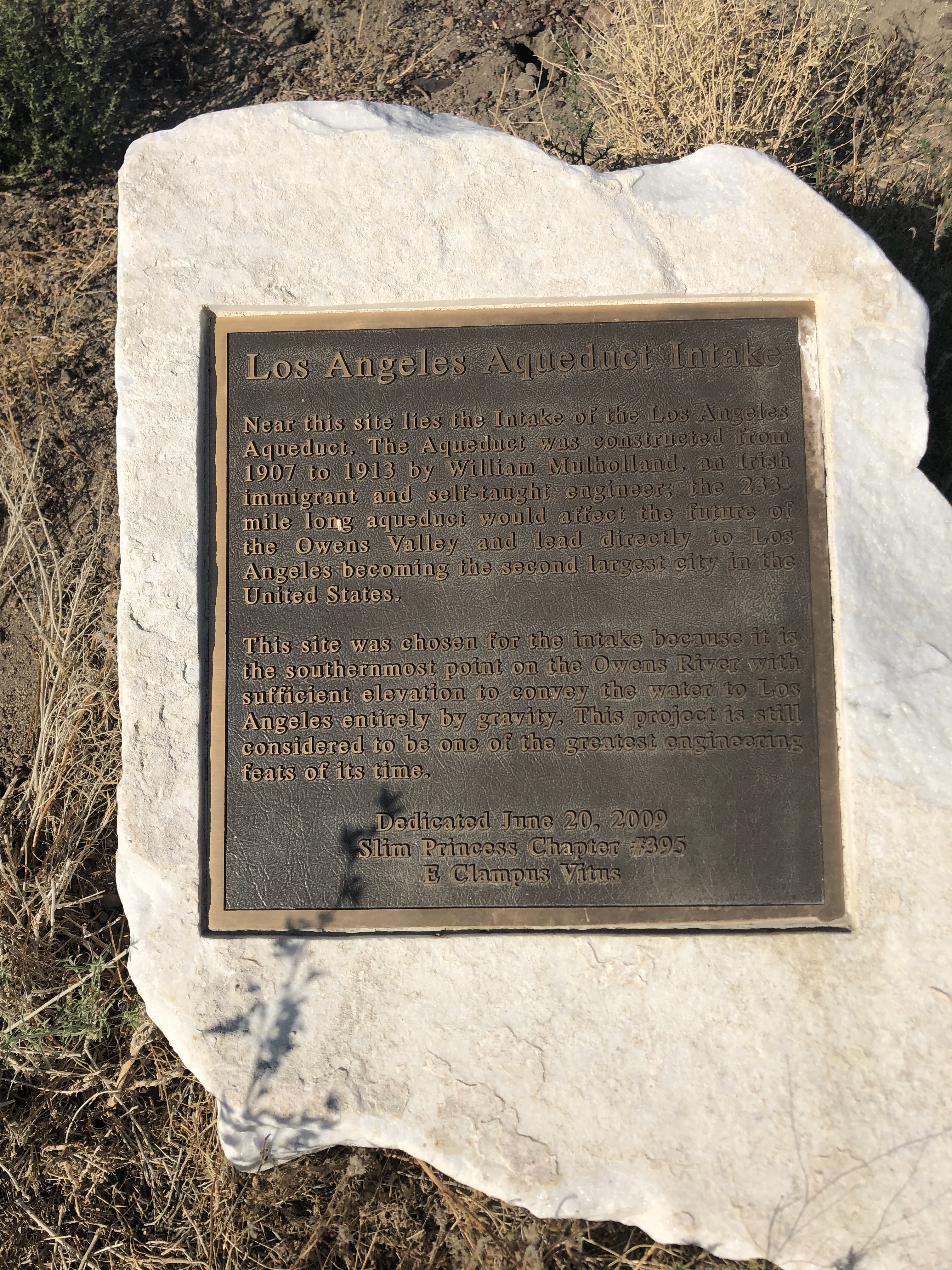
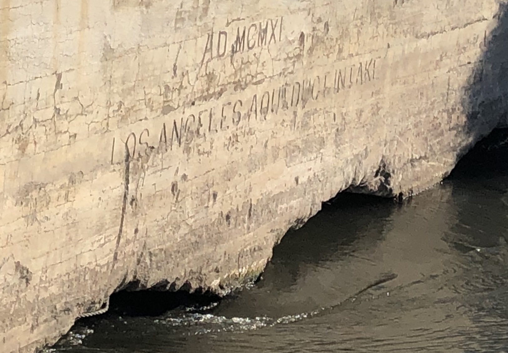
The marker said that “near this site lies the intake of the Los Angeles Aqueduct.” I was close! It gave no directions to said intake, but I presumed I just had to continue along the road.
After a couple of miles I came to a second gate, with another sign hand-painted by the horses. I passed through. I little further still and arrived at Mecca.
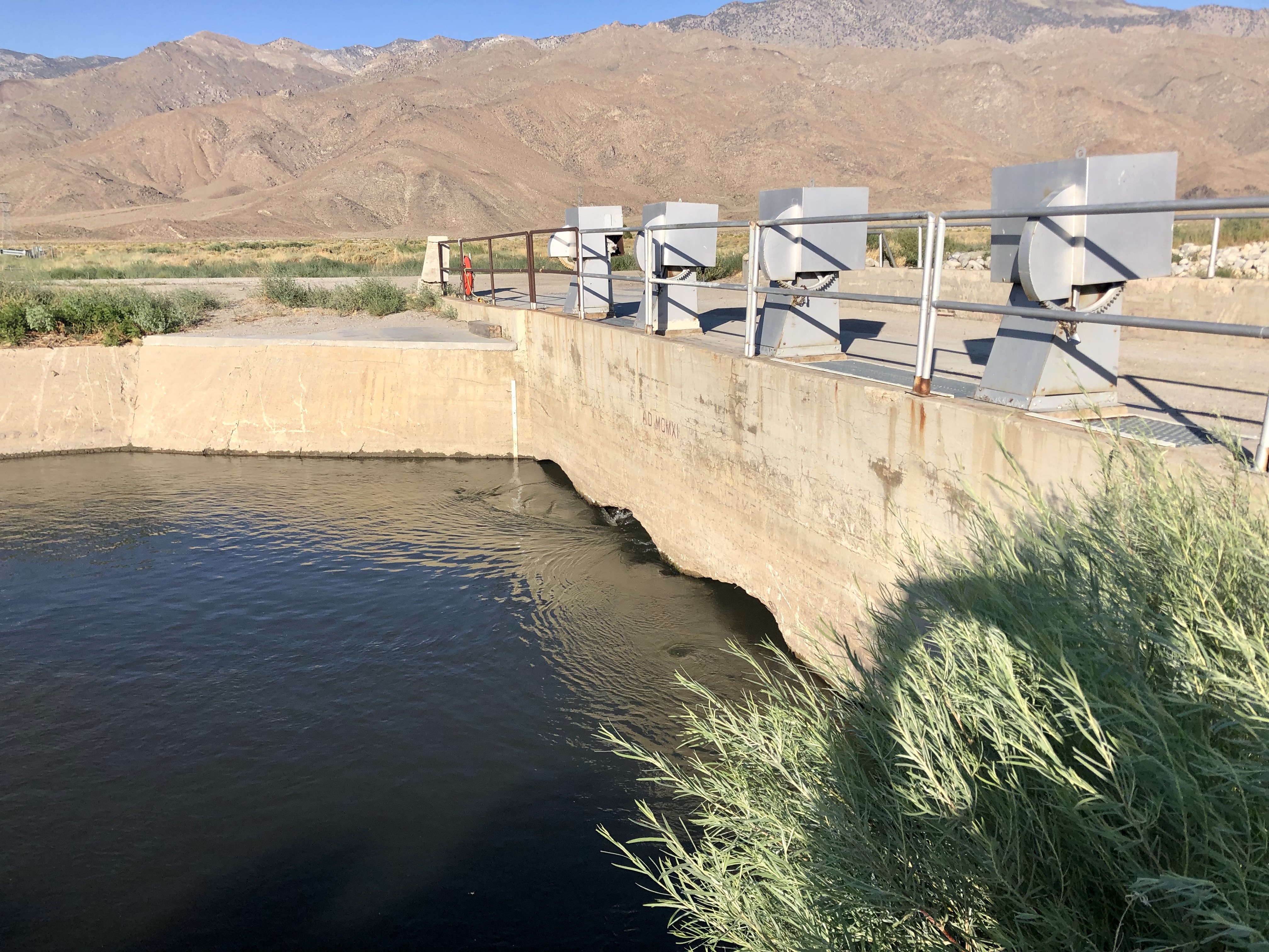
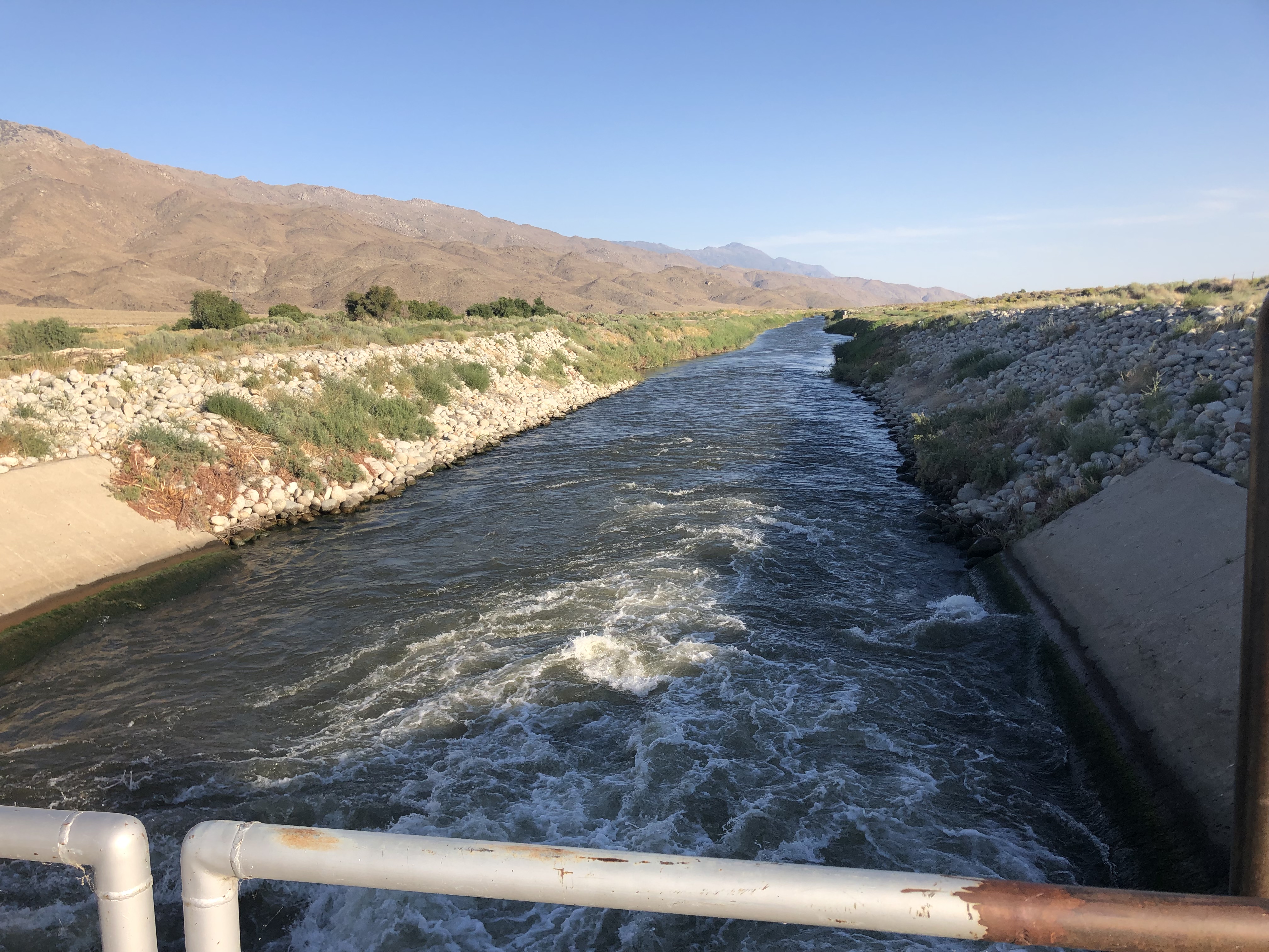
Just sitting there, in the middle of nowhere, surrounded by the parched, dusty Owens Valley, was the intake to the (original) Los Angeles Aqueduct. It’s been sending water on its 230 mile journey for over a century, silently and virtually unwitnessed.
On the other side of the intake, the water enters a canal and is on its way. I watched it for a few minutes.
You can too! Watch it in action:
So that was that. I’d now visited both ends of the LA Aqueduct, a 116-year-old feat of engineering that is as impressive as it is politically and environmentally questionable.
I took the dirt road back to 395 and headed south. After a couple of dozen miles I encountered a coda to the LA Aqueduct story. Up on a hill to the right of the highway I saw this structure:
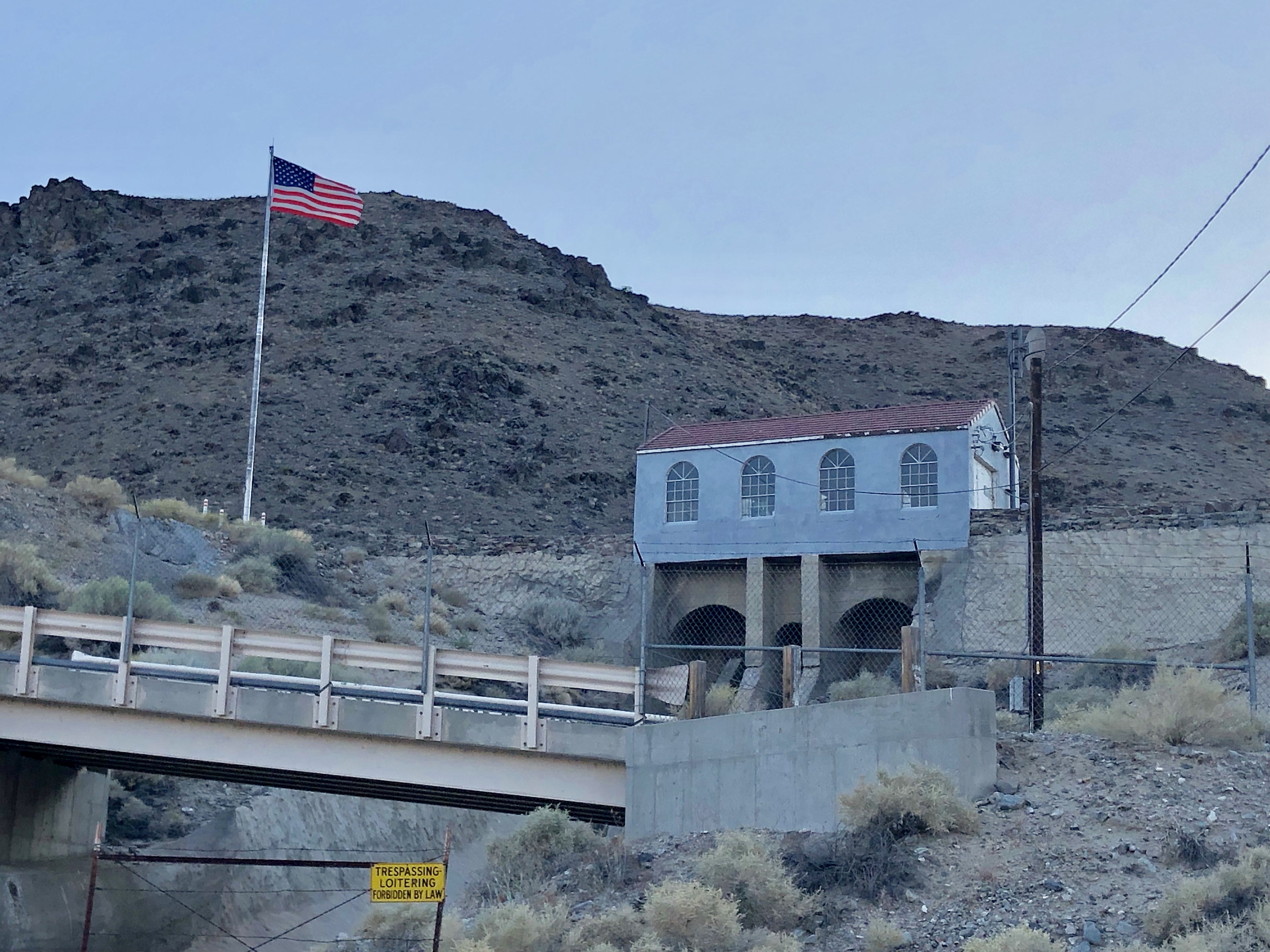
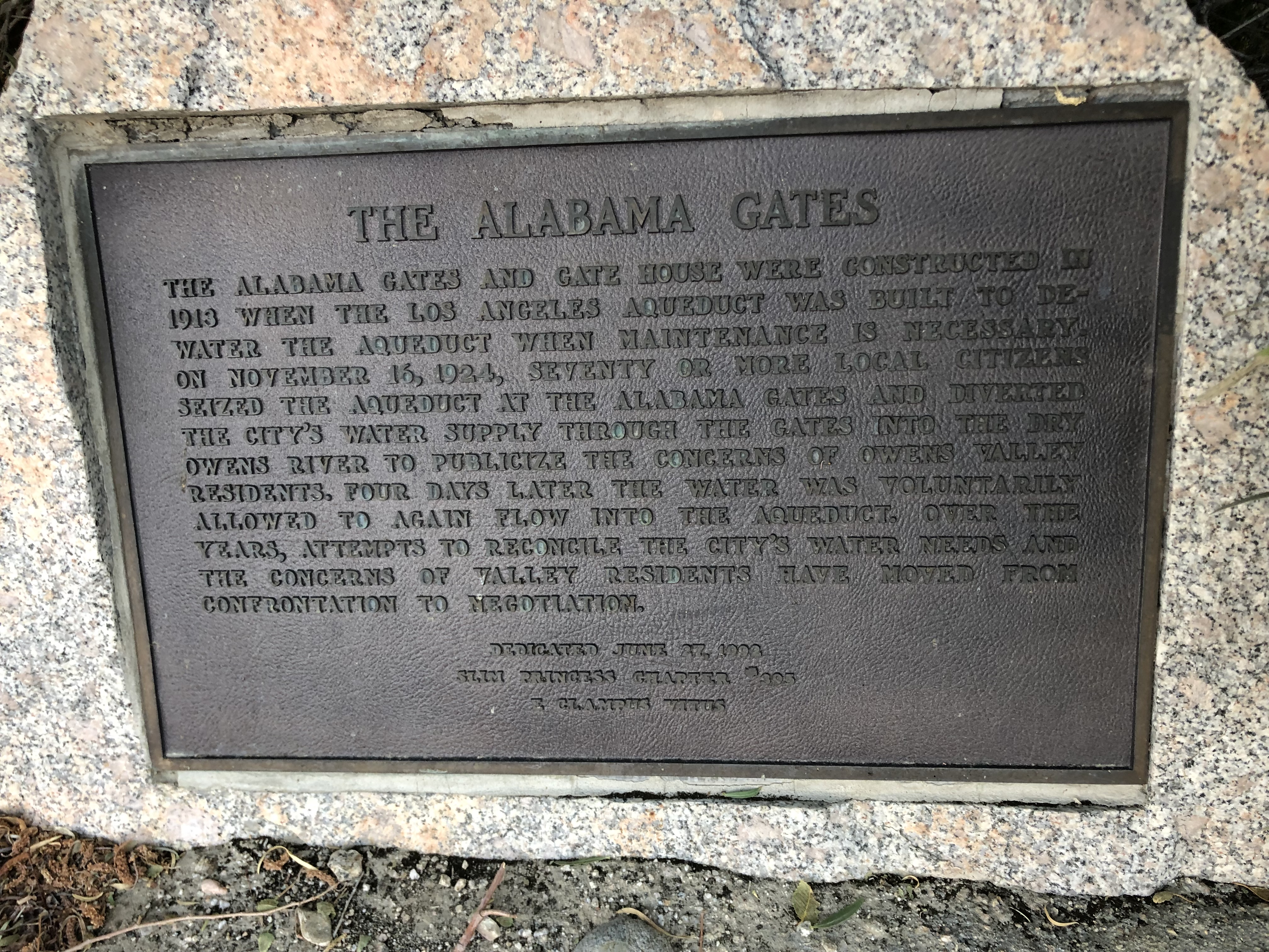
The architectural style suggested it was from the same era as the aqueduct, and the large, dry spillway dropped down to the other side of the highway. I turned up a dirt road and found a plaque with the story. For those of you (foolishly) reading this blog on your smartphones rather than a proper, full-size laptop display, here’s the text in its entirety.
THE ALABAMA GATES The Alabama Gates and gate house were constructed in 1913 when the Los Angeles Aqueduct was built to dewater the aqueduct when maintenance is necessary. On November 16, 1924, seventy or more local citizens seized the aqueduct at the Alabama Gates and diverted the city’s water supply through the gates into the dry Owens River to publicize the concerns of Owens Valley residents. Four days later the water was voluntarily allowed to again flow into the aqueduct. Over the years, attempts to reconcile the City’s water needs and the concerns of Valley residents have moved from confrontation to negotiation.
So, there you have it. The Los Angeles Aqueduct. Makes you realize that Chinatown wasn’t that far fetched of a movie after all.
