Breweries · cemeteries · Road trips

Family Matters

I arrived in Beantown this morning about 6:30, got a good cup of coffee, and soon was in temporary possession of a Nissan Altima (which, I’m told, is specifically designed with an eye to the rental trade). Everything was moving along according to schedule.

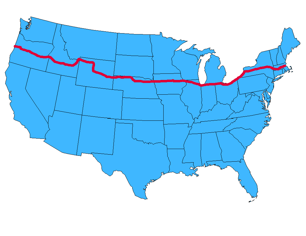
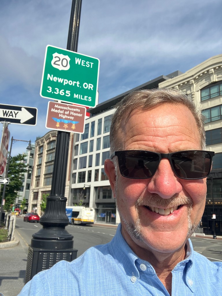
Things gummed up considerably when I drove out of the airport and entered Boston’s rush hour traffic. It took me over half an hour to drive five miles. But finally, I was at Kenmore Square, right next to Fenway Park, and under the giant Citgo sign that gives this fair city light. This is where Route 20 begins (or ends, depending on your perspective.)

Sorry; the giant Citgo sign is behind the green sign…which, for our purposes, is more relevant.

I know there’s a lot to do in Boston. I know it’s a great town. In fact, it wasn’t that long ago that friend Vic and I made a visit that I wrote about in this blog post. But today is not that day. I’ve got a lot of miles to travel, and the focus is on the gentle, low-key life of everyday America, not on a teeming capital city of about 650,000 souls. So I spent most of the morning just trying to escape the metro area.

But eventually, the traffic began to subside and I found myself in the city of Worcester (pop: 200,000). It’s still a biggish city, but I spent a pleasant, quiet hour surrounded by smiley faces. Let me explain.

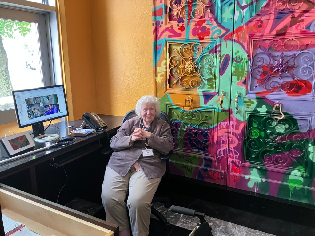
I was at the Worcester Historical Museum, which dates back to 1875. It recently moved to a stately brick building that used to be the headquarters of the Worcester County Horticultural Society. Upon entering I was greeted by the estimable Deb, who grew up in the town and has encyclopedic knowledge of everything that’s happened over the past 150 years. Oh, did I mention this year is their 150th anniversary, and I got in for free?

Deb, demonstrating the famous Worcester Smiley Face.

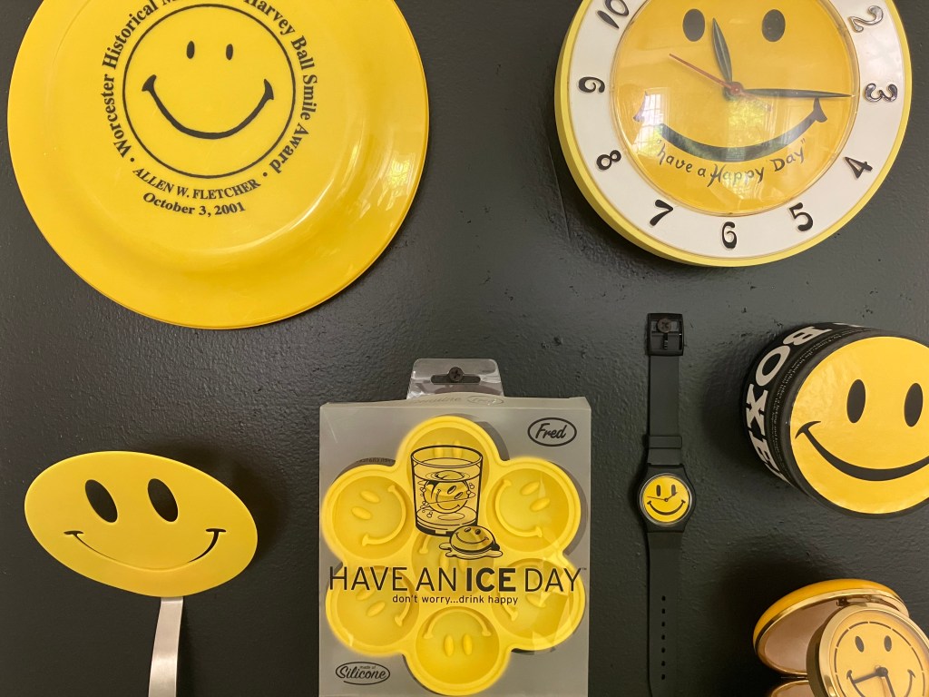
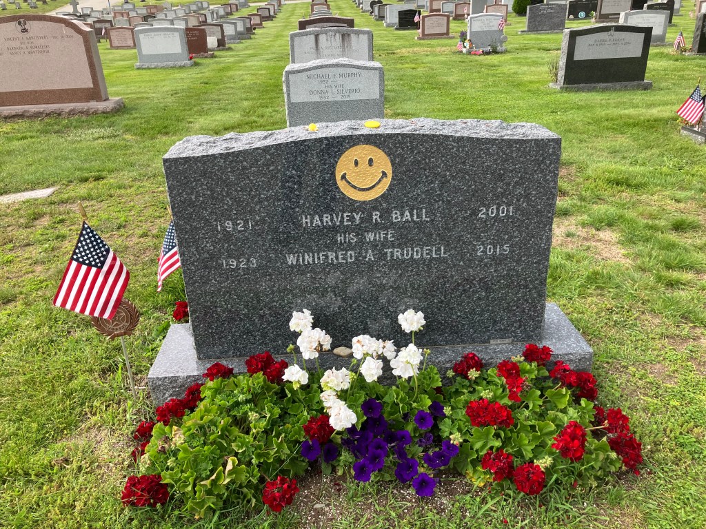
Among the firehose of factoids she shared, the one that made the greatest impression is that the humble and ubiquitous Smiley Face was invented in Worcester in 1963.

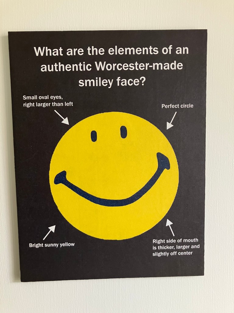
It was designed by a local artist named Harvey Ball, who was commissioned by an insurance company to design a moral-boosting image for their staff. If you were alive in the 1960s or 1970s, you know how the Smiley became a pop culture phenomenon. And of course it remains omnipresent today, adorning WalMart uniforms and, much more importantly, morphing into the emojis that adorn the majority of text messages.

A tiny part of the museum’s Smiley collection.

Deb wanted me to know that Harvey Ball never trademarked the Smiley, and so he never made anything off it other than about fifty bucks for the original drawing. But in the 1990s Walmart tried to copyright it, which led to a court (Deb couldn’t tell me exactly which one) decreeing that they couldn’t claim credit for Harvey’s work. Or something like that.

After visiting the museum I made a pilgrimage to pay my respects to Harvey Ball. I think you can guess where this is leading:

Notre Dame Cemetery, Worcester, MA

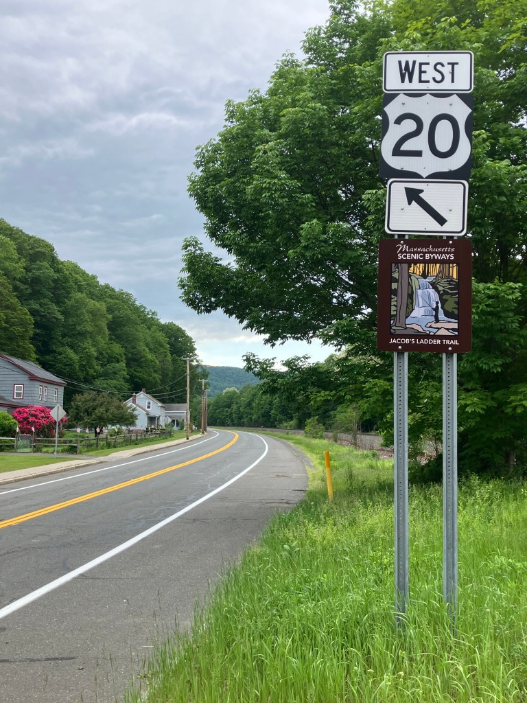
It was time to get back on the road, and once Worcester was in my rearview mirror, US 20 settled into the kind of road I’ve been longing for: rolling hills, a lane or two each direction, and a route smack-dab through the middle of numerous small towns.

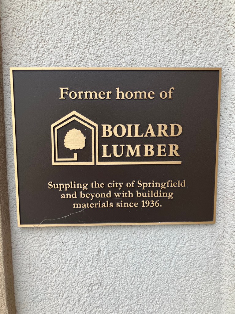
Next up was the town of Indian Orchard, a small village on the outskirts of Springfield, Mass. Now, alert readers may recall that about a dozen years ago I discovered a large Boilard clan living in the northeast. One roguish member of this Boilard branch of the family tree was my grandfather, Henry “Red” Boilard. You can read about him here on my website. Anyway, Henry had an uncle named Adelard Boilard, who founded Boilard and Sons Lumber in Indian Orchard in 1936.

Historic thermometer hangs in my garage, but I’d never visited the store.

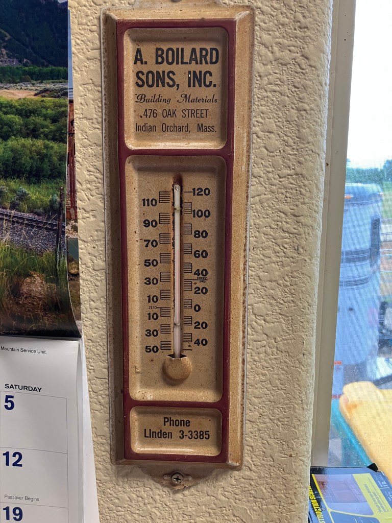
So, since US 20 goes right by Indian Orchard, I figured I’d pay a visit to the old family business at 476 Oak Street. The building still stands on the same site, but as of a couple of years ago Boilard and Sons got purchased by Koopman’s Lumber. The name of the business changed, but next to the front door there’s this plaque that acknowledges the lineage.

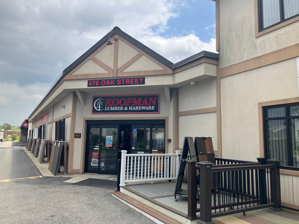
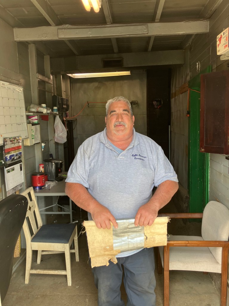
I went into the store hoping that maybe someone remembered the old Boilard family. I explained to the man behind the counter that my name is Steve Boilard, and that I’m related to the family that founded the store. Was he familiar with the history? The guy, whose name is Bob, did indeed know the history and explained how the family ran the place for over 85 years. I asked him if any family members were still involved with the operation. He said, “Well, there’s me.” His name is Bob Boilard…Adelard Boilard’s grandson. Talk about burying the lede! I guess that proves he’s a Boilard after all.

Me with Bob Boilard, who’s demonstrating the famous Boilard enthusiasm.

Bob gave me directions to the local cemetery (another Boilard trademark) and suggested I pay a visit to Adelard Boilard. Soon I was at Saint Aloysius cemetery…but finding Adelard would be like a needle in a haystack. As luck would have it, I ran into a cemetery employee named John, but he said the formal directory was in another part of town, and it wasn’t open today. At my obvious disappointment, he lowered his voice conspiratorially and said, “Well, we can see if maybe there’s anything helpful in the garage.”

Co-conspirator John.

He led me into a dark and dusty building, and asked me when Adelard died. “December of 1981,” said I. John then produced a worn and dusty journal and flipped the pages to December. It had records for all burials that month. No Boilard. “Sometimes they didn’t get recorded,” he explained. But as I was about to turn away empty handed, he said “Wait–these are recorded by date of burial, not date of death.” He pulled out the 1982 journal, and turned to January:

Second line (Jan 4): Adelard Boilard

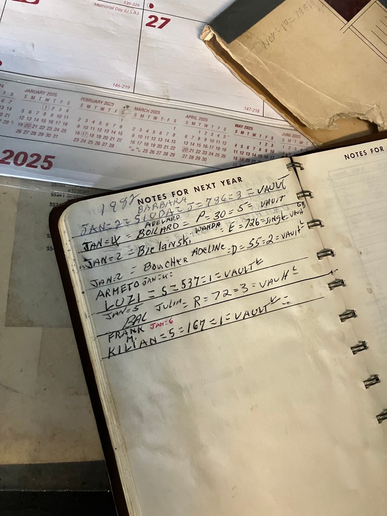
The journal included DaVinci-code-like notations next to the name, which John then used to locate the grave on an ancient plot map.

Boilard: Middle-left edge.

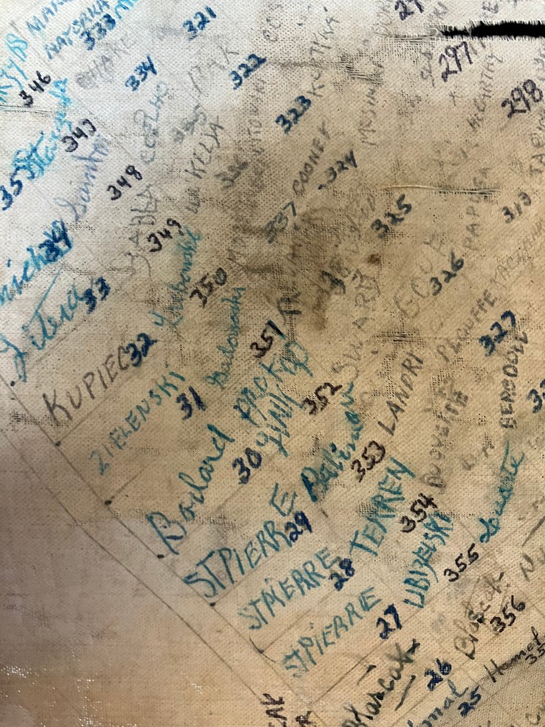
And with that information, my friends, I was able to locate the Boilard marker, under which are buried Adelard, his wife Lillian, and several other Boilards.

Be it ever so humble…

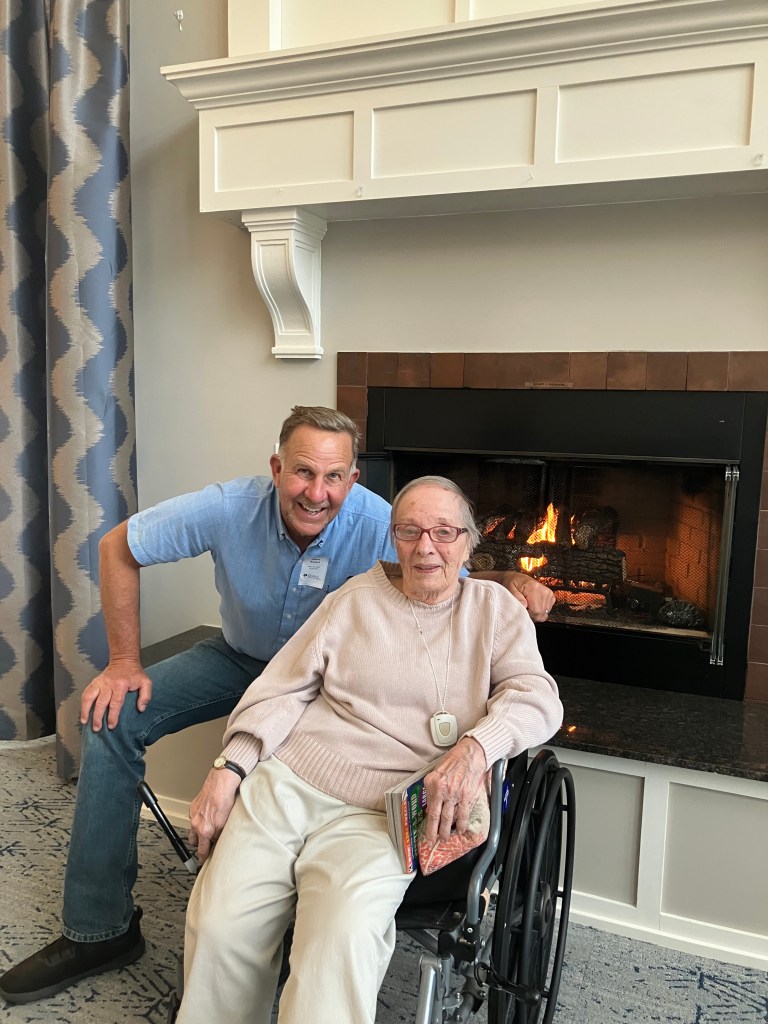
There’s one more postscript to this story: when my Aunt Mary (one of the east coast Boilards) learned of my Route 20 trip, she told me there’s another relative I need to visit in Indian Orchard. Phyllis Emet (nee Boilard). Phyllis’ grandmother was Adelard Boilard’s sister. I guess that makes Phyllis Adelard’s grand-niece? (Somebody please help me with this!) Anyway, Phyllis is 90 years old and has encyclopedic knowledge of the Boilard family history. I spent a delightful hour getting filled in on family lore.

Me with Phyllis, keeper of the Boilard secrets.

After visiting with Phyllis I stumbled upon some interesting (non-Boilard) history in the town of Chester (pop: 1,250), but I think I’ll save that tomorrow as this post is getting long and the jet lag is kicking in. I will end with the…

BOTD

Meh.

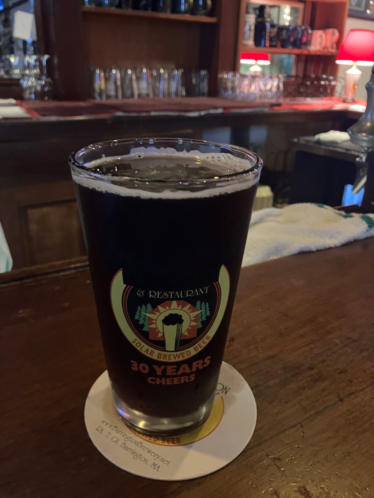
I had my dinner and my Beer of the Day at a place called Barrington Brewery in the town of Great Barrington, Mass (pop: 7,200). I didn’t realize until I saw the bartender’s polo shirt that I’m in the Berkshires. It’s admittedly a very nice environment around here.

On the bartender’s recommendation, I had a pint of the Barrington Brown Ale (5.4 percent alcohol, which barely exceeds the alcohol you’d get from the brandy-flavored chocolates your grandma kept in a dish at Christmas time). After all my other great successes today, I should have known my luck couldn’t hold out. This ale is the color of Lipton Iced Tea, and it’s similarly uncarbonated. It has no discernible strong flavors at all. The mouthfeel is positively watery. It reminds me of dishwater, with notes of dirty straw and potato peels. The finish evokes soggy Cheerios. This is a spectacularly forgettable beer. 1 star.

Road trips

The Long(est) and (not especially) Winding Road

Long-time readers of this blog will recall my goal of driving all the transcontinental US highways in the United States. There are a few caveats to this goal: I’m ignoring the interstates, which are boring, putatively high-speed freeways designed specifically to minimize encounters with towns and villages and, it seems, scenery. Instead, I’ve focused on the US Highway system–the “blue highways”–that traverse the continent. In terms of the US Highway numbering system, this means routes designated with two-digit numbers ending in zero.

Don’t try this at home.

Transcontinental routes I’ve traveled to date include US Route 50, US Route 60, US Route 70, and, somewhat defying the numbering convention, US Route 2. All of them are primarily two-lane roads whose alignments date back to the early 20th century, and which pass right through the center of countless towns, villages, and ghost towns. In fact, these routes are designated Main Street in many, many cities. In between are miles and miles of open country.

Many US Routes have nicknames–US 50 is “The Loneliest Road in America,” Route 66 is “The Mother Road,” US 70 is “The Broadway of America,” US 2 is “The Highline.”

A stretch of “The Loneliest Road in America.”

To my collection of transcontinental routes I am about to add US Route 20, whose somewhat unromantic, bureaucratic nickname is “The National Medal of Honor Highway.” It runs from Boston MA to Newport OR, for a grand total of 3,365 glorious miles. Accordingly, it is considered the country’s longest road.

From Sea to Shining Sea

Now technically, this is a discontinuous route, for US 20 does not exist within the boundaries of Yellowstone National Park, through which you must pass to get across the country. In fact, the original route (opened in 1926) stopped at Yellowstone, and was only extended to the west coast in 1940. For reasons that will become clear later, I will only be driving that original route, from Boston to the east entrance to Yellowstone.

Did somebody say Jellystone?

And so I am sitting here at Sacramento Intergalactic Airport awaiting my overnight flight to Boston. In the morning I’ll pick up my rental car and begin my westward trek, with daily posts over the next week and a half. If you have any suggestions for a stop along the way, or if you live along the route and want to buy me a beer, please say so in the comments below!

Oh, and at the end of this journey I’m going to invite readers to suggest a better nickname for US 20. The winner will get a Medal of Honor.

Gas stations

Orbit Obit

Two months ago I posted about the Jetsons-like Orbit gas stations that one used to see all over the Sacramento region. Most have since been demolished, a few converted to other uses, and one still operates as a gas station.

4716 Auburn Blvd, Sacramento

The other day loyal reader Chris P. sent this photo of a long-abandoned Orbit gas station in Incline Village, Nevada.

Corner of Highway 28 and Lakeshore Blvd, Incline Village, NV

The pine trees, the shake roof, and the stone facade are all reflective of what you’d expect in the Lake Tahoe area. But the bones of this building are unmistakably Orbit. According to Chris, the building has been vacant for decades.

It appears to be in remarkably good shape for its age, so surely there must be local efforts to reopen or repurpose it? Alas, apparently not everyone is as enamored with the place as I am, for in 2008 (that is, 17 years ago) the local Community Development Committee held a “Nuisance Workshop.” The Tahoe Daily Tribune described it thus:

The workshop served as a forum where residents could identify the nuisances particular to the Incline Village/Crystal Bay area. Residents were separated into tables of 10 and asked to address a set of 10 nuisances one at a time.

The paper went on to report that one especially grievous nuisance identified by the 120 residents in attendance was the Orbit gas station:

As a solution, we suggest they maybe level the Orbit station,” said Incline resident Bea Epstein, who served as spokeswoman for her table. The statement was met with widespread applause from those in attendance.

On the other hand, I found a number of comments on local message boards where residents expressed admiration for the quirky old structure, with comments like “I would live there!,” “Bring back the crazy roofs!,” and “Can I buy this?” Other commenters suggested that it be converted to an EV charging station, a visitors center, or maybe a convenience store.

One of the online messages claimed that the building sits abandoned because the cost to clean up underground storage tanks (from its gas station days) would be prohibitive. Lake Tahoe has famously rigorous environmental standards.

So the future for this building remains uncertain. Get out there and check it out while you still can!

California history · Road trips · trains

Central Controversy

In a recent blog post, I asserted that Kingsburg, CA is “smack-dab in the middle of” California. I based this assertion on nothing more than a quick glance at a map.

Several alert readers called out my unsubstantiated claim. The reader with the best case was Jeff N., who wrote: “To go to the official center of the state, head a little North out of Fresno to a spot near the town of North Fork. There’s an official surveyors mark noting the exact center of the state.”

A quick search of various sources provided unanimous corroboration of Jeff’s claim. For instance, check out this newspaper article from the Desert Sun.

Coincidentally, I did stumble across a (sort of) competing claim in the town of Shafter, CA (pop: 22,000). Shafter is home to a 1917 Santa Fe railroad depot, which now serves as a railroad museum. I visited the station because the folks at the Kingsburg Depot meeting I attended the other evening told me that Shafter was their “sister depot”…whatever that means. So I made a quick visit.

Kingsburg’s “sister.”

Anyway, during my visit I noticed this marker, which proudly boasts “California 2010 Center of Population.” So while North Fork is the geographical center of California, Shafter is the population center…at least based on the 2010 census.

“Center of Population” marker on the ground.

But upon closer inspection, the plaque above the marker reads:

The survey monument below commemorates the geographic location of the center of population of the State of California for the 2010 Census. The actual location of the 2010 center lies in a farmer’s field on the south side of San Diego Street and 2,132 feet east of Wasco Avenue, four miles southwest of this point.

All of which raises the obvious question: Why couldn’t they put the marker any closer than 4 miles from the proper location???

Incidentally, the 2020 census still places California’s population center in the town of Shafter. Here’s a good article, for context.

As an aside: close to the Shafter depot is this historic middle school, the facade of which reminds me of a creepy Twilight Zone episode where the school messed with the students’ minds.

An impressive edifice….
…But aren’t these column-topping figures a little creepy?

But to return to the competing claims as the “center” of California: I would be remiss if I didn’t reprise this 2022 photo I took in Glasgow, MT. Few could argue with their claim!

California history · movie theaters · Road trips · trains

Tale of two cities

Today I took a ride down to the city of Kingsburg, CA (pop: 13,000). Kingsburg sits on highway 99, smack-dab in the middle of the state.

Kingsburg is the big red dot blotting out Fresno.

Alert readers will recall that I came through Kingsburg last fall and fell in love with its historic railroad depot. I ended up making a small contribution toward their “1238 Project,” in which they are taking possession of a 1918 Southern Pacific steam locomotive that’s been sitting in a park in Fresno since 1956. As a bonus, my humble contribution earned me membership in the “Friends of the Historic Kingsburg Depot,” which holds monthly meetings about their activities at the depot. So today I said “What the heck; I’ll make the 200-mile drive for this evening’s meeting and get the latest update on the 1238 Project.”

I was running a little ahead of time, so I killed an hour and a half exploring the city of Fresno (pop: 546,000), which is about 20 miles north of Kingsburg. Now, Fresno is a much-maligned city, frequently appearing on lists of the worst places to live in California. It has above-average levels of homelessness, drug use, air pollution, and unemployment. Like much of the Central Valley it experiences extreme temperatures in the summer and winter. And much of the city comprises a run-down urban core surrounded by ugly sprawl. But despite all this, Fresno has a plucky population and a rich history that is, to greater and lesser extents, being preserved. Here are just a few examples that I saw today:

Civic pride is evident in this mural on Tuolumne Street in downtown Fresno.

Fresno has several historic movie palaces in various states of preservation. Two of them (the Crest and the Tower) share names with two semi-famous theaters in Sacramento. Fresno’s 1948 Crest Theater is in particularly rough shape; the exterior is pretty shabby, and the air conditioning doesn’t work. And yet, they show movies every weekend for five bucks!

The terrazzo floor is nice, though.

I wasn’t able to get inside, but I’m told the interior is in better shape than the exterior. And I do appreciate that they’re keeping the theater open, even though they obviously have a lot of deferred maintenance. It’s lovable in a “little engine that could” kind of way.

Next up is the Tower Theater. It’s the centerpiece of Fresno’s “Tower District”–an artsy neighborhood with coffee shops, art galleries, restaurants, and other businesses that give the area a modest but palpable energy. It’s still a little gritty, but it’s definitely a viable destination for an evening out. The Tower Theater itself is an art deco movie palace built in 1939, that now serves as a 761-seat performing arts center.

I didn’t have time to stick around til nightfall, but I’m told the Tower’s neon dominates the district at night. Here’s a photo from a local Fresno news station.

File photo from Fox26 News.

We now move to the most striking movie palace I saw today in Fresno: The Warnors Theater. Opened in 1928, it was owned by the renowned Alexander Pantages. (Surely you’ve heard of the Pantages Theater in Los Angeles?) The theater originally was called The Pantages Theater, then changed to The Warner Theater in 1929, when Warner Brothers bought it. Warner Bros sold it in the 1960s, and the new owners changed the “e” to an “o” in a half-hearted concession to trademark requirements.

Pantages’ fortress.
Sometimes more is more. Or Moor, if you catch my drift.
Box office and lobby. Check out that ceiling!

Warnors has a large stage, seating for 2,100 people(!), and the original 1928 Robert Morgan pipe organ. The theater serves as a popular performing arts center bringing many national and international acts to Fresno.

So, I think it’s fair to say that Fresno is making an effort to support the arts. I think this is a key component to revitalizing the city.

I did encounter other examples of civic pride–here I’ll share just two more. First, there’s an impressive, beautifully-restored 1894 water tower. Originally owned by a private water utility, the tower’s 250,000-gallon tank was drained in the 1960s and sold to the city. It was restored about 25 years ago, and has served as a visitor’s bureau and, most recently, as the Frida Cafe.

Now that’s a water tower.

My final example of Fresno’s civic pride is its historic railroad depot. It was constructed by the Atchison, Topeka & Santa Fe in 1899. Santa Fe stopped passenger service to the station in 1966 and completely shuttered the station in the early 1990s. Fresno civic leaders, God bless ’em, purchased the decaying the station in 2003, spent 6 million bucks restoring it, and re-opened it for Amtrak service in 2005.

Fresno Depot, looking a bit like a La Quinta Inn.

Just as I was leaving, the San Joaquin arrived. There was a good crowd of people boarding at the platform. The station seems to be a very solid transportation hub for the city.

And this mention of trains brings us back to the original purpose of this trip. Twenty minutes after I left Fresno I arrived in Kingsburg, just in time for the Friends of the Historic Kingsburg Depot meeting. It’s a friendly and dedicated group of people, all donating their time toward the betterment of their community. And I think that’s the moral of today’s blog post.

At the meeting I learned that the 1238 steam locomotive is scheduled to be trucked to Kingsburg on two flatbed trailers in early May. I hope I’ll be able to return for that operation, which is something you don’t see every day. I’ll leave you with a photo I took of the space next to the depot that volunteers are preparing for the steam locomotive, complete with some fancy red fencing. Beneath that is a photo of the locomotive itself, still cooling its heels in Fresno, waiting.

Paging John Henry…
Photo from GV Wire.