California history · Hydrology · Road trips

Paradise Lost

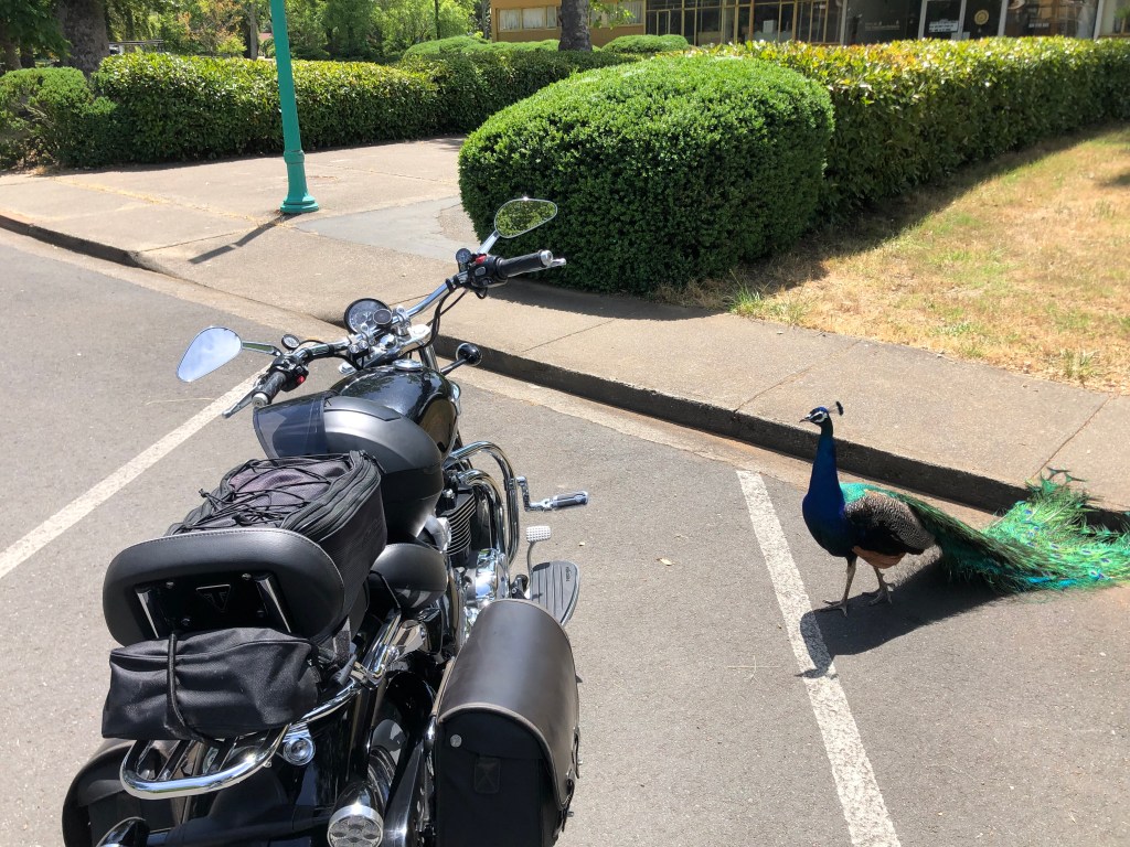
My friend W (whom you would have read about in my memoir) and I are planning a camping trip in the El Dorado National Forest. The weather has been absolutely beautiful of late, so today I took out the Speedmaster for some reconnaissance in the forested region between Auburn and Lake Tahoe, scouting out possible campsites.

I began by cruising up CA 49 to Coloma (pop: 400, and the birthplace of California’s Gold Rush) then heading northwest to Georgetown (pop: 2,500 and one of the original Gold Rush towns). I had planned to get a bite at a local, historic cafe, but such a thing evidently doesn’t exist in Old Georgetown. Seriously, there’s very little going on in this place. Which puzzled me, because when I came through here a couple of years ago it seemed more viable.

Unexplained dinosaur with ladybug costume at a Chevron station in Georgetown.

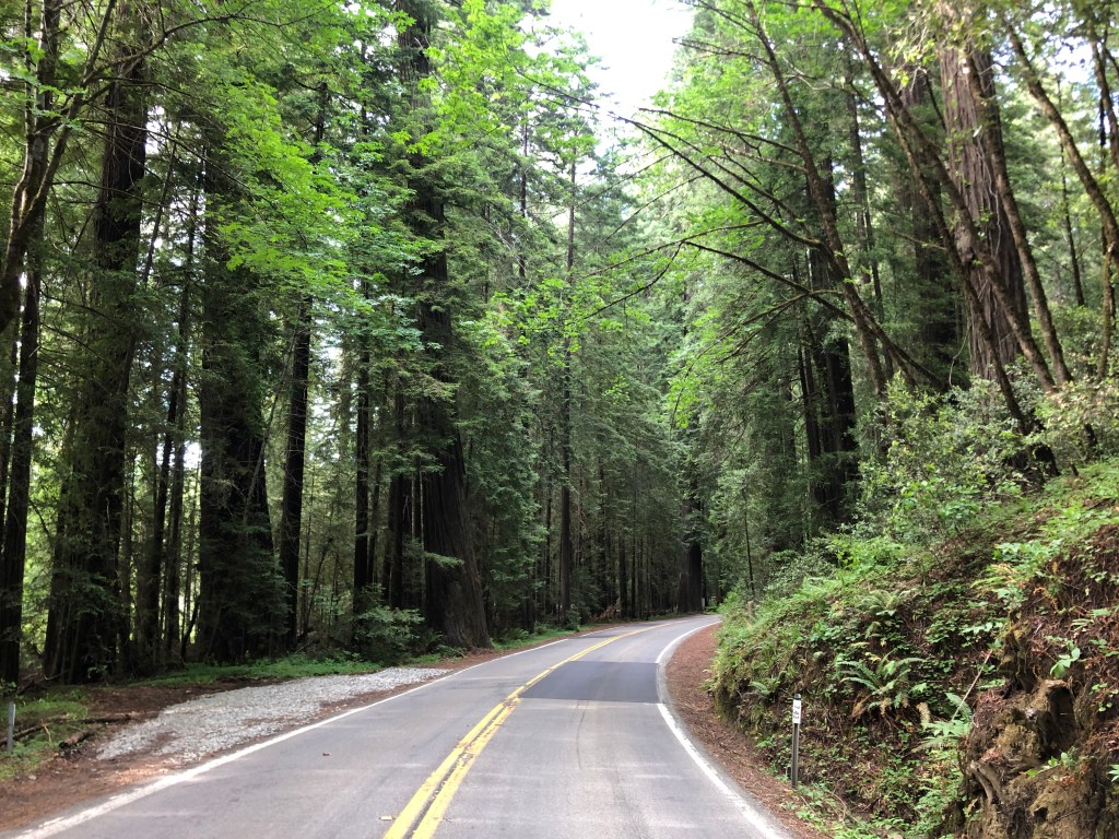
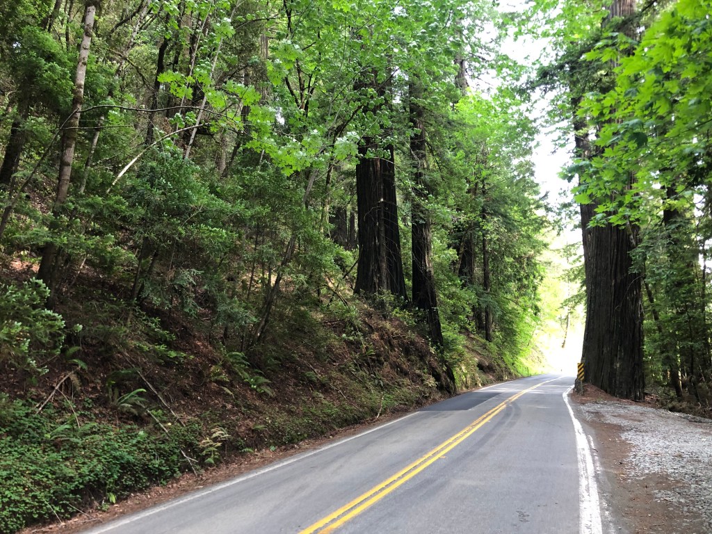
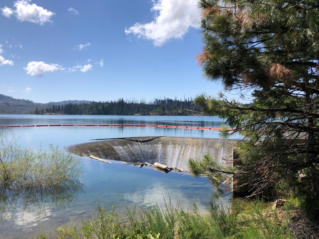
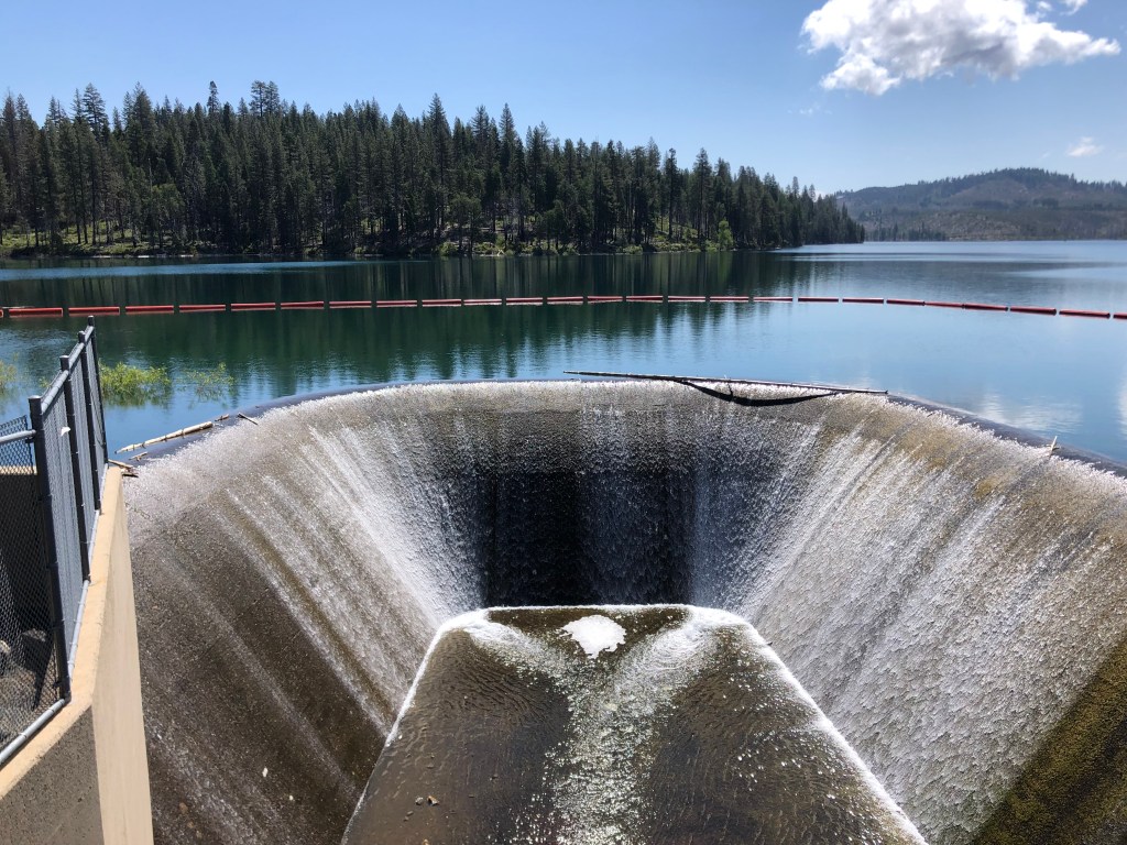
From Georgetown I continued east, immediately entering the El Dorado National Forest. Soon I encountered Stumpy Meadows Reservoir. It’s a peaceful, attractive spot with campsites and picnic facilities. As with many of California’s reservoirs, this one was created as part of the water infrastructure binge in the 1950s and 1960s. The Mark Edson Dam was constructed in 1960, and soon after the meadows were under a lake. Incidentally, the Edson dam is named after the first engineer at California’s Department of Water Resources. The reservoir was named after Edson at the same time, but soon thereafter, for reasons that are not entirely clear, descendants of the meadows’ original owner successfully lobbied to have the name changed to Stumpy Meadows Reservoir.

I was transfixed by this spillway on the edge of Stumpy Meadows Reservoir.
Another view of the spillway.

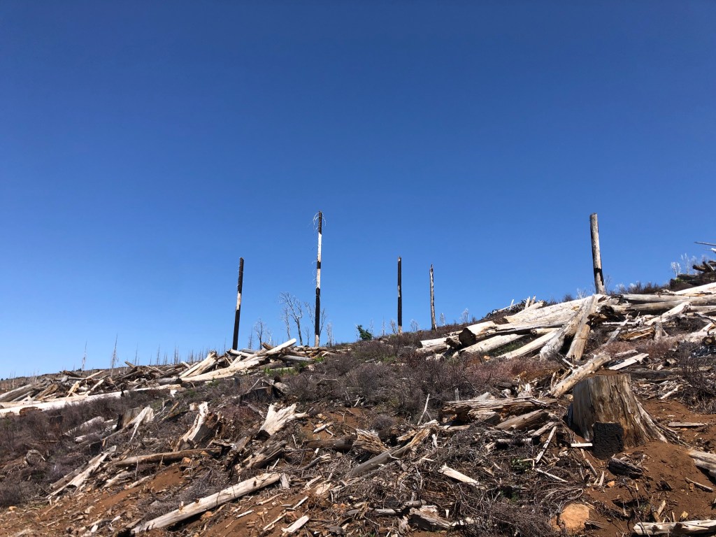
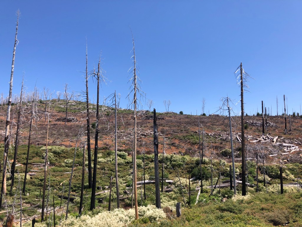
Continuing eastward I soon passed through huge swaths of charred forest that resulted from last year’s Mosquito Fire. That wildfire burned over 76,000 acres of land and destroyed or damaged almost 100 structures. It’s hard to wrap your head around the amount of destruction that can occur in just a short time…and how long it will take to grow back. No specific cause has been officially ascribed to the fire, although documents, news reports, and various lawsuits and criminal investigations all center on PG&E.

Thanks, PG&E.

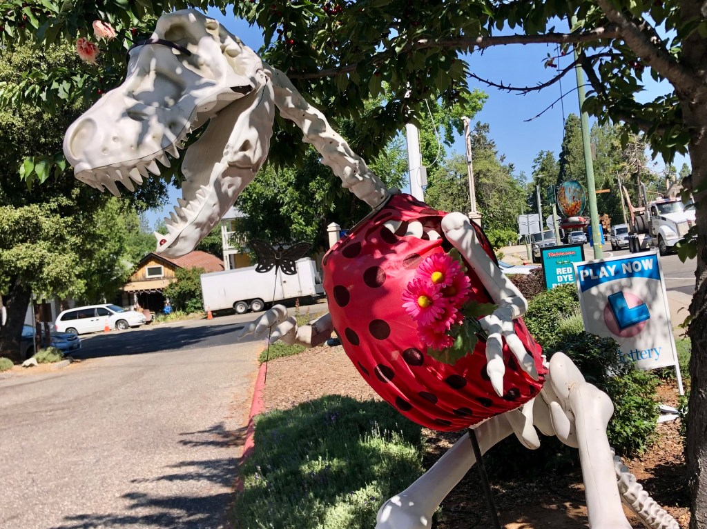
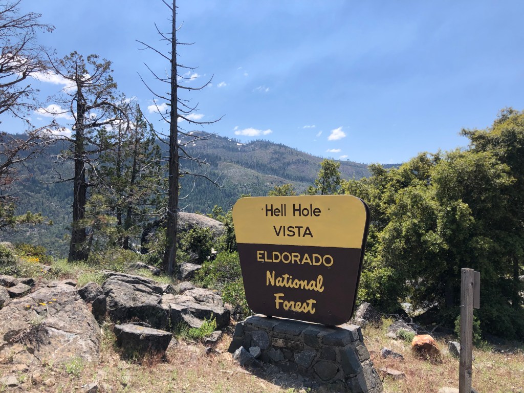
Eventually I passed beyond this hellscape and was again surrounded by green forest. I identified several prime camping spots that W and I might try out. And then I came upon something unusual:

I had a devil of a time finding this place…

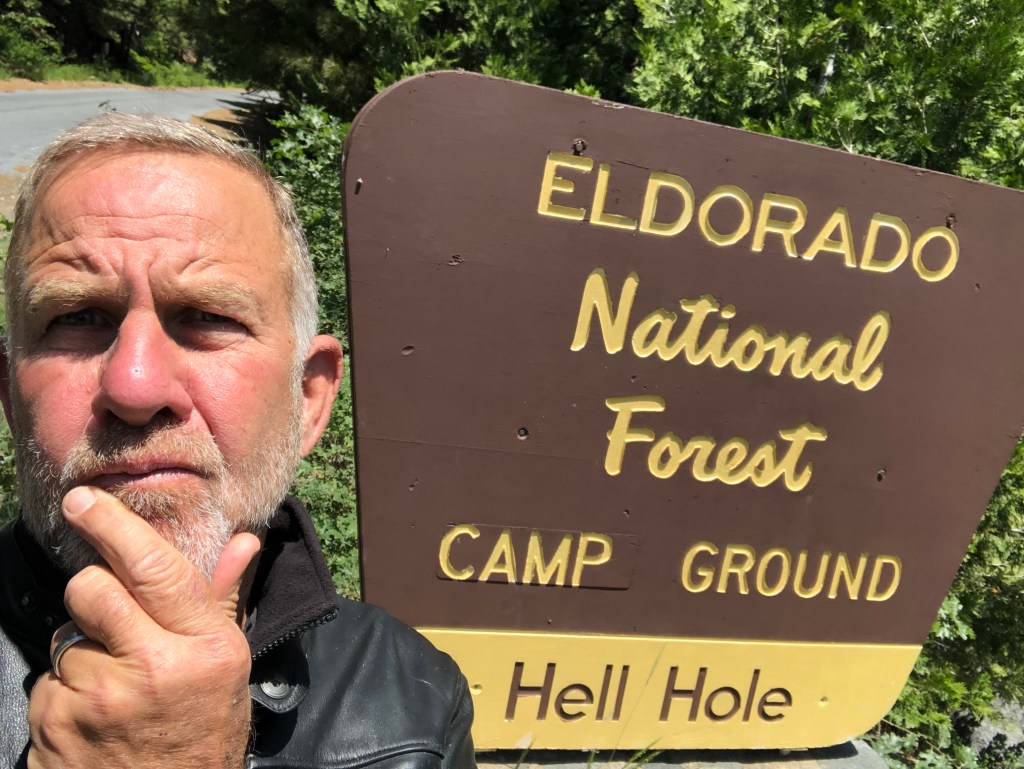
The name Hell Hole certainly doesn’t conjure up idyllic landscapes the way the names Sugar Pine and Emerald Bay and even Stumpy Meadows do. In fact, it seems like the opposite of what you’d want for a campground. The name reminds me more of my first, cramped apartment, located in a shabby building in a gritty part of Sacramento. It also brings to mind a song by the fictitious heavy metal “band” Spinal Tap.

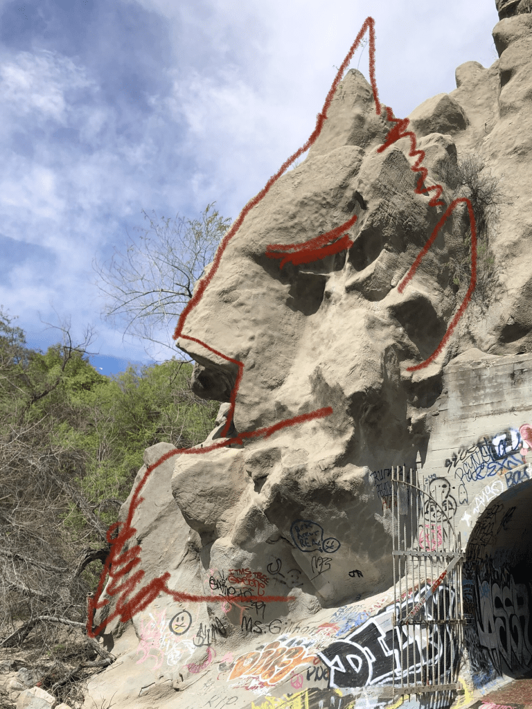
“Hell Hole” also got me thinking about an earlier trip to Devil’s Gate Dam in Pasadena, where a rock outcropping supposedly resembles a profile of the devil. Here’s my photo from that trip:

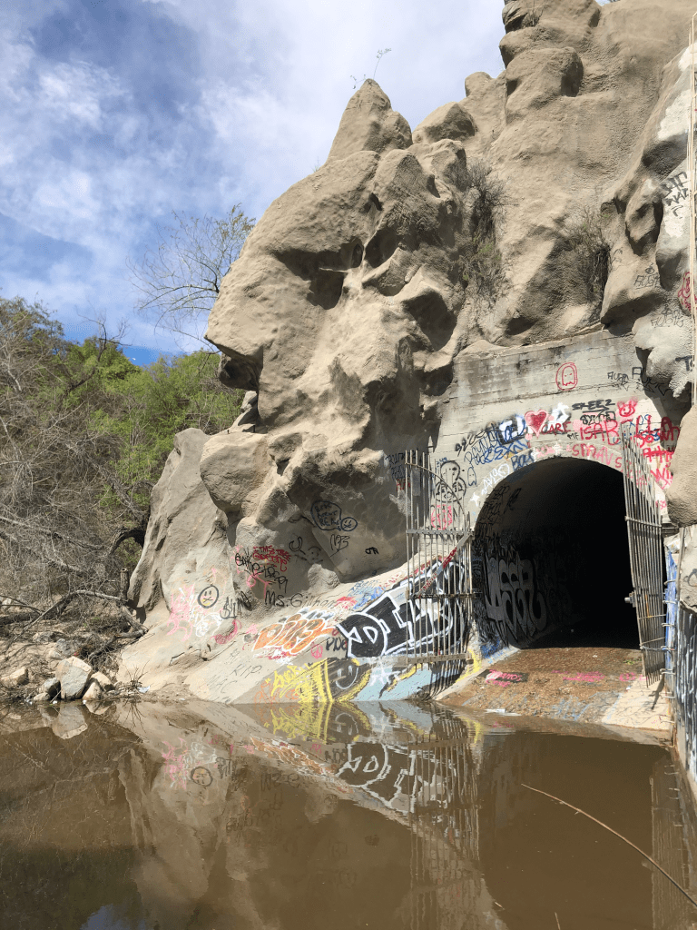
You don’t see it? How about now:

Anyway, the Hell Hole campground gets its name from the Hell Hole Reservoir, which got its name from Hell Hole canyon which it filled. Wikipedia gives this account of the name:

How the canyon came to be named Hell Hole is a combination of folklore and speculation. An early author, George Wharton James (1858–1923), visited the canyon in 1913.[2] He attributed the name to an unidentified miner seeking riches during the Squaw Valley mining excitement of 1862. It was “a hell of hole to get out of,” James wrote, but admitted his source for the place name was more speculative than the anonymous miner’s chances for riches at Squaw Valley.

The reservoir was created in 1966 when the Placer County Water Agency dammed the Rubicon River. Covering about 1,250 acres, it’s a good-size reservoir. And despite its name, it’s a beautiful setting.

Dam this Hell Hole!

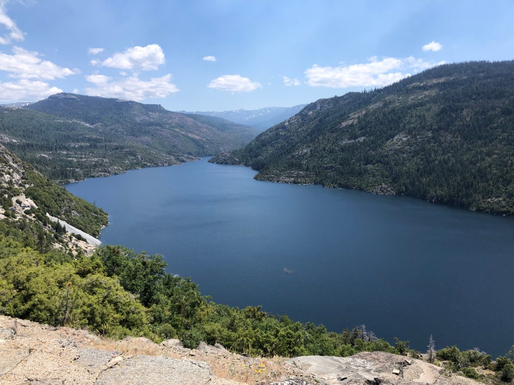
I hiked up to a scenic overlook, where I passed an enjoyable 30 minutes just looking at the scenery and enjoying the warm sunshine.

Three words that don’t normally go together.

After chatting with some campers and making a mental note of this area for my outing with W, I figured it was time to start heading back. For my return trip, I planned to take Mosquito Ridge Road west to the town of Foresthill (pop: 1500), and then head home on CA-49 South. Mosquito Ridge Road is narrow and windy, and the asphalt is potholed and cracked, but the surrounding scenery made it worth the inconvenience.

Mosquito Ridge Road, in red. Hell Hole reservoir is on the center-right edge of the map.

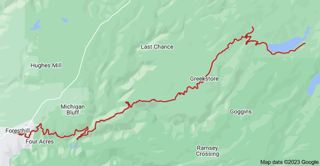
When I got on to Mosquito Ridge a sign informed me that Foresthill was 45 miles away, so I settled in for a long, slow ride. About halfway through my journey I encountered this unwelcome sight:

Not again…

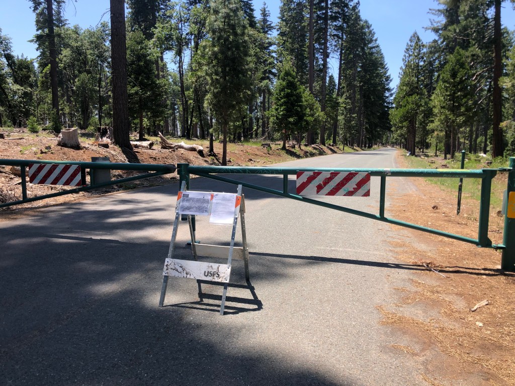
Attentive readers will recall that I’ve run into numerous road closures in my travels. It’s especially inconvenient for me as I’m riding a motorcycle with a small gas tank, so unexpected backtracking in remote areas can be stressful. What’s more irritating is this closure came with no forewarning, and the roadblock itself doesn’t really explain what’s going on. Indeed, instead of a “road closed” sign or something equally straightforward, there’s just a xeroxed office memo tacked to a folding barricade.

Excuse me while I consult with my lawyer…

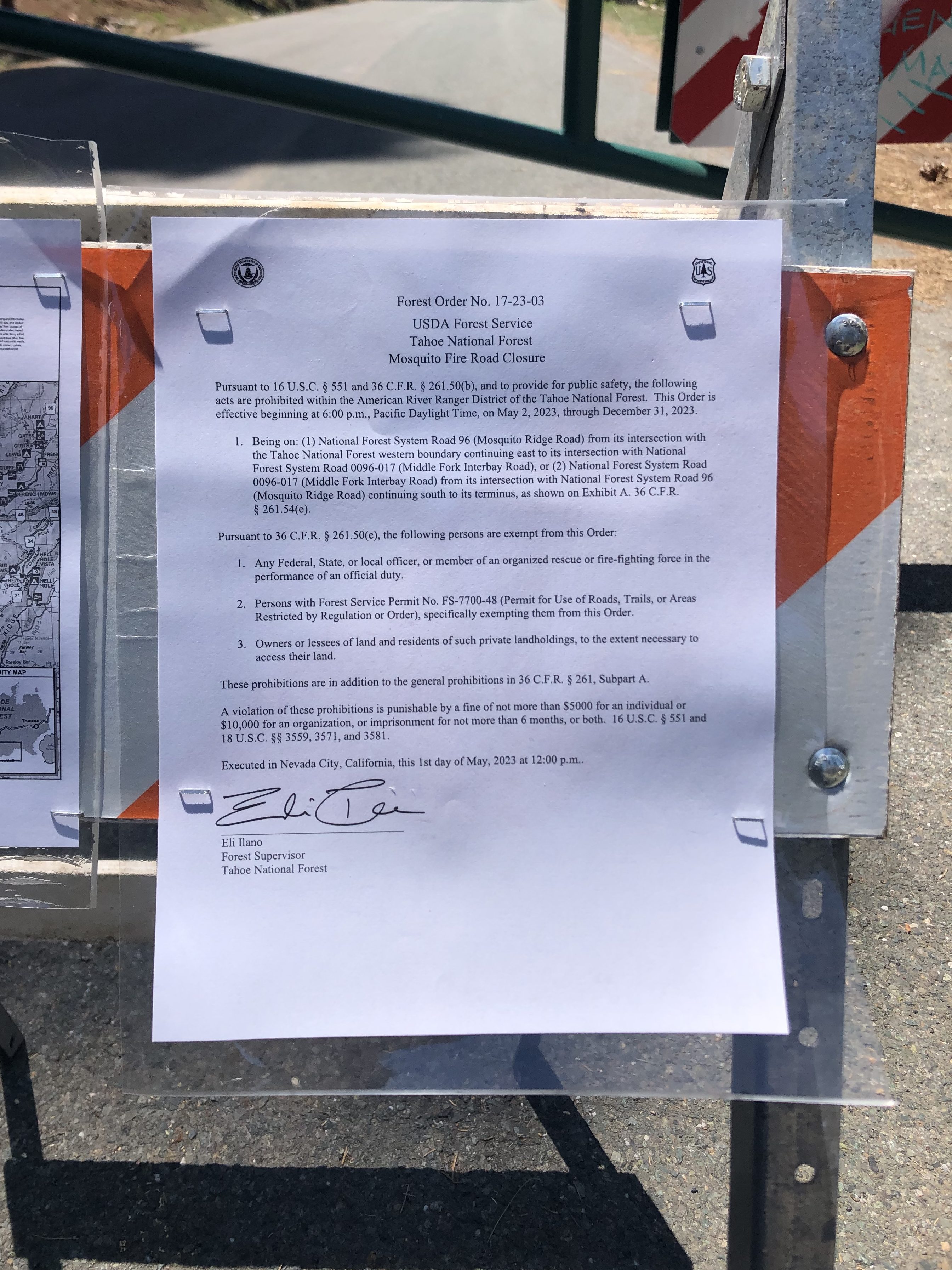
This “forest order” cites “Section U.S.C. Sec. 551 and C.F.R….” blah blah blah… What caught my eye, though was the reference to a $5000 fine and 6 months in jail. Rather than figure out the specific coordinates of the prohibited zones and the details of the exemptions, I just turned around and went back towards the Hell Hole, and then retraced by initial route through the charred hellscape back to Georgetown, hoping I wouldn’t run out of gas.

And then, as if on cue, I encountered a second unwelcome sight: A forest fire!

Where there’s smoke…

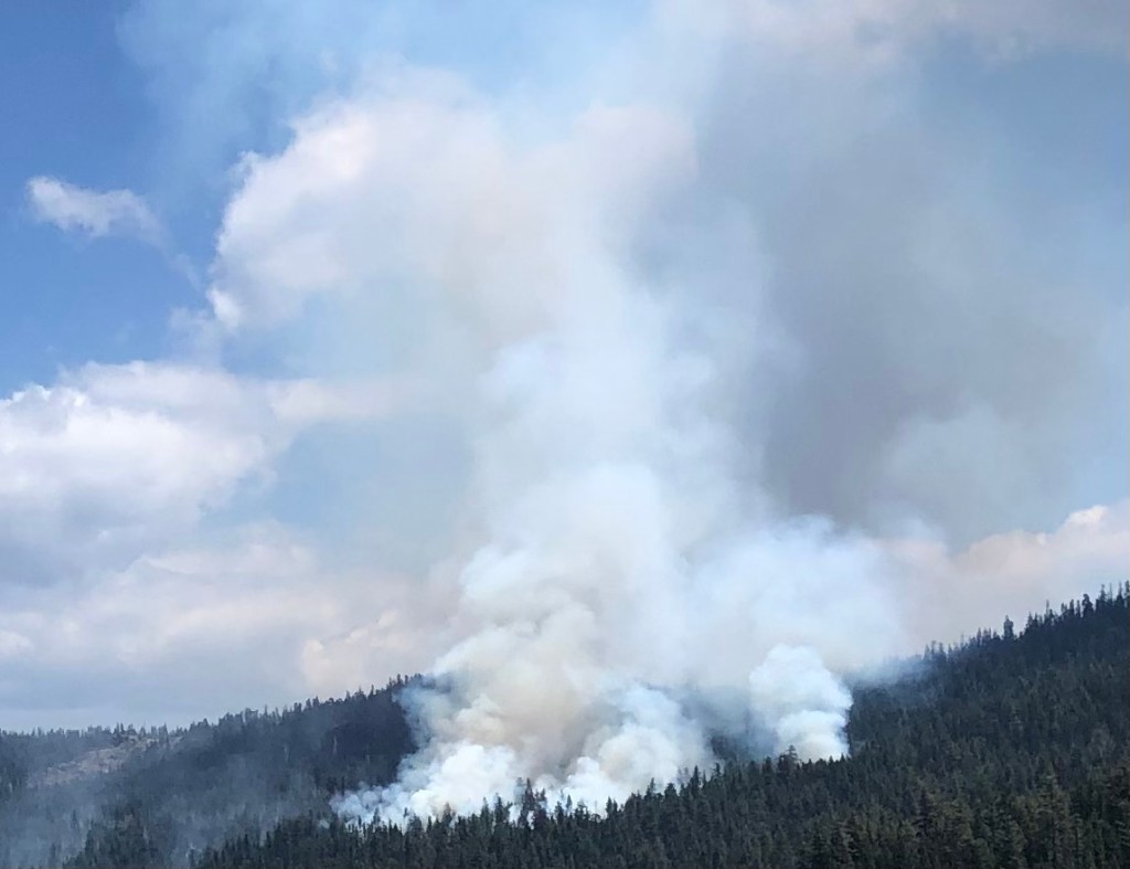
Feeling a little panicky, I got out my phone to call 911. But there’s no service out here in the middle of nowhere. I decided to find a ranger station at the Hell Hole. But then I noticed a portable, electronic sign board: “RX BURN. DO NOT REPORT.” I interpreted this to mean “prescribed burn,” even though technically their sign says “prescription burn.” What would Section U.S.C. 551 have to say about that?

The rest of the trip was uneventful. I got to Georgetown with 7 miles left in the tank, and I got home in time for cocktails. It was a hell of a trip.

California history · Road trips · trains

Bodhisattva, won’t you take me by the hand?

Relax, young Grasshopper. The title will become clear if you are patient…

This morning I set out from Benicia on the trusty Speedmaster

After a pleasant ride skirting the top of San Pablo Bay and cutting up through the wine country, I joined US 101 (or, as my southern-California-reared wife calls it, “the” 101) at Petaluma. Petaluma (pop: 60,000) seems to have a penchant for public art. Take, for example, this 1920s-era PG&E substation. I really appreciate this kind of public art–whimsical, approachable, understandable. Kudos to you, Joel Jones, who conceived and designed the thing!

One of my pet peeves is wall plates that don’t match the color of the outlet. But I’ll let this one slide as an artistic choice.

Close by the substation is some more public art, this time at Petaluma’s historic freight station building, which has been converted to an “arts center”. The effort here seems to be shooting for edgy. Which is another way of saying “head-scratchy.”

War of the Worlds meets Dobie Gillis.
Now that’s a buxom bird.

Not long after leaving Petaluma, US 101 narrows down to a couple of lanes. The countryside is open and green. There’s an old set of Northwestern Pacific Railroad tracks that run along the east side of the highway, but no train has run on these tracks since….well, probably since that Petaluma arts center was still a freight depot.

Finally I arrived at Ukiah (pop: 16,500), which is technically the beginning of the prefab road trip that Ian sent me. The first stop listed is the Grace Hudson Museum and Sun House (cost: $4 senior admission). Grace Hudson (1865-1937) was a California native who became an accomplished artist, working mainly in painting portraits. In 1911 she and her husband built a craftsman-style home they called “Sun House,” which was donated to the City of Ukiah by her heirs. I toured it today. It’s a pleasant, comfortable house, and notably it feels as though Grace just left this morning. It’s full of her furnishings and personal possessions.

The Sun House

Next to the Sun House is a museum that includes a number of examples of Grace’s work, including this self-portrait done when she was a teenager.

The museum also has a temporary exhibition called “Artistic Reflections on the Back to Land Movement.” I’m not sure what that means; it mainly seemed to show a bunch of naked hippies.

The docent (Janice) tried to educate me about these things, but I’m too much of a Philistine to understand. However, in the course of our conversation she mentioned she’d once worked at the nearby Buddhist monastary called the “City of 10,000 Buddhas.” Now that sounded interesting. It’s not technically part of this road prefab road trip, but I figured I’d drop in on the monks. And I’m glad I did!

The moment I entered the grounds I felt relaxed and at peace. Large open spaces, plenty of trees, winding paths, almost no cars. Peacocks roamed about and didn’t seem concerned about an approaching visitor. I’m not making this up.

Now, I should mention that when I lived in Palos Verdes, our street was overrun with peacocks. And let me tell you, they are noisy, dirty, creatures. But you can’t deny that they’re also beautiful.

As I strolled through the campus, every so often I would pass a monk (at least, someone I assumed to be a monk), and he would bow while steepling his hands. It all seemed so mellow. Even the street signs were positive, with names like Joyous, Sincerity, and Mindfulness.

In the center of the campus is the Jeweled Hall. It is here that the eponymous 10,000 Buddhas reside.

It doesn’t look like much from the outside…but that’s because it’s a repurposed building from the old Mendocino State Asylum for the Insane. And no, I’m not making this up.
Start counting the Buddhas. And this is only the anteroom.
The Bodhisattva. Steely Dan had a song by that name, which we played endlessly in college. Part of the refrain is the same as the title of this post.

The City of 10,000 Buddhas was founded in the 1970s by Hsuan Hua, a Buddhist Monk who wanted to bring Buddhism to the West. The site had been the Mendocino State Asylum for the Insane since 1889. The “city” sits on about 500 acres of land.

As I was getting ready to leave, I found that one of the peacocks was taking an interest in my motorcycle.

I was ready to shoo it away, but the guy seemed so calm…so Zen. These peacocks seem to be so much more pleasant than the ones I remember from Palos Verdes. Or am I just becoming more at one with the world?

With resignation I left this refuge and re-entered modern society. I got back on the highway and headed north to Willits (pop: 5000).

My road trip guide tells me the Mendocino County Museum is next. It didn’t look like much from the outside, but I dutifully went in and paid my $5.

How can I put this? The place didn’t really burnish my Buddha. It might be because I’ve been to a lot of museums at this point in my life. I mean, how many sets of old-timey dentist tools does a person need to see? They had the usual stuff: A recreation of the town soda fountain, old household appliances, a lot of photos. The one thing that did catch my interest was the display on the racehorse Seabiscuit. It tuns out that Seabiscuit was bred on a farm right here in WIllits. Who knew??

And the other fun fact is that Charles Howard (who owned Seabiscuit) also owned a dog he called “Wee Biscuit.”

But….habeus corpus??

Willits, by the way, is the western terminus of the Skunk Railroad, which runs from Fort Bragg. I inquired at the station and learned that a collapsed tunnel still hasn’t been repaired, so the rail journey has been indefinitely suspended. You can read more about it in this post from last year.

Next I headed up the highway toward Leggett (pop: 77) and its “world famous drive-thru tree.” But before I got there, I saw this sign on the road:

I’m sure this involves controlled substances in some way.

I pulled off the road into this compound of brightly painted, old buildings.

Given the sign at the road, I assumed this was something open to the public. So I walked around a bit, taking in the “scene” (as they say). Soon I was facing “John-boy” (as he called himself).

Not a Walton.

John-boy was an interesting chap. He wasn’t unfriendly, but he really wasn’t overly friendly either. He dutifully answered my questions about the place, which is supposedly a “venue.” When I asked him what kind of event is coming up next at this venue, he said “Uh, there’s something next month, but I don’t remember what.” (A later Google search informed me that the place is an old gas station site that now is a medical marijuana farming collective.) There is a statue of the Virgin Mary and other religious icons. Then I noticed a Buddha:

Now I was up to 10,001 Buddhas for the day! I asked John-boy about its significance, and he told me “It’s where we hide our money. We wrote it off for tax purposes.” I’m still not sure what that means. When I told him that I’d just come from the City of 10,000 Buddhas, he pointed to a rock fountain and said “that’s a lady who used to live at the City of 10,000 Buddhas.” He said when she died her ashes were scattered around the fountain. He also said she claimed to be a psychic named Anastasia, “but I think she was just a busy-body.” And yet, this skeptic about psychics also told me that the world was controlled by aliens ever since our 1940s-era atomic tests ripped a hole in the space-time continuum. I decided it was time to go.

Within half an hour I was at the famous drive-thru Chandelier Tree (cost: $15 for cars, but only $10 for motorcycles). It’s a 276-foot-tall coast redwood that’s estimated to be about 2,400 years old. The hole was cut to make it a tourist attraction in the 1930s. Attentive readers will recall that I drove through this once before, but that was at a time when this blog was just a series of homemade Word documents emailed to a select few folks. So there’s no record of it here on WordPress. Now there is.

So, I’m now in the thick of the 1950s-era roadside attractions. I passed a “tree house” attraction, but didn’t stop as it was starting to get late and it wasn’t on my pre-fab list. But what was on my list was Confusion Hill.

Confusion Hill is a quintessential roadside tourist attraction with food, a kids play area, restrooms, souvenirs, penny-smashing machines, etc. But it also has a “gravity house,” which is an old shack built at odd angles to create optical illusions. They play up how gravity doesn’t work properly at this spot due to various theories about meteorites, aliens, etc. My dad took the family to one of these in Santa Cruz (“The Mystery Spot”) when I was a kid. It was fun, but Dad (ever the engineer) got into an argument with the tour guide over the proper use of a level to measure angles.

Anyway, at Confusion Hill I asked how this place differed from The Mystery Spot. “Ours is authentic” came the response from the woman behind the counter. She was Carol Campbell, the owner of the place.

Carol Campbell, owner of the authentic Confusion Hill.

Carol also told me that there’s a third place — The Oregon Vortex — which was exposed as a fraud on The History Channel two nights ago. I paid my $5 and checked out the gravity house. It was exactly like the one I remembered from my childhood visit to the Mystery Spot. But I have to admit, the place feels fun and welcoming and good-natured. It’s well worth $5.

There are various other roadside attractions in this area, mostly tree-related.

The Grandfather Tree–265 feet tall and 1,800 years old.

My prefab trip does include a second drive-through tree. This one is called the Shrine Tree. I drove by, but it was getting too late. Besides, who needs to drive through two trees in one day? That said, the Shrine Tree only costs $8 for motorcycles.

Now it was time to drive through the Avenue of the Giants–a 32-mile scenic highway to wends its way through various groves of ancient redwoods….some of which are well over 1,000 years old. It was a beautiful drive that returned me to the Zen state I felt when at the City of 10,000 Buddhas.

And suddenly, it was all over! I had spent $76 (including food and gas along the 130-mile drive). So yes, you can do it for under $100!

I checked into a cheap hotel in Fortuna, and will head back to Placerville via a circuitous route tomorrow. I may make another post if I encounter anything notable. But otherwise, I’ll leave you with the:

BREW OF THE DAY

The BOTD was a Palace Porter from the estimable Ukiah Brewing Company.

It tastes like a dry porter. For a porter this one is pretty heavily hopped (particularly on the finish, which is positively bitter). It has the roasty, malty notes you expect in a porter, but there’s not much complexity beyond that. Maybe I taste a little burnt toast on the front end. It’s got a creamy head, and nice lacing on the side of the glass.

It weighs in at 6.7 ABV. It’s perfectly serviceable, but nothing to write home about. 3.5 out of 5 stars.

Road trips

California’s North Coast

This February son Ian sent me a link to an article entitled “The Most Affordable Northern California Road Trip Takes You To 8 Stunning Sites For Under $100.” He knows his old man’s love of a bargain. And although I suspect it will be difficult to keep the cost of any meaningful road trip under $100, I’m always up for a challenge. So here I am in the East Bay city of Benicia, preparing to set out on my north coast road trip tomorrow morning.

The main part of the trip as described in the article runs from Ukiah to Willits.

The timing of this trip is fortuitous. Not only is the spring weather expected to be pleasant, but I’m just a few days ahead of my friend Brian’s motorcycle trip with his three brothers on a two-week loop from Denver to the West Coast and back again. They’ll be covering a little of the same ground I’m covering on my trip. What’s more, next week I’m planning to join them on another leg of their trip, from Placerville to Lake Tahoe. Incidentally, that will be my first “group” ride. I’m a bit worried I’ll be playing Curly’s role in the photo below.

Anyway, tomorrow evening I’ll post a summary of my north coast journey, which will include an accounting of how well I kept the costs under $100.

Brew of the Day

This evening I went with son Ian and daughter-in-law Katelyn to Side Gate Brewery in Concord. They offered me a porter which, when I tasted it, seemed serviceable. But the guy behind the bar glanced right and left in a conspiratorial way, and whispered that he had a “secret tap option” (or some similar verbiage) which was an imperial Baltic Stout. This secret option wasn’t going to be officially released until the end of the month, but seeing as I was interested in dark beers he was willing to slide one to me under the table.

I wasn’t allowed to photograph this secret option, and I’m probably not supposed to even describe it. But let’s just say it’s worth a trip to Concord to try this very tasty beer.

Until tomorrow.

sdb

cemeteries · Uncategorized

Bay Area Blues

It’s been about 7 weeks since I got back from my road trip along the Blues Highway in the Mississippi Delta. I do think the trip left a bit of an imprint on me — just as I think travel does for all people. As regards this particular trip I feel like I’m more aware of the influence of the blues in much of the music I listen to, and I have a slightly better understanding of the cast of characters who have moved the art form along.

Enter John Lee Hooker. He was born in 1912 in Tutwiler, Mississippi, not far from Route 61 (the Blues Highway) which I drove on my road trip. John Lee Hooker was an incredibly influential Delta Blues artist, and his name kept turning up in the various blues museums I was visiting. He played an electric guitar like nobody’s business. And he popularized the song “One Bourbon, One Scotch, One Beer” long before George Thorogood made it popular all over again on his 1977 debut album.

“I said look man, come down here…”

And here’s something else about JLH: you saw him playing in the original Blues Brothers movie, as himself on the streets of Chicago in 1980. It’s worth watching that clip again, just to get into the mood:

I mention all this because the other day I literally stumbled upon John Lee Hooker’s resting place:

The man was an amazing musician, but his handwriting evidently sucked.

I had taken a ride to the Bay Area to visit with my old college roommate, Bruce. And, for reasons that still aren’t entirely clear, Bruce decided that we should visit The Chapel of the Chimes in Oakland. The COTC is a massive Moorish/Gothic columbarium that was designed by the famed architect Julia Morgan in 1928. (You’ll remember that Morgan designed Hearst Castle, among other iconic structures.) It would be easy to get lost in this place, with its multiple floors, twisting hallways, large airy rooms, and endless decoration. But it’s fascinating and over-the-top with its overwrought decoration.

Random doorway in the Chapel of the Chimes
Bruce trying to find his way out.
This photo stolen from the Internet gives a good sense of the Moorish decoration.

Anyway, to get back to John Lee Hooker: In his later years Hooker lived in California, with houses in Los Angeles and the Bay Area. He was inducted into the Blues Hall of Fame and the Rock and Roll Hall of Fame. He died in 2001 at age 88 (though there’s some dispute about his exact age; he was the son of a sharecropper in the early 20th century, and recordkeeping wasn’t that great at the time). He was in his house in Los Altos when he died, and evidently made the short journey to this final resting spot here in Oakland.

I’d urge you listen to a few songs by John Lee Hooker, and maybe even to visit the Chapel of the Chimes. And if you do, please help Bruce find his way out….

RIP the Boogie Man
Cars · Road trips

The Cross-Country Road Trip is 120 Years Old!

Some of you (such as Alert Reader Detlef K.) have come across articles and news stories about the 120th anniversary of the cross-country automobile road trip. For those of you who haven’t, I am providing this link to a great story in “Big Think.” It was a big deal, as it took Horatio Jackson 63 days to make the trip along (mainly) dirt roads with a mechanic and a dog. It was a big deal at the time. Now, most of my coast-to-coast road trips have taken more like a week. (Once I did it in a little more than three days….but I was on the lam at the time…) But in 1903, 63 days was lightning fast, considering there were no gas stations, no AAA, no signage, and precious little pavement.

I’m seriously thinking of re-tracing Horatio’s route. Somebody talk me out of this…