Breweries · California history · Cars · Puns · Road trips

Life in the Slow Lane

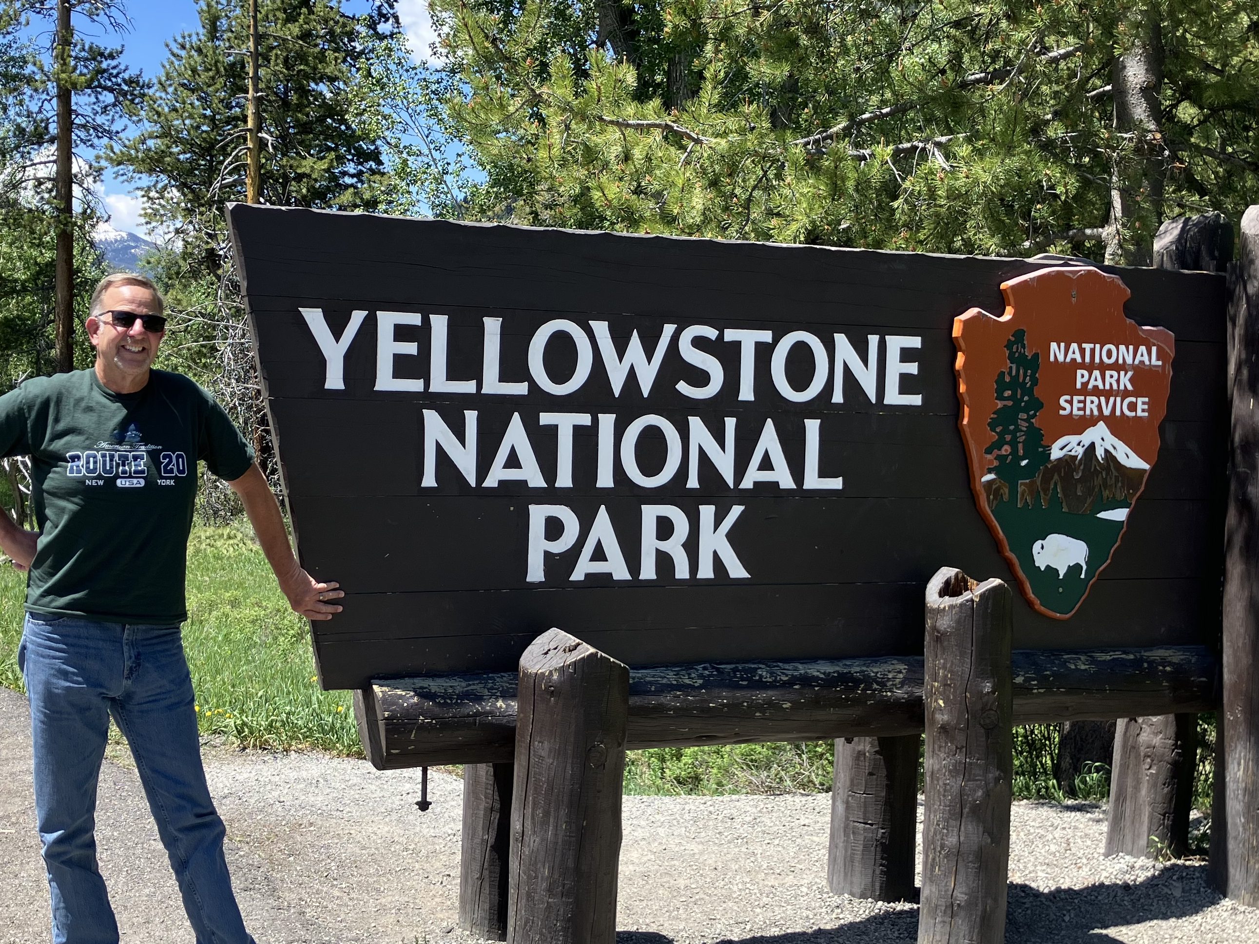
With a level of complication that rivals the Normandy Invasion, my son (Ian) and I decided to rendezvous at a resort near Bend, Oregon, where we used to spend summer vacations once upon a time. Ian flew there from Vermont (which took two days, thanks to United Airlines), while I decided to drive up from Placerville along the east side of the Sierra Nevada range on US 395.

One of the more contemplative drives in California.

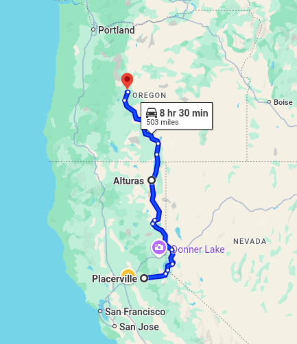
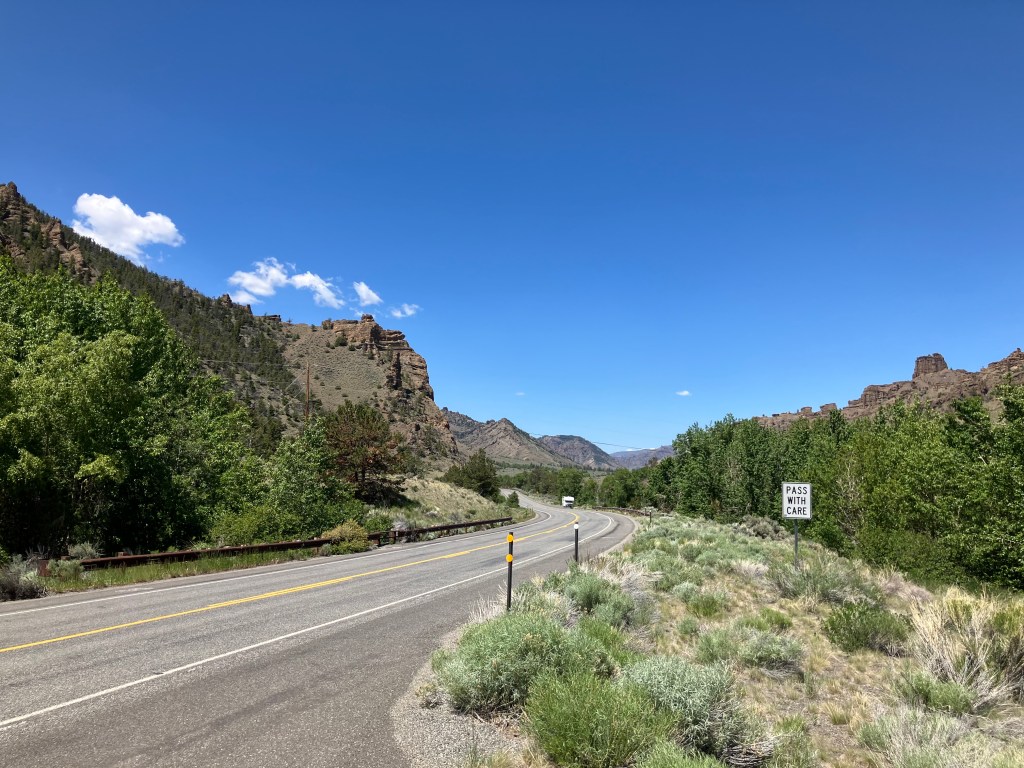
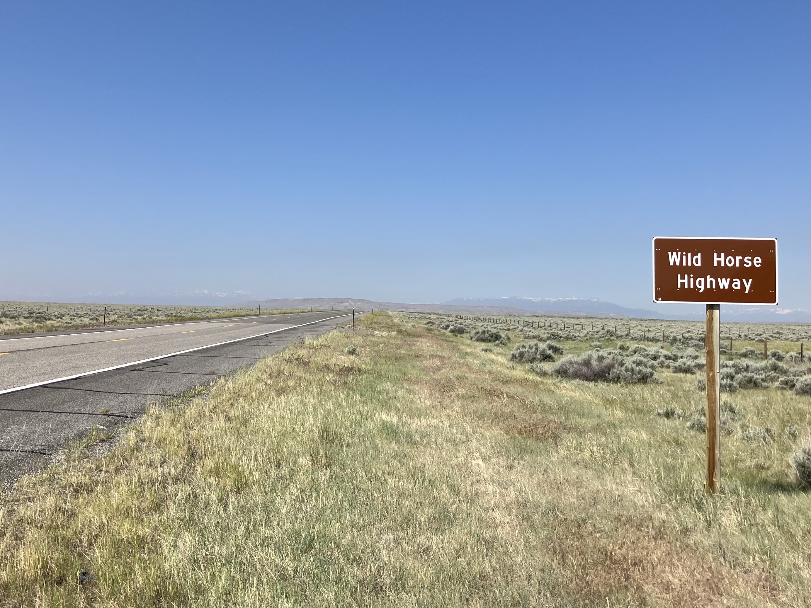
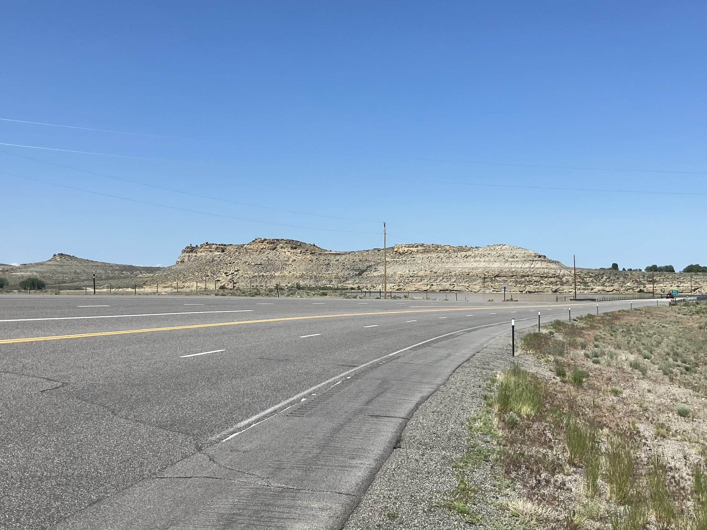
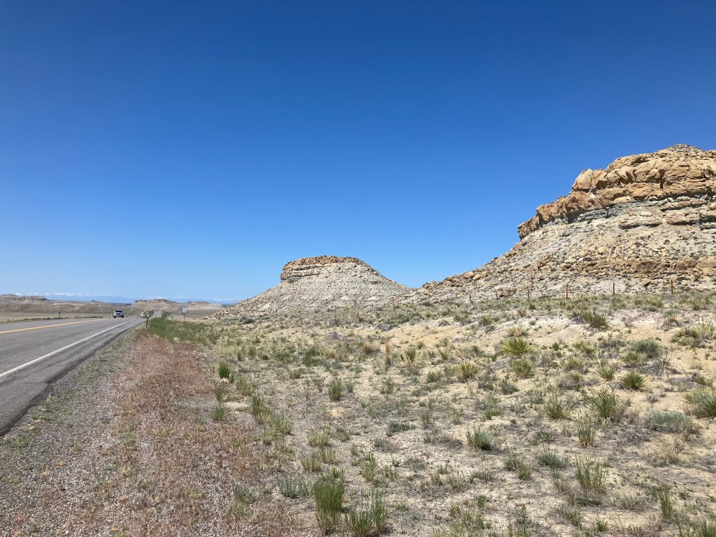
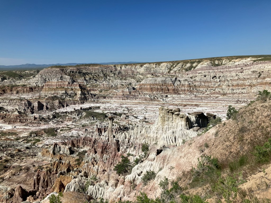
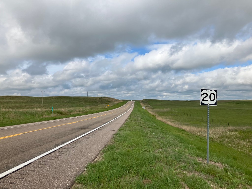
As alert readers will recall, I’ve driven various stretches of 395 at various times, most recently on my famous search for the remnants of the Nevada-California-Oregon narrow-gauge railroad. You can read about that trip here. Heading north on this stretch of US 395 is simultaneously one of the most contemplative and dramatic routes in California, with the craggy east slope of the Sierras on your left and lots of open range and the occasional lake on your right. Traffic is fairly sparse and the occasional towns are small and infrequent. My two favorite stops on the route–partly for their names and partly for their oasis-like qualities–are Hallelujah Junction (pop: 1) and Likely (pop: 99).

Hallelujah Junction’s sole resident.

While I didn’t cover new ground during this week’s trip up to Oregon, I did have a new rental car experience. I typically reserve the smallest, cheapest car on offer, knowing that the rental car companies will almost always “upgrade” me to an Altima because that’s pretty much the only car they actually keep on the lot. Ian correctly points out that the price difference between renting the bottom-of-the-line subcompact and just a normal sedan is only a few bucks a day. But it’s that kind of thinking that led to our current $36.2 billion national debt.

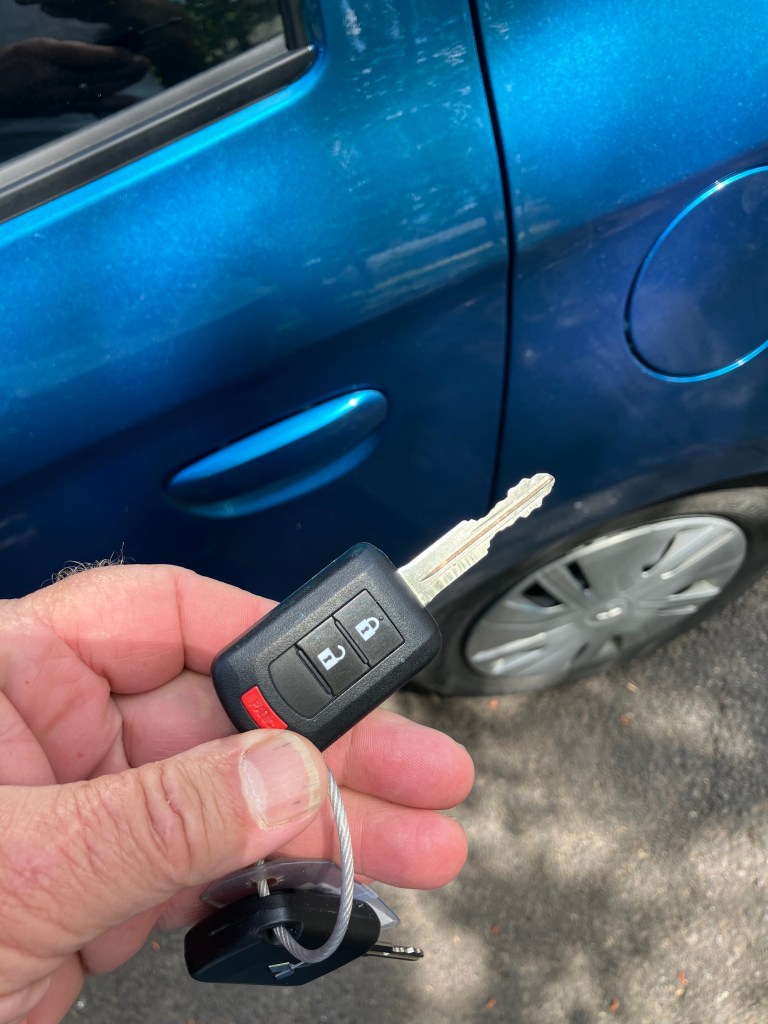
So I booked the cheap-o car. And this time they called my bluff. Meet the Mitsubishi Mirage–with three working cylinders and a total displacement (1.2 liters) that’s literally the same as my motorcycle.

78 Horsepower baby.

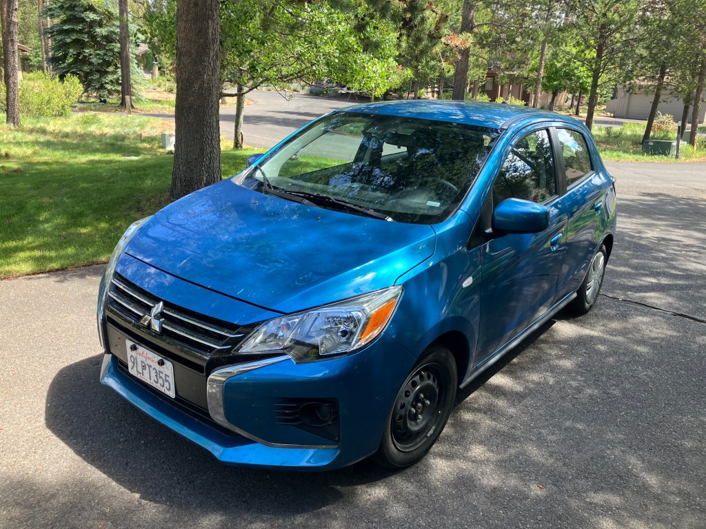
A little research reveals that the Mirage was the lowest-priced car available when it was manufactured in 2023. In a zen-like way, those savings come at a cost. The interior is as bare-bones as it gets, with manual seats, basic AM-FM radio, hard-plastic door panels, and a no center console of any kind.

I’ve eaten pizzas with a larger diameter than the Mirage’s spare tire.

Plus, in a throwback to the Clinton era, this is one of the last production cars to still require an old-fashioned key to get its three cylinders firing.

Remember these?

But the most remarkable thing about the Mirage is the (lack of) acceleration. This car notoriously has the slowest zero-to-sixty time of any production car. Ian did a Google search and found this review that Carbuzz did of the ten slowest cars. Here’s their take on the Mirage:

And finally, the number one slowest vehicle in America is the soon-to-be-dead Mitsubishi Mirage. It takes you an impressive 12.8 seconds to get from zero to 60 miles per hour in this sad excuse for a passenger vehicle, and it’s all thanks to the minuscule 1.2-liter three-cylinder engine that only produces 78 hp and 74 lb-ft of torque. It isn’t fast, it isn’t comfortable, it isn’t nice, and it’s pretty old. The Mirage won’t be missed.

Now, Ian’s an engineer, and he insisted that we subject this claim to empirical testing. So I stopped the Mirage on a flat stretch of road, Ian readied his stopwatch, and I stomped on the (aspirationally-named) accelerator. The analog speedometer began move, like Frankenstein’s monster on the slab. Five mph, ten mph….my fingernails and hair became noticeably longer….twenty mph…empires rose and fell….thirty, forty, fifty….North America drifted another few inches away from Europe…finally we achieved 60 mph.

The feat required 17 seconds–almost a third longer than even even CarBuzz’s incredulous estimate. On the positive side, the Mirage gets good gas mileage.

Anyway, we spent a few days near Bend simultaneously consuming water, hops, and barley. It was a relaxing break from my mile-a-minute retired life.

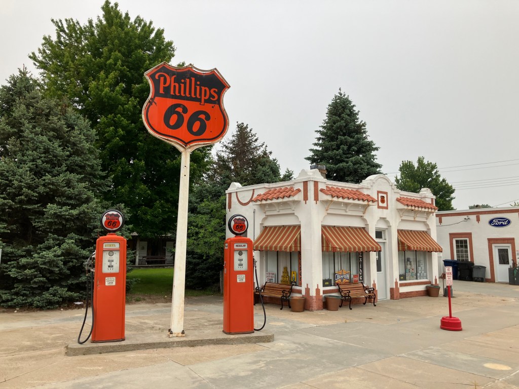
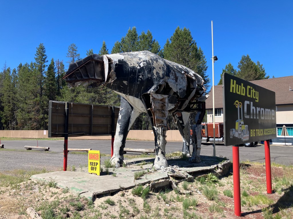
Then, just like that, it was time to head home. For the return trip we took US 97 from Bend to Weed, where we connected to Interstate 5 and continued south to Sacramento. A few notable items along the return trip include this decaying roadside relic in Chiloquin, OR (pop: 769).

I found an online photo from some years back that helps to clarify what it’s supposed to look like:

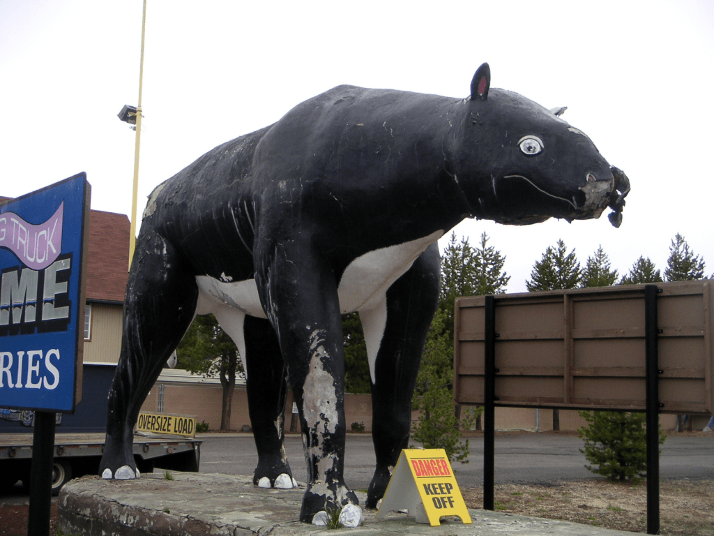
Is it a tapir? A cross between a horse and a cow? A dinosaur of some kind? There’s a lot of online debate about this. It’s sort of the Rorschach test of roadside kitch. Turns out it’s a remnant from a place called Thunderbeast Park that opened on this spot in the 1960s. There are some rumors on the internet that the remaining dinosaurs were relocated to a spot along highway 1 on the north coast. Ian claims we actually saw them on an earlier trip, but I think he may be hallucinating. Please let me know if you have any insights on the whereabouts of the Thunderbeasts.

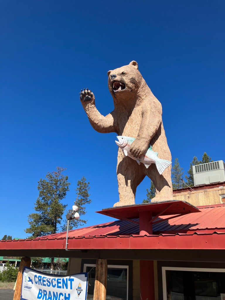
Meanwhile, the town of Crescent (pop: 400) has this unusual, but better-preserved, roadside art on top of the town library. I’m assuming the bear had some meaningful connection to an earlier use of the building?

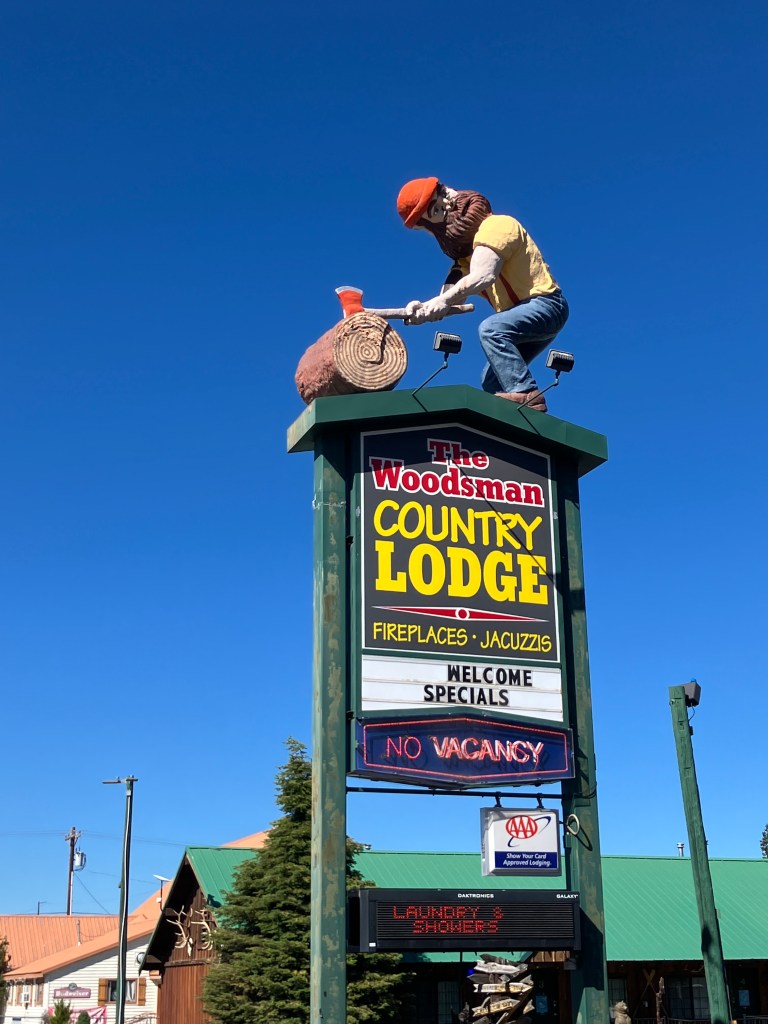
The town of Crescent also features this lumberjack, who appears to be suffering from a cervical fracture:

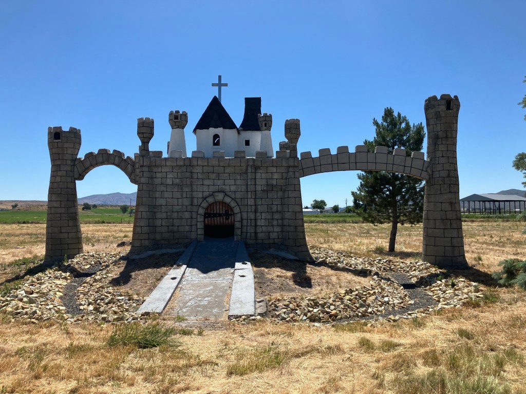
Near Klamath Falls we encountered this unexplained castle sitting in a field along US 97. To me it looks like a giant version of the kind of thing you’d see on a miniature golf course. Turns out it’s a trademark display from a bygone place called “Kastle Klamath,” which billed itself as a “Family Fun Land.” It had go-karts and a swimming pool and, yes, miniature golf. Like so many such places, it seems to be a victim of changing tastes in the Internet age.

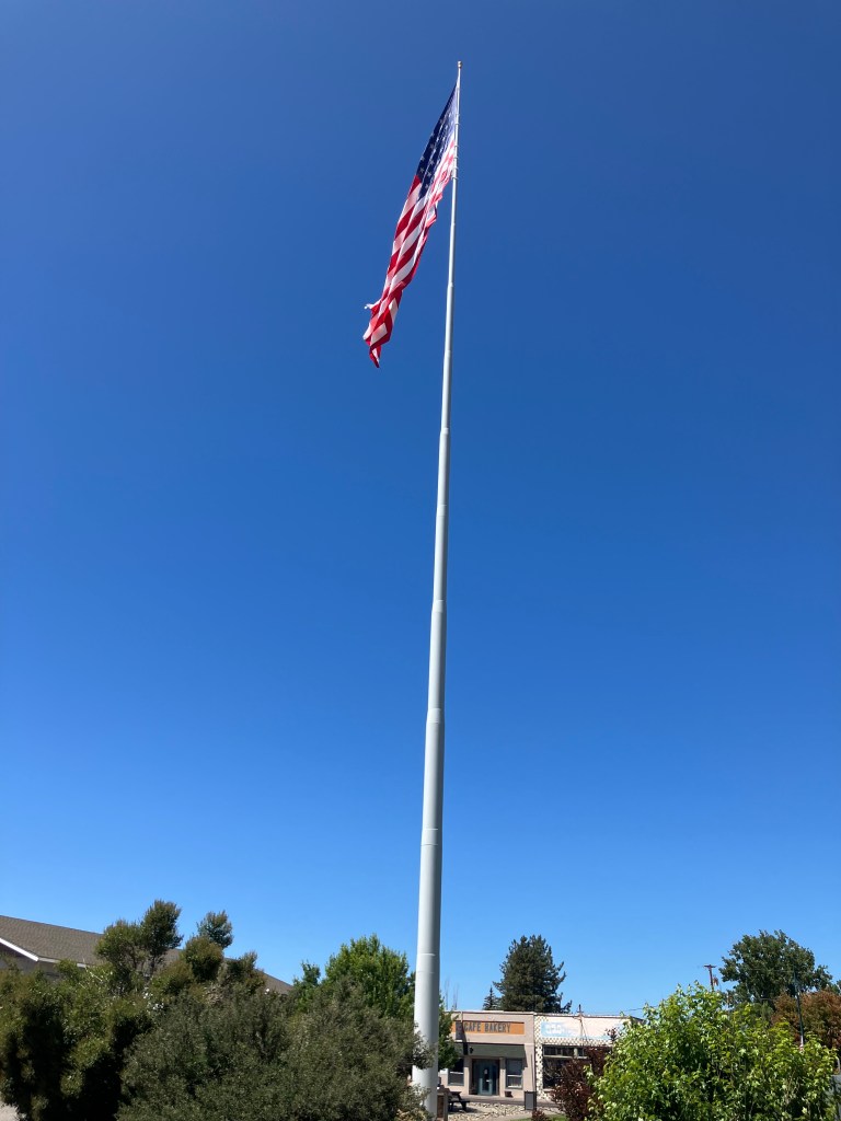
Eventually we crossed back into California and came to the town of Doris (pop: 860), whose claim to fame is its 200-foot-tall flagpole. A plaque claims it is “America’s tallest flagpole.” (As of this writing, the tallest flagpole in America is actually in Wisconsin, and it stands at 400 feet. Meanwhile, the tallest flagpole in the world currently resides in Cairo, Egypt, at 662 feet.)

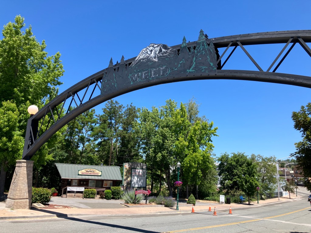
The southern end of US 97 terminates at Interstate 5 in the town of Weed (pop: 3,000). Located close to Mount Shasta, the town of Weed is named after Abner Weed, who founded the town when he built a lumber mill here in 1897. Today, the name provides endless opportunities for hilarious puns. For example, the town’s motto is “Weed like to welcome you.” And there are a half-dozen souvenir shops hawking T-shirts saying “I love Weed” and similar phrases that will make you the envy of Deadheads everywhere.

The historic archway to downtown Weed.

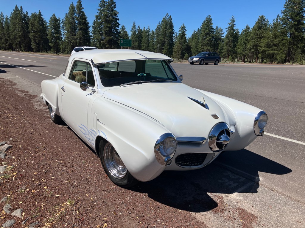
Finally, what is a road trip without a Studebaker sighting? We spotted this heavily-modified 1950 Starlight Coupe on the side of the road…where most Studebakers eventually spend a good portion of any outing.

And now, it’s time for the…

BEER OF THE DAY

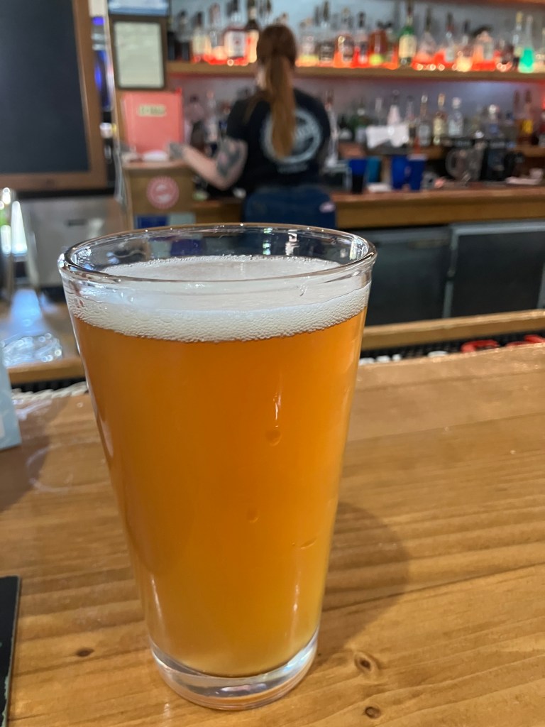
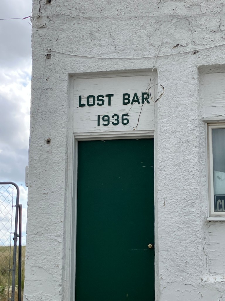
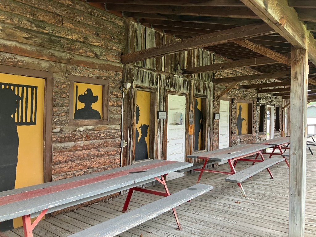
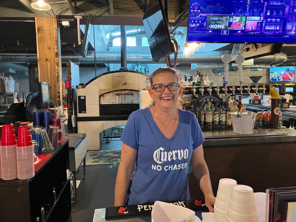
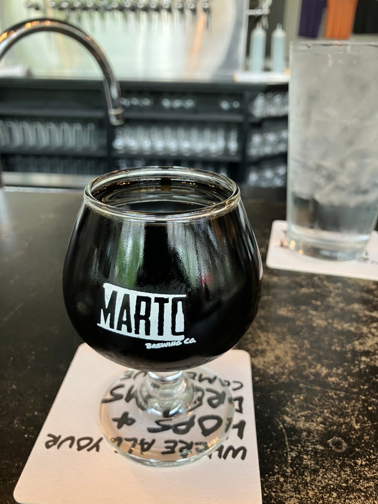
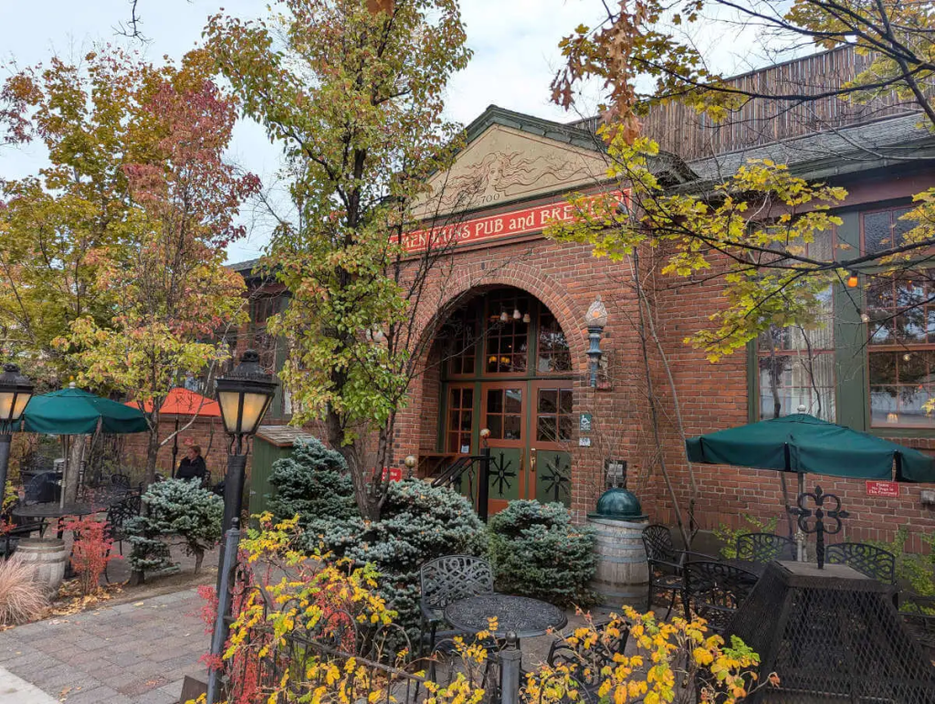
The BOTD comes from McMenamins Old St. Francis School in Bend, Oregon. McMenamins is a privately-owned chain of historic structures that have been converted into pubs, restaurants, and hotels. This location had been a Catholic school which was built in 1936, and today the classrooms are hotel rooms. It also includes a full restaurant, a brewery, and movie theater, and a public pool.

Photo from The Brew Site.

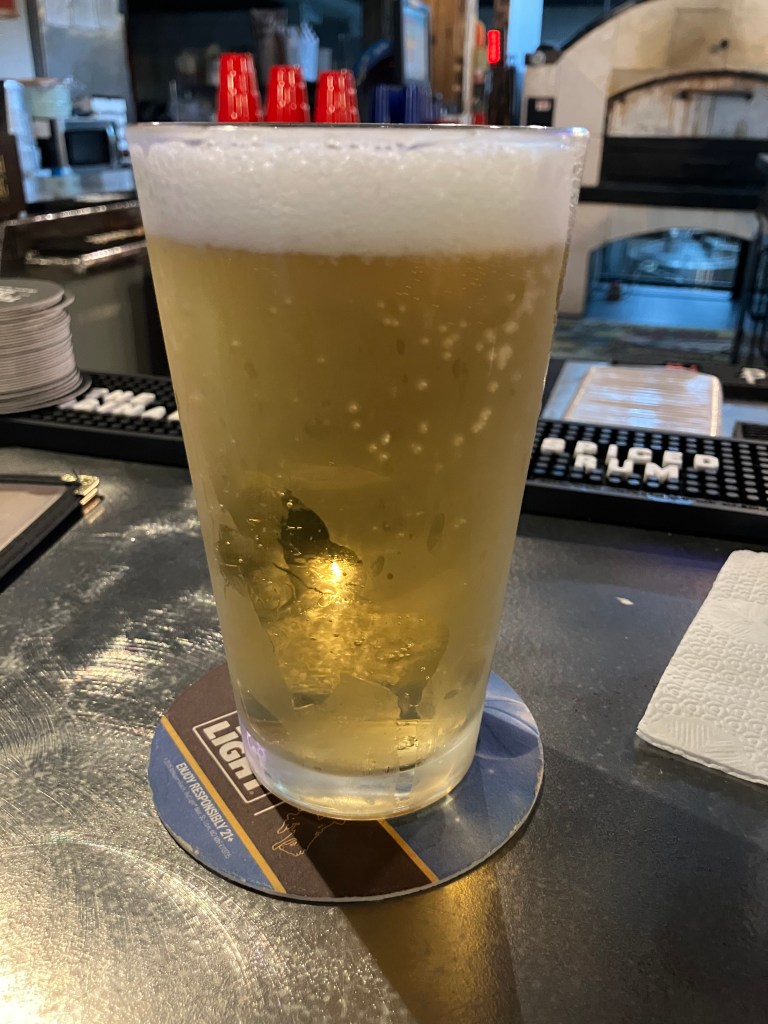
The offspring and I had lunch in the back patio, and for my beverage I selected the Bamberg Obsession. It’s a Munich Helles (a lightish German beer) to which they’ve added beechwood-smoked malt.

This looks promising.

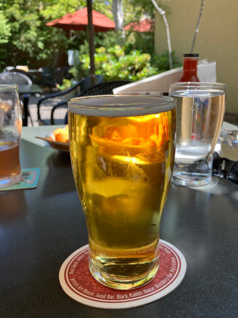
It’s a beautiful, golden beer the color of light honey. I was mesmerized simply by the look of the thing, radiating sunshine and pot-at-the-end-of-the-rainbow good luck. The taste didn’t disappoint, either. This is a refreshing beer, as you’d expect from a Helles. But the addition of the smoked malt lends a subtle complexity that keeps things interesting. It’s not overwhelming, but rather gives just a hint of peat or a distant campfire. There’s not much bitterness to this drink, which again is consistent with the Helles style. A slight sweetness also comes through. The ABV clocks in just under 5 percent. This is the Arnold Palmer of beers. Highly recommended on a warm day. 4.5 out of 5 stars.

Breweries · bridges · Cars · Gas stations · movie theaters · Road trips · Yard art

The final stretch

Today I drove the final stretch of Route 20’s original route, which terminates at the eastern entrance to Yellowstone. I left the lads in TenSleep this morning, and rejoined US 20 at Worland, Wyo. From there I headed north to Greybull, and then east to Yellowstone. The whole drive was about 170 miles…and then another 170 miles to get back to TenSleep!

Westward Ho.

It was a great day for a drive. The weather was perfect, and there was no traffic. It was just me and the open skies. This part of the country, with its solitude and natural beauty, is growing on me.

Idyllic drive.

I picked up where I’d left off a couple of days ago at Worland (pop: 4,800). Worland is a tidy and practical town, where the good folks of TenSleep and other surrounding communities go when they need a supermarket or various specialty stores. It’s also a reasonably attractive community, with a number of western art installations like this one that commemorates the pioneers.

It felt good to be back on US 20 West, with the familiar white signs and the commodious US-standard lanes. Early in today’s trip I came to Manderson, Wyoming (pop: 3,900), where a veritable graveyard of old farm equipment and buses stretches along the side of the road. It’s evidently a vehicle recycling and/or consignment operation, where tractors go to die. The hearse at the edge of the property seems to drive home the point.

Just a small portion of their collection.

Once I was heading east out of Greybull, the endless prairie began to give way to the peaks and crags of the Bighorn and Owl Creek mountain ranges, and fast-flowing Shoshone River gorge. The passing scenes reminded me of the settings for a John Ford movie.

A speed goat keeps watch over US 20.

Even though most of US 20 is designated the Medal of Honor Highway, a segment east of Cody was designated the Wild Horse Highway just a few years ago. This segment borders BLM lands where a herd of about 100 wild mustangs still roam the McCullough Peaks range.

Horses are of course an iconic element of the West. They were brought to the Americas by Spanish missionaries and explorers several hundred years ago. Evidently a number of those horses escaped during the pueblo revolts, and descendants of those horses still roam the plains. In 1971 the US Congress passed the Wild Free-Roaming Horses and Burros Act, which provides for the protection of those horses.

Where the wild horses roam.
Horses along the Wild Horse Highway.

After the Wild Horse Highway I came to the “big city” of today’s trip. Cody, Wyo (pop: 10,250) is one of those larger-than-life towns that inevitably become tourist trips. “Buffalo” Bill Cody founded Cody City in 1895. It was intended as a resort community, near the Demaris mineral hot springs. It was also conveniently located near the eastern entrance to the recently-created Yellowstone National Park. However, just about a year after Buffalo Bill founded Cody City, someone named George Beck established a second city just to the west. It’s this second city that kind of swallowed up Cody City and grew up to be today’s Cody. Ever the entrepreneur, Buffalo Bill embraced the new city and opened a hotel (the Irma) in 1902 that still stands today.

Today’s Cody is a tourist town that leans into its history and western lore. There’s a major museum complex called the Buffalo Bill Center of the West. There are numerous businesses that claim to have authentic links to Buffalo Bill. And the 1936 Cody Theater currently hosts a live musical called the “Wild West Spectacular.”

“Old Trail Town,” which purports to be a semi-authentic reconstruction of the original Cody City. It’s comprised of historic structures from across the region.
The Irma–built by Buffalo Bill and named after his daughter.
Active 1936 theater, showing live stage productions.

After getting my BOTD (more on this below), I left Cody and tackled the final segment of US 20. This stretch, which runs 27 miles from Cody westward to Yellowstone, is designated the Buffalo Bill Cody Scenic Byway.

This Bob’s Big Boy in a field on the side of the Buffalo Bill Scenic Byway is completely unexplained.

Finally, after about 2,500 miles and a dozen days of driving, I arrived at the end of (original) US 20!

My Route 20 shirt is courtesy of The Tepee near Cherry Valley, NY.

That Yellowstone photo comes courtesy of Harry and Xiomata, who were celebrating their 41st anniversary.

Happy Anniversary!

With the road trip complete, there are just a few items left to round out this blog post. Here we go:

BRIDGE CORNER

Today I passed what I consider to be a picturesque, historic bridge that deserves mention. The century-old Hayden Arch Bridge crosses Shoshoni creek near just west of Cody. It’s billed as “Wyoming’s only medium span concrete arch vehicular bridge.” Alas, I arrived just a few days too early for a big celebration. According to a recently-posted notice, “The Cody Country Chamber of Commerce invites the public to a special centennial celebration marking 100 years of Hayden’s Arch, one of Wyoming’s most iconic bridges. The commemorative ceremony will take place Saturday, June 21, 2025, at 4:00 PM, at the historic Hayden Arch Bridge.” It’s not to late to plan your trip!

Wyoming’s iconic Hayden Arch Bridge turns 100!

BEER OF THE DAY

I wanted to do something special for the last BOTD for this trip, so I bellied up to the bar at the Hotel Irma, which Buffalo Bill himself had built in 1902. It’s named after his youngest daughter.

Sadly, I wasn’t able to secure a seat at the bar–there was considerable disagreement among the barflies as to whether “Jack” was going to return to the seat he had earlier vacated. And the wait staff and bartenders–all of whom seemed to have been holdovers from the days of Buffalo Bill–seemed irreparably confused. I left.

Instead I chose the considerably less historic Millstone Pizza Company and Brewery that sits just across the street from the Irma. On advice of Doogie Howser’s doppelganger who was working behind the bar, I had the Pineapple and Jalapeno Ale.

Doogie’s Fave.

Now, this was a reasonably well-made beer, with smooth body, good hoppiness, nice color, and a delicate foam head. The only thing this beer didn’t have was the taste of pineapple or jalapeno. Which would seem to be a problem for a beer billed as a pineapple/jalapeno beer. There was no sweetness and no heat whatsoever. When I brought this to Doogie’s attention, he kind of shrugged and said, “yeah, I’ve complained to the brewmaster about that myself.” (And yet he’d recommended it to me?!) He also hinted that the brewmaster used green peppers rather than jalapenos. Zero stars for false advertising. It’s a disappointing end to a good string of BOTDs.

DELETED SCENES

Finally, we end with a handful of photos from all along US 20 that largely speak for themselves. Is this a great country, or what?

(The pink elephant has become a theme of my trips. For other sightings see here and here and here and here.)

Breweries · Cars · Gas stations · Road trips

Casper to TenSleep

My day began in one of the country’s most haunted cities: Casper, Wyoming (pop: 59,000). It was here I learned a valuable lesson. It’s a variation on the Marianne’s’ Phenomenon, which has come up a few times in this blog over the years. To refresh your memory, you experience the Marianne’s Phenomenon when you mistake unique external conditions for food quality. This happened to me 30 years ago, when I ate at an Italian restaurant named Marianne’s. My wife and I had just taken a long bike ride and I was tired and famished. We sat down to a pasta meal and I was in heaven. “This is the best meal I’ve ever had!” I gushed. The next weekend I insisted we go back to Marianne’s to relive the magic. It sucked. I concluded that my elation at the first meal derived simply from my extreme hunger.

Here’s today’s variation: The motel where I spent the night offered free coffee, which I took with me in the car. It was almost undrinkable–it tasted like the watery and malodorous Folgers my mom used to percolate every morning on the stove. So I drove to the nearest coffee shop to try again, and this time it was the most delicious cup of coffee I’ve ever experienced. Now it’s possible that Copper Cup Coffee legitimately makes great coffee. But I suspect it has more to do with the contrast with earlier coffee. Surely there is an aphorism that neatly captures this? Something like “In the Valley of the Blind the one-eyed man is king.” I realize that one doesn’t exactly suit the circumstances; can someone help?

Anyway, equipped with The Best Cup of Coffee Ever, I pointed the Peregrinator west and headed out of Casper. Casper is a worthy town, situated on the banks of the Platte River and possessing a rich history as a US fort and as a waypoint for westward immigrants. But it’s a bit too big and modern for what this trip has focused on. The perfect illustration of this is Sanford’s Grub and Pub on SE Wyoming Blvd:

Sanford’s Grub and Pub in Casper, Wyo.
The place is flanked by a giant Daffy Duck and a giant Bugs Bunny.
No theme is too random for Sanford’s Grub and Pub!
The back parking lot has a Cadillac Ranch vibe, with the hulks of numerous old cars planted in the landscaping.

To be sure, Stanford’s Grub and Pub has many of the things I’ve enjoyed along Route 20: Old cars, streamline moderne architecture, roadside kitch. But it feels too curated, too much like it was designed in a lab by a soulless consulting firm in Greeley Colorado. It just tries to hard. Don’t get me wrong: It’s probably a great place to take the kids. And I’m told they have a great beer selection. It just lacks the sincerity that abounds along the quieter stretches of the route. So I got directly back on Route 20 and headed out of town.

Today’s route: From Casper (lower right) to Worland (where I departed Route 20) and east to Ten Sleep.

As we discussed yesterday, Wyoming has the least population density of any of the lower 48 states. There just aren’t that many towns, and most of those that I did encounter didn’t have much obvious history or engaging features. That said, the Wyoming landscape is starkly beautiful. Here are a few pictures from today’s drive:

Near Shoshoni, Wyo
Another view near Shoshoni.
One of the many proghorns in the state. The locals evidently call them “speed goats.” They can run as fast as 55 mph.
Seeking a narrow slice of shade.
“Hell’s Half Acre” near Powder River, Wyo. It’s an ancient gorge in the middle of the prairie, where Indians used to drive buffalo over the cliffs.

So, that should give you a sense of the stark beauty along my path today. I just don’t have many man-made features to show you.

My goal for the day was Ten Sleep, Wyo (pop: 260). The name comes from Native Americans, who said it’s a ten-day (ten “sleeps”) trek from Fort Laramie. Today it’s a quiet and pleasant town situated on the laconic Ten Sleep Creek.

Now, Ten Sleep is actually about 25 miles off Route 20. I took this detour because I’m meeting three old friends for a short reunion at Chris P’s Western Retreat. They will likely join me for the final leg of this trip along the original Route 20, which runs to the eastern entrance of Yellowstone. That will probably be on Monday. Until then, we’ll be hanging out at the Ten Sleep Brewing Company. If you’re lucky, I might post some dispatches of the ensuing hijinks.

Location, location, location.

Speaking of brews, it’s time for the…

Brew of the Day

tEven though I spent the evening at the Ten Sleep Brewing Company, the BOTD appropriately comes from a place along Route 20 proper. And that is the One-Eyed Buffalo Brewing Company in Thermopolis (pop: 2,725), which was the largest city on today’s trip. Thermopolis means “hot city” in Greek, in reference to the natural hot springs.

My BOTD was something called the W-Rye-O. It’s a brown ale aged in whiskey cask from Wyoming Whiskey distillers.

I’m a sucker for cask-aged beers of any kind. They generally have more depth and interest than a regular beer. For the W-Rye-O, the cask aging seems to have mellowed the brew. It’s extremely smooth and doesn’t have a lot of carbonation, and the hops are definitely reined it. There’s a distinct tinge of whiskey on the palate, though I wouldn’t say it complements the beer that well. In fact, the two tastes seem to be fighting against each other, akin to brushing your teeth after drinking orange juice. This beer has a slight off-bitterness that tastes like lighter fluid. It’s not enough to ruin the beer, but enough to lose a star. 3 stars.

Breweries · bridges · Cars · Gas stations · movie theaters · Road trips · trains

Cowboy Country

In all my jaunts along the various blue highways criss-crossing the map, it never ceases to amaze me how varied this country is. Just over the past week I’ve gone from coastal New England, through the green hills of the Berkshires, into lighthouses on the Great Lakes, through the rust belt of South Bend and Chicago, between the manicured fields of Iowa farms, and under the leaden skies of the Great Plains.

In all honesty, there hasn’t been a single segment that I haven’t enjoyed, that I haven’t experienced beauty, that I haven’t met wonderful people. And yet, today’s segment was characterized by lots of long, straight stretches at freeway speeds across the plains of Nebraska. Faithful reader Brian W. had encouraged me to “enjoy the unique look and solitude” of western Nebraska. And I did. The sheer scale of its open space forces one to relax, and the solitude is conducive to contemplation.

Cheap therapy.

US 20 is the only major east-west route in the northern half of Nebraska. (Interstate 80 runs along the lowest third, through Lincoln and Omaha. For this reason, there has historically been a good amount of services along US 20. I encountered a surprising number of old garages and gas stations that have been preserved or restored to their vintage look. I peeked in the garages and saw walls lined with fan belts, racks of oil, piles of tires, and other evidence that these places still do business.

But what I appreciate more than the restored buildings are the historic roadside attractions that have just kept going, year after year, with just enough maintenance to stay in the game. That seems to be more the rule out in this part of the country. I’m sure part of the reason is that the local economy can’t support the wholesale replacement of infrastructure unless there’s a good reason. And there’s not enough population to entice national chain stores to locate their businesses here. The result is a “time warp” situation in many of these towns. Here are a few examples:

“Big John’s” had been a local burger chain in the 1960s that never caught on. This is evidently the only remaining sign–some sixty years old. The current business is an independent cafe in Ainsworth, Nebraska (pop: 1,600).

Big John doesn’t look amused.

In the town of Lusk, Wyoming (pop: 1,500) a redwood water tower still stands next to the railroad tracks. It dates to 1886, and used to provide water to the steam locomotives. They moved it once, in 1919, in line with changes in the railroad. The Tower is now something of an icon for the town, but it’s authentic and as you can see in the photo, the whole scene could be from a century ago.

The Lusk Light and Power Plant also looks to be a historical relic, but I couldn’t find any information on it

The Plains theater in Rushville, Nebraska (pop: 784) dates back to 1914. It’s gone through a number of different iterations, including a movie theater and a church. Today it is a live theater venue.

But let’s get back to US 20 itself. For the first 250 miles of today’s drive, the Cowboy Trail (that I mentioned in yesterday’s blog) runs alongside the highway. You’ll recall that the Cowboy Trail used to be a railroad line that’s been replaced with a hiking/biking path. I was surprised that I didn’t see a single person on the trail, but it’s still pretty new and maybe word hasn’t gotten around. But it’s interesting to see how all the old railroad bridges have been replaced with pedestrian bridges.

The lower pilings are left over from the railroad; the new wood slats on the upper sides were added for the Cowboy Trail.
The old railroad roadbed has been covered with crushed granite.

The reassuring monotony of the plains and the cloudy sky, with the Cowboy Trail close by at my right, had something of a lulling effect that required periodic infusions of coffee. But suddenly, in the mid-afternoon, I spotted some sharp buttes rising from the plains. These were most welcome after The Unbearable Flatness of Being that characterized most of the day’s drive.

Where did you come from?

I stopped at the nearby town of Crawford, Nebraska (pop: 1,000) to see if I could learn more about the buttes. My first stop was to get a refreshing beverage from a young entrepreneur named Case.

No BOTD, sadly.

Then, in the center of town, I found the local tourist bureau/museum. The door was open wide, and as I entered I was greeted by a docent named Cathy. She didn’t have a lot to say about the buttes, but she did encourage me to visit Fort Robinson, just a couple of miles up the road. Her father had been stationed there once upon a time, and a couple of family heirlooms are in the lodge.

Cathy is retired and volunteers at several places in town.

Fort Robinson has been around since the 1870s, playing a major role in the so-called Indian Wars, as well as the First and Second World Wars. The “Buffalo Soldiers” were stationed here, horses and mules were bred here, military canines were trained here, and it even served as a POW camp for German prisoners. The army decommissioned the fort in 1947, and it was converted into a state park in 1956.

1905 Headquarters Building, now repurposed as a visitors center.
One of a number of large horse barns, from when Ft Robinson was a “remount depot.”

Per Cathy’s suggestion I visited Fort Ross and tracked down the family heirlooms–these consisted of a “shadow box” with mementos from Cathy’s father, and a large art piece shaped like a buffalo, made entirely of buffalo nickels that Cathy’s family had collected from a bar they used to run.

Cathy’s father was on the camp’s polo team.
A small fortune in buffalo nickels. (Apologies for the unavoidable reflection in the glass.)

A kind lady at the lodge helped me locate these items…and she turned out to be Cathy’s sister Diana. The resemblance is obvious.

Sister Diana.

By now it should be pretty obvious that most of the towns along this stretch of Route 20 are quite small and spaced far apart. It’s certainly a big change from California, where I come from. The population density in California is 254 people per square mile. In Nebraska it is one tenth of that, at 25 people per square mile. In Wyoming it’s 6 people per square mile. You have to wonder what kind of impact these differences have on a person’s sense of self, sense of society, sense of independence.

The smallest town that I passed today was Lost Springs, Wyoming. For some reason that I can’t fathom, they really leaned into their smallness when they commemorated the country’s bicentennial in 1976. At that time they erected this marker (which to me looks like a tombstone) that declares they are the “smallest bicentennial town.” According to the US Bicentennial Commission, in 1976 Lost Springs –with a population of 7–was the smallest incorporated town in the entire country.

They’re even smaller now:

BRIDGE CORNER

Near the town of Valentine, NE (pop: 2,600) a roadside sign directed me to a “historical bridge.”

A marker explained that this is the Bryan Bridge, which is the country’s only “arched cantilever truss bridge connected by a single pin.” Whatever that means. It was also designated “the most beautiful steel bridge of 1932 in class C,” which sounds like it might be a narrow category, but what do I know?

To test the “most beautiful” claim, I scrambled down the embankment and risked life and limb and tick bites to take the below photo from the bank of the Niobrara River.

Most beautiful of all the class Cs in 1932? You be the judge.

BREW OF THE DAY

There aren’t many brew pubs along this stretch of US 20. But I did find a place called “Cowboy State Brewing Company” in Glenrock, Wyo (pop: 2,400). Long-time reader Peter D. had recommended the town to me, as it was his father’s and his grandmother’s home town.

Now, Cowboy State is not your typical California-style brew pub. It’s a bar that dates back to the mid-1970s, with dim lighting, pool tables, and a bar stocked with gin and vodka. The place reeks of cigarette smoke, which might be because Nebraska allows smoking in bars, or maybe because 50 years of smoke can’t be eradicated from the pores of the room.

The 1970s called and they want their bar back.

Now if you think this doesn’t sound like my kind of brew pub, you’re right. I asked the bartender, Billie, if this was really a place where they brewed their own beer. She said yes, but then admitted that they “had to let the brewer go,” and thus they aren’t making beer right now. Nevertheless, she still had some of the Cowboy Cream Ale that they had made for the State Fair last year. Did I want to try it? Now, I’m not sure what the shelf life is for beer, but I suspect it’s somewhat less than a year. Nevertheless, I told her to pour me one–I had a blog to write!

Before I get to the beer, let me just say that Billie is one of those people who make you feel welcome at a bar. She came here from Louisiana just about a year ago, and took over as the manager. She says she puts in about 70 hours a week, but she’s still all smiles and energy.

However, the beer wasn’t very good. Maybe it’s because it was old. Maybe it’s because it’s a weird recipe. Maybe it’s because it’s just not my style. But to me it tasted like Budweiser–that kind of skunky, watery, feed-grainy, metallic taste that mystifyingly is popular with 32 percent of American beer drinkers. I can’t in good conscience give it any stars. But I do need to acknowledge that it was popular at the Nebraska State Fair and is a favorite with the locals. So maybe it’s just me.

I should point out, though, that the beer was only $2 (which is just 50 cents more than Case’s lemonade). And Billie gave me a branded beer cozy!

Breweries · bridges · cemeteries · Obelisks · Road trips · trains

Redenbacher’s Revenge

Today’s segment of Route 20 took me from Iowa Falls, Iowa to O’Neill, Nebraska–a distance of almost 300 miles. But while I covered more distance than usual today, I spent less time on the road. This is because I’m now in the Midwest/Great Plains part of the country, where US 20 runs straight and fast. Plus, frankly, there isn’t as much to see here, meaning fewer stops. This part of the drive is more meditative, with mile after mile of farmland, a big open sky, and almost no other traffic on the road.

As I left Iowa Falls, I noticed this popcorn stand on a downtown corner.

That neon sign looked pretty antique, and a little research revealed that there’s been a popcorn stand in Iowa Falls since the 1870s. The current incarnation has reportedly been around since 1947, though it looks like the wall panels have been replaced fairly recently. Unfortunately, I arrived too early in the morning to get a bag of popcorn. But it still made me smile to see such a simple, old-fashioned treat prominently featured downtown.

About 100 miles to the west I encountered a place called Sac City (pop: 2,000) (har!) I say “har” because Sac City has decided to promote itself through the currency of popcorn. Specifically, right on the side of US 20 (which is also Sac City’s Main Street), a four-and-a-half-ton popcorn ball is on display.

Ummmm…. OK….

Now, this had me scratching my head. Of all the things you could do to put yourself on the map, creating the world’s largest popcorn ball and putting it in a roadside hut doesn’t seem like a huge tourist draw. Especially since it doesn’t seem to relate to the city’s history or industry in any way. What’s more, it seems like the shelf life of a giant popcorn ball would be somewhat limited. But most damning, this isn’t really even a popcorn ball–it’s just a bunch of popcorn dumped into a giant plastic bowl. The top of the popcorn “ball” is almost completely flat. The arrangement of the windows made it difficult for me to get a good shot (which points to another problem with this tourist “attraction”), but you get the general idea:

Popcorn “ball,” my eye!

Still, I give Sac City an A for effort. They have brochures promoting the city next to the popcorn ball, there’s a QR code, there’s signage to other nearby points of interest…They’re really doing a lot to promote their city. I just question their choice of roadside attraction. Quite frankly, I liked Iowa Falls’ popcorn stand a lot better.

Now, the real head-scratcher today was this place:

…Home of Wite-Out (TM)

Now that’s an odd name for a town. Is it build around a state prison? I didn’t realize at the time but the sign’s tagline–“Jog down our main street”–was a clue.

I “jogged down” the Main Street and encountered a monument that explained the name. The town’s name references a land surveying term called “correction lines.” Because of the curvature of the earth, north-south lines are adjusted with “jogs” every 24 miles. In Correctionville, this means that all the north-south streets “Jog” horizontally at 5th Street. Don’t ask me to explain it any further.

It’s actually a pretty clever design.

You can read more about correction lines on this close-up of the plaque. But do you notice anything unusual about it?

That’s right–Correctionville needs to “correct” the punctuation in the heading on this plaque. How embarrassing.

Oh, and speaking of Corrections: in yesterday’s blog post, the link to my story about the Wisconsin Wild West Town was left out. Here’s the link.

I returned to the road and eventually arrived in Sioux City, Iowa (pop: 86,000), on the banks of the Missouri River. It was here that the Lewis and Clark expedition (which was following the River toward its headwaters in the Rocky Mountains) buried Sgt. Charles Floyd, the only member of the expedition to die on the journey. He was buried on a bluff overlooking the river. This was in 1804.

RIP, Sgt Floyd.

Unfortunately, the river eroded the bluff where Floyd was buried, and exposed part of his grave. His skeleton was salvaged and reburied a bit further inland. Then, roughly 100 years after his death, Sgt Floyd was reburied again and his grave was marked with a 100-foot obelisk. (And you know how I’m a sucker for an obelisk!)

Sepulchre for a Sergeant.

After paying my respects to Sgt Floyd, I returned to US 20 and crossed the Missouri River into Nebraska. This is the point in the trip where one needs lots of coffee. The road is straight and monotonous, but not without a stark beauty of its own.

I stopped for the night in one of the few towns of any size, a place called O’Neill (pop: 3,575). As you might guess by the name, O’Neill is named after an Irish immigrant by the name of John O’Neill. Incorporated in 1882, the town was settled mainly by Irish immigrants. Today, it takes that heritage quite seriously. Shamrocks adorn the local fire station, the school, the bank, even the local Subway sandwich shop. The pubs all seem to be Irish themed, and there are several Catholic churches and a Catholic school.

At this point in the trip I was feeling a need for a long walk, and fortunately O’Neill has something called the Cowboy Trail. This is one of those “Rails to Trails” arrangements, where an abandoned railroad right-of-way is converted into a hiking and biking trail.

The Cowboy Trail runs 317 miles along the old Chicago & Northwestern railroad route from Norfolk, Nebraska to Chadron, Nebraska. There’s only one railroad station still standing on the route, and as luck would have it it’s here in O’Neill.

After visiting the station, I spent an hour walking along the trail. It’s a quiet and pleasant walk along a crushed limestone path, with plenty of trees and wildlife. Who knows what the other 300-plus miles look like, but I think it would make for an enjoyable mountain bike trip over a couple of weeks. Towns and sleeping facilities are located all along the route.

But that’s another trip. Tomorrow I’ll again be heading west on Route 20.

BRIDGE CORNER

At the suggestion of loyal reader Peter D, this morning I walked across the so-called Swinging Bridge of Iowa Falls. I say “so-called” because it doesn’t really swing. But then neither do I…

Anyway, it’s a pedestrian suspension bridge across the Iowa River. It was originally constructed in 1897, and then re-built in 1909, 1925, 1956, and 1989. In other words, the bridge has been rebuilt every 23 years (on average). It’s now been 36 years since the last rebuild. But why worry about these things?

A good place for the Billy Goats Gruff to cross.

I crossed the Iowa River on the bridge, and returned to my starting point without incident. It’s actually very pleasant out there in the morning. Here’s a video of the peaceful scene.

My only complaint is that the bridge barely flexes while you walk on it. It certainly doesn’t live up to its “Swinging Bridge” moniker.

Deep cut: Now here’s a real swinging bridge that I crossed in Montana in 2022. It’s the Kootenai Swinging Bridge. The full blog post is here.

BEER OF THE DAY

I really wanted to get the BOTD at Brioux City Brewery in Sioux City. The name alone makes the place worthy. Alas, they were not open when I got there. So instead the BOTD comes courtesy of Marto Brewing Company in Sioux City, Iowa. Though “courtesy” is probably not the right word, as will quickly become evident.

Sioux City actually has several craft breweries, but Marto was distinguished simply by dint of being open at 11:30 am when I came through town. Though “open” is probably not the right word, because they couldn’t be bothered to unlock their doors until well past opening time. At any rate, I eventually got inside and bellied up to the bar. I greeted the bartender behind the counter, though “bartender” is probably not the right word. He was occupied washing out a big plastic bucket in the sink behind the bar, and explained to me “I don’t work here.” He eventually disappeared. Meanwhile, there were approximately a half-dozen servers standing around a table where (I later learned) various new foods were laid out for them to sample so they could speak with authority to the customers. Which presumes, of course, that they actually bother to talk to a customer. The servers filled their plates and went to various corners of the (otherwise empty) restaurant to eat their free food.

Finally a young woman wandered behind the counter and I asked her for the barrel-aged stout. She disappeared and returned with a glass of water. Just when I was going to repeat my request she asked whether I wanted the “Art of Survival” or the “Maple Fluff.” Going against my better judgment, I chose the latter.

That faucet in the background is where the random worker was washing out his bucket.

I tell you all this backstory because I want to acknowledge that I wasn’t in the best mood to review their beer. Anyway, here we go:

The Maple Fluff is billed as a chocolate stout made with peanuts and marshmallows and aged in Jim Beam barrels for over two years. It’s also billed as 13.5 percent alcohol, which is why it comes in a small, 5-ounce goblet. Sounds promising, no?

From the very first sip, it’s clear that this is a case of false advertising. I don’t taste any marshmallow or peanuts. Without exaggeration, this tastes like I’m drinking molasses diluted with Trader Joe’s teriyaki marinade. I can’t overstate how sickeningly sweet this is. There is no trace of hops to even slightly counterbalance the unfermented sugars. And while I like robust, meaty stouts, this has the consistency of Pennzoil. Even after I finished the glass, the sides remained coated with a thick layer of the high-viscosity beer. You know how old glass window panes in a Victorian mansion are thicker at the bottom due to the gradual “flow” of glass downward in the course of a century or two? I suspect that’s how long it would take for this beer to drain from the sides to the bottom of the goblet.

Now, to be fair, a tablespoon or two of this beer would be good over vanilla ice cream. It also might make a good additive to your car’s crankcase if the piston rings are worn. But under no circumstances would you ever want to drink a full glass of this sweet sludge. Actually, that would be a good name for it: Marto’s Sweet Sludge. 1 star.