bridges · California history · trains

Before the Bridge

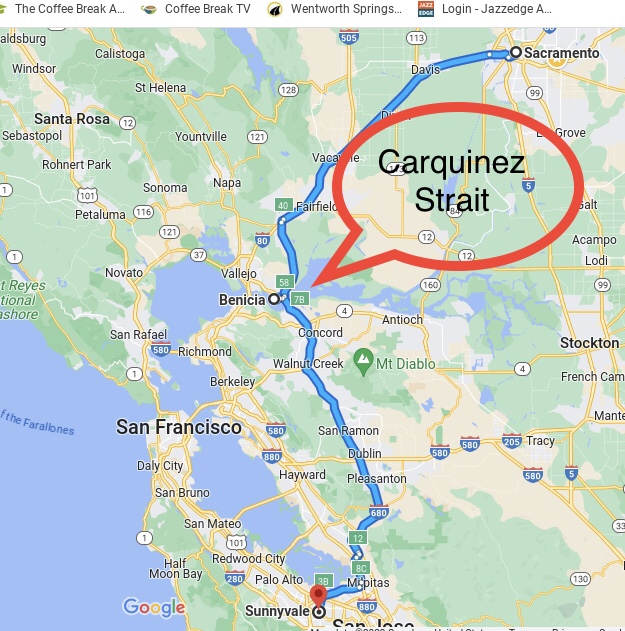
Eons ago, when I finished college, I moved to Sacramento, and in the succeeding years I made many weekend trips back to the familial homestead in Sunnyvale. The trip required crossing the Carquinez strait on the Benicia-Martinez Bridge. In those days, the bridge had traffic going in both directions, but in 2007 a second bridge was opened and each of the two bridges was henceforth devoted to traffic in a single direction.

My overland trail.

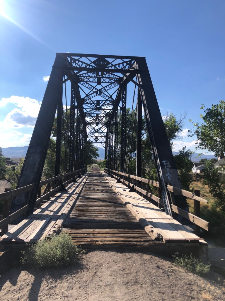
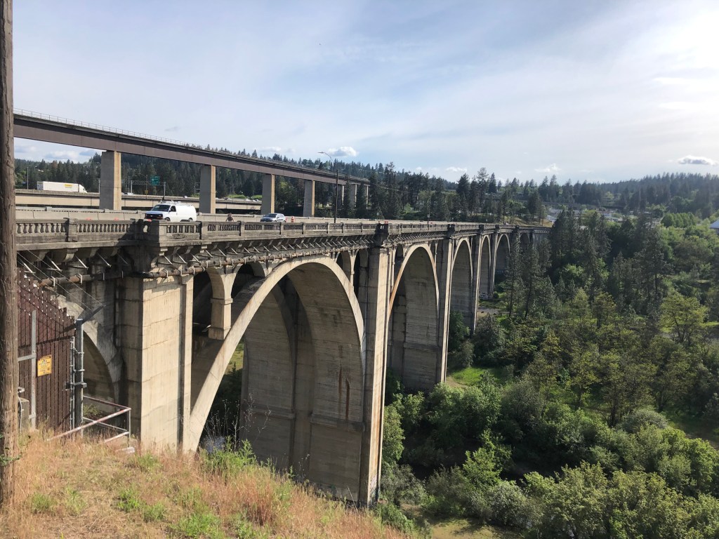
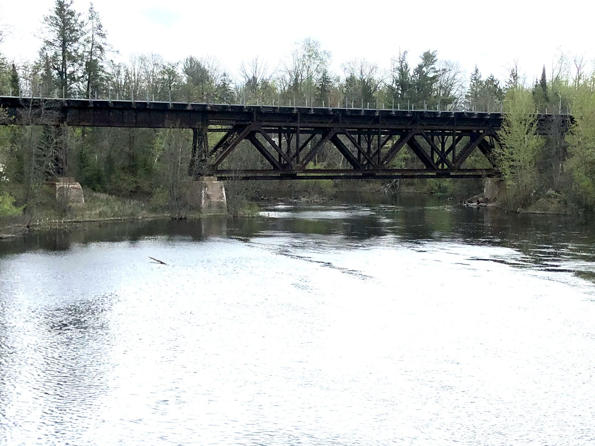
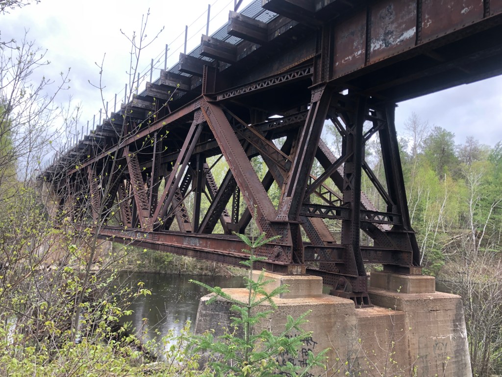
As I crossed the Carquinez Strait in my Studebaker Hawk (which I’m not making up), I would always glance at the old railroad bridge that ran alongside me. Often I’d see a train rumbling over the creaky structure. Here’s a shot I took this morning of the railroad bridge flanked by the two automobile bridges:

Looking south, from Benicia to Martinez.
Aerial view, stolen from the Internet.

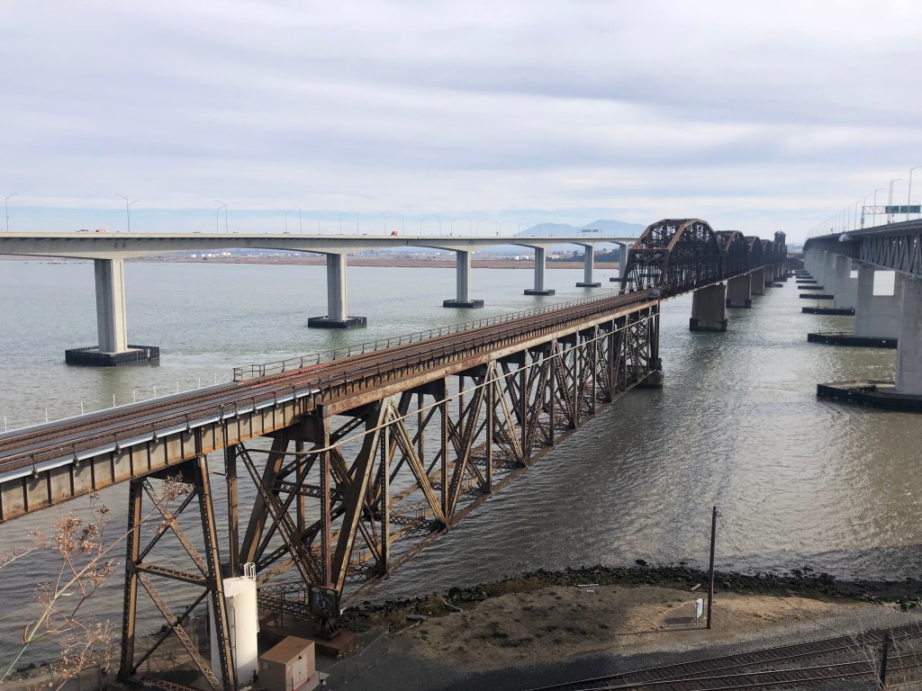
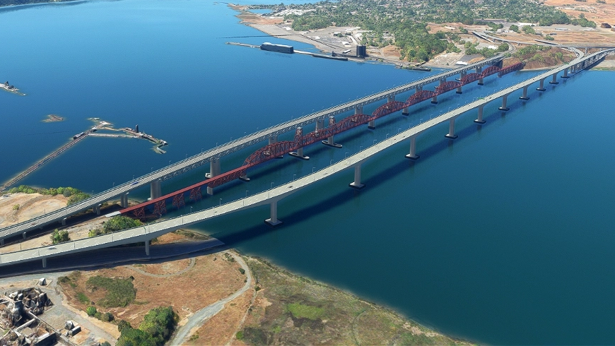
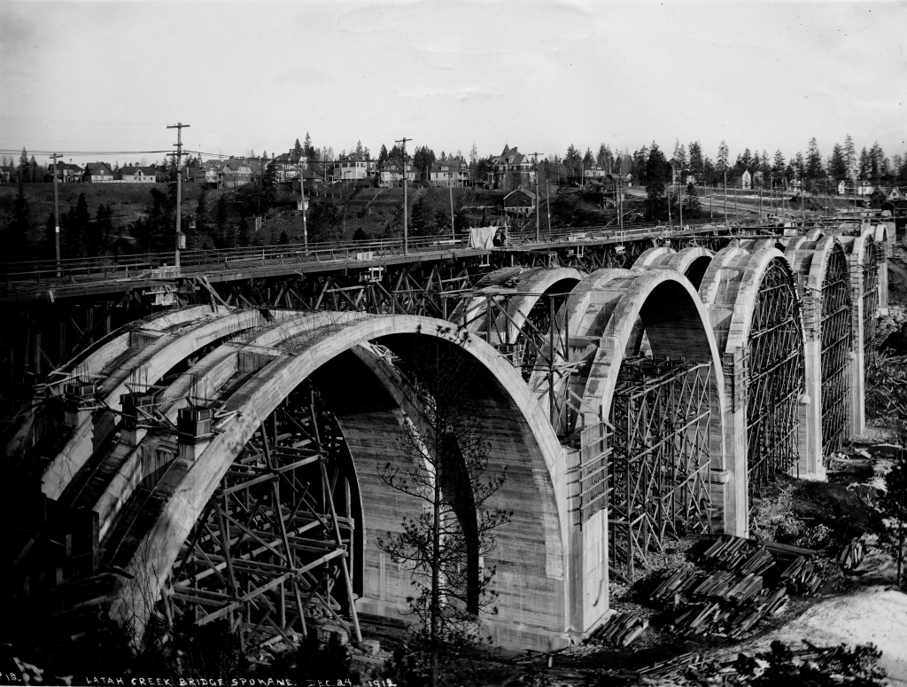
The Benicia-Martinez Bridge railroad bridge opened in 1930. It was–and still is today–the second-longest railroad bridge in North America. But did you know that trains had already begun crossing the Carquinez strait more than half a century earlier? How could this be?

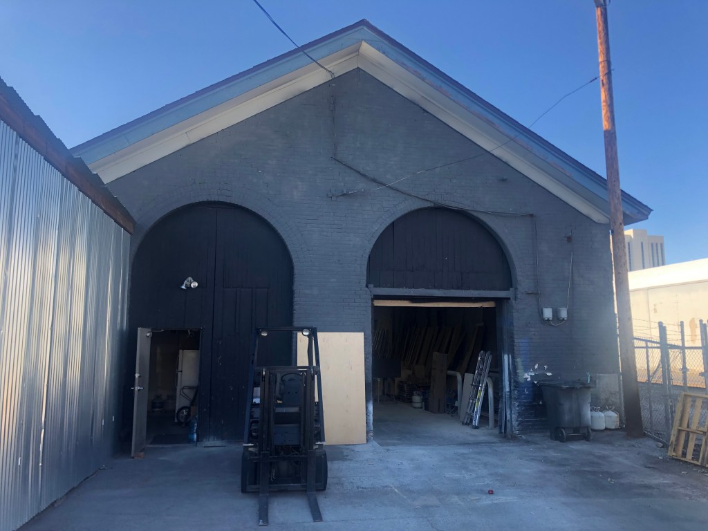
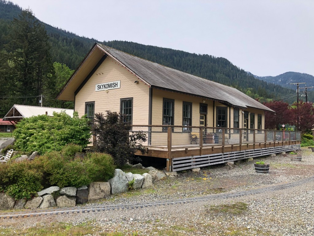
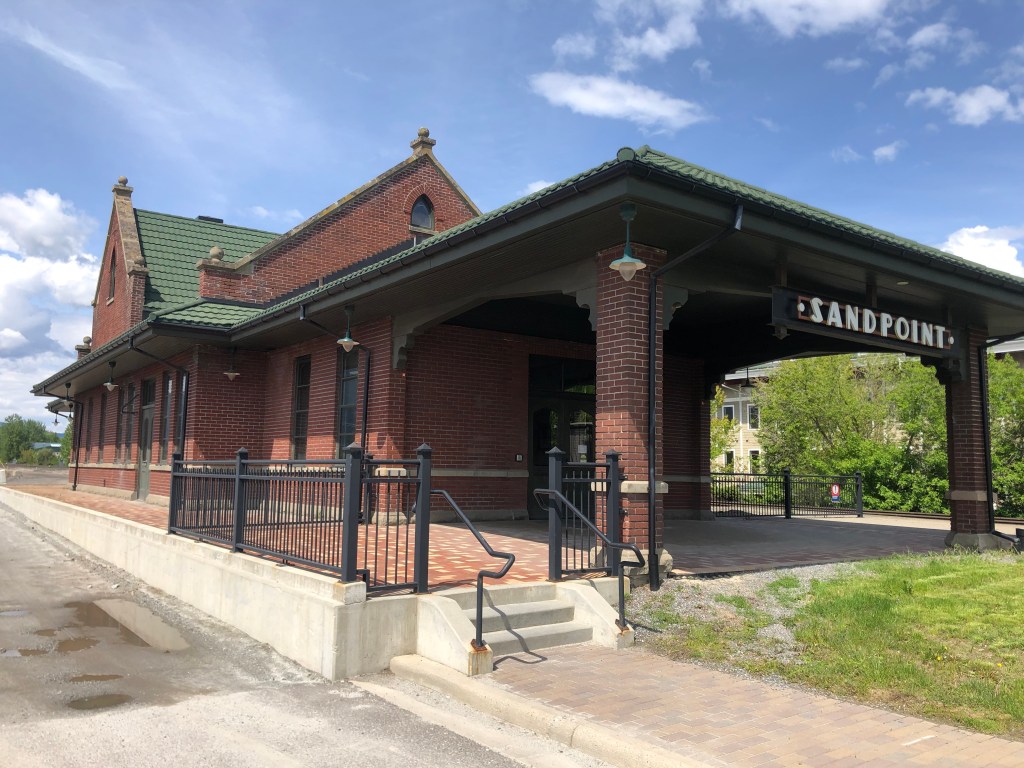
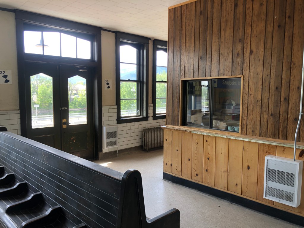
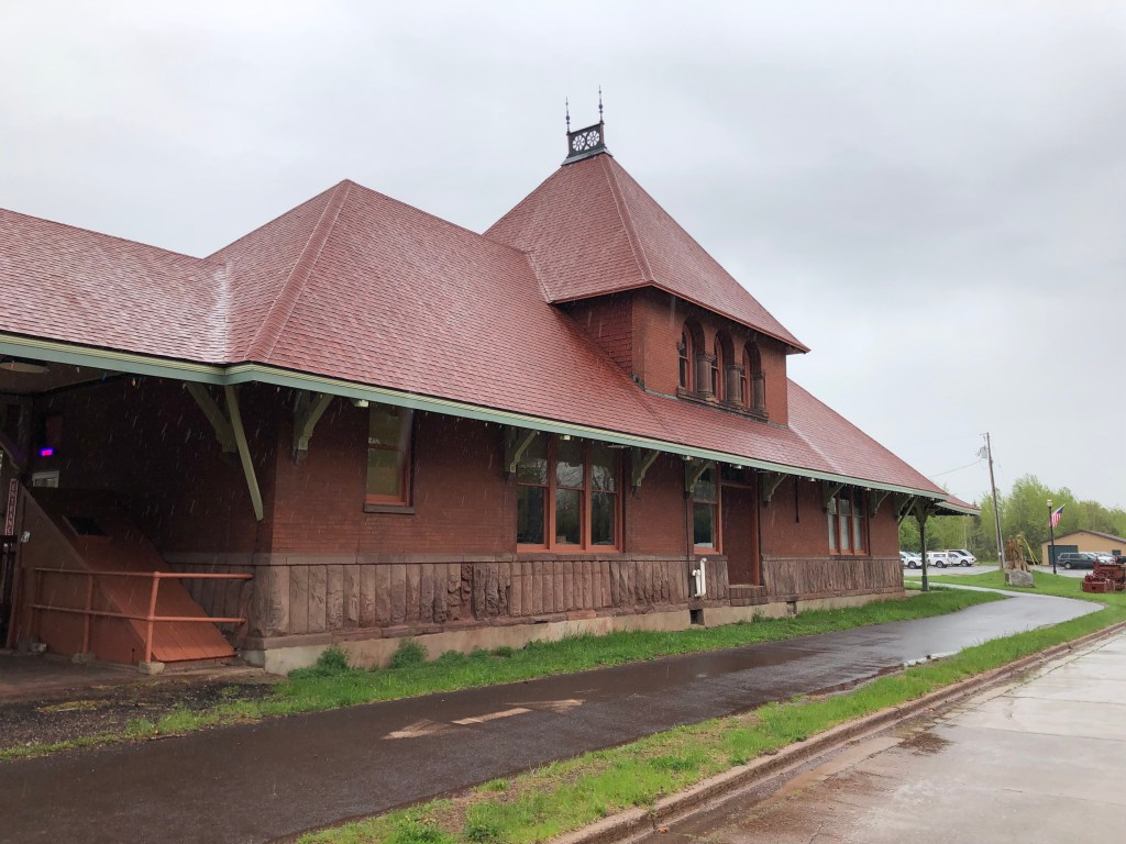
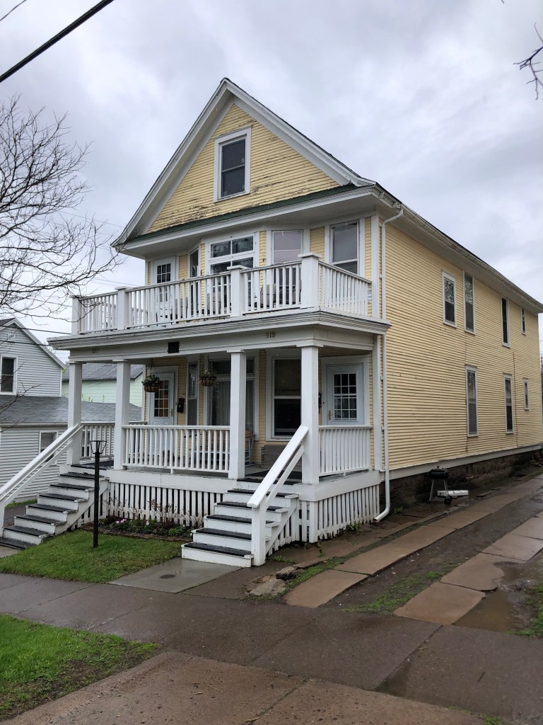
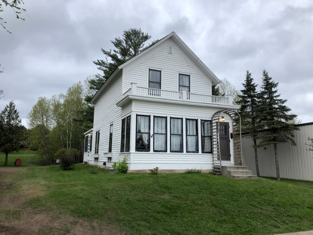
To answer this question, I visited the unassuming town of Benicia (pop: 27,000). Briefly California’s capital (from February 1853 to February 1854), Benicia today is famously home to my son Ian and daughter-in-law Katelyn. But it’s also home to this old depot which can shed some light on our railroad bridge puzzle:

End of the line, in a way…

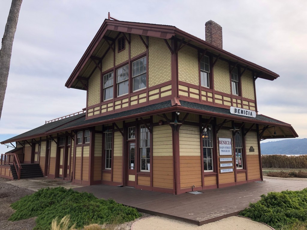
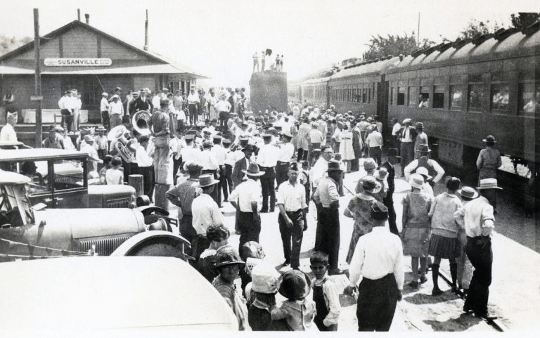
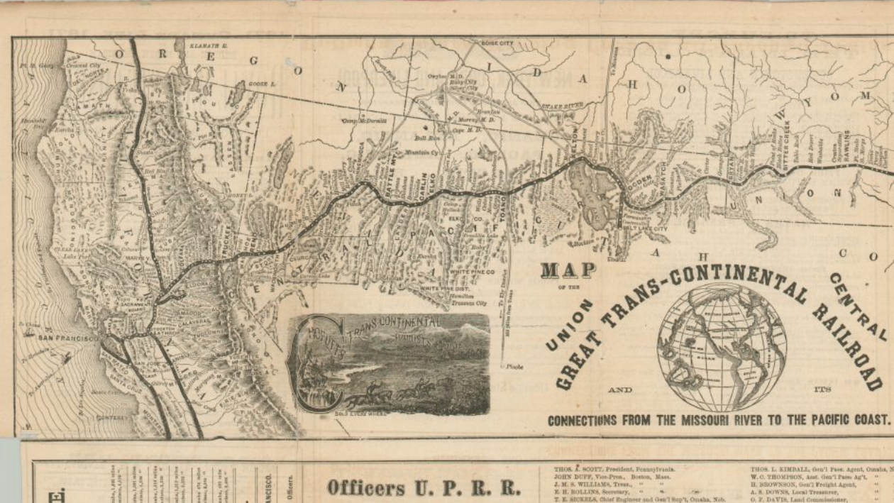
This 144-year-old depot was originally built in 1879 in the small town of Banta, California (pop: unclear, though probably around 100 according to this account). Banta was a whistlestop on the original transcontinental railroad. Westbound trains would make the final leg from Sacramento to the Bay Area by way of the Altamont Pass, which they would cross just after passing Banta.

The original route.

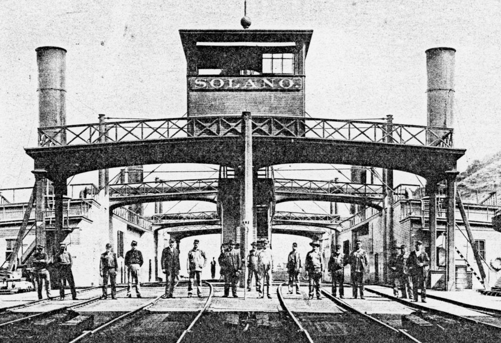
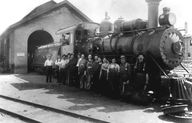
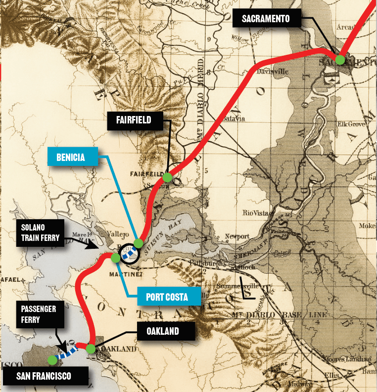
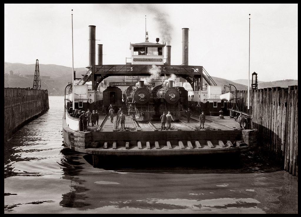
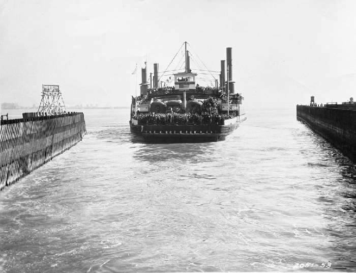
But the same year the Banta train depot was constructed, the Southern Pacific opened a new, shorter route from Sacramento to the Bay Area. This route crossed the Carquinez Strait, shaving off several hours from the old route over Altamont Pass. But since the Benicia-Martinez railroad bridge wouldn’t be constructed until 1930, trains were ferried over the Strait. Seriously. An enormous ferry dubbed The Solano was constructed for this purpose. Westbound trains would slowly chug over the Benicia Pier, roll onto the Solano, and make the half-hour trip to Port Costa, about a mile across the water. From there the trains would return to the mainline and continue to the end of the line in Oakland.

The new route.

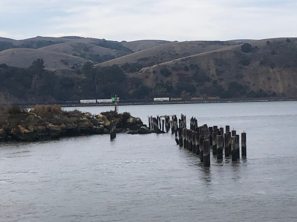
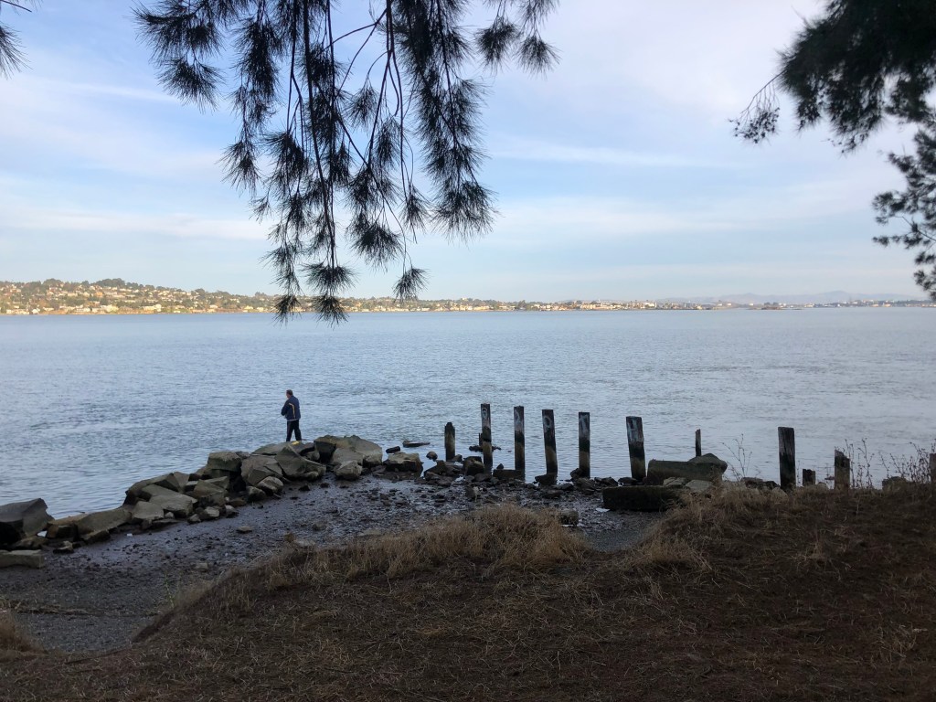
This morning I stood on Benicia’s modern fishing pier and looked out at the ancient pilings from the old pier where the Solano used to dock.

The Solano’s old haunt…perhaps literally?

The Solano, which remained in continuous operation for 51 years, had a length of 425 feet and was equipped with four sets of tracks. It was the largest railroad ferry in the world.

Demand on the line increased continually, and eventually it was decided that a full-size railroad station was needed on the Benicia side of the ferry crossing. So in 1902, Southern Pacific uprooted that station they’d built in Banta, floated it on a barge to Benicia, and planted it where you see it today.

The Solano kept working around the clock, year in and year out. In 1914 she was joined by a sister ferry, the Contra Costa, to absorb the growing demand on the line. But then in 1930, the railroad bridge (which we encountered near the beginning of this post) opened, and the ferries instantly became obsolete. They made their last run in November 1930.

The final run, loaded with well-wishers.

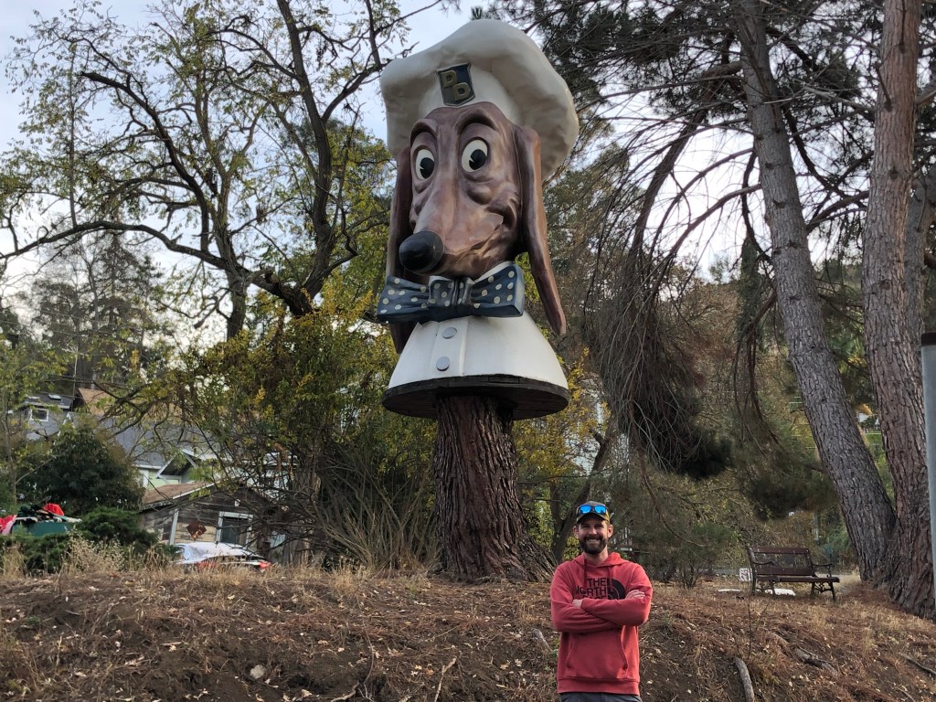
So after exploring the depot and remains of the Benicia ferry pier, I enlisted son Ian to drive us to the other end of the ferry crossing, which was in Port Costa (pop: 200). Port Costa is a small, funky, historic town, replete with a Doggie Diner head. (People of a certain age may remember getting a hotdog at one of the Doggie Diner restaurants in the Bay Area in the 1960s or 1970s. I sure do! Those who don’t remember them can get enlightened here.)

Ian and a midcentury Bay Area icon.

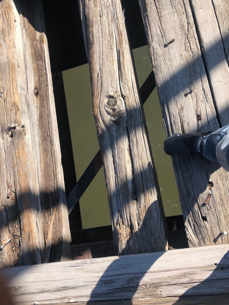
After a bit of walking around Port Costa we came upon the remains of the southern dock of the Carquinez ferry crossing:

The Solano’s southern haunt. Benicia is directly across the strait.

So, for those of you keeping score at home, we’ve managed to find the depot from which ferry-bound trains departed, the remains of both ferry piers, and the bridge that put the ferry out of business. But what of the ferry itself?

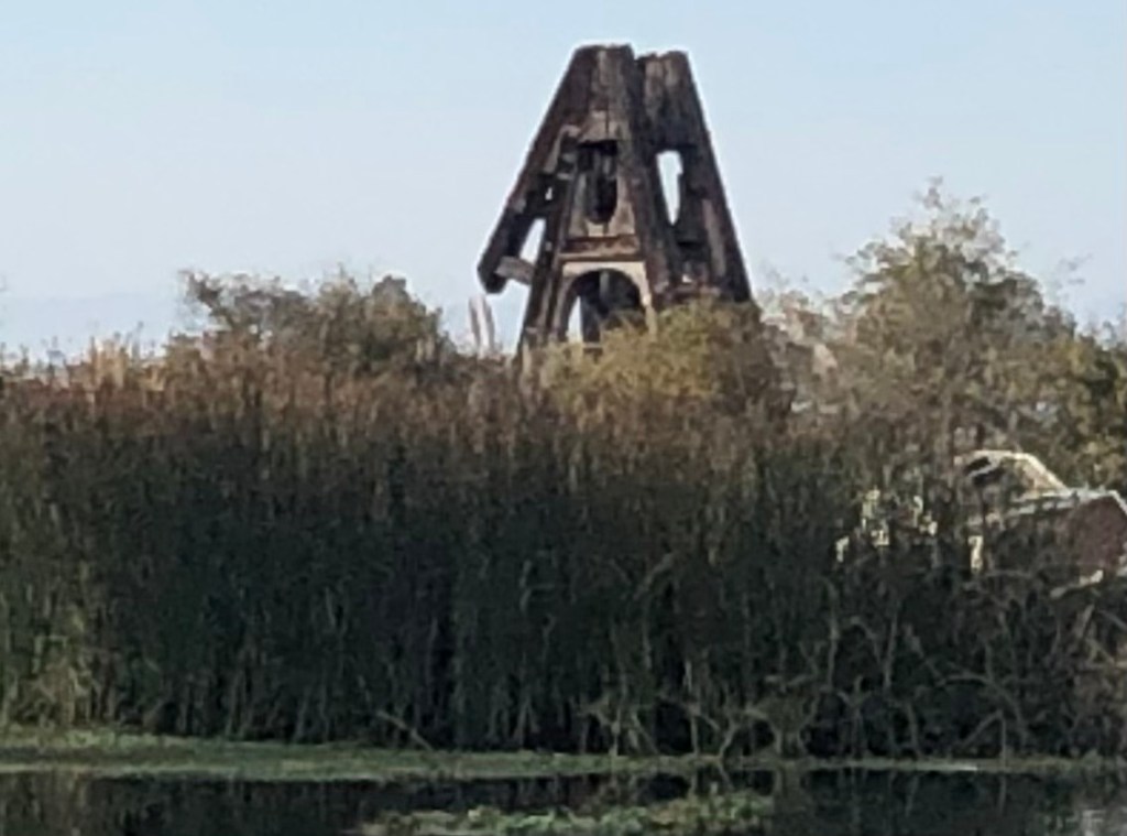
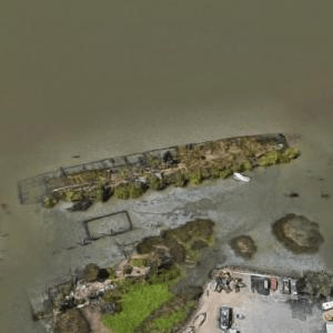
A little Internet research revealed that the Solano was decommissioned and towed out to Antioch in 1931. There she was scuttled near the bank of the San Joaquin River and partially submerged to serve as a breakwater. She remained there, largely identifiable in her old form, for about half a century. But in the 1980s some clown was setting off fireworks and accidentally set The Solano ablaze, and she burned to the waterline.

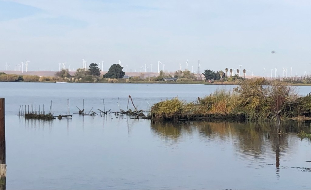
Naturally, Ian and I headed over to Antioch to see what remained of the Solano. The answer is “not a lot,” but there’s still a ghostly presence. Check it out:

Remains of the Solano in Antioch. We’re looking at the port side of the ferry, with metal rods from the bow poking out of the water on the left.
The 40-foot-high A-frame that housed one of The Antioch’s two paddlewheel engines still rises from the wreckage.
Aerial view, courtesy of Virtual Globetrotting, clearly shows the outlines of The Solano.

So that’s pretty much it. As always I’m struck by how physical barriers were overcome in the Age of Steam…and how remnants of that era can still be seen all around us, if we’re just willing to look.

bridges · California history · Road trips · trains

Burning Rubber

After completing my mission at Eagleville, I headed homeward on NV 447, then back into California via Reno.

My route home (in blue).

You’ll note that my return trip skirted the west side of the Black Rock Desert, where Burning Man begins this weekend. My entire run through Nevada was overrun with “Burners” in their anti-establishment Winnebagos, powered by thousands of gallons of anti-establishment Chevron gasoline.

Prophetic sign in Reno.

One worthy sight along the way was this 1907 bridge over the Truckee River in Wadsworth, NV.

The bridge served the Fernley and Lassen Railway, which was a 112-mile short line. I’m told that two of the railroad’s depots (in Fernley, Nevada and Susanville, California) have been restored, so this might be the subject of my next road trip.

One needs to be careful when crossing this bridge….

You should also check out this cute, heart-warming video that features the bridge:

Watch your step, little girl!!

After Wadsworth I stopped in Reno to have dinner with my son Ian, who happened to be in town on business.

Like father, like son.

I spent the night in Reno, and this morning, before leaving town, I made a significant, final discovery related to the N-C-O Railway:

Recall that I had been unable to find the NCO locomotive shop in Lakeview (northern terminus of the railway). This morning, however, I located the NCO’s 19th-century shops building in downtown Reno (the NCO’s southern terminus). The building is on the other side of the tracks from the Depot Brewery and it’s currently serving as the headquarters for Black Rabbit Mead Company. It’s notable that two of the NCO’s surviving Reno structures now make mead and beer.

The NCO’s 1889 locomotive shop, now a meadery.
Same building, viewed from the back.
Steam locomotives used to enter those rounded doorways.
…as proven by this historic photograph.

You can get more information about this building and photographs here.

Finally, I need to share this art installation I saw in front of the Reno bus depot. It’s made from a real, retired bus, though it’s been gutted and narrowed. I’m told it also is illuminated from the inside at night, and the headlights and taillights illuminate.

My only complaint is that the bus was retired from New Jersey. Shouldn’t they have used a Reno bus??!

So ends this latest adventure. Be on the lookout for a Fernley and Lassen trip one day soon!

The F&L’s Susanville station looks like a happening place.
bridges · Golden Bear signs · Road trips · trains

3,773 Miles Later…

You’ll recall that I began this journey in Vermont and upstate New York, where I met with relatives and visited places where my grandfather grew up. After driving 3,773 miles, I’m ending the trip by visiting places where my grandmother grew up. There’s a certain symmetry in all that, which I find strangely satisfying.

I set out this morning from Wenatchee, and soon the environment was changing again. This time it felt like I was in Germany….and that’s because I passed through the town of Leavenworth (pop: 2,500), which for some reason has decided to dress up as a Bavarian village. Like so many towns along Route 2, Leavenworth was founded over 100 years ago as a Great Northern railroad town. It even housed the regional office of the GN. But the office was relocated to Wenatchee in 1925, and then the remaining major industry (timber) steadily declined into the 1950s. The town needed a new source of income, and by the 1960s it settled on a strategy: It would seek tourism dollars by recreating itself as a Bavarian village. No doubt you’re familiar with the town of Solvang on the Central California coast; it’s the same idea. Indeed, Leavenworth officials actually visited Solvang as they were developing their strategy.

I knew I should have packed my Lederhosen!
Are there no German tropes Leavenworth is unwilling to exploit?

Leavenworth has a live webcam trained on its town square. I’m sure it would be fun to watch during Oktoberfest. But right now, not so much.

They even made Starbucks alter its logo.

Immediately beyond the town the North Cascade Range looms, as you can see in the picture below. I was about to experience yet another change in scenery….

Going up…

Route 2 through the Cascades is a truly beautiful drive. The road follows the Wenatchee River, which is impressive and scenic.

Flowing toward the Wenatchee Valley Brewing Company. Seriously.

You’ll recall that a few days ago US Route 2 took me over the Rockies at Marias Pass in Montana, and I noted that the Great Northern Railway ran its transcontinental route over that pass in 1889. The last segment of Great Northern’s transcontinental tracks to be completed was the section over Stevens Pass, right here in the Cascade Range.

Crossing the Cascades at Stevens Pass.

So this morning I stopped on the Pass near the point where the final railroad spike was driven on January 6, 1893. There’s a placard commemorating the event.

A creek runs by this same spot. It’s called Deception Creek, and I’ve been unable to find out the story behind the name. (Please enlighten me, if you have info.) I did manage to take this short video of the creek running under Route 2.

On the other side of the pass I came to the town of Skykomish (pop: 190). Like Leavenworth and many other towns along Route 2, Skykomish was established as part of the Great Northern Railway’s surveying efforts. For about 80 years it provided maintenance and fueling services for the Great Northern. Today, however, the GN doesn’t even stop at Skykomish’s historic depot.

The tiny tracks in front of the depot are for a kiddie-size train ride.

Still, Skykomish continues to link its identity to the Great Northern. Indeed, the town seal incorporates a version of GN’s logo, and it calls itself “A Great Northern Town.”

The railroad’s actual logo.
Look familiar? GN’s goat (named Rocky) is everywhere in Skykomish.

Like Leavenworth, Skykomish seems to have found a niche with tourists. In Skykomish’s case, it’s railfans that they’re courting. They have a restored depot that’s now a museum, they offer train rides, they’ve plotted a walking tour of historic GN-era buildings. And while passenger trains no longer stop in Skykomish, plenty of freight trains pass through the town, making it a good location for train spotting. In addition to all this, the town has several upscale cafes, coffee shops, and outdoor equipment purveyors that are popular with a wide variety of tourists.

1905 Skykomish Hotel, restored and with viable tenants.

After an enjoyable walk among Skykomish’s streets (which, among the older historic structures, include this WPA-era school building that’s still in use), I eased back onto US 2. I was getting dangerously close to the western terminus at Everett.

In continuous use for 86 years.

Now, recall that a few days ago, when I was in Glasgow, Montana, I met a guy named Chris at the Loaded Frog who explained the “Middle of Nowhere” slogan to me. Well, Chris also told me that there’s a good taproom near the western end of Route 2. I’ve been looking forward to checking it out ever since I learned of it. With a little research I discovered that the place–the Route2 Taproom–is in Monroe, WA, which is about a dozen miles before the end of Route 2.

Serving beer to thirsty Route 2 travelers since 2015.

I stopped in and ordered the Triplehorn Nemesis Milk Stout on Nitro. So let’s get the BOTD out of the way:

Maggie at Route2 Taproom serves up a perfect stout.

What a great choice for my final BOTD! It’s got a complex range of flavors, and somehow they work together nicely: There are hints of coffee grounds, vanilla, tobacco leaves, and those miniature Hershey’s bittersweet chocolate bars I used to get at Halloween. The hops are reined in a bit, which is appropriate for a milk stout. The mouthfeel is creamy (that’s partly due to the nitro), and it’s pretty boozy at 10% ABV. It would be really hard to improve on this. I give it 5 stars.

Saved the best for last.

Refreshed and rejuvenated by a good stout, I got back in the car and set out on the last few miles of the trip. And just when I didn’t think my luck could get any better, I spied a Golden/Laughing Bear sign! And what’s more, unlike some of the other such signs I’ve encountered, this one was affixed to a still-operating wheel alignment business. Surely the gods are smiling on me today.

If you zoom in on the window, you can see a second Laughing Bear on the other side of the glass.

And then, after all this, I was driving the final mile of Route 2. I had arrived in Everett (pop: 111,000, which might be about equal to the combined population of all the other towns I visited along Route 2!) The western terminus of Route 2 in Everett is where Maple Street and Interstate 5 meet. Disappointingly, I was unable to find a sign marking the end of the westbound highway. (I couldn’t find a sign marking the beginning of US 2 East, either.) So all I can show you by way of evidence is this photo of where, in theory, the route ends:

Anticlimactic ending

There was no brass band, no one to hand me a key to the city, no banner strung across the roadway for me to snap with my car. My journey simply ended.

Having dispensed with Route 2, I next headed down to Tacoma (pop: 216,000) to visit some places where my grandmother–and, later, my dad–grew up. This blog isn’t the place to go into any detail about the sites I saw, but I will offer this photo of Grandma’s high school, which is still educating students after 107 years.

Grandma walked these halls almost 100 years ago.

Finally, I will be making a final post tomorrow about a memorable visit I made to an abandoned Old West theme park in Wisconsin. I mentioned it in passing in my May 25 blog, but I didn’t have enough time to do it justice. This I will do tomorrow while I’m waiting for my plane.

Until then.

bridges · churches · Road trips · trains

Potatoland

This morning after an unhealthy breakfast I left Kalispell and headed west toward the Idaho border. This is beautiful country–the many small lakes, the Kootenai River, several national forests, the Purcell and Cabinet Mountains… The towns out here are much more vibrant than the towns along the Hi-Line (a term which no longer is used west of Glacier National Park). The towns also feel a bit more optimistic and playful, which shows up in the extensive roadside art installations.

Trailer-On-a-Stick in Libby, Montana
Cross between a Sasquatch and Jerry Garcia?
What is it about Montana and these stick-mounted vehicles?
Giant fishing pole with the catch of the day.
A Clockwork Moose

Along this scenic stretch of northwestern Montana, somewhere between the towns of Libby (pop: 2,800) and Troy (pop: 800), I saw a large number of vehicles parked in a roadside parking lot, with lots of activity as couples and families walked toward a trailhead. I figured I’d park and see what all the fuss was about. It turns out the approximately 3/4-mile-long trail leads to the Kootenai Falls Swinging Bridge.

What could go wrong?

It’s a simple suspension footbridge, 210 feet long, strung 100 feet above the rushing waters of the Kootenai River. Now “swinging” is not generally considered to be a desirable characteristic of a bridge, but the lateral movement is limited by heavy cables, so it sways rather than swings. Plus, you have to admit it’s kind of fun to watch the people ahead of you freaking out. At great personal risk, I took a video of myself crossing the bridge, for the benefit of you, my loyal readers.

Yes I know I’m holding the camera wrong…

After surviving that ordeal, I got back on Route 2 and eventually entered the Potato State. (Idaho actually calls itself the Gem State, but what non-Idahoan has ever called it that?) The first Idaho town I encountered was Bonners Ferry (pop: 2,700). Bonners Ferry calls itself “Idaho’s Most Friendly Town” and that’s a plausible claim. The people seemed warm and welcoming, the motorists waved and yielded the right-of-way, and even the teenagers made eye contact and said hello while passing on the sidewalk. Of course, I’m told that Idaho is beset with an influx of expatriat Californians who are seeking lower taxes, cheaper housing, and fewer wildfires. So we’ll see just how friendly these Idahoans remain.

It was in Bonners Ferry that I saw my daily, obligatory converted church. This particular one looks like it could be haunted. It was built as a Roman Catholic church in 1894, and has been operating as the Pearl Theater since 2012. It seems to be a well-used facility judging by the list of events which shows something (poetry reading, music programs, language classes, belly dancing, movies) happening most days.

Tim Burton would love this place.

Although I left the Great Northern’s Hi-Line behind in Glacier, Route 2 continues westward alongside a set of railroad tracks. I clambered down a hillside to take a photo of the trains’ right-of-way beside the river. This would make a great rail journey!

Speaking of trains, when I got to Sandpoint ID (pop: 8,700) I noticed a historic railroad depot on the other side of Route 2, which runs on an elevated roadbed as it cuts through the downtown. It took me half an hour to find a way to get to the depot, and once I did I was rewarded with this beautiful 1916 structure.

Shockingly this is the only operating Amtrak station in the entire state of Idaho. It is served by two passenger trains a day (one from each direction). As I was taking photos I was greeted by Maggie, who was locking up the station. Maggie had been the station’s first female station agent (I hope I have that title right; Maggie, please correct me if you’re reading this) and is now retired from that position. But she still does contract work for Amtrak, which includes opening and closing the station, as well as some other property management tasks. She generously showed me around the station, which still has much of its original interior woodwork.

Maggie (L) with helper Vickie
Sandpoint’s waiting room

The city of Sandpoint sits on Lake Pend Orielle and is flanked by mountain ranges. As such, it is a major tourist destination. It even has its own miniature version of the Statue of Liberty.

“Bring me your huddled masses yearning for potatoes.”

By the late afternoon I was already leaving Idaho, since US 2 just cuts along the state’s northern panhandle for about 80 miles.

Red line is Route 2 through Idaho. Today’s drive went from Kalispell in the east to Spokane.

I crossed into Washington and I’m spending the night near Spokane. The only notable photo I took in downtown Spokane was of the 1913 Sunset Boulevard Bridge. (Route 2 travels on a more modern bridge paralleling this bridge, but I figured it was worthy of inclusion since it’s a feature you see while traveling Route 2.)

Golden Arches

And for fun, check out this historic photo of the bridge under construction:

With that excitement out of the way, I had great hopes of getting a beer at Iron Goat Brewing. But when I got there I encountered a locked door and a sign saying that they’re closed for Memorial Day. (One wishes Google Maps had been made aware of the closure.) Two other brewpubs were similarly closed. So no BOTD today. I guess I’ll just have to have two beers tomorrow.

bridges · Cars · Road trips · trains

Of Badgers and North Stars

As I headed out of Ironwood this morning, I passed another venerable old railroad depot.

Ironwood Railroad Depot, looking good at 130 years old.

The Ironwood depot of the Chicago and Northwestern Railroad was the town’s transportation hub since it opened in 1892, but the trains stopped coming through in 1970. It’s now a museum and the headquarters for Ironwood’s Chamber of Commerce. It was a few minutes after 7 am when I arrived there, but I found the door unlocked and entered, being greeted by the Chamber of Commerce’s director, Michael Meyer.

Michael gets points for wearing the railroad overalls.

Michael spent close to an hour with me, explaining the history of the depot and of the town. He’s a transplant (from Indiana, if I recall correctly), and thus can speak somewhat objectively about the Yoopers. He’s also a great booster for the town. Apparently the economy took a major jolt when the railroads left and mining petered out, but now, to listen to Michael, the town is experiencing a renaissance.

Michael hepped me to a documentary film about Route 2 called “Route 2 Elsewhere.” (I wish I’d thought of that name!) I’ll have to check that out when I get home. He’s the first person I’ve talked to on this trip who even knew that Route 2 spans the entire country.

After we’d talked awhile Michael was called to a meeting of some kind, and I wandered the displays of the museum. It was the usual stuff–interesting to me, but not really worth describing in a blog. With one exception:

The museum has an old telephone switchboard, and on it was this brochure that evidently was provided to all phone customers in 1963. Now, I’m not saying that Ironwood was a little behind the times, but the brochure explains in excruciating detail how to dial a phone. (I realize that some of my younger readers might not understand this concept, either.)

From the days before instructional Youtube videos.

After reviewing these eye-opening displays about my own early childhood, I got back into the rental car (which is a Jeep, for those of you who have asked) and headed into the great state of Wisconsin.

I have to say this about Route 2: It’s really a very reliable, comfortable, friendly road. This is in part due to the fact that it goes through very few big cities; most of the towns you encounter are small villages that aren’t going to ticket you for parking in the wrong spot or prohibit you from turning left. The gas station attendants and restaurant servers are uncommonly friendly, and graffiti is practically unheard of. Moreover, property owners seem to be compelled to communicate with passersby through yard art. A few examples:

On the side of the road in Solway, Minnesota
In front of a liquor store. The keg is a nice touch.
Made from car parts. Note the spark plug teeth.
The April 1 date might be a giveaway.

There’s something reassuring about people taking the time and making the effort to add some whimsy for the benefits of passersby. I encounter a lot of this kind of thing out on the US highways. If you were to seek out the opposite of a twitter flame war, surely this kind of thing would qualify. God bless these people.

In the town of Mason, Wisconsin a gas station attendant encouraged me to check out an old, abandoned, Wild West theme park that was homemade by a man (recently passed) named Ed Sandor on his farmland. This I did, and it was one of the most enjoyable hours I’ve spent. It deserves its own blog post, which I hope to write in the next day or two. Here’s a photo to whet your appetite:

RIP Ed Sandor

Eventually I came to my first biggish town on this trip: Duluth, Minnesota (pop: 87,000). While stopping to get a sandwich, I asked the proprietor what Duluth is known for. Without skipping a beat, she said “Dylan.” It turns out that one Robert Allen Zimmerman (aka Bob Dylan) spent his early childhood in a modest home on North Third Avenue. I made the pilgrimage, and offer this humble photo.

House of the Risin’ Sun

While in Dylan’s neighborhood, I passed Duluth’s Central High School. This is a breathtaking gothic building, originally constructed in 1893, and it didn’t close until 1970. And even then it remained open as administrative offices until 2011.

I can’t figure out what’s happening with the property now, but this is a staggeringly-impressive, large, historic property. Clearly it speaks of a day when public buildings were not just respected but revered. I do hope that Duluth’s leaders find a suitable use for this historic property.

I ended the day’s travels in Grand Rapids, Minnesota (pop: 11,000). Based on my experiences as a tourist, Grand Rapids is known for two things. The first is that it sits at the upper navigable end of the Mississippi River. I noted this when I crossed the Mississippi on Route 2–it was nice to see a body of water that wasn’t one of the Great Lakes, after the past few days of Lakes Erie, Michigan, and Superior! I took a few photos of a picturesque, turn-of-the-century railroad bridge, and I noticed that the Mississippi wasn’t as mighty as I remember it from past encounters further south. (Edit: I later learned that this river is only a tributary of the Mississippi–the Prairie River.)

Carrying trains since 1899.

Second, Grand Rapids the birthplace of Judy Garland. Indeed, the hotel in which I’m staying tonight is next door to the Judy Garland museum, which includes the (relocated) home where Judy grew up.

There’s no place like home…

Now, to be clear, I’m not a total fanboy of Judy Garland, but I certainly find her story to be compelling. And I always loved The Wizard of Oz. So the museum (which I toured) intrigued me, with various artifacts from her movies and her (somewhat tragic) life.

The actual carriage from Oz. Remember?

Naturally, my primary objective at the Judy Garland museum was to see the ruby slippers. And behold, there they were, just sitting on a pedestal with no barrier separating me from them!

“Their magic must be very powerful, or she wouldn’t want them so badly.”

Alas, a sign explained that while this was the “original pedestal” on which the ruby slippers used to sit, the slippers were reproductions. The original slippers were stolen in 2005. A docent (Sheena, pictured below) told me that the slippers were recovered in 2018 in Minneapolis, but they remain in the possession of the FBI, which continues to gather evidence of the crime. What’s worse is that the slippers were just on loan to the museum, so if and when the FBI releases them, they’ll go to the owner, and not to the museum.

Sheena, the Wizard of…the Garland Museum.

Still, the museum contains numerous authentic artifacts, and I recommend it. Meanwhile, when she heard I was driving the length of US Route 2, Sheena encouraged me to visit the headwaters of the Mississippi River, which are a short drive from the highway. This I will do tomorrow. Until then.

BOTD

The Ichabod Crane of beers.

The Brew of the Day was a “Cocon-Oat and Boat Stout” from Rapids Brewing Co., in Grand Rapids, Minnesota. RBC has only been around for about 3 years, and it looks like your typical modern brewpub with a spacious floor in a warehouse-like building, minimalist industrial-chic decor, and lots of bearded hipsters. But unlike some other such brewpubs that I’ve visited, this place has nailed the food and the staff really makes an old guy like me feel welcome.

As its somewhat-forced name suggests, the “Cocon-Oat” stout is an oatmeal stout brewed with toasted coconut. This won’t be everyone’s cup of tea, but it totally worked for me. The toasted coconut isn’t overpowering, but it adds just the right amount of sweetness and interest to the flavor profile. Don’t think Mounds candybar; think macaroon. The oatmeal lends a creamy smoothness, and it has just the right amount of hops. It goes down really easy, but at 5.9 percent ABV, this isn’t going to put you on the floor. I give it 4.5 stars.

PS: The bartender told me that today is Whiskey Wednesday, which means that I get $2 off any bourbon cocktail. So I chased the stout with an Old Fashioned, to which I give 5 stars.