This morning Scott and I set out early from Louisville. With flights to catch on Monday afternoon, we realized that we were running a bit behind on our schedule, so we were facing almost 600 miles of driving today.
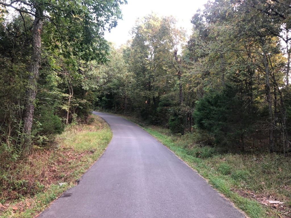
The first 100 miles or so was needed just to drive south from Louisville to reconnect with the Trail of Tears. Once that was accomplished, we were back on the hilly, windy green hills of Kentucky, roughly following the original route that the Cherokees walked.
It’s a nice travel experience….if you aren’t being driven out of your homes by the U.S. Government.
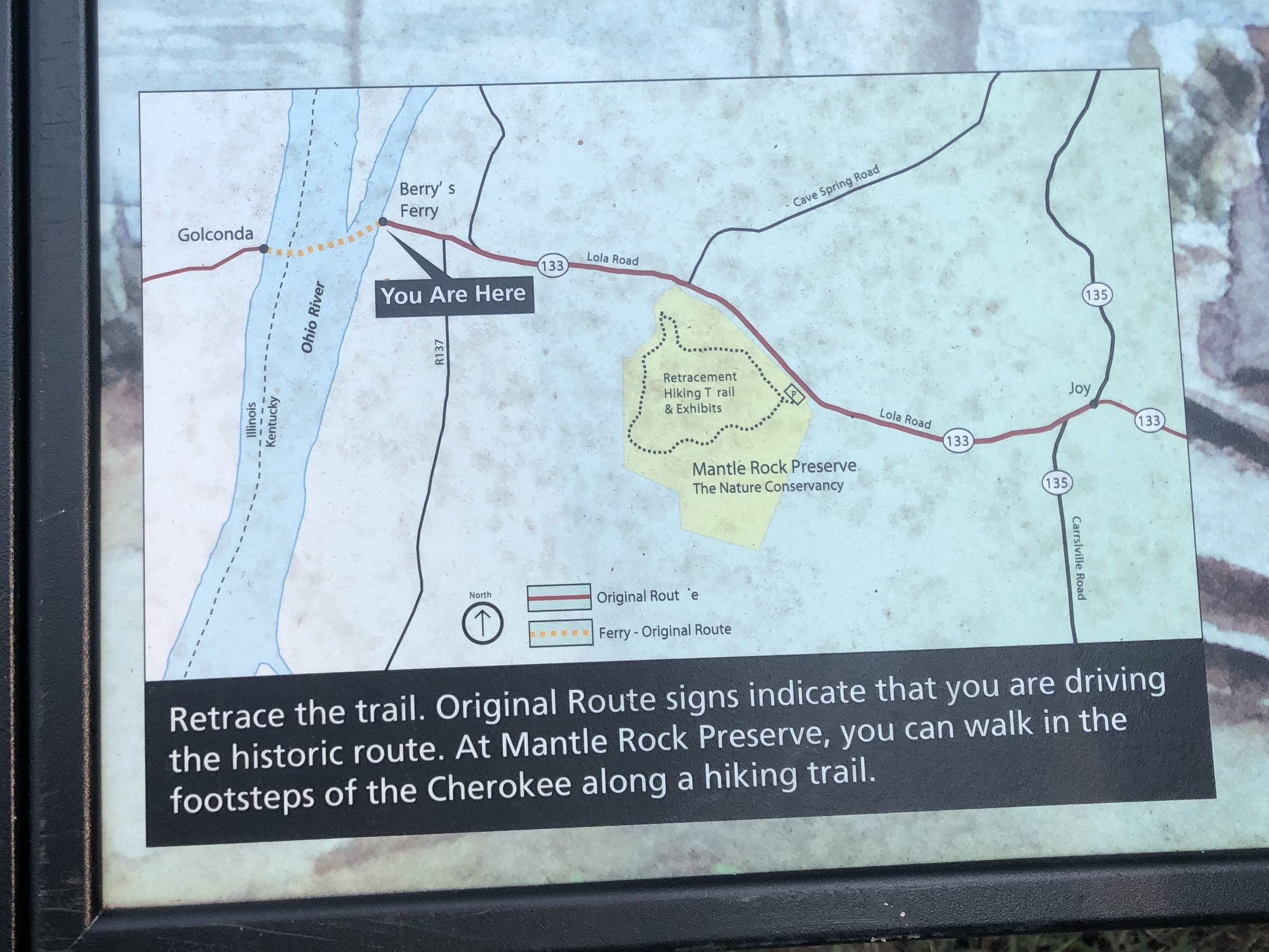
The day’s trip would involve driving west from Hopkinsville, KY to Tahlequah, OK. Our route (which is essentially the Cherokees’ northern route) would take us from Kentucky through Illinois Missouri, and Arkansas, before we crossed the border into the old Indian Territory of Oklahoma.
It’s not a great map, but you get the basic idea.
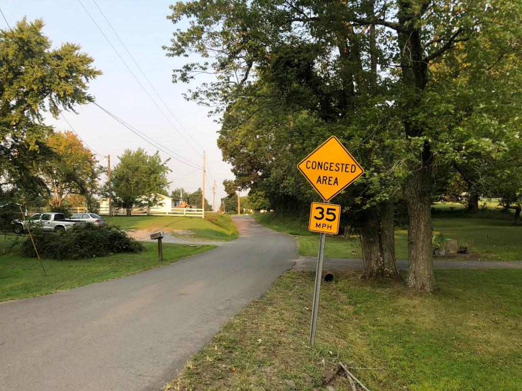
It was still early in the morning on a Sunday in rural Kentucky, so we were pretty much the only ones on the road. As two California boys, we had to chuckle at the Kentuckians’ idea of congestion.
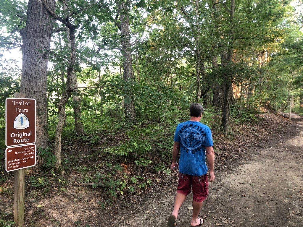
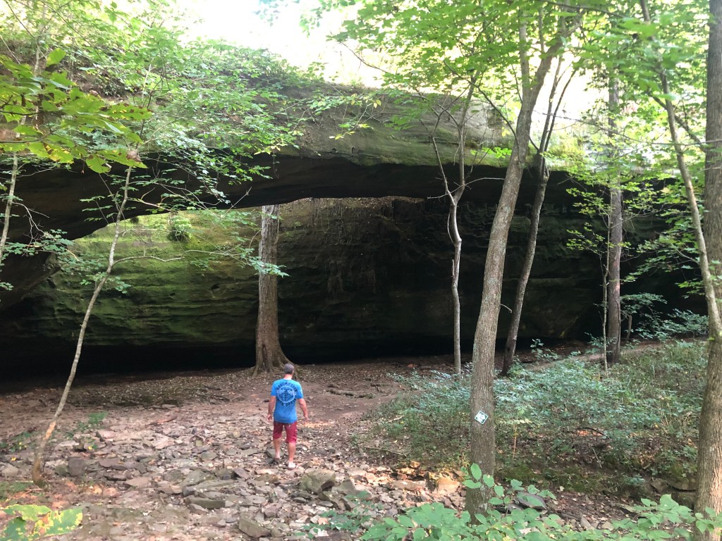
Mid-morning we arrived at Mantle Rock, near the bank of the Ohio River. This is where the Cherokees camped (some for up to two weeks) while waiting for ice on the river to break up enough to permit a ferry crossing. We hiked a short section of trail to get to Mantle Rock.
Only 485 more miles to go….Mantle Rock, where some of the Cherokees took (inadequate) shelter from the rain and cold.
I get the sense that this was one of the more commodious stops along the TOT. It’s hard to imagine the pain, discomfort, and danger of spending three months out on the trail like this.
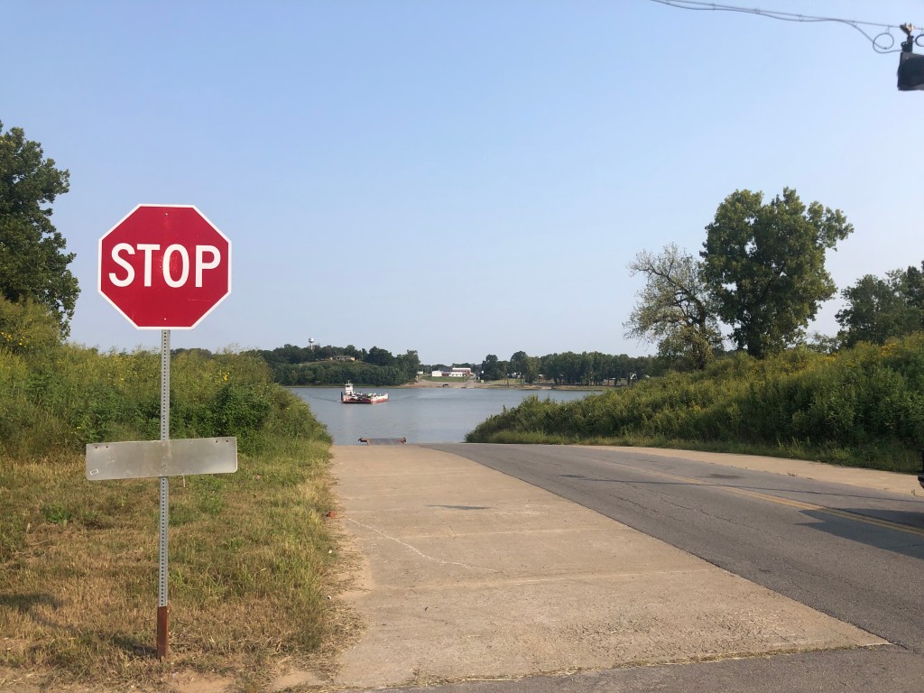
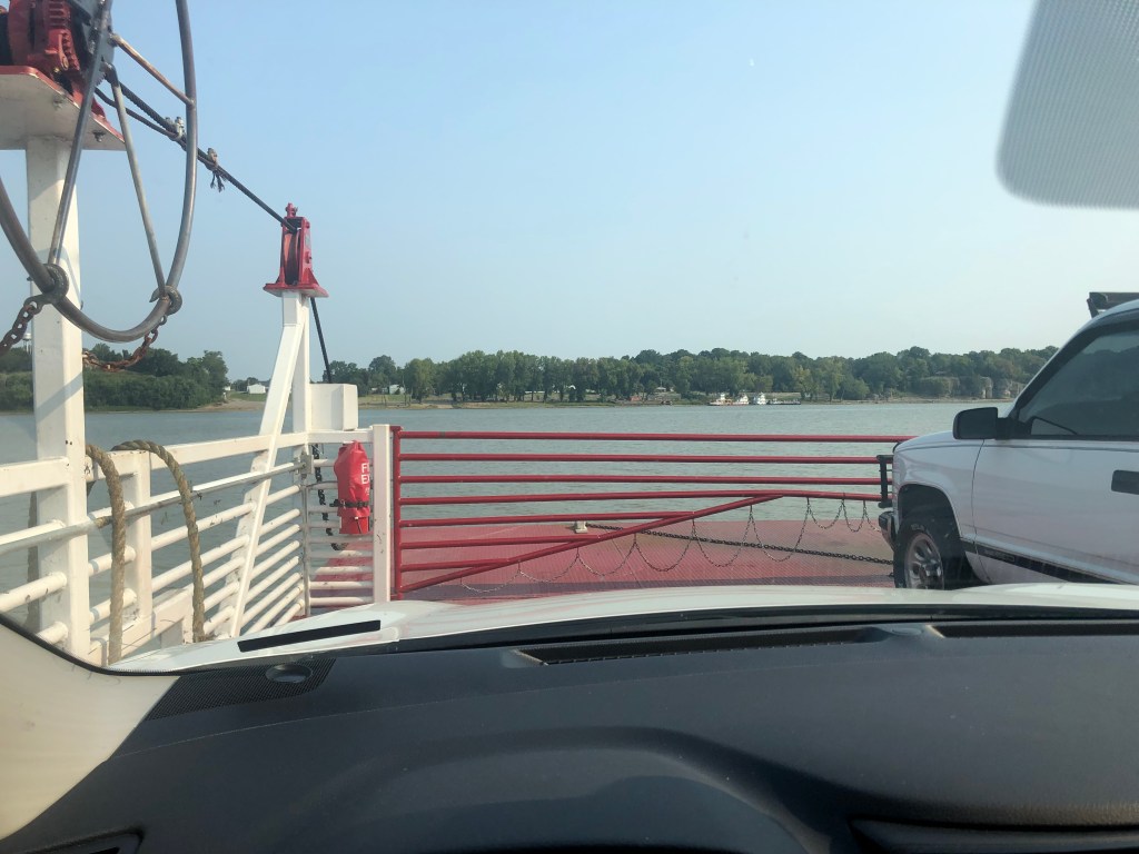
After we got back to the car, we made a short drive to the river and took a ferry across the Ohio River to Golconda, Illinois, and continued in the Cherokees footsteps.
Don’t pay the ferryman.As Spartan as it is, this ferry is a Princess Cruise compared to what was available to the Cherokees.
It was now close to noon, and we settled in for a long drive along the rest of the route, taking in the scenes of rolling hills and endless forests in Illinois Missouri, and Arkansas. About 10 pm we finally crossed the state line into Oklahoma, which at the time of the TOT was the Indian Territory, and the new home for the Cherokees. Tomorrow morning we will explore their national capital of Tahlequah, and complete the trip.
BREW OF THE DAY
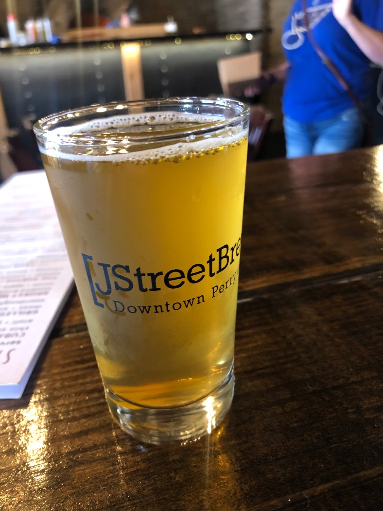
Today’s BOTD comes from the J Street Brew Company in Perryville, Missouri. Perryville is another of the many quaint, quiet, historic towns we passed along our journey. I had a Pineapple Habanero Saison. It’s lighter than I normally drink, but this place seems to specialize in pepper-infused beers. (They also had a Mango Chile IPA, a Jalapeno Lime Lager, and a Poblano Pale Ale). The saison is an uncommon style of beer these days, but it’s refreshing as an afternoon beer in summer. This one tasted somewhat sour, coming, I think, from the combination of the pineapple and peppers. The body is quite light. It’s very fizzy, almost like champagne. The ABV of 5.8 is friendly for a mid-day driving stop.
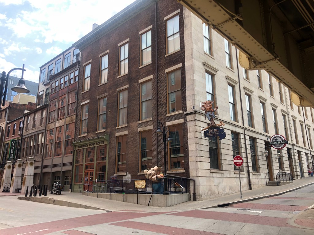
Today Scott and I stuck around Louisville. This city, perched on the bank of the Ohio River, is very much a city of the past, with ancient structures, deep historical connections, and enduring traditions.
We spent the morning walking around downtown Louisville’s old financial district. It’s lined with looming, imposing banks and stock exchanges from the turn of the century. Most of these are now serving other purposes, such as art galleries or lofts or restaurants. They’re impressive and anomalous in the 21st century, and very much give Louisville a unique, historic vibe that you just can’t get from a hipster urban renewal project.
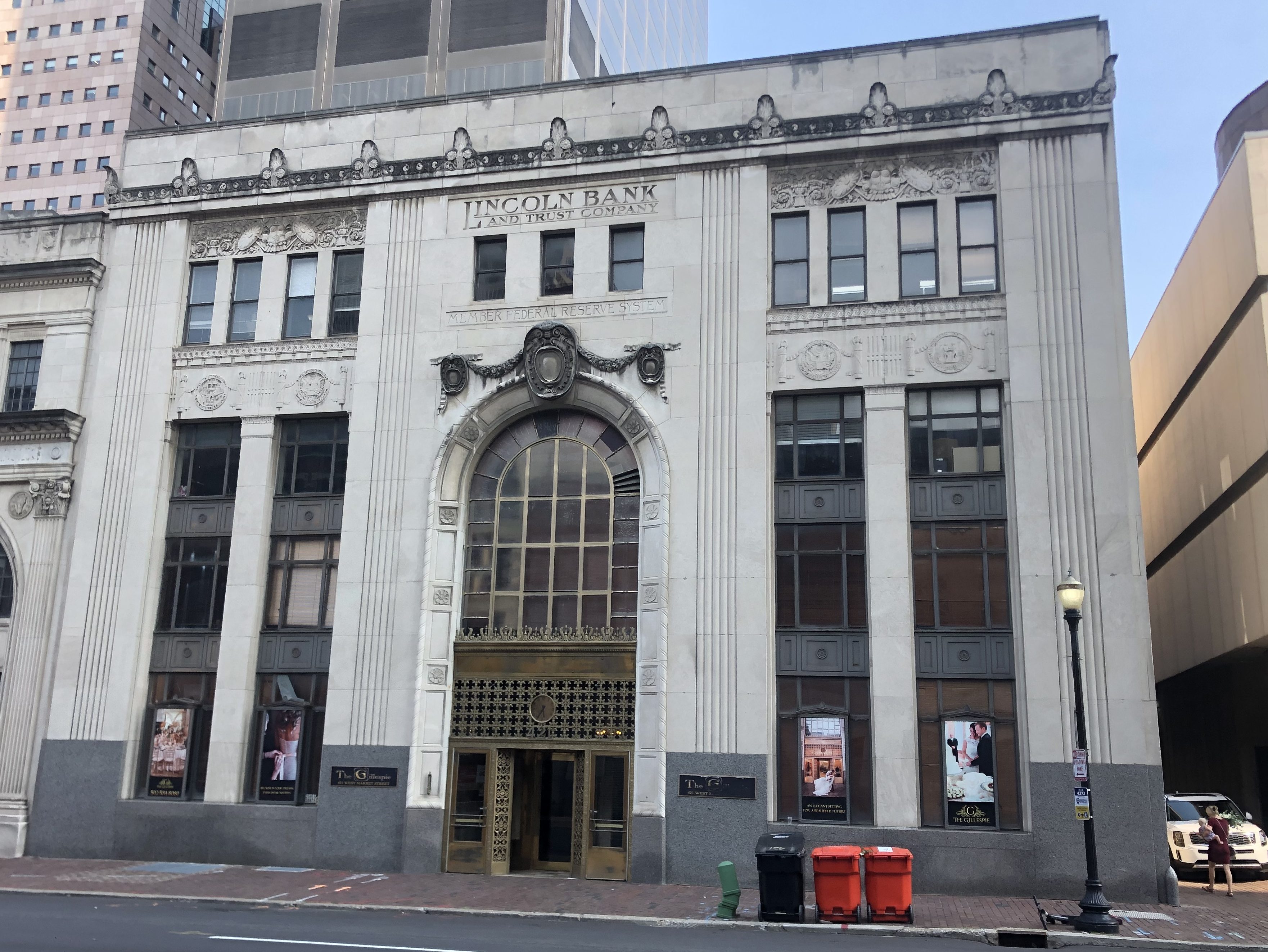
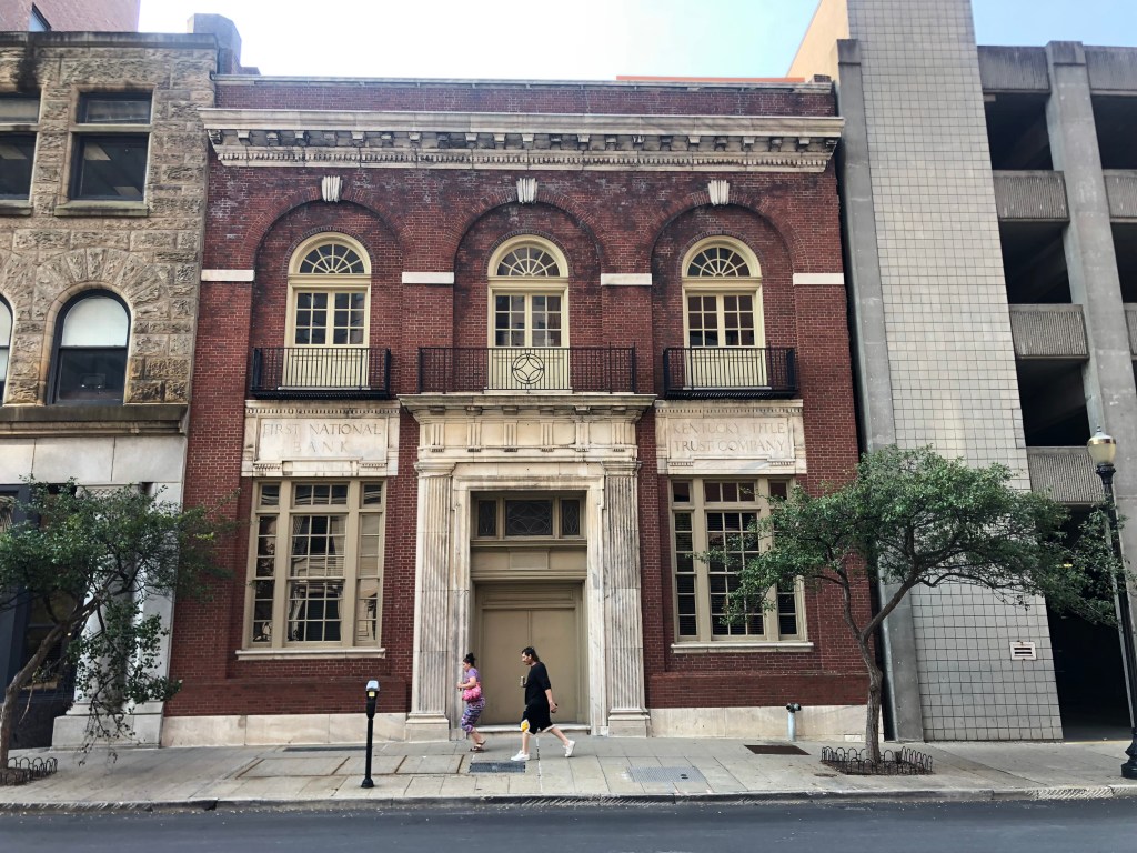
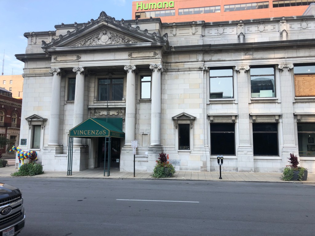
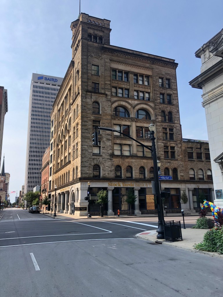
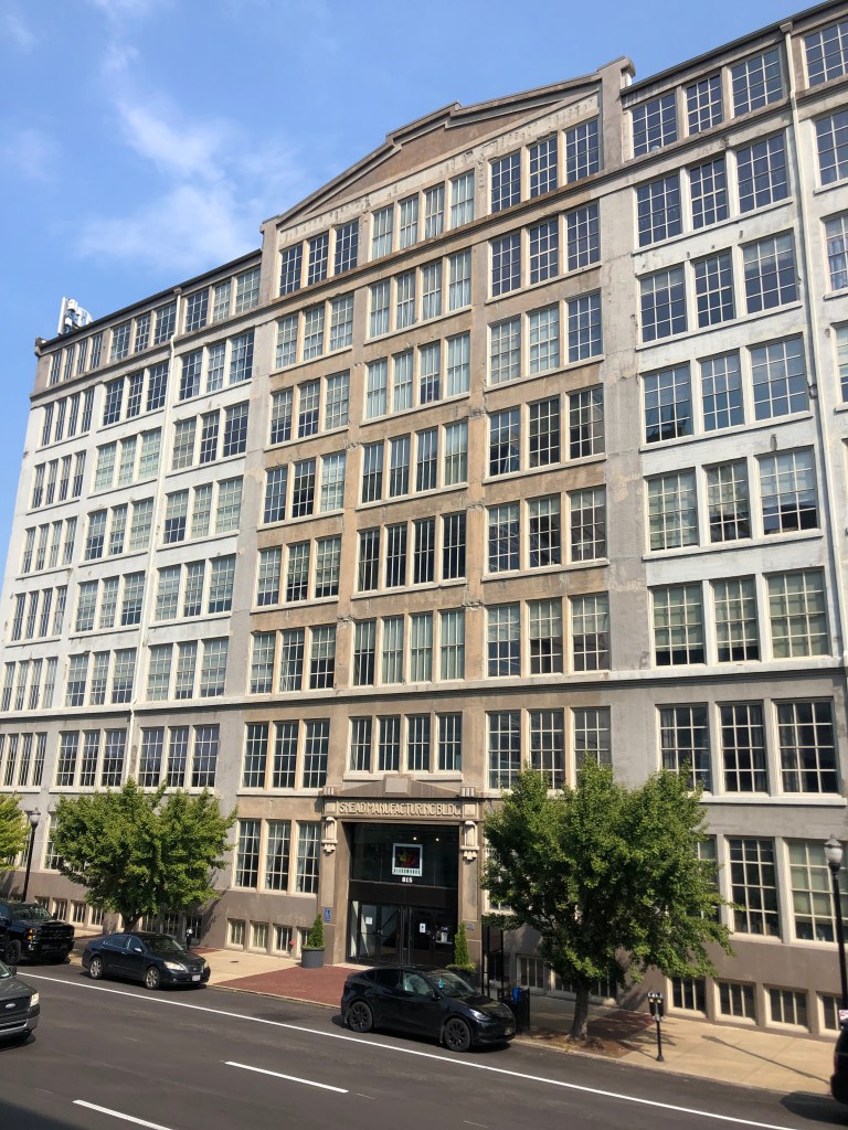
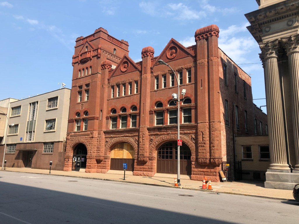
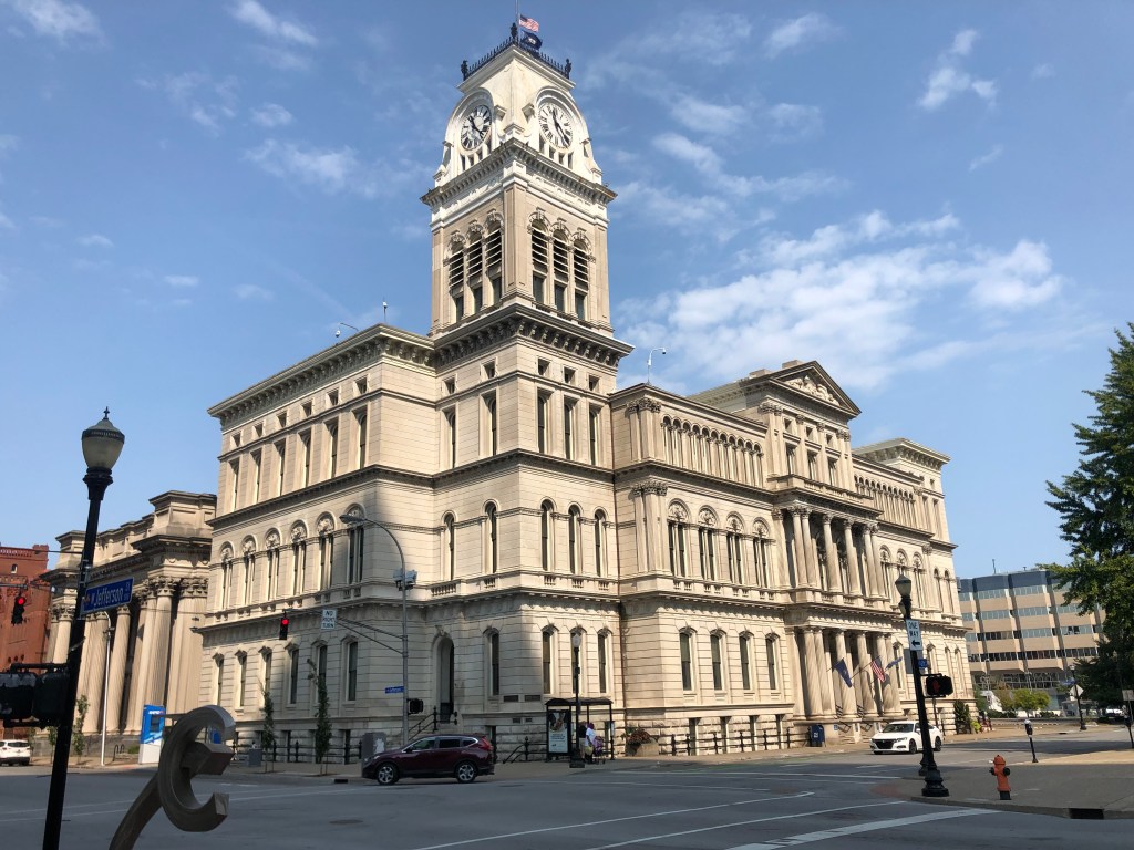
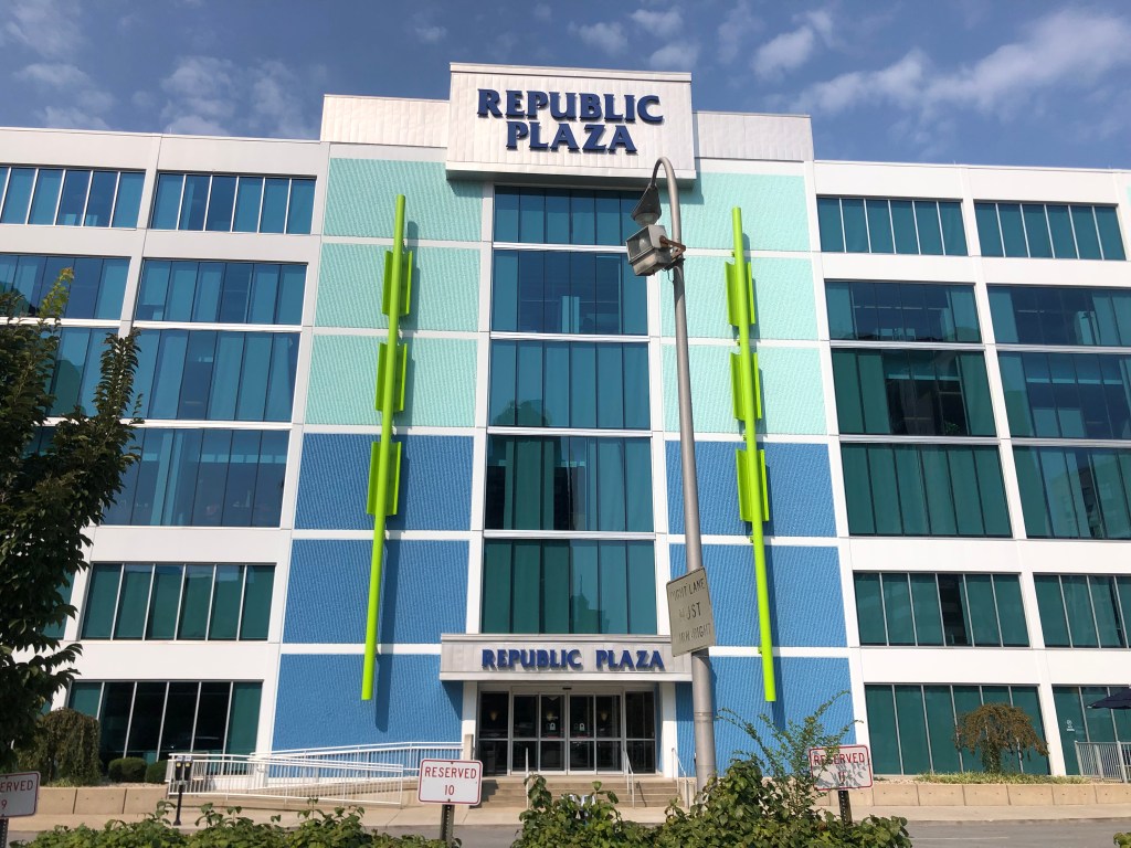
Lincoln Bank and Trust Co. building, constructed in 1929…right at the onset of the Great Depression. It remained a bank until 2005, and now serves as a reception venue.First National Bank – Kentucky Title building, from 1927.The German Bank Building, constructed in 1914. Four years later it was renamed Louisville National Bank. (Like many institutions, it was renamed during World War I to disassociate itself with the Germans.) Today it’s an Italian restaurant…thus associating itself with a different Axis power…Stock Yard Bank and Trust building, of unknown age.The Snead Manufacturing building was constructed in 1909, as a glassworks. In its later years it was widely regarded as one of Louisville’s ugliest buildings. (It also has one of the ugliest names.) It closed in 2012. Today it’s been converted to lofts and office space, and retains an artists glass studio.Historic fire station (Steam Engine Company #2), built in 1890. Now the Metro Revenue Commission building.The awesome City Hall building, from 1873.And, just for contrast, check out this more recent abomination from the so-called “modern” era. What was the architect thinking?? “I know! Let’s flank the doors with giant neon swizzle sticks!”
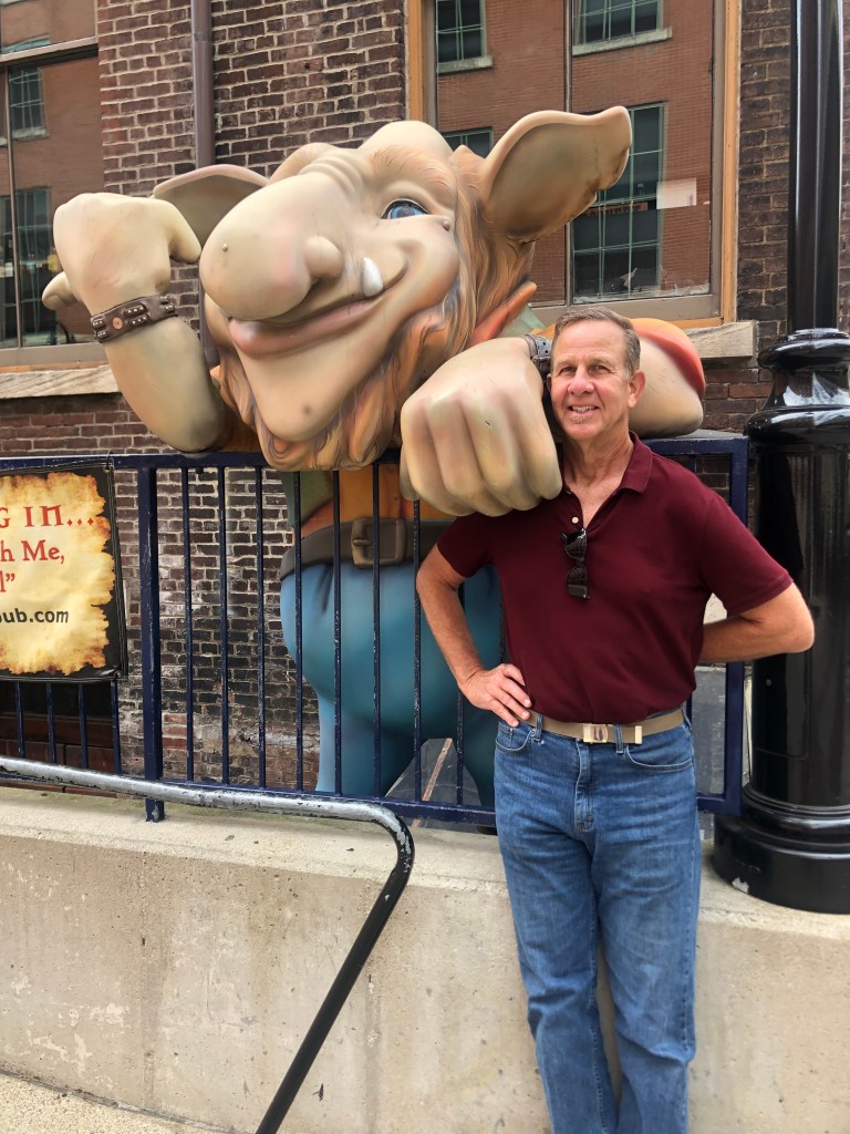
For lunch, we thought we would try the (slightly) celebrated Troll Pub. The name comes from the Three Billy Goats Gruff, since the pub sits under a bridge (Louisville’s Clark Bridge, which crosses the Ohio River into Indiana). The pub is in yet another of Louisville’s historic structures; this one was the headquarters of the Louisville and Nashville Railroad in the late 1800s.
Alas, the pub’s kitchen didn’t open until 1 pm (which seems like an odd time to start serving the lunch crowd), so we left and I got a stale corn dog at a gas station. But at least we were able to get this cool picture with the troll.
“Who’s that tripping over my bridge?!”
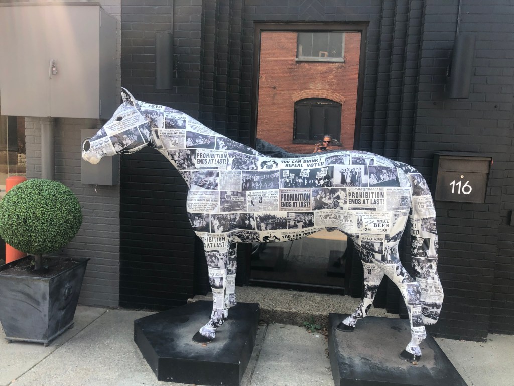
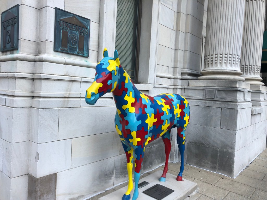
I addition to its cool architecture, Louisville has a strong sense of civic pride. A tangible example is the city’s Gallopalooza, which was a fundraising project whereby businesses and other groups bought and decorated fiberglass horses that were then placed around town. (This followed a popular trend adopted by a number of other towns in the early 2000s.) We encountered a handful of these horses today.
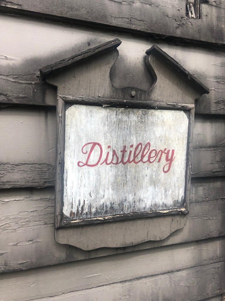
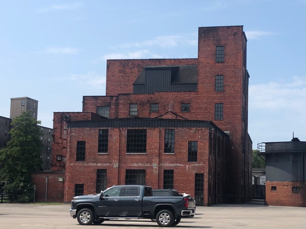
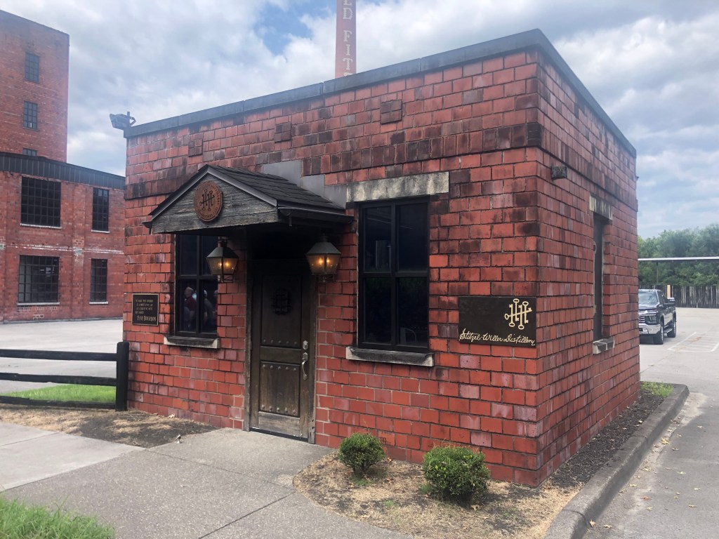
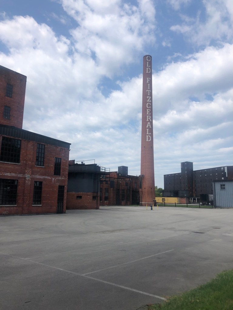
After lunch, we headed out for one final distillery tour, at Stitzel-Weller. The facility, which was constructed in 1935, was both fascinating and depressing.
When we arrived, we were struck by the picturesque, historic setting with ancient trees, rambling old rick houses, an enormous brick smoke stack, and a tidy prewar administrative building in a state of arrested decay. It’s exactly the kind of place that I want to imagine my bourbon comes from: historic, well-worn, traditional, slow-paced, and unpolished.
(Old Fitzgerald had been one of Stitzel-Weller’s labels.)
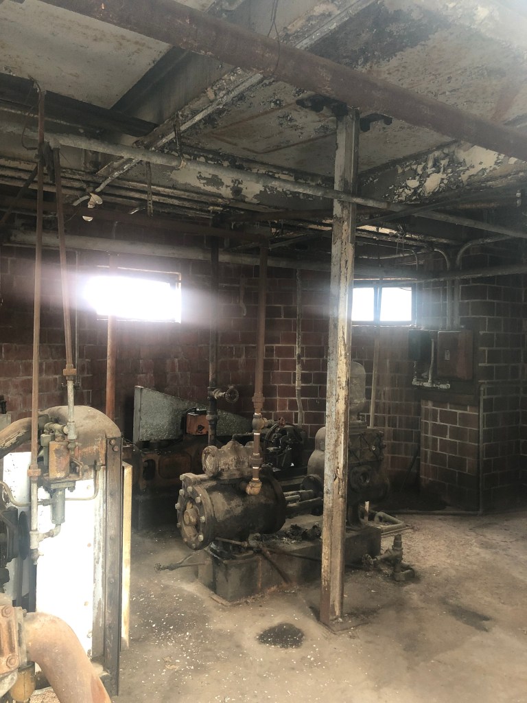
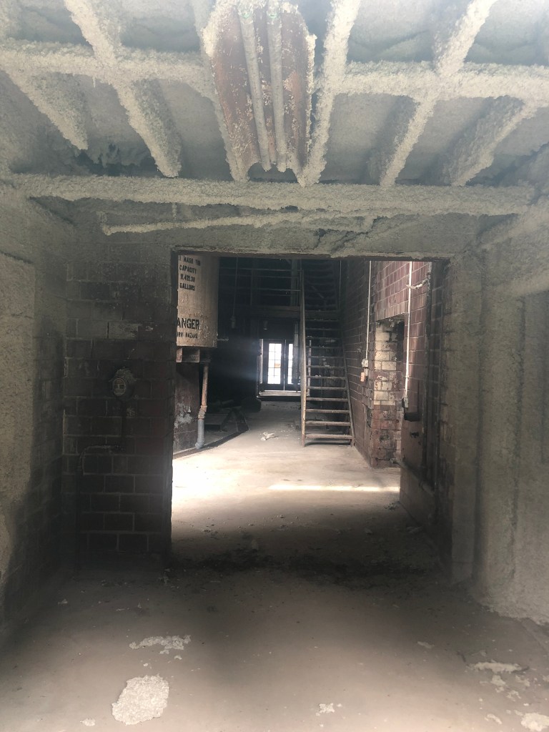
We were soaking up the atmosphere (quite literally in Kentucky’s summer humidity) and enjoying the tour when it became clear that this distillery has not produced whisky in over a quarter of a century. The family that owned it since its inception sold it in 1972, and it fell into the hands of a mega-corporation which shifted production to more efficient plants. The distillery’s buildings are now mainly just used to store barrels from other distilleries, and to conduct tours and tastings. It was somewhat eerie to walk through these buildings that once saw round-the-clock activity, but which now are inhabited mainly by ghosts.
Just imagine what asbestos abatement would cost…
Furnished with this story of commercial quietus and exposed to this setting of decline and decay, we feel properly equipped to return to the Trail of Tears in the morning.
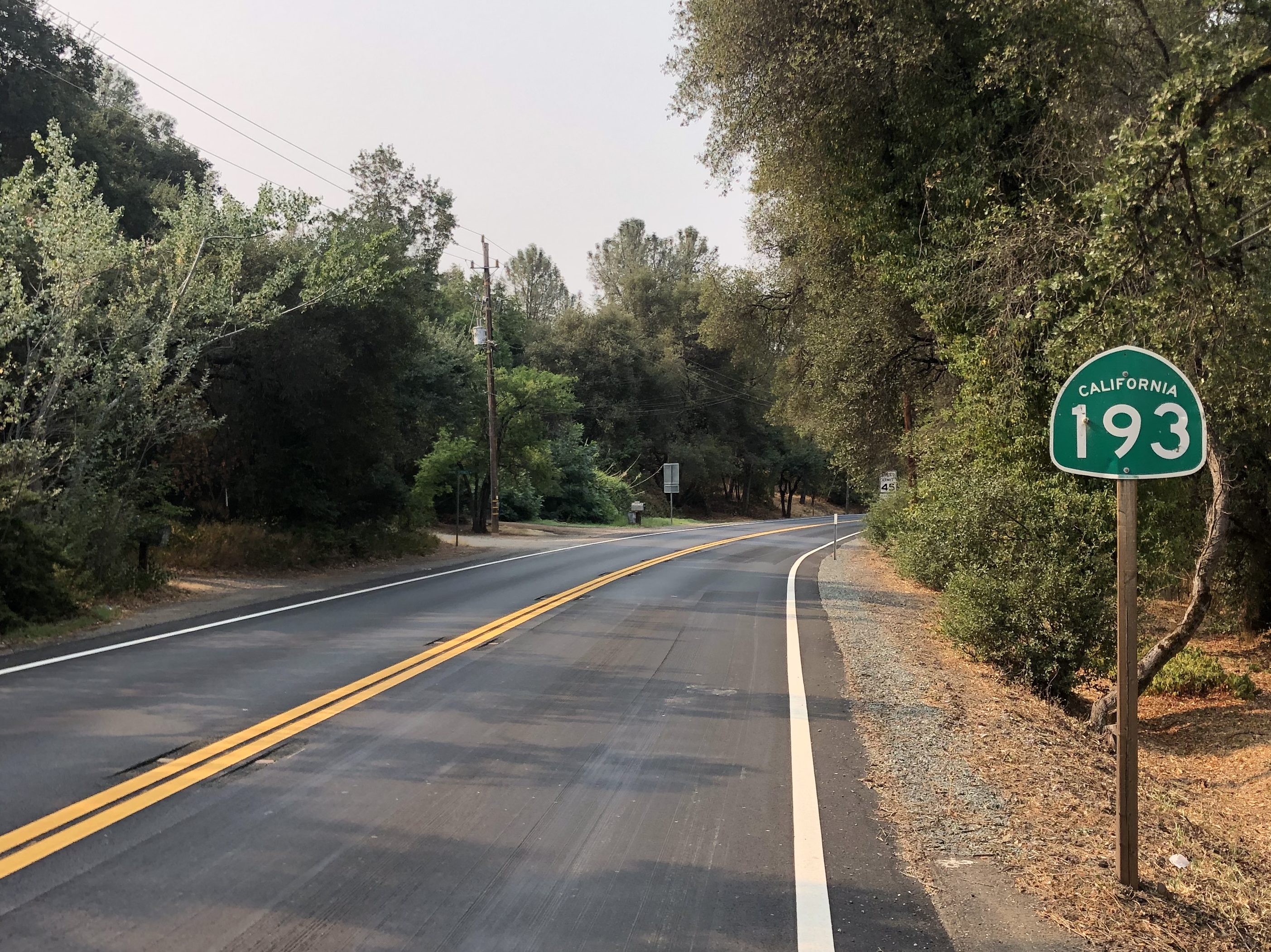
The other day I decided to take a spin along one of the lesser-known California State Routes in northern California. State Route 193 starts (or ends, depending on your perspective) in Lincoln, CA and runs generally east to south through Placer and El Dorado Counties.
For those times when a direct route just won’t do.
Most of Route 193 takes the form of a winding, rural, two-lane road through the Sierra foothills. It’s a wonderfully relaxing drive. As long as you don’t have to be anywhere in particular at any particular time, it’s an ideal roadway.
The land that time forgot.
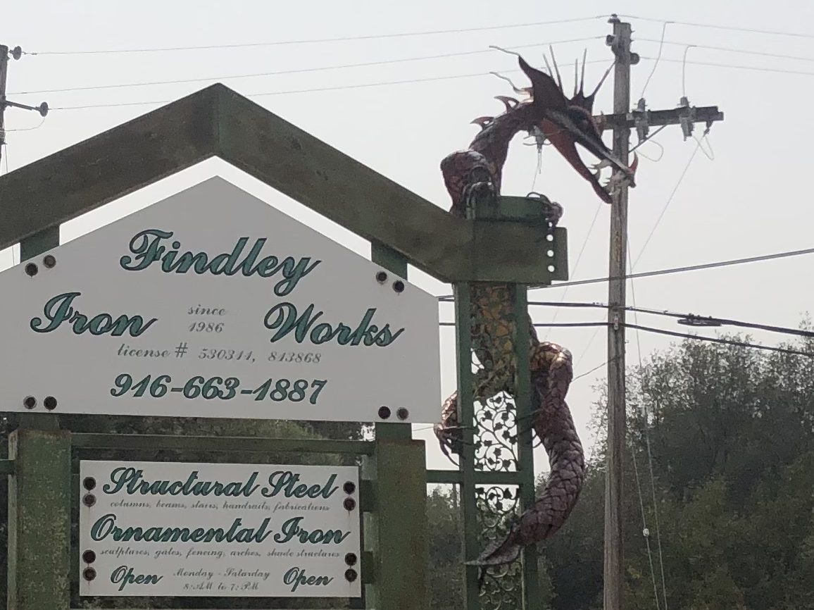
Route 193’s western terminus at Lincoln (pop: 50,000) began as a railroad town in the mid-1800s, and remained a fairly isolated and quiet community for almost 150 years. Then, in the 1990s, it became one of the fastest growing cities in the United States. The incessant expansion of the Sacramento metropolitan area, with families seeking out new suburbs and better schools, swallowed up Citrus Heights, Roseville, and eventually Lincoln. Lincoln’s (relatively) low cost of living and lower crime rate made it a desirable region for new families. Still, despite its railroad heritage, the town doesn’t seem to have a lot of historical interest to offer, at least not along the Route 193 corridor. The most notable roadside scene was the iron dragon at Findley Iron Works in Newcastle, a few miles down the road. The dragon reminds me a lot of Trogdor.
The Burninator stries again.
Route 193 winds through oak-studded hills for about a dozen miles, when it reaches the city of Auburn (pop: 14,000). From here 193 runs concurrently with CA Route 49 for seven or eight miles. (I covered this stretch of Route 49 in an earlier blog post, so I won’t review that stretch again here.) But I will note that I stopped in Auburn to have a burger and a beer with my friend Victor R. The beer appears at the end of this blog entry as my Brew of the Day.
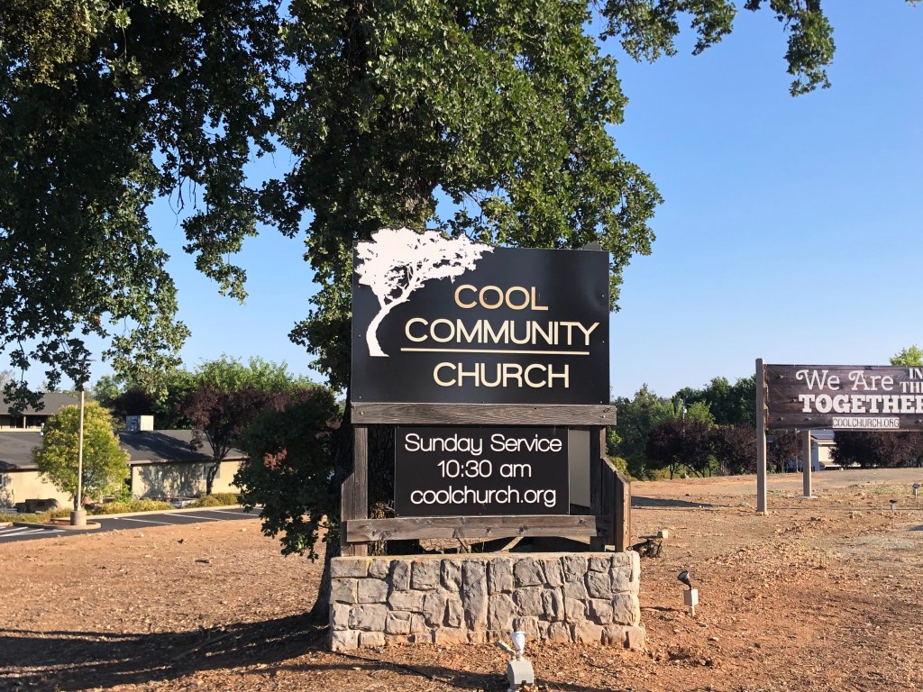
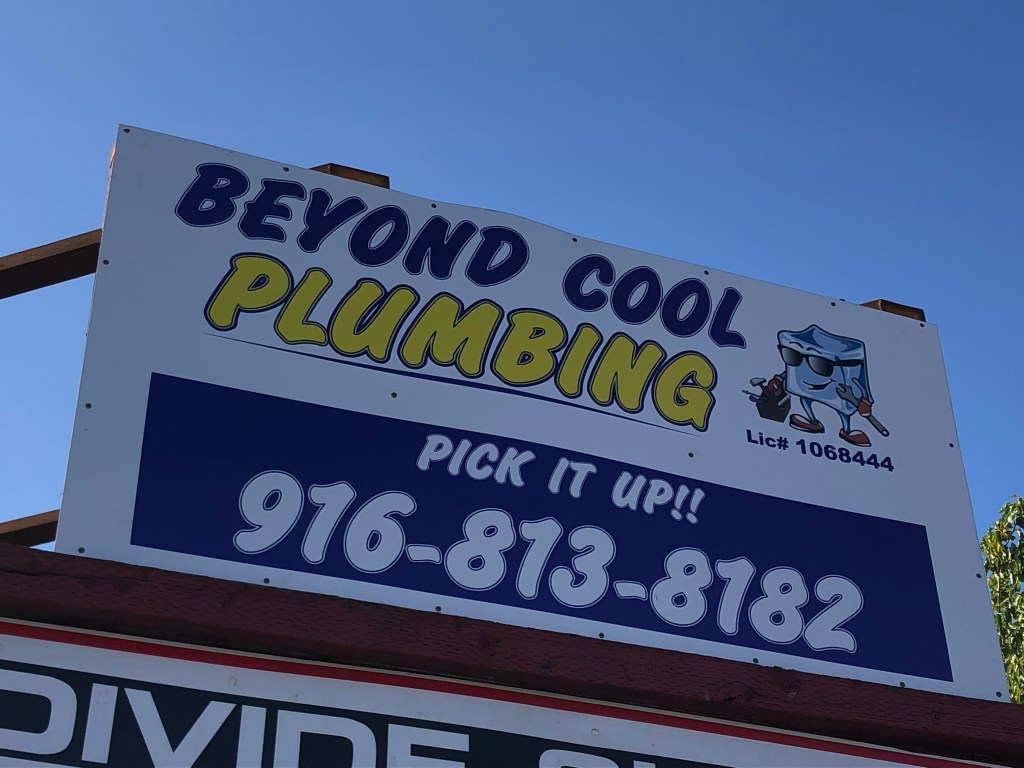
Route 193 again branches off Route 49 at the town of Cool (pop: 4,100). It’s not entirely clear how Cool got its name, but one theory holds that it is a reference to an itinerant preacher named Peter Y. Cool who frequented the area in the 1850s. As you might imagine, the businesses in Cool capitalize on the name’s adjectival properties. Like, “Cool Dentist” and “Cool Tobacco.”
Too Cool for School.Located just past the city limits. Hence, “beyond cool.”
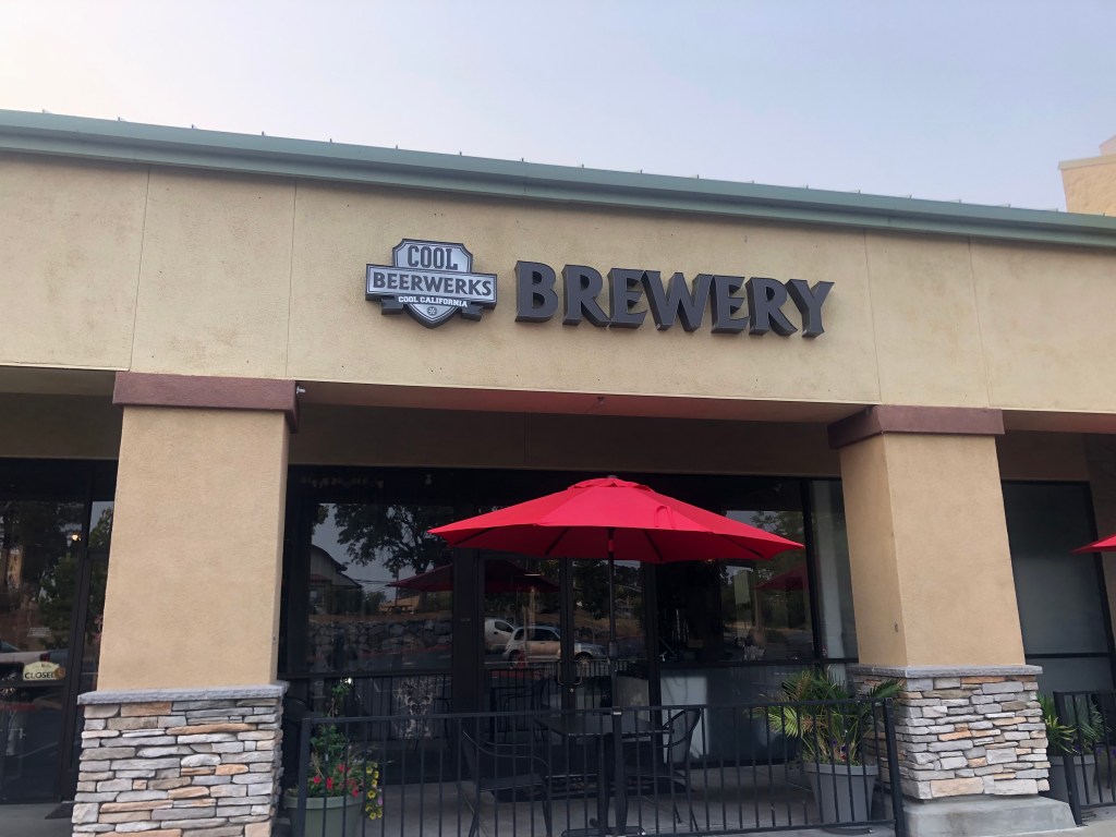
The most notable feature of Cool other than its name is the Cool Beerwerks, whose tagline is the unlikely-sounding “Rockin’ Sushi & Brews.” Fortunately, they were closed when I passed by.
When you’re hot you’re hot, when you’re not you’re cool.
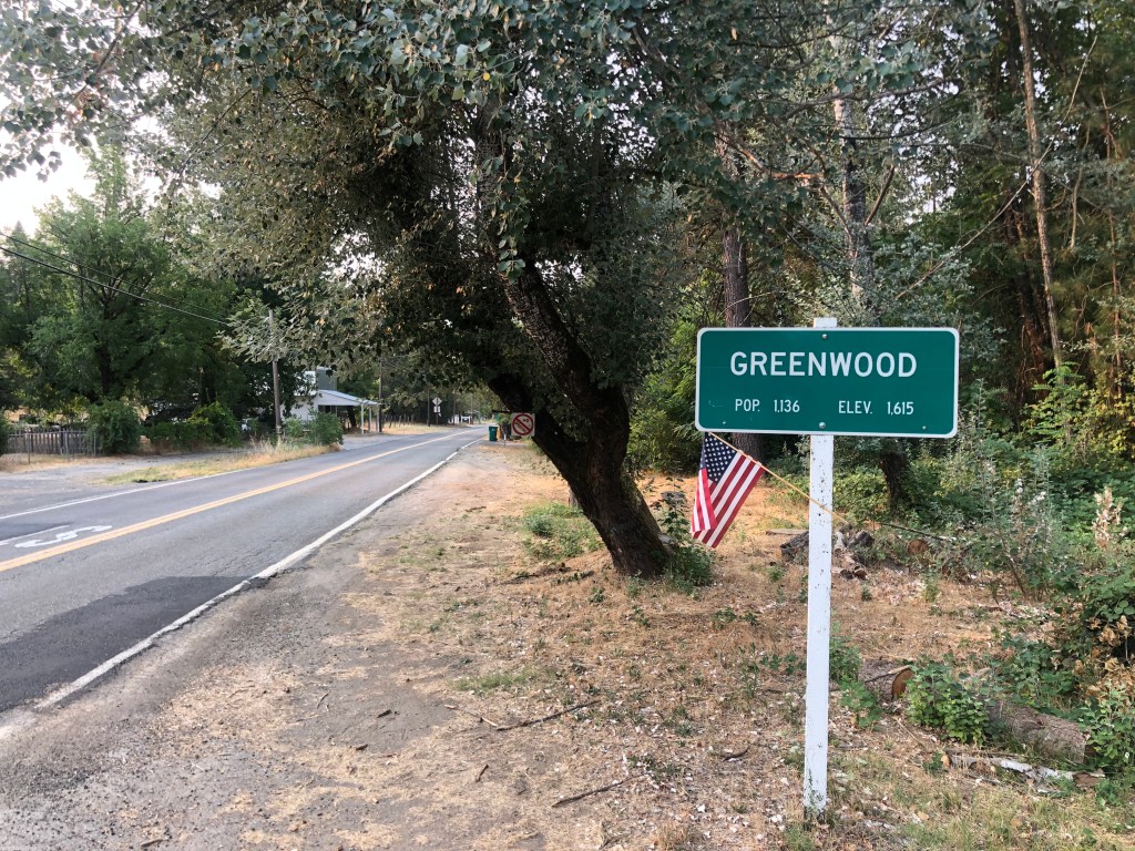
From Cool , Route 193 travels between the middle and south forks of the American River, a hilly area known as the Georgetown Divide. Horse pastures and the occasional farmhouse dot the landscape. The next town of any note is Greenwood (pop: 1,100), nestled among oaks and rolling hills.
Another of those towns where the elevation exceeds the population.
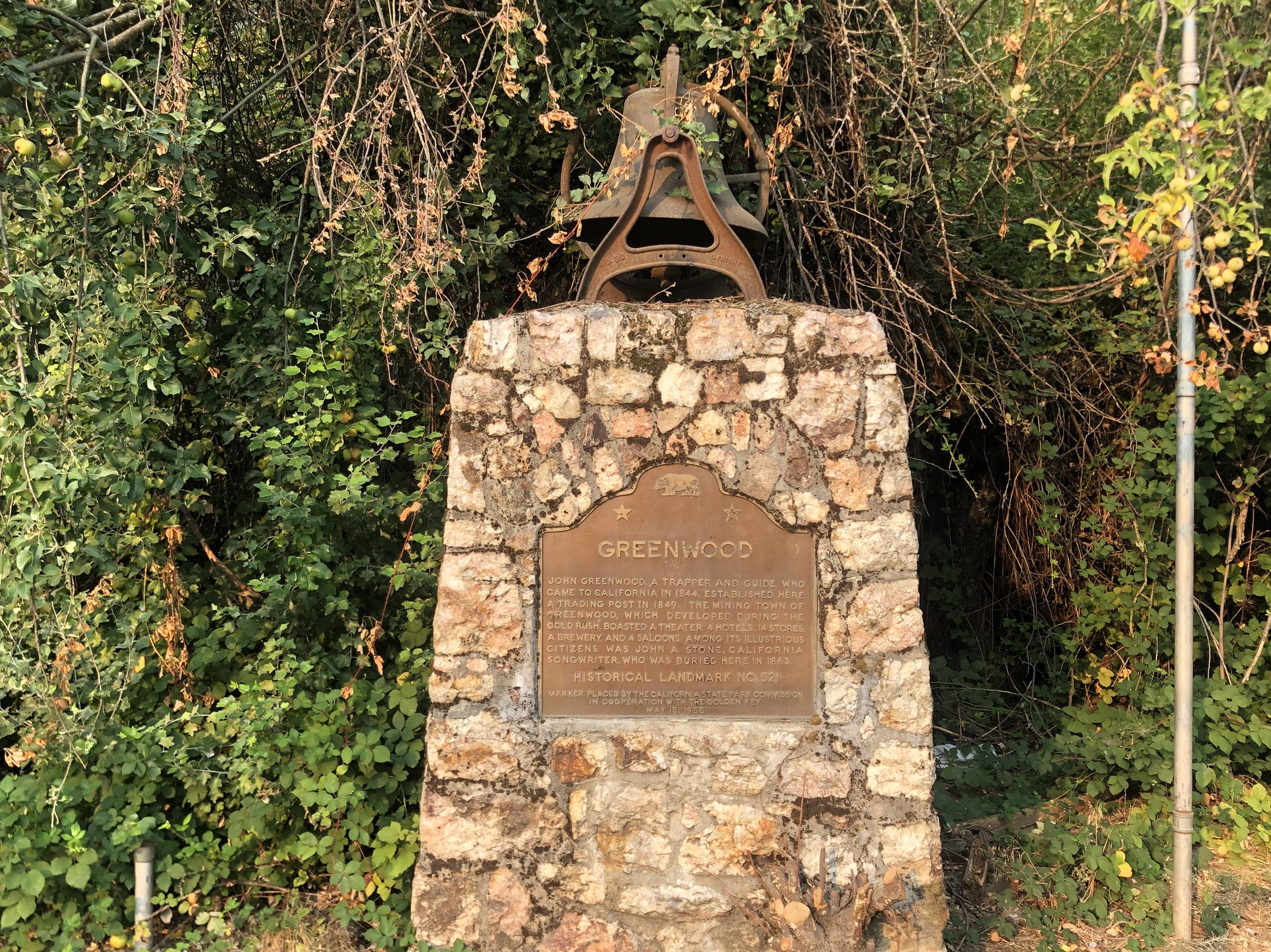
Near the entrance to the town is a stone memorial that was erected in 1955, along with a bronze plaque providing the briefest historical sketch of the town.
Other than the town’s namesake (a trapper named John Greenwood from the 1840s) the plaque mentions only one other famous resident: “John A. Stone, [a] California songwriter who was buried here in 1863.” It seems that Stone (who for some reason was known by the moniker “Old Put”) “wrote most of the songs we associate with the California Gold Rush.” Ummm, which songs would those be, exactly? Maybe My Darlin’ Clementine. Are there any others? Anyway, Old Put published a songbook (called a “Songster” at the time) in 1868.
Put-ting his money where his mouth is.
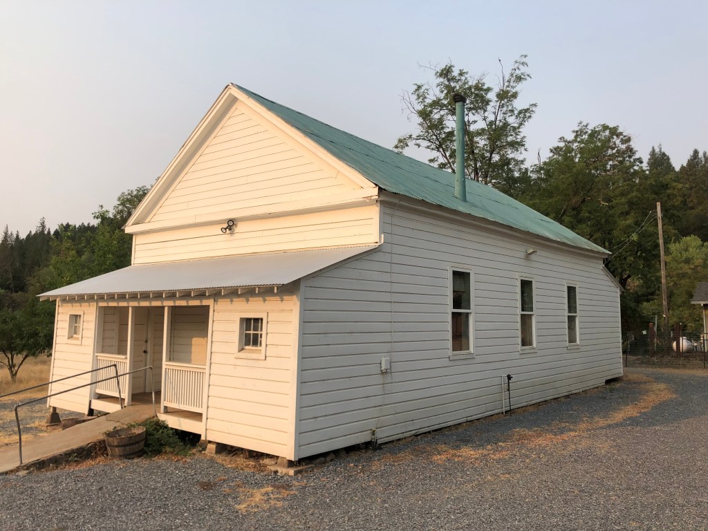
But let’s get back to the memorial plaque. Did you happen to notice the unexplained bell on top of the monument? Was it a fire bell? Is it even related to Greenwood? Well, a short while later I found the answer. A couple of blocks away from the stone memorial there sits an old schoolhouse that was originally constructed in 1858. The school operated for almost a century, until it closed in 1954. (Greenwood’s students thereafter attended in school in Cool, or “Cool School” as they must have called it). The bell on top of the school house was removed and placed on top of the stone memorial pictured above.
Greenwood School, sans bell.
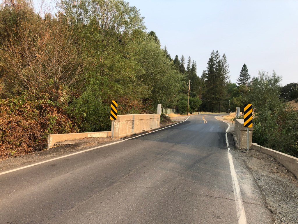
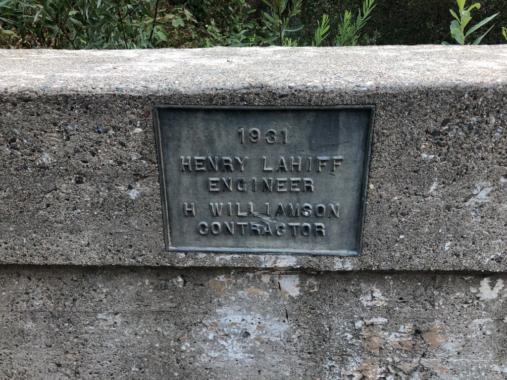
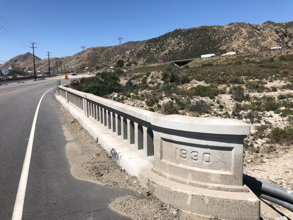
Now, let’s back up for a moment. In the same year (1868) that Old Put published his “Songster,” a man named Henry Lahiff was born in Ireland. He was educated as an engineer, and at age 20 he emigrated to Arizona to work at the Copper Queen Mining Company. He was a capable engineer, and soon was working on projects in other US cities, including a stint as the chief engineer on San Francisco’s Sutro Baths. Eventually he became the surveyor/engineer for El Dorado County, and in 1931 he designed this bridge that I crossed during my visit to Greenwood.
It’s not much to look at. But……it’s nice to still be recognized 80 years later.
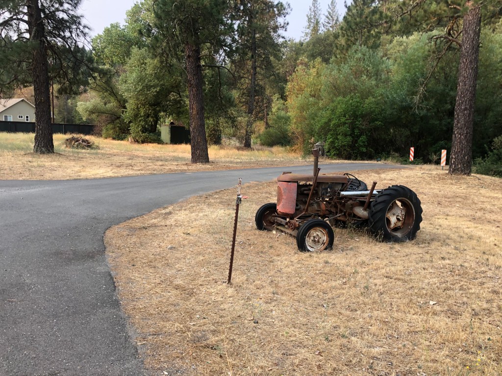
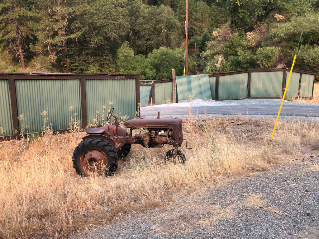
The other notable thing about Greenwood is the propensity for people to permanently park old tractors by the road in front of their property. I must have encountered over a half-dozen of these.
Greenwood’s answer to garden gnomes.
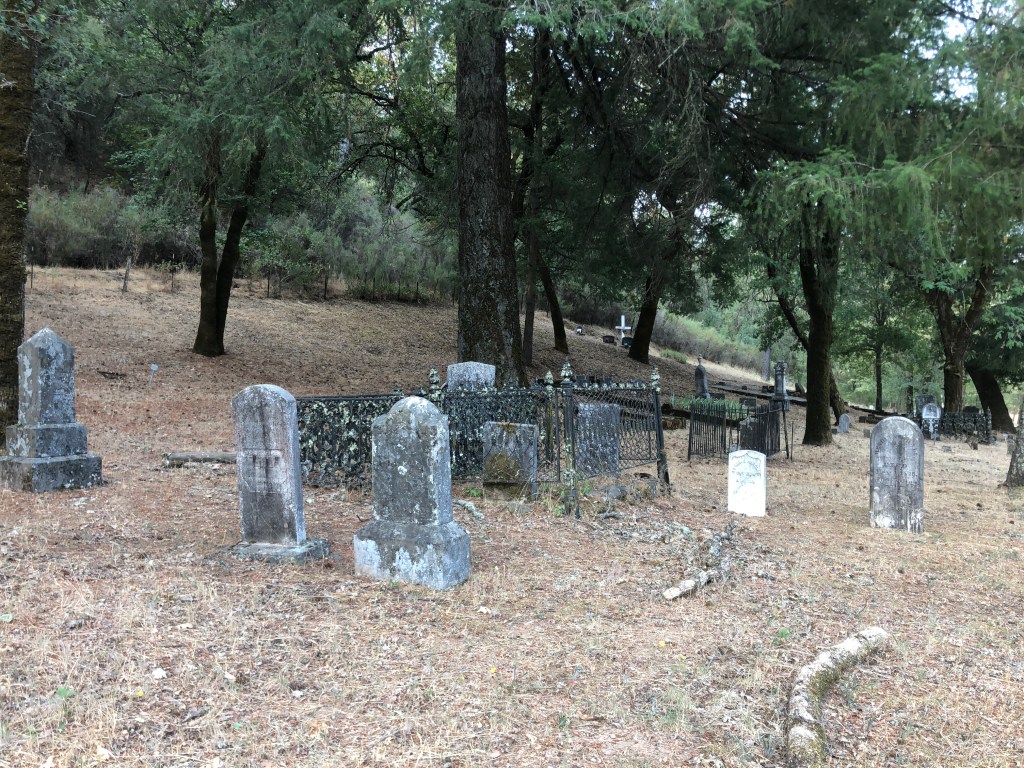
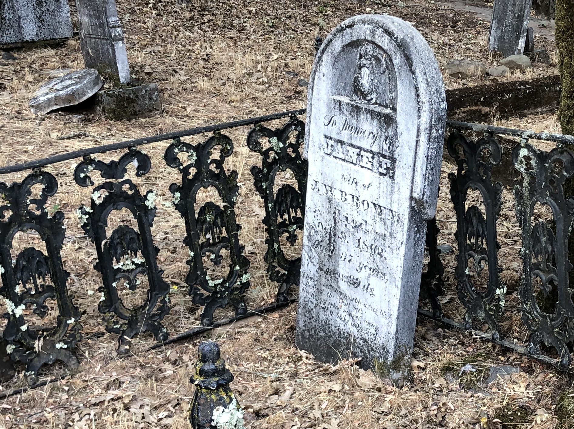
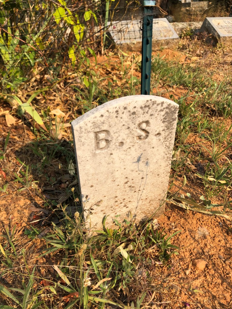
Just as I was leaving town I encountered Greenwood’s old Pioneer Cemetery, with graves dating back to the 1850s. I didn’t find the final resting places for engineer Henry Lahiff or John Stone (“Old Put”) but I did encounter a significant number of ancient gravesites set amid gloomy, drooping trees and weedy earth.
The end of the line for Greenwood’s pioneers.It’s notable that the early pioneers didn’t usually reach a ripe old age.
I found myself in a blue funk (or maybe it was a brown study), thinking about these lives that ended a century and a half ago. These forgotten, neglected markers of granite are all that remain. Or maybe that’s selling them short. I thought of Henry Lahiff, the bridge engineer. While he’s not a household name, and while few people probably even bother to look at the plaque on the local bridge he designed, he did literally leave his mark on this community. And if it weren’t for him, I wouldn’t now be able to cross that creek. Maybe that’s how we achieve immortality: Not be having our names remembered, but by affecting the world in ways, however tiny, that future generations might experience, even if they don’t pay attention.
With these thoughts in my head I re-mounted the trusty Speedmaster and headed west on 193 to the somewhat larger community of Georgetown (pop.: 2,500). As you might have surmised, the town is named after a guy named George. In fact, originally it was called “George’s Town.” I’m not making this up. George Phipps was a sailor who came to the area as a gold prospector, and he founded the mining town in 1849. Georgetown suffered a fire just a few years later, and was rebuilt in a more planned, logical, and attractive fashion than most of the other Gold Rush towns. Georgetown was also more prosperous than most of the others, which led to its being called “The Pride of the Mountains.”
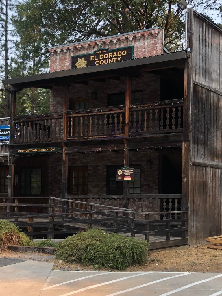
There’s clearly still a lot of pride in Georgetown. Much of the architecture recalls the town’s past. Even the County Sheriff’s Office looks like something out of a John Wayne movie.
Paging Sheriff John T. Chance…
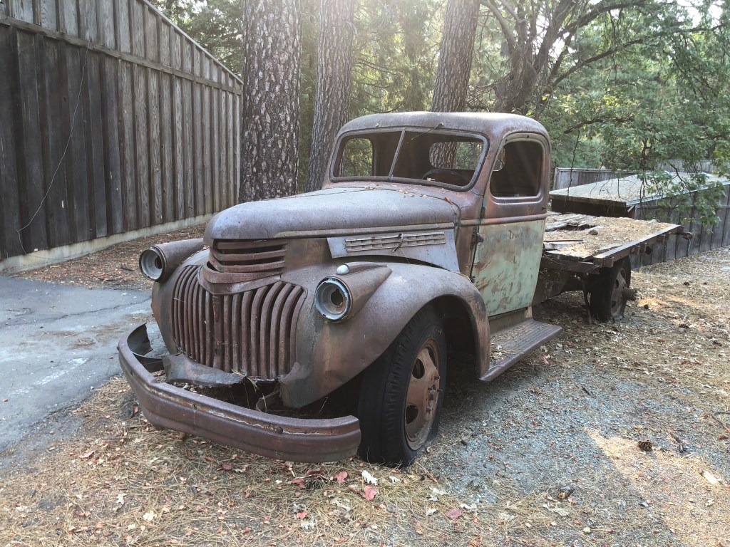
Georgetown seems to have two financial centers. One is a 12-acre commercial zone that calls itself Buffalo Hill. It was conceived and owned for many years by a local couple who wanted an attractive, thriving business node to keep local spending in the area. Most of the buildings display that same old-West style of the Sheriff’s Office, and the property doubles as an outdoor museum with dozens of antique vehicles and logging equipment. When I visited, the businesses looked well cared for and most seemed to be doing a steady business.
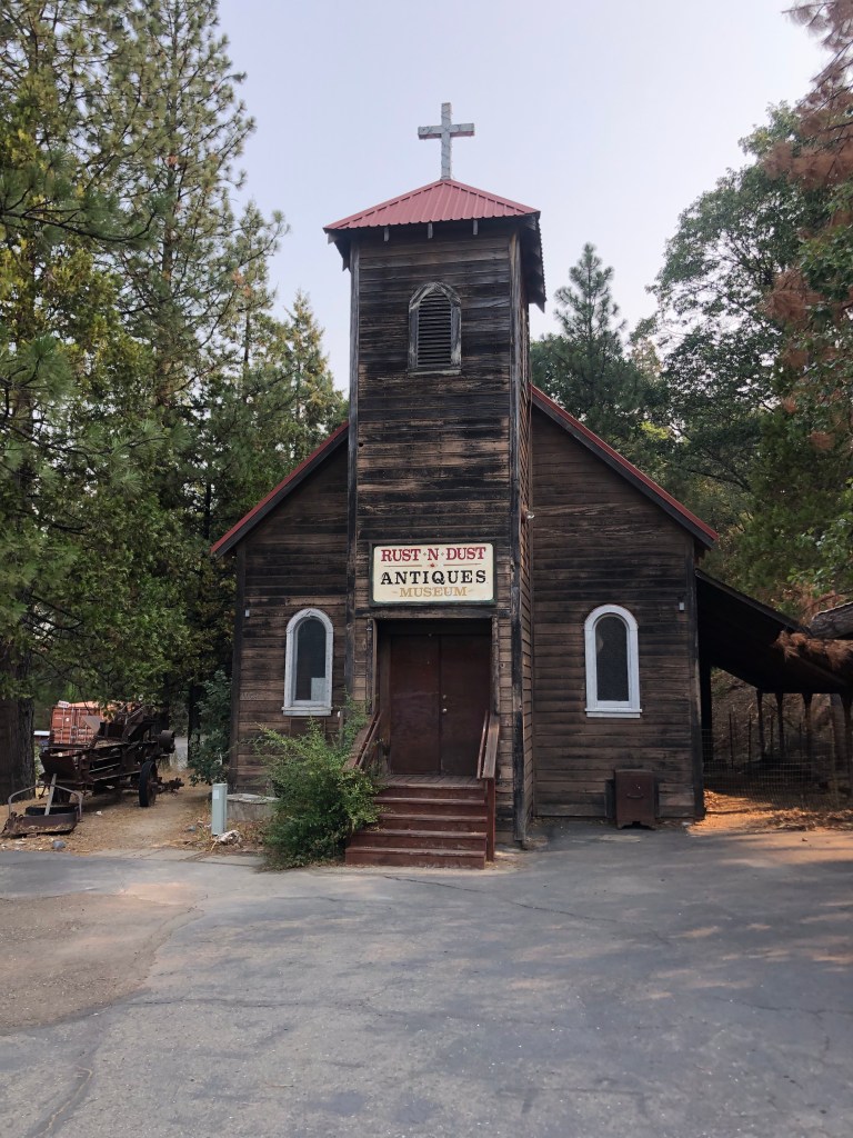
Buffalo Hill’s antique store used to be St. James Catholic Church (built in 1923).Buffalo Hill keeps on truckin’.
Georgetown’s second financial center is its Main Street. Dotted with Gold-Rush era buildings, small crowds of people walk along its covered sidewalks lined with cafes, art galleries, taverns, and small shops.
(Photo stolen from the Web–The one I took didn’t turn out.)
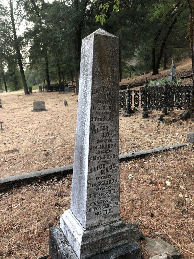
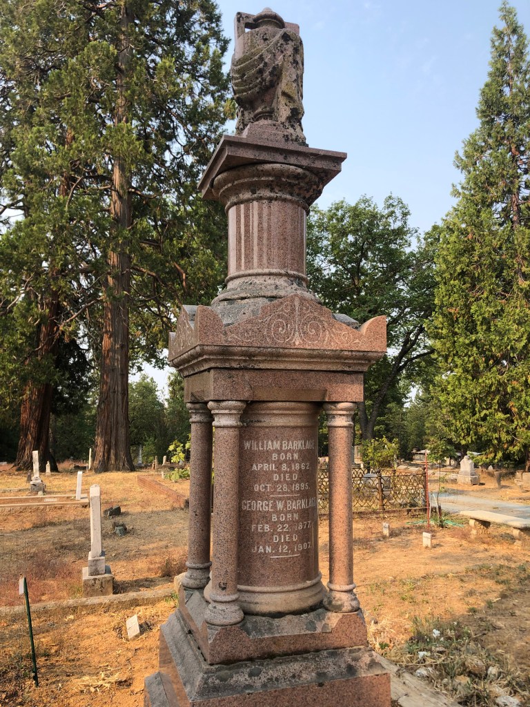
And, of course, Georgetown has its own pioneer cemetery. I suppose cemeteries are the most direct physical link we have with those individuals who came before us. Those from wealthy families often erect ornate monuments in the hope that they will continue to attract attention decades and even centuries later. Like this one from the Barklage family, which emigrated from Germany in the mid-19th Century and made their fortune from timber and mining.
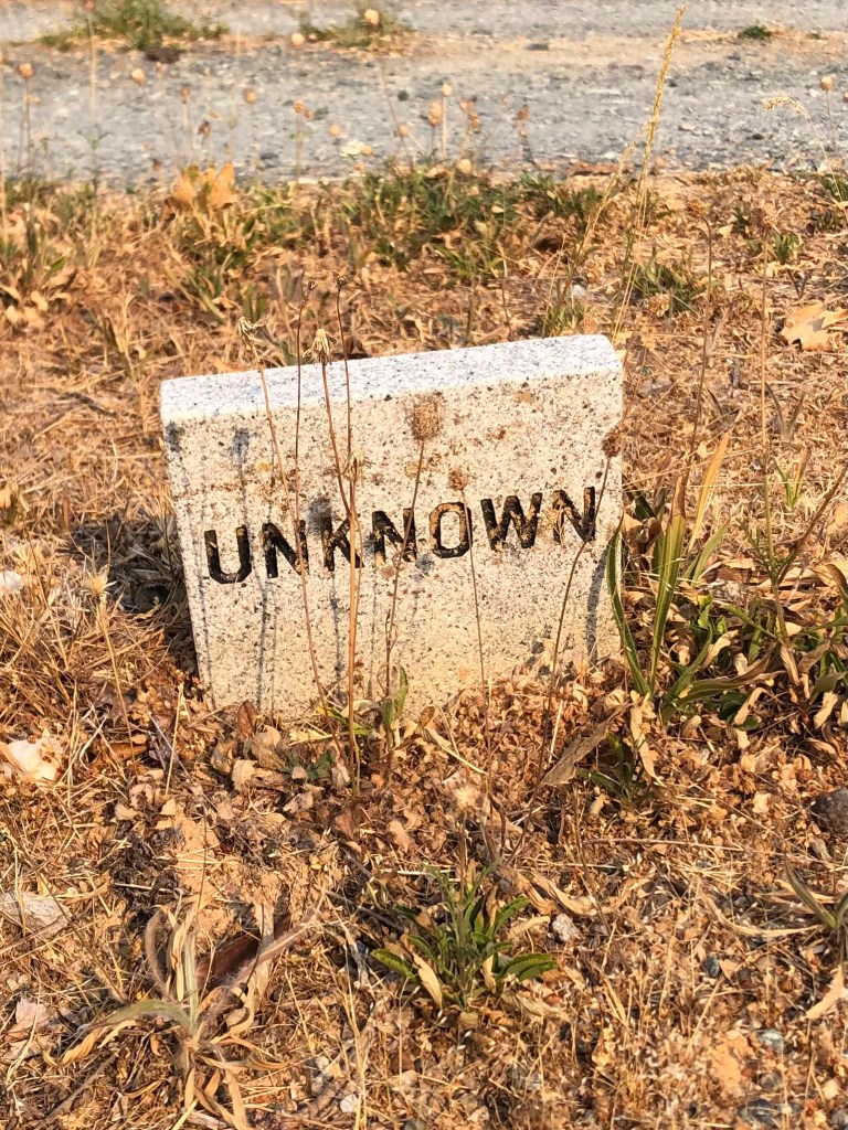
No doubt they expected this imposing monument would ensure their name would always be remembered. And yet, to the people who walk through Georgetown today, are the Barklages any more real than this poor fellow?
In fact, one wonders if the very idea of achieving immortality through stone monuments is summed up thus:
To my way of thinking, it’s people like engineer Henry Lahiff and even Old Put who live on through their efforts to better the world around them.
BREW OF THE DAY
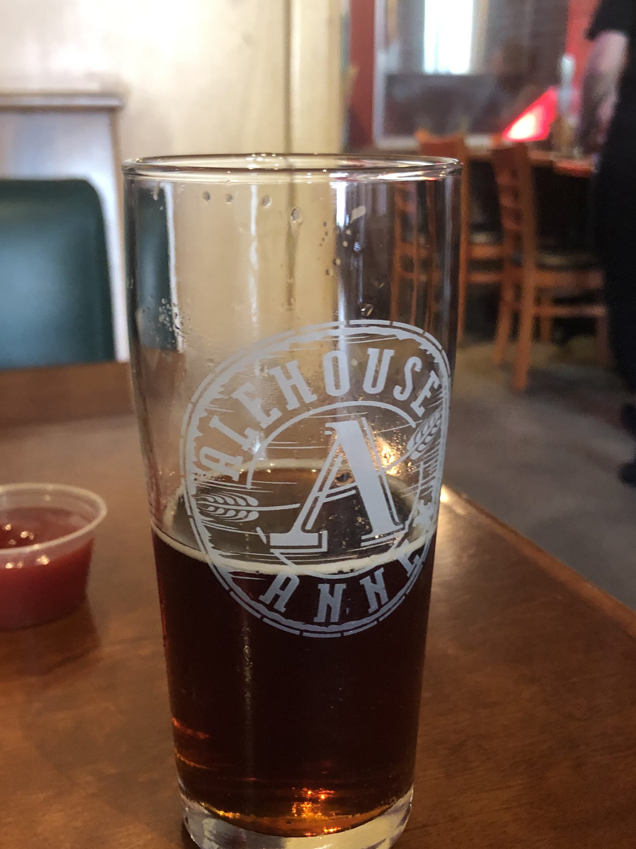
I stopped at the Auburn Alehouse in Auburn’s Old Town. It is located in the venerable structure that was built as a sixteen-room hotel in 1856. (The building has been home to the Auburn Alehouse since 2007.)
I selected the Hop Donkey, which is billed as an Imperial Red Ale. Now, in my experience, many red ales can be somewhat anemic and bitter. But the Hop Donkey is rich and flavorful. Its color reminds me of Starbucks, and its viscosity reminds me of Aunt Jemima. (I note, by the way, that that brand is being retired amid modern sensibilities.) This is an appealing beer. Its rich maltiness is perfectly balanced by its eponymous hops. It has a meaty palate, so much so that you practically chew your way through a glass of it.
Good for what ale you.
I was wanting a second glass of Hop Donkey by the time our meals arrived, but at 9.2 percent ABV, this is beer that requires some self-restraint. But you know that one day soon I’ll be coming back for more.
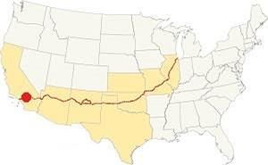
Some years ago, my replacement unit (son Ian) and I drove the entire length of Route 66, from Chicago to Santa Monica. As the reader no doubt knows, Route 66 was one of this country’s first highways, dating back to 1926. It also had been the main way to get to southern California from points east, starting with the dust bowl migration and extending to the car culture of the 1950s and 1960s. Just one or two lanes in each direction, the road has an unhurried and scenic charm. Alas, as depicted in the movie “Cars,” Route 66 was eventually bypassed by various interstates, and the towns and businesses along the old Route slowly declined and eventually dried up. When Ian and I took our trip, we saw plenty of derelict buildings on the side of the road: motels, gas stations, diners, and the like. I suspect that many of those old landmarks that we saw over a decade ago are now gone.
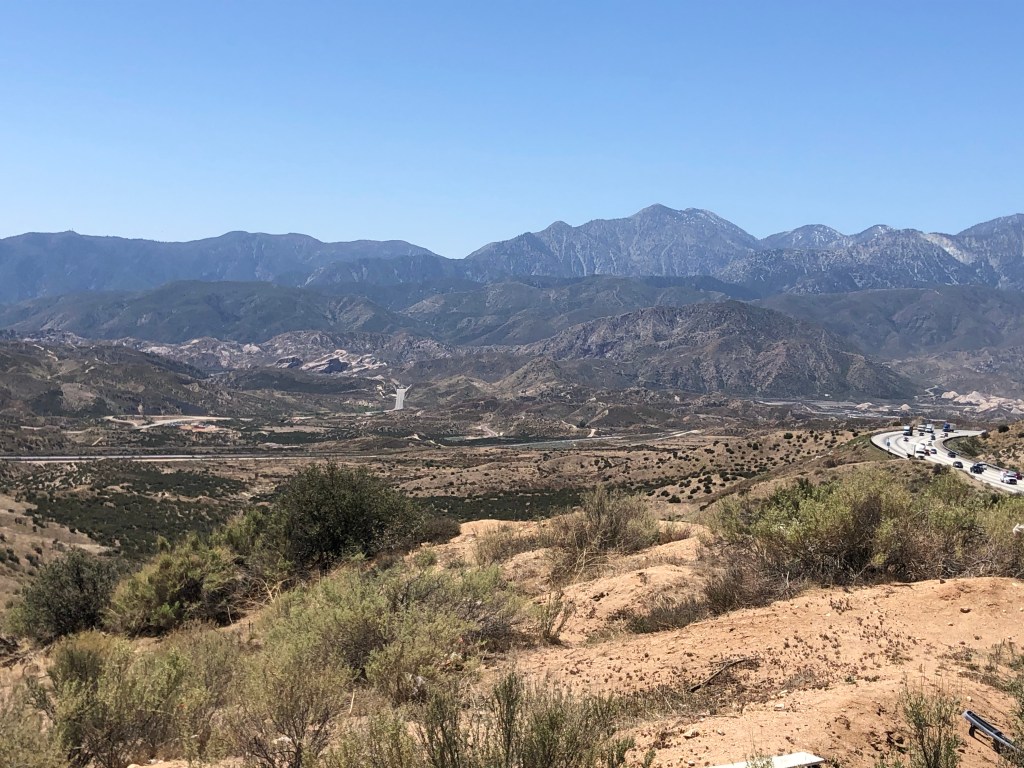
Anyway, Route 66 has always occupied a soft spot in my heart, so I was inspired when my good friend Detlef recommended that I explore an old segment of Route 66 that crosses Cajon Pass (where one crosses from the Mojave Desert to the LA Basin. Or vice versa.) Now, when Ian and I drove Route 66, we didn’t drive on much of this particular segment, because it had been blocked by Interstate 15 in the 1970s. However, a few years ago, the good people of CalTrans redesigned the freeway and reconnected the discontiguous parts of old Route 66 over the pass.
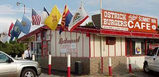
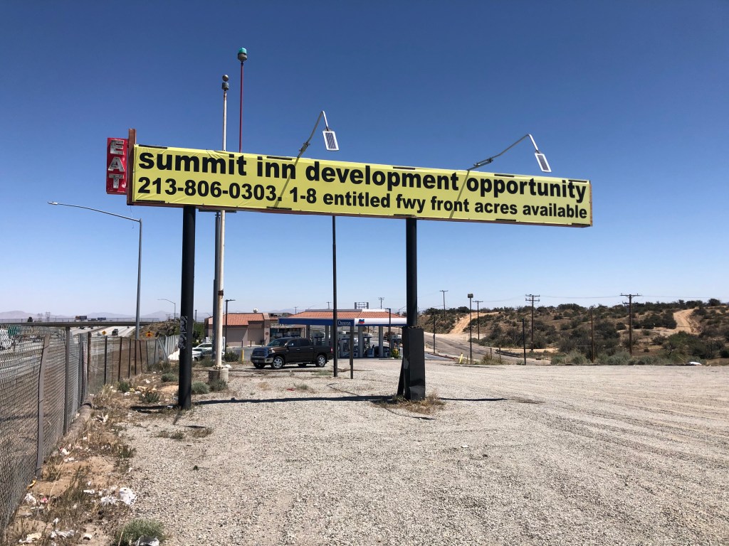
I began today’s tour at the Cajon Summit (approx. 4000 feet above sea level). For over half a century, the Summit Inn stood as a well-known landmark here. The owner, Cecil Stevens, finally sold the place in 2016, and a few months later the structure was destroyed by the “Blue Cut Fire” that ravaged much of the area. Timing is everything. Sadly, Cecil died of Covid just a couple of months ago (February 5). He was 88.
Glory DaysAnyone want to go in with me?On the site of the old Summit Inn. I have no idea what this is.
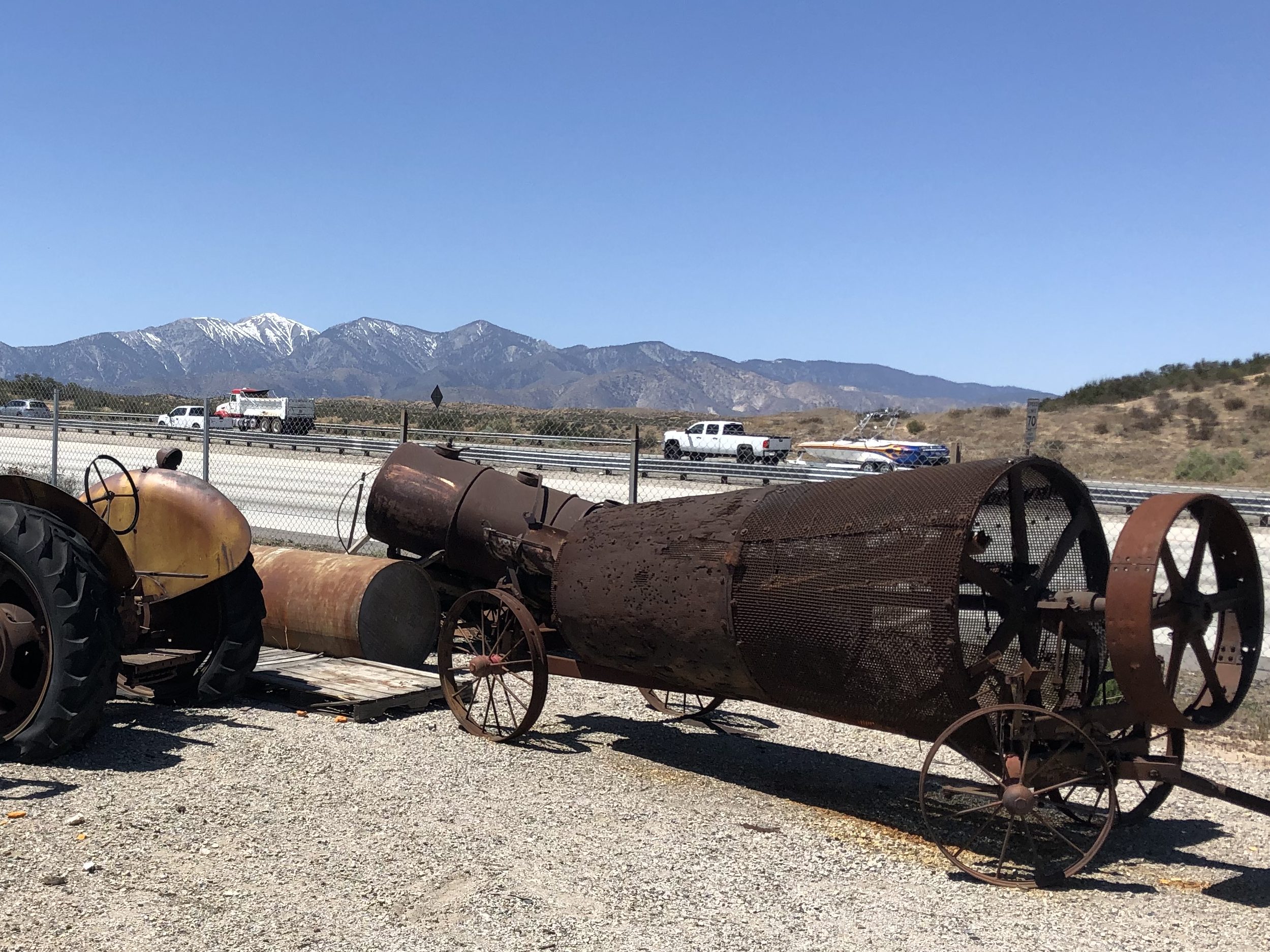
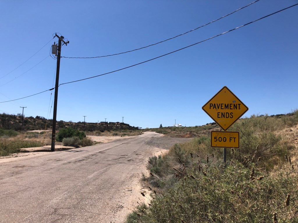
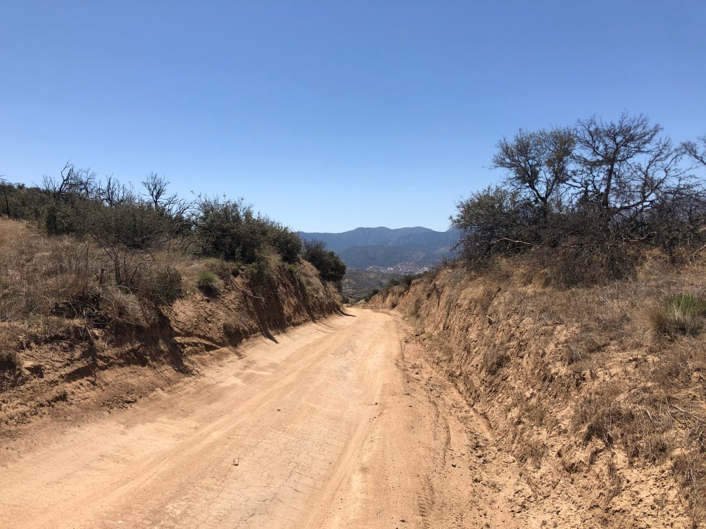
Now, the first part of Route 66 over the pass has been overlaid with Interstate 15. That’s not especially interesting. But you can take an old, rickety, rutted dirt road that had been used as a “shortcut” by motorists in the early years. This dirt road began as a wagon trail called the John Brown Toll Road. It was constructed in 1861–just as the Civil War was erupting. So I set out on this old original road.
…but the old dirt road begins!View of Cajon Pass from John Brown Toll Road. Note I-15 to the right.
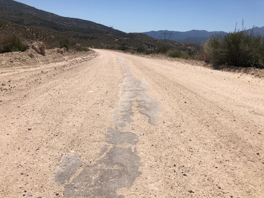
One wonders why this rutted, twisting road was ever considered a “shortcut” for Route 66. My understanding is that it used to be in better shape, and it even received pavement in 1914, but it’s narrow and steep and twisting. I was cruising along at about 5 mph.
Remnants of 1914 pavement.This cut originally was dug by hand in 1861!
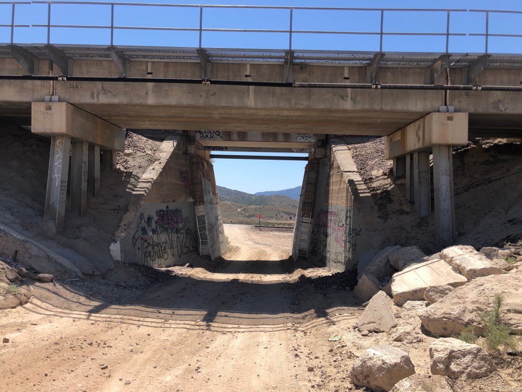
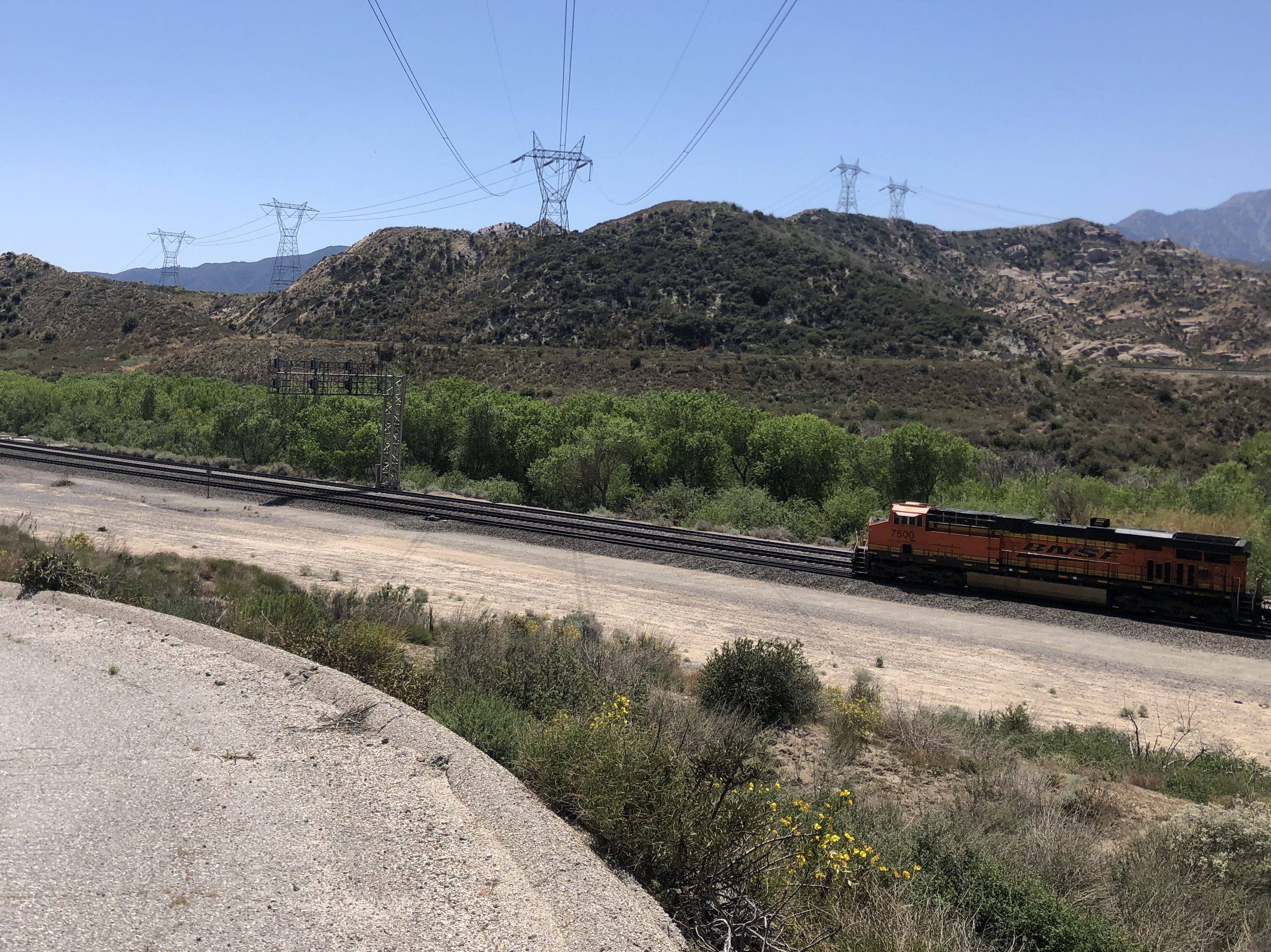
Now, there’s one thing you should know about Cajon Pass: It’s a Mecca for railroad enthusiasts. The railroad first crossed the pass in 1885, and today over 150 trains can pass through in a single day. As I made my way down the John Brown Toll Road, I encountered four sets of tracks, including a trip under these tracks from 1915.
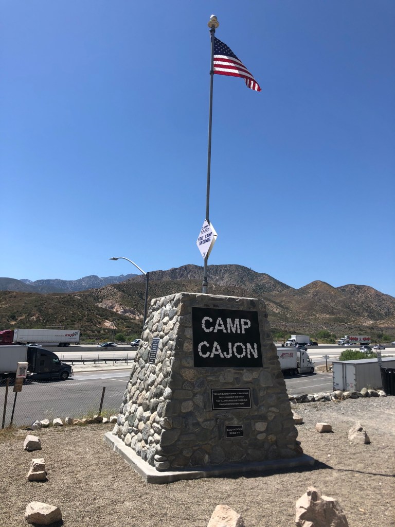
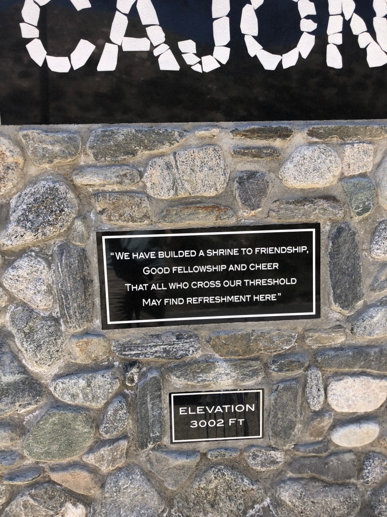
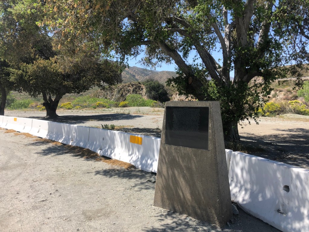
Eventually the John Brown Toll Road reconnects with the old Route 66 proper. At this location, there are several notable markers. One commemorates Camp Cajon, which was a popular resting spot, with various facilities, for travelers coming over the pass. It was developed in 1919, but was destroyed by a flood in 1938.
“We have builded”??
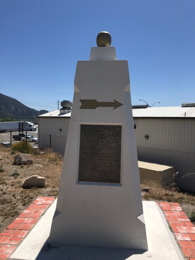
Another marker identifies this spot as the junction of the Santa Fe Trail and the Salt Lake Trail. It honors “the brave pioneers of California,” and was erected in 1917 by a group of eight pioneers. Notably, one of these pioneers in John Brown (of the Wagon Toll Road, which I’d just come down). Two others (Sheldon Stoddard and Sydney Waite) had been members of the “Lost 49ers” through Death Valley. Coincidentally, I’ve run into this group on two earlier trips: Death Valley and, more recently, Walker Pass. These three individuals, along with the other five who sponsored the monument, were all present at the dedication ceremony in 1917.
Monument “to the brave pioneers of California.”
It was now time to get onto Route 66 proper. This segment parallels the modern Interstate 15. Now, as I mentioned, this is railroad country, and much of this road also parallels the old railroad line:
…or are you just happy to see me?
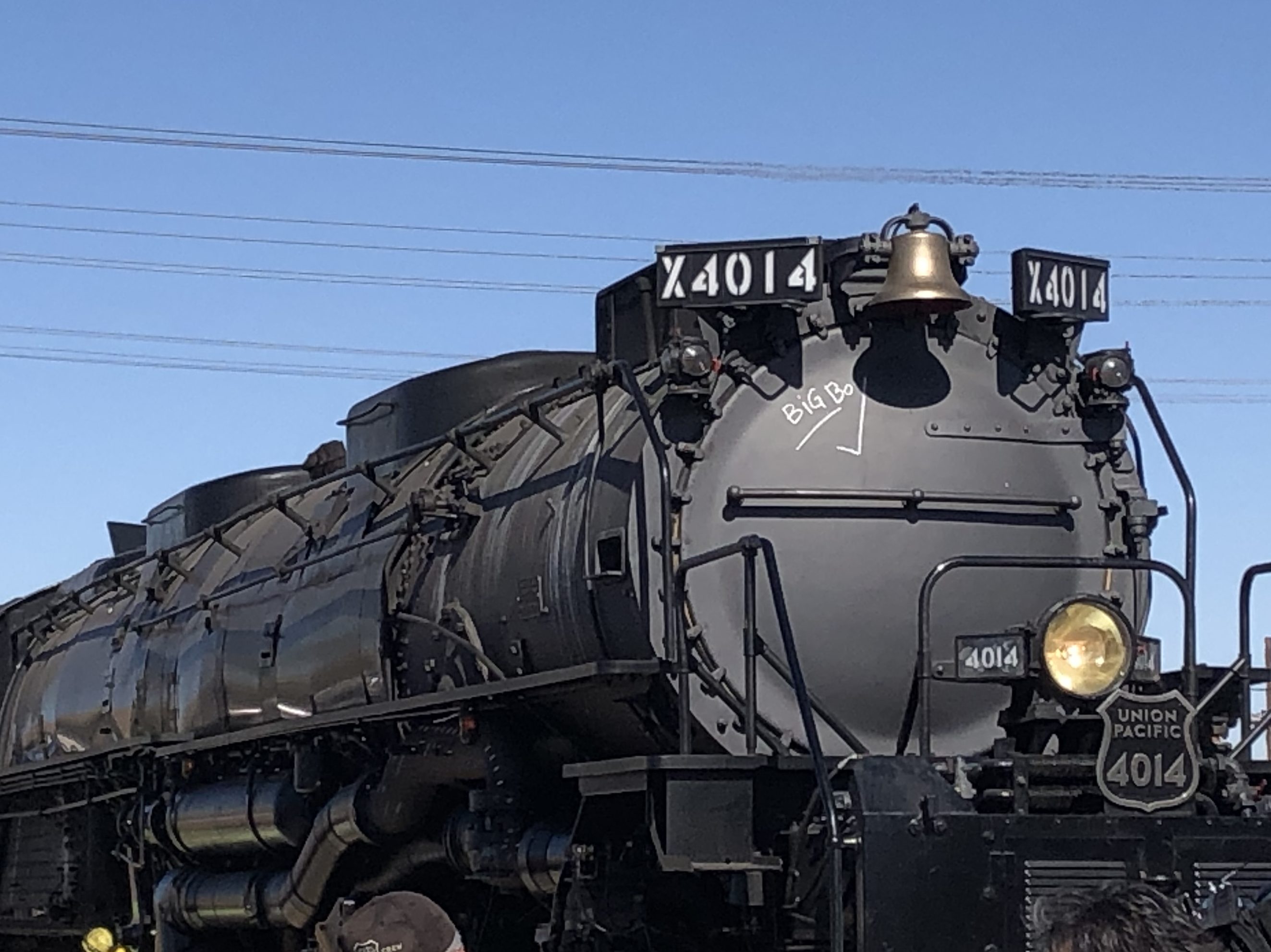
It struck me that this is the same segment of road where I’d camped out for over an hour, waiting for the Union Pacific’s restored “Big Boy” steam locomotive to come through in the fall of 2019. You can see my blog post about that event here.
The Big Boy on its way to through Cajon Pass in 2019.
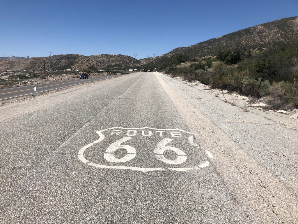
What’s especially cool about this stretch of Route 66 is the good people at CalTrans have repaved the southbound lanes of the old road, and made them into a comfortable two-way road. Meanwhile, they’ve left the northbound lanes of Route 66 unrestored, with periodic K-rail barriers to prevent people from traveling along it, thus preserving it as an artifact. There are even some of the old, painted “Route 66” shields still extant on the original roadbed.
Original roadbed.
Also, some of the bridges from the early days are still in place, with their year of construction stamped in concrete:
From the Herbert Hoover administration.
A bit later I came to an old rest area that had been constructed in 1952. All that remains are some pavement markings and a memorial plaque.
Marker notes, among other things, that the tollhouse for the John Brown Toll Road was nearby.
Incidentally, this location sits on the San Andreas Fault, where the Pacific Plate and the North American Plate meet. In fact, it was the San Andreas Fault that created Cajon Pass in the first place.
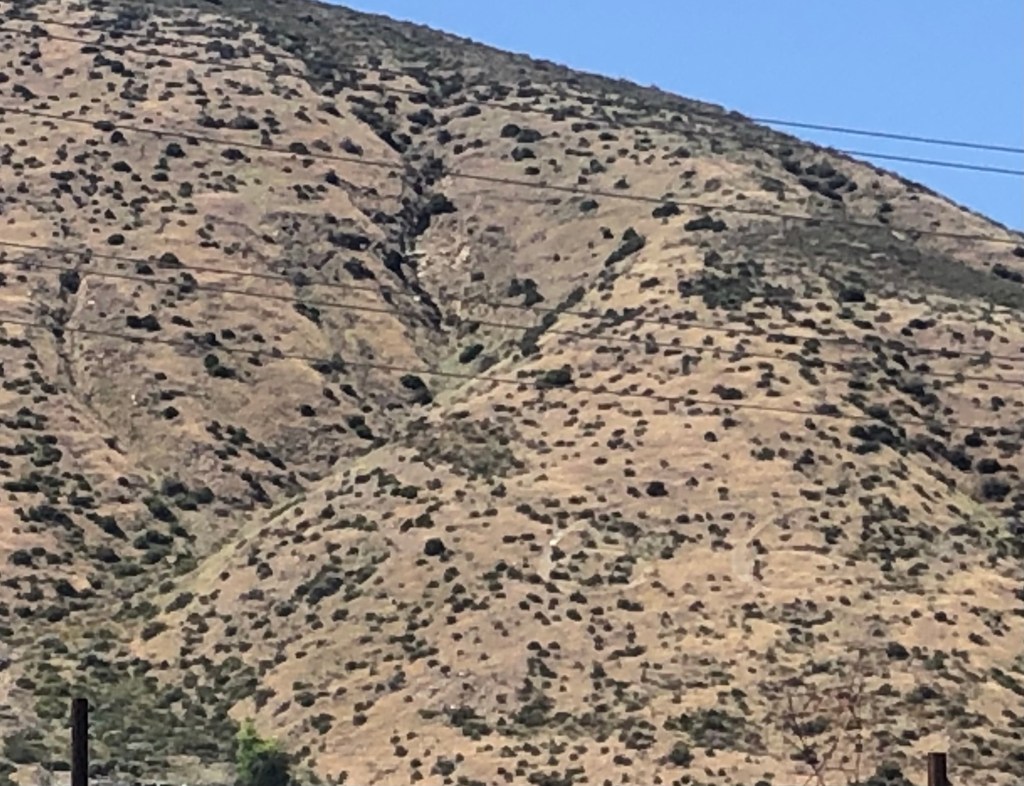
On a hillside next to the road I saw the faintly visible number “66” somehow carved into the earth. I can’t find any information about who did this and when. Tips are welcome!
Can you see it?
Now, let me explain that on my drive from LA to the Pass I was listening to a podcast called “Stuff You Should Know.” (If you’re not already familiar with it I’d recommend it to you.) At the end of the podcast, the hosts always read a letter from a listener. In today’s episode they read a letter they received from the great-great-great niece of one Helen Boss, who caused the car accident in which Sammy Davis Jr. lost his eye in 1954. You can listen to the podcast here (listener mail starts at 59:40).
So imagine my surprise when, shortly after listening to that podcast, I found myself passing the exact place on Route 66 where Sammy’s accident occurred. I’m not making this up. The accident happened where the road passes under a railroad track. Evidently the 72-year-old Mrs Boss had missed her exit, and decided to back up in the early morning gloom. Sammy rear ended her and lost his left eye in the accident. Fortunately, no one was killed.
Where Sammy and Helen met.
Before long Route 66 completes its journey through Cajon Pass, and it enters the city of San Bernardino. At this point, almost no remnants of the old road and infrastructure remain. So I decided to jump back onto the interstate to head back home. But it’s worth noting that some other stretches of the original Route 66, along with some roadside structures, still exist on its final leg westward toward Santa Monica, on a road now named Foothill Boulevard. I drove that stretch a few years ago, and will assemble the photos into a blog entry at a later time.
So there you have it: A good stretch of the original Route 66 can still be driven over the Cajon Pass, bypassing the soulless and numbing Interstate. Thanks to Detlef for calling this to my attention!
Editor’s note: Given limited travel opportunities these days, I decided each Thursday to post travel stories I’d written prior to starting this blog. The following is from a cross-country trip I made along the length of US 50 in the spring of 2018. I hope you might vicariously enjoy this trip while we’re all hunkering down at home. Because this is a longer trip (a week and a half), I’m going to post each of the daily entries over each of the next 10 days.
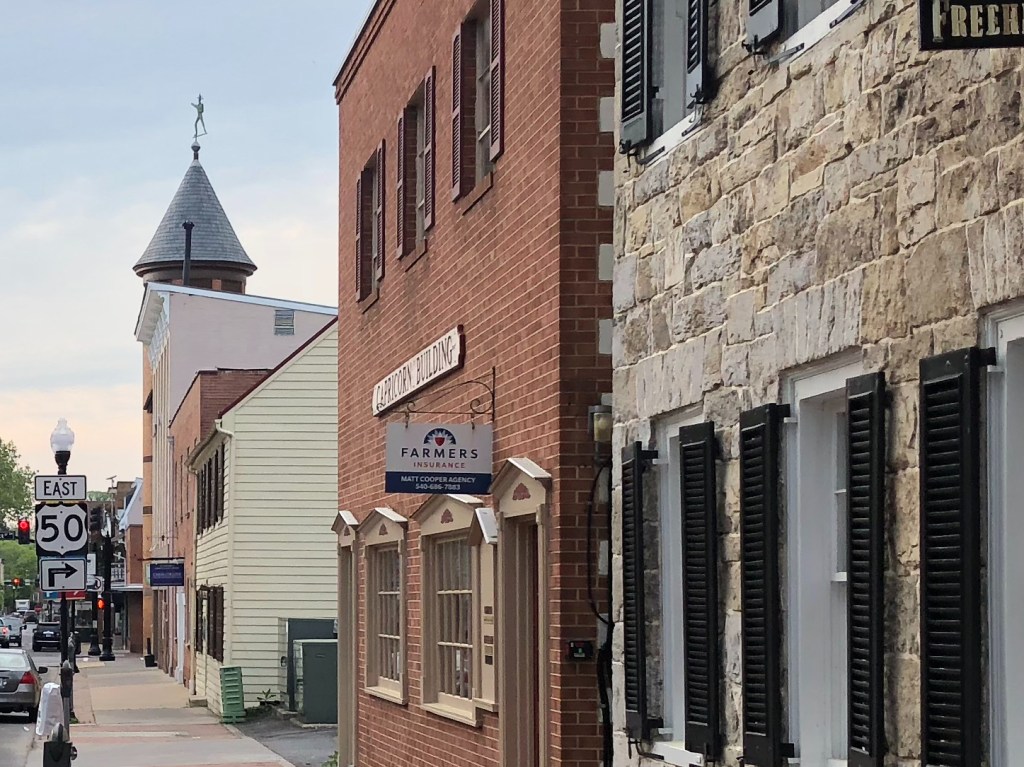
This morning I got up early and back onto US 50 in the town of Winchester (pop: 26,000). As I’ve moved further east, I have noted that the towns are steeped in earlier and earlier history. Winchester goes back to colonial times, and was the location of several Civil War battles. The buildings in the historic “Old Town” district are impressive.
And remember: That road you see is still US 50!See? I told you!
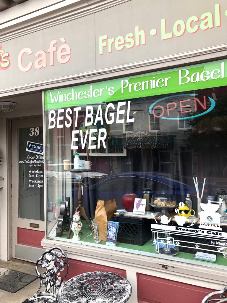
As I drove down the road, appreciating the architecture, I caught sight of this sign:
There’s only one?
Perhaps finally I would finally get that bagel I’ve been craving for the past week! “Best bagel ever” is a pretty enticing promise. I parked the Yaris and approached “Steamy’s Café.” Alas, the door was locked, but they were due to open in about 10 minutes. I figured it would be worth the wait. After a minute a young woman, whom I assumed to work there, approached the door. I welcomed her and told her I was looking forward to trying the Best Bagel Ever. She looked a little confused, and I realized she was merely another customer. The two of us stood awkwardly at the front door, waiting for 8 am. It turns out that my fellow customer was new to town, and was trying Steamy’s for the first time. She had moved here just last week from Arizona, to be closer to her ailing mother who lives in – wait for it – Ocean City, MD! I observed that Ocean City was still a few hours away, and she said “Yeah, I don’t want to be too close.” Yes, well. I told her about my cross-country journey to Ocean City, we made small talk (she just began a job in Front Royal working for Child Support Services) until the stroke of 8, when suddenly the lights of the shop clicked on and the door was unlocked.
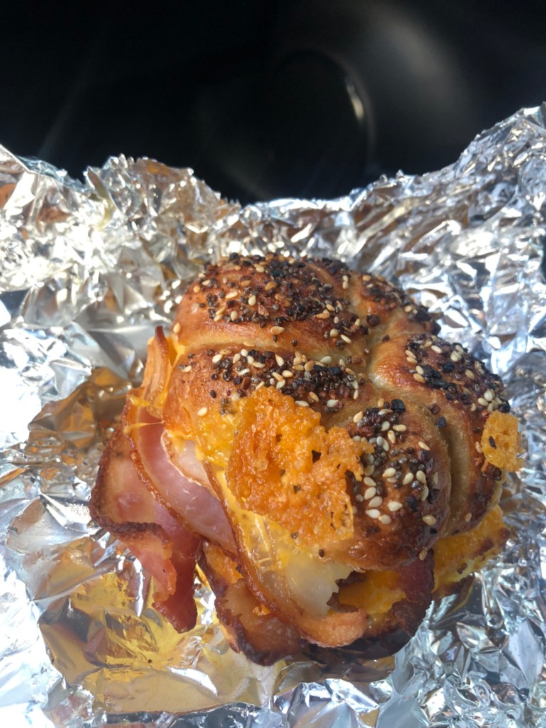
The owner was brusque, but efficient. I asked him what made his bagels the best ever, and he said “you’ll see.” Without actually waiting for me to order anything, he made me something called “The Winchester.” I confess: It was the best bagel I ever had. It’s worth a trip to Winchester. Or at least check out their website.
Certified as non-kosher, not fat-free, not gluten-free, and not non-dairy. Just the way I like ’em!
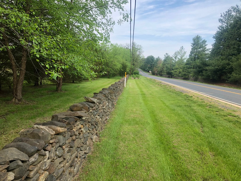
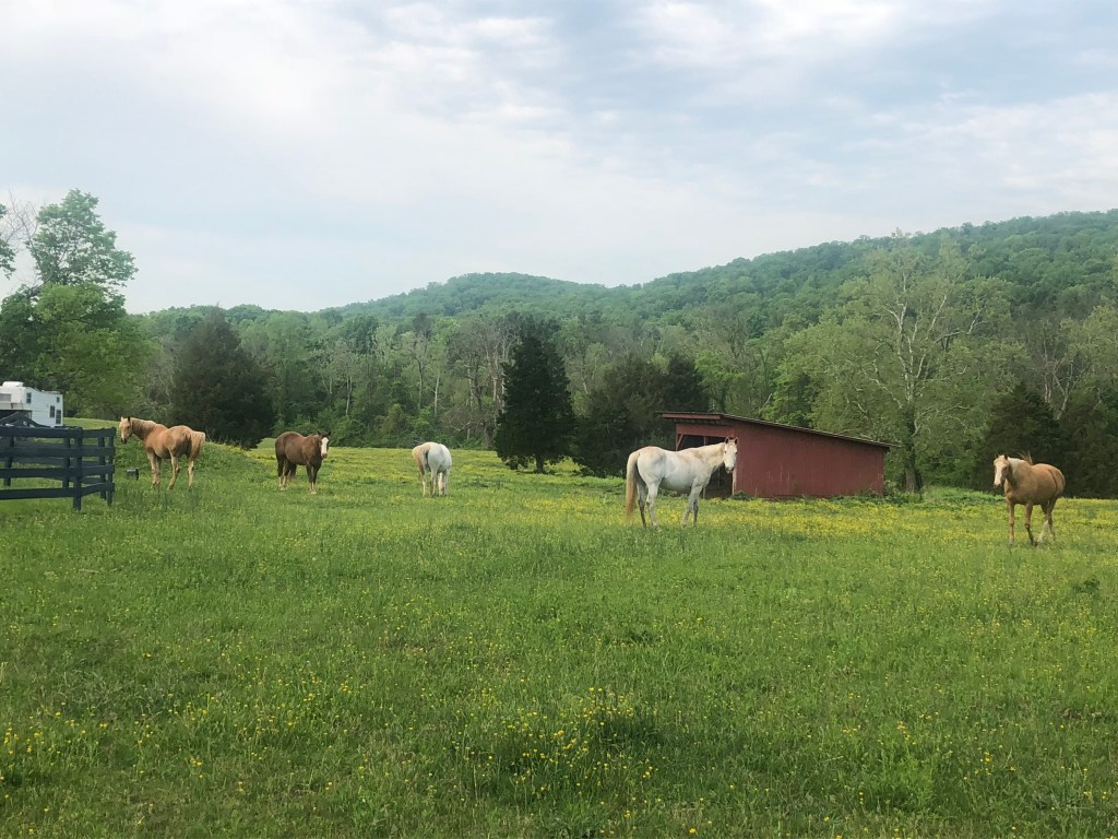
The stretch of US 50 east of US 50 is so pretty it almost makes your eyes hurt. It’s a verdant green, with trees on both sides of the two-lane road. Low stone walls ran along parts of this stretch, as well as three-rail fences lining horse pastures.
How green is my valleyVirginia horseplay
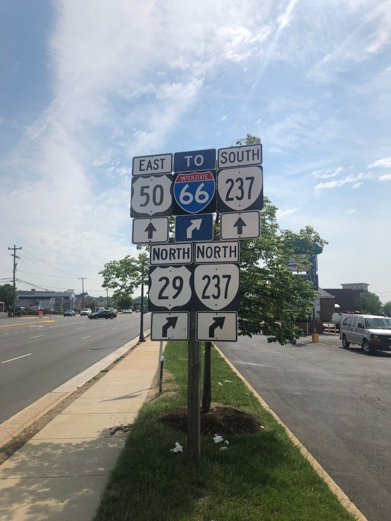
As I got closer to Washington, DC, the road got wider and the countryside disappeared. Driving became gradually more complicated.
Clearly I’m getting near D.C.
Rather suddenly, I found myself crossing the Potomac River on the (uninspiring) Theodore Roosevelt Bridge. I wanted to get a picture of US 50 entering DC, but there was absolutely no place to park. (The picture of the Roosevelt Bridge below I ripped from Wikipedia.)
I’ve seen pontoon bridges with more character
US 50 makes a few turns and then becomes Constitution Avenue, running along the National Mall. The familiar sights of the Lincoln Memorial, the Washington Monument, the US Capitol Building, and other iconic structures greeted me. Even in this cynical age, there is something inspirational about seeing these symbols of American democracy.
I gave up on making a stop, due to the lack of available parking space. But for once I appreciated heavy traffic, as it afforded me a little time to soak in Washington. It struck me that, while US 50 has taken me to all these isolated towns across the country where I met people who are pretty placebound, it now brought me to Washington, where I found myself with many thousands of people who also came from all over the country, and all over the world.
Soon I was leaving DC and entering the final state on my route; Maryland. (Technically, I had already entered Maryland briefly when I was in West Virginia. A small, jagged edge of Maryland reaches down into West Virginia, and US 50 crosses this for a few miles.) Once I left DC, US 50 gradually returned to the green countryside that I’d enjoyed during my morning drive.
Soon I found myself in yet another capital city: Annapolis. I took a slight detour to see the Maryland State House (as they call their Capitol building). I learned that the State House is the oldest state capitol in continuous legislative use, and that it had actually been used as the US Capitol in 1783-4.
Manly deeds, womanly words (or so goes Maryland’s state motto)
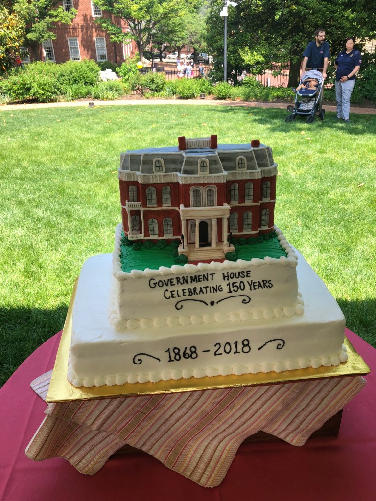
As I was taking the above picture of the Maryland statehouse, I heard live jazz music coming from around the corner. I went to explore, and found myself in a short line of people about to enter some official-looking grounds. Said grounds turned out to be the Maryland Governor’s home, which was celebrating its 150th anniversary today. I moved with this line through a brief security screening, and found myself face to face with an impressive raspberry and whipped cream cake:
Mind if I just eat the portico?
I had a slice of the cake, listened to the jazz band and toured the Governor’s home. It was a good break.
What are you looking at, young man?Can we play you some sea shanties?
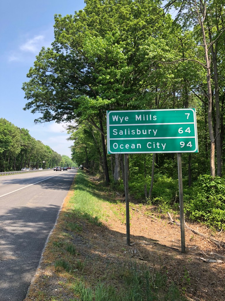
Shortly after leaving Annapolis, I crossed the 4.3 mile Chesapeake Bay Bridge. Shortly after that, I encountered the first road sign to mention Ocean City since I’d left Sacramento.
Down to the final stretch!
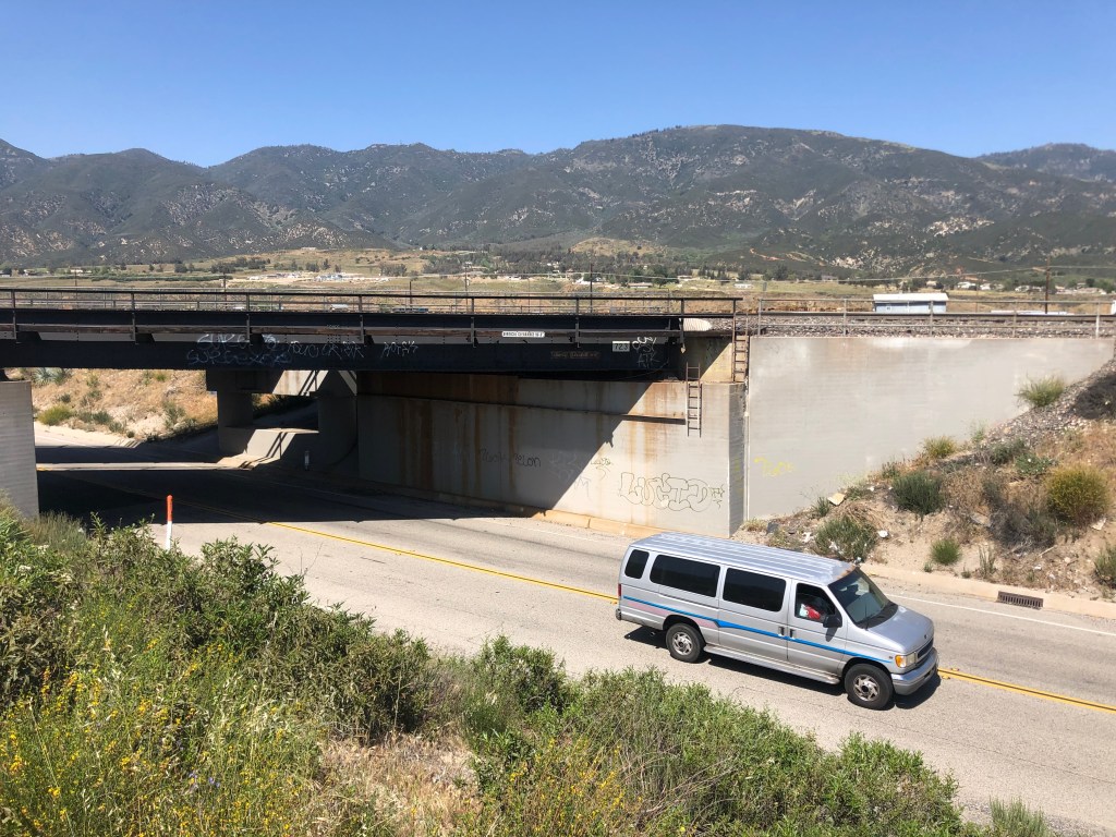
In the town of Vienna, I encountered a short, obsolete section of US 50. Other than the abandoned bridge I’d found in Illinois, this is the only other piece of “old” highway 50 I’ve discovered on this trip. Note how narrow the old US 50 was.
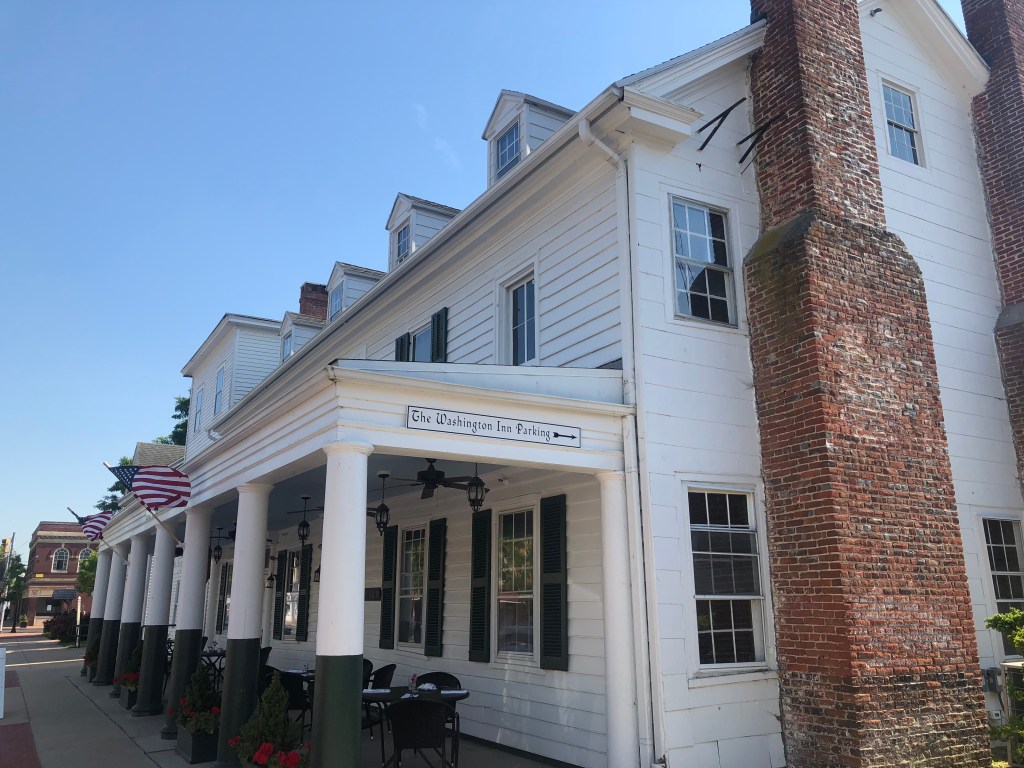
Finally I got to the town of Salisbury, MD (pop: 30,000), where I decided I would end my US 50 travels for today. I’m about 30 miles from Ocean City, where I’ll complete my trip tomorrow. For tonight, I’m staying at the Washington Inn and Tavern, which is about 10 miles off US 50 in the colonial town of Princess Anne (pop: 3,290). The Washington Inn was built as an inn in 1744, and claims to be “one of America’s oldest operating inns.” That would explain my mattress.