California history · Road trips

Eight Hours for a Hot Dog

Editor’s note: Given limited travel opportunities these days, I decided to post some travel stories I’d written prior to starting this blog. The following is from August 2019. I hope you might vicariously enjoy this trip while we’re all hunkering down at home.

Yesterday was a beautiful, warm, sunny day here in the so-called “Southland,” and more importantly, it was not a Monday, Tuesday, or Wednesday. Stick with me on this for a minute.

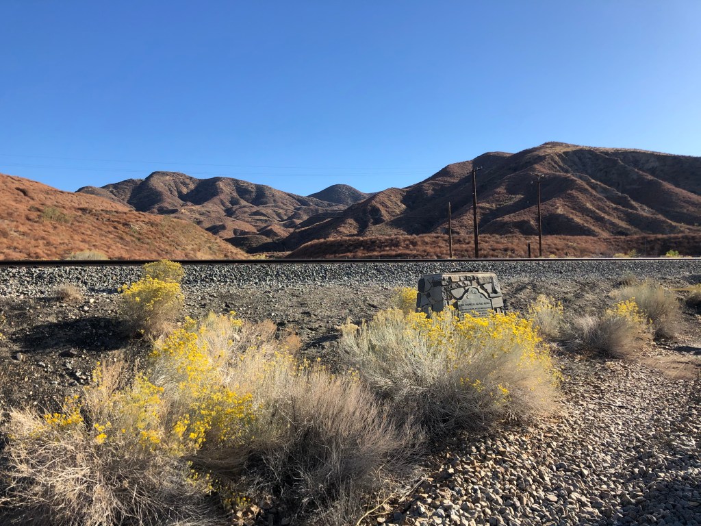
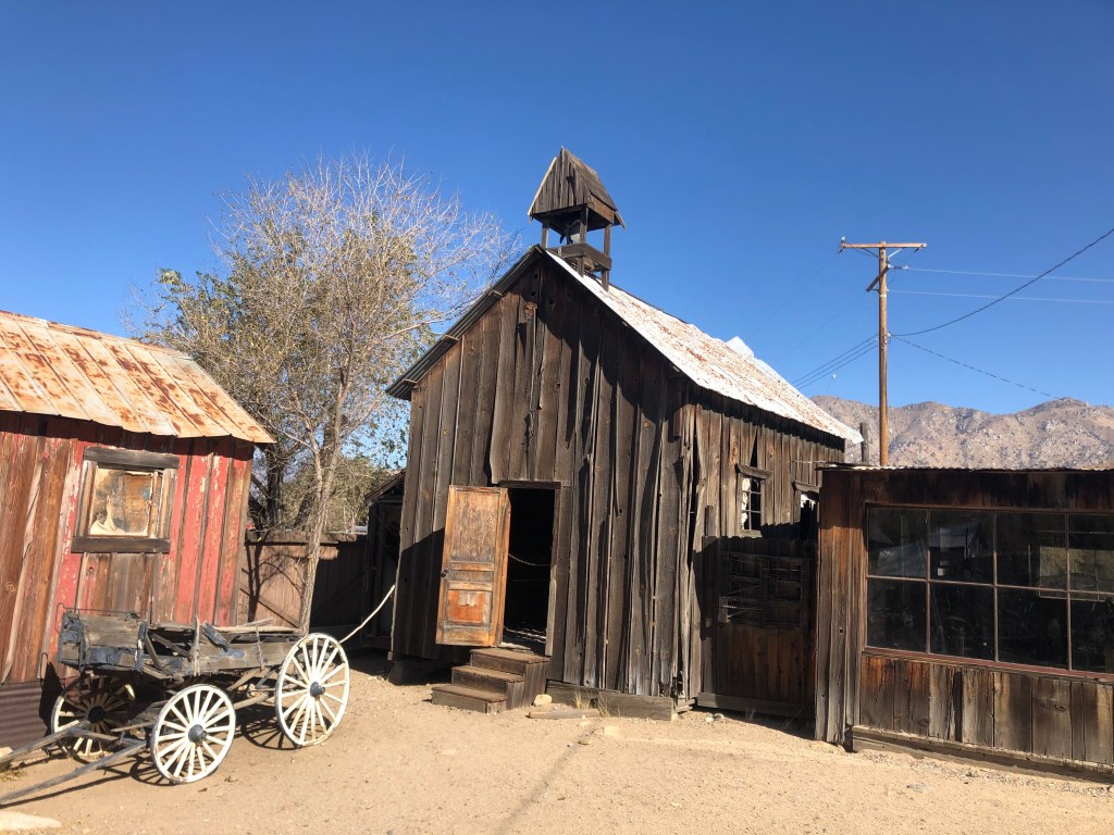
There’s an old restaurant high up in the San Gabriel Mountains. Named Newcomb’s Ranch, its lineage dates back to 1888, when a mountain man named Louie Newcomb built a cabin and became one of the first forest rangers in the new San Gabriel Timber Reserve. Louie ended up selling his land in 1929, and by 1939 the new owners had built a restaurant just a few hundred yards from Louie’s original cabin. Over the years this restaurant (largely rebuilt after a fire some 45 years ago) became a popular stop for motorcyclists. It sits about halfway along the winding, 66-mile, two-lane “Angeles Crest Highway,” which crosses the San Gabriel Mountains and was built by prison labor in the 1930s and 1940s.

I first stumbled across Newcomb’s Ranch a few years back while taking a day trip along the Angeles Crest Highway. Now, no one who knows me would ever use the term “biker” to describe me. But I was strangely attracted to the biker hangout as a way to prove that, yes, I can fit in with that crowd. I mean, I own a bike, right? But it was late in the day, and I didn’t have time to stop. So I made a mental note to return some day. A few weeks later I made the trip up the ACH again, with the intention of stopping for lunch at Newcomb’s. But I found the doors locked, and a couple of swarthy-looking bikers eating bag lunches on a picnic table in front of the place. “Are they closed?” I asked the bikers. The more sentient of the two looked up at me and said “Yep.” When it was obvious that I was looking for a little more information, he volunteered that the place is closed Monday through Wednesday. I was there on a Wednesday.

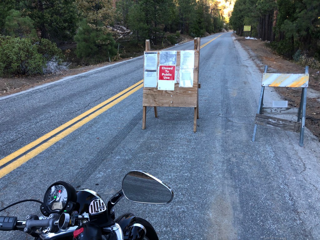
So Thursday of this week I set out for a third assault on Newcomb’s Ranch. I was enjoying the ride through the mountains when I abruptly encountered a “road closed” sign. It turns out the ACH experienced a landslide a few months back, and CalTrans is still at work clearing it and installing new retaining structures. Here’s a picture (from the web) of the goings-on:

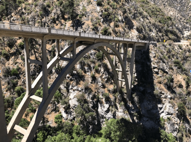
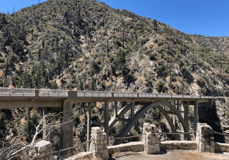
A “detour” sign pointed toward a side road (though it contained no information as to length or destination). I tried it. Before long I was crossing the Big Tujunga Narrows Bridge, which is an impressive structure over 400 feet long from 1941. Here are a couple of my photos:

Tempted to make an arch comment..

The second photo shows what appears to be an old overlook site in the foreground. The area was fenced off, but it was easy to get past the barrier. I got the sense that it was considered unsafe, and thus the public was discouraged from going out to this area. It felt like an old Conservation Corps project, or maybe a WPA project. But there was no plaque, and I couldn’t find any information about it online. I’d welcome any intel that readers might be able to share.

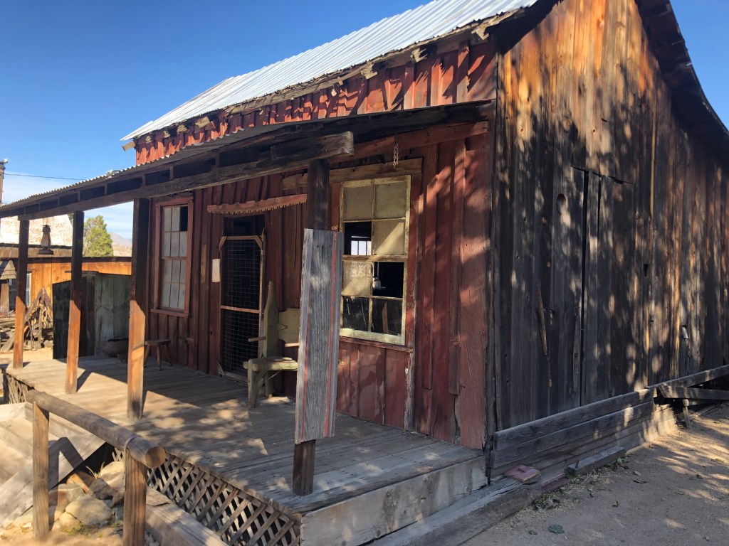
Eventually the detour routed me back to the ACH, some ways past the landslide, I presume. A few more miles and I came upon the fabled Newcomb’s Ranch. But wait: there were no signs of life through the windows of the building. And weren’t those the same two bikers I’d met weeks before, sitting out on a picnic bench? I walked up to these now-familiar figures, and asked if the place was closed. “Yep.” (I should have learned my lesson the first time.) I protested that “It’s Thursday!” One of the guys just shrugged, and said “sometimes something comes up. I think they might have lost their power.” I told them that I’d made a trip out here just to get a burger, so they pointed me down the road to a place called Sky High. How far is it, I asked. “About 30 miles.” That would take me just about to the end of the ACH, so heck, I decided to make the trip.

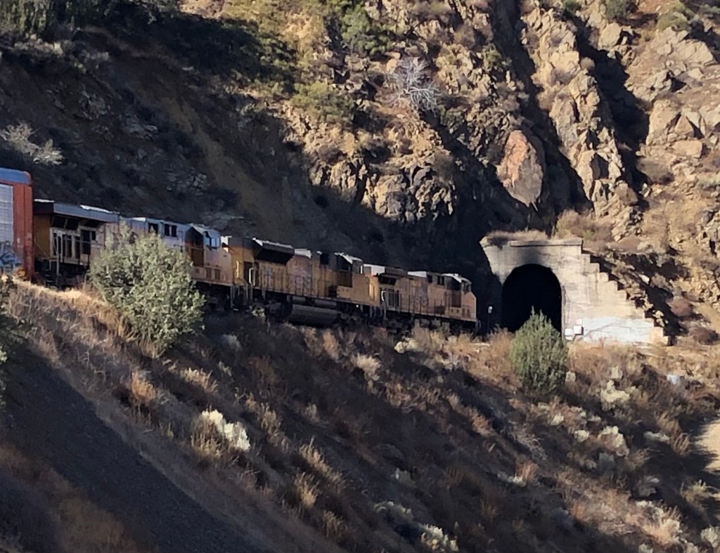
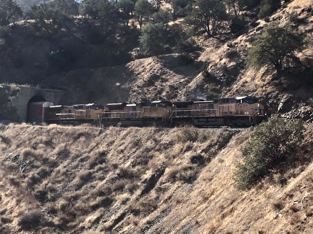
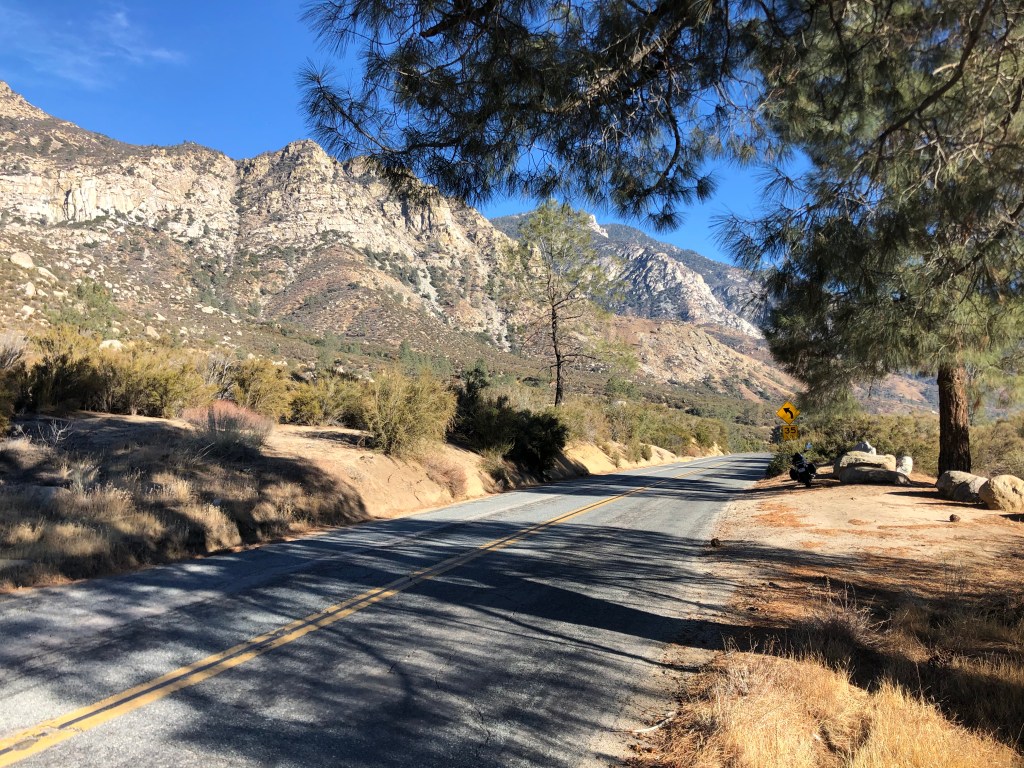
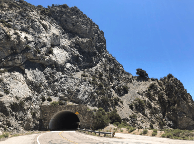
I didn’t encounter much traffic on the ride. Mainly just a few other guys on motorcycles. The road twisted over and even through the mountains. Here’s one of the tunnels, that I thought was picturesque:

Boring work, digging tunnels is.

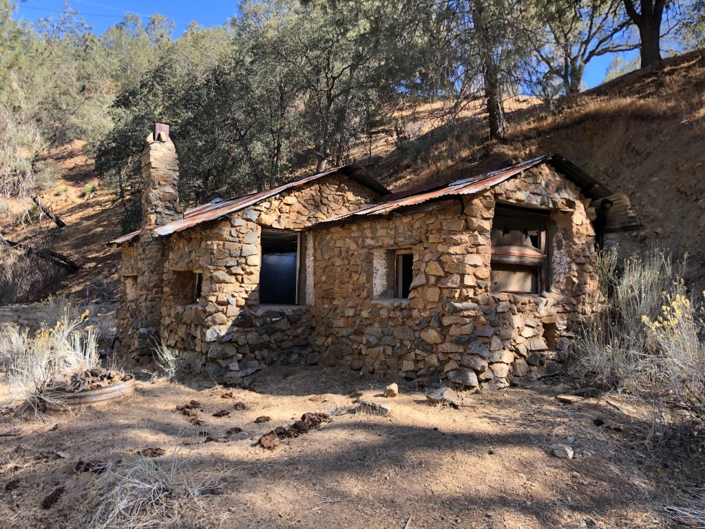
I was becoming famished. What with the detour, and with the unexpected additional mileage to the Sky High restaurant, it was now almost 2 pm. But I stopped once again for another of the rare structures along this desolate road. It looked like an old lodge of some kind, with a stone tower and a bronze plaque bearing a poem from 1925. Here’s a picture of the tower. (Sadly, I didn’t get a picture of the lodge.)

Must be from the Stone Age…

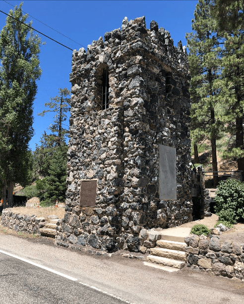
 The structures were immediately on the side of the road, and they were completely deserted. Other than the poem (“In the Pines,” by WIlliam Bristol) and the engraved names of the LA County Supervisors from early in the last century, there was no information as to what the heck I was looking at. Further research would explain that these are the remnants of the Big Pines Recreation Camp — a retreat owned by the County of Los Angeles to provide recreational opportunities like boating, hiking, and horseback riding on 5,600 acres of property in the San Gabriel Mountains. The camp was opened in the 1920s. Here’s a historic photo I found:

You can see that my mysterious stone tower had been part of an entry arch for the camp. The lodge-like building I saw evidently had been the recreation hall. At some point later in the century the facility came to be too much for the county to maintain, so it was turned over to the US Forest Service. I’m told that the recreation hall is now a ranger station, but there were no signs of life when I was there.

WIth hunger gnawing at my stomach, I got back on my bike and continued eastward on the ACH. Shortly I saw a sign for “Burgers and Pizza” at a place called “Sky High Disc Golf.” This must be the place. I turned onto a narrow, steep road for about a mile, and arrived at an old two-story building that seemed to serve as a ski lodge in the winter. Now, in mid-summer, the vast parking lot was deserted. I went up the stairs and found the door to be open. I was met by an older woman who’d evidently had a hard life, standing behind a lunch counter looking bored. I was the only person in the place that wasn’t paid to be there, and I wouldn’t be surprised if I was her only paying customer for the entire day. She asked me what I wanted, and I (perhaps foolishly) asked her what she’d recommend. “Well, the chili cheese dog isn’t bad.” With a recommendation like that, how could I resist? Soon I was tucking into a slightly warmed generic hotdog on a soggy bun covered with shredded American cheese and some questionable chili. This was my quarry for the day.

After my repast, I got back on the Triumph and headed down the hill to rejoin the ACH. But then I figured I’d take a different route to head home, so I jumped onto the Big Pines Highway, which looped a little further north than the route I’d come. Most of the day’s travel was entirely rural, with almost no signs of habitation. Imagine my surprise, then, when I came across this sign which seems to promise some kind of real civilization:

A sign of things to come.

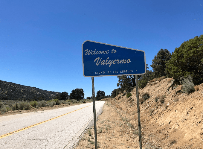
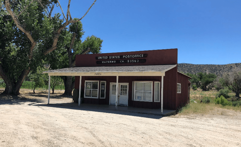
Alas, Valyermo appears to have little to recommend it, other than some scrub brush and a couple of buildings. One of those buildings, surprisingly, is a sturdy post office. It was closed however. On a Thursday afternoon. I can’t imagine they get a lot of business.

Lost in time.

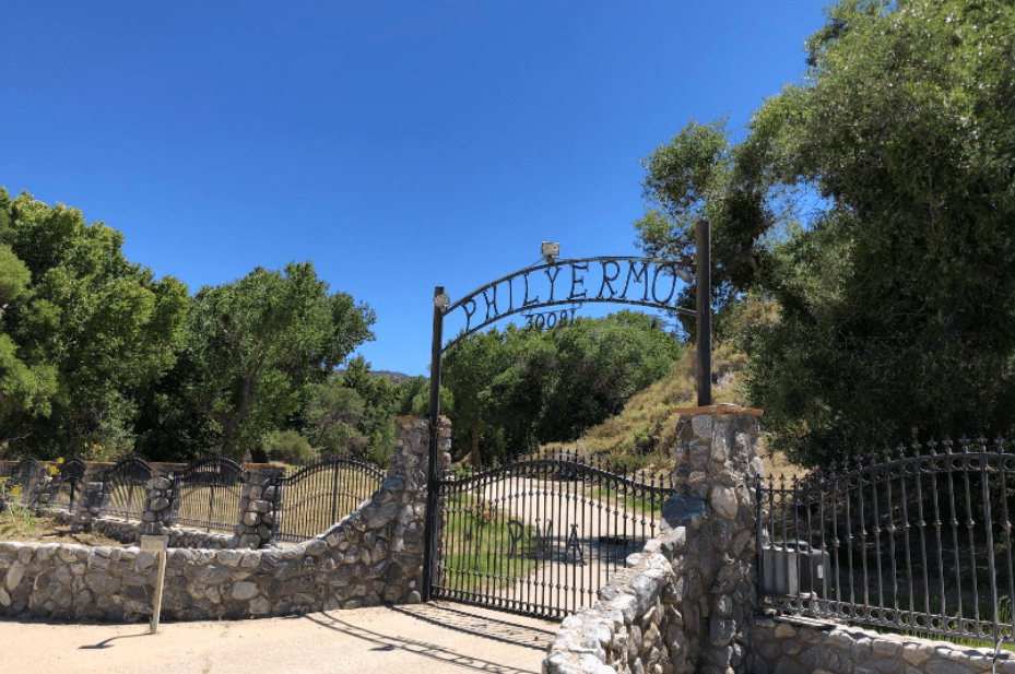
The other notable site was this entrance to an 800-acre ranch, which had originally been owned by Bob Wian (the guy behind the eponymous “Bob’s Big Boy” hamburger chain). Bob died over 25 years ago, but his ranch, I’m told, is now owned by a guy named “Phil,” who renamed the place by inserting his surname into the first syllable of Valyermo. I guess it’s his version of Trump Tower.

The Name Game. Phily, Phily, Bo-Bily, Bo-nana Fanna Fo-Fily….

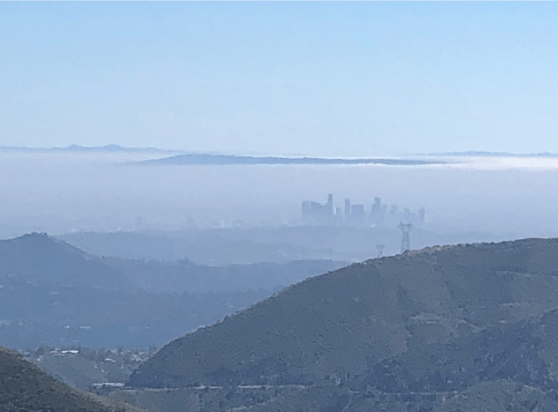
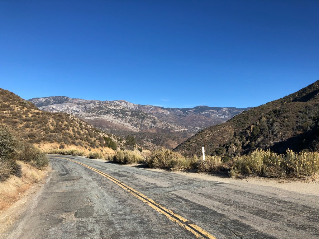
Continuing on, I found myself leaving the mountains and heading towards Palmdale, on the floor of the Mojave Desert. Here’s a photo looking down on the desert from when I was still higher in the mountains:

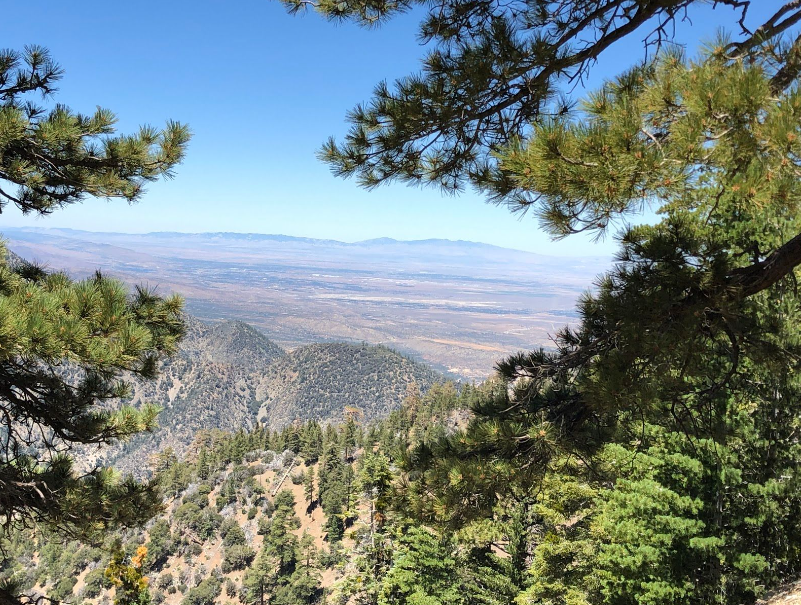
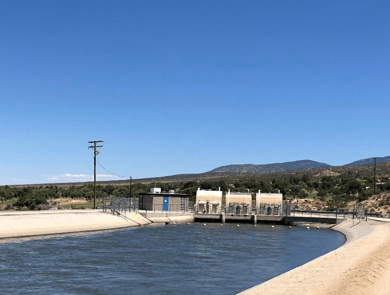
 It’s striking how effectively the San Gabriel mountains separate the burning desert heat from the (relatively) cool ocean air of Los Angeles. And yet, cutting through this inhospitable, arid land is an aqueduct. This time it’s the California Aqueduct, bringing water from the Sacramento Delta down to Los Angeles. You have to wonder how much of the water evaporates before it enters the county.

Next stop: Los Angeles

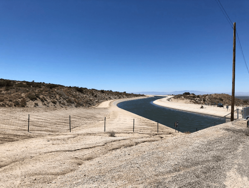
Shockingly, even in this post-9/11 era, one is able to walk directly onto the banks of the aqueduct and, say, fish. (I saw a sunburned fellow in a lawn chair doing just that.) I amused myself by checking out the gate infrastructure:

When I got to an oasis of civilization near Palmdale, just before heading back south toward LA, I encountered something I hadn’t seen for about 30 years: real Golden Arches.

Not much to look at, compared to arches on the Big Tijunga Bridge at the beginning of the trip…

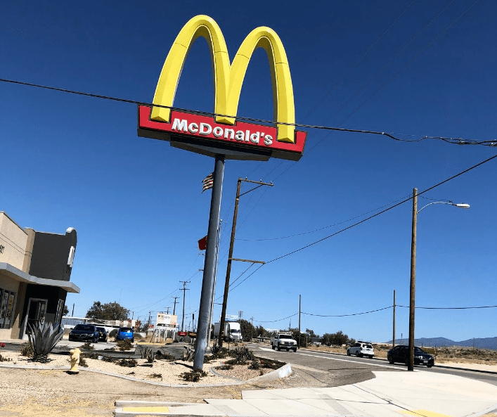
And, come to think of it, it might have been preferable to get my lunch at that old McDonald’s in the middle of the Mojave, rather than at Sky High Disc Golf in the mountains. But no matter. I learned a little more about the Los Angeles region. And it seems like every trip seems to bring more examples of aqueducts, dams, and other water-related facilities. It’s striking that this metropolis of 10 million people relies on so much far-flung infrastructure. From up here in the mountains, you get a whole new perspective on the town.

Shakey Town, through a glass darkly.
California history · Road trips

Ghosts

Funny thing happened when I was checking out of my No-tell Motel this morning. I found the door to the office locked, and so I tried ringing the doorbell at the night window. No one ever materialized, and a hand-lettered sign in the window indicated there were “NO ROOMS!” It’s as though the proprietor suddenly got fed up with all these pesky customers showing up, so he vamoosed. Either that, or I was checked in last night by a ghost.

Speaking of ghosts, on my way out of Porterville I passed an old, ornate, and somewhat creepy Victorian mansion complete with gables, dormers, and a mansard roof. The place, which at some point seems to have become a museum, was locked up tight and surrounded by a gothic wrought-iron fence. Surely a place like this has a story.

1313 Mockingbird Lane?

It turns out the place was built in 1891 as the home of a Bohemian immigrant couple. (I don’t mean they were unemployed pot-smokers who composed folk tunes for sitars; I mean they immigrated from the Kingdom of Bohemia.) And sure enough, the family (named Zalud) suffered a string of tragedies that has led to rumors that the house is haunted. Death was a constant companion: a daughter died of tuberulosis; a son in law was shot to death by a would-be lover, and a son was killed when he was thrown from a horse.

When the last of the Zalud children died (of natural causes, in 1962), the home was donated to the city of Porterville and it became a museum. The house contains the bullet-riddled rocking chair in which the son-in-law was seated when he was shot, as well as the saddle on which the son was seated when he was fatally thrown. Given all this, the Zalud house must be a very tempting venue for any self-respecting ghost. And indeed, paranormal activity at the Zalud house has been chronicled by the “Ghost Adventures” television series.

Just before I passed out of Porterville I figured I’d get a bite for breakfast. I encountered this tempting offer:

That pretty much covers the waterfront of fine cuisine.

The centerpiece of today’s ride was CA Route 43, which skirts the eastern Central Valley from a little south of Fresno to a little west of Bakersfield. It’s primarily flat, agricultural land, and a far cry from the winding mountain roads I was taking yesterday. But I’m on a mission to ride all the California routes, and this number came up. Just don’t expect any scenic photos.

One notable sight along this route is the ghost town of Allensworth. The town was established in 1908 by an escaped former slave, Allen Allensworth, who’d joined the Union forces during the Civil War and retired in 1906 as the highest ranking African American officer in the US Army. With several compatriots, Allensworth purchased this land and created a colony for African American families.

Allensworth is credited as “the only town in California founded, built, governed, and populated by African Americans.” After only a short while, though, the well water that supplied the town began to decline in quality and quantity. By the 1950s water problems and other concerns had caused many residents to leave. The town was purchased by the state in 1970 and was made a state historic park. Today, most of the buildings have been renovated or rebuilt.

Allensworth today
One of the early homes, constructed by Wiley Howard in 1915. It was still inhabited in 1970 when the California State Parks department purchased the entire town.
Restored boxcar from the 1880s, which had been the residence of Allenworth’s railroad station agent.

A short while after leaving Allensworth I passed through the city of Wasco. Prominently featured on a corner is the town’s Amtrak depot. The depot was constructed in 2006 to replace a historic, century-old depot that had been used by the Atchison, Topeka and Santa Fe (AT&SF) railroad. That old station fell into disrepair after AT&SF terminated passenger service in 1971.

Wasco’s AT&SF station in 1974.

The new Amtrak station has some attractive architectural features, and passenger trains continue to stop there several times each day. So you’d think that’s a happy ending. However, in response to Covid, Amtrak has locked up the station and when I visited it today it looked post-apocalyptic: boarded up, tagged with graffiti, beset by homeless people. The landscaping has been let to die, and the entire scene is depressing.

The Wasco station today. It’s only 14 years old.

Further down the road, the historic AT&SF depot at Shafter presents a much prettier picture. It’s been renovated and turned into a museum. It was closed today, however, and I was only able to see it from the outside.

Note the semaphore signal in the backgroud.

The depot dates back to 1917, and it closed, like so many other passenger depots, in the 1970s. It’s been operating as a museum since 1982.

After some more driving I connected with Interstate 5, and I headed over the Grapevine into the San Fernando Valley. There were still a couple of more railroad sites to behold. In the city of Santa Clarita there’s a massive freeway interchange between Interstate 5 and CA 14. It’s an overwhelming tangle of on-ramps, off-ramps, flyovers, and suchlike, originally constructed in the mid-1970s.

5 Freeway and 14 Freeway interchange Los Angeles California United Stock  Photo - Alamy
..and it’s been successively rebuilt after the 1971 Sylmar earthquake, the 1994 Northridge earthquake, and a major tunnel fire in 2007.

Now, hidden unnoticed near the bottom of this jumble of freeway lanes is a Southern Pacific railroad tunnel originally constructed in 1875. Don’t believe me? Here’s a picture I took this afternoon:

Now, remember those tunnels up in Tehachapi that allowed trains to travel over the Tehachapi range from Bakersfield to Mojave? Well, trains moving through there would eventually make their way down to Santa Clarita, where they’d be blocked from further southern movement by the San Gabriel Mountains. And so the Espee built a new tunnel — the San Fernando Tunnel–to allow its trains to enter the LA basin. It was another impressive engineering feat. To expedite the job, SP crews dug from both sides of the mountain, and when they met up in the middle they were only misaligned by one-half of an inch. That’s impressive, given the rudimentary technology of the late 1800s. The completed tunnel measures 6,966 feet long, or over 1.3 miles. It was the fourth longest tunnel in the world at the time. And today, its entrance just sits there, forlorn and unseen by the many thousands of people passing above it every day. But it’s still in use. In fact, I saw a Metrolink train emerge from the portal this afternoon.

It seems that much of this trip centered around the Southern Pacific’s 1876 rail line that connected northern and southern California, mountain ranges be damned. And so there was just one more site to see: I headed northeast from Santa Clarita, on the self-same CA 14 that originates on top of the old San Fernando tunnel. In 10 minutes I was in front of a picturesque stretch of railroad right-of-way called Lang Station. Partially hidden behind some scrub brush was an old bronze plaque set in a stone block. The plaque commemorates an event that happened here in 1876, just a few weeks after the San Fernando tunnel was completed.

For at this spot, on September 5, 1876, the president of the Southern Pacific, Charles Crocker, drove a golden spike to complete the laying of track linking San Francisco to Los Angeles. And that’s a fitting conclusion for this road trip.

Track at the site of the Golden Spike ceremony. (Evidently the spike was removed; I looked.)

MAIL BAG

You’ll remember that Uncle Edward worried that a trip like this would be depressing, given all the Espee sites that have vanished in recent decades. He wrote to point out that the burning of the Tehachapi depot, which I recounted on Saturday, proves his point. But he also shared with me this photo of the depot that he took in 1967.

Photo credit: E.O. Gibson

Also, we had a number of excellent submissions to yesterday’s photo contest. Our celebrity panel selected as the winner this caption, submitted by Loyal Reader Alison C.: “The Future of the Republican Party.” It’s worth noting that Alison is a lapsed Republican. Her caption might also fit in with the title for today’s blog post.

California history · Road trips · trains · Uncategorized

Boring Work

When I awoke in Tehachapi this morning it was 37 degrees. By mid-day, though, the temperature was flirting with 60, so most of the day’s ride was pleasant enough. But clearly this is going to be my last trip into the mountains until next spring.

My first order of business (after choking down the microwaved egg and sausage biscuit that the Fairfield Inn calls their “complimentary breakfast) was to check out some of the 18 Southern Pacific tunnels that were bored for the Tehachapi line in the late 1800s. Tunnels are one of my favorite railroad features. Each represents a triumph over physical obstacles, but in a way that is more elegant than brutal. I say that because, viewed from the outside, very little of the mountain is altered. If not for the portal at each end, you wouldn’t know the mountain had been altered at all. And these particular tunnels along the Tehachapi route are especially impressive when you realize that they were dug without major earth moving equipment. It was mainly picks and shovels, wagons pulled by draft animals, and of course TNT.

Heading west out of Tehachapi parallel to the rail line, I caught glimpses of 4 or 5 of these tunnels. Even early in the morning the long trains with multiple locomotives were moving in and out of these tunnels with a carnal symbolism that made me blush.

Will you respect me in the morning?
Was it good for you too?

After reaching my limit of double entendres, I began my long, winding ride north through the Sequoia National Forest. The last town (and last railroad infrastructure) I passed before I began my climb into the southern Sierra Nevada was the town of Caliente. Like the city of Tehachapi, Caliente owes its existence to the Southern Pacific and its Tehachapi Line. In the late 1800s Caliente was a reasonably prosperous town, with plenty of jobs related to the railroad. The town at one time had about 60 buildings, about a third of which were purportedly saloons. Today, Caliente still sees plenty of rail traffic. But most of the buildings, and the population, are gone.

Is it caliente in here, or is it just me? (Sorry, I’ll stop now.)

Immediately after leaving Caliente my route narrowed to a thin road twisting up into the mountains. I was headed for Lake Isabella, named after Queen Isabella of Spain. The town of Isabella (no “Lake” yet) was founded near the end of the 19th century, and when the Kern River was dammed in the 1950s the original town site was submerged under the new Lake Isabella reservoir. The town was re-established on nearby dry land, and renamed Lake Isabella. I’m telling you all that because there’s really nothing else of interest about Lake Isabella. I just chose it as a arbitrary, midway target for today’s travels.

It was a pleasant ride through the forest. Here and there were signs of long-past settlements. It seems that gold rushes over the years had brought miners to these mountains, just as 49ers flocked to the Mother Lode country up north.

Abandoned stone cabin
Inside the stone cabin

I didn’t see many other people along my route, but I did come across this arachnid. Can anyone identify it?

Along the route I noticed a rustic-looking sign with the words “Cowboy Memorial” hanging over a broad corral gate. Flanking the gate were figures of a cowboy and a cowgirl. I stopped to investigate.

The plaque reads: “Cowboy Memorial and Library established June 17, 1980. Dedicated to THE COWBOYS….”
Classic cowboy….
…and cowgirl.

It turns out this “memorial and library” was the brainchild of one Paul de Fonville. I couldn’t find out much about him, other than he’s a former cowboy and rodeo champion. The museum and library was supposed to provide accurate information about real cowboys, as opposed to the Hollywood versions. I’m told the complex was always a little quirky and disorganized, but now it appears to be shut down entirely. I don’t know whether de Fonville even still walks this earth, but given that he was born in 1923, I doubt it. I did consider jumping the gate, but posted signs warned me not to. Skulls mounted on the fence posts convinced me that it wouldn’t be a good idea.

“Abandon all hope…”

Just before I arrived at Lake Isabella, a cluster of ancient buildings caught me eye on the left. A large plaque memorialized the area as “Silver City Ghost Town.” It seems that in the 1970s a local by the name of Dave Mills decided to rescue a number of historic structures from deteriorating mining towns throughout the Kern Valley. (It was really a very different age, when you could just go in and uproot buildings and take them for yourself!) The buildings came from colorfully-named towns like Whiskey Flat, Hot Springs, Miracle, and old Isabella. Dave re-sited the buildings here in Silver City, and charged people to see ’em. For reasons that aren’t entirely clear, Silver City closed after only a few years. In 1990 it was purchased by a new owner, and it remains open to the public today. So I plunked down my $7.50 and took a stroll around. I think the idea is similar to that of Bodie State Park: To keep the buildings in a state of “arrested decay.” That is, you prevent further deterioration, but you don’t try to fully restore anything. The objective is to have these places looking like that would in a real, uninhabited, ghost town.

There were about 20 buildings altogether, and while the signage was a little wanting (most buildings just had an 8-1/2″x11″ sheet of paper with a few paragraphs of purple prose stapled to the outside), it was a fun way to spend an hour.

Silver City
Many original artifacts are contained within the buildings, such as this post office.
Old church, with a coffin on a bier and a deteriorating organ inside.
The Apalatea/Burlando House, originally from Kernville, has been used in some old western movies, like this one. It’s also supposed to be haunted.

After consuming a BLT in Lake Isabella, I headed northwest through the mountains with the ultimate goal of reaching Porterville for the night. It was simply a beautiful ride.

It was one of those afternoons when you feel at peace with the world. The sun is shining, the air is clean, there’s no one else around, you’re just communing with God’s world.

And then.

I hate it when this happens.

It turns out that lighting started a fire (the “SQF fire”) back in August, which is still burning in the forest and has closed my route to Porterville. I took a detour through a winding, snow-scattered pass and eventually made it to Porterville by nightfall. Near the end of this detour I managed to find one more Southern Pacific-related site: Dutch Corners/ the town of Ducor. Here’s the text from a plaque: “In 1885 four German homesteaders, Chris Joos, Ben Spuhler, Fred Schmidt, Gotlet Utley, sunk a common water well where the corners of their land met. This junction became Dutch Corners. In 1888 the east side line of the Southern Pacific railroad was built and the name was condensed to Ducor.

Tomorrow I’m traveling south on State Route 43.

CAPTION CONTEST!

It turns out Porterville doesn’t have a single decent brew pub. So in lieu of a Brew of the Day, I offer this photo from today’s travels near the town of Loraine. Please submit caption ideas. The mind reels.

California history · Road trips · trains · Uncategorized

Espee

A recent suggestion from a family friend (Linda M.) got me thinking thinking that the storied Southern Pacific Railroad would make a good theme for an upcoming road trip. And given that the days are getting shorter and colder, I figured I should get cracking if this trip were to happen before next Spring.

As regards the question of where, specifically, to go, I decided to ping my Uncle Ed. Alert readers of this blog will recall that Uncle Ed is a lifelong railroad buff who turned his passion for trains into a career. It’s Ed’s influence that got me interested in trains during my childhood. Uncle Ed is also the brains (and all the other organs) behind the celebrated Dome O’ Foam website, which bills itself as a “veritable foam-induced-wheelslip fiesta of past-day railroading.” And its specialization in the Southern Pacific is recognized to be, if not the most definitive, at least the most entertaining.

So I asked Uncle Ed to suggest sites for my trip, and he responded with this melancholy lament: “Nearly all of my favored old SP haunts are either bulldozed from the map, or so radically altered that they are nearly unrecognizable.  These were places where I joked and worked and played cards with my other family, all the while passing and receiving the latest important rumors and gossip. To see these places and their people disappear has been a painful exercise, so I prefer to think of them as they were, rather than confront things as they are. I really don’t want to visit the present when it comes to my past.”

It’s true that vestiges of the Southern Pacific (or, the “Espee,” as some of us old-timers call it) are fast disappearing. Southern Pacific practically owned California (at least, it owned a number of its politicians) for many years, and its influence was exerted in the development of industries, the price of various commodities, and the expansion and even creation of entire cities. In its heyday, the Espee was highly visible in California, and its bright, gleaming Daylight passenger trains were iconic works of art that zipped along the coast.

Southern Pacific  Daylight P192 image 0

But Southern Pacific’s prominence declined with the rise of the automobile and long-haul trucks. It’s passenger service ended in 1971. And then the Espee was absorbed by the Union Pacific in 1995. Since then, the physical infrastructure associated with the old Espee has deteriorated and disappeared.

Now, there’s two ways for these sad facts to influence the planning of a road trip: (1) I could logically conclude that the Espee has been relegated to the dustbin of history, and instead focus my road trip on something else, or (2) I could commit to seeing some of the last remnants of the Espee before they’re all gone for good. Guess which approach I chose?

And so this morning I saddled up the Speedmaster and headed for the town of Tehachapi, home of a Southern Pacific depot dating back to 1904, along a rail line the Espee built in 1876. The depot was recently restored and now serves as a museum. The rail line remains one of the most active rail segments in the West.

The city of Tehachapi (pop: 14,000) lies about halfway between Bakersfield and Mojave. It was founded in the 1870s, beside that new rail line the Southern Pacific constructed between the San Joaquin Valley and the Mojave. I arrived downtown around noon, and took a leisurely look around. It was clear that Tehachapi embraces its railroad heritage, as is evident in these photos:

Their definition of “downtown” is a little different than mine.
But why would the name of the crossing be emblazoned on the train that presumably just passes that crossing?
It used to be a taco stand. I’m trying to imagine what the name of the place was. “The Taco Train?” “The Little Tortilla That Could”?
The trusty Speedmaster rests under a historic water tower from the steam era.
Sadly, as far as real estate agents go, she’s terriable.

The Tehachapi depot museum, which had been one of the main attractions that led me to this city, was looking good for what was supposed to be a 146-year old building. It was painted Southern Pacific colonial yellow, the same, familiar color that all Espee buildings sported.

I entered the building and was immediately accosted by an old man (or maybe it was an old woman; it was hard to tell with the Covid mask) in a Southern Pacific conductor’s uniform who checked my temperature with a “touchless” thermometer. I put “touchless” in quotation marks because he/she bonked me on the head with the thing. I clocked in at 96.7. Slightly below average. My life story.

Having passed the medical exam, I checked in with a pleasant woman at the front desk and then was turned over to a equally pleasant docent named Doug. It was Doug (pictured below) who set me straight on the history of this depot.

When I grow up, I want to be as happy as Doug.

The first Epee depot in Tehachapi was constructed in 1876, the same year that the rail line was put in. That building burned down in 1904, and a new depot was immediately constructed near the original site. This second building was a central feature of “downtown” Tehachapi for many years, but gradually it fell into disrepair, particularly after passenger service was halted in the 1970s. By the 1990s the building had become a dilapidated shell of its former self.

Tehachapi, CA - Official Website
Glory days.
National Register #99001263: Tehachapi Railroad Depot
Forlorn near the turn of the 21st century

Now, remember that the Southern Pacific Railroad, who owned this depot, was absorbed by the Union Pacific in 1995. The UP decided it didn’t need this old white elephant from the Espee days, and figured they’d probably raze the damn thing. Then the good citizens of Tehachapi, who, as we’ve established, embrace their railroad heritage, approached the UP officials and asked if they could have the old building. The UP drove a hard bargain (insisting that it be compensated with a shiny new building to replace the old one), and the city became the proud owner of an old, deteriorating, but historic depot. And guess who was the key actor in making all this happen? Yes, it was my tour guide, Doug.

The city receives the key to the depot from UP. Docent Doug in in the plaid shirt.

So, that’s awesome, right? The city raised funds to fully restore the depot, and finally in 2008 the restoration was complete. In a few months the city would move displays and artifacts into the building and make it into a proper museum of Tehachapi railroad history.

And then, before the museum could open, some errant fireworks torched the restored building and it burned to the ground.

Mimicking the Three Little Pigs, the city’s leaders resolved to rebuild the depot, this time with fire sprinkers and ADA access. Fortunately, they had a full set of blueprints from the 1904 building, and they rebuilt the place almost exactly as it had been. This is the depot that I was now standing in, staffed by cheery volunteers and crowded with railroad memorabilia.

The only obvious reminder that the earlier building had burned was the old clock near the platform, melted from the flames.

Paging Salvador Dali…

I spent a full hour with Doug, learning about the town’s railroad history. As I was leaving, I asked what other sites I should explore while I was in Tehachapi.The woman at the front desk had two suggestions: The Tehachapi Loop (which we’ll get to in a moment), and the Kohnen’s Authentic German Bakery, right next to the museum. She didn’t steer me wrong. Get an eyeful of these baked goods:

Hear that? It’s my arteries screaming.

And so today, 14 days after the conclusion of my Halloween Treat Series, I finally found the Halloween Sugar Cookie I’d been looking for all the month of October. I give it 0 points out of 3 for packaging (they put it in a paper bag), 2 for appearance of the treat (finally someone used the correct color blend of sprinkles!), 3 for taste, and 3 for value (it was a buck and a half), for a Steve’s Sweetoberfest Score of 8 out of 12. A solid treat.

Moments later a chew-chew ran into it.

My next stop was the Tehachapi Loop, which is just a few miles from the depot. Like the original depot, the Tehachapi Loop dates back to 1876. It was considered a major engineering feat of its time, and still operates, essentially unchanged, to this day. Between 20 and 30 trains pass along the loop daily.

The loop allows trains to gain elevation gradually (about a 2 percent grade) so that they are able to cross the Tehachapi Pass. Here’s a photo I got off the web, which has a much better angle than from my vantage points on the winding road in the background.

Tehachapi Loop | Amusing Planet

There’s something mesmerizing about watching 100-car trains spiraling up or down this corkscrew. Unlike a freeway, a railroad leaves much of the surrounding scenery untouched, somehow gracefully blending the trackbed with the natural environment. And it’s especially entrancing when you realize the thing is almost 150 years old, an impressive legacy of the storied Espee.

My more earth-bound view, taken with an iphone.
Here it is in motion…
A section of track near the loop. I just liked how it looked.

After spending an hour or so watching 3 long trains pass through the loop, I continued down the road to see if I could find its the tunnel entrance. I failed in that effort, but as I was searching I came across the grave of one Cesar Chavez, buried just yards from the mainline. I’m not making this up.

Cesar Chavez (on the right), next to his wife Helen.
Train passing behind the wall of Cesar Chavez’s burial place.

The sun was beginning to dip behind the mountains, and I figured it was time to call it a day. Tomorrow I’ll be heading up into the southern Sierra Nevada mountains to see what I can see. But first, I decided that I’d earned a BOTD.

BREW OF THE DAY

Conveniently located next to my hotel is TK’s Pizza and Taproom. I ordered a Stone Xocaveza Imperial Stout to go with my meat-lovers pizza. Now, I usually like my imperial stouts to have an ABV in the double-digits and the viscosity of Havoline. This pint didn’t deliver on either of those scores: it’s only 8.1% alcohol and its got the consistency of lowfat milk. But even though this brew departs from my stereotype of an imperial stout, its flavor is rich, delicious, and intoxicating. You immediately taste coffee up front, and then the various spices make themselves known: nutmeg, cinnamon, maybe a little vanilla. And definitely chocolate. This is a Mexican hot chocolate mixed with Starbucks. It’s a winter warmer to drink next to the fireplace while reading Conan Doyle. It’s a festive, copper-shot mahogany potation that’s sure to improve your outlook on life. Go out and get yourself one today!