California history · movie theaters · Road trips · trains

Tale of two cities

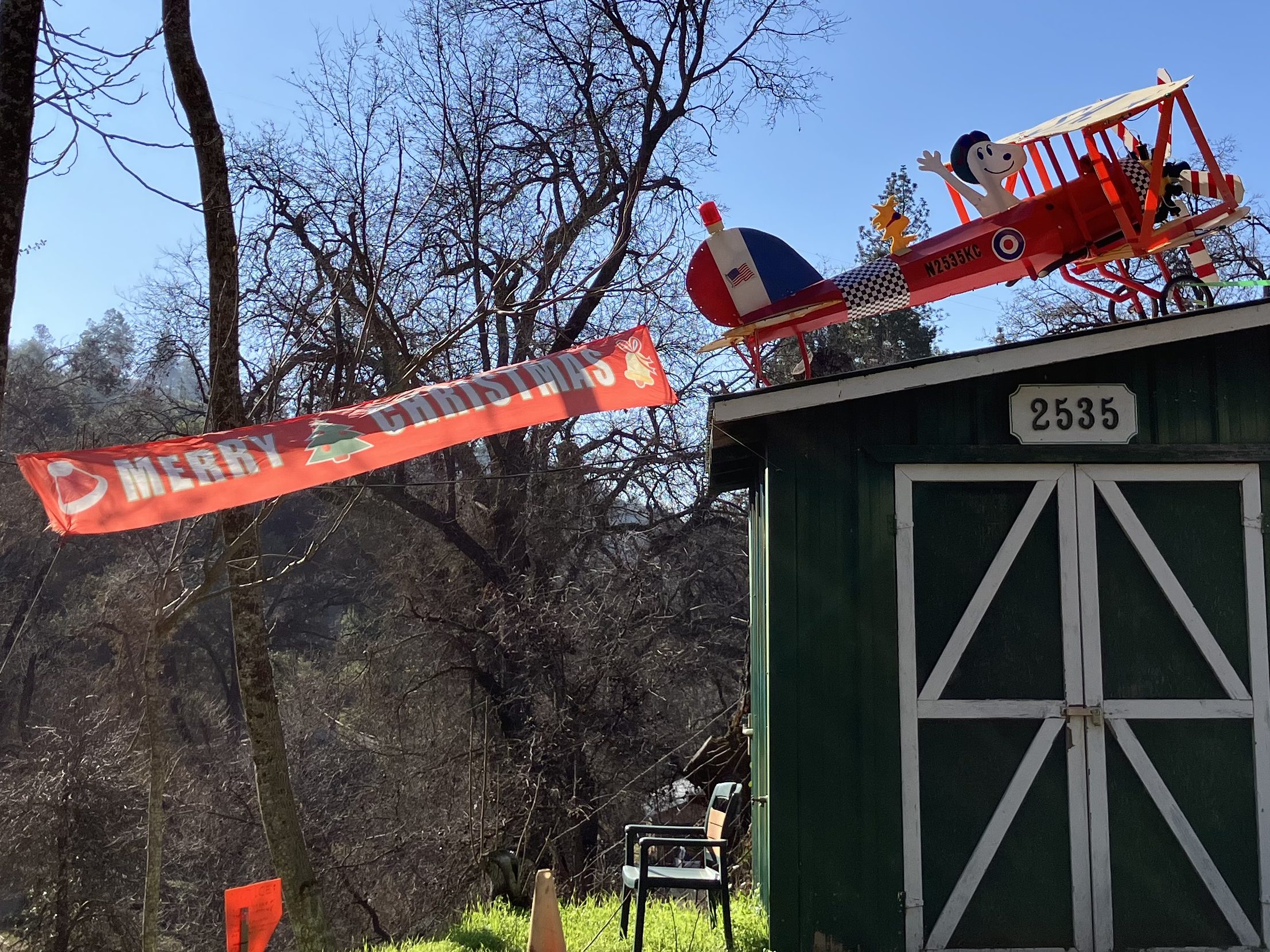
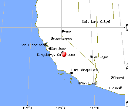
Today I took a ride down to the city of Kingsburg, CA (pop: 13,000). Kingsburg sits on highway 99, smack-dab in the middle of the state.

Kingsburg is the big red dot blotting out Fresno.

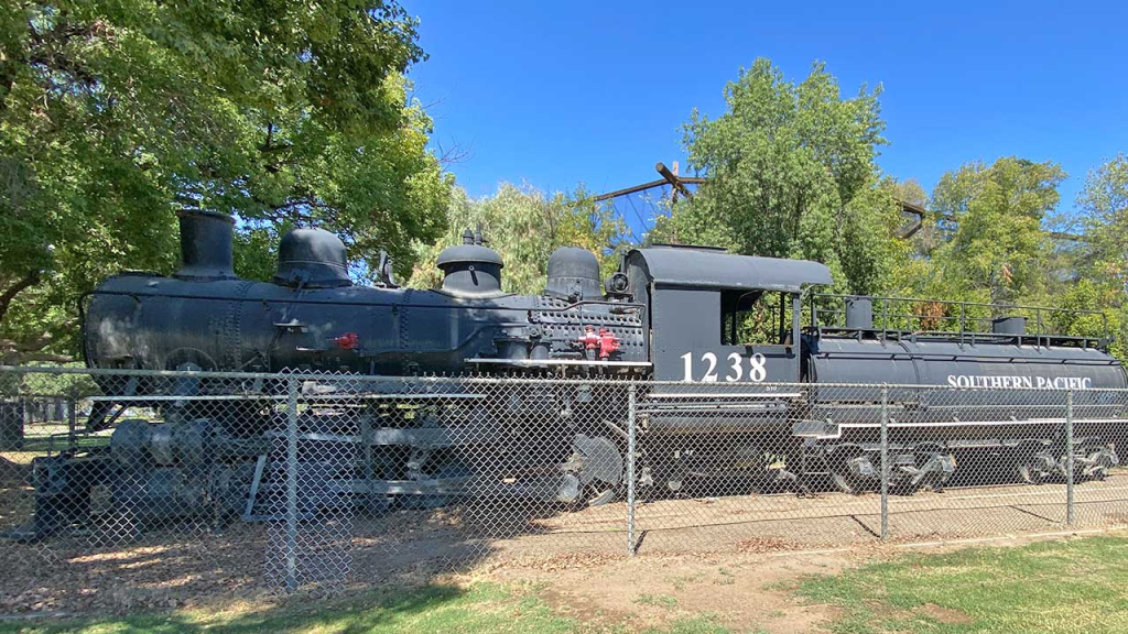
Alert readers will recall that I came through Kingsburg last fall and fell in love with its historic railroad depot. I ended up making a small contribution toward their “1238 Project,” in which they are taking possession of a 1918 Southern Pacific steam locomotive that’s been sitting in a park in Fresno since 1956. As a bonus, my humble contribution earned me membership in the “Friends of the Historic Kingsburg Depot,” which holds monthly meetings about their activities at the depot. So today I said “What the heck; I’ll make the 200-mile drive for this evening’s meeting and get the latest update on the 1238 Project.”

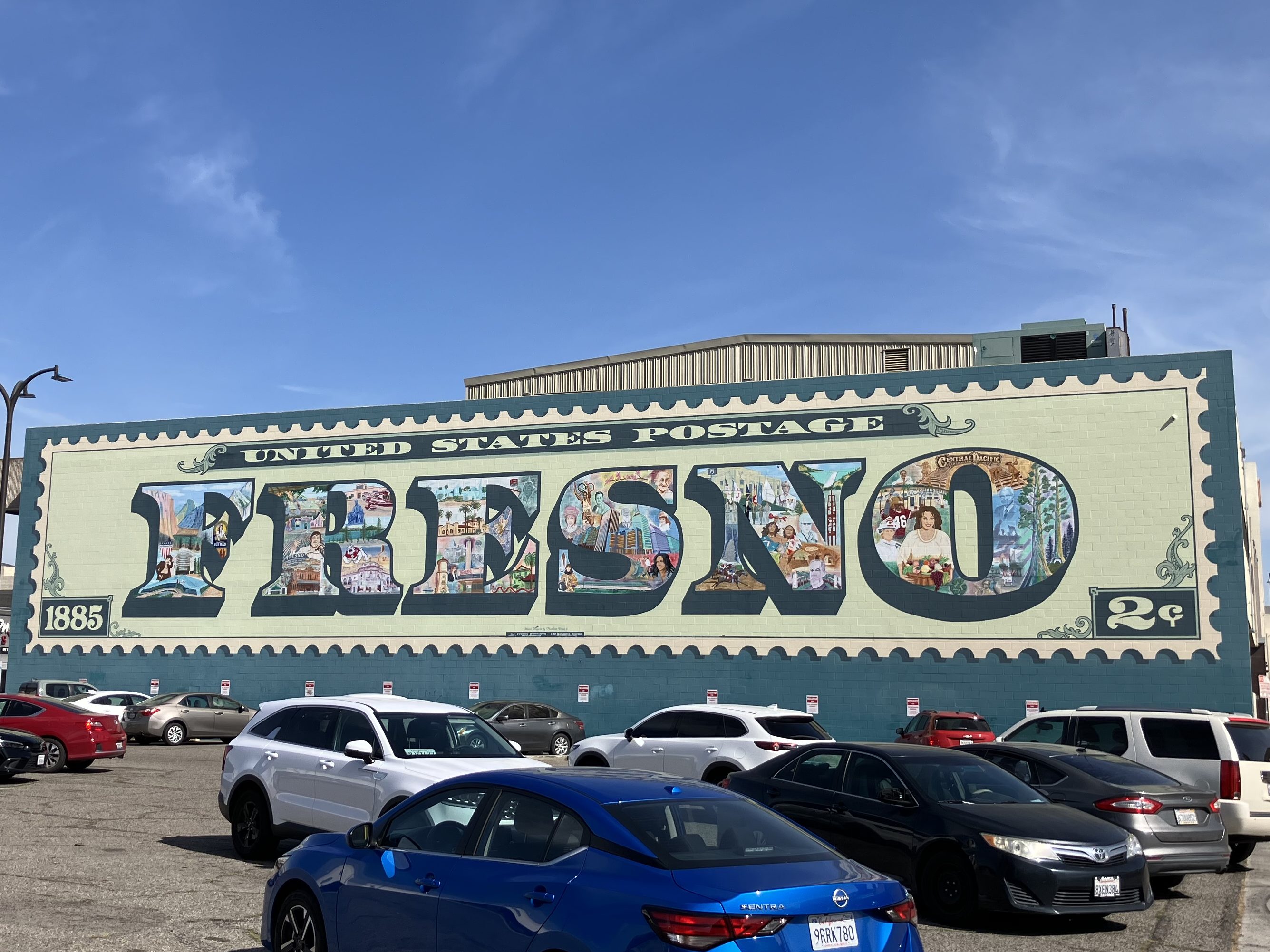
I was running a little ahead of time, so I killed an hour and a half exploring the city of Fresno (pop: 546,000), which is about 20 miles north of Kingsburg. Now, Fresno is a much-maligned city, frequently appearing on lists of the worst places to live in California. It has above-average levels of homelessness, drug use, air pollution, and unemployment. Like much of the Central Valley it experiences extreme temperatures in the summer and winter. And much of the city comprises a run-down urban core surrounded by ugly sprawl. But despite all this, Fresno has a plucky population and a rich history that is, to greater and lesser extents, being preserved. Here are just a few examples that I saw today:

Civic pride is evident in this mural on Tuolumne Street in downtown Fresno.

Fresno has several historic movie palaces in various states of preservation. Two of them (the Crest and the Tower) share names with two semi-famous theaters in Sacramento. Fresno’s 1948 Crest Theater is in particularly rough shape; the exterior is pretty shabby, and the air conditioning doesn’t work. And yet, they show movies every weekend for five bucks!

The terrazzo floor is nice, though.

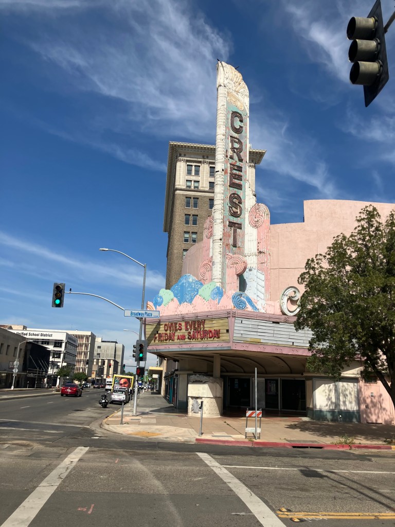
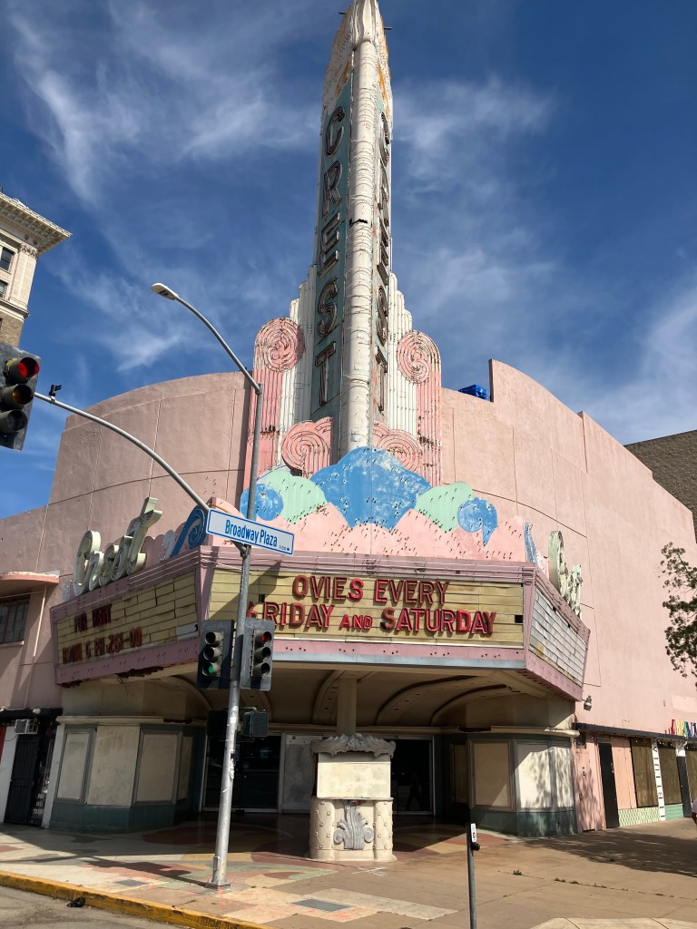
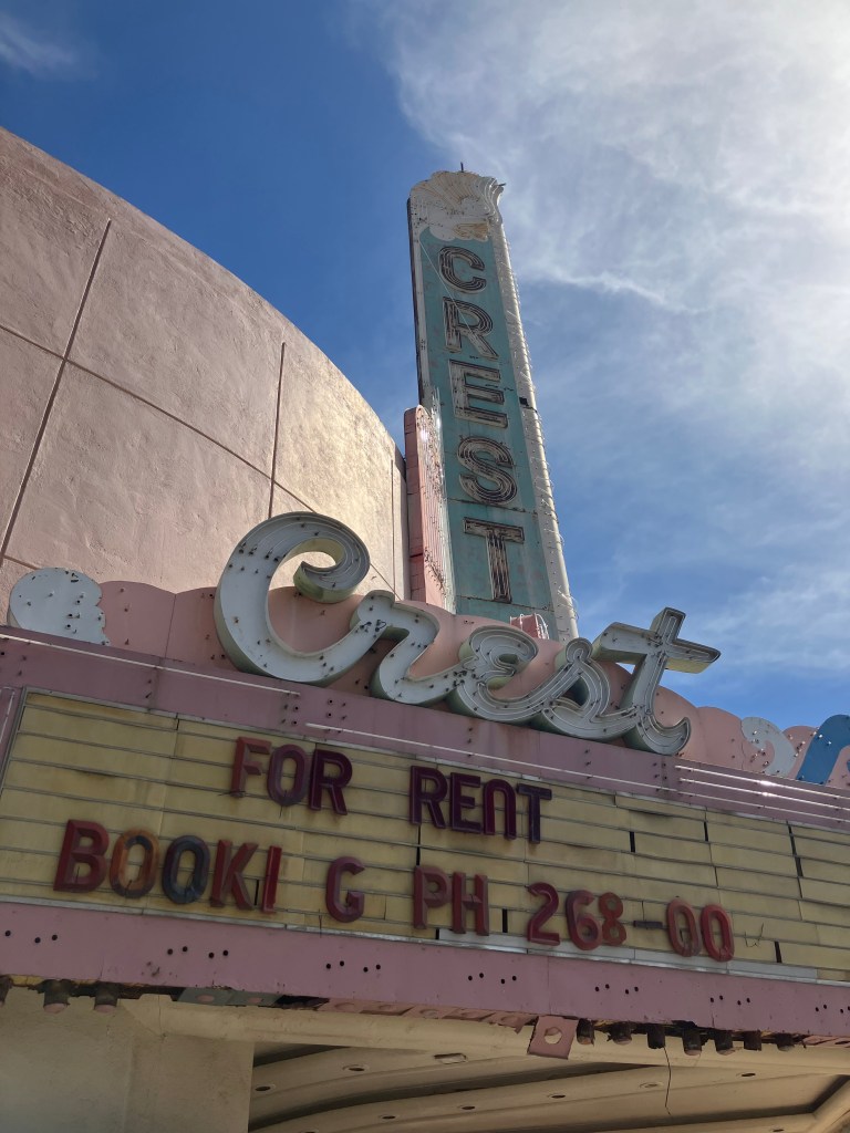
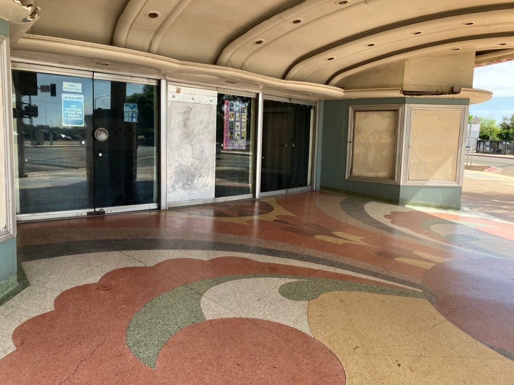
I wasn’t able to get inside, but I’m told the interior is in better shape than the exterior. And I do appreciate that they’re keeping the theater open, even though they obviously have a lot of deferred maintenance. It’s lovable in a “little engine that could” kind of way.

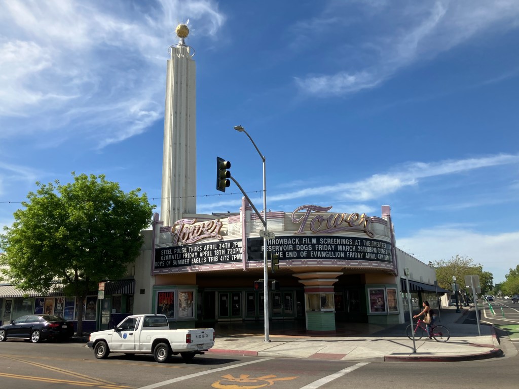
Next up is the Tower Theater. It’s the centerpiece of Fresno’s “Tower District”–an artsy neighborhood with coffee shops, art galleries, restaurants, and other businesses that give the area a modest but palpable energy. It’s still a little gritty, but it’s definitely a viable destination for an evening out. The Tower Theater itself is an art deco movie palace built in 1939, that now serves as a 761-seat performing arts center.

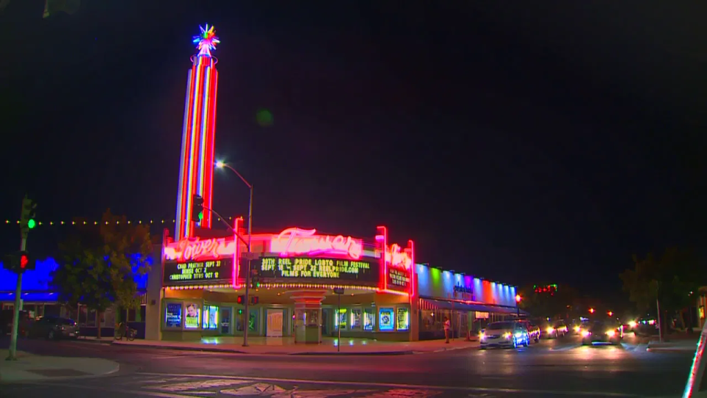
I didn’t have time to stick around til nightfall, but I’m told the Tower’s neon dominates the district at night. Here’s a photo from a local Fresno news station.

File photo from Fox26 News.

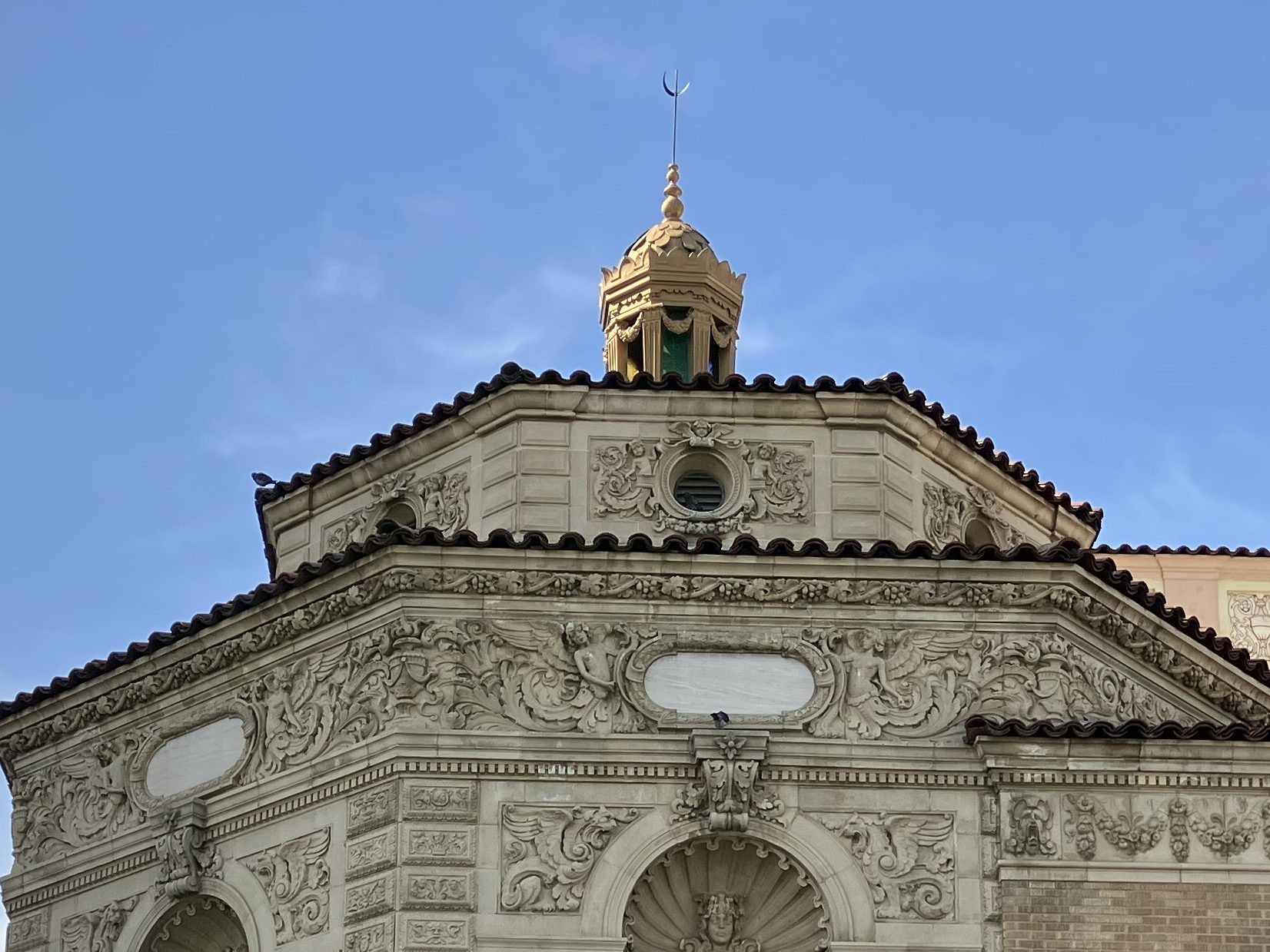
We now move to the most striking movie palace I saw today in Fresno: The Warnors Theater. Opened in 1928, it was owned by the renowned Alexander Pantages. (Surely you’ve heard of the Pantages Theater in Los Angeles?) The theater originally was called The Pantages Theater, then changed to The Warner Theater in 1929, when Warner Brothers bought it. Warner Bros sold it in the 1960s, and the new owners changed the “e” to an “o” in a half-hearted concession to trademark requirements.

Pantages’ fortress.
Sometimes more is more. Or Moor, if you catch my drift.
Box office and lobby. Check out that ceiling!

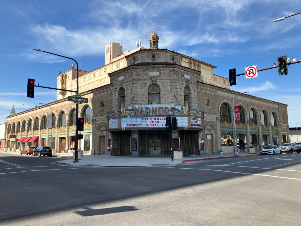
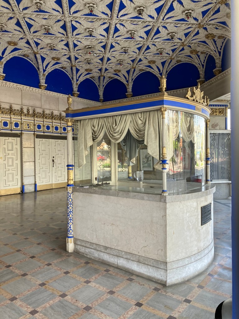
Warnors has a large stage, seating for 2,100 people(!), and the original 1928 Robert Morgan pipe organ. The theater serves as a popular performing arts center bringing many national and international acts to Fresno.

So, I think it’s fair to say that Fresno is making an effort to support the arts. I think this is a key component to revitalizing the city.

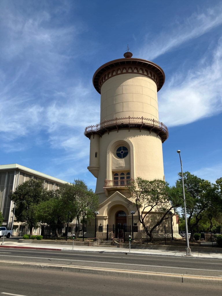
I did encounter other examples of civic pride–here I’ll share just two more. First, there’s an impressive, beautifully-restored 1894 water tower. Originally owned by a private water utility, the tower’s 250,000-gallon tank was drained in the 1960s and sold to the city. It was restored about 25 years ago, and has served as a visitor’s bureau and, most recently, as the Frida Cafe.

Now that’s a water tower.

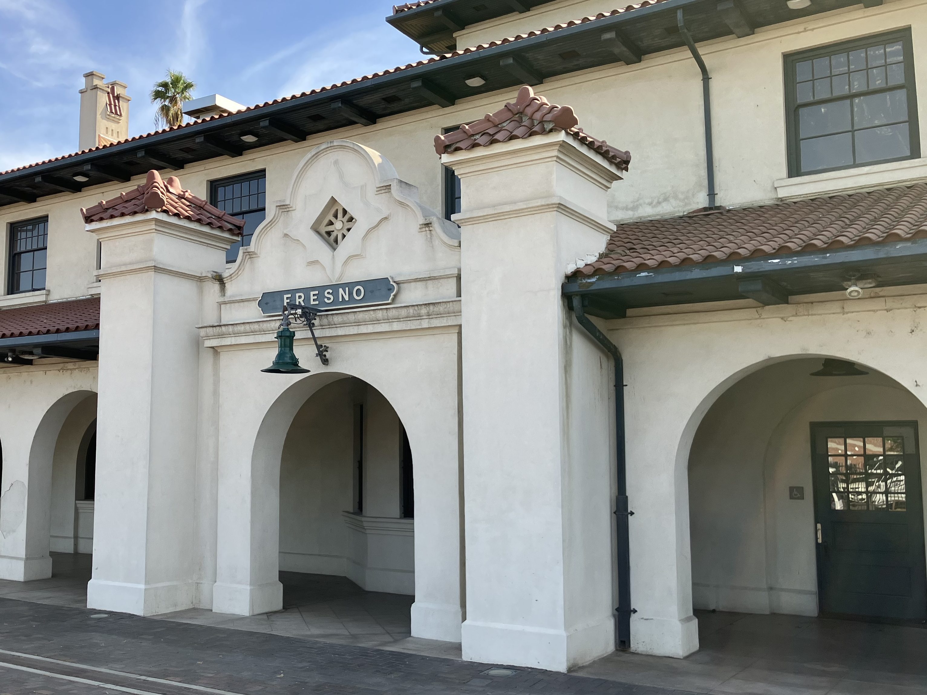
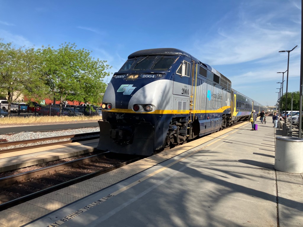
My final example of Fresno’s civic pride is its historic railroad depot. It was constructed by the Atchison, Topeka & Santa Fe in 1899. Santa Fe stopped passenger service to the station in 1966 and completely shuttered the station in the early 1990s. Fresno civic leaders, God bless ’em, purchased the decaying the station in 2003, spent 6 million bucks restoring it, and re-opened it for Amtrak service in 2005.

Fresno Depot, looking a bit like a La Quinta Inn.

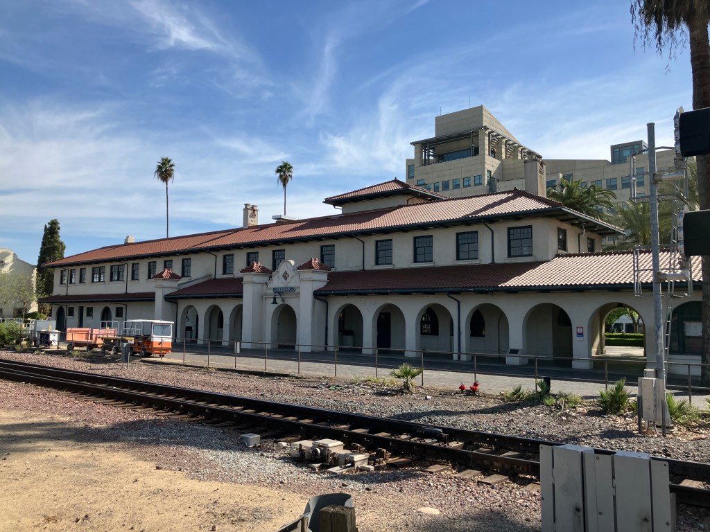
Just as I was leaving, the San Joaquin arrived. There was a good crowd of people boarding at the platform. The station seems to be a very solid transportation hub for the city.

And this mention of trains brings us back to the original purpose of this trip. Twenty minutes after I left Fresno I arrived in Kingsburg, just in time for the Friends of the Historic Kingsburg Depot meeting. It’s a friendly and dedicated group of people, all donating their time toward the betterment of their community. And I think that’s the moral of today’s blog post.

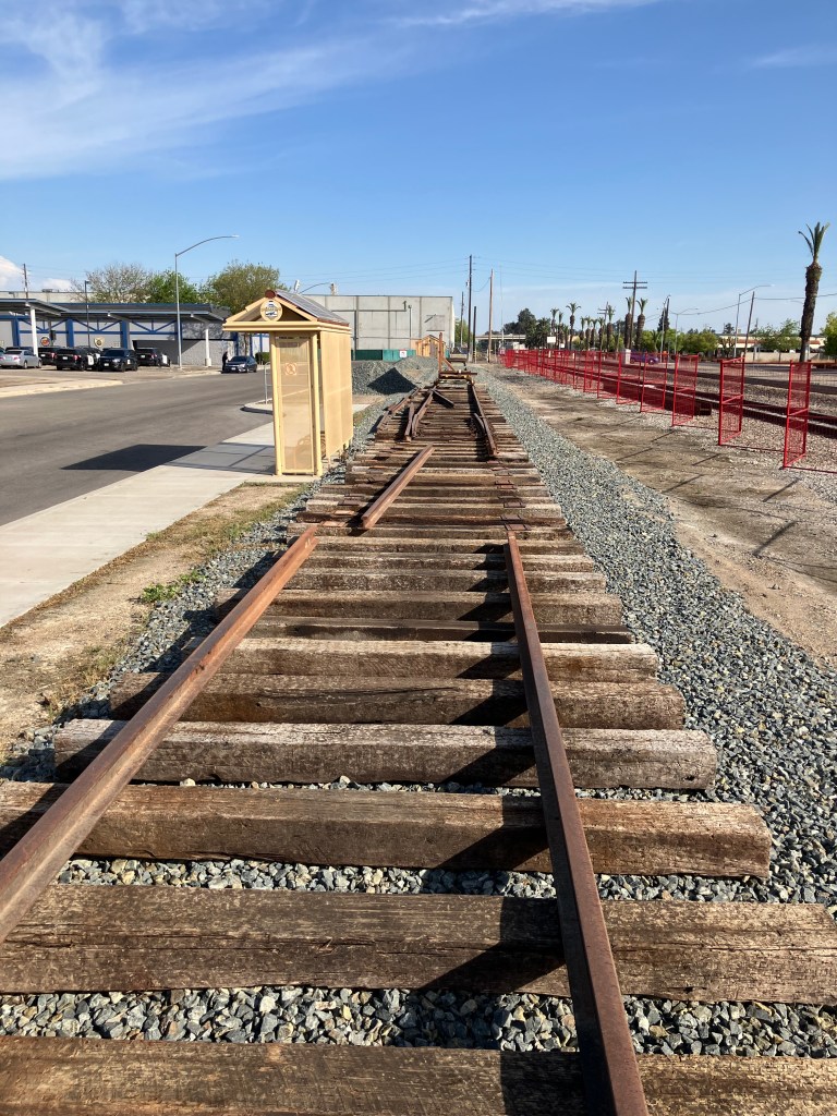
At the meeting I learned that the 1238 steam locomotive is scheduled to be trucked to Kingsburg on two flatbed trailers in early May. I hope I’ll be able to return for that operation, which is something you don’t see every day. I’ll leave you with a photo I took of the space next to the depot that volunteers are preparing for the steam locomotive, complete with some fancy red fencing. Beneath that is a photo of the locomotive itself, still cooling its heels in Fresno, waiting.

Paging John Henry…
Photo from GV Wire.

bridges · California history · Road trips · trains

A Penny Saved…

Regular readers of this blog will recall that, a few years back, I became intrigued with the Lincoln Highway. To refresh your memory, the Lincoln Highway was the country’s first transcontinental automobile route, dating back to 1913. It ran from Times Square, NY to Lincoln Park, CA.

Why is this car driving on the wrong side of the road?

Today, most of the original route is long gone, largely superseded by modern interstates. But a handful of the original segments remain, like this crumbling roadway in the woods near Donner Pass that I (literally) stumbled upon in 2022:

Beware of trip hazards…

You may also recall that I once discovered a roadside memorial commemorating the Lincoln Highway and US Route 40, in Auburn CA. (In 1926, the feds adopted a numbering system for all US highways. The segment of the Lincoln Highway that passed through Auburn was rechristened with the unromantic name “U.S. 40.”)

A number of other remnants of the old Lincoln Highway remain. I’ve driven over segments in other states, such as Pennsylvania and Wyoming. And in an earlier blog, I shared this photo that loyal reader Brian W. took in Tama, Iowa.

Photo courtesy of Brian Weberg.

But it wasn’t until just recently that I realized the Lincoln Highway passes within just a few miles of my house. In fact, my favorite coffee place sits alongside the historic route, in a building that actually predates the Lincoln Highway. More on that in a moment.

It should be noted that the Lincoln Highway forked in Reno, providing two routes into California. One (“the Pioneer Route”) went over Donner Pass and roughly followed modern Interstate 80. The other (“the Scenic Route”) passed south of Lake Tahoe and then roughly followed modern US 50. The two segments linked up again in Sacramento.

Map from the website “Adventures in California History.”

This came to my attention because last month the local historical society held a special program next to one of the longest original pavement sections of the Lincoln Highway, in El Dorado Hills. They even brought out a score of antique cars for the occasion. You can read the newspaper article here.

So my friend Bill P. and I decided to follow more of the original route here in El Dorado County. Using the El Dorado Hills segment as our starting point, we headed east toward Placerville.

Bill, astride an original segment of the Lincoln Highway that dates back to at least 1913. Note the distinctive Lincoln Highway logo.

The surrounding countryside in this area looks, I presume, pretty much as it did a century ago, when a young Army officer named Dwight Eisenhower traveled the entire route in a military caravan. Even the bridges date to that era, I’d reckon.

Dwight probably crossed over this bridge in 1919.

After a brief, unavoidable jaunt along US 50, we were back on the original alignment of the Lincoln Highway. There’s even signage to prove it!

Note the distinctive red, white, and blue sign.

The historic Lincoln Highway route in western El Dorado County is moderately traveled and is flanked with a mix of modern buildings and historic structures dating back a century or more. An example of the latter is this 1896 freight depot in Shingle Springs:

Since last December this depot has been home to Wise Gals Coffee. It’s become a popular community gathering spot and my favorite place to get coffee. I hadn’t realized it’s also on the Lincoln Highway! If you find yourself anywhere on the 3000-mile route, I insist that you stop in for a cappuccino.

Rachel Bezdek and Brylee Lance, the eponymous “Wise Gals.”

Oh, and not only is the original depot still standing; they’re still running trains! Southern Pacific abandoned the line forty years ago, but the tracks were taken over by the local historical society, and volunteers run trains on the weekends.

Railroad equipment next door to the depot.

After paying homage to coffee and trains, Bill and I headed back out on the old Lincoln Highway (signed as Mother Lode Drive in Shingle Springs.)

When we got to the town of El Dorado (pop: 4,000) the old Lincoln Highway (now called Pleasant Valley Road) took us right by the storied Poor Red’s BBQ. Allow me to quote directly from Poor Red’s website:

“Originally constructed as a weigh station for Wells Fargo, it previously operated under the name Kelly’s Bar from 1927 until 1945. Poor Red won the bar in a game of dice, and he and his wife and bookkeeper Rich Opal took it. The murals currently on the walls of Poor Red’s were installed in the 1940’s. They depict former employees and patrons, including their dog, which used to sit out front. It is rumored his dog ran for office, but he lost.”

Photo from S.F. Gate.

Poor Red’s, as you might know, is famous for the Golden Cadillac, a sweet cocktail with equal parts Galliano, cream, and creme de cacao. They claim to have invented the drink in 1952, and to be the world’s largest consumer of Galliano. Bill and I stopped in for lunch…

Next up, we stopped in at the El Dorado County Museum, which we knew has two original Lincoln Highway markers in its collection. One morning in 1927, exactly 2,436 of these cast cement markers were placed along the entire cross-country route by local Boy Scouts. (You can see one of the markers in my earlier photo of the Lincoln/US 40 memorial in Auburn.) Almost all the original markers are now gone, succumbing to road-widening operations, vandals, or weather. Given how iconic they are, Bill and I felt it important to see one “in the flesh,” as it were.

Poor little bastards.

We were met at the museum gate by one of the least helpful docents you’d ever want to meet. Us: “Hi! We understand you have a couple of historic Lincoln Highway markers on display!” Him: “Yes. They’re over there.” He gestured vaguely behind him to a bunch of clutter in a courtyard in front of the museum. But he continued to block the gate. Us: “Uh, could we see it?” Him: “We’re closed.” Us: (disappointed looks). Him: “You might be able to see it through the fence of the parking lot.” And with that he went back to torturing kittens or whatever it is he does for fun.

We did manage to take a photo through the metal fence. God forbid that we would have been allowed to set foot for a moment on the other side of the fencing.

Note that the Lincoln head near the top is embossed. This seems odd; in all the other photos I’ve seen of these, the Lincoln head is on a round, bronze plaque.

We returned to the Lincoln Highway, and once again felt like we’d been transported to the early 20th century. As we approached Placerville we crossed over the historic Weber Creek Bridge, which dates to 1914.

The bridge is in remarkably good shape for over 110 years old. A little research revealed that it’s one of only two “Turner Mushroom Slab” bridges in California. Evidently an engineer named Claude Allen Porter Turner patented a “flat slab support system” (which my wife tells me I could benefit from). But I think it actually has something to do with the way the concrete slabs are designed and assembled. Coincidental fun fact: Turner was born in 1869 in Lincoln, Rhode Island!

Quick! Find the “flat slab support.”

Finally we were approaching Placerville, which meant we had one more opportunity to get up close and personal with a Lincoln Highway marker. The Lincoln Highway through downtown Placerville is now Main Street, and our research suggested that one of the original markers had been discovered during an earlier road-widening, and cemented into the face of a brick wall. After a few false leads and a couple of illegal maneuvers, we found what we were looking for in the external wall of a restaurant:

The real deal!

It’s quite surprising how many of these remnants of a century-old highway remain, largely invisible or unacknowledged by galoots such as myself. My two recommendations to you, gentle reader, are (1) pay attention to the history near you; who knows what’s in your backyard!, and (2) ease onto the Lincoln Highway and make your way to Wise Gals for a cappuccino.

California history · Cars

Googie!

The other day I was driving along the freeway, observing the passing phalanx of big, blocky buildings behind the trees and sound walls that flank the freeway. These buildings all seem to have been conceived by a kindergartener for whom the words “office building” and “box” are synonymous, and then value-engineered to the apotheosis of vapidity–nondescript, slab-sided edifices with bands of tinted windows and, at a top corner, a single word in an unembellished font: “Kaiser,” “Allstate,” “Lennar.” We live in an age of soulless and tedious architecture.

And then, a little later, I spotted this in Sacramento:

Don’t scratch your cornea on that pointed roof!

Now this building has style and soul! I realize that’s not a great photo; it was difficult finding the right angle. But it’s an old Orbit gas station, now repurposed as a hamburger joint called Suzie Burger.

That this was once a gas station is obvious. Note the islands where the gas pumps once stood, and the enormous mullioned windows that used to be roll-up doors in front of the service bays.

These Times They Are A-changin’ indeed.

Orbit gas stations used to be all around the Sacramento area, first showing up around 1963. They represented the future, or at least what people during the age of black-and-white TV and AM radio thought the future would look like. It’s got a very Jetsons vibe, all upswept and angular and exaggerated.

Jane’s addiction.

According to this website, Orbit’s distinctive four-point architecture was the brainchild of some guy named Ed Ward. There were about a dozen of them at their peak. Now, it seems that most have been torn down in the intervening 60-odd years. And yet the good people at Suzie Burger recognized that Orbit’s retro look would be a great calling card for their old-school burger joint.

I remembered that when I lived in Sacramento (pop: 525K) in the 1980s, there was still a handful of Orbit gas stations in operation. In fact, I regularly gassed up the Studebaker at an Orbit station near my apartment in Carmichael. What had happened to it? Had it been torn down? Or had it been converted to some other use? I decided to take a drive out there to find out. And what to my wond’ring eyes should appear but this:

“It’s alive!”

Not only had it not been torn down, but it was still operating as a gas station. It even still bears the Orbit name!

So take that, you big, ugly, featureless office buildings! Even at age 62, this Orbit is still going strong. Next time you find yourself in Sacramento make sure you gas up at 4716 Auburn Blvd and support the preservation of Googie architecture!

bridges · California history · Road trips · trains

South Pacific

No, not that South Pacific…
this one.

The San Francisco Bay Area today is associated with high-tech start-ups, a tangle of crowded freeways, ubiquitous Teslas driven by tech bros on their way to Starbucks, and outsize McMansions squeezed onto tiny lots that once were once cherry and apple orchards. It’s a thoroughly modern region, where Lime Bikes are available on every street corner and Uber Eats is more popular than McDonalds.

And yet here and there you can still find remnants of a long-forgotten, early-industrial past, if you know where to look. Recall, for example, my hunt last year for a century-old, half-sunken railroad ferry in Antioch. I’ve been struggling to articulate just why I’m find the presence of these historic relics so reassuring. To me they’re a tangible link to an obstreperous past that feels more palpable than our virtual this and digital that. The steam-and-iron age had its negative points, to be sure, but it also showcased our civilization’s determination, boldness, and energy. And yet I think there’s more to my interest in this stuff than just their Romantic aspects. By seeing these artifacts in the wild, rather than behind a museum display case, they are at once more authentic and better contextualized. They connect us to our own past. I’m thinking of that scene in the original Logan’s Run, when Logan 5 and Jessica 6 encounter the old man (played by Peter Ustinov). Even though their modern society worships youth, they are drawn to this ancient, bearded feller with connections to a forgotten time.

All this brings us to the South Pacific Coast (SPC) Railroad. It’s an audacious, independent Bay Area rail line that was established almost a century and a half ago. It was an earnest upstart that offered a cheaper alternative to the monopolistic Southern Pacific Railroad, which at the time held California in a “monopolistic death-grip.”

The SPC ran from Alameda down to Santa Cruz–a distance of about 77 miles. The stretch that crossed the Santa Cruz mountains, from Los Gatos to the coast, is especially impressive for a small, independent, narrow-gauge railroad. Trains traversing this section would snake their way through redwood forests, crossing gorges and creeks and passing through eight tunnels. And it was built in the 1880s! The line ended in the town of Santa Cruz.

The Southern Pacific Octopus eventually absorbed the SPC line. Then the route became unprofitable with the opening of Highway 17 between San Jose and Santa Cruz in 1940. That same year a storm destroyed major portions of the old SPC line, and the Southern Pacific decided to abandon much of the line rather than repair it. Trains have not traveled over most of the original line for about 85 years.

So what happened to the SPC’s tracks and tunnels after the railroad was abandoned? My son Ian and I spent two days following the old route in order to find out.

We focused primarily on those old tunnels. There were eight of them. Tunnel #1 was obliterated in 1903, and in the 1950s the area was inundated by the creation of Lexington Reservoir. So we moved on to Wrights Station, which is where Tunnel #2 was bored. And it’s still there! The trees and vines and moss of the Santa Cruz mountains are trying to reclaim the tunnel’s mouth, but a steady flow of water seems to be continuously scouring it.

South portal of Tunnel #2 at Wrights
View from inside Tunnel #2. Son Ian is (wisely) standing outside.

It’s somewhat eerie, these ruins from well over a century ago just silently sitting there in this remote forest. Graffiti reminded us we weren’t the only modern persons to discover these remnants of a past age, but it still felt as though we’d encountered something largely forgotten.

Railroad bridge pier near Wrights.
Another bridge pier, with impressive graffiti.

After Wrights we moved on to the town of Laurel (pop: one family). Laurel used to be a significant stop on the line, but today it seems to amount to just one house.

“Once thriving railroad and sawmill town, known as Highland when the first through train ran in 1880. Name Laurel adopted about 1885. F.A. Hihn built sawmill here in 1889. The Laurel Mill supplied much of the lumber to rebuilt San Francisco in 1906. Little remains today except tunnel portals and memories. This historical marker placed by the County of Santa Cruz and the Santa Cruz County Bicentennial Commission October 1969. “

Apparently, that one home now owns the portal to Tunnel #3 in its backyard. And because the portal is on private property, there’s no graffiti. Once again, it strikes me as an eerie remnant of a long-abandoned railroad that looks very much like it did a century ago.

North portal to Tunnel #3.
Another angle of Tunnel #3. Can you imagine having an old railroad tunnel in your back yard?
Little shed near the tunnel portal. I assume it dates back to the SPC?

We found the south portal to this same tunnel emerging under a residential road in Glenwood, This end too appears to be part of someone’s back yard. I would have killed to have had a historic railroad tunnel in my back yard while growing up!

South end of Tunnel #3.

This tunnel, like several others on the SPC line, was re-constructed after the 1906 earthquake. (The SPC crosses the San Andreas fault.) While they were at it, they widened the tunnels to accommodate standard gauge (about 20 inches wider than narrow gauge.) This tunnel bears a 1909 marker, which presumably is when the tunnel was widened.

Detail from top of the tunnel.

A little further along we were able to catch a glimpse of Tunnel #4, dubbed “Mountain Charlie.” It was a ways up a private hillside, and we couldn’t access the property. But, like the others, it had a visible concrete portal with lots of moss but unmarred by graffiti. What do these families do with these tunnels? (I should note that Southern Pacific dynamited about half of these tunnels in 1942, so you can only go into the mouth of the tunnel for a little bit before encountering a wall of rubble.)

Next up was Tunnel #5: the Zayante tunnel. It’s only about 250 feet long, bored into granite. And this one was not dynamited. Still, it took us awhile to identify it. A little research revealed that a company called Western States Atomic Vaults, Inc sealed off both ends of the tunnel and turned it into a climate-controlled data storage facility at the height of the Cold War. I’m not making this up. Ownership has passed a couple of times, and today it’s owned by Iron Mountain. Reportedly it contains mainly microfiche and microfilm, as well as some original reels of Disney movies.

What used to be the south portal of Tunnel #5.
Same tunnel portal, today.

We were unable to get to Tunnel 6, which was down a steep gorge that was beyond our climbing skills.

Tunnel 7 no longer exists; it was “daylighted” (I,e, the top was removed) some years ago. This stretch of the line, however, still carries rail traffic. The Santa Cruz, Big Trees and Pacific Railway runs an excursion train from Felton to the Santa Cruz Beach Boardwalk. Here’s a picture of the track near the location of the daylighted Tunnel #7.

Stretch of the original trackbed, on which an excursion train now runs. I call the lighting in this photo “Voice of God.”

Finally, we ended up in Santa Cruz, where the final tunnel is still in operation! It’s a short tunnel that passes under Mission Santa Cruz. The Santa Cruz, Big Trees and Pacific Railway still uses this tunnel for excursion trips from Felton.

Tunnel #8, viewed from the south.
Tunnel #8, viewed from the north. It’s next to a lumber yard in the middle of Santa Cruz.

So that’s it for the tunnels. To reiterate, I’m surprised so much of the infrastructure is still around, even though most of it hasn’t seen a train in over 80 years. The fact that they’re mostly on private property or out of the way has contributed to their surviving this long.

Here are a couple of other photos of remnants of the old SPC:

Girder bridge, slowly being reclaimed by nature.
Random road near the railroad right-of-way. This road is still in use and not technically part of the SPC. But I thought it gives a good flavor of the remote, forested environment.

Only one station remains of the original stops on the SPC line. It’s the Agnew station in Santa Clara, and it was built in 1877. Passenger and freight service at the depot ended long ago, although trains still pass by the station on the active tracks next to it. The station is now owned by the California Central Model Railroad Club.

So ends our adventure. If you want to learn more about the SPC, there’s a wonderfully helpful and informative site called “Abandoned Rails” that has a lot of SPC’s back story, an interactive map, and other cool stuff. Thanks also to Uncle Edward and his Dome o’Foam for his helpful tips. Now all that’s left is to wash Ian’s truck!

TREAT (?) of the DAY

During our adventure we stopped at a remote market to replenish our snack supply. For reasons that I really can’t explain, I chose this bag of “Extra Dark Boldly Charred Splits.” It seemed like a good idea at a time.

The “Unique Snacks” company lived up to their name, but not in a good way. These were essentially nothing more than burned pretzels.

“Boldly Charred” my ass!

They are as dry as a discarded empty canteen in the Sahara, and they have the flavor profile of a Kingsford Briquette. I seriously suspect that something happened to the oven at the Unique Snacks Company, which resulted in a month’s pretzel production being irrevocably burned. But rather than throw away the torched snacks, some marketing genius said “let’s just change the package to say ‘boldly charred!'” Doesn’t an analogous story lie behind the popular “sour” beer style and the invention of buttermilk?

bridges · California history · Puns · Road trips · trains · Yard art

All That Glitters

Get it?

When I was a kid, my family would go camping each summer in California’s gold country. We’d hike to open mineshafts, visit countless museums featuring Gold Rush artifacts, and clamber around decaying miner’s cabins and rusty hydraulic mining equipment that had been abandoned in the foothills. My dad would collect antique square nails (a practice that we later learned was unlawful) and occasionally we’d try our hands panning for gold. My mom would stay back at the campsite, cooking meals, sweeping the tent, and wishing we soon would return to suburbia.

Not exactly glamping

Even as a kid I was impressed by how these relics of the Gold Rush could be seen and touched out in the wild, even after more than a century. To a kid like me in the 1960s, the Gold Rush seemed like ancient history. And now it’s been another half-century since I was a kid! It’s hard for me to explain, but today, as I examined old stone buildings from the 1850s and hillside scars created in the 1860s, I felt a connection with a longer arc of history. The State of California was in its infancy then, and they didn’t call it the Wild West for nothing. We’ve come a long way since we routinely dumped cyanide and mercury into waterways, since we carved into hillsides with powerful water canons, since thousands of miners daily breathed toxic fumes and hundreds of them died in fires and cave-ins. That’s not to say we have no problems today; far from it. But clearly there’s been progress.

California’s Gold Country is a reminder both of how our civilization has changed, and how as humans we’re largely unchanged. There’s a persistent 49er spirit in those small towns that still dot the Mother Lode. You can sense the tenacity, patience, perseverance in your average Amadorian or Calaverasian. Take the owner of a coffee shop named Moke-A-Java in Mokelumne Hill. She told me she opened the place in 2019…just before Covid shut everything down. Somehow she managed to keep the business afloat with mail-order candy sales and catering. Today business is finally picking up, and she’s grateful. She’s a latter-day version of a patient prospector.

There’s also something very soul-soothing about the rolling, oak-covered hills in this part of the state. There’s plenty of space and natural beauty, and no one seems to be in a hurry. Take for example the owner of the B&B where I stayed in San Andreas. He sat in conversation with me through the three-course breakfast he’d cooked for me, then spent half an hour showing me his workshop and his Harley. It was as though nothing mattered more to him than visiting with his guests. You can be sure I’ll be back.

About 10 am I got back on Highway 49 and fired up the driving app I’d purchased specifically for this trip. The idea was to have a knowledgeable guide direct me through a handful of small towns from Angels Camp to Jamestown. While the concept of the guide was a good one, I found it to be a bit clunky and fussy. And not only was the app awkward to navigate (a process which is admittedly complicated on a motorcycle), but the interstitial diary readings by overly-enthusiastic community-theater actors were not my cup of tea. So the app was quickly bagged.

I did learn from the app that Calaveras County gets its name from the Spanish word for “skulls,” a quantity of which were discovered by early explorers along local riverbanks. And at almost the moment I learned that fact my eyes beheld this:

Walking into Howard’s Mystic Saloon is  like entering an ossuary. You’re greeted by a giant skeleton standing just inside the door, and as your eyes adjust to the darkness you notice that all the chandeliers are decorated with skulls and bones. More skeletons hang from the ceiling, and the entire wall behind the wall is covered with black skulls.

I asked the bartender, Ivory, for the story, and she told me the skulls are not meant as a reference to Calaveras County. In fact, the owners (Curtis and Tana Howard) own another skeleton-themed bar in Oakland. At this point a jovial man with a beard and a cowboy hat sitting at the end of the bar said “This place is tame compared to their Oakland place!”

Ebony and Ivory

True to my theory about folks in the Gold Country, and despite being surrounded by skeletons, I found this to be one of the friendliest places I’ve been to in years. I chatted with the locals at the bar for the better part of an hour while nursing my hot apple cider. I had eschewed a higher-octane drink because I’d already had my beer of the day earlier in Murphys. 

We’ll get to the BOTD shortly, but Murphys (pop: 2,000) was the one stop that didn’t feel authentic to me. At some point they went all-in as a wine tasting destination. According to Wikipedia, Main Street has at least two dozen wine tasting establishments. In between are boutique-y places selling scented candles, panini presses, and other appurtenances that a miner would never recognize.

An example of Murphy’s Law

Murphys is evidently quite prosperous, and I don’t knock their business model. But this is not the Gold Country experience I was looking for.

More authentic are places like Drytown (pop: 186).

During the Gold Rush it was home to some 10,000 souls, and despite the name, it also had 26 saloons. (The name refers to a dry creek.) It burned down in 1857, and never really recovered. But there’s a roadside marker and occasional artifacts among the rolling hills and oak trees.

I also appreciate how Angels Camp (pop: 3,700 and the only incorporated city in Calaveras County) has leveraged its purported role in Mark Twain’s story “The Celebrated Jumping Frog of Calaveras County.” The little buggers are everywhere!

Now, if I had been in charge of that driving app I would have featured a Depression-era railroad bridge that crosses Highway 49 just south of San Andreas. It was part of a railroad short line that connected the Calaveras Cement plant to several local quarries. Calaveras Cement Co. produced material that built dams, freeways, and other infrastructure throughout northern California. The company shut down in 1983 as Chinese imports undercut domestic cement production. But the bridge remains as a proud (and shockingly graffiti-less) relic of a major local industry.

Before we get to the BOTD, let me leave you with a couple of photos of yard art I saw a long the way. These people are true artists.

How many different car parts can you identify?
Please don’t tell the Charles Schultz estate about this one.

BEER OF THE DAY

Just because I’m a cranky contrarian, I walked right past all the wine shops in Murphys and snagged myself a brew at Murphy’s Pourhouse. It’s an open, friendly place with outdoor seating and 16 beers on tap. I chose the rare and coveted Anniversary XXVI Strong Ale from Firestone Walker.

Even if you don’t like dark beer, you should try this. It’s aged in bourbon and brandy barrels, and if that doesn’t guarantee a symphony of flavors, it at least delivers a cacophony of flavors. We’re talking anise, black strap molasses, oak, Christmas fruitcake, semi-sweet chocolate, toasted pecans, vanilla extract, cherry sucrets, Worcestershire sauce, and those spent “grounds for your garden” you get at Starbucks. It’s on the sweet side, but there’s just enough hops to prevent it from becoming cloying. Well-carbonated but no head. 11 percent ABV, so if you are riding a motorcycle and find yourself at Howard’s Mystic Saloon shortly thereafter, have yourself a hot apple cider. I give this beer 5 points out of 5.

MAIL BAG

Faithful reader Peter D pointed out that I walked right past a pun opportunity  in my post about the tailing wheels at the Kennedy Mine. I had explained that, despite their shape, they’re not Ferris wheels. Peter’s response: Of course they aren’t Ferrous Wheels; they’re made of wood! Peter also helpfully includes this newspaper report on the bordellos of Jackson, CA.

Meanwhile, Victor R points out that the Frolic’s delivery of a disassembled courthouse building in 1849 proves that Americans had stuff delivered from China well before Amazon was even a glint in Jeff Bezos’ eye. 

Finally, Sherrill J informs me that the third book in her mystery series discusses mining for gold in southern California–a topic I confess to knowing almost nothing about!