California history · cemeteries · churches · movie theaters · Road trips · trains

A Likely Story

About half a century ago, when I was in the throes of adolescence, my dad loaded up our family and made the seven-hour drive from Sunnyvale to Eagleville, in the northeast corner of California. We were going to spend the Thanksgiving weekend with my Aunt Alice’s family. One of Alice’s brothers owned a house up there (in retrospect, it seems her extended family owned half the town).

Motto: “Any further north and you’d be in Oregon.”

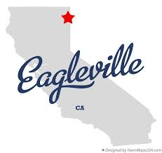
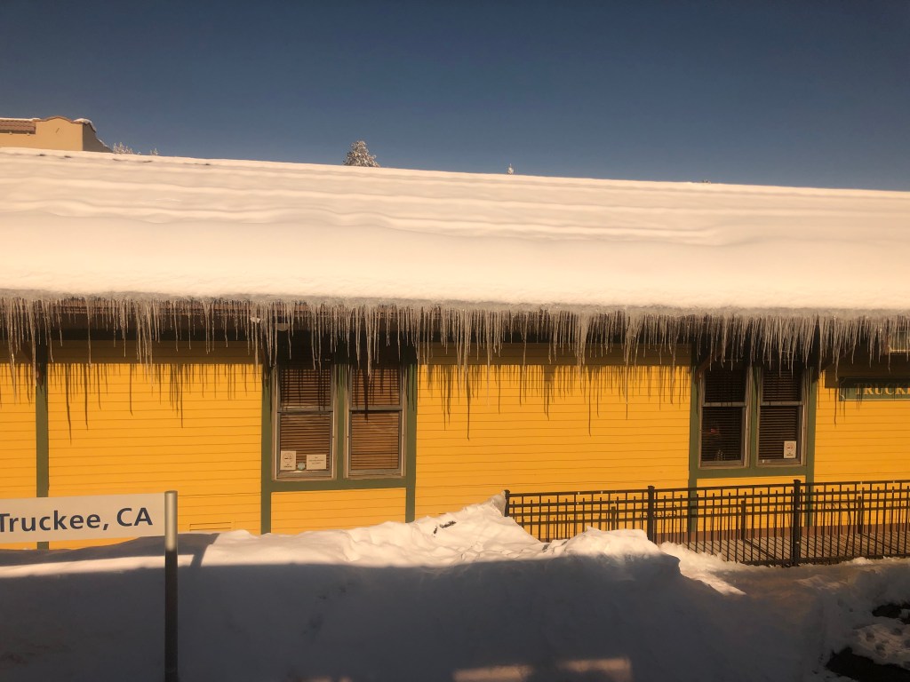
Eagleville is a tiny town in Modoc County. (Today it boasts 45 residents, about half of whom presumably are related to Aunt Alice). I have three main memories from that weekend we spent there: (1) Mom was sick with a migraine headache, Dad was distracted by mom’s condition, and Dave and I knew no one else other than Aunt Alice and Uncle Edward (Dad’s brother). (2) The general store was the only business open that weekend, so my brother Dave and I hung out there for what seemed like hours, studying the comic books and MAD magazines. (3) There was a tiny church that was unlocked and empty; as a city slicker, I was surprised that people could be so trusting as to leave a building full of chalices and patens and suchlike just sitting there unattended. Even though Dave and I were not known for our high moral principles, we realized that it would be extremely bad karma to rip off anything from a church. So we left well enough alone.

As I recall, our Thanksgiving dinner was a traditional though awkward affair. All the expected Thanksgiving staples were there: turkey, stuffing, cranberry sauce, etc. But the four of us in my immediate family were clearly unfamiliar outsiders, while Aunt Alice’s family members were all comfortable together, laughing and joking and having fun. I envied their ease being in their own skin, and their grounding in that remote corner of California.

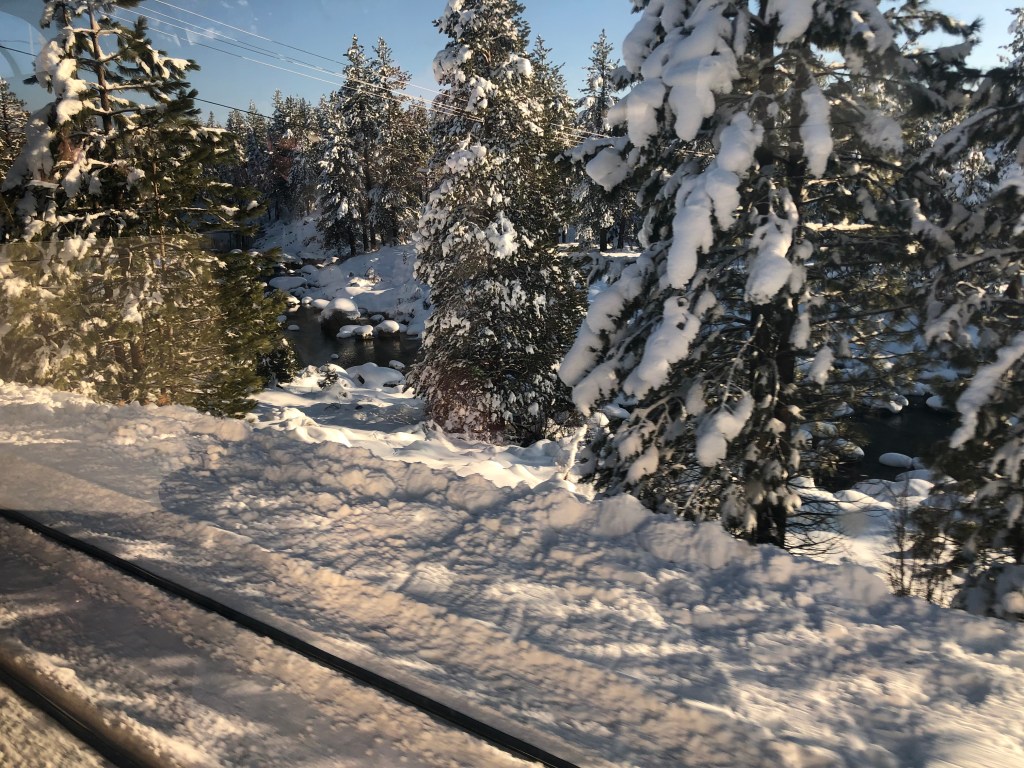
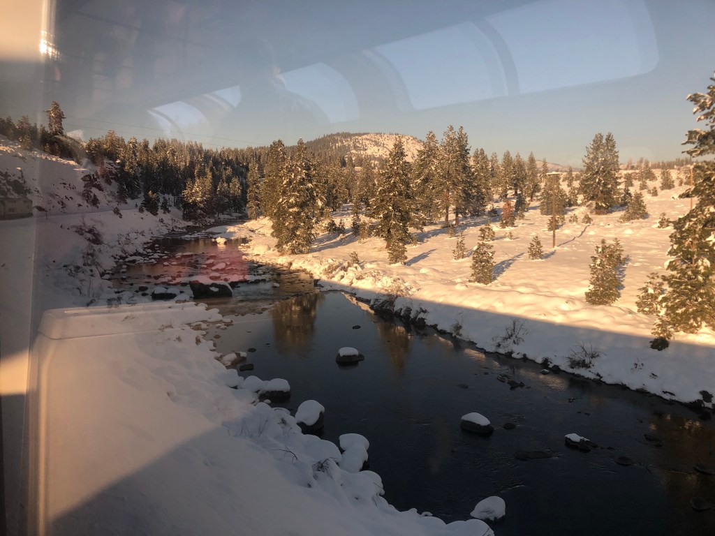
That Thanksgiving weekend still stands out from the 60 undistinguished others I’ve experienced. Perhaps it’s because it was the only Thanksgiving I spent with snow. Perhaps it’s because Eagleville felt like such a mysterious, remote, foreign place. Notably, I’ve never been back to Eagleville.

Until now.

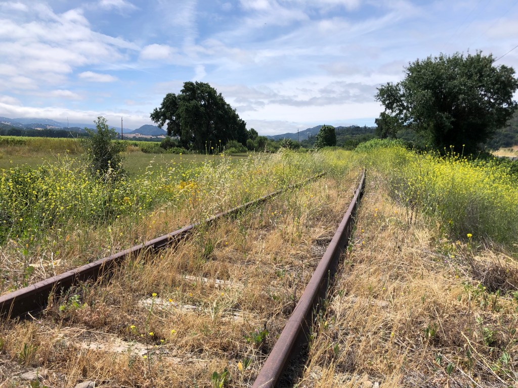
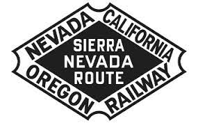
Recently I decided, for no particular reason, that I would revisit that tiny town and see how the reality stacked up against my memory. So I contacted my Uncle Edward, who helpfully supplied me with the address of the house where we stayed, which evidently still remains in Alice’s family. As loyal readers of this blog know, Uncle Ed is the creator and sole “staff” of The Dome of Foam, which is internationally recognized as the premier, authoritative, entertaining website on western railroads (particularly the Southern Pacific). I asked Uncle Ed if he could recommend any railroad-related sites in the greater Eagleville area, and he connected me with a doozy: The Nevada-California-Oregon (N-C-O) Railway, a now-defunct narrow-gauge railroad that connected Eagleville’s Surprise Valley with the outside world.

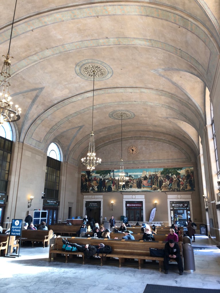
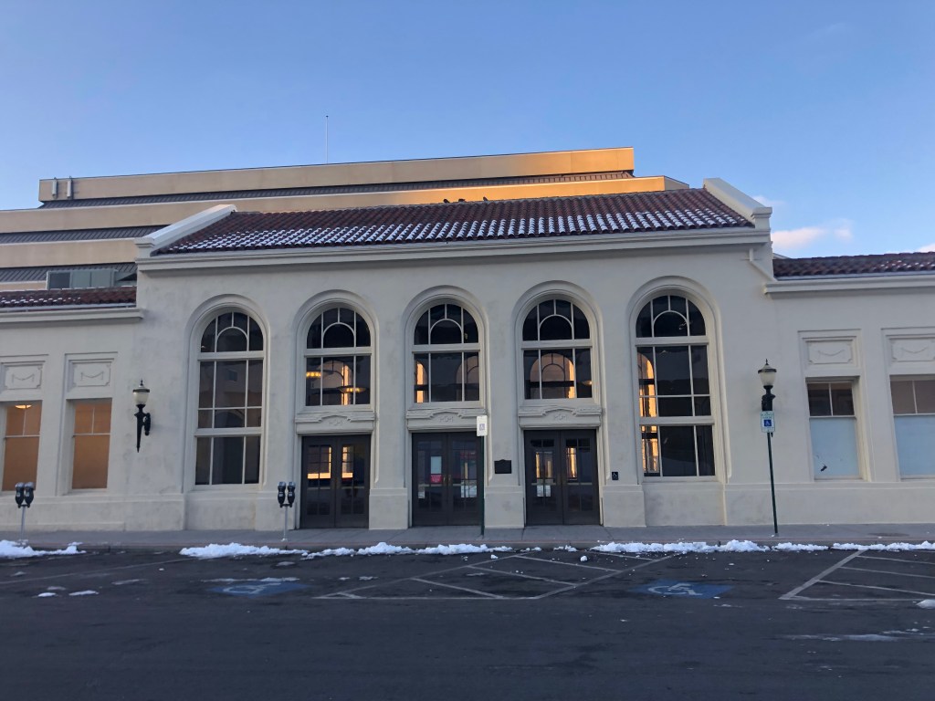
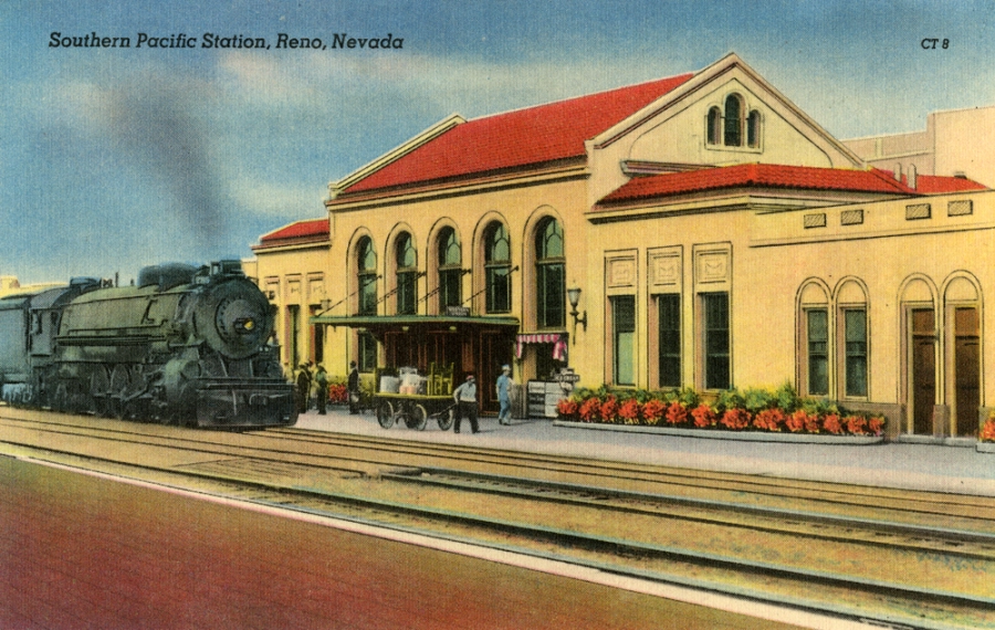
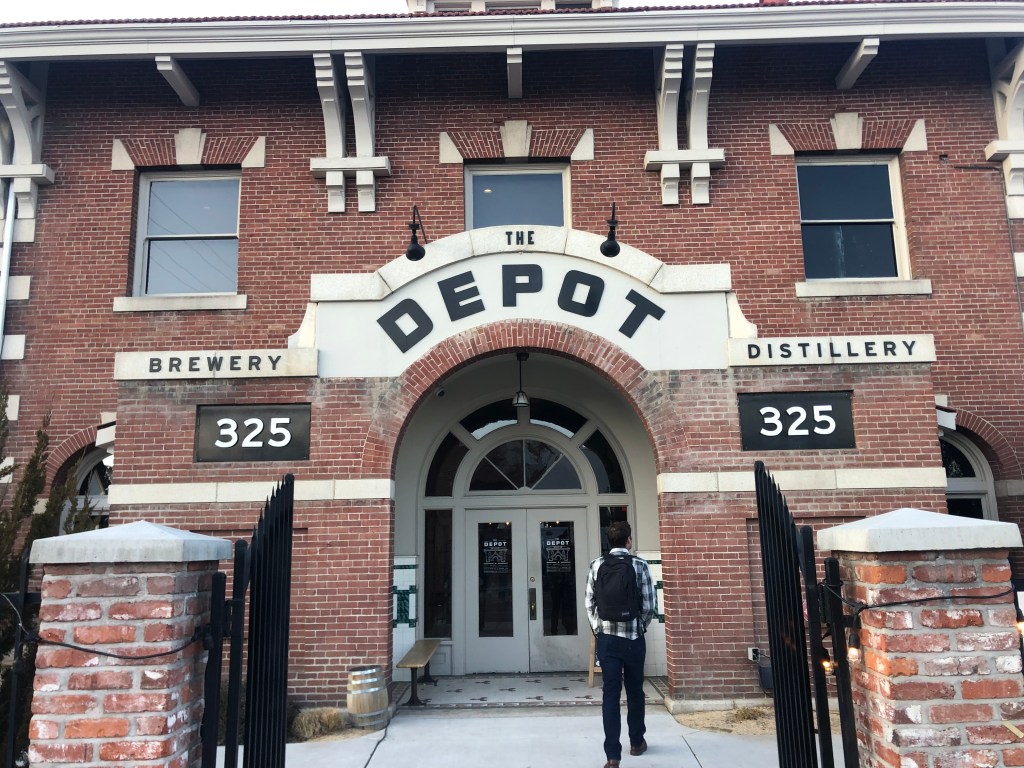
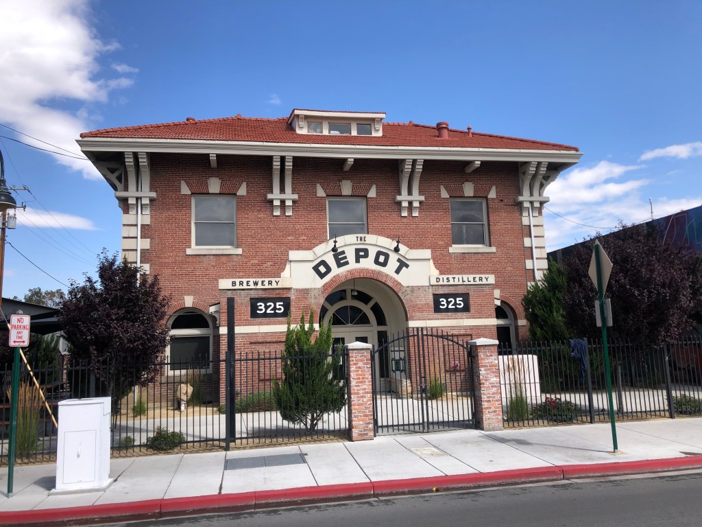
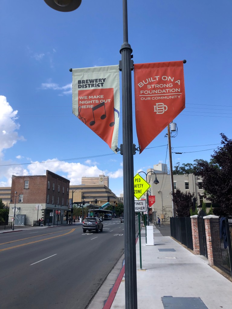
In doing a little research I read that the N-C-O Railway’s southern terminus was in Reno, Nevada, and I recalled that son Ian and I had visited that same depot just last winter. (Scroll down to the BOTD in this post.) It’s now a brewery/distillery, but they’ve keep the original exterior largely intact. The N-C-O also had a major presence in Alturas, which is just west of Eagleville. And the northern terminus was in Lakeview, Oregon, which is just north of Alturas.

Route of the N-C-O Railway.

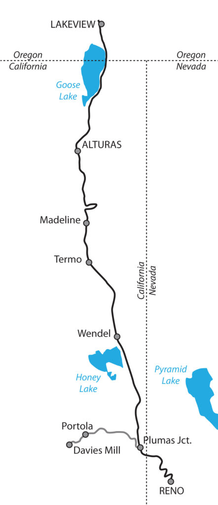
So my plan became clear: my trip to Eagleville would generally follow the entire route of the N-C-O Railway, an I’d be able to visit historic structures in each of the three states served by the railroad.

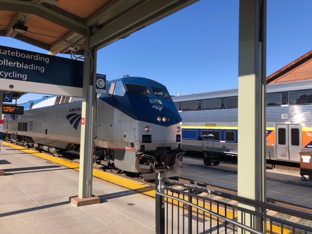
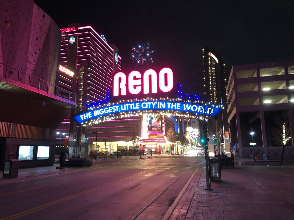
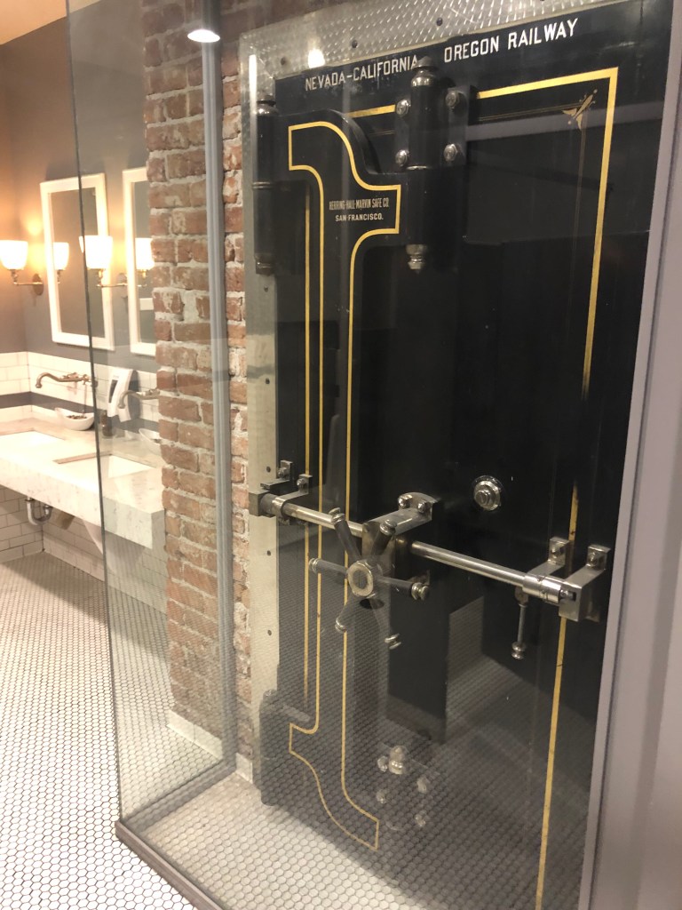
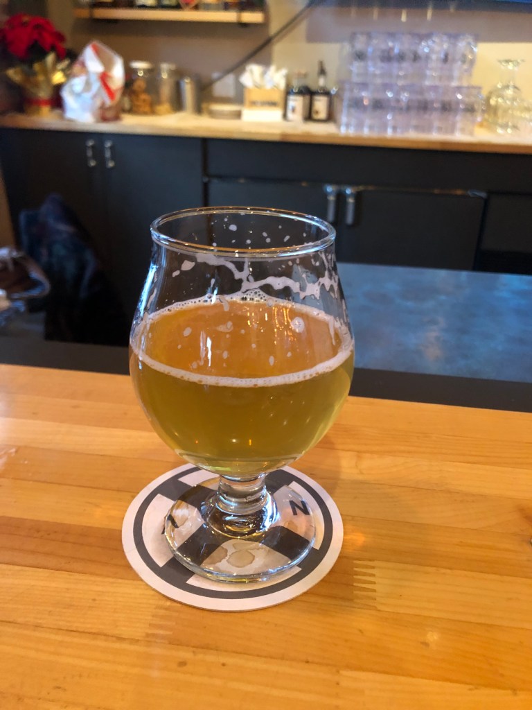
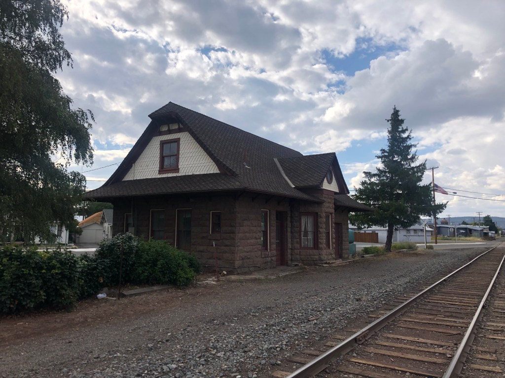
And so this morning I set out on the trusty Speedmaster eastward to Reno (pop: 264,000). Within a couple of hours I was standing in front of the N-C-O’s Reno depot. Originally built in 1910, the building served as a railroad depot until 1937. After that it was used for railroad offices and was finally sold off for non-railroad purposes in 1975. It was eventually abandoned, then in 2014 it underwent renovation to become the brewery/restaurant it is today.

Once the southern terminus of the NCO Railway.
The rail line still runs alongside the Depot.
The Depot sits in the middle of Reno’s Brewery District, alongside a handful of other breweries and distilleries.

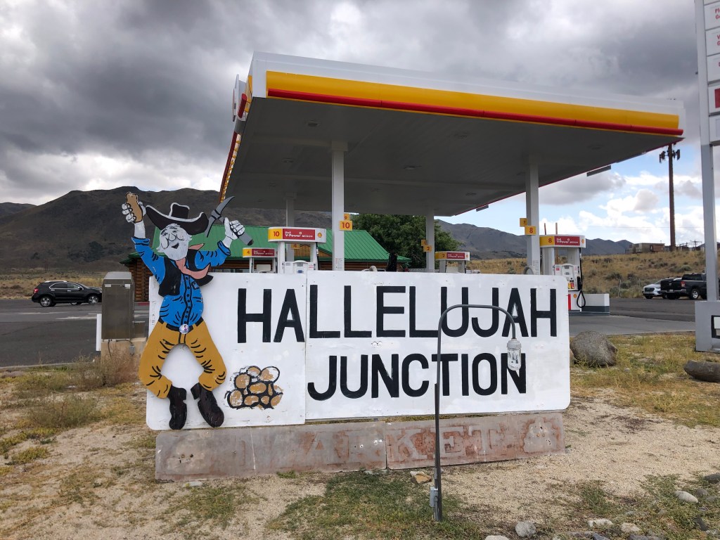
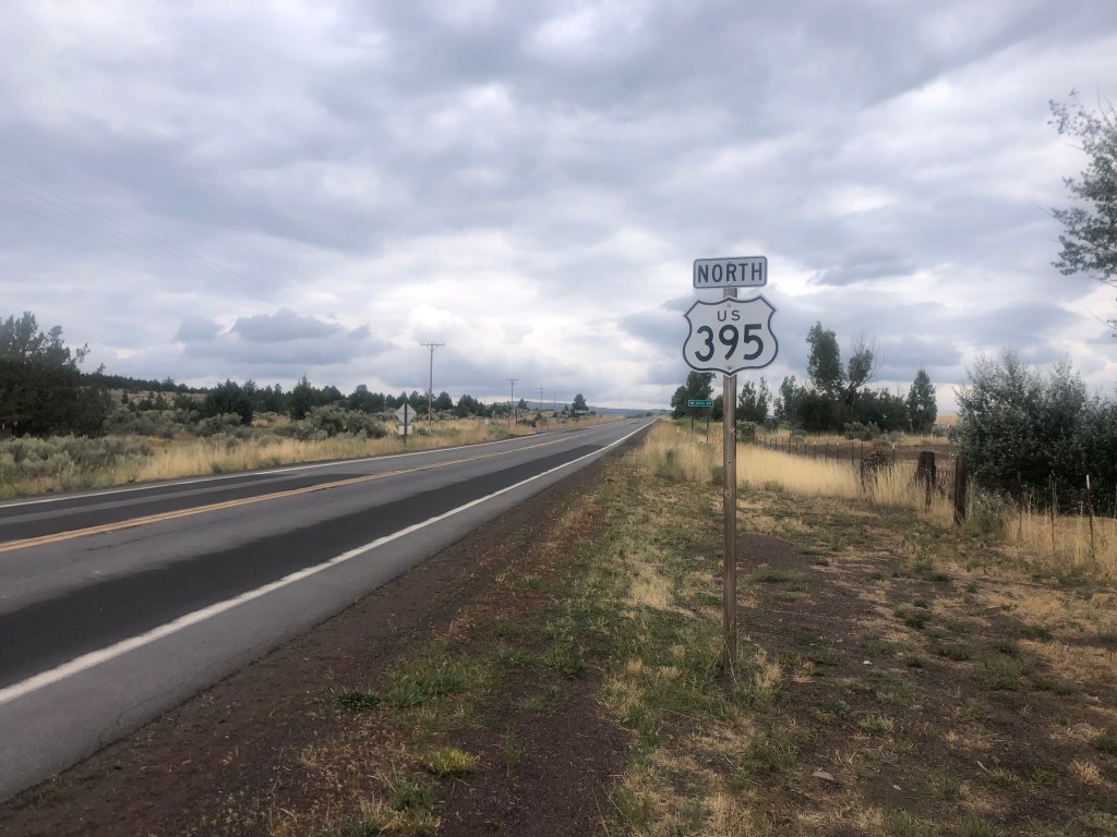
I next headed north on US 395. I’ve written about US 395 before (here and here and here, for example). You’ll recall that Hallelujah Junction (where US 395 intersects with CA-70) holds special significance. So I made a brief stop as as I passed through, to relive the magic.

Where I learned about the Seven Wonders of the Railroad World.

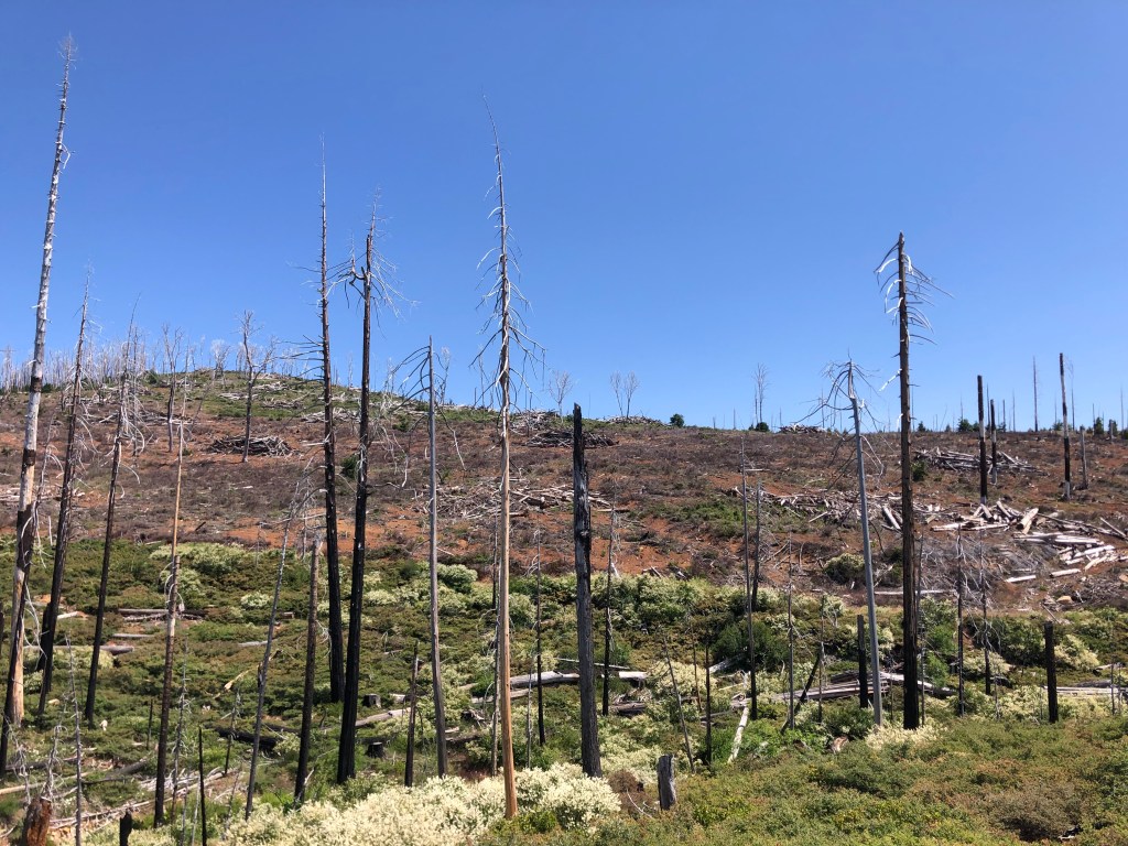
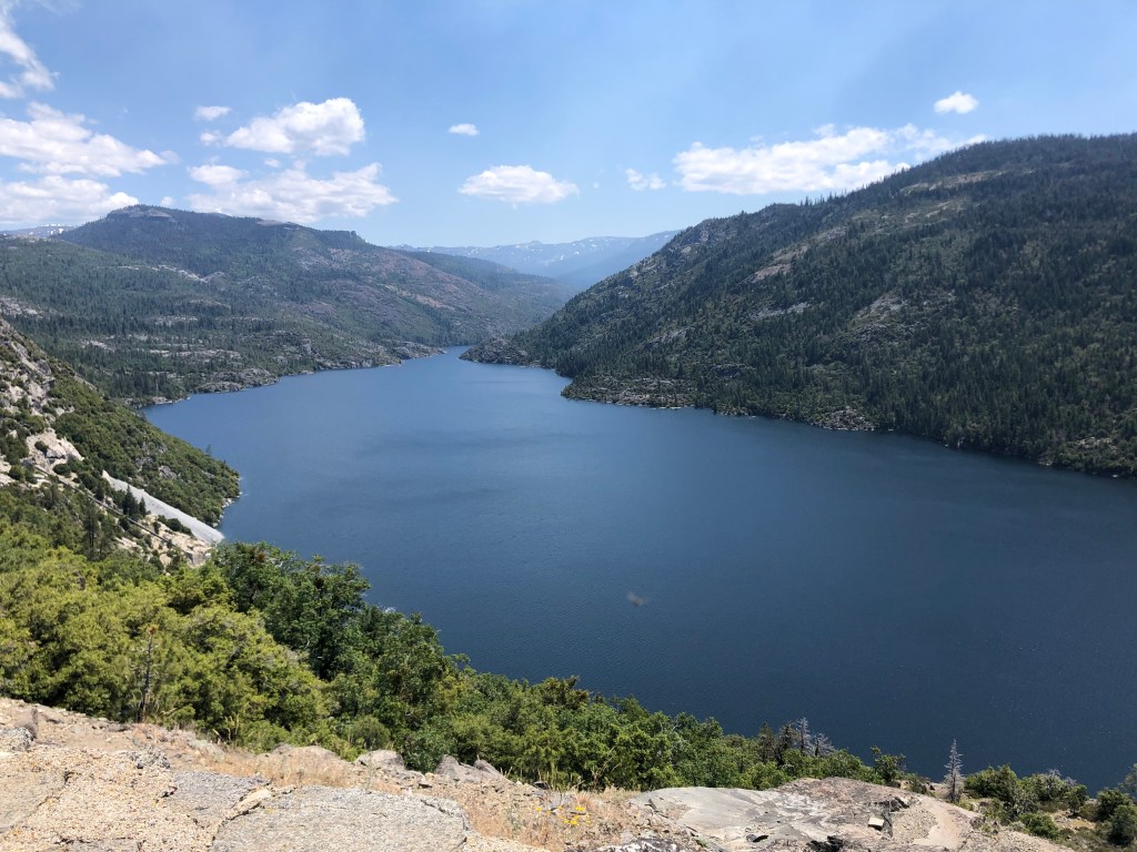
US 395 has a stark beauty to it. You don’t see much in the way of towns or even other cars. The quietude and long horizon are conducive to contemplation if not meditation.

Ommmmm…..

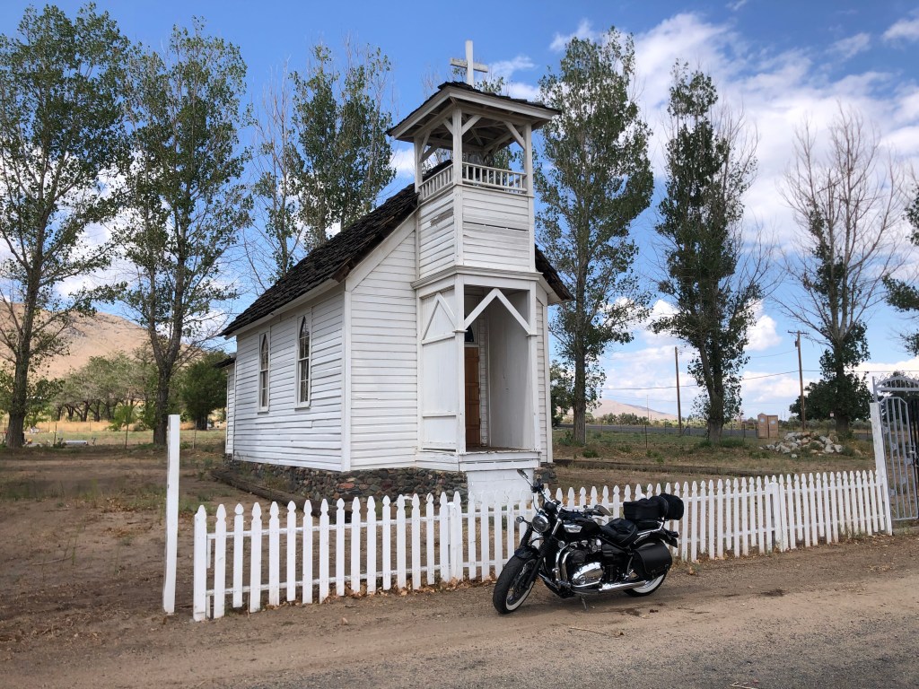
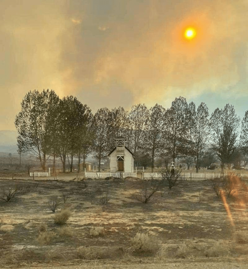
When the rare town does appear, I feel compelled to stop and look around a bit. One such town is Doyle (pop: 700). A couple of years ago Doyle lost much of its housing stock due to wildfires, so there really isn’t much going on here. But I was charmed by this historic chapel that somehow escaped the fire. Constantina Church was built around 1900 about five miles south of Doyle, and infrequent worship services were held there whenever a circuit priest was available. Services stopped around the 1920s, and the chapel was eventually abandoned. The structure was moved to Doyle in 1994, and it appears to be in regular use as a church once again.

Constantina Church today.
Same church in 2021, after the town’s fire.
A historic cemetery is next to the church.

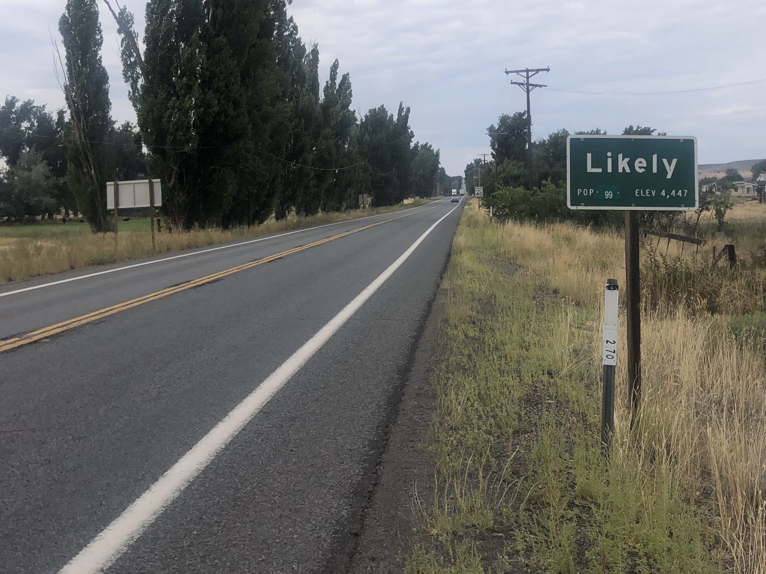
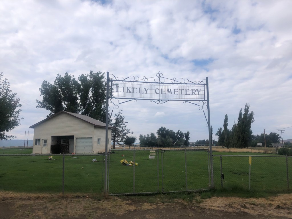
I also passed through the town of Likely (pop: 99). The story goes that, back when the area was being settled, some homesteaders were speculating about whether the settlement would become a proper town. One man (Billy Nelson) reportedly said “There’s likely to be a town here one day, and there’s just as likely not to be. So let’s call it Likely.”

A Likely story.
But we’re not sure.

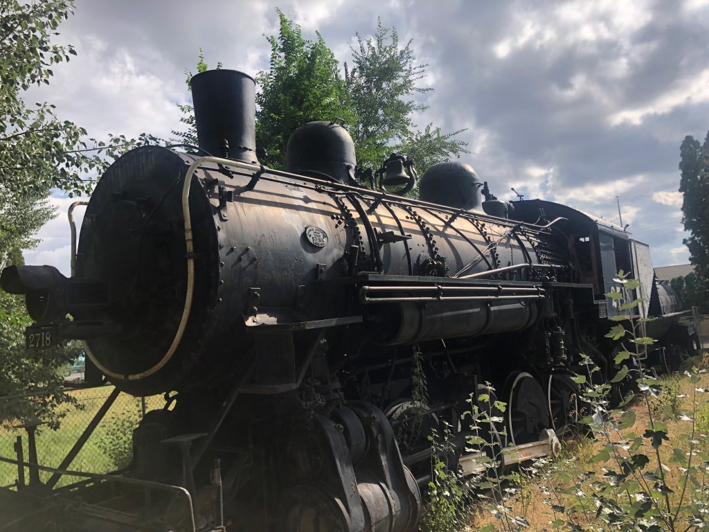
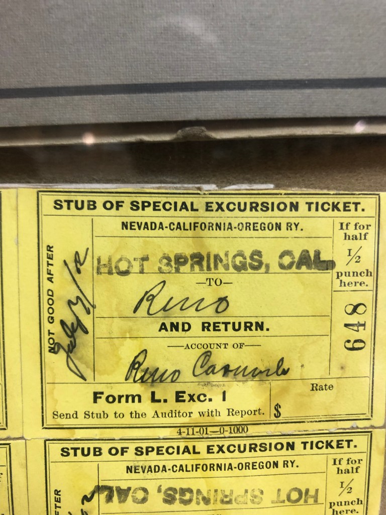
Finally I arrived at the relative metropolis of Alturas (pop: 2,700). Approaching from the south, the first thing you encounter is a striking, if somewhat faded, 1904 steam locomotive that used to run on the NCO line. The locomotive was presented to Alturas in 1956 by Southern Pacific (which had earlier bought up the NCO), and it resides outside the Modoc County Museum.

Standing still since 1956.

The story of the locomotive, as told by the local boosters, makes clear how much the NCO had meant to Alturas:

“This particular locomotive was utilized on the Alturas, California to Reno, Nevada route. The railroad was chartered as N.C.O. (Nevada, California, Oregon) in 1884. It was first established in Alturas in 1908 reaching Lakeview by 1912. The railroad and Alturas have an extensive symbiotic relationship from its inception to the day that Alturas was terminated as a home terminal on January 17, 1972, which was a devastating blow to the city as a large percentage of the population was forced to relocate to Klamath Falls, Oregon. Every business in town interacted with the railroad, whether by the influx of tourists or business travelers when the Southern Pacific offered a passenger service from 1927 to 1938. Even railroad workers who made their home base in Alturas, or stayed in one of the hotels made on impact on the town. The third floor of the Niles Hotel offered dorm style living for the railroad workers for decades. Before and during the time of passenger rails, the Southern Pacific and N.C.O. offered livestock shipment from 1908 to 1972, which provided most of its revenue. This was an option for the ranchers throughout the region to get their livestock to markets and sustained a way of life followed since the pioneers first arrived to this region.”

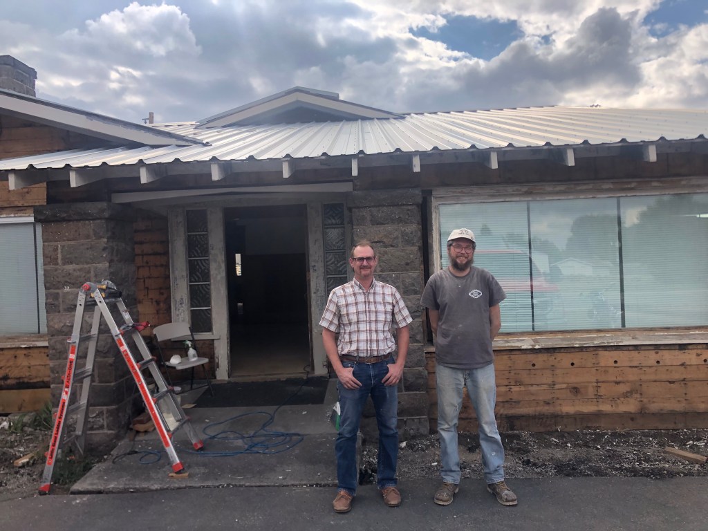
The docent at the museum was incredibly helpful when I told him of my interest in the NCO. He directed me to a place down the road where an old NCO structure was being renovated. “Look for the red truck and ask for Shane.” Dutifully I followed the directions, and was rewarded by the sight of a large NCO sign…and a red truck.

This must be the place….

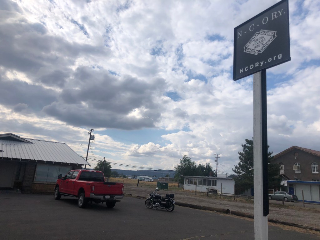
Shane turned out to be the head of a nonprofit organization called the Nevada-California-Oregon Railway. (Evidently the name was free to use.) The nonprofit is working to preserve the history of the NCO railroad, including buildings and rolling stock. The building where I met him (and where he was restoring some woodwork) had once been NCO crew quarters, and Shane’s dream is to turn the building into a museum.

Shane (left) and Andrew, taking a break from restoring the NCO crew quarters on Main Street, Alturas.

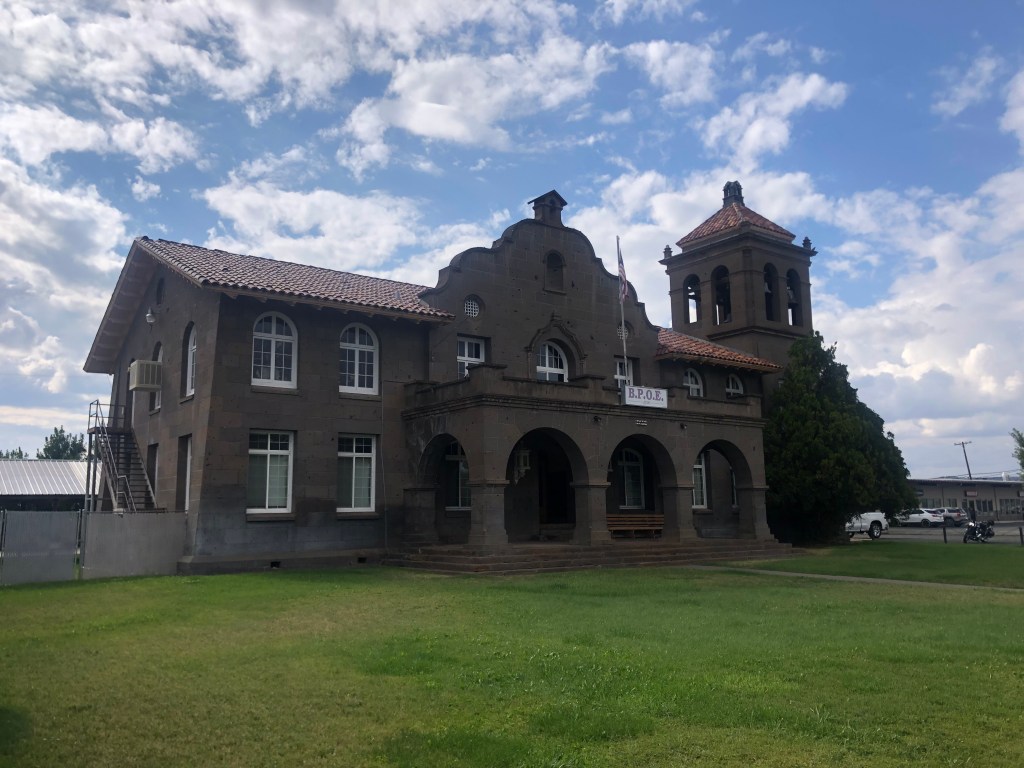
According to Shane, there are several NCO buildings still standing in Alturas. He pointed to a large Mission Revival building that had once served as the NCO’s headquarters. Built in 1918, the building became an Elks Lodge in 1974 and remains such today.

Attentive readers will recall that I encountered this building when I drove through town coming back from my Weiser trip last year. At the time I didn’t put together that this building and the Reno Depot shared the same lineage.
View from the parking lot.

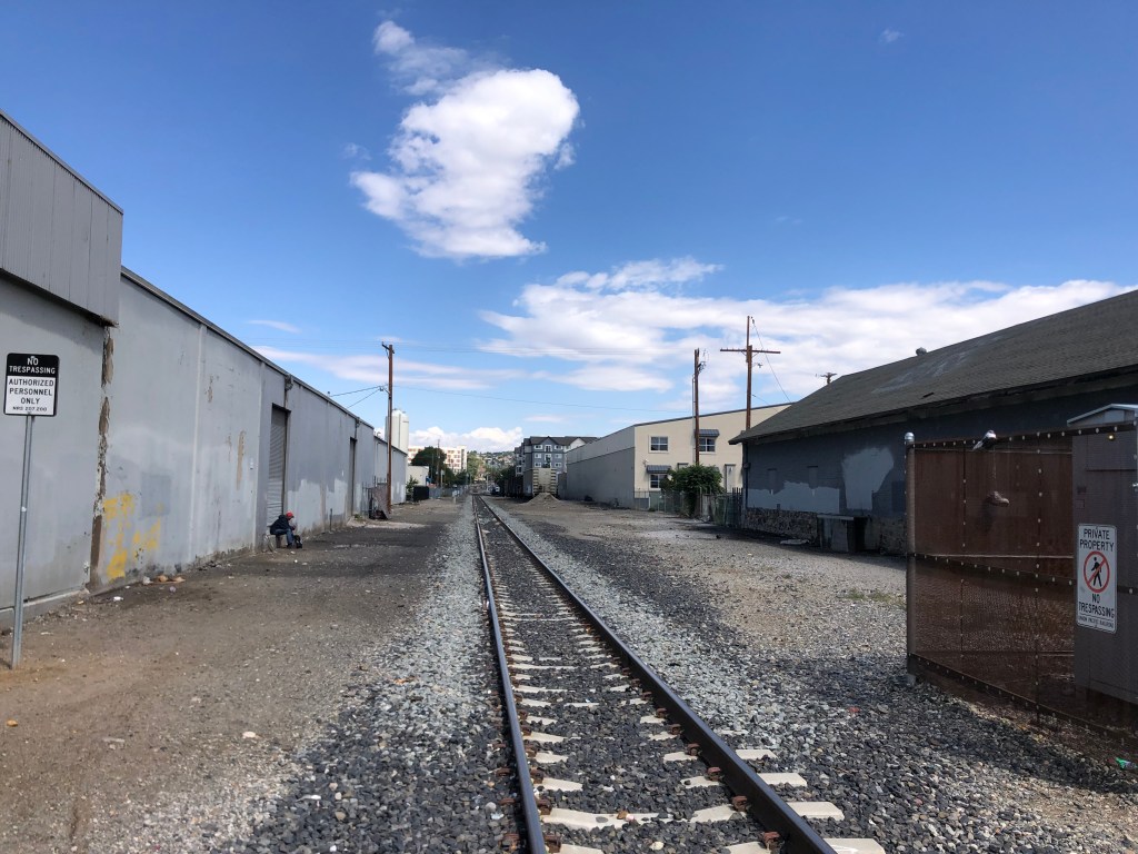
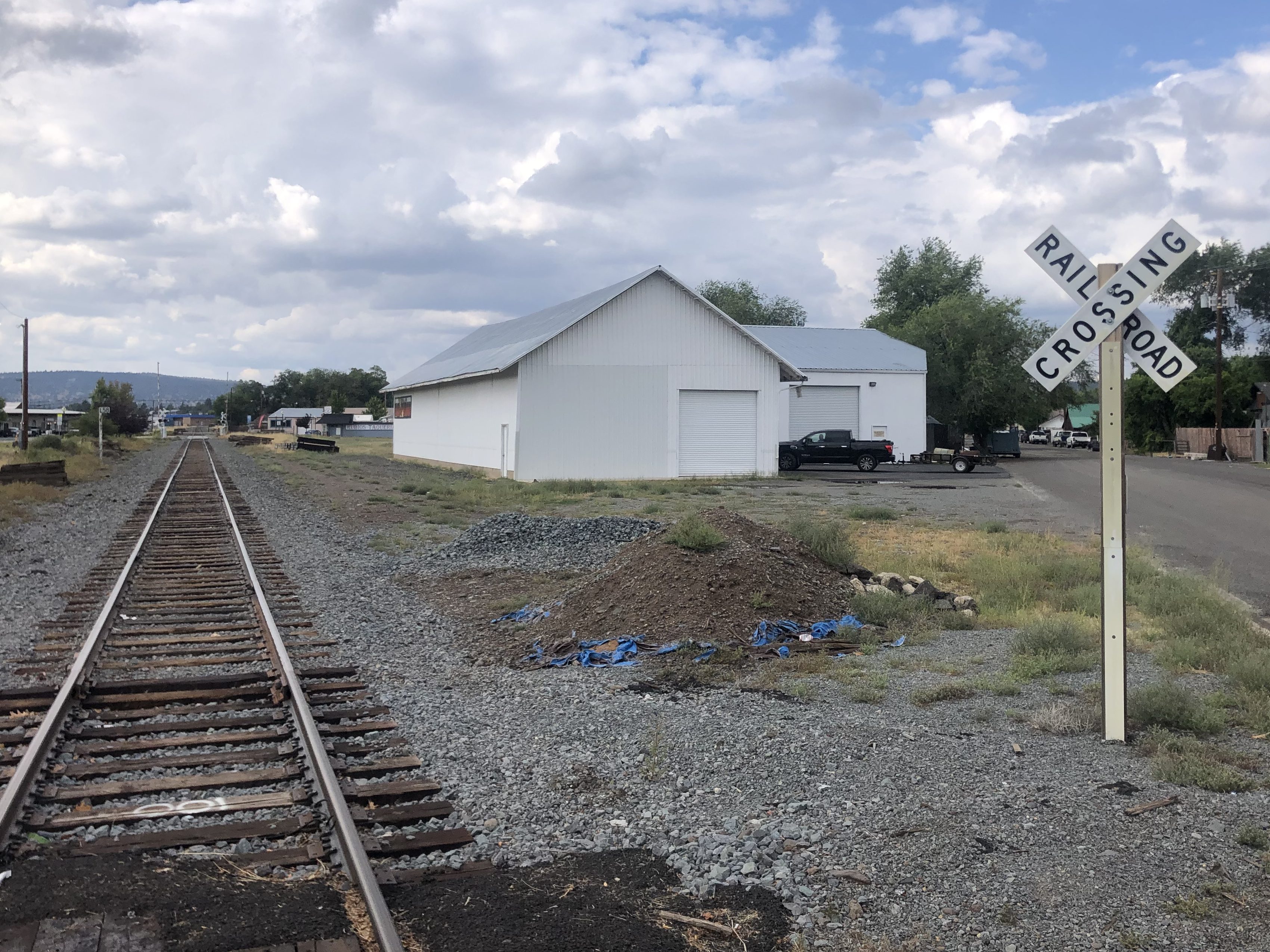
Shane also pointed to a carpet store which had once been the NCO’s freight depot in Alturas.

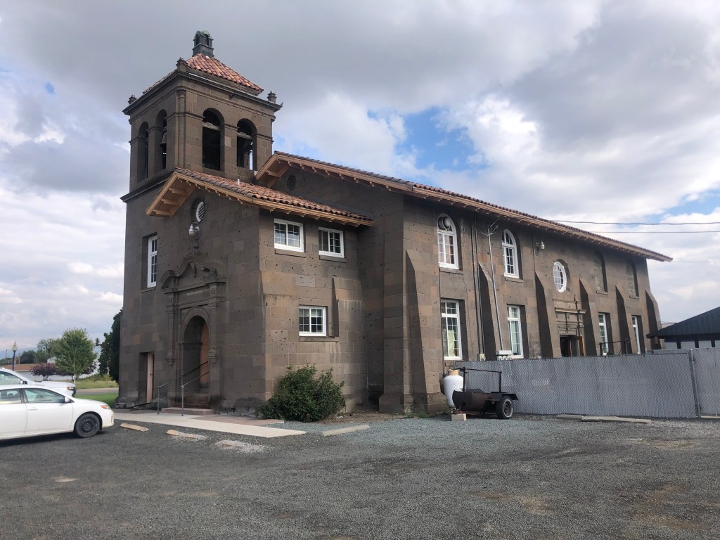
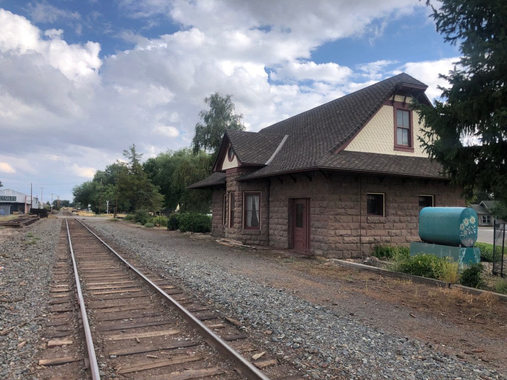
And finally, Shane directed me to the NCO’s passenger depot, which was constructed in 1908. Seven years later, it was decided that the station should be closer to the center of town, so it was moved, stone by stone, several blocks.

Peripatetic depot.

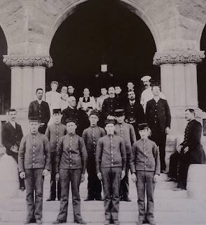
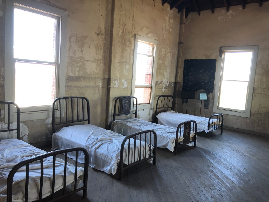
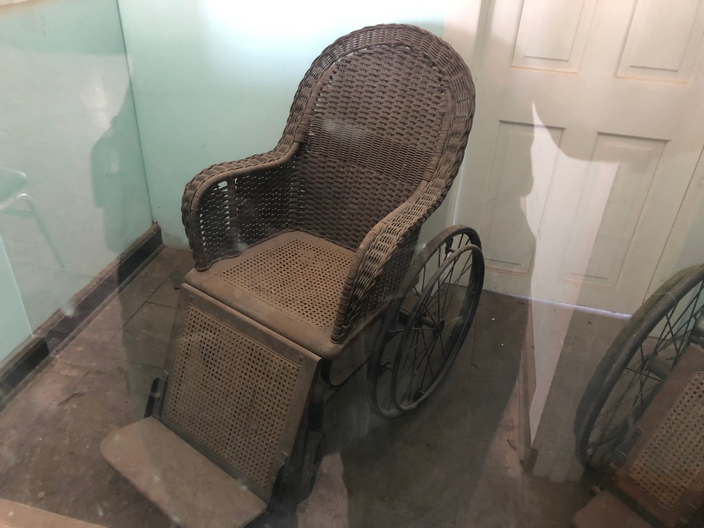
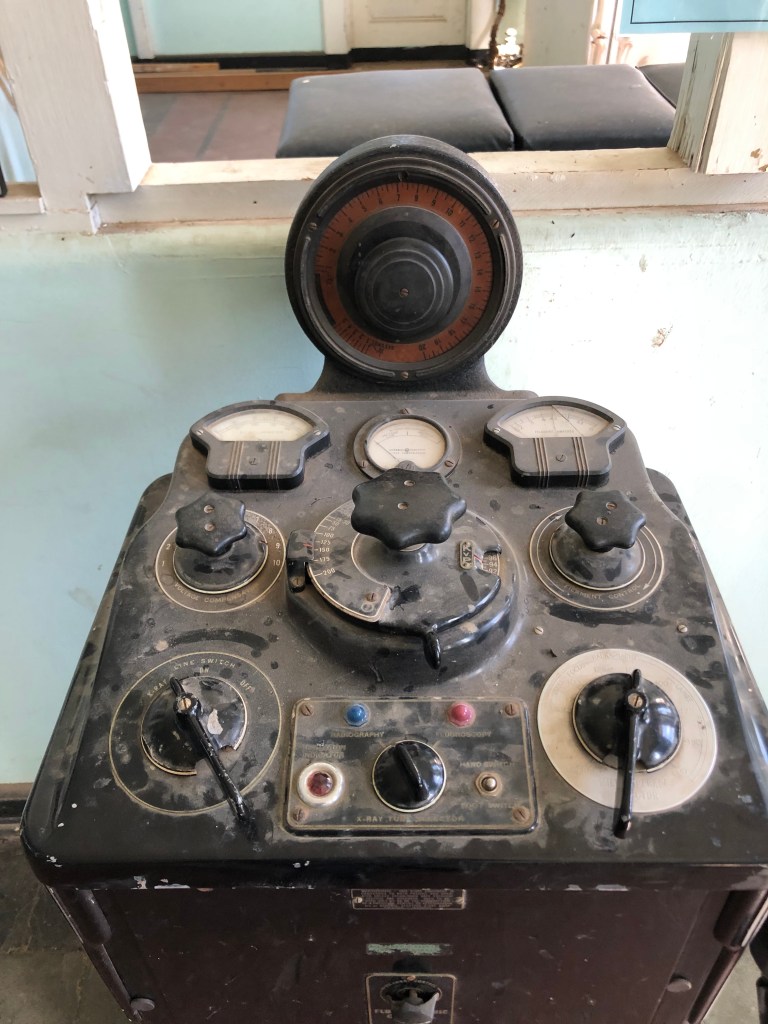
The Southern Pacific RR bought the NCO in 1926, and passenger service to Alturas was discontinued in 1938. Freight service ended in 1988. Still, Alturas remembers the NCO as an influential and pivotal part of its history. Indeed, the Modoc County museum includes a number of photographs and artifacts from the railroad.

I’m holing up for the night in the Hotel Niles, a historic hotel that was built before the First World War. The hotel remains authentic, by which I mean the floors creak and the widows rattle. But it’s a fitting place to spend the night on this day of historical exploration.

This image has an empty alt attribute; its file name is hotel-niles.jpg
I’m on the second floor of the left side.

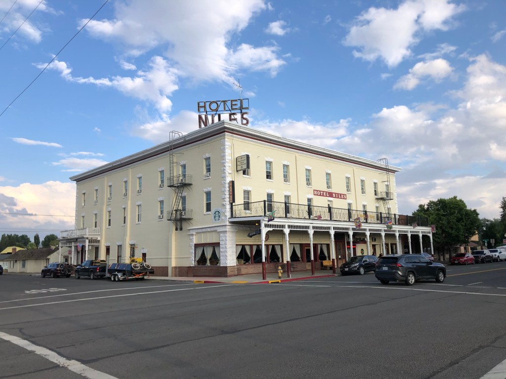
Incidentally, the hotel sits across the street from the Niles Theater. Built in 1937, it dates back to the era of art deco movie palaces. The neon itself is a sight to behold. An unlike many historic theaters, this one still shows first-run movies. (Next week it starts showing the Barbie movie. I’m not making this up.)

Note the telltale pink “B” on the lobby card.
(Night photo c/o the theater’s website.)

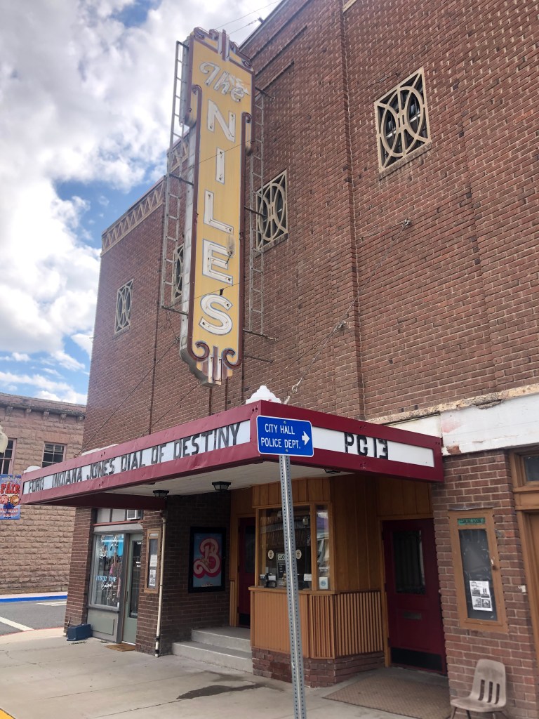
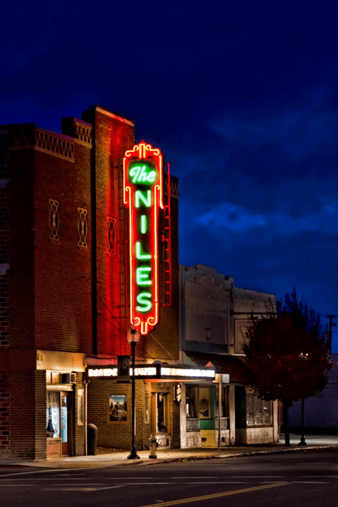
What are the odds that two buildings in such close proximity (the hotel and the theater) would both be named “Niles?” Well, both were built by local businessman J.E. Niles. He was 85 years old when the theater first opened.

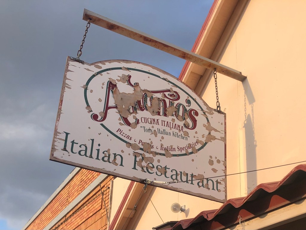
I had dinner down the block at a place called Antonio’s. Sadly I can’t recommend it. Even the BOTD is not worth mentioning.

You’d think I would have taken a hint from the condition of the sign.

Tomorrow I’m making the hour’s drive up to Lakeview to see the northern terminus of the NCO Railway. Then it’s off to Eagleville!

California history · Hydrology · Road trips

Paradise Lost

My friend W (whom you would have read about in my memoir) and I are planning a camping trip in the El Dorado National Forest. The weather has been absolutely beautiful of late, so today I took out the Speedmaster for some reconnaissance in the forested region between Auburn and Lake Tahoe, scouting out possible campsites.

I began by cruising up CA 49 to Coloma (pop: 400, and the birthplace of California’s Gold Rush) then heading northwest to Georgetown (pop: 2,500 and one of the original Gold Rush towns). I had planned to get a bite at a local, historic cafe, but such a thing evidently doesn’t exist in Old Georgetown. Seriously, there’s very little going on in this place. Which puzzled me, because when I came through here a couple of years ago it seemed more viable.

Unexplained dinosaur with ladybug costume at a Chevron station in Georgetown.

From Georgetown I continued east, immediately entering the El Dorado National Forest. Soon I encountered Stumpy Meadows Reservoir. It’s a peaceful, attractive spot with campsites and picnic facilities. As with many of California’s reservoirs, this one was created as part of the water infrastructure binge in the 1950s and 1960s. The Mark Edson Dam was constructed in 1960, and soon after the meadows were under a lake. Incidentally, the Edson dam is named after the first engineer at California’s Department of Water Resources. The reservoir was named after Edson at the same time, but soon thereafter, for reasons that are not entirely clear, descendants of the meadows’ original owner successfully lobbied to have the name changed to Stumpy Meadows Reservoir.

I was transfixed by this spillway on the edge of Stumpy Meadows Reservoir.
Another view of the spillway.

Continuing eastward I soon passed through huge swaths of charred forest that resulted from last year’s Mosquito Fire. That wildfire burned over 76,000 acres of land and destroyed or damaged almost 100 structures. It’s hard to wrap your head around the amount of destruction that can occur in just a short time…and how long it will take to grow back. No specific cause has been officially ascribed to the fire, although documents, news reports, and various lawsuits and criminal investigations all center on PG&E.

Thanks, PG&E.

Eventually I passed beyond this hellscape and was again surrounded by green forest. I identified several prime camping spots that W and I might try out. And then I came upon something unusual:

I had a devil of a time finding this place…

The name Hell Hole certainly doesn’t conjure up idyllic landscapes the way the names Sugar Pine and Emerald Bay and even Stumpy Meadows do. In fact, it seems like the opposite of what you’d want for a campground. The name reminds me more of my first, cramped apartment, located in a shabby building in a gritty part of Sacramento. It also brings to mind a song by the fictitious heavy metal “band” Spinal Tap.

“Hell Hole” also got me thinking about an earlier trip to Devil’s Gate Dam in Pasadena, where a rock outcropping supposedly resembles a profile of the devil. Here’s my photo from that trip:

You don’t see it? How about now:

Anyway, the Hell Hole campground gets its name from the Hell Hole Reservoir, which got its name from Hell Hole canyon which it filled. Wikipedia gives this account of the name:

How the canyon came to be named Hell Hole is a combination of folklore and speculation. An early author, George Wharton James (1858–1923), visited the canyon in 1913.[2] He attributed the name to an unidentified miner seeking riches during the Squaw Valley mining excitement of 1862. It was “a hell of hole to get out of,” James wrote, but admitted his source for the place name was more speculative than the anonymous miner’s chances for riches at Squaw Valley.

The reservoir was created in 1966 when the Placer County Water Agency dammed the Rubicon River. Covering about 1,250 acres, it’s a good-size reservoir. And despite its name, it’s a beautiful setting.

Dam this Hell Hole!

I hiked up to a scenic overlook, where I passed an enjoyable 30 minutes just looking at the scenery and enjoying the warm sunshine.

Three words that don’t normally go together.

After chatting with some campers and making a mental note of this area for my outing with W, I figured it was time to start heading back. For my return trip, I planned to take Mosquito Ridge Road west to the town of Foresthill (pop: 1500), and then head home on CA-49 South. Mosquito Ridge Road is narrow and windy, and the asphalt is potholed and cracked, but the surrounding scenery made it worth the inconvenience.

Mosquito Ridge Road, in red. Hell Hole reservoir is on the center-right edge of the map.

When I got on to Mosquito Ridge a sign informed me that Foresthill was 45 miles away, so I settled in for a long, slow ride. About halfway through my journey I encountered this unwelcome sight:

Not again…

Attentive readers will recall that I’ve run into numerous road closures in my travels. It’s especially inconvenient for me as I’m riding a motorcycle with a small gas tank, so unexpected backtracking in remote areas can be stressful. What’s more irritating is this closure came with no forewarning, and the roadblock itself doesn’t really explain what’s going on. Indeed, instead of a “road closed” sign or something equally straightforward, there’s just a xeroxed office memo tacked to a folding barricade.

Excuse me while I consult with my lawyer…

This “forest order” cites “Section U.S.C. Sec. 551 and C.F.R….” blah blah blah… What caught my eye, though was the reference to a $5000 fine and 6 months in jail. Rather than figure out the specific coordinates of the prohibited zones and the details of the exemptions, I just turned around and went back towards the Hell Hole, and then retraced by initial route through the charred hellscape back to Georgetown, hoping I wouldn’t run out of gas.

And then, as if on cue, I encountered a second unwelcome sight: A forest fire!

Where there’s smoke…

Feeling a little panicky, I got out my phone to call 911. But there’s no service out here in the middle of nowhere. I decided to find a ranger station at the Hell Hole. But then I noticed a portable, electronic sign board: “RX BURN. DO NOT REPORT.” I interpreted this to mean “prescribed burn,” even though technically their sign says “prescription burn.” What would Section U.S.C. 551 have to say about that?

The rest of the trip was uneventful. I got to Georgetown with 7 miles left in the tank, and I got home in time for cocktails. It was a hell of a trip.

California history · Road trips · trains

Bodhisattva, won’t you take me by the hand?

Relax, young Grasshopper. The title will become clear if you are patient…

This morning I set out from Benicia on the trusty Speedmaster

After a pleasant ride skirting the top of San Pablo Bay and cutting up through the wine country, I joined US 101 (or, as my southern-California-reared wife calls it, “the” 101) at Petaluma. Petaluma (pop: 60,000) seems to have a penchant for public art. Take, for example, this 1920s-era PG&E substation. I really appreciate this kind of public art–whimsical, approachable, understandable. Kudos to you, Joel Jones, who conceived and designed the thing!

One of my pet peeves is wall plates that don’t match the color of the outlet. But I’ll let this one slide as an artistic choice.

Close by the substation is some more public art, this time at Petaluma’s historic freight station building, which has been converted to an “arts center”. The effort here seems to be shooting for edgy. Which is another way of saying “head-scratchy.”

War of the Worlds meets Dobie Gillis.
Now that’s a buxom bird.

Not long after leaving Petaluma, US 101 narrows down to a couple of lanes. The countryside is open and green. There’s an old set of Northwestern Pacific Railroad tracks that run along the east side of the highway, but no train has run on these tracks since….well, probably since that Petaluma arts center was still a freight depot.

Finally I arrived at Ukiah (pop: 16,500), which is technically the beginning of the prefab road trip that Ian sent me. The first stop listed is the Grace Hudson Museum and Sun House (cost: $4 senior admission). Grace Hudson (1865-1937) was a California native who became an accomplished artist, working mainly in painting portraits. In 1911 she and her husband built a craftsman-style home they called “Sun House,” which was donated to the City of Ukiah by her heirs. I toured it today. It’s a pleasant, comfortable house, and notably it feels as though Grace just left this morning. It’s full of her furnishings and personal possessions.

The Sun House

Next to the Sun House is a museum that includes a number of examples of Grace’s work, including this self-portrait done when she was a teenager.

The museum also has a temporary exhibition called “Artistic Reflections on the Back to Land Movement.” I’m not sure what that means; it mainly seemed to show a bunch of naked hippies.

The docent (Janice) tried to educate me about these things, but I’m too much of a Philistine to understand. However, in the course of our conversation she mentioned she’d once worked at the nearby Buddhist monastary called the “City of 10,000 Buddhas.” Now that sounded interesting. It’s not technically part of this road prefab road trip, but I figured I’d drop in on the monks. And I’m glad I did!

The moment I entered the grounds I felt relaxed and at peace. Large open spaces, plenty of trees, winding paths, almost no cars. Peacocks roamed about and didn’t seem concerned about an approaching visitor. I’m not making this up.

Now, I should mention that when I lived in Palos Verdes, our street was overrun with peacocks. And let me tell you, they are noisy, dirty, creatures. But you can’t deny that they’re also beautiful.

As I strolled through the campus, every so often I would pass a monk (at least, someone I assumed to be a monk), and he would bow while steepling his hands. It all seemed so mellow. Even the street signs were positive, with names like Joyous, Sincerity, and Mindfulness.

In the center of the campus is the Jeweled Hall. It is here that the eponymous 10,000 Buddhas reside.

It doesn’t look like much from the outside…but that’s because it’s a repurposed building from the old Mendocino State Asylum for the Insane. And no, I’m not making this up.
Start counting the Buddhas. And this is only the anteroom.
The Bodhisattva. Steely Dan had a song by that name, which we played endlessly in college. Part of the refrain is the same as the title of this post.

The City of 10,000 Buddhas was founded in the 1970s by Hsuan Hua, a Buddhist Monk who wanted to bring Buddhism to the West. The site had been the Mendocino State Asylum for the Insane since 1889. The “city” sits on about 500 acres of land.

As I was getting ready to leave, I found that one of the peacocks was taking an interest in my motorcycle.

I was ready to shoo it away, but the guy seemed so calm…so Zen. These peacocks seem to be so much more pleasant than the ones I remember from Palos Verdes. Or am I just becoming more at one with the world?

With resignation I left this refuge and re-entered modern society. I got back on the highway and headed north to Willits (pop: 5000).

My road trip guide tells me the Mendocino County Museum is next. It didn’t look like much from the outside, but I dutifully went in and paid my $5.

How can I put this? The place didn’t really burnish my Buddha. It might be because I’ve been to a lot of museums at this point in my life. I mean, how many sets of old-timey dentist tools does a person need to see? They had the usual stuff: A recreation of the town soda fountain, old household appliances, a lot of photos. The one thing that did catch my interest was the display on the racehorse Seabiscuit. It tuns out that Seabiscuit was bred on a farm right here in WIllits. Who knew??

And the other fun fact is that Charles Howard (who owned Seabiscuit) also owned a dog he called “Wee Biscuit.”

But….habeus corpus??

Willits, by the way, is the western terminus of the Skunk Railroad, which runs from Fort Bragg. I inquired at the station and learned that a collapsed tunnel still hasn’t been repaired, so the rail journey has been indefinitely suspended. You can read more about it in this post from last year.

Next I headed up the highway toward Leggett (pop: 77) and its “world famous drive-thru tree.” But before I got there, I saw this sign on the road:

I’m sure this involves controlled substances in some way.

I pulled off the road into this compound of brightly painted, old buildings.

Given the sign at the road, I assumed this was something open to the public. So I walked around a bit, taking in the “scene” (as they say). Soon I was facing “John-boy” (as he called himself).

Not a Walton.

John-boy was an interesting chap. He wasn’t unfriendly, but he really wasn’t overly friendly either. He dutifully answered my questions about the place, which is supposedly a “venue.” When I asked him what kind of event is coming up next at this venue, he said “Uh, there’s something next month, but I don’t remember what.” (A later Google search informed me that the place is an old gas station site that now is a medical marijuana farming collective.) There is a statue of the Virgin Mary and other religious icons. Then I noticed a Buddha:

Now I was up to 10,001 Buddhas for the day! I asked John-boy about its significance, and he told me “It’s where we hide our money. We wrote it off for tax purposes.” I’m still not sure what that means. When I told him that I’d just come from the City of 10,000 Buddhas, he pointed to a rock fountain and said “that’s a lady who used to live at the City of 10,000 Buddhas.” He said when she died her ashes were scattered around the fountain. He also said she claimed to be a psychic named Anastasia, “but I think she was just a busy-body.” And yet, this skeptic about psychics also told me that the world was controlled by aliens ever since our 1940s-era atomic tests ripped a hole in the space-time continuum. I decided it was time to go.

Within half an hour I was at the famous drive-thru Chandelier Tree (cost: $15 for cars, but only $10 for motorcycles). It’s a 276-foot-tall coast redwood that’s estimated to be about 2,400 years old. The hole was cut to make it a tourist attraction in the 1930s. Attentive readers will recall that I drove through this once before, but that was at a time when this blog was just a series of homemade Word documents emailed to a select few folks. So there’s no record of it here on WordPress. Now there is.

So, I’m now in the thick of the 1950s-era roadside attractions. I passed a “tree house” attraction, but didn’t stop as it was starting to get late and it wasn’t on my pre-fab list. But what was on my list was Confusion Hill.

Confusion Hill is a quintessential roadside tourist attraction with food, a kids play area, restrooms, souvenirs, penny-smashing machines, etc. But it also has a “gravity house,” which is an old shack built at odd angles to create optical illusions. They play up how gravity doesn’t work properly at this spot due to various theories about meteorites, aliens, etc. My dad took the family to one of these in Santa Cruz (“The Mystery Spot”) when I was a kid. It was fun, but Dad (ever the engineer) got into an argument with the tour guide over the proper use of a level to measure angles.

Anyway, at Confusion Hill I asked how this place differed from The Mystery Spot. “Ours is authentic” came the response from the woman behind the counter. She was Carol Campbell, the owner of the place.

Carol Campbell, owner of the authentic Confusion Hill.

Carol also told me that there’s a third place — The Oregon Vortex — which was exposed as a fraud on The History Channel two nights ago. I paid my $5 and checked out the gravity house. It was exactly like the one I remembered from my childhood visit to the Mystery Spot. But I have to admit, the place feels fun and welcoming and good-natured. It’s well worth $5.

There are various other roadside attractions in this area, mostly tree-related.

The Grandfather Tree–265 feet tall and 1,800 years old.

My prefab trip does include a second drive-through tree. This one is called the Shrine Tree. I drove by, but it was getting too late. Besides, who needs to drive through two trees in one day? That said, the Shrine Tree only costs $8 for motorcycles.

Now it was time to drive through the Avenue of the Giants–a 32-mile scenic highway to wends its way through various groves of ancient redwoods….some of which are well over 1,000 years old. It was a beautiful drive that returned me to the Zen state I felt when at the City of 10,000 Buddhas.

And suddenly, it was all over! I had spent $76 (including food and gas along the 130-mile drive). So yes, you can do it for under $100!

I checked into a cheap hotel in Fortuna, and will head back to Placerville via a circuitous route tomorrow. I may make another post if I encounter anything notable. But otherwise, I’ll leave you with the:

BREW OF THE DAY

The BOTD was a Palace Porter from the estimable Ukiah Brewing Company.

It tastes like a dry porter. For a porter this one is pretty heavily hopped (particularly on the finish, which is positively bitter). It has the roasty, malty notes you expect in a porter, but there’s not much complexity beyond that. Maybe I taste a little burnt toast on the front end. It’s got a creamy head, and nice lacing on the side of the glass.

It weighs in at 6.7 ABV. It’s perfectly serviceable, but nothing to write home about. 3.5 out of 5 stars.

California history · Hydrology · trains

Polar Express

In the 1860s, the Central Pacific Railroad began laying tracks from Sacramento that would cross the Sierra Nevada mountain range and eventually connect with tracks that the Union Pacific was laying westward from Omaha. The two railroads were joined at Promontory Point, Utah on May 10, 1869. The country’s first transcontinental railroad was complete.

“The Driving of the Last Spike,” by Thomas Hill (1881). This painting, which isn’t entirely historically accurate, hangs in the California State Railroad Museum in Sacramento.

Much of the new railroad was hurriedly and haphazardly put down in a relatively straight shot across the Great Plains. But the much more difficult, dangerous, and impressive work involved cutting a roadbed across the Sierras. Fifteen tunnels would have to be dug through solid granite, using hand tools and blasting powder. Daily progress was measured in mere inches. In addition to the tunnels, various cuts, fills, and bridges were constructed to keep the roadbed at a manageably gradual incline. And because of the heavy snowfall in the Sierras, about 40 miles of snowsheds were built to protect tracks in the areas given to especially heavy snow and avalanches.

No picnic.

Today, over 150 years later, most of the original route is still in daily operation. (Some small improvements to the route have been made over the years, most notably the abandonment of the 1,687-foot long Summit Tunnel at Donner Pass. My friend Bill and I were able to walk through that abandoned tunnel a few years ago.)

Bill, literally walking in the footsteps of Chinese railroad workers.

Amtrak (the country’s only remaining interstate passenger railroad) runs a daily train called The California Zephyr between Chicago and San Francisco, and naturally it travels the historic route over the Sierras. Now, you can catch glimpses of the railroad and its tunnels and snowsheds from your car window on Interstate 80, which roughly parallels the railroad. (I recommend the book Sierra Crossing by Thomas Howard, which describes the history of various routes over the Sierra Nevada.) But by car you just can’t appreciate the engineering marvel that is the Sierra route as well as you can by riding the rails themselves.

And so it was that, a few years back, my son (Ian) and I flew out to Chicago and boarded the California Zephyr. We were excited to experience the Sierra passage from the window of our compartment. But alas, Amtrak (which notoriously and habitually runs late) reached the Sierras not at midday as scheduled, but rather in the middle of the night as we slept.

Yesterday Ian and I tried again. This time we are boarding at the historic Sacramento station and heading east. We’re only taking the Zephyr as far as Reno, because the whole point of this trip is to finally experience the Sierra crossing in daylight.

The historic Sacramento Station, built by the Southern Pacific in 1926.
Interior of the station, in all its Renaissance Revival glory.
The California Zephyr arrived on time!

As the train started rolling we settled into our seats and began watching out the window at rather sketchy parts of Sacramento, Citrus Heights, and Roseville. We decided this might be a little more tolerable if we had beer, so we repaired to the club car. Fortified with our beers and some microwaved food, the scenery began to improve. Upstairs from the snack bar is a friendly and casual observation area, with nice big vista-dome windows and comfy chairs and tables. This is where we spent most of the trip.

Everyone loves the Vista Dome.

After a bit we started to climb into the foothills, and soon we encountered snow. Our climb over the Sierra had begun!

There’s something very relaxing about watching scenery through the window of a railroad car. The train moves steadily and smoothly, and the car is warm and comfortable. The passengers adopt an attitude like they’re in their own living rooms. Young parents entertain their kids, college students take pictures and send text messages, an older couple plays cards. One friendly guy was gushing to his seatmate about how he prefers train travel to the stress and hassle of flying. A few people were napping. Many just watched out the windows. It’s a remarkably relaxed way to travel, where you wear no seatbelt, you have freedom to move from room to room, and someone else up at the front of the train is in charge of getting you where you need to go.

Of course, I had my own specific interest in this particular route. I kept trying to imagine how the Central Pacific work crews managed to build this railroad over the Sierras using 1860s technology. They worked in subfreezing temperatures and massive snow drifts battling avalanches, gravity, and relentless granite walls. And yet they completed the job in just a few years. It’s hard to imagine CalTrans, even with all its modern equipment, ever matching that record.

After a few hours we reached Donner Pass at about 7,000 feet. The snow was at its thickest here, but it was pretty scanty by historic standards. A snowplow had passed through about a week earlier. Fortunately, brother-in-law Scott found a video of that very event: The plowing of Donner Pass around December 10.

The other thing I really like about going over the Sierra by train is the visual access to California’s remote and relatively untouched lands. In the more urbanized parts of the state where most of us live, very little evidence of our history remains. Historic buildings are torn down as soon as they are deemed “outdated.” Those that do remain are often rebuilt with modern materials or modified for ADA access. But here in the Sierra it’s not unusual to see 150-year-old relics still standing proud–Like many of those original tunnels that we passed through.

I did not take this photo, since I was onboard the train! Photo taken by Tom Taylor, who does excellent railroad photography.

Another relic from a century ago is a collection of wooden flumes conducting water along the Truckee River. The water powers several century-old hydroelectric plants that are still in operation today.

The Truckee River.
The flume is the railroad-track-like structure at the lower third of the photo. Note the icicles hanging beneath. Evidently the wooden flumes aren’t watertight.

Speaking of Truckee, the town still has its old Southern Pacific station from 1900. It’s remarkably well preserved, and according to “The Great American Stations” website, “Renovations and modernization in 1985 altered the historic fabric only slightly.”

Careful standing under those eaves!

Eventually we got over the Sierras and dropped into Reno, NV (pop: 270,000). Reno’s current Amtrak station was grafted onto the city’s 1926 Southern Pacific depot in 2005. That same project lowered the railroad tracks into a 2-mile long ditch (a two-track-wide concrete canyon), in order to eliminate 11 grade crossings at street level. We got off the train down in this concrete canyon, enter a waiting room, and then climb stairs to the street level.

The Reno station at street level. (This is the original Southern Pacific portion of the structure; the Amtrak section is to the left.)
Reno’s Southern Pacific station in the steam era.

So, that’s about it for our Amtrak adventure over the Sierra. (We returned today, but obviously covered the exact same ground.) But it’s worth noting that we spent some time walking around Reno last night…

…and naturally I was able to squeeze in a Brew of the Day. So, without further ado, I present:

THE BREW OF THE DAY

Just a few blocks from the Reno station is a brew pub named The Depot. Appropriately, it’s housed in the old Nevada-California-Oregon Railroad depot, which was built in 1910.

It’s a cool old building, remarkably preserved, with an impressive bar and attractive decor. There are neat old and anachronistic features everywhere, including the railroad’s ancient walk-in safe standing in the Men’s room.

Feeling good about our find, we set ourselves down at the bar and studied the extensive beer menu. After much consideration I ordered something called a “Yankee and Kraut.” Let me quote how the menu describes it: “German beechwood smoked malt and Bavarian pretzel smoked sour ale.” (5.9% ABV.) I was intrigued. I’d literally never heard of anything like it. But I like Bavarian pretzels, and I like smokey drinks like Scotch or Mezcal or a smoked porter. What could go wrong?

Yankee and Kraut

The first sip I took definitely had a smokey profile, but it was fleeting and became immediately overwhelmed by a sour, vinegary assault on my tastebuds. This wasn’t a fun or playful sour like you get from sour gummy worms or Lemonheads. This was reminiscent of swimming pool acid. What’s more, the acidic, sour taste kept increasing with each new sip. And then, just when I thought it couldn’t get any worse, a “finish” reminiscent of off-brand window cleaner washed over my tongue and singed my sinuses. Meanwhile, there was not the slightest hint of “Bavarian pretzel” anywhere–not even the requisite salt or mustard, which would have been a welcome distraction for this beer. I cannot in good conscience give this anything higher than zero points. (The Mac ‘n’ Cheese Bites were awesome, though.)

California history · Hydrology

Spooky Castle in the Sierra Foothills

As a child I was never sent to prison–though not for lack of trying. But if the law had caught up with me, I surely would have been sent to juvenile hall (a place invariably referred to as “juvie” when I was growing up). For I grew up in a more enlightened time than that of the unfortunate wastrels of the 19th century. In those days, northern California felons as young as 14 years old would be sent to San Quentin or Folsom prison.

And then, in 1889, the California Legislature passed legislation to create a state reform school for boys. It was a progressive idea for the time: Instead of serving out their terms in prison alongside more seasoned felons, underage boys would be sent to live together at a youth facility, where they would attend school, learn a trade, and eventually be reintegrated into society.

The new reform school’s first class (1894). All seven young men had been transferred from San Quentin.

Originally the school was to be sited near Folsom Prison, but the Legislature ultimately decided to downplay the prison connection and place the new school in a more bucolic setting, amid the rolling, oak-studded hills of Amador County. They also gave it the milder name, “Preston School of Industry.” (Senator Edward Preston was the bill’s author.) Soon, an imposing, four-story stone building was being erected outside the tiny town of Ione, about 30 miles southeast of Folsom.

The Preston School of Industry, in all its Romanesque Revival glory.

Preston opened its doors to student inmates (they were officially called “wards”) in 1894, and it eventually housed up to 800 wards at a time from all of the state. They weren’t all felons; during the Depression it was not unusual for some impoverished families to abandon their boys to Preston, where they would be fed and clothed at the state’s expense. One Preston “graduate” who would go on to become famous was country singer Merle Haggard, who was sent there in 1954 after being convicted of auto theft.

The Okie from Muskogee did a stretch at Preston School of Industry.

The Preston School of Industry was shut down in the late 1950s, when it was replaced with more modern facilities next door. The new facility adopted the name “Preston Youth Correctional Facility,” which, if you ask me, sounds less enlightened than “School of Industry.” The “new” facility itself shut down in 2011.

Well-intentioned step backward in nomenclature.

But what of the original building? The plan was to tear it down, and, incredibly, in 1960 the general public was invited to come in and take whatever usable pieces they wanted. Wainscoting, moulding, light fixtures, decorative tile, even parts of the slate roof were ransacked. But then local activists successfully fought to spare the building from the wrecking ball. The building became State Historical Landmark #867, and it’s been standing in a state of barely-arrested decay ever since.

Today I visited what’s now known as Preston Castle. It’s as imposing as ever.

Can you imagine calling this home?
But be it ever so humble…

The building was open for self-guided tours today–the last day of the season, as it’s next going to be transformed into a haunted house for a Halloween fundraiser. From what I saw today, it won’t require much work to make it into a proper haunted house….

You know what’s creepier than a 100-year-old institutional ward?
…It’s a 100-year-old institutional wheelchair.
Runner up is this old-timey X-ray machine.

And then we have the infamous “plunge.” Newly-arrived wards would be stripped, shorn, and then required to swim through a chemical pool to rid them of lice and other bugs. I’m not making this up. (Some accounts say the pool was filled with lye, though I haven’t been able to confirm that.)

The Plunge. What? No jacuzzi?

Overall, a palpable sense of despair hangs over this place. I’m sure part of it is due to the state of decay. But the history doesn’t help.

As if anyone else would want to darken that doorstep!

I noted that the Castle contained some innovative features. For example, it boasted a late-19th-century elevator, prior to electrification. The device was powered by water pressure. Alas, the elevator was soon deemed too slow and an unnecessary waste of water in the dry foothills, so it was removed. (From that point forward, everyone had to use stairs to move between floors in the four-story building.) But the lift mechanism remains today in the dusty basement.

Abandoned lift mechanism for Preston’s water-powered elevator.

Another water-related innovation is the fire escape. It’s actually a spiral slide within a metal tube, which utilized a spray of water to lubricate the trip down. I’m not making this up either.

Top of the fire escape/water slide. Eat your heart out, Six Flags!

The only bright spot I observed during my visit was the reading room which adjoins the building’s library. You can still feel the lightness of spirit afforded by an open space and a good view.

Refuge for reading.

So, what to make of all this? First, I think we all owe a debt of gratitude to the original activists and to the Preston Castle Foundation for preserving this piece of history. Preston Castle is a stunning structure with a fascinating past. Second, I think we’re well advised to continually revisit the topic of how we’re dealing with the state’s youthful offenders. I’m of the opinion that we as a society must stand up to antisocial behavior…but, at the same time, I believe that no one is irredeemable. I don’t know how to balance those two thoughts, but I do have some confidence in this third point: Public institutions should pay some attention to architectural style. I’m looking at you, Golden 1 Center.