California history · Cars · Road trips

The Last Word in Road Trips

My hotel for last night was in Pahrump, NV, and when I checked in, the desk clerk explained the town is pronounced “paw-RUMP.” And so, when I awoke this morning, a Christmas carol was running through my head: “Pa-rump-a-pum-pum…”

I was eager to make the 25-minute drive back to Shoshone and finish my trip along CA-127. But first I settled onto a Pahrump park bench and enjoyed my coffee and muffin in the warm morning air. But what’s this? Next to my bench was a plaque commemorating Pahrump favorite son Art Bell.

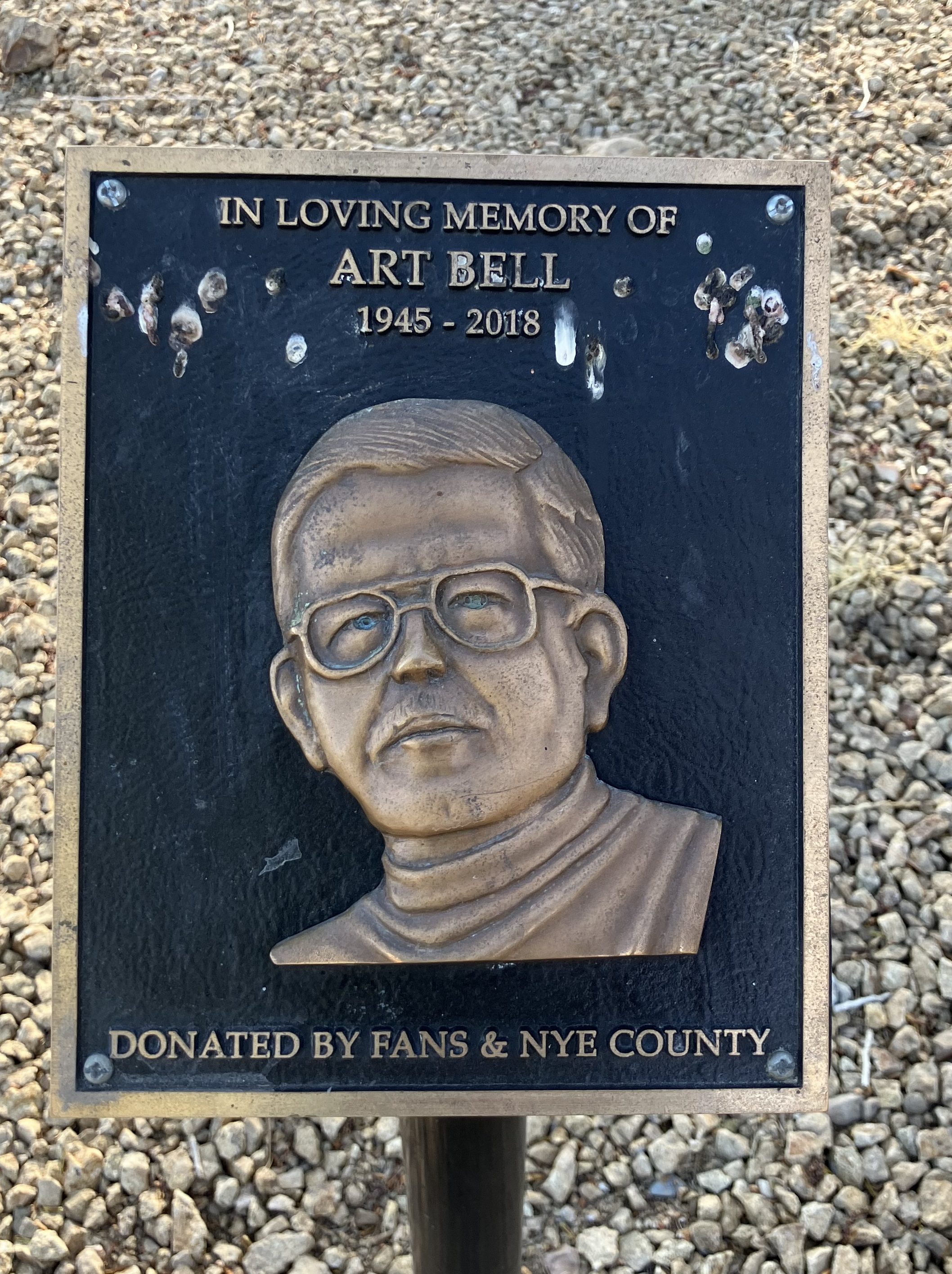
Why was his name familiar? I pondered a bit, then recalled he’d been mentioned by Sue at the Amargosa Hotel on the first night. Sue had explained she’d spent years working in radio, and was always intrigued by a guy who used to broadcast a paranormal- and conspiracy-related radio show from his home “compound” in Pahrump. That man was, of course, Art Bell. Sue was born in Canada and her career moved her around a lot, but because Art Bell had a strong transmitter (or maybe just because his show was syndicated), Sue was able to listen to him wherever she lived.

Art Bell was a complicated guy. Sure, we are all complicated, but Art was especially so. He definitely trafficked in conspiracy theories, but it’s unclear how much of it he actually believed. He set records, won awards, and had a huge influence upon the medium of radio from the 1970s until his death in 2018. He was married four times and had many children. There’s far too much to go into here, but if you’re interested, check out his Wikipedia page. But remember his name; we’ll come back to it.

After I finished my coffee with the graven image of Art Bell, I returned to Shoshone and resumed my southward journey along CA-127. It was a relaxing and uneventful drive, as there was nothing but desert to be seen for about 50 miles.

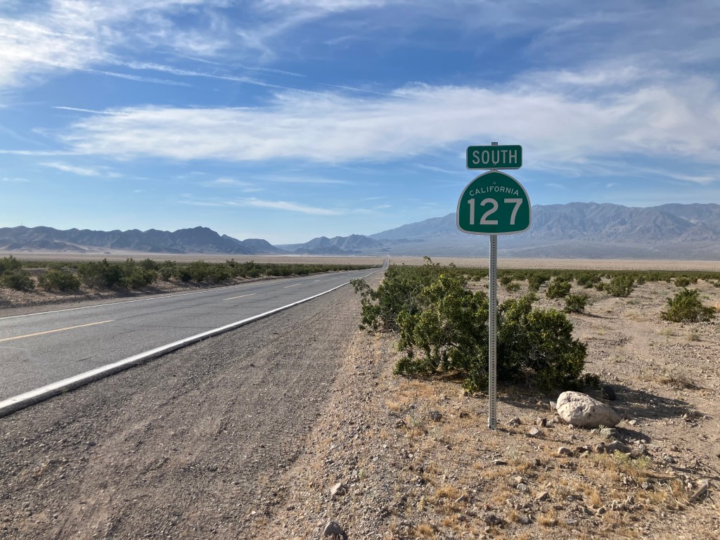
But then, just as I was reaching the highway’s southern terminus, I entered the town of Baker, CA (pop: 480). Like the other towns on CA-127, Baker owes its existence to the Tonopah & Tidewater Railroad and to “Dad” Fairbanks. And because Baker is situated where CA-127 meets Interstate 15, it benefits from significant tourist activity.

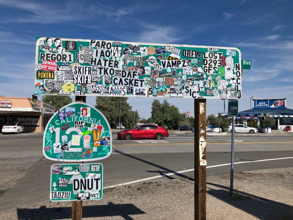
Sadly, there was no sign marking the End of CA-127 South. The closest approximation is the first Northbound sign, and it’s been obliterated by stickers. (I guess this is one of the downsides of having a steady inflow of interstate travelers.)

Paging CalTrans. Clean-up on aisle I-15.

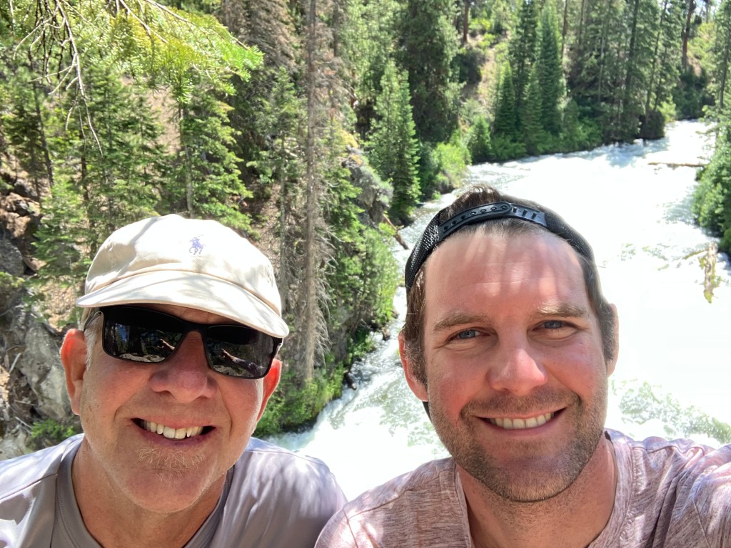
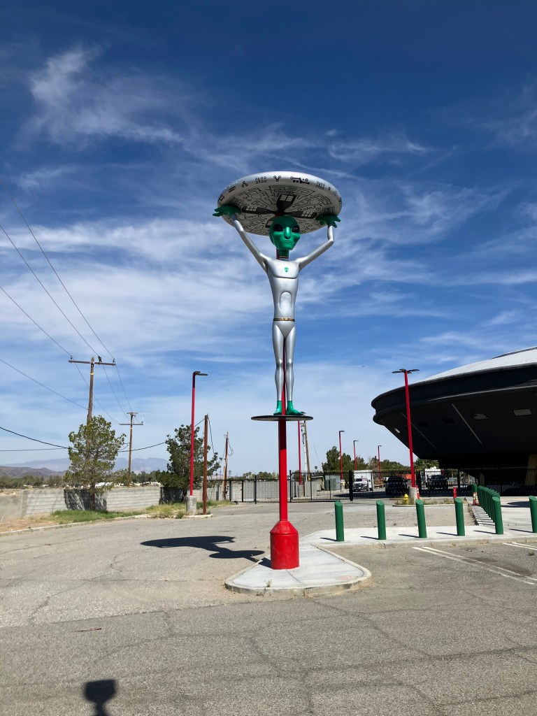
Deprived of my customary end-of-the-highway photo-op, I had to settle for this alien-themed selfie:

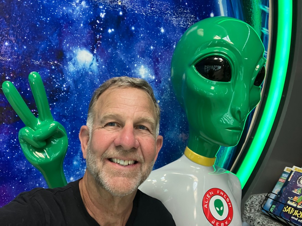
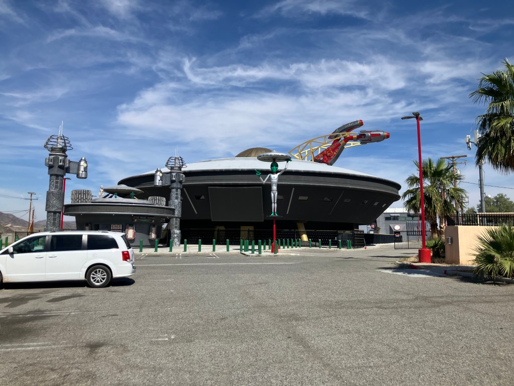
As should be obvious, Baker’s primary tourist draw is an extraterrestrial-themed snack store called Alien Fresh Jerky. The enormous space-fighter(?)-shaped building looms over the main drag.

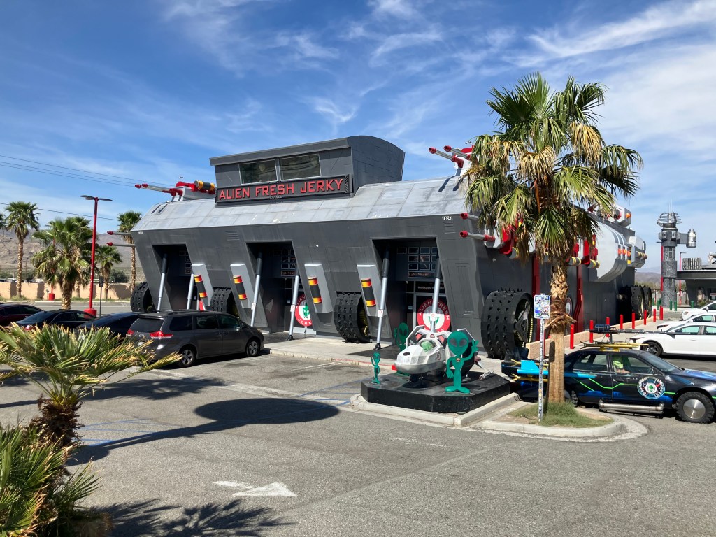
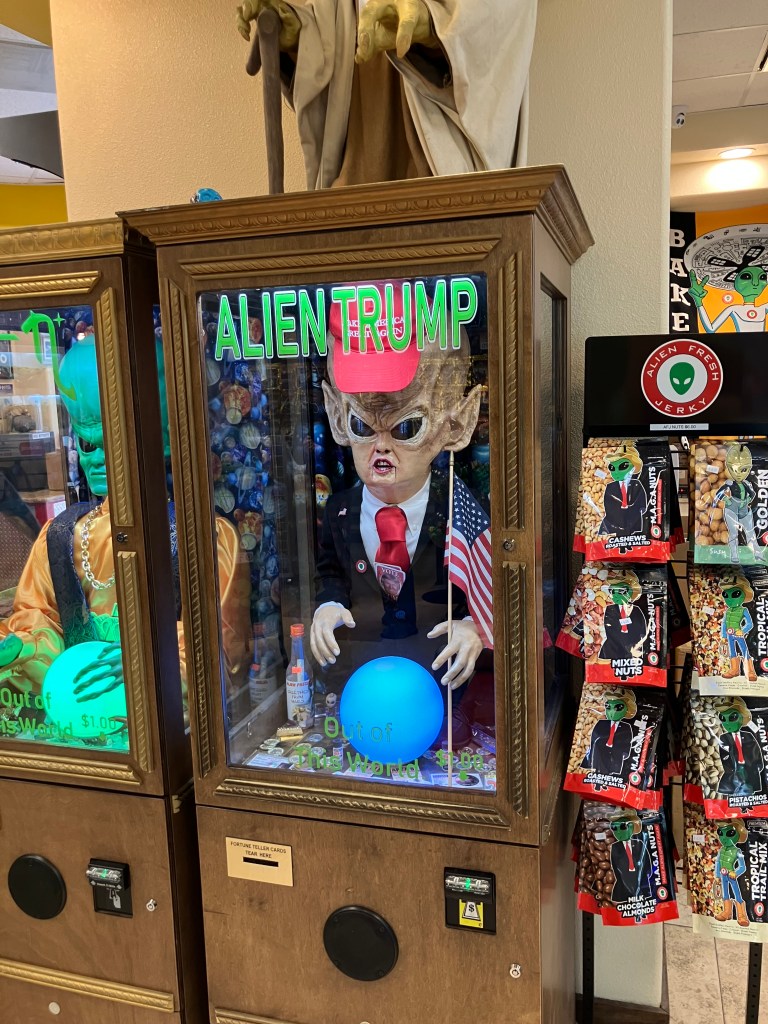
Inside are a million different flavors of beef jerky, as well as alien-themed snacks, sodas, T-shirts, and plush toys. There are also various aliens posing on benches for selfies, and several “fortune-telling” booths.

In the back parking lot there’s a giant flying saucer. I’m not making this up. The clerk in the store explained it’s a hotel that, for reasons she didn’t want to get into, hasn’t yet been approved for occupancy. I am so staying there next time I come through.

Across the street from the alien jerky place is The World’s Tallest Thermometer (134 feet!), which was registering a comfortable 82 degrees.

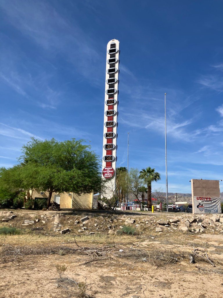
The thermometer was erected by Willis Herron, the owner of Baker’s famous Bun Boy restaurant that used to stand next door.

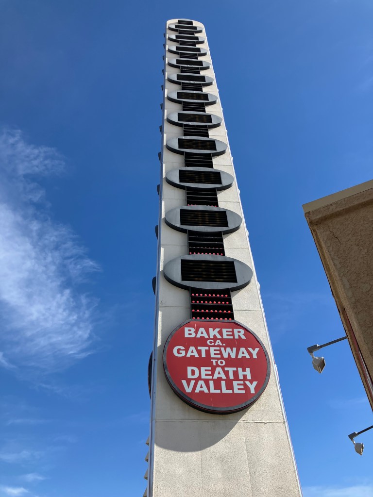
The Bun Boy restaurant had been around since 1926, and Willis bought it in 1956. Things were going well, then it burned down in 1990. Undeterred, Willis had the restaurant rebuilt the next year, but he added the giant thermometer as a gimmicky attraction. This was the state of affairs until 2005, when Willis sold the restaurant and the thermometer.

Willis died in 2007. And sadly, the new owner neglected the thermometer, which began to malfunction and eventually went dark. Even the Bun Boy fell on hard times, and briefly became a Bob’s Big Boy before closing entirely in 2013.

But that’s not the end of the story, obviously. Willis’s widow bought back the thermometer, had it restored, and held a grand re-lighting in 2014. And that’s why I was able to see it today.

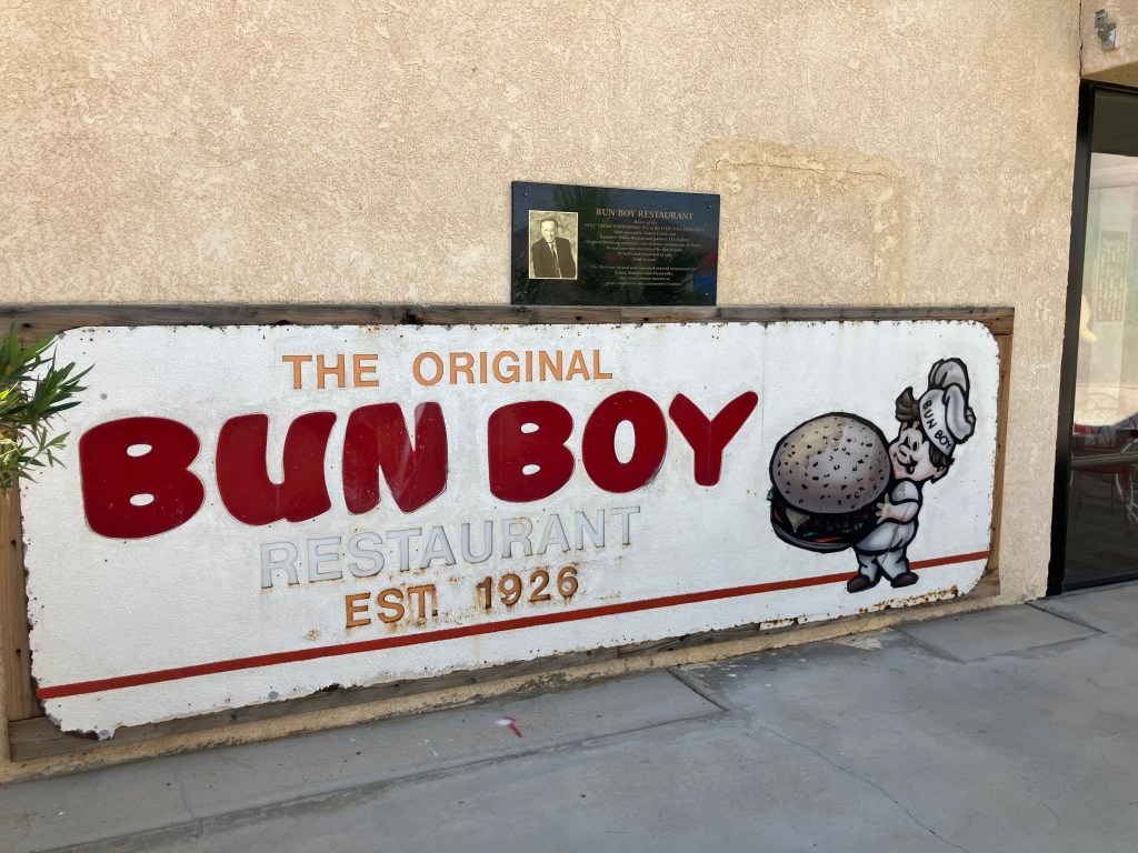
There’s a Gift Shop near the base of the thermometer, because of course there is. On the wall of the gift shop is an antique Bun Boy sign.

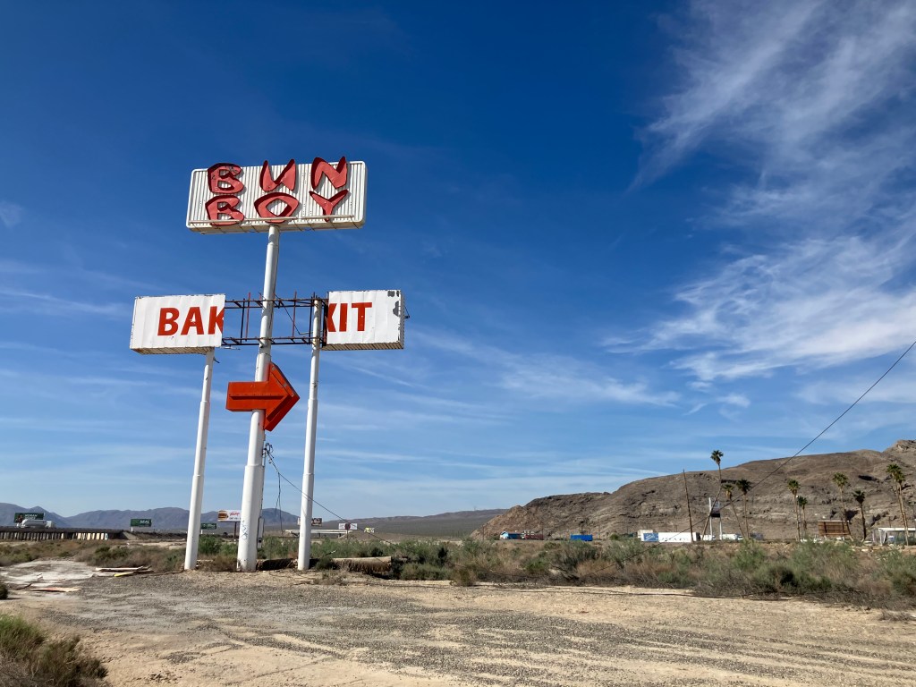
And, at least for now, a towering Bun Boy sign still beckons travelers on Interstate 15.

And so, lacking a Bun Boy, I decided to have lunch at a different local institution: The Mad Greek Cafe.

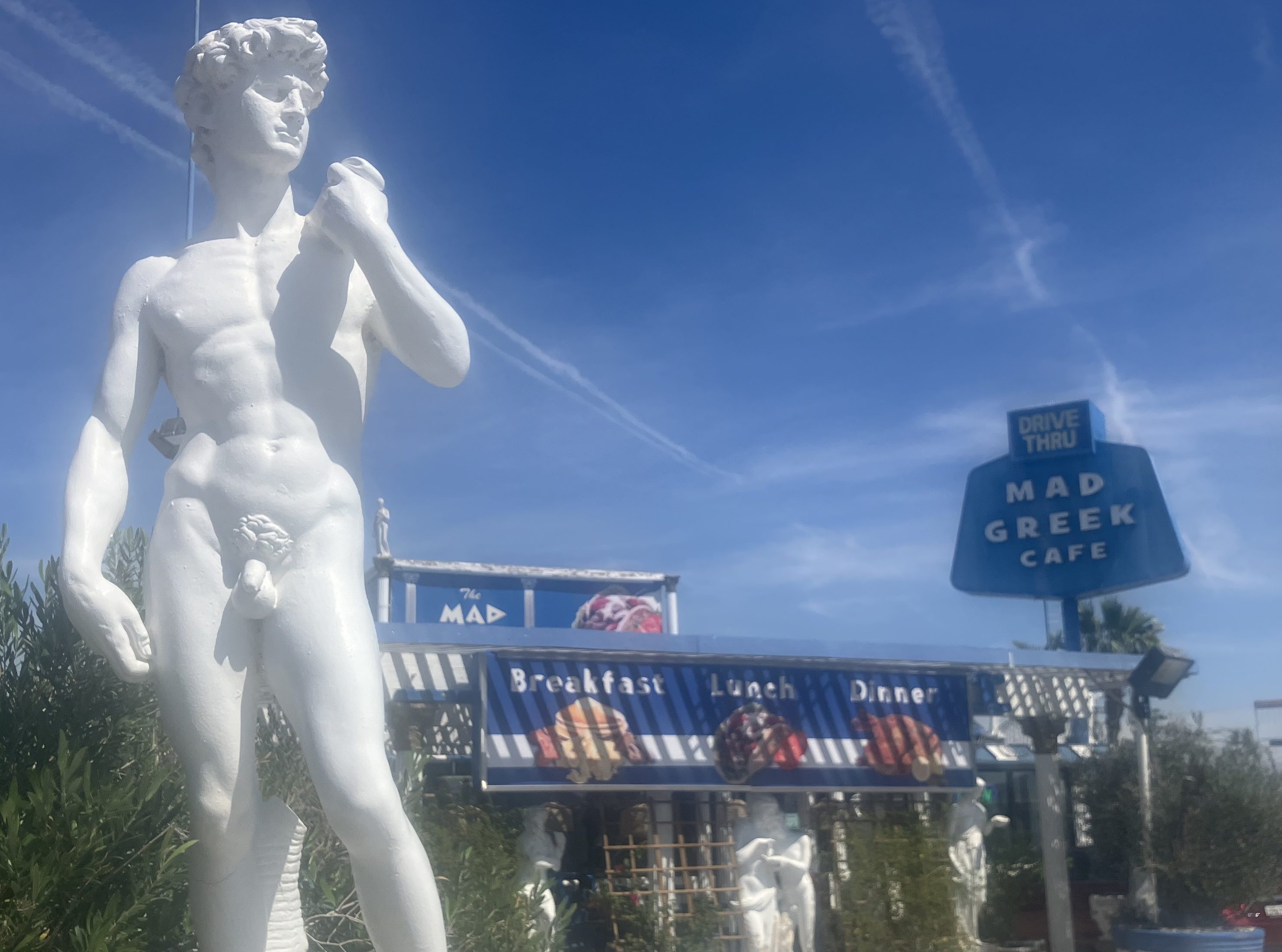
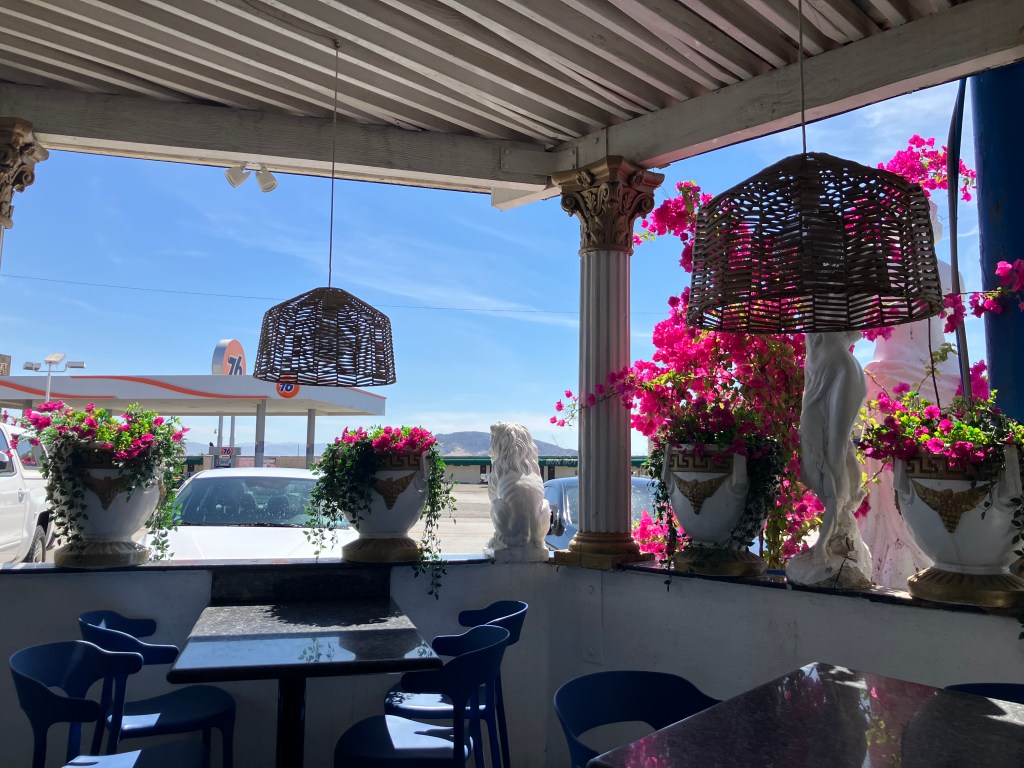
It’s delightfully tacky, painted up in the colors of the Greek flag and surrounded by statuary. It’s sort of a Greek version of Buca di Beppo. But it’s not a chain–the same Greek family has been running this place since 1974. And this place is not just surviving; it’s thriving.

I ordered a gyro and took a seat in the enclosed patio…

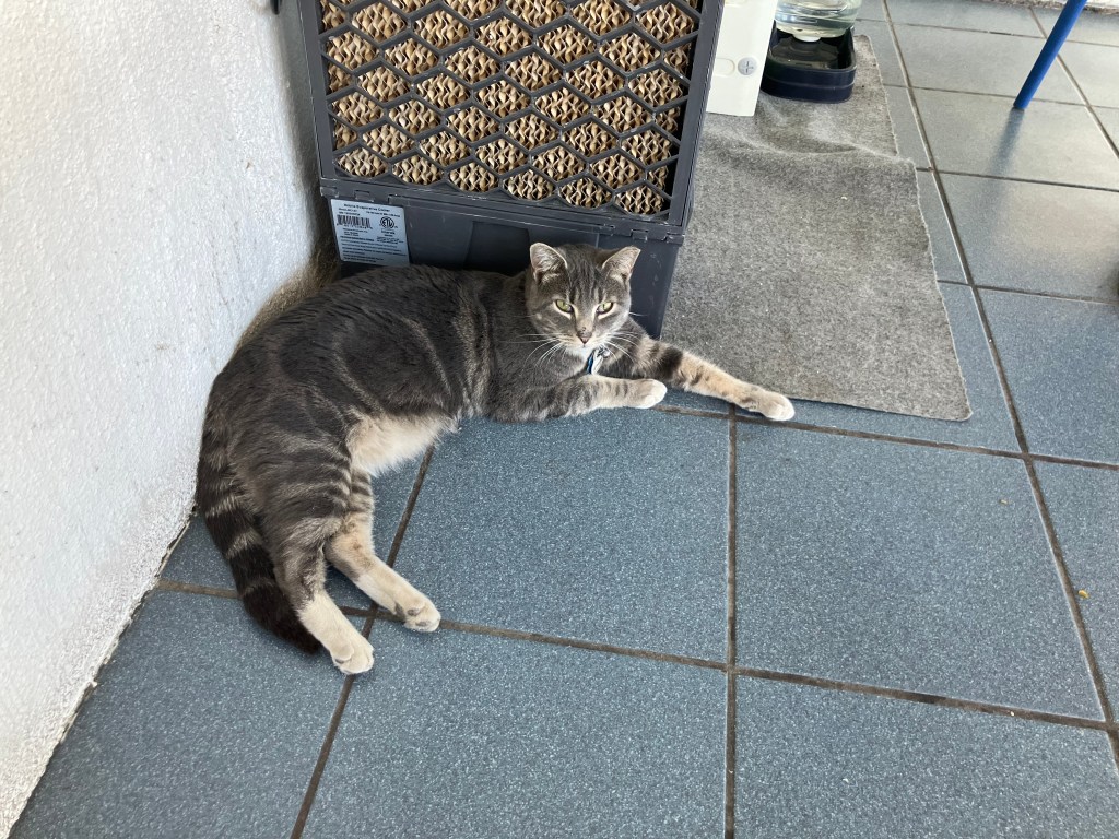
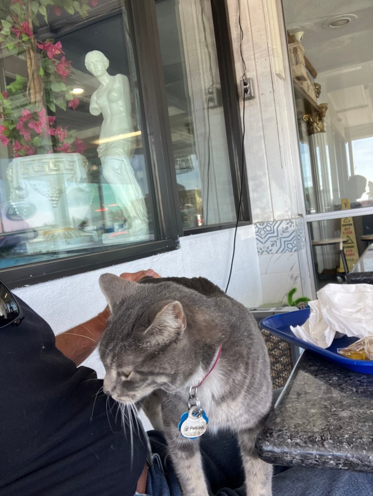
…which, it turns out, is home to the restaurant’s pet cat.

I managed to keep maybe 3/4 of the Gyro for myself.

That kind of sums up Baker, and thus it kind of sums up CA-127. But before I close, I want to return to the “Last Word” promised in this blog’s title. And it’s claimed that the last word in the English dictionary is (or should be) “Zzyzx.”

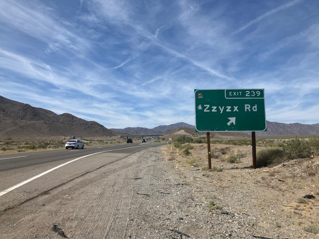
Zzyzx (pronounced ZYE-zix) is a community just a few miles west of Baker. It was originally known as Soda Springs, But in 1944 a self-proclaimed doctor and radio evangelist named Curtis Springer filed mining claims for almost 13,000 acres in the area, and he named it Zzyzx (because, he said, it’s “the last word in the English language.”)

Springer reminds me a bit of Art Bell, the conspiracy monger who broadcast from Pahrump. Springer claimed to be a minister (but he was ordained by no church), and he developed a nationwide radio following. And, like Bell, he would set up his own broadcast studio on his property.

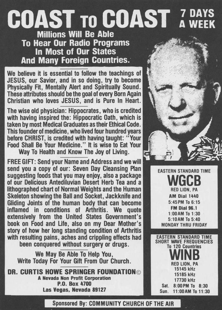
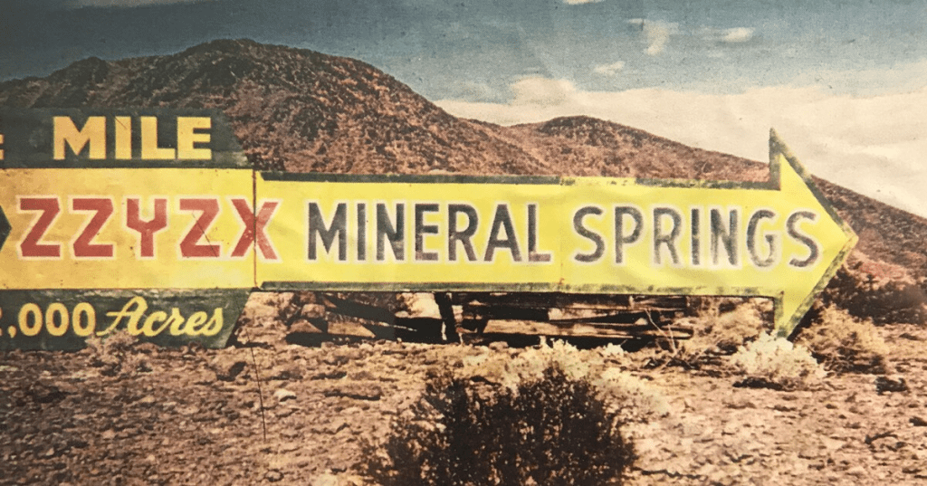
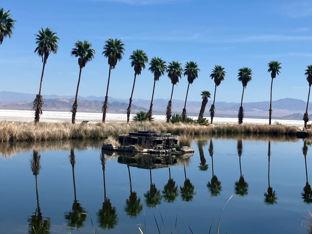
Springer created the Zzyzx Mineral Springs and Health Spa on his Mojave mining claim, which was fed by natural springs. People flocked to this putative health oasis in the desert, where Springer blended some legitimate physical therapies with spiritual programming and some outright quack nostrums. The place was a destination to be sure, but like some other oasis, it was something of an illusion. The property’s “naturally occurring hot springs” were actually heated by gas boilers. And Springer’s “mining claims” contained no valuable minerals. Thirty years later, in 1974, the federal government reclaimed Zzyzx on the grounds that Springer’s mining claims weren’t valid. Springer would (unsuccessfully) fight that decision for the rest of his life. He died in 1985, at the age of 88.

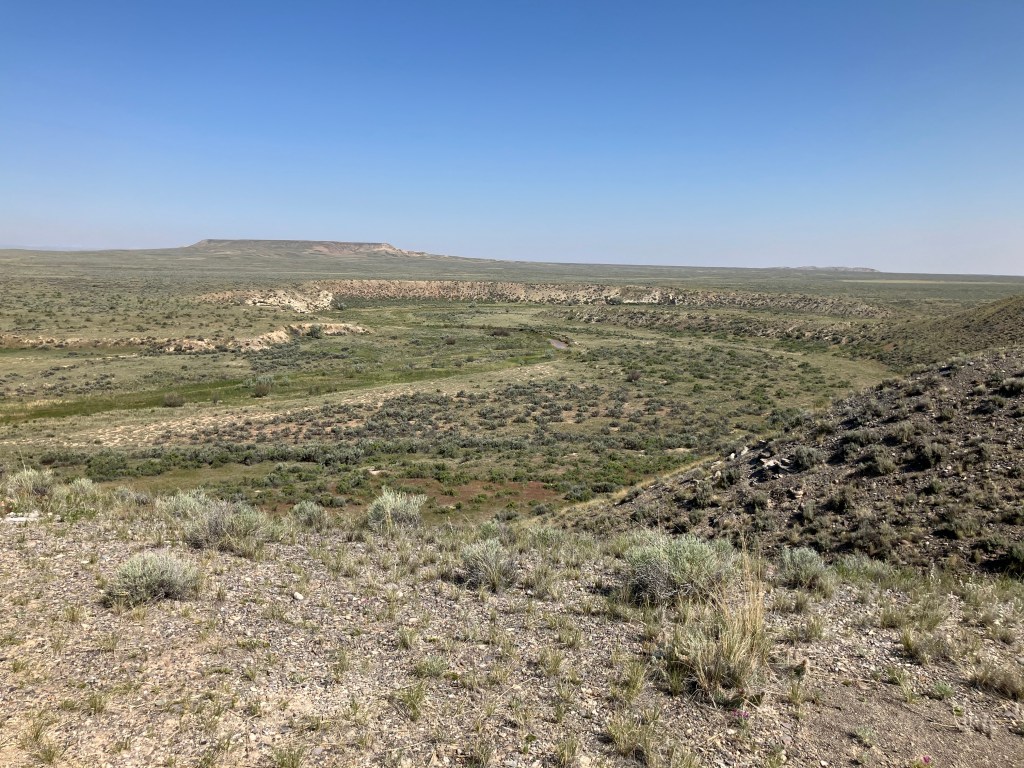
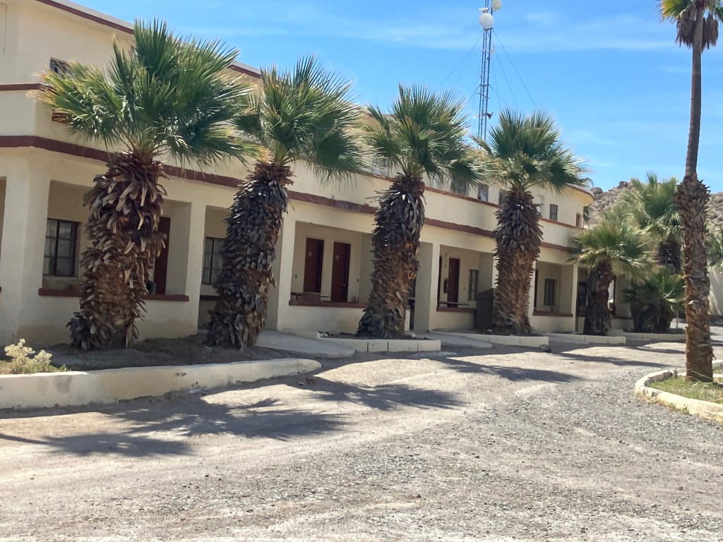
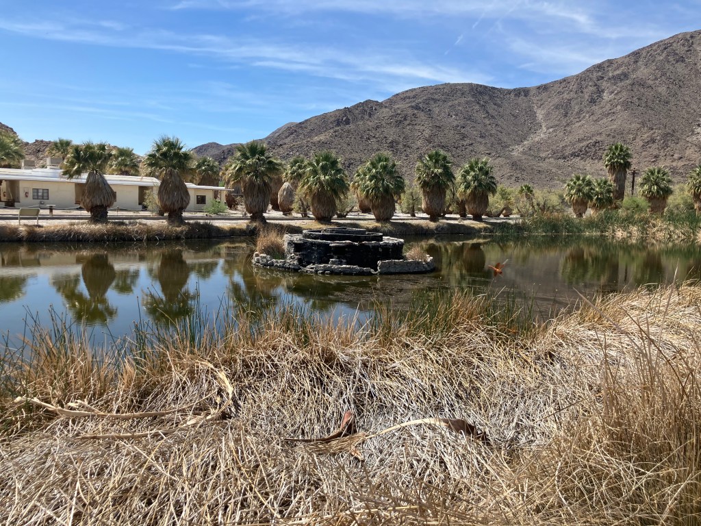
The federal government handed the property over to the California State University, which to this day uses it for a Desert Studies Center. Many of the original buildings, palm trees, and water features remain. When I visited today, there wasn’t a soul around. It was eerie to see this abandoned oasis just sitting in the middle of the desert. Here are some of my pictures.

That’s a dry lake bed in the background.
(Now-defunct) fountain originally put in place by Springer.

As the desert sun reached high in the sky, it was time for me to put a wrap on this road trip and head back to the airport. CA-127 isn’t an exciting road. In fact, it’s pretty empty, with only three towns of any note to drive through. Even in March the weather is less than hospitable, and rattlesnakes hide in the shadows. And yet, the scene through the windshield is entrancing, and the (few) people you meet are warm and welcoming. I wouldn’t choose to live here myself, but I’m glad places like this exist.

Post Script

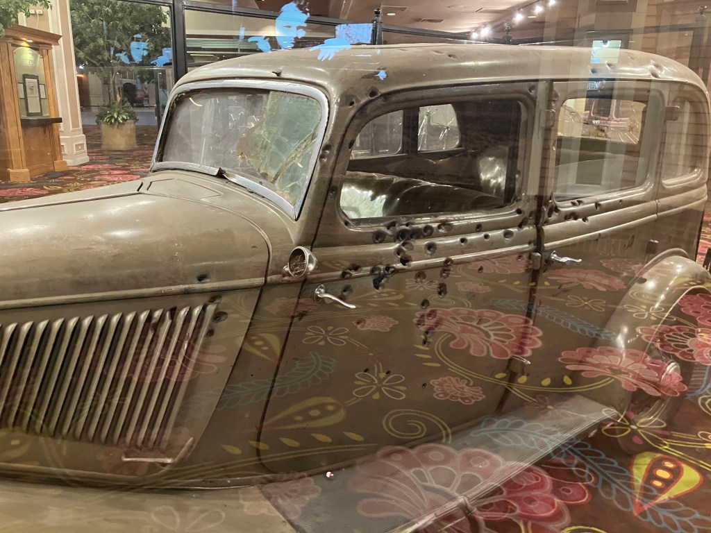
Now, you’d think Zzyzx would truly be the Last Word. But on my may back to Las Vegas International airport, I made a brief pit stop at the Primm Valley casino. And what did I see inside but the 1934 Ford sedan that Bonnie and Clyde were driving when a posse ambushed and killed them. There are over 100 bullet holes in this car.

Not only that, but the shirt that Clyde had been wearing is also on display:

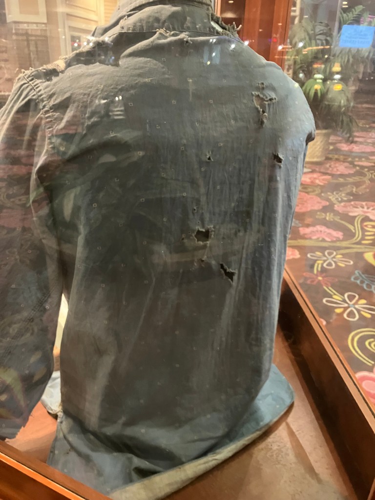
Which brings us back to yesterday’s meditation about burying the dead. Bonnie and Clyde’s bodies are both buried in Texas, but the scene of their death–this car–has been on display literally around the world for some 90 years. And here I am gawking at it. But I ask the question again: What’s the interplay between embracing our past and moving on? When do we bury the dead? At this moment, I think the car is a legit artifact of history. The shirt, not so much.

Breweries · bridges · California history · Cars · movie theaters · Road trips · Yard art

Been There, Done That, Got the T-Shirt

This morning I headed downstairs from my motel room to partake of the “free” breakfast. Then I spotted this sign in the breakfast room:

But a “D” is technically passing right? At least that’s what I used to tell my parents when I brought home my report card.

Instead of the motel breakfast, I got a gas-station coffee and donut. I then got onto the U-28 scenic byway, which carves its way through the Colorado River gorge towards Grand Junction. It was so spectacular it even made my donut taste good.

That’s the muddy Colorado River on the left.
A perfect setting for a Western…which it has been, many times.

After maybe half an hour of driving I came across a pedestrian suspension bridge that crosses the Colorado River. Attentive readers will recall that I’m a sucker for these things, so I looked for a place to pull over and sway my way across the (not-so-) mighty Colorado.

So far so good…

So imagine my disappointment when I discovered that the bridge’s decking was entirely missing.

…but wait–what’s wrong with this picture?

Turns out the Dewey Bridge (for that’s its name) was built in 1916 and is Utah’s longest suspension bridge. It was fully restored in 2000….and eight years later some kid was playing with matches and the whole thing went up in flames.

Kids, don’t play with matches! (2008 photo from Wikipedia Commons.)

A sad and ghostly air hangs about the skeleton of the Dewey Bridge. It set back my good mood a bit.

A little later I came to the town of Fruita, Colorado (pop: 13,400). I could live in this town. It’s one of those places that’s figured out how to preserve its history, cater to modern tastes, create a livable community, and attract tourists. The town is jammed with public art, and the main street has plenty of outdoor cafes and benches to relax, have a cup of coffee, and watch the world go by. It seems that most of the buildings along Main Street are historic and well-preserved or restored.

One public art installation that made me scratch my head was this rooster with no head:

A friendly fellow drinking coffee at an outdoor table noticed me photographing the sculpture and gave me the story of Mike the Headless Chicken. (Trigger warning for those sensitive about food preparation by carnivores.) It seems that in 1945, a local farmer by the name of Lloyd Olsen was attempting to behead one of his chickens for dinner. His aim was a little off, and most of the chicken’s brain stem remained with the body. The chicken survived his beheading, flapping his wings and running around headlessly. What was Lloyd to do? He spent the next year and a half carefully feeding Mike (for that was the chicken’s name) individual kernels of corn through the throat and addressing Mike’s thirst with milk and water from an eyedropper. Mike became a sideshow attraction and gained national fame. Indeed, I remember reading about Mike in a “Ripley’s Believe It Or Not” paperback in the 1960s. Fruita still remembers Mike with the sculpture, T-shirts and other souvenirs, and an annual “Mike the Headless Chicken Festival” each spring. I am not making this up.

Fruita also has a lot of non-headless-chicken art around town. In fact, I noticed that many of the towns in eastern Utah and western Colorado feature interesting public art installations. Here is a sampling:

Bionic bicyclist in Fruita.
Sculpture honoring children’s music teacher David Carl Moore in Delta, Colorado.
Detail of the Moore sculpture.
Windrider Custom Cycles sculpture in Delta.
Sculpture at Dennis Weaver Memorial Park in Ridgway, Colorado. Dennis Weaver (I remember him as McCloud from the NBC television series) reportedly loved eagles and lived in Ridgway for many years.

I also randomly ran into these women playing the tubular bells (?) xylophones(?) that are installed at the park. Somehow I think Dennis Weaver would have appreciated it.

I’m not sure if it technically qualifies as art, but there is a large number of long-parked classic cars on both sides of the street in downtown Delta, Colorado.
Artistic Chrysler hood ornament.
Used car lots, frozen in time.

Also related to this theme of public art is the 1928 Egyptian Theater in Delta. It’s obviously been loving restored, and it regularly shows movies and hosts performances. It’s much smaller than the Egyptian Theater in Hollywood, but it similarly reflects the fascination with all things Egyptian in that era.

But let’s get back to the purpose of today, which was to complete my trek to Placerville, Colorado. You’ll recall that the California version of Placerville was originally called Hangtown, and the tree where those hangings took place (in 1849) stood on Main Street for many years. Even though it was cut down in 1853, the stump remains in the basement of an old Main Street building, where a dummy perpetually hangs from a noose.

Photo by the author, from my 2021 blog post about Placerville, CA.

So it was auspicious that, just as I was getting close to Placerville, Colorado, I spotted this hangman’s tree in the town of Montrose:

According to the sign, George Bikford was hanged from this tree for robbery and “horse stealin'” in 1878.

And so, with that preface, I finally came to the storied town of Placerville, Colorado. Let’s just say it wasn’t exactly El Dorado.

This is seriously about all there is to the town.

Pretty much all that makes up Placerville is a post office, a general store, a storage facility, and a few houses. In the 1800s it was a mining boom town, but as with many boom towns, the mines dried up and the population went elsewhere. Later, the failure of the local Trout Lake Dam in 1909 wiped out most of what remained.

But be that as it may, I think we can declare this mission a success.

And (shockingly) I was even able to purchase Placerville merch at the general store!

I was hoping for “My husband drove from Placerville to Placerville and all I got was this stupid T-shirt.”

BREW OF THE DAY

We have a winner!

In the town of Ridgway, Colorado (pop: 1,300) I stopped in at the Floating Lotus Brewery. It’s a friendly, casual place with an airy atmosphere, two outdoor patios, a stage for live music, and a great view of the neighboring property where John Wayne filmed some scenes from True Grit. Owner/Brewmaster Kenny Conley hooked me up with his favorite beer: the Blastoplast IPA.

This was hands down the best beer I’ve had on this trip. Of course, that’s an admittedly low bar. But this is seriously a tasty brew. Unlike so many modern IPAs, this one is perfectly balanced. It’s not too hoppy, not to carbonated, not too pungent. At the same time, it’s flavorful and a bit “richer” than you’d expect from an IPA, without the astringent IPA afterburn you sometimes experience by the end of the glass. And at 6.3 percent ABV, I’d say the alcohol content is right where it should be. This is a five-star brew.

Kenny at his post. If you ever find yourself in Ridgway, or even in the vicinity of Telluride, pay him a visit!
Breweries · California history · Cars · Puns · Road trips

Life in the Slow Lane

With a level of complication that rivals the Normandy Invasion, my son (Ian) and I decided to rendezvous at a resort near Bend, Oregon, where we used to spend summer vacations once upon a time. Ian flew there from Vermont (which took two days, thanks to United Airlines), while I decided to drive up from Placerville along the east side of the Sierra Nevada range on US 395.

One of the more contemplative drives in California.

As alert readers will recall, I’ve driven various stretches of 395 at various times, most recently on my famous search for the remnants of the Nevada-California-Oregon narrow-gauge railroad. You can read about that trip here. Heading north on this stretch of US 395 is simultaneously one of the most contemplative and dramatic routes in California, with the craggy east slope of the Sierras on your left and lots of open range and the occasional lake on your right. Traffic is fairly sparse and the occasional towns are small and infrequent. My two favorite stops on the route–partly for their names and partly for their oasis-like qualities–are Hallelujah Junction (pop: 1) and Likely (pop: 99).

Hallelujah Junction’s sole resident.

While I didn’t cover new ground during this week’s trip up to Oregon, I did have a new rental car experience. I typically reserve the smallest, cheapest car on offer, knowing that the rental car companies will almost always “upgrade” me to an Altima because that’s pretty much the only car they actually keep on the lot. Ian correctly points out that the price difference between renting the bottom-of-the-line subcompact and just a normal sedan is only a few bucks a day. But it’s that kind of thinking that led to our current $36.2 billion national debt.

So I booked the cheap-o car. And this time they called my bluff. Meet the Mitsubishi Mirage–with three working cylinders and a total displacement (1.2 liters) that’s literally the same as my motorcycle.

78 Horsepower baby.

A little research reveals that the Mirage was the lowest-priced car available when it was manufactured in 2023. In a zen-like way, those savings come at a cost. The interior is as bare-bones as it gets, with manual seats, basic AM-FM radio, hard-plastic door panels, and a no center console of any kind.

I’ve eaten pizzas with a larger diameter than the Mirage’s spare tire.

Plus, in a throwback to the Clinton era, this is one of the last production cars to still require an old-fashioned key to get its three cylinders firing.

Remember these?

But the most remarkable thing about the Mirage is the (lack of) acceleration. This car notoriously has the slowest zero-to-sixty time of any production car. Ian did a Google search and found this review that Carbuzz did of the ten slowest cars. Here’s their take on the Mirage:

And finally, the number one slowest vehicle in America is the soon-to-be-dead Mitsubishi Mirage. It takes you an impressive 12.8 seconds to get from zero to 60 miles per hour in this sad excuse for a passenger vehicle, and it’s all thanks to the minuscule 1.2-liter three-cylinder engine that only produces 78 hp and 74 lb-ft of torque. It isn’t fast, it isn’t comfortable, it isn’t nice, and it’s pretty old. The Mirage won’t be missed.

Now, Ian’s an engineer, and he insisted that we subject this claim to empirical testing. So I stopped the Mirage on a flat stretch of road, Ian readied his stopwatch, and I stomped on the (aspirationally-named) accelerator. The analog speedometer began move, like Frankenstein’s monster on the slab. Five mph, ten mph….my fingernails and hair became noticeably longer….twenty mph…empires rose and fell….thirty, forty, fifty….North America drifted another few inches away from Europe…finally we achieved 60 mph.

The feat required 17 seconds–almost a third longer than even even CarBuzz’s incredulous estimate. On the positive side, the Mirage gets good gas mileage.

Anyway, we spent a few days near Bend simultaneously consuming water, hops, and barley. It was a relaxing break from my mile-a-minute retired life.

Then, just like that, it was time to head home. For the return trip we took US 97 from Bend to Weed, where we connected to Interstate 5 and continued south to Sacramento. A few notable items along the return trip include this decaying roadside relic in Chiloquin, OR (pop: 769).

I found an online photo from some years back that helps to clarify what it’s supposed to look like:

Is it a tapir? A cross between a horse and a cow? A dinosaur of some kind? There’s a lot of online debate about this. It’s sort of the Rorschach test of roadside kitch. Turns out it’s a remnant from a place called Thunderbeast Park that opened on this spot in the 1960s. There are some rumors on the internet that the remaining dinosaurs were relocated to a spot along highway 1 on the north coast. Ian claims we actually saw them on an earlier trip, but I think he may be hallucinating. Please let me know if you have any insights on the whereabouts of the Thunderbeasts.

Meanwhile, the town of Crescent (pop: 400) has this unusual, but better-preserved, roadside art on top of the town library. I’m assuming the bear had some meaningful connection to an earlier use of the building?

The town of Crescent also features this lumberjack, who appears to be suffering from a cervical fracture:

Near Klamath Falls we encountered this unexplained castle sitting in a field along US 97. To me it looks like a giant version of the kind of thing you’d see on a miniature golf course. Turns out it’s a trademark display from a bygone place called “Kastle Klamath,” which billed itself as a “Family Fun Land.” It had go-karts and a swimming pool and, yes, miniature golf. Like so many such places, it seems to be a victim of changing tastes in the Internet age.

Eventually we crossed back into California and came to the town of Doris (pop: 860), whose claim to fame is its 200-foot-tall flagpole. A plaque claims it is “America’s tallest flagpole.” (As of this writing, the tallest flagpole in America is actually in Wisconsin, and it stands at 400 feet. Meanwhile, the tallest flagpole in the world currently resides in Cairo, Egypt, at 662 feet.)

The southern end of US 97 terminates at Interstate 5 in the town of Weed (pop: 3,000). Located close to Mount Shasta, the town of Weed is named after Abner Weed, who founded the town when he built a lumber mill here in 1897. Today, the name provides endless opportunities for hilarious puns. For example, the town’s motto is “Weed like to welcome you.” And there are a half-dozen souvenir shops hawking T-shirts saying “I love Weed” and similar phrases that will make you the envy of Deadheads everywhere.

The historic archway to downtown Weed.

Finally, what is a road trip without a Studebaker sighting? We spotted this heavily-modified 1950 Starlight Coupe on the side of the road…where most Studebakers eventually spend a good portion of any outing.

And now, it’s time for the…

BEER OF THE DAY

The BOTD comes from McMenamins Old St. Francis School in Bend, Oregon. McMenamins is a privately-owned chain of historic structures that have been converted into pubs, restaurants, and hotels. This location had been a Catholic school which was built in 1936, and today the classrooms are hotel rooms. It also includes a full restaurant, a brewery, and movie theater, and a public pool.

Photo from The Brew Site.

The offspring and I had lunch in the back patio, and for my beverage I selected the Bamberg Obsession. It’s a Munich Helles (a lightish German beer) to which they’ve added beechwood-smoked malt.

This looks promising.

It’s a beautiful, golden beer the color of light honey. I was mesmerized simply by the look of the thing, radiating sunshine and pot-at-the-end-of-the-rainbow good luck. The taste didn’t disappoint, either. This is a refreshing beer, as you’d expect from a Helles. But the addition of the smoked malt lends a subtle complexity that keeps things interesting. It’s not overwhelming, but rather gives just a hint of peat or a distant campfire. There’s not much bitterness to this drink, which again is consistent with the Helles style. A slight sweetness also comes through. The ABV clocks in just under 5 percent. This is the Arnold Palmer of beers. Highly recommended on a warm day. 4.5 out of 5 stars.

Breweries · bridges · Cars · Gas stations · movie theaters · Road trips · Yard art

The final stretch

Today I drove the final stretch of Route 20’s original route, which terminates at the eastern entrance to Yellowstone. I left the lads in TenSleep this morning, and rejoined US 20 at Worland, Wyo. From there I headed north to Greybull, and then east to Yellowstone. The whole drive was about 170 miles…and then another 170 miles to get back to TenSleep!

Westward Ho.

It was a great day for a drive. The weather was perfect, and there was no traffic. It was just me and the open skies. This part of the country, with its solitude and natural beauty, is growing on me.

Idyllic drive.

I picked up where I’d left off a couple of days ago at Worland (pop: 4,800). Worland is a tidy and practical town, where the good folks of TenSleep and other surrounding communities go when they need a supermarket or various specialty stores. It’s also a reasonably attractive community, with a number of western art installations like this one that commemorates the pioneers.

It felt good to be back on US 20 West, with the familiar white signs and the commodious US-standard lanes. Early in today’s trip I came to Manderson, Wyoming (pop: 3,900), where a veritable graveyard of old farm equipment and buses stretches along the side of the road. It’s evidently a vehicle recycling and/or consignment operation, where tractors go to die. The hearse at the edge of the property seems to drive home the point.

Just a small portion of their collection.

Once I was heading east out of Greybull, the endless prairie began to give way to the peaks and crags of the Bighorn and Owl Creek mountain ranges, and fast-flowing Shoshone River gorge. The passing scenes reminded me of the settings for a John Ford movie.

A speed goat keeps watch over US 20.

Even though most of US 20 is designated the Medal of Honor Highway, a segment east of Cody was designated the Wild Horse Highway just a few years ago. This segment borders BLM lands where a herd of about 100 wild mustangs still roam the McCullough Peaks range.

Horses are of course an iconic element of the West. They were brought to the Americas by Spanish missionaries and explorers several hundred years ago. Evidently a number of those horses escaped during the pueblo revolts, and descendants of those horses still roam the plains. In 1971 the US Congress passed the Wild Free-Roaming Horses and Burros Act, which provides for the protection of those horses.

Where the wild horses roam.
Horses along the Wild Horse Highway.

After the Wild Horse Highway I came to the “big city” of today’s trip. Cody, Wyo (pop: 10,250) is one of those larger-than-life towns that inevitably become tourist trips. “Buffalo” Bill Cody founded Cody City in 1895. It was intended as a resort community, near the Demaris mineral hot springs. It was also conveniently located near the eastern entrance to the recently-created Yellowstone National Park. However, just about a year after Buffalo Bill founded Cody City, someone named George Beck established a second city just to the west. It’s this second city that kind of swallowed up Cody City and grew up to be today’s Cody. Ever the entrepreneur, Buffalo Bill embraced the new city and opened a hotel (the Irma) in 1902 that still stands today.

Today’s Cody is a tourist town that leans into its history and western lore. There’s a major museum complex called the Buffalo Bill Center of the West. There are numerous businesses that claim to have authentic links to Buffalo Bill. And the 1936 Cody Theater currently hosts a live musical called the “Wild West Spectacular.”

“Old Trail Town,” which purports to be a semi-authentic reconstruction of the original Cody City. It’s comprised of historic structures from across the region.
The Irma–built by Buffalo Bill and named after his daughter.
Active 1936 theater, showing live stage productions.

After getting my BOTD (more on this below), I left Cody and tackled the final segment of US 20. This stretch, which runs 27 miles from Cody westward to Yellowstone, is designated the Buffalo Bill Cody Scenic Byway.

This Bob’s Big Boy in a field on the side of the Buffalo Bill Scenic Byway is completely unexplained.

Finally, after about 2,500 miles and a dozen days of driving, I arrived at the end of (original) US 20!

My Route 20 shirt is courtesy of The Tepee near Cherry Valley, NY.

That Yellowstone photo comes courtesy of Harry and Xiomata, who were celebrating their 41st anniversary.

Happy Anniversary!

With the road trip complete, there are just a few items left to round out this blog post. Here we go:

BRIDGE CORNER

Today I passed what I consider to be a picturesque, historic bridge that deserves mention. The century-old Hayden Arch Bridge crosses Shoshoni creek near just west of Cody. It’s billed as “Wyoming’s only medium span concrete arch vehicular bridge.” Alas, I arrived just a few days too early for a big celebration. According to a recently-posted notice, “The Cody Country Chamber of Commerce invites the public to a special centennial celebration marking 100 years of Hayden’s Arch, one of Wyoming’s most iconic bridges. The commemorative ceremony will take place Saturday, June 21, 2025, at 4:00 PM, at the historic Hayden Arch Bridge.” It’s not to late to plan your trip!

Wyoming’s iconic Hayden Arch Bridge turns 100!

BEER OF THE DAY

I wanted to do something special for the last BOTD for this trip, so I bellied up to the bar at the Hotel Irma, which Buffalo Bill himself had built in 1902. It’s named after his youngest daughter.

Sadly, I wasn’t able to secure a seat at the bar–there was considerable disagreement among the barflies as to whether “Jack” was going to return to the seat he had earlier vacated. And the wait staff and bartenders–all of whom seemed to have been holdovers from the days of Buffalo Bill–seemed irreparably confused. I left.

Instead I chose the considerably less historic Millstone Pizza Company and Brewery that sits just across the street from the Irma. On advice of Doogie Howser’s doppelganger who was working behind the bar, I had the Pineapple and Jalapeno Ale.

Doogie’s Fave.

Now, this was a reasonably well-made beer, with smooth body, good hoppiness, nice color, and a delicate foam head. The only thing this beer didn’t have was the taste of pineapple or jalapeno. Which would seem to be a problem for a beer billed as a pineapple/jalapeno beer. There was no sweetness and no heat whatsoever. When I brought this to Doogie’s attention, he kind of shrugged and said, “yeah, I’ve complained to the brewmaster about that myself.” (And yet he’d recommended it to me?!) He also hinted that the brewmaster used green peppers rather than jalapenos. Zero stars for false advertising. It’s a disappointing end to a good string of BOTDs.

DELETED SCENES

Finally, we end with a handful of photos from all along US 20 that largely speak for themselves. Is this a great country, or what?

(The pink elephant has become a theme of my trips. For other sightings see here and here and here and here.)

Breweries · Cars · Gas stations · Road trips

Casper to TenSleep

My day began in one of the country’s most haunted cities: Casper, Wyoming (pop: 59,000). It was here I learned a valuable lesson. It’s a variation on the Marianne’s’ Phenomenon, which has come up a few times in this blog over the years. To refresh your memory, you experience the Marianne’s Phenomenon when you mistake unique external conditions for food quality. This happened to me 30 years ago, when I ate at an Italian restaurant named Marianne’s. My wife and I had just taken a long bike ride and I was tired and famished. We sat down to a pasta meal and I was in heaven. “This is the best meal I’ve ever had!” I gushed. The next weekend I insisted we go back to Marianne’s to relive the magic. It sucked. I concluded that my elation at the first meal derived simply from my extreme hunger.

Here’s today’s variation: The motel where I spent the night offered free coffee, which I took with me in the car. It was almost undrinkable–it tasted like the watery and malodorous Folgers my mom used to percolate every morning on the stove. So I drove to the nearest coffee shop to try again, and this time it was the most delicious cup of coffee I’ve ever experienced. Now it’s possible that Copper Cup Coffee legitimately makes great coffee. But I suspect it has more to do with the contrast with earlier coffee. Surely there is an aphorism that neatly captures this? Something like “In the Valley of the Blind the one-eyed man is king.” I realize that one doesn’t exactly suit the circumstances; can someone help?

Anyway, equipped with The Best Cup of Coffee Ever, I pointed the Peregrinator west and headed out of Casper. Casper is a worthy town, situated on the banks of the Platte River and possessing a rich history as a US fort and as a waypoint for westward immigrants. But it’s a bit too big and modern for what this trip has focused on. The perfect illustration of this is Sanford’s Grub and Pub on SE Wyoming Blvd:

Sanford’s Grub and Pub in Casper, Wyo.
The place is flanked by a giant Daffy Duck and a giant Bugs Bunny.
No theme is too random for Sanford’s Grub and Pub!
The back parking lot has a Cadillac Ranch vibe, with the hulks of numerous old cars planted in the landscaping.

To be sure, Stanford’s Grub and Pub has many of the things I’ve enjoyed along Route 20: Old cars, streamline moderne architecture, roadside kitch. But it feels too curated, too much like it was designed in a lab by a soulless consulting firm in Greeley Colorado. It just tries to hard. Don’t get me wrong: It’s probably a great place to take the kids. And I’m told they have a great beer selection. It just lacks the sincerity that abounds along the quieter stretches of the route. So I got directly back on Route 20 and headed out of town.

Today’s route: From Casper (lower right) to Worland (where I departed Route 20) and east to Ten Sleep.

As we discussed yesterday, Wyoming has the least population density of any of the lower 48 states. There just aren’t that many towns, and most of those that I did encounter didn’t have much obvious history or engaging features. That said, the Wyoming landscape is starkly beautiful. Here are a few pictures from today’s drive:

Near Shoshoni, Wyo
Another view near Shoshoni.
One of the many proghorns in the state. The locals evidently call them “speed goats.” They can run as fast as 55 mph.
Seeking a narrow slice of shade.
“Hell’s Half Acre” near Powder River, Wyo. It’s an ancient gorge in the middle of the prairie, where Indians used to drive buffalo over the cliffs.

So, that should give you a sense of the stark beauty along my path today. I just don’t have many man-made features to show you.

My goal for the day was Ten Sleep, Wyo (pop: 260). The name comes from Native Americans, who said it’s a ten-day (ten “sleeps”) trek from Fort Laramie. Today it’s a quiet and pleasant town situated on the laconic Ten Sleep Creek.

Now, Ten Sleep is actually about 25 miles off Route 20. I took this detour because I’m meeting three old friends for a short reunion at Chris P’s Western Retreat. They will likely join me for the final leg of this trip along the original Route 20, which runs to the eastern entrance of Yellowstone. That will probably be on Monday. Until then, we’ll be hanging out at the Ten Sleep Brewing Company. If you’re lucky, I might post some dispatches of the ensuing hijinks.

Location, location, location.

Speaking of brews, it’s time for the…

Brew of the Day

tEven though I spent the evening at the Ten Sleep Brewing Company, the BOTD appropriately comes from a place along Route 20 proper. And that is the One-Eyed Buffalo Brewing Company in Thermopolis (pop: 2,725), which was the largest city on today’s trip. Thermopolis means “hot city” in Greek, in reference to the natural hot springs.

My BOTD was something called the W-Rye-O. It’s a brown ale aged in whiskey cask from Wyoming Whiskey distillers.

I’m a sucker for cask-aged beers of any kind. They generally have more depth and interest than a regular beer. For the W-Rye-O, the cask aging seems to have mellowed the brew. It’s extremely smooth and doesn’t have a lot of carbonation, and the hops are definitely reined it. There’s a distinct tinge of whiskey on the palate, though I wouldn’t say it complements the beer that well. In fact, the two tastes seem to be fighting against each other, akin to brushing your teeth after drinking orange juice. This beer has a slight off-bitterness that tastes like lighter fluid. It’s not enough to ruin the beer, but enough to lose a star. 3 stars.