Cars · cemeteries · Road trips · trains

US Route 95, Part II

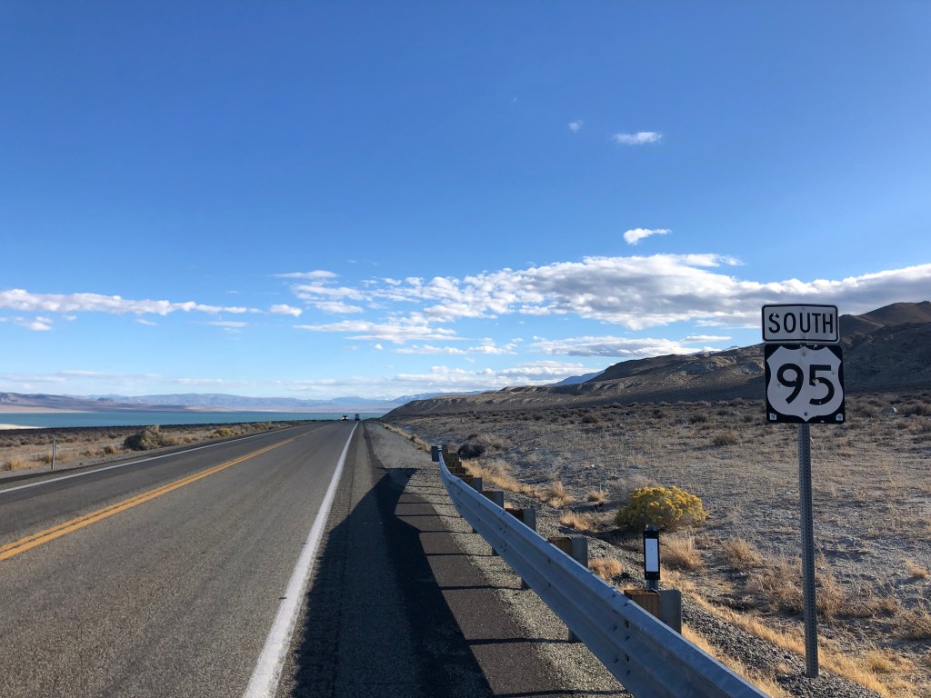
I awoke early in Hawthorne, got a decent breakfast at Mr. Beane’s coffee shop, and got back on the road. A short distance from Hawthorne US 95 takes a jog eastward, but otherwise today’s ride was looking a lot like yesterday’s.

Deja vu

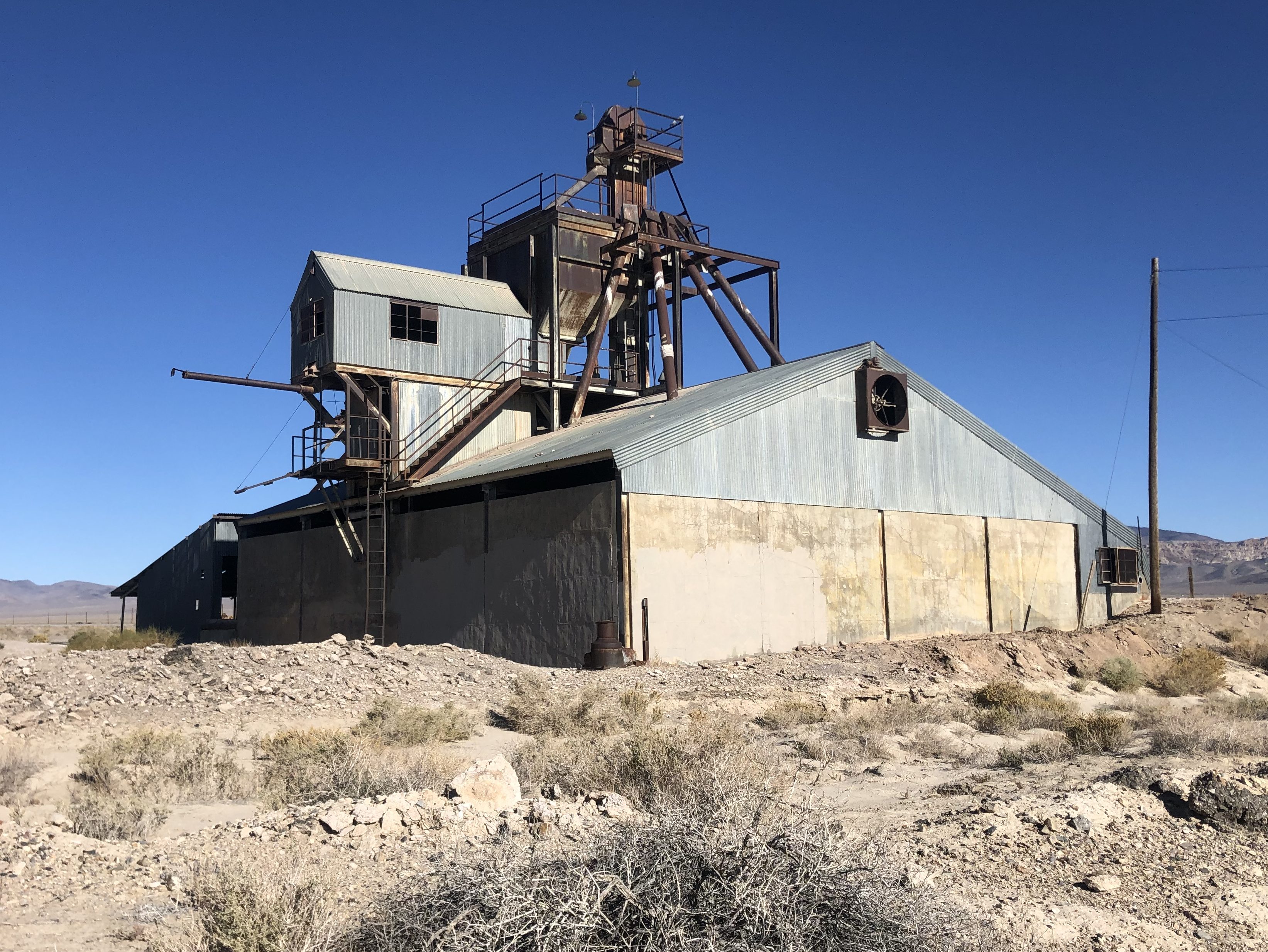
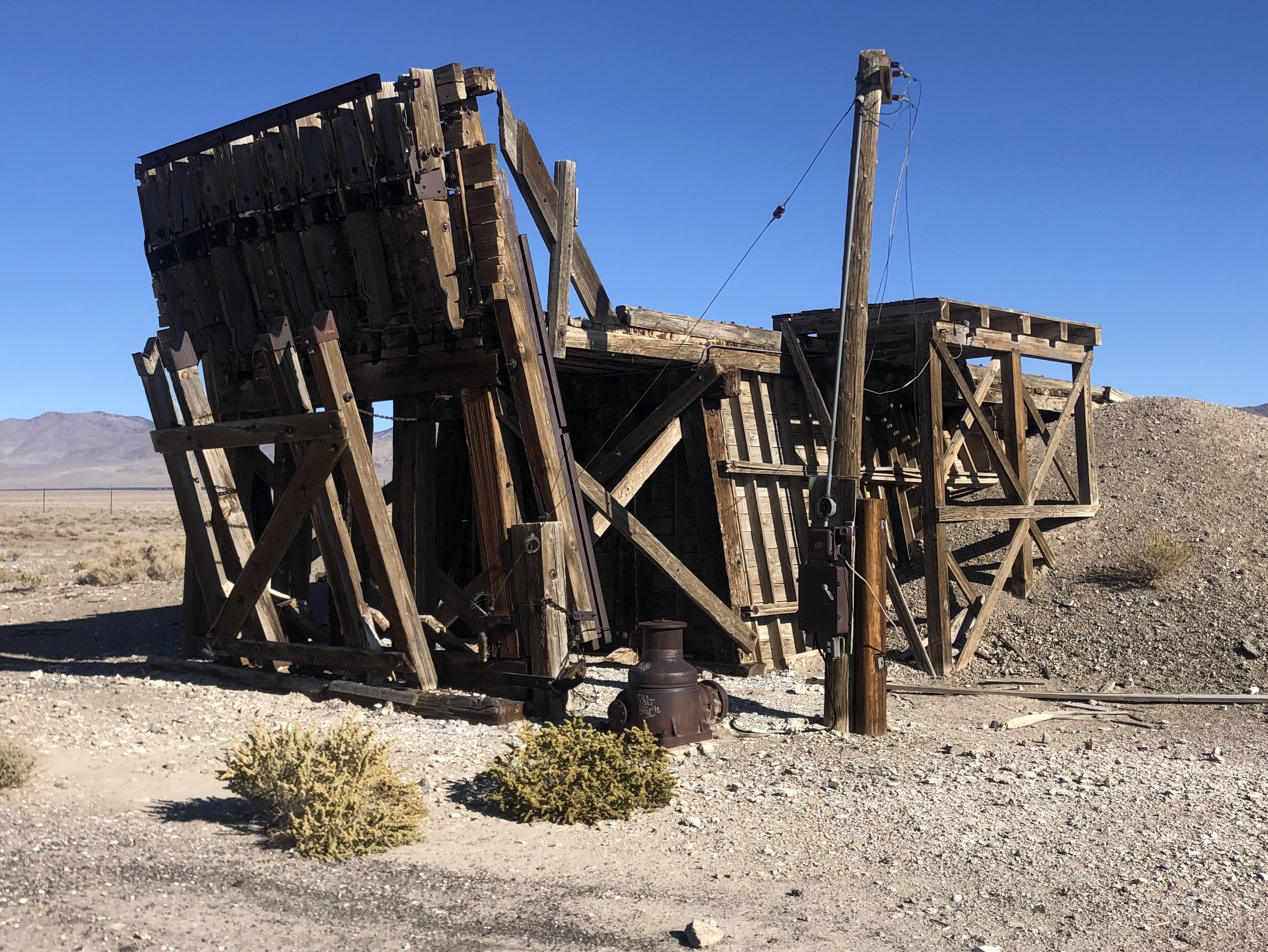
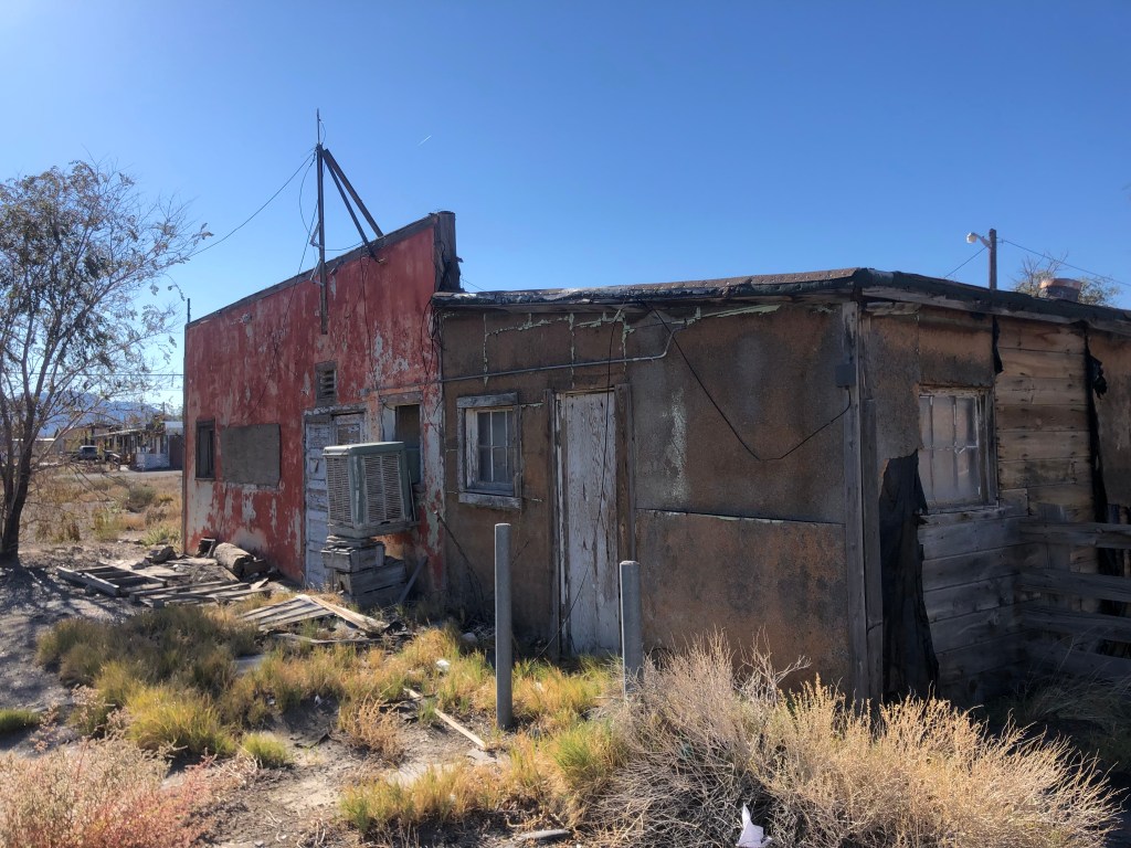
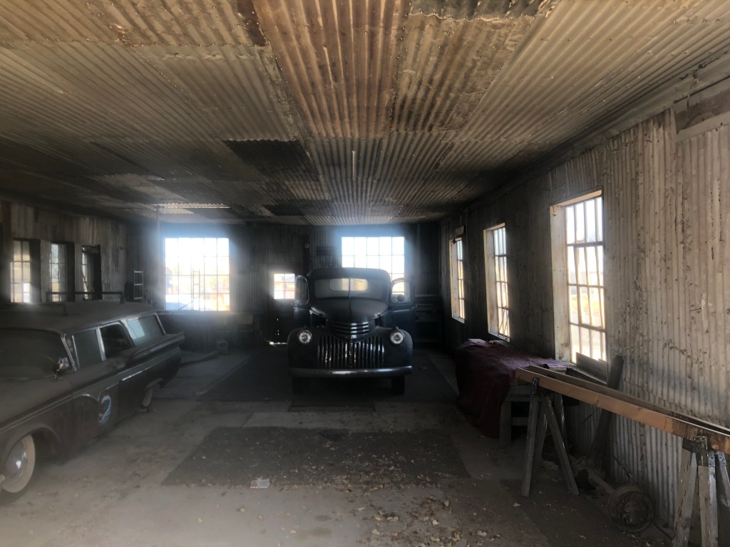
Then suddenly I found myself passing through another (nearly dead) town. Luning (pop: 87) was established in 1884 as a railroad town, with a trackside facility for loading magnesium ore onto freight cars. The once-active facility has long since shut down, but the main structures still stand, and I suspect the ghosts of long-since-passed stevedores still walk their creaky floors on moonlit nights.

Luning’s obsolete raison d’etre.

One wonders why 87 people still remain in this ghost town. From what I saw, the housing stock isn’t especially covetable.

Still inhabited.

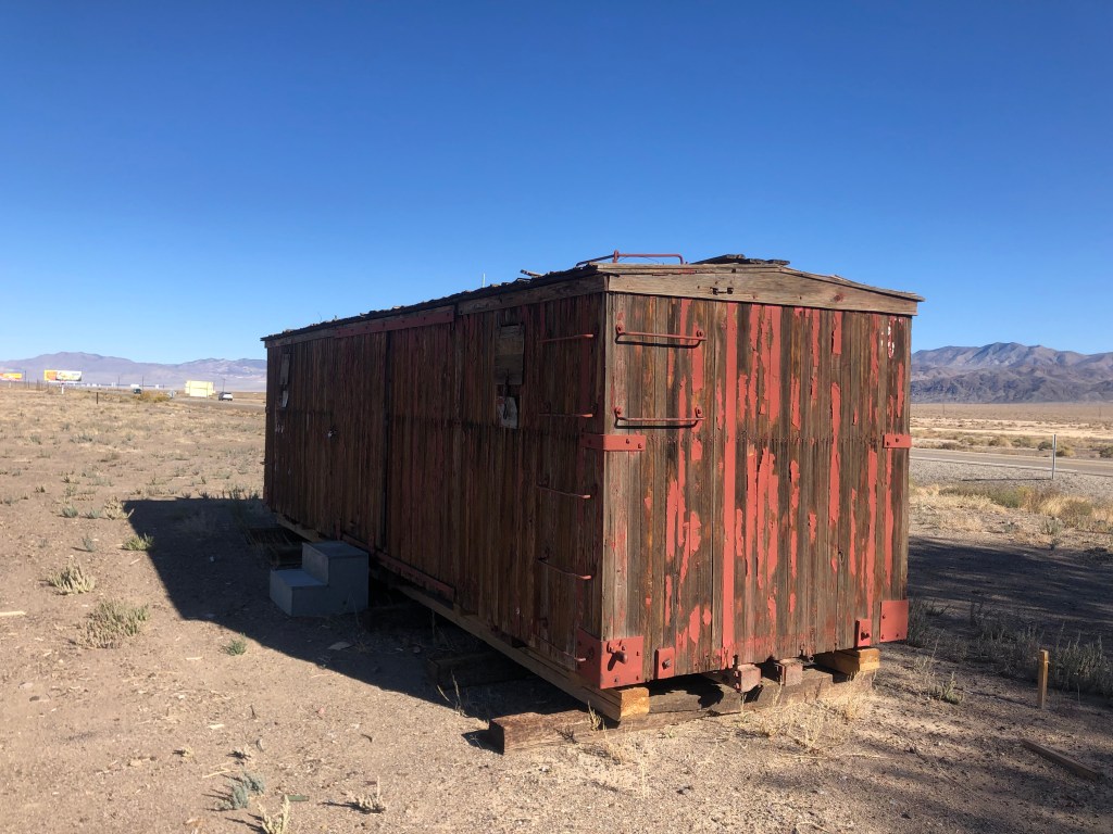
Some time after leaving Luning I came to a similar town. Like Luning, Mina (pop: 150) was founded as a railroad town over a century ago. As with so many Nevada towns, Mina owed its existence to mining operations. But the mines eventually played out, the residents began to move away, and the trains stopped coming through town.

Ancient railcar in Mina, now used for storage, apparently.

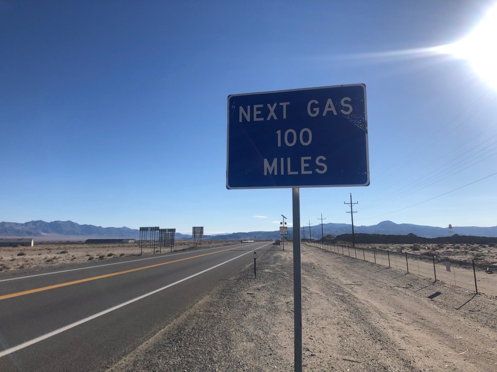
You’ve really got to wonder why anyone stays in this godforsaken place, with no working infrastructure to speak of, no job opportunities, and, to my eye at least, no pleasant surroundings. On top of all that, the nearest town with a gas pump and a mini mart is well over an hour away.

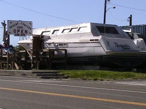
As far as I can tell, Mina is only known for two things. First, it used to have a restaurant named The Desert Lobster that was definitely unique. Owner Bob Eddy bought an old, damaged yacht he’d found in Texas and had it shipped to Mina, and this served as the front of his restaurant. But here was the genius of Bob’s plan: He would raise lobsters in greenhouses out in the desert, fed with water from a nearby spring. Sadly, wildlife officials eventually put an end to the lobster farm, and as of a few years ago the restaurant closed.

The Desert Lobster, back in the day. (Photo credit: Tom M., on Yelp)

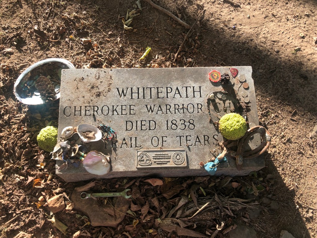
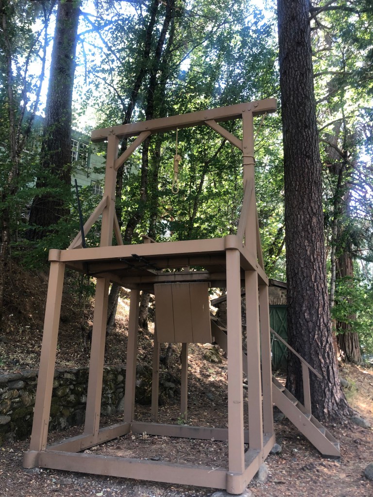
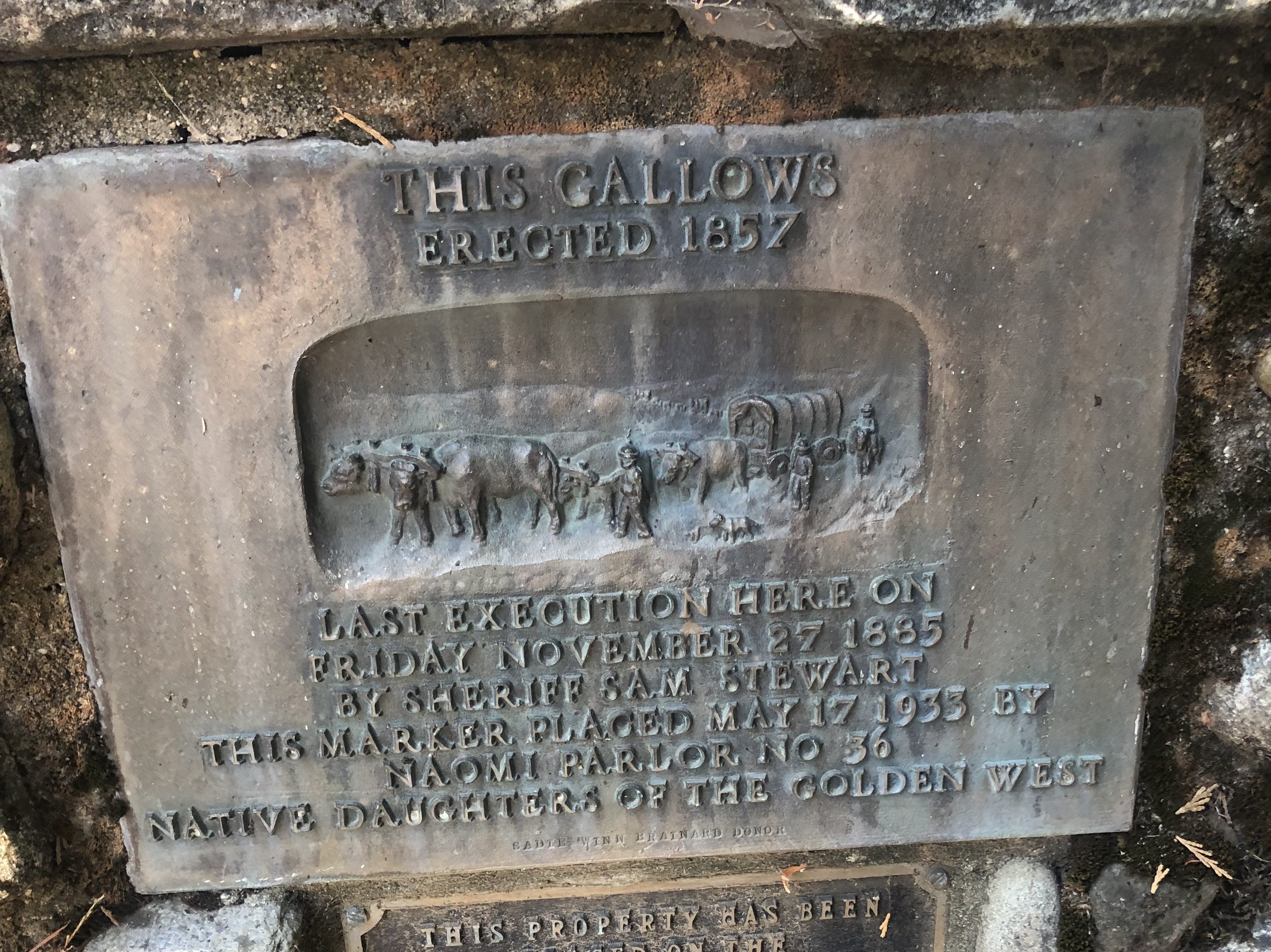
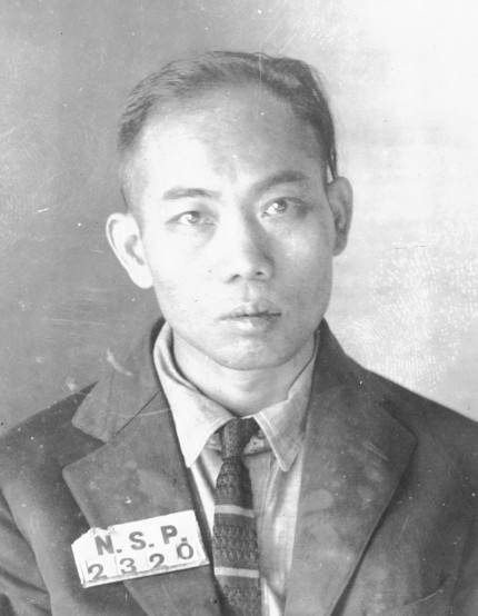
The other thing Mina is known for is its role in shaping America’s death penalty. In 1921 a Chinese immigrant by the name of Gee Jon was convicted of killing a laundry proprietor in Mina. He was sentenced to death, and was the first person to be executed by lethal gas. You can read the whole sordid tale here.

Gee Jon

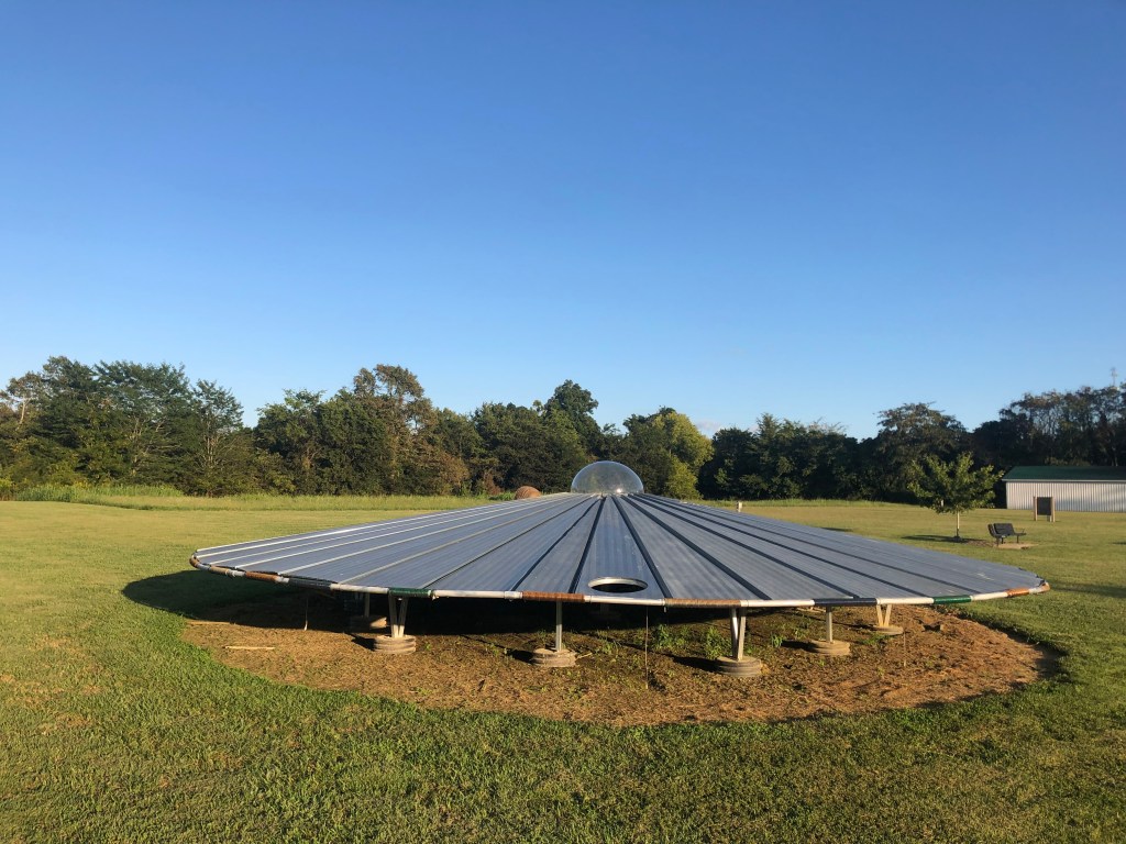
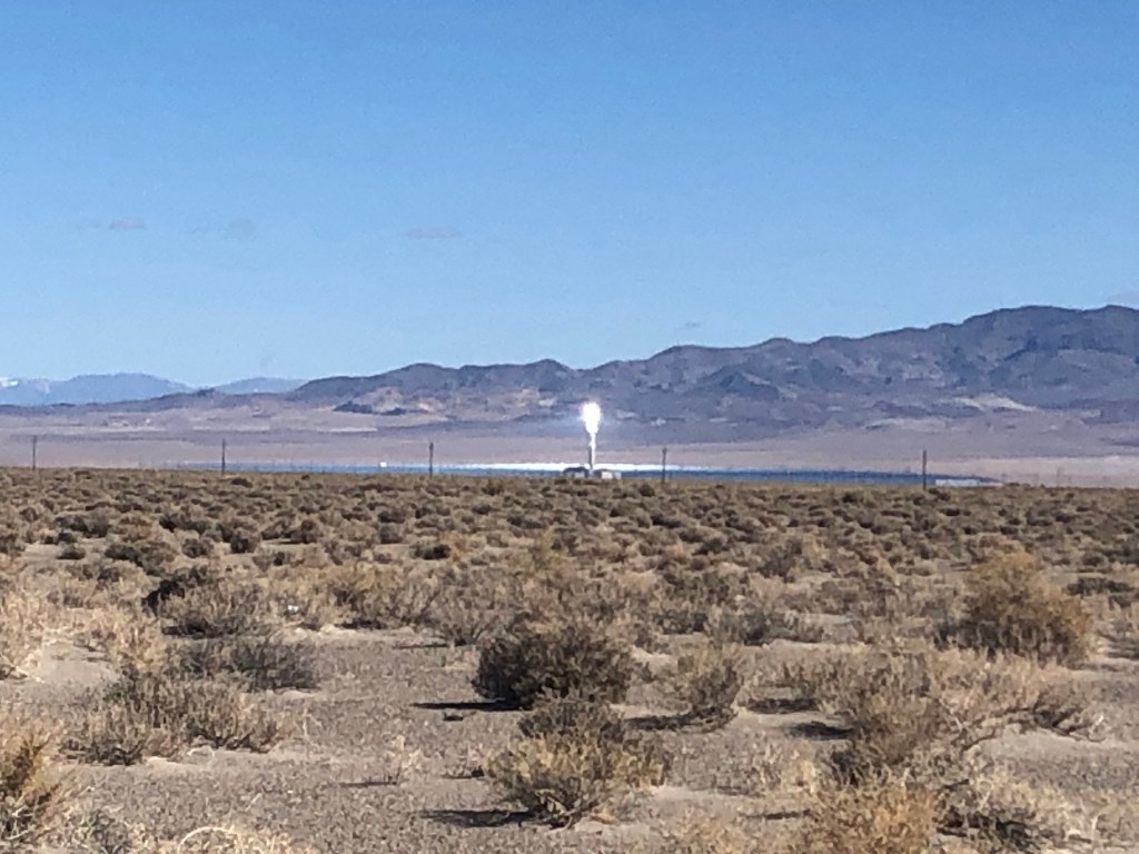
As I drove away from Mina I began to notice an intense point of light ahead of me on the left. For many miles the light kept getting brighter and closer. Finally I stopped at a rest stop near the light’s source and I learned that the light was coming from the Crescent Dunes Solar Energy Project. The project is essentially a huge array of mirrors sitting in the desert that concentrates sunlight at one point, creating enough heat to superheat liquid salt that is then used to produce steam and turn generators. (Think of it as frying an ant with a magnifying glass, on steroids.) Only about 6 years old, the plant has been beset with technical troubles and lawsuits. It was eventually shut down, but it appears to have been restarted by the time I drove by.

Not such a bright idea after all.

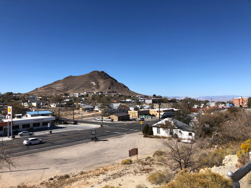
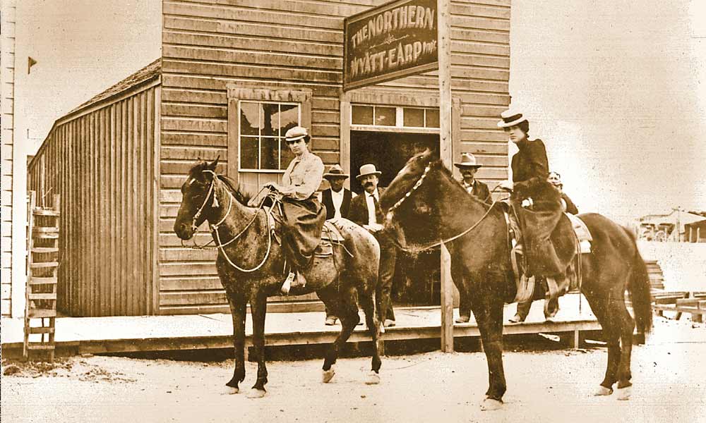
About an hour and half later I came upon the (relative) metropolis of Tonopah (pop: 2,500). Once the place that Wyatt Earp called home, Tonopah started out as a mining town around the turn of the 20th century. Like all the other mining towns it declined in the mid-century, but its location about halfway between Reno and Las Vegas seems to have helped it to survive as a convenient stopover location for those traveling between the two cities.

Downtown Tonopah
After becoming wealthy in the goldfields of Alaska, Wyatt and Josie Earp moved to the latest mining bonanza in Tonapah, Nevada, where they operated Wyatt Earp’s Northern Saloon, some believe the woman on horseback at left is Josie. – True West Archives –
Wyatt Earp’s bar in Tonopah

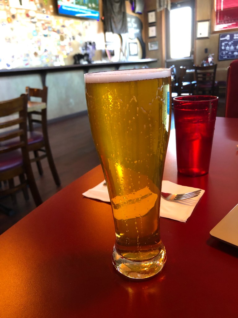
I stopped for lunch at the Tonopah Brewing Company, whose motto is “blood, sweat & beers” (seriously). I ordered their Double IPA, but managed to knock it over it before I’d had more than a sip. (The waitress was not happy with my clumsiness.) So I really can’t say much about the beer. But I can say that Tonopah Brewing Company is the absolute best brew pub in Tonopah. Of course, it’s also the absolute worst brew pub in Tonopah…because it’s the only brew pub in Tonopah. Perhaps because it’s the only game in town, the place seems to cater to every conceivable taste. The music is an unlikely combination of death metal, country&western, 1970s pop, and the Beastie Boys. And the television is tuned to a Spanish-language station.

Tonopah Brewing Company. Not much to look at from the outside.
BOTD, moments before The Big Spill

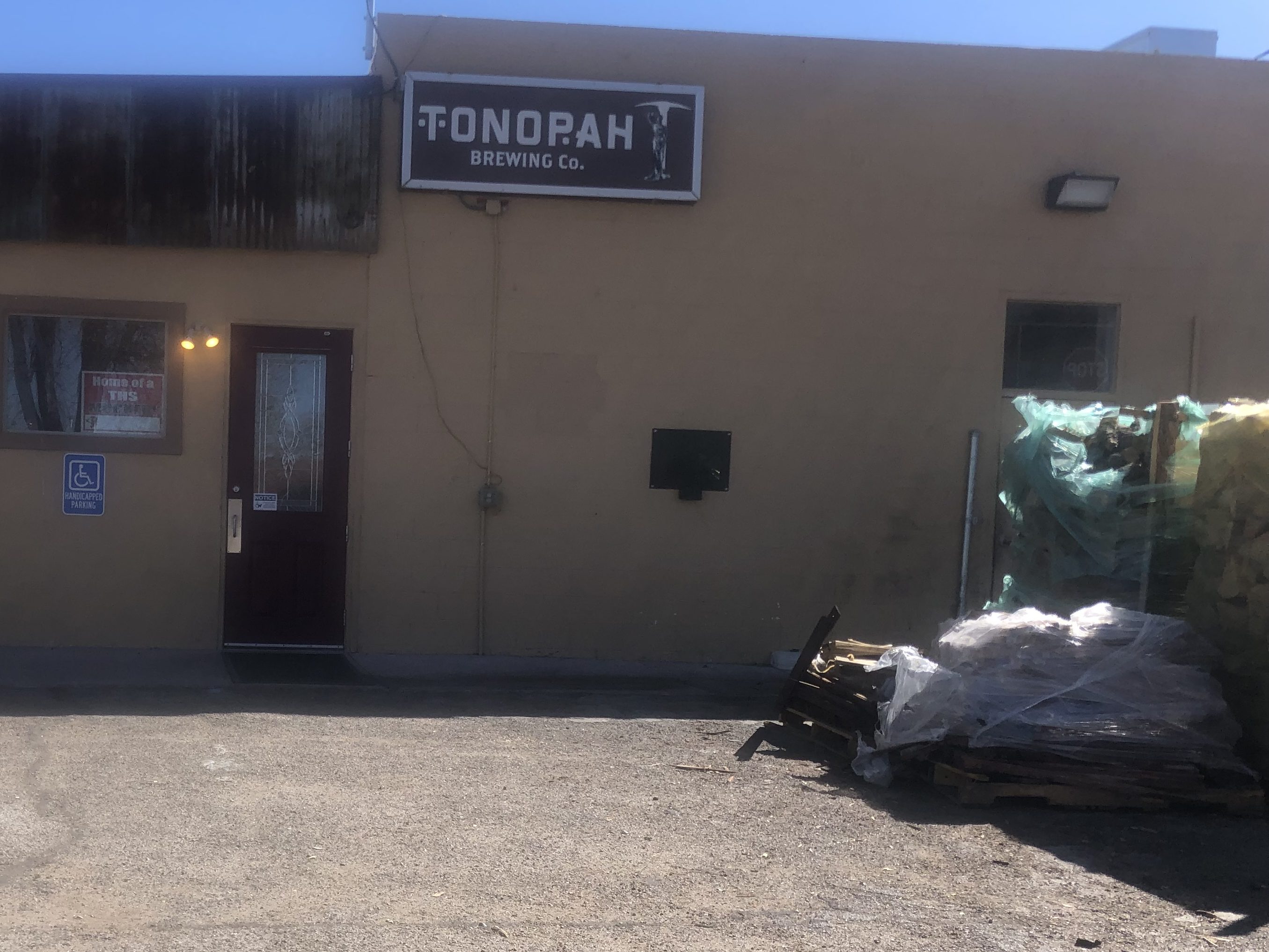
They do have their own small-batch brewing setup, and they have their own smoker for in-house barbecue preparation. I had a decent pulled pork sandwich.

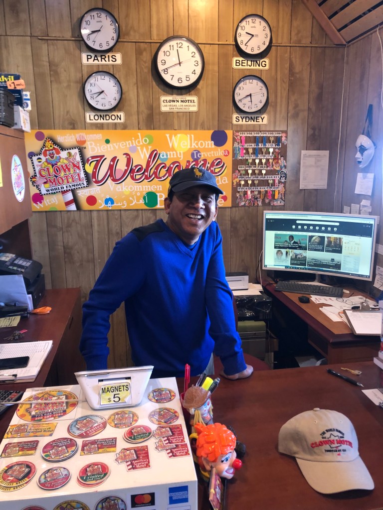
Thus fortified with smoked, cooked, dead animals and a sleeve soaked with beer, I got back on the familiar Route 95 and soon encountered what is surely the scariest part of this trip: Tonopah’s Clown Motel.

Please don’t kill me, Please don’t kill me….

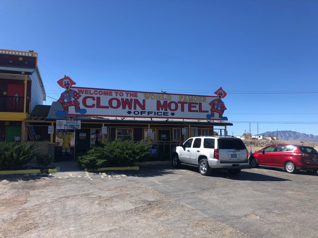
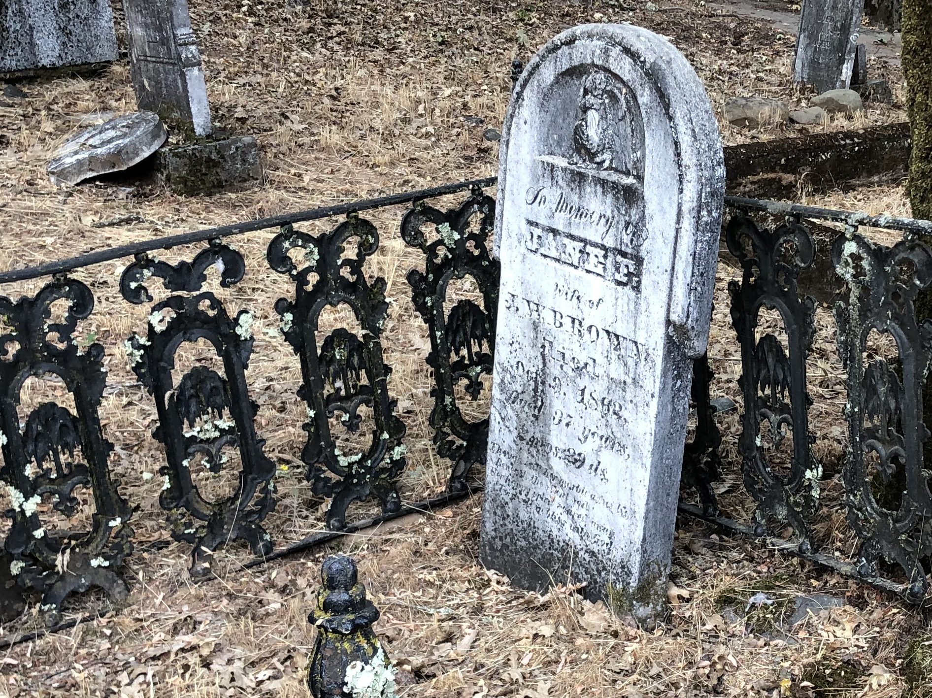
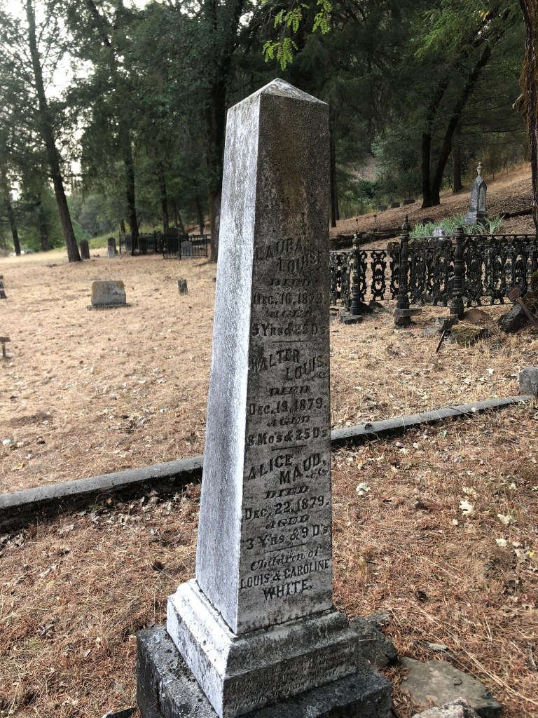
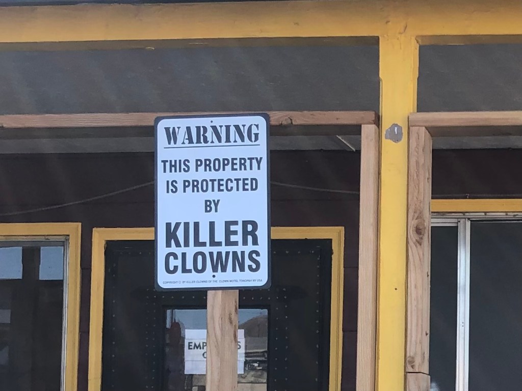
The hotel was originally opened in 1985, and it seems that the intent was innocent enough. The original owners, Leroy and Leona David, say they wanted to honor their late father who’d amassed a collection of about 150 clown figures (as one frequently does). The clown figures were used to decorate the property, and that’s about it. But over time the “creepy clown” trope became a thing, and books and movies like “It” pushed clowns into the realm of the truly scary. So the motel seems to have decided to swim with the tide and play up the creepy aspects of their clown theme. Oh, and did I mention that the motel sits right next door to an ancient cemetery? I’m not making this up.

Sign in front of parking lot. Way to reassure the kids whose parents take them here!

Over the years, the place has developed something of a cult following. Many people have sent in their own clown memorabilia, which now numbers over 2000 items. Many of the pieces are on display in the lobby, which doubles as a “clown museum.” The motel has also been featured on the television show “Ghost Adventures” in 2015. Supposedly a clown doll was caught on film moving by itself. You can judge for yourself!

In the lobby, which doubles as a “Clown Museum.”

The current owner, Vijay Mehar, told me that Covid has really put a dent in business, but he’s making a go of it. He’s even amping up the scary clown vibe, decorating a few of the rooms with themes such as the “Halloween” room, the “Friday the 13th” room, and the “Exorcist” room. Again, I’m not making this up.

The man behind the clowns.

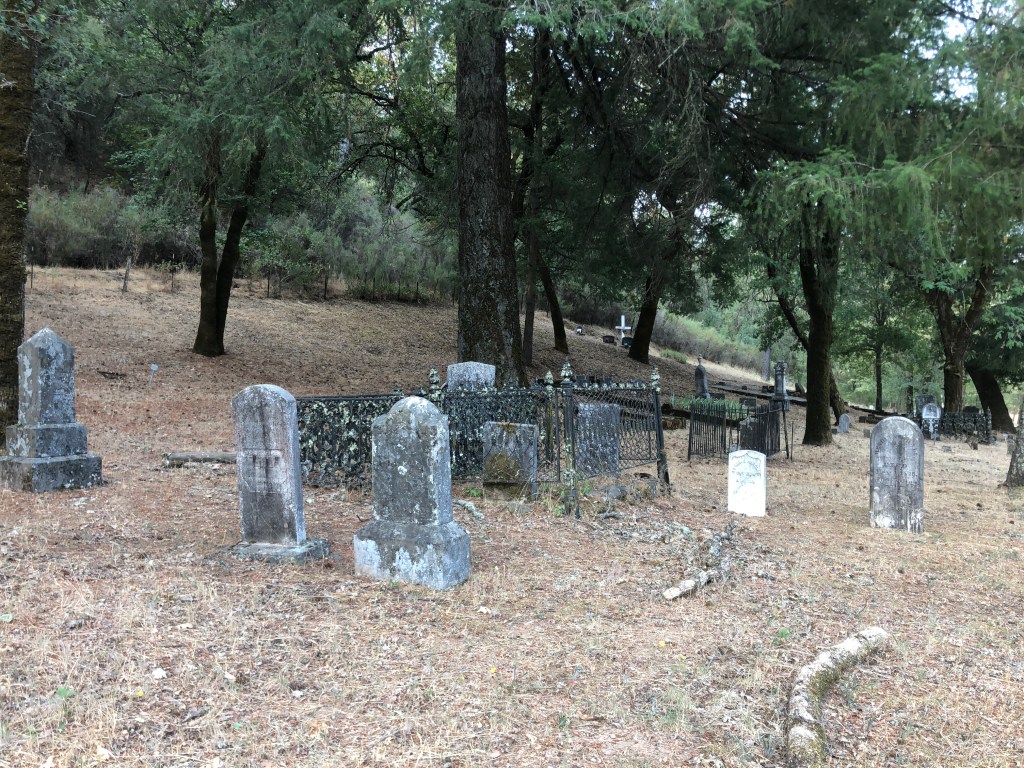
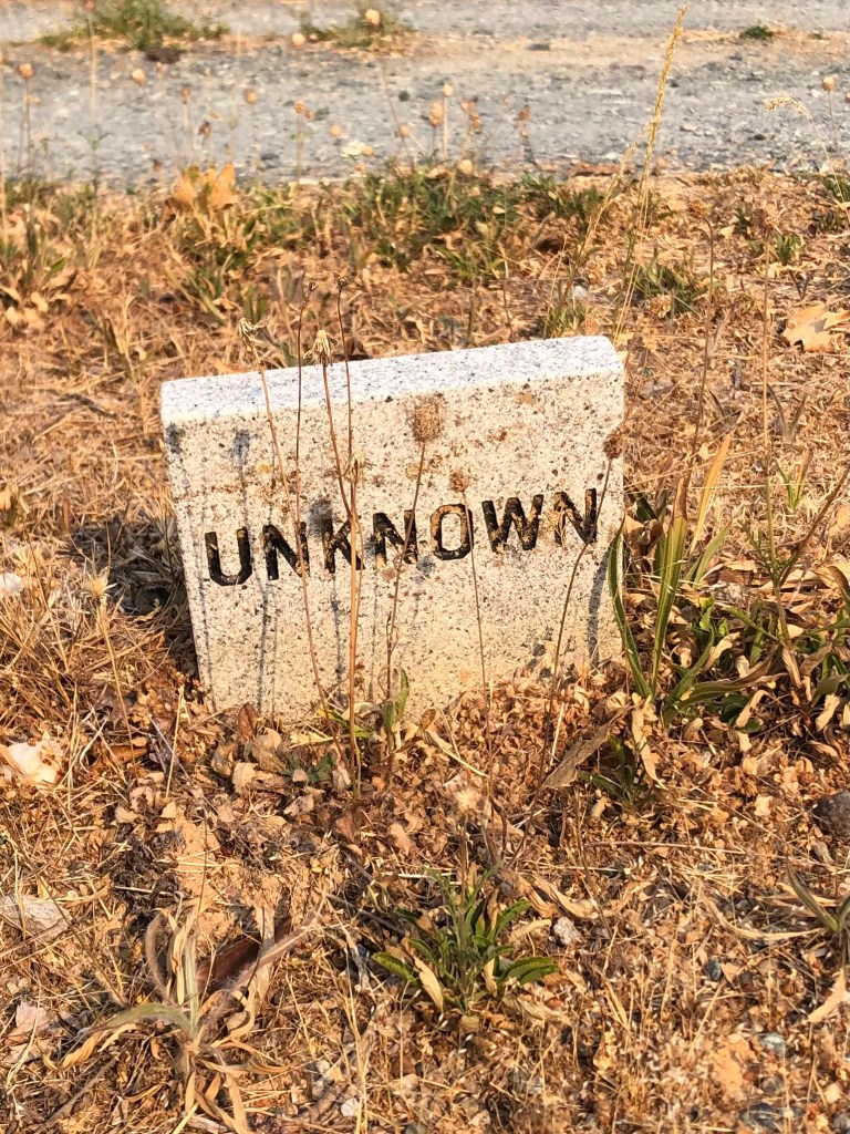
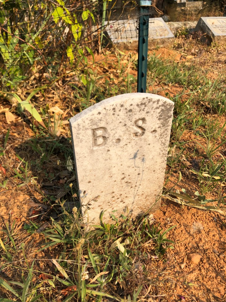
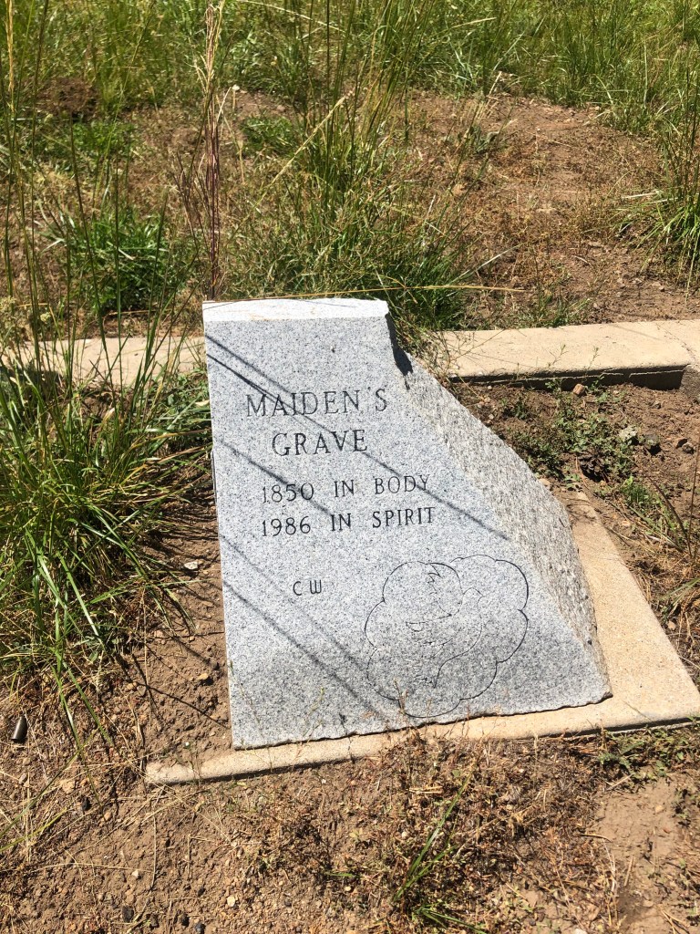
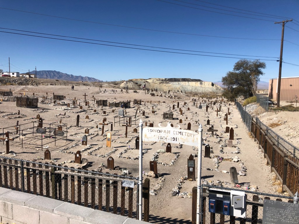
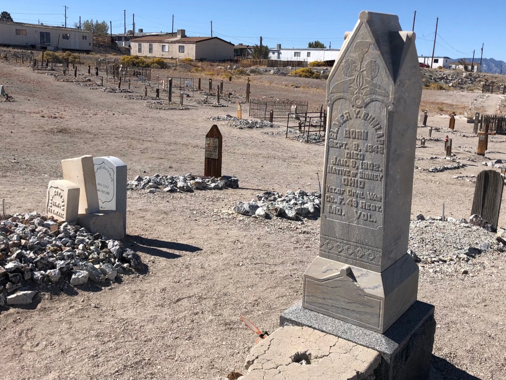
Vijay encouraged me to go take a walk through the neighboring graveyard, which butts up against the Clown Motel’s parking lot. It’s one of those desert cemeteries which lack trees, grass, or any other signs of life. I was surprised that Vijay hadn’t placed a few zombie clowns around the cemetery, in order to further advance the creepy clown vibe of his property.

Having pretty much exhausted the coulrobic aspects of Tonopah, I once again hit the road. Within 45 minutes I encountered the remarkably well-maintained, historic town of Goldfield (pop: 250). As the name suggests, Goldfield had started out as a gold mining encampment. The mines produced about $1 billion in gold (in today’s dollars.) The rich gold veins turned Goldfield into a boom town, and for a time it was Nevada’s largest city. Goldfield boasted some 20,000 residents at its peak in 1906. One of those residents in 1904 and 1905 was Virgil Earp (Wyatt’s brother), who was the town’s deputy sheriff.

A fire in 1923 destroyed much of Goldfield. Since gold production had become much less profitable by that point, there wasn’t much reason for people to rebuild their homes in the town. Those who did remain steadily declined until only a few hundred people were left in 1950, and Goldfield has limped along ever since.

Today Goldfield has just a handful of residents, but the town exudes a strength and robustness that belies its scant population. This is town that clearly values its history. The Goldfield Historical Society is a local nonprofit organization that actively works to preserve and restore Goldfield’s buildings and to promote its history. They’ve erected markers and plaques, organized walking tours, and held various fundraisers. You can see evidence of their work on almost every block.

Originally Goldfield’s elementary school, this building is now the town’s public library. The grounds (on the other side) serve as a “historic equipment park.”
A few cars that look like they haven’t moved in awhile. (Goldfield’s courthouse is in the background.)

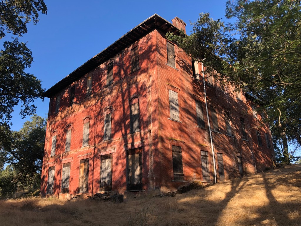
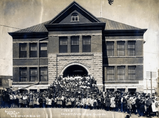
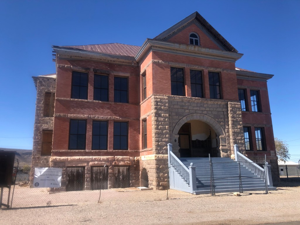
Goldfield High School is one of the historical society’s biggest projects. It was built in 1907, and its three stories served up to 450 high school students. The school closed in 1952, and it’s been shuttered ever since. After a half-century of neglect, the south wall collapsed, and efforts to save the structure finally began in earnest. The historical society has received grants and donations toward a full restoration of the building, which is ongoing.

Goldfield High School, back in the day.
Goldfield High School today.

Another major restoration effort focuses on the Goldfield Hotel. It’s a huge structure, and in surprisingly good shape considering it was built in 1907, survived a flood and a fire, and has been vacant since World War II.

The Goldfield Hotel.
Inside the Goldfield Hotel. Don’t ask how I got this photo.

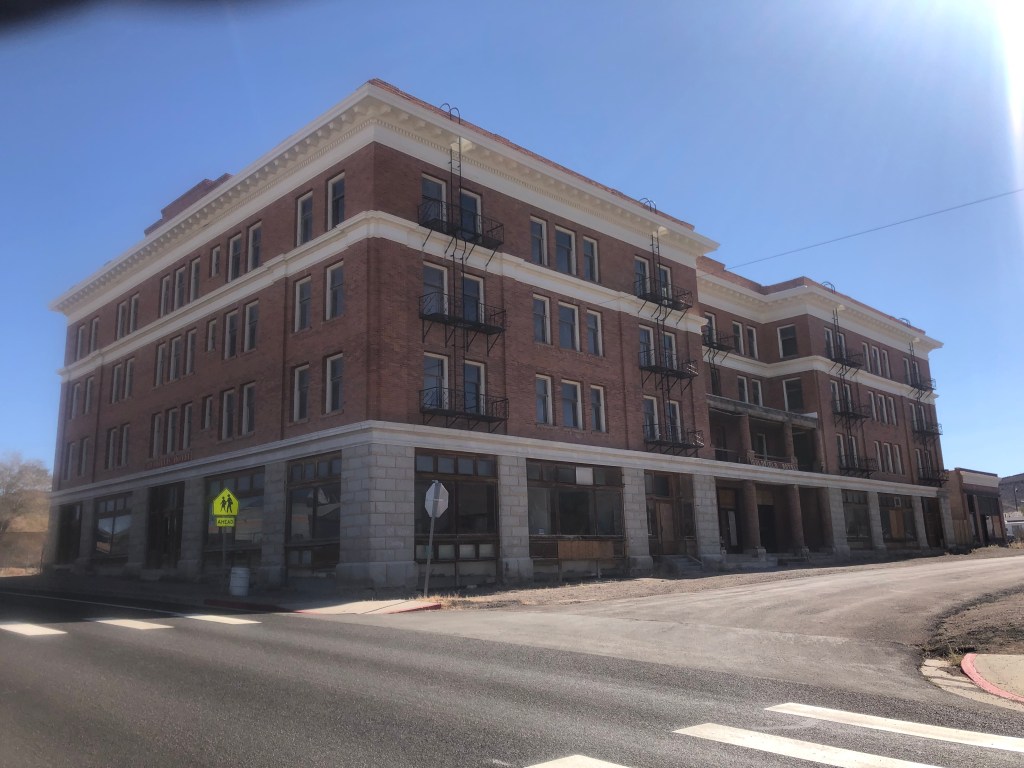
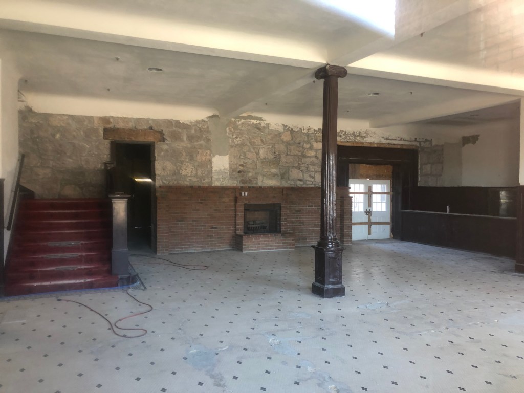
Ownership of the hotel has changed several times in recent years, and plans to make it into a boutique hotel seem to have fallen through. But I saw clear evidence of active restoration work when I visited. Oh, and that same Ghost Adventures show that went to the Clown Motel also has been to the Goldfield Hotel, and claim that they’ve seen evidence of hauntings. A local resident told me that the Ghost Adventures team had recently come back just a few months ago to do another feature on the hotel.

Anyway, it feels like there are historic structures all over this town. And I’m told that every single one of them has a current owner who’s either restored it or is planning to do so. Why does Goldfield have all this energy and civic pride, while towns like Luning and Mina have essentially disappeared?

Goldfield’s fire station, from 1908. Beautifully restored, and now a museum (that’s only open by appointment).
The Esmeralda County Courthouse in Goldfield, constructed in 1907
Old filling station and garage, built around 1935.
Inside the garage
Of course, not everyone in Goldfield is on board with the historical society’s pleas for historical authenticity.

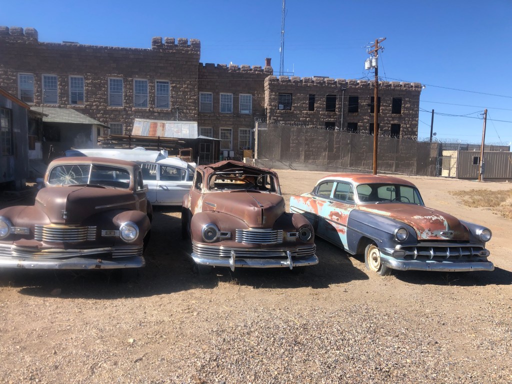
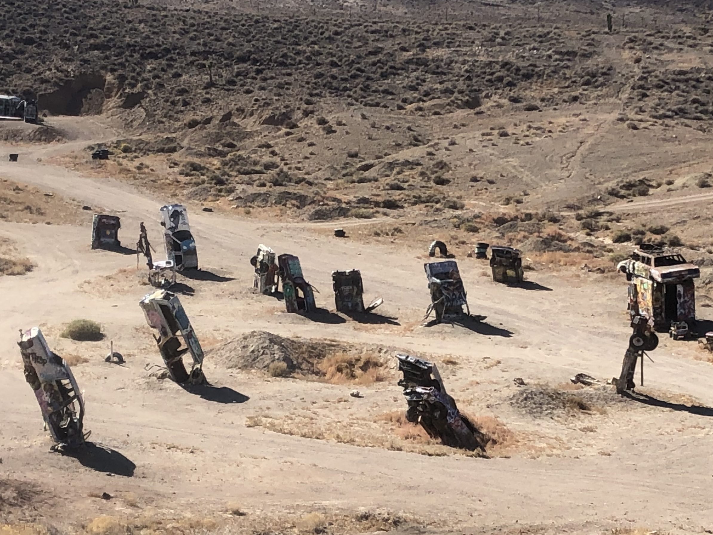
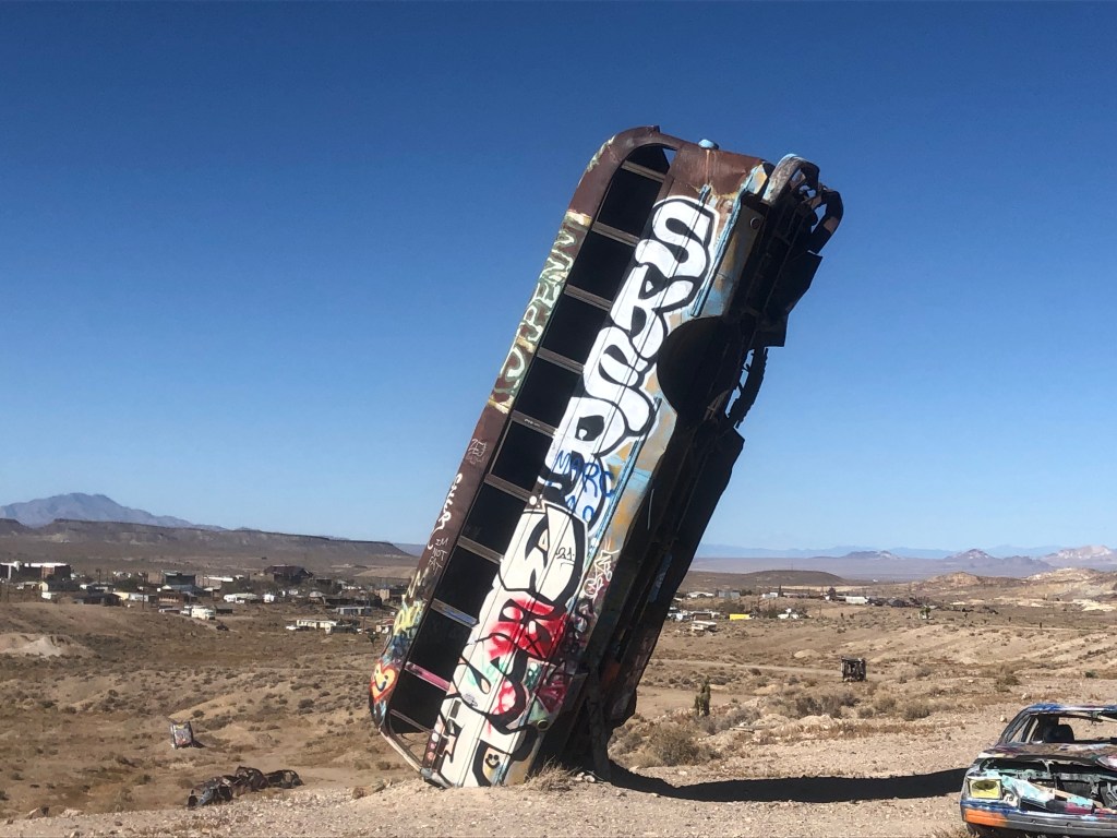
On the outskirts of town is a quite different type of attraction. The International Car Forest of the Last Church is a public art installation (I guess). It started when local resident Mark Rippie for some reason decided to stand a car on its nose in the desert outside Goldfield. This “art installation” was noticed by artist Chad Sorg as he was passing along Route 95, and Sorg was so taken by the piece that he settled in Goldfield to help Rippie expand the single car into a “forest” of abandoned cars. (I’m assuming that controlled substances played a part in the decisionmaking.) Today the “forest” includes over 40 vehicles, all of which are regularly covered and re-covered with graffiti by visitors. (The International Car Forest of the Last Church in fact encourages that behavior.) I hate to sound like a Philistine, but isn’t this all highly derivative of the much more famous and whimsical Cadillac Ranch?

Just a portion of the forest
Won’t get fueled again

Yes. Well. So, after studying each vehicle with my arms behind my back and muttering “I can feel what the artist is trying to say,” like a hippie version of Woody Allen, I left the Forest and got back on US 95. After my enjoyable and engaging visit to Goldfield, I was back in the mode of speeding along endless miles of desert and an unchanging horizon. After a little over an hour I saw a large yellow sign ahead and, as I was about due for a break, I figured I’d make a stop.

You at least have to admire the bluntness. No “Gentlemen’s Club” or similar euphemisms here!

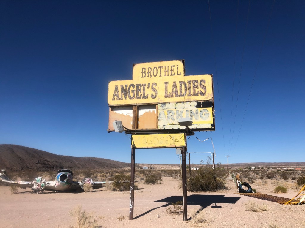
As we all know, prostitution is legal in Nevada. Has been since 1971. You just have to conduct your activity in a licensed brothel. So, here we have the confusingly-punctuated “Angel’s Ladies” brothel, which has been around (under various names) for over a century. (Yes, evidently it operated illegally until 1971.) The place has been closed since 2014.

Alert readers might notice the wreckage of a small plane not far from the sign.

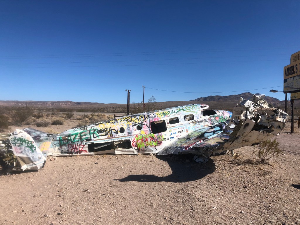
Well, there’s a story to it. It seems the brothel’s owners decided to run a promotion in 1978: They got this plane, and let volunteers parachute out of the plane from a low altitude over the property. If the jumper managed to land on a mattress that had been put on the ground, they won a free night at the brothel with the woman of their choice. Unfortunately, the pilot had some trouble during the promotion and crashed the plane right where you see it today. The owners evidently figured that it was worth more as a roadside attraction than as scrap, so they left it where it crash-landed. (News reports say that no one was hurt in the crash.)

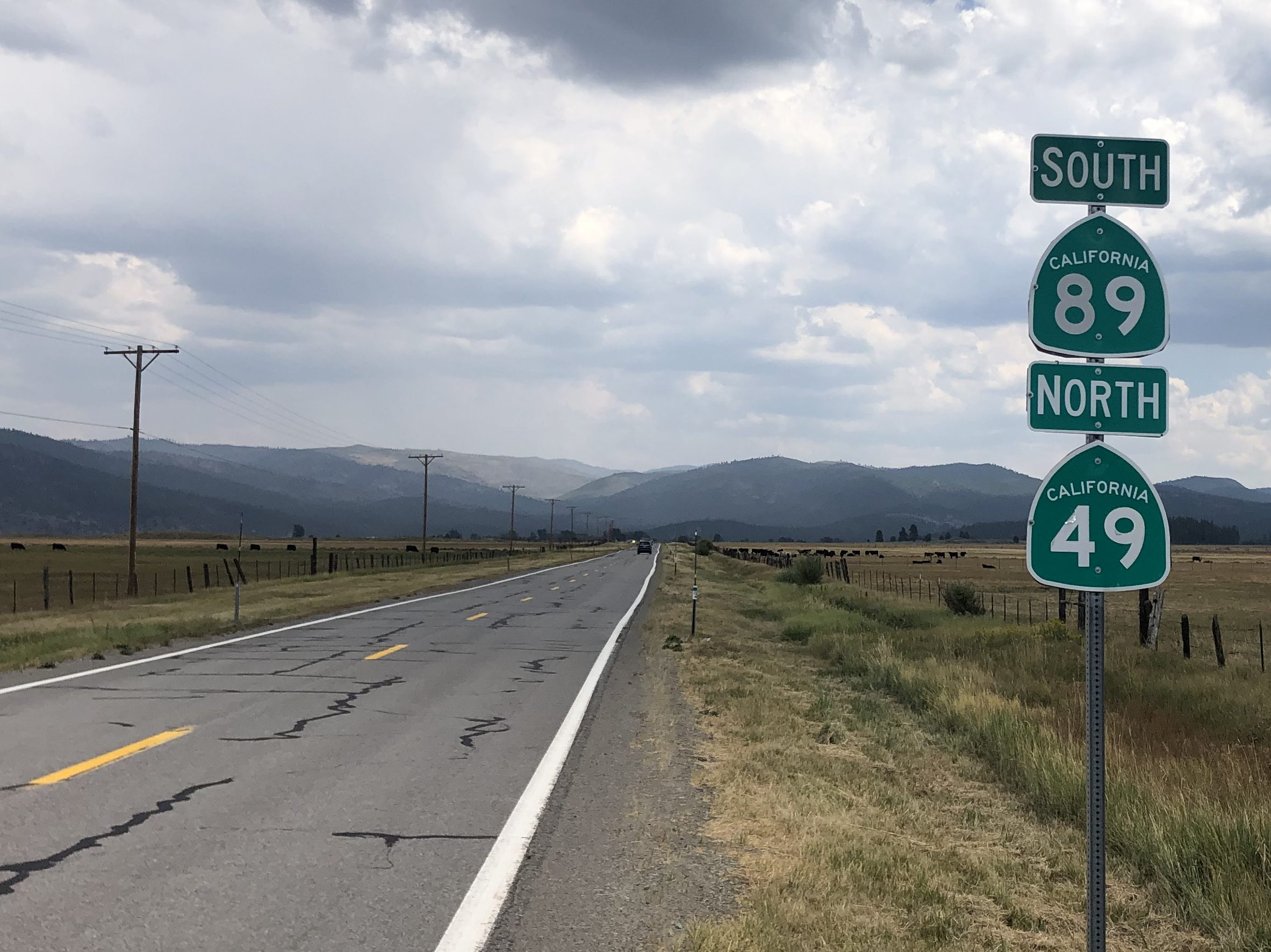
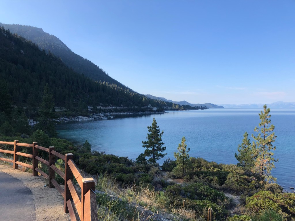
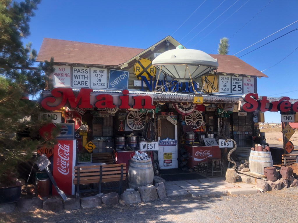
Angel’s Ladies Brothel is just north of the town of Beatty, which is otherwise not notable. After passing Beatty, I started to plan (better late than never) on the remainder of my route. I decided that I didn’t want to go all the way to Las Vegas, as it really isn’t the kind of city that I’ve been seeking out on these trips. So I made a last-minute decision to leave US 95 and cut northwest through Death Valley and then take US 395 home. Those segments have been the subject of other blogs (like this and this), so I won’t detail the rest of the trip, except to say that Death Valley in the fall is stunning, and US 395 always affords awesome views of the eastern Sierras.

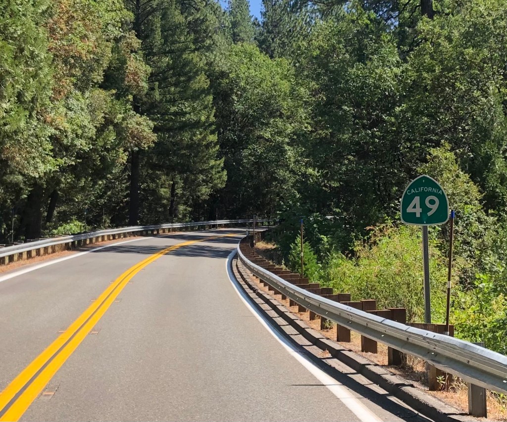
I’d also say that US 95 — at least the segment of it that I took through Nevada — is an interesting, stress-free, pleasant enough highway for those looking for such things. And I’m sure there were plenty of roadside attractions and stories that I missed, so I’d encourage you go out there and find some more!

cemeteries · Obelisks · Road trips

End of the Line

We made it!

Today Scott and I ended our journey along the Trail of Tears at Tahlequah, Oklahoma, where the bedraggled and exhausted survivors of the original ordeal arrived 182 years ago. As we’ve learned, some 16,000 Cherokees had been forced from their homeland in and around Georgia after the federal government passed the Indian Removal Act of 1830. The idea was to free up the Indian lands for the use of white settlers. The forced march of the Cherokees took place between 1838 and 1839, and up to 4,000 of them died during or immediately after the forced removal.

The survivors then went about the business of re-establishing their nation on these new lands. They chose Tahlequah as their new capital, and began planning streets, government buildings, homes, and other facilities. The Cherokees had adopted many aspects of the European Americans’ society, including western dress, a written language, democratic governance, agriculture, Christianity, and frame architecture. In fact, even in its early years, Tahlequah very much resembled any other small American town. Today the town is tidy, respectable, and generally quiet, though we had breakfast at a bustling downtown cafe next to a jazz club. Afterwards we walked through the historic district, which stands alongside a clear and gently-flowing creek.

The old Cherokee Capitol building, in Tahlequah’s town square. Not that different from many small, old American towns.

You’ll remember John Ross, who had been Principal Chief of the Cherokee Nation since 1828. He had fought the diaspora for years, desperately lobbying the Congress in Washington, DC, appealing to President Jackson, and even taking the State of Georgia to the Supreme Court (not literally, of course). After exhausting all avenues, and after a cabal of other Cherokee leaders surreptitiously signed a separate treaty with the federal government giving up the Cherokee lands, Ross resignedly helped manage the movement of his people out west to present-day Oklahoma. He joined them on the Trail of Tears, and his wife Quatie died along the way, in Arkansas. Ross helped to establish the new capital in Tahlequah, and was re-elected principal chief until his death in 1866. Today, Tahlequah (pop: 17,000) remains the Cherokee national capital. The Cherokee nation has jurisdiction over most of the land in northeastern Oklahoma. About 300,000 people belong to the nation.

Grave of John Ross (1790-1866), in Tahlequah. Note the obelisk!

So, while it’s not exactly a story of triumph, the Trail of Tears and its aftermath constitute a story of survival. Still, it’s notable to me that few of the people we met along the way had much knowledge of or interest in the TOT. Even the hotel clerk in Tahlequah didn’t seem much to care when we informed her that we’d just finished covering the entire route. “Did you walk it?” she asked, unimpressed. To be fair, ours wasn’t much of an accomplishment when compared to that of the original travelers.

We did, though, receive genuinely enthusiastic responses from precisely two individuals along the route. One was Amy, who managed the visitors center in Hopkinsville, KY. The other was Gena, who we met today at Tahlequah’s Chamber of Commerce. Gena is the director of tourism for Tahlequah, and like Amy, she’s well suited to the role. She clearly loves this town, having moved here from Mt. Shasta, CA. (It’s a long story.) Gena patiently answered our questions about the town’s history, gave us directions to several historic sites, and hooked us up with some Tahlequah swag.

Gena and her Granddaughter, Ellis

On our way out of town we stopped at two cemeteries. The Ross Cemetery is the final resting place for John Ross and many of his relatives. (It had originally been the homesite of one of Ross’s nephews.)

“Here We Rest,” at the Ross family cemetery.

The other was the Caney Cemetery, which holds the remains of many figures from this area, including a handful who had survived the Trail of Tears. Scott and I were struck by the number of graves of children and infants, which may speak to the state of healthcare among the nation, or to other issues. On the other end of the spectrum, though, were graves from individuals who had walked this earth for many, many years. One such long-lived individual was Betsey Snaketail, a Trail of Tears survivor who died in 1881. She was born in 1771, before the American Revolution.

Little could stop Betsey Snaketail, God bless her.

We lingered a bit at this place where a handful of the TOT survivors have finally found their rest. Then we got in the car and headed for Tulsa to catch our flights home. Those of you who know me well are aware that I’m not normally given to sentimentality or mawkishness. But I’m left with an enduring sadness about the treatment of these people by our government. And even if you take the government out of it, it’s distressing to be reminded how individuals can mistreat other individuals, sometimes harshly. I recognize that mistreatment of others is not unique to any time or place, and that it goes on even today. But I wonder if the experience of the Trail of Tears holds any answers that might help us to do better, even as individuals.

cemeteries · Road trips · trains

Volunteers and Bluegrass

This morning we awoke in Chattanooga, and got a good, greasy breakfast at a place called Aretha Frankensteins. The restaurant is in a tidy house on a residential street, where the cook was smoking a doobie out on the porch.

R.E.S.P.E.C.T. the zoning ordinances…

The interior is a mish-mash of horror movie stills, plastic skeletons, and various Halloween props. The biscuits were, um, to die for.

I say a little prayer…

Suitably fortified, we headed out eastward to Red Clay State Historic park, just over the border from Georgia. This served as the Cherokee’s national seat of government from 1832 to 1837. But wait, you say: Wasn’t New Echota, Georgia (that we visited yesterday) the Cherokee capital? Indeed it was, but in the early 1830s Georgia passed a state law making it illegal for the Cherokees to gather and officially vote on anything. In order for their national Council to convene, therefore, they moved across the state line into Tennessee. See the two points at the right-hand end of the Trail of Tears, below.

Following In Their Footsteps · National Parks Conservation Association

The state park at Red Clay includes the reconstructed Council meeting house, as well as other structures. It’s much less impressive than New Echota, and clearly served as a makeshift site for a government-in-exile.

From Red Clay, we roughly followed the northern route that the Cherokees took when they were forced from Georgia to Oklahoma. We passed through a number of small, out-of-the way Tennessee towns, and skirted around the west side of Nashville. Along the way we stopped in McMinnville, TN (pop: 14,000) for lunch. We tried the Vanilla Bean Bakery, which hooked us up with baked goods an coffee. (I never said it was going to be a healthy lunch.)

The girls at The Vanilla Bean put together our to-go order…

On the way out of The Vanilla Bean we passed a narrow, granite monument of sorts that was squeezed between two buildings. The monument reads: “JESSE WALLING. I enlisted in the Lord’s cause when young. Later I enlisted in the Confederate cause and was wounded at Murfreesboro and later discharged by President Davis. The Lord has been good to me 85 years.”

And just beneath the monument is an engraved notation: “This stone is not to be moved for love or money.” So evidently, Jesse’s wishes have been honored.

It turns out that Jesse Walling had been mayor of McMinnville, and he’d founded a bank, a power company, and a cotton mill. He died in 1930 at the age of 89. The Lord had been good to him, indeed.

 Jesse Walling
He collected properties like a Monopoly player.

A little later along our route, in Goodlettsville, Tennessee, we encountered this Transformer-like yard art.

“I will never stop fighting for our freedom.” –Optimus Prime

It even has (barely) moving parts! Watch it in action.

I’d love to see it go head-to-head with this medieval bad boy that we found guarding a junkyard yesterday:

None shall pass.

Eventually we entered Kentucky at roughly the same point that the Cherokees did 183 years ago. We headed up the “Dixie Beeline Highway,” and eventually found ourselves in the quaint town of Hopkinsville (pop: 32,000). It’s home to an unusual 1892 depot of the Louisville and Nashville Railroad.

The architect may have been suffering from “turrets” syndrome.

Hopkinsville was one of the few towns in the region permitting alcohol sales. It’s said that Hopkinsville was often referred to as “Hoptown,” because it was only station between Evanston, IL and Nashville, TN where a passenger could “hop off” and get a drink. I’m not making this up.

Speaking of drinks, on today’s drive we encountered a few pink elephants. Though located in different cities, they appear to have been manufactured out of fiberglass from the same mold. Alert readers will recall that I’ve run into a couple of similar (though slightly different) pink elephants on my Route 70 trip (see near the end of this post and this post.)

Outside a liquor store (of course) in Hopkinsville, KY
Outside a gas station in Guthrie, KY

Finally, just three minutes before its 5 pm closing time, we arrived at the Hopkinsville-Christian County Visitors Center. It was on this land that Cherokees on the Trail of Tears camped, were reprovisioned, and (for a couple of them at least) died. We were greeted by Amy, who was the only person so far who’s showed any enthusiasm for our trek. In fact, Amy seems to show enthusiasm for everything, including a story about aliens landing in the area in 1955. It seems that the Lankford-Sutton family, which lived in a farmhouse a few miles up the road, watched a spaceship land on an adjoining field on the night of August 21, 1955. Little silver beings emerged from the ship and converged on the farmhouse. Some of the menfolk in the house fired shots at the beings (as one does), but the shots had no effect on them. The police were called out, but they could find no evidence of an alien invasion. The story was largely forgotten until 2005, when some townsfolk figured a 50th anniversary celebration would be a good way to draw tourists. There’s been an annual “Little Green Men” festival ever since. (Never mind that the men were originally claimed to have been silver, not green.)

Amy hawks an Alien doll, that she’s named Cletus.
“”Flying saucer” at the scene where the alien invasion “happened” some 66 years ago. (Yes, Scott and I felt compelled to drive out to the field and check it out.)

We spent some time chatting with Amy about her job (the Lord answered her prayers and led her to it two months ago), her home (on her parents’ 150-acre farm), the Trail of Tears (there’s going to be a big commemorative meeting of Indians at the Visitors Center this weekend), and various other topics. Sensitive that we were keeping her at her job well past closing time, we let her lock up while we moved outside to the area where the Cherokees had camped. Next to a creek were the graves of two Cherokee chiefs who had succumbed during the forced march. These are among the very few verified graves along the Trail of Tears.

After a quick trip to a nearby field to view the “flying saucer” that commemorates the invasion (see above), it was time for us to take a long detour off the Trail of Tears, and head to Louisville for a day or two on Kentucky’s Bourbon Trail. But before we could start that detour, we got clipped by a maroon Dodge Caravan, which shot across four lanes to make a turn while we waited patiently at a stoplight. We tried to catch up with this hit-and-run driver, but lost him/her. Let us know if you see this vehicle!

You bastard.
The damage.

Eventually we did make it to Louisville. It was now quite late, so there was no time for a BOTD. In fact, we barely had time to get a drive-though sandwich from Subway just as they were closing. Notably, Michelle (the cheerful southern belle who was working the take-out window) insisted she could guess our occupations based strictly on our voices when we ordered through the microphone. “One of you is in insurance, and the other is in the ministry.” She didn’t indicate who was the minister. But either way, she’s zero for zero.

bridges · California history · cemeteries · Obelisks

Divide and Conquer

The other day I decided to take a spin along one of the lesser-known California State Routes in northern California. State Route 193 starts (or ends, depending on your perspective) in Lincoln, CA and runs generally east to south through Placer and El Dorado Counties.

California State Route 193 - Wikipedia
For those times when a direct route just won’t do.

Most of Route 193 takes the form of a winding, rural, two-lane road through the Sierra foothills. It’s a wonderfully relaxing drive. As long as you don’t have to be anywhere in particular at any particular time, it’s an ideal roadway.

The land that time forgot.

Route 193’s western terminus at Lincoln (pop: 50,000) began as a railroad town in the mid-1800s, and remained a fairly isolated and quiet community for almost 150 years. Then, in the 1990s, it became one of the fastest growing cities in the United States. The incessant expansion of the Sacramento metropolitan area, with families seeking out new suburbs and better schools, swallowed up Citrus Heights, Roseville, and eventually Lincoln. Lincoln’s (relatively) low cost of living and lower crime rate made it a desirable region for new families. Still, despite its railroad heritage, the town doesn’t seem to have a lot of historical interest to offer, at least not along the Route 193 corridor. The most notable roadside scene was the iron dragon at Findley Iron Works in Newcastle, a few miles down the road. The dragon reminds me a lot of Trogdor.

The Burninator stries again.

Route 193 winds through oak-studded hills for about a dozen miles, when it reaches the city of Auburn (pop: 14,000). From here 193 runs concurrently with CA Route 49 for seven or eight miles. (I covered this stretch of Route 49 in an earlier blog post, so I won’t review that stretch again here.) But I will note that I stopped in Auburn to have a burger and a beer with my friend Victor R. The beer appears at the end of this blog entry as my Brew of the Day.

Route 193 again branches off Route 49 at the town of Cool (pop: 4,100). It’s not entirely clear how Cool got its name, but one theory holds that it is a reference to an itinerant preacher named Peter Y. Cool who frequented the area in the 1850s. As you might imagine, the businesses in Cool capitalize on the name’s adjectival properties. Like, “Cool Dentist” and “Cool Tobacco.”

Too Cool for School.
Located just past the city limits. Hence, “beyond cool.”

The most notable feature of Cool other than its name is the Cool Beerwerks, whose tagline is the unlikely-sounding “Rockin’ Sushi & Brews.” Fortunately, they were closed when I passed by.

When you’re hot you’re hot, when you’re not you’re cool.

From Cool , Route 193 travels between the middle and south forks of the American River, a hilly area known as the Georgetown Divide. Horse pastures and the occasional farmhouse dot the landscape. The next town of any note is Greenwood (pop: 1,100), nestled among oaks and rolling hills.

Another of those towns where the elevation exceeds the population.

Near the entrance to the town is a stone memorial that was erected in 1955, along with a bronze plaque providing the briefest historical sketch of the town.

Other than the town’s namesake (a trapper named John Greenwood from the 1840s) the plaque mentions only one other famous resident: “John A. Stone, [a] California songwriter who was buried here in 1863.” It seems that Stone (who for some reason was known by the moniker “Old Put”) “wrote most of the songs we associate with the California Gold Rush.” Ummm, which songs would those be, exactly? Maybe My Darlin’ Clementine. Are there any others? Anyway, Old Put published a songbook (called a “Songster” at the time) in 1868.

Put's original California songster by
Put-ting his money where his mouth is.

But let’s get back to the memorial plaque. Did you happen to notice the unexplained bell on top of the monument? Was it a fire bell? Is it even related to Greenwood? Well, a short while later I found the answer. A couple of blocks away from the stone memorial there sits an old schoolhouse that was originally constructed in 1858. The school operated for almost a century, until it closed in 1954. (Greenwood’s students thereafter attended in school in Cool, or “Cool School” as they must have called it). The bell on top of the school house was removed and placed on top of the stone memorial pictured above.

Greenwood School, sans bell.

Now, let’s back up for a moment. In the same year (1868) that Old Put published his “Songster,” a man named Henry Lahiff was born in Ireland. He was educated as an engineer, and at age 20 he emigrated to Arizona to work at the Copper Queen Mining Company. He was a capable engineer, and soon was working on projects in other US cities, including a stint as the chief engineer on San Francisco’s Sutro Baths. Eventually he became the surveyor/engineer for El Dorado County, and in 1931 he designed this bridge that I crossed during my visit to Greenwood.

It’s not much to look at. But…
…it’s nice to still be recognized 80 years later.

The other notable thing about Greenwood is the propensity for people to permanently park old tractors by the road in front of their property. I must have encountered over a half-dozen of these.

Just as I was leaving town I encountered Greenwood’s old Pioneer Cemetery, with graves dating back to the 1850s. I didn’t find the final resting places for engineer Henry Lahiff or John Stone (“Old Put”) but I did encounter a significant number of ancient gravesites set amid gloomy, drooping trees and weedy earth.

The end of the line for Greenwood’s pioneers.
It’s notable that the early pioneers didn’t usually reach a ripe old age.

And then, what should I find among these headstones, but another Washington Monument-style Obelisk!

Sad monument to three young children.

I found myself in a blue funk (or maybe it was a brown study), thinking about these lives that ended a century and a half ago. These forgotten, neglected markers of granite are all that remain. Or maybe that’s selling them short. I thought of Henry Lahiff, the bridge engineer. While he’s not a household name, and while few people probably even bother to look at the plaque on the local bridge he designed, he did literally leave his mark on this community. And if it weren’t for him, I wouldn’t now be able to cross that creek. Maybe that’s how we achieve immortality: Not be having our names remembered, but by affecting the world in ways, however tiny, that future generations might experience, even if they don’t pay attention.

With these thoughts in my head I re-mounted the trusty Speedmaster and headed west on 193 to the somewhat larger community of Georgetown (pop.: 2,500). As you might have surmised, the town is named after a guy named George. In fact, originally it was called “George’s Town.” I’m not making this up. George Phipps was a sailor who came to the area as a gold prospector, and he founded the mining town in 1849. Georgetown suffered a fire just a few years later, and was rebuilt in a more planned, logical, and attractive fashion than most of the other Gold Rush towns. Georgetown was also more prosperous than most of the others, which led to its being called “The Pride of the Mountains.”

There’s clearly still a lot of pride in Georgetown. Much of the architecture recalls the town’s past. Even the County Sheriff’s Office looks like something out of a John Wayne movie.

Paging Sheriff John T. Chance…

Georgetown seems to have two financial centers. One is a 12-acre commercial zone that calls itself Buffalo Hill. It was conceived and owned for many years by a local couple who wanted an attractive, thriving business node to keep local spending in the area. Most of the buildings display that same old-West style of the Sheriff’s Office, and the property doubles as an outdoor museum with dozens of antique vehicles and logging equipment. When I visited, the businesses looked well cared for and most seemed to be doing a steady business.

Buffalo Hill’s antique store used to be St. James Catholic Church (built in 1923).
Buffalo Hill keeps on truckin’.

Georgetown’s second financial center is its Main Street. Dotted with Gold-Rush era buildings, small crowds of people walk along its covered sidewalks lined with cafes, art galleries, taverns, and small shops.

Historic Main Street location - Picture of Art on the Divide Gallery,  Georgetown - Tripadvisor
(Photo stolen from the Web–The one I took didn’t turn out.)

And, of course, Georgetown has its own pioneer cemetery. I suppose cemeteries are the most direct physical link we have with those individuals who came before us. Those from wealthy families often erect ornate monuments in the hope that they will continue to attract attention decades and even centuries later. Like this one from the Barklage family, which emigrated from Germany in the mid-19th Century and made their fortune from timber and mining.

No doubt they expected this imposing monument would ensure their name would always be remembered. And yet, to the people who walk through Georgetown today, are the Barklages any more real than this poor fellow?

In fact, one wonders if the very idea of achieving immortality through stone monuments is summed up thus:

To my way of thinking, it’s people like engineer Henry Lahiff and even Old Put who live on through their efforts to better the world around them.

BREW OF THE DAY

I stopped at the Auburn Alehouse in Auburn’s Old Town. It is located in the venerable structure that was built as a sixteen-room hotel in 1856. (The building has been home to the Auburn Alehouse since 2007.)

I selected the Hop Donkey, which is billed as an Imperial Red Ale. Now, in my experience, many red ales can be somewhat anemic and bitter. But the Hop Donkey is rich and flavorful. Its color reminds me of Starbucks, and its viscosity reminds me of Aunt Jemima. (I note, by the way, that that brand is being retired amid modern sensibilities.) This is an appealing beer. Its rich maltiness is perfectly balanced by its eponymous hops. It has a meaty palate, so much so that you practically chew your way through a glass of it.

Good for what ale you.

I was wanting a second glass of Hop Donkey by the time our meals arrived, but at 9.2 percent ABV, this is beer that requires some self-restraint. But you know that one day soon I’ll be coming back for more.

California history · cemeteries · Obelisks · Road trips

In a cavern, in a canyon excavating for a mine…

…dwelt a miner forty-niner and his daughter Clementine. (Copyright 1884, Percy Montrose.)

The forty-niners, of course, got their name from the year in which most of them came to the gold fields of California. Hundreds of thousands came seeking their fortune, tripling the state’s population in just a few years. The original forty-niners are of course long gone, but the forty-niner cognomen lives in in various forms, including an NFL football team, an independent student newspaper at Cal State Long Beach, and an auto repair shop in Grass Valley.

There’s also a state highway with the designation “49” that cuts through the old mining towns in the Sierra foothills. The route was established in 1934, and of course its number is a nod to the prospectors who came in search of gold. (The route also bears the official nickname “Golden Chain Highway,” but I’ve never heard anyone actually call it that.)

I tell you all this because yesterday morning I set out on a trip along a goodly portion of Route 49. I began in the Goldrush-era town of Placerville. Why did I start there? Because I recently moved to the area. There’s no need for this post to go into the sordid tale of why I moved there, but if you want the full story, ask my wife. And then tell me what she said; I’m still trying to figure it out.

Placerville: Where they haven’t yet received the news that the Rexall chain closed in 1977.

Anyway, I started my Route 49 trip in Placerville (pop: 10,000). Currently the county seat of El Dorado County, Placerville was originally established as a mining camp named Hangtown in 1849. The name referenced the vigilante justice that was meted out at the end of a rope attached to an oak tree on Main Street. After a few years some of the more sensitive souls in town called for a new and less gruesome name, and Hangtown was rechristened Placerville. The more colorful, earlier name still appears around town, including the town logo, complete with a noose. (I am not making this up.)

The Placerville city logo, with its Gold Rush-era "lynching tree"
“Come for the gold, stay for the necktie party”

There’s even a saloon on Main Street called “The Hangman’s Tree.” It calls itself a “historic spot” because it’s built on top of the stump of that very tree that once bore the hangman’s noose. And in case the name is too subtle, the proprietors have hung the effigy of a man from a noose outside the second-story window, just to drive home the point.

I’m told it’s a great place to hang out.

Of course, for a town that relies heavily on tourism, this whole gallows theme clashes uncomfortably with current political tides. And so the City Council recently voted to phase out the noose (but not the “Old Hangtown” moniker) from their logo.

Naturally, Placerville tries to keep up with the likes of Denver, Colo., Trenton, Nebraska, and Boston, Mass. with its own wannabe Washington Monument obelisk. Actually, Placerville’s doesn’t look anything like the Washington Monument, but given my last post, it struck me as propitious that I’d encounter an obelisk at the beginning of my journey. Interestingly, this obelisk was erected by “The Druids of California” in 1926. I’m not making this up.

The designer of this monument first “druid” on paper…

Incidentally, I feel compelled to share with you a Washington Monument photo from the Boilard Family Archives. This is my dad, Dennis Boilard, in the mid-1960s.

A monumental feat.

Back to Placervile: An especially tourist-friendly attraction is the town’s “Gold Bug Park,” which includes a historic mine you can walk through, a working blacksmith’s shop, a stamp mill, and other attractions. There’s even a small, historic dam on a stream that once saw hundreds of gold panners.

Keep off dam fence!

After a friendly chat with the docent at Gold Bug park (a matronly woman who’s been working there for 24 years), I set out north on Highway 49. An ancient sign beneath one of those El Camino Real mission bells pointed the way.

Mysterious Marker

In 1906, cast iron mission bells were placed along the “El Camino Route” that joined California’s Franciscan missions. Much of that route is now modern-day US 101. Over the years many of those bells were damaged or stolen, but periodic efforts have been undertaken to repair or replace them. Today many of these bells can still be seen along US 101.

But what’s this bell doing along CA 49? As you can see in the photo above (those of you reading this on your smart phones may need to zoom in on the photo), it’s clearly inscribed as an El Camino Real bell. But Placerville is a long way from the El Camino Real. A little internet research found a historical marker database that claims the bell was placed there in 1948. But the photo below, dated as 1917, suggests the bell was installed much earlier. Anyone with information is encouraged to please contact me!

Maybe the bell designated a “toll” road?

As I left the teeming metropolis of Placerville behind me, I settled into a comfortable cruise along the winding, oak-lined road that is Highway 49.

Even on the open road, I did encounter a few bottlenecks.

Soon I was passing through the historic town of Coloma (pop: 529) which is where, in January 1848, James Marshall discovered gold in the water channel serving Sutter’s Mill. Word of the find spread instantly, and within months California was inundated with would-be gold prospectors. Notably, Marshall himself never made much money on his discovery, and he eventually died penniless and largely unknown. A few years after his death, however, the state Legislature appropriated funds to have Marshall’s remains dug up and reinterred under a suitable monument. That monument sits just a mile or so off Highway 49, a distance that covers the entire length of CA Route 153. The sign below explains this conundrum.

An unusual brag.

The Marshall monument is indeed impressive. Installed in 1890, it features a larger-than-life statue of Marshall pointing at the spot where gold was discovered. The base of the monument includes all manner of symbolism, from gold mining implements to the California bear to Queen Calafia.

RIP James Marshall, 1810-1885.

All along Highway 49 there are reminders of how California was fundamentally changed by Marshall’s discovery. Most of the towns along Highway 49 served miners in some way. And of course, California’s very statehood was accelerated by the country’s desire to latch onto the Sierra goldfields. And the throngs of people coming to California demanded improved transportation routes, which helped to spur the completion of of the Transcontinental Railroad in the 1860s.

One of the first towns I encountered after Coloma was Pilot Hill (pop: 750), where in 1861 A.J. Bayley began constructing a 10,000 square foot, 22-room hotel to capitalize on what he assumed would be the construction of the Transcontinental Railroad right past his property. Indeed, the Central Pacific had been planning to use that route, but the plans where changed after an easier route was discovered through Auburn. The hotel was completed, but without easy access to the railroad it never saw the business Bayley had hoped for. The building still stands next to Highway 49 on a rise, and local organizations are hoping to renovate it.

Gold Rush-era white elephant.

One of the few “big” towns I encountered on this trip was Auburn (pop: 13,000). Auburn is in Placer County, and you’d of course expect Placerville to be the county seat of Placer County. But as we already learned, Placerville is the county seat of El Dorado County. Auburn is the seat of Placer County. To add to the confusion, Highway 49 also passes through Nevada County, which is a county of California.

Anyway, as 49 passes through Auburn is crosses the historic “Lincoln Highway.” The Lincoln Highway dates back to 1913, and was the country’s first coast-to-coast highway. It ran from Times Square to San Francisco’s Lincoln Park. When US highway numbering became a thing in the 1930s and 1940s, the portion of the Lincoln Highway passing through Auburn was designated as US Route 40. I tell you all this because in Auburn there is now a marker commemorating the Lincoln Highway and Route 40, with slabs of original pavement from the route.

Roadway Remembrance

Incidentally, most of the Lincoln Highway has now been superseded by Interstate 80.

Before leaving Auburn, I took this picture of a roadside art installation. I’m told the statue was created by a local dentist. I’m not sure what it’s supposed to mean, but the sheer size is impressive.

I certainly wouldn’t mess with her.

After Auburn, one just has to get through the rival cities of Grass Valley and Nevada City before highway 49 returns to a slow, winding, two-lane road. I didn’t feel much need to stop in those cities, given that they’ve become overrun with weekend tourists, posing hipsters, and college students showing off their starter tats. Between those two cities, though, I encountered a roadside collection of fire engines. They were parked in front of someone’s property, with no signs, no explanation, and no one to ask. Even an internet search came up empty.

Hey, Mac — where’s the fire?
Circa 1939, I’d reckon.

A bit further along the road I came upon the North Star Mine Powerhouse. It was constructed in 1895, and used water power from a neighboring creek to power a mining operation. Large mining operations were, of course, a direct outgrowth of the gold rush. The stone powerhouse building is situated among trees beside the stream, and looks like something out of a Robert Kinkade painting.

Built like a brick powerhouse.
Thomas Kinkade, eat your heart out.

And now the road settled into an idyllic, meandering, quiet route that flirted with various forks and tributaries of the American and Yuba Rivers.

Eventually I came to a turnout that overlooked the town of Downieville (pop: 300). It’s not a big or even a substantial town by any measure, and yet Downieville feels solid if not prosperous, and picturesque if not beautiful.

Downieville, viewed from the final turn of 49 before it becomes the town’s main drag.

The town quickly arose in 1849 when a Scotsman named William Downie discovered gold in the area. The gold eventually played out, of course, but the isolated little town has refused to die. As the county seat of Sierra County, it does possess a handful of government buildings and a court house. It even has its own gallows, which was used only once, to hang a 20-year-old man for murder in 1881. A change to state law later that year ended local executions in California.

Insert gallows humor here

Continuing with our theme of hangings, in 1851 a young woman was hanged from the local bridge by a vigilante mob seeking justice for a murder. Josefa Segovia was the first woman to be executed by hanging in California. Her body rests in the local cemetery, not far from that of the man she supposedly murdered.

Josefa’s last stand. (The bridge was replaced in 1938.)

But let’s leave Downieville on a less gruesome note. I passed an enjoyable 30 minutes chatting with Carol at the town’s two-room museum. Carol’s husband (now 80) grew up in this town, and Carol has learned to love the place as her own. She admits that many of the town’s young people feel a need to “spread their wings” by leaving, at least for awhile. But she believes that most of them eventually come back, “at least to visit.” She says it’s a close community, and the residents take pride in the town’s ties to the Gold Rush. Her husband even paints river rocks with gold paint for Carol to give to young visitors at the museum.

Carol, doing a little Covid-strip tease.
All that glitters is not gold.

The next town I encountered after Downieville was Sierra City (pop: 200). Like so many of the other settlements along Route 49, Sierra City saw its heyday during the Gold Rush. Today the town has only a handful of structures and few signs of life. The exception to this was an enormous barn with a cluster of people standing around its open doors. I stopped to check it out.

It turns out the barn’s owner, Joshua, was holding an estate sale to raise funds to open a museum in the barn. He told me that the barn was built in 1873, and when he purchased it a few years back it was full of various old (and I mean old) pieces of farm equipment, horse tack, tools, and the like. The barn is even bigger than it looks; it has two stories above ground, and another two floor below ground.

Joshua the Barn Baron
Sam Drucker would feel at home.

While we talked, cars would stop, people would get out and look at the stuff Joshua had out for sale, and they’d ask him what this doodad is or what that gimcrack does. Joshua had a detailed explanation for each item, including its origin, history, and purpose. (I ended up purchasing a mid-19th century equine curry comb for twenty bucks.) Joshua clearly enjoys history, and he was especially enthusiastic about getting the museum up and running. The barn itself holds a place-bound story about the town, and the artifacts tell stories about our ancestors, their culture, and their way of life. Joshua sees the importance of preserving those stories. Although he grew up in the Bay Area, he (like Carol the docent in Downieville) has come to greatly appreciate his new hometown, and he (like she) works to share it with others.

After awhile I got back on the road, and soon found myself heading north and south simultaneously.

Cue the Twilight Zone music…

Finally I came to the town of Sierraville (not to be confused with the earlier Sierra City). The town’s barber had some fun referencing the town’s name.

With apologies to Gioachino Rossini.

I stopped at a small cafe for a java, and ended up chatting with a guy roughly my age who was getting a latte for his wife (or so he said). We got to talking, and he mentioned he lives in Reno. “What brings you all the way out here?” I asked. “That,” he answered, pointing across the street to a Mexican restaurant called Los Dos Hermanos. “It’s the best Mexican food in Reno,” he explained, and it took me a moment to understand what he meant. Evidently the place is so good he considers it his “local” Mexican restaurant.

I was noticing that the weather was starting to change, and there was a slight smell of smoke in the air. From Sierraville, highway 49 would head north toward the so-called Dixie fire that’s currently the state’s largest wildfire so far this year. Given my track record of encountering fire-related roadblocks on my road trips, I decided to instead head south on state highway 89 and spend the night on the north shore of Lake Tahoe. I was accommodated by my friend Chris P., who lives in Incline Village with his wife Carla. Chris and I got a couple of beers at the local brewery, then went back to his place for martinis, steaks, and red wine. I am grateful to them both for their hospitality.

This morning I took a leisurely ride around the Lake Tahoe on the Nevada side, taking in the brisk morning air and enjoying the views. Mine was practically the only vehicle on the road.

Keep Tahoe Blue!

After passing the cluster of aging casinos near the state line, I re-entered California at South Lake Tahoe. I was experiencing a hankering for a good, rich cheese danish and a cup of strong coffee. I tried several local bakeries, and while the proprietors offered me all manner of bagels, scones, and (at the natural food bakery) a CBD muffin, there were no danishes to be had. As my final stop I went to a place called Crazy Good Bakery, where I got a delicious danish, a great cup of coffee, and a heart-warming smile from the owner’s daughter-in-law, who’s up here for the summer from San Diego.

These girls are having way too much fun.
650 calories of Danish goodness.

Thus refueled, I got back on the road and rejoined Route 89 south toward Route 88 west. Almost immediately after joining Route 88 I saw a structure that resembled a fire lookout tower, but it was equipped with what appeared to be grenade launchers or mortars of some kind.

Like something Hogan’s Heroes would sabotage.

Closer inspection revealed a “Danger!” sign warning that “unexploded military shell and explosives used for snow avalanche control may be found in target areas.” Does this mean that the equipment on the tower is used to fire live ammunition at the nearby snow-covered mountain? This sounds like one of Peter D’s tall tales, but I’d appreciate it if someone could please explain.

The rest of the trip home was relatively uneventful, with the following exception: Around Carson Pass I saw a sign for a historic site named “Maiden’s Grave.” Those are two words that really should never go together. But I was intrigued, and stopped to look at a small headstone that had been placed there in 1908.

The story goes like this: Remember all those immigrants coming to California during the Gold Rush? It was a hard, dangerous journey, marked with all manner of hardship, injury, and even death. One of those deaths was a young woman named Rachael, who was crossing Carson Pass with her family in 1850. Her parents buried her there near the pass. Half a century later, Rachael’s now-elderly mother came to the area looking for Rachael’s grave in order to bring her daughter’s remains “home.” She inquired of the locals, but no one could provide information on the grave’s whereabouts. The mother left, disappointed.

Word got around about the mother’s inquiries, and some visitors at Kirkwood recalled a grave in the area marked with a crude wooden cross naming its occupant as “Rachael Melton” and noting her death as 1850. They assumed this must be the daughter that the mother sought, and they raised funds to provide a headstone for the grave. Hence, the marker that I saw, placed in 1908.

That would be the end of the story, but in 1986 (!) a landowner about 2 miles northeast of the putative maiden’s grave was clearing his land and came across a grave outlined with rocks. Historical records were consulted, research was performed, and it was determined that this was the actual location of Rachael’s remains. The landowner erected a marker for the “Real” maiden’s grave. Such was the postscript appended on a plaque near the marker I encountered along Route 88. So I did some quick Google searches, and armed with that information, I set out in search of the secondary marker. I found it on a nearby road called Tragedy Springs. Here it is:

Rachael’s actual resting place?
Short and sweet.

So, that may be the end of Rachael’s story, but then who is buried under the “Maiden’s Grave” on the side of CA-88? Most agree that it’s the body of Allen Melton, who hailed from “Henry County.” His story is all but forgotten, or ignored.

Still, the Maiden’s Grave story strikes me as a positive one. It highlights a mother’s love for her daughter, the decency of a group of strangers who volunteered to help mark (albeit erroneously) a girl’s grave, the decency of a local landowner to tried to right a historical wrong by placing a new marker on his land, and efforts by all of us, channeled through our state government, to remember and honor the hardships and losses experienced by the pioneers who founded this state. For a road trip focused on the Gold Rush, the importance of place, and the impact of history, I can’t imagine a more fitting final reflection.