bridges · cemeteries · churches · Obelisks · Road trips · trains

Philadelphia Stories

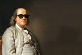
I’ve been working on a top-secret project (which will likely be revealed by the end of the year) and it involves, oddly, Benjamin Franklin. I’m not making this up. And this project has made clear to me how much my grasp of American history is lacking.

Growing up in California, I never learned much about the Continental Congress or the Revolutionary War or really anything that took place before 1849. I’ve made a few attempts to remedy this, including my trip with friend Vic to Salem, Mass.

So I’m now trying to fill in some of the gaps in my education Which is why this morning I found myself in The Quaker City for a few days of exploration. What could go wrong?

My crash course on Philadelphia actually began on the plane ride. I’d taken a red-eye from Sacramento, and my seatmate was a garrulous Philadelphian (if you’ll permit me that redundant phrase). He was on his way home after a vacation with his wife, but they were taking separate planes. It seems there was some kind of booking mix-up related to the use of frequent flyer points. But the real point, for my purposes, is that he was unexpectedly flying solo and looking for someone to talk to. And having learned that I was going to be sight-seeing around his home turf, he spent the next few thousand miles sharing his insights about the city. (Did you know that Elphreth’s Alley is the oldest continuously-habitated street in America?)

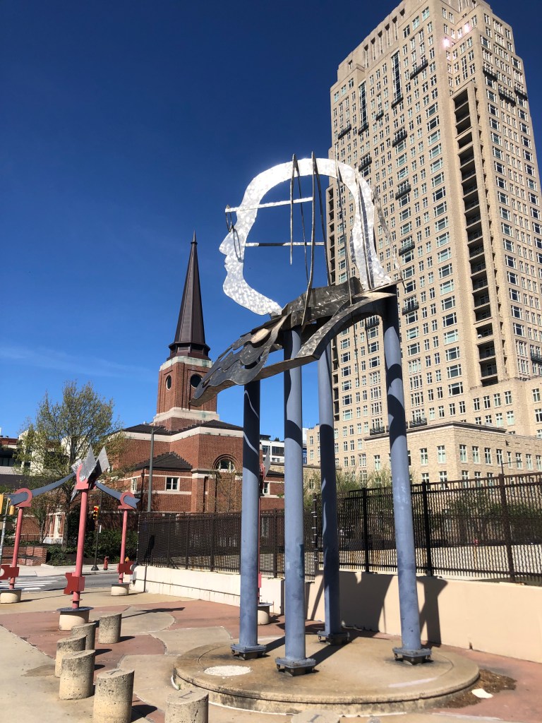
Anyway, I got breakfast and a Nissan Sentra near the airport and set out for downtown Philly. Ben Franklin is certainly well represented around the city. Bridges, parkways, institutes, boulevards, schools, and various other features of the city are named after Franklin. There’s even a large, modern sculpture of his distinctive bespectacled face and stringy hair on a random street corner.

“Big Ben” sculpture from 1992.

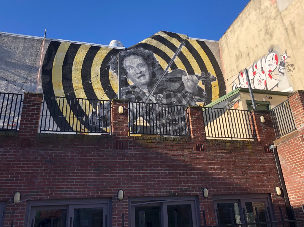
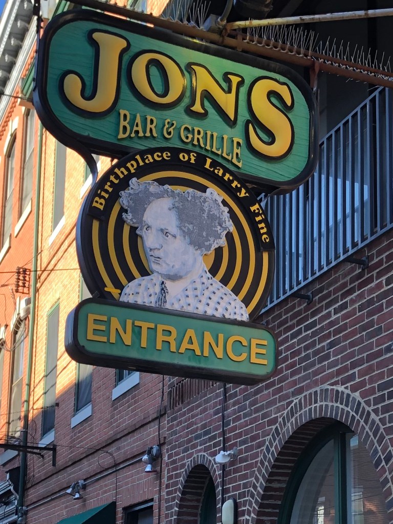
While chatting up the National Park ranger at the Ben Franklin Museum, I learned the following story: Some years back the Philadelphia Inquirer was taking up a collection for a Frank Sinatra mural somewhere in the city. A rival paper objected, pointing out in an editorial that Philadelphia should instead create a mural for one of its native sons. And, perhaps as a joke, the editorial noted that Larry Fine (of Three Stooges fame) is one such native son. The idea nevertheless caught on, donations were made, and the mural was painted at the location (S. 3rd and South Street) where Fine was born.

Giving Ben Franklin a run for his money.
A bar in the same building capitalizes on the Fine connection as well.

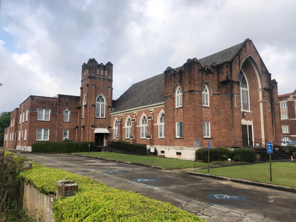
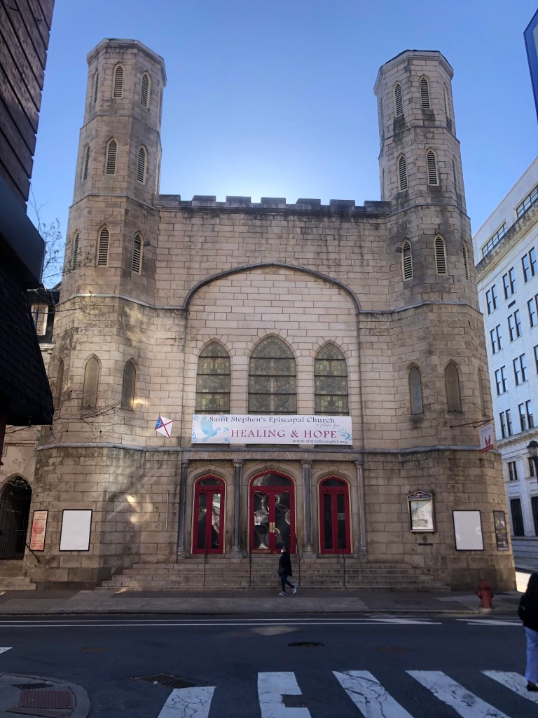
But I digress. I was talking about how Ben Franklin has captured this city’s imagination. And in addition to all the named structures and graven images, the city has been tagged with various plaques that commemorate Franklin’s various activities in the area. For example, on St. Stephen’s Church is a brass plaque which claims Ben Franklin conducted his famous kite experiment on this site in 1752.

Built in 1823 at 10th and Ludlow, which may or may not be where Ben flew his kite.

Here’s a closer look at the plaque:

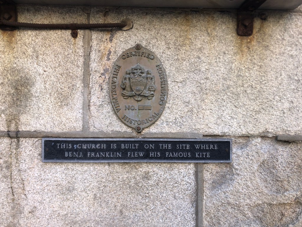
Now, it turns out that there’s considerable debate as to whether this is really the site of Frankin’s kite adventure. And while the “Certified” marker above the plaque would seem to lend credence to the plaque’s claim, it turns out the marker relates to the church building, and not to the plaque.

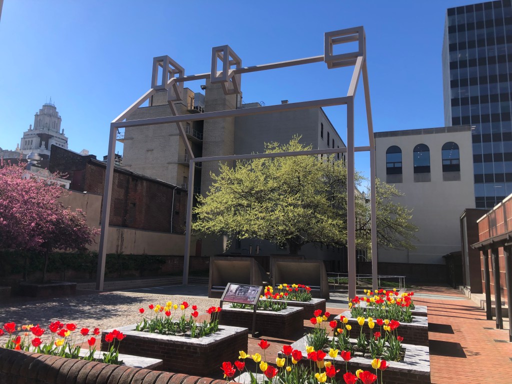
A few blocks from the dubious kite claim is a bare steel pipe structure outlining where Franklin’s last family home had stood. Ben’s kids had the house razed some years after he died. But in the 1940s, archeological efforts uncovered the foundations of the house. The steel “ghost house” was erected in the 1970s, since there were insufficient records or drawings to reconstruct the house itself.

The ghostly outline of Franklin’s house, marking its exact location some two and a half centuries ago.

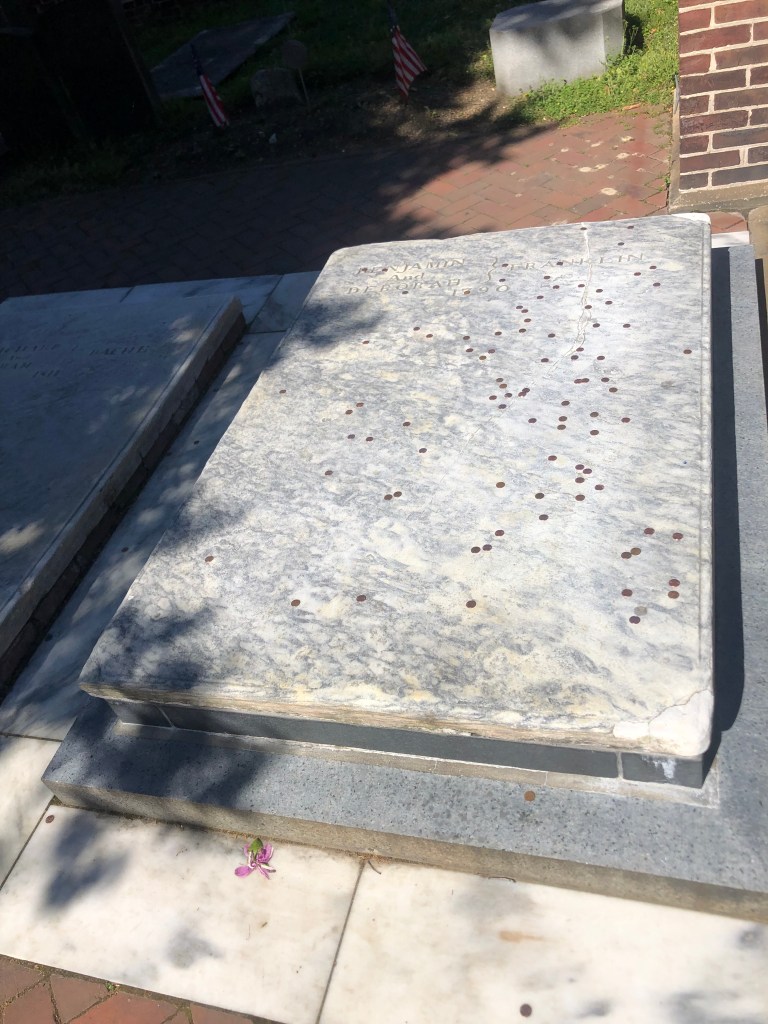
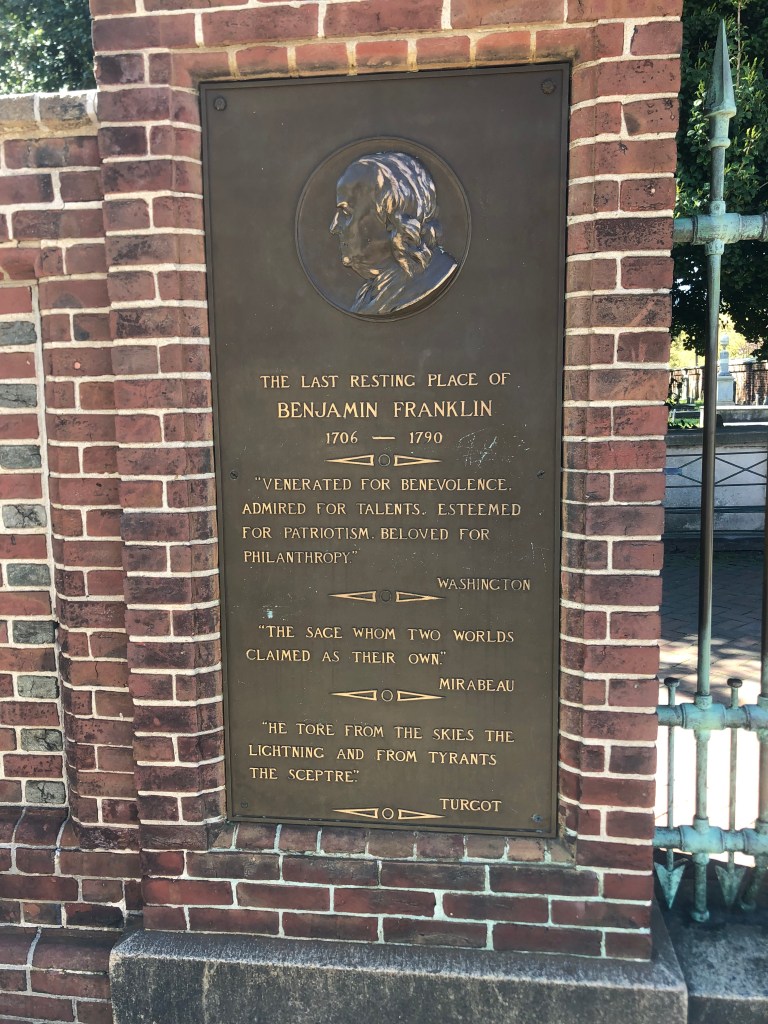
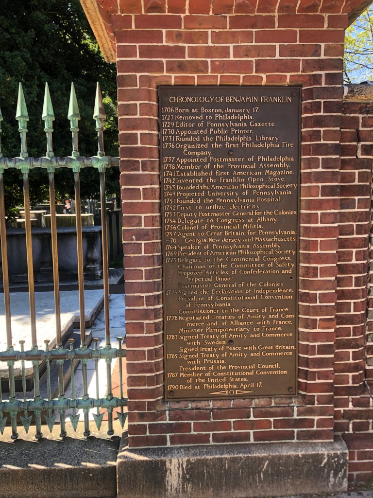
Finally, and inevitably, Franklin’s body rests in Philadelphia, not far from the ghost house. He is buried at Christ Church Burial Ground under a smooth marble tablet that’s perpetually covered with a scattering of pennies from passersby.

“A penny saved is a penny earned.”
Even allowing for some resume-padding, it’s an impressive list of accomplishments.

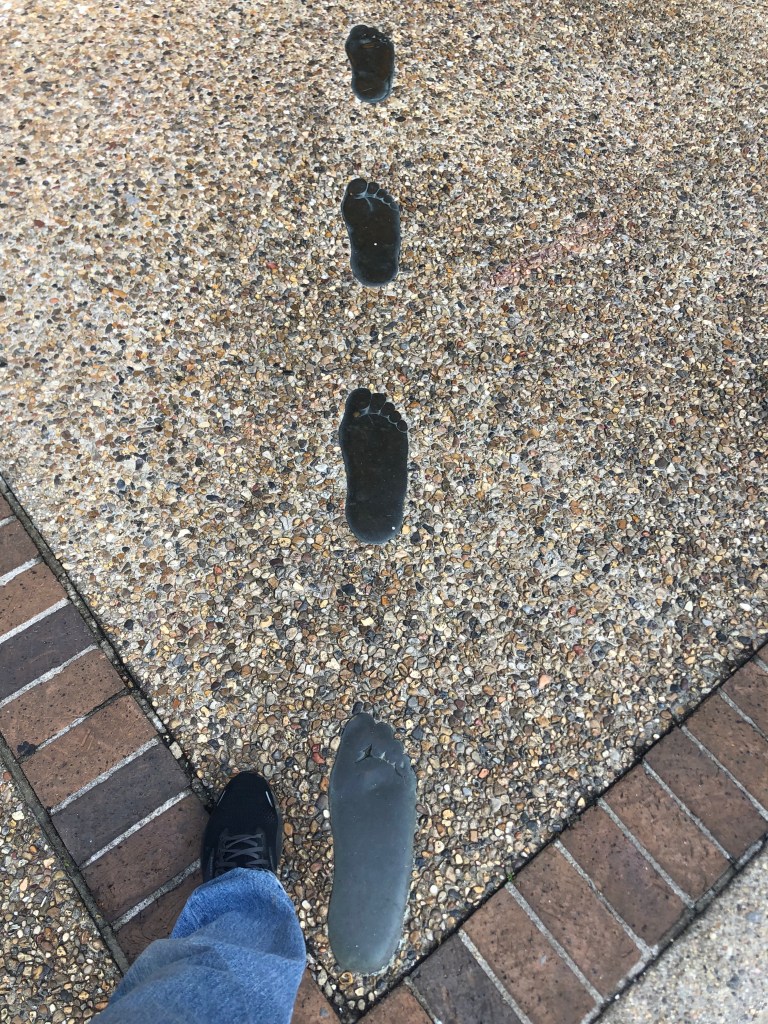
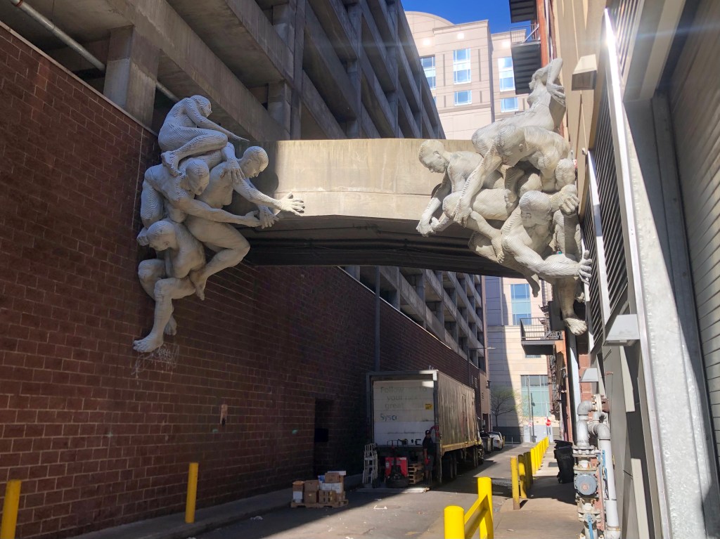
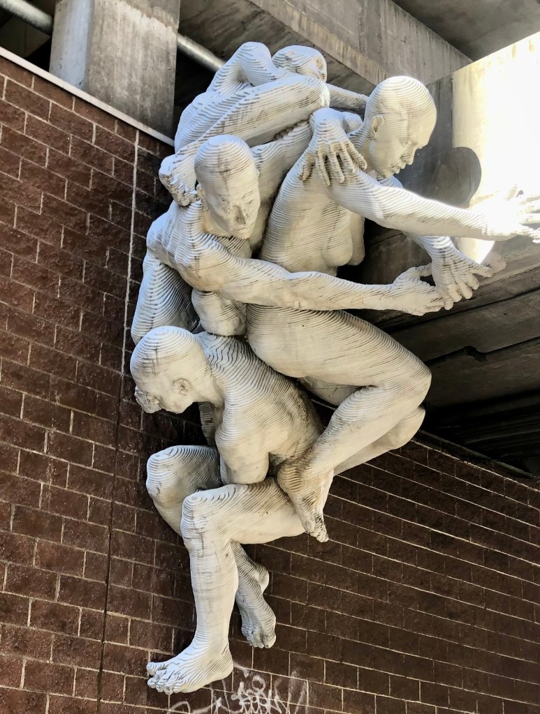
Of course, Philadelphia isn’t all Ben Franklin and Larry Fine. For example, there are these random nudes built into a pedestrian walkway. For no discernible reason.

There’s got to be a flying buttress joke in here somewhere...

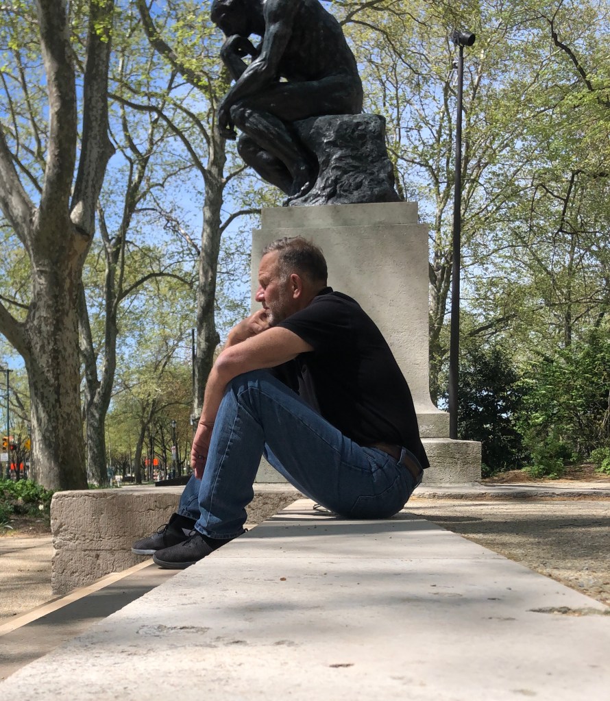
There’s also Auguste Rodin’s bronze sculpture The Thinker on the grounds of Philadelphia’s Rodin Museum:

I think I can…I think I can…

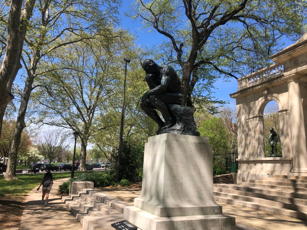
You probably know of this piece. Rodin actually cast a number of identical bronze Thinkers. I remember once seeing one at Stanford University. But I’ll forever associate it with Dobie Gillis, who had a habit of sitting next to the statue in a copycat pose.

Kind of inevitable.

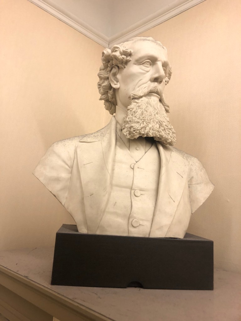
And if that’s not enough, today I also ran into some literary luminaries that you don’t often associate with Philadelphia. In the Philadelphia Free Library’s Central branch (built almost a century ago in the beau arts style) one finds a bust of Charles Dickens in the Rare Books Room.

Have you ever noticed how Charles Dickens resembles Don Quixote?

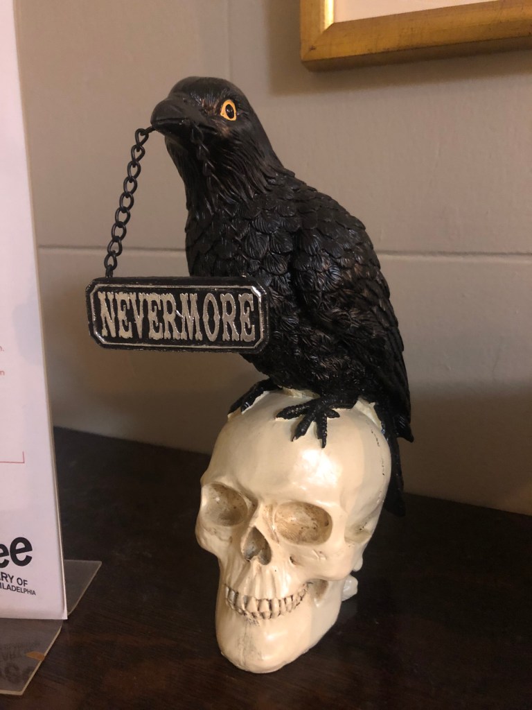
Not far from the Dickens’ bust is his actual pet bird, now stuffed and mounted in a glass box.

That’s so Raven.

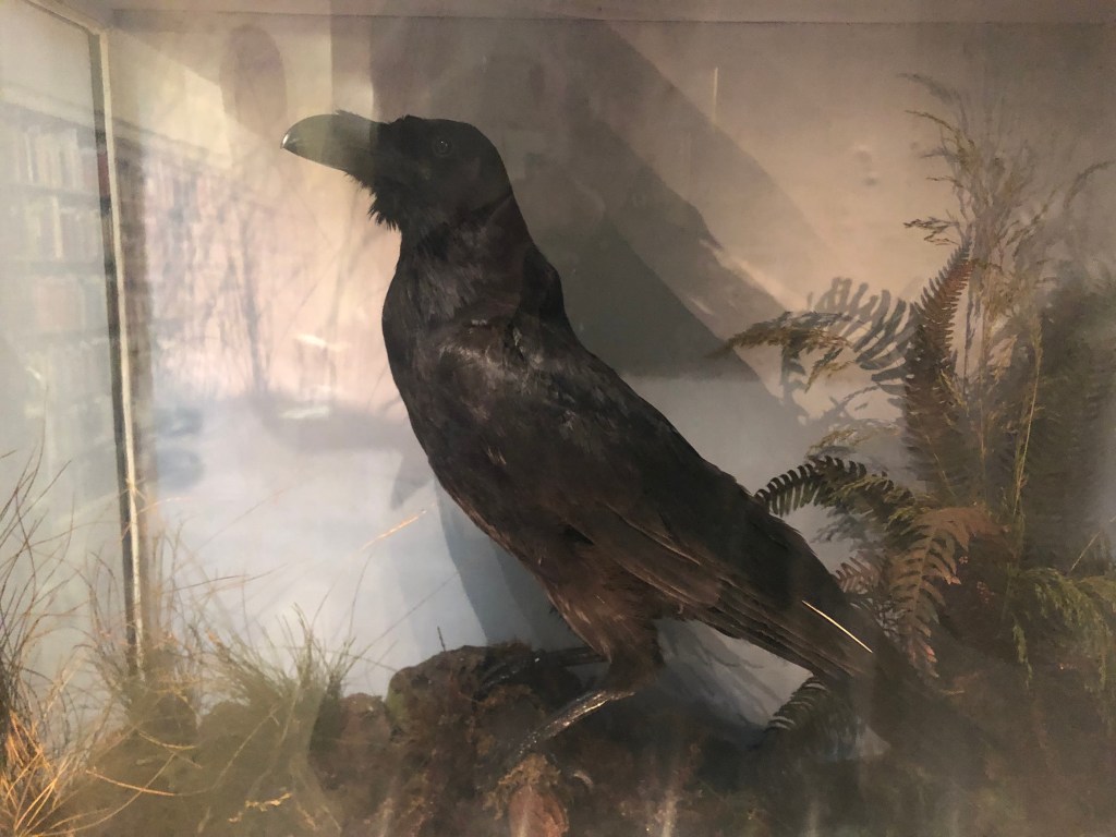
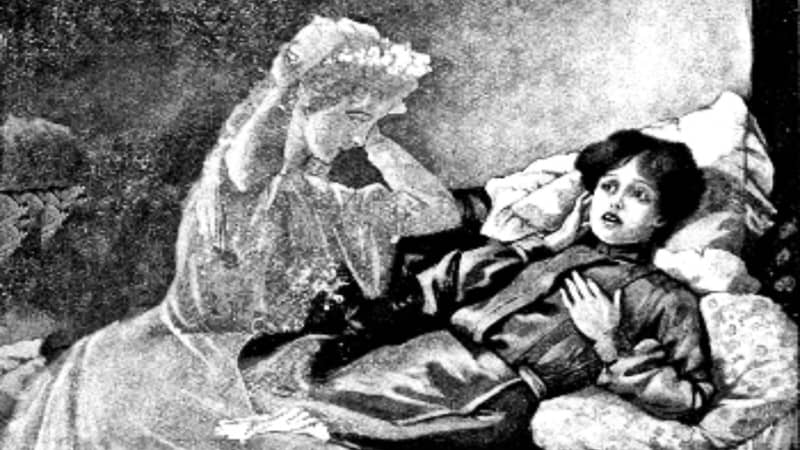
The bird is (was?) a raven by the name of Grip. Grip even gets some speaking lines in Dickens’ novel Barnaby Rudge. But she (for Grip is a female) also played a much more important literary role: She is said to be the inspiration for Edgar Allan Poe’s The Raven.

Wasn’t Nevermore the title of a Nirvana album?

As we all know, Poe lived in Philadelphia for six years. And one of his Philadelphia homes still stands. I will be visiting it on Friday, so we’ll be returning to this theme later.

It’s now getting late, but I do have two more items to share from today. The first is:

OBELISK CORNER

I was taking an afternoon walk through Philadelphia’s Woodlands Cemetery. It dates back to the 1840s, and has a distinctive Victorian air about it. Many of the grave markers take the form of obelisks, with some quite large specimens cropping up here and there.

…or are you just happy to see me?

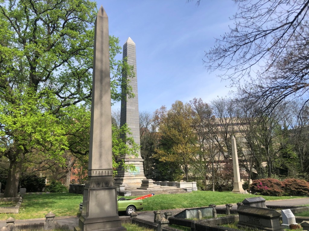
But take a closer look at that one in the center. Though it doesn’t appear especially large in the photo, it’s actually about 15 stories high. In fact, it’s the largest gravestone in the Continental U.S. Let’s take a closer look:

For perspective, note the two stacked sarcophagi at the foot of the obelisk.

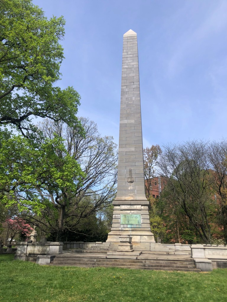
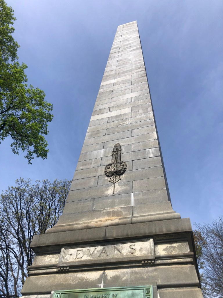
The obelisk marks the grave of one Thomas Wiltberger Evans, who died in 1897. You never heard of him either? It seems that the man with the country’s tallest headstone was a….dentist.

And now, let’s finish up with the
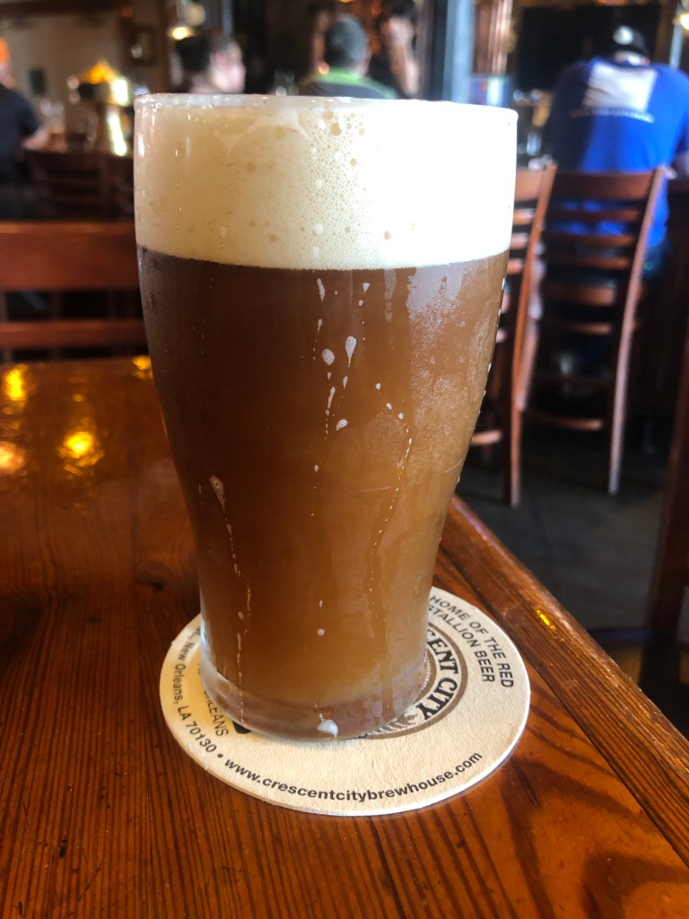
BREW OF THE DAY

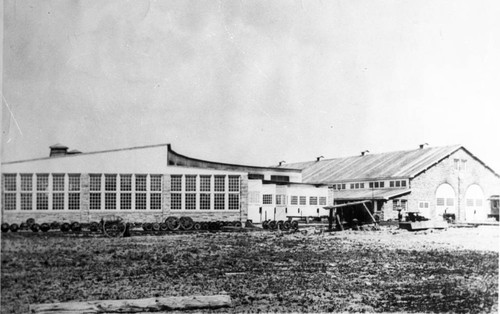
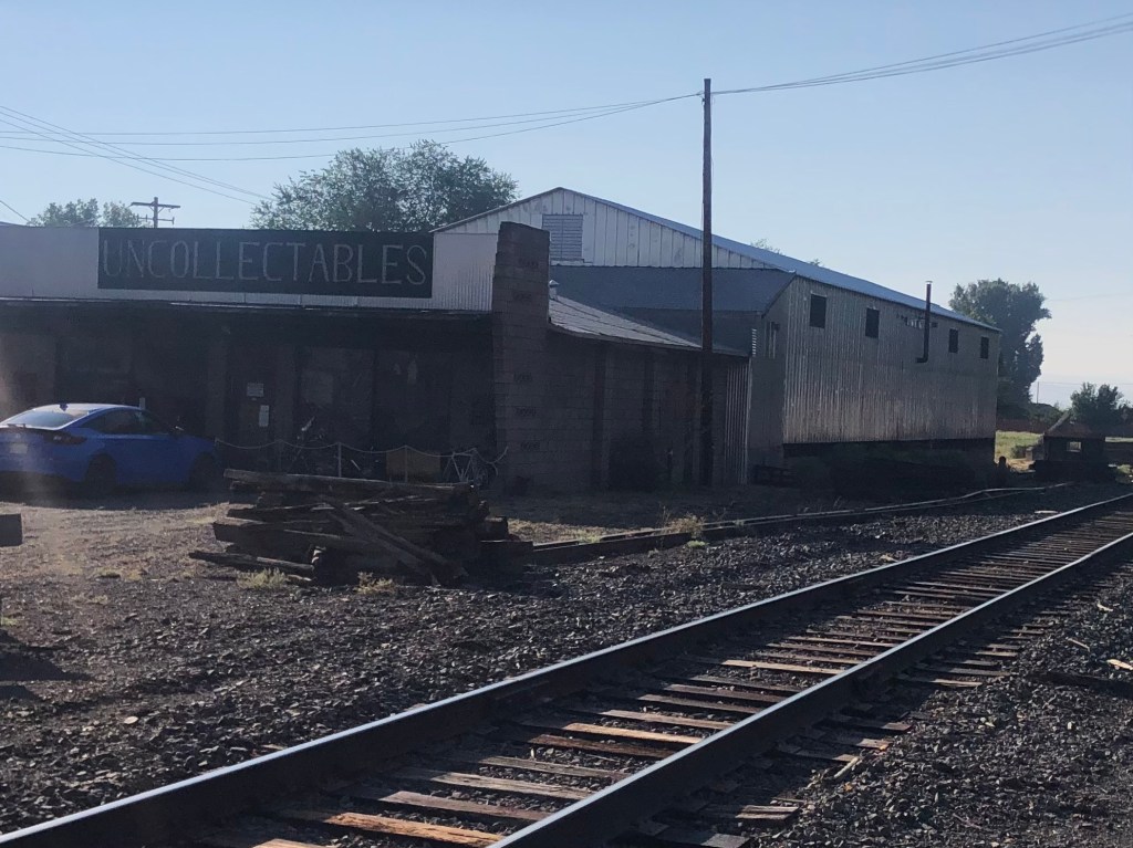
I drank my BOTD at Manayunk Brewing Company, which sits in a cavernous, historic cotton mill on the banks of the Schuylkill River. The cotton mill dates back to 1822, and it operated (making cotton or, later, wool) until 1992. At that point it became a brewery.

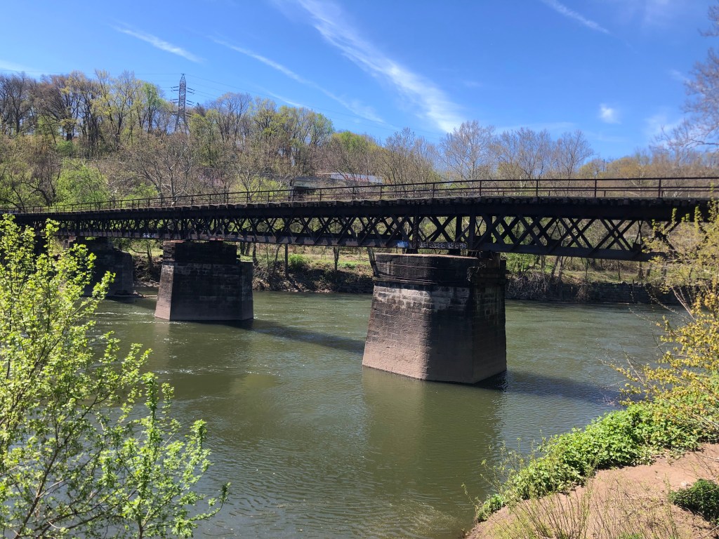
My words can’t do justice to the wonderful setting. Not only is the historic building awe-inspiring, but there’s an old railroad (?) bridge crossing the river right behind the brewery. And I had a great spot in the sun to enjoy the view.

First cotton, then wool, now ales.
I couldn’t find any info on this bridge that’s directly behind the old cotton mill. Uncle Ed, please help!

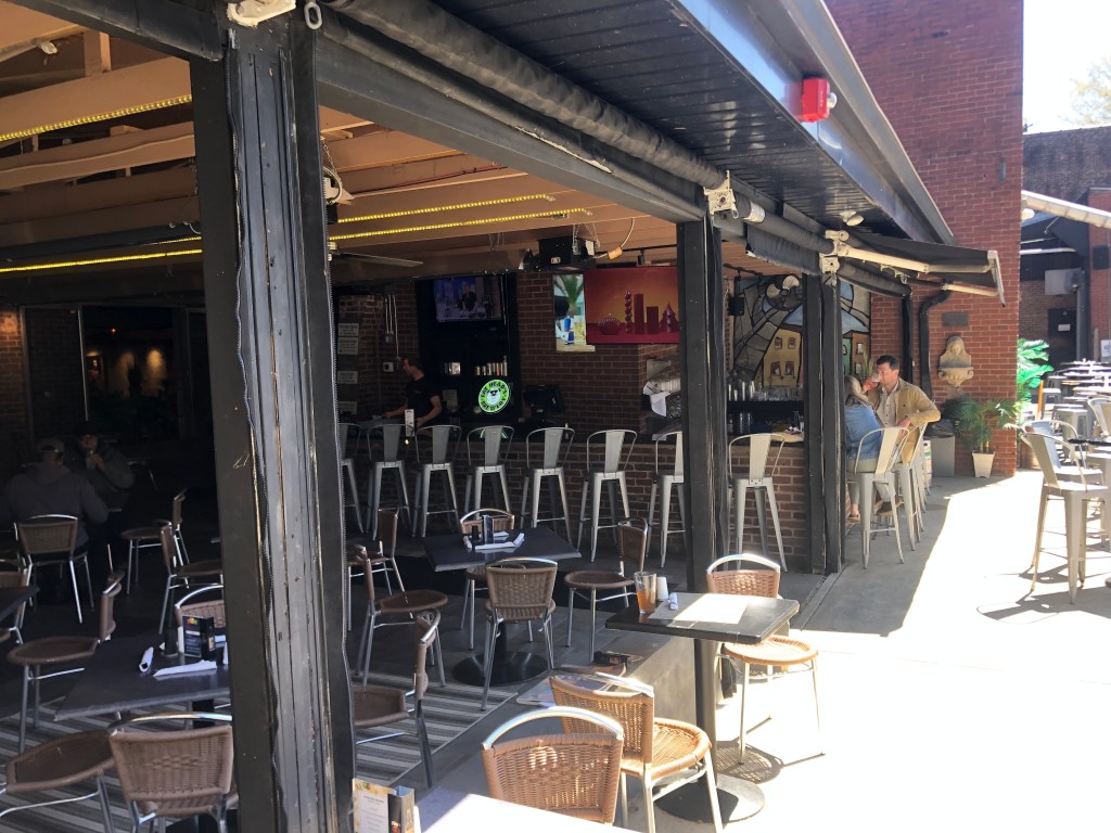
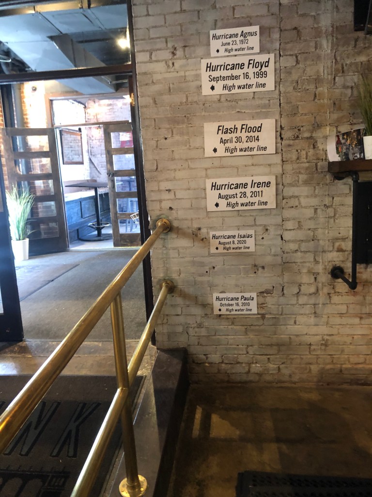
I had my heart set on getting one of Manayunk’s home-made brews. But sadly, my server informed me that they lost their entire brewing setup to a flood a few years back. It seems that flooding has been a recurrent problem, judging from the “high water mark” signs in the bar.

However, a few of their beer recipes are still being faithfully produced by local brewing partners. I selected the Schuylkill Punch, which is being brewed by Yards Brewing.

“How would you like a nice Hawaiian Punch?”

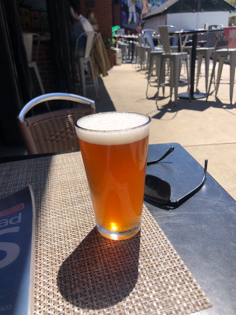
This is nothing like what I normally drink. It’s light, with a body light iced tea. There’s almost no malt. And with an ABV of 4.5 percent, it has about half the alcohol of my usual brews.

But this is an exceedingly smooth beer, and it complemented the warm weather perfectly. It’s slightly sweet, with distinct citrus notes of grapefruit, lemon, and some tropical fruits. Carbonation is low, but it has a nice head. Overall, I’d call this a “session” beer, especially if your session is outdoors on a warm day next to the Schuylkill River. I give it 3.5 stars out of five. If they could up the flavor a bit (maybe brewing it with more fruit), I’d knock it up to a solid 4.

cemeteries · churches · Ghost stories · Halloween · Road trips

Bonus! A True Halloween Story

I hope you all enjoyed this month’s Halloween offering, “A Dying Wish.” Of course, the way the timing worked out, the story ended on October 30 (All Hallow’s Eve Eve). So for today, which is Halloween proper, I offer this “true” ghost story for Halloween.

[Editor’s Note: Long-time readers may recall that I related this incident some years back, while I was on my US Route 60 trip. But that story appeared in the days when I was composing my so-called “blog” in Google Docs and emailing it to a small number of friends, so you might not have seen it. We pick up the story on Day 7 of my trip, as I’d entered West Virginia.]

It struck me today that this drive across the country on US 60 is similar in many ways to my trip across the country last fall on US 50. Sure, US 50 is a northern route, and US 60 is a southern route, so they each have a distinct flavor. But there are many similarities between the roads. Both are mainly two-lane highways, and both cut through the middle of countless towns. The two roads even end up in the same state, not too far apart. And this morning I was feeling that this leg, through West Virginia, feels as remote and lonely as US 50 passing through Nevada. They call that stretch of US 50 “The loneliest road in America,” and for good reason. In a similar way, today’s stretch of US 60 had me driving for long stretches without seeing a town or even another car. It’s not a bad thing. In fact, it’s pretty therapeutic to be driving all alone along a windy road closed in on both sides with foliage. It’s calming and gives you time and room to meditate.

The narrow ribbon of asphalt that is US 60, cutting through the briars and brambles of The Mountain State.

As the afternoon wore on, the sky began to cloud over and the mountains began to take on a more melancholy feel. I was passing through the unincorporated village of Sam Black Church (named after a church building, which itself was named after an itinerant 19th-century minister). Here’s the church:

A white church named Black.

As I was passing through the deserted village and sensing the melancholy air, I came across this sign:

Roadside ghost story.

This was awesome! A “real” ghost story! (The full tale is explained here, in Wikipedia.)

Maybe it was just how my mood was affected by the weather and the long, solitary drive, but I felt compelled to find the grave of this Zona Heaster Shue. Surely she would be buried close by. After a quick consultation of Find-a-Grave on my iPhone, I found that she was buried in a churchyard just a few miles away. I set out for Soule Chapel Methodist Cemetery. The route was a narrow, twisting road over some hills, without a living soul anywhere in sight. Not so much as a grazing horse was out in the fields.

A good road for ghostspotting.

Finally, I arrived at the cemetery, which turned out to be a 150-year-old churchyard next to a white clapboard chapel. It was the perfect setting for a ghost sighting.

“So sure of death the marbles rhyme, yet can’t help marking all the time/How no one dead will seem to come. What is it men are shrinking from?” -Robert Frost

I walked among the graves and quickly found Zona’s headstone:

I have to admit that, while it was gratifying to have found the “ghost’s” grave, I was disappointed that the headstone looked so much fancier, perhaps newer, than the others in the cemetery. And it’s a little garish to identify her as the Greenbrier Ghost on her headstone. (The ghostly phantom you see in the headstone is my reflection, which just goes to show how shiny the headstone is.)

I should point out that this is Zona’s second headstone. She was first buried shortly after her death, but after her ghost supposedly appeared to her grieving mother, the authorities were compelled to exhume her body. Her corpse showed evidence (earlier overlooked) that she’d been murdered, and her husband was implicated and soon sent to prison. When she was re-buried, someone saw fit to identify her as the “Greenbrier Ghost” on her headstone. I assume that she’s OK with that, because even in death she doesn’t seem to be shy about communicating her complaints to others.

OK–It’s me again, on Halloween 2023. I hope you enjoyed all this month’s spooky offerings. Feel free to suggest your ideas for next October! Meanwhile, watch this space for another road trip soon.

sdb

California history · Cars · churches · Road trips · trains · Yard art

The More Things Change…

After getting my complimentary coffee and scone from the Niles Hotel this morning, I made a final circuit of Alturas looking for one final NCO structure. Apparently the old locomotive shops buildings are still around, but I could not find an address on the Interwebs. There was just this historic photo from the Modoc County Museum:

“Portrait of the old N.C. & O railroad shop in Alturas, Ca. Published by: The Journal of the Modoc County Historical Society in 1982.
Old N. C. & O Railroad Shop”

So I just cruised around the city, trying to hew to the rail line on the theory that railroad shops would be connected to the tracks somehow. Only two structures even remotely resembled the rightmost building in the historic photo, but I think they are not what I’m looking for. Here they are:

The roof of the building in the back has the right pitch. Note the misspelling on the “uncollectables” sign.
This CalTrans facility looks like it could have been an old train shed…

Anyone with information or even a hunch (I’m looking at you, Quasimodo) please let me know!

Around 9:30 am I left Alturas in defeat, and got back onto US 395 north. On my way to Lakeview, OR (which you will recall was the northern terminus of the NCO Railway), I passed a couple of noteworthy sites:

I spotted this Tin Man figure on the side of a house facing the road. Like the one I saw a month ago near Georgetown, CA, it brought a smile to my face. The owner came out of his house while I was taking the photo, and we had a nice chat. I think what this world needs is more Tin Men.
Here’s the one from Georgetown.
Entering the third state of the NCO!
If Salvador Dali built a barn…

Finally I arrived in Lakeview, Oregon (pop: 2,500).

Just to the west of downtown I found the depot. It looked to be a happening place, with numerous cars parked in front.

Note the rare AMC Marlin (?) on the right.

But it turned out that these cars all belong to the depot’s owner. For unlike the other depots on this trip, this one is serving as a private residence. The owner’s name is Carmen, and she bought the depot from the second owner (after the railroad sold it). She appears to have changed little of the outside of the building. As for the interior, I can’t say. She steadfastly ignored my repeated hints that I’d like to see the inside.

Carmen, managing her little Yardmaster.

Interestingly, the tracks immediately behind the depot are still active. It seems there’s a short line railroad that ships goods between Lakeview and Alturas. The tracks are essentially unprotected, and run just a dozen or so feet from the depot’s back door. For a railfan, it sounds ideal. For anyone else, it sounds noisy and dangerous. But I am grateful to Carmen for preserving this piece of NCO history.

Not your typical bungalow.

It was now finally time to fulfill the whole point of this trip: A return visit to Eagleville, CA. I said goodbye to Carmen and headed back down US 395 to Surprise Junction, then headed east on CA-299. After about an hour and a half I stopped in Cedarville (pop: 425) to get gas and lunch. Cedarville is only 17 miles from Eagleville, but the latter has almost no services, so I made use of the former.

While pumping gas I noticed numerous campers and RVs and VW buses lining up at the pumps. Almost all of them were carrying bicycles and other equipment, and the drivers and passengers all had fluorescent hair. “Burners,” muttered the gas station attendant. In response to my confused look, he explained that these folks were all going to the annual Burning Man event in the Black Rock desert. It struck me that, in their effort to be independent and iconoclastic, they all looked and behaved exactly the same way. That said, I did have to admire the work this guy put into his Burner Mobile.

About 20 minutes after I’d finished my pit stop in Cedarville, I was standing in Eagleville (pop: 45) for the first time in almost half a century.

Perpetual plea.

The first thing I noticed was the general store, which was originally built in 1876. It’s gone out of business, and the owners seem to be trying their luck renting it out as a B&B. I think that might be a stretch. The 150-year-old exterior walls look largely unchanged from when I had last seen it.

Across from the general store was the old (1888) church I’d remembered. It looked almost exactly the same as my memory, though I read it underwent some restoration work in 2000. This time, though, the door was locked. Evidently they are less trusting than they once were. And who can blame them? I also read the church no longer holds regular worship services.

A restored church that is no longer open for worship.

I then went down the street to the street Aunt Alice’s family maintains three homes. The house where we’d spent Thanksgiving in the mid-1970s was still there, seemingly frozen in time. The South Warner Mountains still stand sentry over the town.

Back of the house, just as I remembered it.
Great view from the family homestead.

Notably, I did not see one living soul in Eagleville. Maybe people stay indoors during the mid-day heat. But l it did feel a little unsettling. I guess some people prefer a quiet, isolated existence. Indeed, the gas station attendant in Cedarville told me he left Alturas to “escape the rat race.” He likes “how small this town of Cedarville is.”

But Cedarville is a metropolis compared to Eagleville. At least Cedarville has a gas station. Most of Eagleville’s erstwhile businesses are long closed. Like the Eagleville Garage.

I think I’d go crazy in a place like Eagleville. But I’m glad it exists, and I’m glad that some people make it their home. We all need to find the place that suits us. In addition, there’s also something reassuring about a memory from my past retaining some physical form.

After melancholy reflections such as these, I got back on the road and started to head home. Hundreds of “burners” shared the road with me as they made their way to the Black Rock desert, seeking to transform one of the country’s most desolate places into a teeming metropolis….if only for a week.

Mail Bag/Miscellany:

I neglected to mention in yesterday’s blog that Uncle Ed’s Dome of Foam includes information on the NGO and its depots. Here is the link.

See also some further input that Ed and others posted in the comments section of yesterday’s blog.

Finally, here’s Edward’s photo of Carmen’s “house,” back when it was serving a very different function.

“Arrival in Lakeview,” 1974. From Uncle Ed’s Dome of Foam.
California history · cemeteries · churches · movie theaters · Road trips · trains

A Likely Story

About half a century ago, when I was in the throes of adolescence, my dad loaded up our family and made the seven-hour drive from Sunnyvale to Eagleville, in the northeast corner of California. We were going to spend the Thanksgiving weekend with my Aunt Alice’s family. One of Alice’s brothers owned a house up there (in retrospect, it seems her extended family owned half the town).

Motto: “Any further north and you’d be in Oregon.”

Eagleville is a tiny town in Modoc County. (Today it boasts 45 residents, about half of whom presumably are related to Aunt Alice). I have three main memories from that weekend we spent there: (1) Mom was sick with a migraine headache, Dad was distracted by mom’s condition, and Dave and I knew no one else other than Aunt Alice and Uncle Edward (Dad’s brother). (2) The general store was the only business open that weekend, so my brother Dave and I hung out there for what seemed like hours, studying the comic books and MAD magazines. (3) There was a tiny church that was unlocked and empty; as a city slicker, I was surprised that people could be so trusting as to leave a building full of chalices and patens and suchlike just sitting there unattended. Even though Dave and I were not known for our high moral principles, we realized that it would be extremely bad karma to rip off anything from a church. So we left well enough alone.

As I recall, our Thanksgiving dinner was a traditional though awkward affair. All the expected Thanksgiving staples were there: turkey, stuffing, cranberry sauce, etc. But the four of us in my immediate family were clearly unfamiliar outsiders, while Aunt Alice’s family members were all comfortable together, laughing and joking and having fun. I envied their ease being in their own skin, and their grounding in that remote corner of California.

That Thanksgiving weekend still stands out from the 60 undistinguished others I’ve experienced. Perhaps it’s because it was the only Thanksgiving I spent with snow. Perhaps it’s because Eagleville felt like such a mysterious, remote, foreign place. Notably, I’ve never been back to Eagleville.

Until now.

Recently I decided, for no particular reason, that I would revisit that tiny town and see how the reality stacked up against my memory. So I contacted my Uncle Edward, who helpfully supplied me with the address of the house where we stayed, which evidently still remains in Alice’s family. As loyal readers of this blog know, Uncle Ed is the creator and sole “staff” of The Dome of Foam, which is internationally recognized as the premier, authoritative, entertaining website on western railroads (particularly the Southern Pacific). I asked Uncle Ed if he could recommend any railroad-related sites in the greater Eagleville area, and he connected me with a doozy: The Nevada-California-Oregon (N-C-O) Railway, a now-defunct narrow-gauge railroad that connected Eagleville’s Surprise Valley with the outside world.

In doing a little research I read that the N-C-O Railway’s southern terminus was in Reno, Nevada, and I recalled that son Ian and I had visited that same depot just last winter. (Scroll down to the BOTD in this post.) It’s now a brewery/distillery, but they’ve keep the original exterior largely intact. The N-C-O also had a major presence in Alturas, which is just west of Eagleville. And the northern terminus was in Lakeview, Oregon, which is just north of Alturas.

Route of the N-C-O Railway.

So my plan became clear: my trip to Eagleville would generally follow the entire route of the N-C-O Railway, an I’d be able to visit historic structures in each of the three states served by the railroad.

And so this morning I set out on the trusty Speedmaster eastward to Reno (pop: 264,000). Within a couple of hours I was standing in front of the N-C-O’s Reno depot. Originally built in 1910, the building served as a railroad depot until 1937. After that it was used for railroad offices and was finally sold off for non-railroad purposes in 1975. It was eventually abandoned, then in 2014 it underwent renovation to become the brewery/restaurant it is today.

Once the southern terminus of the NCO Railway.
The rail line still runs alongside the Depot.
The Depot sits in the middle of Reno’s Brewery District, alongside a handful of other breweries and distilleries.

I next headed north on US 395. I’ve written about US 395 before (here and here and here, for example). You’ll recall that Hallelujah Junction (where US 395 intersects with CA-70) holds special significance. So I made a brief stop as as I passed through, to relive the magic.

Where I learned about the Seven Wonders of the Railroad World.

US 395 has a stark beauty to it. You don’t see much in the way of towns or even other cars. The quietude and long horizon are conducive to contemplation if not meditation.

Ommmmm…..

When the rare town does appear, I feel compelled to stop and look around a bit. One such town is Doyle (pop: 700). A couple of years ago Doyle lost much of its housing stock due to wildfires, so there really isn’t much going on here. But I was charmed by this historic chapel that somehow escaped the fire. Constantina Church was built around 1900 about five miles south of Doyle, and infrequent worship services were held there whenever a circuit priest was available. Services stopped around the 1920s, and the chapel was eventually abandoned. The structure was moved to Doyle in 1994, and it appears to be in regular use as a church once again.

Constantina Church today.
Same church in 2021, after the town’s fire.
A historic cemetery is next to the church.

I also passed through the town of Likely (pop: 99). The story goes that, back when the area was being settled, some homesteaders were speculating about whether the settlement would become a proper town. One man (Billy Nelson) reportedly said “There’s likely to be a town here one day, and there’s just as likely not to be. So let’s call it Likely.”

A Likely story.
But we’re not sure.

Finally I arrived at the relative metropolis of Alturas (pop: 2,700). Approaching from the south, the first thing you encounter is a striking, if somewhat faded, 1904 steam locomotive that used to run on the NCO line. The locomotive was presented to Alturas in 1956 by Southern Pacific (which had earlier bought up the NCO), and it resides outside the Modoc County Museum.

Standing still since 1956.

The story of the locomotive, as told by the local boosters, makes clear how much the NCO had meant to Alturas:

“This particular locomotive was utilized on the Alturas, California to Reno, Nevada route. The railroad was chartered as N.C.O. (Nevada, California, Oregon) in 1884. It was first established in Alturas in 1908 reaching Lakeview by 1912. The railroad and Alturas have an extensive symbiotic relationship from its inception to the day that Alturas was terminated as a home terminal on January 17, 1972, which was a devastating blow to the city as a large percentage of the population was forced to relocate to Klamath Falls, Oregon. Every business in town interacted with the railroad, whether by the influx of tourists or business travelers when the Southern Pacific offered a passenger service from 1927 to 1938. Even railroad workers who made their home base in Alturas, or stayed in one of the hotels made on impact on the town. The third floor of the Niles Hotel offered dorm style living for the railroad workers for decades. Before and during the time of passenger rails, the Southern Pacific and N.C.O. offered livestock shipment from 1908 to 1972, which provided most of its revenue. This was an option for the ranchers throughout the region to get their livestock to markets and sustained a way of life followed since the pioneers first arrived to this region.”

The docent at the museum was incredibly helpful when I told him of my interest in the NCO. He directed me to a place down the road where an old NCO structure was being renovated. “Look for the red truck and ask for Shane.” Dutifully I followed the directions, and was rewarded by the sight of a large NCO sign…and a red truck.

This must be the place….

Shane turned out to be the head of a nonprofit organization called the Nevada-California-Oregon Railway. (Evidently the name was free to use.) The nonprofit is working to preserve the history of the NCO railroad, including buildings and rolling stock. The building where I met him (and where he was restoring some woodwork) had once been NCO crew quarters, and Shane’s dream is to turn the building into a museum.

Shane (left) and Andrew, taking a break from restoring the NCO crew quarters on Main Street, Alturas.

According to Shane, there are several NCO buildings still standing in Alturas. He pointed to a large Mission Revival building that had once served as the NCO’s headquarters. Built in 1918, the building became an Elks Lodge in 1974 and remains such today.

Attentive readers will recall that I encountered this building when I drove through town coming back from my Weiser trip last year. At the time I didn’t put together that this building and the Reno Depot shared the same lineage.
View from the parking lot.

Shane also pointed to a carpet store which had once been the NCO’s freight depot in Alturas.

And finally, Shane directed me to the NCO’s passenger depot, which was constructed in 1908. Seven years later, it was decided that the station should be closer to the center of town, so it was moved, stone by stone, several blocks.

Peripatetic depot.

The Southern Pacific RR bought the NCO in 1926, and passenger service to Alturas was discontinued in 1938. Freight service ended in 1988. Still, Alturas remembers the NCO as an influential and pivotal part of its history. Indeed, the Modoc County museum includes a number of photographs and artifacts from the railroad.

I’m holing up for the night in the Hotel Niles, a historic hotel that was built before the First World War. The hotel remains authentic, by which I mean the floors creak and the widows rattle. But it’s a fitting place to spend the night on this day of historical exploration.

This image has an empty alt attribute; its file name is hotel-niles.jpg
I’m on the second floor of the left side.

Incidentally, the hotel sits across the street from the Niles Theater. Built in 1937, it dates back to the era of art deco movie palaces. The neon itself is a sight to behold. An unlike many historic theaters, this one still shows first-run movies. (Next week it starts showing the Barbie movie. I’m not making this up.)

Note the telltale pink “B” on the lobby card.
(Night photo c/o the theater’s website.)

What are the odds that two buildings in such close proximity (the hotel and the theater) would both be named “Niles?” Well, both were built by local businessman J.E. Niles. He was 85 years old when the theater first opened.

I had dinner down the block at a place called Antonio’s. Sadly I can’t recommend it. Even the BOTD is not worth mentioning.

You’d think I would have taken a hint from the condition of the sign.

Tomorrow I’m making the hour’s drive up to Lakeview to see the northern terminus of the NCO Railway. Then it’s off to Eagleville!

churches · movie theaters · Road trips · trains

Another Hub City and the Big Easy

I spent an hour this morning puttering around Hattiesburg a little longer. I really like this city. Two recurring themes really struck me:

First, how many cities call themselves Hub City?? I’d thought it was a quaint moniker for Clarksdale, with its Devils Crossroads and all that. But Hattiesburg also claims the nickname. A quick search of Wikipedia lists about a score of cities that refer to themselves as “Hub City,” so it’s not at all unique. But admittedly Hattiesburg has good cause: it’s strategically located, with numerous highways and freeways and historic railroad routes. Indeed, its 1910 railroad station is huge, suggesting that a large number of trains came through here in the day.

Front of the Hattiesburg station

The station was restored about 15 years ago, and today serves as an intermodal transportation hub (there’s that word again), including daily Amtrak service.

The Amtrak main line at the back of the station.

The second thing that struck me about Hattiesburg is that this city values the arts. Music (a recurring theme of this trip) is celebrated everywhere, such as this public art installation called “The Jook.”

The Jook is a collection of whimsical instruments that the public is invited to use to make their own music. They include a trash can bass, chimes and bells, a giant guitar, and a xylophone (of sorts).

The Jook’s name is a reference to Blind Roosevelt Graves and his Mississippi Jook Band, which recorded blues music in Hattiesburg in the 1920s and 1930s. Two of their 1936 songs–“Barbeque Bust” and “Dangerous Woman”–are considered by some to be the first rock&roll songs. Listen and decide for yourself:

It’s not exactly Chubby Checker, but I do sense some elements of early Rock&Roll.

Other evidence of Hattiesburg’s musical bona fides is Mississippi Music Inc., a musical instrument sales and repair service and music teaching academy that opened in Hattiesburg in 1946.

And then there’s the theater. I’ve come to the conclusion that one of the quickest, surest ways to measure a town’s cultural health is to see what they’ve done with their historic theater. Hattiesburg’s Saenger Theater was built in 1929 as a huge, thousand-seat silent movie theater, and it had an equally-impressive 778-pipe theater organ. The theater remained open for about 45 years, and closed in 1974. Along the way the organ (largely obsolete after the introduction of talkies) was sold off.

The city of Hattiesburg acquired the theater from Saenger, restored it, and (here’s the impressive part) managed to track down the original organ, purchased it, and put it back into the theater. The theater underwent a more extensive renovation in 2000, and today it serves as a major performing arts venue.

While I was exploring the downtown I was literally walking in the footsteps of a long-ago Hattiesburgian (?) named John Wesley Farley. Mr. Farley had once been enslaved, but eventually became a successful businessman in town. As a publicity stunt that I still don’t quite understand, he had bronze casts made of his size-14 feet. These were set into the sidewalk in front of a department store in 1903. The sidewalks were replaced in 1983, but the public works dept returned the footprints to their original location. Somehow that warms my heart.

Even bigger than my clodhoppers!

Another impressive story about Hattiesburg’s commitment to historic preservation is found at the old high school.

The Old Hattiesburg High School.

Originally built in 1921, the original high school building closed in 1959. After being used as the school district’s administrative offices for a few years, it became an antiques mall–which is typically the last stop before the wrecking ball. However, in 2002, the local historical society acquired the property with the intention of renovating it. Then Hurricane Katrina hit in 2005, And if that weren’t enough, arsonists torched the place in 2007. Despite all this, a project was funded to restore the historic structure and convert the interior to senior apartments. I consider this another sign of a healthy city: addressing civic needs while preserving the town’s history.

Oh, and I just wanted to include this photo of True Light Missionary Baptist Church (a name which rivals “the Holy Ghost Big Bang Theory Pentecostal Fire and Brimstone Mission Temple Firework Stand“). Anyway, this huge, impressive structure was built in 1903 and renovated in 1990. I can only imagine what it must be like in there on a Sunday. They also run a childcare center and various other missions.

But what really delighted me (a phrase I seldom use) most about Hattiesburg was the “pocket art gallery” on a random alley behind a parking garage. At first I simply noticed what I thought were some tiny plastic figures that some child left on a water meter.

But then I saw more….

…and more…

…and more.

Soon, I realized the the alley was full of random, whimsical art installations.

What I found most notable was that these small, delicate installations were unmolested. So that’s another sign that Hattiesburg values the arts.

I hated to leave Hattiesburg–my new favorite city–but it was time to head south to the Big Easy. Along the way I stopped for gas in Slidell, Louisiana, which was the last stop before New Orleans. Like so many of these towns, Slidell (pop: 29,000) has a historic railroad station. This one, built in 1913, is still a functioning Amtrak station, but it also houses a popular restaurant and an art gallery. I’m starting to feel that the Deep South has something to teach the rest of us about preserving historic civic buildings.

The 1913 Slidell depot.
The station supposedly has a nice waiting room…but I didn’t arrive during the 2 hours and 5 minutes that it’s open each day. (C’mon, Amtrak! Do better!)

After getting gas and a coffee, I eased onto the 5-1/2 mile long causeway that crosses Lake Ponchartrain and drops you into New Orleans.

Lake Ponchartrain (viewed from downtown New Orleans).

New Orleans (pop: 380,000) is of course a historic, culturally-rich, music-infused city. It’s also almost as hard to navigate by car as San Francisco. My goal was to get to the New Orleans Jazz Museum, which required life-threatening maneuvers along the narrow streets, several illegal turns, and a 20-minute search for a parking spot. Alas, after all that, I found the door to the museum was locked. They’re closed on Monday. So I spent the afternoon walking around the French Quarter. It was actually a good way to end this trip. Music floated from every corner. There were street buskers, jazz combos playing in restaurants, stereos blaring from upstairs apartments, and a second line performance, to name a few. Heck, there was even a pair of obviously inebriated street beggars who decided to sing their appeal for funds (“Can you spare a buck?/We’re down on our luck.”)

The Jazz Cats.
Second line performance.
Wish I’d brought my sax.

There are lots of different types of music played here in New Orleans, but the city is best known for its jazz. It feels like the natural progression from the other musical styles I’ve encountered on this road trip: Country, bluegrass, soul, R&B, Memphis blues, delta blues, and so on. I’m no expert on any of this music, but I can understand how they’re related–how they grow out of a uniquely American experience. I intend to expand my listening when I get home, following up on some of the styles and artists that I’ve encountered.

So that’s it for the trip. As always, I’m thankful for all the people I encountered along the way who’ve patiently explained their cities to me, taken me on tours, cooked food for me, served me drinks, and even cut my hair. I really love the people of this country.

I’m at the Airport Hilton getting ready to fly home on an early morning flight. But there’s one thing left, and that’s the…

BREW OF THE DAY

While wandering around the French Quarter I paid a visit to the Crescent City Brewhouse. They have a good selection of beers, all of which they brew themselves. I asked my server what he recommended, and he told me his favorite hands down was the “Weizenboch.” So that’s what I had–living on the edge.

This is a German style beer (as should be obvious from the name). The appearance screams the opposite of a Sleepy Hollow beer (i.e., it has a very prominent head). All that foam ensures an attractive presentation and it makes the first few sips especially enjoyable. The appearance is very cloudy, with a golden tan color. At only 6 percent ABV, it’s well suited for a mid-afternoon drink.

Ichabod Crane wouldn’t recognize it.

The taste is incredibly yeasty–like sourdough starter. Notes of banana peel and clove are prominent. Maybe a tiny bit of lemon? It’s not too hoppy (unlike some of the English styles I normally drink). Overall this is a very drinkable, approachable beer. It gets a solid 4 stars. Heck, I’m feeling good at the end of this trip; let’s give it a 4.5.