churches · Hydrology · Road trips

Dam Detour

So, here we are in the final state of this two-week odyssey. Not only have we traveled through 11 states (VT, NY, PA, OH, MI, WI, MN, ND, MT, ID, WA), but along the way we’ve seemingly experienced most of the types of terrain this country has to offer. For example, today I left behind the green mountains of western Montana and Idaho, and entered the flat, arid, scrub brush-covered badlands of eastern Washington.

The parched landscape of eastern Washington.

There’s not a lot of settlements out in this part of the country. One of the isolated towns I drove through this morning was Wilbur (pop: 900). It’s worth quoting Wikipedia about how the town got its name:

Just prior to the construction of the Central Washington Railroad line in 1889, no towns existed west of Davenport in Lincoln County. One place along the line, “Wild Goose Bill’s Ranch,” run by Samuel Wilbur Condit, was assigned a post office by the Federal government. Condit was 62 years old and known throughout the region as Wild Goose Bill when he and another man shot each other to death on Jan. 21, 1895. Condit platted the town that bears his middle name “Wilbur,” though he didn’t have anything to do with the naming. Goosetown was a consideration, until the blacksmith’s wife complained that she would never live in a place with such a silly name. Instead, the name Wilbur was chosen by town surveyors.

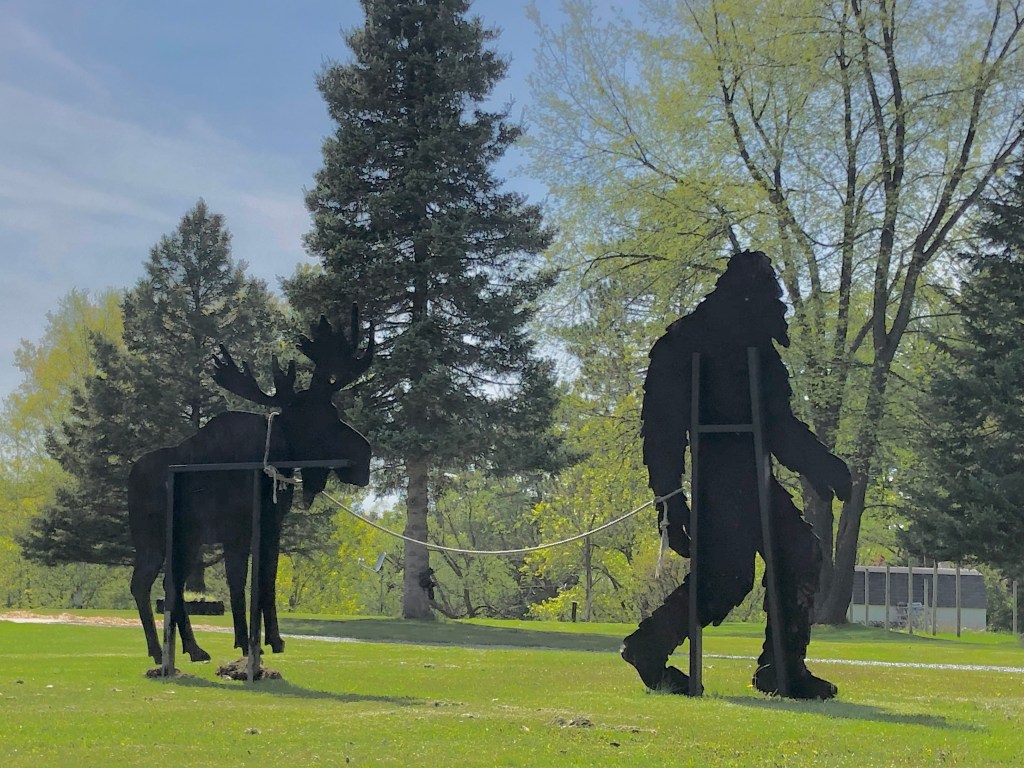
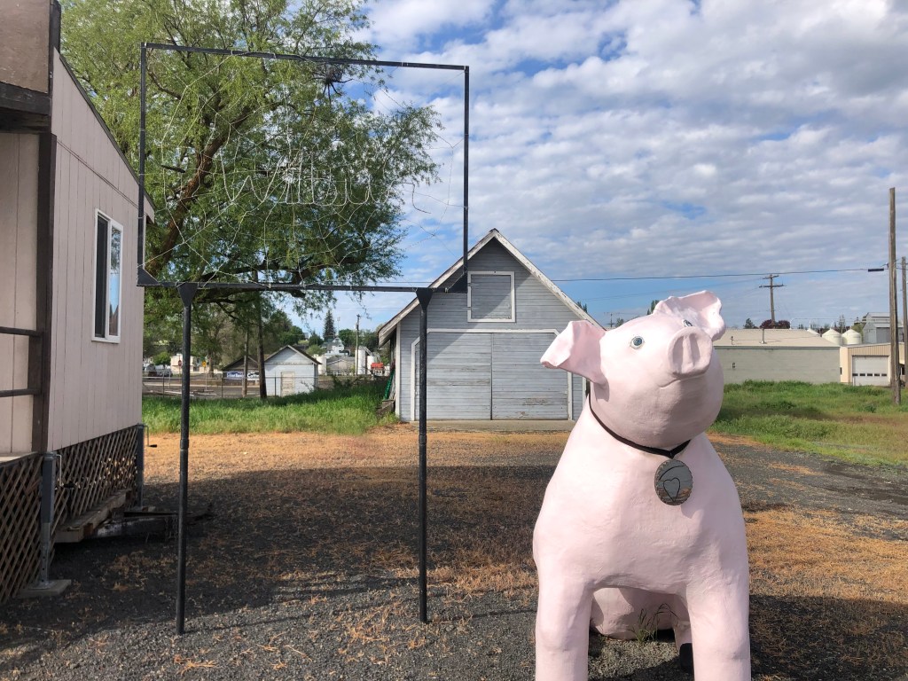
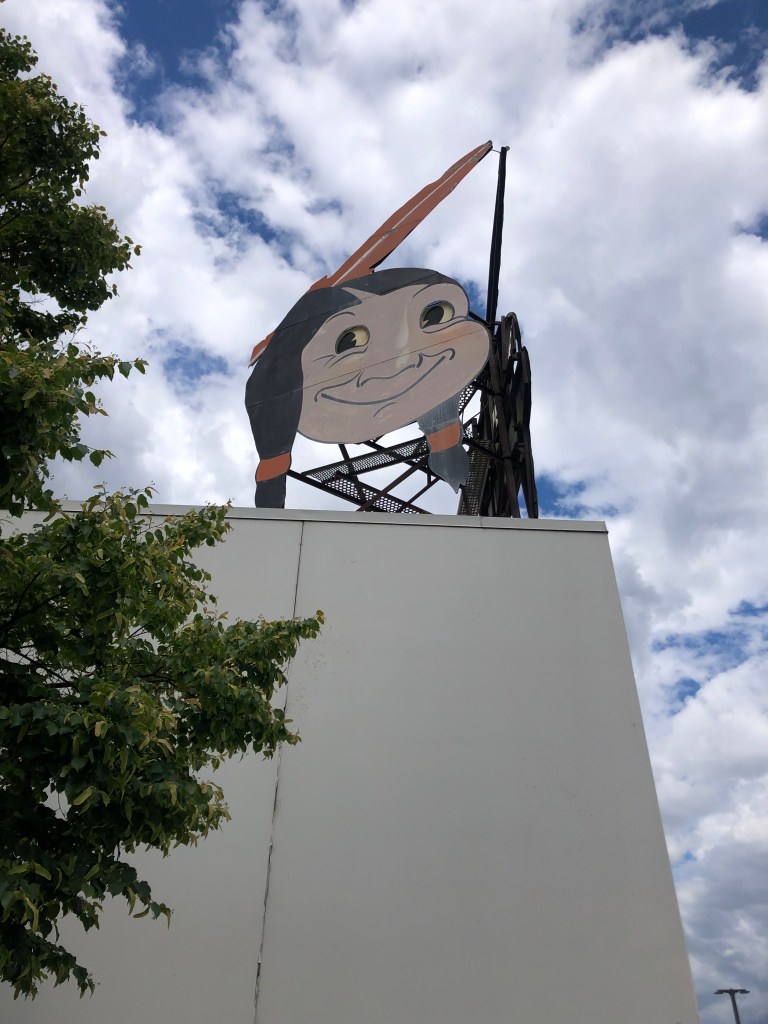
OK, so knowing that, check out this mascot next to the visitor’s center:

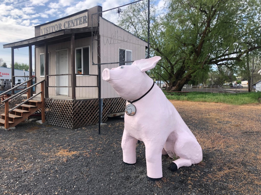
I won”t comment on the unusual shape of the anorexic pig, but I will note that a wire spiderweb (barely visible in the below photo) bears the name Wilbur. Clearly the Chamber (or whoever is responsible for this pig) doesn’t know the true origin of the town’s name. But E. B. White must be smiling.

A little past Wilbur on Route 2 is the town of Coulee City (pop: 550). With all due respect, it’s not much of a town…but it is home to “the world’s largest waterfall.” The only catch is there’s no water. Let me explain.

Waterless waterfall.

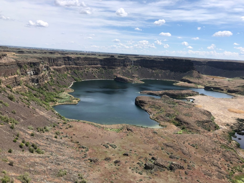
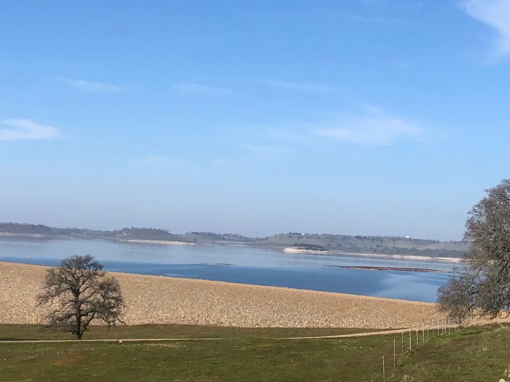
Scientists have determined that at the end of the last ice age, an ice dam blocked a river in Idaho, which gradually created an enormous lake that reached into Montana. Eventually the ice dam failed, and the stored water rushed westward toward the Pacific, scouring the landscape along the way. This evidently happened a number of times, and the hydraulic activity created these “coulees” (deep ravines), which in turn produced enormous falls when the next flood occurred. The falls at Coulee City were over 400 feet high and 3.5 miles across.

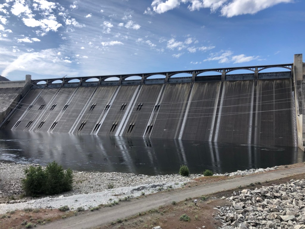
All this reminded me of a cul-de-sac near my childhood home named Grand Coulee Court. It’s where Phillip Waters lived. (I’m not making up that serendipous surname.) Did this ravine I was now taking photos of–called a “coulee”–relate in some way to “Grand Coulee”? Then, somewhere in the back of my mind, I remembered there’s a “Grand Coulee Dam,” though I didn’t know any details about it. A quick consultation of my trusty road atlas (that I’ve been carrying around since 2010) informed me that the Grand Coulee Dam was a short 20-minute detour from Coulee City. So off I went.

I won’t bore you with the details, but the basic points are these: The US Bureau of Reclamation built the Grand Coulee Dam in the decade leading up to World War II. The dam is on the Columbia River, creating a reservoir (Lake Roosevelt) from which water is pumped to irrigate farms in central Washington. In addition, water passing through the dam powers generators which produce the largest amount of hydroelectric power in the US (about 21 billion kilowatt hours each year.) I learned all this on a guided tour, which took me into the pump stations and onto the top of the dam.

The Grand Coulee Dam, viewed from downstream on the Columbia River.
On top of the dam with my tour group.

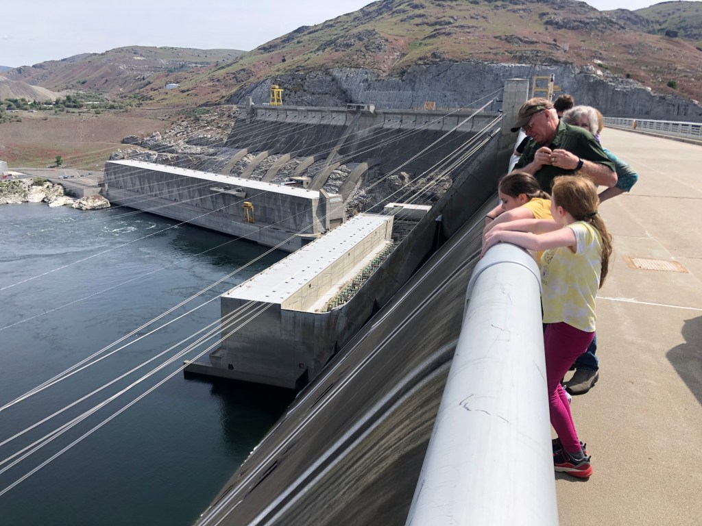
And if you’re interested, here’s a short video showing my view looking over the edge of the dam, on the downstream side.

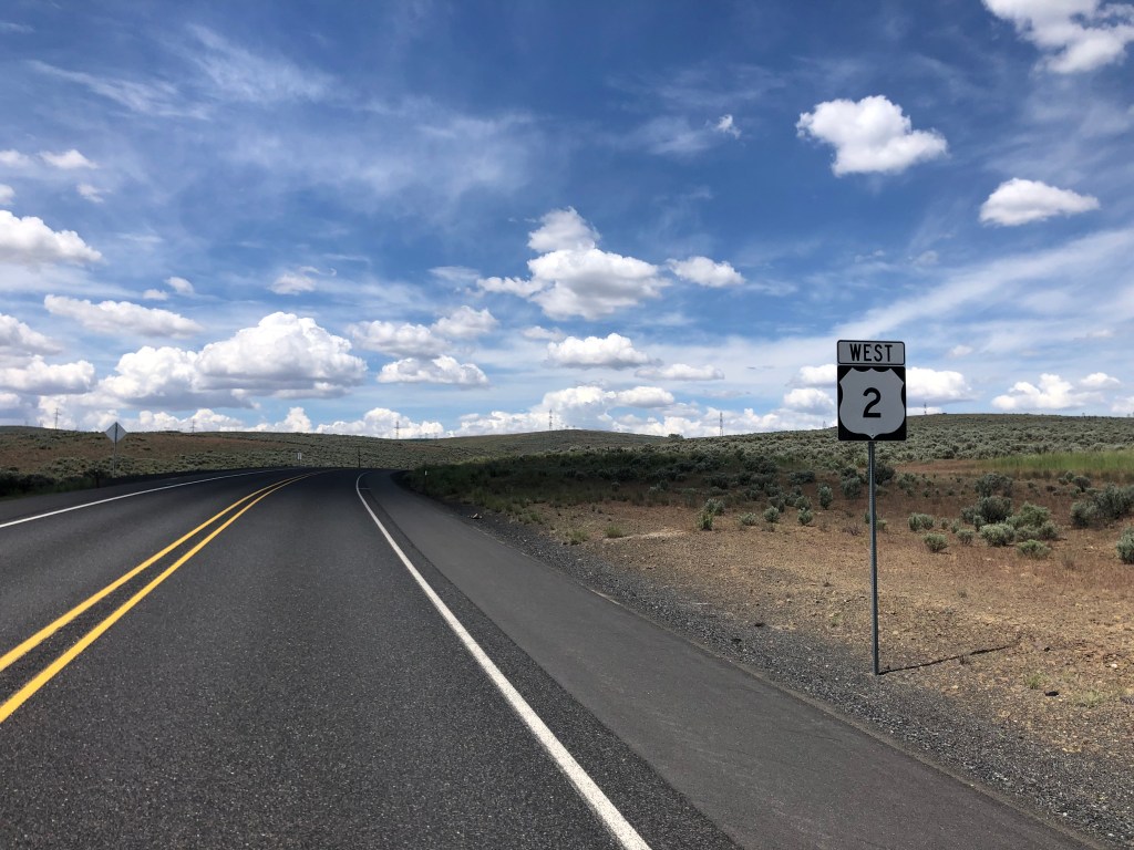
Around noon I wound up this educational detour and reconnected with that familiar friend, Route 2. Along the way I drove through “Electric City” (pop: 1,000), whose name relates to the nearby Grand Coulee Dam’s generating capacity. But what struck me about Electric City was not its proximity to someone else’s generators, but rather a large collection of homemade windmill sculptures in a “windmill garden” next to a park.

Positively mesmerizing in person.

The sculptures were created by a hobbyist metalworker named Emil Gehrke, and they’ve supposedly been featured in National Geographic magazine. Gehrke created the sculptures from scrap that he collected from all over the world. He displayed the sculptures in his yard for years, but after his death in 1979 (at age 95) most of them were moved to this park.

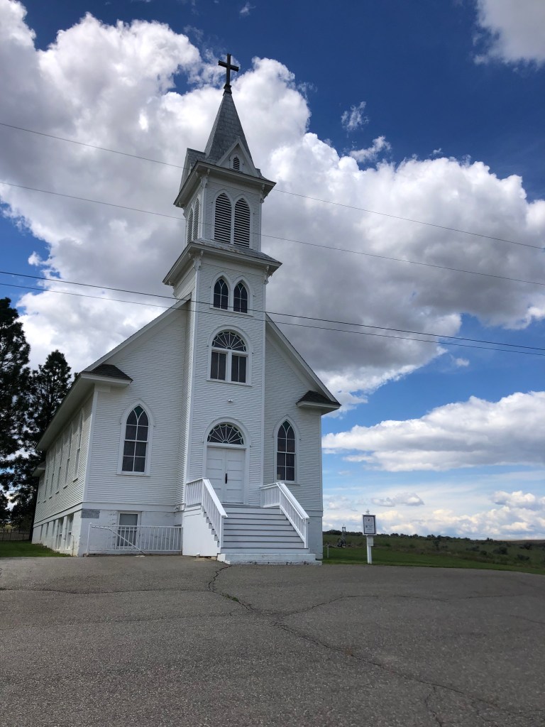
Soon I reconnected with Route 2 and returned to my westward trek. I came to the town of Waterville, where I encountered the daily, obligatory former church building. Today’s ex-church started out as St. Paul’s Lutheran Church in 1915. It closed in 1968, when the congregation built a new church along with another Lutheran congregation. The old building was purchased by the local historical society in 2006, and it’s now used as a community center and wedding venue. The historical society did an impressive job of restoring the structure.

Look familiar?

I am spending the night in Wenatchee (pop: 35,000, which is one of the largest towns on this trip). Wenatchee is a comfortable, seemingly prosperous town at the confluence of the Wenatchee and Columbia Rivers, with lots of outdoor venues for enjoying the great weather. It calls itself “the apple capital of the world,” in reference to its many apple orchards.

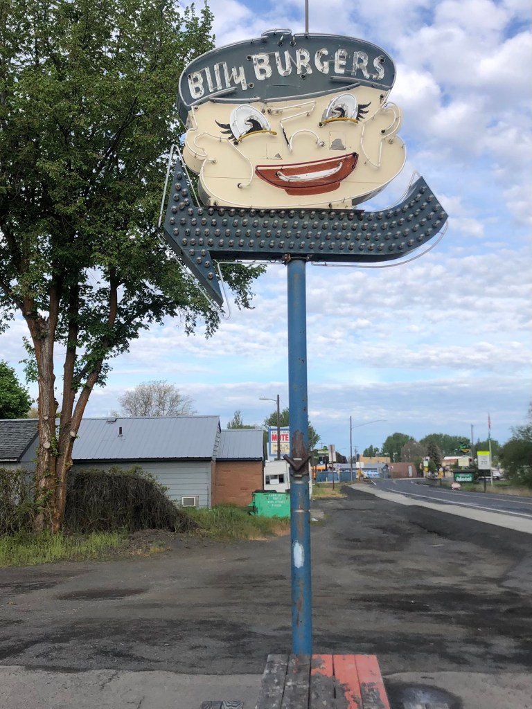
I’ll end my description of today’s travels with these two semi-creepy floating faces that evidently had been employed for advertising purposes in the middle of the last century.

Atop an Office Depot in Wenatchee. (The sign was grandfathered in from the prior business on this site.)
Hamburger joint in Wilbur.

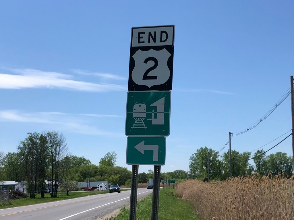
Tomorrow I’m planning to reach the end of Route 2, in Everett.

Brew(s) of the Day

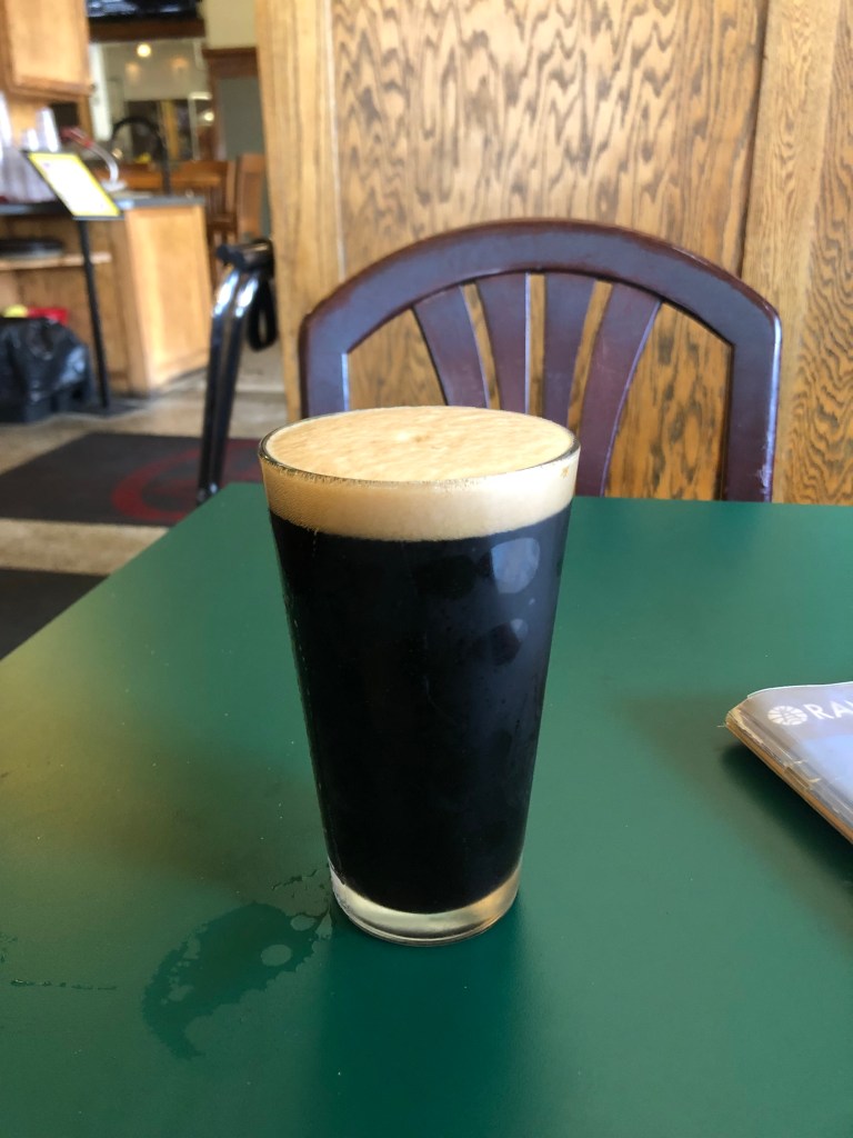
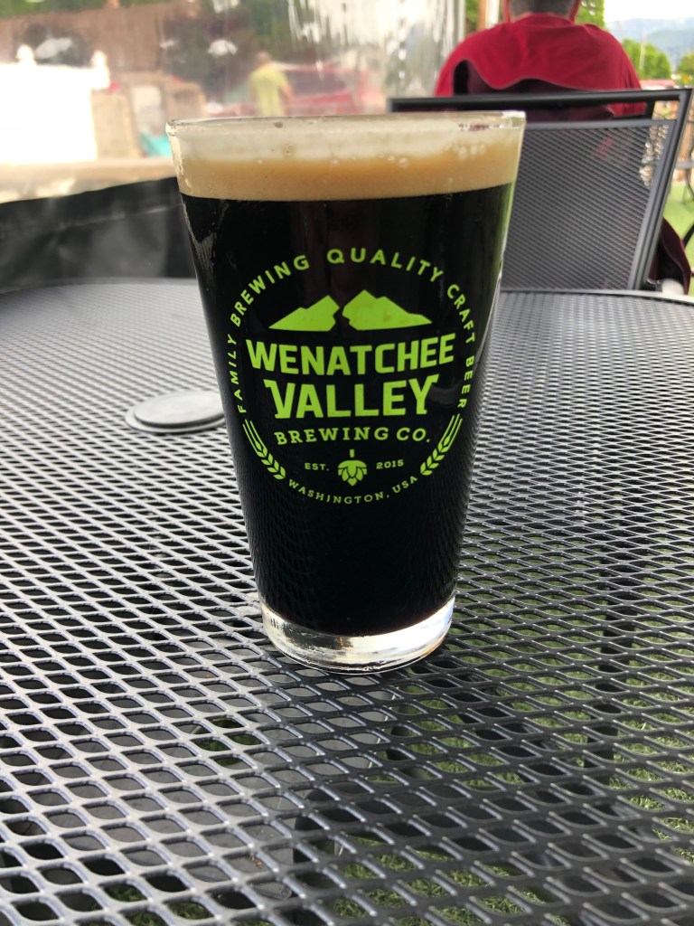
Today’s BOTD comes courtesy of the good folks at Wenatchee Valley Brewing Company in Wenatchee, Washington. It’s the usual modern, western brew pub, with the brewery and service counter in a warehouse-like space, lots of outdoor seating with views of the busy street, and the ubiquitous corn hole game set up on the lawn. Wenatchee Valley Brewing is located on the bank of the Columbia River, which makes for a pleasant environment.

The usual setup.

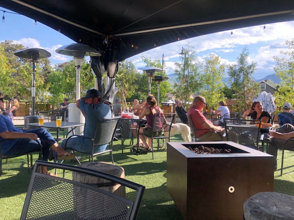
I ordered the Trout Stout on nitro. (“Nitro” is a dispensing process for some draft beers–particularly stouts–which uses nitrogen rather than carbon dioxide, lending a creamier mouthfeel.) I have to say that it was a good presentation, and a tasty brew. The beer is a dark-chocolate brown, with a thick, creamy, tan head. The taste is remarkably smooth and balanced. It manages to avoid the bitterness that plagued the last few stouts that I’ve drunk. The main flavors that come through are roasty ones: espresso, burnt toast, maybe a little bit of roasted chestnut. And at only 6% ABV, this is a very drinkable beer. Recommended. I give it four stars.

Powered by nitro.

Now, recall that I couldn’t find a BOTD yesterday, so I’m making up for that by having a second BOTD today. Loyal reader Ron P. sugested I have a hazy IPA, but there are none to be found at this place. So instead I had a “Hopcicle Double IPA.”

Not hazy, but definitely boozy.

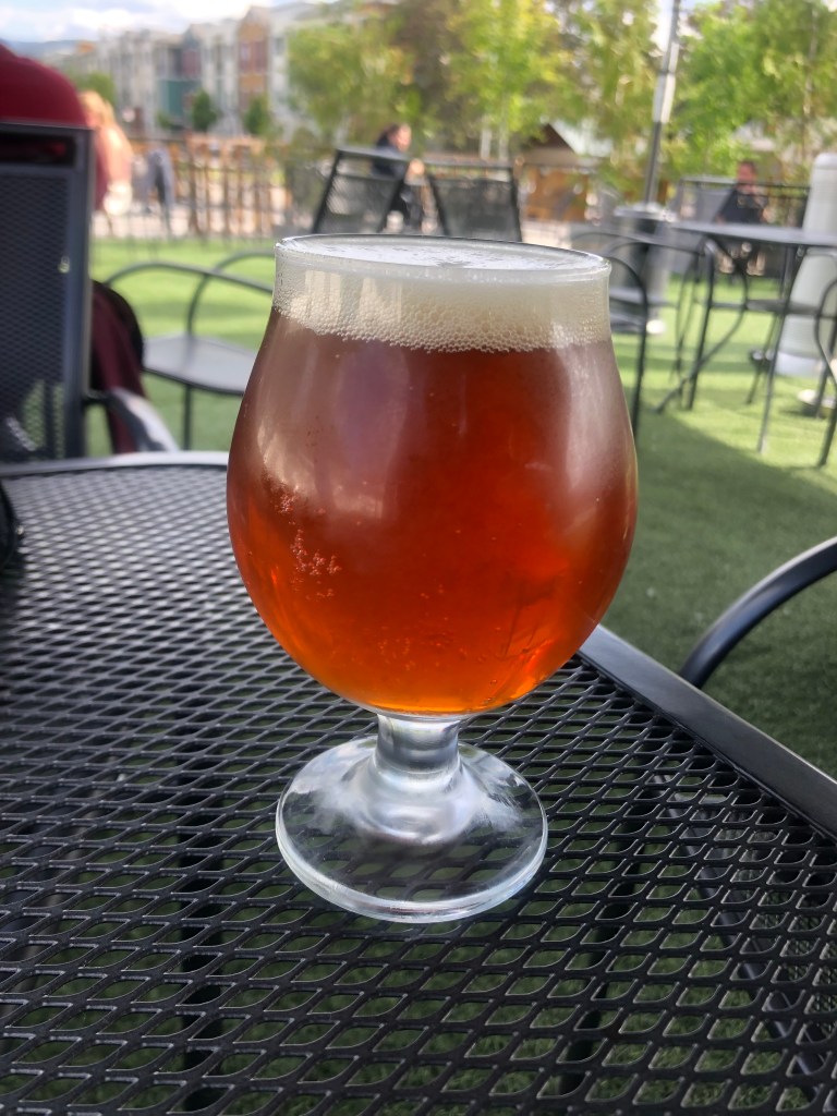
This is a good summer brew, made all the more enjoyable because I’m sitting outside in the warm sunshine with it. It’s pretty sweet for an IPA, with hints of honey and marmelade. Hops balance out that sweetness, but it doesn’t taste bitter. It’s got a light body, which makes it go down pretty easy. But it’s 9.2 percent ABV, so they serve it in a smaller (12-oz) glass. Which is a good thing, I’m sure. I give it 4.5 stars, but that might be alcohol talking…

Cars · Hydrology · Road trips · trains

My Day as a Yooper

This morning I awoke to a pleasant, clear, sunny day in St. Ignace, Michigan—a city that straddles Lake Huron and Lake Michigan.

Uncharacteristically, I even sprang for a room with a view. When I awoke in the middle of the night and observed that there were virtually no lights to be seen out around the lake. I guess there’s very little development out in these parts.

Paging Lucy Honeychurch…

After a virtually inedible continental breakfast at the hotel, I drove a few blocks to the beginning of US Route 2’s western segment.

And away we go!

The day’s travel took me about 300 miles due west across Michigan’s Upper Peninsula, or UP (sounds like “you pee”) (that’s a quote from a helpful cashier at the local BP [“bee pee”?] gas station). Residents of the UP are therefore called “Yoopers.”

Anyway, I pointed the car west and soon the touristy town of St. Ignace was in the rearview mirror. US 2 is a simple two-lane road surrounded by pine and spruce, and offers occasional glimpses of Lake Michigan to the south. It has virtually no stoplights or even stop signs, except when it passes through the occasional small town. It’s a great road for decompressing and pondering the meaning of life.

As I went driving that ribbon of highway/I saw above me that endless skyway.

Now, I don’t pretend to be an expert on the UP. In fact, this is the first time I’ve ever set foot in the territory. But after 300 miles of driving, with numerous stops and exploratory side trips, I can offer the following top five things that the UP is (or should be) known for:

1: Moose. Moose are native to Michigan, but they were heavily predated and largely eliminated from the lower part of the state in the 1800s. In the 1980s Michigan’s Department of Natural Resources introduced more moose into the UP, where they maintain a self-sustaining population. The moose seems to have become an unofficial mascot, which I came across repeatedly.

2: Bigfoot. His likeness is everywhere. I guess the fact that the UP is remote, with lots of trees to hide among, makes for good Sasquatch habitat. There’s even a UP Bigfoot Conference each year.

And perhaps inevitably, I even encountered a Bigfoot with a Moose on a leash…

3: Trains. Railroads played a key role in the development of Michigan, of course. But with the long stretches of undeveloped land in the UP, trains were especially vital for communications, transportation, economic development, etc. in the region. Parts of the UP are major producers of iron, and railroads made it possible to export the ore to far-flung markets. Throughout my drive I encountered remnants of the old railroad infrastructure, now largely abandoned.

1911 steam locomotive from the Soo Line, now in Gladstone, MI
Iron Mountain RR Depot, built around 1910. Note the still-operational semaphore!
The Curio Fair antique shop/tourist trap, in Saint Ignace. The closer of the two structures is an old railroad depot from the Duluth, South Shore & Atlantic RR. You can also walk up the adjoining tower structure to get a good view of Lake Michigan. Sadly, it was closed when I visited.

4: Pasties. No, pasty doesn’t rhyme with tasty; it rhymes with nasty. Pasties are advertised everywhere in the UP. Supposedly they were introduced by Cornish settlers to the region in the 19th Century. Essentially, they’re meat pies. I had one today and it was definitely tasty–not nasty at all.

5: Rust. Winter in the UP brings freezing temperatures, ice, and snow, which requires that the Transportation Department spread salt on the roads. The combination of continuous moisture and salt hastens the formation of rust on iron and steel, which means that your F150 is going to gradually disappear.

Rust never sleeps.

Anyway, that’s my view of the UP, based on a drive along Route 2. I’m sure I’m missing some key elements… But before I get to the BOTD, let me share one other historic structure I came across in the city of Manistique, MI (pop: 2,800). It’s a water pumping station that was constructed in 1922. It operated into the 1950s, but then was replaced by a more modern facility. It’s currently part of a museum complex. It’s a good example of neoclassical, brick structures that I saw in historic downtowns throughout the UP. Courthouses, city halls, theaters, even office buildings have a similar grandeur that, to me, seems really out of place given the UP’s rustic culture.

Might make for a good haunted hydro? (see yesterday’s blog)

Now, as we move into the BOTD, let me set the mood with one more structure: The Richter Brewing Company building was constructed in 1915 in Escanaba, MI. Brewing operations were shut down with Prohibition, and Richter sold off the building. But it was again used to brew beer by another company until 1940. Then it stood vacant for about 50 years. It was renovated in 2012, and now houses loft apartments.

Zoom in on the lettering over the door.

Tonight I’m in Ironwood, MI, and will drive across the border into Wisconsin tomorrow morning.

BREW OF THE DAY

Close to the Richter Brewing Company is the Delta Hotel, built in 1915. The first floor of the hotel building is now a brewpub named Hereford and Hops.

The venerable Delta Hotel building

It was here that I ordered a pint of the Blackbird Oatmeal Stout, which is made on the premises. It was a beautiful pour: a dark mahogany color with a perfect, creamy head. The temperature was just right, with a bit of condensation on the glass.

Pretty as a picture. But not as pretty as a pitcher.

Sadly, though, I can’t recommend this beer. It seemed overhopped–just too bitter for a stout. And the malt flavor that did manage to make itself known was one-dimensional, completely lacking in that kaleidoscope of changing flavors you expect from a stout. It had more of an earthy taste than the caramel, malty taste I was hoping for. Partly redeeming it was a satisfying, creamy mouthfeel courtesy of the oatmeal. I’ll give this a three out of five stars.

cemeteries · Hydrology · Obelisks · Road trips · trains

The Big Lacuna

As you will recall from my last post, I recently flew out east to visit family and friends for a few days, after which I would travel the entire western segment of US Route 2, from St. Ignace, Michigan to Everett, Washington. The visits have been made, and I have now arrived at St. Ignace. I will be traveling Route 2 over the next 8 days. Be looking for daily posts on this site.

I did manage to drive a small portion of Route 2’s eastern segment while I was visiting as I left Cousin Bonnie’s in Vermont. That segment terminates (or begins, depending on your direction) at Rouse’s Point, NY. And (drum roll please) here it is:

All good things must come to an end.

I then spent the next two days making my way across Route 2’s lacuna. (Along the way I stopped at a Greek restaurant for a little moussaka. Ah, Lacuna Moussaka–what a wonderful phrase!)

Anyway, although I was technically not on Route 2 during this time, I did encounter a few noteworthy roadside oddities. And here they are:

We start with this awesome, restored, historic building in Endicott, NY which was once part of the Lighthouse Service Station chain that supposedly served much of New England. It now appears to be some kind of private office or business, though there are no signs indicating what, exactly, they do.

I also stopped a number of cemeteries (the east is lousy with ’em!), and found some notable gravesites:

Lucille Ball’s grave (along with other famly members), in Jamestown, NY. Lucy was born in Jamestown, don’t you know.
Obelisk alert! Here, in Owego NY, lie the remains of Sa Sa Na Loft, who was killed by a runaway freight train in 1852. It’s supposedly the “oldest white-sponsored grave tribute to a Native American woman.”
In Elmira, NY: Family plot marker for Mark Twain and his son-in-law, Ossip Gabrilowitsch. Elmira was Twain’s wife’s hometown.

Let me note here my favorite Mark Twain factoid: When he was born in 1835, Halley’s Comet appeared in the sky. It was known that the comet passes earth every 75 years or so. And so, as the next encounter with the comet approached in 1910, Twain made this comment:

I came in with Halley’s Comet… It is coming again … and I expect to go out with it… The Almighty has said, no doubt: ‘Now here are these two unaccountable freaks; they came in together, they must go out together.’

And they did. Twain died the day after the comet emerged from the far side of the sun.

Hitched to Halley.

The most impressive cemetery I encountered during my Drive of the Lacuna was Lake View Cemetery, in Cleveland, Ohio. It includes these notable figures and impressive works of art:

Marker for Untouchable Elliott Ness. His ashes were scattered over a pond just behind the marker.
Very touching sculpture over the grave of local musician Sergei Gaidaenko. He’s of Ukrainian background.
It’s well worth 45 seconds of your time to watch this video, with Sergei’s music in the background. I never met him but I miss him.
Here’s something you don’t see every day: A jukebox tombstone. It belongs to local disk jockey Alan Freed, who supposedly coined the term “rock and roll” in 1951.

If you’re interested in what all the fuss was about, check this out:

At a miniature golf course in Owego, NY. Alert readers will recall a number of Pink Elephant sightings on my earlier trips; see here for a refresher.

And speaking of recurring creatures, this Beetle/Spider in Erie, Pennsylvania very much resembles earlier encounters. Observe:

Erie, Pennsylvania
Somewhere in New Mexico
Reno, NV

And of course, there’s this recurring fellow:

Fremont, OH
Milford, OH (from a prior trip). Full story about the Big Boys is here.

Finally, I bring you the Haunted Hydro, a so-called “Dark Attraction Park” that is open during the Halloween season.

Scary juxtaposition of skull and portapotty….

The place looks pretty run down, even abandoned. But I’m told that it’ll be resurrected in time for Halloween. The main part of the attraction is a century-old hydroelectric power plant (hence the “hydro” part of the name). You can see it in action here.

The 1911 Hydro

Finally, this afternoon I arrived in St. Ignace, Michigan, where I’ll start the western segment of Route 2 tomorrow morning. By the way, the the Lacuna ended as it began, with a lighthouse–this time a real one:

Old Mackinac Point Lighthouse, in St. Ignace

Until tomorrow!

California history · Hydrology · Obelisks · trains

Spring Train-ing

Yesterday my good friend Bill mentioned that there was going to be some kind of celebration in Sierra Foothills this weekend to commemorate a new locomotive acquisition by California’s Department of State Parks. Given my long-standing interest in trains, as well as the fact that the spring weather has been glorious this year, it sounded like a worthy day trip. I consulted my calendar, which, given my state of retirement, is as empty as a bird’s nest in December. So it was that Bill and I met this morning in the historic township of Jamestown.

Jamestown (pop: 3,100) was founded just as the Gold Rush was beginning, in 1848. It remains a small, unincorporated town of Tuolumne County, about 100 miles southeast of Sacramento. The important thing about Jamestown, for our purposes today, is the railroad. The Sierra Railway Company was established in Jamestown in 1897, hauling ore from mining operations and timber from logging operations around the area.

The narrow-gauge railroad operated into the 1960s. In addition to freight and passenger hauling, the Sierra Railway developed a niche as a “movie railroad,” whose trains and structures appeared in numerous Hollywood films (including High Noon (1952), 3:10 to Yuma (1957), and for you young ‘uns, Back To the Future Part III (1990). Oh, and it was featured in the opening credits of “Petticoat Junction” each week.

Then….
…and now.

In 1971, after most of the commercial transportation purposes of the railroad had dried up, the Sierra Railroad’s Jamestown facilities (including a station, roundhouse, and shops) were opened to the public as “Rail Town 1897.” A decade later (i.e., 50 years ago this year), the facilities, along with locomotives and cars, were purchased by the California Department of Parks and Recreation for $750,000. Railtown 1897 was designated a State Historic Park. It remains a popular tourist destination, offering tours of the shops and steam train rides pulled by the original engines on the original tracks.

I can’t emphasize enough how unique and impressive this place is. The roundhouse is largely unchanged from how it looked over 100 years ago. Most of the same tools and equipment are still in place, and are used regularly to repair and restore locomotives and cars. They have vintage locomotives and rail cars that offer excursion rides every weekend. This place is an authentic time capsule.

The Roundhouse, over a century old and still in use
Inside the roundhouse
Don’t try this at home.

But let’s get back to the purpose of this trip. The whole reason we came was because Railtown 1897 had put out a press release that they had acquired a new locomotive. And by “new,” they meant “old.” The locomotive (Sierra Railway’s No. 34) was built almost a century ago. Sierra purchased it new in 1925 from the venerable Baldwin Locomotive Works and it remained on Sierra’s roster until the company closed in the late 1960s. The locomotive was eventually sold to a collector (someone who evidently didn’t think model trains were sufficiently authentic), but this collector never got around to moving the engine away from its stomping grounds. It just sat there in the roundhouse in Jamestown. Recently that owner/collector died, and the locomotive went up for sale. Money was provided by two generous donors–Chris Baldo and Marion Hatch–and Railtown was able to acquire the “pink slip” for the engine that’s been on their property for a century. Hence the big celebration today.

The engine in question is the Sierra Railway’s No. 34, seen here in its heyday:

Old Number 34
Friend Bill in front of Old(er) No. 34 today

The engine hasn’t run since 1980, but, using words familiar to everyone who’s purchased a classic automobile, “it was running when we last shut her down.” The plan is to restore the locomotive to operational condition.

Like Charlie Brown’s Christmas tree, it just needs a little TLC…

They plan to do the restoration work right here, in the venerable old shops at Railtown. Bill and I hope to provide a little volunteer muscle on that project.

Meanwhile, Railtown does have other steam locomotives. These include the No. 28, which celebrates its 100th birthday this year. The engine hauled cement and rock for the construction of the O’Shaughnessy Dam at Hetch Hetchy in the 1920s, and then turned to regular freight and passenger service. It has appeared in various movies and television shows, including “Little House on the Prairie” and Bound for Glory.

Old No. 28, back in the day

Today this same engine is still running strong. In fact, it pulled our excursion train this afternoon as we enjoyed an hour’s journey along the Sierra Railway’s old, historic tracks.

No. 28, under steam this morning
View of the Old 28 from our passenger car

Railtown also has another operational steam engine–the No. 3, which was built in 1891(!). This locomotive has appeared in more movies than any other locomotive, and is regarded as an archetypal example of late 19th-century American trains. It’s been involved in a few mishaps over the years…

…like this one in 1918….

…but it’s been repaired each time, and remains in service to pull excursion trains.

Old No. 3 today

So, overall, the Sierra Railway’s facilities in Jamestown (i.e., “Railtown 1897”) is a remarkable, virtually unspoiled, authentic example of California’s railroading past. It’s well worth a trip. (Admission is $5. I’ll send you a fin if you’re strapped for cash.)

Postscript

Stick with me here; this is going to connect back to Railtown 1897.

On the way home along Highway 49, I stopped in the town of Jackson (pop: 4,800) to check out this obelisk that I saw from the road:

Wouldn’t you have stopped for it?

The obelisk was erected in 1938 to honor favorite son Anthony Caminetti (1854-1923), who racked up an impressive resume. Allow me to quote the marker: “District Attorney, State Senator, United States Congressman, United States Commissioner, General of Immigration, the first native Californian to be elected to Congress, author of bills creating California Debris Commission, Preston School of Industry at Ione, California Junior Colleges, Father of Alpine State Highway, a loyal American and a faithful public official.”

Some of these posts sound impressive (Congressman, Senator…). Others are a bit less so. I mean, being one (of many) authors of certain pieces of legislation isn’t exactly herculean. It does, however, raise a critical question: What exactly is the “California Debris Commission,” anyway? Answer: it was an agency created in 1893 to clean up the damage that had been done to California’s waterways by the extensive use of hydraulic mining in the Sierras. The Commission was dismantled in 1986.

And here’s were we link back to Railtown 1897. For it turns out that the Clint Eastwood movie Pale Rider (1985) focuses on hydraulic mining and how it did extensive environmental damage to the rivers. And scenes from that movie were filmed at Railtown.

I do recommend the movie, by the way. Check it out here.

California history · cemeteries · Hydrology

Underwater Towns

Back when I was a babe (shockingly, no one calls me this anymore), the good folks at the East Bay Municipal Utility District (East Bay MUD) decided to dam the Mokelumne River in the Sierra Foothills, thus creating a reservoir that would supply the growing population of the East Bay with reliable drinking water. They named the reservoir Lake Camanche.

I vaguely remember the too-good-to-be-true commercials, featuring over-excited sport fishermen and giddy children playing at the beach, that were broadcast over the fuzzy UHF stations on our ancient television set in the late 1960s. The commercials sought to entice families to buy undeveloped land that, thanks to the creation of the reservoir, had suddenly become beachfront property. The sales pitches belong to a mildly ineffable class of advertisements that evoke tropical beaches improbably appearing in the shrublands of California’s dry foothills or, say, the deserts of northern Arizona. Here’s a good example of the genre. For an illustration of how these schemes can go wrong, see my post on the Salton Sea.

Anyway, although new communities were springing up on the north and south shores of Lake Camanche, several historic settlements found themselves underwater–literally. By damming the Mokelumne River, East Bay MUD flooded several gold rush towns: Lancha Plana, Poverty Bar, and Camanche. The first two were unihabited ghost towns, but Camanche still had some residents and a functioning post office that had to be relocated. (Camanche had been named by settlers in the 1850s after their home town of Camanche, Iowa.) Today, the towns sit under about 150 feet of water. It’s said that scuba divers occasionally explore the submerged remnants of the old towns.

Now, the Sacramento region has been experiencing unusually warm temperatures this week, feeling more like mid-spring than mid-February. And if that’s not a good enough reason for a retired chap to take a little road trip down to Lake Camanche, I don’t know what is.

Thus I found myself heading south from my newish stomping grounds near Placerville, down to an area where Amador, San Joaquin, and Calaveras Counties meet. (Most of the trip followed Route 49, which I described in a recent blog post.)

As I got close to Lake Camanche, I passed through the town of Ione (pop: 8,600). It’s a historic, quaint, and reasonably prosperous little community that no doubt will be the subject of a later blog. But for now, let’s just observe that Ione is home to the historic Preston Castle, which had been a reform school for boys that was built at the end of the 19th century. It’s said to be haunted, and for that it will likely be the subject of a blog in October.

You should see it at night.

When I finally arrived at Lake Camanche, I was somewhat disappointed. Let me enumerate the three reasons for my disappointment:

Camanche Reservoir, behind a dike.
  1. There is limited public access to the lake itself. You can pay day use fees to enter at the boat launch, but I couldn’t find any shoreline drive to cruise along. I guess I should have brought a boat.
  2. The communities around the lake never seem to have properly taken root. I saw no evidence of viable commercial districts, neighborhood parks, or even a decent brewpub. What little infrastructure I encountered was abandoned and/or decrepit.

3. Although recent news items spoke of how California’s drought has exposed ruins that normally reside under water, major rains this past December re-covered those historic remains and I was unable to find any evidence of those three historic towns under Lake Camanche.

Somewhere under Lake Camanche

Incidentally, although Lancha Plana had no population when the reservoir was being developed, it did have a cemetery. East Bay MUD decided to move the graves to another location…as if somehow, after over a hundred years, it would be cruel to put a lake over the cemetery. But such are the expectations of civilized society. Let’s just hope they learned the lesson of Poltergeist.

Still, even without encountering drought-exposed ruins, the visit was a good one. I took a pleasant drive more or less around the lake, with glimpses of the blue water and, more often, views of the surrounding hills. Eventually I came to Camanche Dam, which stops the Mokelumne River in its tracks.

A few stats about the dam, which was constructed in 1964: it’s 2640 feet long and 261 feet high, holding back up to 241 billion gallons of water. For those of you who can’t wrap your head around that number, it equates to about 107 billion cases of beer.

Weekend Drowning At Lake Camanche | myMotherLode.com
Is it just me, or does anyone else think the reservoir is in the shape of a guppy?

Here’s the placid Mokelumne River shortly after it passes through the dam.

Near the reservoir there’s also a fish hatchery, which is used to restore Chinook salmon and steelhead whose kinky sex lives were impeded by the dam. Sadly, the facility is now “temporarily closed” to visitors.

Well, that’s kind of it. Without a watercraft or scuba gear, there isn’t a whole lot to do around Lake Camanche. With a final glance at a few anglers attempting to hook, kill, and presumably devour some of the recent graduates from the fish hatchery, I got back on the Speedmaster and headed for home.