Breweries · bridges · California history · Cars · movie theaters · Road trips · Yard art

Been There, Done That, Got the T-Shirt

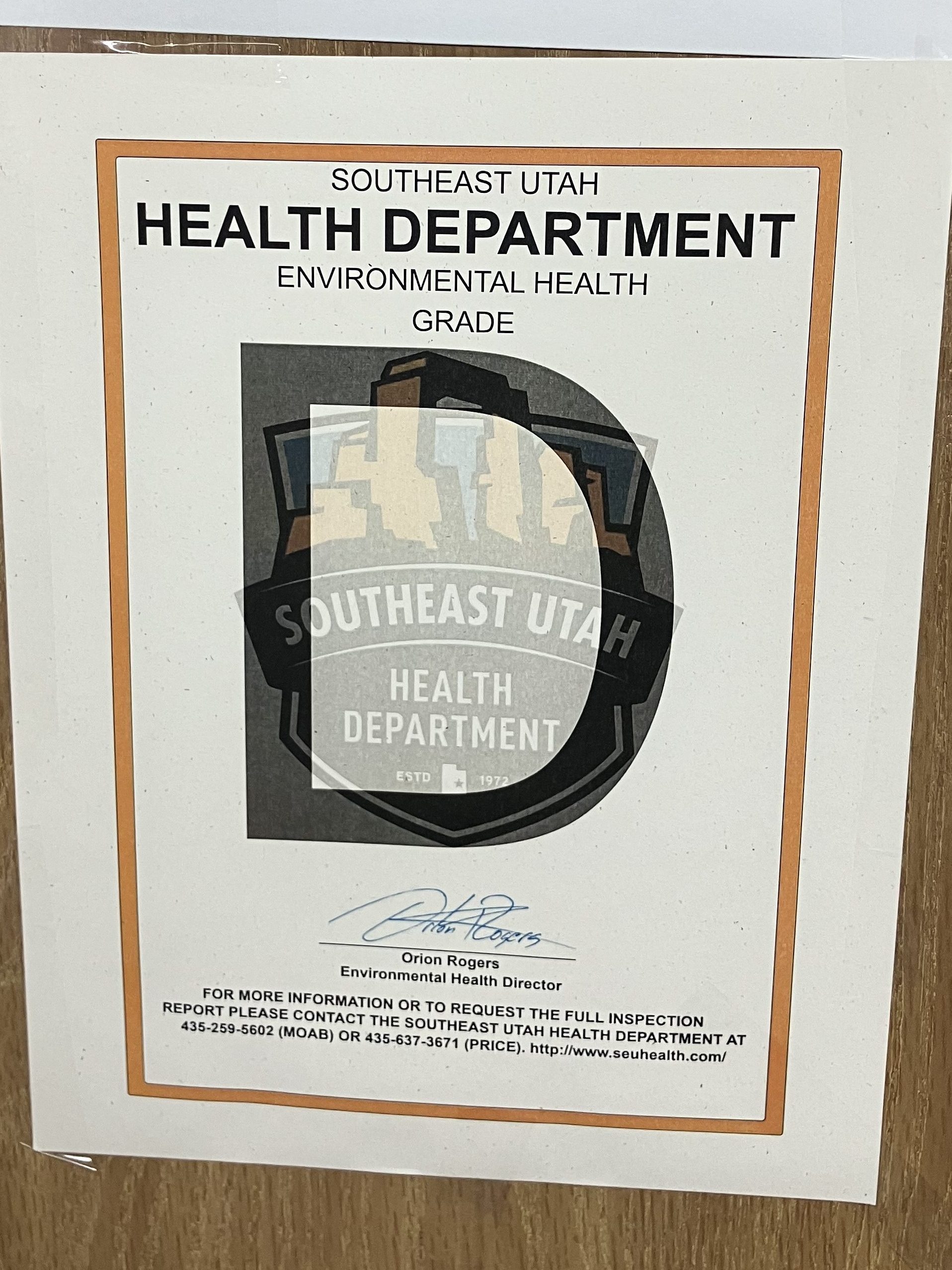
This morning I headed downstairs from my motel room to partake of the “free” breakfast. Then I spotted this sign in the breakfast room:

But a “D” is technically passing right? At least that’s what I used to tell my parents when I brought home my report card.

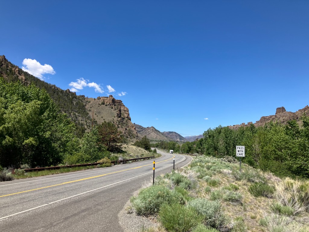
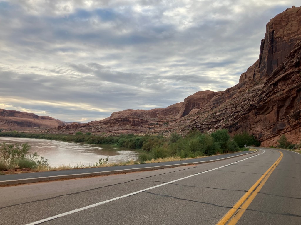
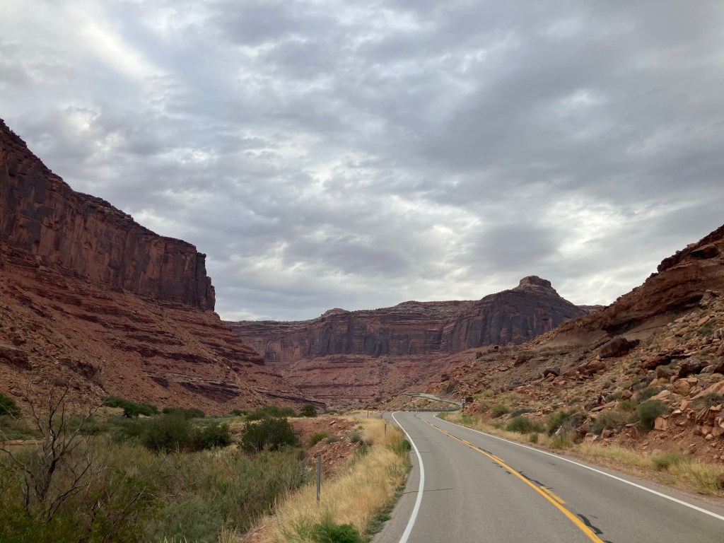
Instead of the motel breakfast, I got a gas-station coffee and donut. I then got onto the U-28 scenic byway, which carves its way through the Colorado River gorge towards Grand Junction. It was so spectacular it even made my donut taste good.

That’s the muddy Colorado River on the left.
A perfect setting for a Western…which it has been, many times.

After maybe half an hour of driving I came across a pedestrian suspension bridge that crosses the Colorado River. Attentive readers will recall that I’m a sucker for these things, so I looked for a place to pull over and sway my way across the (not-so-) mighty Colorado.

So far so good…

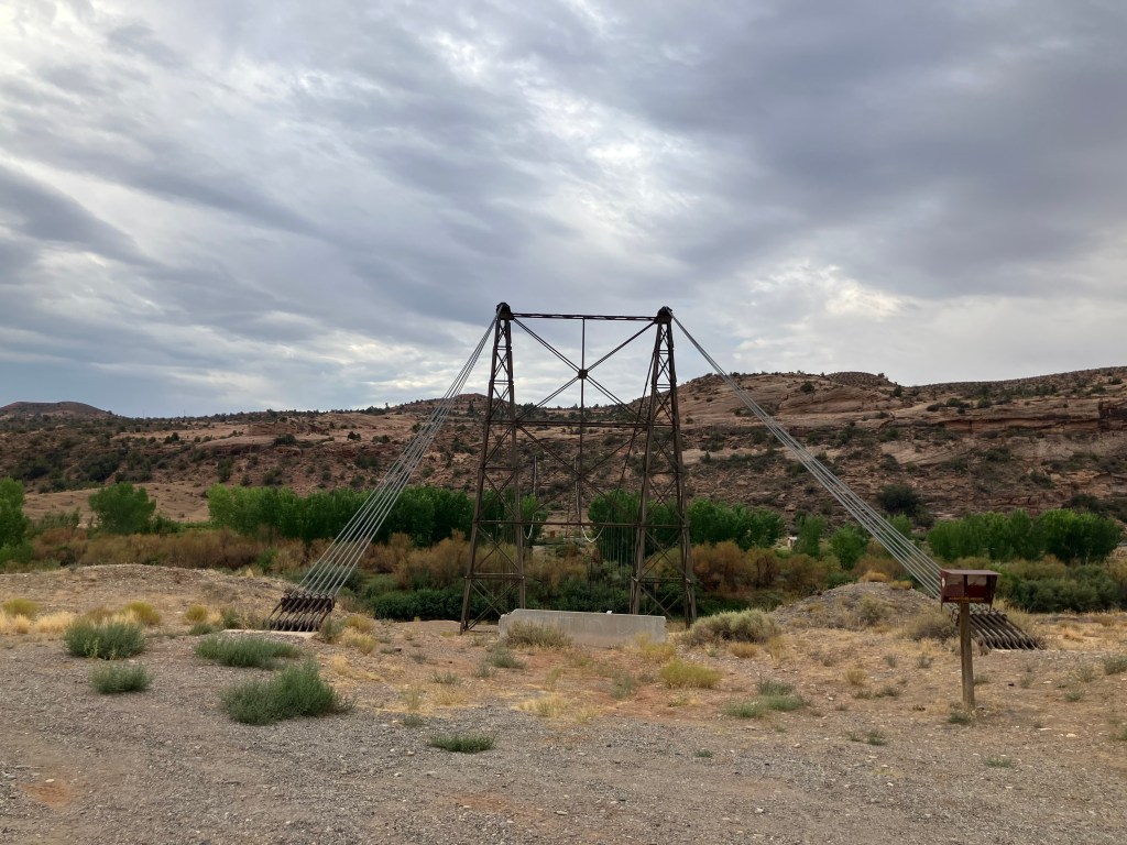
So imagine my disappointment when I discovered that the bridge’s decking was entirely missing.

…but wait–what’s wrong with this picture?

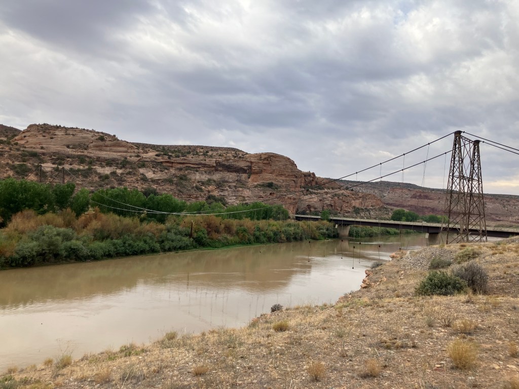
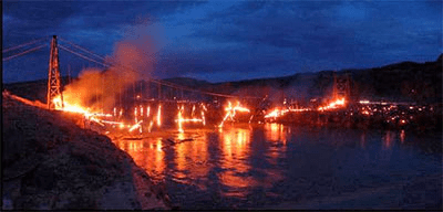
Turns out the Dewey Bridge (for that’s its name) was built in 1916 and is Utah’s longest suspension bridge. It was fully restored in 2000….and eight years later some kid was playing with matches and the whole thing went up in flames.

Kids, don’t play with matches! (2008 photo from Wikipedia Commons.)

A sad and ghostly air hangs about the skeleton of the Dewey Bridge. It set back my good mood a bit.

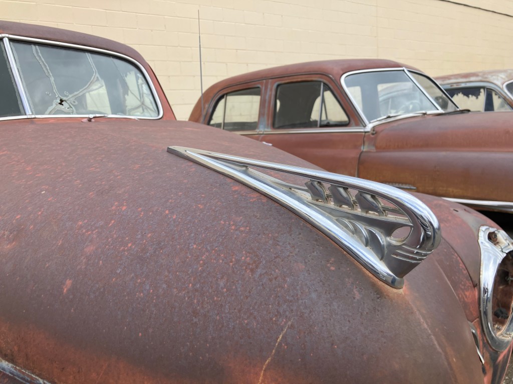
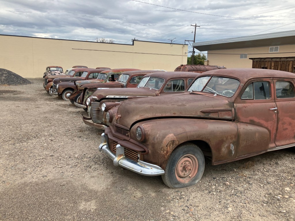
A little later I came to the town of Fruita, Colorado (pop: 13,400). I could live in this town. It’s one of those places that’s figured out how to preserve its history, cater to modern tastes, create a livable community, and attract tourists. The town is jammed with public art, and the main street has plenty of outdoor cafes and benches to relax, have a cup of coffee, and watch the world go by. It seems that most of the buildings along Main Street are historic and well-preserved or restored.

One public art installation that made me scratch my head was this rooster with no head:

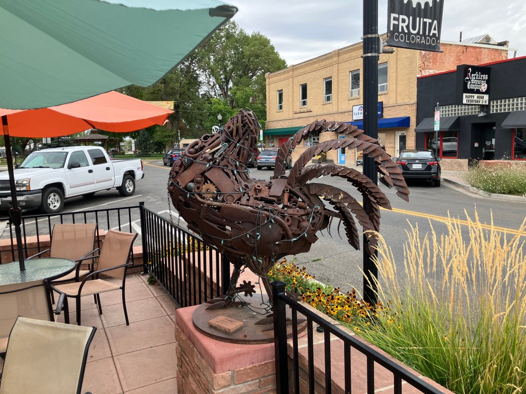
A friendly fellow drinking coffee at an outdoor table noticed me photographing the sculpture and gave me the story of Mike the Headless Chicken. (Trigger warning for those sensitive about food preparation by carnivores.) It seems that in 1945, a local farmer by the name of Lloyd Olsen was attempting to behead one of his chickens for dinner. His aim was a little off, and most of the chicken’s brain stem remained with the body. The chicken survived his beheading, flapping his wings and running around headlessly. What was Lloyd to do? He spent the next year and a half carefully feeding Mike (for that was the chicken’s name) individual kernels of corn through the throat and addressing Mike’s thirst with milk and water from an eyedropper. Mike became a sideshow attraction and gained national fame. Indeed, I remember reading about Mike in a “Ripley’s Believe It Or Not” paperback in the 1960s. Fruita still remembers Mike with the sculpture, T-shirts and other souvenirs, and an annual “Mike the Headless Chicken Festival” each spring. I am not making this up.

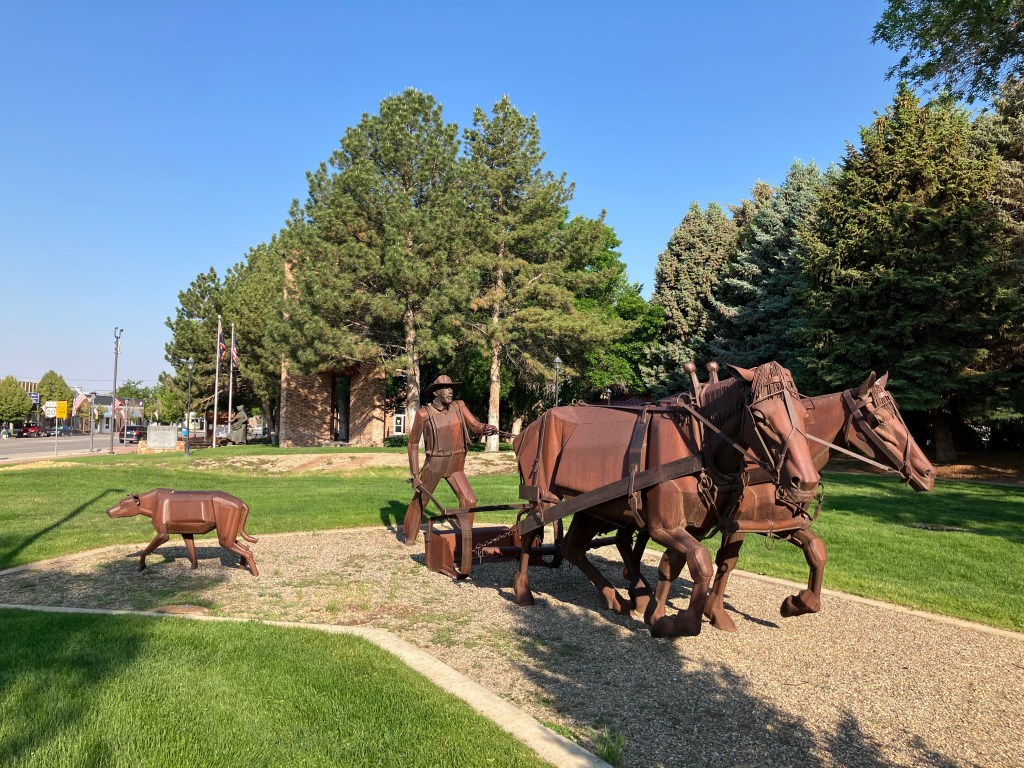
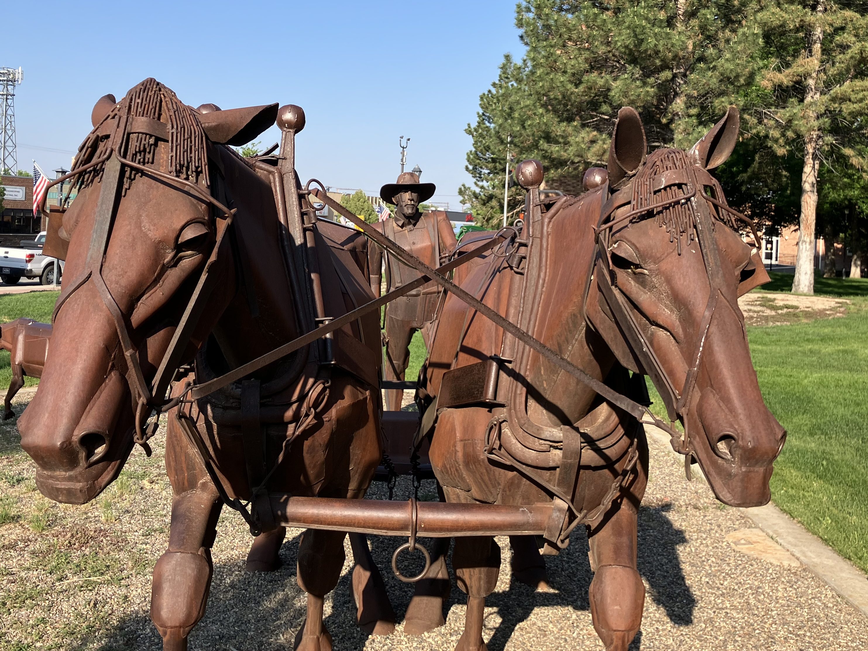
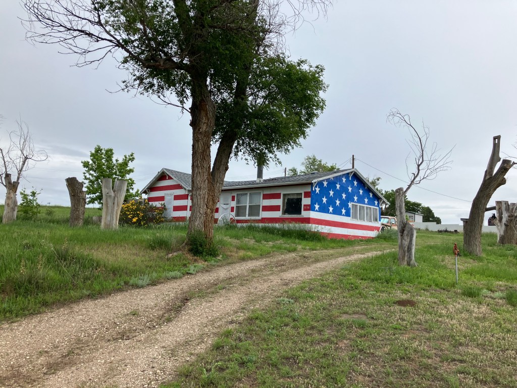
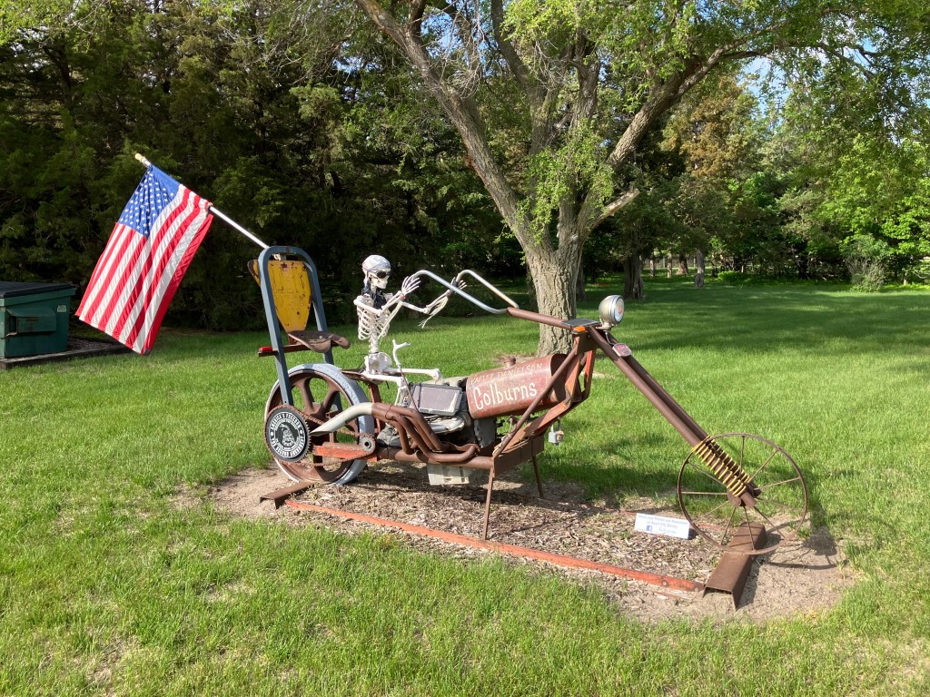
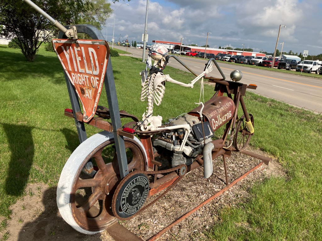
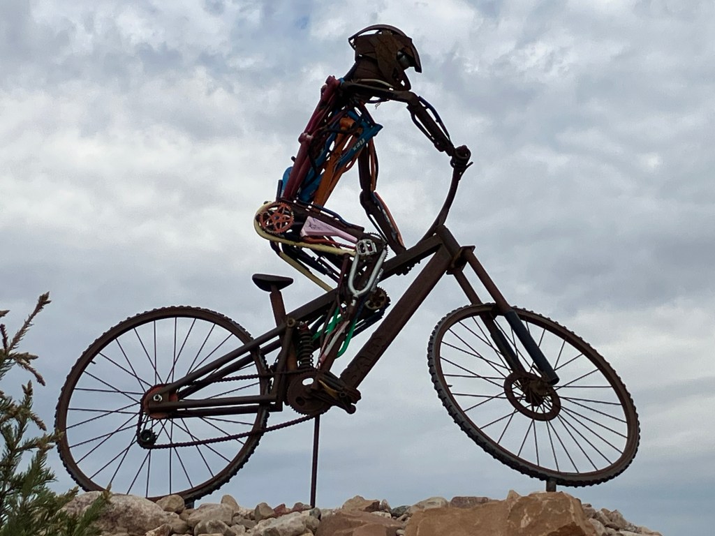
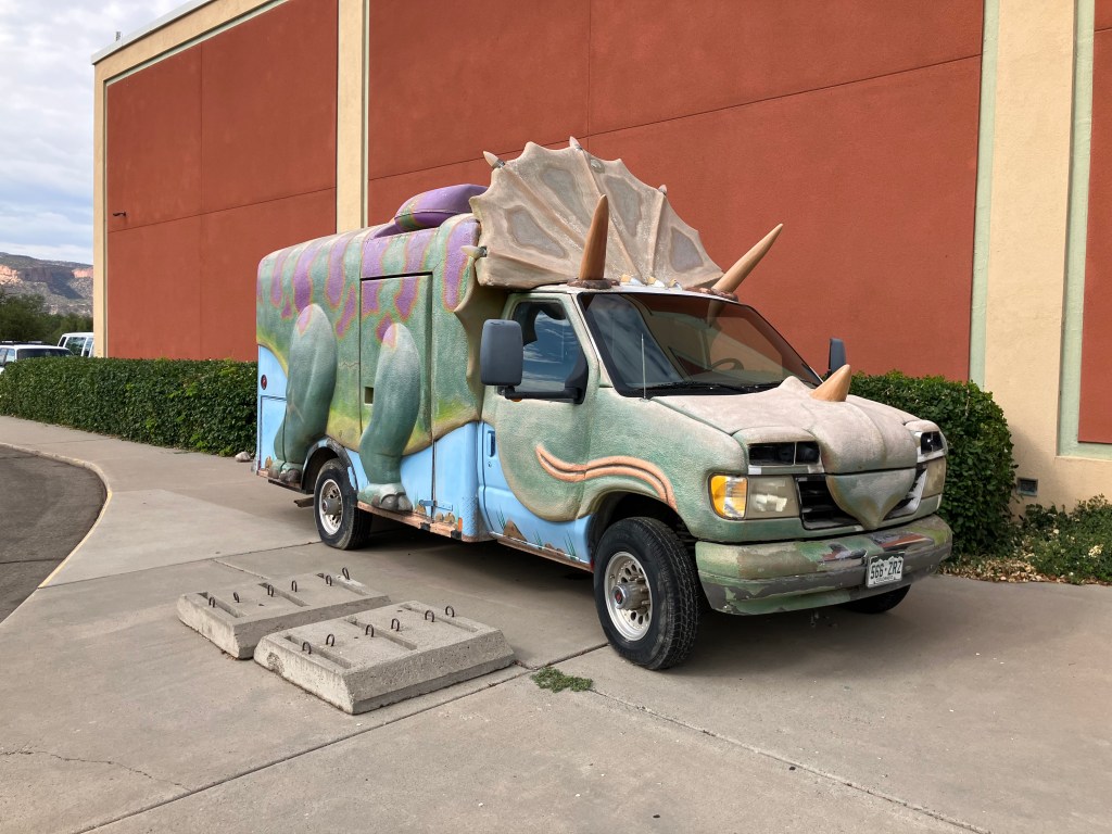
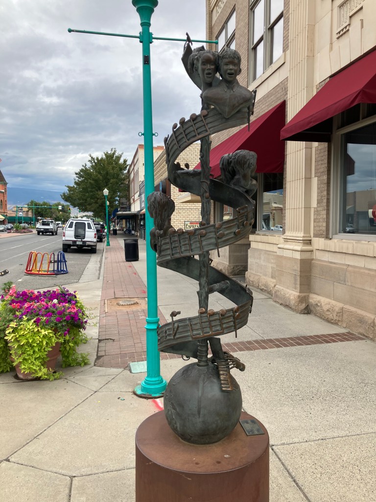
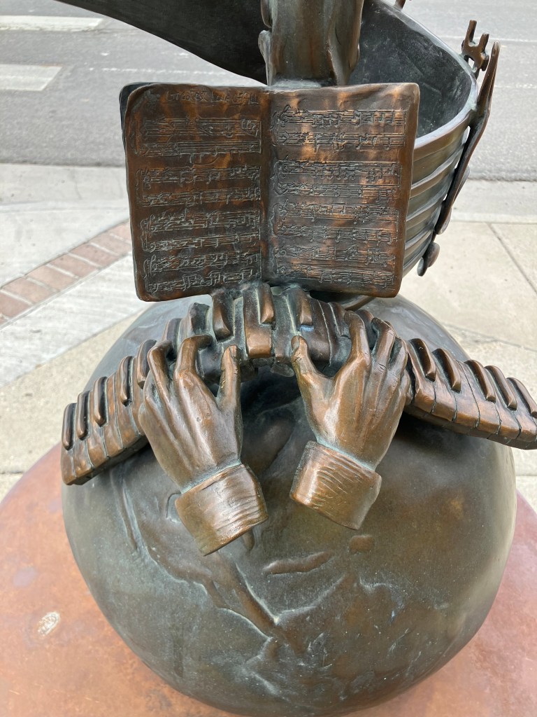
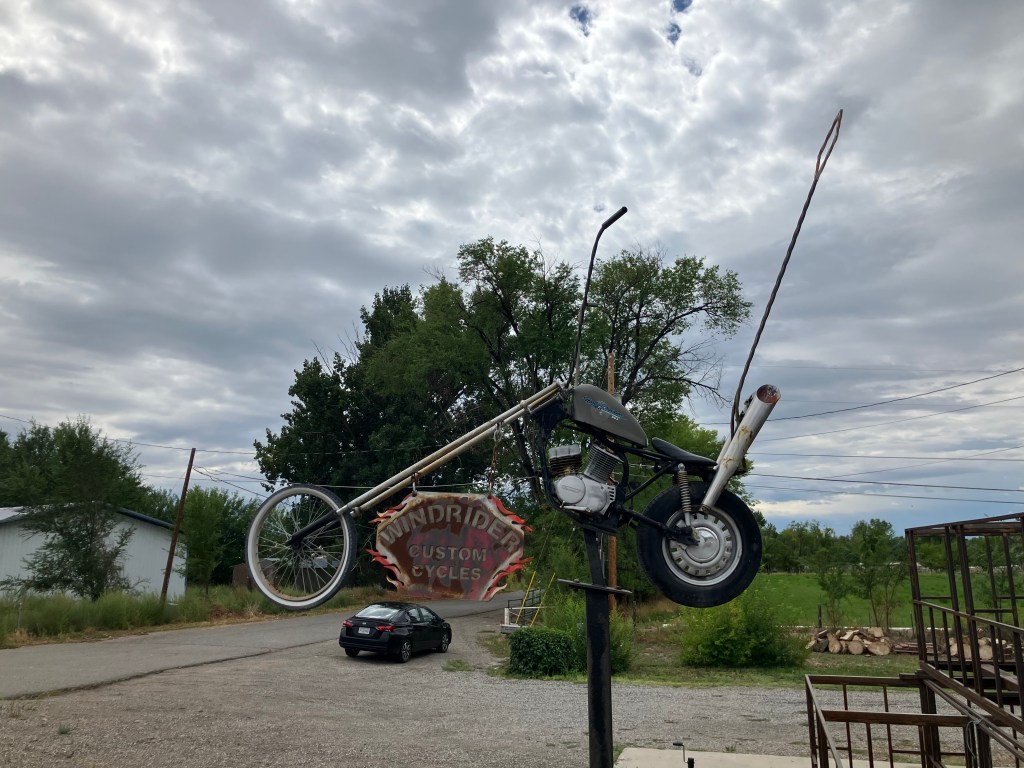
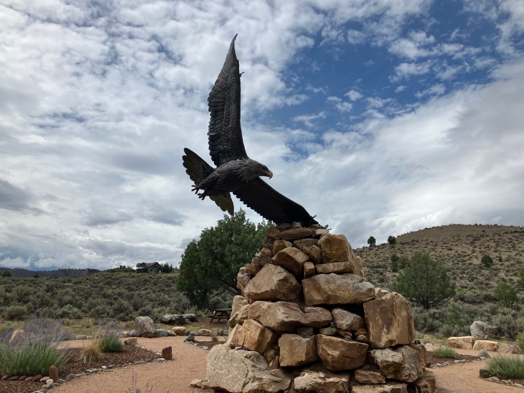
Fruita also has a lot of non-headless-chicken art around town. In fact, I noticed that many of the towns in eastern Utah and western Colorado feature interesting public art installations. Here is a sampling:

Bionic bicyclist in Fruita.
Sculpture honoring children’s music teacher David Carl Moore in Delta, Colorado.
Detail of the Moore sculpture.
Windrider Custom Cycles sculpture in Delta.
Sculpture at Dennis Weaver Memorial Park in Ridgway, Colorado. Dennis Weaver (I remember him as McCloud from the NBC television series) reportedly loved eagles and lived in Ridgway for many years.

I also randomly ran into these women playing the tubular bells (?) xylophones(?) that are installed at the park. Somehow I think Dennis Weaver would have appreciated it.

I’m not sure if it technically qualifies as art, but there is a large number of long-parked classic cars on both sides of the street in downtown Delta, Colorado.
Artistic Chrysler hood ornament.
Used car lots, frozen in time.

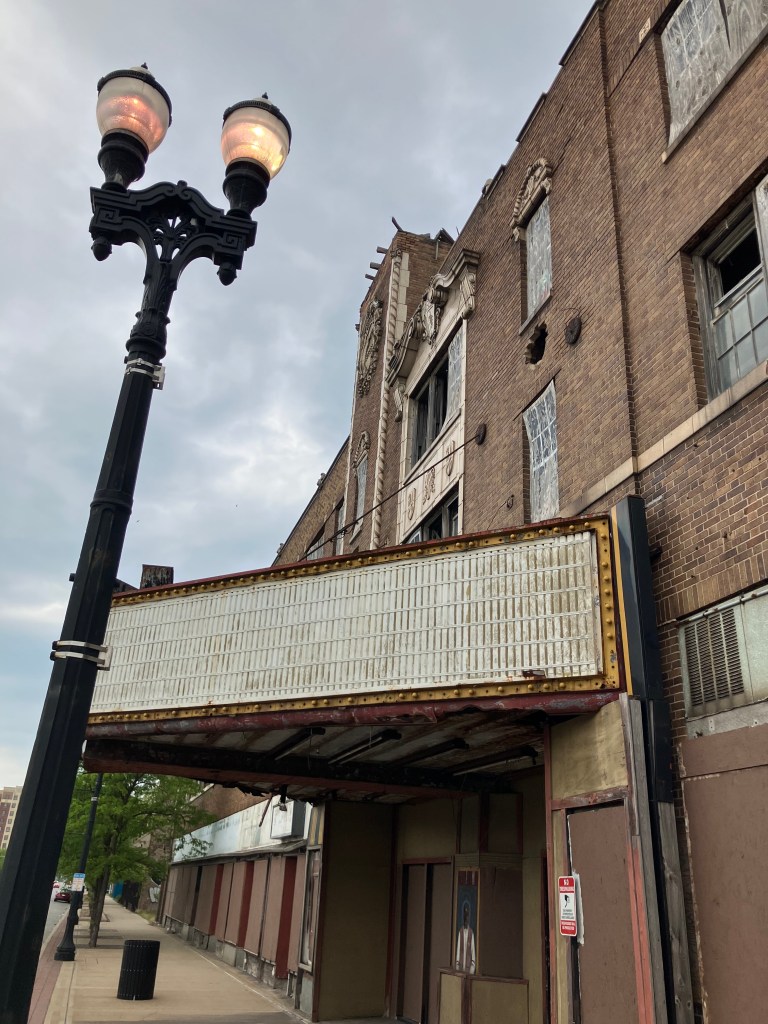
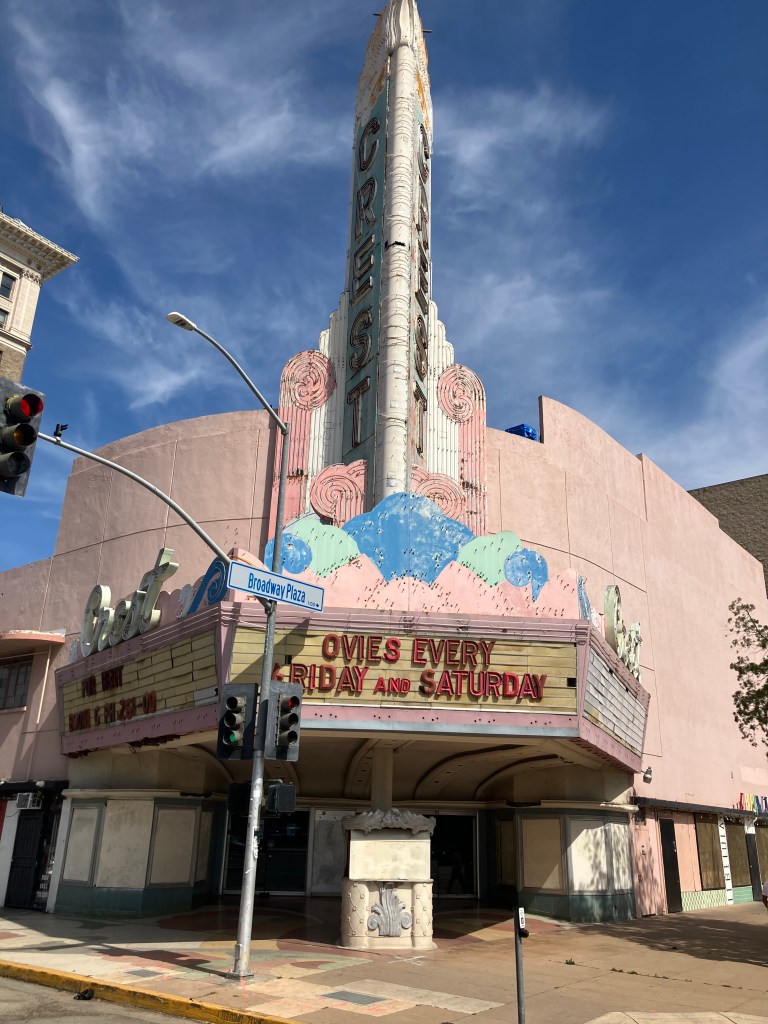
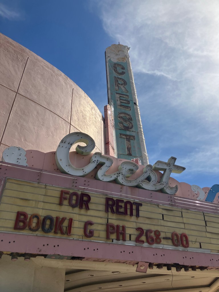
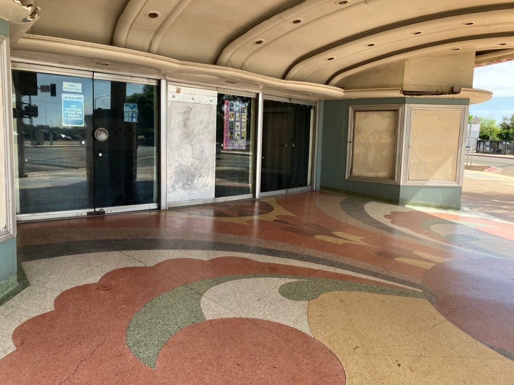
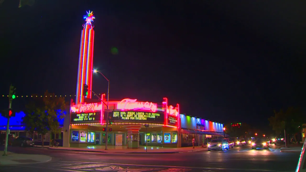
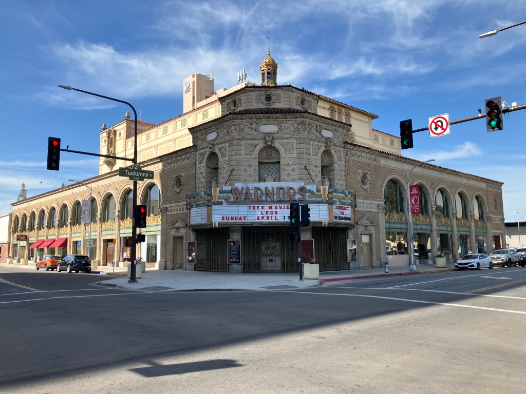
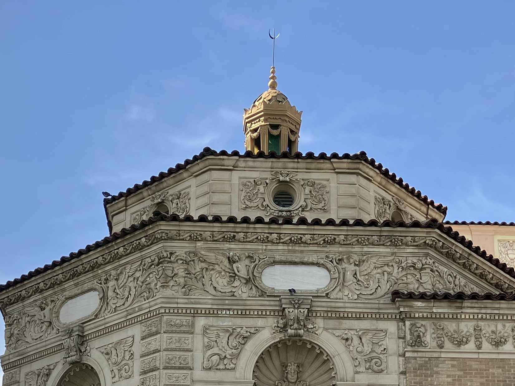
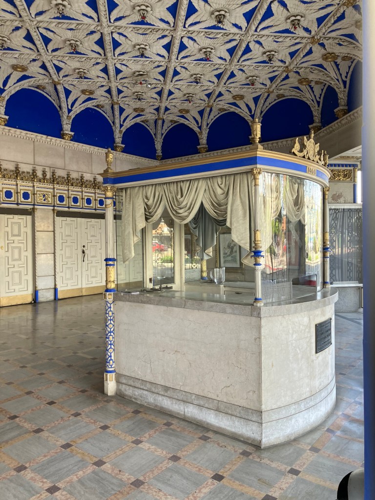
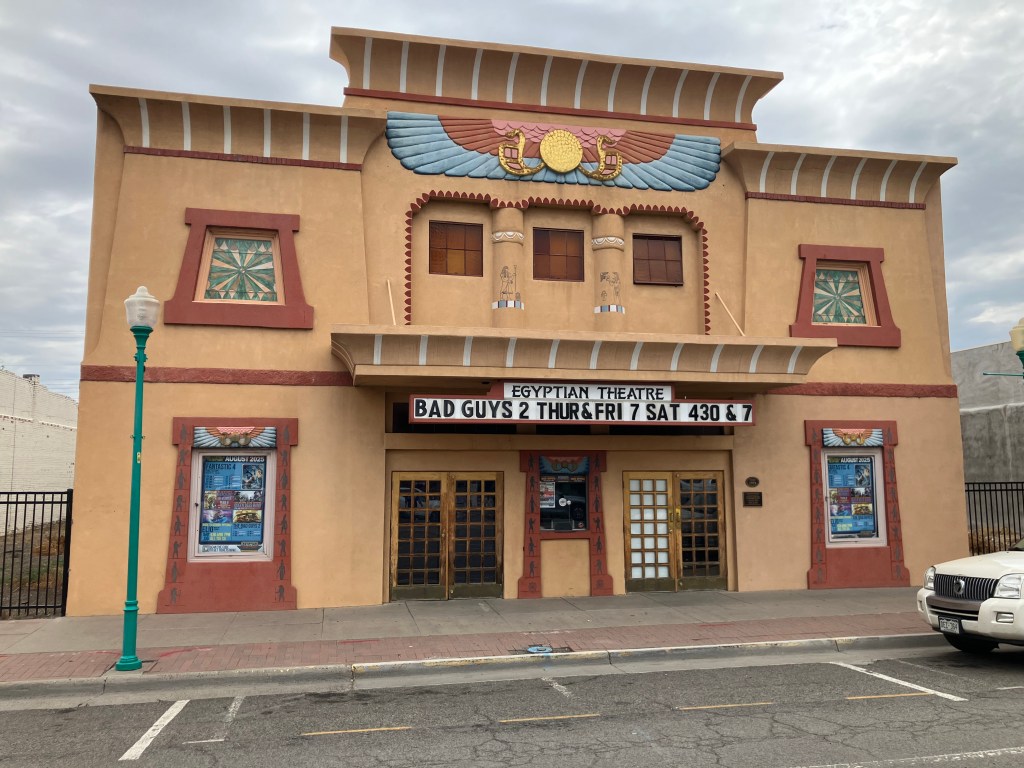
Also related to this theme of public art is the 1928 Egyptian Theater in Delta. It’s obviously been loving restored, and it regularly shows movies and hosts performances. It’s much smaller than the Egyptian Theater in Hollywood, but it similarly reflects the fascination with all things Egyptian in that era.

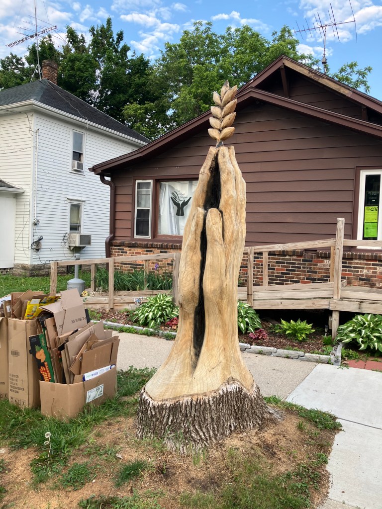
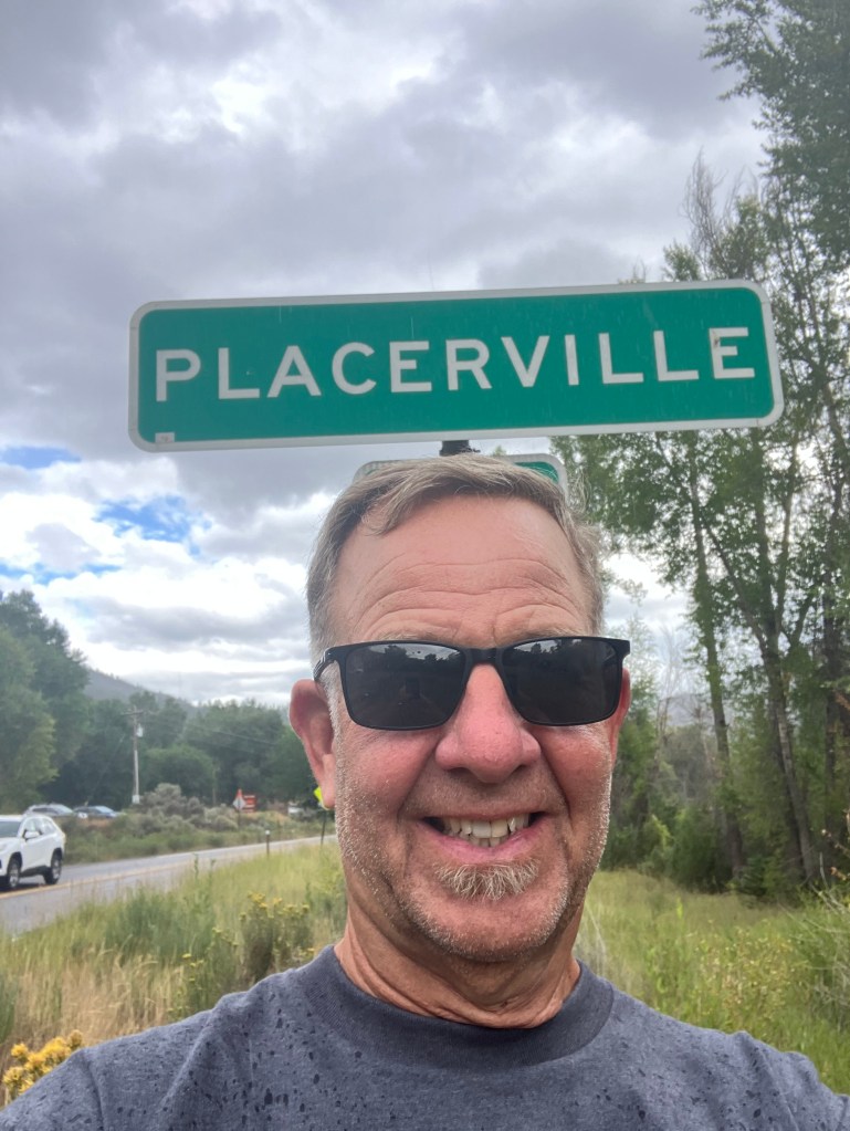
But let’s get back to the purpose of today, which was to complete my trek to Placerville, Colorado. You’ll recall that the California version of Placerville was originally called Hangtown, and the tree where those hangings took place (in 1849) stood on Main Street for many years. Even though it was cut down in 1853, the stump remains in the basement of an old Main Street building, where a dummy perpetually hangs from a noose.

Photo by the author, from my 2021 blog post about Placerville, CA.

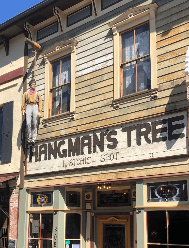
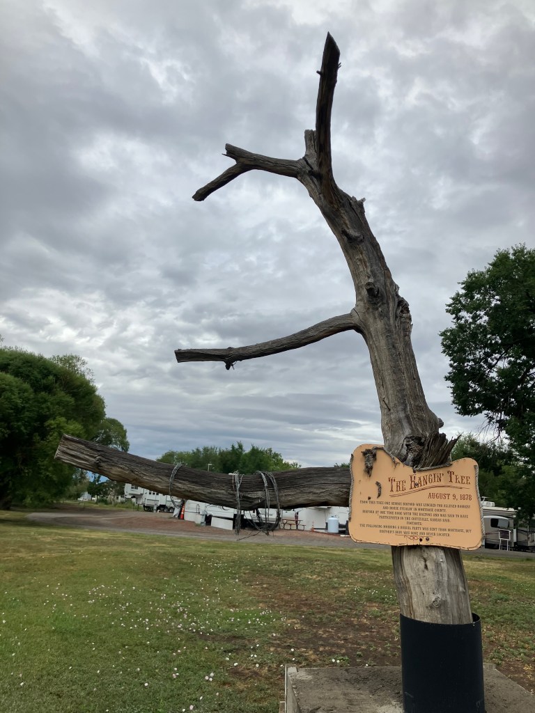
So it was auspicious that, just as I was getting close to Placerville, Colorado, I spotted this hangman’s tree in the town of Montrose:

According to the sign, George Bikford was hanged from this tree for robbery and “horse stealin'” in 1878.

And so, with that preface, I finally came to the storied town of Placerville, Colorado. Let’s just say it wasn’t exactly El Dorado.

This is seriously about all there is to the town.

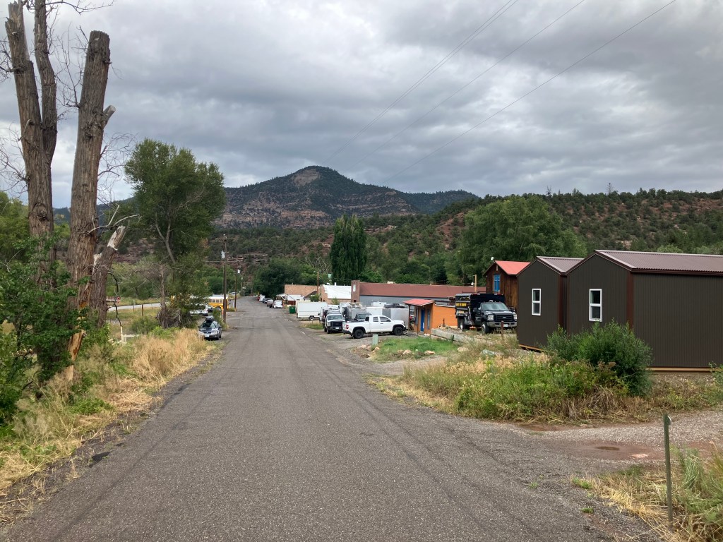
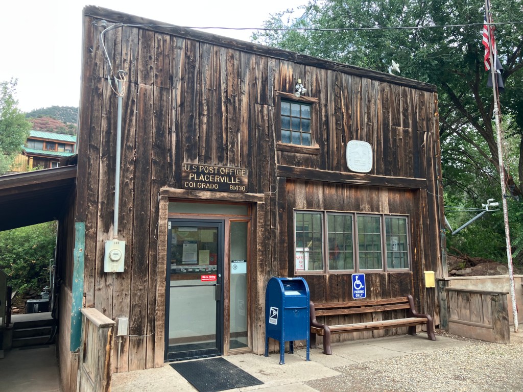
Pretty much all that makes up Placerville is a post office, a general store, a storage facility, and a few houses. In the 1800s it was a mining boom town, but as with many boom towns, the mines dried up and the population went elsewhere. Later, the failure of the local Trout Lake Dam in 1909 wiped out most of what remained.

But be that as it may, I think we can declare this mission a success.

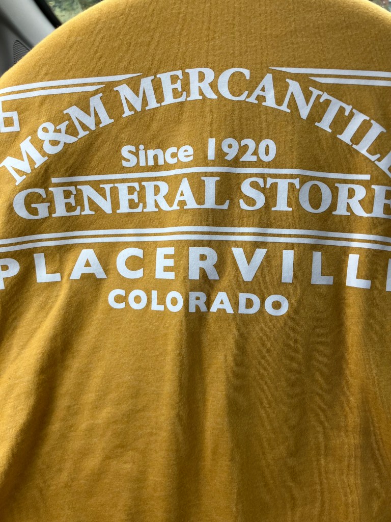
And (shockingly) I was even able to purchase Placerville merch at the general store!
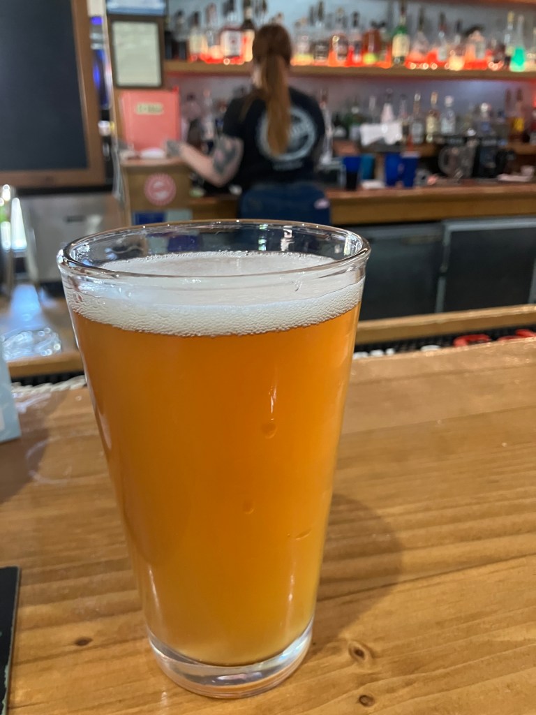
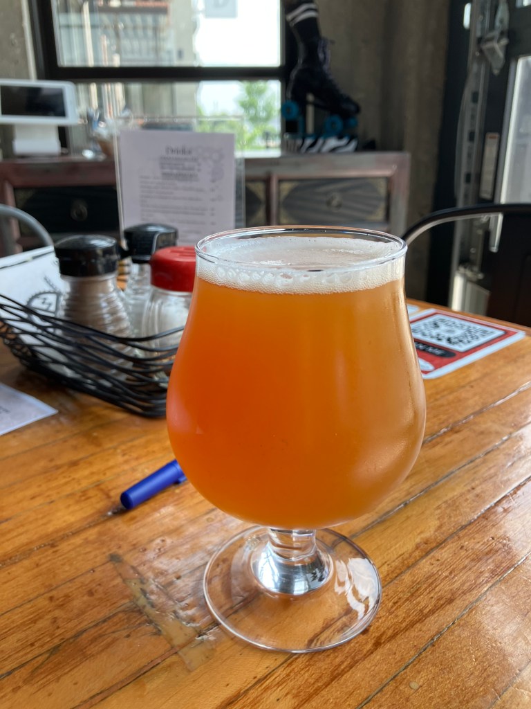
I was hoping for “My husband drove from Placerville to Placerville and all I got was this stupid T-shirt.”

BREW OF THE DAY

We have a winner!

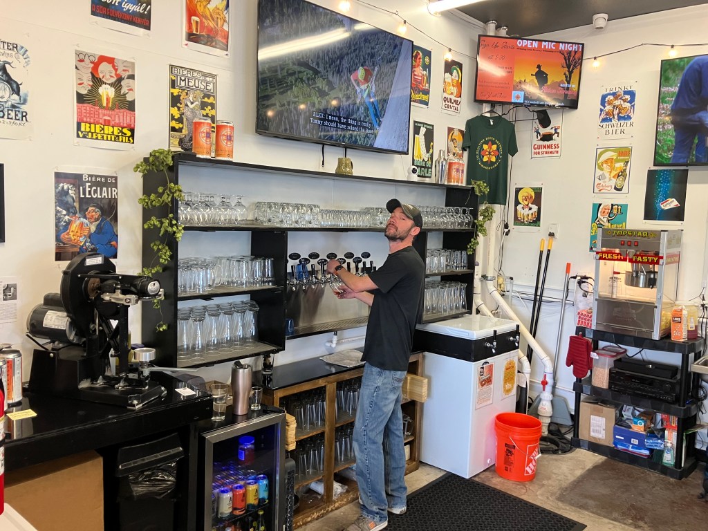
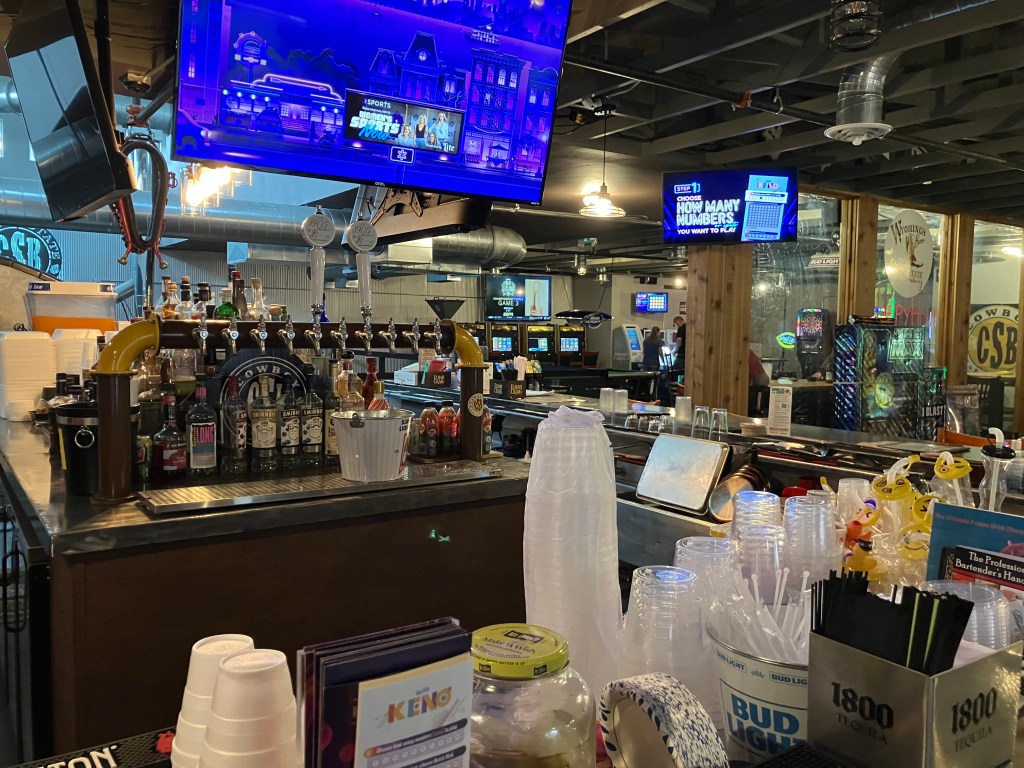
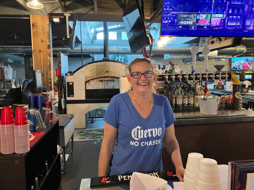
In the town of Ridgway, Colorado (pop: 1,300) I stopped in at the Floating Lotus Brewery. It’s a friendly, casual place with an airy atmosphere, two outdoor patios, a stage for live music, and a great view of the neighboring property where John Wayne filmed some scenes from True Grit. Owner/Brewmaster Kenny Conley hooked me up with his favorite beer: the Blastoplast IPA.

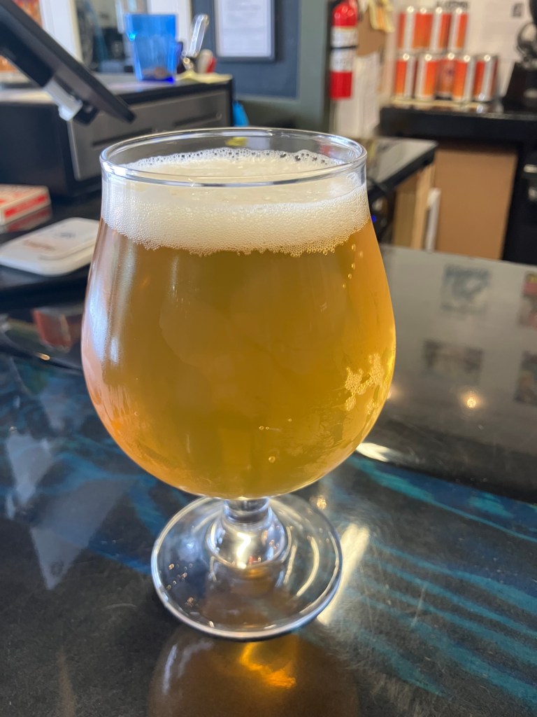
This was hands down the best beer I’ve had on this trip. Of course, that’s an admittedly low bar. But this is seriously a tasty brew. Unlike so many modern IPAs, this one is perfectly balanced. It’s not too hoppy, not to carbonated, not too pungent. At the same time, it’s flavorful and a bit “richer” than you’d expect from an IPA, without the astringent IPA afterburn you sometimes experience by the end of the glass. And at 6.3 percent ABV, I’d say the alcohol content is right where it should be. This is a five-star brew.

Kenny at his post. If you ever find yourself in Ridgway, or even in the vicinity of Telluride, pay him a visit!
Breweries · bridges · Cars · Gas stations · movie theaters · Road trips · Yard art

The final stretch

Today I drove the final stretch of Route 20’s original route, which terminates at the eastern entrance to Yellowstone. I left the lads in TenSleep this morning, and rejoined US 20 at Worland, Wyo. From there I headed north to Greybull, and then east to Yellowstone. The whole drive was about 170 miles…and then another 170 miles to get back to TenSleep!

Westward Ho.

It was a great day for a drive. The weather was perfect, and there was no traffic. It was just me and the open skies. This part of the country, with its solitude and natural beauty, is growing on me.

Idyllic drive.

I picked up where I’d left off a couple of days ago at Worland (pop: 4,800). Worland is a tidy and practical town, where the good folks of TenSleep and other surrounding communities go when they need a supermarket or various specialty stores. It’s also a reasonably attractive community, with a number of western art installations like this one that commemorates the pioneers.

It felt good to be back on US 20 West, with the familiar white signs and the commodious US-standard lanes. Early in today’s trip I came to Manderson, Wyoming (pop: 3,900), where a veritable graveyard of old farm equipment and buses stretches along the side of the road. It’s evidently a vehicle recycling and/or consignment operation, where tractors go to die. The hearse at the edge of the property seems to drive home the point.

Just a small portion of their collection.

Once I was heading east out of Greybull, the endless prairie began to give way to the peaks and crags of the Bighorn and Owl Creek mountain ranges, and fast-flowing Shoshone River gorge. The passing scenes reminded me of the settings for a John Ford movie.

A speed goat keeps watch over US 20.

Even though most of US 20 is designated the Medal of Honor Highway, a segment east of Cody was designated the Wild Horse Highway just a few years ago. This segment borders BLM lands where a herd of about 100 wild mustangs still roam the McCullough Peaks range.

Horses are of course an iconic element of the West. They were brought to the Americas by Spanish missionaries and explorers several hundred years ago. Evidently a number of those horses escaped during the pueblo revolts, and descendants of those horses still roam the plains. In 1971 the US Congress passed the Wild Free-Roaming Horses and Burros Act, which provides for the protection of those horses.

Where the wild horses roam.
Horses along the Wild Horse Highway.

After the Wild Horse Highway I came to the “big city” of today’s trip. Cody, Wyo (pop: 10,250) is one of those larger-than-life towns that inevitably become tourist trips. “Buffalo” Bill Cody founded Cody City in 1895. It was intended as a resort community, near the Demaris mineral hot springs. It was also conveniently located near the eastern entrance to the recently-created Yellowstone National Park. However, just about a year after Buffalo Bill founded Cody City, someone named George Beck established a second city just to the west. It’s this second city that kind of swallowed up Cody City and grew up to be today’s Cody. Ever the entrepreneur, Buffalo Bill embraced the new city and opened a hotel (the Irma) in 1902 that still stands today.

Today’s Cody is a tourist town that leans into its history and western lore. There’s a major museum complex called the Buffalo Bill Center of the West. There are numerous businesses that claim to have authentic links to Buffalo Bill. And the 1936 Cody Theater currently hosts a live musical called the “Wild West Spectacular.”

“Old Trail Town,” which purports to be a semi-authentic reconstruction of the original Cody City. It’s comprised of historic structures from across the region.
The Irma–built by Buffalo Bill and named after his daughter.
Active 1936 theater, showing live stage productions.

After getting my BOTD (more on this below), I left Cody and tackled the final segment of US 20. This stretch, which runs 27 miles from Cody westward to Yellowstone, is designated the Buffalo Bill Cody Scenic Byway.

This Bob’s Big Boy in a field on the side of the Buffalo Bill Scenic Byway is completely unexplained.

Finally, after about 2,500 miles and a dozen days of driving, I arrived at the end of (original) US 20!

My Route 20 shirt is courtesy of The Tepee near Cherry Valley, NY.

That Yellowstone photo comes courtesy of Harry and Xiomata, who were celebrating their 41st anniversary.

Happy Anniversary!

With the road trip complete, there are just a few items left to round out this blog post. Here we go:

BRIDGE CORNER

Today I passed what I consider to be a picturesque, historic bridge that deserves mention. The century-old Hayden Arch Bridge crosses Shoshoni creek near just west of Cody. It’s billed as “Wyoming’s only medium span concrete arch vehicular bridge.” Alas, I arrived just a few days too early for a big celebration. According to a recently-posted notice, “The Cody Country Chamber of Commerce invites the public to a special centennial celebration marking 100 years of Hayden’s Arch, one of Wyoming’s most iconic bridges. The commemorative ceremony will take place Saturday, June 21, 2025, at 4:00 PM, at the historic Hayden Arch Bridge.” It’s not to late to plan your trip!

Wyoming’s iconic Hayden Arch Bridge turns 100!

BEER OF THE DAY

I wanted to do something special for the last BOTD for this trip, so I bellied up to the bar at the Hotel Irma, which Buffalo Bill himself had built in 1902. It’s named after his youngest daughter.

Sadly, I wasn’t able to secure a seat at the bar–there was considerable disagreement among the barflies as to whether “Jack” was going to return to the seat he had earlier vacated. And the wait staff and bartenders–all of whom seemed to have been holdovers from the days of Buffalo Bill–seemed irreparably confused. I left.

Instead I chose the considerably less historic Millstone Pizza Company and Brewery that sits just across the street from the Irma. On advice of Doogie Howser’s doppelganger who was working behind the bar, I had the Pineapple and Jalapeno Ale.

Doogie’s Fave.

Now, this was a reasonably well-made beer, with smooth body, good hoppiness, nice color, and a delicate foam head. The only thing this beer didn’t have was the taste of pineapple or jalapeno. Which would seem to be a problem for a beer billed as a pineapple/jalapeno beer. There was no sweetness and no heat whatsoever. When I brought this to Doogie’s attention, he kind of shrugged and said, “yeah, I’ve complained to the brewmaster about that myself.” (And yet he’d recommended it to me?!) He also hinted that the brewmaster used green peppers rather than jalapenos. Zero stars for false advertising. It’s a disappointing end to a good string of BOTDs.

DELETED SCENES

Finally, we end with a handful of photos from all along US 20 that largely speak for themselves. Is this a great country, or what?

(The pink elephant has become a theme of my trips. For other sightings see here and here and here and here.)

Breweries · bridges · Cars · Gas stations · movie theaters · Road trips · trains

Cowboy Country

In all my jaunts along the various blue highways criss-crossing the map, it never ceases to amaze me how varied this country is. Just over the past week I’ve gone from coastal New England, through the green hills of the Berkshires, into lighthouses on the Great Lakes, through the rust belt of South Bend and Chicago, between the manicured fields of Iowa farms, and under the leaden skies of the Great Plains.

In all honesty, there hasn’t been a single segment that I haven’t enjoyed, that I haven’t experienced beauty, that I haven’t met wonderful people. And yet, today’s segment was characterized by lots of long, straight stretches at freeway speeds across the plains of Nebraska. Faithful reader Brian W. had encouraged me to “enjoy the unique look and solitude” of western Nebraska. And I did. The sheer scale of its open space forces one to relax, and the solitude is conducive to contemplation.

Cheap therapy.

US 20 is the only major east-west route in the northern half of Nebraska. (Interstate 80 runs along the lowest third, through Lincoln and Omaha. For this reason, there has historically been a good amount of services along US 20. I encountered a surprising number of old garages and gas stations that have been preserved or restored to their vintage look. I peeked in the garages and saw walls lined with fan belts, racks of oil, piles of tires, and other evidence that these places still do business.

But what I appreciate more than the restored buildings are the historic roadside attractions that have just kept going, year after year, with just enough maintenance to stay in the game. That seems to be more the rule out in this part of the country. I’m sure part of the reason is that the local economy can’t support the wholesale replacement of infrastructure unless there’s a good reason. And there’s not enough population to entice national chain stores to locate their businesses here. The result is a “time warp” situation in many of these towns. Here are a few examples:

“Big John’s” had been a local burger chain in the 1960s that never caught on. This is evidently the only remaining sign–some sixty years old. The current business is an independent cafe in Ainsworth, Nebraska (pop: 1,600).

Big John doesn’t look amused.

In the town of Lusk, Wyoming (pop: 1,500) a redwood water tower still stands next to the railroad tracks. It dates to 1886, and used to provide water to the steam locomotives. They moved it once, in 1919, in line with changes in the railroad. The Tower is now something of an icon for the town, but it’s authentic and as you can see in the photo, the whole scene could be from a century ago.

The Lusk Light and Power Plant also looks to be a historical relic, but I couldn’t find any information on it

The Plains theater in Rushville, Nebraska (pop: 784) dates back to 1914. It’s gone through a number of different iterations, including a movie theater and a church. Today it is a live theater venue.

But let’s get back to US 20 itself. For the first 250 miles of today’s drive, the Cowboy Trail (that I mentioned in yesterday’s blog) runs alongside the highway. You’ll recall that the Cowboy Trail used to be a railroad line that’s been replaced with a hiking/biking path. I was surprised that I didn’t see a single person on the trail, but it’s still pretty new and maybe word hasn’t gotten around. But it’s interesting to see how all the old railroad bridges have been replaced with pedestrian bridges.

The lower pilings are left over from the railroad; the new wood slats on the upper sides were added for the Cowboy Trail.
The old railroad roadbed has been covered with crushed granite.

The reassuring monotony of the plains and the cloudy sky, with the Cowboy Trail close by at my right, had something of a lulling effect that required periodic infusions of coffee. But suddenly, in the mid-afternoon, I spotted some sharp buttes rising from the plains. These were most welcome after The Unbearable Flatness of Being that characterized most of the day’s drive.

Where did you come from?

I stopped at the nearby town of Crawford, Nebraska (pop: 1,000) to see if I could learn more about the buttes. My first stop was to get a refreshing beverage from a young entrepreneur named Case.

No BOTD, sadly.

Then, in the center of town, I found the local tourist bureau/museum. The door was open wide, and as I entered I was greeted by a docent named Cathy. She didn’t have a lot to say about the buttes, but she did encourage me to visit Fort Robinson, just a couple of miles up the road. Her father had been stationed there once upon a time, and a couple of family heirlooms are in the lodge.

Cathy is retired and volunteers at several places in town.

Fort Robinson has been around since the 1870s, playing a major role in the so-called Indian Wars, as well as the First and Second World Wars. The “Buffalo Soldiers” were stationed here, horses and mules were bred here, military canines were trained here, and it even served as a POW camp for German prisoners. The army decommissioned the fort in 1947, and it was converted into a state park in 1956.

1905 Headquarters Building, now repurposed as a visitors center.
One of a number of large horse barns, from when Ft Robinson was a “remount depot.”

Per Cathy’s suggestion I visited Fort Ross and tracked down the family heirlooms–these consisted of a “shadow box” with mementos from Cathy’s father, and a large art piece shaped like a buffalo, made entirely of buffalo nickels that Cathy’s family had collected from a bar they used to run.

Cathy’s father was on the camp’s polo team.
A small fortune in buffalo nickels. (Apologies for the unavoidable reflection in the glass.)

A kind lady at the lodge helped me locate these items…and she turned out to be Cathy’s sister Diana. The resemblance is obvious.

Sister Diana.

By now it should be pretty obvious that most of the towns along this stretch of Route 20 are quite small and spaced far apart. It’s certainly a big change from California, where I come from. The population density in California is 254 people per square mile. In Nebraska it is one tenth of that, at 25 people per square mile. In Wyoming it’s 6 people per square mile. You have to wonder what kind of impact these differences have on a person’s sense of self, sense of society, sense of independence.

The smallest town that I passed today was Lost Springs, Wyoming. For some reason that I can’t fathom, they really leaned into their smallness when they commemorated the country’s bicentennial in 1976. At that time they erected this marker (which to me looks like a tombstone) that declares they are the “smallest bicentennial town.” According to the US Bicentennial Commission, in 1976 Lost Springs –with a population of 7–was the smallest incorporated town in the entire country.

They’re even smaller now:

BRIDGE CORNER

Near the town of Valentine, NE (pop: 2,600) a roadside sign directed me to a “historical bridge.”

A marker explained that this is the Bryan Bridge, which is the country’s only “arched cantilever truss bridge connected by a single pin.” Whatever that means. It was also designated “the most beautiful steel bridge of 1932 in class C,” which sounds like it might be a narrow category, but what do I know?

To test the “most beautiful” claim, I scrambled down the embankment and risked life and limb and tick bites to take the below photo from the bank of the Niobrara River.

Most beautiful of all the class Cs in 1932? You be the judge.

BREW OF THE DAY

There aren’t many brew pubs along this stretch of US 20. But I did find a place called “Cowboy State Brewing Company” in Glenrock, Wyo (pop: 2,400). Long-time reader Peter D. had recommended the town to me, as it was his father’s and his grandmother’s home town.

Now, Cowboy State is not your typical California-style brew pub. It’s a bar that dates back to the mid-1970s, with dim lighting, pool tables, and a bar stocked with gin and vodka. The place reeks of cigarette smoke, which might be because Nebraska allows smoking in bars, or maybe because 50 years of smoke can’t be eradicated from the pores of the room.

The 1970s called and they want their bar back.

Now if you think this doesn’t sound like my kind of brew pub, you’re right. I asked the bartender, Billie, if this was really a place where they brewed their own beer. She said yes, but then admitted that they “had to let the brewer go,” and thus they aren’t making beer right now. Nevertheless, she still had some of the Cowboy Cream Ale that they had made for the State Fair last year. Did I want to try it? Now, I’m not sure what the shelf life is for beer, but I suspect it’s somewhat less than a year. Nevertheless, I told her to pour me one–I had a blog to write!

Before I get to the beer, let me just say that Billie is one of those people who make you feel welcome at a bar. She came here from Louisiana just about a year ago, and took over as the manager. She says she puts in about 70 hours a week, but she’s still all smiles and energy.

However, the beer wasn’t very good. Maybe it’s because it was old. Maybe it’s because it’s a weird recipe. Maybe it’s because it’s just not my style. But to me it tasted like Budweiser–that kind of skunky, watery, feed-grainy, metallic taste that mystifyingly is popular with 32 percent of American beer drinkers. I can’t in good conscience give it any stars. But I do need to acknowledge that it was popular at the Nebraska State Fair and is a favorite with the locals. So maybe it’s just me.

I should point out, though, that the beer was only $2 (which is just 50 cents more than Case’s lemonade). And Billie gave me a branded beer cozy!

Breweries · Cars · movie theaters · Road trips

Wow! Great Lakes!

Today’s drive along highway 20 was reflective. The route took me from Toledo Ohio (at the west end of Lake Erie), around the bottom of Lake Michigan, and up to the town of North Lake, Illinois, which is just west of Chicago. Here’s a map:

Though it doesn’t show up on this map, Route 20 passes through the city of South Bend, Indiana (pop: 103,400). Named after the southernmost bend of the St. Joseph River, South Bend has an interesting history. It’s been home to Notre Dame University since 1842 (Go Fighting Irish!), of course. But ten years later the Studebaker Brothers came to town and established a very successful wagon manufacturing plant that, around the turn of the century, switched to building automobiles. Studebaker was one of the larger “independent” auto manufacturers, and at its peak it employed 22,000 workers in South Bend. It would be stretching things to say that South Bend was a company town, but Studebaker certainly was a major contributor to the local economy.

Studebaker factory in South Bend, circa 1940.

Some of you young ones might never have heard of Studebaker; it closed its doors in South Bend in 1963, and then shut its last remaining facility in Canada three years later. But I actually owned one. It was my first car, which I bought in 1978. Behold!

Parked at stately Boilard Manor around 1980.

I owned that car for about 25 years, and then, in a rash act, I sold it. Recently I’ve been wondering if I should have kept it. I’ve even had dreams about it. And then, a couple of days ago, I spotted what at first glance appeared to be my old car on the side of US 20 in New York:

Back from the dead, like Christine?

A couple of telltale signs convinced me this wasn’t the same car. But it was eerie nonetheless. And it was eerier still to see a version of the car again today, in the Studebaker National Museum in South Bend:

But I digress. My point was that Studebaker was a major contributor to South Bend’s economy. And so when it shut down in the 1960s, it had a major negative impact on unemployment. It’s estimated that, at the time of its closure, Studebaker employed two thirds of the city’s African-American labor force. To make matters worse, South Bend was already suffering from the general effects of deindustrialization that were besetting towns throughout the Rust Belt.

Terra Cotta logo that once graced the Studebaker factory.

South Bend gained national prominence with presidential candidate Pete Buttigieg as mayor from 2011-2018. He and others have worked to gain investment in the city’s businesses and infrastructure. But I can report from my visit today there’s still a long way to go. Block after block has vacant and dilapidated buildings. The area around the old Studebaker factory is especially rough. Most of the Studebaker buildings have been torn down, but a few, such as Studebaker’s main administration building, still stand, albeit to no good purpose.

Used to be the nerve center of the Studebaker empire.

Here’s another random, old building on Michigan Street that appears to be serving no purpose. It caught my eye for two reasons: First, because of the tubular external fire escape.

I wonder if this is where the McDonald’s folks got the idea for their Playplace (TM)?
And Potter seems to still be in business today!

Second, and more importantly, the building caught my eye because of this barely-legible painted signage facing the road:

“US 20” is still clearly visible. (Less clearly, it seems to read “7 MICH ST.”) Funny thing, though, I had to turn off US 20 to drive down this road (on my way to a brew pub. More on that later). It turns out that US 20 used to be routed through here, before being re-routed around the downtown in the 1960s.

Now, some of you know my pet theory that you can tell a lot about the health of a town by its historic theaters. Almost all older towns have had a theater or two along the way. And almost all theaters declined with the advent of television and VCRs and such. But what did the towns do with their old theaters? Did they knock them down to make way for “progress”? Did they let them decay? Did they repurpose them? The answers to these questions tell a lot about the priority of the arts in the community, the extent of civic pride in the city’s history, the functionality of local government, and so forth. And I’m happy to report that South Bend has restored and preserved its beautiful, large, historic Morris Theater. The original theater opened in 1922 as a vaudeville house. It’s now a performing arts center that seats over 2,500. It’s home to the South Bend Symphony Orchestra, and it hosts broadway shows.

And the inside is even more beautiful than the outside!

What’s more, South Bend has a second historic theater that it’s actively working to restore. The 1919 Blackstone-State theater was operating on and off up until 2016. As of a couple of months ago, the South Bend Redevelopment Commission approved the City’s purchase of the building for $800,000. Presumably, as a city-owned property, it will have more stability going forward.

Note the non-Potter fire escape.

So I judge South Bend to be on an upward trajectory, despite the significant challenges it still faces.

I’m less bullish on the next major town I drove through today: Gary, Indiana. I became quite depressed just passing through. Broadway was once a grand boulevard, but now it looked like it’d been bombed, with half-standing buildings, vacant lots, and rubble lining the street. People roamed the sidewalks in a fashion that seemed aimless and hopeless. And, most damningly, the historic theaters looked like they weren’t ever going to be saved.

Gary’s Palace Theater.
Detail of the marquee. That street lamp looks good, at least.

While I was taking a picture of the Palace theater (above) a man who was passing by stopped to tell me about how it used to be his favorite movie theater. “Apple” (as he called himself) used to sit up in the balcony and watch double features in the 1960s. He was sorry to see it go. Now, he says, he lives in an “old people’s home” and walks past the theater every day on his way to the corner store. He was a kind and sympathetic man, but he didn’t seem to have any spark in his eyes.

Apple, waving ciao.

Now, you probably know Gary Indiana for one of two things: the song from The Music Man (sung by a young Ron Howard), or the birthplace of Michael Jackson.

In fact, while driving through the town I passed a sign directing me to the Jackson House. I dutifully followed the sign and ended up on Jackson Street (whose name, I assume, was changed after the Jacksons became famous. Otherwise it would be too much of a coincidence!) The neighborhood is severely run down, and seems to be populated by people who haven’t had a break. There’s no obvious signs of graffiti or gangs or drugs or anything like that; just poverty and neglect. Many houses are boarded up and/or abandoned.

Sad state of affairs.

But then you come to the Jackson place. It’s a tidy and tiny (two-bedroom) bungalow, in which the eleven Jackson family members somehow lived. It makes me glad to know they hit the big time, but my heart goes out to the rest of the folks around here who didn’t.

Stately Jackson Manor.
Memorials in the driveway. I don’t think I’d hire Diamond Yard Bricks to do any installation work.

Anyway, I left Gary feeling sad for a dead city and the people who still live in it.

After passing through Gary Indiana, Route 20 skirts around the edge of Chicago. I happen to love Chicago as a city, but visiting it is a commitment, and this is not that kind of road trip. So I stuck to Route 20, skirting around the outer edges of the city. I’ve parked myself in a nondescript town called North Lake, about 13 miles west of Chi-Town. Tomorrow I should finish crossing Indiana.

BEER OF THE DAY

I nabbed my BOTD at the South Bend Brew Werks. It’s another example of how South Bend is on the way up: It’s a nice, bright, new space with art on the walls and a big outdoor patio. They’re part of an energetic business district near the Morris Theater. They take their beer and their food seriously.

My server–Jason–was incredibly knowledgeable about beer, not just the stuff they brew but also the beers at breweries throughout the region. He’s also a rubber-stamp artist, and his work is currently hanging in this restaurant.

Jason, beer-savant.

On Jason’s recommendation, I had the “Disinhibited Ep. IV: A New Haze.” It’s a double hazy IPA.

It’s a highly drinkable beer, though it clocks in at 8 percent ABV. The appearance, as you would expect, is hazy. And as an IPA, it has the expected piney hoppiness and medium carbonation. But the flavor is more interesting than your average IPA. It has notes of grapefruit and dandelion, balanced by the aforementioned hops. There’s just a suggestion of sweetness. Overall, the flavor is more sunny than bright, and more juicy than refreshing. It’s a very solid effort and manages to stand out in a world dominated by endless IPAs. 4 stars.

COINCIDENCE CORNER:

Yesterday I posted a picture of the Christmas Story house in Cleveland. Today I saw this in the corner of the South Bend Brewing Company:

Also, in April I did a blog post about the stretch of the Lincoln Highway that runs near my home in El Dorado County, CA. Today I saw this on a street corner in downtown South Bend:

California history · movie theaters · Road trips · trains

Tale of two cities

Today I took a ride down to the city of Kingsburg, CA (pop: 13,000). Kingsburg sits on highway 99, smack-dab in the middle of the state.

Kingsburg is the big red dot blotting out Fresno.

Alert readers will recall that I came through Kingsburg last fall and fell in love with its historic railroad depot. I ended up making a small contribution toward their “1238 Project,” in which they are taking possession of a 1918 Southern Pacific steam locomotive that’s been sitting in a park in Fresno since 1956. As a bonus, my humble contribution earned me membership in the “Friends of the Historic Kingsburg Depot,” which holds monthly meetings about their activities at the depot. So today I said “What the heck; I’ll make the 200-mile drive for this evening’s meeting and get the latest update on the 1238 Project.”

I was running a little ahead of time, so I killed an hour and a half exploring the city of Fresno (pop: 546,000), which is about 20 miles north of Kingsburg. Now, Fresno is a much-maligned city, frequently appearing on lists of the worst places to live in California. It has above-average levels of homelessness, drug use, air pollution, and unemployment. Like much of the Central Valley it experiences extreme temperatures in the summer and winter. And much of the city comprises a run-down urban core surrounded by ugly sprawl. But despite all this, Fresno has a plucky population and a rich history that is, to greater and lesser extents, being preserved. Here are just a few examples that I saw today:

Civic pride is evident in this mural on Tuolumne Street in downtown Fresno.

Fresno has several historic movie palaces in various states of preservation. Two of them (the Crest and the Tower) share names with two semi-famous theaters in Sacramento. Fresno’s 1948 Crest Theater is in particularly rough shape; the exterior is pretty shabby, and the air conditioning doesn’t work. And yet, they show movies every weekend for five bucks!

The terrazzo floor is nice, though.

I wasn’t able to get inside, but I’m told the interior is in better shape than the exterior. And I do appreciate that they’re keeping the theater open, even though they obviously have a lot of deferred maintenance. It’s lovable in a “little engine that could” kind of way.

Next up is the Tower Theater. It’s the centerpiece of Fresno’s “Tower District”–an artsy neighborhood with coffee shops, art galleries, restaurants, and other businesses that give the area a modest but palpable energy. It’s still a little gritty, but it’s definitely a viable destination for an evening out. The Tower Theater itself is an art deco movie palace built in 1939, that now serves as a 761-seat performing arts center.

I didn’t have time to stick around til nightfall, but I’m told the Tower’s neon dominates the district at night. Here’s a photo from a local Fresno news station.

File photo from Fox26 News.

We now move to the most striking movie palace I saw today in Fresno: The Warnors Theater. Opened in 1928, it was owned by the renowned Alexander Pantages. (Surely you’ve heard of the Pantages Theater in Los Angeles?) The theater originally was called The Pantages Theater, then changed to The Warner Theater in 1929, when Warner Brothers bought it. Warner Bros sold it in the 1960s, and the new owners changed the “e” to an “o” in a half-hearted concession to trademark requirements.

Pantages’ fortress.
Sometimes more is more. Or Moor, if you catch my drift.
Box office and lobby. Check out that ceiling!

Warnors has a large stage, seating for 2,100 people(!), and the original 1928 Robert Morgan pipe organ. The theater serves as a popular performing arts center bringing many national and international acts to Fresno.

So, I think it’s fair to say that Fresno is making an effort to support the arts. I think this is a key component to revitalizing the city.

I did encounter other examples of civic pride–here I’ll share just two more. First, there’s an impressive, beautifully-restored 1894 water tower. Originally owned by a private water utility, the tower’s 250,000-gallon tank was drained in the 1960s and sold to the city. It was restored about 25 years ago, and has served as a visitor’s bureau and, most recently, as the Frida Cafe.

Now that’s a water tower.

My final example of Fresno’s civic pride is its historic railroad depot. It was constructed by the Atchison, Topeka & Santa Fe in 1899. Santa Fe stopped passenger service to the station in 1966 and completely shuttered the station in the early 1990s. Fresno civic leaders, God bless ’em, purchased the decaying the station in 2003, spent 6 million bucks restoring it, and re-opened it for Amtrak service in 2005.

Fresno Depot, looking a bit like a La Quinta Inn.

Just as I was leaving, the San Joaquin arrived. There was a good crowd of people boarding at the platform. The station seems to be a very solid transportation hub for the city.

And this mention of trains brings us back to the original purpose of this trip. Twenty minutes after I left Fresno I arrived in Kingsburg, just in time for the Friends of the Historic Kingsburg Depot meeting. It’s a friendly and dedicated group of people, all donating their time toward the betterment of their community. And I think that’s the moral of today’s blog post.

At the meeting I learned that the 1238 steam locomotive is scheduled to be trucked to Kingsburg on two flatbed trailers in early May. I hope I’ll be able to return for that operation, which is something you don’t see every day. I’ll leave you with a photo I took of the space next to the depot that volunteers are preparing for the steam locomotive, complete with some fancy red fencing. Beneath that is a photo of the locomotive itself, still cooling its heels in Fresno, waiting.

Paging John Henry…
Photo from GV Wire.