Road trips · Uncategorized

Father and Great-Great-Grandson

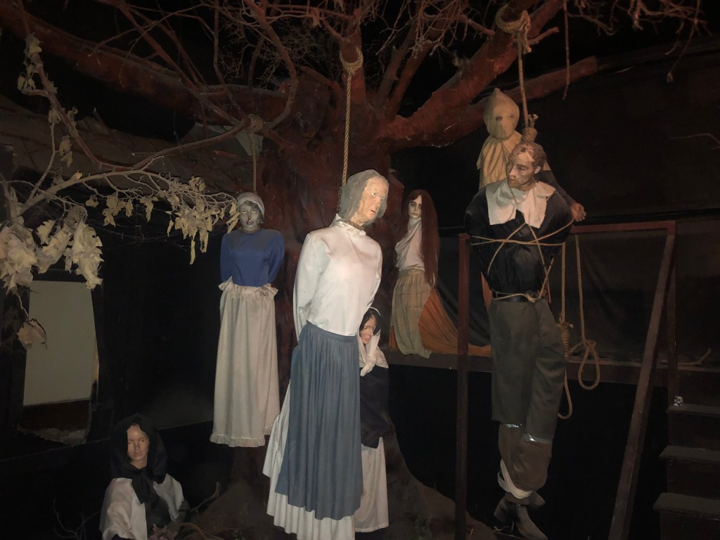
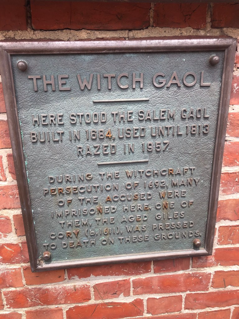
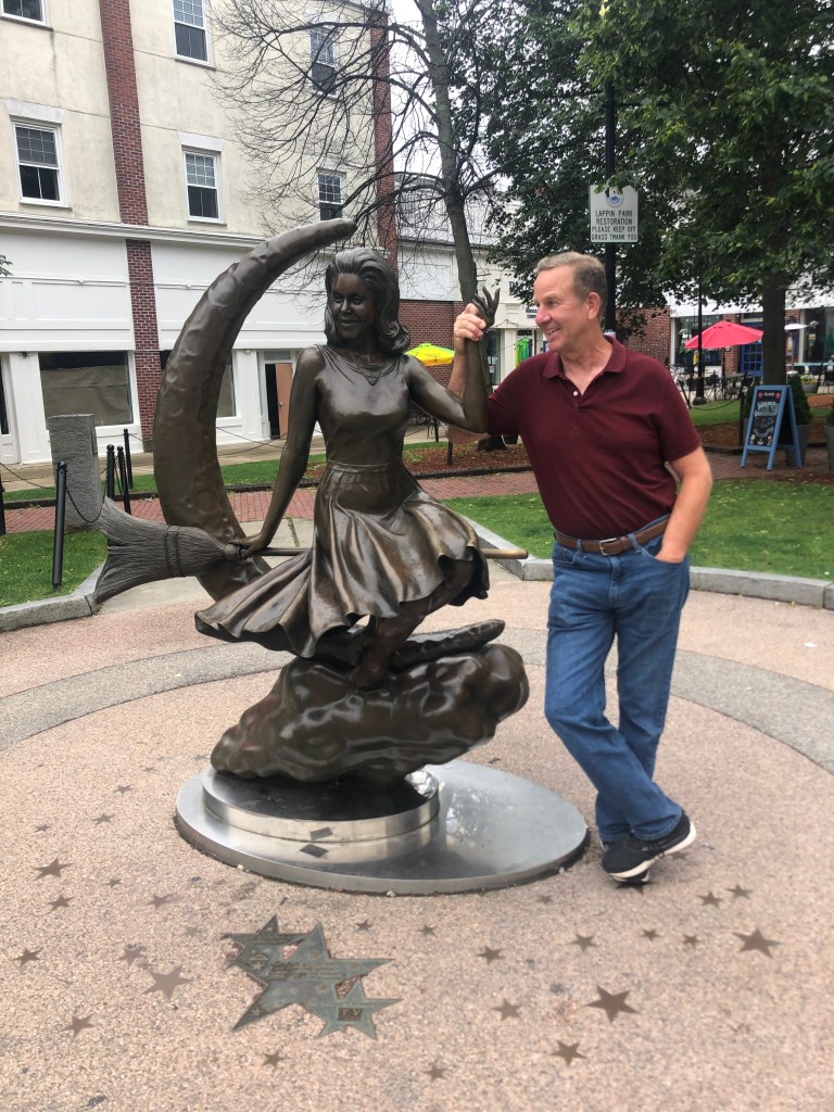
Today we made one more foray into Salem’s witch-infested past, this time at the Salem Witch Museum.The museum is housed in a Gothic Revival church originally constructed in the 1840s. The church closed in 1902, and after being used for a few other purposes (including an auto museum), it was transformed into the Witch Museum in 1972.

Paging Maleficent, party of one — Your table is ready

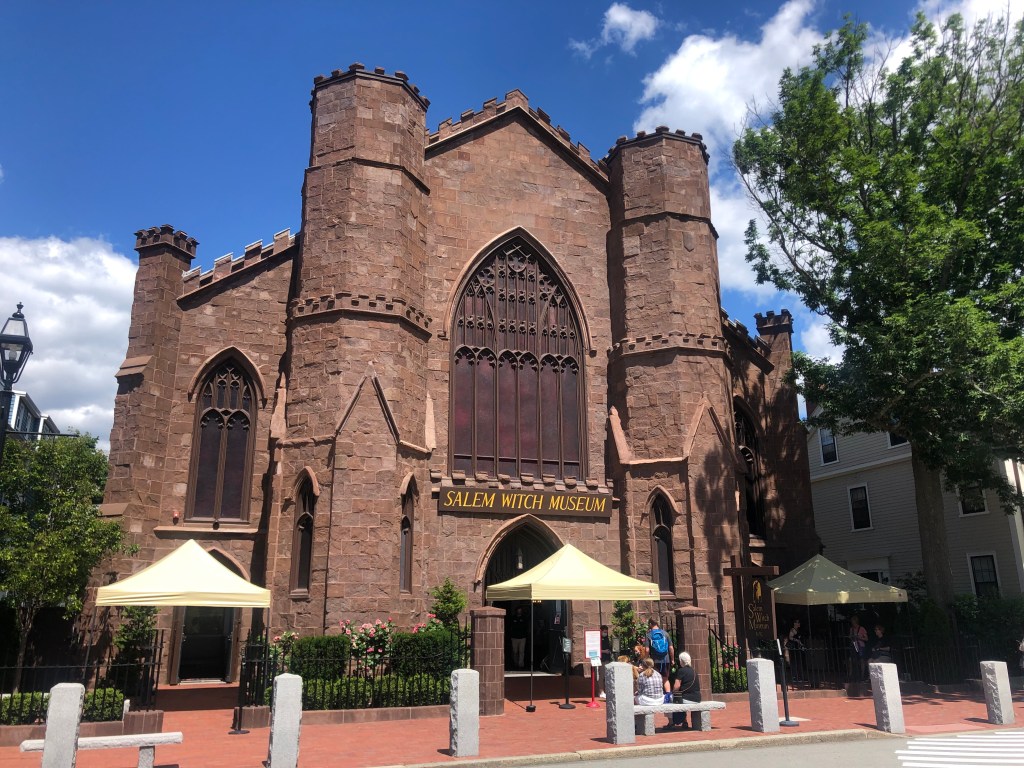
It’s an impressive structure, and the multimedia presentation of the Salem witch trials was entertaining. Still, Vic and I realized that by now we knew Salem’s witch story pretty well, so we didn’t learn much that was new. What’s more, the museum’s message is overly tendentious, hammering on the point, over and over, that our society still engages in forms of witch hunts. (I seem to remember a recent president making this claim…)

After the museum, we took the rental car on a leisurely trip along the Essex Coastal Scenic Byway. It was a breathtaking drive, with sweeping views of the Atlantic from Massachusetts’ north coast. The towns along the way are idyllic, and the homes are right out of the pages of Better Homes and Gardens. The weather was perfect, with temperatures in the mid-70s and a slight breeze.

STPH | Blog

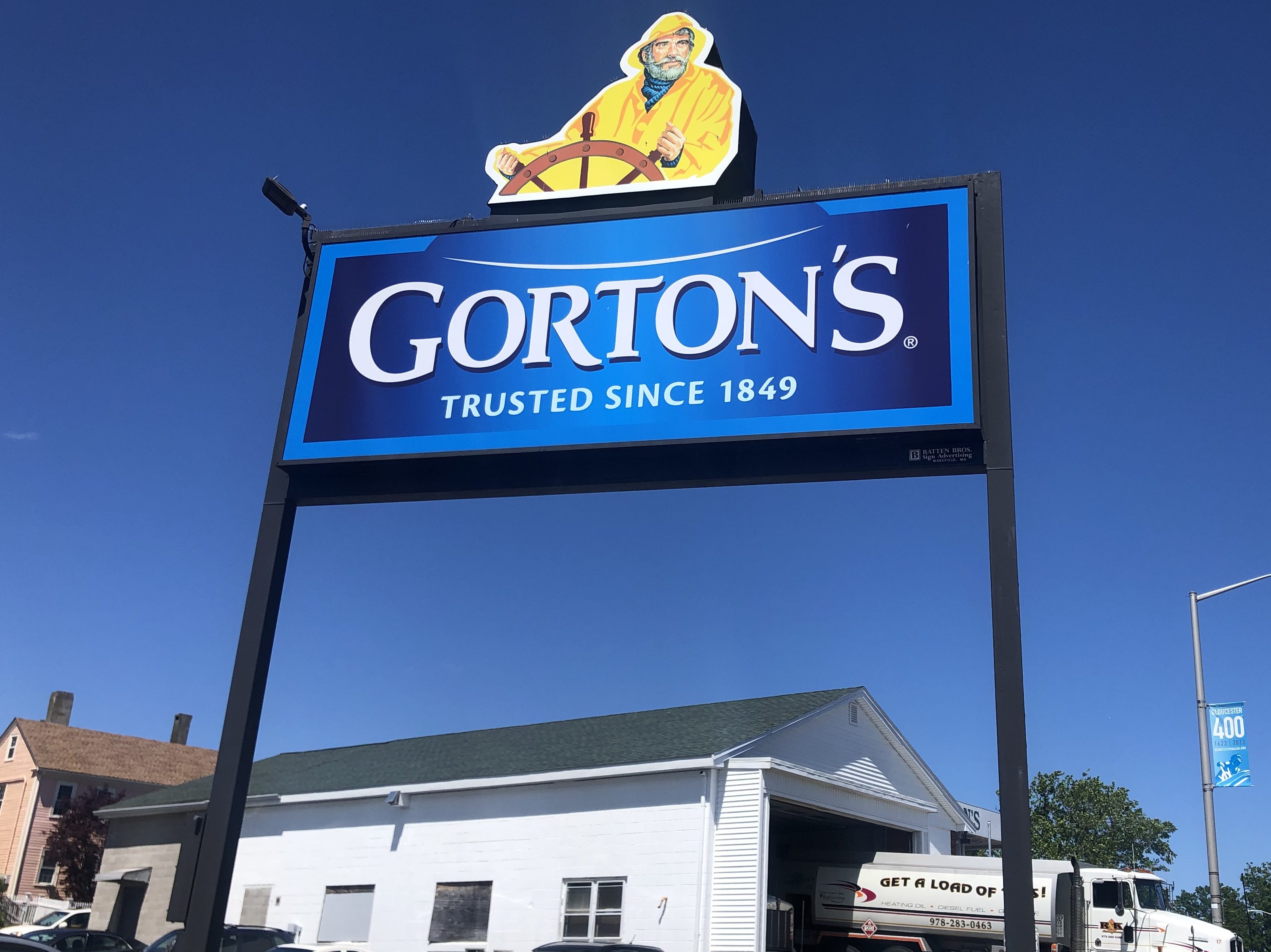
Being a native Californian, I don’t know much at all about the eastern seaboard. I did, however, recognize the Gorton’s Seafood fisherman in Gloucester. Gorton’s was founded in Gloucester in 1849, but their iconic fisherman didn’t appear in advertising until 1975.

“Churning out soggy, breaded chunks of cod for over 150 years”

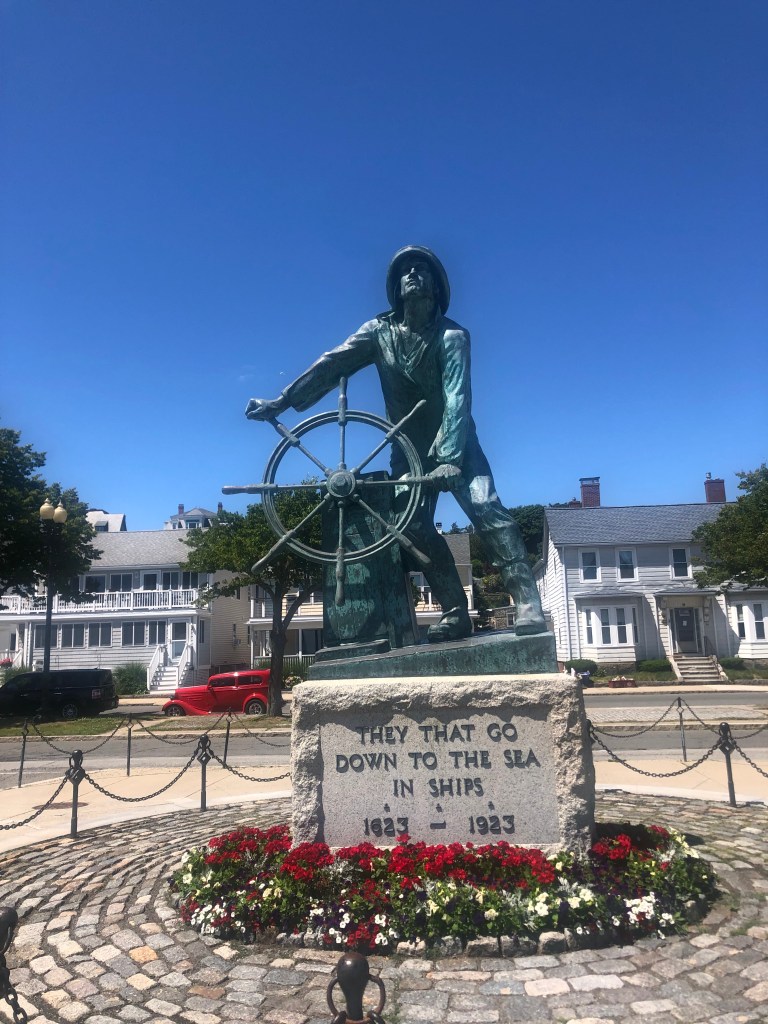
We also passed a bronze statue of a mariner at the wheel that looked suspiciously like the Gorton’s fisherman. The statue is part of a memorial to sailors lost at sea since 1716, with an array of plaques listing their names. The memorial statute was installed in 1925, so clearly it was Gorton’s (with their 1975 character) that copied the memorial, and not the other way around.

:… Then they cry unto the Lord in their trouble, and he bringeth them out of their distresses.”

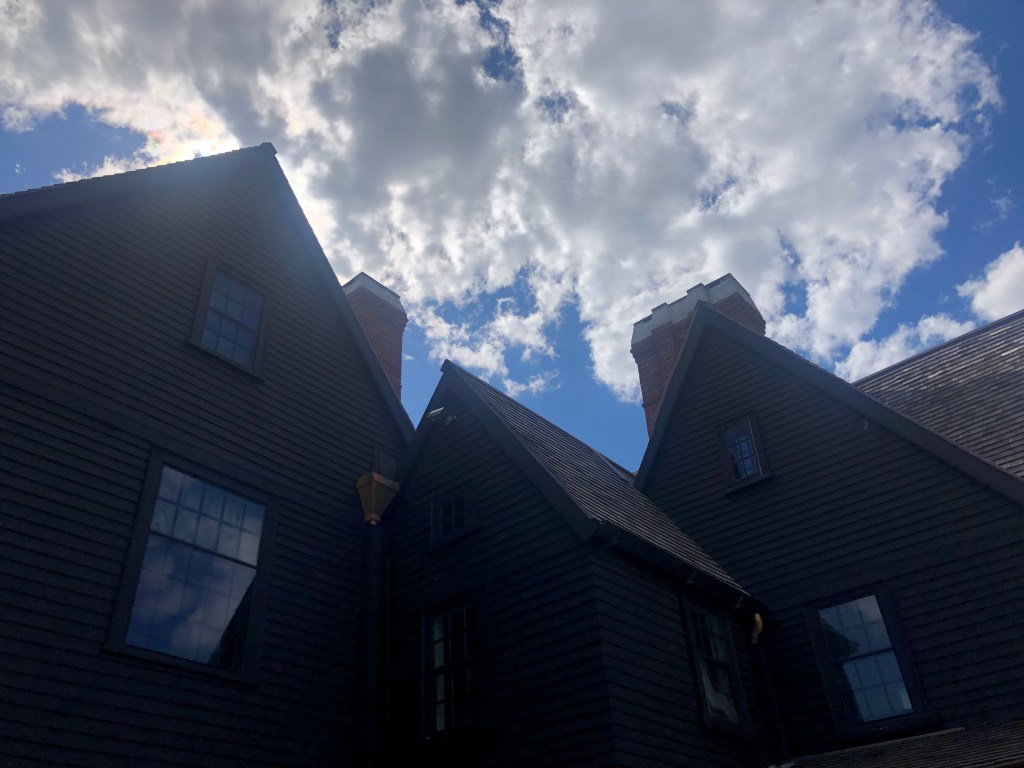
Upon returning to Salem, we continued with our witch-free diversions with a visit to The House of the Seven Gables. This, of course, is the mansion that Nathaniel Hawthorne wrote of in his 1851 novel of the same name. The house was originally constructed in 1668, and by the time Hawthorne visited it in the mid-19th century, it had been remodeled so that it only had only three gables. Hawthorne thought the idea of a house of seven gables sounded more interesting than “the house of the three gables,” so he envisioned its original form when he wrote his book.

“Halfway down a by-street of one of our New England towns stands a rusty wooden house, with seven acutely peaked gables, facing towards various points of the compass, and a huge, clustered chimney in the midst.”
A man will commit almost any wrong … to build a great, gloomy, dark-chambered mansion, for himself to die in.

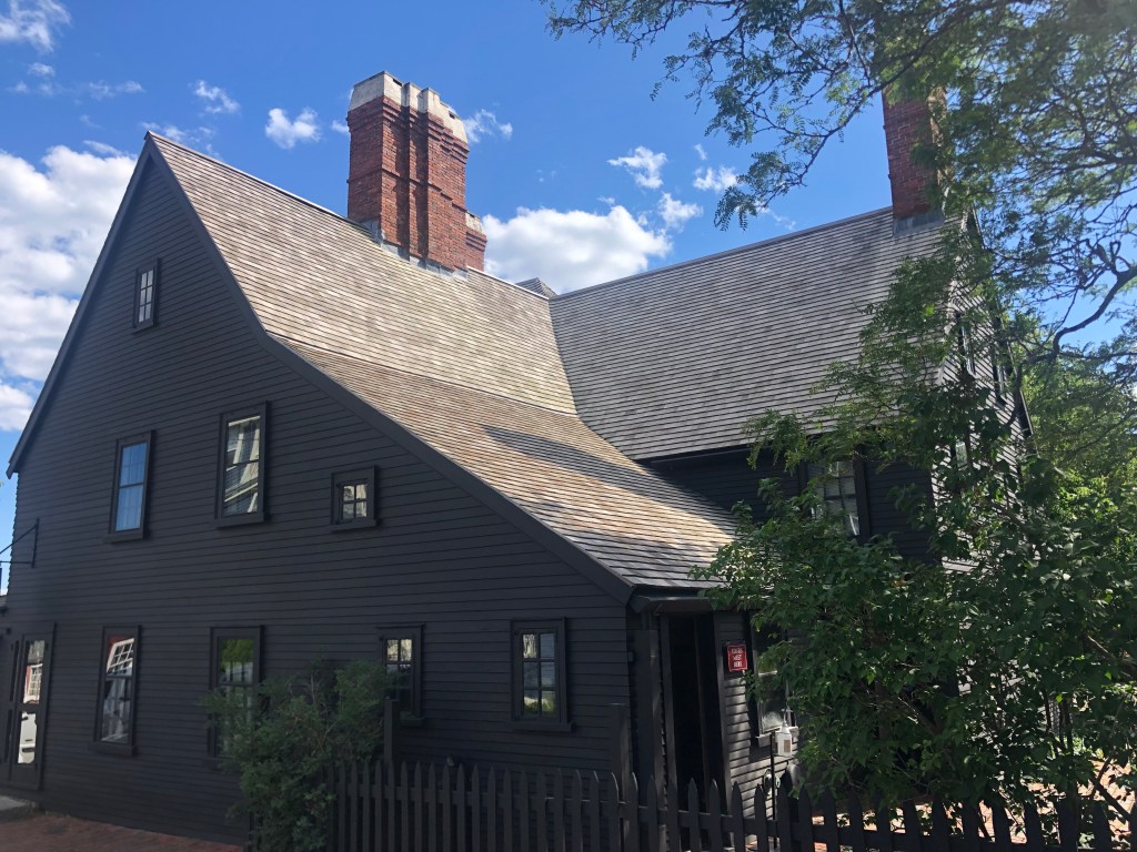
By the way, our Seven Gables diversion was not entirely witch-free. Nathaniel Hawthorne’s great-great-grandfather was John Hathorne (no “W”), who was a key, influential judges in the Salem witch trials. Nathaniel changed his last name from Hathorne to Hawthorne, in part to disassociate himself from his ancestor.

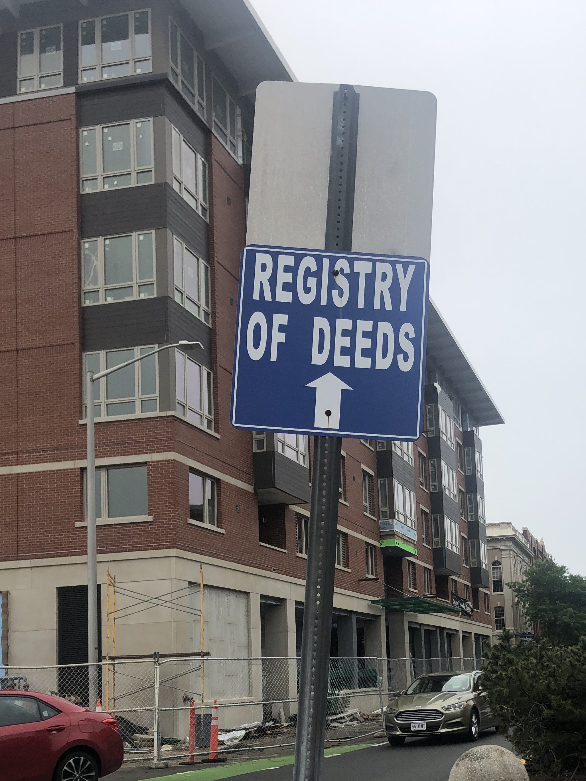
One final Hawthorne reference from today: The sight of this sign reminded me of Hawthorne’s The Scarlet Letter. Doesn’t it evoke a ledger of one’s offenses and wrongdoings?

What have you got to say for yourself?

And finally, speaking of signs, this local liquor store certainly sports a colorful moniker.

On second thought, I think I’ll pass.

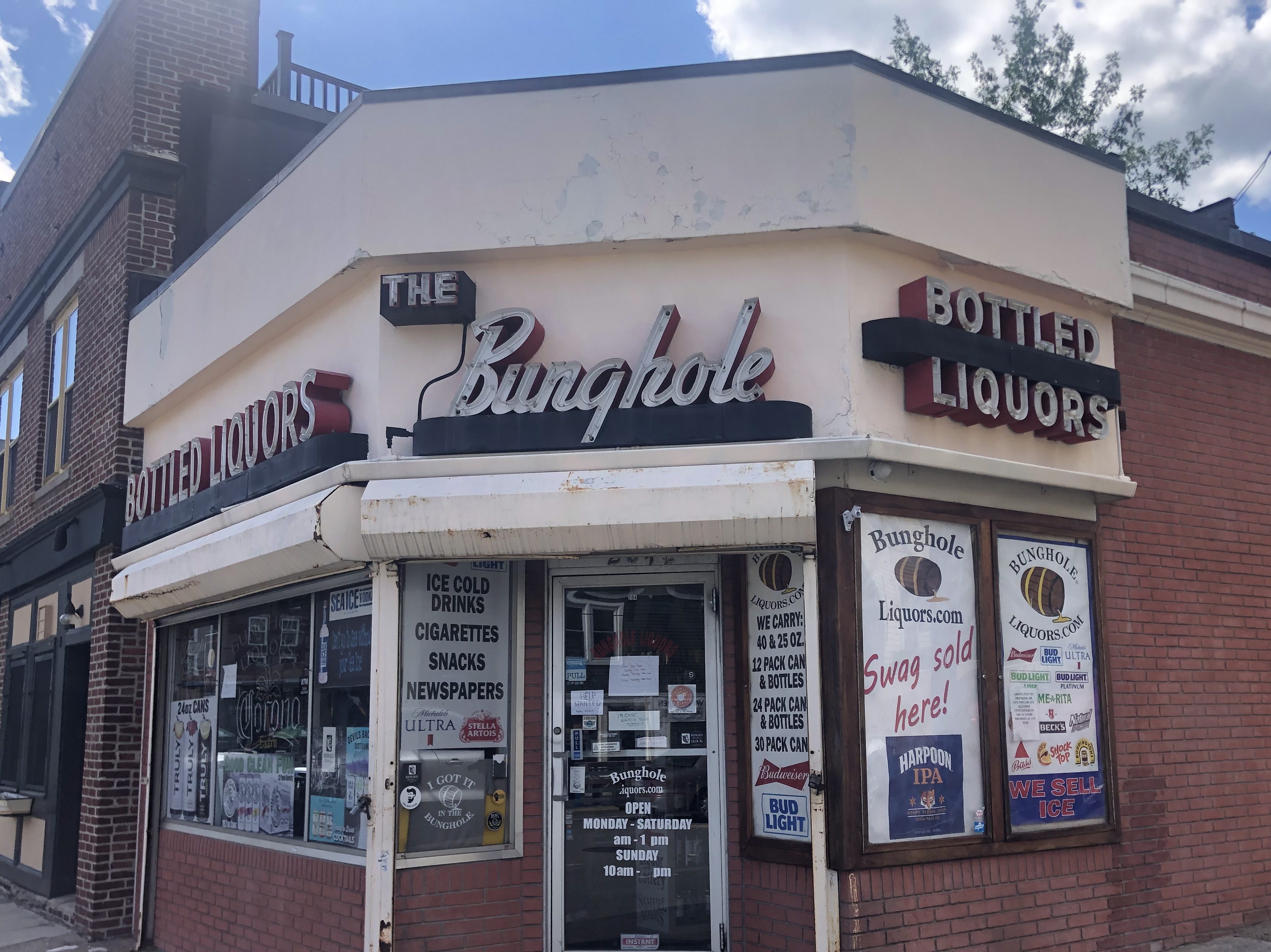
The place was a funeral home in the early 20th century, and during Prohibition the owner surreptitiously served liquor out of the basement. Such establishments at that time were sometimes called “bungholes” (a term related to wine barrels). After the 21st amendment was passed in 1933, the owner converted the funeral parlor to a full-scale liquor store. The nickname became the official name, providing endless amusement for visitors. (There’s also a line of tasteless merch.)

And so ends our third day in Salem. Tomorrow morning we’re off to historic “Salem Village,” aka Danvers.
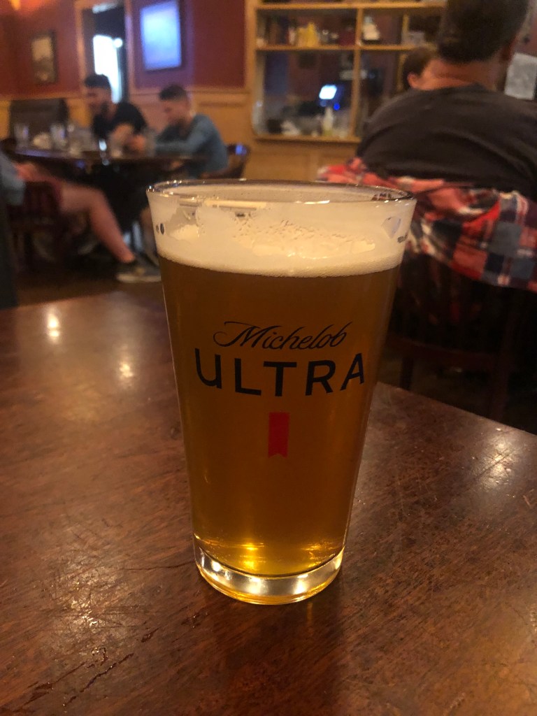
BREW OF THE DAY

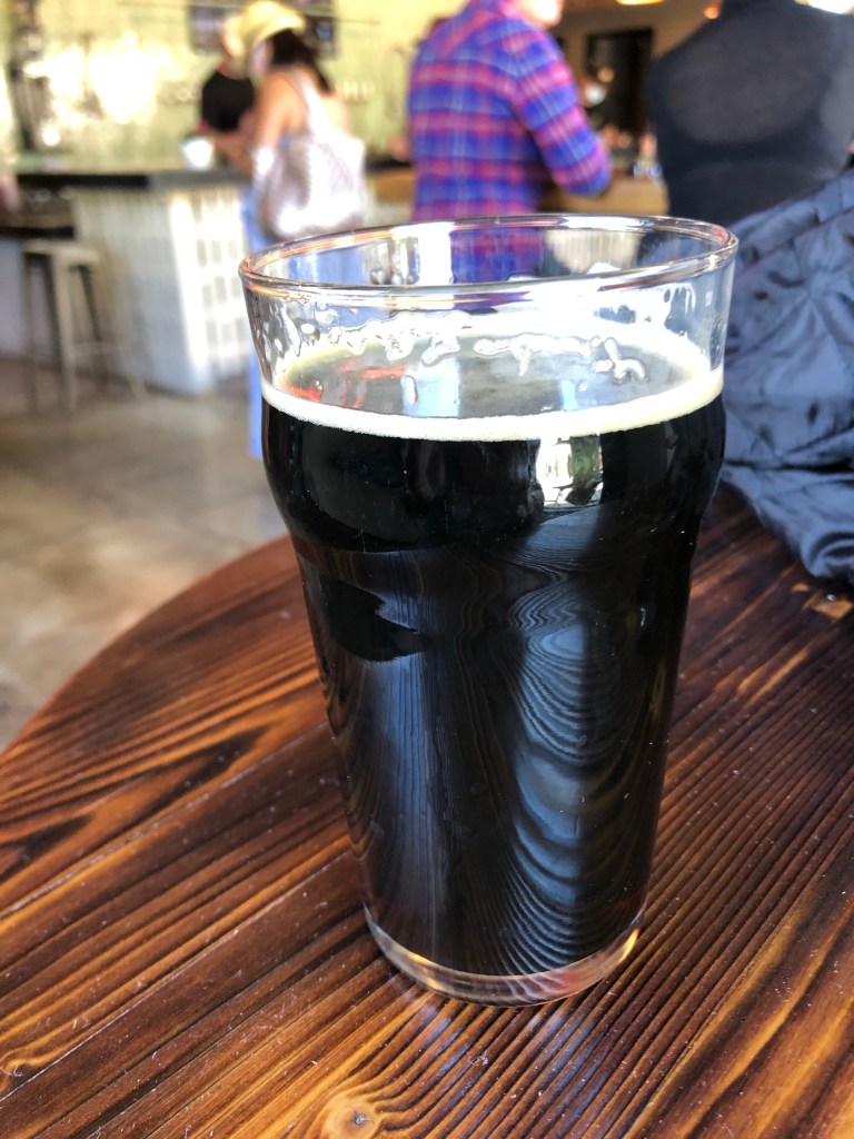
We found a local brewpub called East Regiment Beer Company. Established in 2014, it resides in what used to be Salem’s first fire station.The name references colonial Massachusetts’ militia, which is claimed to be the origin of the National Guard. This is a small (three-barrel) brewery, with a handful of their own beers on tap at any given time. I selected the BAF Porter.

Puritans, witches and militias, all in one logo!

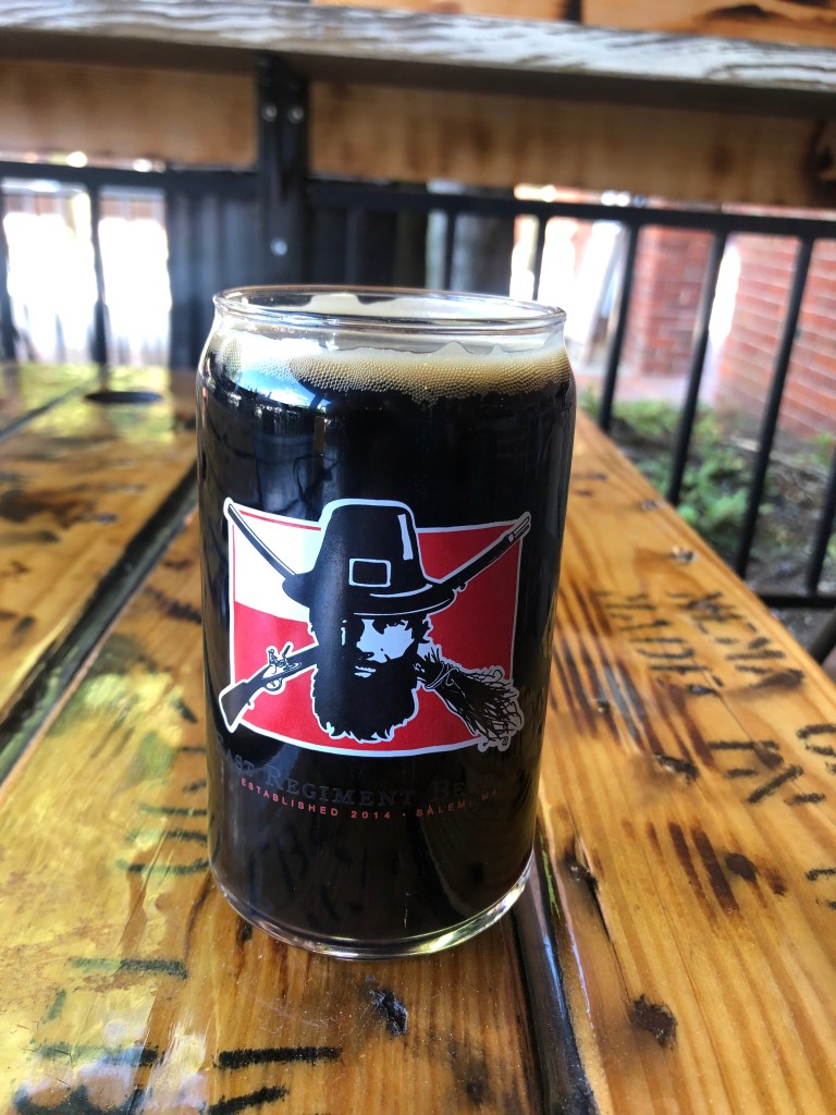
This is a mahogany-colored brew with just the slightest hint of lacy foam at the top. On the first sip, you’re greeted with roasty and nutty flavor that washes over your tongue. You notice a mild carbonation, which is just enough to keep things interesting. It’s not a thick or heavy beer — but it’s not watery either. It strikes that ideal viscosity that a porter should have.

The finish is slightly bitter, as you’d expect from a lightly hopped beer. Overall, I’d have to say the beer is balanced. But after a few sips, it becomes clear that this beer lacks complexity. There is no play of flavors, no grace notes. Just a big glass of roasty sameness, sip after sip after sip. By the time you’re drinking the second half, you’re tired of it. Let’s give it 3.5 stars.

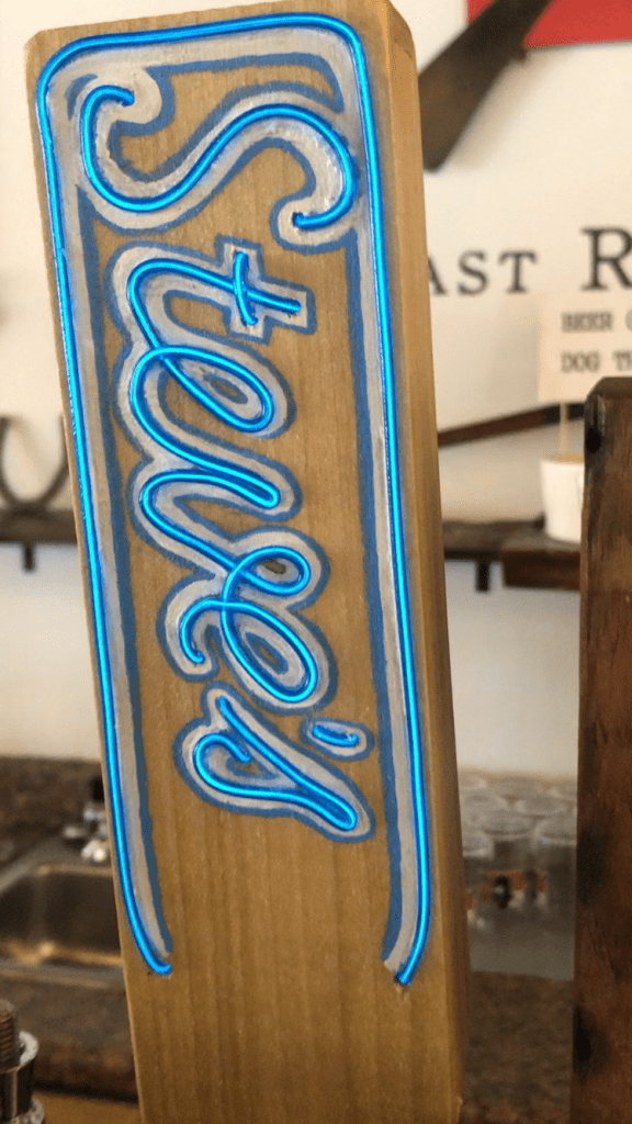
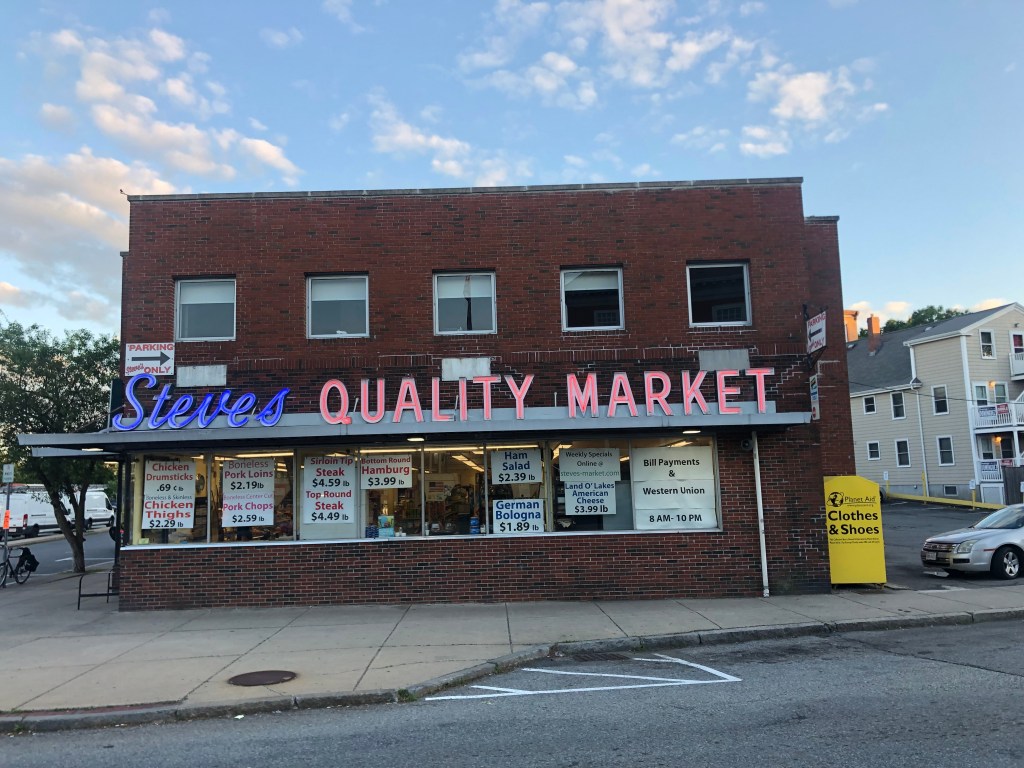
PS: As I was settling our account, the barkeep (Mike) pointed out a beer on tap that shares my name. “Steve’s Quality Saison” is a paean to the local “Steve’s Quality Market,” and the tap handle even has the same neon script as the signage on the store (which happens to be across the street from our hotel.) I wish I’d been aware of it when I ordered my porter!

When was the last time you saw a neon-lighted tap handle?
Presumably beats Ralph’s Pretty Good Grocery in Lake Wobegon.
Road trips · Uncategorized

A Restless Spirit on an Endless Flight

Yesterday’s post, in which I anticipated what today held in store, was prescient, if I do say so myself. We were indeed beset on all sides by witch imagery, and our tour guide was in fact a local college student in a period costume with a flair for hystrionics. But let’s start at the beginning.

Boo.

Salem seems to have a conflicted, love-hate relationship with its witch history. On the one hand, the witch trials are understandably seen as, well, witch trials. One wonders if 300 years ago an accused witch would have decried the whole thing as a “communist hunt.” On the other hand, and in saying this I mean no ill will, Salem doesn’t really have a lot else to attract tourists. And so it is that witch imagery is omnipresent. Even the local constabulary sports the silhouette of a flying crone.

“Sweeping the streets of crime since 1692”

We started off at the Salem Witch Museum, which is as straightforward of a name as you’re going to find. We were the only two people on the tour (evidently June is their slow season). Our guide was the aforementioned young woman inclined to stagecraft who’s getting her master’s in Salem history. As she took us past barely-animated tableaux of witch trials and suchlike, she explained the sordid history, which I’ll summarize here:

In 1692, the two daughters of Salem’s new minister were found cavorting in the woods. This was frowned upon in Puritan society, so the girls offered an excuse which would become a pop culture phrase in the 1970s: “The Devil made me do it.” Indeed, they claimed that one (or sometimes a few) local witches had cast spells on them. To strengthen their case, the girls would occasionally fall into catatonic states or writhe uncontrollably. Now, in those days, witches were very much considered a thing, and the townsfolk set about the business of discovering who these witches were, and putting an end to them.

In the year and a half that followed, accusations and counter-accusations flew, and some 200 people were arrested as witches. Nineteen of them were hanged. The hysteria came to an end only when the Governor’s wife was accused of witchcraft, and the Governor decided it was time to grow up and enter the (then-dawning) 18th Century.

The hangry witches of Salem.

We then went to Salem’s Witch Dungeon Museum, which is a recreation of one of the jails (or, in the local vernacular, “gaols” where accused witches were held. They were not pleasant accommodations. And even if you were lucky enough to be acquitted, you then had to pay off your debt for the cost of food, shackles, and other provisions you had used before you could be released.

That Giles Cory was one “impressive” guy.

For a somewhat less lurid, even somber meditation on the events of 1692, we visited the (presumed) site of the hangings. For years no one was really sure where this storied “Gallows Hill” was located, but recent scholarship says it’s at a place known as Proctor’s Ledge, which sits behind the local Walgreens. A memorial was erected on the site in 2017, with the names of each of the 19 victims. (Excluded are the names of two dogs that also were hanged as witches.) (I am not making this up.)

Witch is to say…

But not all of modern Salem’s witch infrastructure is quite so gloomy. There is, for example, this brass statue of Samantha Stephens from the 1960s sitcom, “Bewitched.”

RIP Elizabeth Montgomery

The statue was erected by TV Land in 2005, and it caused a bit of controversy. Some residents felt it showed an insensitivity towards witches…or at least toward those who were accused of being witches. “It’s a distortion of what went on,” harumphed one resident to NPR when the statue was unveiled. You think? A pretty blond witch living as a housewife in suburban 1960s America, with Paul Lynde as her wisecracking, campy uncle? Yeah, I guess that’s a distortion of what actually happened in a 17th-century Puritan community.

By the way, TV Land has erected statutes of other fictional characters in their hometowns, including Bob Hartley (Bob Newhart) in Chicago, Ralph Kramden (Jackie Gleason) at a New York bus station, Mary Richards (Mary Tyler Moore) at the same downtown Minneapolis corner where she throws her hat in the opening titles, and Andy and Opie Taylor (Andy Griffith and Ron Howard) in Raleigh, North Carolina. Sadly, Ron Howard is the only surviving member of this entire entourage.

Finally, as we were getting a little saturated with witchy things, we decided to have a fresh, cleansing experience at Salem’s….wait for it….pirate museum! After a day of witch gaols and hangings and men being crushed to death, nothing restores your faith in humanity like a bunch of displays about bloodthirsty marauders on the high seas.

Yo-ho-ho indeed!

Brew of the Day

It turns out most of Salem’s brew pubs are closed on Tuesday. So we tried a restaurant that was supposed to have a good beer menu. Here is said menu:

Read it and weep.

You’ll note that it’s all IPAs and lagers. Not a manly beer to be had. And for some reason, every single place we’ve been to over the past two days has PBR.

I had a margarita.

The devil made me do it.

Road trips · Uncategorized

Witch and Famous

My good friend Vic and I have engaged in our share of aimless and/or pointless activities. Such as the time we had a hankering for a greasy meal from the Cracker Barrel restaurant, and we made the 550-mile drive from Sacramento to the nearest Cracker Barrel, which was in Boise, Idaho. After enjoying our meals we immediately got back in the car and returned home that same day. Vic and I have also visited the unofficial McDonald’s museum which resides inside the Juan Pollo Chicken headquarters in San Bernardino, and we flirted with the cowgirl waitress in a ten-gallon bra at the Big Texan Steak Ranch in Amarillo.

So when Vic recently observed that we were overdue for another “stupid trip,” I was all ears. (Those of you who have seen me in profile can attest to that fact.) Vic suggested that we make a pilgrimage (if you’ll pardon the expression) out to Salem, Massachusetts, home of the storied Salem Witch trials, to see what all the fuss was about. Admittedly, the fuss ended rather abruptly about 300 years ago, but growing up in California, our formal education studiously avoided any mention of events occurring before 1849. So we figured we’d correct for that oversight by listening to theater majors from North Shore Community College spin lurid, embellished tales about “The Troubles of 1692” while restlessly standing in reconstructed Colonial buildings next to a family of tourists from Minnesota wearing matching “WITCH WAY TO SALEM” shirts.

Which is why this morning we found ourselves at Sacramento Intergalactic Airport at Zero Dark Thirty. Vic and I took separate flights. This is not because we wanted to minimize the risk that the world might lose both of us in a plane crash, but because we each have frequent flier miles with different airlines.

After a day of flying, we were reunited at Boston Logan Airport (motto: “You Think Your Flight Was Long? Just Wait Til You Experience Our Rental Car Shuttles!”) just in time for a relaxing, pub-inspired dinner and a couple of brews at the Village Tavern.

Now, the thing you should know about Salem is that, like most historic towns, they really try to capitalize on their cliches. Judging from the Chamber of Commerce literature, nothing significant has happened in Salem since the late 17th century. Most businesses proudly play up their historic link with sorcery and black magic.

Anyway, we arrived too late to explore much this evening. But tomorrow I’ll be able to report on Salem’s unholy history.

BREW OF THE DAY

The Village Tavern has an extensive beer menu, but a significant portion is dedicated to the likes of Coors and PBR. However, I selected the intriguingly-named Lord Hobo Boom Sauce. (Disappointingly, it was served in a Michelob Ultra glass.)

My LHBS is a double IPA with an ABV of 7.8 percent. Lord Hobo Brewing was established in Woburn Massachusetts in 2015. It’s a decent brew, if you like IPAs. It’s piney and a little sweet, but it has almost no nose. (Those of you who have seen me in profile know that this does NOT apply to me.) It’s rather one-dimensional, uninteresting in color, and and has an aftertaste of straw. On the other hand, it has decent carbonation.

I give it 1 out of 5 stars.

bridges · California history · Cars · Road trips · trains · Uncategorized

Getting My Kicks

Some years ago, my replacement unit (son Ian) and I drove the entire length of Route 66, from Chicago to Santa Monica. As the reader no doubt knows, Route 66 was one of this country’s first highways, dating back to 1926. It also had been the main way to get to southern California from points east, starting with the dust bowl migration and extending to the car culture of the 1950s and 1960s. Just one or two lanes in each direction, the road has an unhurried and scenic charm. Alas, as depicted in the movie “Cars,” Route 66 was eventually bypassed by various interstates, and the towns and businesses along the old Route slowly declined and eventually dried up. When Ian and I took our trip, we saw plenty of derelict buildings on the side of the road: motels, gas stations, diners, and the like. I suspect that many of those old landmarks that we saw over a decade ago are now gone.

GKRep66W0.jpg

Anyway, Route 66 has always occupied a soft spot in my heart, so I was inspired when my good friend Detlef recommended that I explore an old segment of Route 66 that crosses Cajon Pass (where one crosses from the Mojave Desert to the LA Basin. Or vice versa.) Now, when Ian and I drove Route 66, we didn’t drive on much of this particular segment, because it had been blocked by Interstate 15 in the 1970s. However, a few years ago, the good people of CalTrans redesigned the freeway and reconnected the discontiguous parts of old Route 66 over the pass.

Cajon Pass, Route 66 California

I began today’s tour at the Cajon Summit (approx. 4000 feet above sea level). For over half a century, the Summit Inn stood as a well-known landmark here. The owner, Cecil Stevens, finally sold the place in 2016, and a few months later the structure was destroyed by the “Blue Cut Fire” that ravaged much of the area. Timing is everything. Sadly, Cecil died of Covid just a couple of months ago (February 5). He was 88.

Glory Days
Anyone want to go in with me?
On the site of the old Summit Inn. I have no idea what this is.

Now, the first part of Route 66 over the pass has been overlaid with Interstate 15. That’s not especially interesting. But you can take an old, rickety, rutted dirt road that had been used as a “shortcut” by motorists in the early years. This dirt road began as a wagon trail called the John Brown Toll Road. It was constructed in 1861–just as the Civil War was erupting. So I set out on this old original road.

…but the old dirt road begins!
View of Cajon Pass from John Brown Toll Road. Note I-15 to the right.

One wonders why this rutted, twisting road was ever considered a “shortcut” for Route 66. My understanding is that it used to be in better shape, and it even received pavement in 1914, but it’s narrow and steep and twisting. I was cruising along at about 5 mph.

Remnants of 1914 pavement.
This cut originally was dug by hand in 1861!

Now, there’s one thing you should know about Cajon Pass: It’s a Mecca for railroad enthusiasts. The railroad first crossed the pass in 1885, and today over 150 trains can pass through in a single day. As I made my way down the John Brown Toll Road, I encountered four sets of tracks, including a trip under these tracks from 1915.

Eventually the John Brown Toll Road reconnects with the old Route 66 proper. At this location, there are several notable markers. One commemorates Camp Cajon, which was a popular resting spot, with various facilities, for travelers coming over the pass. It was developed in 1919, but was destroyed by a flood in 1938.

“We have builded”??

Another marker identifies this spot as the junction of the Santa Fe Trail and the Salt Lake Trail. It honors “the brave pioneers of California,” and was erected in 1917 by a group of eight pioneers. Notably, one of these pioneers in John Brown (of the Wagon Toll Road, which I’d just come down). Two others (Sheldon Stoddard and Sydney Waite) had been members of the “Lost 49ers” through Death Valley. Coincidentally, I’ve run into this group on two earlier trips: Death Valley and, more recently, Walker Pass. These three individuals, along with the other five who sponsored the monument, were all present at the dedication ceremony in 1917.

Monument “to the brave pioneers of California.”

It was now time to get onto Route 66 proper. This segment parallels the modern Interstate 15. Now, as I mentioned, this is railroad country, and much of this road also parallels the old railroad line:

…or are you just happy to see me?

It struck me that this is the same segment of road where I’d camped out for over an hour, waiting for the Union Pacific’s restored “Big Boy” steam locomotive to come through in the fall of 2019. You can see my blog post about that event here.

The Big Boy on its way to through Cajon Pass in 2019.

What’s especially cool about this stretch of Route 66 is the good people at CalTrans have repaved the southbound lanes of the old road, and made them into a comfortable two-way road. Meanwhile, they’ve left the northbound lanes of Route 66 unrestored, with periodic K-rail barriers to prevent people from traveling along it, thus preserving it as an artifact. There are even some of the old, painted “Route 66” shields still extant on the original roadbed.

Original roadbed.

Also, some of the bridges from the early days are still in place, with their year of construction stamped in concrete:

From the Herbert Hoover administration.

A bit later I came to an old rest area that had been constructed in 1952. All that remains are some pavement markings and a memorial plaque.

Marker notes, among other things, that the tollhouse for the John Brown Toll Road was nearby.

Incidentally, this location sits on the San Andreas Fault, where the Pacific Plate and the North American Plate meet. In fact, it was the San Andreas Fault that created Cajon Pass in the first place.

On a hillside next to the road I saw the faintly visible number “66” somehow carved into the earth. I can’t find any information about who did this and when. Tips are welcome!

Can you see it?

Now, let me explain that on my drive from LA to the Pass I was listening to a podcast called “Stuff You Should Know.” (If you’re not already familiar with it I’d recommend it to you.) At the end of the podcast, the hosts always read a letter from a listener. In today’s episode they read a letter they received from the great-great-great niece of one Helen Boss, who caused the car accident in which Sammy Davis Jr. lost his eye in 1954. You can listen to the podcast here (listener mail starts at 59:40).

So imagine my surprise when, shortly after listening to that podcast, I found myself passing the exact place on Route 66 where Sammy’s accident occurred. I’m not making this up. The accident happened where the road passes under a railroad track. Evidently the 72-year-old Mrs Boss had missed her exit, and decided to back up in the early morning gloom. Sammy rear ended her and lost his left eye in the accident. Fortunately, no one was killed.

Where Sammy and Helen met.

Before long Route 66 completes its journey through Cajon Pass, and it enters the city of San Bernardino. At this point, almost no remnants of the old road and infrastructure remain. So I decided to jump back onto the interstate to head back home. But it’s worth noting that some other stretches of the original Route 66, along with some roadside structures, still exist on its final leg westward toward Santa Monica, on a road now named Foothill Boulevard. I drove that stretch a few years ago, and will assemble the photos into a blog entry at a later time.

So there you have it: A good stretch of the original Route 66 can still be driven over the Cajon Pass, bypassing the soulless and numbing Interstate. Thanks to Detlef for calling this to my attention!

California history · Cars · Road trips · trains · Uncategorized

From Oil to Oat Milk

Today’s travels focused primarily on CA Route 33. To get there I took an easy and leisurely route across the Central Valley floor to Blackwell’s Corner at the intersection of CA Routes 46 and 33. Blackwell’s corner is one of my favorite stops on California roadtrips, as it’s a friendly and well-provisioned oasis in the middle of nowhere. A single building is outfitted with a gas station, a diner, a grocery store, showers, bathrooms, an ice cream fountain, a homemade fudge kitchen, and a James Dean shrine. For it’s at this spot that James Dean was last seen alive before his fatal car crash a half-hour later on September 30, 1955. He was 24 years old.

Well, he did star in Giant, you know.

Blackwell’s Corner traces its lineage back exactly 100 years — to 1921 — when George Blackwell opened a rest stop on the site. I’ve stopped here many times. Sure, the gas is about a buck a gallon more expensive than elsewhere, and the snacks are severely overpriced. And the fudge doesn’t do much for me. But this place is an institution, it feels really earnest, and there’s really no other options for rest and refreshment in the region. It’s reassuring to know that it’s here. So I’m happy to support it.

Some years back Blackwell’s put in this 1950’s-themed diner to capitalize on its James Dean connection. Even before Covid, I’ve never seen anyone eating there.

So after gassing up and getting a bottle of juice for breakfast, I turned onto CA Route 33. Like Blackwell’s Corner, Route 33 reminds me of a reliable old friend. I’ve traveled segments of 33 on various occasions — particularly the stretch known as the Petroleum Highway. This segment is a hellscape of oil rigs and pipelines scattered willy-nilly across the parched and poisoned earth. It’s like something out of Mad Max, and somehow you can’t take your eyes off it.

“I’m just here for the gasoline.” — Mad Max

One of the notable intersections in the area is where Route 33 is crossed by “Brown Mat. Road.”

Wipe your feet.

At first I thought this meant the road was covered with brown mats, or appeared to be so covered. Then I noticed that “Mat.” is short for “Material.” So why would you name a road “Brown Material Road”? Is it simply an odd reference to a dirt road? Or a euphemism for something scatological?

Could you please be more specific?

After doing some research, I discovered that the name references a business that used to be on the road: A place called Brown’s Material Supply Company. So it’s really analogous to Magic Mountain Parkway in Santa Clarita.

Anyway, the Petroleum Highway is much more famous for its oil than for Brown Material. The scale of production is impressive. This region (Kern County) produces fully three- quarters of the state’s oil (and about a tenth of the country’s overall oil production). One of the major oil producers, Aera, takes great pride in showing off one of its old pumps, tarted up with Christmas lights next to the road.

Long since retired.

In the midst of these oilfields, I happened upon the Oakwood Bar-B-Q and Bar in the tiny town of McKittrick (pop: 115). Under the main yellow sign was a tarnished copper sign on the outer wall that read “Penny Bar.” Upon closer inspection, that entire sign was made of pennies.

I’m definitely not getting my BOTD here!

This seemed intriguing. A plaque informed me that the building’s owners have over time glued over a million pennies to the bar, walls, and other flat surfaces of the building. I didn’t take any photos inside the building, since the roughnecks (or whatever the oil workers call themselves these days) that populated the establishment didn’t look like they’d take too kindly to a stranger photographing them. But I did get this photo of the back entrance:

Penny for your thoughts?

A little further along Route 33 I came to the town of Taft (pop: 9,300). Taft is just about the most southern town of the San Joaquin Valley, nestled against the foothills of the Transverse Ranges. Taft was originally named “Moron” around 1900, but after it burned down in 1909 it was renamed after William Howard Taft, who became president that same year. Taft is one of the more substantial towns on Route 33, and has close ties to the oil industry. While its downtown still feels stuck in the mid-20th century, it still feels viable and maybe even prosperous. The Fox Theater dates back to 1918. It’s had ownership changes and was even closed for awhile, but on this trip it seemed to be fully restored and functioning. Indeed, it’s showing “Godzilla vs. Kong” tonight!

Would have been great if Mothra could have been part of the showdown.

It was now getting to be lunch time. Because there would be no towns of any substance for the next 75 miles or so, I decided to get lunch at a place called Roots Eatery. Even though it was plopped down in a strip mall, two elements spoke of promise: (1) the meat smoker puffing away in the parking lot, and (2) the promise of “Good, Bad, and Ugly” on the menu.

Roots’ smoker. Somehow I doubt that the county health department has inspected, let alone approved, the setup…
I wish they’d point out the “bad” part of the menu.

I had a toothsome smoked pastrami sandwich with smoked bacon and smoked gouda on grilled and buttered sourdough. It was just what the doctor ordered, even though my arteries didn’t approve.

On the outskirts of town I encountered two notable things. One was this car; Points will be awarded to the first person to identify the make and year.

Second was this homemade art installation. Alert readers will recall that I have a soft spot for folk art. This trip has been largely devoid of any such sightings…until now.

Shades of Almira Gulch…

It was now time to leave the valley are start climbing up over the Transverse Ranges. The last bit of Kern County is commemorated by the town of Ventucopa (pop: 92), which marks the transition from Kern’s Maricopa to the county of Ventura.

As if “Inyokern” weren’t bad enough…

I was entering my favorite part of Route 33: the climb over the Transverse Ranges and the Santa Ynez Mountains. It’s a meandering, little-traveled, two-lane road with grasslands, oaks, and commanding views. Plenty of switchbacks allowed me to take panoramic photos of the road I was travelling.

The red line marks Route 33 over the Transverse Ranges
Still chugging along…
On the way to Ojai

Finally I was delivered into the town of Ojai (pop: 7,500). If you’re wondering what happened to all the country’s hippies, I can report they’re alive and well and living in Ojai. Seriously. I’ve never seen so many healing crystals, incense shops, natural food coops, organic this and free-trade that. Ojai has a city ordinance banning chain stores, so the businesses are all pretty unique. I did find a decent brew pub, which I’ll mention in the BOTD at the end. (Famously, Ojai is also known for standing in for Shangri-La in Lost Horizon.)

Now, I’d planned to take 33 to its end near the oceanfront in Ventura about 25 miles away. But on a whim I instead headed out of Ojai on highway 150 east, which took me to Santa Paula (pop: 30,000). This was one of the few decent-size cities I encountered on this trip. I always associate Santa Paula with the St. Francis dam disaster of 1928. The dam was dozens of miles away, but when it failed in the middle of the night it unleashed a wall of water that passed through canyons and took out hundreds of structures before it reached the ocean. A year ago I made a visit to the dam site and described the disaster here. Today in Santa Paula, I saw this monument commemorating two motorcycle police officers who alerted townspeople of the impending disaster.

Latter day Paul Reveres.

But the real treasure in Santa Paula, for me, is the old Southern Pacific railroad depot. It was built in 1887 and served as the center of commerce and passenger travel for many years. Passenger service was halted in the 1930s and freight in the 1970s. But the structure has been lovingly restored and today serves as the Chamber of Commerce’s headquarters and an art gallery. I’ve seen a lot of restored railroad depots in my day, but this one is among the absolute best. It appears vibrant and solid, and is really a thing of beauty.

Soon after Santa Paula, I connected with Interstate 5. As soon as I get on a freeway, I consider the trip to be over…even though I still had another hour and a half of driving. As I fought the LA traffic, I was thankful for two days of two-lane roads in the deserts, valleys, and mountains of California.

BREW OF THE DAY

I had my BOTD at a place called Topa Topa Brewing Company in Ojai. The place is about 6 years old, and is named after the nearby Topa Topa Mountains. It’s got lots of outdoor seating a very laid-back vibe, which is typical for an Ojai business.

Nice day for a beer.

I chose the “Gadabout Stout.” Like yesterday’s BOTD, this is a nitro stout, which gives it a creamy mouthfeel. It’s brewed with coffee from the nearby Ragamuffin Roasters, and that gives it some decent roasty notes. But I have to say that I was underwhelmed by this beer. It’s made with oat milk, which while it may appeal to the Ojai hippies, seems to be an odd choice for beer. I suppose my main complaint is that the beer just feels flat and weak. It’s like drinking skim milk when you’re expecting a glass of whole milk. The beer doesn’t deliver much of a bite — either from hops or from alcohol. (It weighs in at 6% ABV). The main taste profile evokes corn cakes and unsalted tater tots. In a word, it’s bland. Definitely needs to be sharpened under a pyramid or healed with a crystal.

The Pone of Beers