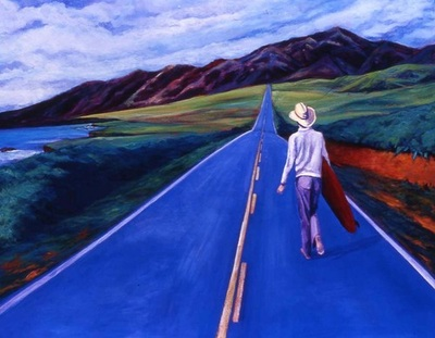
Long-time readers of this blog will recall my goal of driving all the transcontinental US highways in the United States. There are a few caveats to this goal: I’m ignoring the interstates, which are boring, putatively high-speed freeways designed specifically to minimize encounters with towns and villages and, it seems, scenery. Instead, I’ve focused on the US Highway system–the “blue highways”–that traverse the continent. In terms of the US Highway numbering system, this means routes designated with two-digit numbers ending in zero.
Don’t try this at home.
Transcontinental routes I’ve traveled to date include US Route 50, US Route 60, US Route 70, and, somewhat defying the numbering convention, US Route 2. All of them are primarily two-lane roads whose alignments date back to the early 20th century, and which pass right through the center of countless towns, villages, and ghost towns. In fact, these routes are designated Main Street in many, many cities. In between are miles and miles of open country.
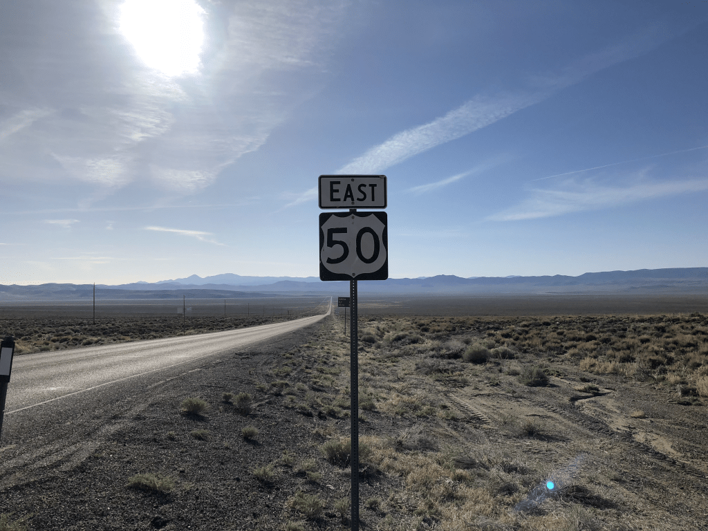
Many US Routes have nicknames–US 50 is “The Loneliest Road in America,” Route 66 is “The Mother Road,” US 70 is “The Broadway of America,” US 2 is “The Highline.”
A stretch of “The Loneliest Road in America.”
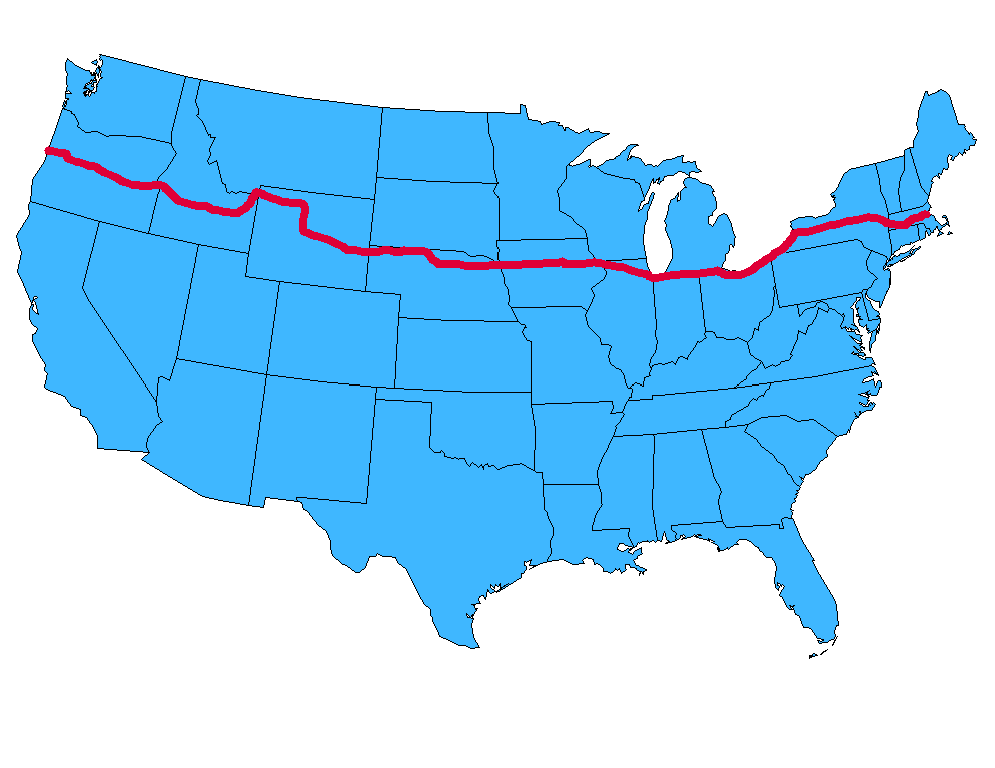
To my collection of transcontinental routes I am about to add US Route 20, whose somewhat unromantic, bureaucratic nickname is “The National Medal of Honor Highway.” It runs from Boston MA to Newport OR, for a grand total of 3,365 glorious miles. Accordingly, it is considered the country’s longest road.
From Sea to Shining Sea
Now technically, this is a discontinuous route, for US 20 does not exist within the boundaries of Yellowstone National Park, through which you must pass to get across the country. In fact, the original route (opened in 1926) stopped at Yellowstone, and was only extended to the west coast in 1940. For reasons that will become clear later, I will only be driving that original route, from Boston to the east entrance to Yellowstone.
Did somebody say Jellystone?
And so I am sitting here at Sacramento Intergalactic Airport awaiting my overnight flight to Boston. In the morning I’ll pick up my rental car and begin my westward trek, with daily posts over the next week and a half. If you have any suggestions for a stop along the way, or if you live along the route and want to buy me a beer, please say so in the comments below!
Oh, and at the end of this journey I’m going to invite readers to suggest a better nickname for US 20. The winner will get a Medal of Honor.
In a recent blog post, I asserted that Kingsburg, CA is “smack-dab in the middle of” California. I based this assertion on nothing more than a quick glance at a map.
Several alert readers called out my unsubstantiated claim. The reader with the best case was Jeff N., who wrote: “To go to the official center of the state, head a little North out of Fresno to a spot near the town of North Fork. There’s an official surveyors mark noting the exact center of the state.”
A quick search of various sources provided unanimous corroboration of Jeff’s claim. For instance, check out this newspaper article from the Desert Sun.
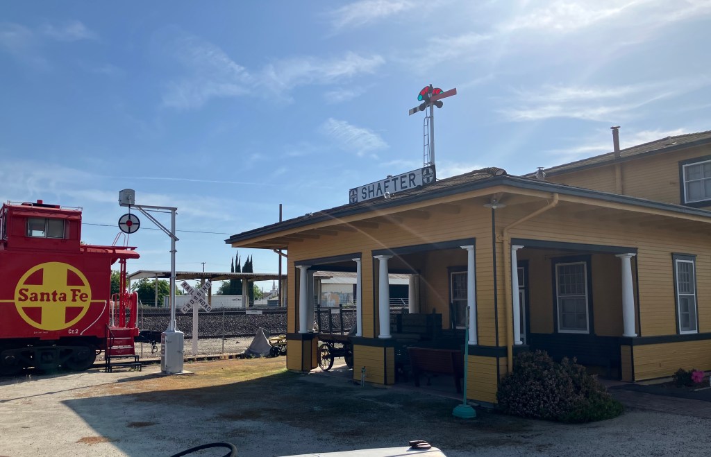
Coincidentally, I did stumble across a (sort of) competing claim in the town of Shafter, CA (pop: 22,000). Shafter is home to a 1917 Santa Fe railroad depot, which now serves as a railroad museum. I visited the station because the folks at the Kingsburg Depot meeting I attended the other evening told me that Shafter was their “sister depot”…whatever that means. So I made a quick visit.
Kingsburg’s “sister.”
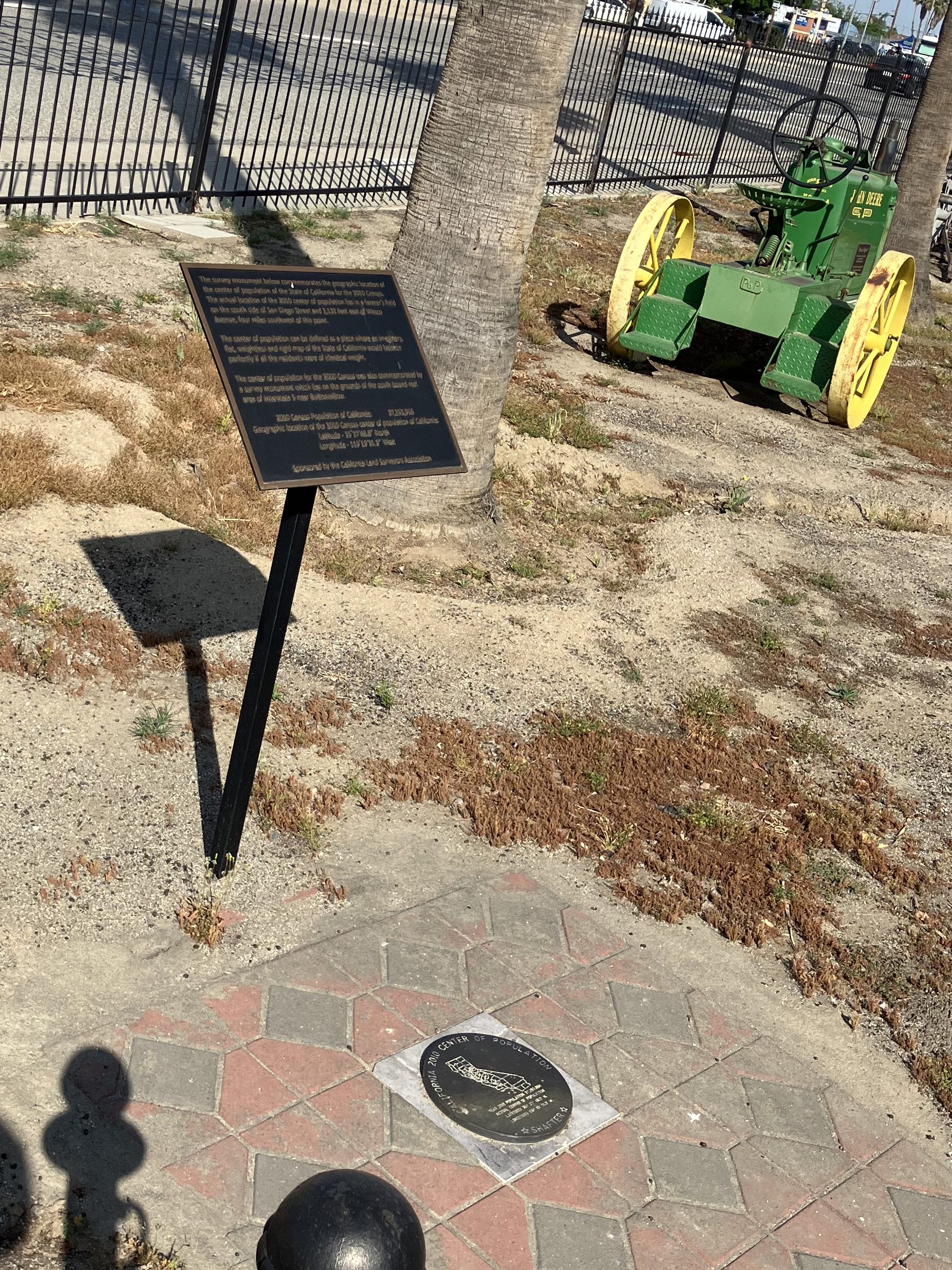
Anyway, during my visit I noticed this marker, which proudly boasts “California 2010 Center of Population.” So while North Fork is the geographical center of California, Shafter is the population center…at least based on the 2010 census.
“Center of Population” marker on the ground.
But upon closer inspection, the plaque above the marker reads:
The survey monument below commemorates the geographic location of the center of population of the State of California for the 2010 Census. The actual location of the 2010 center lies in a farmer’s field on the south side of San Diego Street and 2,132 feet east of Wasco Avenue, four miles southwest of this point.
All of which raises the obvious question: Why couldn’t they put the marker any closer than 4 miles from the proper location???
Incidentally, the 2020 census still places California’s population center in the town of Shafter. Here’s a good article, for context.
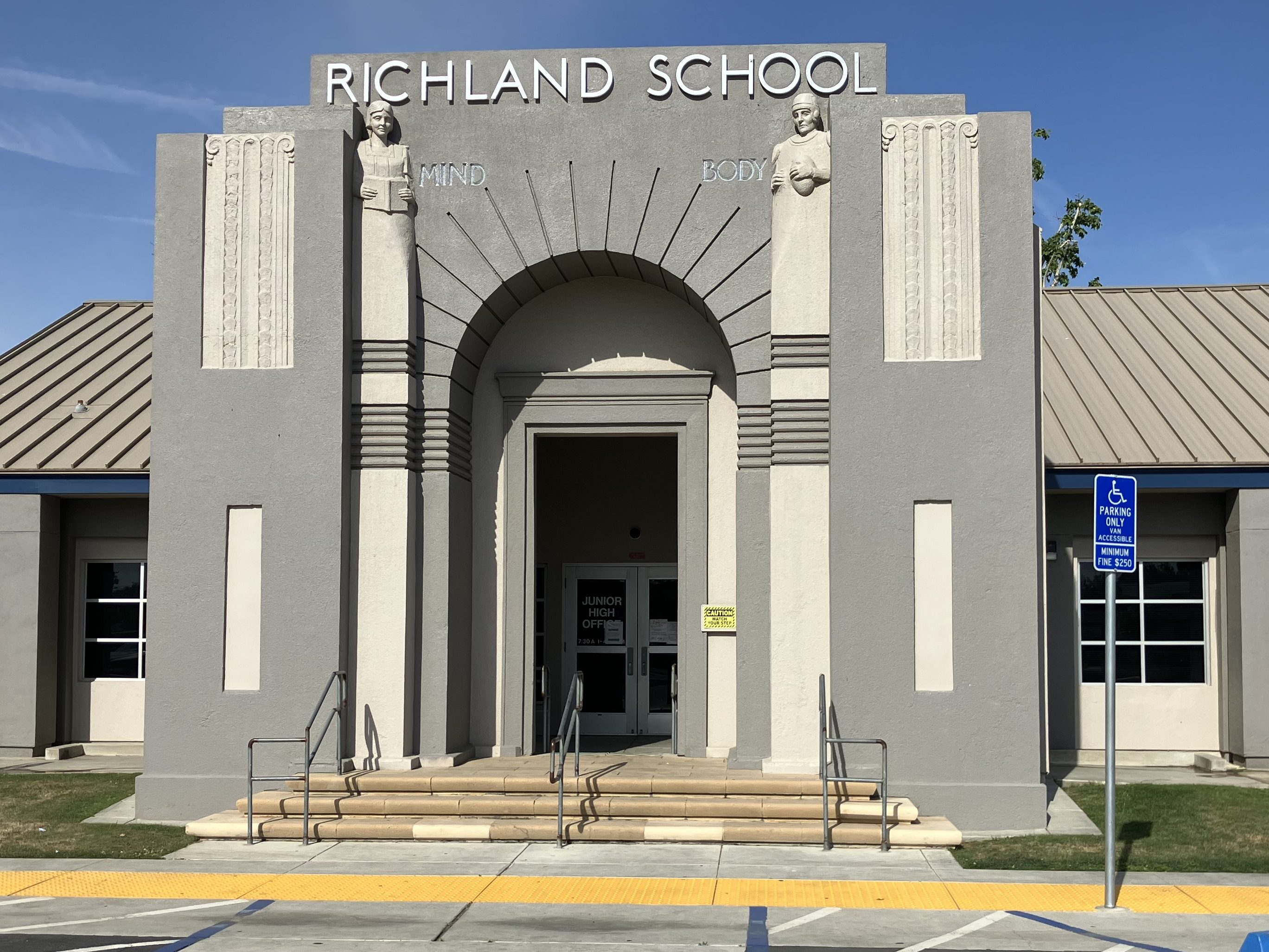
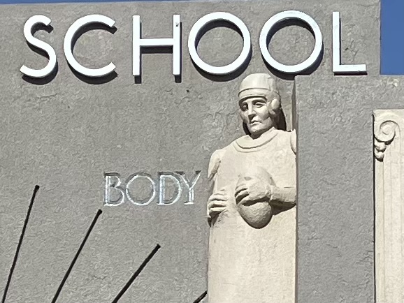
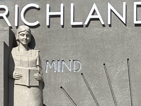
As an aside: close to the Shafter depot is this historic middle school, the facade of which reminds me of a creepy Twilight Zone episode where the school messed with the students’ minds.
An impressive edifice….
…But aren’t these column-topping figures a little creepy?
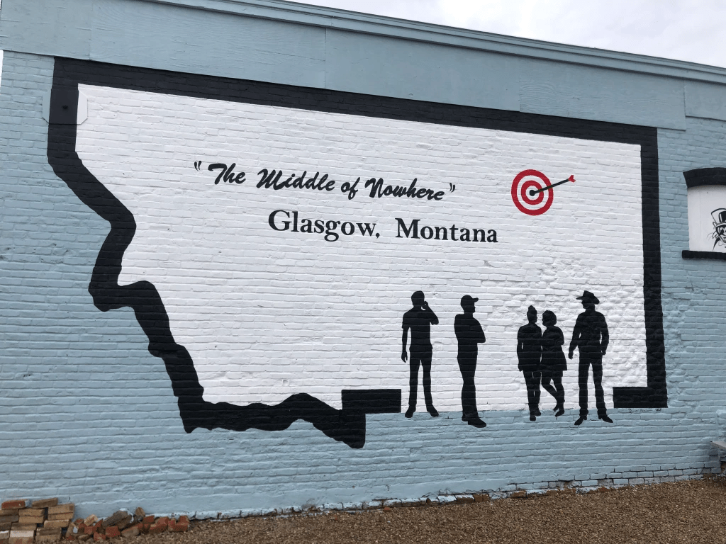
But to return to the competing claims as the “center” of California: I would be remiss if I didn’t reprise this 2022 photo I took in Glasgow, MT. Few could argue with their claim!
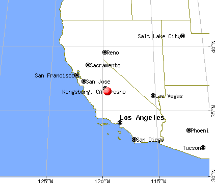
Today I took a ride down to the city of Kingsburg, CA (pop: 13,000). Kingsburg sits on highway 99, smack-dab in the middle of the state.
Kingsburg is the big red dot blotting out Fresno.
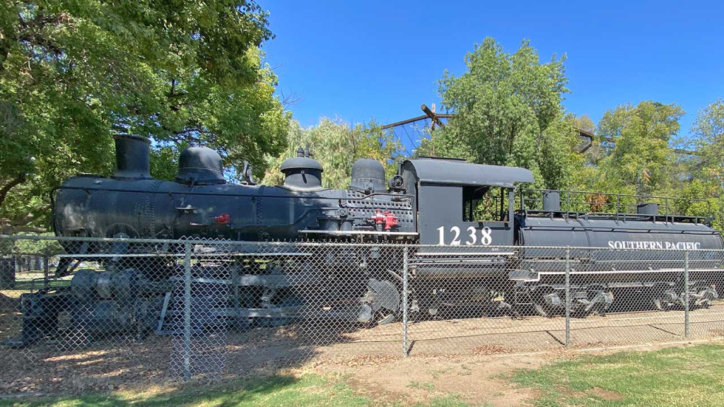
Alert readers will recall that I came through Kingsburg last fall and fell in love with its historic railroad depot. I ended up making a small contribution toward their “1238 Project,” in which they are taking possession of a 1918 Southern Pacific steam locomotive that’s been sitting in a park in Fresno since 1956. As a bonus, my humble contribution earned me membership in the “Friends of the Historic Kingsburg Depot,” which holds monthly meetings about their activities at the depot. So today I said “What the heck; I’ll make the 200-mile drive for this evening’s meeting and get the latest update on the 1238 Project.”
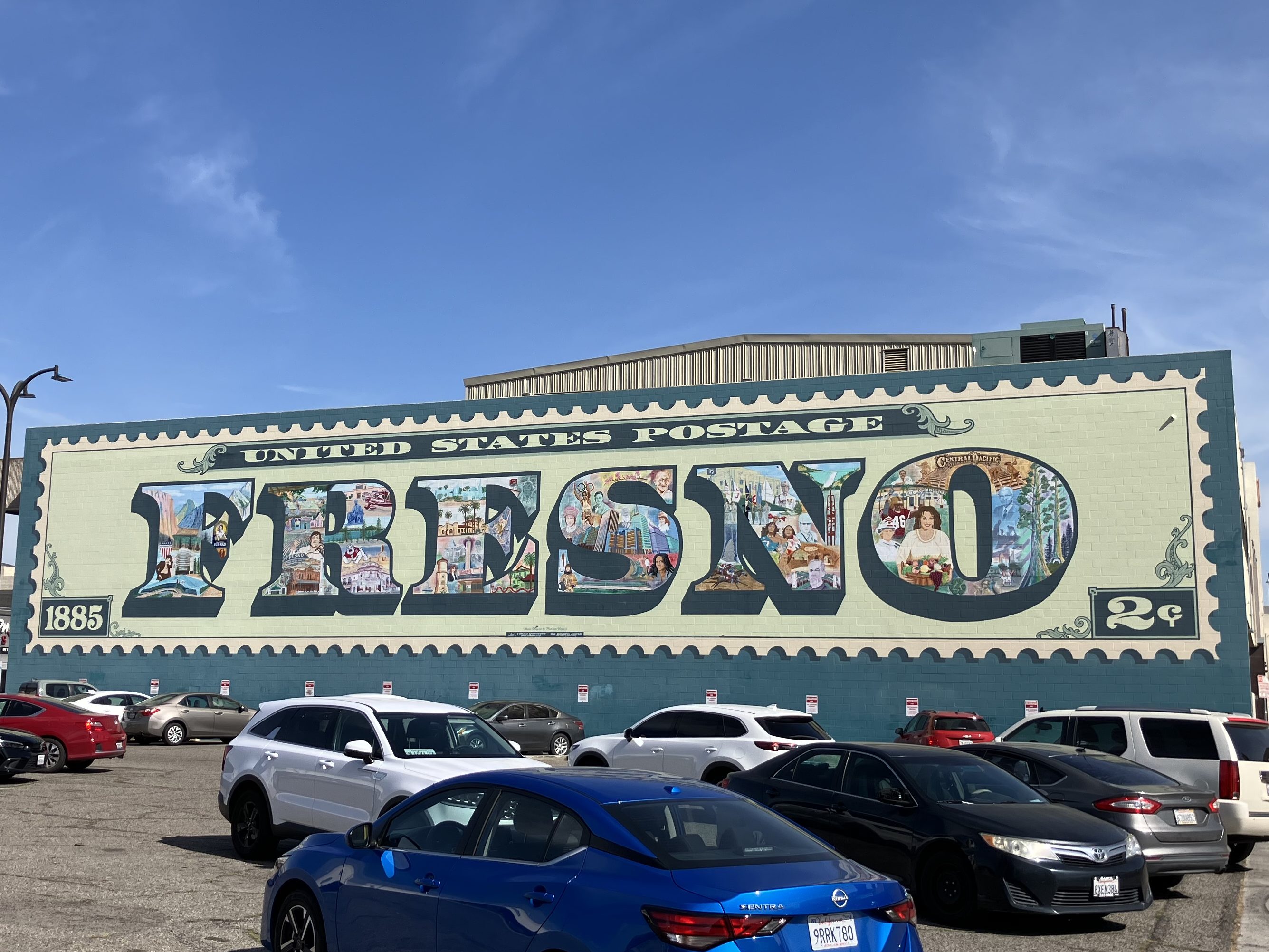
I was running a little ahead of time, so I killed an hour and a half exploring the city of Fresno (pop: 546,000), which is about 20 miles north of Kingsburg. Now, Fresno is a much-maligned city, frequently appearing on lists of the worst places to live in California. It has above-average levels of homelessness, drug use, air pollution, and unemployment. Like much of the Central Valley it experiences extreme temperatures in the summer and winter. And much of the city comprises a run-down urban core surrounded by ugly sprawl. But despite all this, Fresno has a plucky population and a rich history that is, to greater and lesser extents, being preserved. Here are just a few examples that I saw today:
Civic pride is evident in this mural on Tuolumne Street in downtown Fresno.
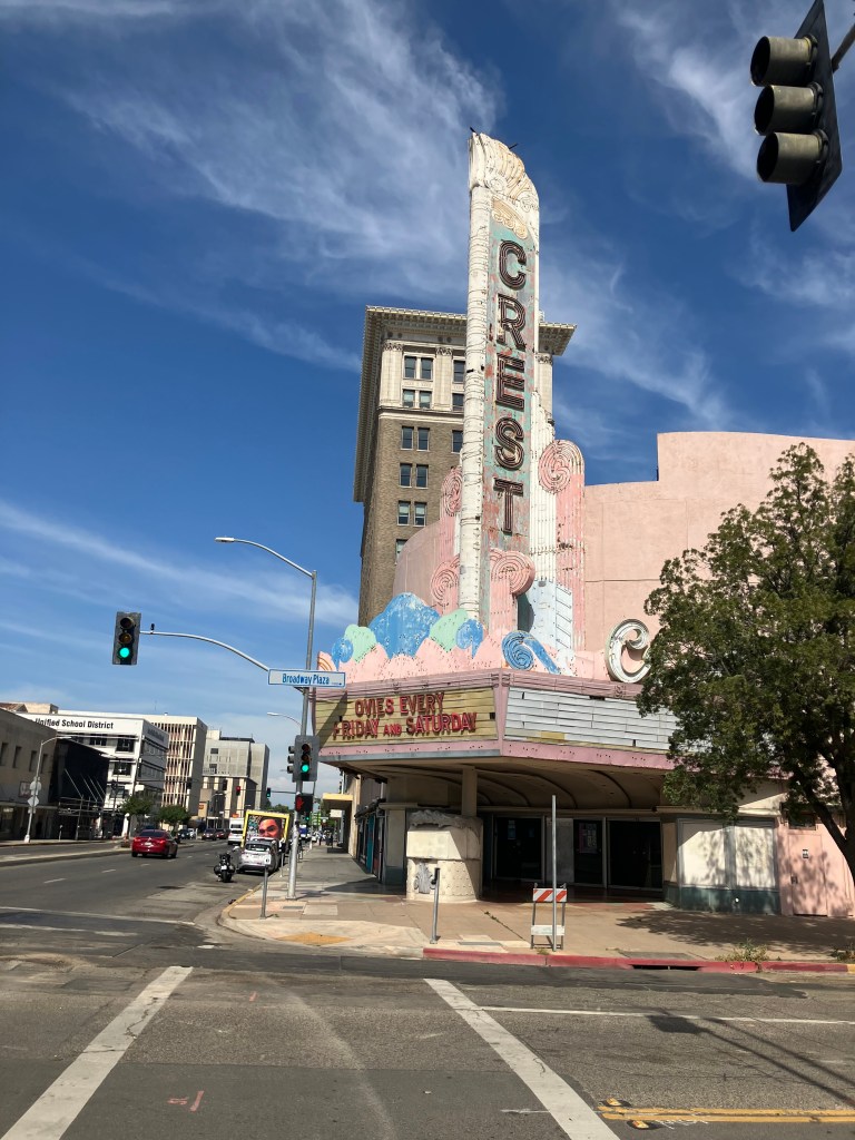
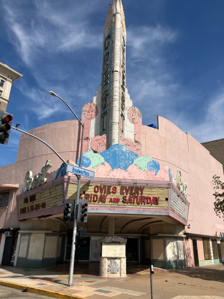
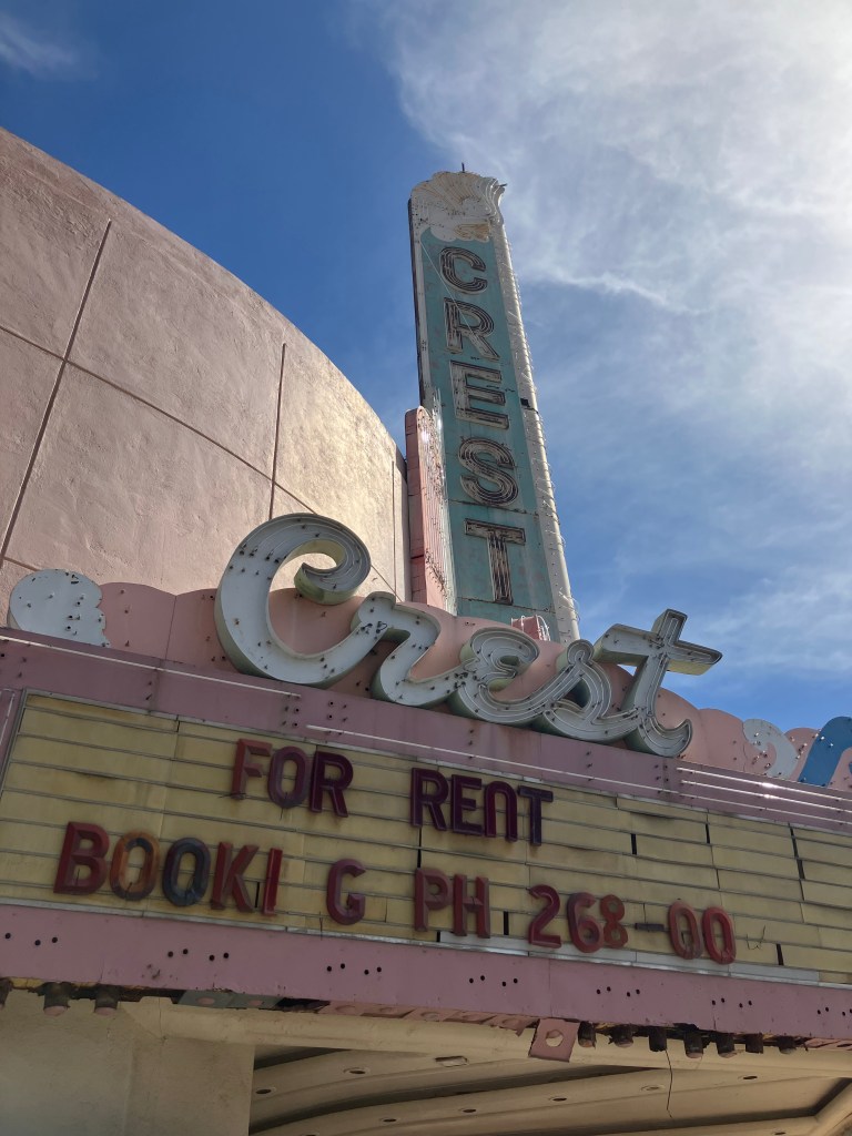
Fresno has several historic movie palaces in various states of preservation. Two of them (the Crest and the Tower) share names with two semi-famous theaters in Sacramento. Fresno’s 1948 Crest Theater is in particularly rough shape; the exterior is pretty shabby, and the air conditioning doesn’t work. And yet, they show movies every weekend for five bucks!
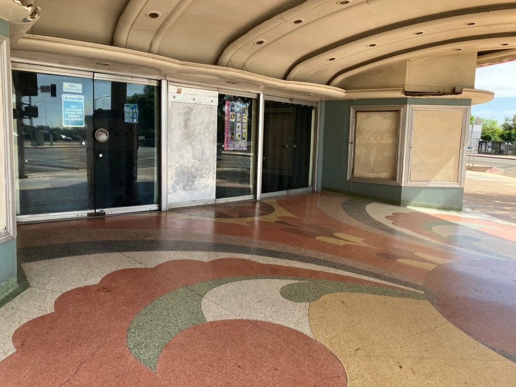
The terrazzo floor is nice, though.
I wasn’t able to get inside, but I’m told the interior is in better shape than the exterior. And I do appreciate that they’re keeping the theater open, even though they obviously have a lot of deferred maintenance. It’s lovable in a “little engine that could” kind of way.
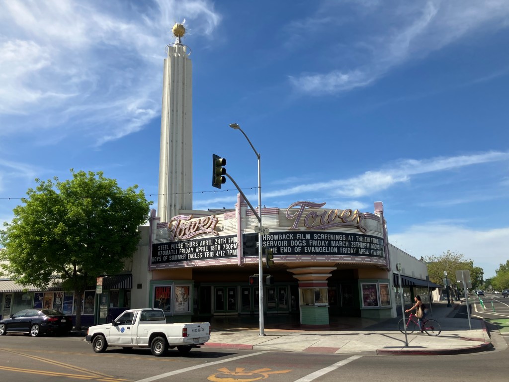
Next up is the Tower Theater. It’s the centerpiece of Fresno’s “Tower District”–an artsy neighborhood with coffee shops, art galleries, restaurants, and other businesses that give the area a modest but palpable energy. It’s still a little gritty, but it’s definitely a viable destination for an evening out. The Tower Theater itself is an art deco movie palace built in 1939, that now serves as a 761-seat performing arts center.
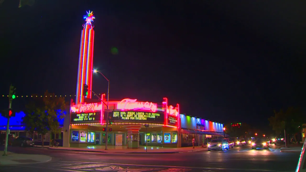
I didn’t have time to stick around til nightfall, but I’m told the Tower’s neon dominates the district at night. Here’s a photo from a local Fresno news station.
File photo from Fox26 News.
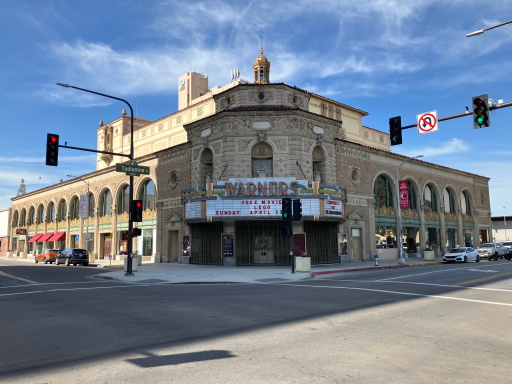
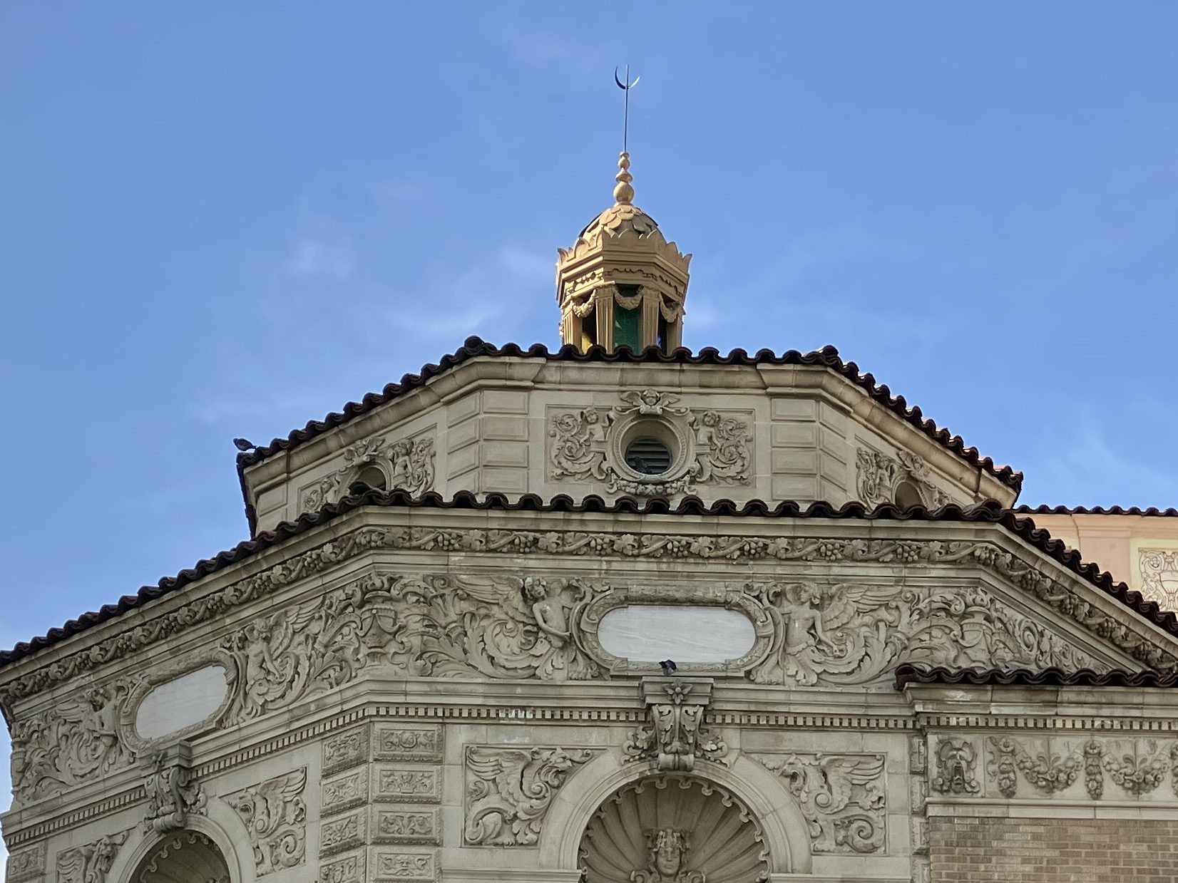
We now move to the most striking movie palace I saw today in Fresno: The Warnors Theater. Opened in 1928, it was owned by the renowned Alexander Pantages. (Surely you’ve heard of the Pantages Theater in Los Angeles?) The theater originally was called The Pantages Theater, then changed to The Warner Theater in 1929, when Warner Brothers bought it. Warner Bros sold it in the 1960s, and the new owners changed the “e” to an “o” in a half-hearted concession to trademark requirements.
Pantages’ fortress.
Sometimes more is more. Or Moor, if you catch my drift.
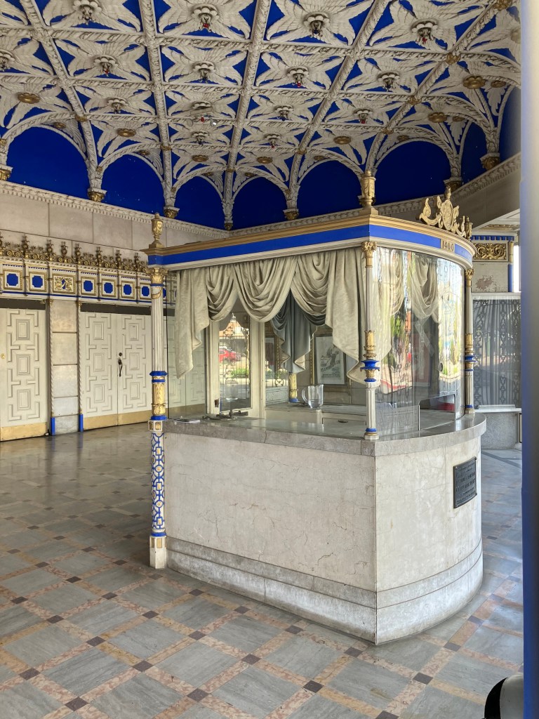
Box office and lobby. Check out that ceiling!
Warnors has a large stage, seating for 2,100 people(!), and the original 1928 Robert Morgan pipe organ. The theater serves as a popular performing arts center bringing many national and international acts to Fresno.
So, I think it’s fair to say that Fresno is making an effort to support the arts. I think this is a key component to revitalizing the city.
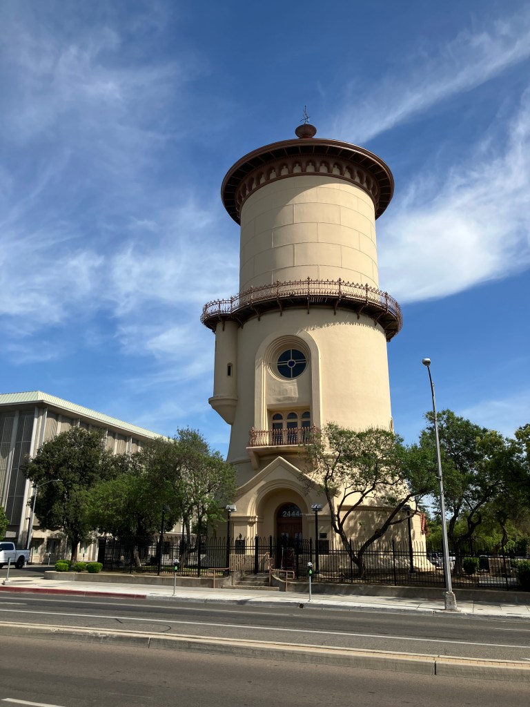
I did encounter other examples of civic pride–here I’ll share just two more. First, there’s an impressive, beautifully-restored 1894 water tower. Originally owned by a private water utility, the tower’s 250,000-gallon tank was drained in the 1960s and sold to the city. It was restored about 25 years ago, and has served as a visitor’s bureau and, most recently, as the Frida Cafe.
Now that’s a water tower.
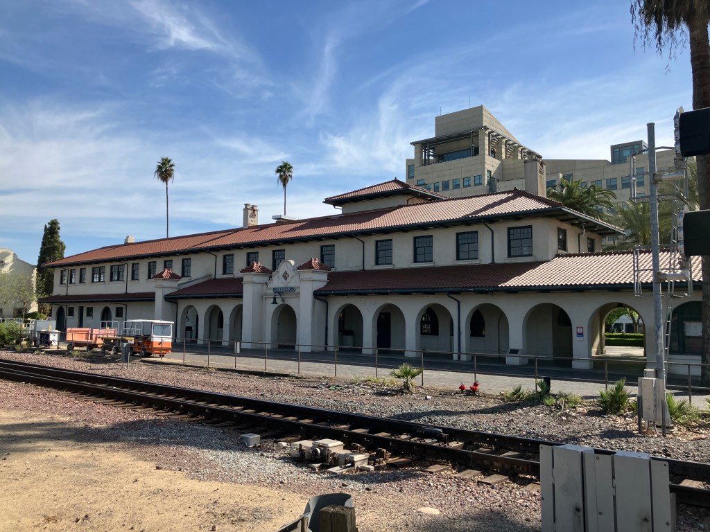
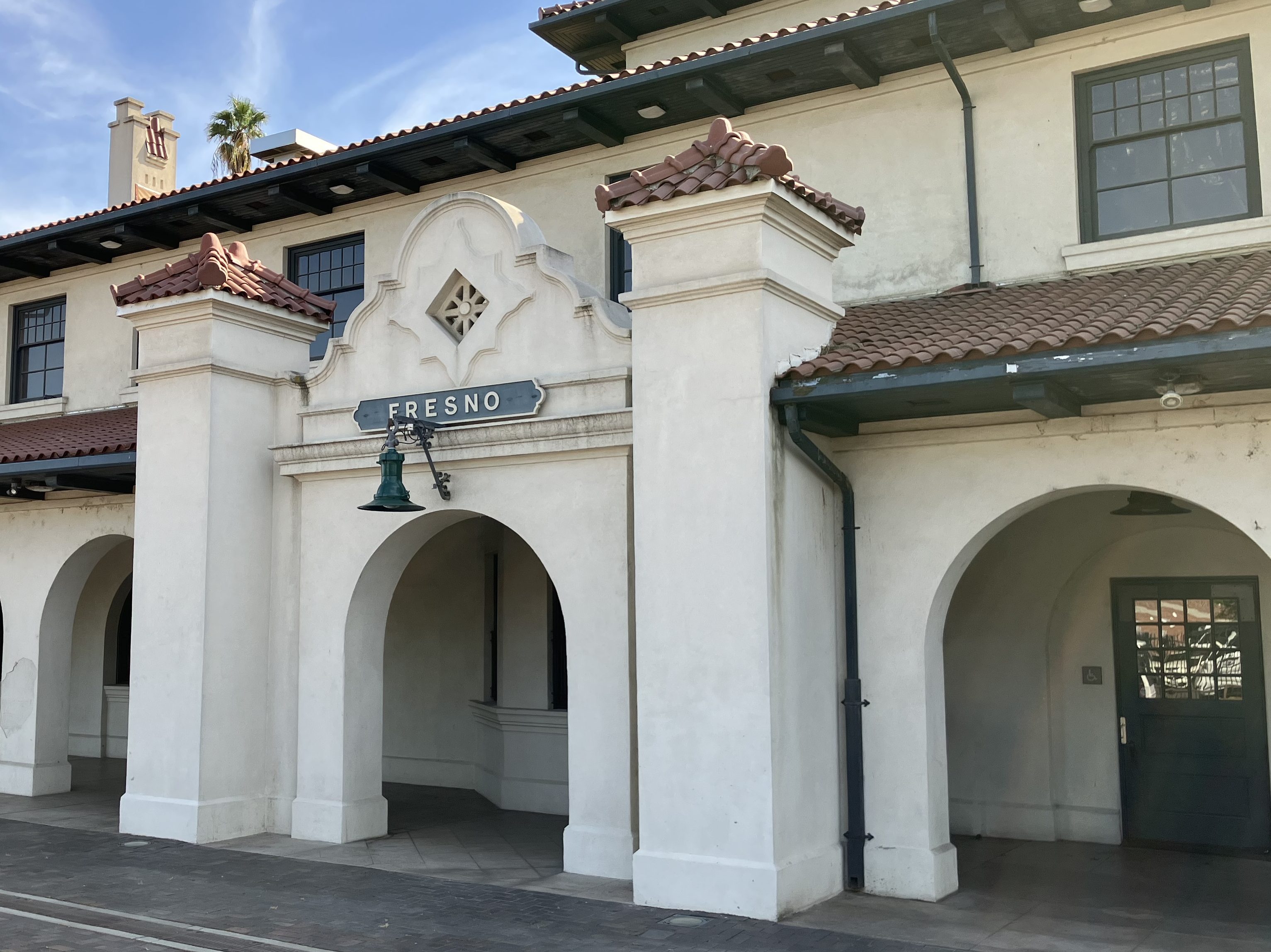
My final example of Fresno’s civic pride is its historic railroad depot. It was constructed by the Atchison, Topeka & Santa Fe in 1899. Santa Fe stopped passenger service to the station in 1966 and completely shuttered the station in the early 1990s. Fresno civic leaders, God bless ’em, purchased the decaying the station in 2003, spent 6 million bucks restoring it, and re-opened it for Amtrak service in 2005.
Fresno Depot, looking a bit like a La Quinta Inn.
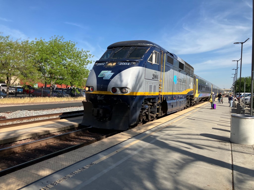
Just as I was leaving, the San Joaquin arrived. There was a good crowd of people boarding at the platform. The station seems to be a very solid transportation hub for the city.
And this mention of trains brings us back to the original purpose of this trip. Twenty minutes after I left Fresno I arrived in Kingsburg, just in time for the Friends of the Historic Kingsburg Depot meeting. It’s a friendly and dedicated group of people, all donating their time toward the betterment of their community. And I think that’s the moral of today’s blog post.
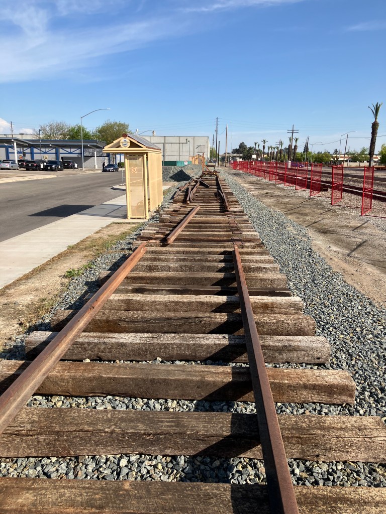
At the meeting I learned that the 1238 steam locomotive is scheduled to be trucked to Kingsburg on two flatbed trailers in early May. I hope I’ll be able to return for that operation, which is something you don’t see every day. I’ll leave you with a photo I took of the space next to the depot that volunteers are preparing for the steam locomotive, complete with some fancy red fencing. Beneath that is a photo of the locomotive itself, still cooling its heels in Fresno, waiting.
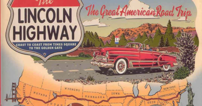
Regular readers of this blog will recall that, a few years back, I became intrigued with the Lincoln Highway. To refresh your memory, the Lincoln Highway was the country’s first transcontinental automobile route, dating back to 1913. It ran from Times Square, NY to Lincoln Park, CA.
Why is this car driving on the wrong side of the road?
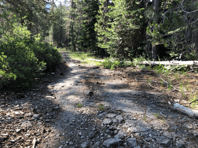
Today, most of the original route is long gone, largely superseded by modern interstates. But a handful of the original segments remain, like this crumbling roadway in the woods near Donner Pass that I (literally) stumbled upon in 2022:
Beware of trip hazards…
You may also recall that I once discovered a roadside memorial commemorating the Lincoln Highway and US Route 40, in Auburn CA. (In 1926, the feds adopted a numbering system for all US highways. The segment of the Lincoln Highway that passed through Auburn was rechristened with the unromantic name “U.S. 40.”)
A number of other remnants of the old Lincoln Highway remain. I’ve driven over segments in other states, such as Pennsylvania and Wyoming. And in an earlier blog, I shared this photo that loyal reader Brian W. took in Tama, Iowa.
Photo courtesy of Brian Weberg.
But it wasn’t until just recently that I realized the Lincoln Highway passes within just a few miles of my house. In fact, my favorite coffee place sits alongside the historic route, in a building that actually predates the Lincoln Highway. More on that in a moment.
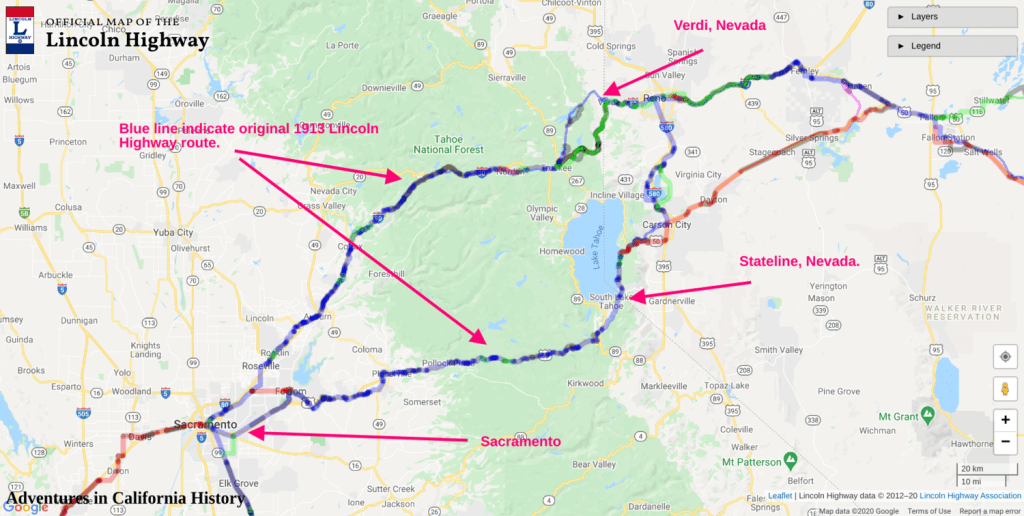
It should be noted that the Lincoln Highway forked in Reno, providing two routes into California. One (“the Pioneer Route”) went over Donner Pass and roughly followed modern Interstate 80. The other (“the Scenic Route”) passed south of Lake Tahoe and then roughly followed modern US 50. The two segments linked up again in Sacramento.
Map from the website “Adventures in California History.”
This came to my attention because last month the local historical society held a special program next to one of the longest original pavement sections of the Lincoln Highway, in El Dorado Hills. They even brought out a score of antique cars for the occasion. You can read the newspaper article here.
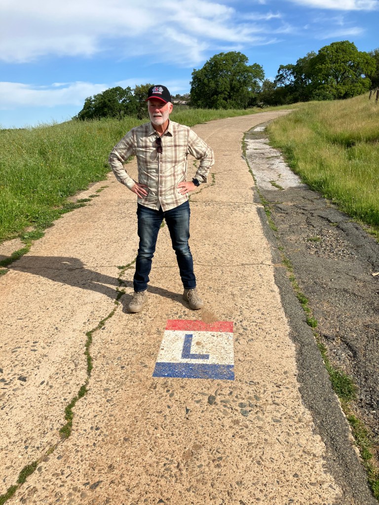
So my friend Bill P. and I decided to follow more of the original route here in El Dorado County. Using the El Dorado Hills segment as our starting point, we headed east toward Placerville.
Bill, astride an original segment of the Lincoln Highway that dates back to at least 1913. Note the distinctive Lincoln Highway logo.
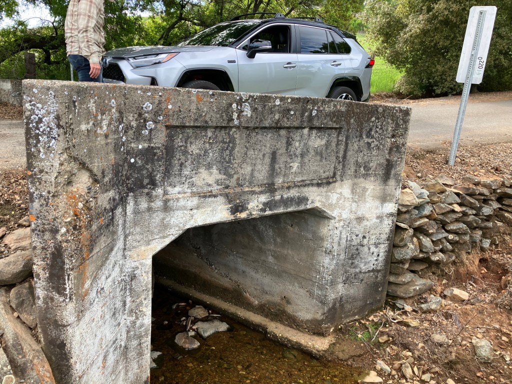
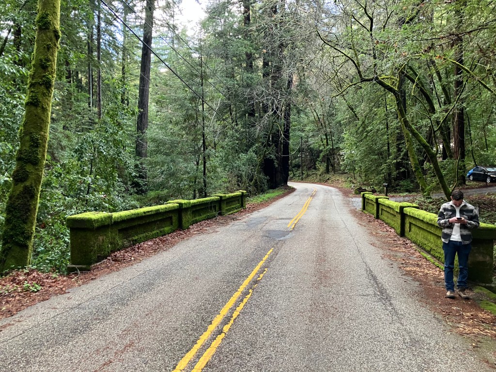
The surrounding countryside in this area looks, I presume, pretty much as it did a century ago, when a young Army officer named Dwight Eisenhower traveled the entire route in a military caravan. Even the bridges date to that era, I’d reckon.
Dwight probably crossed over this bridge in 1919.
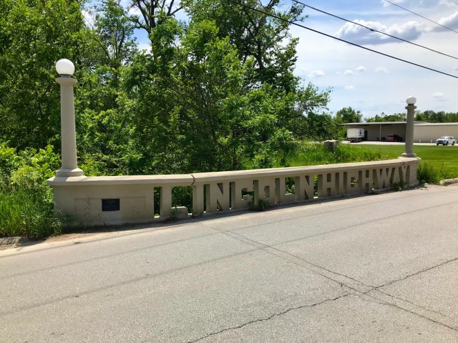
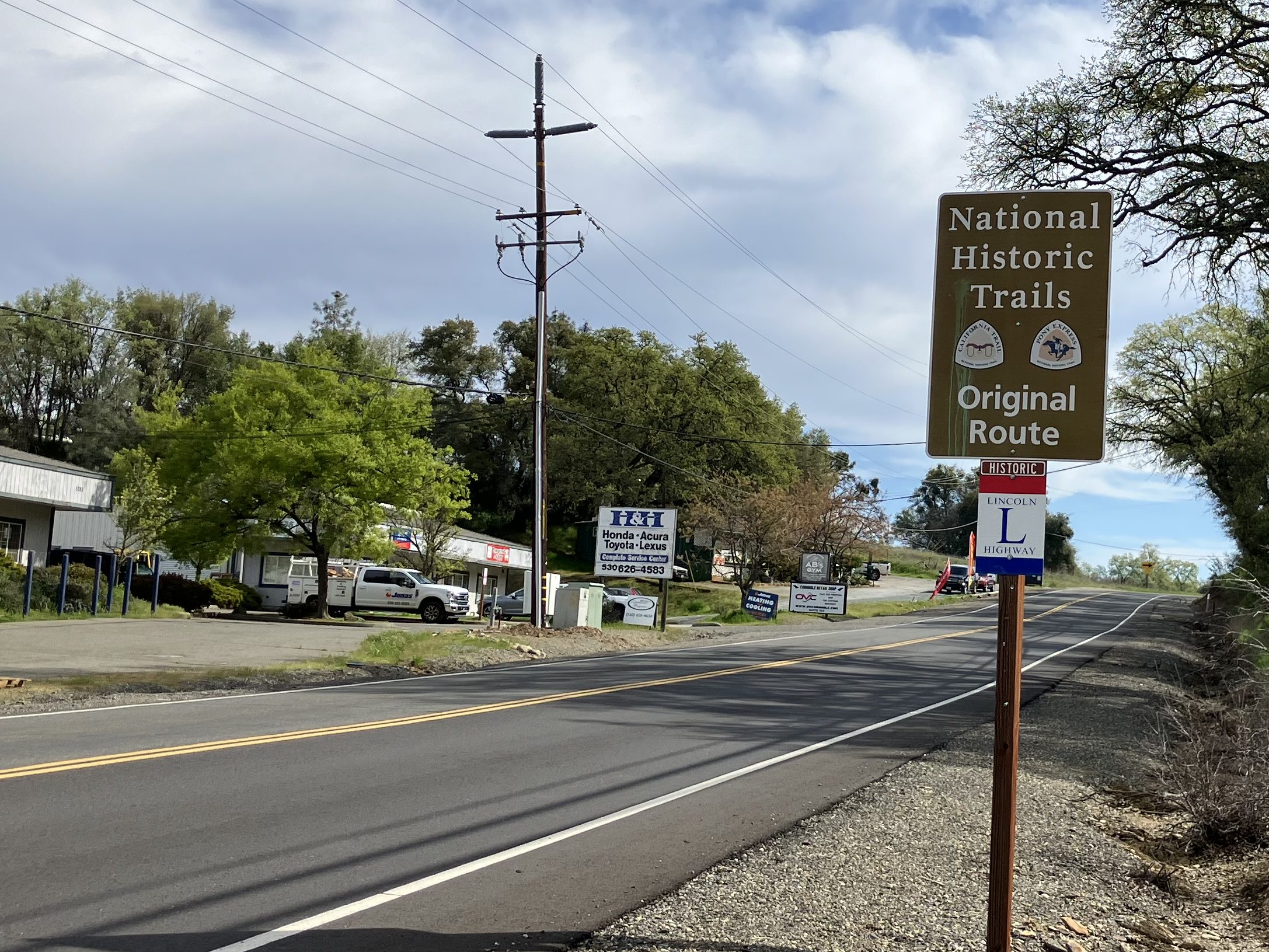
After a brief, unavoidable jaunt along US 50, we were back on the original alignment of the Lincoln Highway. There’s even signage to prove it!
Note the distinctive red, white, and blue sign.
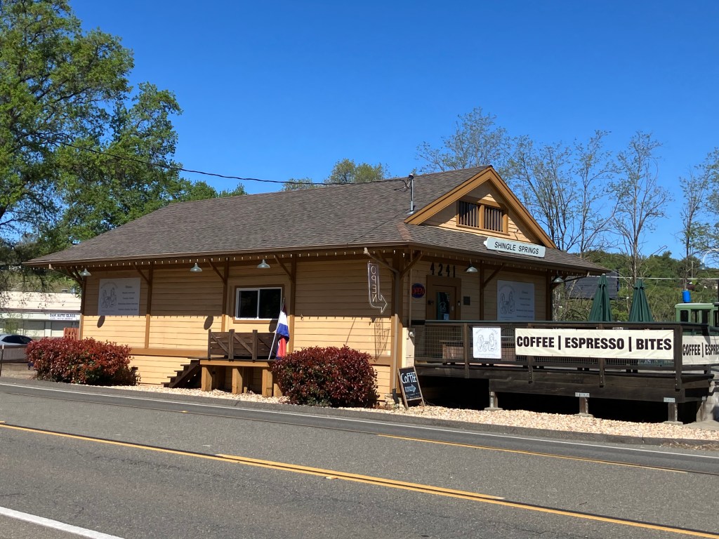
The historic Lincoln Highway route in western El Dorado County is moderately traveled and is flanked with a mix of modern buildings and historic structures dating back a century or more. An example of the latter is this 1896 freight depot in Shingle Springs:
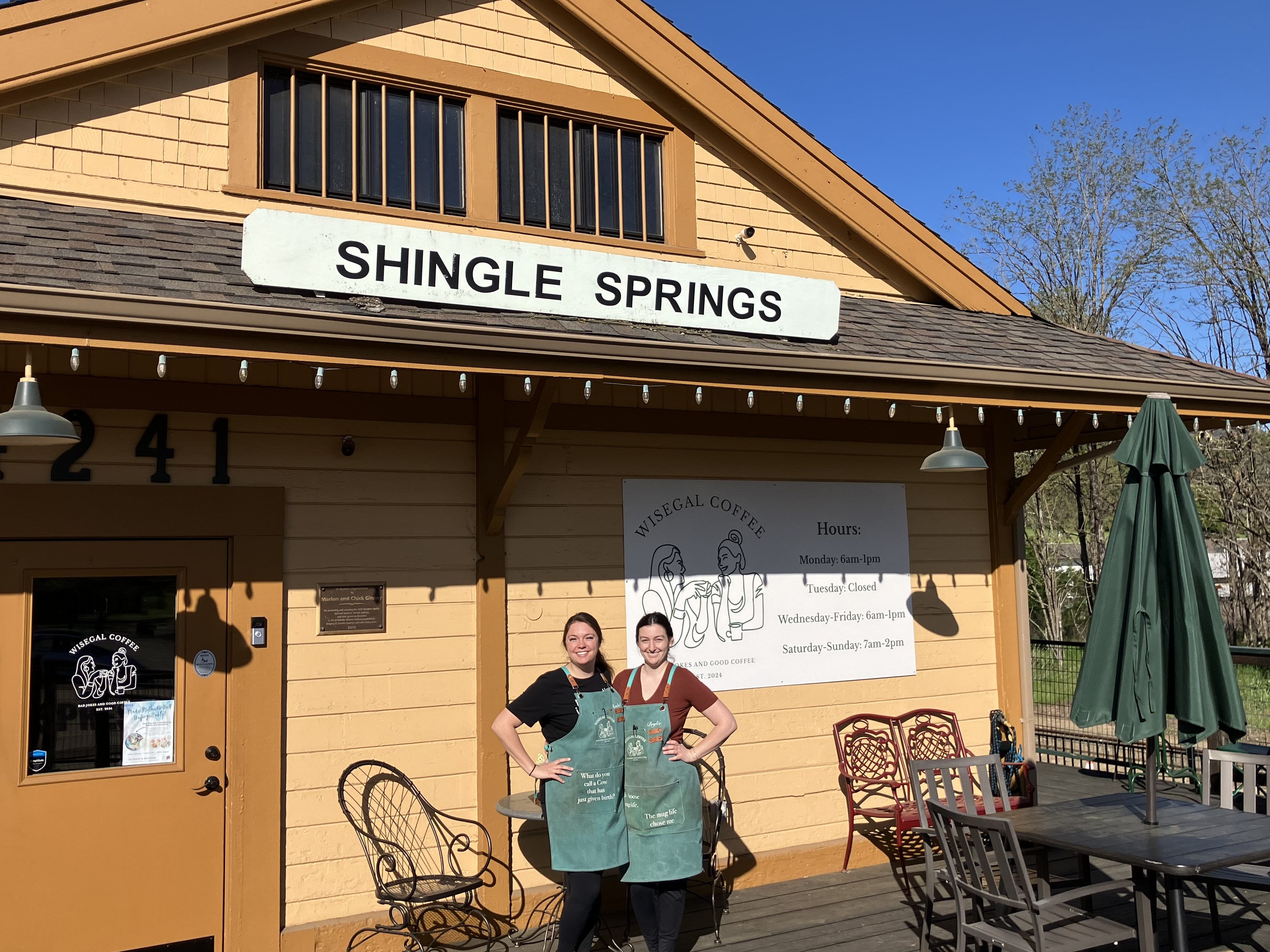
Since last December this depot has been home to Wise Gals Coffee. It’s become a popular community gathering spot and my favorite place to get coffee. I hadn’t realized it’s also on the Lincoln Highway! If you find yourself anywhere on the 3000-mile route, I insist that you stop in for a cappuccino.
Rachel Bezdek and Brylee Lance, the eponymous “Wise Gals.”
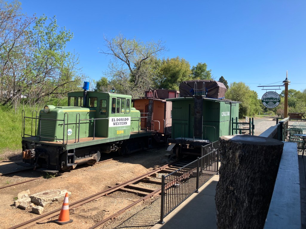
Oh, and not only is the original depot still standing; they’re still running trains! Southern Pacific abandoned the line forty years ago, but the tracks were taken over by the local historical society, and volunteers run trains on the weekends.
Railroad equipment next door to the depot.
After paying homage to coffee and trains, Bill and I headed back out on the old Lincoln Highway (signed as Mother Lode Drive in Shingle Springs.)
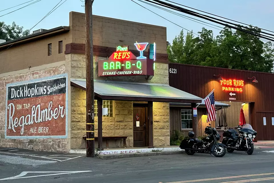
When we got to the town of El Dorado (pop: 4,000) the old Lincoln Highway (now called Pleasant Valley Road) took us right by the storied Poor Red’s BBQ. Allow me to quote directly from Poor Red’s website:
“Originally constructed as a weigh station for Wells Fargo, it previously operated under the name Kelly’s Bar from 1927 until 1945. Poor Red won the bar in a game of dice, and he and his wife and bookkeeper Rich Opal took it. The murals currently on the walls of Poor Red’s were installed in the 1940’s. They depict former employees and patrons, including their dog, which used to sit out front. It is rumored his dog ran for office, but he lost.”
Photo from S.F. Gate.
Poor Red’s, as you might know, is famous for the Golden Cadillac, a sweet cocktail with equal parts Galliano, cream, and creme de cacao. They claim to have invented the drink in 1952, and to be the world’s largest consumer of Galliano. Bill and I stopped in for lunch…
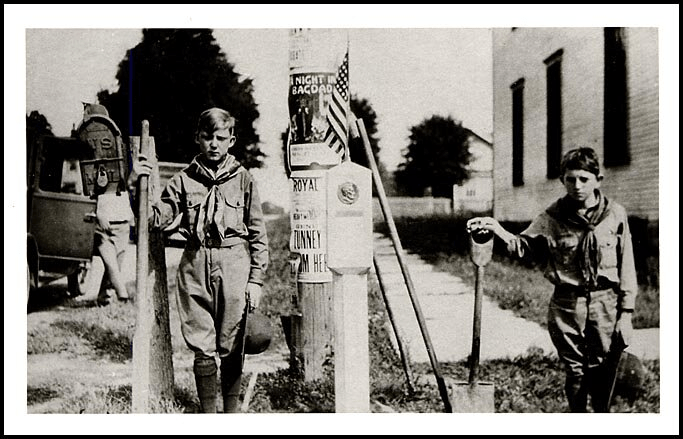
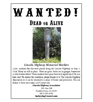
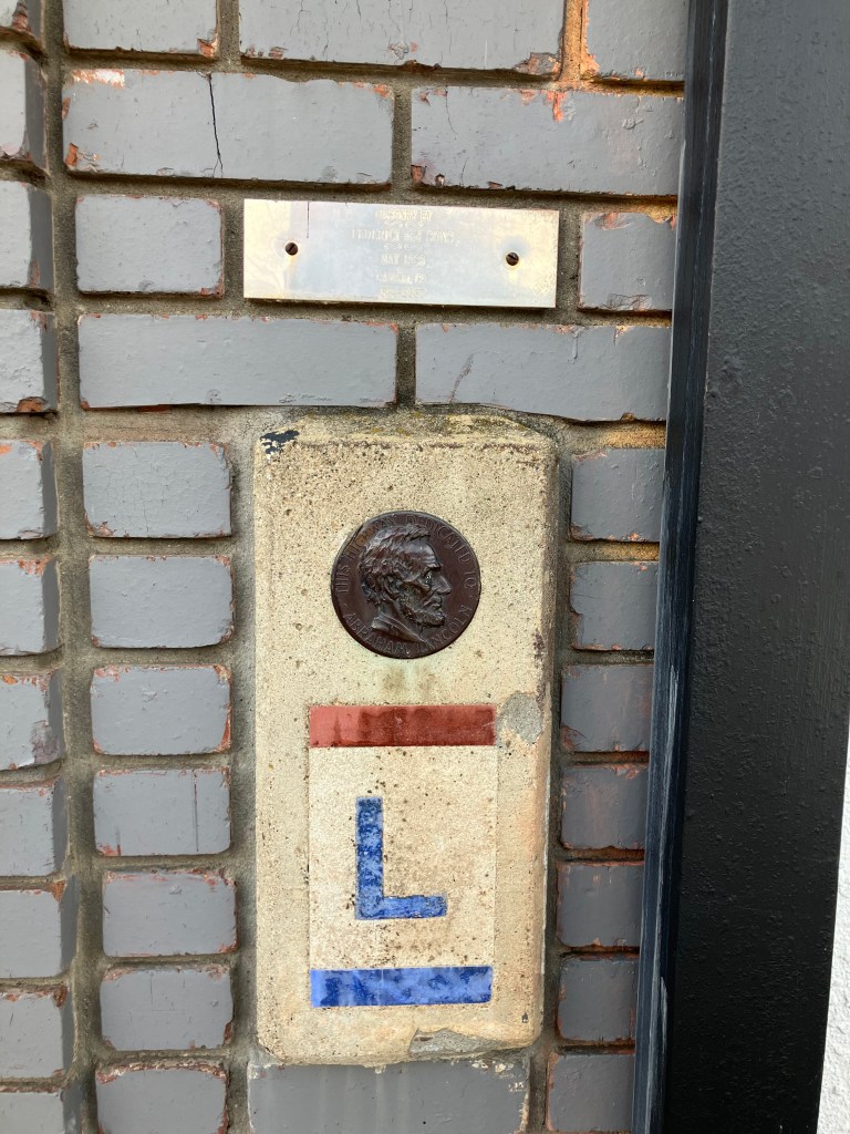
Next up, we stopped in at the El Dorado County Museum, which we knew has two original Lincoln Highway markers in its collection. One morning in 1927, exactly 2,436 of these cast cement markers were placed along the entire cross-country route by local Boy Scouts. (You can see one of the markers in my earlier photo of the Lincoln/US 40 memorial in Auburn.) Almost all the original markers are now gone, succumbing to road-widening operations, vandals, or weather. Given how iconic they are, Bill and I felt it important to see one “in the flesh,” as it were.
Poor little bastards.
We were met at the museum gate by one of the least helpful docents you’d ever want to meet. Us: “Hi! We understand you have a couple of historic Lincoln Highway markers on display!” Him: “Yes. They’re over there.” He gestured vaguely behind him to a bunch of clutter in a courtyard in front of the museum. But he continued to block the gate. Us: “Uh, could we see it?” Him: “We’re closed.” Us: (disappointed looks). Him: “You might be able to see it through the fence of the parking lot.” And with that he went back to torturing kittens or whatever it is he does for fun.
We did manage to take a photo through the metal fence. God forbid that we would have been allowed to set foot for a moment on the other side of the fencing.
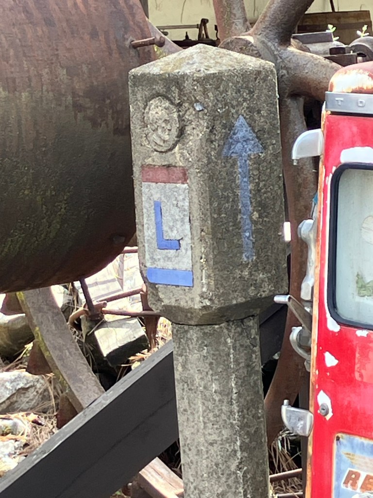
Note that the Lincoln head near the top is embossed. This seems odd; in all the other photos I’ve seen of these, the Lincoln head is on a round, bronze plaque.
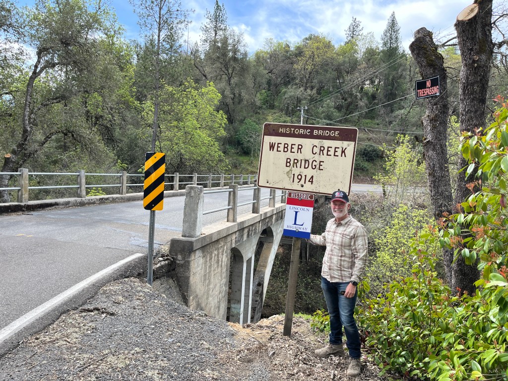
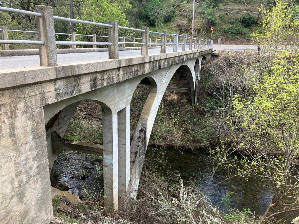
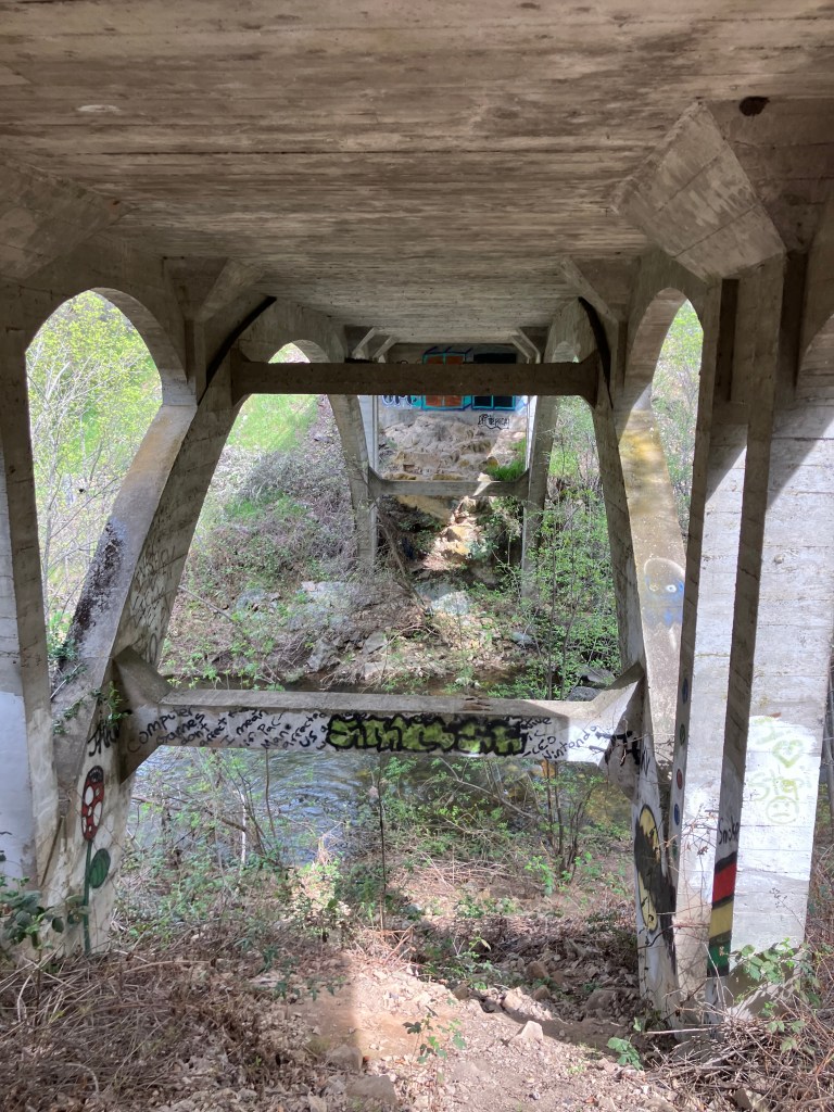
We returned to the Lincoln Highway, and once again felt like we’d been transported to the early 20th century. As we approached Placerville we crossed over the historic Weber Creek Bridge, which dates to 1914.
The bridge is in remarkably good shape for over 110 years old. A little research revealed that it’s one of only two “Turner Mushroom Slab” bridges in California. Evidently an engineer named Claude Allen Porter Turner patented a “flat slab support system” (which my wife tells me I could benefit from). But I think it actually has something to do with the way the concrete slabs are designed and assembled. Coincidental fun fact: Turner was born in 1869 in Lincoln, Rhode Island!
Quick! Find the “flat slab support.”
Finally we were approaching Placerville, which meant we had one more opportunity to get up close and personal with a Lincoln Highway marker. The Lincoln Highway through downtown Placerville is now Main Street, and our research suggested that one of the original markers had been discovered during an earlier road-widening, and cemented into the face of a brick wall. After a few false leads and a couple of illegal maneuvers, we found what we were looking for in the external wall of a restaurant:
The real deal!
It’s quite surprising how many of these remnants of a century-old highway remain, largely invisible or unacknowledged by galoots such as myself. My two recommendations to you, gentle reader, are (1) pay attention to the history near you; who knows what’s in your backyard!, and (2) ease onto the Lincoln Highway and make your way to Wise Gals for a cappuccino.
The San Francisco Bay Area today is associated with high-tech start-ups, a tangle of crowded freeways, ubiquitous Teslas driven by tech bros on their way to Starbucks, and outsize McMansions squeezed onto tiny lots that once were once cherry and apple orchards. It’s a thoroughly modern region, where Lime Bikes are available on every street corner and Uber Eats is more popular than McDonalds.
And yet here and there you can still find remnants of a long-forgotten, early-industrial past, if you know where to look. Recall, for example, my hunt last year for a century-old, half-sunken railroad ferry in Antioch. I’ve been struggling to articulate just why I’m find the presence of these historic relics so reassuring. To me they’re a tangible link to an obstreperous past that feels more palpable than our virtual this and digital that. The steam-and-iron age had its negative points, to be sure, but it also showcased our civilization’s determination, boldness, and energy. And yet I think there’s more to my interest in this stuff than just their Romantic aspects. By seeing these artifacts in the wild, rather than behind a museum display case, they are at once more authentic and better contextualized. They connect us to our own past. I’m thinking of that scene in the original Logan’s Run, when Logan 5 and Jessica 6 encounter the old man (played by Peter Ustinov). Even though their modern society worships youth, they are drawn to this ancient, bearded feller with connections to a forgotten time.
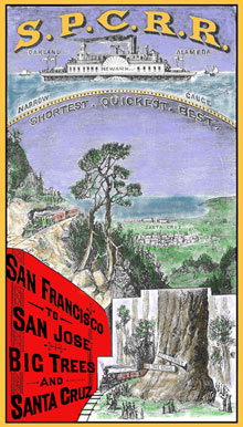
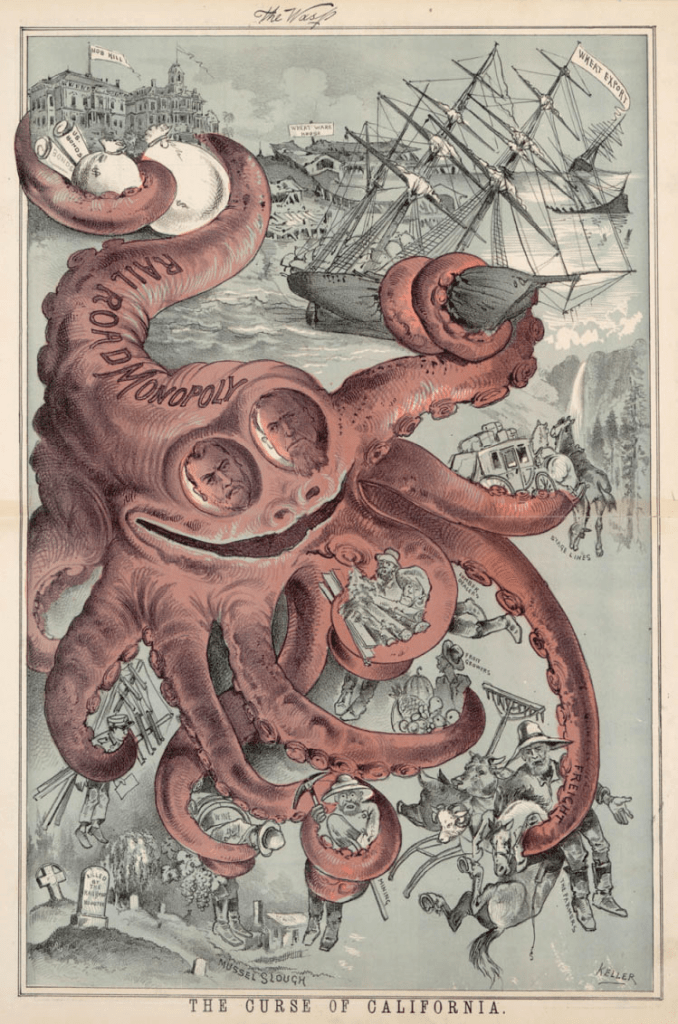
All this brings us to the South Pacific Coast (SPC) Railroad. It’s an audacious, independent Bay Area rail line that was established almost a century and a half ago. It was an earnest upstart that offered a cheaper alternative to the monopolistic Southern Pacific Railroad, which at the time held California in a “monopolistic death-grip.”
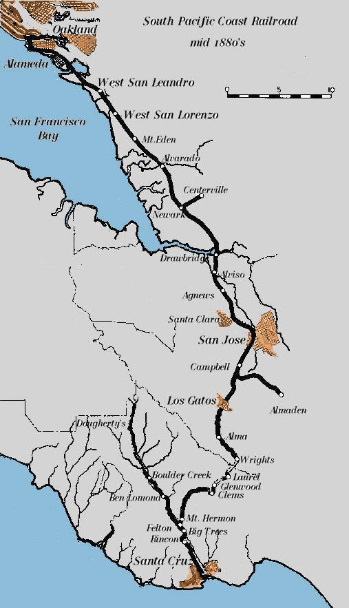
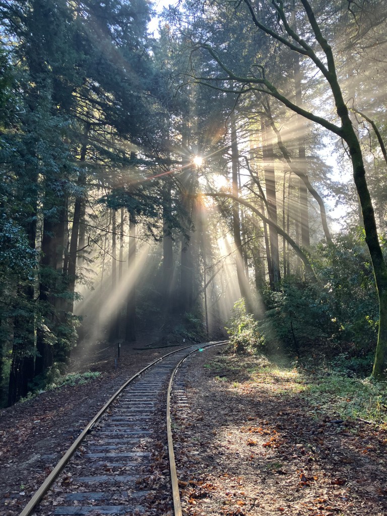
The SPC ran from Alameda down to Santa Cruz–a distance of about 77 miles. The stretch that crossed the Santa Cruz mountains, from Los Gatos to the coast, is especially impressive for a small, independent, narrow-gauge railroad. Trains traversing this section would snake their way through redwood forests, crossing gorges and creeks and passing through eight tunnels. And it was built in the 1880s! The line ended in the town of Santa Cruz.
The Southern Pacific Octopus eventually absorbed the SPC line. Then the route became unprofitable with the opening of Highway 17 between San Jose and Santa Cruz in 1940. That same year a storm destroyed major portions of the old SPC line, and the Southern Pacific decided to abandon much of the line rather than repair it. Trains have not traveled over most of the original line for about 85 years.
So what happened to the SPC’s tracks and tunnels after the railroad was abandoned? My son Ian and I spent two days following the old route in order to find out.
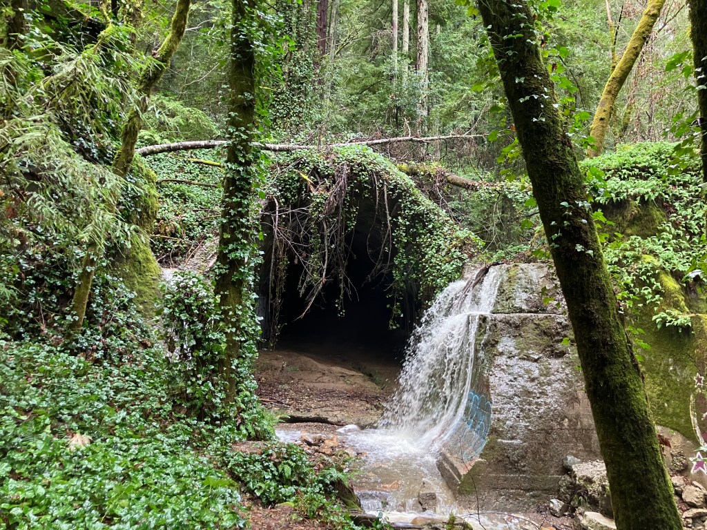
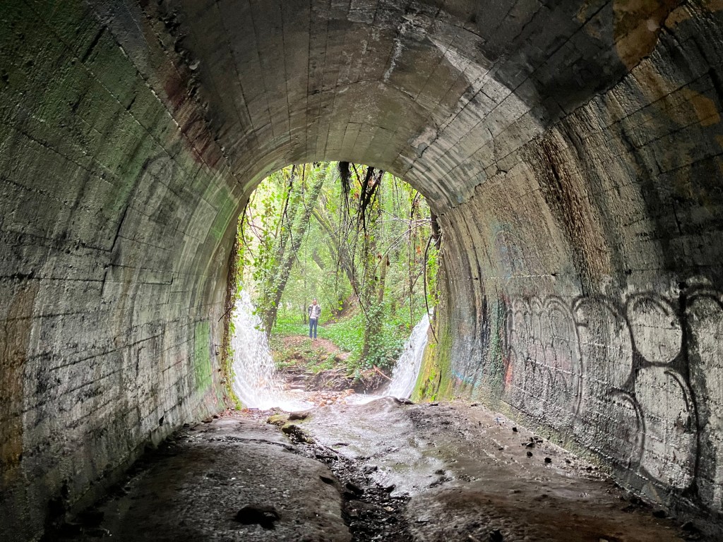
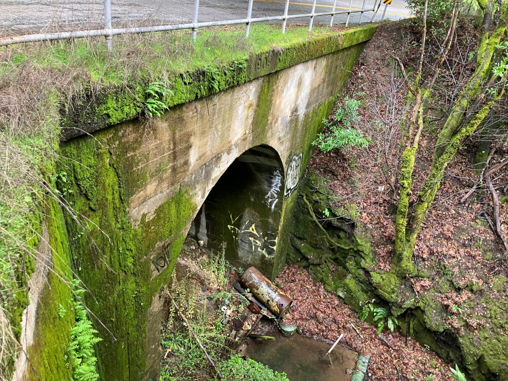
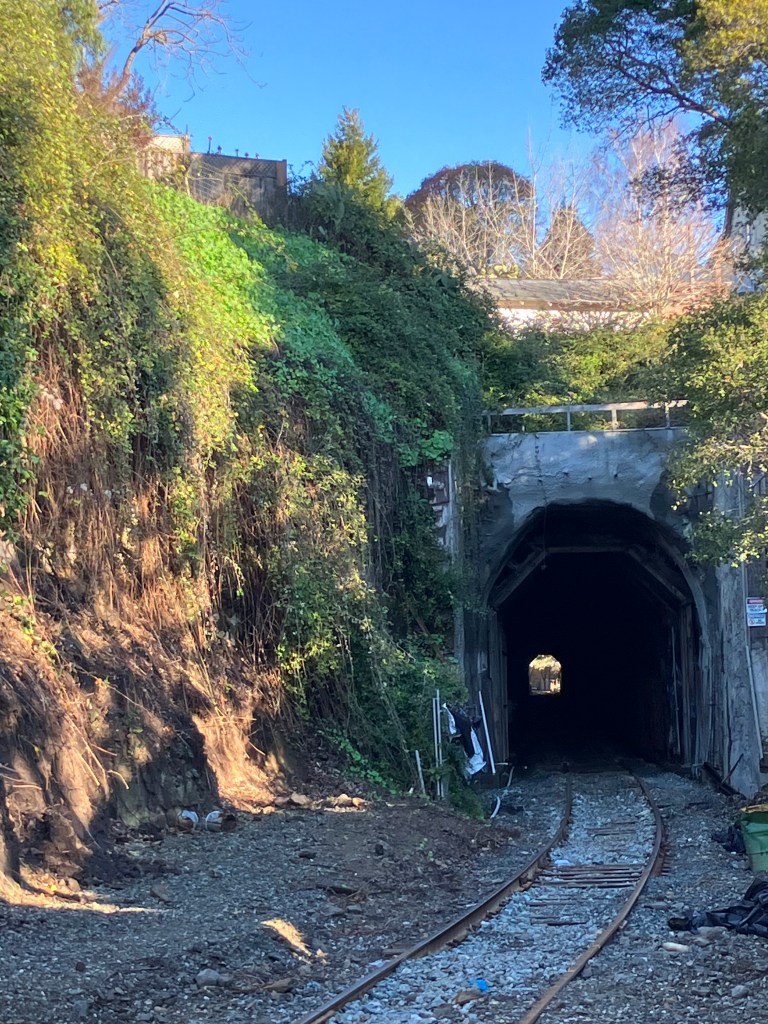
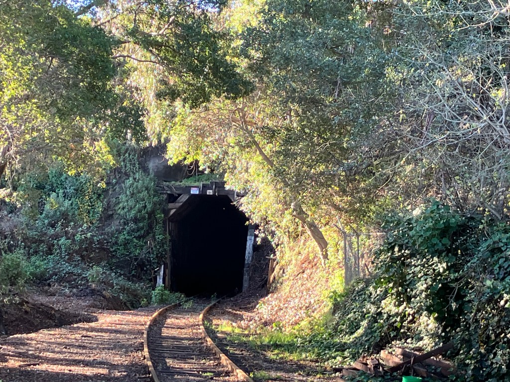
We focused primarily on those old tunnels. There were eight of them. Tunnel #1 was obliterated in 1903, and in the 1950s the area was inundated by the creation of Lexington Reservoir. So we moved on to Wrights Station, which is where Tunnel #2 was bored. And it’s still there! The trees and vines and moss of the Santa Cruz mountains are trying to reclaim the tunnel’s mouth, but a steady flow of water seems to be continuously scouring it.
South portal of Tunnel #2 at Wrights
View from inside Tunnel #2. Son Ian is (wisely) standing outside.
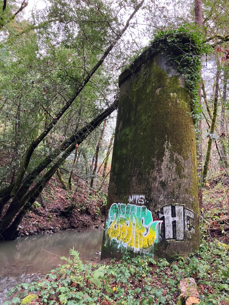
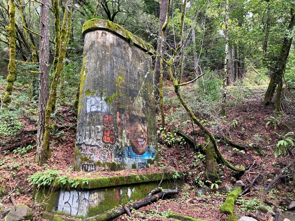
It’s somewhat eerie, these ruins from well over a century ago just silently sitting there in this remote forest. Graffiti reminded us we weren’t the only modern persons to discover these remnants of a past age, but it still felt as though we’d encountered something largely forgotten.
Railroad bridge pier near Wrights.
Another bridge pier, with impressive graffiti.
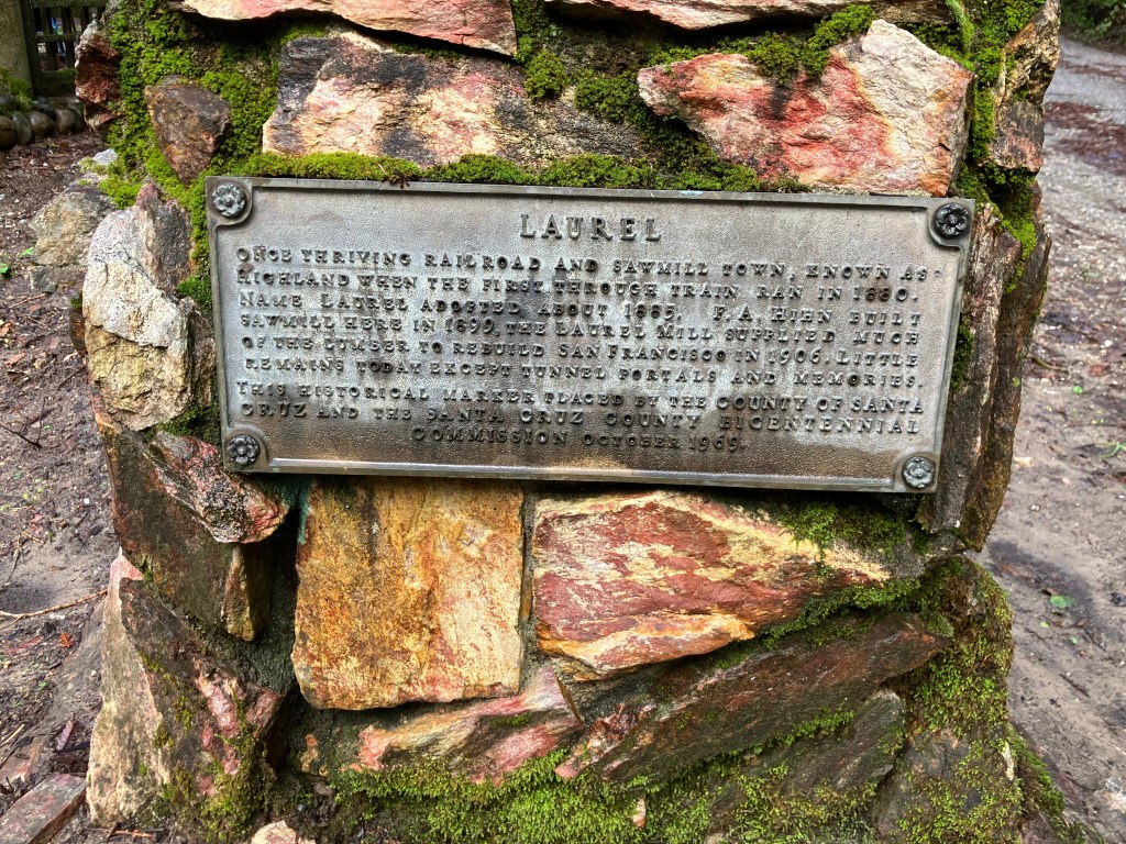
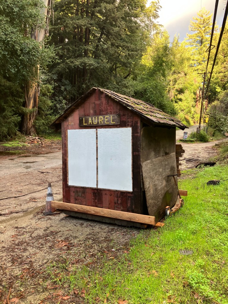
After Wrights we moved on to the town of Laurel (pop: one family). Laurel used to be a significant stop on the line, but today it seems to amount to just one house.
“Once thriving railroad and sawmill town, known as Highland when the first through train ran in 1880. Name Laurel adopted about 1885. F.A. Hihn built sawmill here in 1889. The Laurel Mill supplied much of the lumber to rebuilt San Francisco in 1906. Little remains today except tunnel portals and memories. This historical marker placed by the County of Santa Cruz and the Santa Cruz County Bicentennial Commission October 1969. “
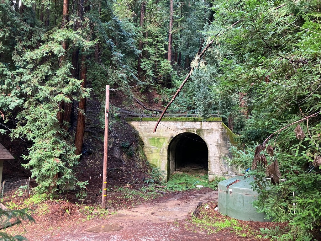
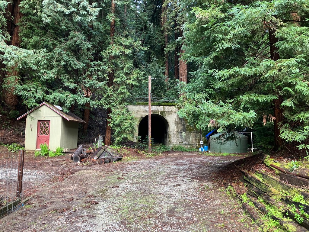
Apparently, that one home now owns the portal to Tunnel #3 in its backyard. And because the portal is on private property, there’s no graffiti. Once again, it strikes me as an eerie remnant of a long-abandoned railroad that looks very much like it did a century ago.
North portal to Tunnel #3.
Another angle of Tunnel #3. Can you imagine having an old railroad tunnel in your back yard?
Little shed near the tunnel portal. I assume it dates back to the SPC?
We found the south portal to this same tunnel emerging under a residential road in Glenwood, This end too appears to be part of someone’s back yard. I would have killed to have had a historic railroad tunnel in my back yard while growing up!
South end of Tunnel #3.
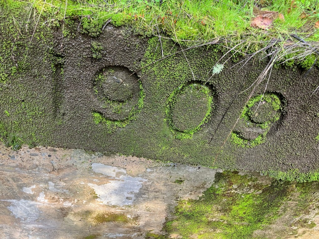
This tunnel, like several others on the SPC line, was re-constructed after the 1906 earthquake. (The SPC crosses the San Andreas fault.) While they were at it, they widened the tunnels to accommodate standard gauge (about 20 inches wider than narrow gauge.) This tunnel bears a 1909 marker, which presumably is when the tunnel was widened.
Detail from top of the tunnel.
A little further along we were able to catch a glimpse of Tunnel #4, dubbed “Mountain Charlie.” It was a ways up a private hillside, and we couldn’t access the property. But, like the others, it had a visible concrete portal with lots of moss but unmarred by graffiti. What do these families do with these tunnels? (I should note that Southern Pacific dynamited about half of these tunnels in 1942, so you can only go into the mouth of the tunnel for a little bit before encountering a wall of rubble.)
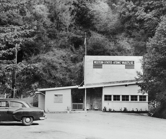
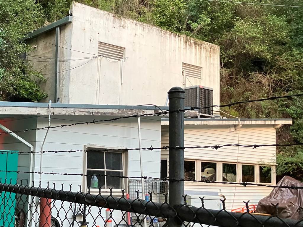
Next up was Tunnel #5: the Zayante tunnel. It’s only about 250 feet long, bored into granite. And this one was not dynamited. Still, it took us awhile to identify it. A little research revealed that a company called Western States Atomic Vaults, Inc sealed off both ends of the tunnel and turned it into a climate-controlled data storage facility at the height of the Cold War. I’m not making this up. Ownership has passed a couple of times, and today it’s owned by Iron Mountain. Reportedly it contains mainly microfiche and microfilm, as well as some original reels of Disney movies.
What used to be the south portal of Tunnel #5.
Same tunnel portal, today.
We were unable to get to Tunnel 6, which was down a steep gorge that was beyond our climbing skills.
Tunnel 7 no longer exists; it was “daylighted” (I,e, the top was removed) some years ago. This stretch of the line, however, still carries rail traffic. The Santa Cruz, Big Trees and Pacific Railway runs an excursion train from Felton to the Santa Cruz Beach Boardwalk. Here’s a picture of the track near the location of the daylighted Tunnel #7.
Stretch of the original trackbed, on which an excursion train now runs. I call the lighting in this photo “Voice of God.”
Finally, we ended up in Santa Cruz, where the final tunnel is still in operation! It’s a short tunnel that passes under Mission Santa Cruz. The Santa Cruz, Big Trees and Pacific Railway still uses this tunnel for excursion trips from Felton.
Tunnel #8, viewed from the south.
Tunnel #8, viewed from the north. It’s next to a lumber yard in the middle of Santa Cruz.
So that’s it for the tunnels. To reiterate, I’m surprised so much of the infrastructure is still around, even though most of it hasn’t seen a train in over 80 years. The fact that they’re mostly on private property or out of the way has contributed to their surviving this long.
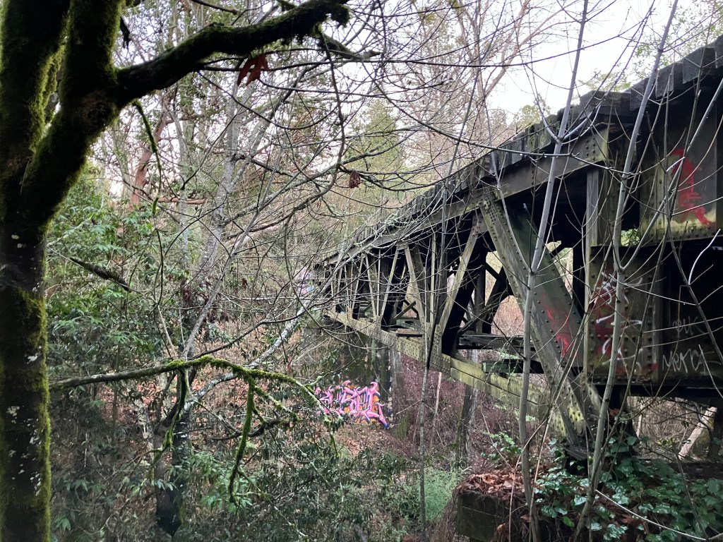
Here are a couple of other photos of remnants of the old SPC:
Girder bridge, slowly being reclaimed by nature.
Random road near the railroad right-of-way. This road is still in use and not technically part of the SPC. But I thought it gives a good flavor of the remote, forested environment.
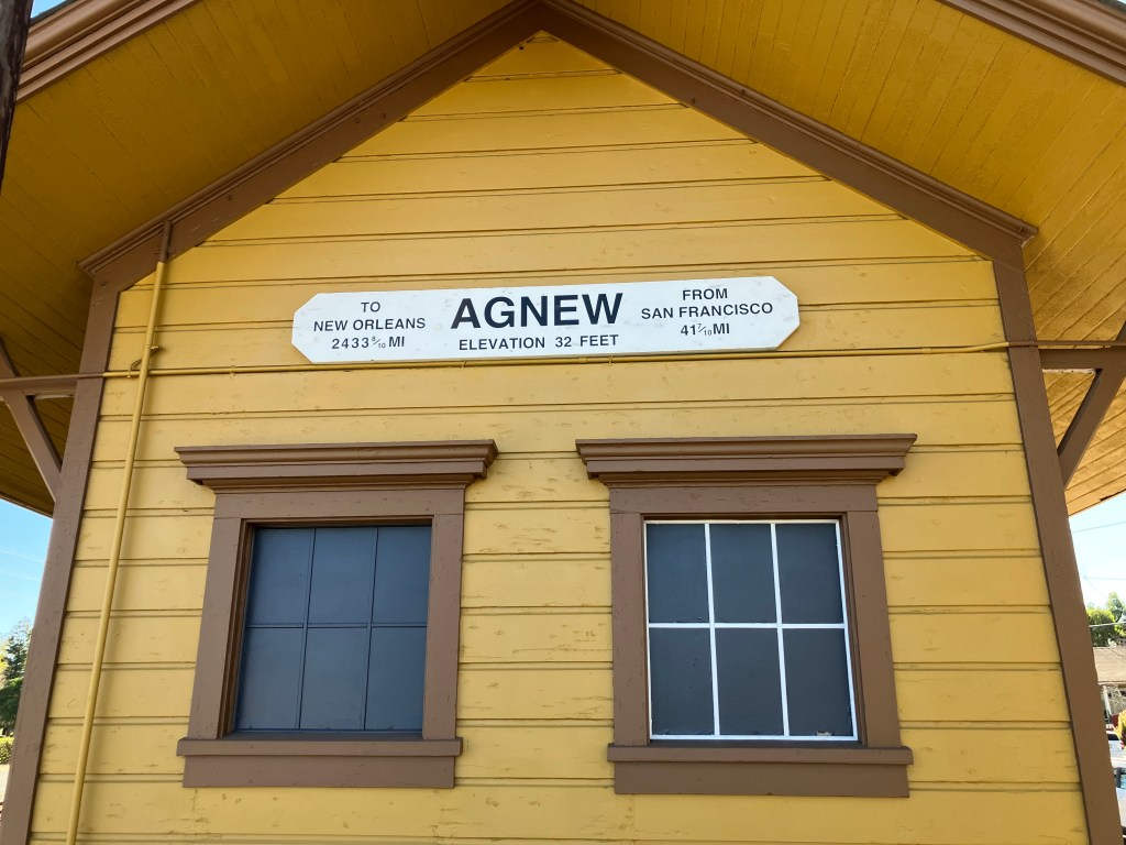
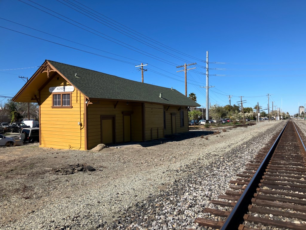
Only one station remains of the original stops on the SPC line. It’s the Agnew station in Santa Clara, and it was built in 1877. Passenger and freight service at the depot ended long ago, although trains still pass by the station on the active tracks next to it. The station is now owned by the California Central Model Railroad Club.
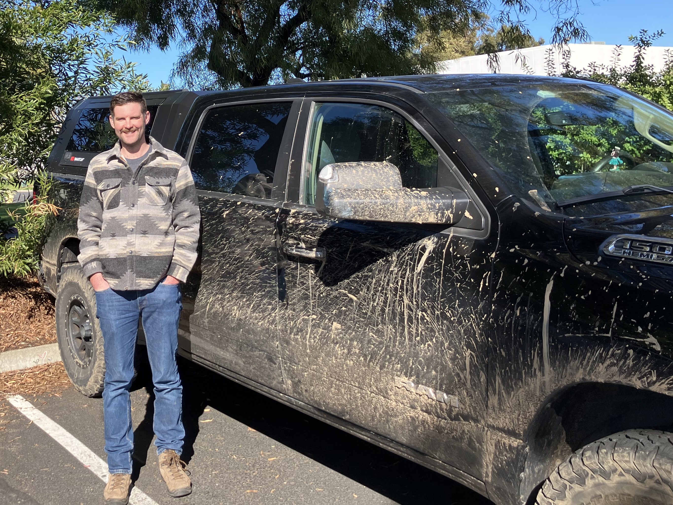
So ends our adventure. If you want to learn more about the SPC, there’s a wonderfully helpful and informative site called “Abandoned Rails” that has a lot of SPC’s back story, an interactive map, and other cool stuff. Thanks also to Uncle Edward and his Dome o’Foam for his helpful tips. Now all that’s left is to wash Ian’s truck!
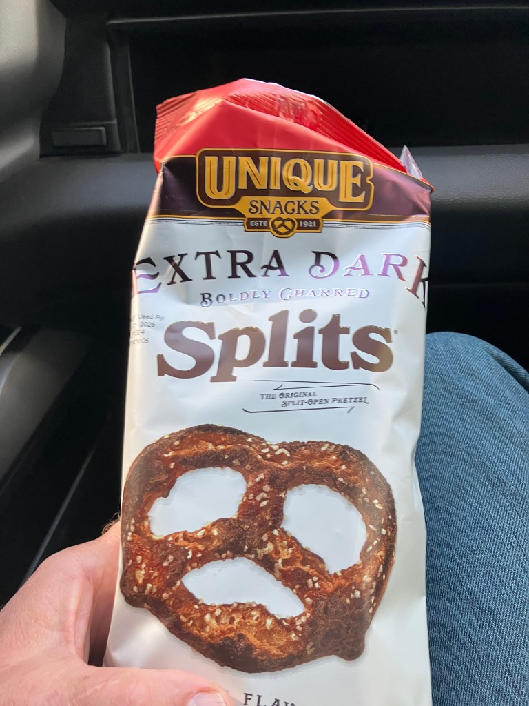
TREAT (?) of the DAY
During our adventure we stopped at a remote market to replenish our snack supply. For reasons that I really can’t explain, I chose this bag of “Extra Dark Boldly Charred Splits.” It seemed like a good idea at a time.
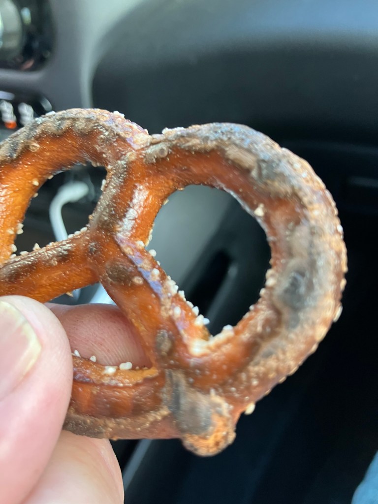
The “Unique Snacks” company lived up to their name, but not in a good way. These were essentially nothing more than burned pretzels.
“Boldly Charred” my ass!
They are as dry as a discarded empty canteen in the Sahara, and they have the flavor profile of a Kingsford Briquette. I seriously suspect that something happened to the oven at the Unique Snacks Company, which resulted in a month’s pretzel production being irrevocably burned. But rather than throw away the torched snacks, some marketing genius said “let’s just change the package to say ‘boldly charred!'” Doesn’t an analogous story lie behind the popular “sour” beer style and the invention of buttermilk?