T.S. Eliot called April “the cruelest month,” but I’ve always felt that January is more deserving of that title. This is of course largely due to the obvious and excruciating bathos occasioned by sudden termination of a string of merry holidays–all the decorations, costumes, huge meals, family reunions, parties, and music come to a screeching halt after a superfluous sip of champagne and a perfunctory kiss from our sweetheart literally at the first moment of January.
“ I think we are in rats’ alley/Where the dead men lost their bones.“
But there are other reasons I nominate January as the cruelest month. January is cold and dreary; the skies are gray and the trees are bare and the front lawn is brown. The rain curtails outdoor activities, and even if you do get a clear day, the sun seems to set just a few hours after it rises. Add to this the arrival of W-2’s and other tax forms that signal the unwelcome beginning of tax season. And if that’s not enough, January is the month with the most American deaths. According to the CDC, about a quarter of a million of us die each January. Cruel indeed!
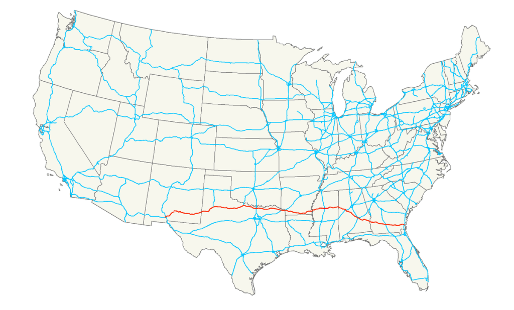
Faced with 31 days of this wintry and literally life-threatening cruelty, I decided it was time for a road trip. A change of scene might do me good. And even if I can’t escape the month, perhaps I can escape the worst of the weather. So I consulted my trusty Atlas and searched for a suitable route in the South. And I came up with US Highway 82.
Highway 82 was established in 1931, initially as an east-west route between Mississippi and Arkansas. It was extended over the years, and today it runs from Alamogordo, NM all the way to Brunswick, GA on the east coast.
Route 82: The Official Highway of the Cruelest Month.
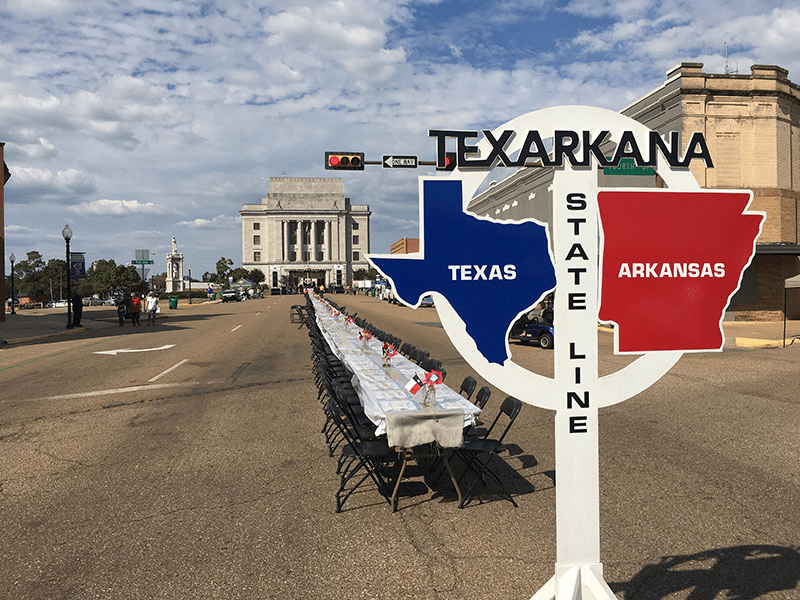
I’m not going to be driving the whole route, however. I’ve already crossed the Texas panhandle more times than I’d like to remember. Therefore, I’m going to begin my journey at the Texas-Arkansas border, in the imaginatively-named town of Texarkana.
The town that takes the concept of drive-through dining to a new level.
The drive from Texarkana to Brunswick is about 900 miles, and I plan to get there on Tuesday evening. Then, on Wednesday I’m going to make a special side trip before heading home. I won’t reveal the surprise, but suffice it to say that it will be a monumental achievement in the Boilard Travel Archives.
Right now I’m at Sacramento Intergalactic Airport, waiting on a red-eye flight that departs at 11:59 pm. I’ll be in Texarkana tomorrow morning, so expect my first blog post from the road tomorrow night.
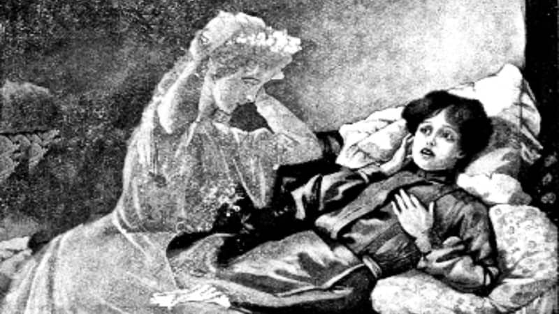
I hope you all enjoyed this month’s Halloween offering, “A Dying Wish.” Of course, the way the timing worked out, the story ended on October 30 (All Hallow’s Eve Eve). So for today, which is Halloween proper, I offer this “true” ghost story for Halloween.
[Editor’s Note: Long-time readers may recall that I related this incident some years back, while I was on my US Route 60 trip. But that story appeared in the days when I was composing my so-called “blog” in Google Docs and emailing it to a small number of friends, so you might not have seen it. We pick up the story on Day 7 of my trip, as I’d entered West Virginia.]
It struck me today that this drive across the country on US 60 is similar in many ways to my trip across the country last fall on US 50. Sure, US 50 is a northern route, and US 60 is a southern route, so they each have a distinct flavor. But there are many similarities between the roads. Both are mainly two-lane highways, and both cut through the middle of countless towns. The two roads even end up in the same state, not too far apart. And this morning I was feeling that this leg, through West Virginia, feels as remote and lonely as US 50 passing through Nevada. They call that stretch of US 50 “The loneliest road in America,” and for good reason. In a similar way, today’s stretch of US 60 had me driving for long stretches without seeing a town or even another car. It’s not a bad thing. In fact, it’s pretty therapeutic to be driving all alone along a windy road closed in on both sides with foliage. It’s calming and gives you time and room to meditate.
The narrow ribbon of asphalt that is US 60, cutting through the briars and brambles of The Mountain State.
As the afternoon wore on, the sky began to cloud over and the mountains began to take on a more melancholy feel. I was passing through the unincorporated village of Sam Black Church (named after a church building, which itself was named after an itinerant 19th-century minister). Here’s the church:
A white church named Black.
As I was passing through the deserted village and sensing the melancholy air, I came across this sign:
Roadside ghost story.
This was awesome! A “real” ghost story! (The full tale is explained here, in Wikipedia.)
Maybe it was just how my mood was affected by the weather and the long, solitary drive, but I felt compelled to find the grave of this Zona Heaster Shue. Surely she would be buried close by. After a quick consultation of Find-a-Grave on my iPhone, I found that she was buried in a churchyard just a few miles away. I set out for Soule Chapel Methodist Cemetery. The route was a narrow, twisting road over some hills, without a living soul anywhere in sight. Not so much as a grazing horse was out in the fields.
A good road for ghostspotting.
Finally, I arrived at the cemetery, which turned out to be a 150-year-old churchyard next to a white clapboard chapel. It was the perfect setting for a ghost sighting.
“So sure of death the marbles rhyme, yet can’t help marking all the time/How no one dead will seem to come. What is it men are shrinking from?” -Robert Frost
I walked among the graves and quickly found Zona’s headstone:
I have to admit that, while it was gratifying to have found the “ghost’s” grave, I was disappointed that the headstone looked so much fancier, perhaps newer, than the others in the cemetery. And it’s a little garish to identify her as the Greenbrier Ghost on her headstone. (The ghostly phantom you see in the headstone is my reflection, which just goes to show how shiny the headstone is.)
I should point out that this is Zona’s second headstone. She was first buried shortly after her death, but after her ghost supposedly appeared to her grieving mother, the authorities were compelled to exhume her body. Her corpse showed evidence (earlier overlooked) that she’d been murdered, and her husband was implicated and soon sent to prison. When she was re-buried, someone saw fit to identify her as the “Greenbrier Ghost” on her headstone. I assume that she’s OK with that, because even in death she doesn’t seem to be shy about communicating her complaints to others.
OK–It’s me again, on Halloween 2023. I hope you enjoyed all this month’s spooky offerings. Feel free to suggest your ideas for next October! Meanwhile, watch this space for another road trip soon.
NOTE: As we take the weekend off from our Halloween tale, I figured I’d update my loyal readership on my latest travels (which is, after all, the putative purpose of Chasing Phantoms.)
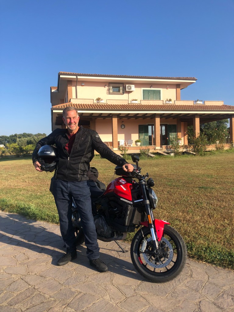
Last week I took a motorcycle trip in a formerly fascist country that’s now run by a far-right government, where people treat traffic laws as mere suggestions, and where still-active volcanoes periodically spew lava. What could go wrong?
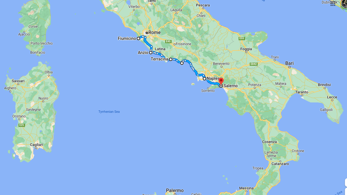
I speak, of course, of Italy. My wife and I decided to take a trip to Europe, and as part of our Preserve The Marriage Pact (whereby we try to keep at least two countries between us while on vacation), she went to Portugal and I got The Boot. I rented a Ducati motorcycle with the unsettling model name “Monster,” and started cruising down the Italian coast from Fiumicino to Salerno.
To paraphrase Joel Coen: “We rent monsters and then we can’t control them.”
My route in blue.
Now, the Internet already has tons of reviews and photos of Italy’s coastline, so I’m not going to add to that saturated theme. But I would like to make a few observations about Italy’s drivers. You may have heard that they’re insane. That charge is patently unfair–to the mentally ill.
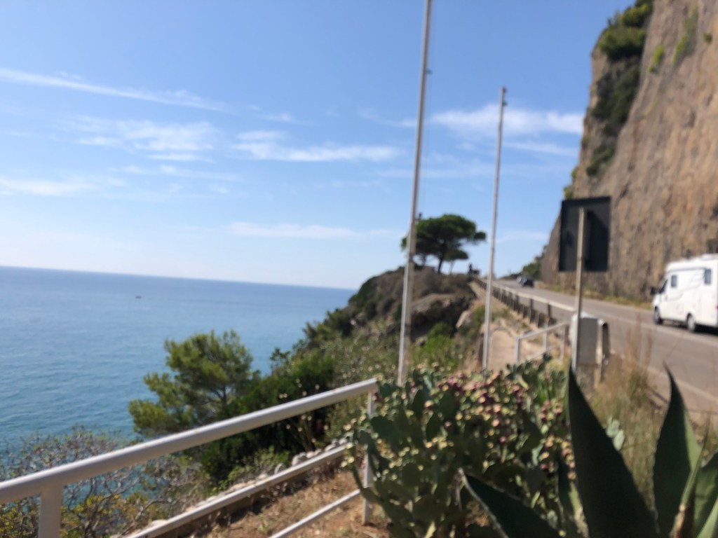
Let me paint a picture for you: Most of the roads I’ve been riding are two lanes (i.e., one in each direction). The lanes are narrow, but they’re sufficient to allow one car width each. So I can comfortably keep the Monster in the center of my lane. Periodically another motorcycle will pass me in my lane, which makes for a pretty tight squeeze, but you get used to it. However, cars do the same thing; they come up behind me and pass me in my lane.
The real challenge, though, comes from the oncoming vehicles. In my lane. Seriously. Sometimes oncoming drivers find that there’s no room left to pass someone in their own lane, so they shift over to the opposing traffic lane to pass. But they are totally unconcerned about the presence of other vehicles. As a result, many times I looked ahead to see an Alfa Romeo coming straight at me at 100 km/hour. I get the sense that whoever’s got the smaller vehicle is the one who’s expected to take evasive action, so, since I’m on a motorcycle, I move toward the right shoulder and let the guy pass me. Did I mention this all takes place in my lane?
Not much margin for error.
The other notable thing is the speed of traffic. These coastal roads have posted speed limits of anything from 30 km/hr up to 80 km/hr. (The inland “Autostrada” goes up to 130 km/hr.) But on all these roads they might as well display meaningless symbols like the one Prince confusingly adopted, since the actual speed of traffic bears no relationship. Periodically you’ll see a sign that says “controllo della velocita con sistema Tutor,” which seems to mean that speed is monitored electronically. Either these are just empty warnings, or half of Italy’s GDP is based on traffic fines.
Where’s the fire, Mac? Can’t you read the signs?
And then there’s Naples (pop: 900,000). Naples makes the hazards of Italy’s coastal motorways seem like the Autopia at Disneyland. Neopolitans must dodge speeding, swerving cars and everyone tries to avoid the motorcycles that are parked helter-skelter…and that’s just the sidewalks I’m talking about!
A rough approximation of driving in Naples.
I can’t let this topic go without commenting on Italian parking. To be fair, these people are pros. They can parallel park a 9-foot minivan into a 9.5-foot space. And I have proof. Check out this video I took from my hotel room in Rome, figuring I’d need it for my insurance claim when the guy hit my motorcycle. Somehow there was no collision!
Anyway, it’s the smaller towns where one really experiences Italy’s charm. For me, the unsung gem is the town of Anzio (pop: 60,000), where I spent my first night. Anzio is an unpresupposing fishing port just a little south of Rome. Ancient ruins from the Roman empire (including the remains of Nero’s villa) still stand in the town, largely ignored by the residents. And, somewhat randomly, it’s a sister city to Brooklyn.
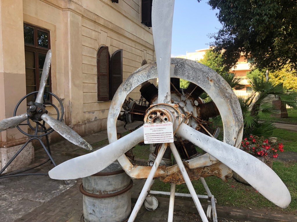
In January 1944 Anzio was the site of an Allied landing which slowly (over four long months) pushed the Germans out of their strongholds and eventually led to the liberation of Rome. This paved the way for D-Day and, ultimately, the defeat of Germany. Anzio seems to be quite proud of its accidental heritage, and the local museum is largely dedicated to the allied landing.
Recovered WWII propellers outside the Anzio BeachHead Museum.
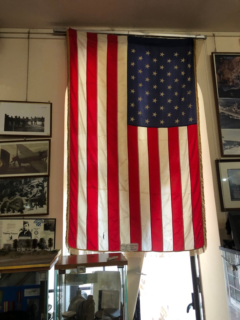
Recovered American flag. I tried to point out to the docent that the flag was hanging backwards, but he didn’t seem too concerned…or, more likely, he didn’t understand my rudimentary Italian.
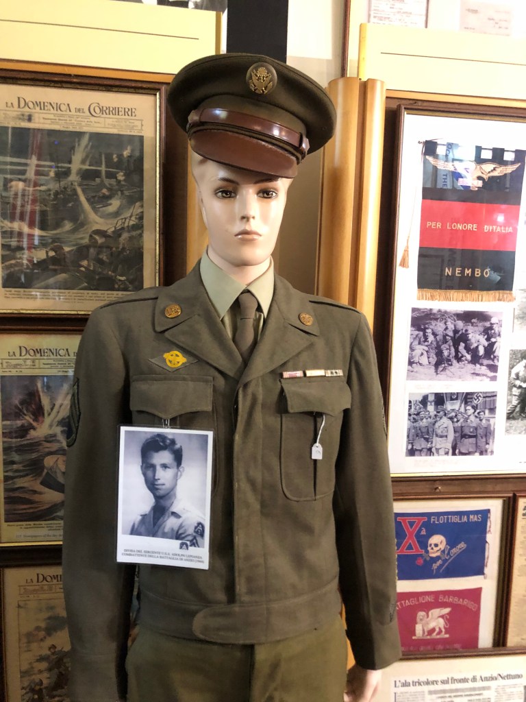
Does the mannequin used to display this soldier’s uniform look a little, uh, feminine (compared to the photo of the soldier)?
And what’s up with this soldier’s headgear?
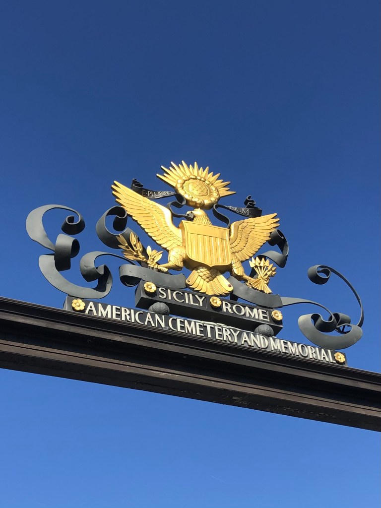
Anzio also hosts an American cemetery with the remains of over 7,800 American war dead.
A small portion of a very large sacrifice.
For me, the best part of Anzio was the Villa Romano B&B. It’s a spacious and comfortable home off the beaten track. It’s also the family homestead of brothers Alessandro and Francesco, whose family has deep roots in the town. They were the perfect hosts, and shared good tips for visiting the area. Francesco tells me they’re planning to open an American-style barbecue restaurant and plant a vineyard on the property. If you ever find yourself in central Italy, you must visit.
Hanging with Alessandro.
Anyway, I promised not to try to replicate the much-better Italian travelogues that are readily available online. So I’ll say “Arrivederci.” I’ll be back Monday with the next installment of A Dying Wish.
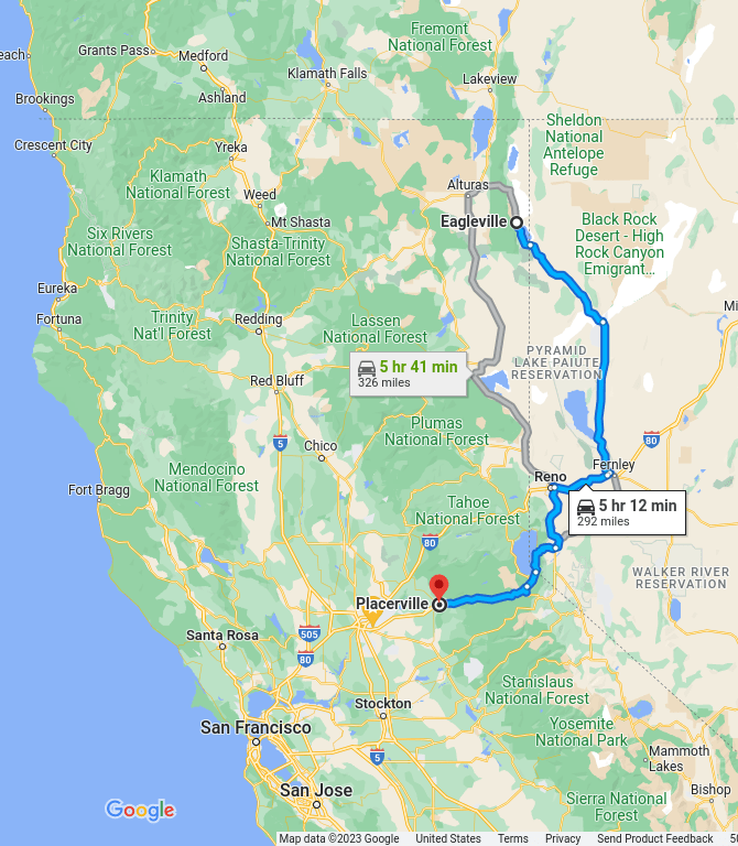
After completing my mission at Eagleville, I headed homeward on NV 447, then back into California via Reno.
My route home (in blue).
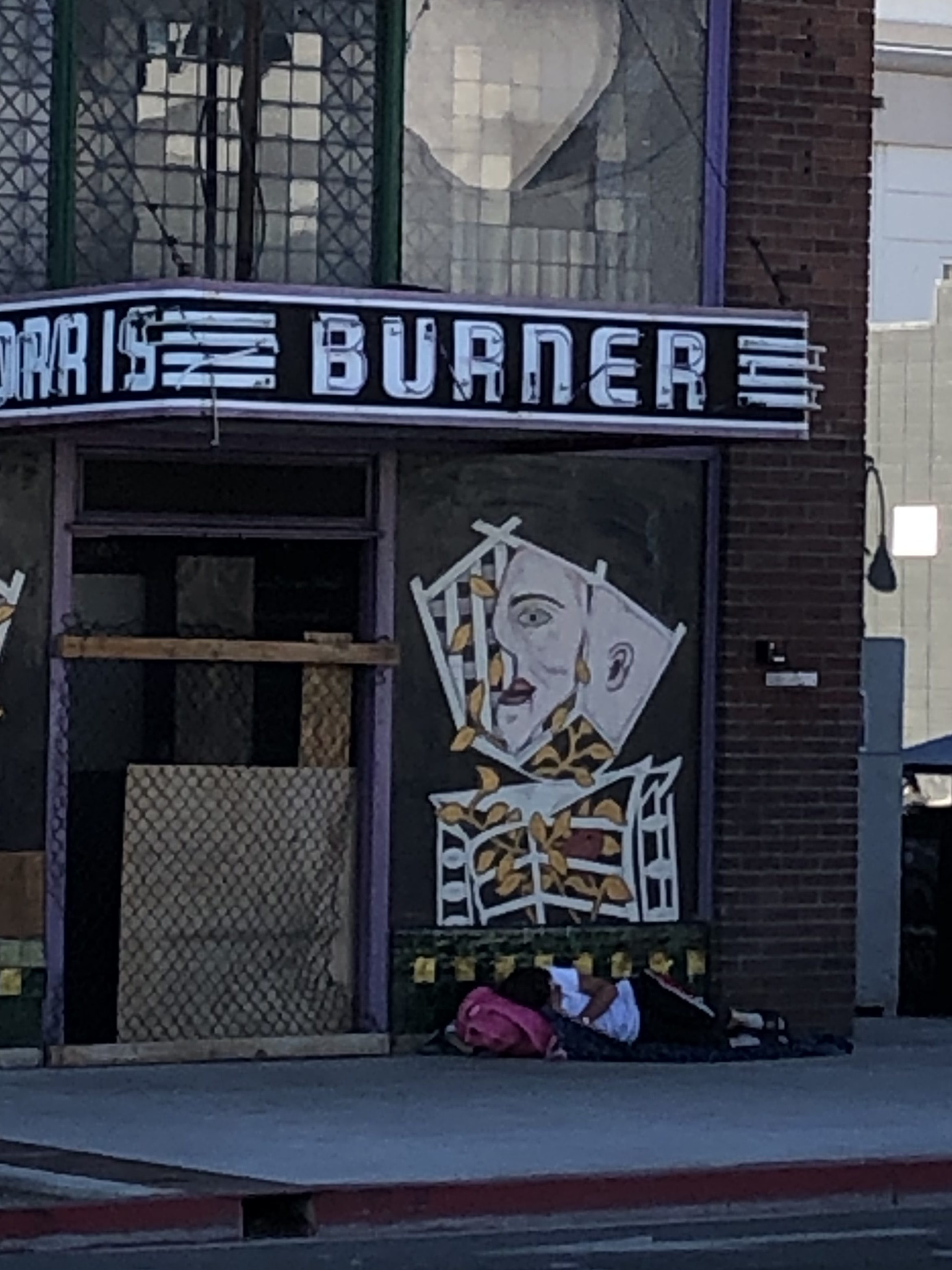
You’ll note that my return trip skirted the west side of the Black Rock Desert, where Burning Man begins this weekend. My entire run through Nevada was overrun with “Burners” in their anti-establishment Winnebagos, powered by thousands of gallons of anti-establishment Chevron gasoline.
Prophetic sign in Reno.
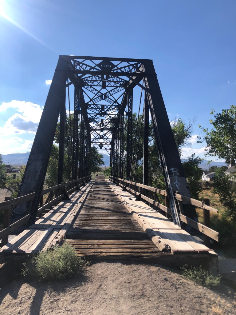
One worthy sight along the way was this 1907 bridge over the Truckee River in Wadsworth, NV.
The bridge served the Fernley and Lassen Railway, which was a 112-mile short line. I’m told that two of the railroad’s depots (in Fernley, Nevada and Susanville, California) have been restored, so this might be the subject of my next road trip.
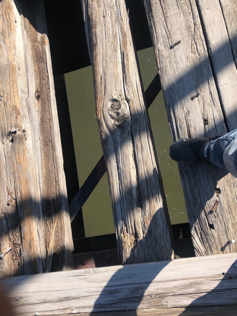
One needs to be careful when crossing this bridge….
You should also check out this cute, heart-warming video that features the bridge:
Watch your step, little girl!!
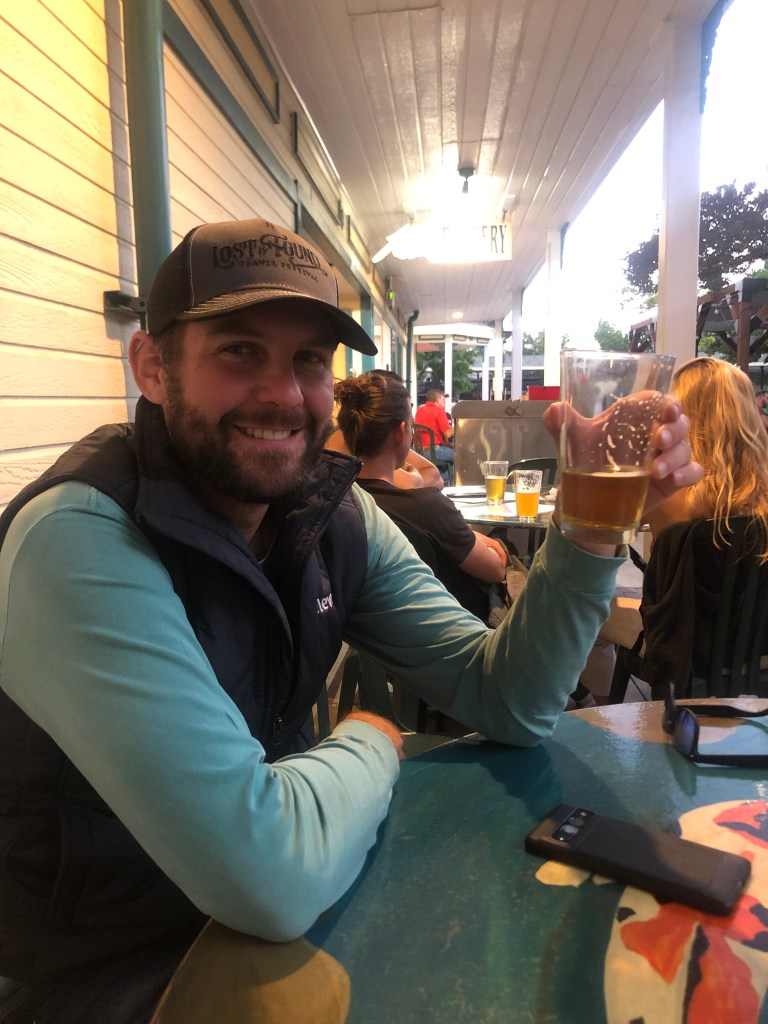
After Wadsworth I stopped in Reno to have dinner with my son Ian, who happened to be in town on business.
Like father, like son.
I spent the night in Reno, and this morning, before leaving town, I made a significant, final discovery related to the N-C-O Railway:
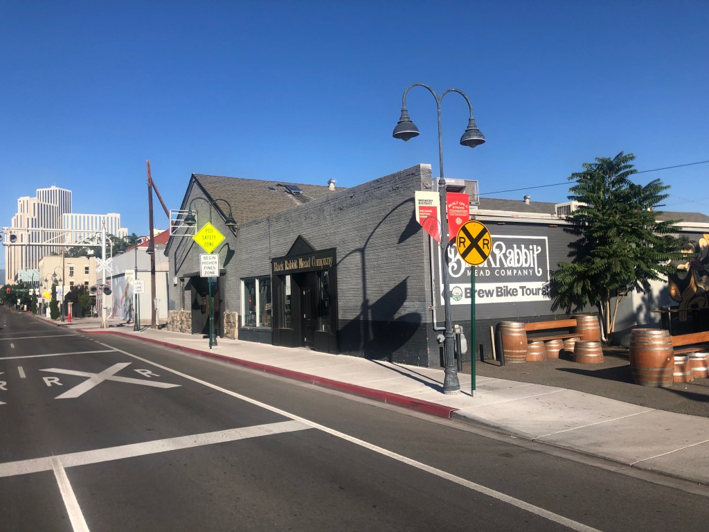
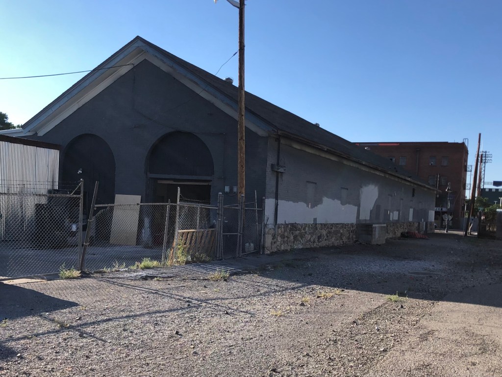
Recall that I had been unable to find the NCO locomotive shop in Lakeview (northern terminus of the railway). This morning, however, I located the NCO’s 19th-century shops building in downtown Reno (the NCO’s southern terminus). The building is on the other side of the tracks from the Depot Brewery and it’s currently serving as the headquarters for Black Rabbit Mead Company. It’s notable that two of the NCO’s surviving Reno structures now make mead and beer.
The NCO’s 1889 locomotive shop, now a meadery.
Same building, viewed from the back.
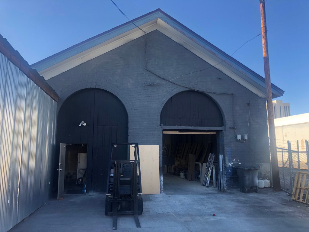
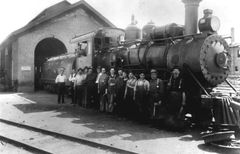
Steam locomotives used to enter those rounded doorways.…
…as proven by this historic photograph.
You can get more information about this building and photographs here.
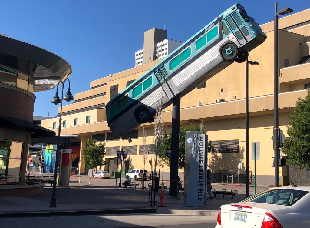
Finally, I need to share this art installation I saw in front of the Reno bus depot. It’s made from a real, retired bus, though it’s been gutted and narrowed. I’m told it also is illuminated from the inside at night, and the headlights and taillights illuminate.
My only complaint is that the bus was retired from New Jersey. Shouldn’t they have used a Reno bus??!
So ends this latest adventure. Be on the lookout for a Fernley and Lassen trip one day soon!
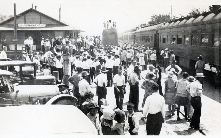
The F&L’s Susanville station looks like a happening place.
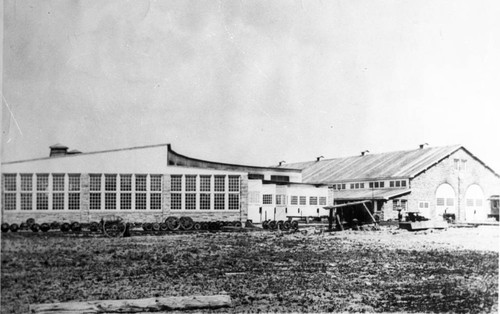
After getting my complimentary coffee and scone from the Niles Hotel this morning, I made a final circuit of Alturas looking for one final NCO structure. Apparently the old locomotive shops buildings are still around, but I could not find an address on the Interwebs. There was just this historic photo from the Modoc County Museum:
“Portrait of the old N.C. & O railroad shop in Alturas, Ca. Published by: The Journal of the Modoc County Historical Society in 1982. Old N. C. & O Railroad Shop”
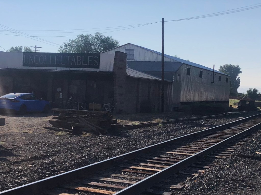
So I just cruised around the city, trying to hew to the rail line on the theory that railroad shops would be connected to the tracks somehow. Only two structures even remotely resembled the rightmost building in the historic photo, but I think they are not what I’m looking for. Here they are:
The roof of the building in the back has the right pitch. Note the misspelling on the “uncollectables” sign.
This CalTrans facility looks like it could have been an old train shed…
Anyone with information or even a hunch (I’m looking at you, Quasimodo) please let me know!
Around 9:30 am I left Alturas in defeat, and got back onto US 395 north. On my way to Lakeview, OR (which you will recall was the northern terminus of the NCO Railway), I passed a couple of noteworthy sites:
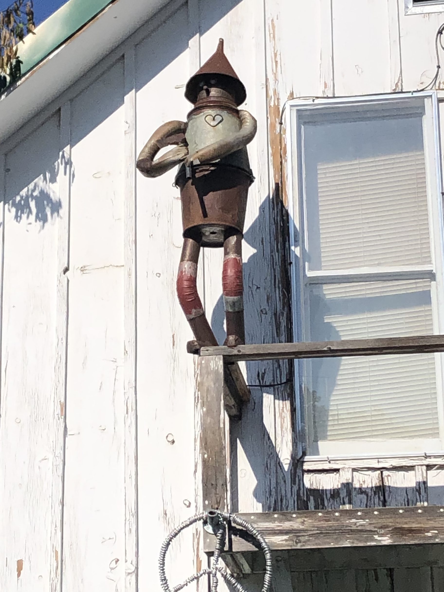
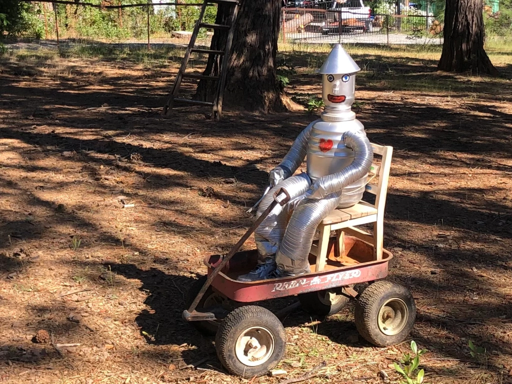
I spotted this Tin Man figure on the side of a house facing the road. Like the one I saw a month ago near Georgetown, CA, it brought a smile to my face. The owner came out of his house while I was taking the photo, and we had a nice chat. I think what this world needs is more Tin Men.
Here’s the one from Georgetown.
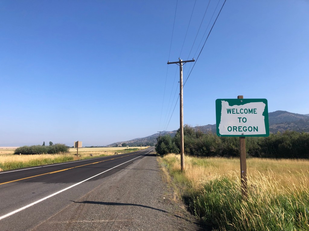
Entering the third state of the NCO!
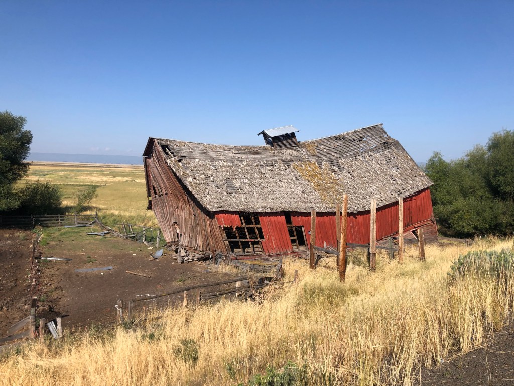
If Salvador Dali built a barn…
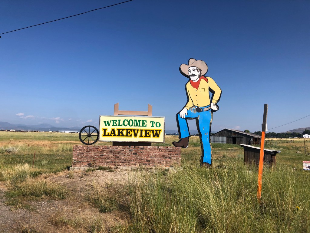
Finally I arrived in Lakeview, Oregon (pop: 2,500).
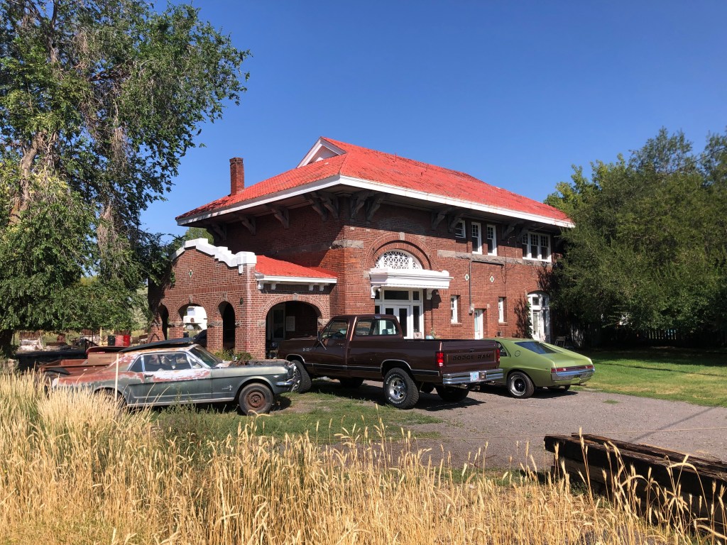
Just to the west of downtown I found the depot. It looked to be a happening place, with numerous cars parked in front.
Note the rare AMC Marlin (?) on the right.
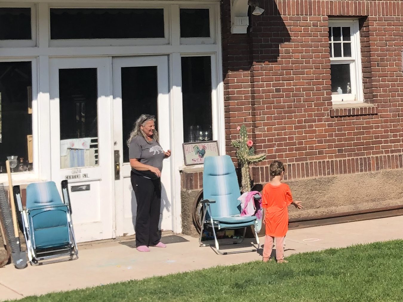
But it turned out that these cars all belong to the depot’s owner. For unlike the other depots on this trip, this one is serving as a private residence. The owner’s name is Carmen, and she bought the depot from the second owner (after the railroad sold it). She appears to have changed little of the outside of the building. As for the interior, I can’t say. She steadfastly ignored my repeated hints that I’d like to see the inside.
Carmen, managing her little Yardmaster.
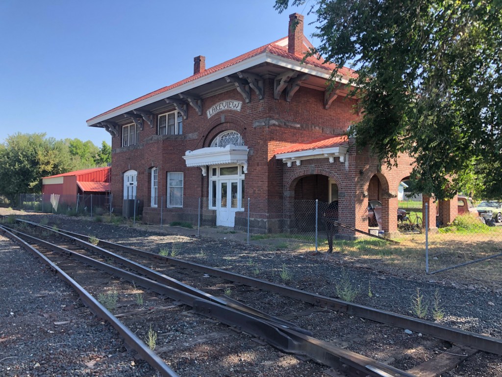
Interestingly, the tracks immediately behind the depot are still active. It seems there’s a short line railroad that ships goods between Lakeview and Alturas. The tracks are essentially unprotected, and run just a dozen or so feet from the depot’s back door. For a railfan, it sounds ideal. For anyone else, it sounds noisy and dangerous. But I am grateful to Carmen for preserving this piece of NCO history.
Not your typical bungalow.
It was now finally time to fulfill the whole point of this trip: A return visit to Eagleville, CA. I said goodbye to Carmen and headed back down US 395 to Surprise Junction, then headed east on CA-299. After about an hour and a half I stopped in Cedarville (pop: 425) to get gas and lunch. Cedarville is only 17 miles from Eagleville, but the latter has almost no services, so I made use of the former.
While pumping gas I noticed numerous campers and RVs and VW buses lining up at the pumps. Almost all of them were carrying bicycles and other equipment, and the drivers and passengers all had fluorescent hair. “Burners,” muttered the gas station attendant. In response to my confused look, he explained that these folks were all going to the annual Burning Man event in the Black Rock desert. It struck me that, in their effort to be independent and iconoclastic, they all looked and behaved exactly the same way. That said, I did have to admire the work this guy put into his Burner Mobile.
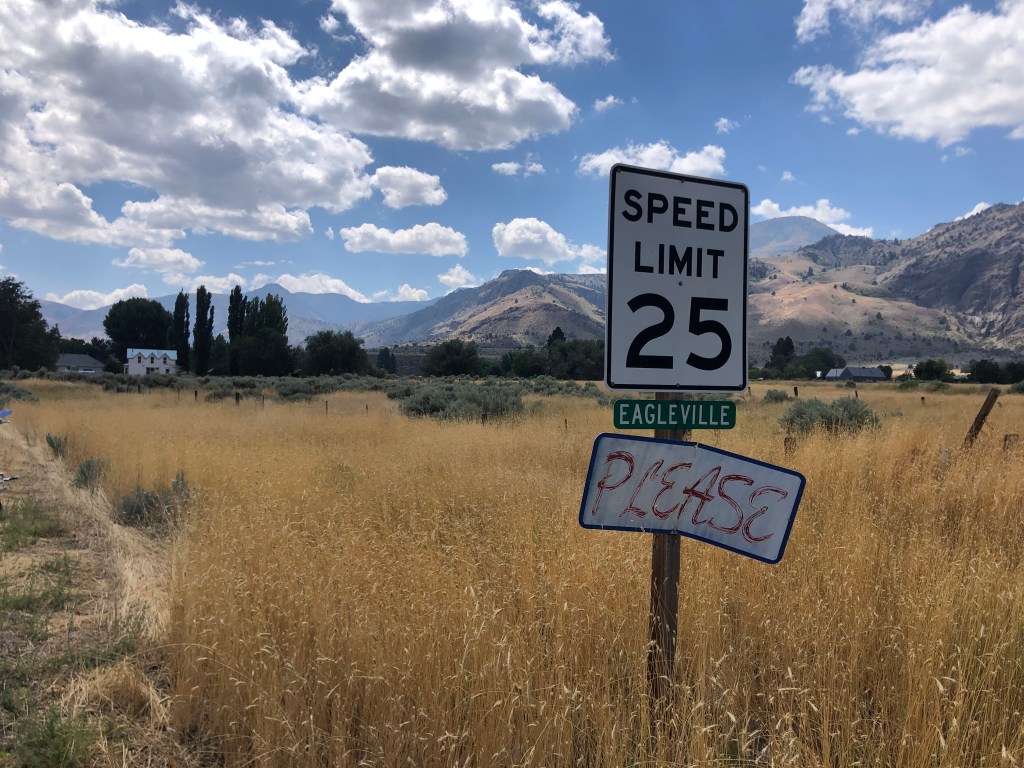
About 20 minutes after I’d finished my pit stop in Cedarville, I was standing in Eagleville (pop: 45) for the first time in almost half a century.
Perpetual plea.
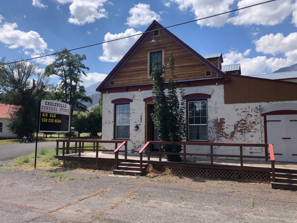
The first thing I noticed was the general store, which was originally built in 1876. It’s gone out of business, and the owners seem to be trying their luck renting it out as a B&B. I think that might be a stretch. The 150-year-old exterior walls look largely unchanged from when I had last seen it.
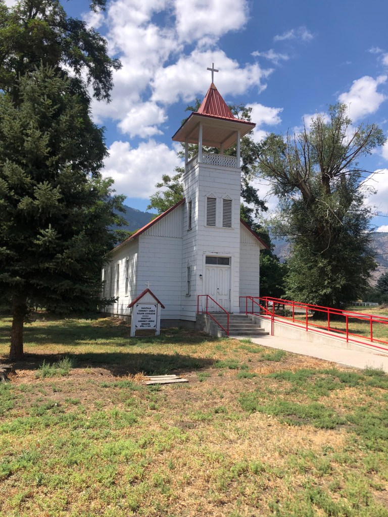
Across from the general store was the old (1888) church I’d remembered. It looked almost exactly the same as my memory, though I read it underwent some restoration work in 2000. This time, though, the door was locked. Evidently they are less trusting than they once were. And who can blame them? I also read the church no longer holds regular worship services.
A restored church that is no longer open for worship.
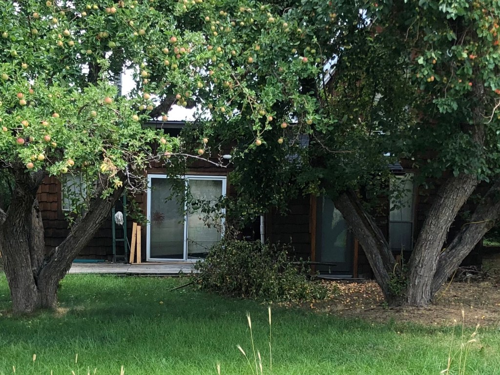
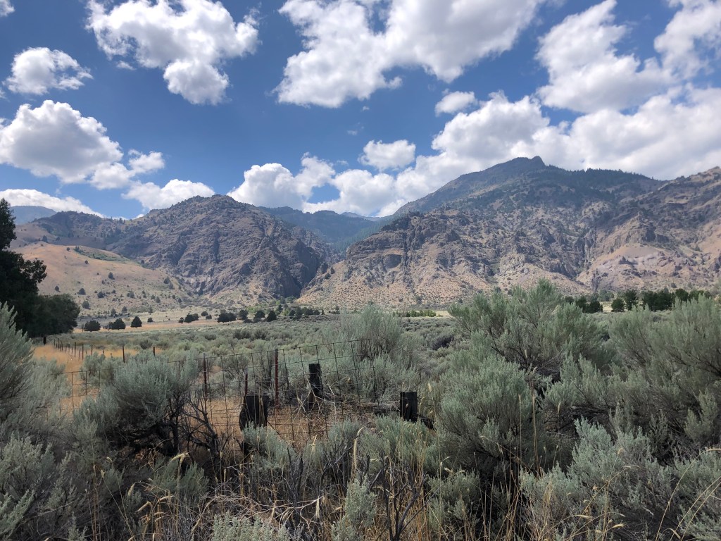
I then went down the street to the street Aunt Alice’s family maintains three homes. The house where we’d spent Thanksgiving in the mid-1970s was still there, seemingly frozen in time. The South Warner Mountains still stand sentry over the town.
Back of the house, just as I remembered it.
Great view from the family homestead.
Notably, I did not see one living soul in Eagleville. Maybe people stay indoors during the mid-day heat. But l it did feel a little unsettling. I guess some people prefer a quiet, isolated existence. Indeed, the gas station attendant in Cedarville told me he left Alturas to “escape the rat race.” He likes “how small this town of Cedarville is.”
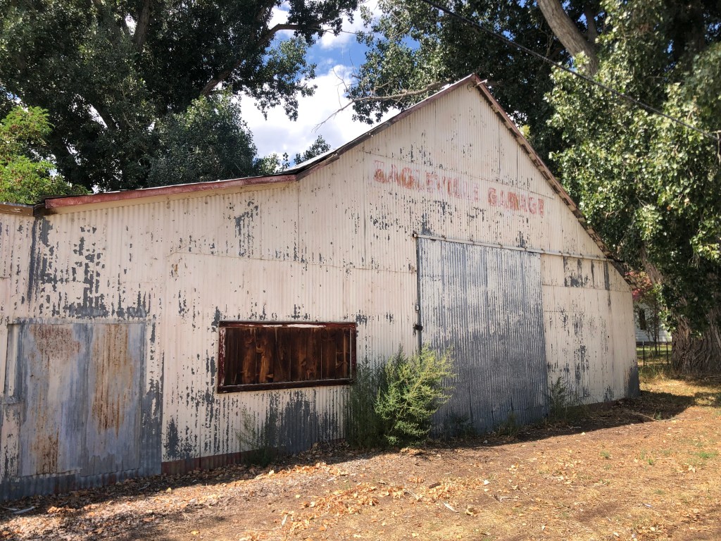
But Cedarville is a metropolis compared to Eagleville. At least Cedarville has a gas station. Most of Eagleville’s erstwhile businesses are long closed. Like the Eagleville Garage.
I think I’d go crazy in a place like Eagleville. But I’m glad it exists, and I’m glad that some people make it their home. We all need to find the place that suits us. In addition, there’s also something reassuring about a memory from my past retaining some physical form.
After melancholy reflections such as these, I got back on the road and started to head home. Hundreds of “burners” shared the road with me as they made their way to the Black Rock desert, seeking to transform one of the country’s most desolate places into a teeming metropolis….if only for a week.
Mail Bag/Miscellany:
I neglected to mention in yesterday’s blog that Uncle Ed’s Dome of Foam includes information on the NGO and its depots. Here is the link.
See also some further input that Ed and others posted in the comments section of yesterday’s blog.
Finally, here’s Edward’s photo of Carmen’s “house,” back when it was serving a very different function.
“Arrival in Lakeview,” 1974. From Uncle Ed’s Dome of Foam.