Breweries · California history · cemeteries · churches · Gas stations · Obelisks · Puns · Road trips · trains

Meditation

Spending a few days in the desert gives you time to think. To ruminate. To meditate. To shorten your sentences to unconjugated verbs.

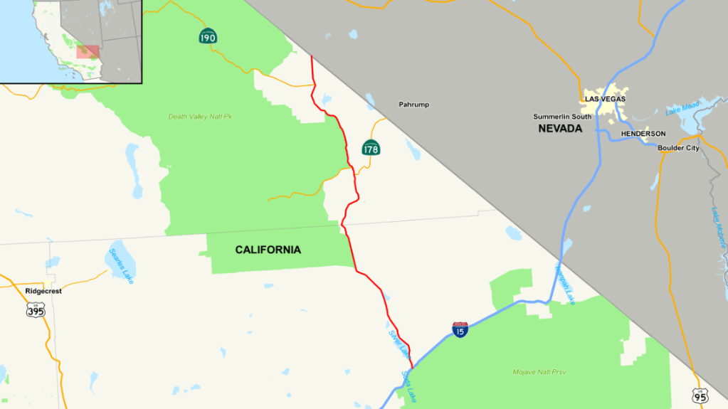
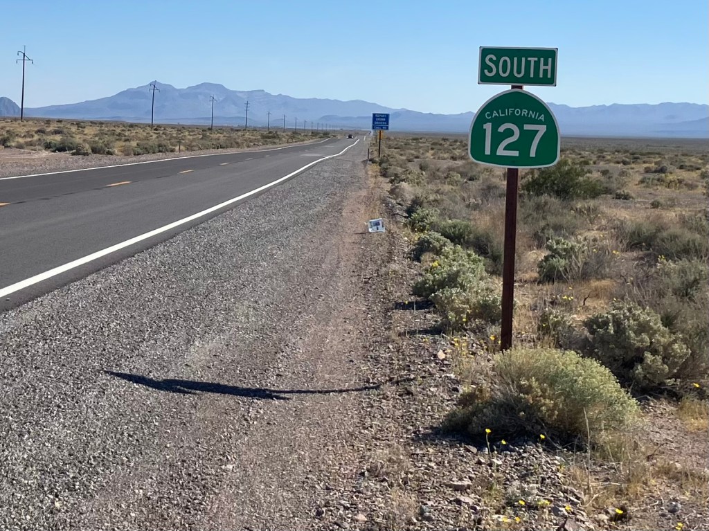
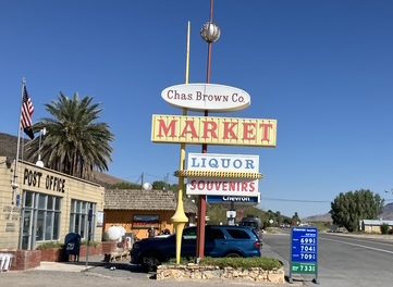
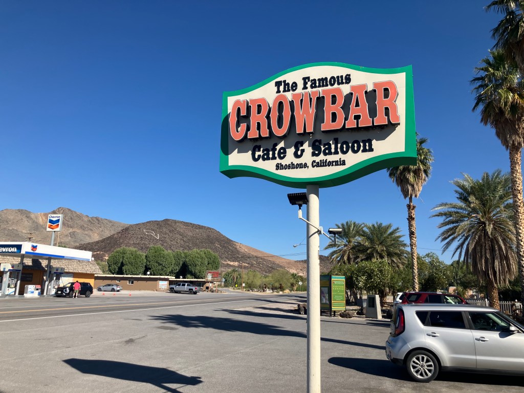
This morning I headed south on CA 127, and within the hour I was at Shoshone (official pop: 31). I say “official”population because one of the locals told me the actual population is now down to 13. In any event, Shoshone was founded in 1910 by Ralph “Dad” Fairbanks, by literally relocating buildings from nearby abandoned mines and towns. Shoshone was situated on the Tonopah and Tidewater Railroad line which, we learned yesterday, was launched a few years earlier to haul borax. Interestingly, the T&T’s name was an unfulfilled aspiration. It never reached north to Tonopah, and it never reach southwest to San Diego (which was the “tidewater” envisioned by the name). Anyway, “Dad” Fairbanks’ daughter married a boy named Charlie Brown (well, Charles Brown), and young Charles essentially became the heir apparent of the town.

All roads lead to Shoshone.

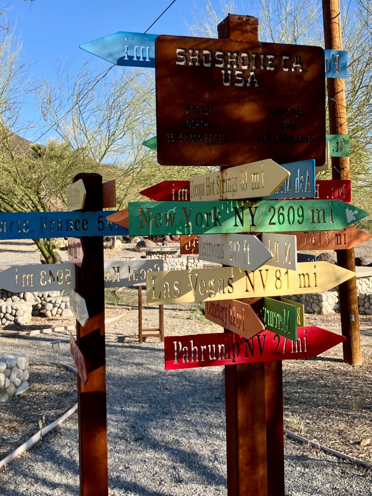
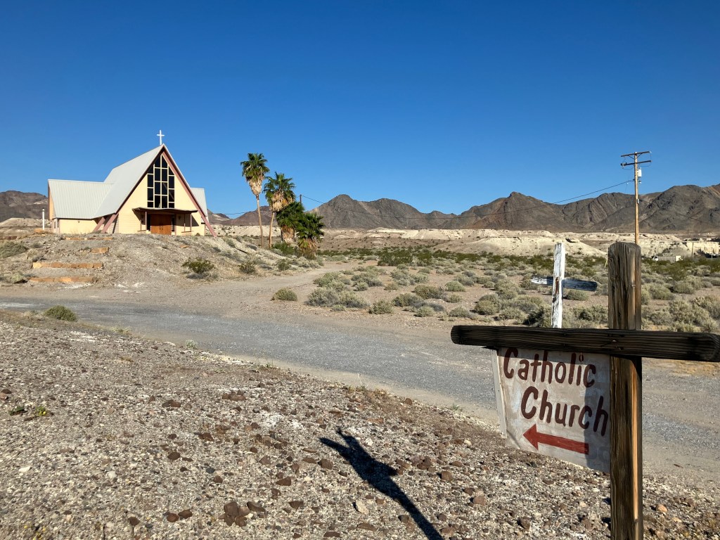
Despite its limited population, Shoshone today remains a going concern. It’s well-positioned as the southern gateway to Death Valley, and it’s at the crossroads of a couple of important highways. Services are therefore oriented towards travelers, with a gas station, a market, a restaurant, a museum, and even a generic Catholic church.

Note the ownership of the market. Also, is it just me, or is the sign done in the Googie tradition?

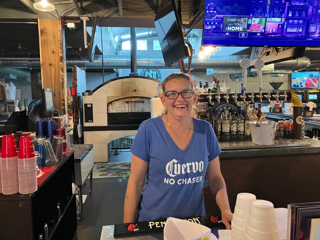
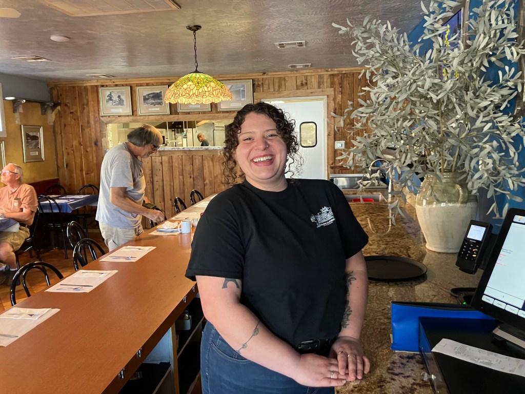
I decided to get breakfast at the “famous” Crowbar Cafe & Saloon. There were a few other people at the counter, and they seemed to be travelers like myself.

I’m still not sure whether the restaurant has earned the term “famous,” but Brianna–the server–is memorable. Friendly, attentive, and effervescent, with a sly sense of humor, she gives the place a buoyancy that goes well with the strong coffee.

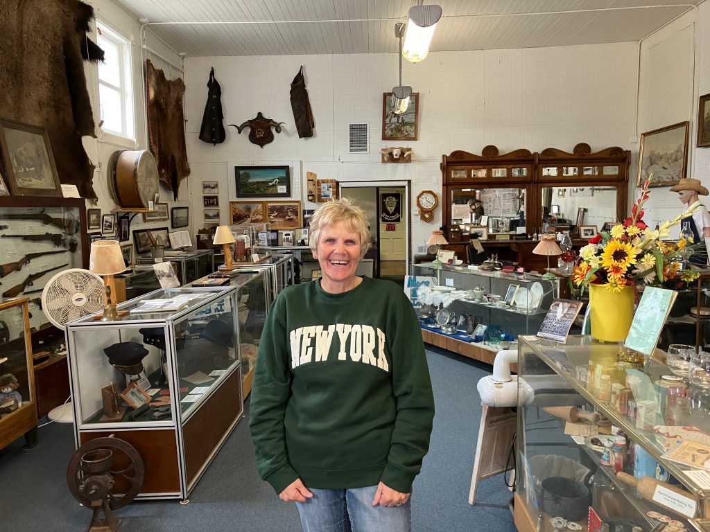
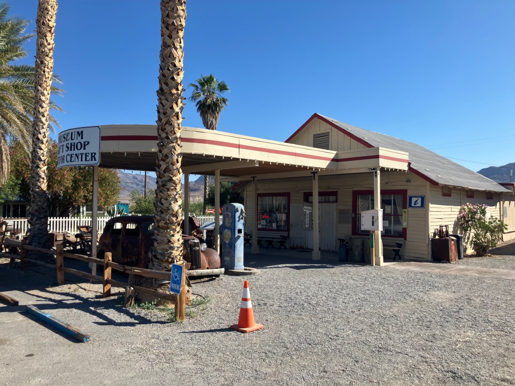
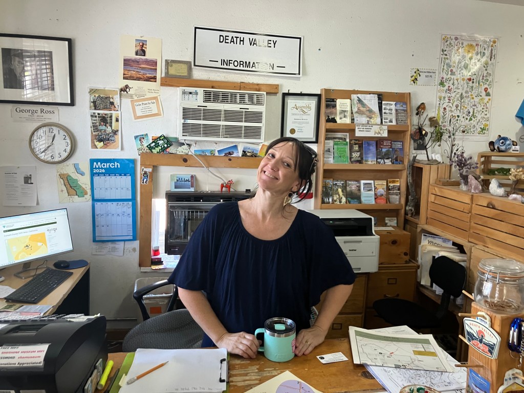
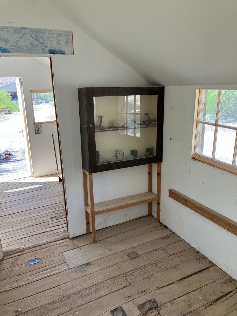
Directly next door to the Crowbar is an old service station that’s been converted into a museum and visitor center. What the heck, thought I. Let’s see what I can learn about this town.

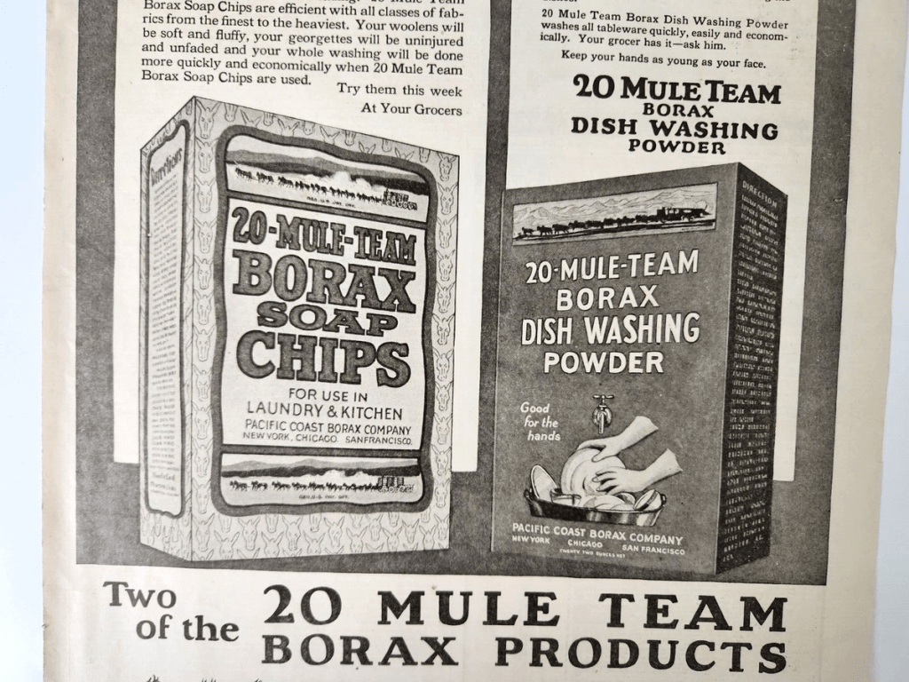
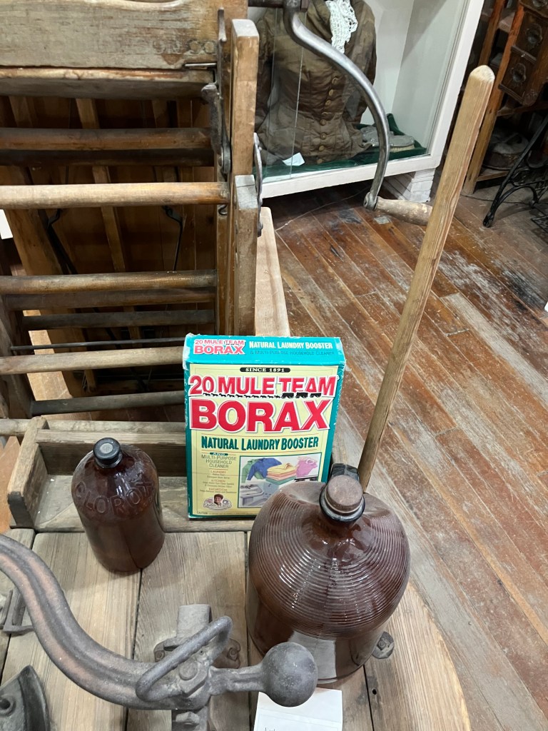
Even though it’s small, every corner of the building is packed with artifacts: old railroad schedules, household appliances, guns, photographs, maps, sheriff’s badges, even an old mastodon skeleton that was uncovered by local students. And of course there’s the requisite box of that white gold of Death Valley: Borax.

If I have any critique of the museum, it’s that some of the exhibits lack enough descriptive backstory. Fortunately, there’s a remedy in the form of Eliza, who runs the place (or at least today she was).

Eliza–Shoshone’s answer to Google.

It was Eliza who sketched the town’s history for me, who pointed me to the remnants of the T&T Railroad, who told me which local breweries were open and which were still getting their taps installed, and who insisted that I make a short detour to the date orchards of Tecopa for a date shake.

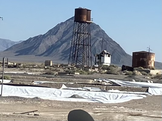
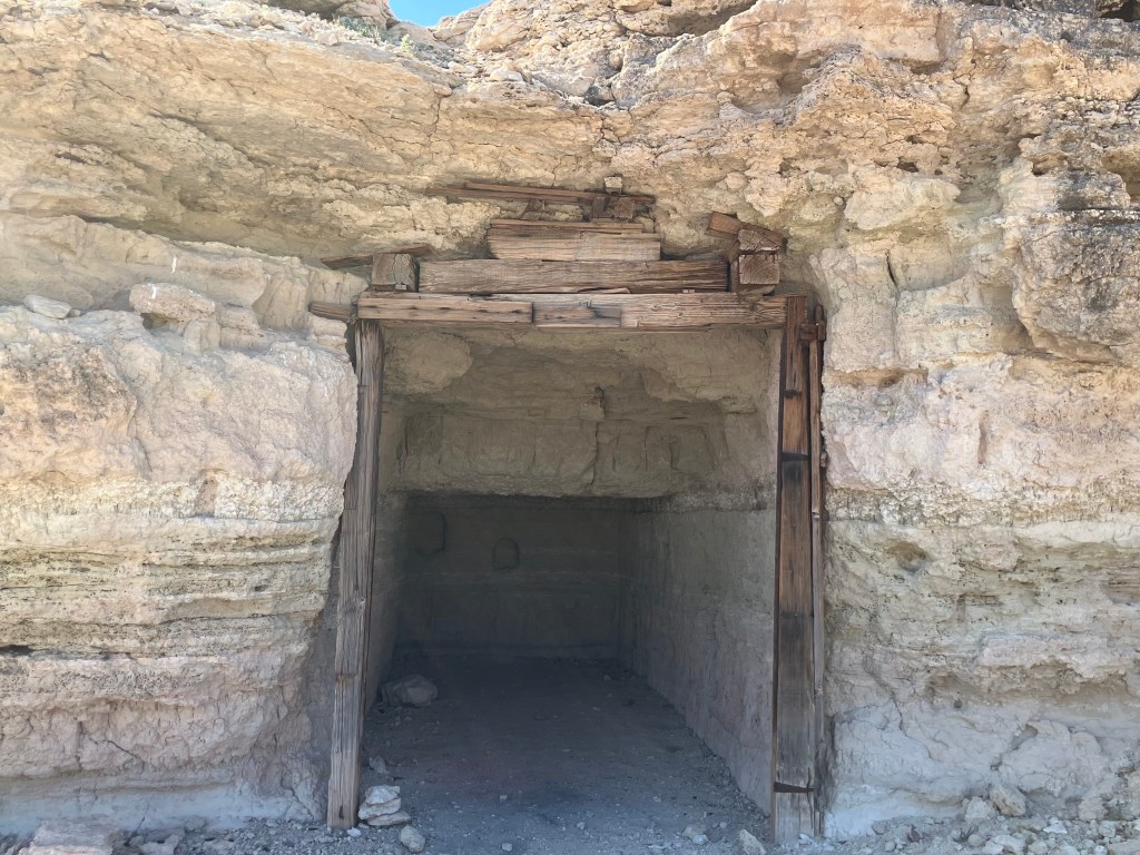
Based in part of Eliza’s suggestions, I first went across the street to Dublin Gulch, where miners dug rough-hewn caves into the hillside a century ago.

Be it ever so humble…
The ground around the caves is strewn with old cans. Presumably these once contained dinner.
More cans…
…and another….

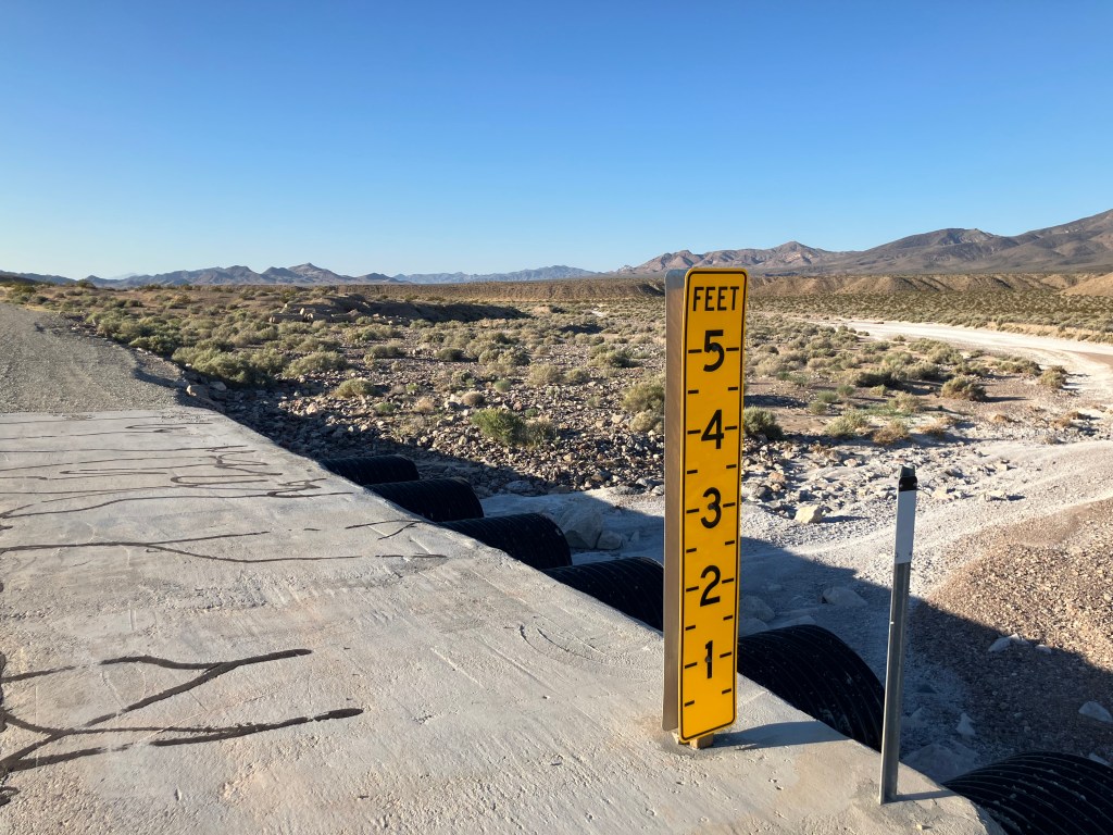
Having seen what I could see in Shoshone, I got back in the car and headed out to Tecopa (pop: 169). Along the way I spotted a few of these 5-foot markers where the road comes close to the Amargosa River. I learned yesterday that flash floods are a real and persistent danger out here; the Amargosa Opera House has been flooded several times. I’m guessing the markers help drivers to judge the depth of water on the roadway?

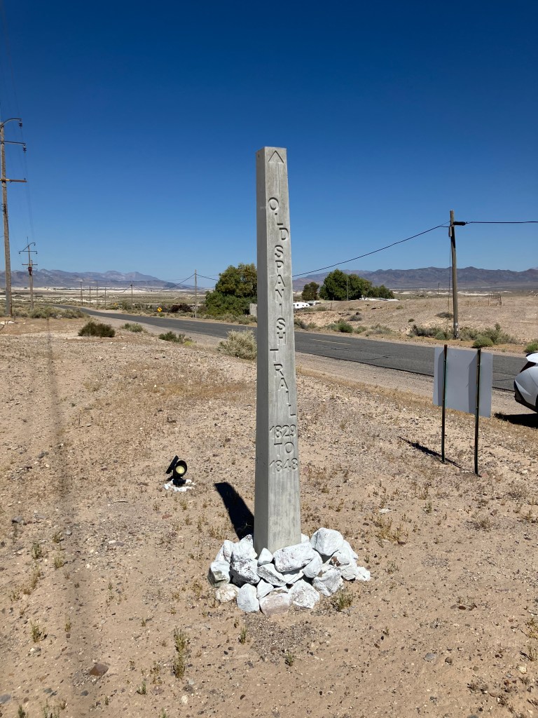
Tecopa is a few miles off CA-127, and to get there you cross the Old Spanish Trail, that connected the settlements of Santa Fe with Los Angeles in the 19th century. I saw a small obelisk (about 5 feet tall, designated #32) marking the route. I surmise there are at least 31 others, and most likely many more. This may be the subject of an upcoming road trip…

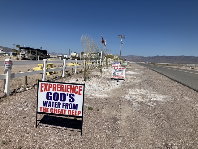
The road to the date orchards passes along a string of privately-owned hot springs. Signage from competing outfits lines the road. Some of the claims seem a bit over-the-top…

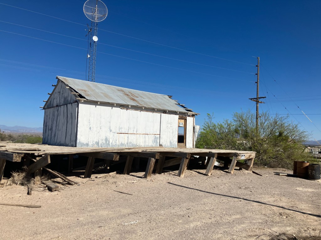
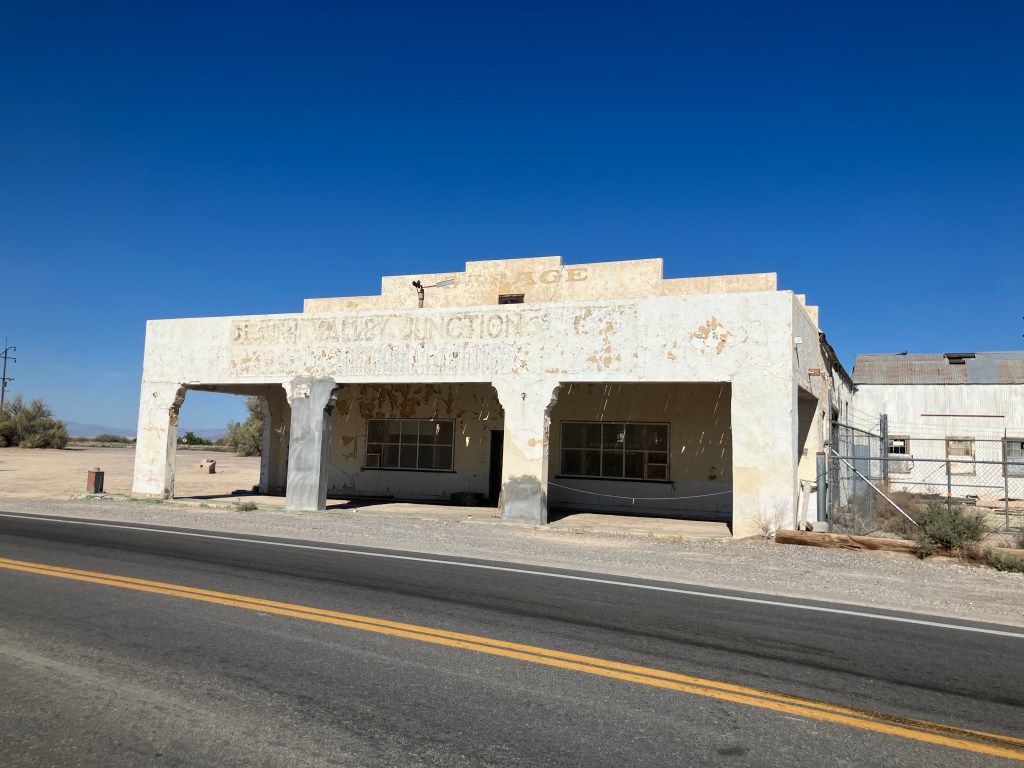
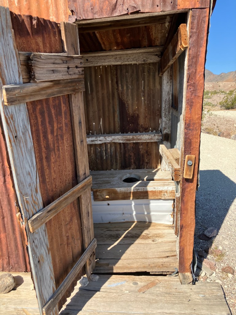
I did eventually get to the China Ranch Date Farm, where I had me one of best of the two date shakes I’ve consumed in my life. But near the farm I encountered two sites that spurred the rumination suggested in the title of this post. First, there’s the U-We Wash:

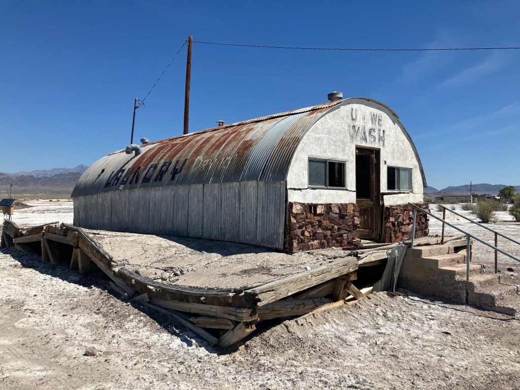
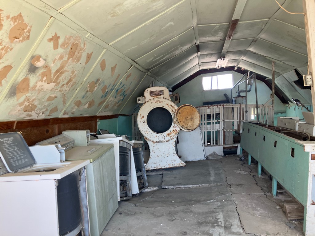
It’s a long-defunct laundromat in a quonset hut. The equipment remains largely intact, seemingly spared from vandals.

It seems the place has been around since early in the last century, and has been abandoned for decades. It must have served visitors staying at the trailer and RV parks across the street. It’s got a bit of an eerie, Twilight Zone vibe, as though the the owners and customers all instantly disappeared decades ago, perhaps due to a nuclear explosion.

Now, hold that thought and consider the second site that got me ruminating: Just down the dirt road from the date farm is the self-proclaimed “Modest Museum,” which is a simple, old two-room building which a few neglected displays about the history of the area.

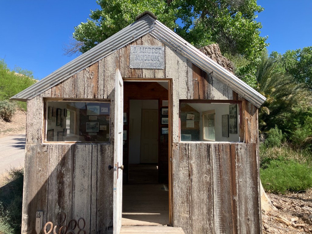
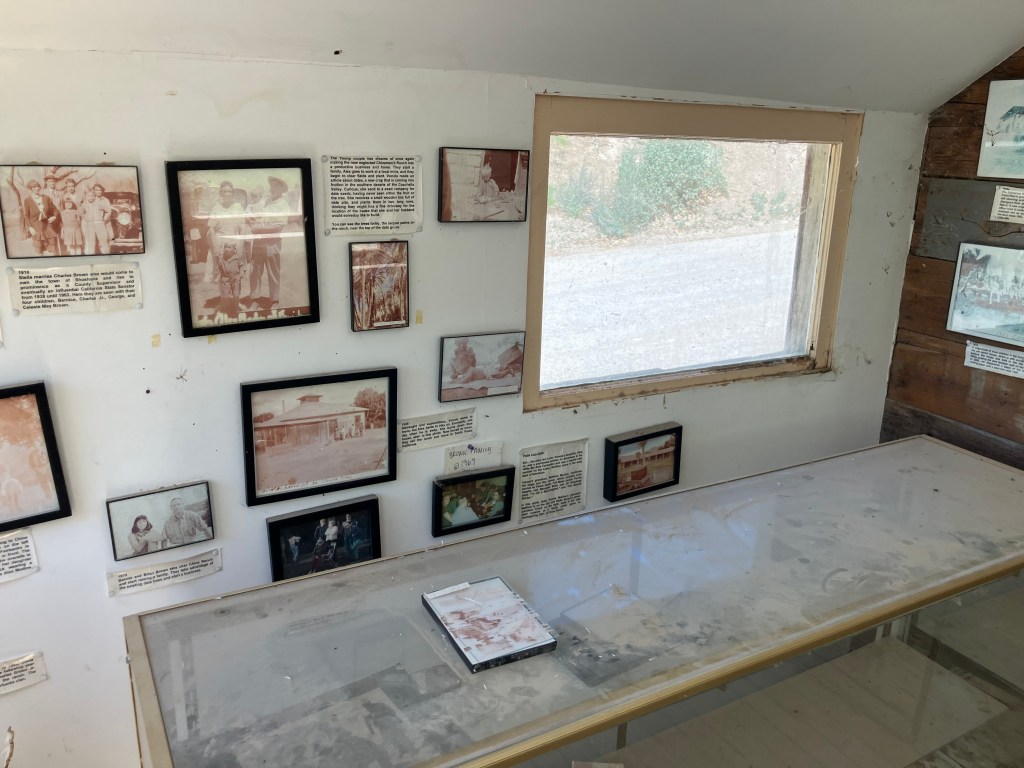
A sign on the wall reads: “We have deliberately made these exhibits accessible to the public, especially children, so they can get a real sense of the history here. Please behave honorably and do not remove or vandalize anything in this little museum.” And indeed, there are no signs of vandalism or theft, which is of course a good thing. And yet, there’s also no sign that the museum has been visited or cared for in the slightest. Dust is thick on the display cases, the photographs are sun-bleached and virtually indecipherable, and descriptive labels have fallen to the ground.

To me, the U-We Wash is cool and intriguing, an artifact in our midst that testifies to a different time. But the Modest Museum is depressing: a well-intentioned and hopeful endeavor that has fallen flat and/or been abandoned. Why my different reactions? Why are some artifacts cool, and others are junk? I’m thinking now of an old home-made theme park in Wisconsin that I visited in 2022. The man who lovingly created it had recently died, and the place was falling into disrepair. As I walked through it on a rainy afternoon I felt melancholy but appreciative of his effort. I did not feel like the remnants of his little park should be torn down. Just as I did not feel the U-We wash should be torn down. And to be fair, it’s not that I think the Modest Museum should be torn down exactly, but if the owners still believe in the mission, they need to give it some TLC or think of a new approach.

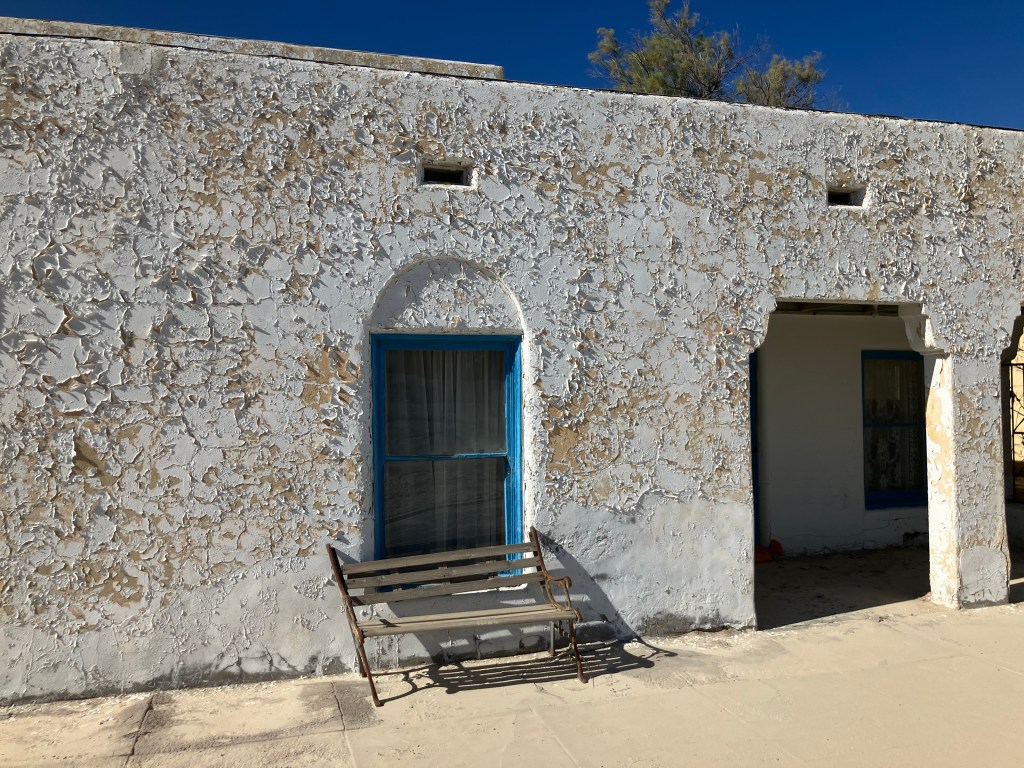
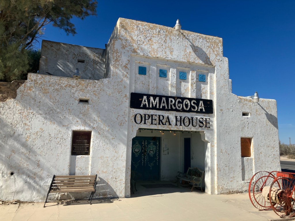
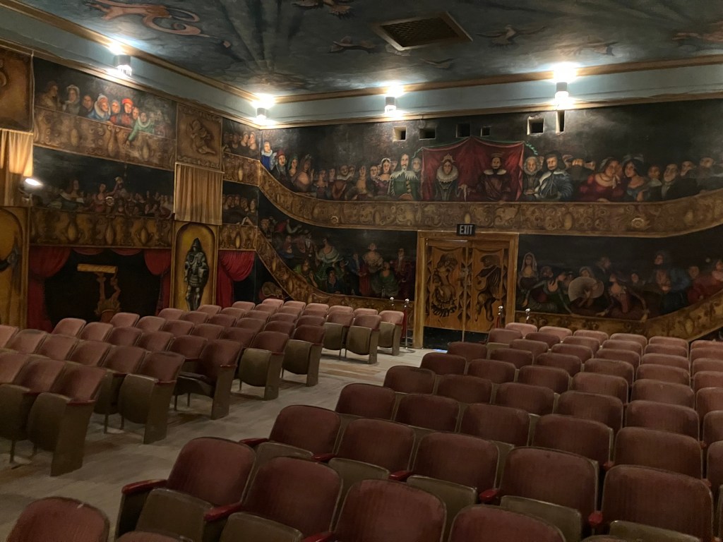
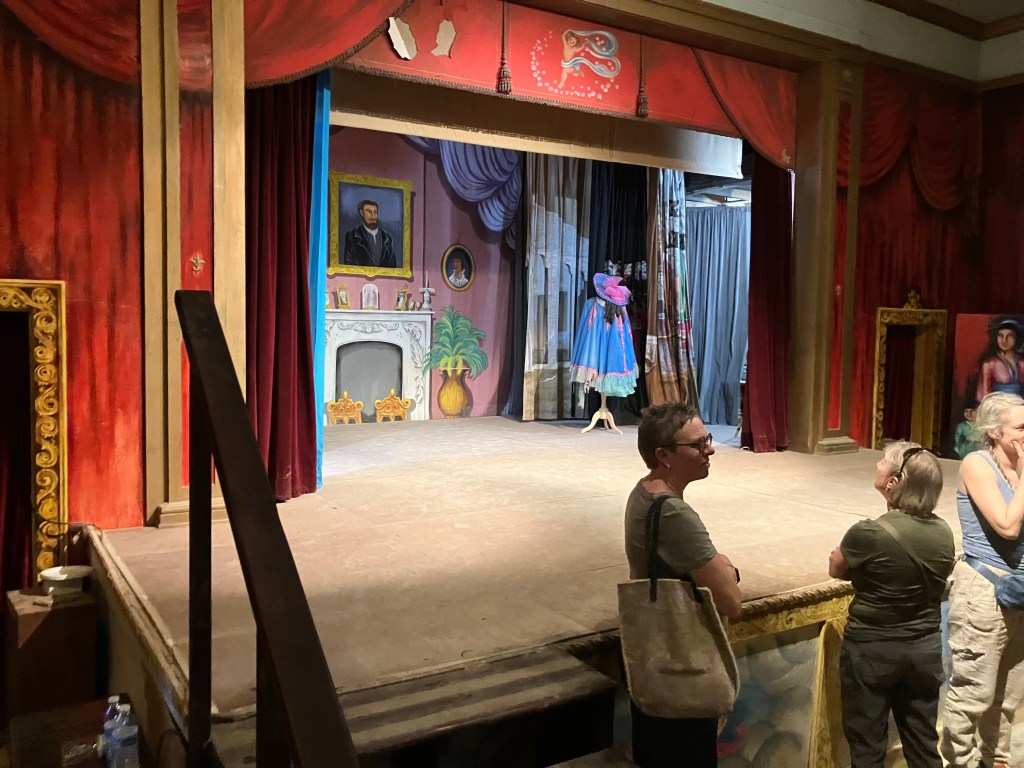
Part of this rumination comes from something that tourguide Sue mentioned at the Amargosa Opera House. According to Sue, Marta Becket had always insisted that, after her death, no one should ever restore or otherwise repaint any of the murals she had painted on the walls of the opera house and the hotel. She believed that the desert will rightly reclaim all that she did out here, and she was OK with that. Don’t fight it, she said. And so, as our tour group walked through the opera house, we saw areas of peeling paint and torn fabric that, according to Sue, the caretakers just have to accept.

I spent a lot of time thinking about this today, and the thought that keeps coming to my mind is the notion of burying the dead. Trees die in our gardens and we cut them down. Buildings become uninhabitable and unsalvagable, so we take a wrecking ball to them. An open bottle of wine goes bad and we pour it out. And, of course, our pets and our relatives die, so we return their bodies to the earth. I still don’t know exactly why I don’t feel that the U-We Wash shouldn’t be torn down. But I do know that the guy in my neighborhood with the weathered, broken, and rudderless boat in his side yard needs to get rid of the damn thing.

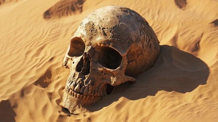
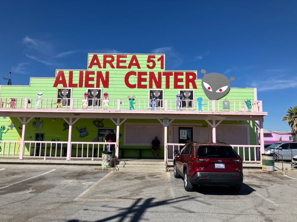
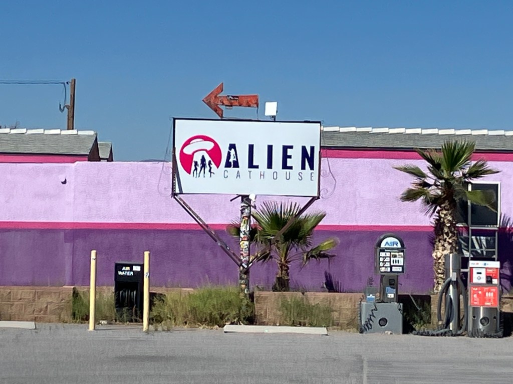
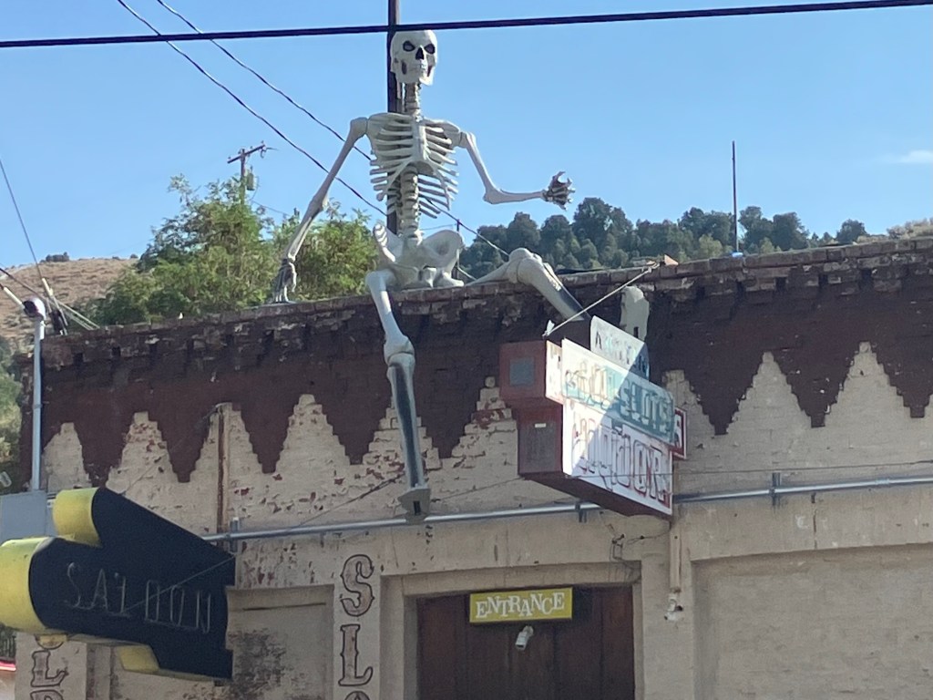
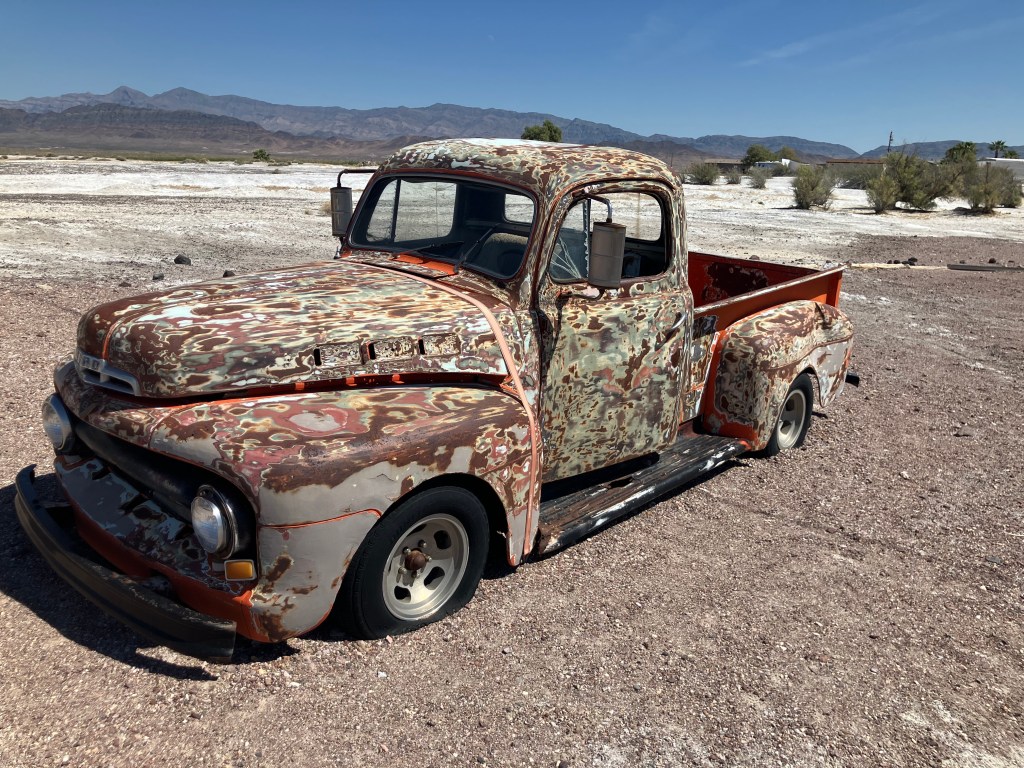
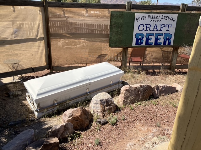
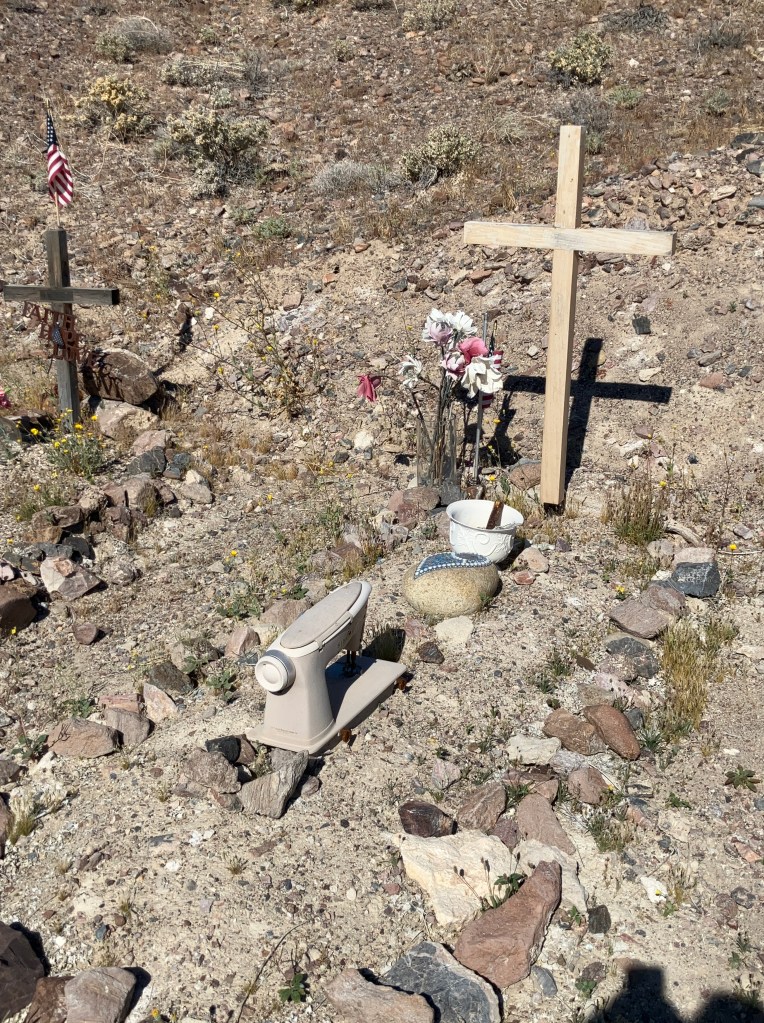
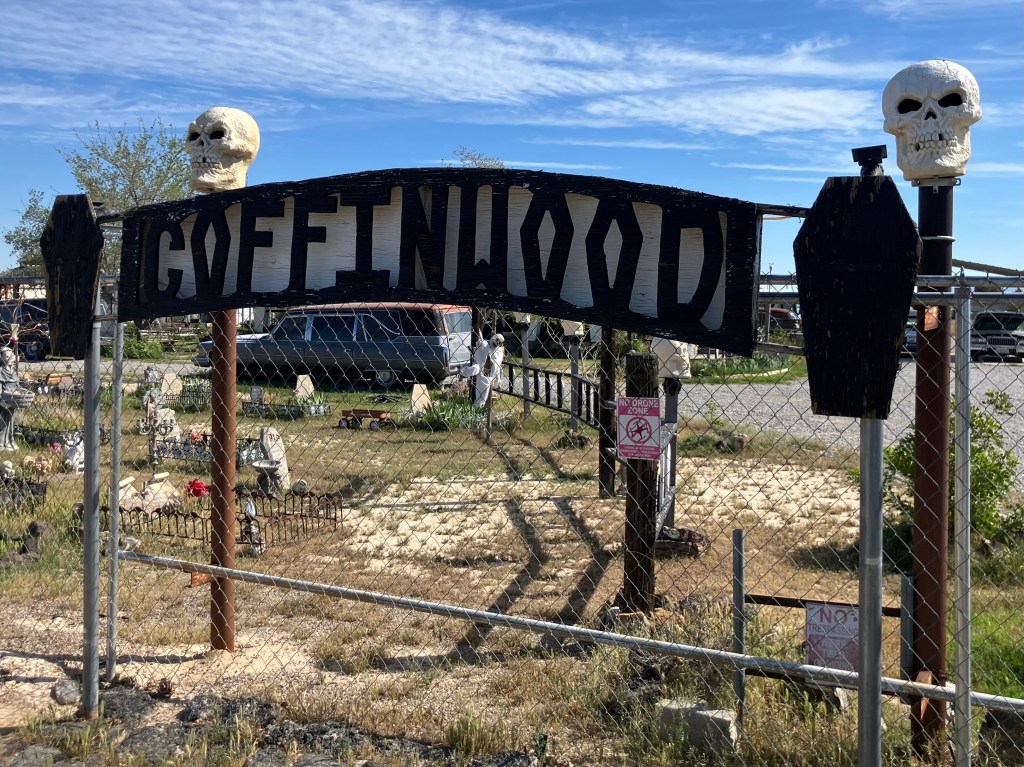
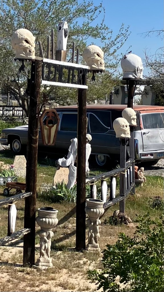
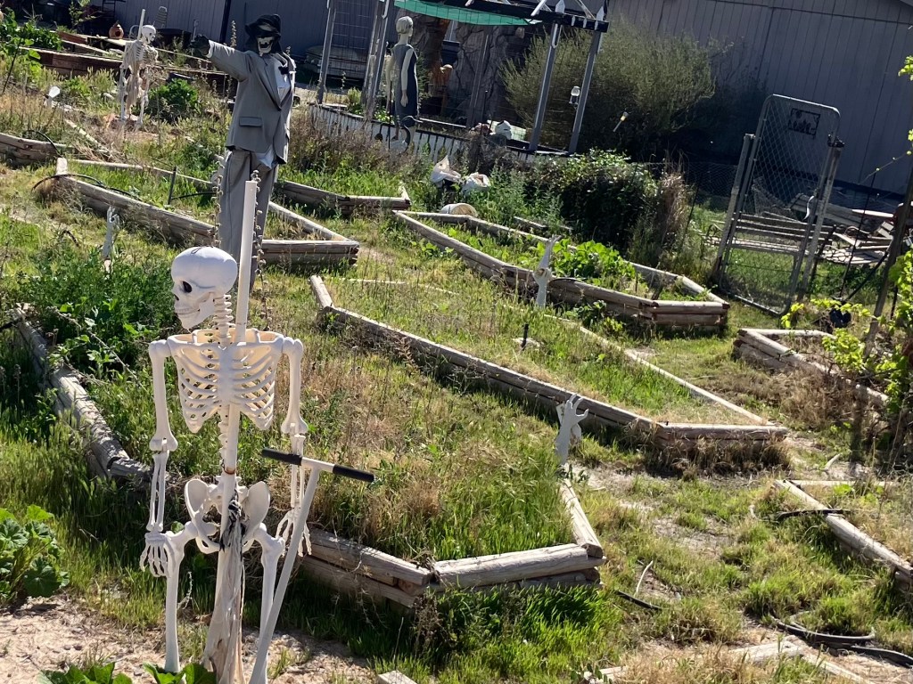
Out here in the desert there seems to be different attitude about death. Desert people appear to do a better job of accepting the concept. The imagery of death of all around the desert, including, of course, in the name Death Valley. So I’ll leave you with some of that imagery.
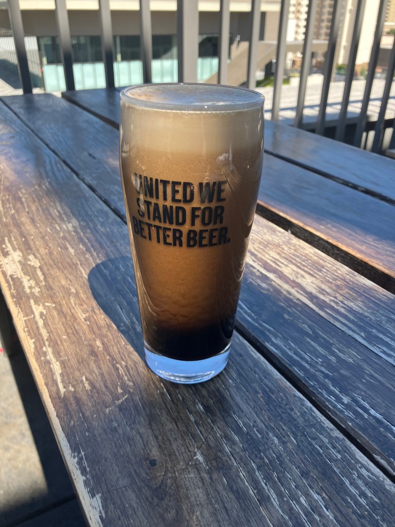
I’m betting the deceased was a singer. Har.

BEER OF THE DAY

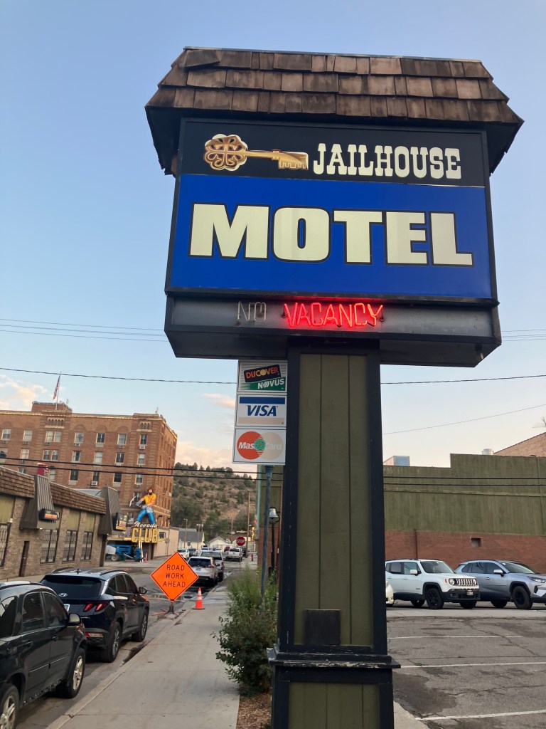
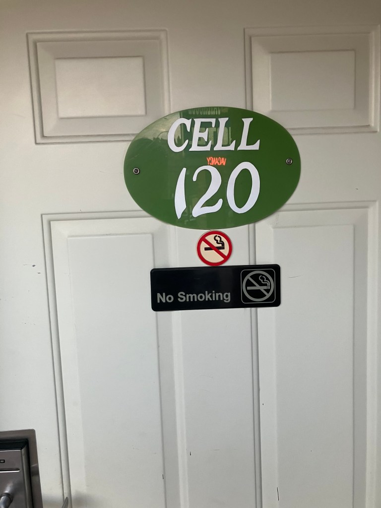
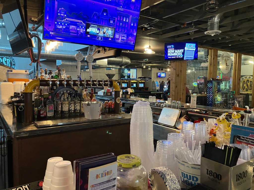
OK, that was a little heavy. So let’s end with the Beer of the Day. I had a beer at Steelbound Brewery and Distillery in Pahrump, NV (pop: 44,000). (I had to make a 20-minute detour across the state line to find a place to spend the night.)

Speaking of imagery of death…

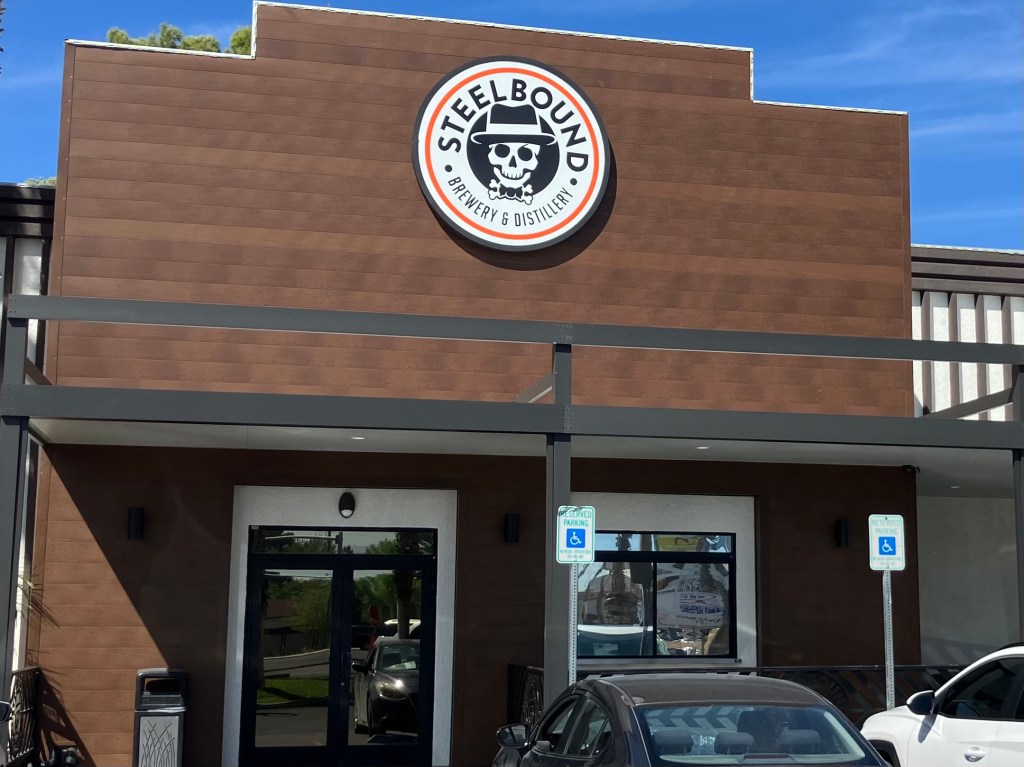
This brewery/restaurant feels a little weird, and seems to still be trying to find its niche. (I’m told the place recently changed ownership.) It’s attached to the Best Western hotel, which seems to seriously undercut its effort to appear like a hip microbrewery. Video gambling machines are situated at every seat at the bar. Giant TV screens show The Price is Right, a program that’s punctuated with endless ads for prescription weight loss and asthma drugs. The menu is overrepresented with Indian food. The Sirius country-western station is piped over the speakers. The whole place has a soulless corporate feel. Even the servers seem robotic.

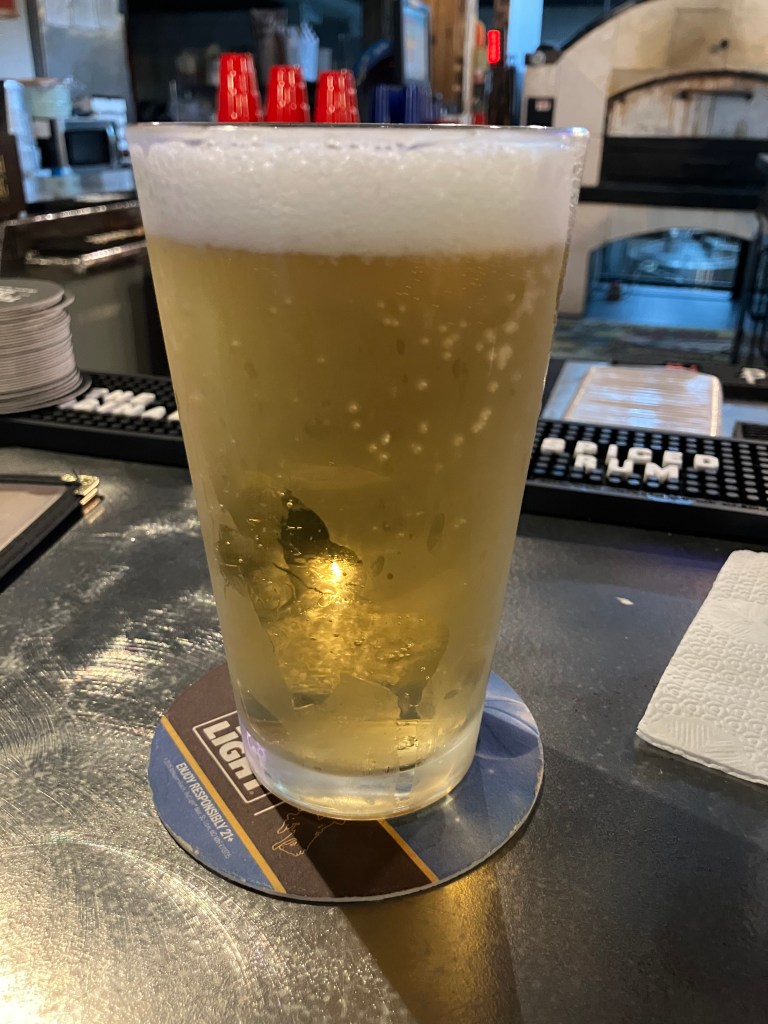
But they make their own beer. Perhaps because they’re still in the start-up phase, they only had three beers on tap. I chose the Chocolate Peanut Honey Cream Ale. Believe it or not, I considered this to be the safer choice.

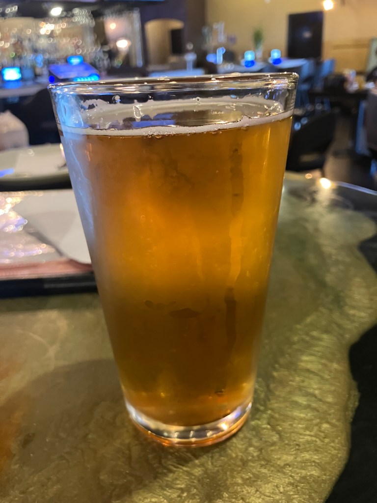
And I wasn’t disappointed! It’s got a golden honey color with a slight cloudiness. There’s no nose to speak up, but it is definitely refreshing. It’s not too hopped, not too carbonated, but neither is it flat or bland. I’d call it “brisk.” The mouthfeel is slightly creamy. I don’t taste the “chocolate” mentioned in the name, except maybe that slight chocolate essence you get from chocolate bitters. A full pint of this stuff was not filling in the slightest. If I lived near here, this would be my go-to summer beer. 5 out of 5 stars.

Breweries · California history · Road trips · trains

“Death Valley Road”: What Could Go Wrong?

Spring officially began a few days ago, which of course signals the opening of road trip season. And right on cue, loyal reader Peter D. helpfully sent us a Los Angeles Times article highlighting a stretch of highway in the Mojave Desert that piqued our interest. It’s California Route 127, and it’s known to old-timers as Death Valley Road. It dates back to the FDR administration–or, perhaps more relevant for a California highway, it dates back to the administration of Governor James “Sunny Jim” Rolph, Jr, a man who lasted three years in office before he collapsed and died while campaigning for re-election.

Route 127 is about 91 miles miles long, running along the eastern edge of Death Valley National Park from the Nevada state line down to the town of Baker on Interstate 15.

State Route 127 in red.

And so this morning I took a cheap Southwest flight to Las Vegas, where I rented a car and set out to explore this fabled (?) stretch of roadway. I’m going to cover the full 91 miles, but first I had to get there.

As luck would have it, getting to the beginning (or end, depending on your perspective) of Route 127 meant driving a stretch of US Route 95, which is a highway I explored in 2021. Attentive readers might recall that I got as far south as Beatty, Nevada on that trip. Today I had the opportunity to cover another stretch of US 95, between Las Vegas and Beatty. I must say, it’s a whole lotta nothin’.

“In the desert you can’t remember your name/’cuz there ain’t no one for to give you no pain.”

Well, not quite nothing. While looking for a gas station, I saw this sign along US 95:

Now, Area 51 is indeed in this general area, but this facility and signage feel a little too obvious:

It turned out to be one of those combination convenience store/alien souvenir junk/gas station operations. (It’s almost identical to Jackass Joe’s, that I visited in Utah last year.) But this UFO-themed place has another distinguishing feature:

That’s right–the front door of the Älien Cathouse is right next to the gas station’s water and air hoses. As you may or may not know, brothels are legal in Nye County, Nevada. While I was pumping my ethyl (if you’ll pardon the expression) a husband and wife were posing with their young children in front of the Cathouse.

I got back on the road, and after a short time I was approaching the California state line, where I passed a Last Chance Nevada casino whose roadside calling cards are, confusingly, a giant pig and a giant cow.

(Interesting side note: The cow used to stand atop the now-defunct “Holy Cow! Casino and Brewery”in Las Vegas.)

Finally, as I crossed into California, I was instantly on California Route 127. I was eager to see for myself the road that the LA Times calls an “antidote to the frantic pace of our modern condition, a necessary pause to see not what has been forgotten, but what endures.”

Shortly after starting my journey along CA 127, I arrived at a magical place called Death Valley Junction (pop: 3). The town was founded in 1907, when the Tonapah and Tidewater Railroad ran a spur line here to serve the Pacific Coast Borax Company’s plant. (You have to admire the chutzpah of naming a mining operation in the middle of Death Valley after the shores of the Pacific Ocean.) Borax is a naturally occurring mineral that was discovered here in Death Valley, and is used for cleaning and other uses.

Anyway, the western writer Zane Grey published an article decrying the horrible living conditions of the borax workers living in tents out here in the desert. So the Pacific Coast Borax Company, sensing a potential PR nightmare, built proper housing and facilities right here where I’m standing. This company town was constructed almost exactly a century ago, and it had offices, a hotel, worker dormitories, an infirmary, a community hall, and other facilities. By all accounts it was a thriving community.

This state of affairs only lasted for a few years. It seems that a richer vein of borax was discovered elsewhere, and the Pacific Coast Borax Company moved its operation out of Death Valley Junction. Then, in the 1940s, even the railroad left town…literally. The rails were pulled up and sold to the US government, which used them for the war effort in Egypt.

The few remnants of Death Valley Junction’s borax plant, as seen today.
The 100-year-old dock where borax was once loaded onto railcars.

Without the railroad or the borax operation, Death Valley Junction essentially became a ghost town. Except for the hotel, which struggled along, the old company town was left to decay.

Abandoned company town.

Then something wonderful happened. In 1967, a ballerina and artist from New York named Marta Becket was on tour through the west, and her car broke down near Death Valley Junction. While the car was being repaired at the town’s sole garage, Marta explored the old buildings and fell in love with them. In particular, she envisioned the old, abandoned community hall as an opera house. Here. In the middle of the desert.

The garage where Marta Becket serendipitously took her car and walked across the street to discover what would become the Amargosa Opera House.

So Marta Becket and her husband leased (and later bought) the property, converted the community hall into the Amargosa Opera House, and opened for business. Marta herself would perform on the stage every weekend. For forty years. Here, in the middle of the desert. A story in National Geographic in 1970 caused this little secret in the desert to become world famous. People came from around the world to watch her perform and to see the artwork she painted on the walls of the opera house and the adjoining hotel.

Marta finally retired in 2012, and died at age 92 in 2017.

RIP Marta Becket.

The Amargosa Opera House continues to honor the legacy of its creator with daily tours and various performances throughout the year. My tour guide was an enthusiastic and knowledgeable person named Sue, and she also works at the hotel.

Sue and her 1000-megawatt smile.

Speaking of which, I’m spending the night here in the old, original hotel that the Pacific Coast Borax Company built in 1924. Some say the place is haunted…..

Beer of the Day

The BOTD comes from BrewDog in Las Vegas. It’s their Black Heart Nitro Stout.

Because it’s a stout, it has the usual roasty and malty notes. Plus, as a nitro beer (i.e., it’s carbonated not with the usual carbon dioxide but with nitrogen), it has a creamy mouthfeel and a slightly sweeter taste. The nitro also presents an attractive, cascading-bubbles effect and a creamy head.

All that said, this beer was underwhelming. It has no complexity; it just tastes like someone filled a sock with oatmeal and steeped it in dishwater. There is absolutely no finish and, it seems, no hops. And at a scant 4.1 ABV, there’s no alcohol bite. This is a beer that’s nice to look at, but that’s about it.

bridges · California history · cemeteries · Road trips · trains

The Placerville Chronicles–Day 1

This morning I picked up my rental car in Placerville, California, and headed in the direction of Placerville, Colorado–some 900 miles to the east. (For those coming late to this story, the details are here.)

As I left Placerville I passed this mural that honors John Albert “Snowshoe” Thompson, a Norwegian immigrant who settled in Placerville in the mid 19th century. Every winter for 20 years (1856-1876) he made a twice-monthly trip over the Sierra Nevada range to deliver the mail. He made the 90-mile trek on skis (despite his “Snowshoe” nickname) from Placerville to settlements in Nevada.

Unlike Snowshoe Thompson, I chose an easier passage over the mountain, driving a Nissan on US 50 over Echo Summit. I ended up in a little tourist trap of a town called Genoa, NV (pop: 1,300). Genoa brags that it’s the oldest settlement in Nevada…but I was struck by something that’s more relevant to this journey: Genoa was the eastern terminus of Snowshoe Thompson’s mail delivery route. And they have a statue to commemorate the fact.

Snowshoe Thompson, doing his Gorton’s Fisherman impression.

At some point Snowshoe Thompson moved his residence from Placerville to Genoa. In fact, Genoa became his final resting place.

The Postman Resteth.
Those pruning shears on the face of his tombstone presumably are meant to be skis. But who knows, given the misspelling of his last name.

Having appropriately honored this (quasi-)native son of Placerville, CA, it was time to continue my journey toward Placerville, CO. To do this, I passed through the “independent and sovereign nation” of Molossia.

What, you’ve never heard of Molossia? Neither had I. But it seems that there are about 11 acres of land in the town of Dayton, Nevada, whose owner (Kevin Baugh) has declared to be a sovereign nation. Molossia claims to have its own currency, postal service, navy, railroad, and various other trappings of a proper nation. President Baugh does have to pay property taxes to the county assessor, but he calls this “foreign aid.” Molassia’s back story is actually quite interesting and entertaining; if you’re interested, you should check their Wikipedia entry or their actual website.

The president of Molossia is very clear that you need to arrange your visit ahead of time. So a few weeks I emailed His Excellency, and got this response:

Steve, Greetings, and thank you for your interest in visiting our nation as a part of your travel blog. It is an honor.

I regret that we will be unable to host your visit to our nation on that date. … There are other events and activities taking place in Molossia on those dates, thus we will not be able to welcome you to our nation. My apologies.  Hopefully you will make it back out this way on a future tour date and we will be more than happy to welcome you to Molossia then.

Regards,

His Excellency President Kevin Baugh
Republic of Molossia

Undeterred, when I came to Dayton I drove up to the border of Molossia. Conveniently, there was an open parking spot.

The Molossian flag was flying proudly, and a sign made clear that I was indeed about to leave the United States.

A sign next to a bench even invited me to “take a seat in a foreign country.”

Despite my inability to secure a reservation, I decided to approach the customs building. Alas, it was locked up.

So I had no choice but to follow the signs back to the United States.

I plan to try to get on Molossia’s official tour list for 2026. When I have a date, I will announce it on this blog in case any of my loyal readers want to join my delegation. But for now, I had to bid a sad farewell to Molossia.

Almost all the remainder of today’s journey involved traveling US 50 across Nevada’s enchantingly bleak Great Basin. This stretch of highway is often called “The Loneliest Highway in America.” I’ve driven it several times (see my blog post here) and I always find it to be relaxing and contemplative. Today was no exception. Here are a few pictures to give you a sense of the landscape:

Inevitably, even out here in the middle of nowhere, you run into jackasses…
Speaking of the middle of nowhere…
One of the few watering holes along the way, in Austin, NV.

As the sunlight was wanting I stopped for the night in Ely, NV (pop: 3,900). Ely is well known for its superb railroad museum and heritage railway, but beyond that there isn’t much besides smoky casinos. I took a room at the Jailhouse Motel, whose reception desk is inside the adjoining smoky casino.

Also in the casino was something that passes for a bar, so I figured I’d try to get my Brew of the Day. But the beer selection was positively abysmal, and each seat at the bar was equipped with a huge, noisy video poker terminal. Looking at the bar’s sad patrons, I mumbled “terminal indeed,” and headed across the street to my room.

Hardy-har-har.

BRIDGE CORNER!

Although we don’t have a BOTD for today, we can offer you this 1906 railroad bridge over the Carson River in Fallon, NV:

As should be painfully obvious, this is a Pratt subdivided through-truss bridge. And, as a steel marker certifies, it’s made by the American Bridge Company of New York.

OK…thanks for indulging me. Tomorrow we’ll return to the BOTD.

California history · Road trips · trains

Tale of Two Cities

I’ve called many places “home” during my many years here on this big blue marble. Currently, I hang my hat in Placerville, California—a medium-sized town halfway between Sacramento and Lake Tahoe on US 50. Placerville started out as a mining camp during the California Gold Rush, and today it is the county seat of El Dorado County. And it may or may not be where Edgar Allan spent his final years, incognito.

The settlement was originally known as “Hangtown” because of the way justice was meted out from a big oak tree on Main Street. After the town got bigger and more respectable it changed its name to Placerville—a reference to the placer mining (that is, the relatively simple collection of gold from stream beds) which characterized the first years of the Gold Rush.

In addition to its gold mining heritage, Placerville is steeped in transportation history. Spurned by the original transcontinental railroad, Placerville was the eastern terminus of the Placerville and Sacramento Valley Railroad. It also served as a relay station for the Pony Express, and it’s where John Studebaker made his fortune selling wheelbarrows before he went back east to produce automobiles. (See my earlier blog post for more on these last two items.)

Faithful reproduction of Placerville’s 1889 depot. Placerville had hoped to be a stop on the original transcontinental railroad, but a more northerly route through Truckee was chosen.

So, Placerville is a historic town with a unique and colorful history all its own. And yet about a month ago, my brother-in-law Scott was in Colorado and came across this sign:

Who knew?? It seems there’s a second Placerville about 900 miles to the east. Evidently this eastern upstart was founded on Colorado’s San Miguel River in 1878, about three decades after “my” Placerville.

Photo c/o Western Mining History.

The two Placervilles presumably take their name from their shared history of placer mining. And yet there are significant differences: California’s Placerville sits at about 1800 feet in the Sierra foothills, while Colorado’s Placerville is perched at 7300 feet in the Rocky Mountains. The California version has a population of about 10,700, while the eastern upstart only has about 3 percent as many souls.

ChatGPT generated this image for me…and seems to have some trouble with spelling.

So, what to do with this discovery of Placerville’s doppelganger? Why, plan a Placerville-to-Placerville road trip, of course! And that trip starts tomorrow morning. To spice things up, my route is going to take me through a foreign nation. All will be revealed over the next couple of days. Stay tuned!

Breweries · bridges · Cars · Gas stations · movie theaters · Road trips · trains

Cowboy Country

In all my jaunts along the various blue highways criss-crossing the map, it never ceases to amaze me how varied this country is. Just over the past week I’ve gone from coastal New England, through the green hills of the Berkshires, into lighthouses on the Great Lakes, through the rust belt of South Bend and Chicago, between the manicured fields of Iowa farms, and under the leaden skies of the Great Plains.

In all honesty, there hasn’t been a single segment that I haven’t enjoyed, that I haven’t experienced beauty, that I haven’t met wonderful people. And yet, today’s segment was characterized by lots of long, straight stretches at freeway speeds across the plains of Nebraska. Faithful reader Brian W. had encouraged me to “enjoy the unique look and solitude” of western Nebraska. And I did. The sheer scale of its open space forces one to relax, and the solitude is conducive to contemplation.

Cheap therapy.

US 20 is the only major east-west route in the northern half of Nebraska. (Interstate 80 runs along the lowest third, through Lincoln and Omaha. For this reason, there has historically been a good amount of services along US 20. I encountered a surprising number of old garages and gas stations that have been preserved or restored to their vintage look. I peeked in the garages and saw walls lined with fan belts, racks of oil, piles of tires, and other evidence that these places still do business.

But what I appreciate more than the restored buildings are the historic roadside attractions that have just kept going, year after year, with just enough maintenance to stay in the game. That seems to be more the rule out in this part of the country. I’m sure part of the reason is that the local economy can’t support the wholesale replacement of infrastructure unless there’s a good reason. And there’s not enough population to entice national chain stores to locate their businesses here. The result is a “time warp” situation in many of these towns. Here are a few examples:

“Big John’s” had been a local burger chain in the 1960s that never caught on. This is evidently the only remaining sign–some sixty years old. The current business is an independent cafe in Ainsworth, Nebraska (pop: 1,600).

Big John doesn’t look amused.

In the town of Lusk, Wyoming (pop: 1,500) a redwood water tower still stands next to the railroad tracks. It dates to 1886, and used to provide water to the steam locomotives. They moved it once, in 1919, in line with changes in the railroad. The Tower is now something of an icon for the town, but it’s authentic and as you can see in the photo, the whole scene could be from a century ago.

The Lusk Light and Power Plant also looks to be a historical relic, but I couldn’t find any information on it

The Plains theater in Rushville, Nebraska (pop: 784) dates back to 1914. It’s gone through a number of different iterations, including a movie theater and a church. Today it is a live theater venue.

But let’s get back to US 20 itself. For the first 250 miles of today’s drive, the Cowboy Trail (that I mentioned in yesterday’s blog) runs alongside the highway. You’ll recall that the Cowboy Trail used to be a railroad line that’s been replaced with a hiking/biking path. I was surprised that I didn’t see a single person on the trail, but it’s still pretty new and maybe word hasn’t gotten around. But it’s interesting to see how all the old railroad bridges have been replaced with pedestrian bridges.

The lower pilings are left over from the railroad; the new wood slats on the upper sides were added for the Cowboy Trail.
The old railroad roadbed has been covered with crushed granite.

The reassuring monotony of the plains and the cloudy sky, with the Cowboy Trail close by at my right, had something of a lulling effect that required periodic infusions of coffee. But suddenly, in the mid-afternoon, I spotted some sharp buttes rising from the plains. These were most welcome after The Unbearable Flatness of Being that characterized most of the day’s drive.

Where did you come from?

I stopped at the nearby town of Crawford, Nebraska (pop: 1,000) to see if I could learn more about the buttes. My first stop was to get a refreshing beverage from a young entrepreneur named Case.

No BOTD, sadly.

Then, in the center of town, I found the local tourist bureau/museum. The door was open wide, and as I entered I was greeted by a docent named Cathy. She didn’t have a lot to say about the buttes, but she did encourage me to visit Fort Robinson, just a couple of miles up the road. Her father had been stationed there once upon a time, and a couple of family heirlooms are in the lodge.

Cathy is retired and volunteers at several places in town.

Fort Robinson has been around since the 1870s, playing a major role in the so-called Indian Wars, as well as the First and Second World Wars. The “Buffalo Soldiers” were stationed here, horses and mules were bred here, military canines were trained here, and it even served as a POW camp for German prisoners. The army decommissioned the fort in 1947, and it was converted into a state park in 1956.

1905 Headquarters Building, now repurposed as a visitors center.
One of a number of large horse barns, from when Ft Robinson was a “remount depot.”

Per Cathy’s suggestion I visited Fort Ross and tracked down the family heirlooms–these consisted of a “shadow box” with mementos from Cathy’s father, and a large art piece shaped like a buffalo, made entirely of buffalo nickels that Cathy’s family had collected from a bar they used to run.

Cathy’s father was on the camp’s polo team.
A small fortune in buffalo nickels. (Apologies for the unavoidable reflection in the glass.)

A kind lady at the lodge helped me locate these items…and she turned out to be Cathy’s sister Diana. The resemblance is obvious.

Sister Diana.

By now it should be pretty obvious that most of the towns along this stretch of Route 20 are quite small and spaced far apart. It’s certainly a big change from California, where I come from. The population density in California is 254 people per square mile. In Nebraska it is one tenth of that, at 25 people per square mile. In Wyoming it’s 6 people per square mile. You have to wonder what kind of impact these differences have on a person’s sense of self, sense of society, sense of independence.

The smallest town that I passed today was Lost Springs, Wyoming. For some reason that I can’t fathom, they really leaned into their smallness when they commemorated the country’s bicentennial in 1976. At that time they erected this marker (which to me looks like a tombstone) that declares they are the “smallest bicentennial town.” According to the US Bicentennial Commission, in 1976 Lost Springs –with a population of 7–was the smallest incorporated town in the entire country.

They’re even smaller now:

BRIDGE CORNER

Near the town of Valentine, NE (pop: 2,600) a roadside sign directed me to a “historical bridge.”

A marker explained that this is the Bryan Bridge, which is the country’s only “arched cantilever truss bridge connected by a single pin.” Whatever that means. It was also designated “the most beautiful steel bridge of 1932 in class C,” which sounds like it might be a narrow category, but what do I know?

To test the “most beautiful” claim, I scrambled down the embankment and risked life and limb and tick bites to take the below photo from the bank of the Niobrara River.

Most beautiful of all the class Cs in 1932? You be the judge.

BREW OF THE DAY

There aren’t many brew pubs along this stretch of US 20. But I did find a place called “Cowboy State Brewing Company” in Glenrock, Wyo (pop: 2,400). Long-time reader Peter D. had recommended the town to me, as it was his father’s and his grandmother’s home town.

Now, Cowboy State is not your typical California-style brew pub. It’s a bar that dates back to the mid-1970s, with dim lighting, pool tables, and a bar stocked with gin and vodka. The place reeks of cigarette smoke, which might be because Nebraska allows smoking in bars, or maybe because 50 years of smoke can’t be eradicated from the pores of the room.

The 1970s called and they want their bar back.

Now if you think this doesn’t sound like my kind of brew pub, you’re right. I asked the bartender, Billie, if this was really a place where they brewed their own beer. She said yes, but then admitted that they “had to let the brewer go,” and thus they aren’t making beer right now. Nevertheless, she still had some of the Cowboy Cream Ale that they had made for the State Fair last year. Did I want to try it? Now, I’m not sure what the shelf life is for beer, but I suspect it’s somewhat less than a year. Nevertheless, I told her to pour me one–I had a blog to write!

Before I get to the beer, let me just say that Billie is one of those people who make you feel welcome at a bar. She came here from Louisiana just about a year ago, and took over as the manager. She says she puts in about 70 hours a week, but she’s still all smiles and energy.

However, the beer wasn’t very good. Maybe it’s because it was old. Maybe it’s because it’s a weird recipe. Maybe it’s because it’s just not my style. But to me it tasted like Budweiser–that kind of skunky, watery, feed-grainy, metallic taste that mystifyingly is popular with 32 percent of American beer drinkers. I can’t in good conscience give it any stars. But I do need to acknowledge that it was popular at the Nebraska State Fair and is a favorite with the locals. So maybe it’s just me.

I should point out, though, that the beer was only $2 (which is just 50 cents more than Case’s lemonade). And Billie gave me a branded beer cozy!