Road trips · trains

Sobering Thoughts

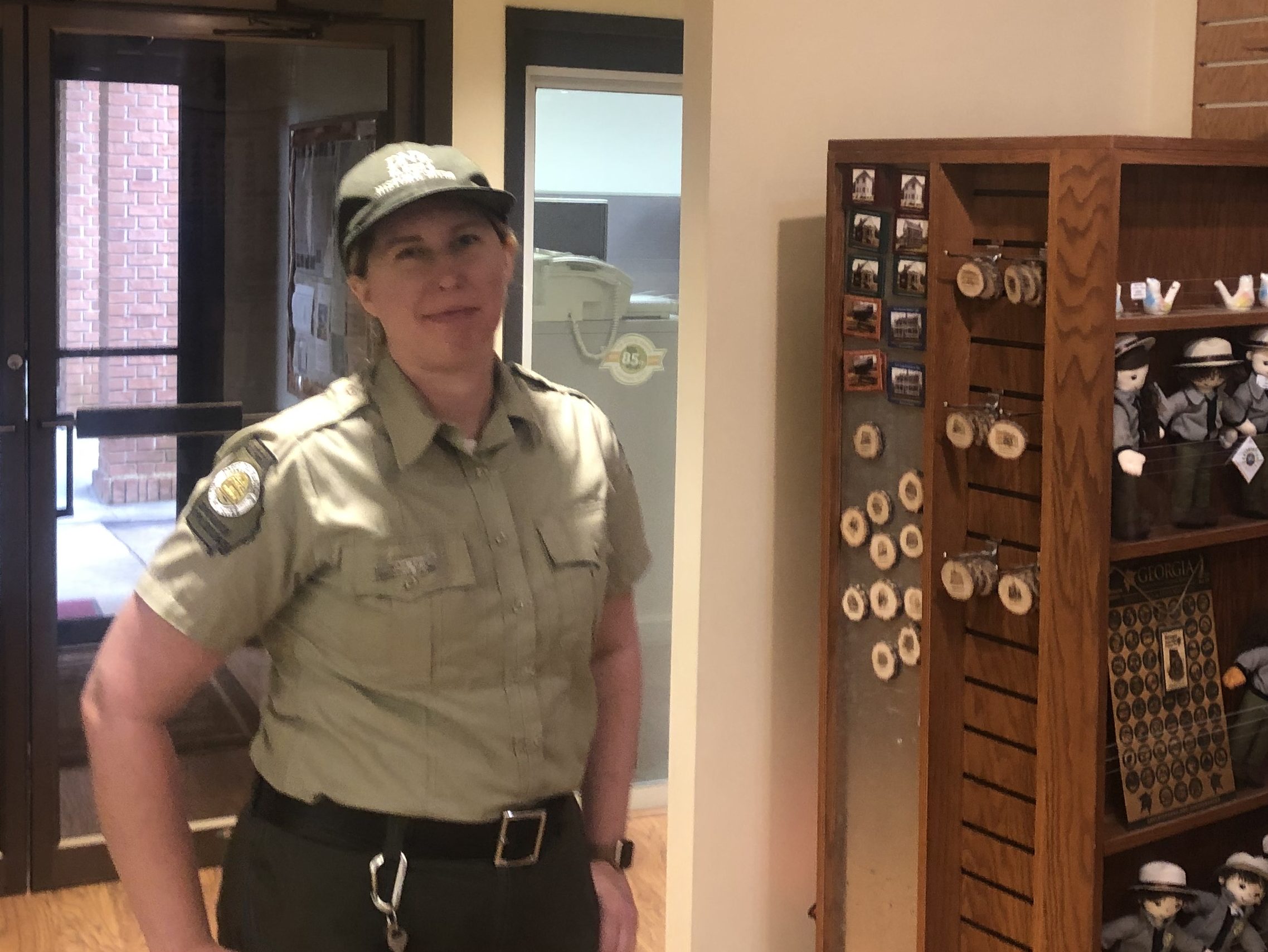
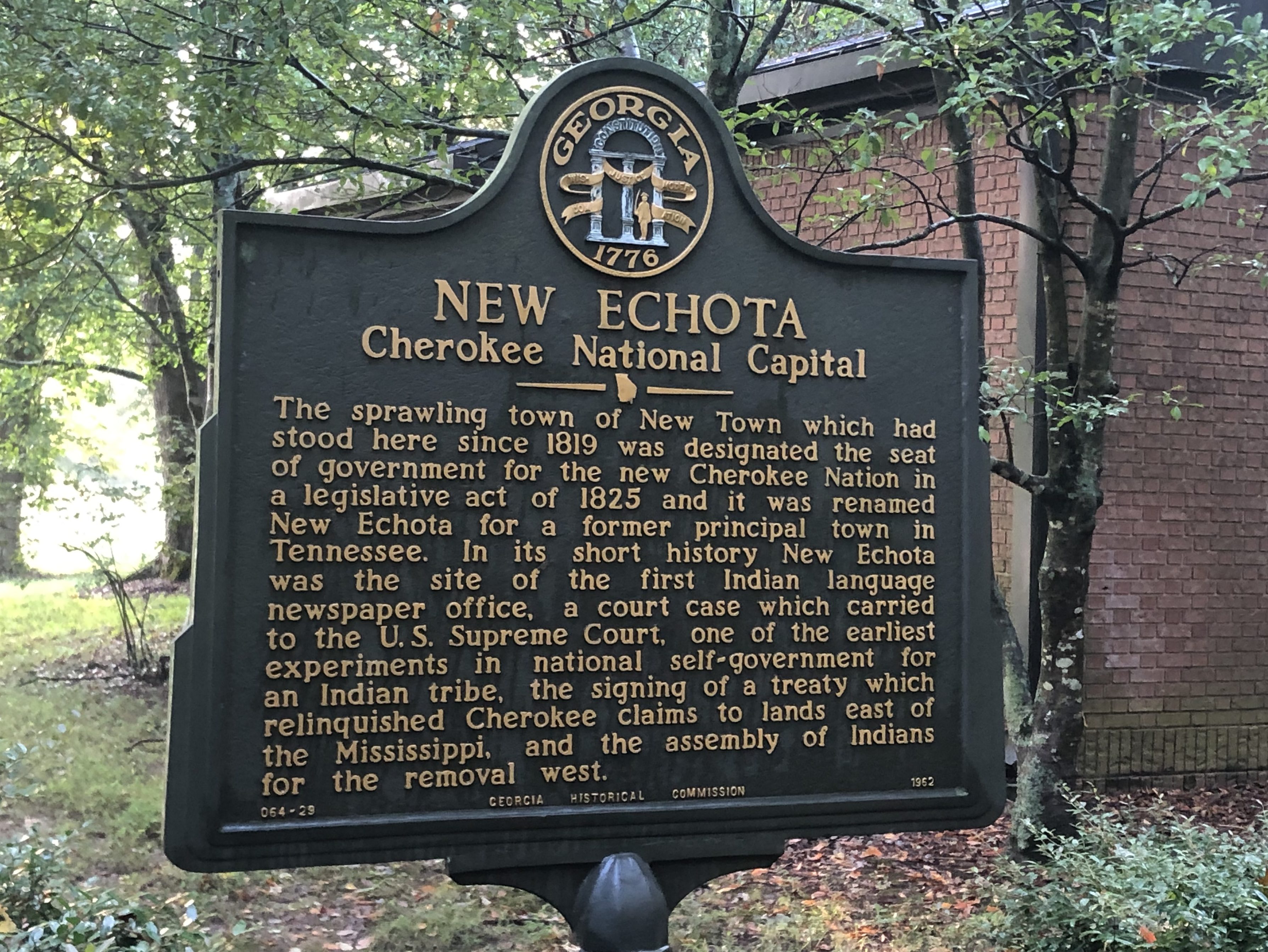
This morning Scott and I began our Trail of Tears Tour (T3) with a visit to New Echota, Georgia. This was the short-lived capital of the Cherokee nation before everyone was rounded and up and driven out to the new “Indian Territory” in Oklahoma in 1838. New Echota is now a Georgia State Park, and the exceedingly helpful Ranger Jackie gave us a valluable orientation about the Cherokees and the Trail of Tears.

Ranger Jackie, enlightening us.

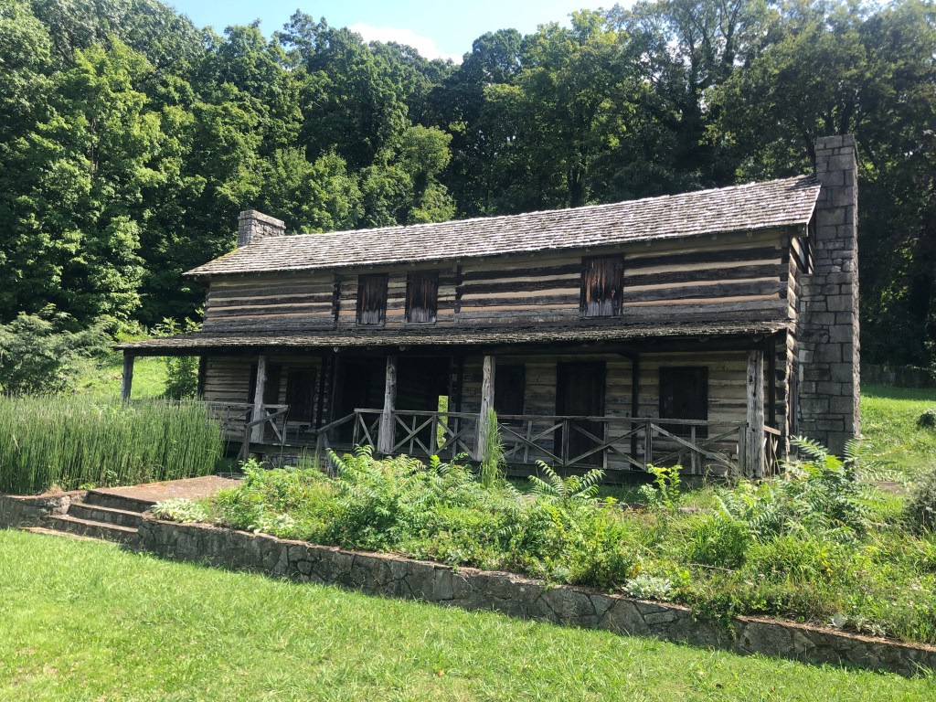
The Cherokees, we learned, had a remarkably progressive and European-influenced culture, especially when compared with other Native American groups (let alone the stereotypes of western movies). They adopted a written constitution that reflected many of the features of the US Constitution. They build their economy on farming and trade, and they constructed hewn-wood cabins and clapboard buildings. They developed a written alphabet, and produced their own Cherokee newspaper. Their government operated as a democratic republic, with separate executive, legislative, and judicial branches. Some intermarried with whites, and generally maintained good relations with the white authorities.

At the same time, the Cherokees were not above criticism by today’s standards. For example, they kept African Americans as slaves, and generally harbored what today would be considered racist views about blacks.

Yet Scott and I felt only sorrow for the Cherokees as we learned more about their treatment on the Trail of Tears. Here was a people who, by all accounts, tried to assimilate into a young United States — despite the fact that they were here hundreds of years earlier. They sought mutually beneficial trade relations with the American settlers, and when conflicts arose, they turned to the American courts, rather than violence, to gain their due. Despite this, as Georgia’s appetite for land increased (and as it became clear that Cherokee land included some rich gold deposits), it was decided that the Cherokees had to go and the land handed over to white settlers.

Some 16,000 Cherokees forced to make the westward trek along the Trail of Tears. Only a portion of them passed through New Echota, but the town is important for its role as the political center of the Cherokee nation. After the Cherokees had been relocated, New Echota was left to fall into disrepair. But in the early- to mid-twentieth century, various groups worked to restore and rebuild the structures. Today, about a dozen of these buildings bear mute testimony to the Cherokee way of life in 19th-century Georgia.

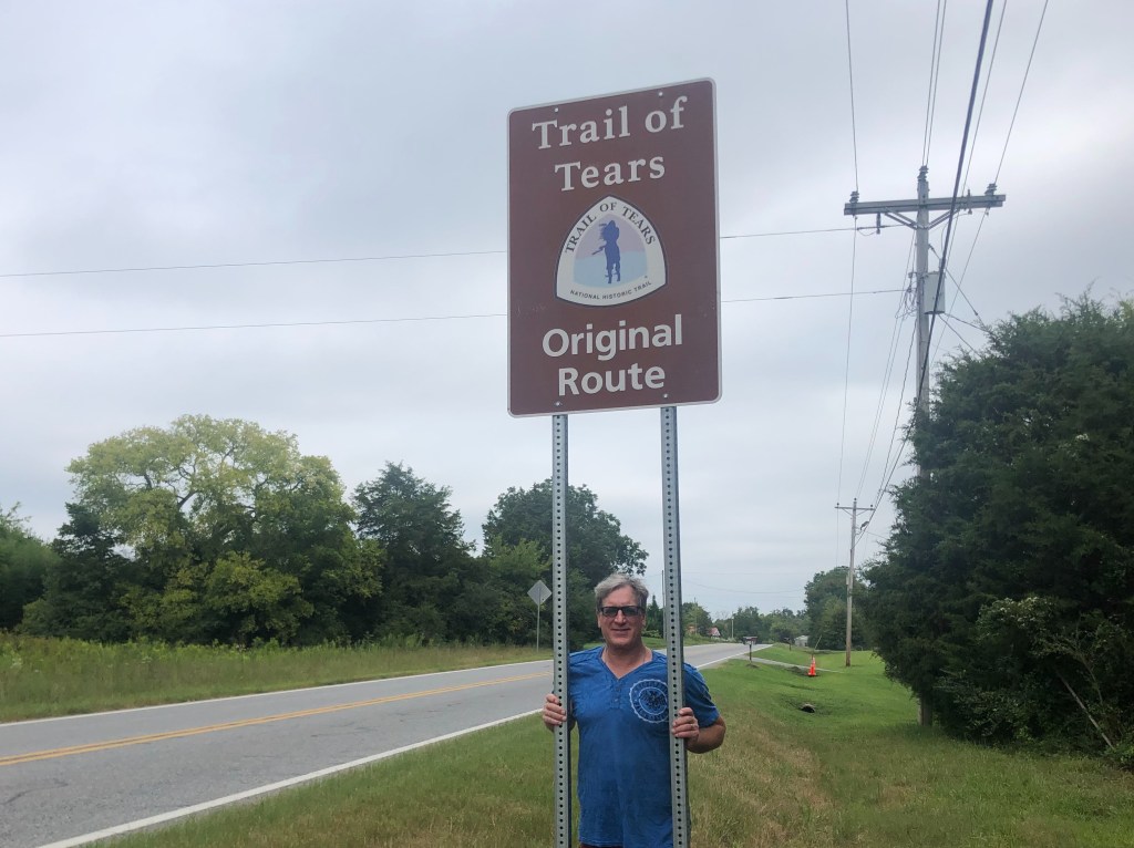
It strikes me that the story of the Trail of Tears carries two separate tragedies. One is the the brutal treatment of these human beings, pushed, often at the point of a bayonet, along an 800-mile trek without adequate food or clothing. As many as 4000 Cherokees died during that forced march. But the second tragedy is the very fact that they were pushed out of their homes and off their ancestral lands. That is, even if the “relocation” (as it was sometimes euphemistically called) was conducted much more civilly, with comfortable transportation and good provisions, the entire enterprise would still be tainted as unjustified and cruel.

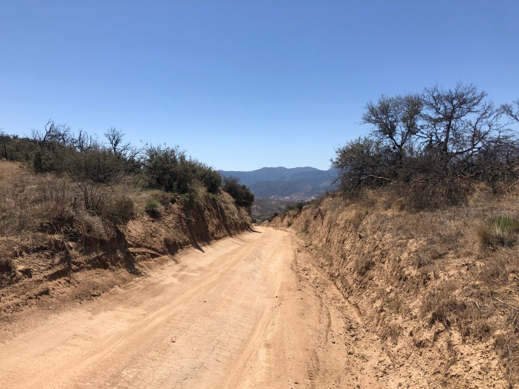
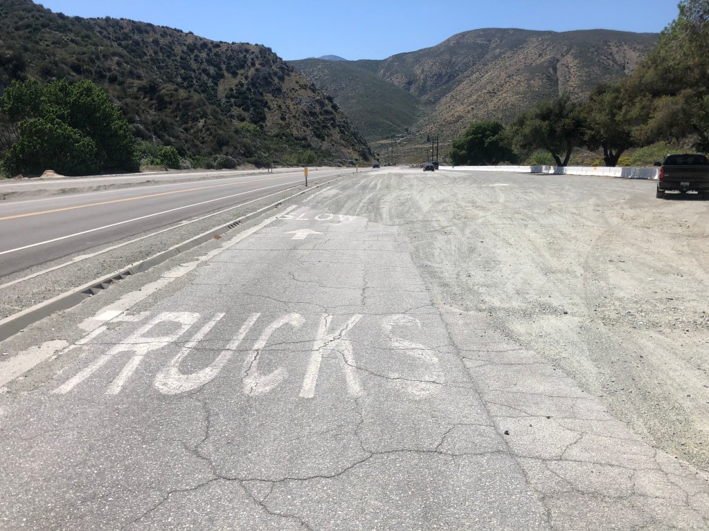
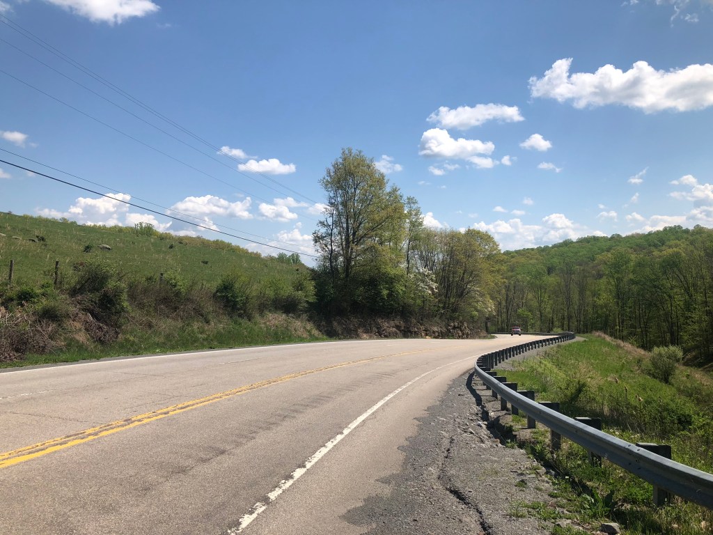
With these sobering thoughts, we set out along one of the routes (the northern one) taken by the hapless Cherokees. This part of the country is exceedingly green and alive with the sounds of cicadas, and we could imagine the ragtag groups struggling along the way.

Scott doing his Edward G Robinson impersonation

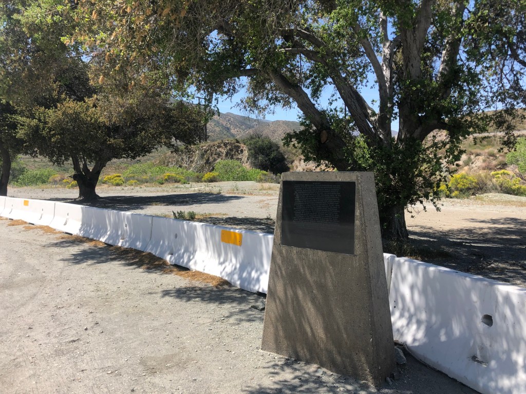
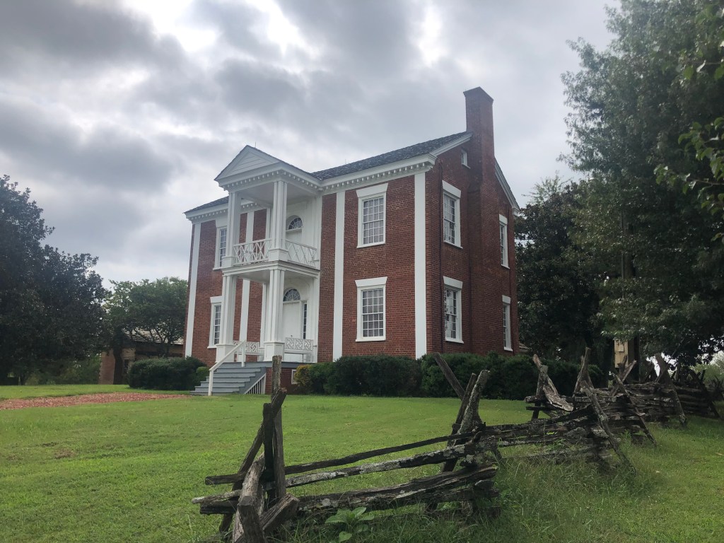
Along the drive today we passed two homes that had belonged to important Cherokee Chiefs. The first is the home of Chief James Vann, a wealthy Cherokee leader and businessman. Vann’s family lost the home when they were forced with the others to the Oklahoma in 1838. It now belongs to the Georgia State Parks System.

Far cry from a tipi.

We also came upon the home of Chief John Ross. Ross, who was only one-eighth Cherokee, nevertheless served as the nation’s principal chief for almost 40 years–longer than any other Cherokee chief. He presided over the nation all through the events leading up to the Trail of Tears, the actual relocation, and the aftermath. His is a complicated but fascinating story.

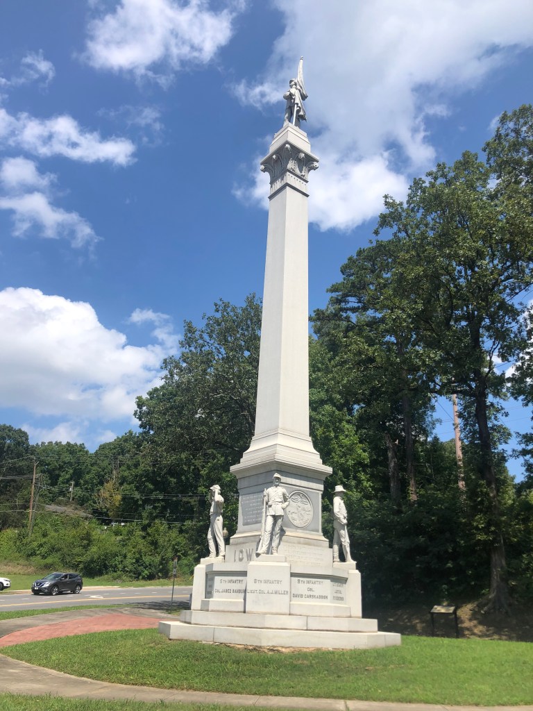
There were plenty of other notable sites along today’s drive, many of which related to the Civil War (which took place a quarter century after the Trail of Tears). For example, there was this monument in Chatanooga, which commemorates Ohio soldiers who fought at the Battle of Missionary Ridge. I’m no Civil War historian, but I find it somewhat surprising that a Union state (Ohio) was able to erect a monument to its soldiers in a Confederate state (Tennesee). The monument also includes an 80-foot obelisk, to add to our collection.

Not to rub it in, but we won.

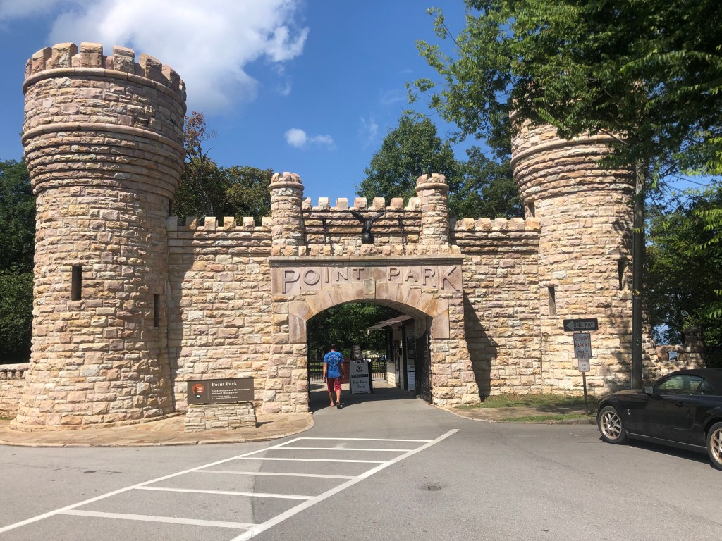
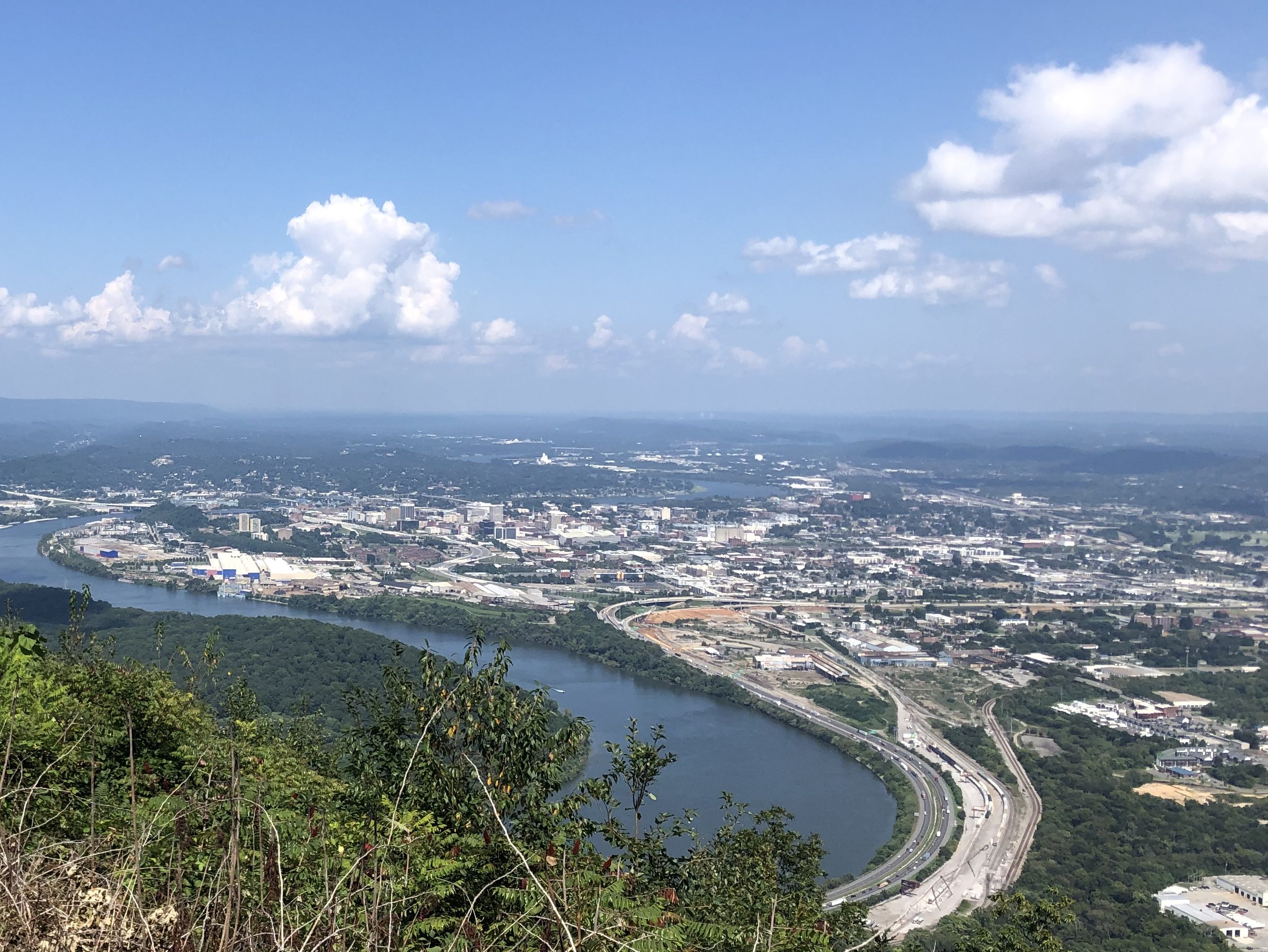
Not far from Ohio’s monument is Point Park, on Lookout Mountain. Scott remembered visiting the mountain as a school child a half-century ago, when he was living near Atlanta. Point Park is a national park that commemorates a Civil War battle. More importantly for us, it has a great view of the Tennessee River snaking through Chattanooga.

Yes, the entrance to Point Park feels a bit like Disneyland…
…but what a view!

It turns out that Lookout Mountain has a number of other attractions, including a cable car that claims to be the “world’s steepest railway.” It was constructed in the late 1800s, and still runs today, taking passengers up and down the side of Lookout Mountain.

But more enticing, to me a least, is Rock City. Doubtless you’ve seen, or at least heard of, the multitudinous advertisements painted on barn roofs along Route 66 and other highways, urging travelers to “See Rock City.” Here is an example, stolen from the Internet:

See Rock City  14 x 11 Print  FREE SHIPPING image 0

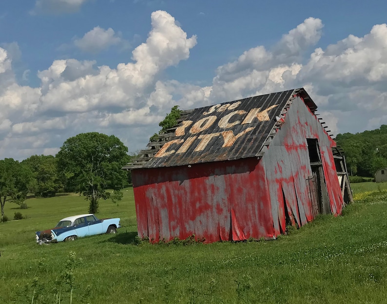
I’ve seen plenty of the barn-emblazoned advertisements, but I’ve never seen Rock City. In fact, I can’t say that I ever had much desire to see Rock City. But let’s back up a bit. About 100 years ago, a fellow named Garnet Carter (you may know him as the inventor of miniature golf, but that’s another story) decided to turn an unusual outcropping of rocks on Lookout Mountain into a tourist attraction. He purchased a large parcel (about 700 acres) of land, with this “rock city” in the middle of it. He developed a network of trails, and added statutes of gnomes for good measure (as one does). He then paid to have advertisements for Rock City painted on barns across the midwest and south. It’s said that over 900 barns across 19 states were eventually painted with the advertisements. The advertisements, especially linked with the picturesque old barns, became iconic. Rock City has been open to the public since 1932.

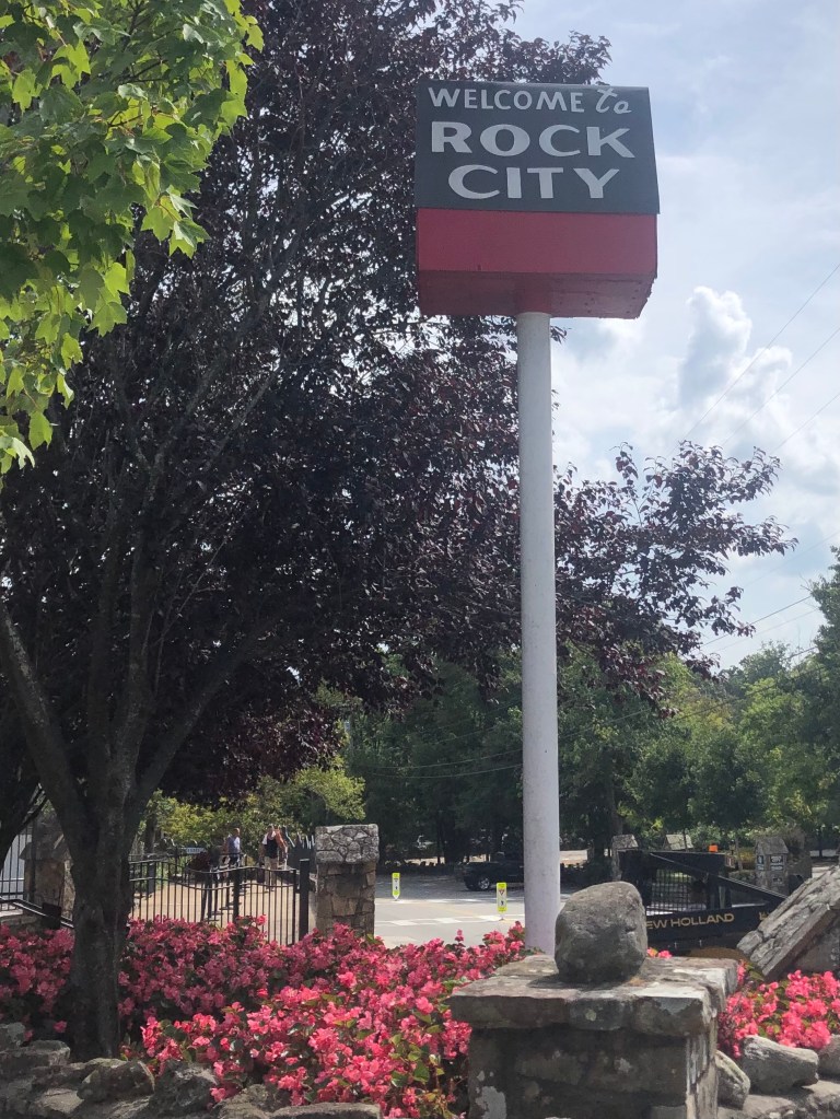
Well, it turns out that Rock City is just a few miles from Lookout Point, so Scott and I went to see what all the fuss is about. I can’t say that it’s an impressive phenomenon. But I can say that, finally, I’ve followed the injunction to See Rock City.

Didn’t Starship have a song about this in 1985?

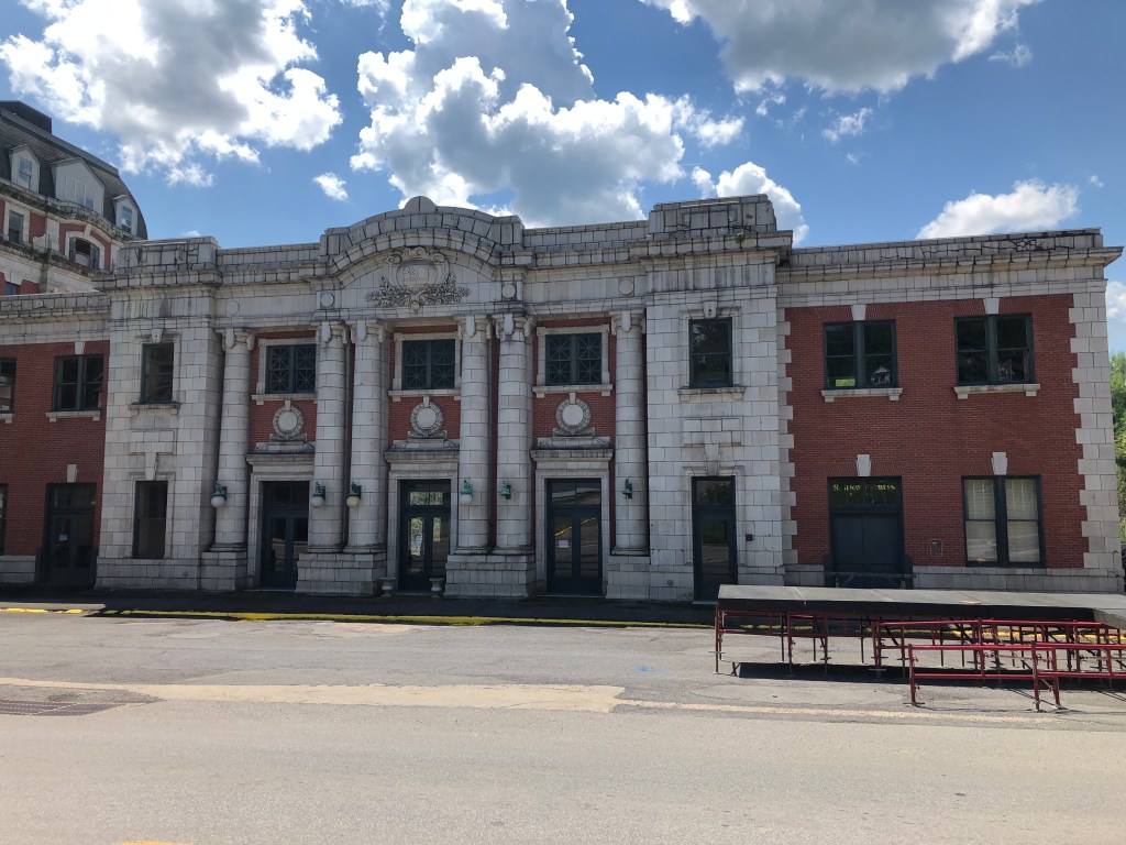
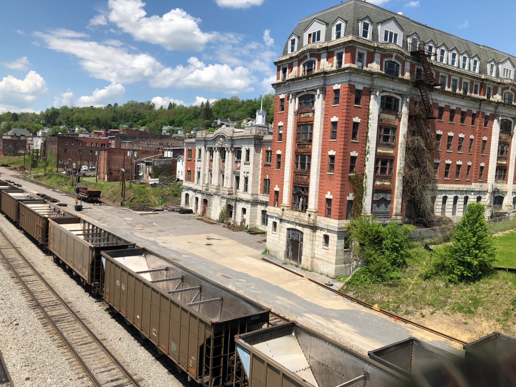
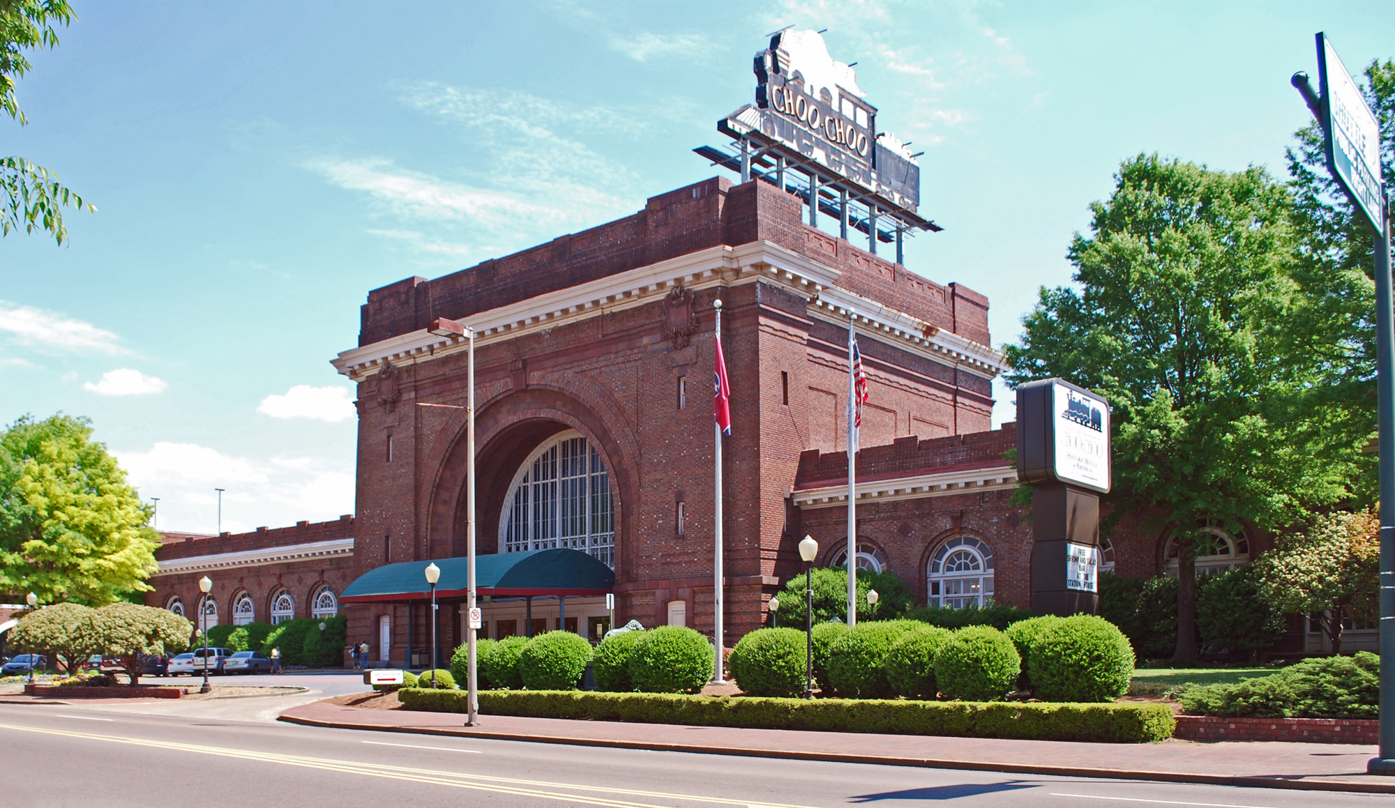
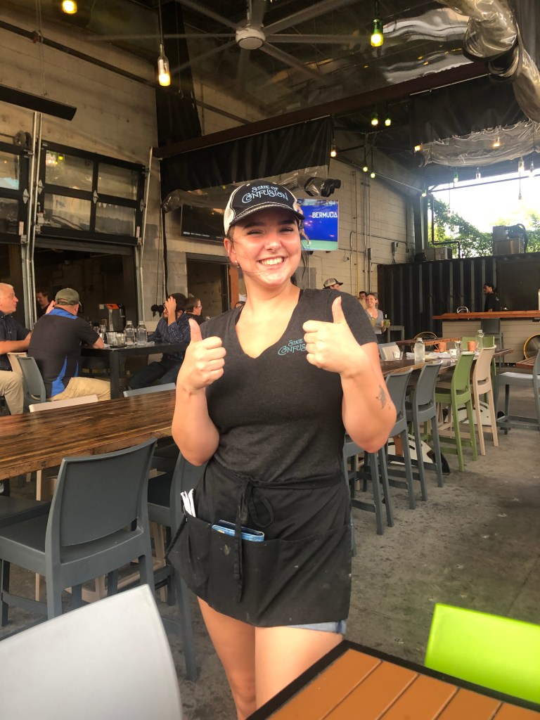
As we drove down from Lookout Mountain, we realized we’d worked up an appetite. So we repaired to a restaurant called State of Confusion. The restaurant is next to Chattanooga’s historic Terminal Station, which had been constructed in 1909, and was restored to its former grandeur in the 1970s.

Chattanooga Choo Choo: History, Hotel, Pullman Cars
Not bad for 110 years old.
Interior of Terminal Station’s lobby.
Our server, Jolie, in a State of Confusion.

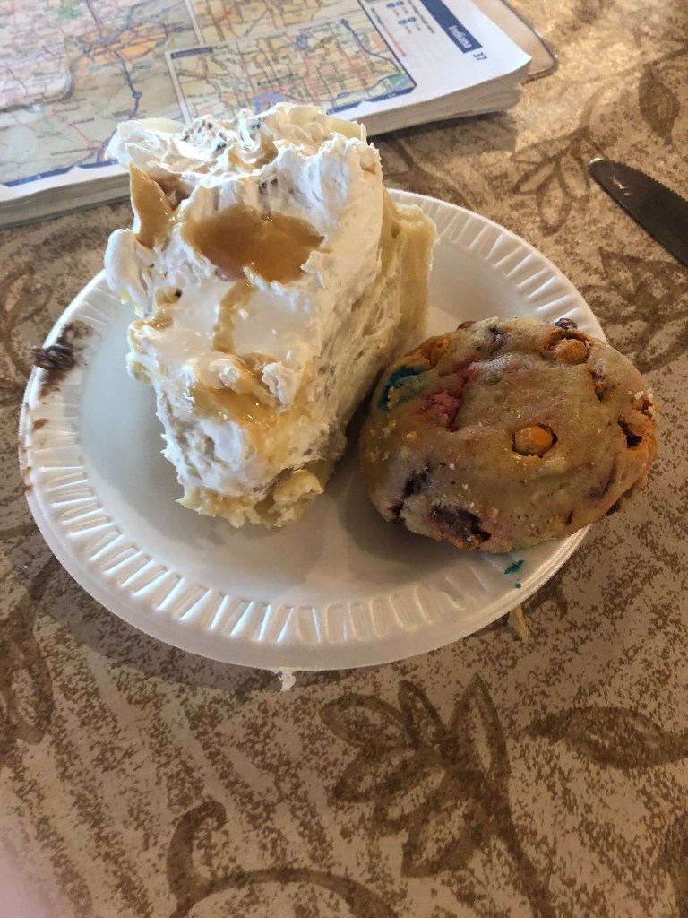
So, having driven about 75 miles of the Trail of Tears, seeing Rock City, and fortifying ourselves with greasy food, all that was left was to get a Brew of the Day….

BREW OF THE DAY

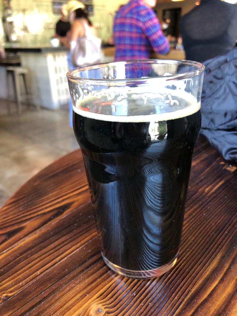
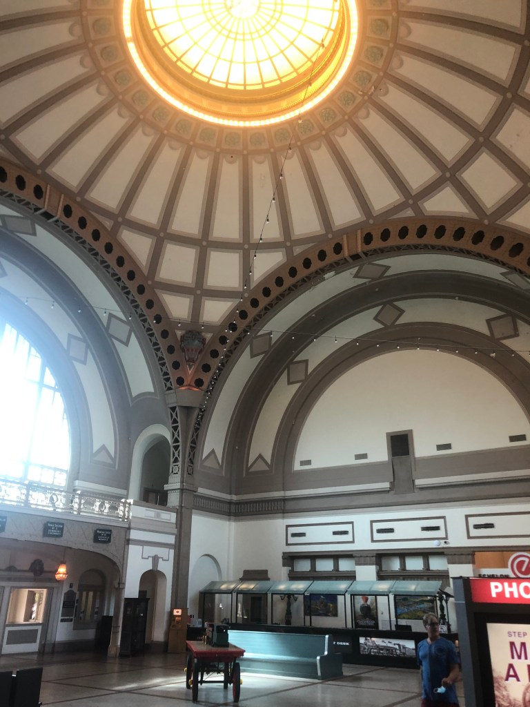
Today’s BOTD came from American Draft, which is a beer bar situated in a historic railroad car parked at Terminal Station. It’s a cool setting. Evidently, it was conceived as another one of the beer automats like the one we went to the previous evening. Check out their webpage. But tonight there was no serve-yourself option, and we instead were served by a charming and helpful young woman. After a half-dozen “could I just have a taste?” pours, I finally settled on the O’Fallon Salted Caramel Pumpkin Ale.

Now, I know what you’re thinking: Isn’t that a little bit girly for a manly guy like yourself? And you’d be right. But I guess I was feeling in touch with my feminine side. Plus, as we walked around Terminal Station, Scott and I had already stopped at not one but two distilleries, and had sampled a few bourbons and gins. So I needed to throttle back the alcohol intake a bit. The pumpkin concoction is only 5.4 percent ABV.

I have to admit, though, it’s a well-balanced beer. It’s not just a cynical attempt to go after the Starbucks Pumpkin Spice Latte crowd. This is quality stuff, with caramel malts, pink Himalayan sea salt, a “proprietary blend” of spices, and a little lactose to suggest a pumpkin puree mouthfeel. There’s none of that cloying aftertaste you get from artificially-flavored beers. With the calendar moving towards fall, I suggest you try a pint….if you’re man enough to do so.

bridges · California history · Cars · Road trips · trains · Uncategorized

Getting My Kicks

Some years ago, my replacement unit (son Ian) and I drove the entire length of Route 66, from Chicago to Santa Monica. As the reader no doubt knows, Route 66 was one of this country’s first highways, dating back to 1926. It also had been the main way to get to southern California from points east, starting with the dust bowl migration and extending to the car culture of the 1950s and 1960s. Just one or two lanes in each direction, the road has an unhurried and scenic charm. Alas, as depicted in the movie “Cars,” Route 66 was eventually bypassed by various interstates, and the towns and businesses along the old Route slowly declined and eventually dried up. When Ian and I took our trip, we saw plenty of derelict buildings on the side of the road: motels, gas stations, diners, and the like. I suspect that many of those old landmarks that we saw over a decade ago are now gone.

GKRep66W0.jpg

Anyway, Route 66 has always occupied a soft spot in my heart, so I was inspired when my good friend Detlef recommended that I explore an old segment of Route 66 that crosses Cajon Pass (where one crosses from the Mojave Desert to the LA Basin. Or vice versa.) Now, when Ian and I drove Route 66, we didn’t drive on much of this particular segment, because it had been blocked by Interstate 15 in the 1970s. However, a few years ago, the good people of CalTrans redesigned the freeway and reconnected the discontiguous parts of old Route 66 over the pass.

Cajon Pass, Route 66 California

I began today’s tour at the Cajon Summit (approx. 4000 feet above sea level). For over half a century, the Summit Inn stood as a well-known landmark here. The owner, Cecil Stevens, finally sold the place in 2016, and a few months later the structure was destroyed by the “Blue Cut Fire” that ravaged much of the area. Timing is everything. Sadly, Cecil died of Covid just a couple of months ago (February 5). He was 88.

Glory Days
Anyone want to go in with me?
On the site of the old Summit Inn. I have no idea what this is.

Now, the first part of Route 66 over the pass has been overlaid with Interstate 15. That’s not especially interesting. But you can take an old, rickety, rutted dirt road that had been used as a “shortcut” by motorists in the early years. This dirt road began as a wagon trail called the John Brown Toll Road. It was constructed in 1861–just as the Civil War was erupting. So I set out on this old original road.

…but the old dirt road begins!
View of Cajon Pass from John Brown Toll Road. Note I-15 to the right.

One wonders why this rutted, twisting road was ever considered a “shortcut” for Route 66. My understanding is that it used to be in better shape, and it even received pavement in 1914, but it’s narrow and steep and twisting. I was cruising along at about 5 mph.

Remnants of 1914 pavement.
This cut originally was dug by hand in 1861!

Now, there’s one thing you should know about Cajon Pass: It’s a Mecca for railroad enthusiasts. The railroad first crossed the pass in 1885, and today over 150 trains can pass through in a single day. As I made my way down the John Brown Toll Road, I encountered four sets of tracks, including a trip under these tracks from 1915.

Eventually the John Brown Toll Road reconnects with the old Route 66 proper. At this location, there are several notable markers. One commemorates Camp Cajon, which was a popular resting spot, with various facilities, for travelers coming over the pass. It was developed in 1919, but was destroyed by a flood in 1938.

“We have builded”??

Another marker identifies this spot as the junction of the Santa Fe Trail and the Salt Lake Trail. It honors “the brave pioneers of California,” and was erected in 1917 by a group of eight pioneers. Notably, one of these pioneers in John Brown (of the Wagon Toll Road, which I’d just come down). Two others (Sheldon Stoddard and Sydney Waite) had been members of the “Lost 49ers” through Death Valley. Coincidentally, I’ve run into this group on two earlier trips: Death Valley and, more recently, Walker Pass. These three individuals, along with the other five who sponsored the monument, were all present at the dedication ceremony in 1917.

Monument “to the brave pioneers of California.”

It was now time to get onto Route 66 proper. This segment parallels the modern Interstate 15. Now, as I mentioned, this is railroad country, and much of this road also parallels the old railroad line:

…or are you just happy to see me?

It struck me that this is the same segment of road where I’d camped out for over an hour, waiting for the Union Pacific’s restored “Big Boy” steam locomotive to come through in the fall of 2019. You can see my blog post about that event here.

The Big Boy on its way to through Cajon Pass in 2019.

What’s especially cool about this stretch of Route 66 is the good people at CalTrans have repaved the southbound lanes of the old road, and made them into a comfortable two-way road. Meanwhile, they’ve left the northbound lanes of Route 66 unrestored, with periodic K-rail barriers to prevent people from traveling along it, thus preserving it as an artifact. There are even some of the old, painted “Route 66” shields still extant on the original roadbed.

Original roadbed.

Also, some of the bridges from the early days are still in place, with their year of construction stamped in concrete:

From the Herbert Hoover administration.

A bit later I came to an old rest area that had been constructed in 1952. All that remains are some pavement markings and a memorial plaque.

Marker notes, among other things, that the tollhouse for the John Brown Toll Road was nearby.

Incidentally, this location sits on the San Andreas Fault, where the Pacific Plate and the North American Plate meet. In fact, it was the San Andreas Fault that created Cajon Pass in the first place.

On a hillside next to the road I saw the faintly visible number “66” somehow carved into the earth. I can’t find any information about who did this and when. Tips are welcome!

Can you see it?

Now, let me explain that on my drive from LA to the Pass I was listening to a podcast called “Stuff You Should Know.” (If you’re not already familiar with it I’d recommend it to you.) At the end of the podcast, the hosts always read a letter from a listener. In today’s episode they read a letter they received from the great-great-great niece of one Helen Boss, who caused the car accident in which Sammy Davis Jr. lost his eye in 1954. You can listen to the podcast here (listener mail starts at 59:40).

So imagine my surprise when, shortly after listening to that podcast, I found myself passing the exact place on Route 66 where Sammy’s accident occurred. I’m not making this up. The accident happened where the road passes under a railroad track. Evidently the 72-year-old Mrs Boss had missed her exit, and decided to back up in the early morning gloom. Sammy rear ended her and lost his left eye in the accident. Fortunately, no one was killed.

Where Sammy and Helen met.

Before long Route 66 completes its journey through Cajon Pass, and it enters the city of San Bernardino. At this point, almost no remnants of the old road and infrastructure remain. So I decided to jump back onto the interstate to head back home. But it’s worth noting that some other stretches of the original Route 66, along with some roadside structures, still exist on its final leg westward toward Santa Monica, on a road now named Foothill Boulevard. I drove that stretch a few years ago, and will assemble the photos into a blog entry at a later time.

So there you have it: A good stretch of the original Route 66 can still be driven over the Cajon Pass, bypassing the soulless and numbing Interstate. Thanks to Detlef for calling this to my attention!

California history · Cars · Road trips · trains · Uncategorized

From Oil to Oat Milk

Today’s travels focused primarily on CA Route 33. To get there I took an easy and leisurely route across the Central Valley floor to Blackwell’s Corner at the intersection of CA Routes 46 and 33. Blackwell’s corner is one of my favorite stops on California roadtrips, as it’s a friendly and well-provisioned oasis in the middle of nowhere. A single building is outfitted with a gas station, a diner, a grocery store, showers, bathrooms, an ice cream fountain, a homemade fudge kitchen, and a James Dean shrine. For it’s at this spot that James Dean was last seen alive before his fatal car crash a half-hour later on September 30, 1955. He was 24 years old.

Well, he did star in Giant, you know.

Blackwell’s Corner traces its lineage back exactly 100 years — to 1921 — when George Blackwell opened a rest stop on the site. I’ve stopped here many times. Sure, the gas is about a buck a gallon more expensive than elsewhere, and the snacks are severely overpriced. And the fudge doesn’t do much for me. But this place is an institution, it feels really earnest, and there’s really no other options for rest and refreshment in the region. It’s reassuring to know that it’s here. So I’m happy to support it.

Some years back Blackwell’s put in this 1950’s-themed diner to capitalize on its James Dean connection. Even before Covid, I’ve never seen anyone eating there.

So after gassing up and getting a bottle of juice for breakfast, I turned onto CA Route 33. Like Blackwell’s Corner, Route 33 reminds me of a reliable old friend. I’ve traveled segments of 33 on various occasions — particularly the stretch known as the Petroleum Highway. This segment is a hellscape of oil rigs and pipelines scattered willy-nilly across the parched and poisoned earth. It’s like something out of Mad Max, and somehow you can’t take your eyes off it.

“I’m just here for the gasoline.” — Mad Max

One of the notable intersections in the area is where Route 33 is crossed by “Brown Mat. Road.”

Wipe your feet.

At first I thought this meant the road was covered with brown mats, or appeared to be so covered. Then I noticed that “Mat.” is short for “Material.” So why would you name a road “Brown Material Road”? Is it simply an odd reference to a dirt road? Or a euphemism for something scatological?

Could you please be more specific?

After doing some research, I discovered that the name references a business that used to be on the road: A place called Brown’s Material Supply Company. So it’s really analogous to Magic Mountain Parkway in Santa Clarita.

Anyway, the Petroleum Highway is much more famous for its oil than for Brown Material. The scale of production is impressive. This region (Kern County) produces fully three- quarters of the state’s oil (and about a tenth of the country’s overall oil production). One of the major oil producers, Aera, takes great pride in showing off one of its old pumps, tarted up with Christmas lights next to the road.

Long since retired.

In the midst of these oilfields, I happened upon the Oakwood Bar-B-Q and Bar in the tiny town of McKittrick (pop: 115). Under the main yellow sign was a tarnished copper sign on the outer wall that read “Penny Bar.” Upon closer inspection, that entire sign was made of pennies.

I’m definitely not getting my BOTD here!

This seemed intriguing. A plaque informed me that the building’s owners have over time glued over a million pennies to the bar, walls, and other flat surfaces of the building. I didn’t take any photos inside the building, since the roughnecks (or whatever the oil workers call themselves these days) that populated the establishment didn’t look like they’d take too kindly to a stranger photographing them. But I did get this photo of the back entrance:

Penny for your thoughts?

A little further along Route 33 I came to the town of Taft (pop: 9,300). Taft is just about the most southern town of the San Joaquin Valley, nestled against the foothills of the Transverse Ranges. Taft was originally named “Moron” around 1900, but after it burned down in 1909 it was renamed after William Howard Taft, who became president that same year. Taft is one of the more substantial towns on Route 33, and has close ties to the oil industry. While its downtown still feels stuck in the mid-20th century, it still feels viable and maybe even prosperous. The Fox Theater dates back to 1918. It’s had ownership changes and was even closed for awhile, but on this trip it seemed to be fully restored and functioning. Indeed, it’s showing “Godzilla vs. Kong” tonight!

Would have been great if Mothra could have been part of the showdown.

It was now getting to be lunch time. Because there would be no towns of any substance for the next 75 miles or so, I decided to get lunch at a place called Roots Eatery. Even though it was plopped down in a strip mall, two elements spoke of promise: (1) the meat smoker puffing away in the parking lot, and (2) the promise of “Good, Bad, and Ugly” on the menu.

Roots’ smoker. Somehow I doubt that the county health department has inspected, let alone approved, the setup…
I wish they’d point out the “bad” part of the menu.

I had a toothsome smoked pastrami sandwich with smoked bacon and smoked gouda on grilled and buttered sourdough. It was just what the doctor ordered, even though my arteries didn’t approve.

On the outskirts of town I encountered two notable things. One was this car; Points will be awarded to the first person to identify the make and year.

Second was this homemade art installation. Alert readers will recall that I have a soft spot for folk art. This trip has been largely devoid of any such sightings…until now.

Shades of Almira Gulch…

It was now time to leave the valley are start climbing up over the Transverse Ranges. The last bit of Kern County is commemorated by the town of Ventucopa (pop: 92), which marks the transition from Kern’s Maricopa to the county of Ventura.

As if “Inyokern” weren’t bad enough…

I was entering my favorite part of Route 33: the climb over the Transverse Ranges and the Santa Ynez Mountains. It’s a meandering, little-traveled, two-lane road with grasslands, oaks, and commanding views. Plenty of switchbacks allowed me to take panoramic photos of the road I was travelling.

The red line marks Route 33 over the Transverse Ranges
Still chugging along…
On the way to Ojai

Finally I was delivered into the town of Ojai (pop: 7,500). If you’re wondering what happened to all the country’s hippies, I can report they’re alive and well and living in Ojai. Seriously. I’ve never seen so many healing crystals, incense shops, natural food coops, organic this and free-trade that. Ojai has a city ordinance banning chain stores, so the businesses are all pretty unique. I did find a decent brew pub, which I’ll mention in the BOTD at the end. (Famously, Ojai is also known for standing in for Shangri-La in Lost Horizon.)

Now, I’d planned to take 33 to its end near the oceanfront in Ventura about 25 miles away. But on a whim I instead headed out of Ojai on highway 150 east, which took me to Santa Paula (pop: 30,000). This was one of the few decent-size cities I encountered on this trip. I always associate Santa Paula with the St. Francis dam disaster of 1928. The dam was dozens of miles away, but when it failed in the middle of the night it unleashed a wall of water that passed through canyons and took out hundreds of structures before it reached the ocean. A year ago I made a visit to the dam site and described the disaster here. Today in Santa Paula, I saw this monument commemorating two motorcycle police officers who alerted townspeople of the impending disaster.

Latter day Paul Reveres.

But the real treasure in Santa Paula, for me, is the old Southern Pacific railroad depot. It was built in 1887 and served as the center of commerce and passenger travel for many years. Passenger service was halted in the 1930s and freight in the 1970s. But the structure has been lovingly restored and today serves as the Chamber of Commerce’s headquarters and an art gallery. I’ve seen a lot of restored railroad depots in my day, but this one is among the absolute best. It appears vibrant and solid, and is really a thing of beauty.

Soon after Santa Paula, I connected with Interstate 5. As soon as I get on a freeway, I consider the trip to be over…even though I still had another hour and a half of driving. As I fought the LA traffic, I was thankful for two days of two-lane roads in the deserts, valleys, and mountains of California.

BREW OF THE DAY

I had my BOTD at a place called Topa Topa Brewing Company in Ojai. The place is about 6 years old, and is named after the nearby Topa Topa Mountains. It’s got lots of outdoor seating a very laid-back vibe, which is typical for an Ojai business.

Nice day for a beer.

I chose the “Gadabout Stout.” Like yesterday’s BOTD, this is a nitro stout, which gives it a creamy mouthfeel. It’s brewed with coffee from the nearby Ragamuffin Roasters, and that gives it some decent roasty notes. But I have to say that I was underwhelmed by this beer. It’s made with oat milk, which while it may appeal to the Ojai hippies, seems to be an odd choice for beer. I suppose my main complaint is that the beer just feels flat and weak. It’s like drinking skim milk when you’re expecting a glass of whole milk. The beer doesn’t deliver much of a bite — either from hops or from alcohol. (It weighs in at 6% ABV). The main taste profile evokes corn cakes and unsalted tater tots. In a word, it’s bland. Definitely needs to be sharpened under a pyramid or healed with a crystal.

The Pone of Beers

Road trips · trains · Uncategorized

Day 7: Ohio and West Virginia

Editor’s note: Given limited travel opportunities these days, I decided each Thursday to post travel stories I’d written prior to starting this blog. The following is from a cross-country trip I made along the length of US 50 in the spring of 2018. I hope you might vicariously enjoy this trip while we’re all hunkering down at home. Because this is a longer trip (a week and a half), I’m going to post each of the daily entries over each of the next 10 days.

I left my motel early this morning, and was struck that, once again, I was the only guest at the whole place. Check out the parking lot:

Paging Norman Bates…

On my way back onto US 50, I came upon the Athens Bread Company. Given that Athens is a college town, and the shop is located on a nice, upscale street, I figured I’d finally be able to get that fresh, artisan bagel that I was craving for breakfast for the past few days. I entered the shop and encountered a nice young man wearing a baker’s apron. This looked like the real thing! I asked him what kinds of bagels he had. He had none. Well, ok, how about a good scone? None. Bear claw? No. Donut? No. Well, I was really hoping to get something for breakfast. What do you have? He looked at me meekly and said that he could make me a sandwich. Like a breakfast sandwich, I asked? No, just like a sandwich sandwich. I was flabbergasted. It was 8 in the morning, and all this guy is selling is sandwiches? The whole thing was playing out like Monty Python’s cheese shop sketch, where it turns out the shop has no cheese at all. I gave up and decided I’d just get a cup of coffee for the road. I asked for a dark roast. “We have blueberry crunch.” Yes, that’s the coffee flavor he offered. I left empty handed.

And by “pastries” we mean “sandwiches”

My last stop in Ohio was Coolville (pop: 496). I just liked the name. I obviously failed in trying to do a cool pose in this selfie.

S-Boi makin’ sum phat rhymes…or whatever.

Before long I crossed into West Virginia. For most of the day’s drive, US 50 cut through heavily wooded, hilly countryside. It was perfect weather, and an enjoyable drive.

Mountain mama

There were, however, very few towns to explore. One exception was Clarksburg (pop: 16,578). As soon as I entered the town I knew I was now in the South. Confederate statutes abounded, and the local courthouse had a large granite depiction of the ten commandments. Note the woman smoking next to the commandments.

Thou shalt not smoke

Another West Virginia town of note was Grafton (pop: 5,000). I pulled the Yaris over in front of a nice-looking city block, and got out to look for a place to get a decent sandwich. A pleasant, older woman in a purple outfit seemed to appear out of nowhere, and asked me if she could be of assistance. I gave her my usual line that I’m a tourist traveling the entirety of US 50, and that was just exploring her town. Her eyes lit up, and invited me into the large brick church that was in front of us.

Hit the road, Jack

It turns out that the building was constructed as a Methodist church in 1873. According to my guide (whose name is Mary), the church hosted the first official Mother’s Day celebration in 1908. This was arranged by a local woman named Anna Jarvis, who was looking to honor her own mother who had died a few years earlier. After that initial celebration, Anna Jarvis pushed for an official national Mother’s Day, that would be on the second Sunday of May (which marked the date of her own mother’s death). Her efforts culminated in President Woodrow Wilson proclaiming a national Mother’s Day in 1914. Mary showed me the pen that Wilson used to sign the proclamation. 

The Hallmark people were salivating
Music courtesy of a kind organ donor

The building’s lower rooms also have many historic pictures of Grafton. The town had been founded as a major railroad junction on the Baltimore and Ohio railroad, and grew into a good-size city before declining in the late 20th century as the rail industry slowed. Mary, who  grew up in Grafton, seemed genuinely saddened by the decline. Eventually we made our way back out of the building, and Mary pointed out the old railroad depot across the street. Built in 1911, it has been out of service since the 1970s, but it’s still an impressive structure. Next to it is a large hotel that was built at the same time, as an incentive to get the B&O to locate the station there. Here’s the view of the station from the street:

The B&O railroad put the “BO” in beaux arts

And here’s the view from the railroad tracks. The hotel is on the right.

Bonus material here.

After about an hour, I made my goodbye to Mary. She invited me to attend the Mother’s Day service at the Shrine/Church this coming Sunday, but I told her I would be long gone. She gave me a look like I was an unappreciative rube. I then asked for a recommendation for lunch. She gave me several suggestions (she seems to know every place in town), and I settled on getting a “hoagie sandwich” from the food truck that parks near the abandoned depot every Wednesday. It was one of the best lunches I’ve had on this trip.

I got back onto US 50, and made my way through the Appalatians. Near the border with Virginia I saw this outhouse on the side of the road:

Yes, this whole thing is just an elaborate mailbox in front of someone’s home.

Here’s another stretch of abandoned buildings, in Virginia, that I thought was picturesque:

Remember: Every time you see a street in any of these photos, it’s US 50!

I ended my US 50 drive today at the city of Winchester, VA (pop: 27,300). From there, I took a three-hour detour south to visit my friend Chris, who moved to Virginia with his wife Carol about a year and a half ago. I’m going to take tomorrow off, while Chris and I drink Scotch and explore the area. Not at the same time. I will return to US 50 on Friday, and will resume my “blog” then.

bridges · Road trips · trains · Uncategorized

Day 6: Missouri and Indiana

Editor’s note: Given limited travel opportunities these days, I decided each Thursday to post travel stories I’d written prior to starting this blog. The following is from a cross-country trip I made along the length of US 50 in the spring of 2018. I hope you might vicariously enjoy this trip while we’re all hunkering down at home. Because this is a longer trip (a week and a half), I’m going to post each of the daily entries over each of the next 10 days.

I think I’ve achieved the Zen of US 50. There’s something very freeing—what the current argot might call “in the moment” – about living for almost a week on this road. In some ways, it’s ever-changing–—passing through 12 states, four time zones, countless communities, and various climates and topographies. It reveals the diversity at least of some of America. Unlike an interstate, which studiously avoids small towns, US 50 seamlessly wends its way through the middle of communities,  with houses lining either side of the road. In many communities, US 50 is literally “Main Street.” 

Despite revealing enormous diversity of our country, US 50 is also a very constant companion. It’s primarily a two-lane ribbon of asphalt with standardized signage. At this point, after driving it for over 2,000 miles, I recognize the familiar “feel” of 50. One of you asked me if I need to use GPS to keep up with all the twists and turns. The answer is no—US 50 is extremely well marked. You know when you’re on it. I haven’t gotten lost once. And, as you know, for me, that’s saying something.

This morning I passed through the greater St. Louis metro area and then crossed the Mississippi River into Illinois, where the countryside is remarkably green and open. It was a very calming and pleasant drive through the state, and soon I found myself in southern Illinois. I’ve noticed that the communities (that is, at least the ones along US 50) seem to be tidy, well-kept, solid communities. This contrasts with the ghost towns of Nevada and the worn, dying communities of eastern Colorado and Kansas. In Illinois I stopped at an Amish restaurant, nestled in an Amish community replete with simple farms and horse-drawn buggies. The lunch wasn’t great, but the dessert (peanut butter pie) made it worth it. I explained to the waitress that I was traveling all of US 50. She seemed confused, not quite understanding what this entailed, and why I would do it. But she wished me safe travels anyway.

I might need a bigger car soon

After driving through Indiana all afternoon I stopped for dinner in Lawrenceburg, which sits right on the Ohio River. The road had flirted with the River a little bit before I arrived in Lawrenceburg, so I wasn’t quite sure whether I was now on the Indiana side or the Ohio side. I asked my waitress if I was in Ohio, and she burst out laughing. “No!” she spluttered. “We’re in Indiana!” Now, maybe they don’t get many tourists, but surely it’s not that unreasonable to not know which side of the river you’re on, when you’re 2000 miles from home. Changing the subject, I asked what kind of dark beers she had on tap, and she offered me a lager (which is so light it barely qualifies as beer). Undaunted, I ordered dinner (and a milk stout). When she returned with my meal, the waitress noticed my atlas and asked where I was heading. I told her I was driving US 50 coast to coast. “50 doesn’t go coast to coast!” she proclaimed. “It’s just in Indiana!” I showed her on the map that US 50 does indeed span the country. She seemed astonished. She called to another waitress to come over and get a load of this. “Can you believe it? Our 50 starts in California!”

After dinner I did in fact cross the river and enter Ohio proper. US 50 skirts around Cincinnati, but I did get a glimpse of what can only be described as the Rust Belt, replete with rusty railroad bridges and other decaying infrastructure. Very quickly, however, the road entered hilly, forested land which felt like I was in the Santa Cruz mountains. I ended up stopping in Athens, OH for tonight.

And now, a few photos from the day:

Cool abandoned bridge, originally built in 1923, that US 50 used to run across in western Illinois.
More of that abandoned stretch of US 50
I almost stuck the Yaris
North Vernon, IN. The age, style, and condition of the downtown buildings is typical of the towns I saw today.
Butlerville, IN. The road in this photo is US 50.
Ohio & Mississippi RR Depot in Aurora, IN. Originally constructed in 1854, now nicely restored.
Frisch’s Big Boy in Milford, OH. When I was growing up in the south bay area, there was a chain called Bob’s Big Boy. They even had a “big boy” statuette, similar to this one. The full story is here.
“Hiya, Big Boy.” –Mae West
…and don’t forget to turn your engine off when you get to your destination.