Editor’s note: Given limited travel opportunities these days, I decided each Thursday to post travel stories I’d written prior to starting this blog. The following is from a cross-country trip I made along the length of US 50 in the spring of 2018. I hope you might vicariously enjoy this trip while we’re all hunkering down at home. Because this is a longer trip (a week and a half), I’m going to post each of the daily entries over each of the next 10 days.
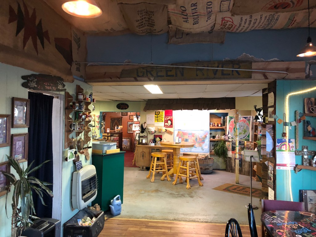
I set out this morning around 6:30 am. I stopped at the Green River Coffee Company (in Green River, Utah), which was just half a mile from my motel. The place was empty, but I heard someone rustling in the back kitchen. Eventually a lanky woman in her early 30s emerged, looking very much like a hippie from 1969. She was cheerful, and said “If you want coffee or breakfast” [why else would I have come there??] “you’ll have to wait a few minutes while my equipment wakes up.” I assured her I was in no hurry, and observed that it was indeed still early. “I must be your first customer” I astutely noted. The woman, whose name turned out to be Becky, explained to me that the place doesn’t actually open until 7, but she gets in at 6:30 to “wake up” her equipment. “I used to get here at 5:30, in order to do my online homework using the shop’s wifi. But now I can get internet service on my phone, so I do my homework in the morning before I leave.” It turns out she’s taking an online program through Oxford (supposedly the Oxford) in English literature. And she’s going to take an in-person class in England next summer. “I’m hoping to move there permanently.” I asked what would happen to the Green River Coffee Company. Does she own it? “No, I’m just the Coffee Wench.” Thanks for the coffee. Gotta go…
Green River Cafe. Note the equipment waking up.
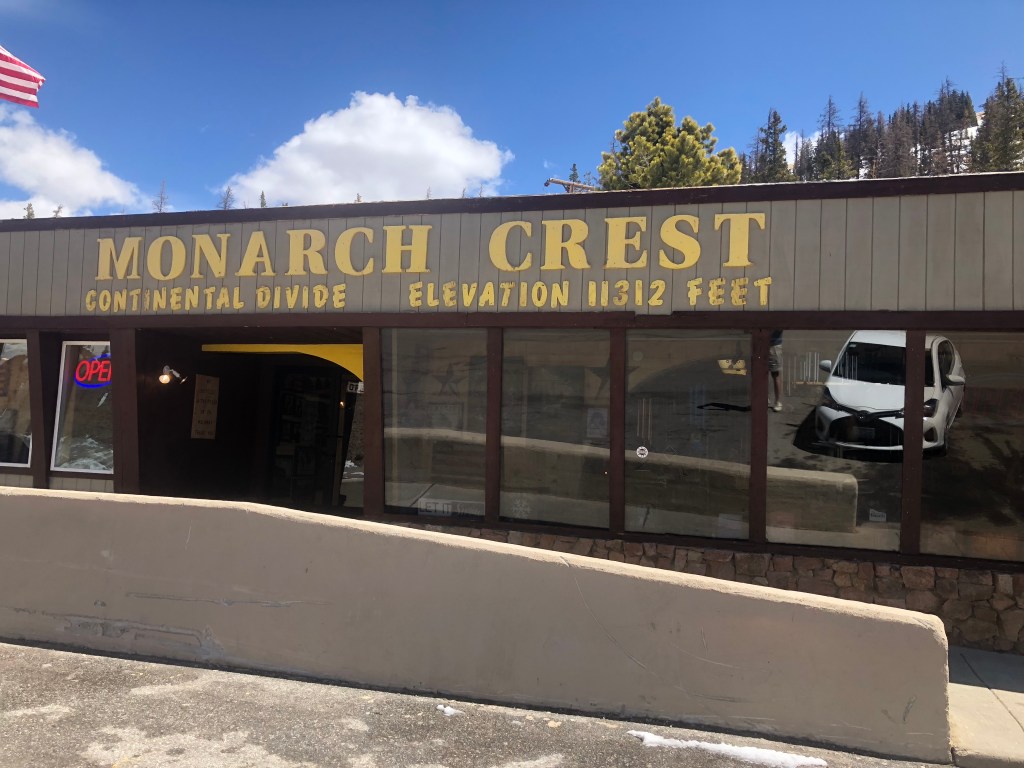
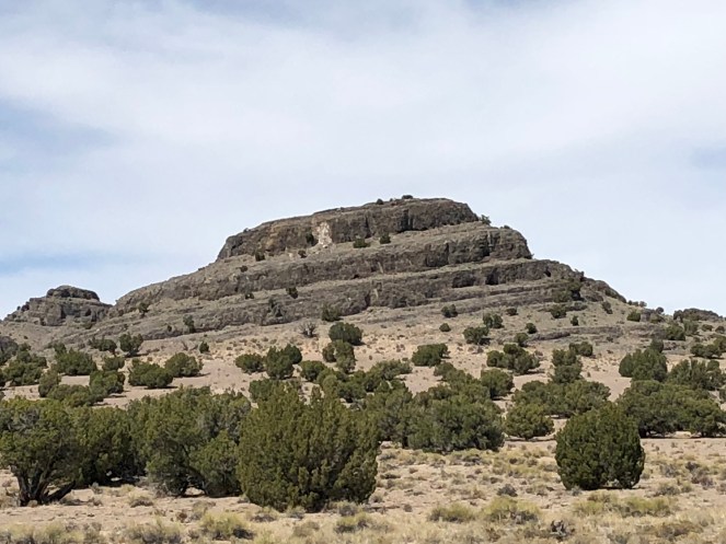
US 50 is still part of I-70 heading east out of Green River, so the drive to the Colorado border was pretty fast and uneventful. Shortly after entering Colorado, I came to Grand Junction, where 50 once again breaks off from I-70. I was back on the familiar, undivided, quiet road that is US 50. It was like reuniting with an old friend. The road began twisting and climbing as I moved up into the Rockies, and I admit that there were moments when I questioned whether the Yaris was up to the task. I became especially nervous as I approached Monarch Pass (elevation: 11,312 feet) where there was even some snow on the ground. Somehow we managed to get over the hump, which, incidentally, is the Continental Divide. I know that doesn’t make the pass any harder to cross, but there’s something notable about crossing the Divide. It makes one feel like they’re leaving the West. Which I guess I was.
“On top of the world, Ma!” (Edward G. Robinson)
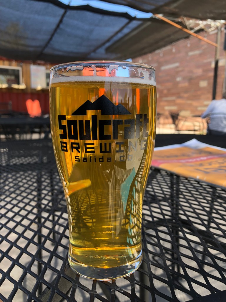
A short time later I came into the town of Salida (which the locals pronounce “suh-LIE-duh), and stopped at Soulcraft Brewing for a lunch stop. I had the Green Chile Ale, which was just the ticket on a warm day. I asked the bartender about food, and she directed me to the “food truck” outside next to the patio. This “food truck” is a “truck” the way that a mobile home is “mobile.” The food truck was really just a trailer, permanently built in place, and when I asked the gray-haired cook/owner about it she told me “this thing never moves. I don’t even have a truck that could move it.” I suspect Soulcraft is getting around some kind of restaurant license by calling this thing a “truck.” Anyway, the “truck” owner told me that this was now her restaurant — she used to own a regular brick and mortar restaurant in Denver, but then somehow she became the dean of a university. As one does. I asked her which university, and she muttered something about an online university. Somehow this didn’t quite pan out for her, so she recently quit the academic life and bought this “food truck.” I’ll say this much for her though: She makes a delicious homemade pasta dish. I had it with my beer, sitting on the patio in the sunshine. You really can’t beat that.
Green Chile Ale, with rootbound “food truck” in the background.
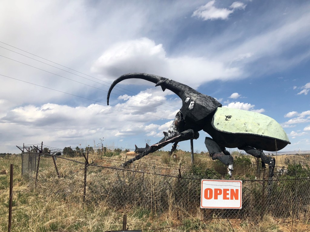
I got back onto US 50, with the Arkansas River and a small railroad line stretching along on my right. It was a very pretty and pleasant drive. Now, for the most part, this trip has not been about tacky, kitchy tourist attractions. Admittedly, I’ve made that the focus of some prior trips with Ian, such as our Route 66 trip. But this US 50 trip is meant to experience a more authentic part of America. I did slip once today, though, when I saw this giant beetle beckoning me to an insect museum. How could I say no??
Paging the Orkin man…
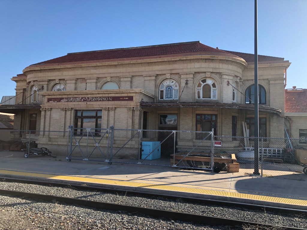
In the mid-afternoon I hit Pueblo, Colorado, which marks the end of my US 50 journey for today. Upon arriving in Pueblo, I took a 2-hour detour up the interstate to see my old friend Detlef Kurpanek (yes, that’s his real name). Detlef and I were friends in middle school and high school, back in the 1970s. We both had an interest in trains, each had a model railroad, and we’d ride our bikes 10 miles to San Jose to watch the commuter trains come in from San Francisco. Detlef has been living with his wife Nancy in Aurora, CO for a couple of decades now. I’m staying at his house tonight, and I’ll return to US 50 tomorrow afternoon. I’m planning to make to the middle of Kansas tomorrow.
Cool old RR depot in Grand Junction CO — in honor of my visit to Detlef.
Editor’s note: Given limited travel opportunities these days, I decided each Thursday to post travel stories I’d written prior to starting this blog. The following is from a cross-country trip I made along the length of US 50 in the spring of 2018. I hope you might vicariously enjoy this trip while we’re all hunkering down at home. Because this is a longer trip (a week and a half), I’m going to post each of the daily entries over each of the next 10 days.
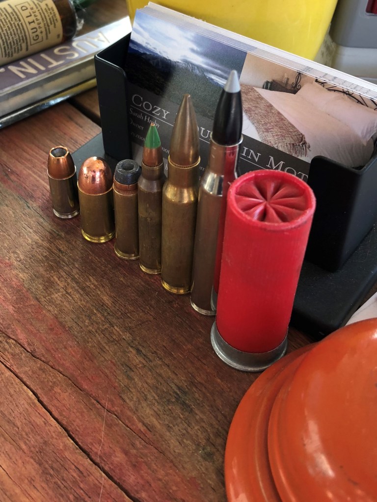
I woke surprisingly refreshed this morning at the Cozy Mountain Motel, and took my bracing cold shower. While checking out, I noticed these displayed on the front counter like Russian nesting dolls. I decided to hurry on my way before they discovered any problems with my MasterCard payment…
Literally loaded for bear
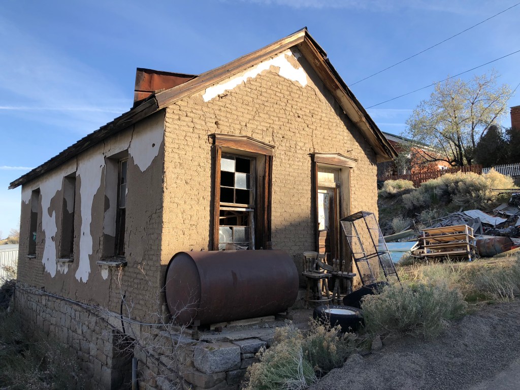
I explored the town of Austin a bit more before getting back onto 50. I was struck by the number of abandoned buildings, completely untouched for decades. This is truly a ghost town.
1313 Mockingbird Lane meets Georgia O’Keeffe
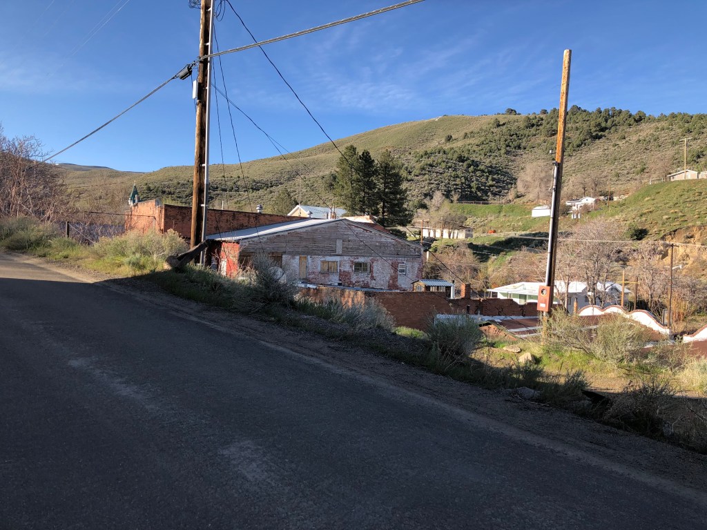
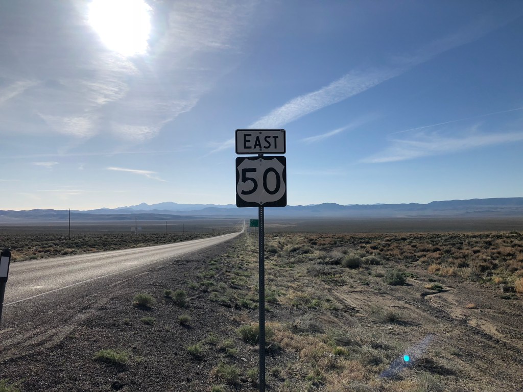
As I mentioned yesterday, I resolved to get breakfast in the town of Eureka, about an hour down the road. So I got back onto US 50, which, if anything, was more deserted than yesterday. I’m getting used to the rhythm, though, and there’s a fullness to the emptiness, if that makes any sense. The sky is big, blue, and beautiful, and the landscape stretches out for miles and miles. Periodic US 50 signs confirm that I didn’t make a wrong turn somewhere, heading far off course.
The zen of the Great Basin
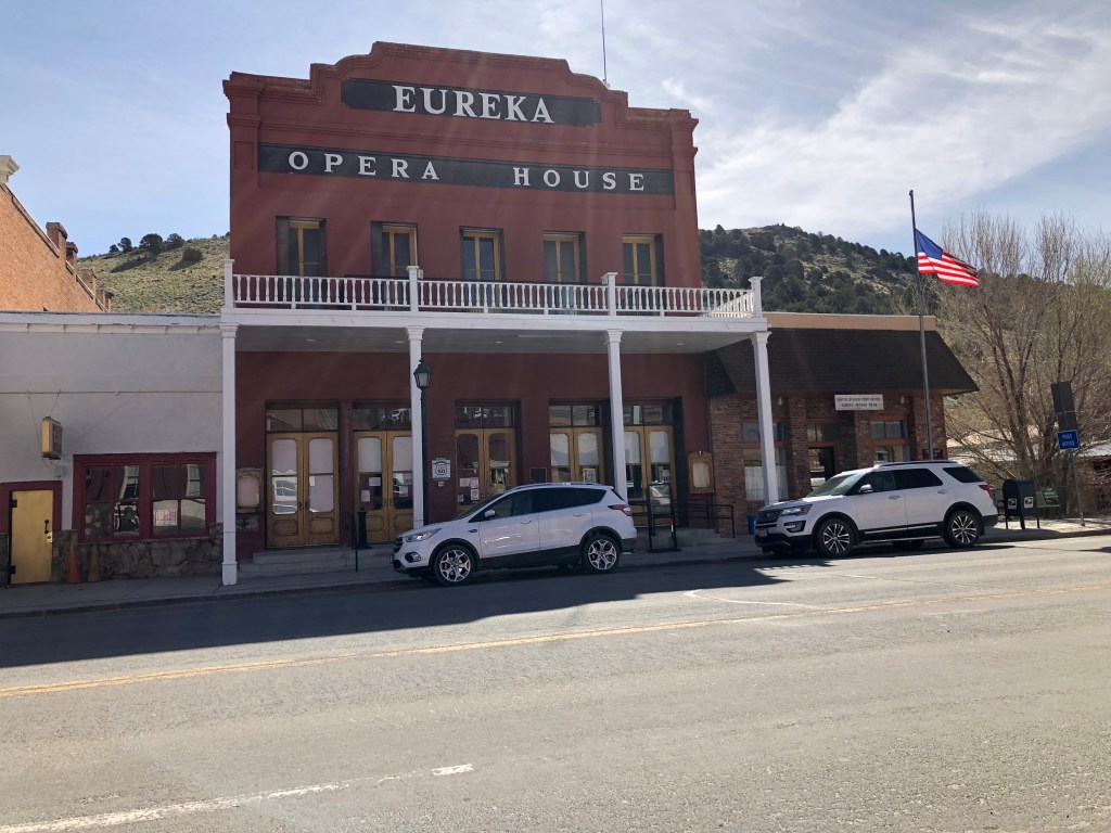
I was quite hungry when I got to Eureka, and I found the Jackson Hotel (which supposedly has the amazing food) quite easily. It’s part of a complex of buildings on the main drag (which is, of course, US 50). I had trouble determining which door actually led to the restaurant, so I just entered a door that said “open” on it, hoping for the best. I found myself in a large auditorium of sorts that looked to be well over a century old. After a moment I was greeted by a middle-aged woman with a Farrah Fawcett hairdo who asked if she could help me. When I informed her I was just a tourist looking for a place to eat, she seized upon the opportunity to give me a guided tour of the building, which I learned was the Eureka Opera House.
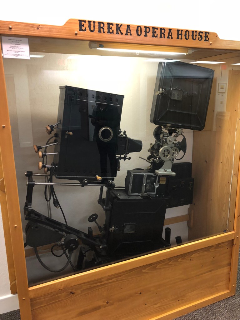
It’s an impressive building that was originally built in 1880. My guide (whose name is Patty), it turns out, is the manager of the building, and is responsible for booking events (including concerts by Eddie Rabbit and Loretta Lynn’s daughter, among others. Their signed photos are on the wall.) She’s also responsible for setup, clean up, and everything else. Check out the old, original projectors that are down in the basement:
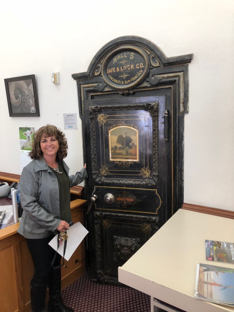
Patty is a bundle of energy, and wants nothing more than to promote the Opera House and the town of Eureka. After she gave me a tour of the Opera House, she took me across the street to the county courthouse, the jail, the assessors office, and other county offices. (These are housed in the historic courthouse, as well as a more modern annex.) For some reason, Patty has keys to all these offices, as well as several vaults. Here she is showing off the Treasurer’s vault:
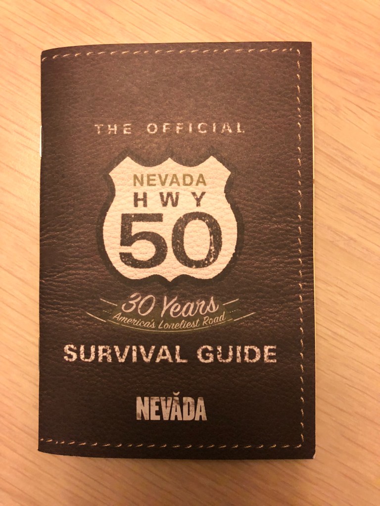
I told Patty I was driving the full length of US 50, and she asked if I had the “passport” for the drive. I hadn’t heard of this at all, so she provided me with a copy. It turns out that it’s just for the towns along the Nevada stretch of US 50, and I had already passed most of those towns. But I took the passport, and she stamped it with the gusto of a customs official.
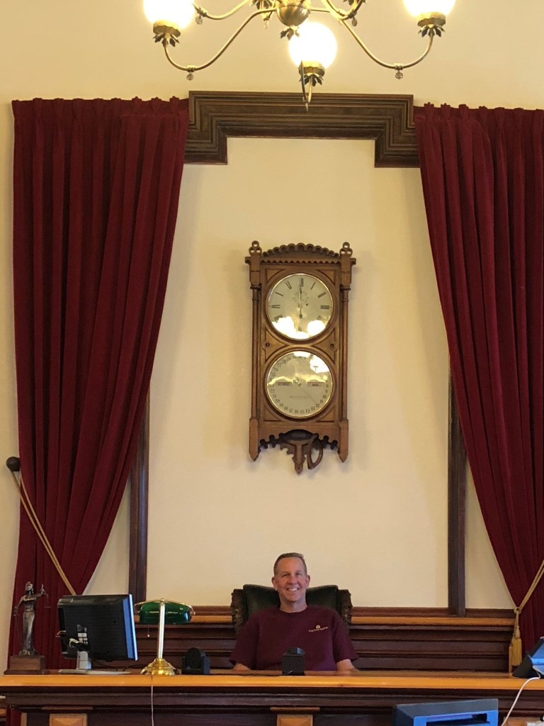
When I told her I’m writing a blog about my trip, she offered to take a picture of me in the judge’s chair in the courtroom.
Patty spend a full hour with me, and which point I was really ready for breakfast. I asked for a recommendation, and she referred me to the Pony Express Café. (It turns out that US 50 follows the old Pony Express trail in Nevada; I encountered numerous references to it along the way.) The Café is run by a couple of Amish women, who were warm and welcoming. It appears that the Café is where all the locals hang out, with plenty of conversation and back-slapping. In fact, while I was sitting at a table waiting for my breakfast, I felt a large hand grab my shoulder. I looked up and it was just some local greeting me, smiling and asking how I was doing. Is this a great town, or what? Oh, and I had the best “Amish Breakfast Sandwich” ever.
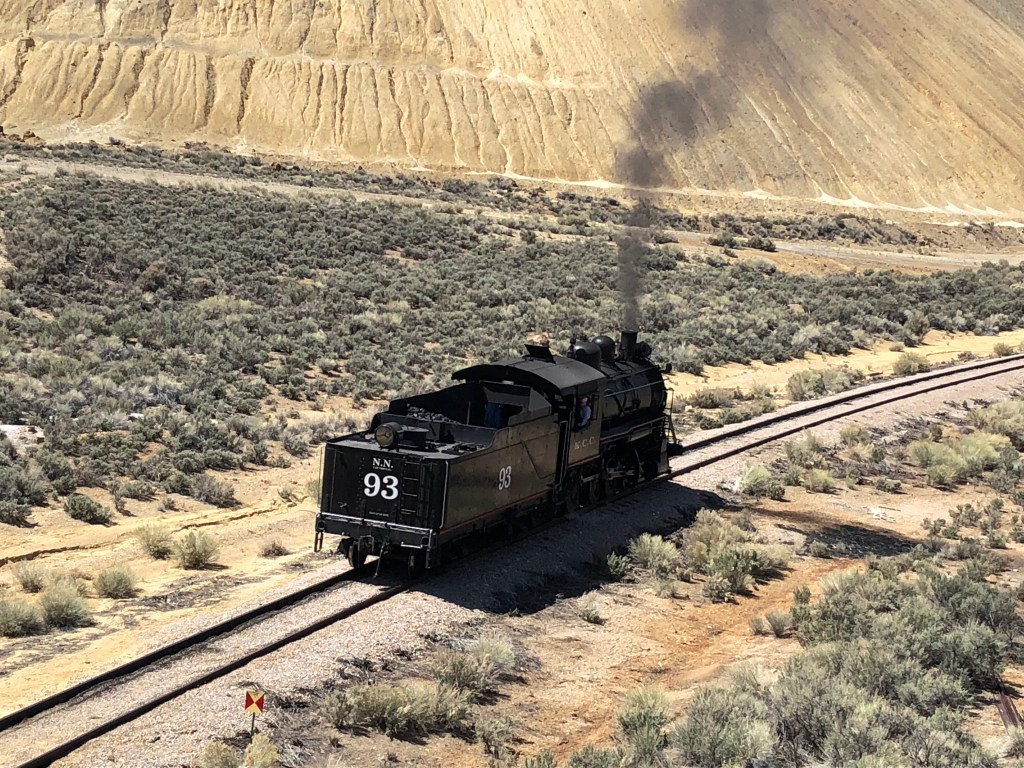
Refueled, I got back onto 50 and headed for Ely, Nevada. Ely is a famous railroad town, and a few miles before reaching Ely I saw plumes of black smoke next to the highway. It turns out a steam locomotive was operating – I still am not sure why. But there’s something wonderful about seeing this equipment, which must be from the 1930s or earlier, out in the wild, rather than at some museum. (Editor’s note: I later learned that, for a fee, regular shmoes like me can drive these vintage steam engines along a private track. Is this a great country, or what?)
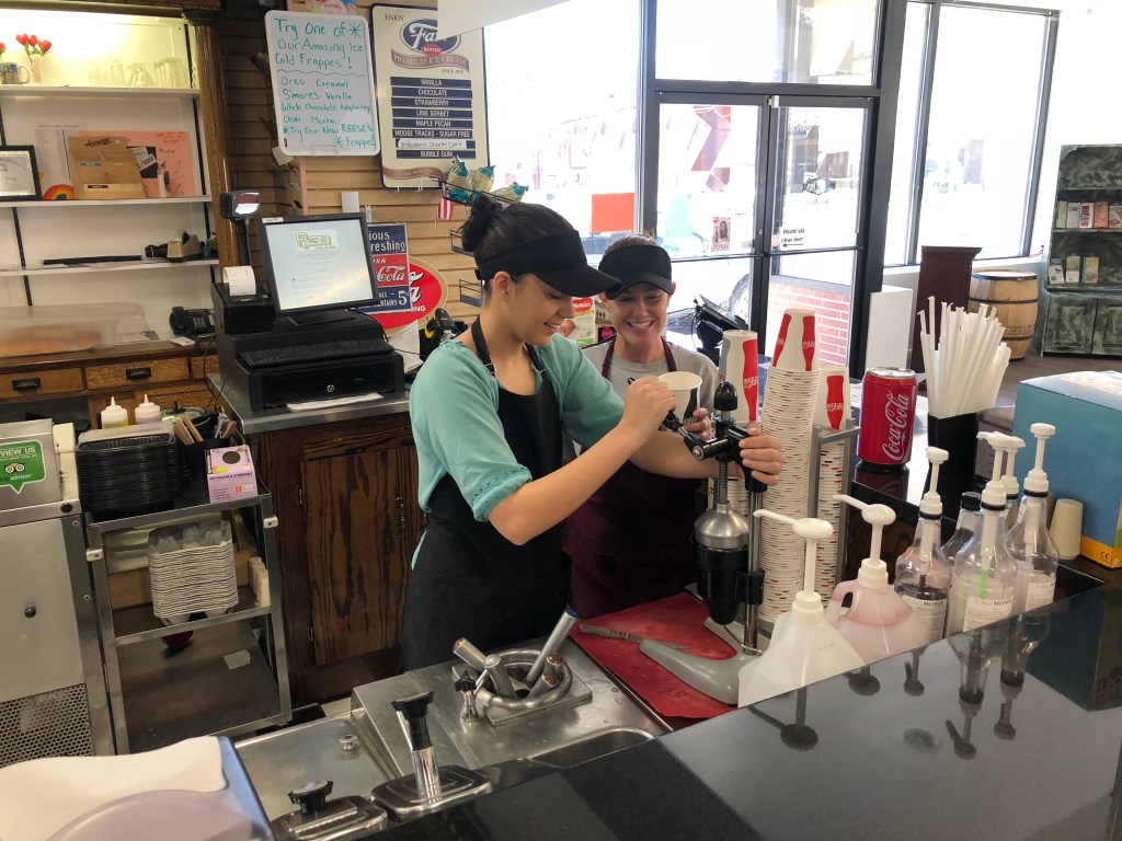
Now that I had my official US 50 passport, I visited the Chamber of Commerce in Ely. The woman there stamped it with the “Ely” stamp, and commented that Patty sure had made a lot of stamps in my passport. Evidently there was some rivalry between the two towns, or these two women. I asked her what I should visit in Ely, and she said I should get a lime rickey from the old drug store down the street. I didn’t know what a lime rickey even is (didn’t he manage the Brooklyn Dodgers?), but I was game.
Upon arriving at the drug store I learned it had been at the same location since 1946, with the same soda fountain, same chairs, same stamped metal ceiling, etc. all those years. There were two young women working the fountain, and I ordered my lime rickey. Impressively, the two of them created this drink from scratch, which involved cutting and squeezing fresh limes. It turns out the woman on the right is 31, with a 3 year old, and she moved here from Las Vegas. She seems to really love Ely, and says it’s definitely a good place to be raising a young child. But she thinks in a few years she’s going to move out to Florida, where all her relatives currently reside. She reflected that Ely used to be a much bigger town, “before the mine closed.” It used to be a bustling town of almost 10,000 souls. “We even had a Sears!” I think she sees the writing on the wall.
After my lime rickey, I returned to the familiar ribbon of US 50. I left Nevada behind some time in the afternoon, entering Utah. I stopped for dinner in the town of Delta. There were two good prospects on the main drag; a diner and a motel “cafe.” It turns out the diner now serves only Chinese food, so I opted for the cafe. I was feeling a need for some greens, so I ordered a chef’s salad. It came with my choice of bread, and the waitress recommended I get the scone. It’s not like any scone I’ve ever seen:
Shortly after leaving Delta, US 50 becomes part of Interstate 70 for a bit. I was dreading this part of the trip, because I hadn’t been on an interstate since I’d left Sacramento and I was enjoying the freedom to drive on the empty, undivided, quiet roadway that is US 50. I could pull over whenever I wanted to see anything, and I could flip around whenever I needed to backtrack. So the idea of getting onto the interstate, and sharing it with semis, was not appealing.
However, it turns out that I-70 in Utah cuts through some of the most spectacular scenery I’ve seen. You wend your way around enormous carved mountains that are iconic in this area. Here’s an example, which somehow reminds me of a poop emoji.
So I actually enjoyed this part of the drive. Even travelling at 80 mph plus, the scenery simply dwarfs and overwhelms me. It’s a unique experience, and really places one in perspective.
I didn’t take many photos of this scenery, because an iphone camera just doesn’t do it justice. You really have to drive through it to appreciate it. But I did stop at the “ghost rock” viewing area in Emory, UT. There I ran into a solitary person who was taking a photo. She was probably in her 20s, and probably pregnant. (I knew better than to ask.) I noticed her SUV was packed to the gills with boxes and suitcases. I said that it looks like she’s moving somewhere. “Yes. New York.” From where? “San Francisco.” That was about the extent of our conversation, but after I got back in my car I wondered: Why is she taking this route? Wouldn’t Interstate 80 make more sense? What caused her to want to relocate all the way to the other side of the country? One theme I seem to keep running into on this trip is that everyone wants to be somewhere else.
I called a halt to today’s driving when I got to Green River, UT. Tomorrow it’s off to Colorado!
When I awoke in Tehachapi this morning it was 37 degrees. By mid-day, though, the temperature was flirting with 60, so most of the day’s ride was pleasant enough. But clearly this is going to be my last trip into the mountains until next spring.
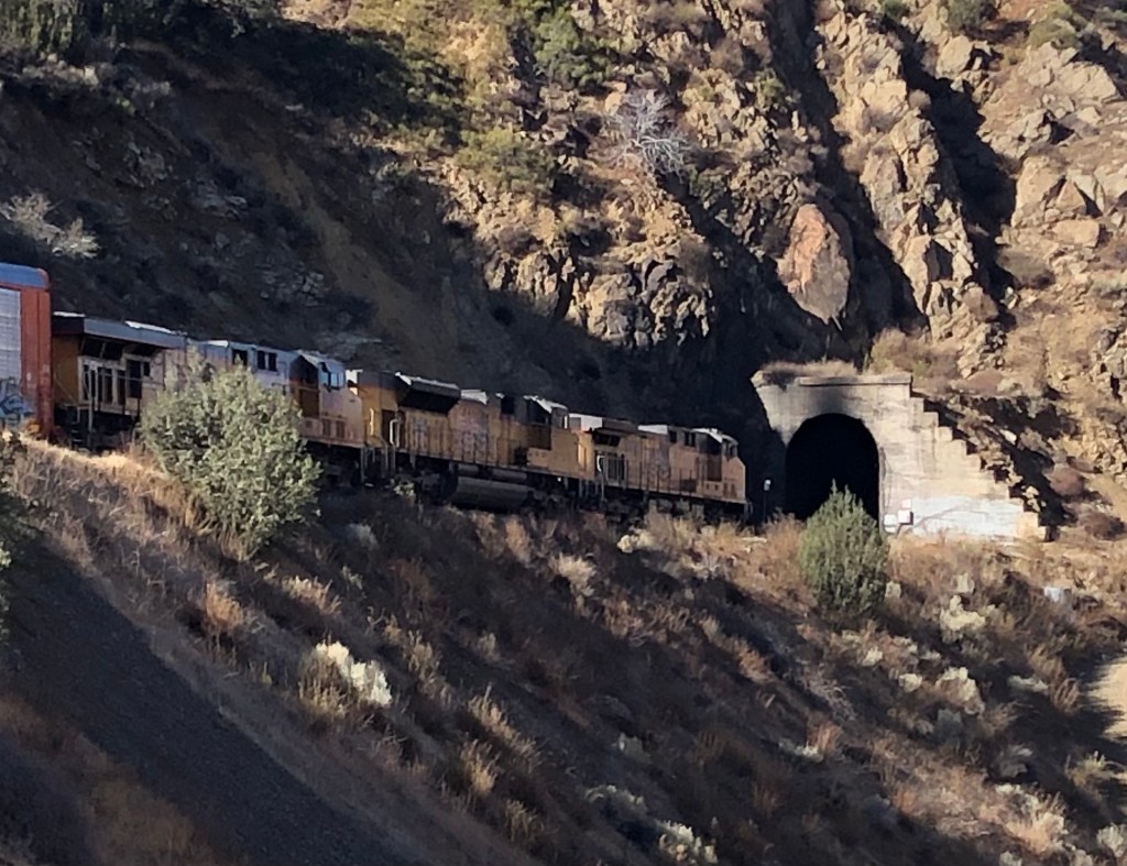
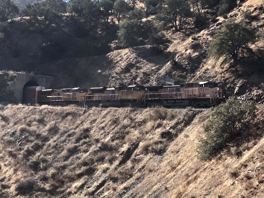
My first order of business (after choking down the microwaved egg and sausage biscuit that the Fairfield Inn calls their “complimentary breakfast) was to check out some of the 18 Southern Pacific tunnels that were bored for the Tehachapi line in the late 1800s. Tunnels are one of my favorite railroad features. Each represents a triumph over physical obstacles, but in a way that is more elegant than brutal. I say that because, viewed from the outside, very little of the mountain is altered. If not for the portal at each end, you wouldn’t know the mountain had been altered at all. And these particular tunnels along the Tehachapi route are especially impressive when you realize that they were dug without major earth moving equipment. It was mainly picks and shovels, wagons pulled by draft animals, and of course TNT.
Heading west out of Tehachapi parallel to the rail line, I caught glimpses of 4 or 5 of these tunnels. Even early in the morning the long trains with multiple locomotives were moving in and out of these tunnels with a carnal symbolism that made me blush.
Will you respect me in the morning?Was it good for you too?
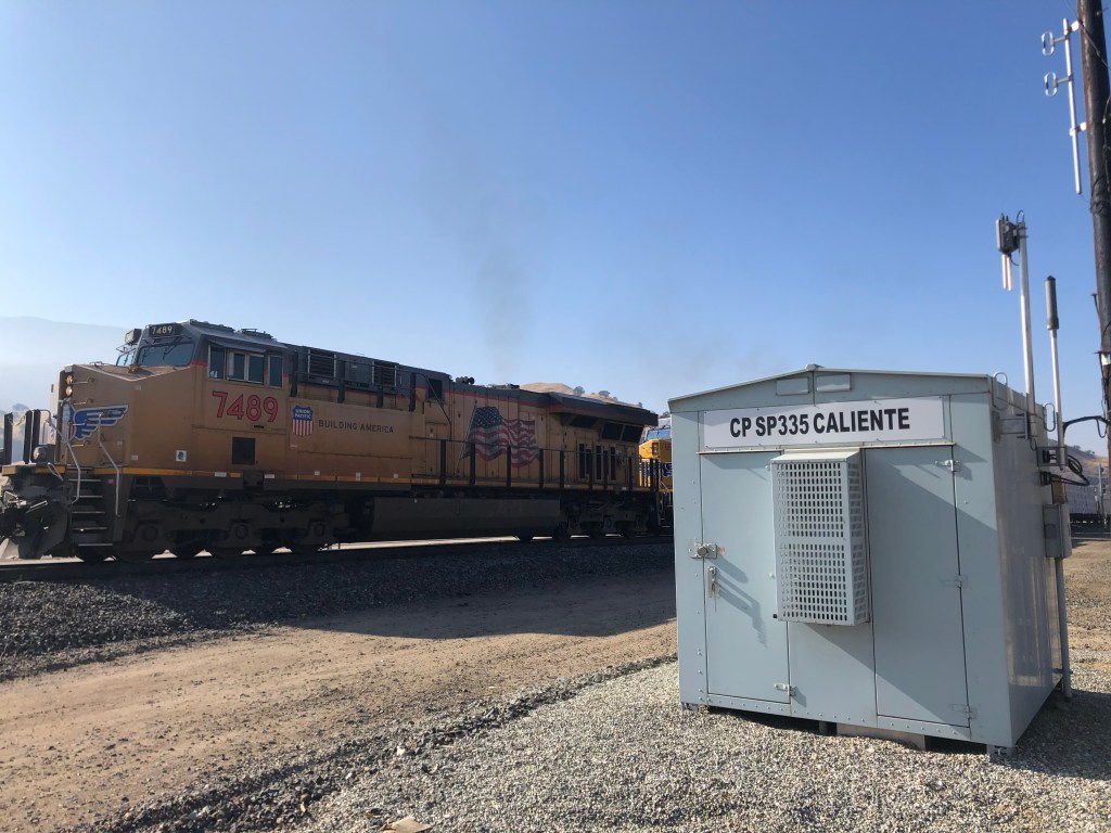
After reaching my limit of double entendres, I began my long, winding ride north through the Sequoia National Forest. The last town (and last railroad infrastructure) I passed before I began my climb into the southern Sierra Nevada was the town of Caliente. Like the city of Tehachapi, Caliente owes its existence to the Southern Pacific and its Tehachapi Line. In the late 1800s Caliente was a reasonably prosperous town, with plenty of jobs related to the railroad. The town at one time had about 60 buildings, about a third of which were purportedly saloons. Today, Caliente still sees plenty of rail traffic. But most of the buildings, and the population, are gone.
Is it caliente in here, or is it just me? (Sorry, I’ll stop now.)
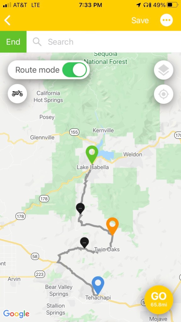
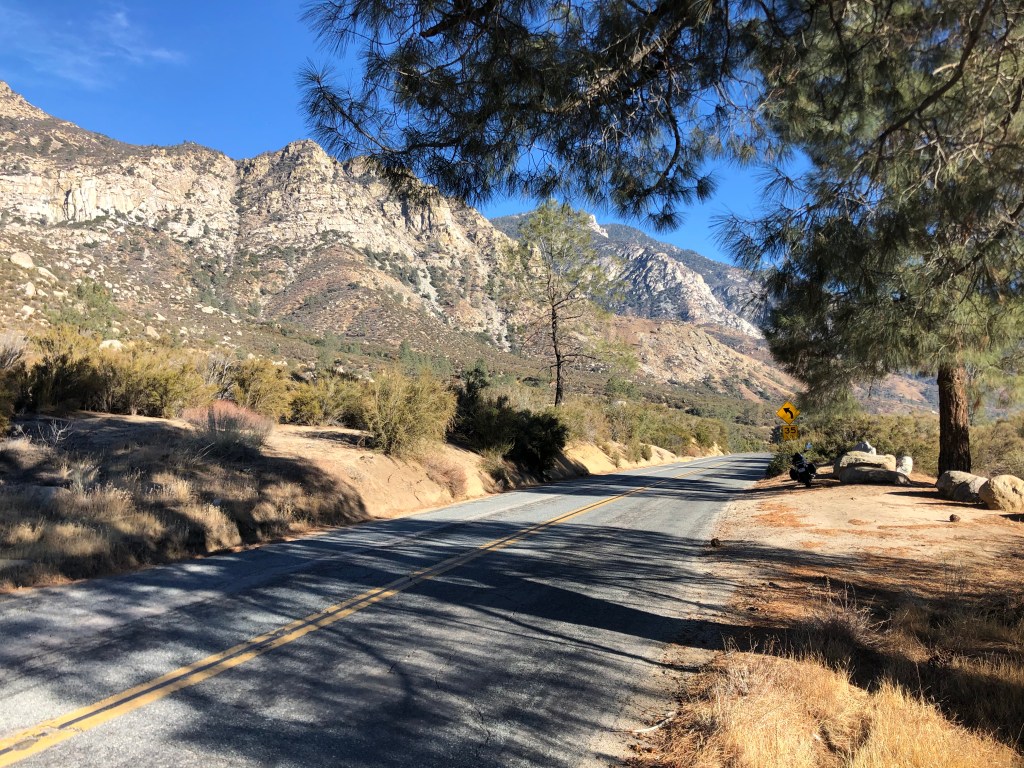
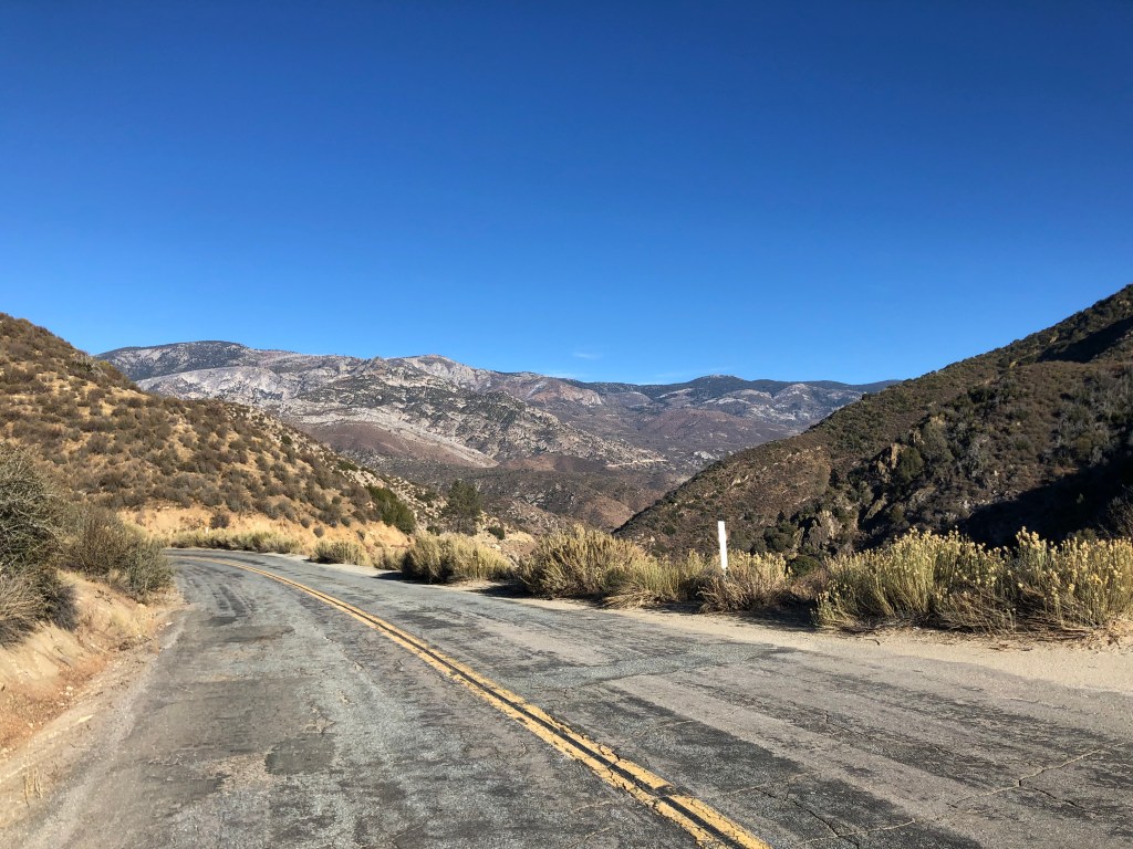
Immediately after leaving Caliente my route narrowed to a thin road twisting up into the mountains. I was headed for Lake Isabella, named after Queen Isabella of Spain. The town of Isabella (no “Lake” yet) was founded near the end of the 19th century, and when the Kern River was dammed in the 1950s the original town site was submerged under the new Lake Isabella reservoir. The town was re-established on nearby dry land, and renamed Lake Isabella. I’m telling you all that because there’s really nothing else of interest about Lake Isabella. I just chose it as a arbitrary, midway target for today’s travels.
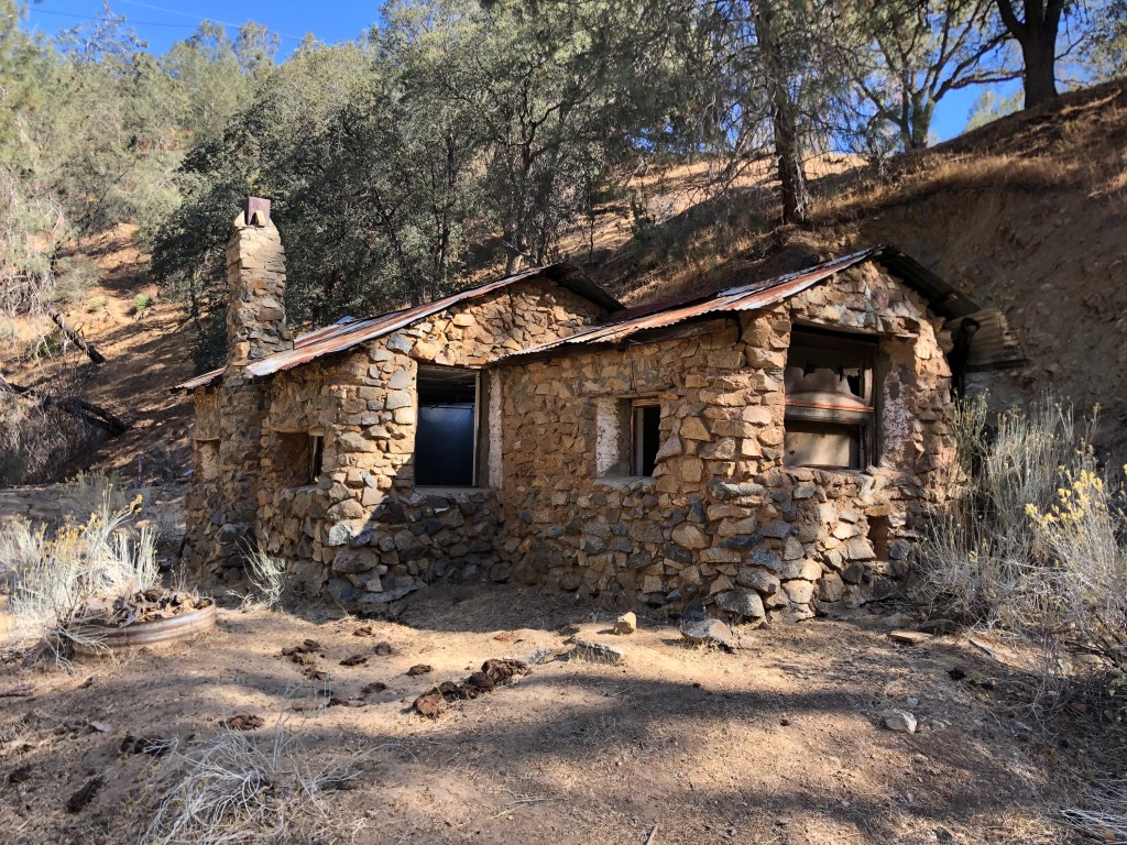
It was a pleasant ride through the forest. Here and there were signs of long-past settlements. It seems that gold rushes over the years had brought miners to these mountains, just as 49ers flocked to the Mother Lode country up north.
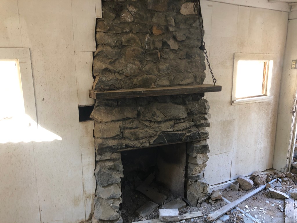
Abandoned stone cabinInside the stone cabin
I didn’t see many other people along my route, but I did come across this arachnid. Can anyone identify it?
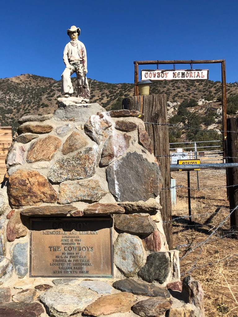
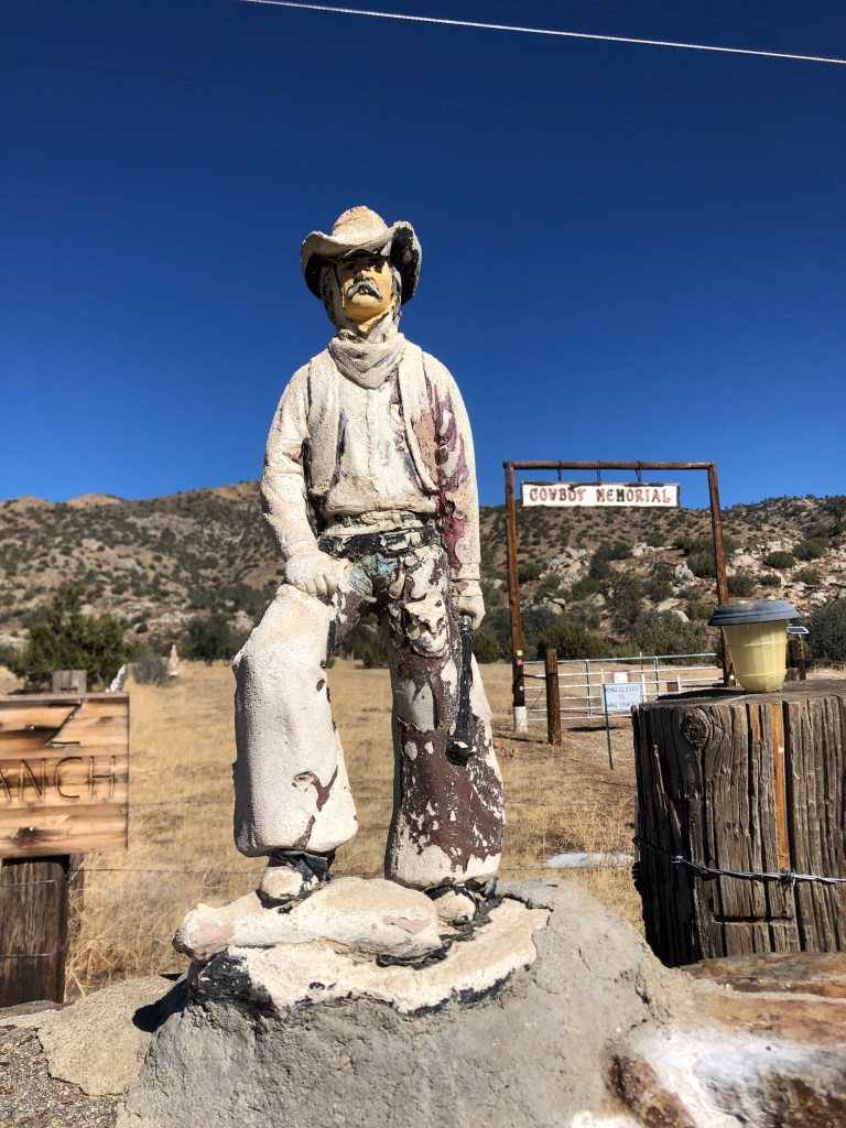
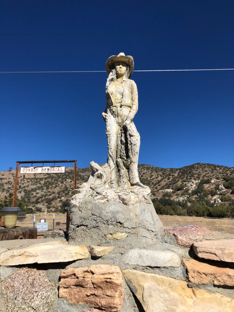
Along the route I noticed a rustic-looking sign with the words “Cowboy Memorial” hanging over a broad corral gate. Flanking the gate were figures of a cowboy and a cowgirl. I stopped to investigate.
The plaque reads: “Cowboy Memorial and Library established June 17, 1980. Dedicated to THE COWBOYS….”Classic cowboy….…and cowgirl.
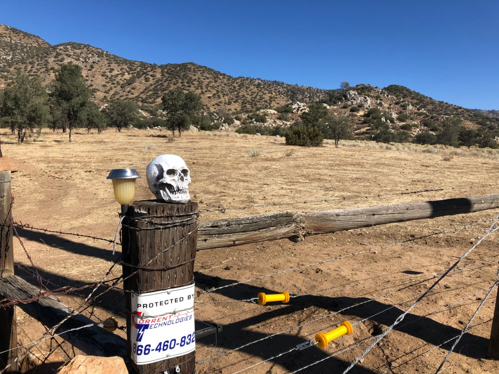
It turns out this “memorial and library” was the brainchild of one Paul de Fonville. I couldn’t find out much about him, other than he’s a former cowboy and rodeo champion. The museum and library was supposed to provide accurate information about real cowboys, as opposed to the Hollywood versions. I’m told the complex was always a little quirky and disorganized, but now it appears to be shut down entirely. I don’t know whether de Fonville even still walks this earth, but given that he was born in 1923, I doubt it. I did consider jumping the gate, but posted signs warned me not to. Skulls mounted on the fence posts convinced me that it wouldn’t be a good idea.
“Abandon all hope…”
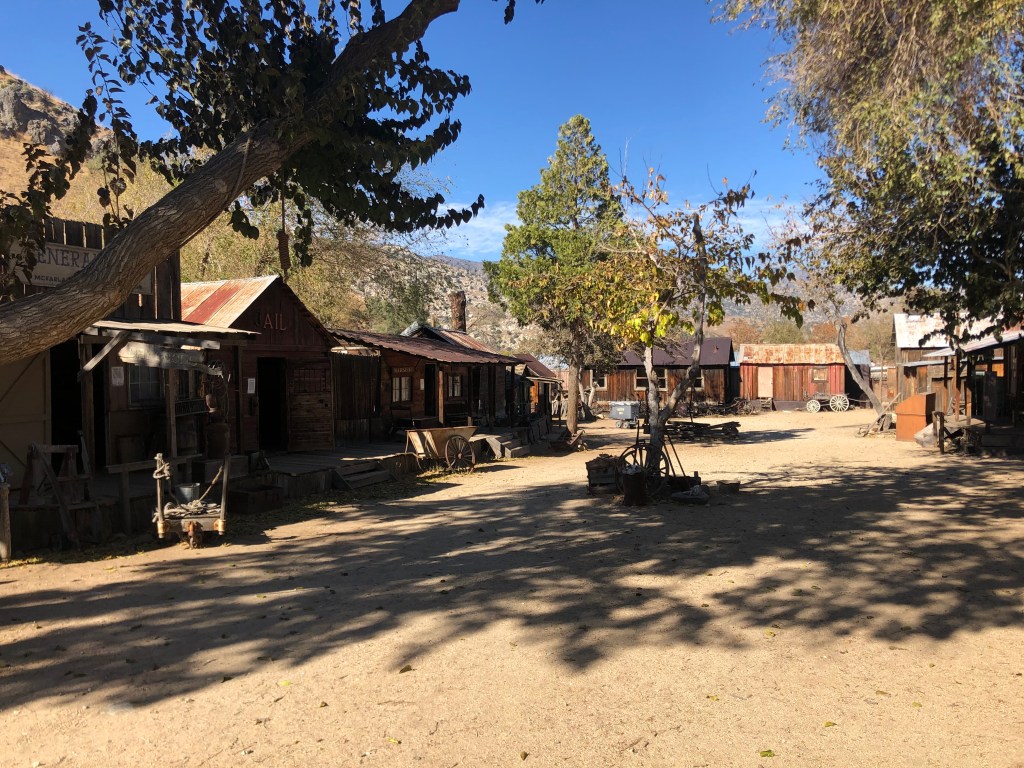
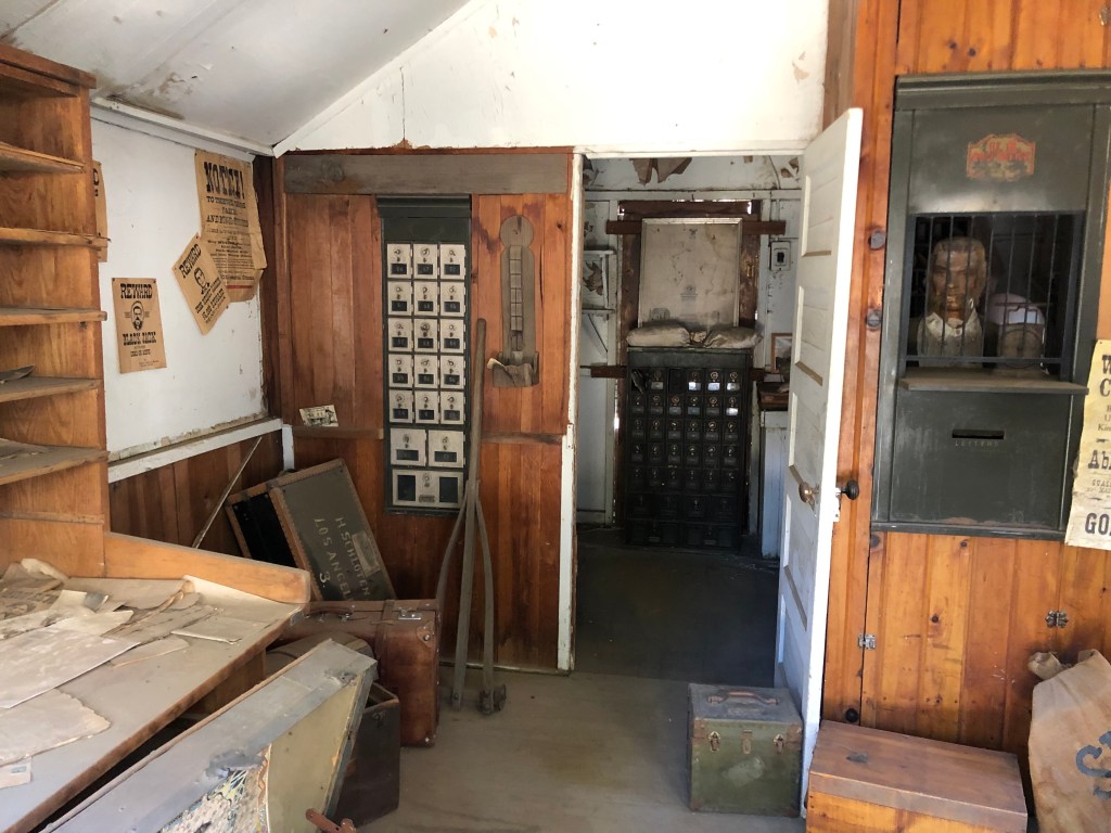
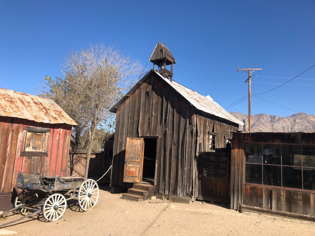
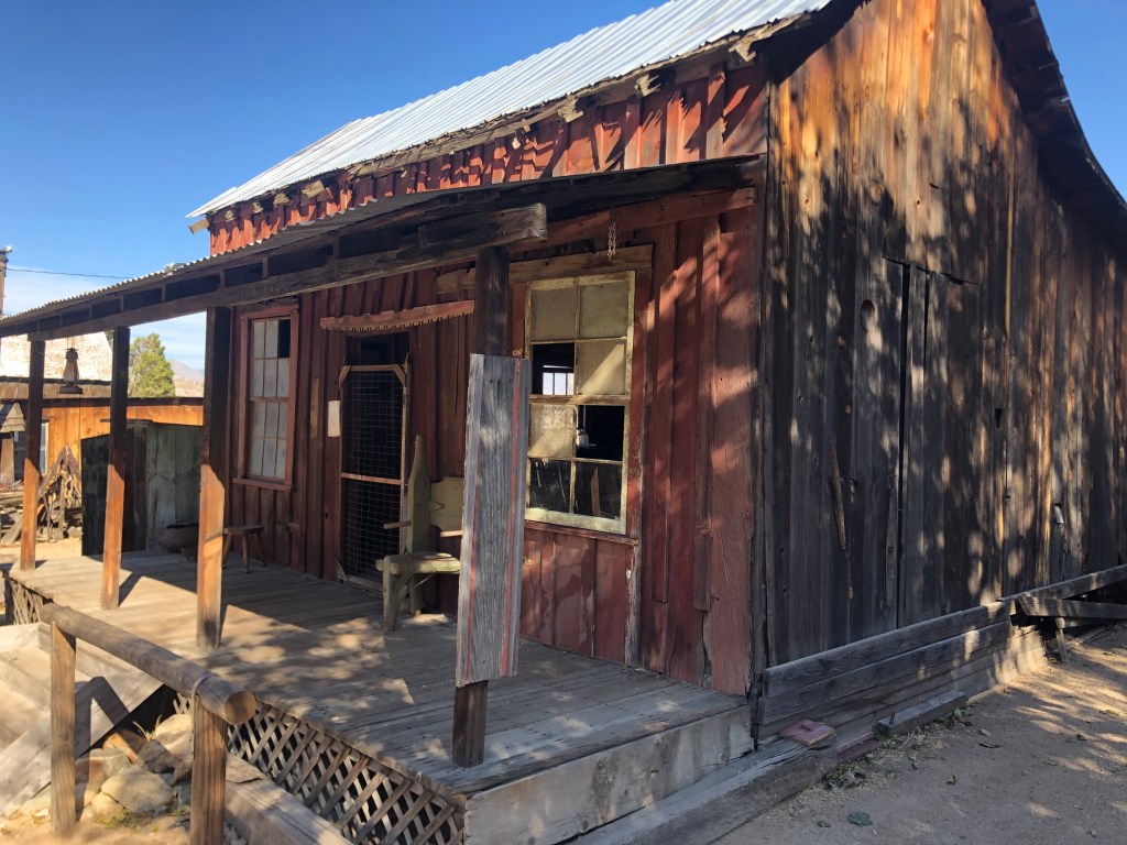
Just before I arrived at Lake Isabella, a cluster of ancient buildings caught me eye on the left. A large plaque memorialized the area as “Silver City Ghost Town.” It seems that in the 1970s a local by the name of Dave Mills decided to rescue a number of historic structures from deteriorating mining towns throughout the Kern Valley. (It was really a very different age, when you could just go in and uproot buildings and take them for yourself!) The buildings came from colorfully-named towns like Whiskey Flat, Hot Springs, Miracle, and old Isabella. Dave re-sited the buildings here in Silver City, and charged people to see ’em. For reasons that aren’t entirely clear, Silver City closed after only a few years. In 1990 it was purchased by a new owner, and it remains open to the public today. So I plunked down my $7.50 and took a stroll around. I think the idea is similar to that of Bodie State Park: To keep the buildings in a state of “arrested decay.” That is, you prevent further deterioration, but you don’t try to fully restore anything. The objective is to have these places looking like that would in a real, uninhabited, ghost town.
There were about 20 buildings altogether, and while the signage was a little wanting (most buildings just had an 8-1/2″x11″ sheet of paper with a few paragraphs of purple prose stapled to the outside), it was a fun way to spend an hour.
Silver CityMany original artifacts are contained within the buildings, such as this post office.Old church, with a coffin on a bier and a deteriorating organ inside. The Apalatea/Burlando House, originally from Kernville, has been used in some old western movies, like this one. It’s also supposed to be haunted.
After consuming a BLT in Lake Isabella, I headed northwest through the mountains with the ultimate goal of reaching Porterville for the night. It was simply a beautiful ride.
It was one of those afternoons when you feel at peace with the world. The sun is shining, the air is clean, there’s no one else around, you’re just communing with God’s world.
And then.
I hate it when this happens.
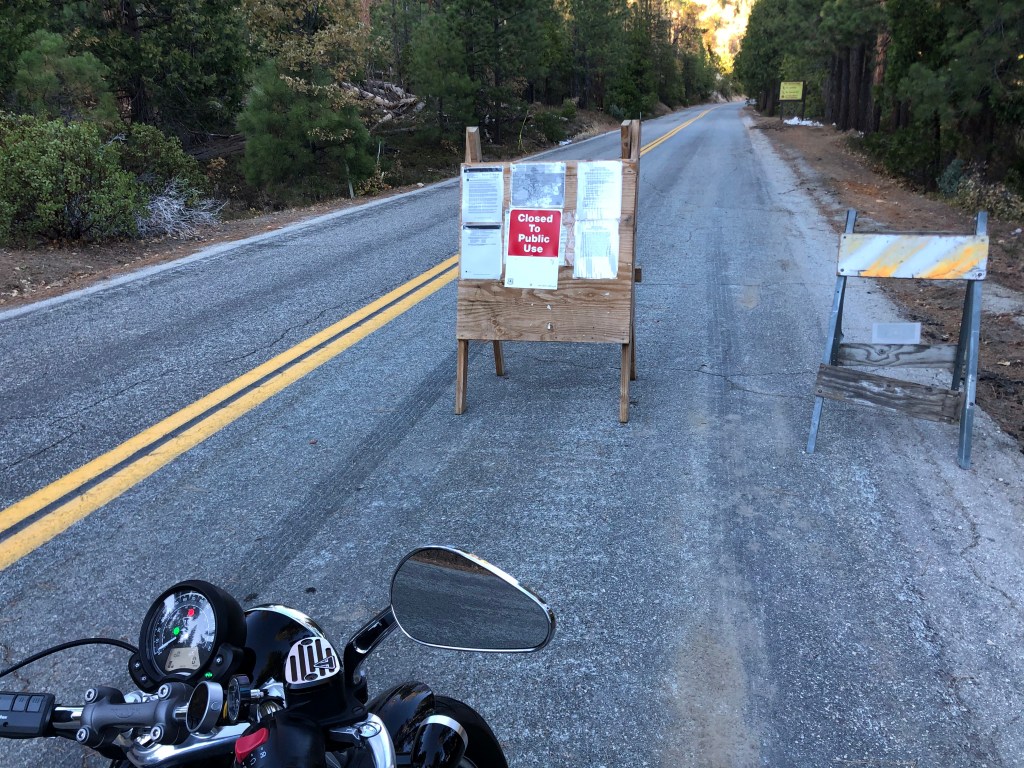
It turns out that lighting started a fire (the “SQF fire”) back in August, which is still burning in the forest and has closed my route to Porterville. I took a detour through a winding, snow-scattered pass and eventually made it to Porterville by nightfall. Near the end of this detour I managed to find one more Southern Pacific-related site: Dutch Corners/ the town of Ducor. Here’s the text from a plaque: “In 1885 four German homesteaders, Chris Joos, Ben Spuhler, Fred Schmidt, Gotlet Utley, sunk a common water well where the corners of their land met. This junction became Dutch Corners. In 1888 the east side line of the Southern Pacific railroad was built and the name was condensed to Ducor.
Tomorrow I’m traveling south on State Route 43.
CAPTION CONTEST!
It turns out Porterville doesn’t have a single decent brew pub. So in lieu of a Brew of the Day, I offer this photo from today’s travels near the town of Loraine. Please submit caption ideas. The mind reels.
A recent suggestion from a family friend (Linda M.) got me thinking thinking that the storied Southern Pacific Railroad would make a good theme for an upcoming road trip. And given that the days are getting shorter and colder, I figured I should get cracking if this trip were to happen before next Spring.
As regards the question of where, specifically, to go, I decided to ping my Uncle Ed. Alert readers of this blog will recall that Uncle Ed is a lifelong railroad buff who turned his passion for trains into a career. It’s Ed’s influence that got me interested in trains during my childhood. Uncle Ed is also the brains (and all the other organs) behind the celebrated Dome O’ Foam website, which bills itself as a “veritable foam-induced-wheelslip fiesta of past-day railroading.” And its specialization in the Southern Pacific is recognized to be, if not the most definitive, at least the most entertaining.
So I asked Uncle Ed to suggest sites for my trip, and he responded with this melancholy lament: “Nearly all of my favored old SP haunts are either bulldozed from the map, or so radically altered that they are nearly unrecognizable. These were places where I joked and worked and played cards with my other family, all the while passing and receiving the latest important rumors and gossip. To see these places and their people disappear has been a painful exercise, so I prefer to think of them as they were, rather than confront things as they are. I really don’t want to visit the present when it comes to my past.”
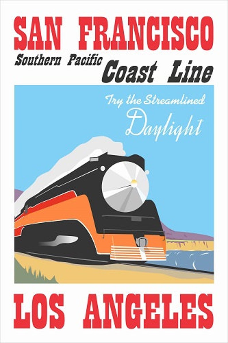
It’s true that vestiges of the Southern Pacific (or, the “Espee,” as some of us old-timers call it) are fast disappearing. Southern Pacific practically owned California (at least, it owned a number of its politicians) for many years, and its influence was exerted in the development of industries, the price of various commodities, and the expansion and even creation of entire cities. In its heyday, the Espee was highly visible in California, and its bright, gleaming Daylight passenger trains were iconic works of art that zipped along the coast.
But Southern Pacific’s prominence declined with the rise of the automobile and long-haul trucks. It’s passenger service ended in 1971. And then the Espee was absorbed by the Union Pacific in 1995. Since then, the physical infrastructure associated with the old Espee has deteriorated and disappeared.
Now, there’s two ways for these sad facts to influence the planning of a road trip: (1) I could logically conclude that the Espee has been relegated to the dustbin of history, and instead focus my road trip on something else, or (2) I could commit to seeing some of the last remnants of the Espee before they’re all gone for good. Guess which approach I chose?
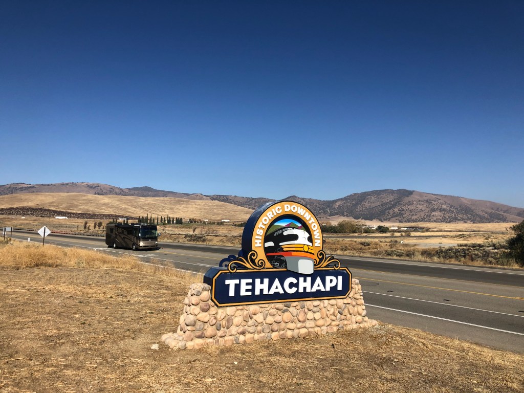
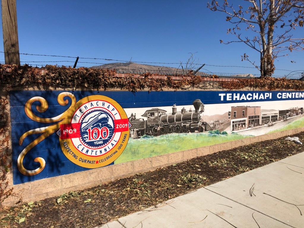
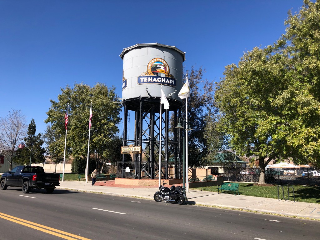
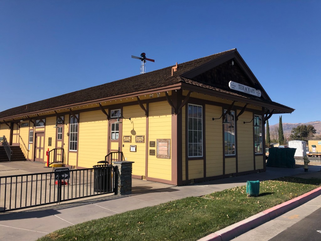
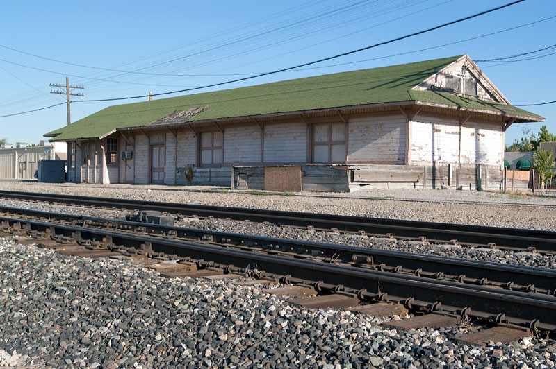
And so this morning I saddled up the Speedmaster and headed for the town of Tehachapi, home of a Southern Pacific depot dating back to 1904, along a rail line the Espee built in 1876. The depot was recently restored and now serves as a museum. The rail line remains one of the most active rail segments in the West.
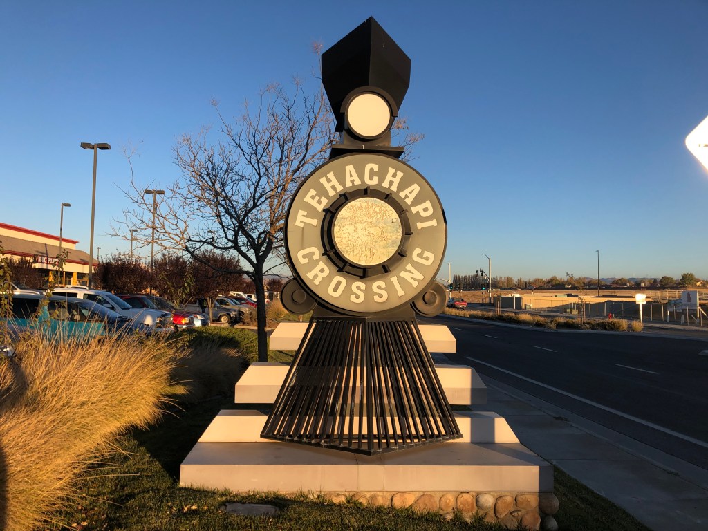
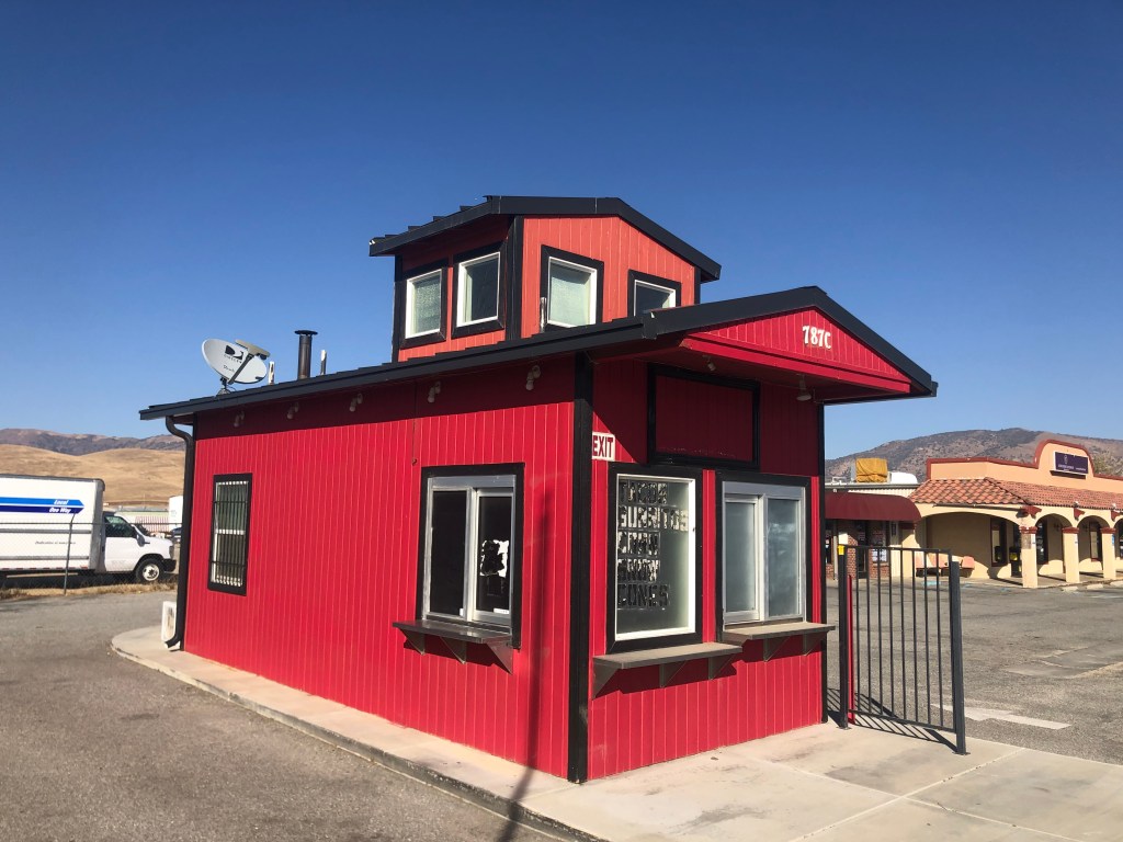
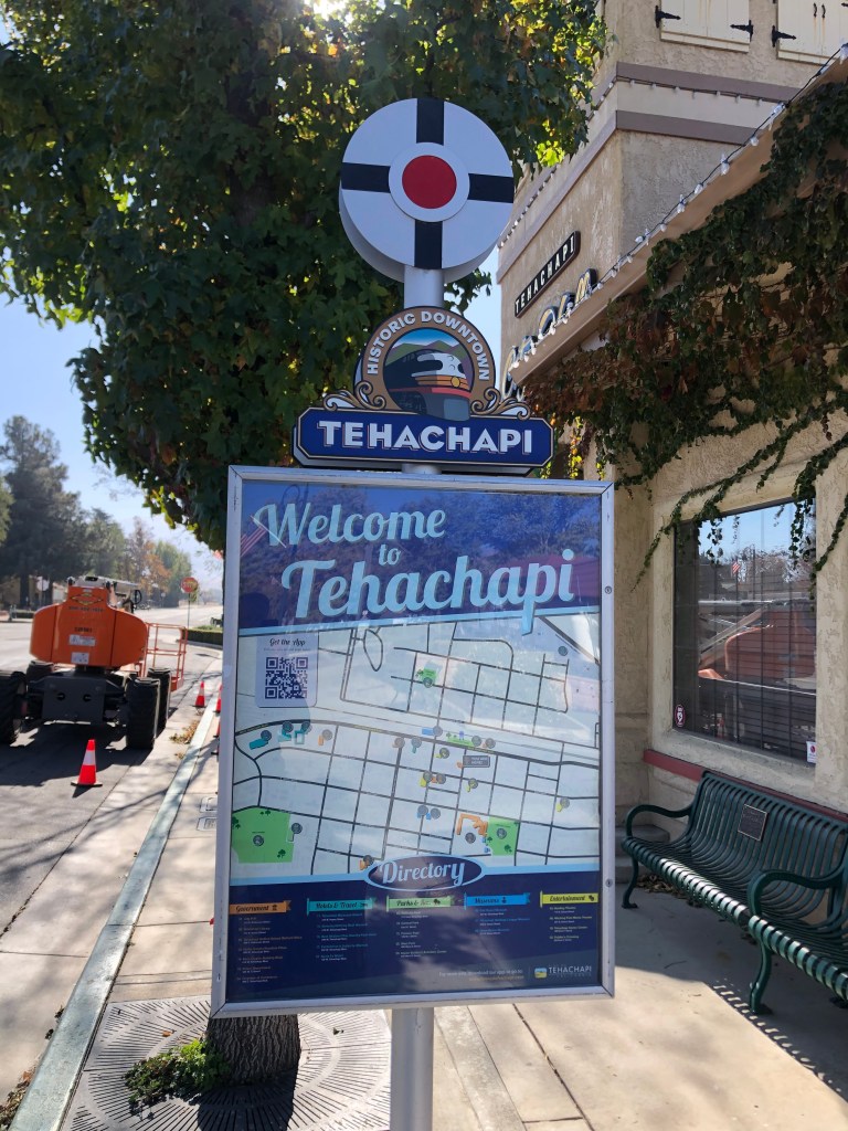
The city of Tehachapi (pop: 14,000) lies about halfway between Bakersfield and Mojave. It was founded in the 1870s, beside that new rail line the Southern Pacific constructed between the San Joaquin Valley and the Mojave. I arrived downtown around noon, and took a leisurely look around. It was clear that Tehachapi embraces its railroad heritage, as is evident in these photos:
Their definition of “downtown” is a little different than mine.But why would the name of the crossing be emblazoned on the train that presumably just passes that crossing?It used to be a taco stand. I’m trying to imagine what the name of the place was. “The Taco Train?” “The Little Tortilla That Could”?The trusty Speedmaster rests under a historic water tower from the steam era.Sadly, as far as real estate agents go, she’s terriable.
The Tehachapi depot museum, which had been one of the main attractions that led me to this city, was looking good for what was supposed to be a 146-year old building. It was painted Southern Pacific colonial yellow, the same, familiar color that all Espee buildings sported.
I entered the building and was immediately accosted by an old man (or maybe it was an old woman; it was hard to tell with the Covid mask) in a Southern Pacific conductor’s uniform who checked my temperature with a “touchless” thermometer. I put “touchless” in quotation marks because he/she bonked me on the head with the thing. I clocked in at 96.7. Slightly below average. My life story.
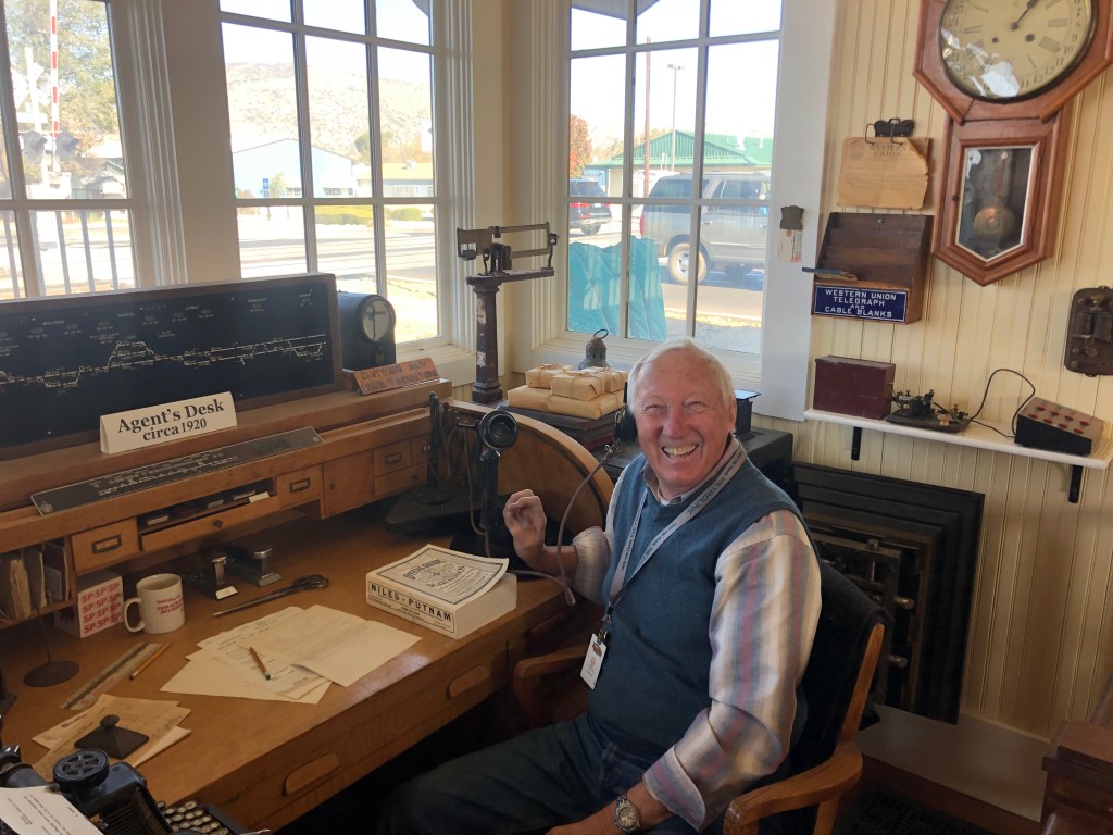
Having passed the medical exam, I checked in with a pleasant woman at the front desk and then was turned over to a equally pleasant docent named Doug. It was Doug (pictured below) who set me straight on the history of this depot.
When I grow up, I want to be as happy as Doug.
The first Epee depot in Tehachapi was constructed in 1876, the same year that the rail line was put in. That building burned down in 1904, and a new depot was immediately constructed near the original site. This second building was a central feature of “downtown” Tehachapi for many years, but gradually it fell into disrepair, particularly after passenger service was halted in the 1970s. By the 1990s the building had become a dilapidated shell of its former self.
Glory days.Forlorn near the turn of the 21st century
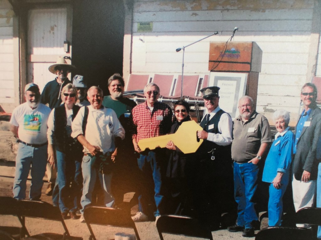
Now, remember that the Southern Pacific Railroad, who owned this depot, was absorbed by the Union Pacific in 1995. The UP decided it didn’t need this old white elephant from the Espee days, and figured they’d probably raze the damn thing. Then the good citizens of Tehachapi, who, as we’ve established, embrace their railroad heritage, approached the UP officials and asked if they could have the old building. The UP drove a hard bargain (insisting that it be compensated with a shiny new building to replace the old one), and the city became the proud owner of an old, deteriorating, but historic depot. And guess who was the key actor in making all this happen? Yes, it was my tour guide, Doug.
The city receives the key to the depot from UP. Docent Doug in in the plaid shirt.
So, that’s awesome, right? The city raised funds to fully restore the depot, and finally in 2008 the restoration was complete. In a few months the city would move displays and artifacts into the building and make it into a proper museum of Tehachapi railroad history.
And then, before the museum could open, some errant fireworks torched the restored building and it burned to the ground.
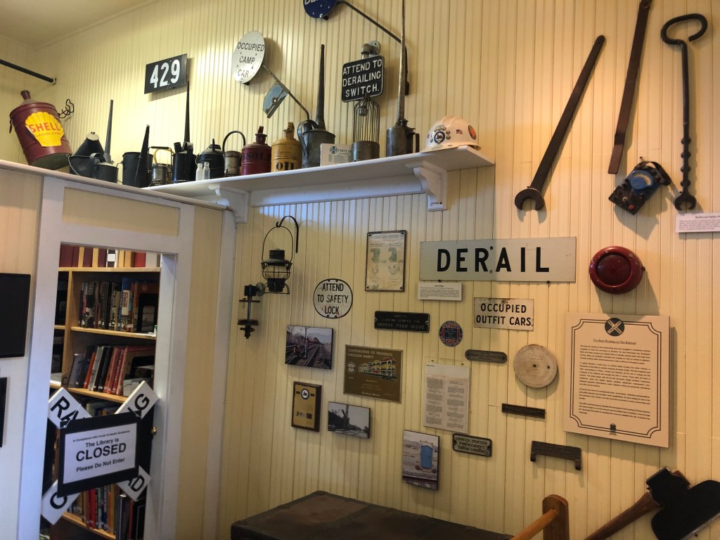
Mimicking the Three Little Pigs, the city’s leaders resolved to rebuild the depot, this time with fire sprinkers and ADA access. Fortunately, they had a full set of blueprints from the 1904 building, and they rebuilt the place almost exactly as it had been. This is the depot that I was now standing in, staffed by cheery volunteers and crowded with railroad memorabilia.
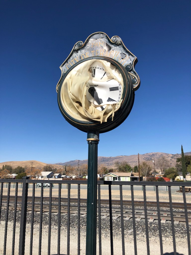
The only obvious reminder that the earlier building had burned was the old clock near the platform, melted from the flames.
Paging Salvador Dali…
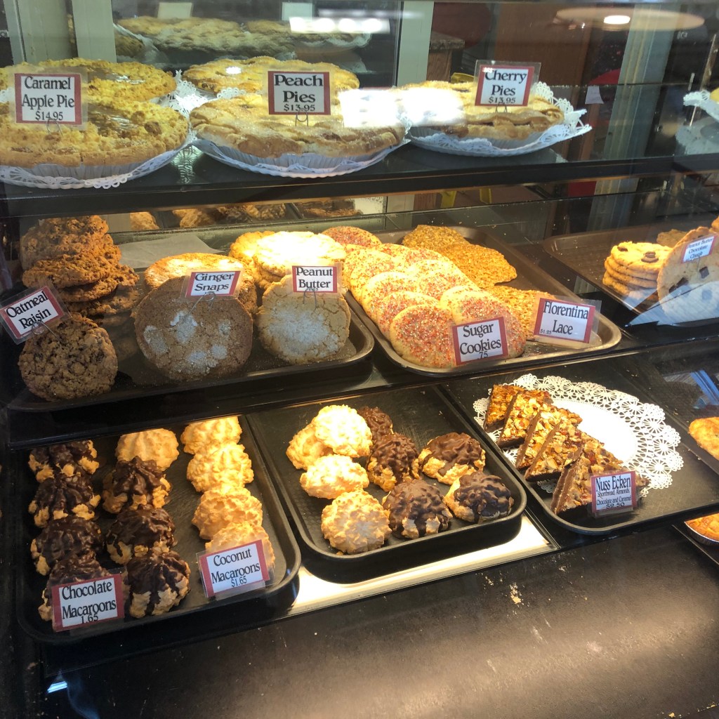
I spent a full hour with Doug, learning about the town’s railroad history. As I was leaving, I asked what other sites I should explore while I was in Tehachapi.The woman at the front desk had two suggestions: The Tehachapi Loop (which we’ll get to in a moment), and the Kohnen’s Authentic German Bakery, right next to the museum. She didn’t steer me wrong. Get an eyeful of these baked goods:
Hear that? It’s my arteries screaming.
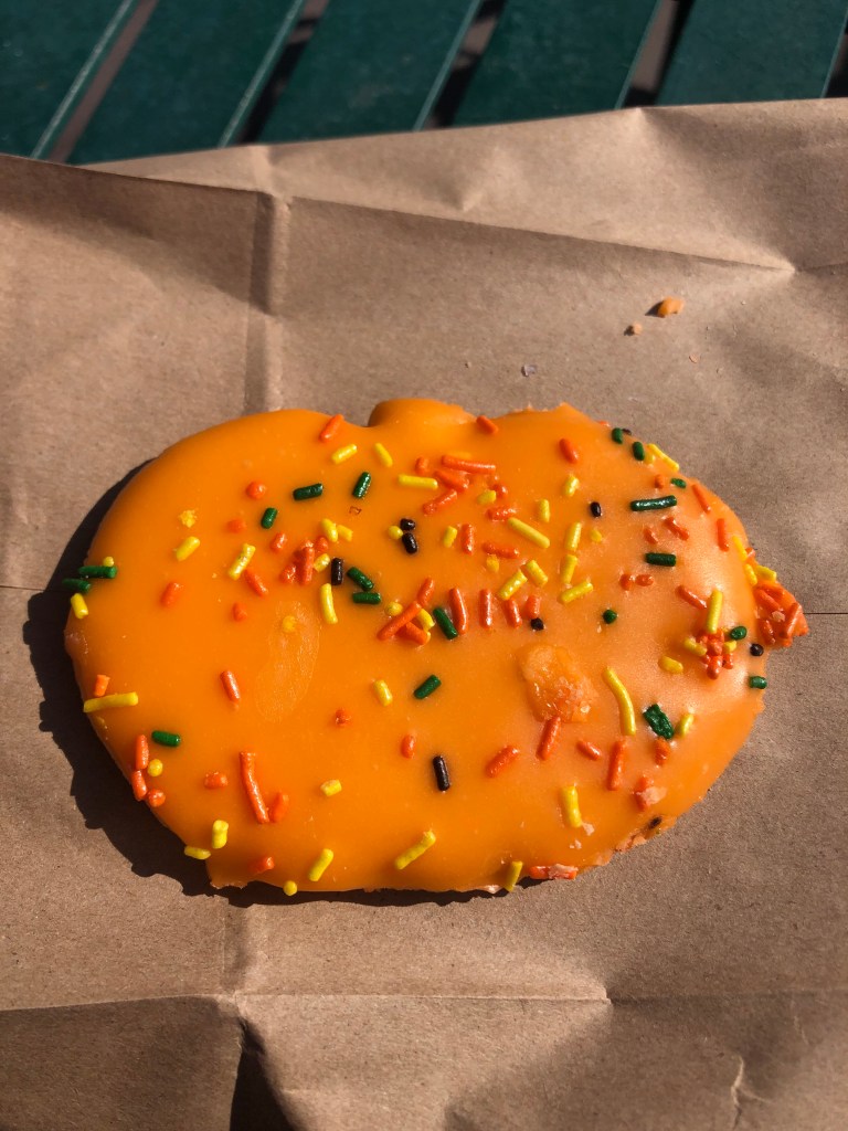
And so today, 14 days after the conclusion of my Halloween Treat Series, I finally found the Halloween Sugar Cookie I’d been looking for all the month of October. I give it 0 points out of 3 for packaging (they put it in a paper bag), 2 for appearance of the treat (finally someone used the correct color blend of sprinkles!), 3 for taste, and 3 for value (it was a buck and a half), for a Steve’s Sweetoberfest Score of 8 out of 12. A solid treat.
Moments later a chew-chew ran into it.
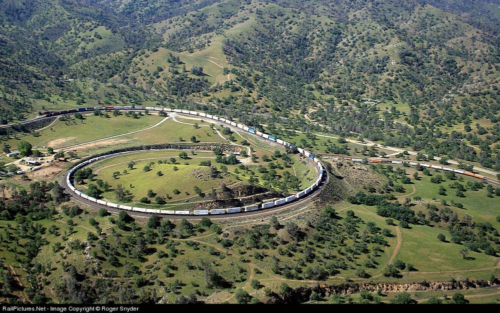
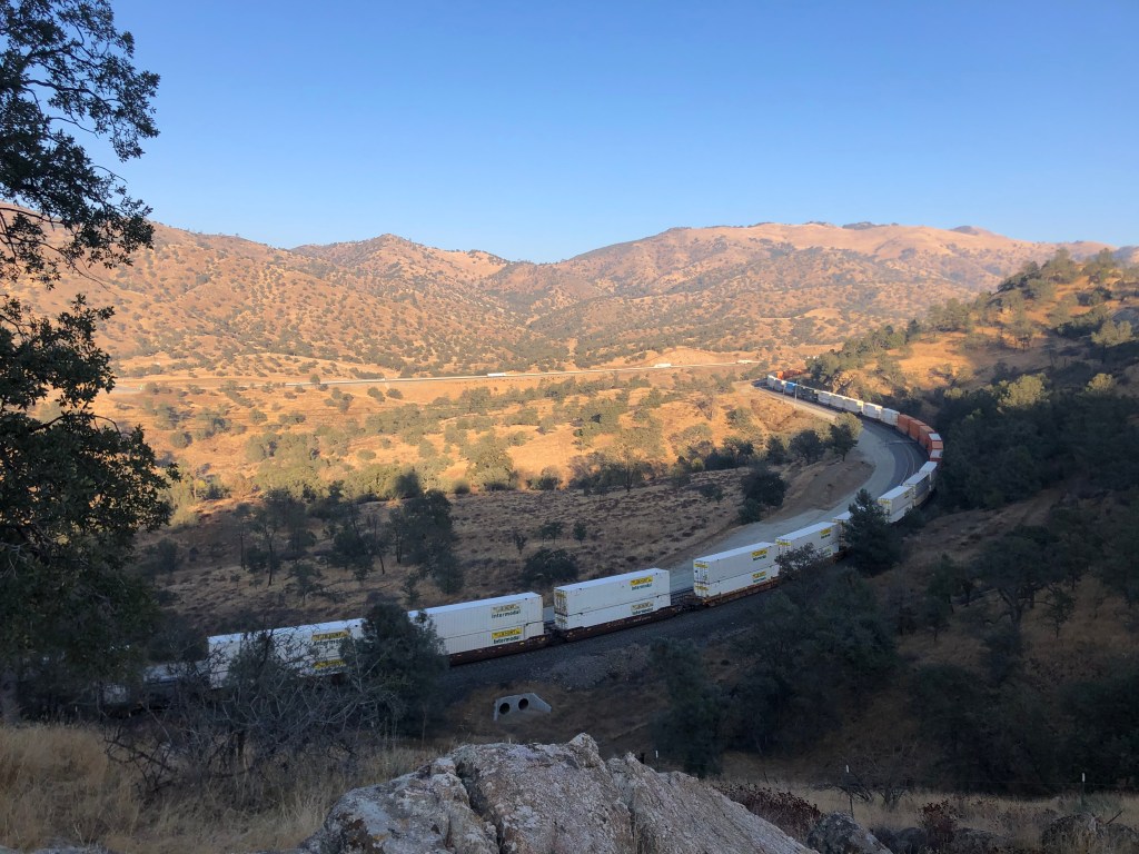
My next stop was the Tehachapi Loop, which is just a few miles from the depot. Like the original depot, the Tehachapi Loop dates back to 1876. It was considered a major engineering feat of its time, and still operates, essentially unchanged, to this day. Between 20 and 30 trains pass along the loop daily.
The loop allows trains to gain elevation gradually (about a 2 percent grade) so that they are able to cross the Tehachapi Pass. Here’s a photo I got off the web, which has a much better angle than from my vantage points on the winding road in the background.
There’s something mesmerizing about watching 100-car trains spiraling up or down this corkscrew. Unlike a freeway, a railroad leaves much of the surrounding scenery untouched, somehow gracefully blending the trackbed with the natural environment. And it’s especially entrancing when you realize the thing is almost 150 years old, an impressive legacy of the storied Espee.
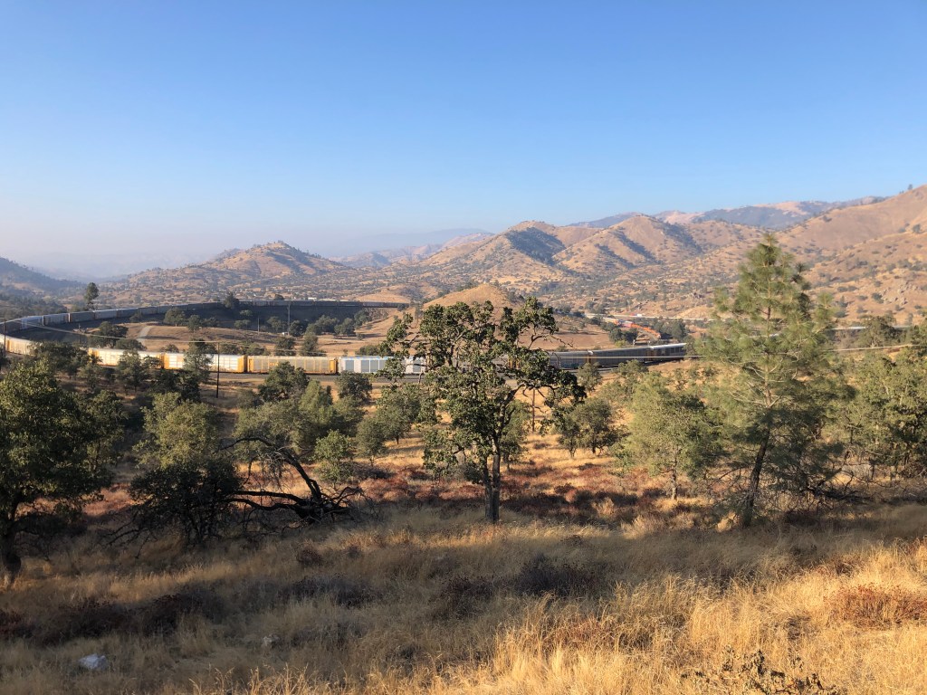
My more earth-bound view, taken with an iphone.
Here it is in motion…A section of track near the loop. I just liked how it looked.
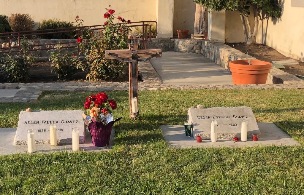
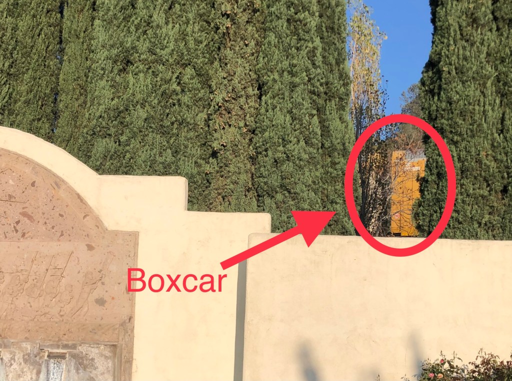
After spending an hour or so watching 3 long trains pass through the loop, I continued down the road to see if I could find its the tunnel entrance. I failed in that effort, but as I was searching I came across the grave of one Cesar Chavez, buried just yards from the mainline. I’m not making this up.
Cesar Chavez (on the right), next to his wife Helen.Train passing behind the wall of Cesar Chavez’s burial place.
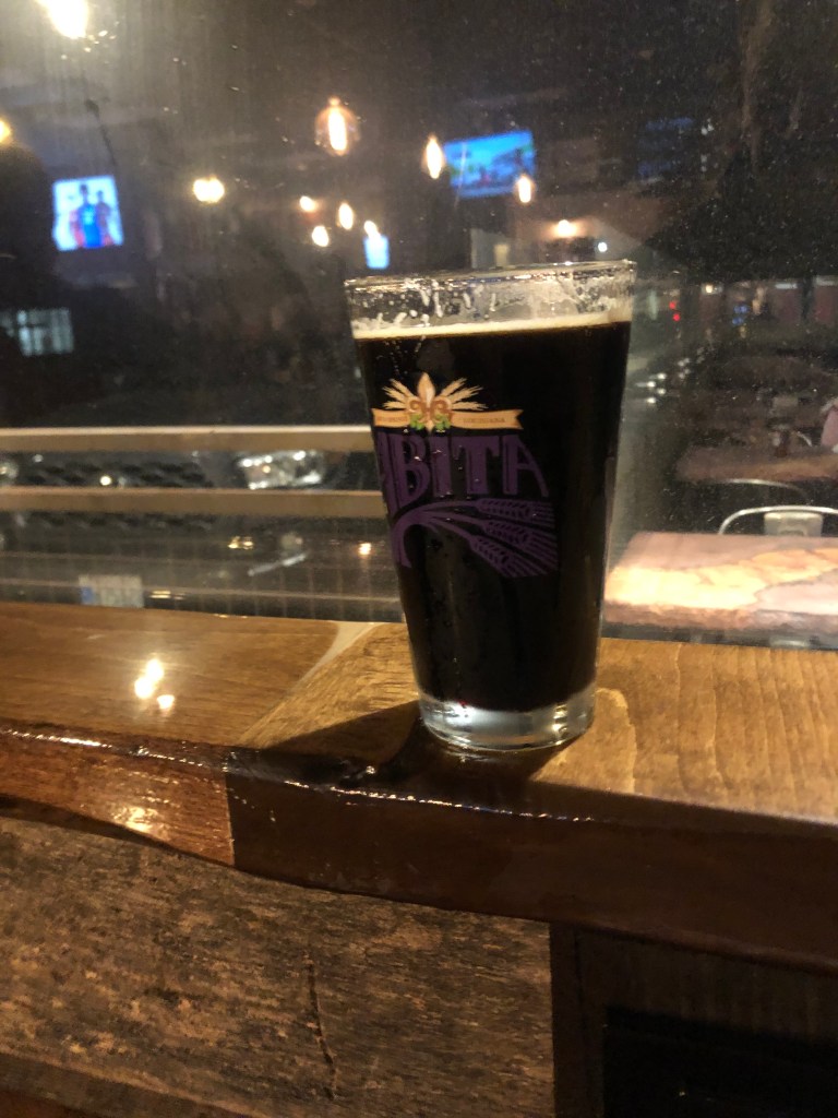
The sun was beginning to dip behind the mountains, and I figured it was time to call it a day. Tomorrow I’ll be heading up into the southern Sierra Nevada mountains to see what I can see. But first, I decided that I’d earned a BOTD.
BREW OF THE DAY
Conveniently located next to my hotel is TK’s Pizza and Taproom. I ordered a Stone Xocaveza Imperial Stout to go with my meat-lovers pizza. Now, I usually like my imperial stouts to have an ABV in the double-digits and the viscosity of Havoline. This pint didn’t deliver on either of those scores: it’s only 8.1% alcohol and its got the consistency of lowfat milk. But even though this brew departs from my stereotype of an imperial stout, its flavor is rich, delicious, and intoxicating. You immediately taste coffee up front, and then the various spices make themselves known: nutmeg, cinnamon, maybe a little vanilla. And definitely chocolate. This is a Mexican hot chocolate mixed with Starbucks. It’s a winter warmer to drink next to the fireplace while reading Conan Doyle. It’s a festive, copper-shot mahogany potation that’s sure to improve your outlook on life. Go out and get yourself one today!