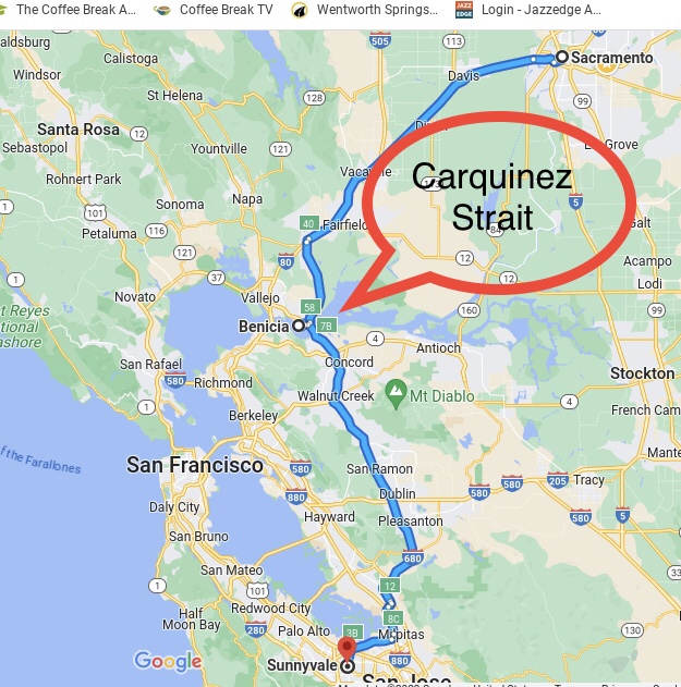
Eons ago, when I finished college, I moved to Sacramento, and in the succeeding years I made many weekend trips back to the familial homestead in Sunnyvale. The trip required crossing the Carquinez strait on the Benicia-Martinez Bridge. In those days, the bridge had traffic going in both directions, but in 2007 a second bridge was opened and each of the two bridges was henceforth devoted to traffic in a single direction.
My overland trail.
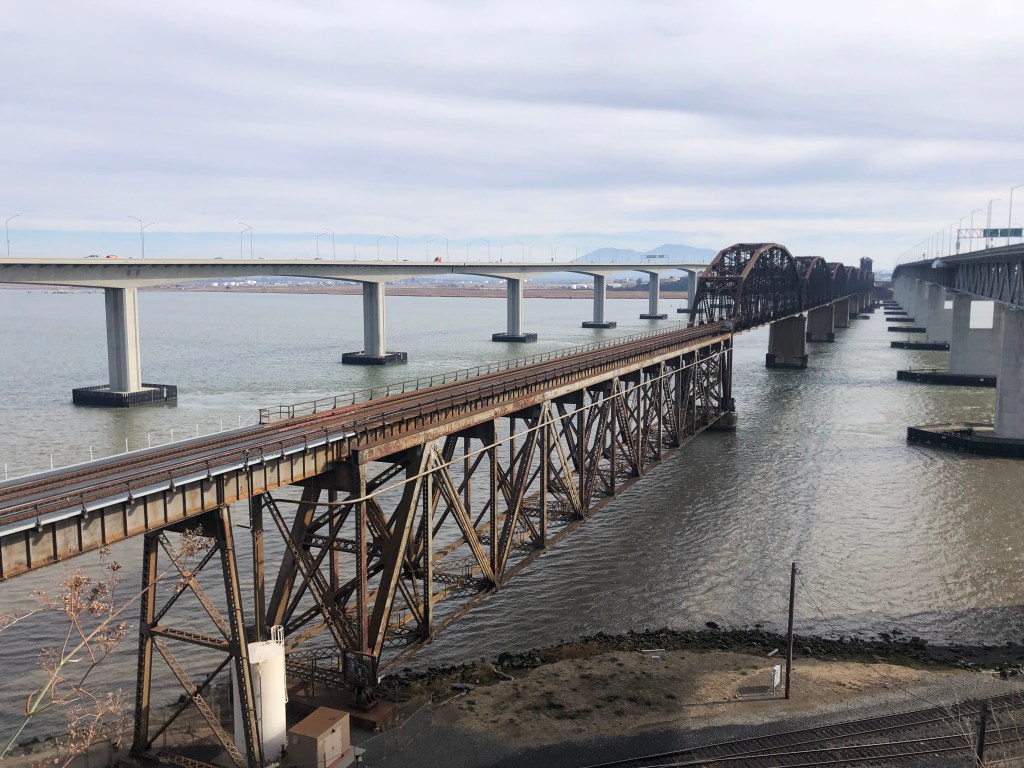
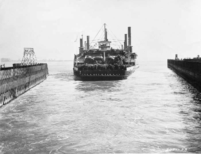
As I crossed the Carquinez Strait in my Studebaker Hawk (which I’m not making up), I would always glance at the old railroad bridge that ran alongside me. Often I’d see a train rumbling over the creaky structure. Here’s a shot I took this morning of the railroad bridge flanked by the two automobile bridges:
Looking south, from Benicia to Martinez.
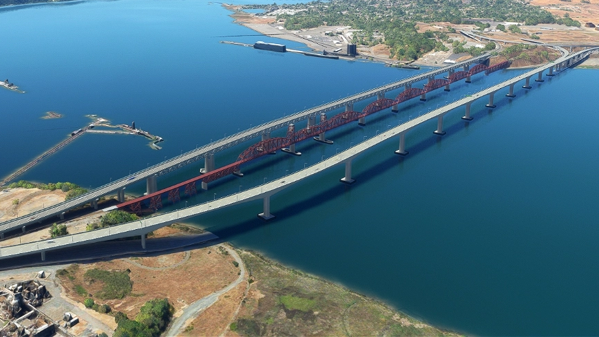
Aerial view, stolen from the Internet.
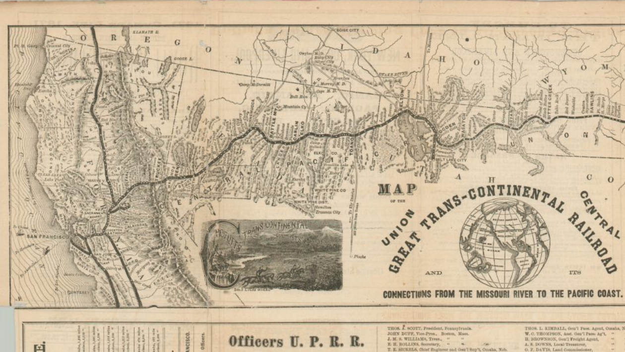
The Benicia-Martinez Bridge railroad bridge opened in 1930. It was–and still is today–the second-longest railroad bridge in North America. But did you know that trains had already begun crossing the Carquinez strait more than half a century earlier? How could this be?
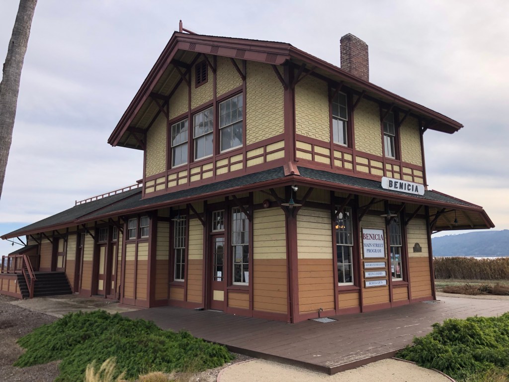
To answer this question, I visited the unassuming town of Benicia (pop: 27,000). Briefly California’s capital (from February 1853 to February 1854), Benicia today is famously home to my son Ian and daughter-in-law Katelyn. But it’s also home to this old depot which can shed some light on our railroad bridge puzzle:
End of the line, in a way…
This 144-year-old depot was originally built in 1879 in the small town of Banta, California (pop: unclear, though probably around 100 according to this account). Banta was a whistlestop on the original transcontinental railroad. Westbound trains would make the final leg from Sacramento to the Bay Area by way of the Altamont Pass, which they would cross just after passing Banta.
The original route.
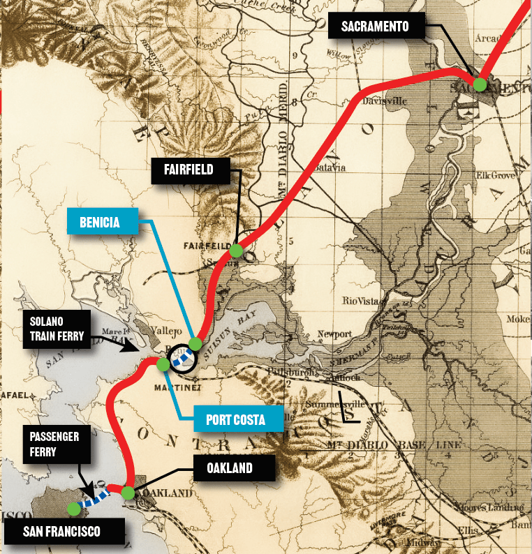
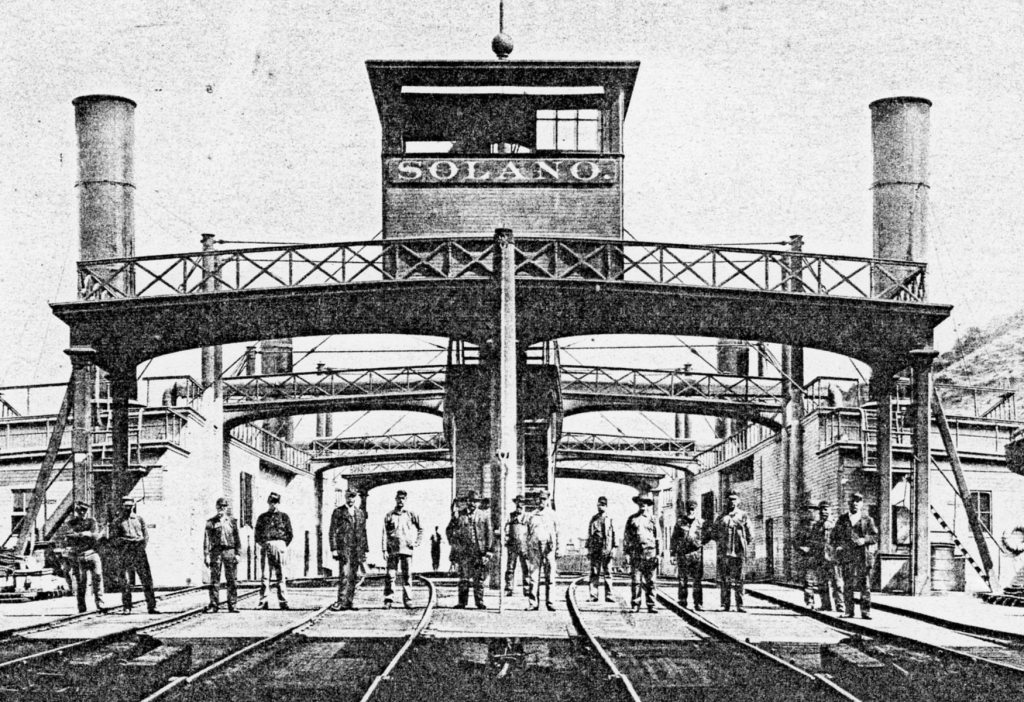
But the same year the Banta train depot was constructed, the Southern Pacific opened a new, shorter route from Sacramento to the Bay Area. This route crossed the Carquinez Strait, shaving off several hours from the old route over Altamont Pass. But since the Benicia-Martinez railroad bridge wouldn’t be constructed until 1930, trains were ferried over the Strait. Seriously. An enormous ferry dubbed The Solano was constructed for this purpose. Westbound trains would slowly chug over the Benicia Pier, roll onto the Solano, and make the half-hour trip to Port Costa, about a mile across the water. From there the trains would return to the mainline and continue to the end of the line in Oakland.
The new route.
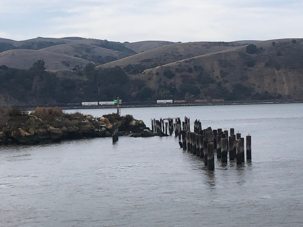
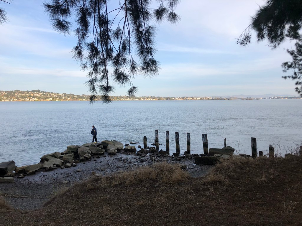
This morning I stood on Benicia’s modern fishing pier and looked out at the ancient pilings from the old pier where the Solano used to dock.
The Solano’s old haunt…perhaps literally?
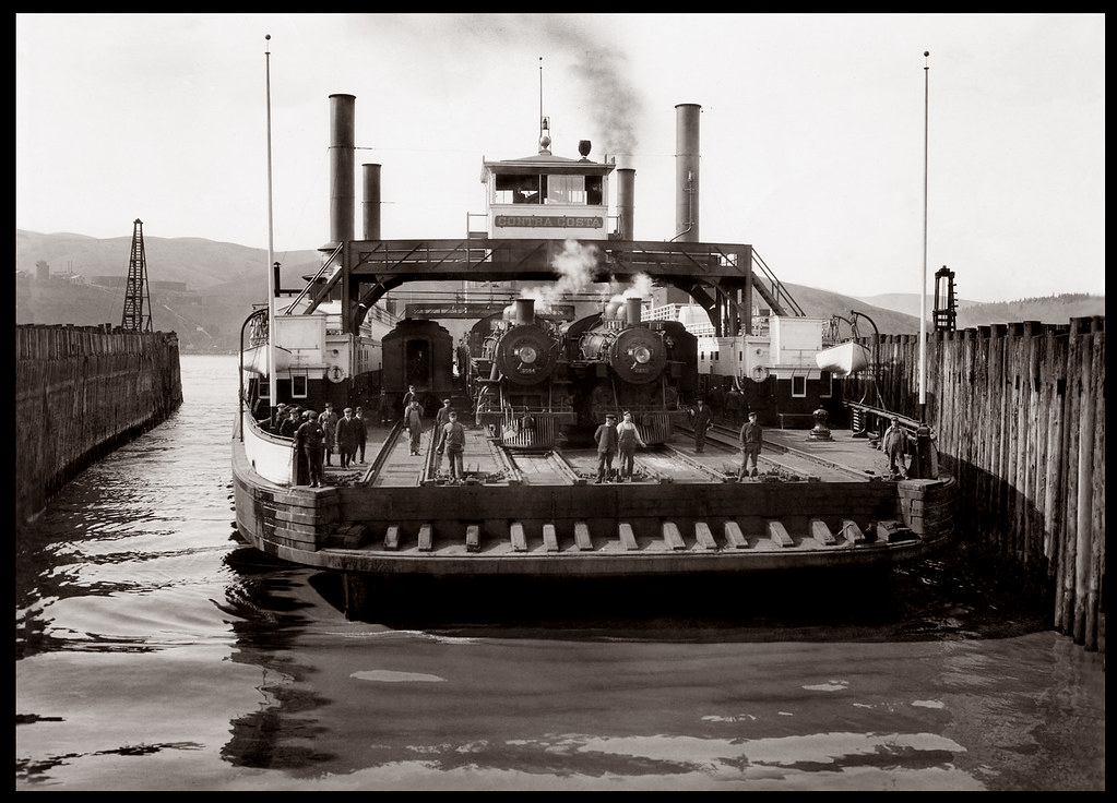
The Solano, which remained in continuous operation for 51 years, had a length of 425 feet and was equipped with four sets of tracks. It was the largest railroad ferry in the world.
Demand on the line increased continually, and eventually it was decided that a full-size railroad station was needed on the Benicia side of the ferry crossing. So in 1902, Southern Pacific uprooted that station they’d built in Banta, floated it on a barge to Benicia, and planted it where you see it today.
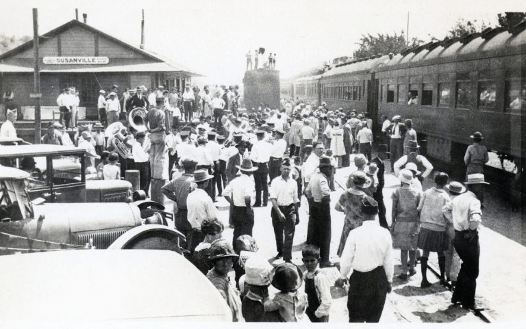
The Solano kept working around the clock, year in and year out. In 1914 she was joined by a sister ferry, the Contra Costa, to absorb the growing demand on the line. But then in 1930, the railroad bridge (which we encountered near the beginning of this post) opened, and the ferries instantly became obsolete. They made their last run in November 1930.
The final run, loaded with well-wishers.
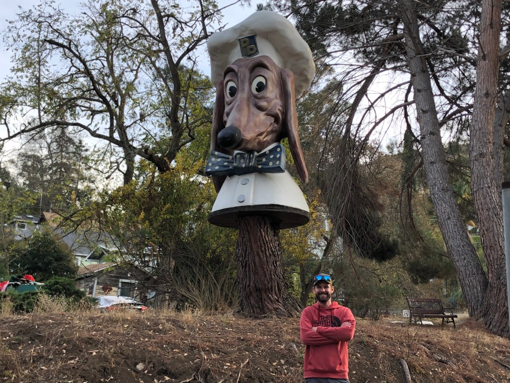
So after exploring the depot and remains of the Benicia ferry pier, I enlisted son Ian to drive us to the other end of the ferry crossing, which was in Port Costa (pop: 200). Port Costa is a small, funky, historic town, replete with a Doggie Diner head. (People of a certain age may remember getting a hotdog at one of the Doggie Diner restaurants in the Bay Area in the 1960s or 1970s. I sure do! Those who don’t remember them can get enlightened here.)
Ian and a midcentury Bay Area icon.
After a bit of walking around Port Costa we came upon the remains of the southern dock of the Carquinez ferry crossing:
The Solano’s southern haunt. Benicia is directly across the strait.
So, for those of you keeping score at home, we’ve managed to find the depot from which ferry-bound trains departed, the remains of both ferry piers, and the bridge that put the ferry out of business. But what of the ferry itself?
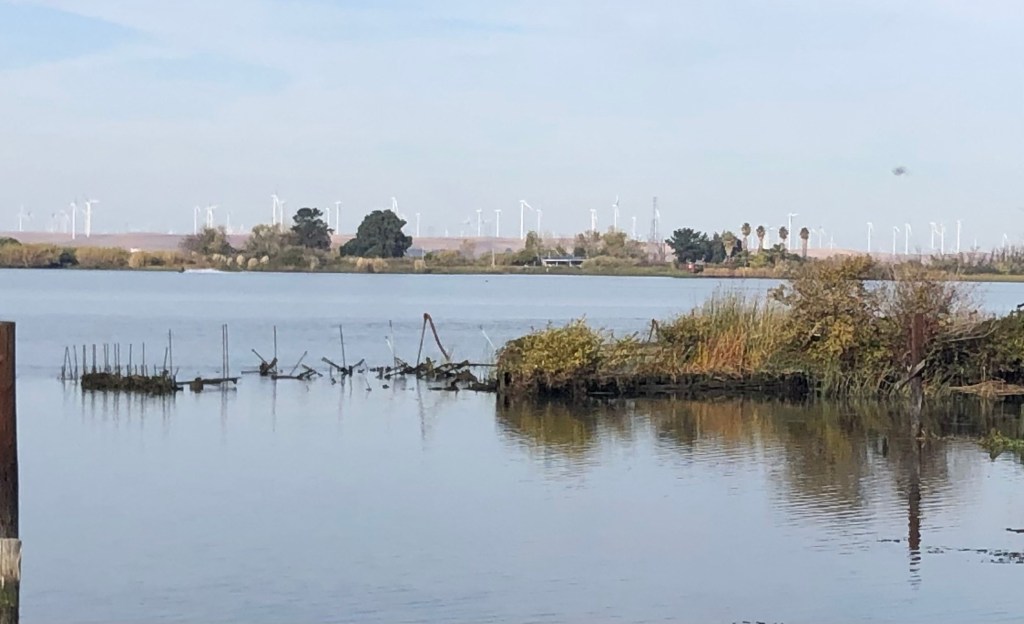
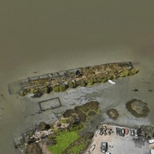
A little Internet research revealed that the Solano was decommissioned and towed out to Antioch in 1931. There she was scuttled near the bank of the San Joaquin River and partially submerged to serve as a breakwater. She remained there, largely identifiable in her old form, for about half a century. But in the 1980s some clown was setting off fireworks and accidentally set The Solano ablaze, and she burned to the waterline.
Naturally, Ian and I headed over to Antioch to see what remained of the Solano. The answer is “not a lot,” but there’s still a ghostly presence. Check it out:
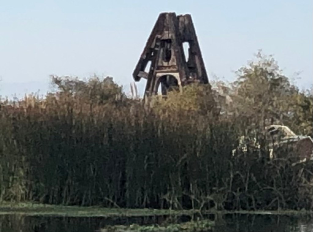
Remains of the Solano in Antioch. We’re looking at the port side of the ferry, with metal rods from the bow poking out of the water on the left.
The 40-foot-high A-frame that housed one of The Antioch’s two paddlewheel engines still rises from the wreckage.
Aerial view, courtesy of Virtual Globetrotting, clearly shows the outlines of The Solano.
So that’s pretty much it. As always I’m struck by how physical barriers were overcome in the Age of Steam…and how remnants of that era can still be seen all around us, if we’re just willing to look.
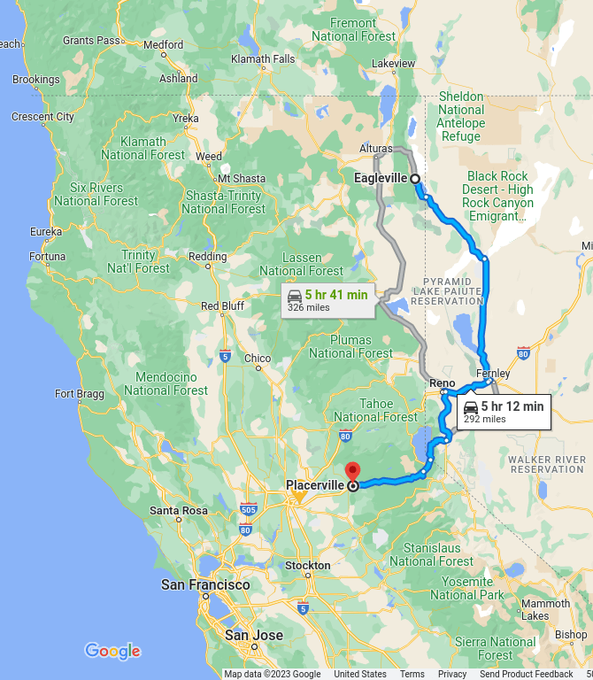
After completing my mission at Eagleville, I headed homeward on NV 447, then back into California via Reno.
My route home (in blue).
You’ll note that my return trip skirted the west side of the Black Rock Desert, where Burning Man begins this weekend. My entire run through Nevada was overrun with “Burners” in their anti-establishment Winnebagos, powered by thousands of gallons of anti-establishment Chevron gasoline.
Prophetic sign in Reno.
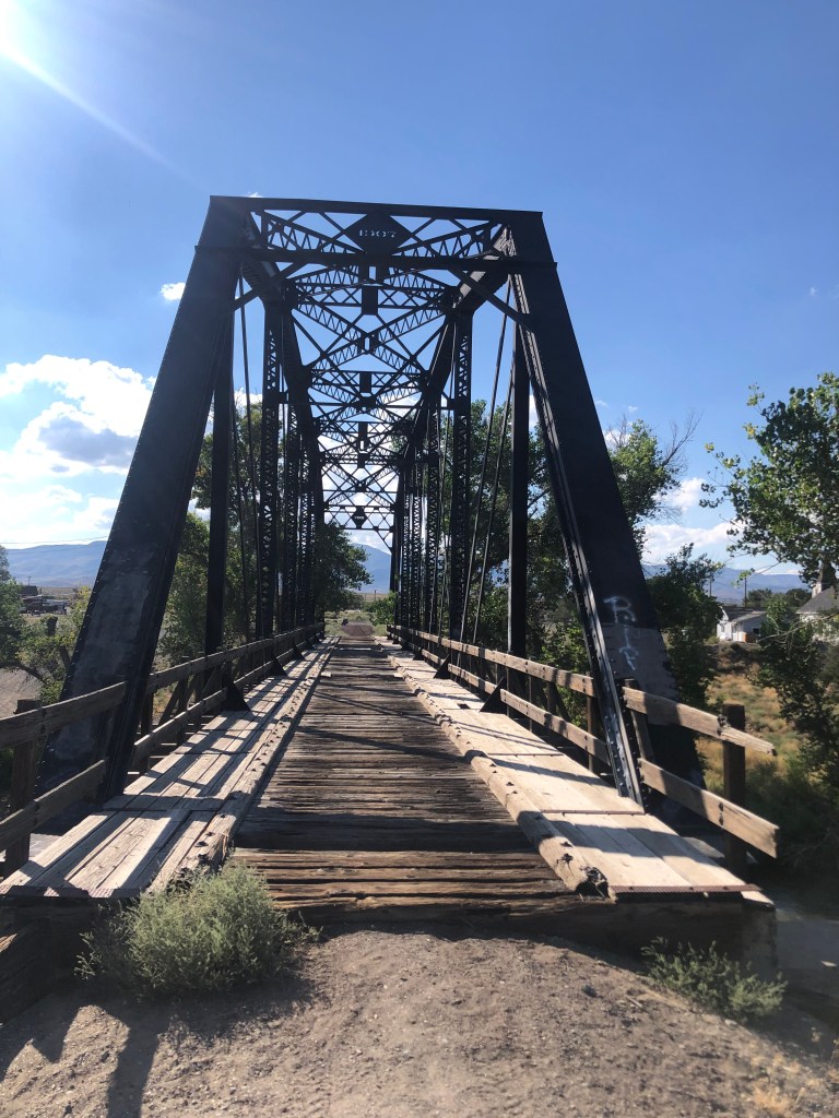
One worthy sight along the way was this 1907 bridge over the Truckee River in Wadsworth, NV.
The bridge served the Fernley and Lassen Railway, which was a 112-mile short line. I’m told that two of the railroad’s depots (in Fernley, Nevada and Susanville, California) have been restored, so this might be the subject of my next road trip.
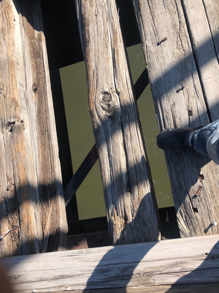
One needs to be careful when crossing this bridge….
You should also check out this cute, heart-warming video that features the bridge:
Watch your step, little girl!!
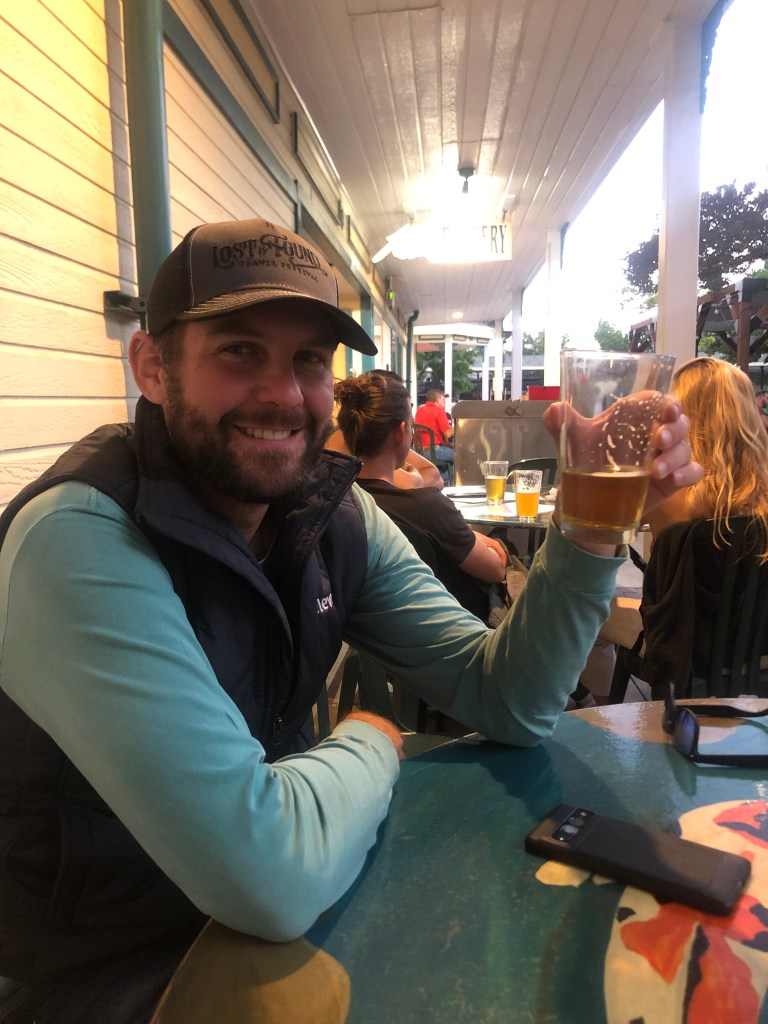
After Wadsworth I stopped in Reno to have dinner with my son Ian, who happened to be in town on business.
Like father, like son.
I spent the night in Reno, and this morning, before leaving town, I made a significant, final discovery related to the N-C-O Railway:
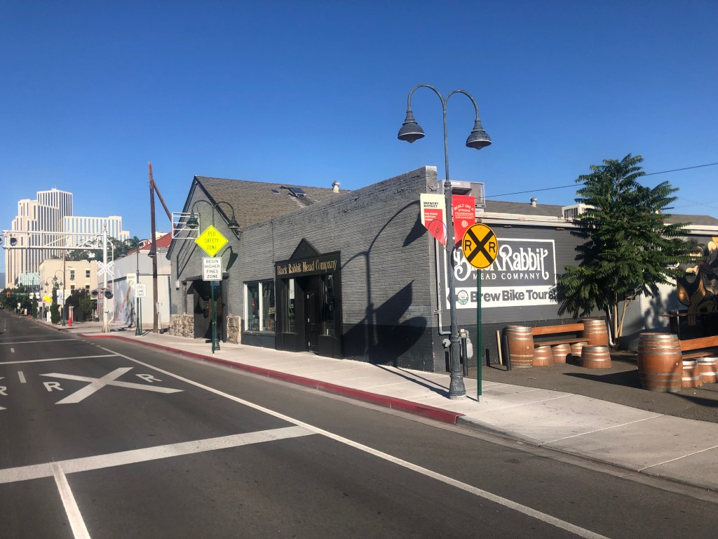
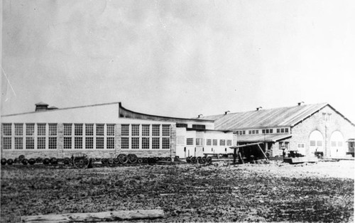
Recall that I had been unable to find the NCO locomotive shop in Lakeview (northern terminus of the railway). This morning, however, I located the NCO’s 19th-century shops building in downtown Reno (the NCO’s southern terminus). The building is on the other side of the tracks from the Depot Brewery and it’s currently serving as the headquarters for Black Rabbit Mead Company. It’s notable that two of the NCO’s surviving Reno structures now make mead and beer.
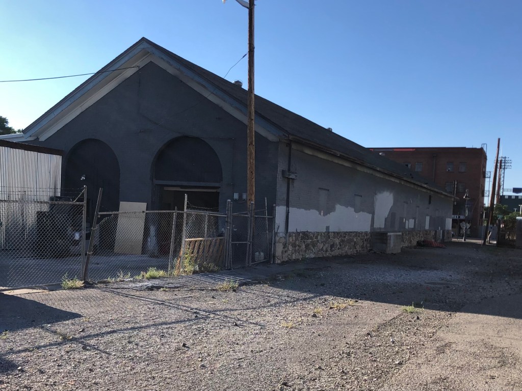
The NCO’s 1889 locomotive shop, now a meadery.
Same building, viewed from the back.
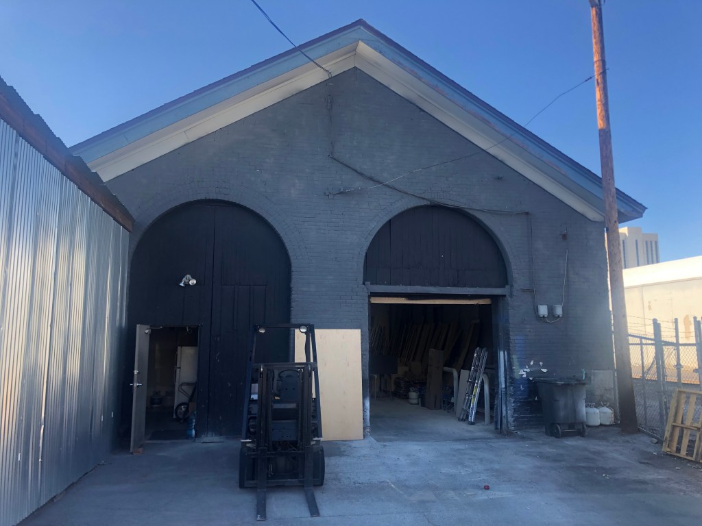
Steam locomotives used to enter those rounded doorways.…
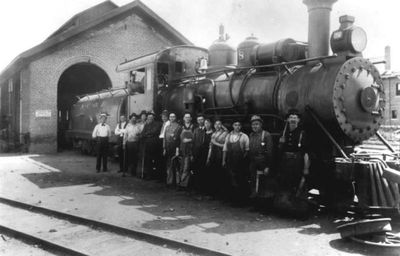
…as proven by this historic photograph.
You can get more information about this building and photographs here.
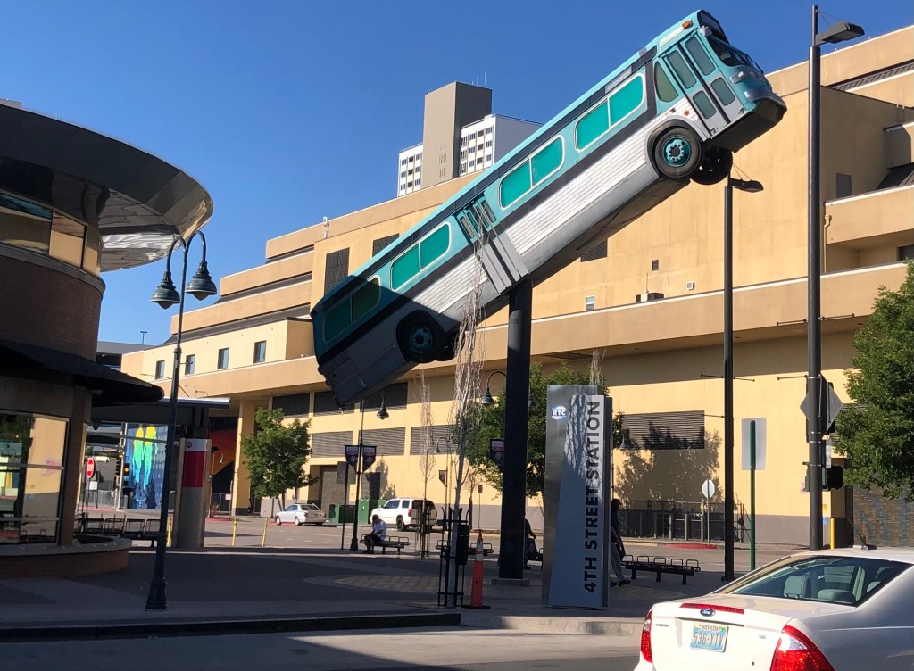
Finally, I need to share this art installation I saw in front of the Reno bus depot. It’s made from a real, retired bus, though it’s been gutted and narrowed. I’m told it also is illuminated from the inside at night, and the headlights and taillights illuminate.
My only complaint is that the bus was retired from New Jersey. Shouldn’t they have used a Reno bus??!
So ends this latest adventure. Be on the lookout for a Fernley and Lassen trip one day soon!
The F&L’s Susanville station looks like a happening place.
After getting my complimentary coffee and scone from the Niles Hotel this morning, I made a final circuit of Alturas looking for one final NCO structure. Apparently the old locomotive shops buildings are still around, but I could not find an address on the Interwebs. There was just this historic photo from the Modoc County Museum:
“Portrait of the old N.C. & O railroad shop in Alturas, Ca. Published by: The Journal of the Modoc County Historical Society in 1982. Old N. C. & O Railroad Shop”
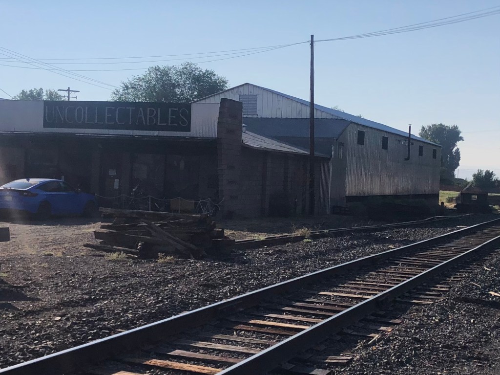
So I just cruised around the city, trying to hew to the rail line on the theory that railroad shops would be connected to the tracks somehow. Only two structures even remotely resembled the rightmost building in the historic photo, but I think they are not what I’m looking for. Here they are:
The roof of the building in the back has the right pitch. Note the misspelling on the “uncollectables” sign.
This CalTrans facility looks like it could have been an old train shed…
Anyone with information or even a hunch (I’m looking at you, Quasimodo) please let me know!
Around 9:30 am I left Alturas in defeat, and got back onto US 395 north. On my way to Lakeview, OR (which you will recall was the northern terminus of the NCO Railway), I passed a couple of noteworthy sites:
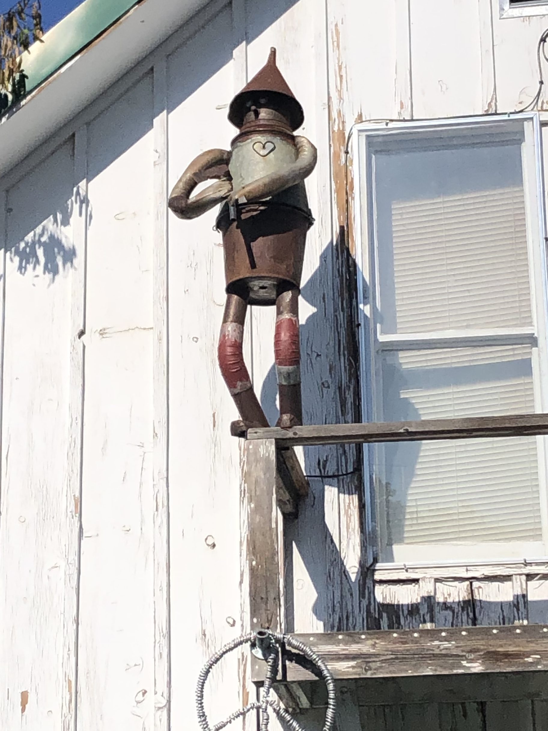
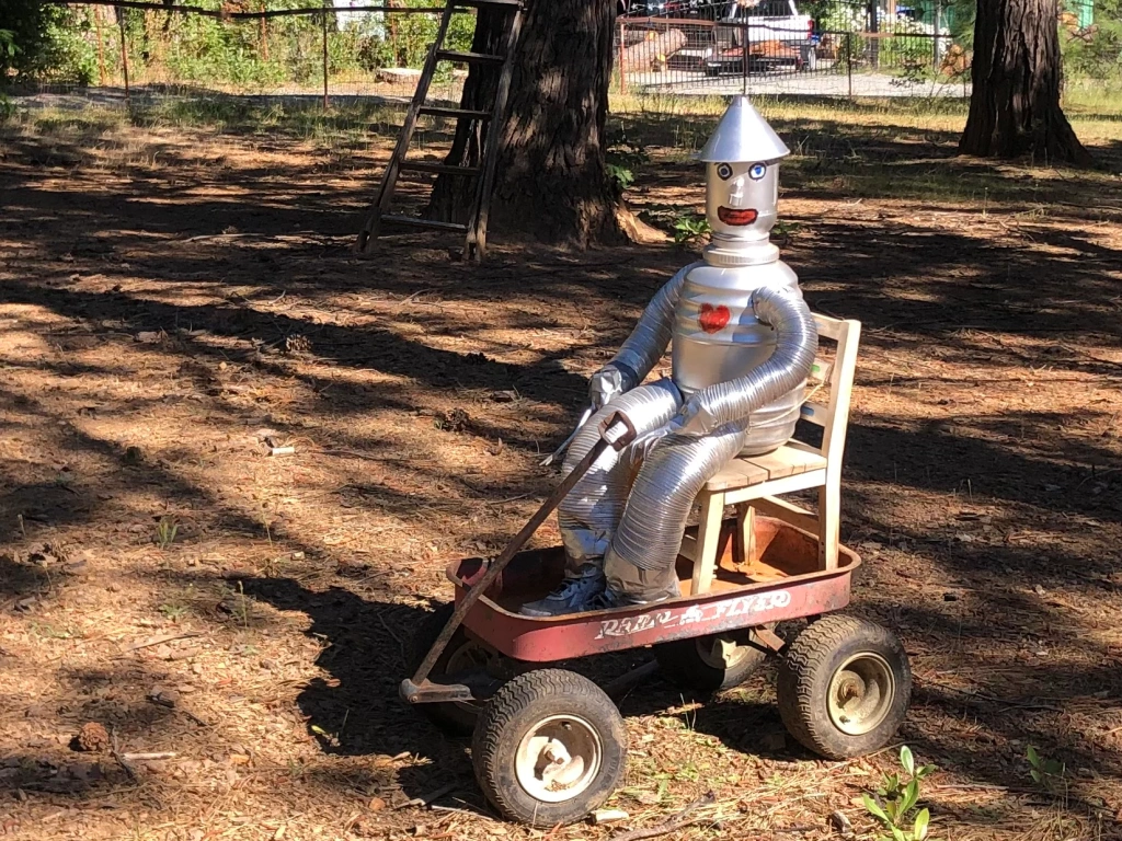
I spotted this Tin Man figure on the side of a house facing the road. Like the one I saw a month ago near Georgetown, CA, it brought a smile to my face. The owner came out of his house while I was taking the photo, and we had a nice chat. I think what this world needs is more Tin Men.
Here’s the one from Georgetown.
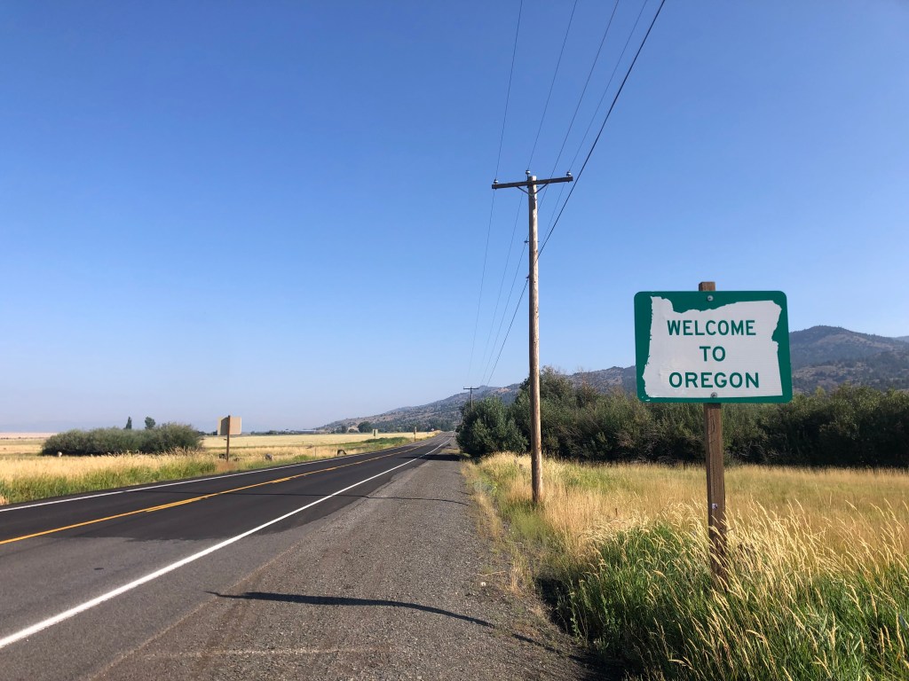
Entering the third state of the NCO!
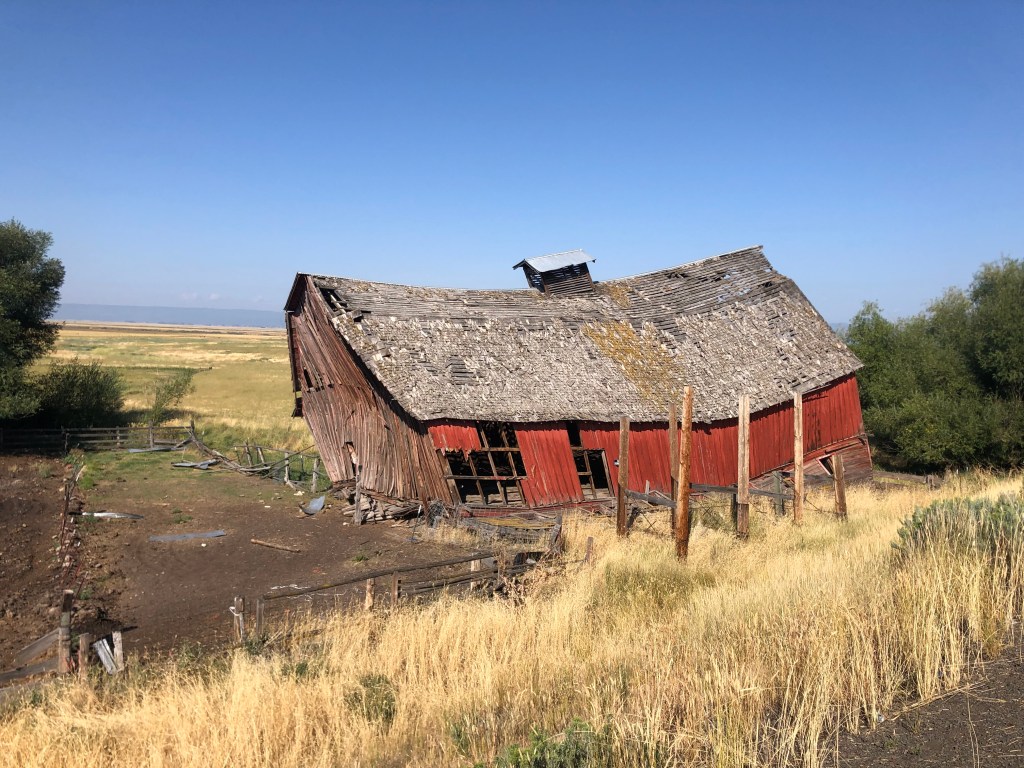
If Salvador Dali built a barn…
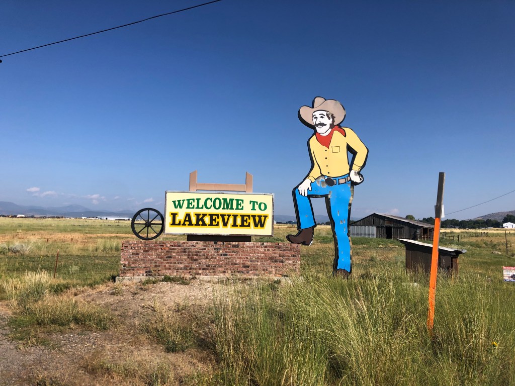
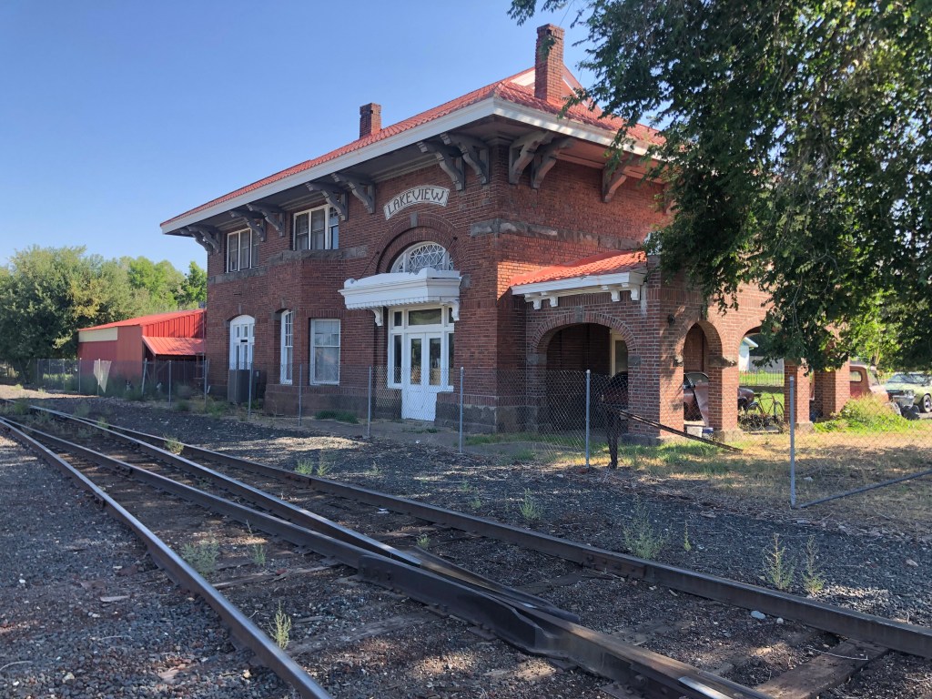
Finally I arrived in Lakeview, Oregon (pop: 2,500).
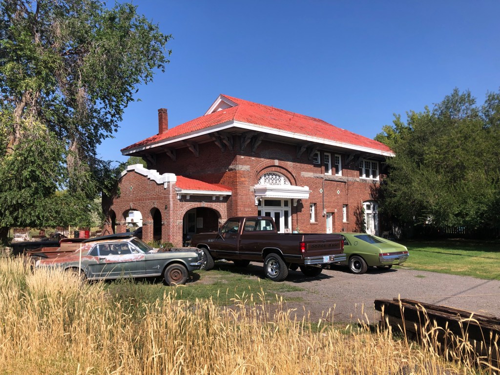
Just to the west of downtown I found the depot. It looked to be a happening place, with numerous cars parked in front.
Note the rare AMC Marlin (?) on the right.
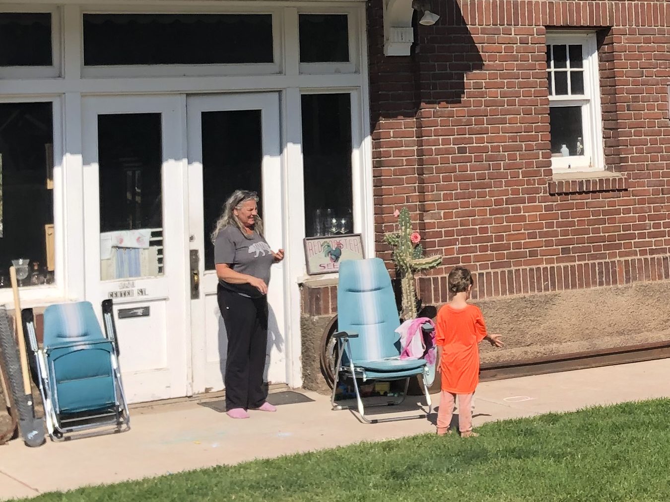
But it turned out that these cars all belong to the depot’s owner. For unlike the other depots on this trip, this one is serving as a private residence. The owner’s name is Carmen, and she bought the depot from the second owner (after the railroad sold it). She appears to have changed little of the outside of the building. As for the interior, I can’t say. She steadfastly ignored my repeated hints that I’d like to see the inside.
Carmen, managing her little Yardmaster.
Interestingly, the tracks immediately behind the depot are still active. It seems there’s a short line railroad that ships goods between Lakeview and Alturas. The tracks are essentially unprotected, and run just a dozen or so feet from the depot’s back door. For a railfan, it sounds ideal. For anyone else, it sounds noisy and dangerous. But I am grateful to Carmen for preserving this piece of NCO history.
Not your typical bungalow.
It was now finally time to fulfill the whole point of this trip: A return visit to Eagleville, CA. I said goodbye to Carmen and headed back down US 395 to Surprise Junction, then headed east on CA-299. After about an hour and a half I stopped in Cedarville (pop: 425) to get gas and lunch. Cedarville is only 17 miles from Eagleville, but the latter has almost no services, so I made use of the former.
While pumping gas I noticed numerous campers and RVs and VW buses lining up at the pumps. Almost all of them were carrying bicycles and other equipment, and the drivers and passengers all had fluorescent hair. “Burners,” muttered the gas station attendant. In response to my confused look, he explained that these folks were all going to the annual Burning Man event in the Black Rock desert. It struck me that, in their effort to be independent and iconoclastic, they all looked and behaved exactly the same way. That said, I did have to admire the work this guy put into his Burner Mobile.
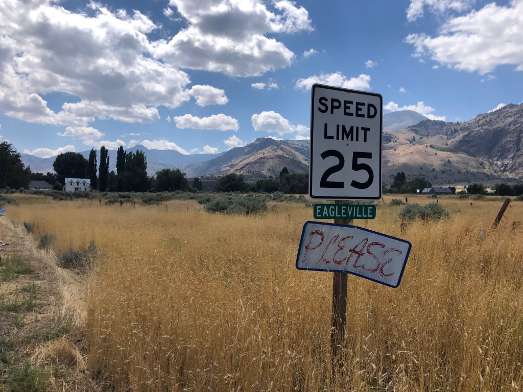
About 20 minutes after I’d finished my pit stop in Cedarville, I was standing in Eagleville (pop: 45) for the first time in almost half a century.
Perpetual plea.
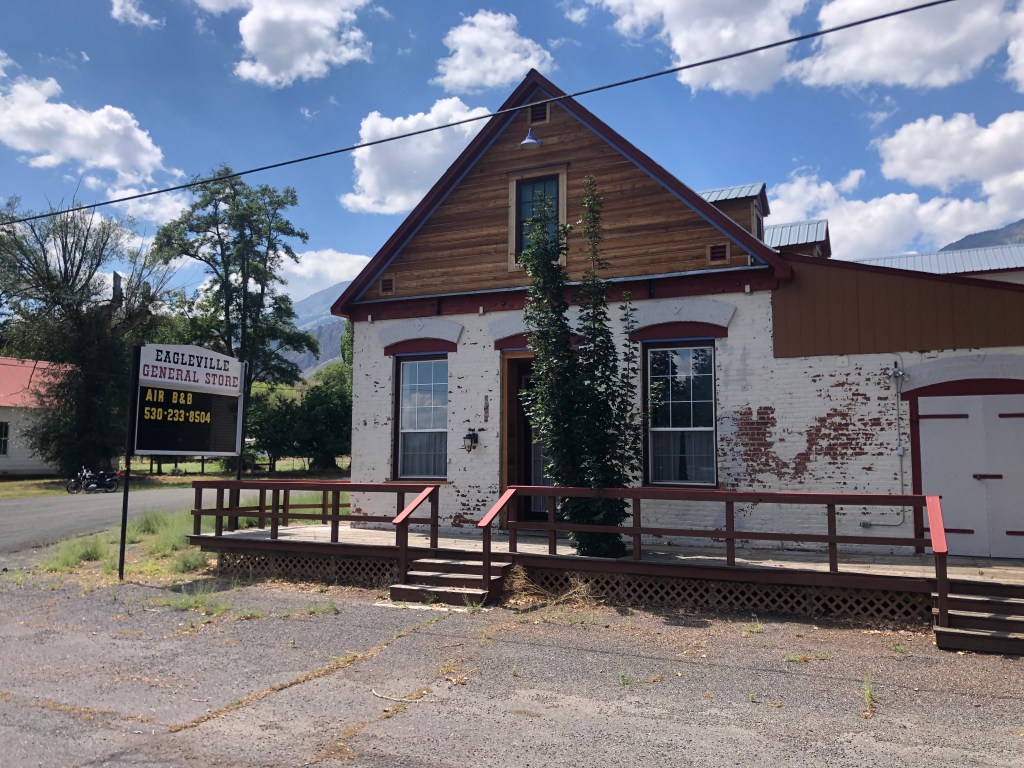
The first thing I noticed was the general store, which was originally built in 1876. It’s gone out of business, and the owners seem to be trying their luck renting it out as a B&B. I think that might be a stretch. The 150-year-old exterior walls look largely unchanged from when I had last seen it.
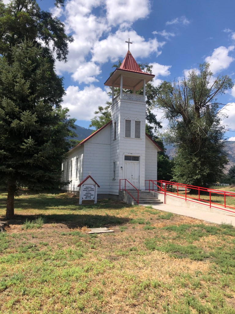
Across from the general store was the old (1888) church I’d remembered. It looked almost exactly the same as my memory, though I read it underwent some restoration work in 2000. This time, though, the door was locked. Evidently they are less trusting than they once were. And who can blame them? I also read the church no longer holds regular worship services.
A restored church that is no longer open for worship.
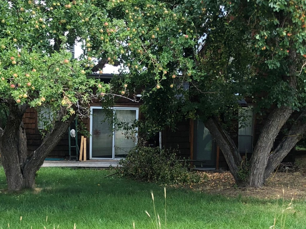
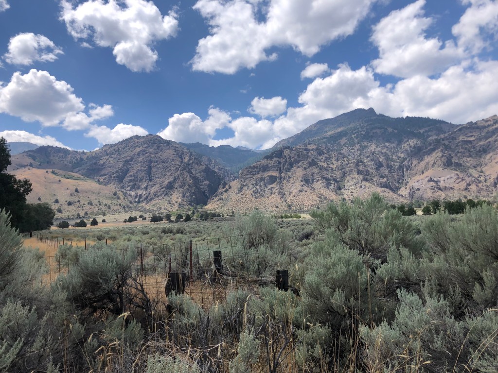
I then went down the street to the street Aunt Alice’s family maintains three homes. The house where we’d spent Thanksgiving in the mid-1970s was still there, seemingly frozen in time. The South Warner Mountains still stand sentry over the town.
Back of the house, just as I remembered it.
Great view from the family homestead.
Notably, I did not see one living soul in Eagleville. Maybe people stay indoors during the mid-day heat. But l it did feel a little unsettling. I guess some people prefer a quiet, isolated existence. Indeed, the gas station attendant in Cedarville told me he left Alturas to “escape the rat race.” He likes “how small this town of Cedarville is.”
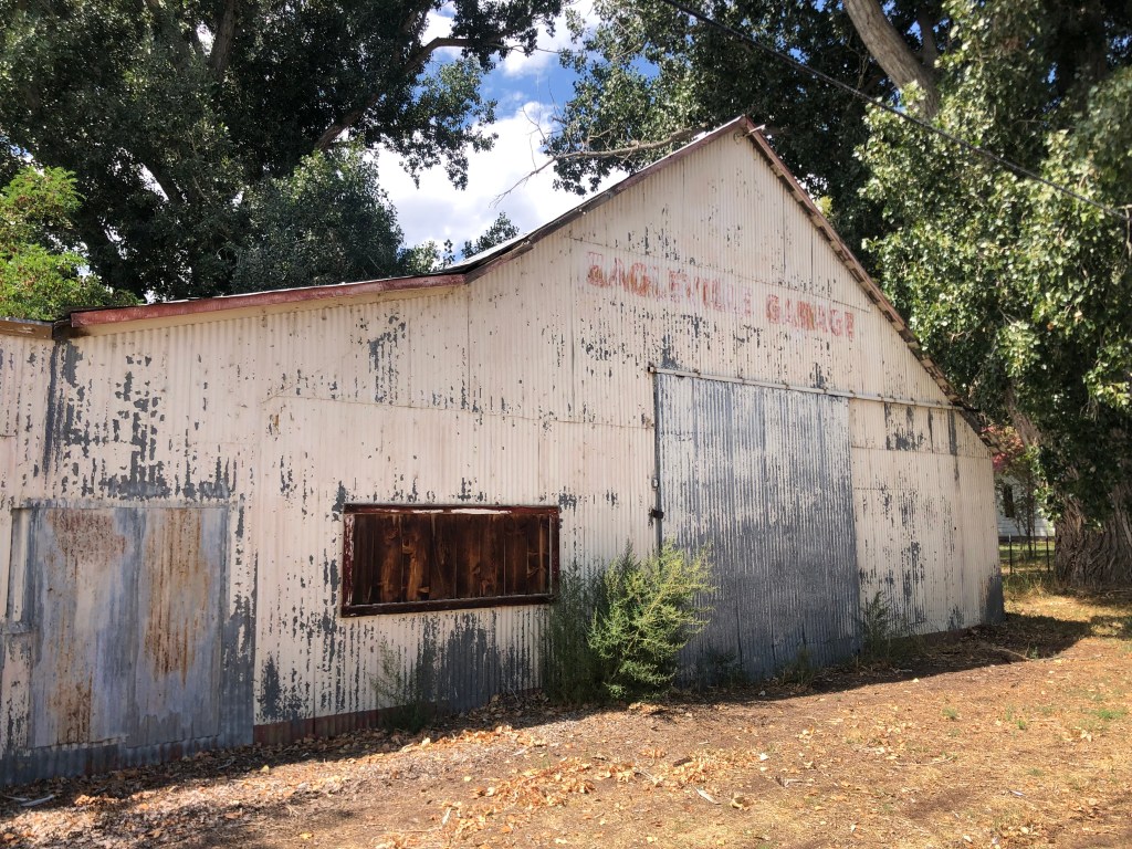
But Cedarville is a metropolis compared to Eagleville. At least Cedarville has a gas station. Most of Eagleville’s erstwhile businesses are long closed. Like the Eagleville Garage.
I think I’d go crazy in a place like Eagleville. But I’m glad it exists, and I’m glad that some people make it their home. We all need to find the place that suits us. In addition, there’s also something reassuring about a memory from my past retaining some physical form.
After melancholy reflections such as these, I got back on the road and started to head home. Hundreds of “burners” shared the road with me as they made their way to the Black Rock desert, seeking to transform one of the country’s most desolate places into a teeming metropolis….if only for a week.
Mail Bag/Miscellany:
I neglected to mention in yesterday’s blog that Uncle Ed’s Dome of Foam includes information on the NGO and its depots. Here is the link.
See also some further input that Ed and others posted in the comments section of yesterday’s blog.
Finally, here’s Edward’s photo of Carmen’s “house,” back when it was serving a very different function.
“Arrival in Lakeview,” 1974. From Uncle Ed’s Dome of Foam.
About half a century ago, when I was in the throes of adolescence, my dad loaded up our family and made the seven-hour drive from Sunnyvale to Eagleville, in the northeast corner of California. We were going to spend the Thanksgiving weekend with my Aunt Alice’s family. One of Alice’s brothers owned a house up there (in retrospect, it seems her extended family owned half the town).
Motto: “Any further north and you’d be in Oregon.”
Eagleville is a tiny town in Modoc County. (Today it boasts 45 residents, about half of whom presumably are related to Aunt Alice). I have three main memories from that weekend we spent there: (1) Mom was sick with a migraine headache, Dad was distracted by mom’s condition, and Dave and I knew no one else other than Aunt Alice and Uncle Edward (Dad’s brother). (2) The general store was the only business open that weekend, so my brother Dave and I hung out there for what seemed like hours, studying the comic books and MAD magazines. (3) There was a tiny church that was unlocked and empty; as a city slicker, I was surprised that people could be so trusting as to leave a building full of chalices and patens and suchlike just sitting there unattended. Even though Dave and I were not known for our high moral principles, we realized that it would be extremely bad karma to rip off anything from a church. So we left well enough alone.
As I recall, our Thanksgiving dinner was a traditional though awkward affair. All the expected Thanksgiving staples were there: turkey, stuffing, cranberry sauce, etc. But the four of us in my immediate family were clearly unfamiliar outsiders, while Aunt Alice’s family members were all comfortable together, laughing and joking and having fun. I envied their ease being in their own skin, and their grounding in that remote corner of California.
That Thanksgiving weekend still stands out from the 60 undistinguished others I’ve experienced. Perhaps it’s because it was the only Thanksgiving I spent with snow. Perhaps it’s because Eagleville felt like such a mysterious, remote, foreign place. Notably, I’ve never been back to Eagleville.
Until now.
Recently I decided, for no particular reason, that I would revisit that tiny town and see how the reality stacked up against my memory. So I contacted my Uncle Edward, who helpfully supplied me with the address of the house where we stayed, which evidently still remains in Alice’s family. As loyal readers of this blog know, Uncle Ed is the creator and sole “staff” of The Dome of Foam, which is internationally recognized as the premier, authoritative, entertaining website on western railroads (particularly the Southern Pacific). I asked Uncle Ed if he could recommend any railroad-related sites in the greater Eagleville area, and he connected me with a doozy: The Nevada-California-Oregon (N-C-O) Railway, a now-defunct narrow-gauge railroad that connected Eagleville’s Surprise Valley with the outside world.
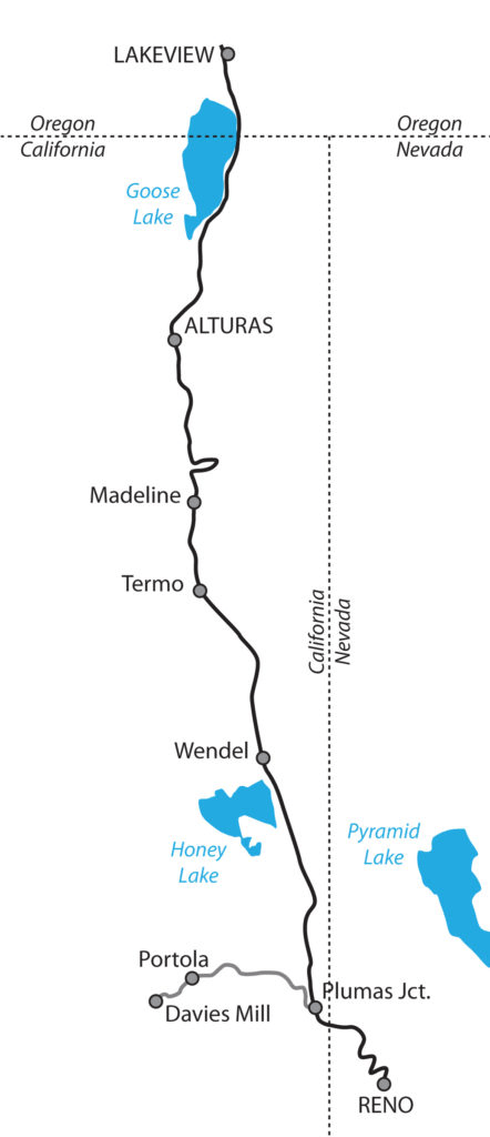
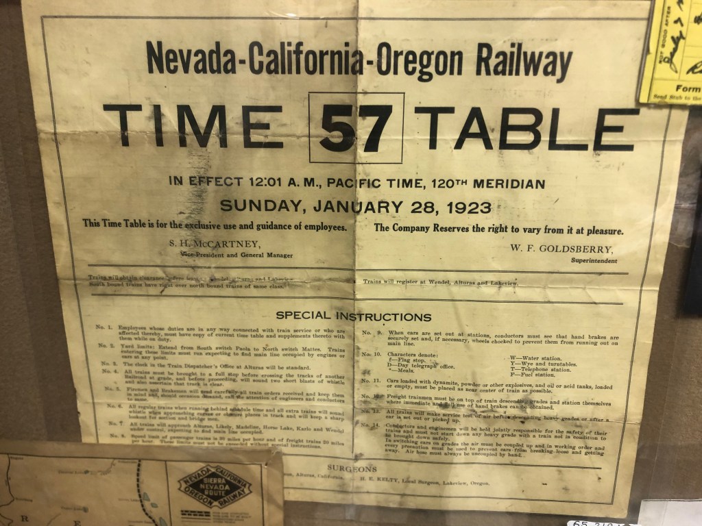
In doing a little research I read that the N-C-O Railway’s southern terminus was in Reno, Nevada, and I recalled that son Ian and I had visited that same depot just last winter. (Scroll down to the BOTD in this post.) It’s now a brewery/distillery, but they’ve keep the original exterior largely intact. The N-C-O also had a major presence in Alturas, which is just west of Eagleville. And the northern terminus was in Lakeview, Oregon, which is just north of Alturas.
Route of the N-C-O Railway.
So my plan became clear: my trip to Eagleville would generally follow the entire route of the N-C-O Railway, an I’d be able to visit historic structures in each of the three states served by the railroad.
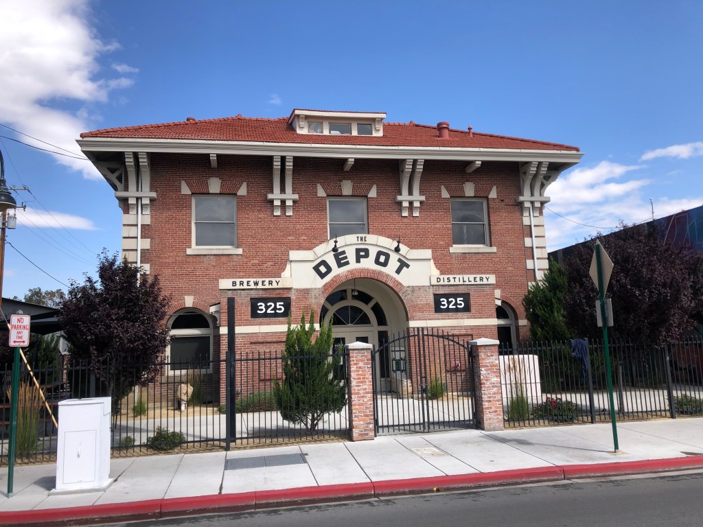
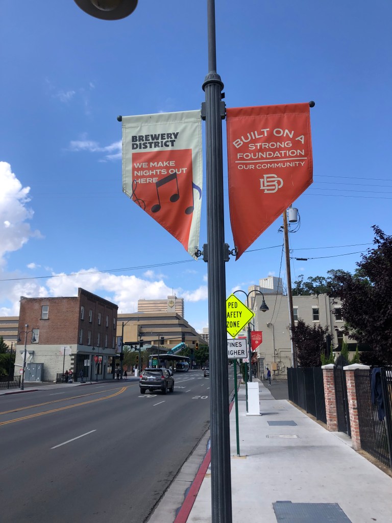
And so this morning I set out on the trusty Speedmaster eastward to Reno (pop: 264,000). Within a couple of hours I was standing in front of the N-C-O’s Reno depot. Originally built in 1910, the building served as a railroad depot until 1937. After that it was used for railroad offices and was finally sold off for non-railroad purposes in 1975. It was eventually abandoned, then in 2014 it underwent renovation to become the brewery/restaurant it is today.
Once the southern terminus of the NCO Railway.
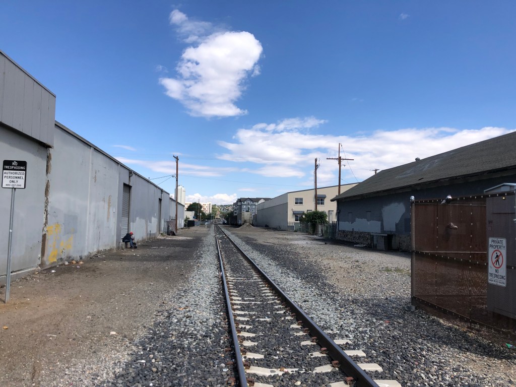
The rail line still runs alongside the Depot.
The Depot sits in the middle of Reno’s Brewery District, alongside a handful of other breweries and distilleries.
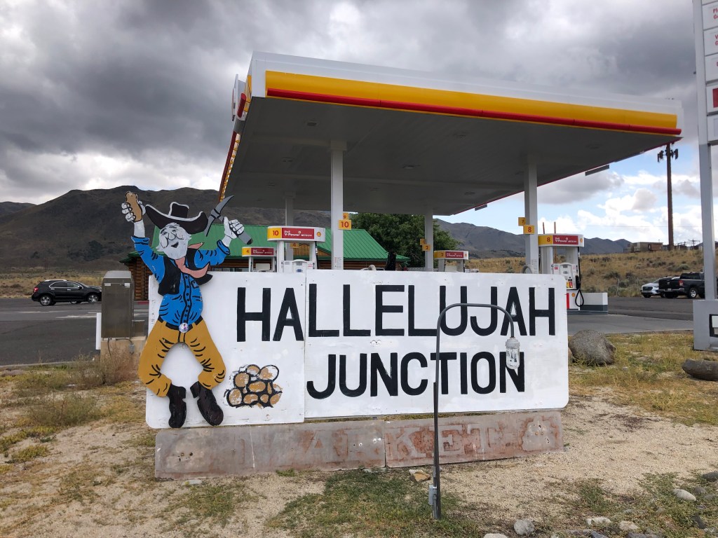
I next headed north on US 395. I’ve written about US 395 before (here and here and here, for example). You’ll recall that Hallelujah Junction (where US 395 intersects with CA-70) holds special significance. So I made a brief stop as as I passed through, to relive the magic.
Where I learned about the Seven Wonders of the Railroad World.
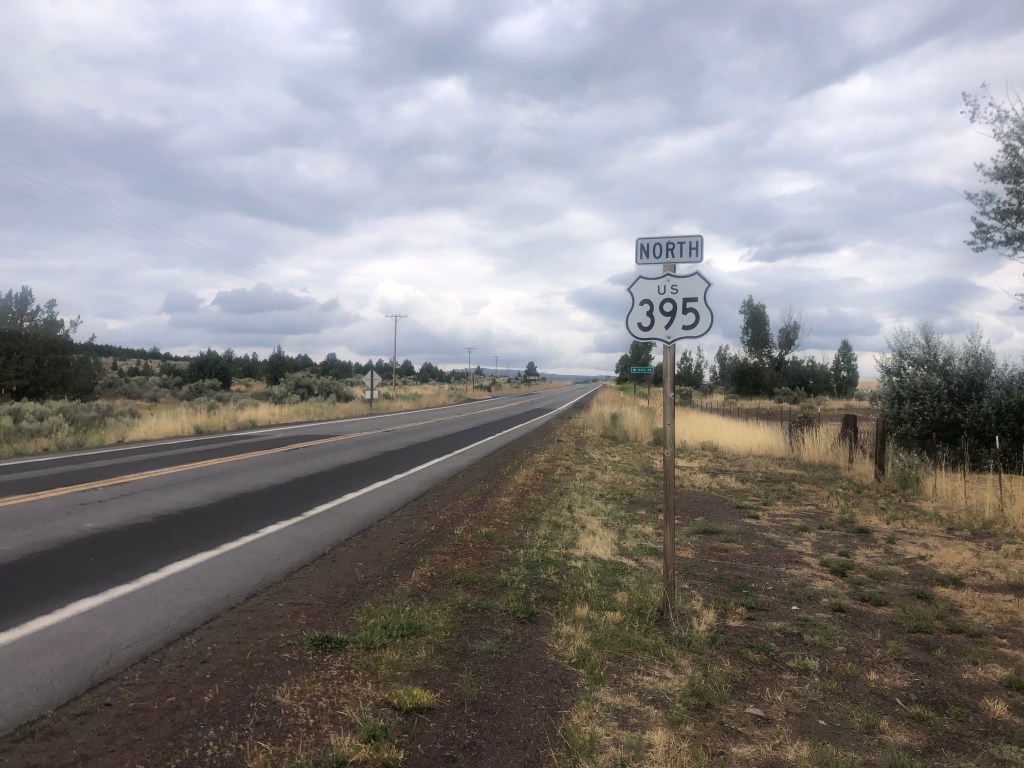
US 395 has a stark beauty to it. You don’t see much in the way of towns or even other cars. The quietude and long horizon are conducive to contemplation if not meditation.
Ommmmm…..
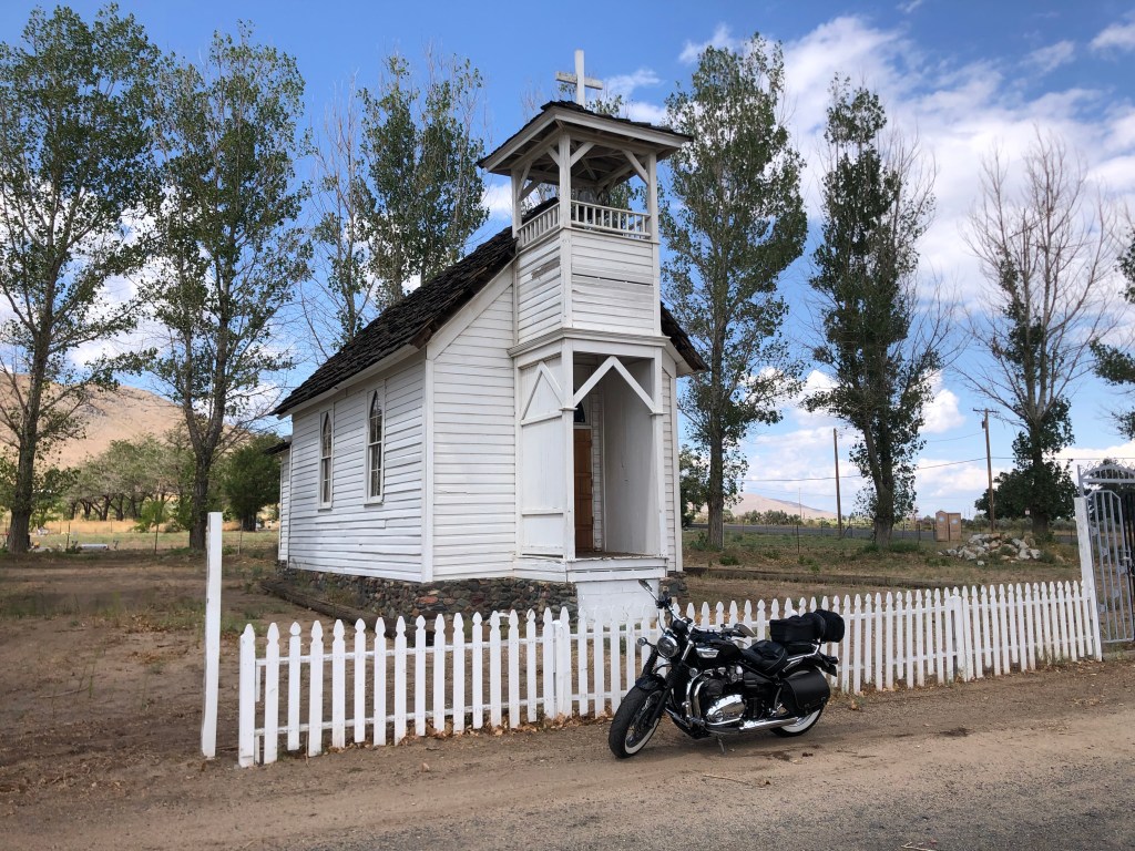
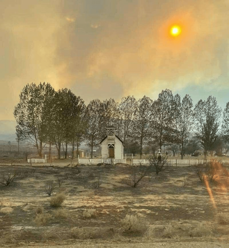
When the rare town does appear, I feel compelled to stop and look around a bit. One such town is Doyle (pop: 700). A couple of years ago Doyle lost much of its housing stock due to wildfires, so there really isn’t much going on here. But I was charmed by this historic chapel that somehow escaped the fire. Constantina Church was built around 1900 about five miles south of Doyle, and infrequent worship services were held there whenever a circuit priest was available. Services stopped around the 1920s, and the chapel was eventually abandoned. The structure was moved to Doyle in 1994, and it appears to be in regular use as a church once again.
Constantina Church today.
Same church in 2021, after the town’s fire.
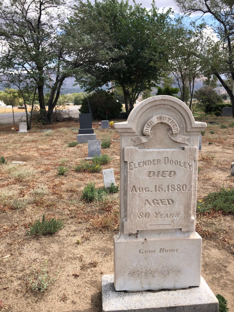
A historic cemetery is next to the church.
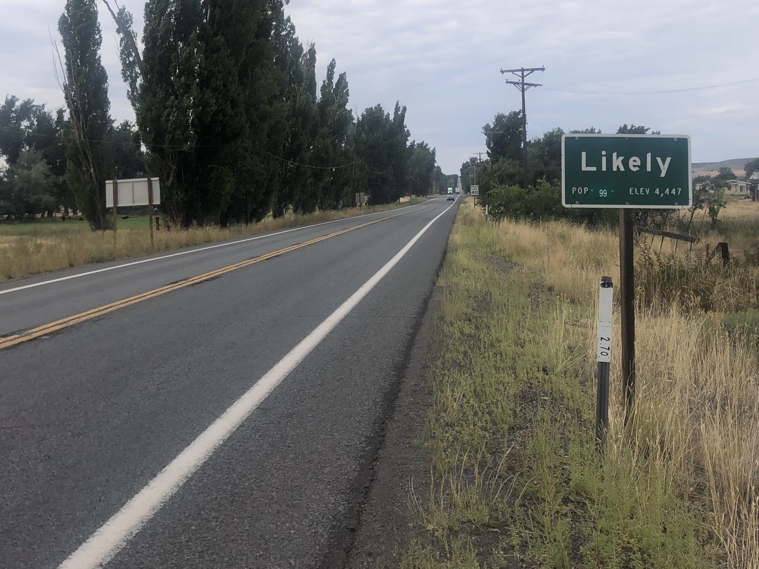
I also passed through the town of Likely (pop: 99). The story goes that, back when the area was being settled, some homesteaders were speculating about whether the settlement would become a proper town. One man (Billy Nelson) reportedly said “There’s likely to be a town here one day, and there’s just as likely not to be. So let’s call it Likely.”
A Likely story.
But we’re not sure.
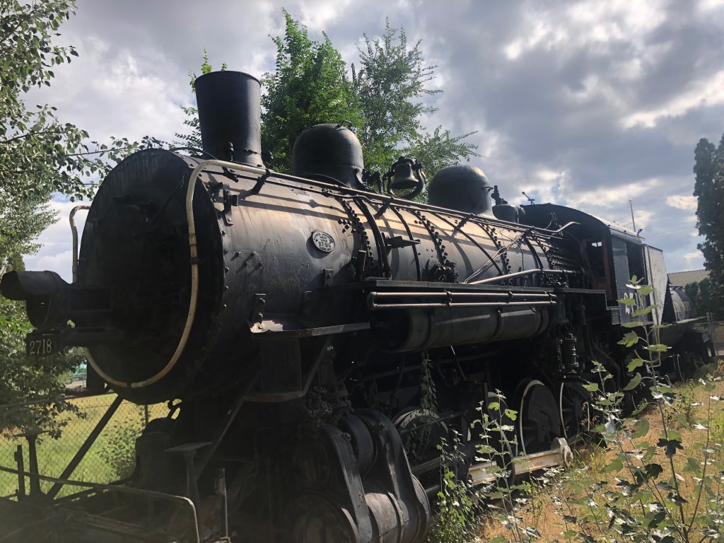
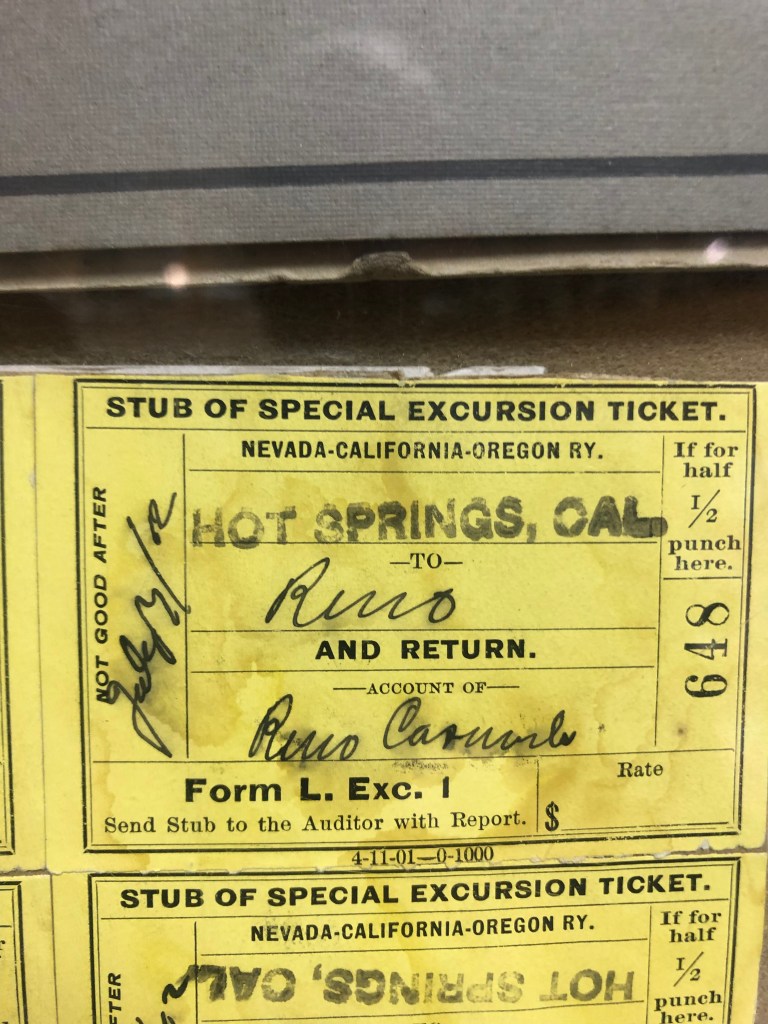
Finally I arrived at the relative metropolis of Alturas (pop: 2,700). Approaching from the south, the first thing you encounter is a striking, if somewhat faded, 1904 steam locomotive that used to run on the NCO line. The locomotive was presented to Alturas in 1956 by Southern Pacific (which had earlier bought up the NCO), and it resides outside the Modoc County Museum.
Standing still since 1956.
The story of the locomotive, as told by the local boosters, makes clear how much the NCO had meant to Alturas:
“This particular locomotive was utilized on the Alturas, California to Reno, Nevada route. The railroad was chartered as N.C.O. (Nevada, California, Oregon) in 1884. It was first established in Alturas in 1908 reaching Lakeview by 1912. The railroad and Alturas have an extensive symbiotic relationship from its inception to the day that Alturas was terminated as a home terminal on January 17, 1972, which was a devastating blow to the city as a large percentage of the population was forced to relocate to Klamath Falls, Oregon. Every business in town interacted with the railroad, whether by the influx of tourists or business travelers when the Southern Pacific offered a passenger service from 1927 to 1938. Even railroad workers who made their home base in Alturas, or stayed in one of the hotels made on impact on the town. The third floor of the Niles Hotel offered dorm style living for the railroad workers for decades. Before and during the time of passenger rails, the Southern Pacific and N.C.O. offered livestock shipment from 1908 to 1972, which provided most of its revenue. This was an option for the ranchers throughout the region to get their livestock to markets and sustained a way of life followed since the pioneers first arrived to this region.”
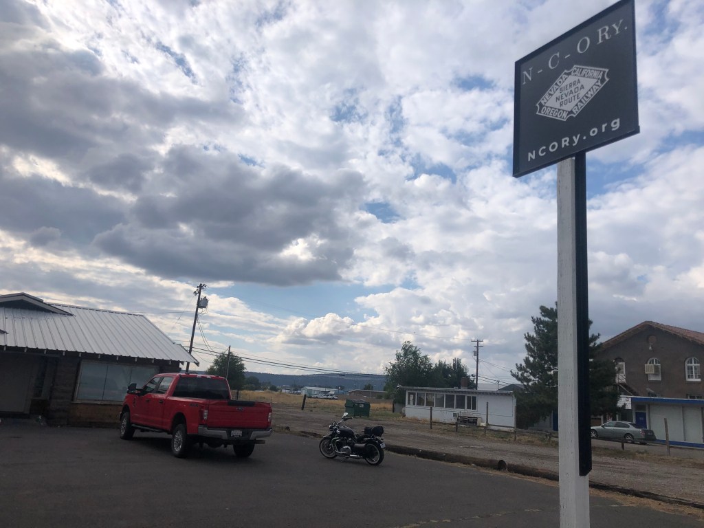
The docent at the museum was incredibly helpful when I told him of my interest in the NCO. He directed me to a place down the road where an old NCO structure was being renovated. “Look for the red truck and ask for Shane.” Dutifully I followed the directions, and was rewarded by the sight of a large NCO sign…and a red truck.
This must be the place….
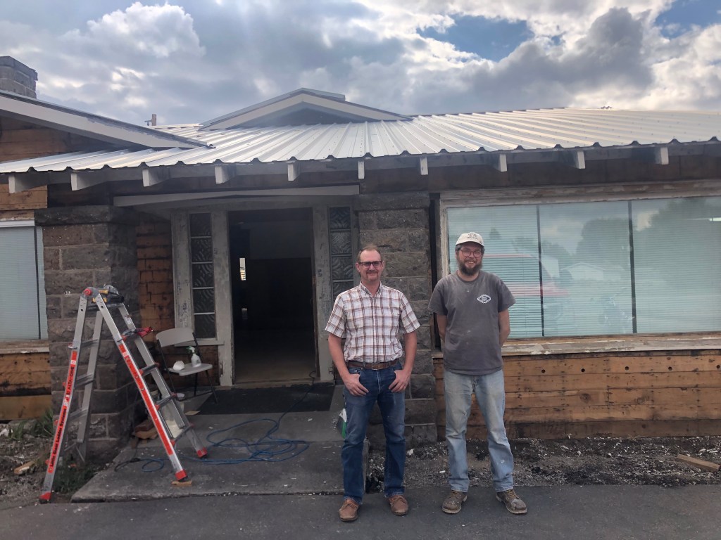
Shane turned out to be the head of a nonprofit organization called the Nevada-California-Oregon Railway. (Evidently the name was free to use.) The nonprofit is working to preserve the history of the NCO railroad, including buildings and rolling stock. The building where I met him (and where he was restoring some woodwork) had once been NCO crew quarters, and Shane’s dream is to turn the building into a museum.
Shane (left) and Andrew, taking a break from restoring the NCO crew quarters on Main Street, Alturas.
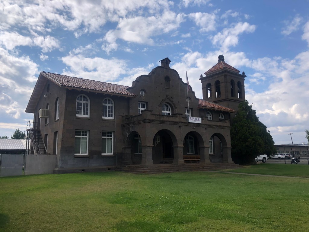
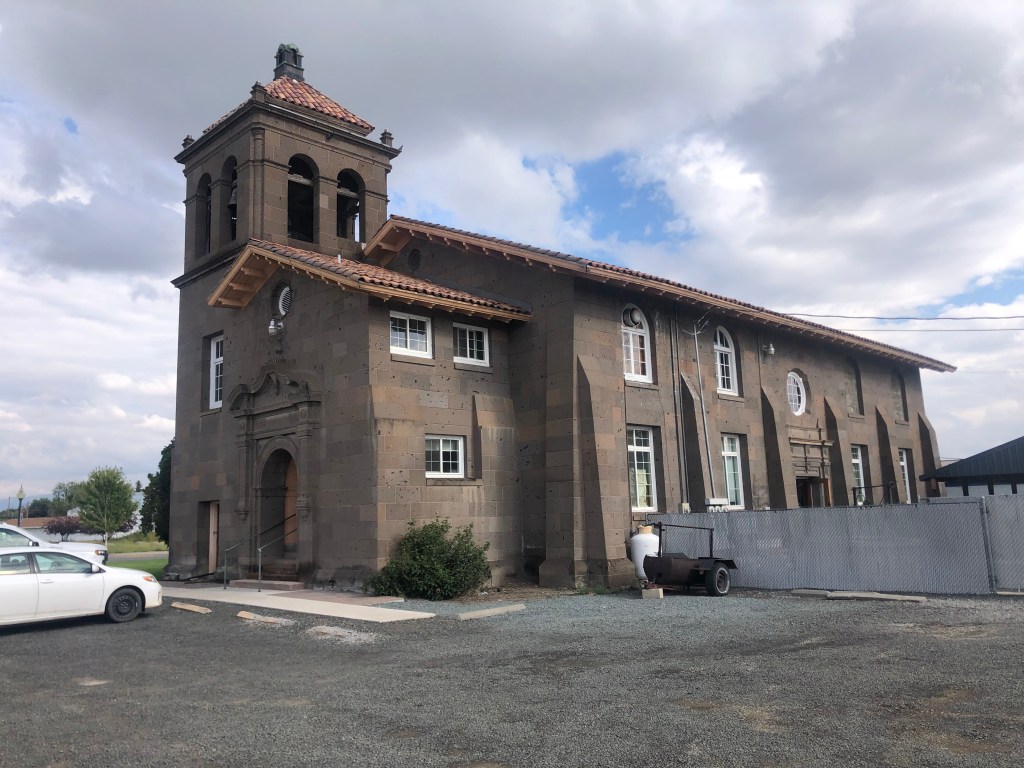
According to Shane, there are several NCO buildings still standing in Alturas. He pointed to a large Mission Revival building that had once served as the NCO’s headquarters. Built in 1918, the building became an Elks Lodge in 1974 and remains such today.
Attentive readers will recall that I encountered this building when I drove through town coming back from my Weiser trip last year. At the time I didn’t put together that this building and the Reno Depot shared the same lineage.
View from the parking lot.
Shane also pointed to a carpet store which had once been the NCO’s freight depot in Alturas.
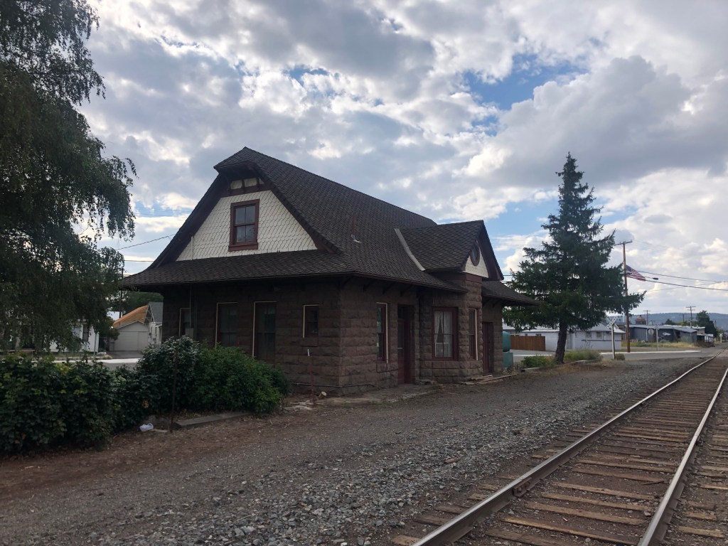
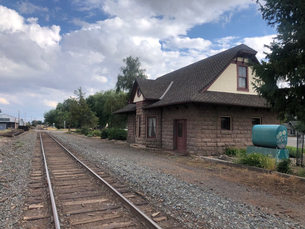
And finally, Shane directed me to the NCO’s passenger depot, which was constructed in 1908. Seven years later, it was decided that the station should be closer to the center of town, so it was moved, stone by stone, several blocks.
Peripatetic depot.
The Southern Pacific RR bought the NCO in 1926, and passenger service to Alturas was discontinued in 1938. Freight service ended in 1988. Still, Alturas remembers the NCO as an influential and pivotal part of its history. Indeed, the Modoc County museum includes a number of photographs and artifacts from the railroad.
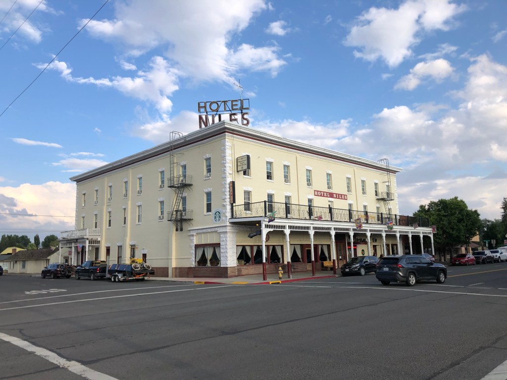
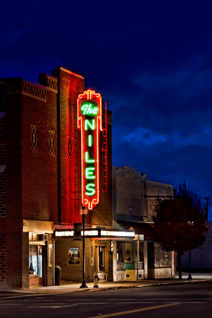
I’m holing up for the night in the Hotel Niles, a historic hotel that was built before the First World War. The hotel remains authentic, by which I mean the floors creak and the widows rattle. But it’s a fitting place to spend the night on this day of historical exploration.
I’m on the second floor of the left side.
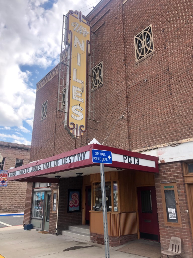
Incidentally, the hotel sits across the street from the Niles Theater. Built in 1937, it dates back to the era of art deco movie palaces. The neon itself is a sight to behold. An unlike many historic theaters, this one still shows first-run movies. (Next week it starts showing the Barbie movie. I’m not making this up.)
Note the telltale pink “B” on the lobby card.
(Night photo c/o the theater’s website.)
What are the odds that two buildings in such close proximity (the hotel and the theater) would both be named “Niles?” Well, both were built by local businessman J.E. Niles. He was 85 years old when the theater first opened.
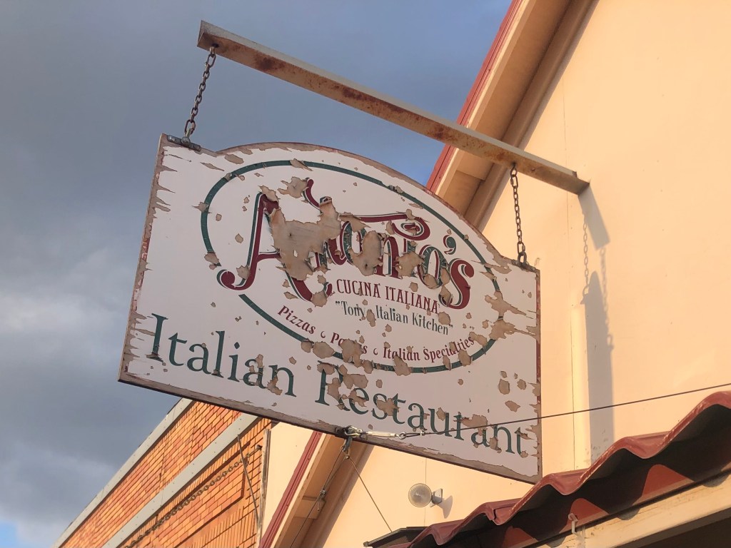
I had dinner down the block at a place called Antonio’s. Sadly I can’t recommend it. Even the BOTD is not worth mentioning.
You’d think I would have taken a hint from the condition of the sign.
Tomorrow I’m making the hour’s drive up to Lakeview to see the northern terminus of the NCO Railway. Then it’s off to Eagleville!
Relax, young Grasshopper. The title will become clear if you are patient…
This morning I set out from Benicia on the trusty Speedmaster
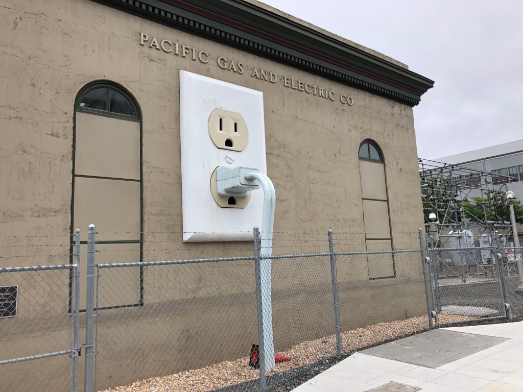
After a pleasant ride skirting the top of San Pablo Bay and cutting up through the wine country, I joined US 101 (or, as my southern-California-reared wife calls it, “the” 101) at Petaluma. Petaluma (pop: 60,000) seems to have a penchant for public art. Take, for example, this 1920s-era PG&E substation. I really appreciate this kind of public art–whimsical, approachable, understandable. Kudos to you, Joel Jones, who conceived and designed the thing!
One of my pet peeves is wall plates that don’t match the color of the outlet. But I’ll let this one slide as an artistic choice.
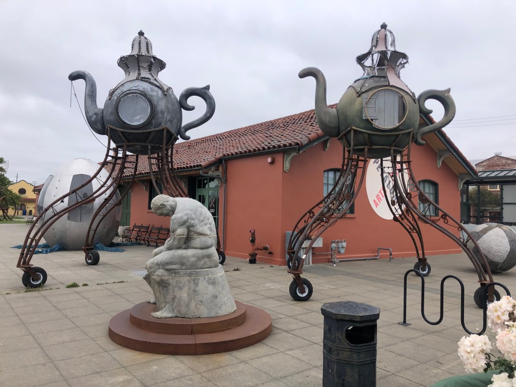
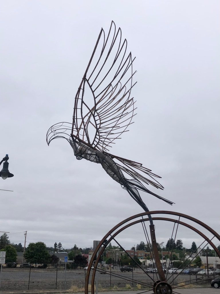
Close by the substation is some more public art, this time at Petaluma’s historic freight station building, which has been converted to an “arts center”. The effort here seems to be shooting for edgy. Which is another way of saying “head-scratchy.”
War of the Worlds meets Dobie Gillis.
Now that’s a buxom bird.
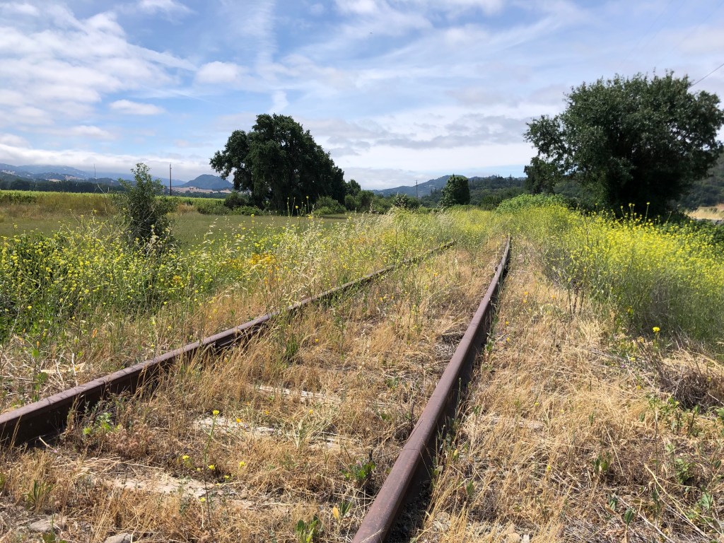
Not long after leaving Petaluma, US 101 narrows down to a couple of lanes. The countryside is open and green. There’s an old set of Northwestern Pacific Railroad tracks that run along the east side of the highway, but no train has run on these tracks since….well, probably since that Petaluma arts center was still a freight depot.
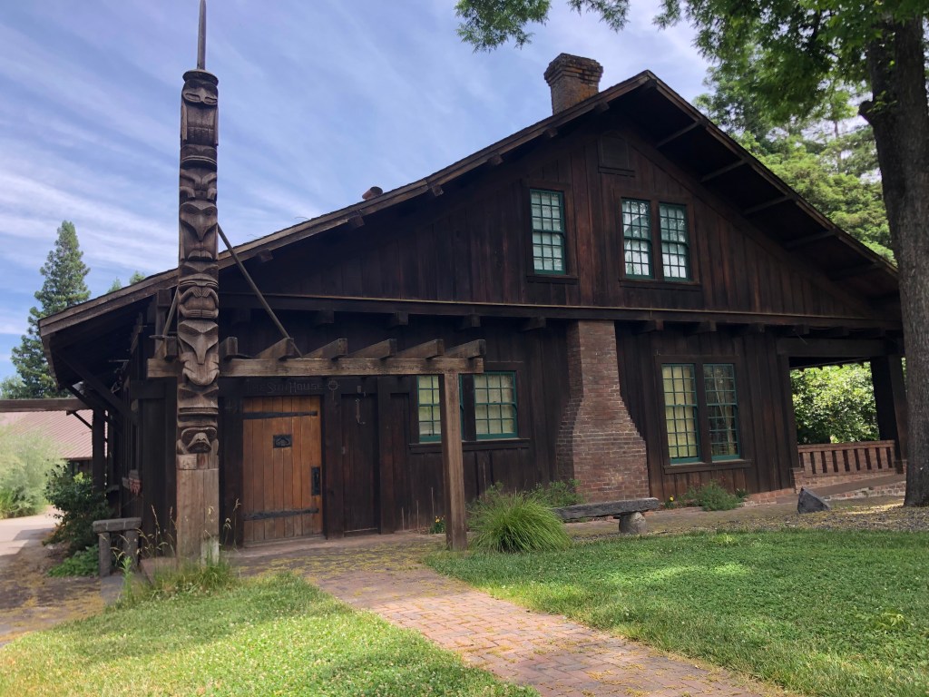
Finally I arrived at Ukiah (pop: 16,500), which is technically the beginning of the prefab road trip that Ian sent me. The first stop listed is the Grace Hudson Museum and Sun House (cost: $4 senior admission). Grace Hudson (1865-1937) was a California native who became an accomplished artist, working mainly in painting portraits. In 1911 she and her husband built a craftsman-style home they called “Sun House,” which was donated to the City of Ukiah by her heirs. I toured it today. It’s a pleasant, comfortable house, and notably it feels as though Grace just left this morning. It’s full of her furnishings and personal possessions.
The Sun House
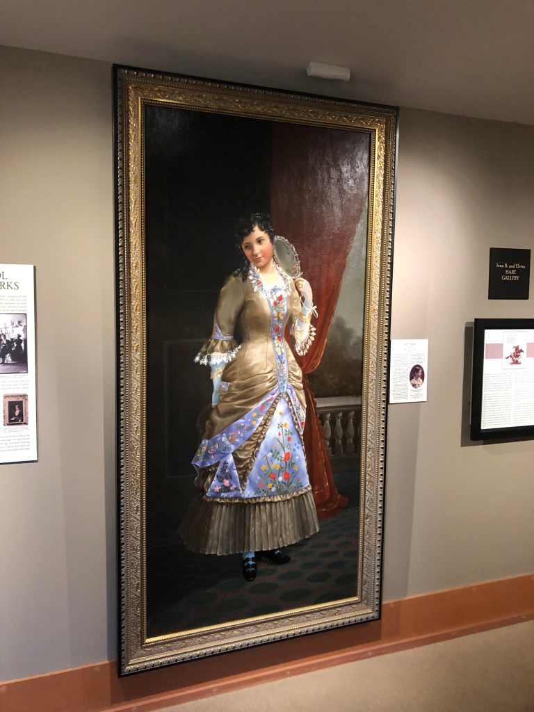
Next to the Sun House is a museum that includes a number of examples of Grace’s work, including this self-portrait done when she was a teenager.
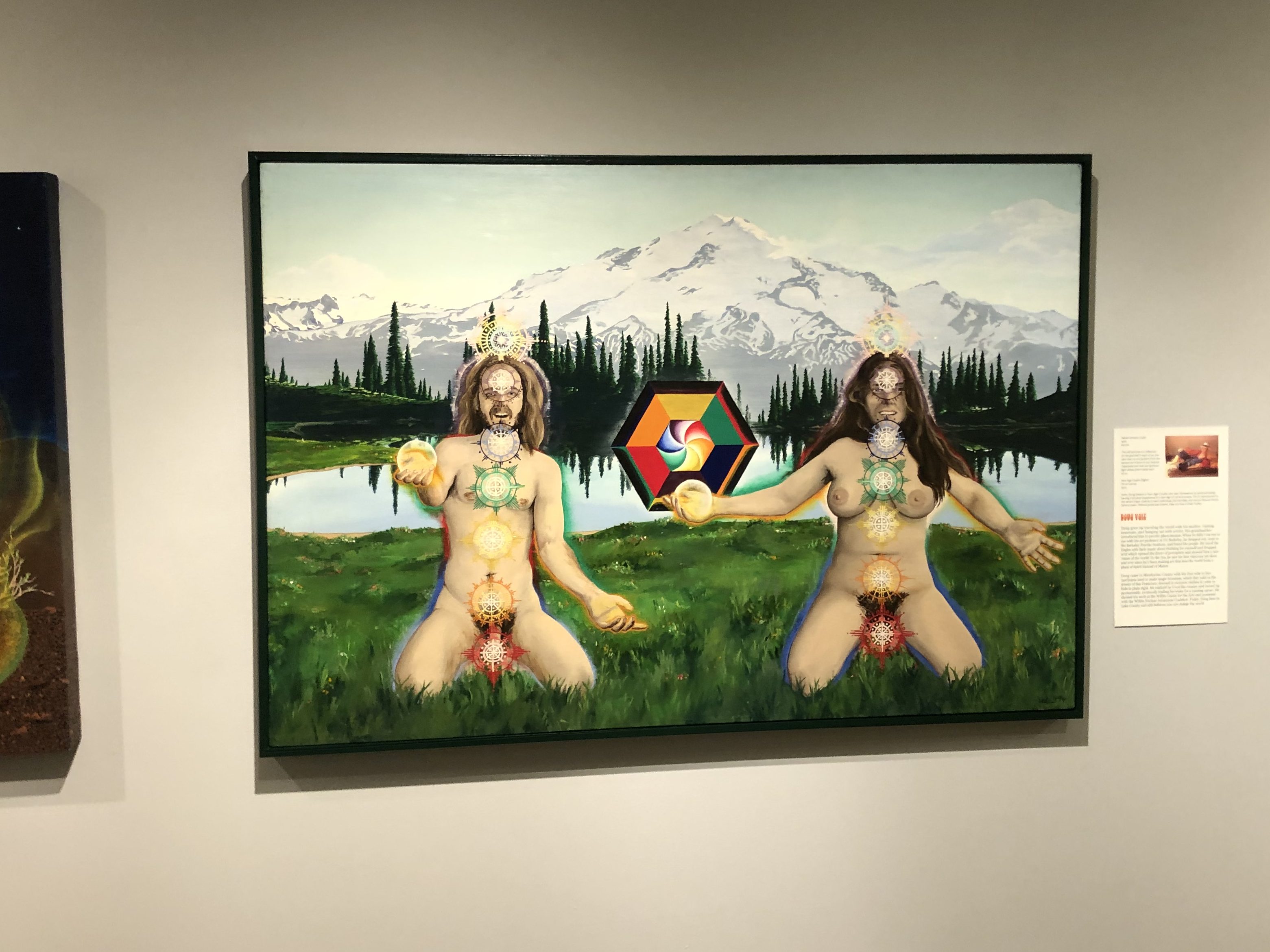
The museum also has a temporary exhibition called “Artistic Reflections on the Back to Land Movement.” I’m not sure what that means; it mainly seemed to show a bunch of naked hippies.
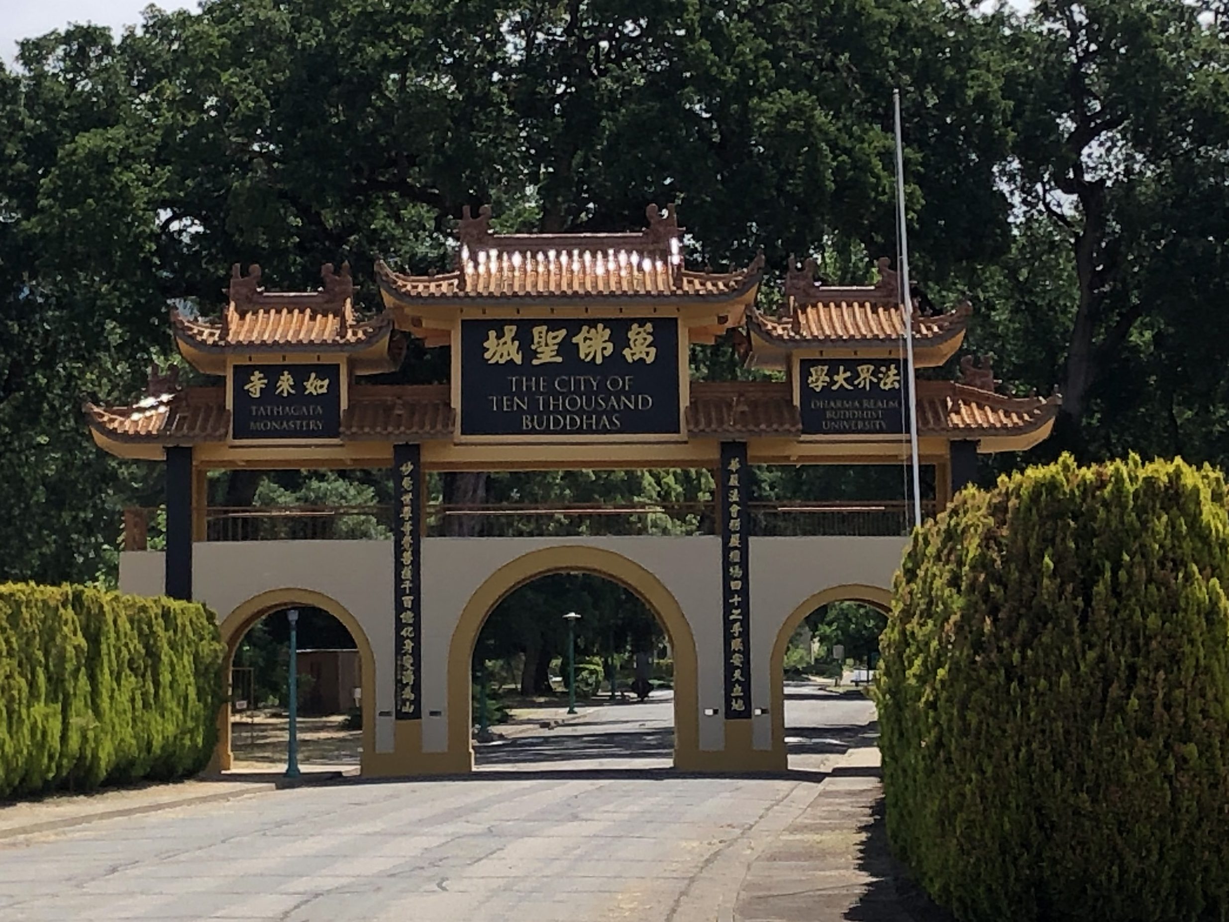
The docent (Janice) tried to educate me about these things, but I’m too much of a Philistine to understand. However, in the course of our conversation she mentioned she’d once worked at the nearby Buddhist monastary called the “City of 10,000 Buddhas.” Now that sounded interesting. It’s not technically part of this road prefab road trip, but I figured I’d drop in on the monks. And I’m glad I did!
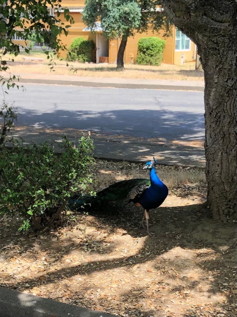
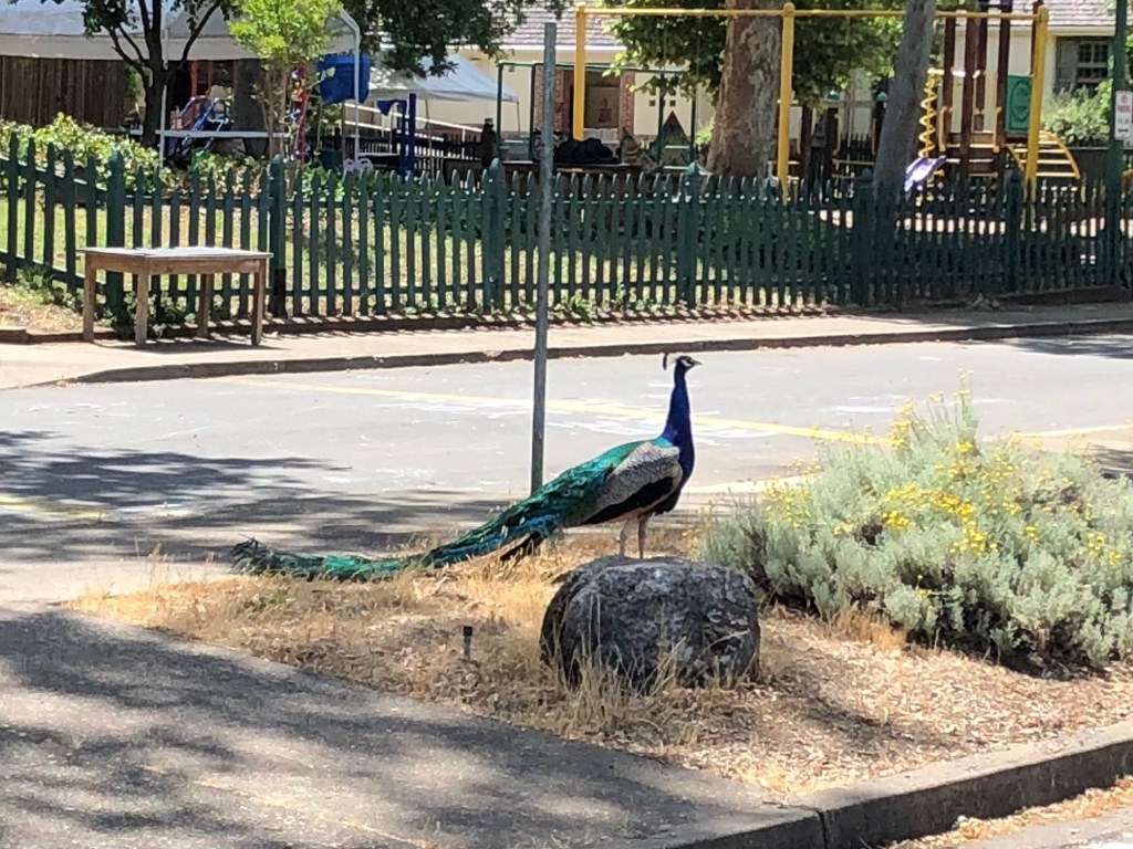
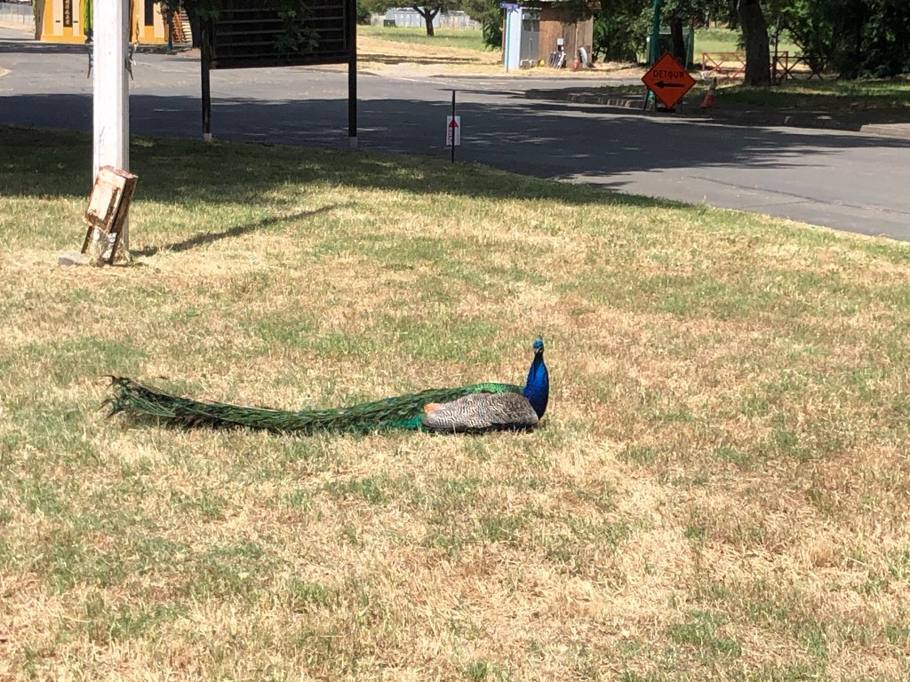
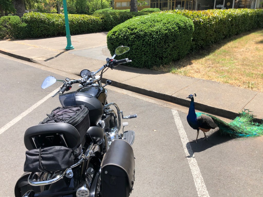
The moment I entered the grounds I felt relaxed and at peace. Large open spaces, plenty of trees, winding paths, almost no cars. Peacocks roamed about and didn’t seem concerned about an approaching visitor. I’m not making this up.
Now, I should mention that when I lived in Palos Verdes, our street was overrun with peacocks. And let me tell you, they are noisy, dirty, creatures. But you can’t deny that they’re also beautiful.
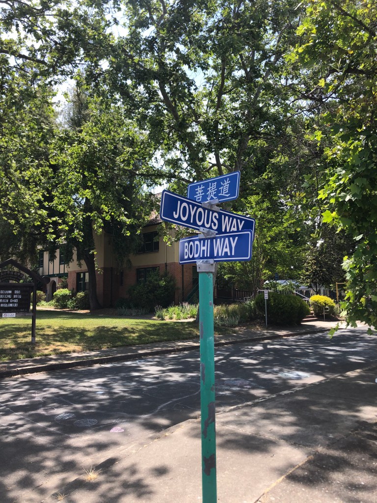
As I strolled through the campus, every so often I would pass a monk (at least, someone I assumed to be a monk), and he would bow while steepling his hands. It all seemed so mellow. Even the street signs were positive, with names like Joyous, Sincerity, and Mindfulness.
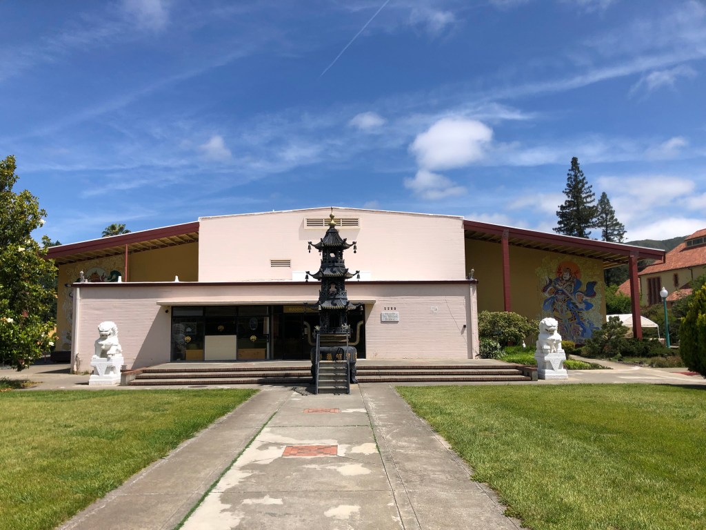
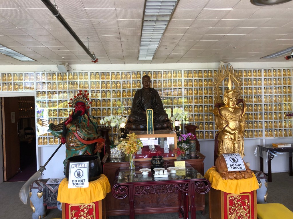
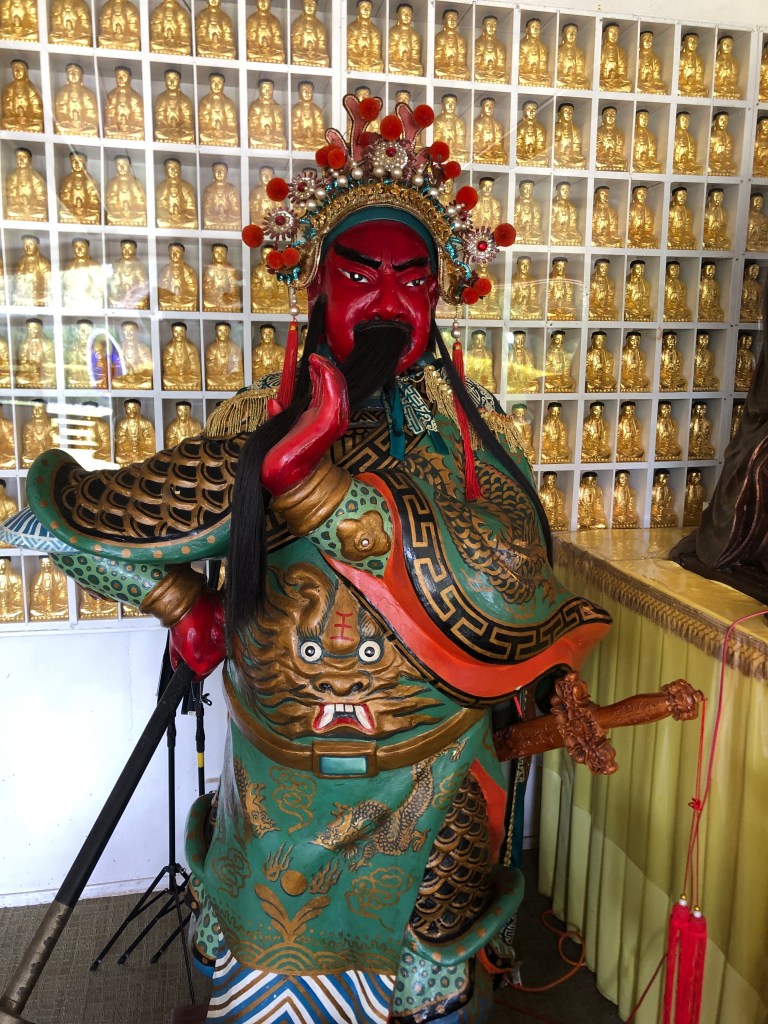
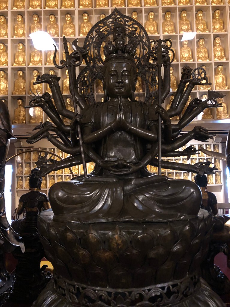
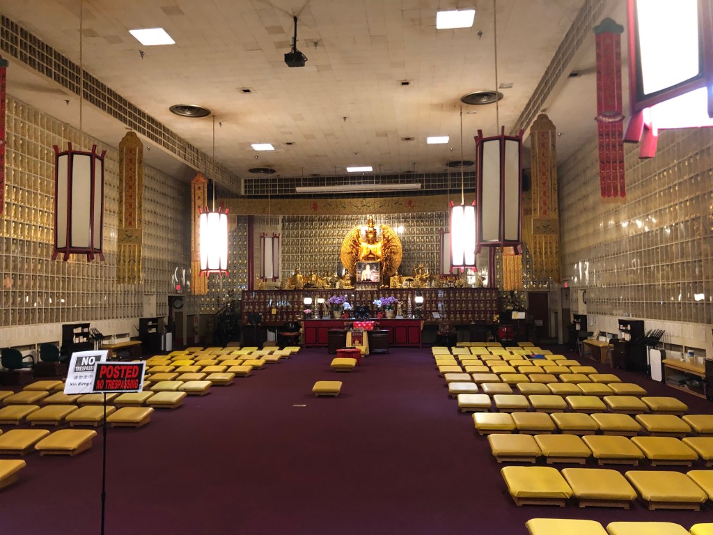
In the center of the campus is the Jeweled Hall. It is here that the eponymous 10,000 Buddhas reside.
It doesn’t look like much from the outside…but that’s because it’s a repurposed building from the old Mendocino State Asylum for the Insane. And no, I’m not making this up.
Start counting the Buddhas. And this is only the anteroom.
The Bodhisattva. Steely Dan had a song by that name, which we played endlessly in college. Part of the refrain is the same as the title of this post.
The City of 10,000 Buddhas was founded in the 1970s by Hsuan Hua, a Buddhist Monk who wanted to bring Buddhism to the West. The site had been the Mendocino State Asylum for the Insane since 1889. The “city” sits on about 500 acres of land.
As I was getting ready to leave, I found that one of the peacocks was taking an interest in my motorcycle.
I was ready to shoo it away, but the guy seemed so calm…so Zen. These peacocks seem to be so much more pleasant than the ones I remember from Palos Verdes. Or am I just becoming more at one with the world?
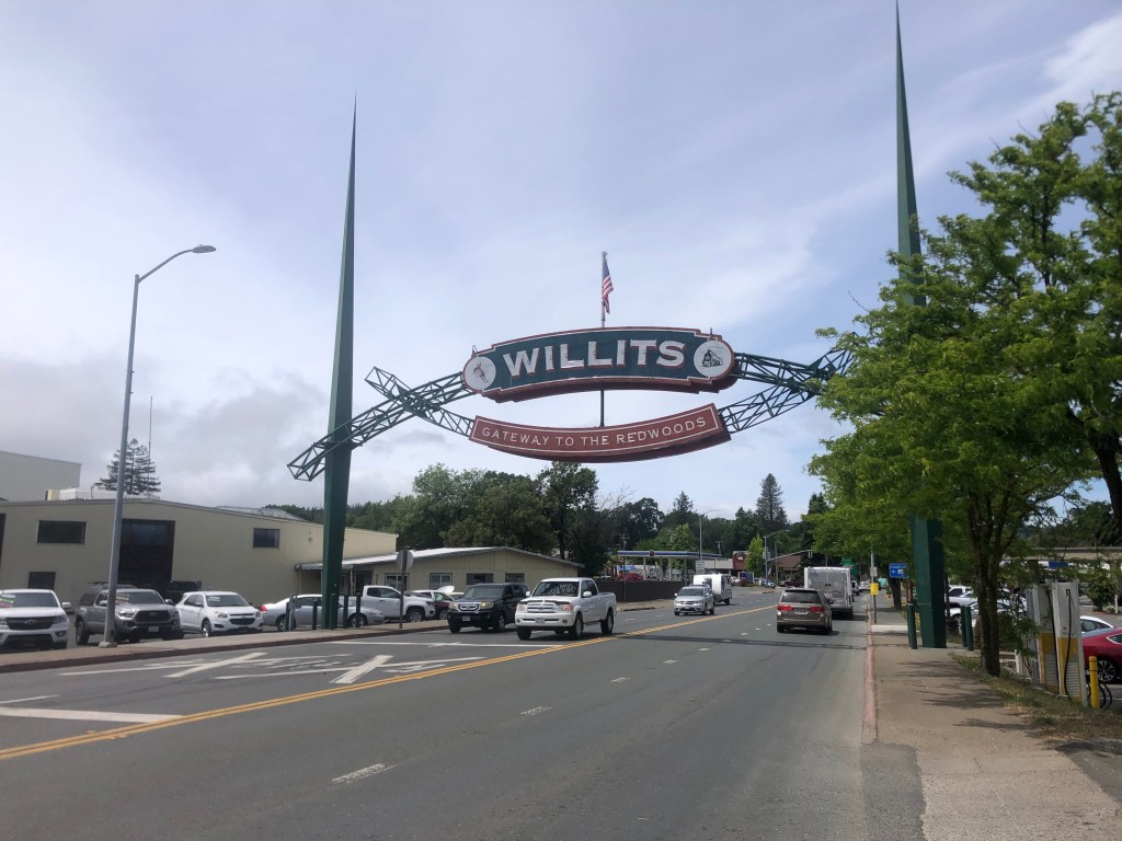
With resignation I left this refuge and re-entered modern society. I got back on the highway and headed north to Willits (pop: 5000).
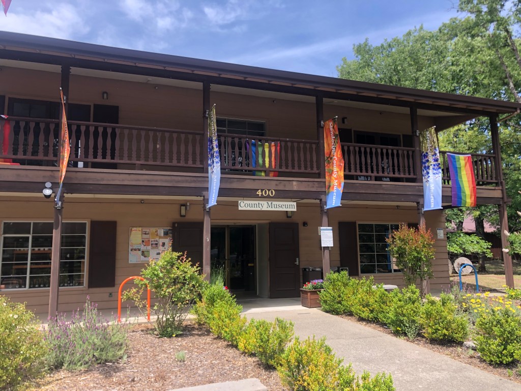
My road trip guide tells me the Mendocino County Museum is next. It didn’t look like much from the outside, but I dutifully went in and paid my $5.
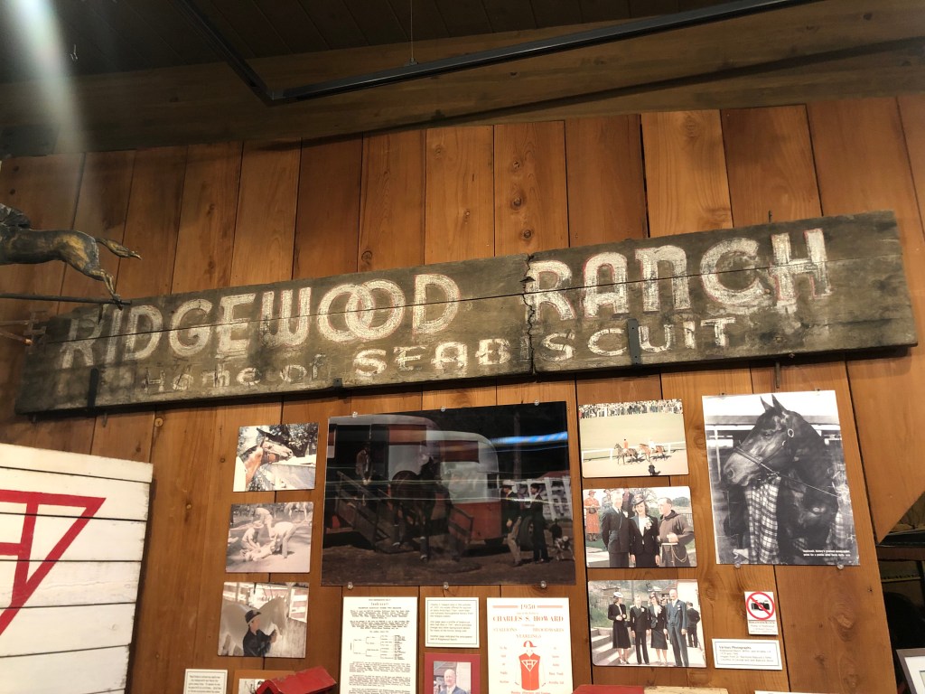
How can I put this? The place didn’t really burnish my Buddha. It might be because I’ve been to a lot of museums at this point in my life. I mean, how many sets of old-timey dentist tools does a person need to see? They had the usual stuff: A recreation of the town soda fountain, old household appliances, a lot of photos. The one thing that did catch my interest was the display on the racehorse Seabiscuit. It tuns out that Seabiscuit was bred on a farm right here in WIllits. Who knew??
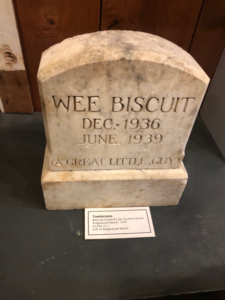
And the other fun fact is that Charles Howard (who owned Seabiscuit) also owned a dog he called “Wee Biscuit.”
But….habeus corpus??
Willits, by the way, is the western terminus of the Skunk Railroad, which runs from Fort Bragg. I inquired at the station and learned that a collapsed tunnel still hasn’t been repaired, so the rail journey has been indefinitely suspended. You can read more about it in this post from last year.
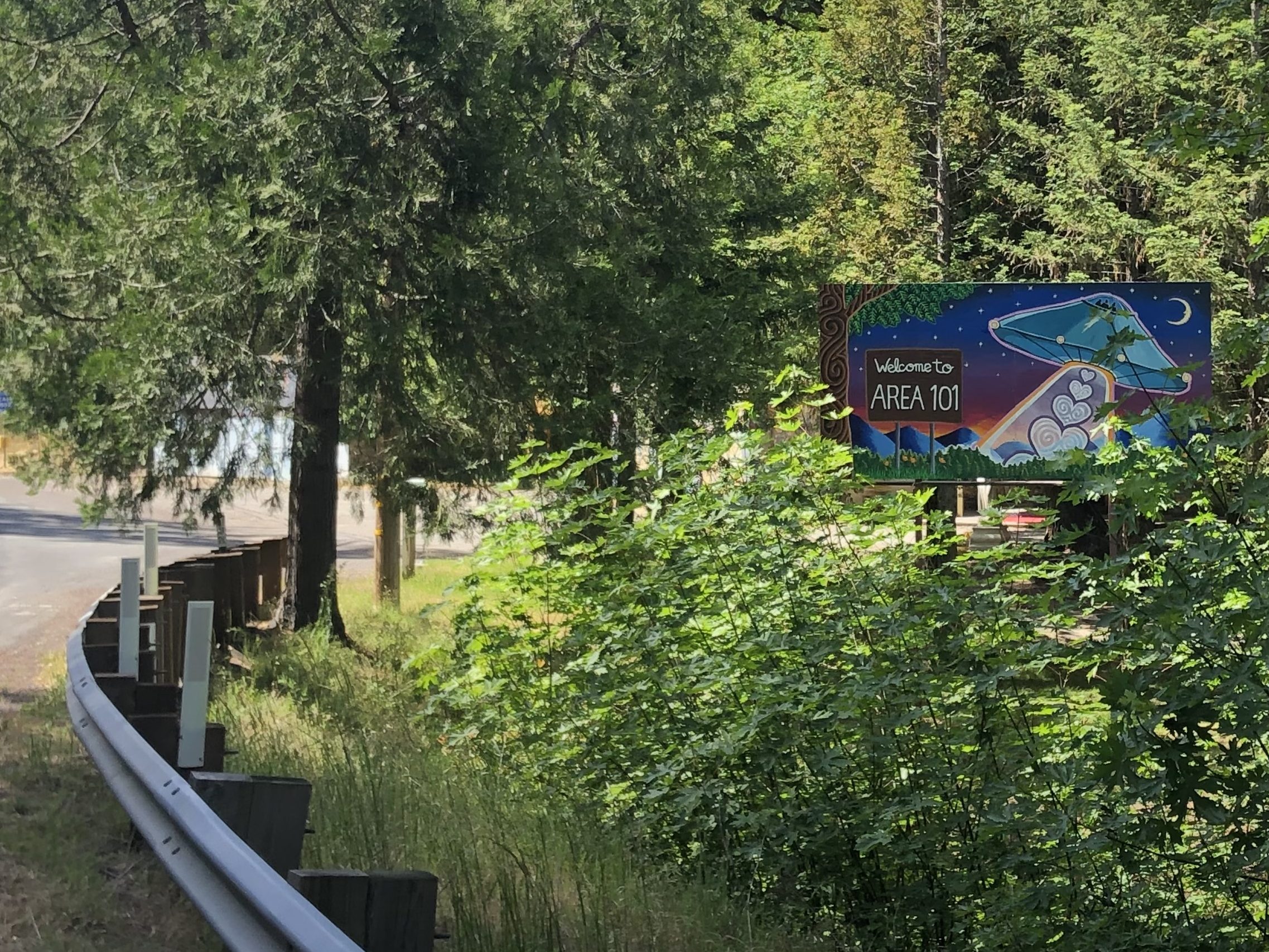
Next I headed up the highway toward Leggett (pop: 77) and its “world famous drive-thru tree.” But before I got there, I saw this sign on the road:
I’m sure this involves controlled substances in some way.
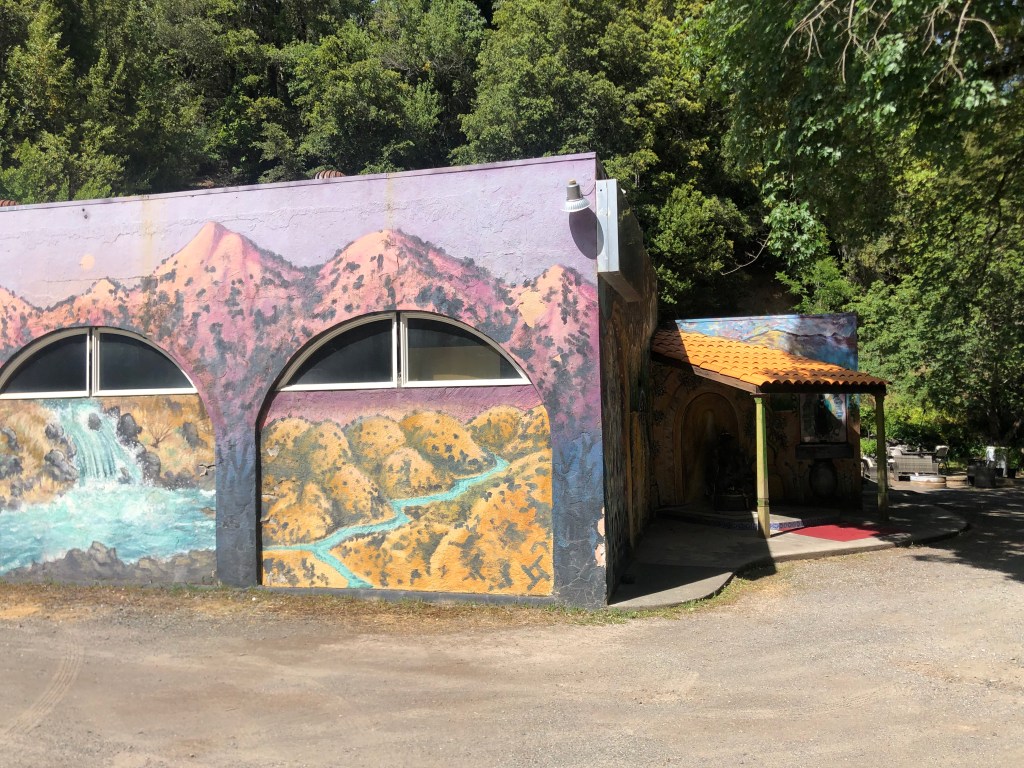
I pulled off the road into this compound of brightly painted, old buildings.
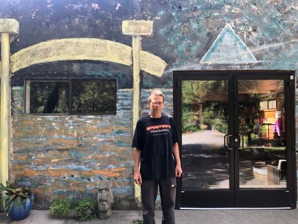
Given the sign at the road, I assumed this was something open to the public. So I walked around a bit, taking in the “scene” (as they say). Soon I was facing “John-boy” (as he called himself).
Not a Walton.
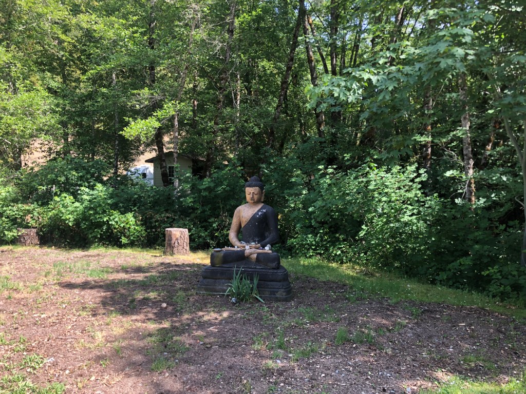
John-boy was an interesting chap. He wasn’t unfriendly, but he really wasn’t overly friendly either. He dutifully answered my questions about the place, which is supposedly a “venue.” When I asked him what kind of event is coming up next at this venue, he said “Uh, there’s something next month, but I don’t remember what.” (A later Google search informed me that the place is an old gas station site that now is a medical marijuana farming collective.) There is a statue of the Virgin Mary and other religious icons. Then I noticed a Buddha:
Now I was up to 10,001 Buddhas for the day! I asked John-boy about its significance, and he told me “It’s where we hide our money. We wrote it off for tax purposes.” I’m still not sure what that means. When I told him that I’d just come from the City of 10,000 Buddhas, he pointed to a rock fountain and said “that’s a lady who used to live at the City of 10,000 Buddhas.” He said when she died her ashes were scattered around the fountain. He also said she claimed to be a psychic named Anastasia, “but I think she was just a busy-body.” And yet, this skeptic about psychics also told me that the world was controlled by aliens ever since our 1940s-era atomic tests ripped a hole in the space-time continuum. I decided it was time to go.
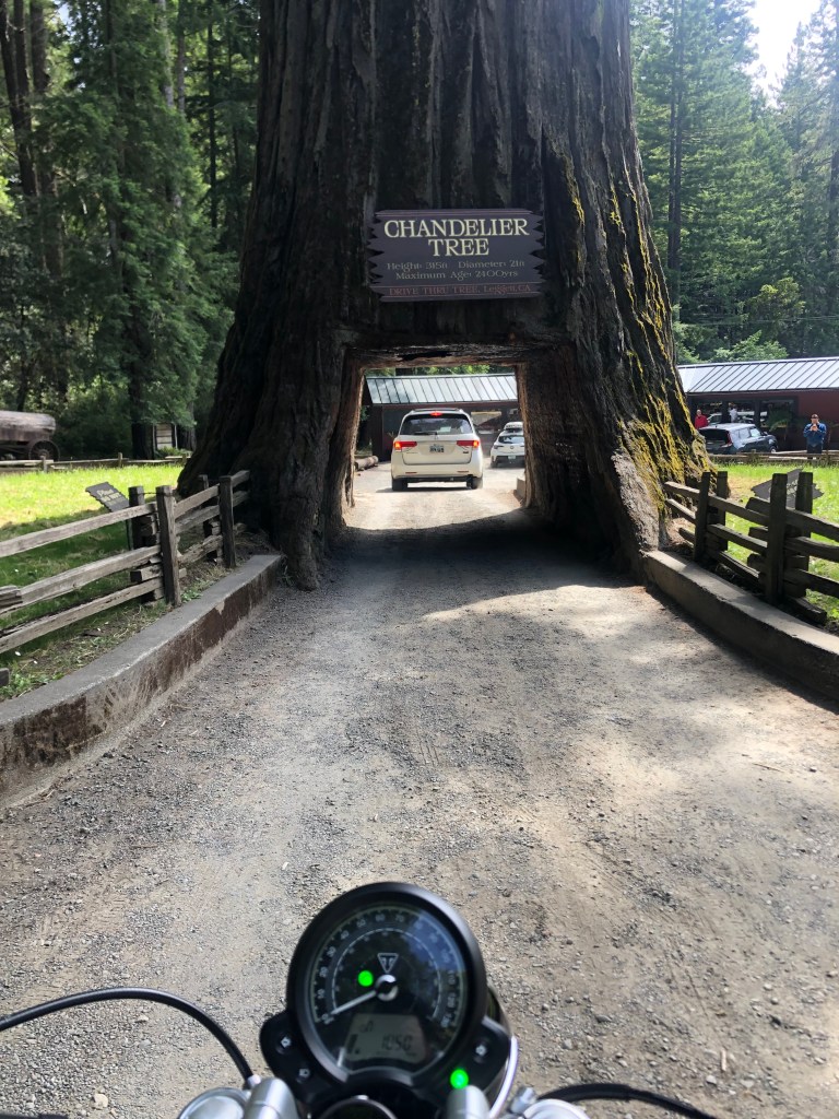
Within half an hour I was at the famous drive-thru Chandelier Tree (cost: $15 for cars, but only $10 for motorcycles). It’s a 276-foot-tall coast redwood that’s estimated to be about 2,400 years old. The hole was cut to make it a tourist attraction in the 1930s. Attentive readers will recall that I drove through this once before, but that was at a time when this blog was just a series of homemade Word documents emailed to a select few folks. So there’s no record of it here on WordPress. Now there is.
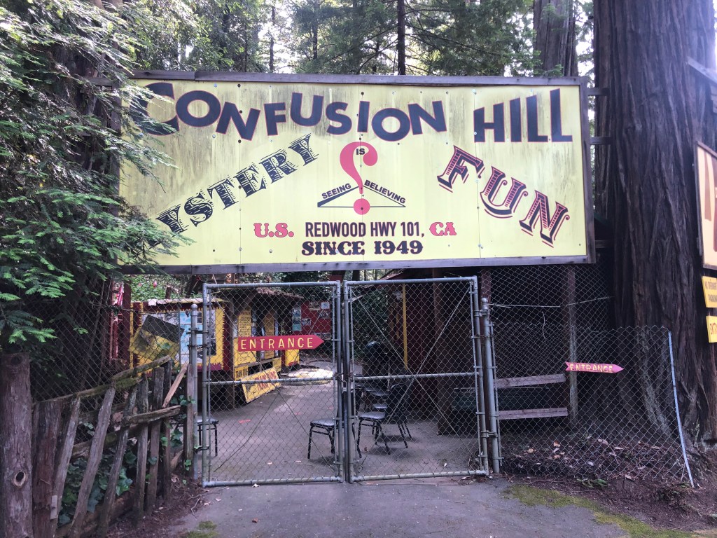
So, I’m now in the thick of the 1950s-era roadside attractions. I passed a “tree house” attraction, but didn’t stop as it was starting to get late and it wasn’t on my pre-fab list. But what was on my list was Confusion Hill.
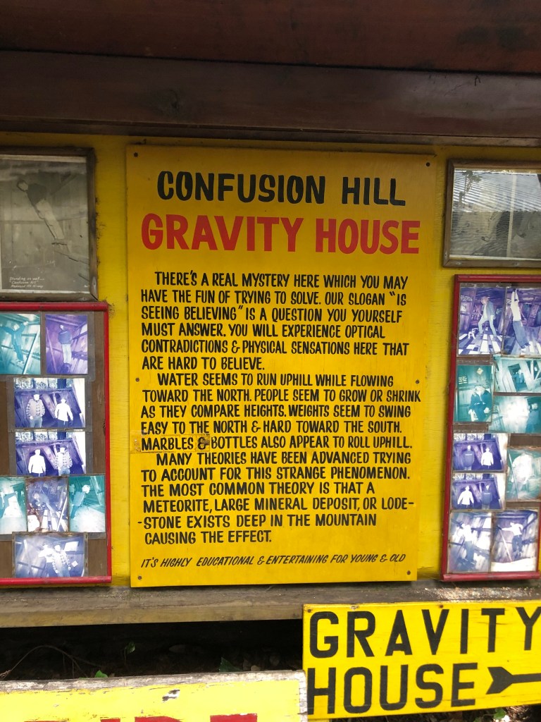
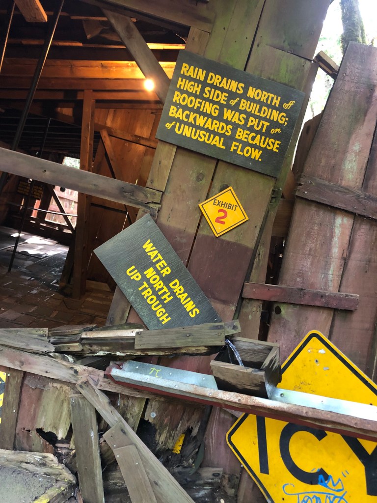
Confusion Hill is a quintessential roadside tourist attraction with food, a kids play area, restrooms, souvenirs, penny-smashing machines, etc. But it also has a “gravity house,” which is an old shack built at odd angles to create optical illusions. They play up how gravity doesn’t work properly at this spot due to various theories about meteorites, aliens, etc. My dad took the family to one of these in Santa Cruz (“The Mystery Spot”) when I was a kid. It was fun, but Dad (ever the engineer) got into an argument with the tour guide over the proper use of a level to measure angles.
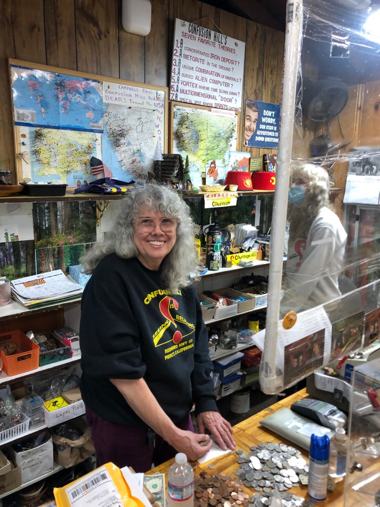
Anyway, at Confusion Hill I asked how this place differed from The Mystery Spot. “Ours is authentic” came the response from the woman behind the counter. She was Carol Campbell, the owner of the place.
Carol Campbell, owner of the authentic Confusion Hill.
Carol also told me that there’s a third place — The Oregon Vortex — which was exposed as a fraud on The History Channel two nights ago. I paid my $5 and checked out the gravity house. It was exactly like the one I remembered from my childhood visit to the Mystery Spot. But I have to admit, the place feels fun and welcoming and good-natured. It’s well worth $5.
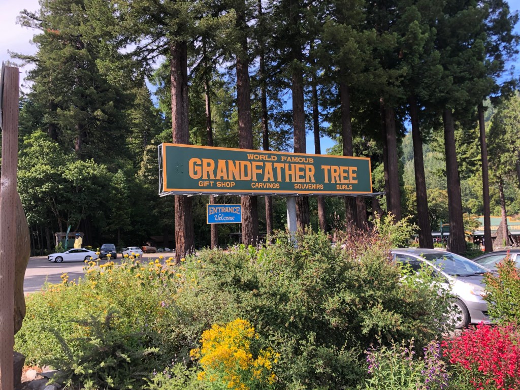
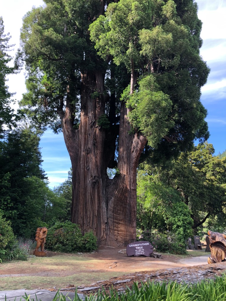
There are various other roadside attractions in this area, mostly tree-related.
The Grandfather Tree–265 feet tall and 1,800 years old.
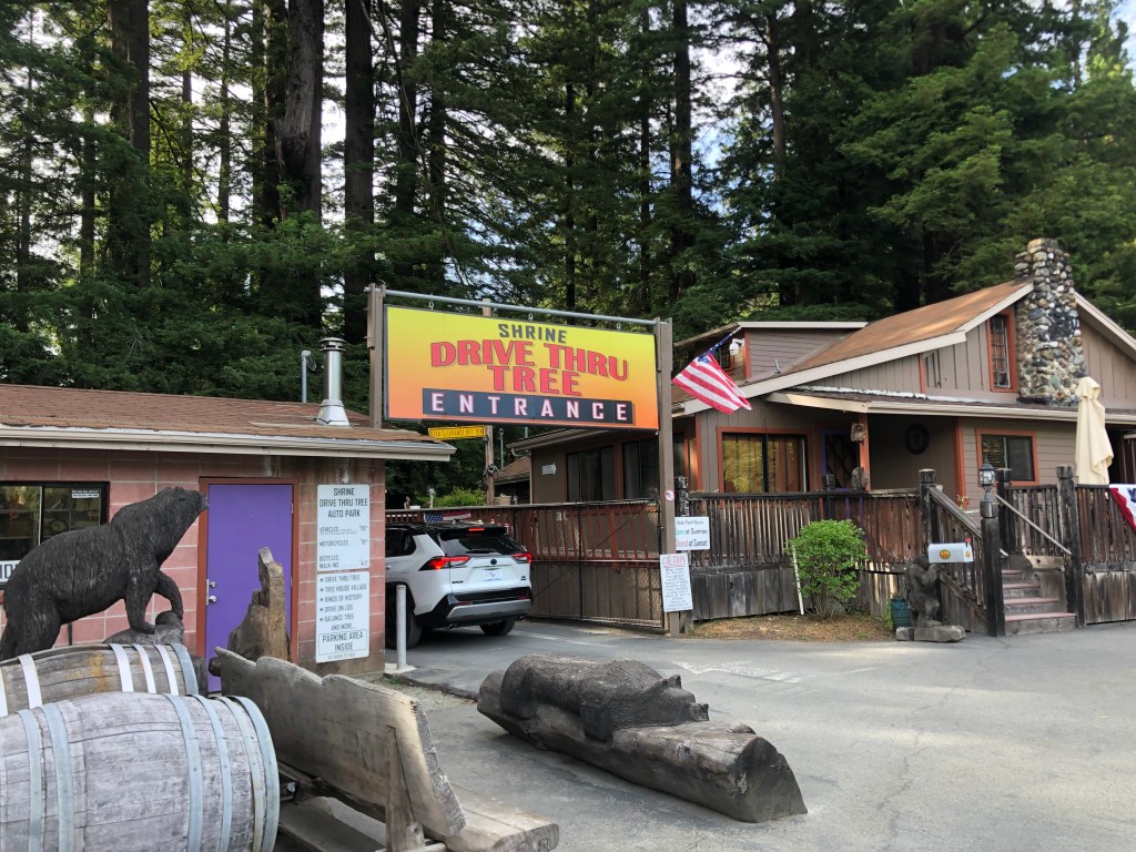
My prefab trip does include a second drive-through tree. This one is called the Shrine Tree. I drove by, but it was getting too late. Besides, who needs to drive through two trees in one day? That said, the Shrine Tree only costs $8 for motorcycles.
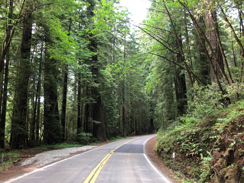
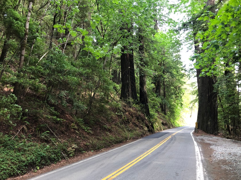
Now it was time to drive through the Avenue of the Giants–a 32-mile scenic highway to wends its way through various groves of ancient redwoods….some of which are well over 1,000 years old. It was a beautiful drive that returned me to the Zen state I felt when at the City of 10,000 Buddhas.
And suddenly, it was all over! I had spent $76 (including food and gas along the 130-mile drive). So yes, you can do it for under $100!
I checked into a cheap hotel in Fortuna, and will head back to Placerville via a circuitous route tomorrow. I may make another post if I encounter anything notable. But otherwise, I’ll leave you with the:
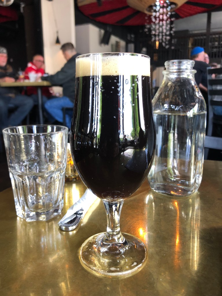
BREW OF THE DAY
The BOTD was a Palace Porter from the estimable Ukiah Brewing Company.
It tastes like a dry porter. For a porter this one is pretty heavily hopped (particularly on the finish, which is positively bitter). It has the roasty, malty notes you expect in a porter, but there’s not much complexity beyond that. Maybe I taste a little burnt toast on the front end. It’s got a creamy head, and nice lacing on the side of the glass.
It weighs in at 6.7 ABV. It’s perfectly serviceable, but nothing to write home about. 3.5 out of 5 stars.