It was another beautiful day in southern California, so I decided to take a leisurely motorcycle ride into the San Gabriel Mountains. I eventually found myself on something called the Sierra Highway. It turns out the full extent of the Sierra Highway runs from Los Angeles to Lake Tahoe, but I just traveled a short stretch of it in the San Gabriels. (I’ve now added the whole route to my road trip to-do list. Stay tuned.)
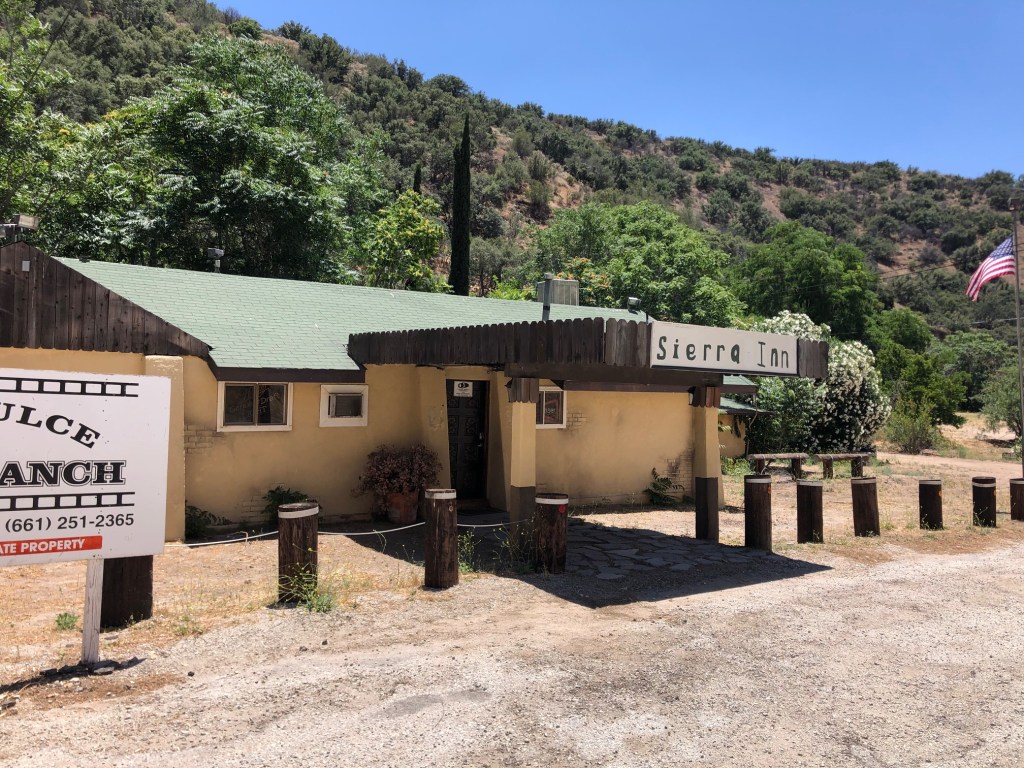
Anyway, while the stretch I rode has impressive scenery, there aren’t many points of historical interest. One of the exceptions is this building I came across:
The building is owned by a property management company called Agua Dulce Movie Ranch. They rent out these properties as locations for filming movies. And what movies has this site appeared in? Yes, of course, it was that beloved classic, Pee Wee’s Big Adventure.
“No one hipped me to that, dude.”
The building also appeared in Terminator 2. Note the similar story line as Pee Wee’s.
Skip ahead to 0:51.
I’m sure the building’s been used in other movies as well, but these were all I could quickly identify.
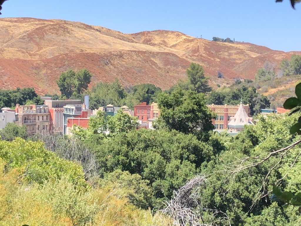
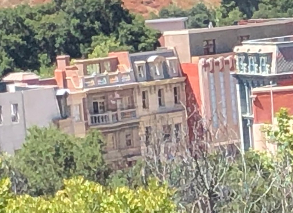
Elsewhere on my ride I noticed an unexpected cluster of buildings through the dense foliage that lined the road:
Closer inspection revealed it to be a collection of ornate buildings from a bygone era, like something from Disneyland’s Main Street USA:
Why do I have a sudden craving for cotton candy and a $7.99 soda?
A little research revealed that the reason it looks like a Disney creation is because it is a Disney creation. It’s called Golden Oak Ranch, and Disney has owned it since the 1950s. It’s essentially a back lot that’s been used for many Disney and non-Disney movies over the years.
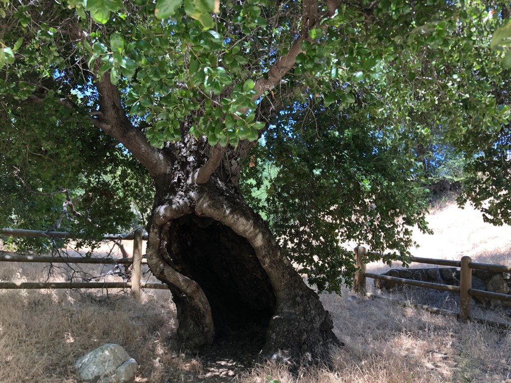
Incidentally, the name “Golden Oak” is a reference to an ancient tree that is said to predate California’s Gold Rush. It stands in a nearby park which I visited on this same ride. Here’s the tree in question:
Say “ah.”
The story goes that one Francisco Lopez took a nap under this tree in 1842, and dreamt he was surrounded by gold. After waking, he picked some wild onions (as one typically does after napping) and noticed flecks of gold on the roots. This was the first recorded discovery of gold in California…some six year’s before James Marshall found gold at Sutter’s Mill, triggering the California Gold Rush.
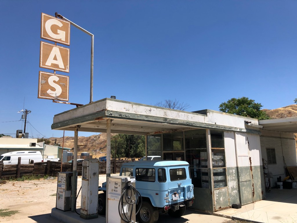
But I don’t want to leave you with the impression that it’s all movie sets and golden onions along the Sierra Highway. There’s also some very prosaic old buildings left over from a different era. Such as this gas station:
They probably still have Ethyl…
And after filling up, I headed back into the Los Angeles basin, where I would spend the rest of the afternoon dreaming of gold and tequila.
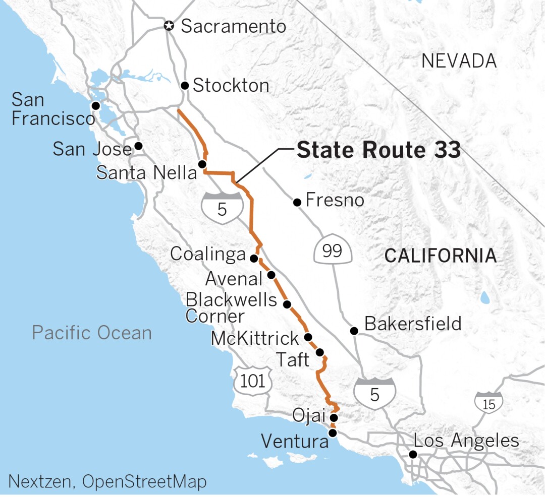
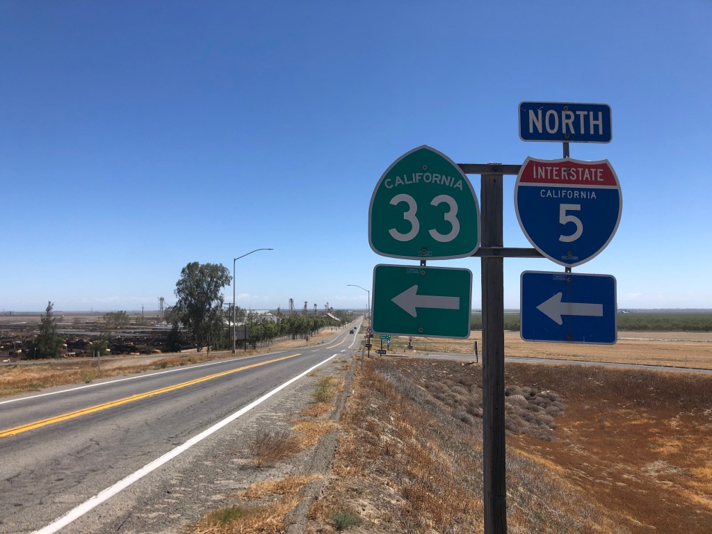
To get from Northern to Southern California (or vice versa) by car, you have a number of viable options. If you’re in a hurry you can take I-5 straight up the middle of the state. If you want a leisurely drive along the coast, the Pacific Coast Highway awaits. US 101 offers a somewhat faster route with views of the ocean. Route 99 will take you through scores of small central valley towns. And then there is CA Route 33, which you’ve probably never heard of. (The motorheads at Jalopnik have put together a video to explain why 33 remains so obscure.)
CA-33 runs about 300 miles along the western central valley, starting a few blocks from the beach in Ventura and terminating at a nondescript road east of Tracy, south of Stockton. I can’t think of very many scenarios that would cause a person to want to travel between these two points. And yet, there I was, setting out on that very mission late last week. It was time for a road trip.
CA-33 was the brainchild of California Governor Hiram Johnson in 1910. Desiring to reduce the power of the railroads, Johnson sought to connect all of the state’s county seats by roadway. One major part of that plan was highway 33. The route was opened in 1934 and has been modified and expanded over the years, with its current configuration being solidified about 50 years ago.
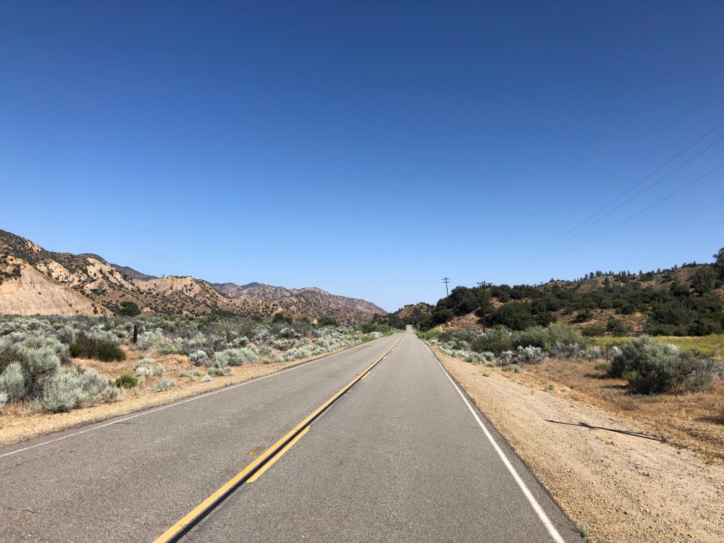
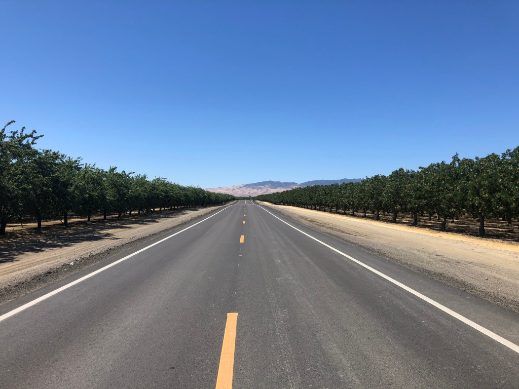
Route 33 is a study in the contrasts that are California. The road connects sunny beaches with 5,000-foot mountains and fertile valleys. It runs through forests, orchards, cropland, sagebrush, and oilfields. It’s home to ranchers, farmworkers, aging hippies, oil roughnecks, and warehouse workers. It’s all the parts of California that you don’t see on The Real Housewives of Orange County. And best of all, you can experience it all rolling along a narrow, two-lane road with almost no traffic.
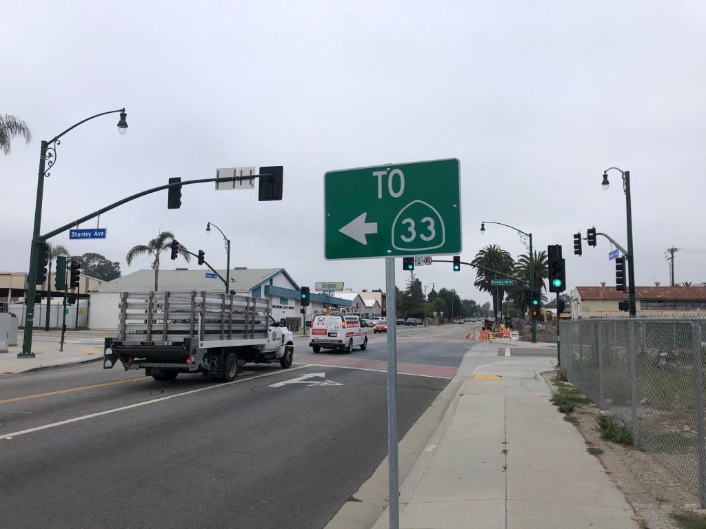
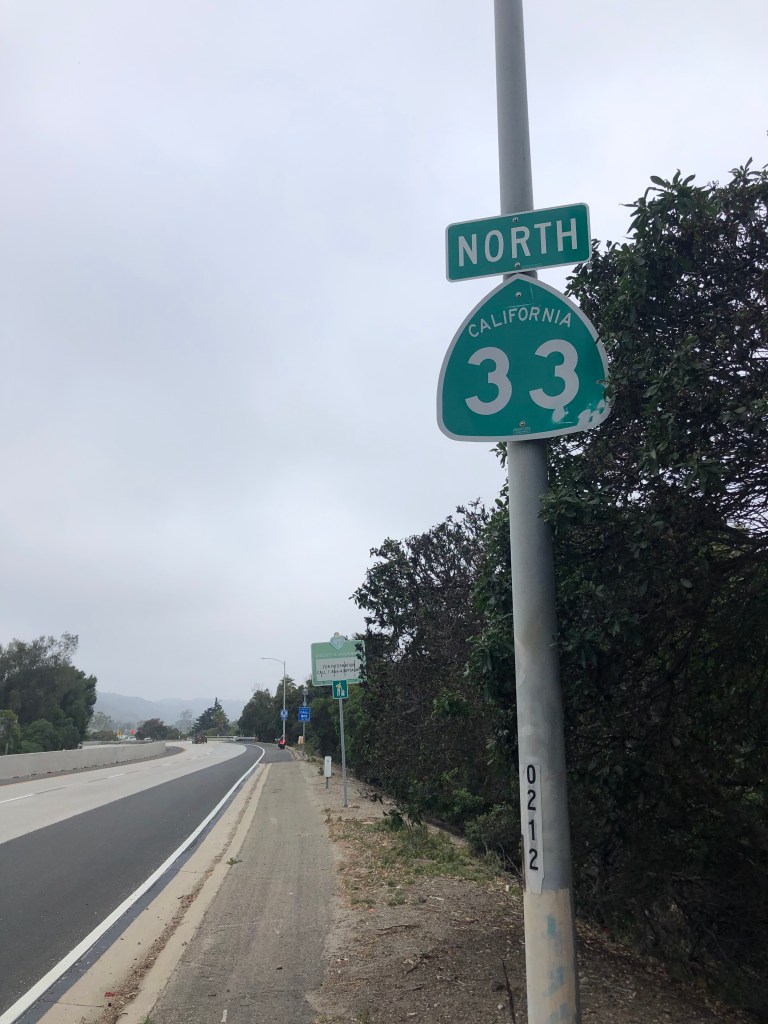
So Thursday morning I saddled up the Triumph and headed through the typical spring fog to Ventura (pop: 111,000), which is a coastal city that lies between Los Angeles and Santa Barbara. A little rooting around near the San Buenaventura Mission and I was able to find the beginning of Route 33.
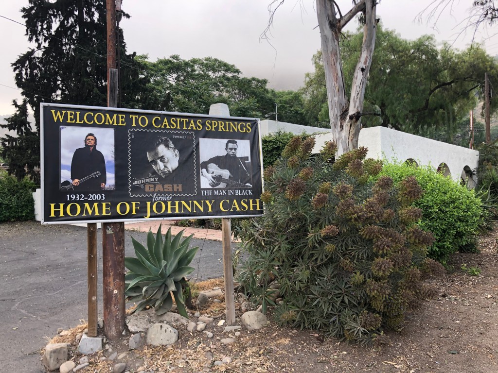
The first 10 miles or so take the form of a divided freeway named the Ojai Freeway. But before long 33 climbs into the Topatopa Mountains and becomes a winding two-lane road. Soon I was passing through the town of Casitas Springs, (pop: 1,000) which advertises itself as the “former home of Johnny Cash.” (Cash lived there from 1961 to 1967, until he divorced the mother of his children to be with June Carter.)
Odd how the middle picture is actually a reproduction of a postage stamp honoring Cash. Wouldn’t it have made more sense just to have found the source photo?
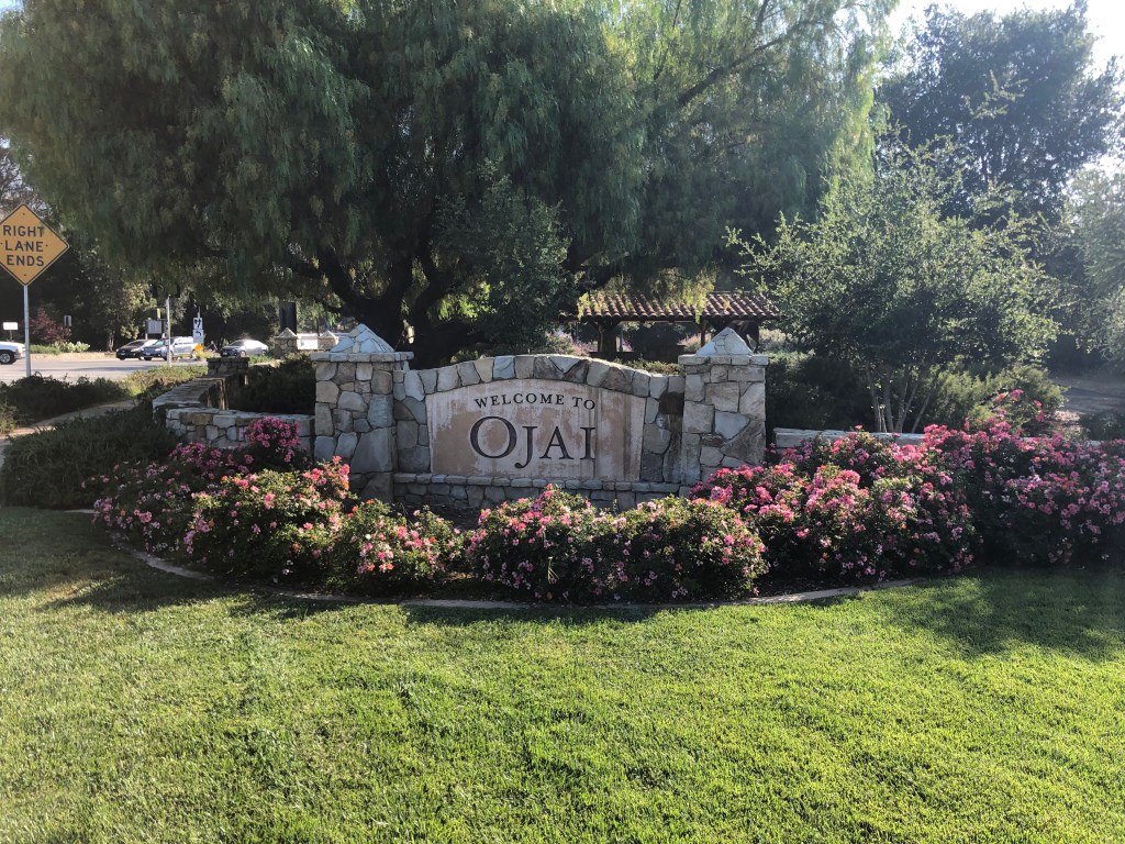
After Casitas Springs I entered Ojai (pop: 7,500), which is a famed New Age enclave in the Ojai Valley. It’s an idyllic setting, and it portrayed Shangri-La in Frank Capra’s Lost Horizon in 1937. (If you haven’t already seen that movie, you should.)
Best place to get an aromatherapy treatment for your dog.
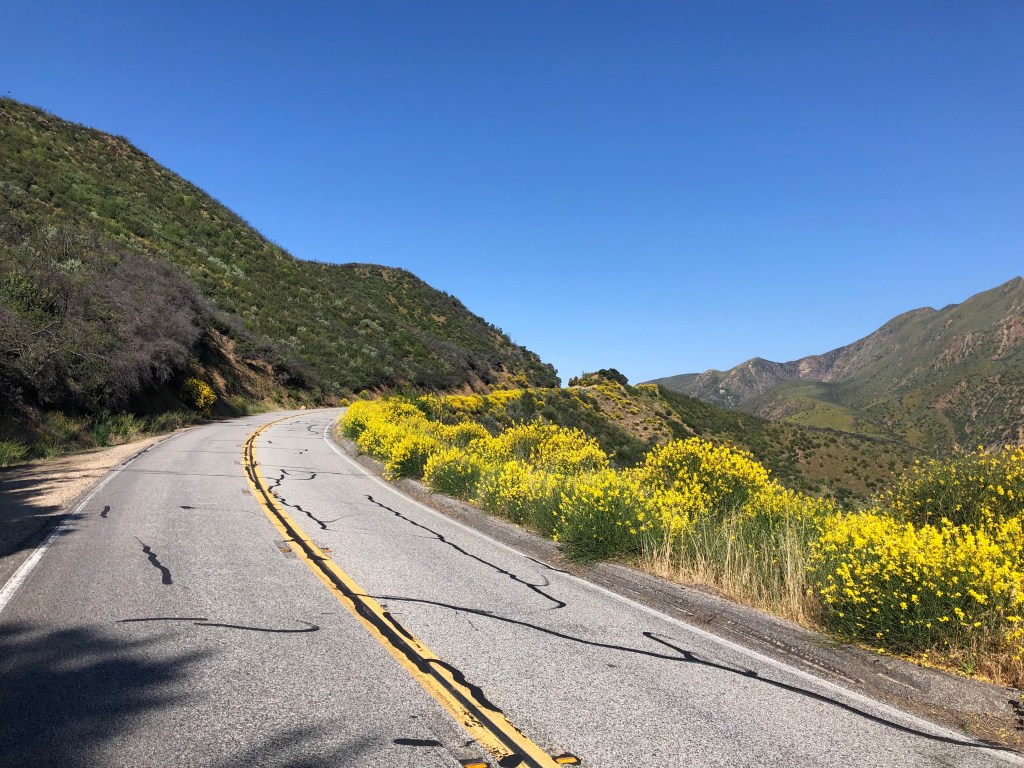
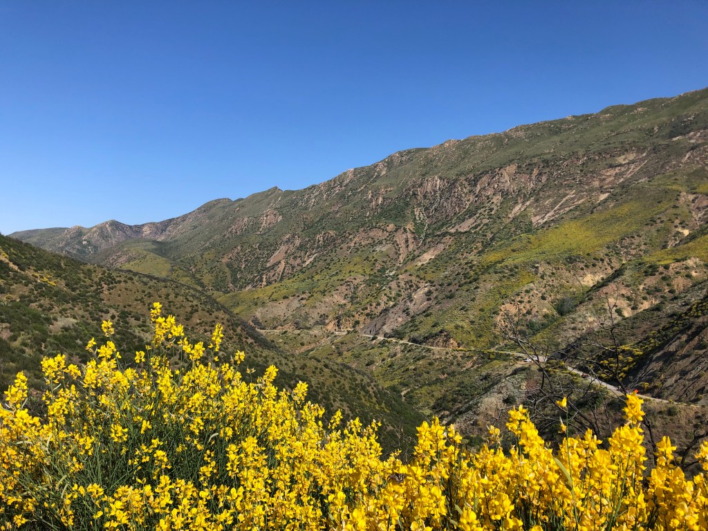
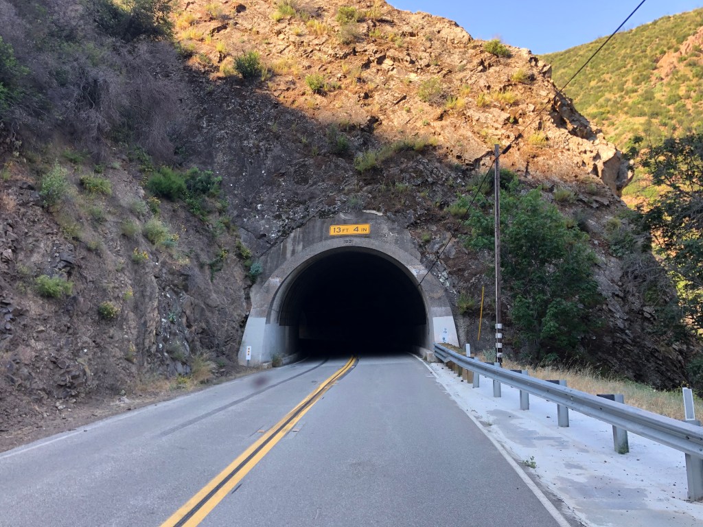
As I climbed out of the Ojai Valley, I found myself crossing the Transverse Ranges, so named because they run east-west, in opposition to the more typical north-south orientation of California’s coastal mountains. This was the most beautiful scenery of the trip: winding switchbacks, wildflowers, tunnels, and views of the ocean behind me.
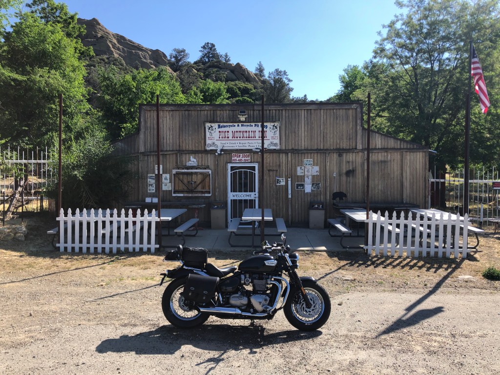
Eventually, as my stomach was demanding tribute, I happened upon a friendly-looking tavern named the Pine Mountain Inn. It advertises itself as a “motorcycle and bicycle pit stop,” offering food, drink, restrooms, and other comforts. The white front door read “welcome,” and the American flag was flying. But on closer inspection the open sign actually read “open soon.” It turns out that a tavern has operated on this site since 1939, and the current owner bought it in 1976. It’s been a favorite stop for bikers, hunters, and others for decades, until Ventura County shut it down in 2007 as a result of a zoning change. The owner, Tom Wolf, has been engaged in legal battles with the county ever since. At the front door, he has even provided petitions for a visitor to sign, demanding the county allow the place to reopen. The place has attracted attention from property rights advocates, libertarians, and conspiracy theorists from far and wide.
Define “soon.”
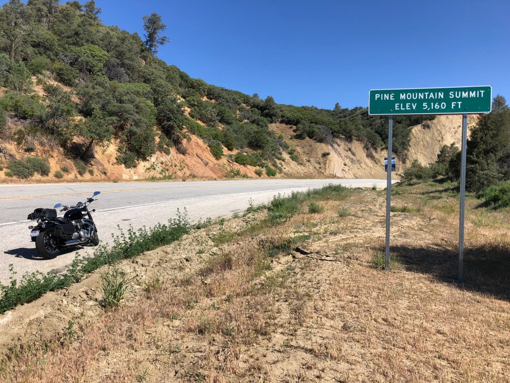
My interest in the place was much more prosaic, involving victuals. So after determining there was no hope of getting a burger at this place, I got back on the road, and soon crossed the summit.
I’m over the hill! Or so my son tells me…
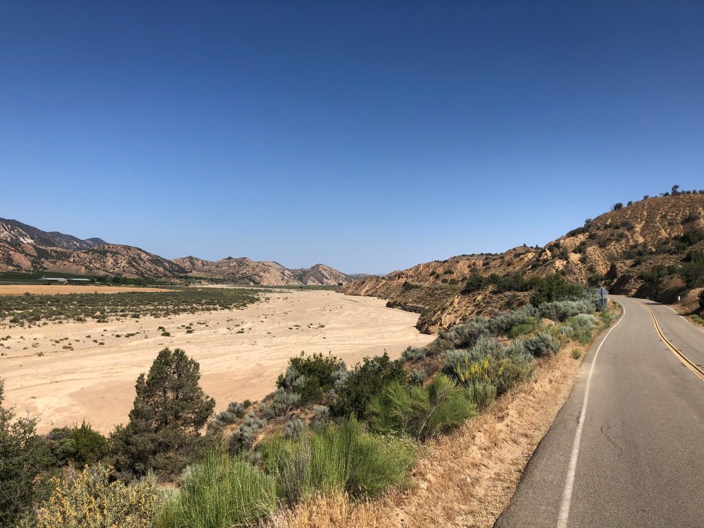
As I descended toward the Cuyama Valley, the greenery of Pine Mountain was replaced with scrub brush and a broad, dry wash.
This kind of stark desolation has its own beauty. Particularly for someone who spends most of his time in the Los Angeles metro area.
This would be a lousy place to run out of gas. Put a pin in that for later…
After awhile I crossed into Kern County. Kern is responsible for three quarters of California’s oil production, and a tenth of the country’s oil production. And the county is very proud of this distinction, having dubbed its stretch of Route 33 “The Petroleum Highway” in 2004.
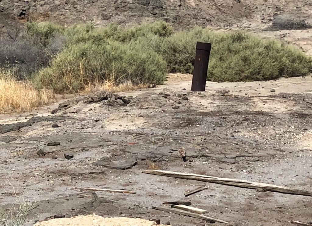
Near the southern end of The Petroleum Highway is the site of “Lakeview Gusher No. 1,” which in 1910 was a major oil blowout that destroyed the derrick and resulted in a continuous uncontrolled oil flow for the next 18 months. A total of nine million barrels of oil were lost. Today, the ground is still saturated with dried oil and a small stub of pipe remains poking out of the ground. A plaque was placed here in 1952 to commemorate the disaster, though the narrative sounds more like it’s bragging about the scale rather than bemoaning the environmental damage. “Lakeview #1 produced an estimated 9 million barrels of oil, a record not yet equaled by any other well in California.”
“And up through the ground came a-bubblin’ crude. Oil, that is…”
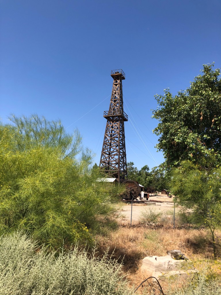
A nearby museum in the town of Taft (pop: 9,500) even includes a replica of the derrick:
“…or are you just happy to see me?”
The city of Taft was not always so named. When it was just an unnamed small stop on the Sunset Railroad, the residents asked the railed to christen it “Moro.” Railroad officials felt that the name could be confused with Morro Bay, so they instead assigned the name Moron. I am not making this up. After a major fire burned much of the town in 1909, the name of the rebuilt city was changed to Taft, after the recently-elected 27th president of the United States.
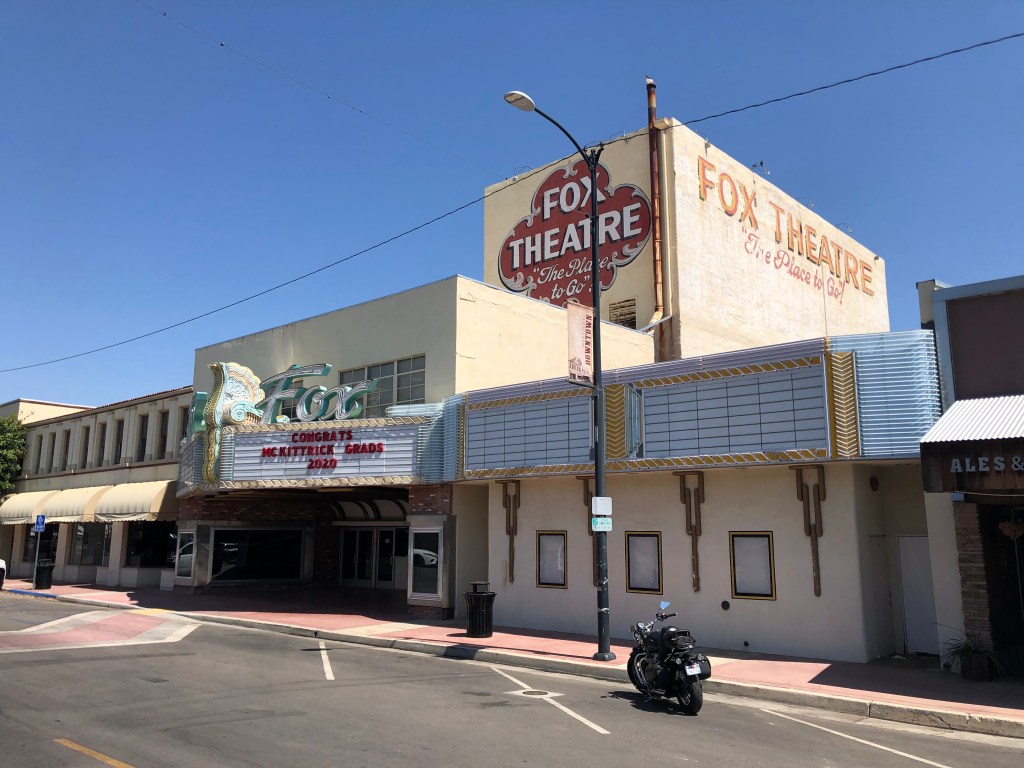
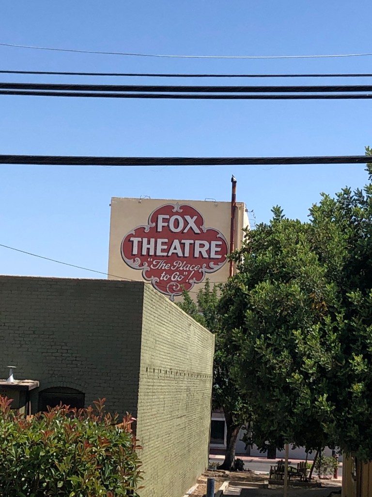
Taft boasts a well-preserved historic movie theater that still shows movies and liver performances. Originally built in 1918 as the Hippodrome, the theater was renamed the Fox Theater in 1952.
Not bad for 102 years old!Sounds like they’re very proud of their bathrooms…
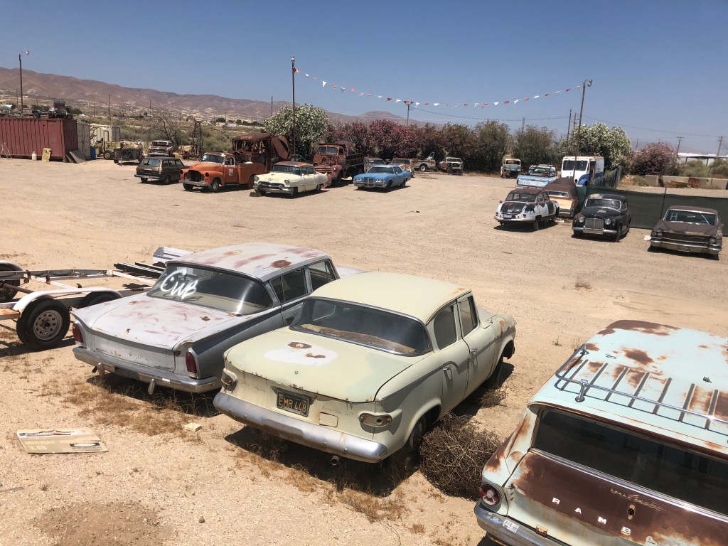
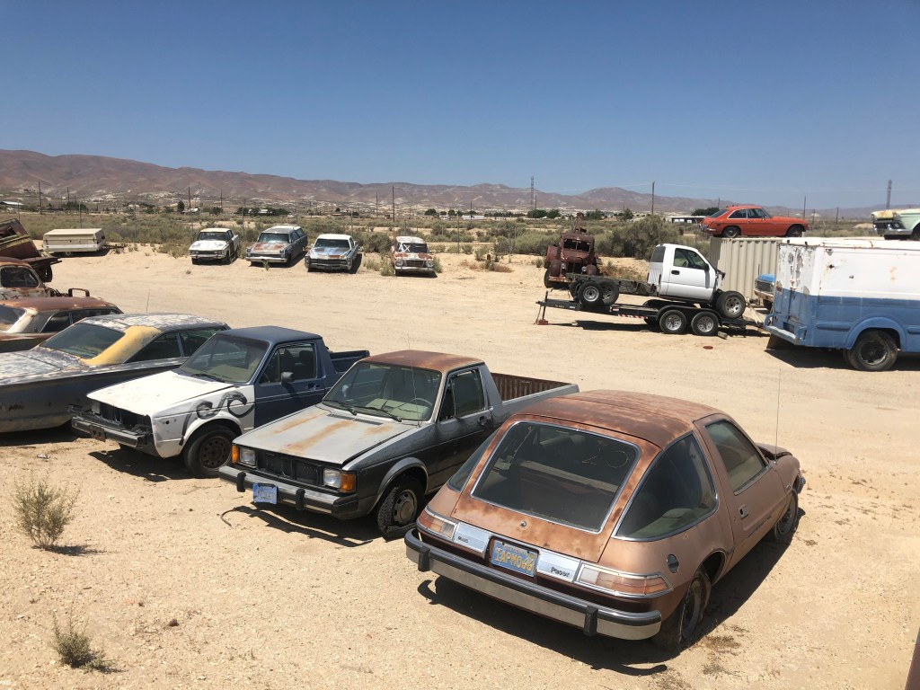
Just outside of Taft I came across a large collection of old cars. What caught my eye was the Studebaker Lark. You get points if you can pick it out.
And bonus points if you can figure out what color it’s supposed to be.
The other notable car was the AMC Pacer, which was one of most maligned cars in automotive history. At least until one appeared as Garth Algar’s car in Wayne’s World.
The Mirth Mobile
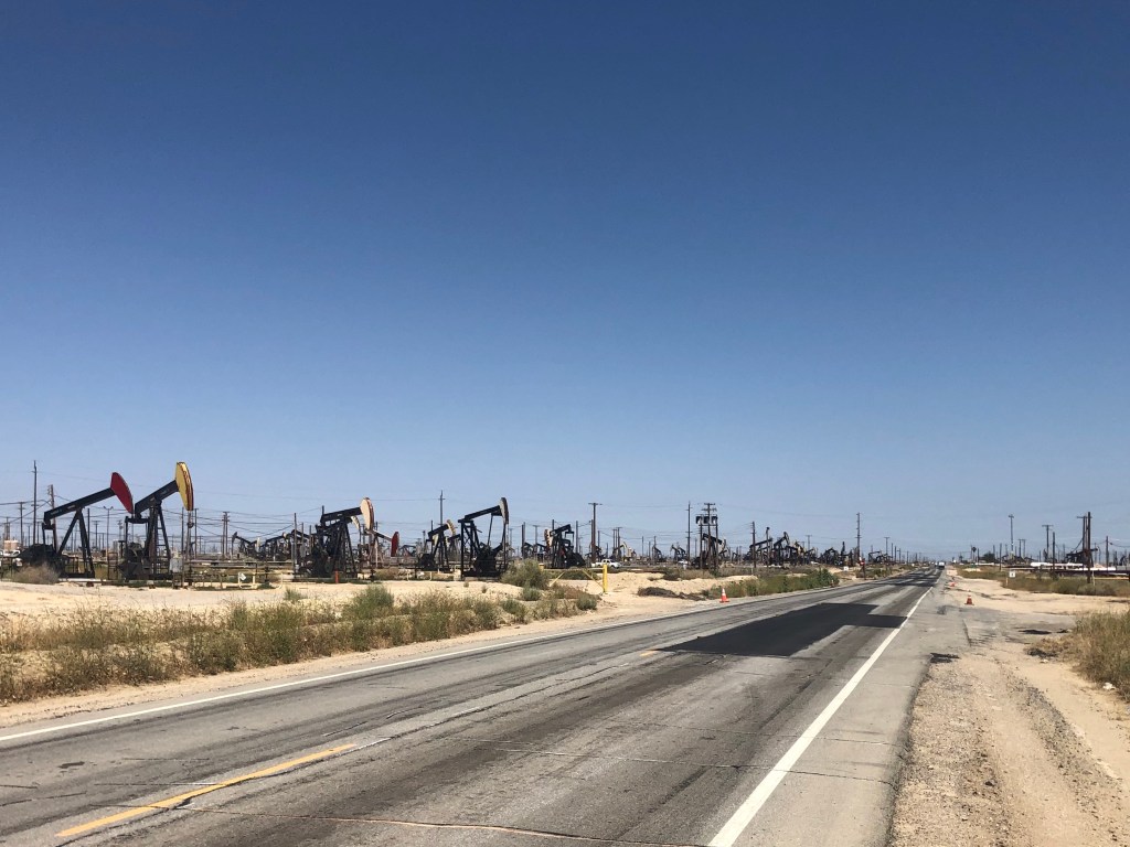
Now, Route 33 passes through 10 counties in all. So far I’d been through Ventura, Santa Barbara, and San Luis Obsipo, and was now making my way through Kern. Each county seems to have its own distinct approach to zoning and infrastructure. For example, as we noted at Pine Mountain with Tom Wolf’s situation, Ventura County places a premium on open space and “viewsheds.” But now, as I moved deeper into Kern County, it was clear the locals value oil production over natural beauty. Check out the landscape as seen from CA 33:
Oh, whoops. Wrong photo. Here’s what it actually looks like:
Abandon all hope, ye who enter here.
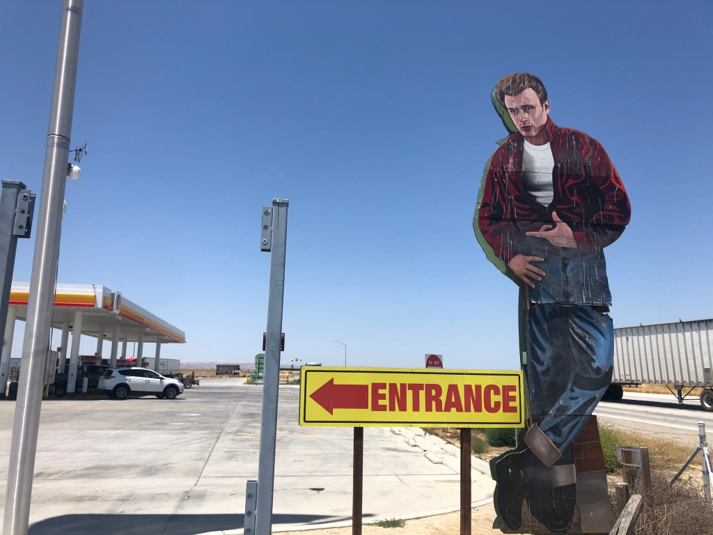
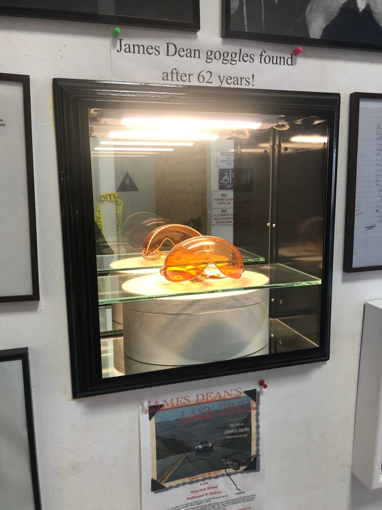
One bright spot along the Petroleum Highway in Kern is Blackwell’s Corner. Since 1921 it’s been a traveler’s oasis at the intersection of CA-33 and CA-46. With food, gas, drinks, and restrooms, it’s the kind of place the Pine Mountain Inn might have been. But Blackwell’s Corner is famous as the last stop James Dean made before he crashed his convertible Porsche head-on into a Ford about 20 minutes later, in September 1955. Trivia fact: The name of the man Dean hit was Donald Turnupseed. Turnupseed survived; Dean didn’t.
Blackwell’s plays up the James Dean connection, with a larger-than-life cutout of Dean beckoning drivers to stop, and with a small display of Dean memorabilia. They’ve also got a 1950s-themed diner, where I got the best pastrami sandwich I’ve ever eaten.
Part of the James Dean shrineThe Covid-related yellow tape clashes with the 50’s vibe.
After the relative buzz of activity at Blackwell’s, it was back to the desolation of Route 33 in Kern County. At least the oil wells had given way to orchards.
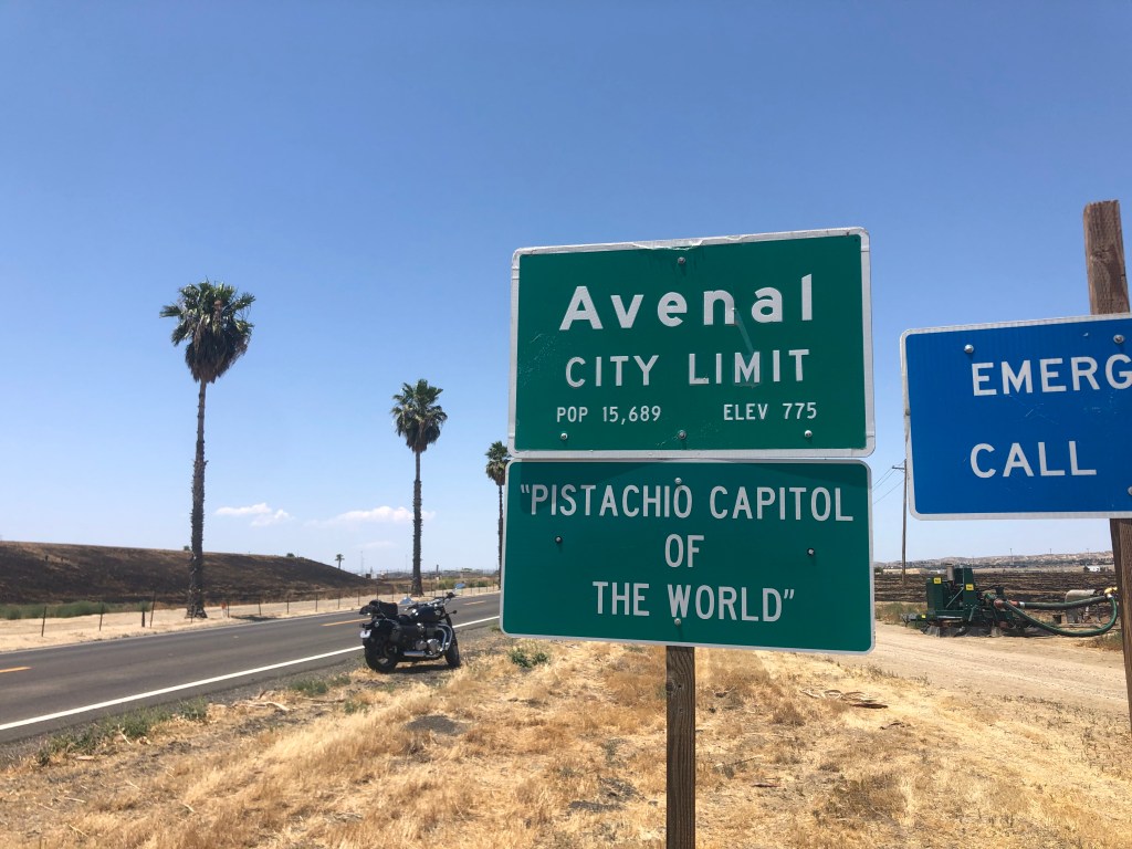
Soon I was crossing another county line. Kings County is another agricultural region. Which generally means that, in addition to lots of farms and fields, it has a couple of prisons. Route 33 passes through the city of Avenal (pop: 15,600) is home to one of these prisons. But Avenal doesn’t boast about that; they’re rather be known for their pistachios.
But evidently it’s not the spelling capital of the world.
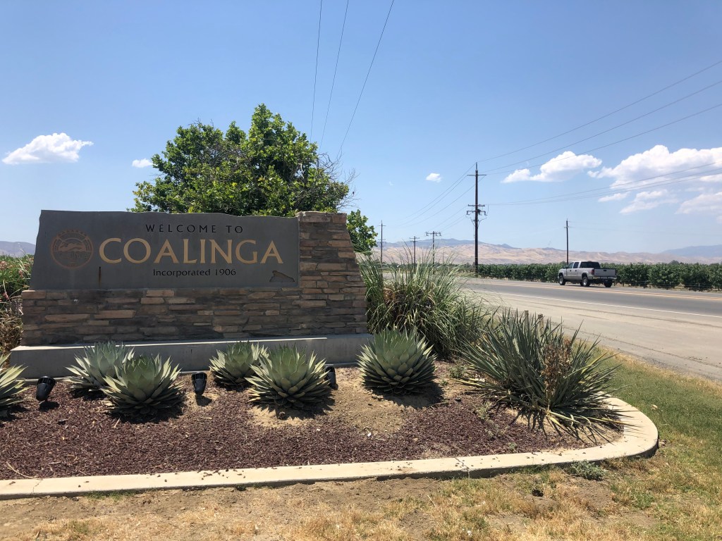
Soon I was approaching Coalinga (pop: 12,000). With large cattle ranches, Coalinga is the kind of place you smell before you see it. For me, the most interesting thing about Coalinga is its name. The place was established as a coaling station by the Southern Pacific Railroad in 1888. They called it “Coaling Station A,” which frequently got abbreviated to “Coaling A.” Before long, CoalingA was born.
Coalinga: The PromiseCoalinga: The reality. Would I “steer” you wrong?
Now, let me just get out on the table that I should have stopped for gas in Coalinga. My gas gauge was getting low, but gas stations seemed to be pretty plentiful in these parts, so I figured I’d go a bit further. For reasons we don’t need to go into here, I found myself in the middle of nowhere with an empty gas tank. No problem, I thought. I’ll call roadside assistance. Unfortunately, the robot on the other end of the phone thought I wanted to sign up for insurance, and kept offering to send me quotes. Somehow I managed to get connected with a human being, who informed me that they’d be happy to deliver a gallon of gas to me for $177.50. I declined their generous offer, and decided to just get an uber to take me to the nearest gas station, which according to google was about 8 miles away. Alas, there were “no cars available” from either Uber or Lyft. After a bit longer a cop stopped for me, but once he saw I was OK he said he was on his way to a call and didn’t have time to help. Just as I was regretting not paying the $177.50, and was now figuring I’d just walk the 8 miles to the gas station, a Scion pulled up next to me and the driver offered to take me to the gas station. Crisis averted.
Thank you, Mr. Scion Driver, whoever you are.
So, back to the road trip: A dozen miles after passing through Coalinga, CA-33 becomes concurrent with Interstate 5 for 13 miles. Clogged with semis, this is the only part of the road that isn’t fun on a motorcycle.
Upon exiting I-5, I was firmly planted in the workaday world of the San Joaquin Valley. Which means, of course, more prisons. It also means long, flat stretches and lots of orchards lining the road.
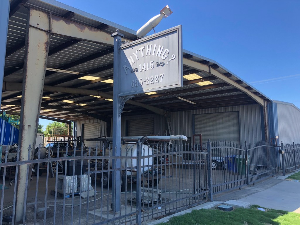
Towns along this northern portion of CA-33 seem to be located closer together. Could it be the proximity to the spillover-sprawl from the Bay Area? Mendota (pop: 11,000) is a typical town along this stretch, with tidy homes, leafy streets, and historic downtowns. Mendota claims to the “The cantaloupe center of the world.” (Take that, Avenal!) But I was most intrigued by this business that calls itself “Anything,” but then adds a question mark to perhaps qualify their range of business. And they added a bomb, just for good measure.
Not a good sign…
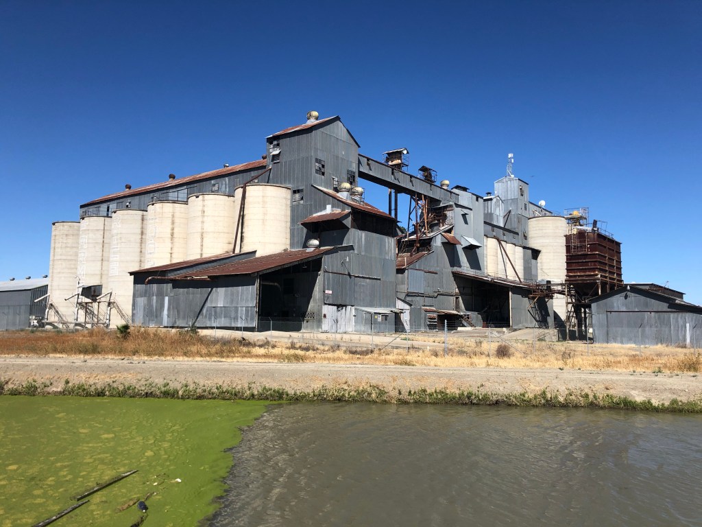
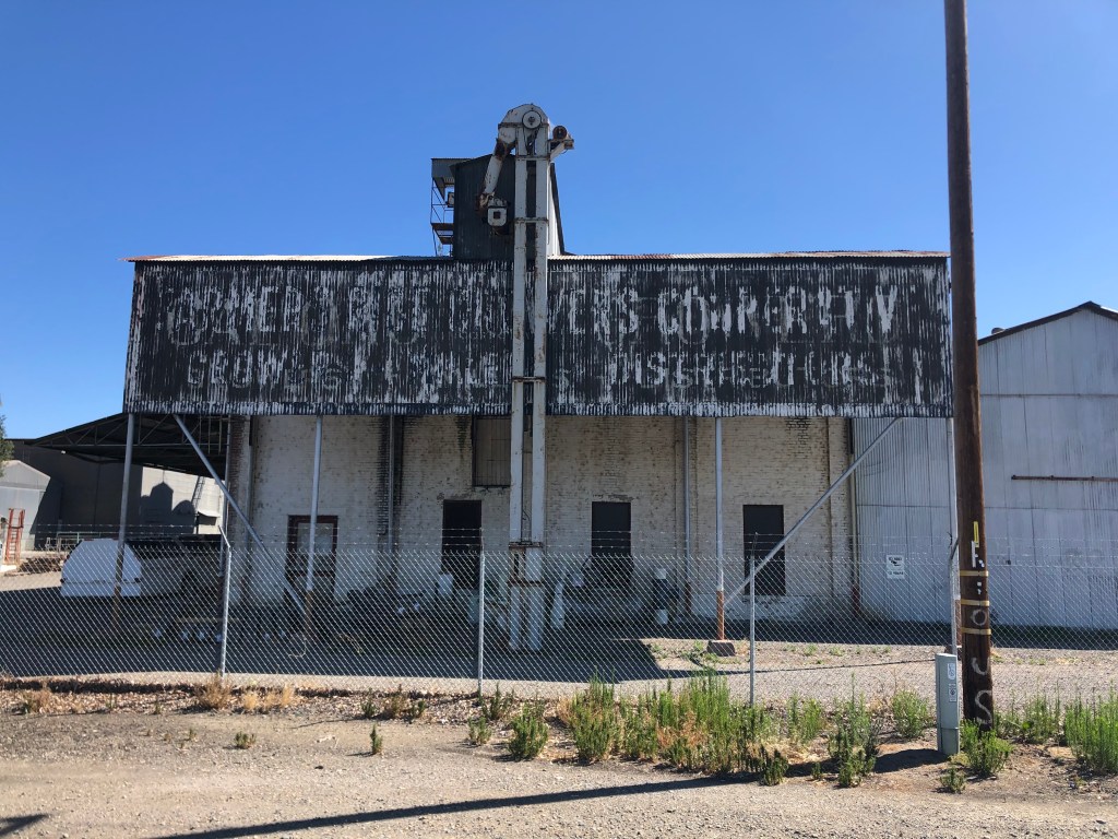
More common than unexploded ordnance mounted on mysterious signs are silos and granaries. Here are a couple of picturesque specimens from Dos Palos.
If ever you wanted a poster child for the effects of agriculture on water quality…
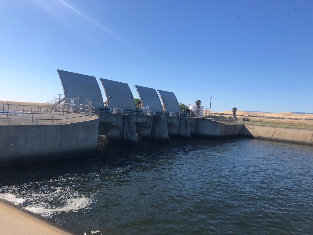
One other feature that figures prominently into CA-33’s landscape is water infrastructure. This isn’t surprising, given the agricultural presence all along the road. The California Aqueduct and the Delta-Mendota canal cross the road at various points.
Next stop: Los Angeles!
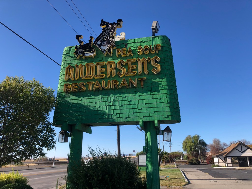
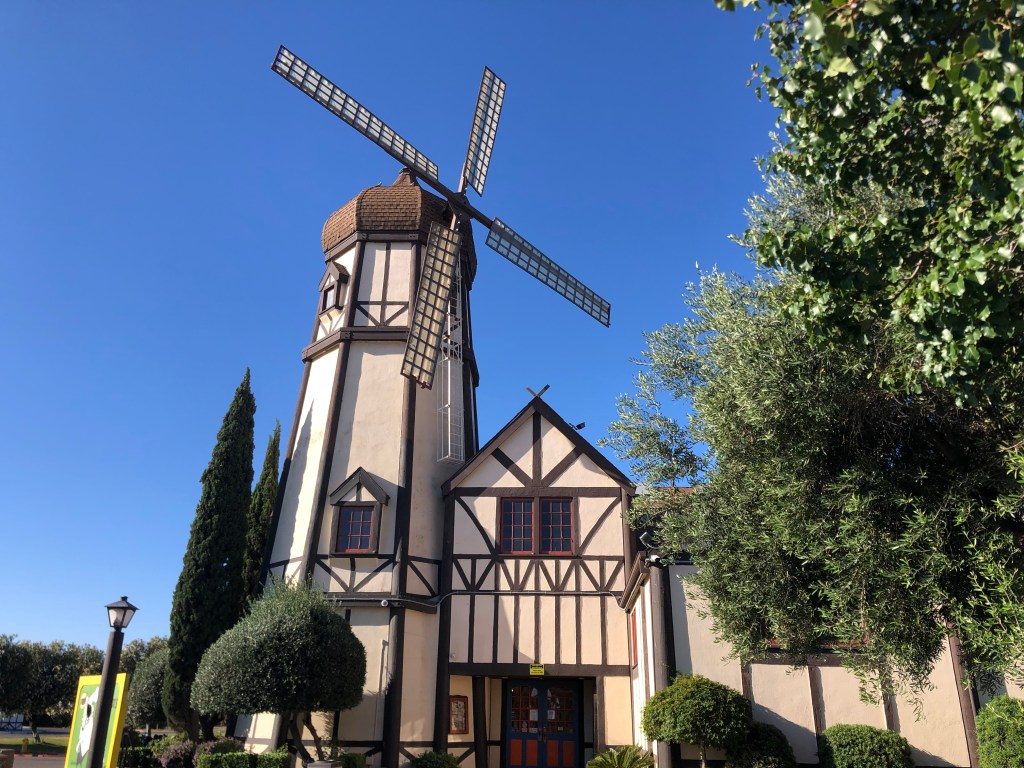
Regular travelers along I-5 or US 101 are familiar with the iconic Pea Soup Andersen’s, which has locations at Santa Nella and Buellton, respectively. In 1924 Anton and Juliette Andersen opened the Buellton location, which was originally named Andersen’s Electric Cafe to emphasize their fancy-pants electric stove. The Santa Nella location was opened in 1976. The two locations are kitchy Danish themed, with restaurants, bakeries, and hotels on site. For years the restaurants have been heavily advertised on billboards along the two freeways, enticing travelers with the promise of split pea soup in only 157 more miles.
For the first time in my life, I stopped for a meal at the Santa Nella location. During this Covid pandemic, I was the only customer. The food was tolerable.
And people said it wouldn’t fly….Plenty of available seating, c/o the Coronavirus.
My favorite town of the entire drive arrived near the end. Gustine (pop: 5,500) seems largely untouched by developments since the Eisenhower administration. It’s remains a very small town with many old buildings, but somehow exudes an air of viability, if not prosperity. It has a charm that seems lacking in many of the other central valley small towns.
This dive bar in Gustine gets good reviews on Yelp.Old bank converted to an antique shop. Plus, evidently, a wine store. This historic Oldsmobile dealership is now an auto body shop.Historic bridge crossing an irrigation canal in Gustine. Nice to see an old bridge without graffiti.
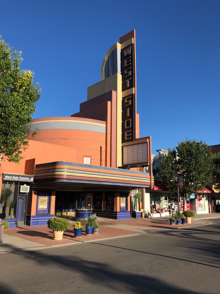
Just up the road from Gustine is the town of Newman (pop: 10,000). It also seems to be holding on to its past, which includes the historic West Side Theater. The streamline moderne theater was built in 1940, and fell into disrepair in the 1980s. The city bought the property in 1996, and launched a major effort to have it fully renovated. Today it hosts live entertainment.
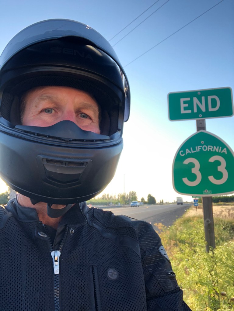
I was getting used to exploring these well-maintained, historic towns, but after a few more miles I reached the end of CA-33, at a nondescript junction with I-5.
The helmet hides my Covid hair…
So ends another journey on California’s blue highways. CA-33 is certainly not the most glamorous, but it sure gives you a lot of exposure to forgotten aspects of California. For those of you hunkered down at home, I hope this gave you some vicarious fresh air. Except for that part in Coalinga.
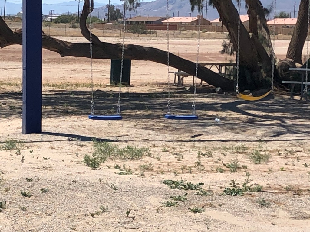
With apologies to Dire Straits, I went to the Salton Sea and took a picture of this:
The Swings of Salton
The Salton Sea lies lies about 170 miles from my house, so this sounded like a manageable day trip. The only downside was that my route passed through a town called “Corona,” which is a name that’s taken on somewhat disquieting associations during this pandemic.
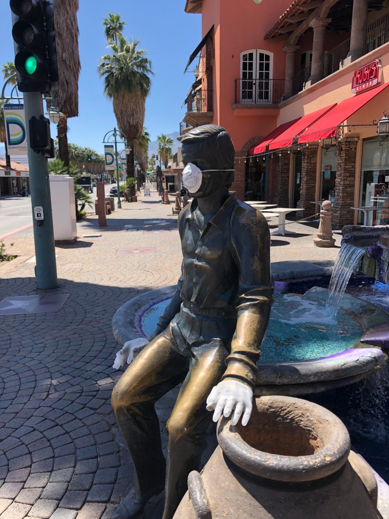
I took this picture in Palm Springs, but wouldn’t it have been great if it had been in Corona?
Anyway, the only notable sight I saw in Corona was this sign advertising an archery range.
I’m sorry, but I just don’t see the point.
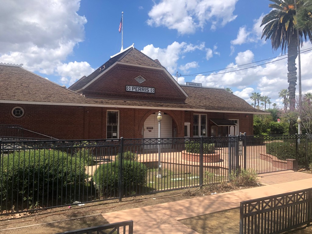
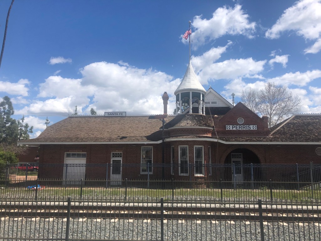
Along the way, California Route 74 — the “Pines to Palms Highway” — traverses the Santa Ana Mountains and passes by Lake Elsinore. Lake Elsinore is a natural, freshwater lake around which has sprung up a good-sized town (pop: 68,000) of the same name and various horse ranches. It’s a pleasant enough area. I also made a swing through the town of Perris, which also has a lake. Lake Perris is at the southern terminus of the California Water Project, and is a popular spot for various recreational activities. The city of Perris (pop: 80,000) is holding its own, benefiting from the many visitors who come to the lake.
It’s hard to gauge the vitality of of town while everyone’s sheltering in place, but I was heartened to see this fully restored railroad depot that originally had been built in 1892. The depot now operates as a museum.
Perris in the Springtime… Back view of the depot. You don’t normally see this kind of architecture on railroad stations.
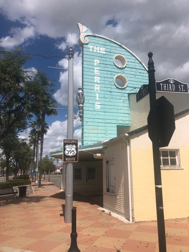
I also was struck by a semi-restored movie theater. The Perris Theater originally opened in the early 1930s as an open-air amphitheater. It was modified into its current, enclosed form in 1946. The theater closed in the 1970s as patrons took their business to the multiplexes. It then became used as a church, and was finally purchased by the city about 10 years ago, to be used as an entertainment venue. It’s hard to tell when it last hosted a show, but the condition of the paint suggests it’s been vacant since before the Coronavirus hit…
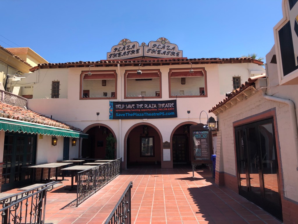
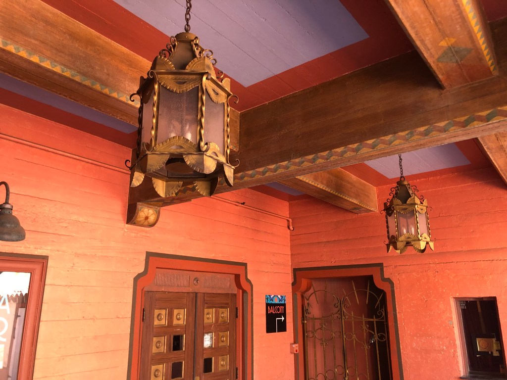
Yes, yes, I’m going to get to the Salton Sea in a moment. But I did want to share another theater that I saw in Palm Springs. The Plaza Theater was built in 1936 in the Spanish Colonial Revival style. In addition to screening movies, it also hosted live programs by entertainers like Frank Sinatra, Jack Benny, Bing Crosby, and Bob Hope, which were broadcast over the radio. The city of Palm Springs is currently seeking funds for further restoration of the theater.
Check out the detail around the outdoor front lobby.
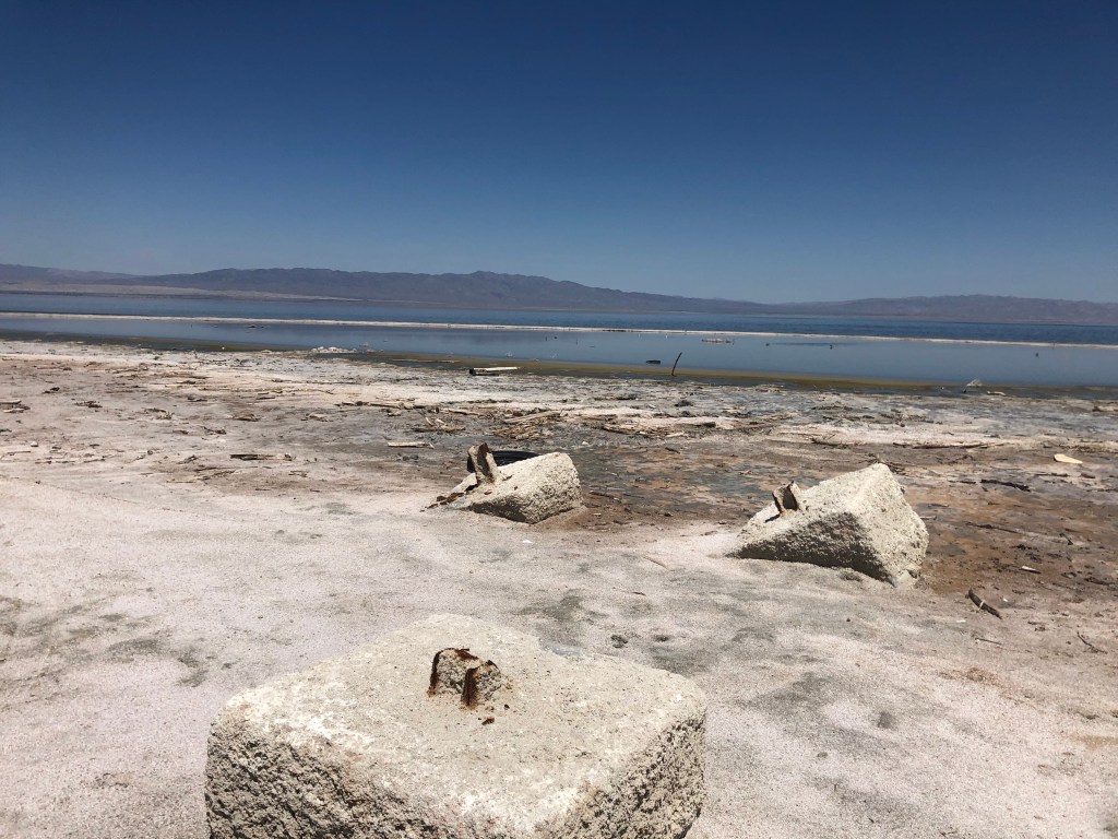
By mid-afternoon I finally arrived at the Salton Sea. It’s probably helpful here to review some history. In 1900, a decision was made to dig an irrigation canal from the Colorado River to irrigate the great, dry lake bed in southeastern California called the Salton Sink. Things worked pretty well for a few years, but in 1905 heavy rainfall and snowmelt caused the Colorado River to overflow its banks, and the irrigation canal quickly eroded into a river. In fact, the entire flow of the Colorado River was diverted through the canal and into the Salton Sink for two years. Let me repeat that: All the water from the Colorado River just dumped into the desert for two years and filled this dry lake bed, while government officials tried to staunch the flow. When the Colorado River’s banks were finally restored, a new lake had been formed, which today has a surface area of about 350 square miles. This is the Salton Sea.
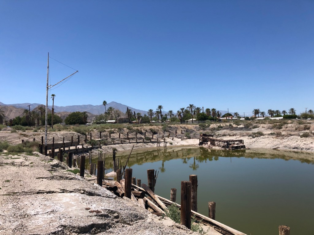
Sensing a providential business opportunity, developers began to create towns and housing developments on the newly-formed shores of the Salton Sea. Things were looking up in the 1950s, as marinas, boat launches, hotels, and enormous housing tracts were developed. I mean, who wouldn’t want to have a beachfront house in the middle of the desert? The Salton Sea was just a larger version of Lake Elsinore or Lake Perris.
But then things began to take a nasty turn. Unlike Lake Elsinore and Lake Perris, the Salton Sea lacks any outflow, so over the years saline levels continued to rise and agricultural runoff became increasingly concentrated. Fish began to die off, with large numbers of dead fish washing up on the shores to rot. Add this smell to the odor of the polluted water, and you can understand why the area began to suffer as a tourist destination. Many of the new housing units were abandoned by developers, and the “seaside” communities began to resemble ghost towns.
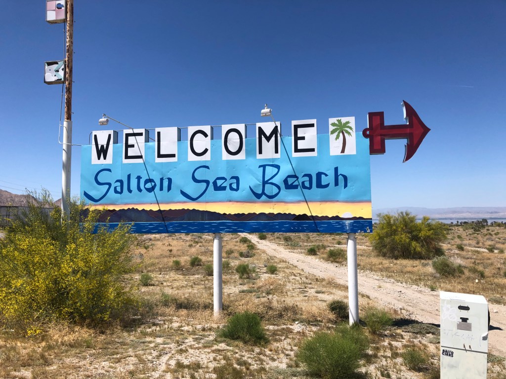
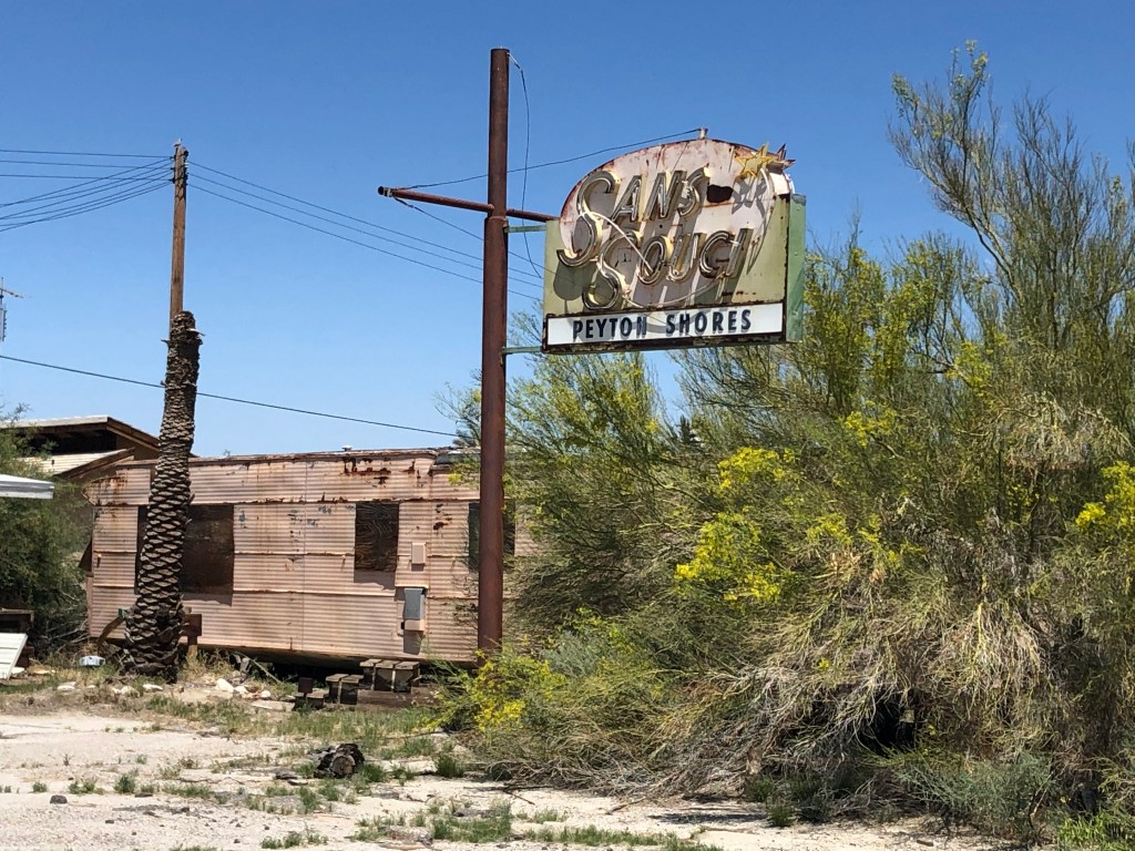
Such is the situation I came upon today. I took highway 86, which runs along the western side of the “sea,” and encountered signage that evoked palm-studded resorts: “Desert Shores,” “Salton Sea Beach,”Whitewater Cove,” “Coral Wash.”
This looks promising….Best laid plans….
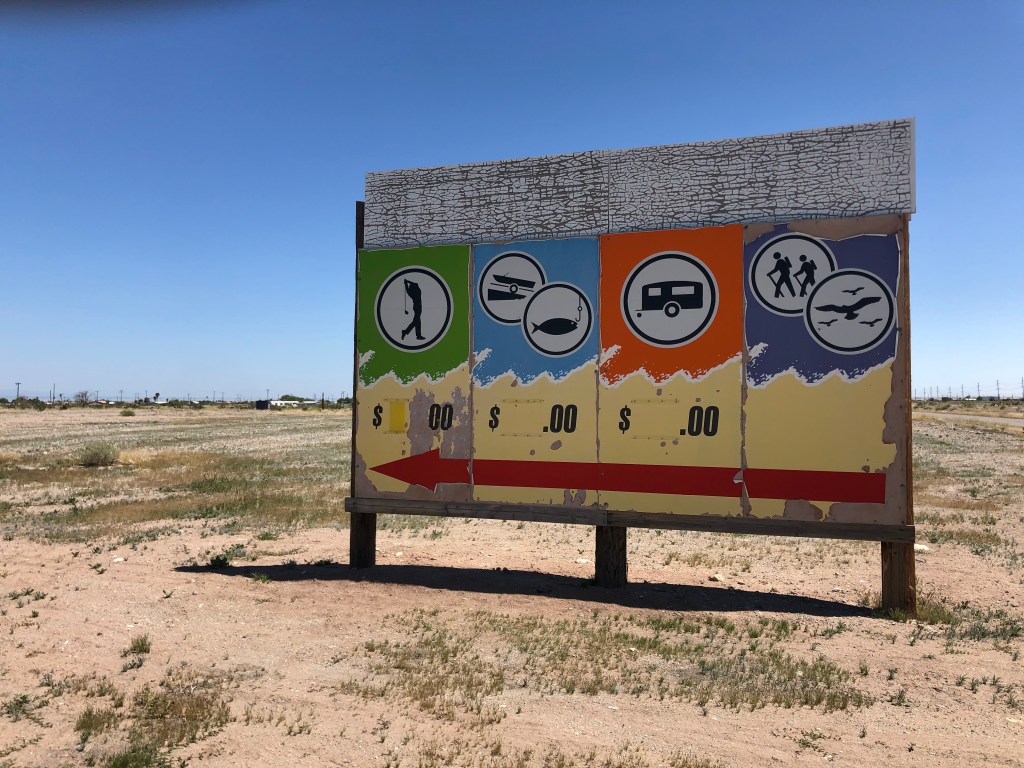
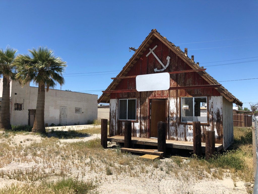
As I headed toward the shore, I passed dozens of derelict buildings, bearing mute testimony to shattered dreams and failed schemes.
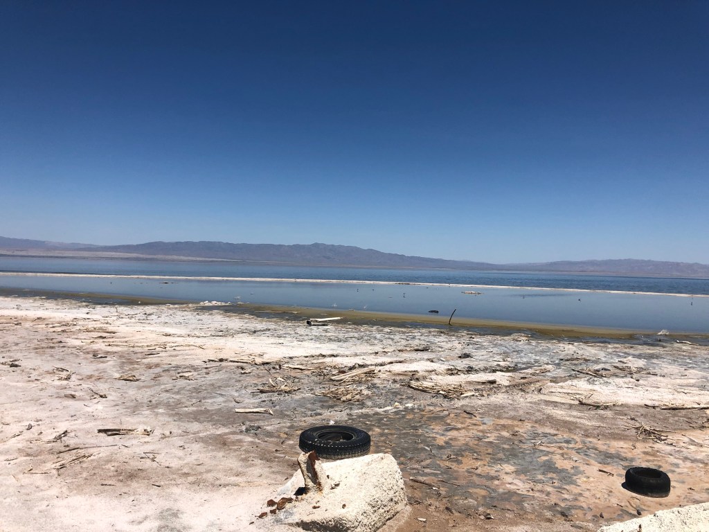
I smelled the sea before I saw it, and when I did enter visual range, the sights and smells matched perfectly.
The landscape’s looking a little tired…A marina, or what’s left of it.Tank traps?
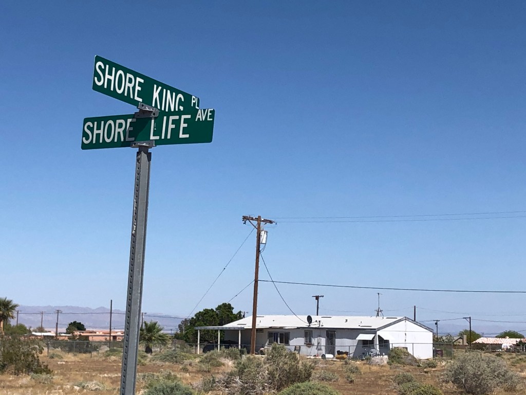
You can imagine how depressing this all was. It’s not just the environmental disaster that’s so disquieting; it’s also the dissonance between the the current reality and the optimistic promises embodied in the names. For example, I drove though a half-completed, now largely abandoned residential tract where every street name promised the best a seaside community could offer.
Today, the main town on the Salton Sea — Salton City — has a few thousand residents, and subdivided lots designed for 40,000. Most of the lots are undeveloped, even though signs advertise them for about $2,500. Over a third of the extant housing stock is abandoned. The only employment of any note in the area is a recently-constructed Indian casino.
The story of the Salton Sea is one of hubris, greed, environmental disaster, and quiet desperation. It shore is a mess…
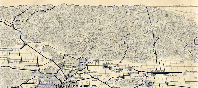
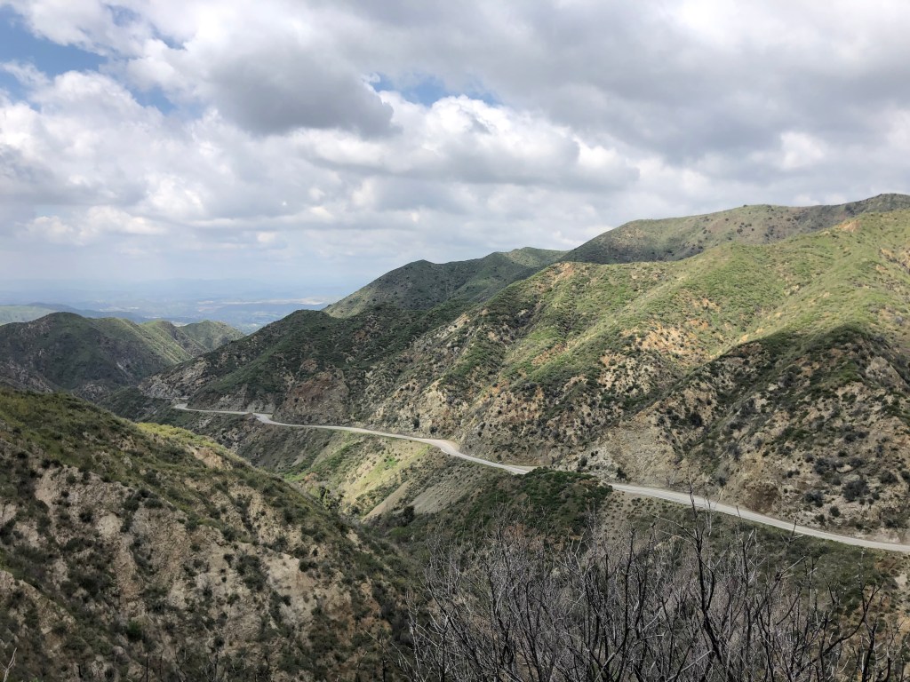
High in the San Gabriel Mountains, just north of Los Angeles, Big Tujunga Creek has over the centuries carved a deep and beautiful canyon. The creek and its smaller tributary (aptly named Little Tujunga Creek) eventually end up in the Los Angeles “river.” (One of the implausible aspects of Los Angeles is that its namesake river carries far less water than the creeks that feed it.) Today I decided to head up into the mountains and explore the Tujungas. Now, I realize that there’s a shelter-in-place order in effect, but this was a necessary trip that could save a life. As in, Karen was going to kill me if we spent another full day in the house together.
Driving the Tujunga Canyons pretty much took me from Mt. Wilson (near the center of this map) westward to San Fernando.
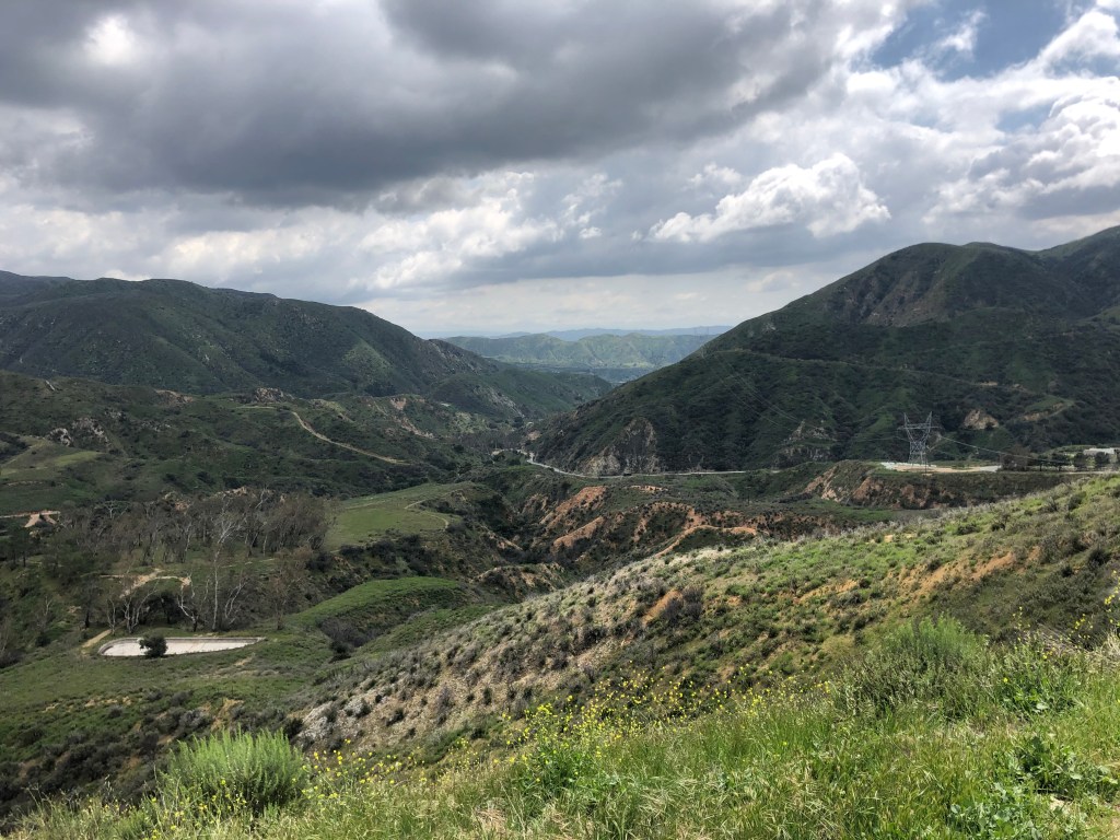
It was good to get up into the mountains. It never ceases to amaze me how you’re transported to an entirely different world with just a 20 minute drive from downtown. (Well, 20 minutes these days, with the traffic attenuated by Covid 19.) I got up a few thousand feet above sea level, and enjoyed commanding views of the mountains.
Big Tujunga Canyon Road
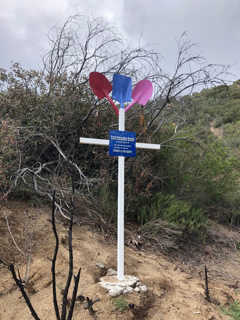
Of course, these views don’t come for free. I passed several makeshift markers that commemorated roadside deaths. One memorialized someone named Kevin Alexander Arnold, who’d succumbed last October at age 38. The marker was constructed from three shovels, each painted a different color, making me wonder if he was involved in road work. Whatever the circumstances, it was a tragedy for someone so young, and a “husband and father,” to have died.
RIP Kevin Arnold
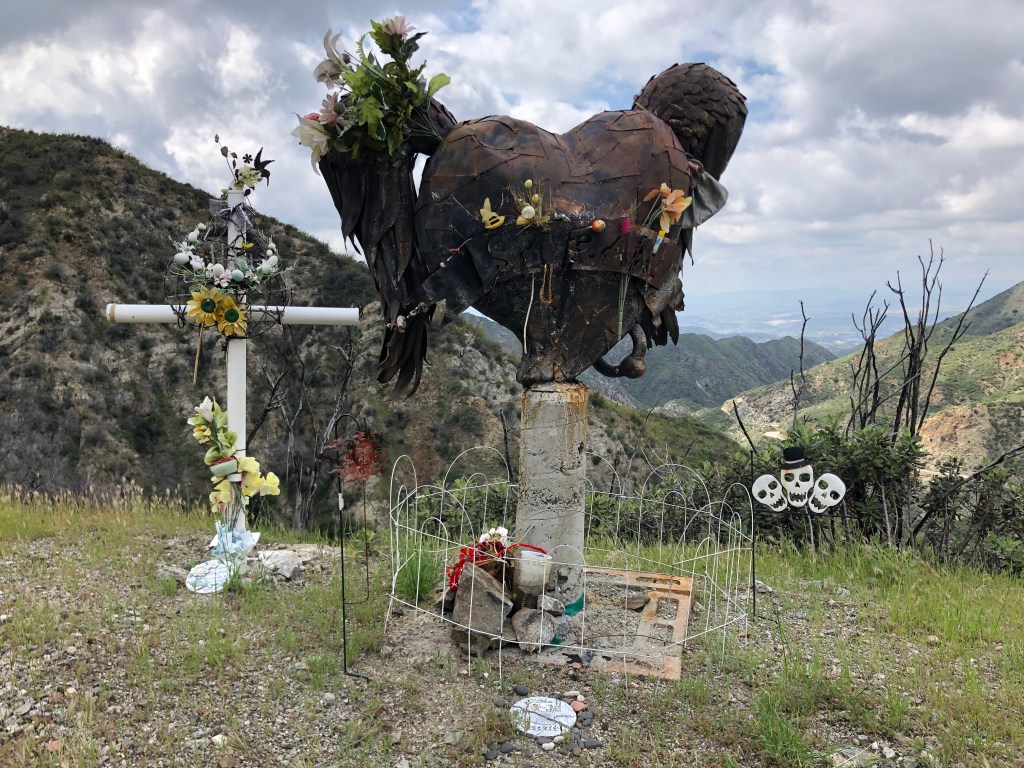
I encountered a more disturbing memorial some miles later. It reminds me of a steam punk sculpture, constructed of metal plates welded together into the shape of a girl’s head, with pigtails and an enormous earring, mounted on a concrete pillar. There is no name or dates in evidence. But there is a Halloween decoration with three jolly skulls looking on.
Paging Dr. Robotnik…
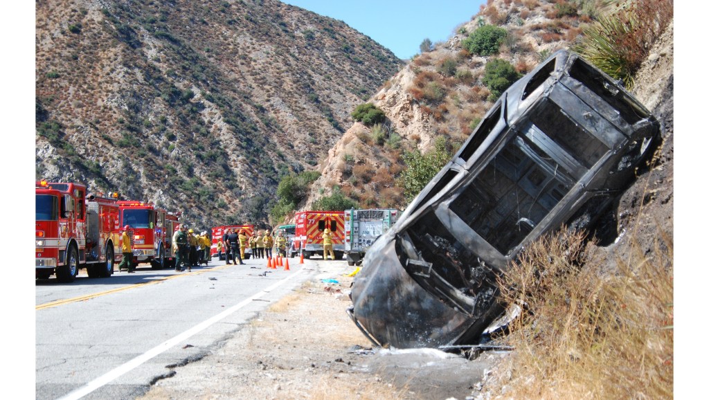
You figure there’s been a lot of accidents on this winding two-lane road through the mountains, especially in the winter with the added dangers of snow and ice. I tried to research the story behind the makeshift memorials I encountered, but to no avail. I did, however, find an online photo depicting the road’s hazards.
There’s got to be quite a story here.
As I continued along the Big Tujunga, I thought about how the ecosystem up here in the San Gabriels is so different from the LA Basin to the south, and from the Mojave Desert to the north. The San Gabriels are high enough to get snow, and the runoff feeds the creeks and, ultimately, the LA “River.” Los Angeles has always had a love-hate relationship with water. There’s always too little or too much. So LA, like many cities in the early 20th century, undertook various hydro projects to store water, produce electricity, and control floods. I encountered a good example of this infrastructure in the form of the Big Tujunga Dam, which stands over 200 feet high at the bottom of the canyon. The dam was completed in 1931 by the Los Angeles Department of Water and Power.
89 years old and still going strong!
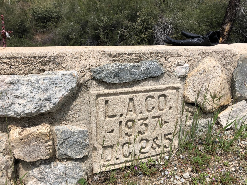
Much of LA’s far-flung infrastructure was constructed in the early 20th century. Even the Big Tujunga Canyon Road on which I was traveling had markers cast into the retaining walls with dates from the 1930s.
Yes, that’s my motorcycle glove on the wall. A professional photographer I ain’t.
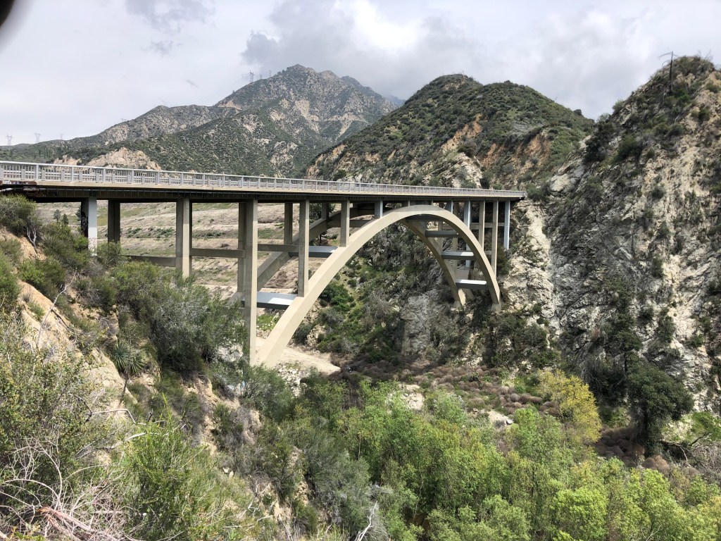
This next structure is more modern, having been built in 1958. It’s a concrete arch bridge that takes the Big Tujunga Canyon Road across Big Tujunga Creek. There’s something about these arch bridges that I find to be graceful and mesmerizing.
Insert “arch” comment here…
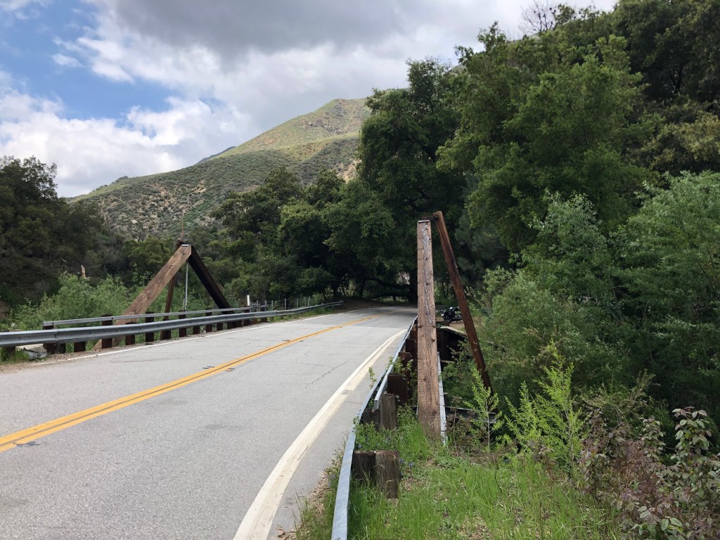
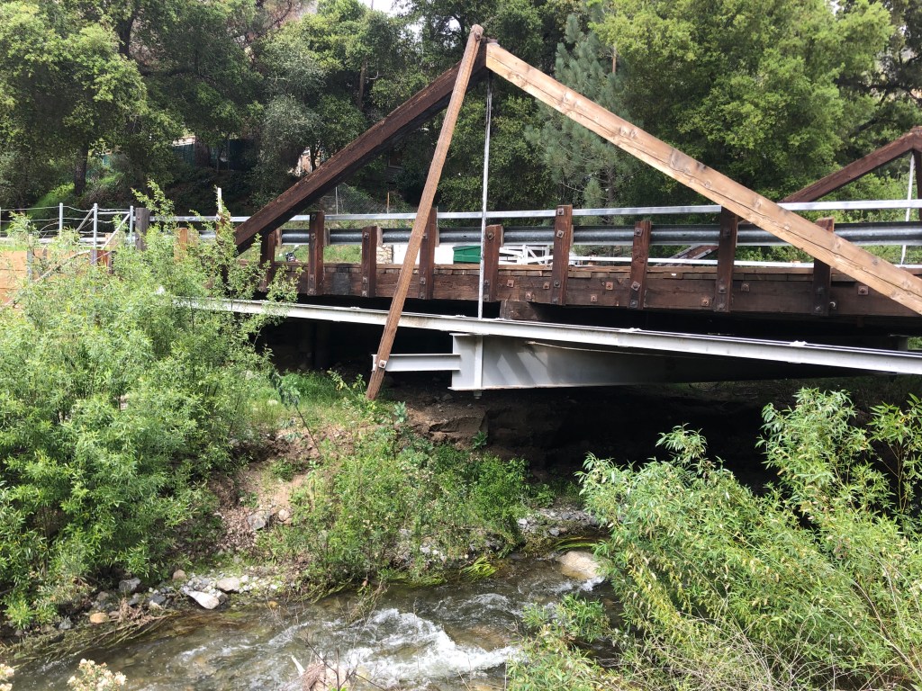
Most of the other bridges on today’s trip were less impressive. For example, I crossed two or three timber truss bridges that looked like they’d been designed by high school students using old telephone poles. But while they’re inelegant, they have their own kind of simple charm.
It’s not much to look at from the road. But if you climb down in the creek and look at it from the side….…it’s still not much to look at.
All in all, it was an enjoyable outing. I’m hoping to get deeper into the mountains during another trip in a week or two. Meanwhile, I hope you’re all getting a chance to engage in some socially-distant activities during the lockdown. Stay safe.
Since December I’ve been planning to spend a few days on a motorcycle ride along State Route 33, which begins on the coast in Ventura, makes its way north across the Transverse Ranges, enters a hellscape in Kern County known as The Petroleum Highway, and ends up about 50 miles south of Sacramento. I had blocked out this week to finally make the journey.
Alas, I’ve decided to postpone the trip. This is partly due to unsettled weather this week. Also, I figured that staying in motels and/or with friends is discouraged during a global pandemic. So, the Great Highway 33 Adventure will have to wait.
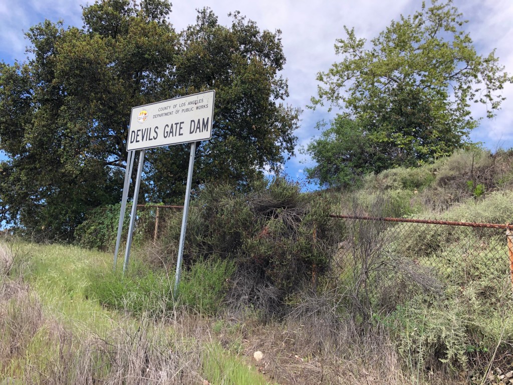
But yesterday the rains held off, and it seemed like a good opportunity to make at least a short day-trip out of the LA basin. I remembered a suggestion from my friend Bruce that I check out something called The Devils’ Gate, up in Pasadena. And so that became my plan.
Traffic on [the] 110 freeway was almost nonexistent, due no doubt to a shelter-in-place order imposed by the Mayor. (As I’m not a resident of the City of Los Angeles, I don’t feel bound by his orders.) In no time (well, 45 minutes, which by LA standards is no time) I found myself at the Devil’s Gate Dam.
The dam was evidently named before the invention of the apostrophe.
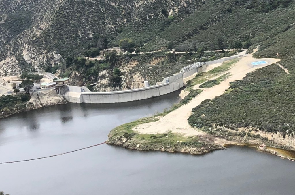
The dam was built exactly 100 years ago, as a flood control measure to regulate the flow of the mighty Arroyo Seco. The Arroyo Seco today is little more than a trickle, but presumably back in 1920 there had been heavier snowmelt off the surrounding mountains, thus necessitating the dam. Still, with a name that translates into “Dry Creek,” the Arroyo Seco was perhaps never all that mighty after all.
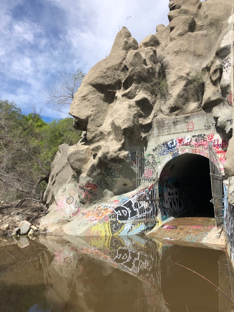
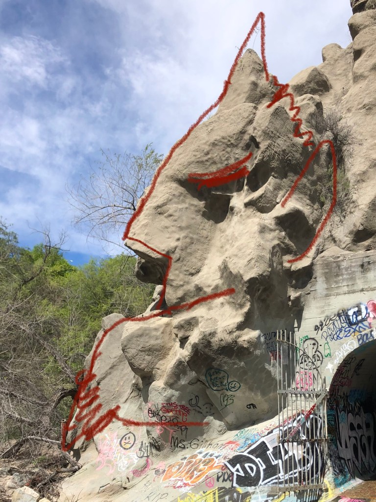
The dam is named for Devil’s Gate Gorge, which is the narrowest part of the Arroyo Seco’s course and thus a good dam site. The gorge itself was named for an outcropping that supposedly resembles Satan. At least, that’s the story. And that’s what I was here to validate.
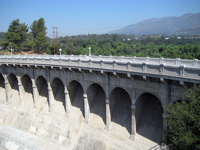
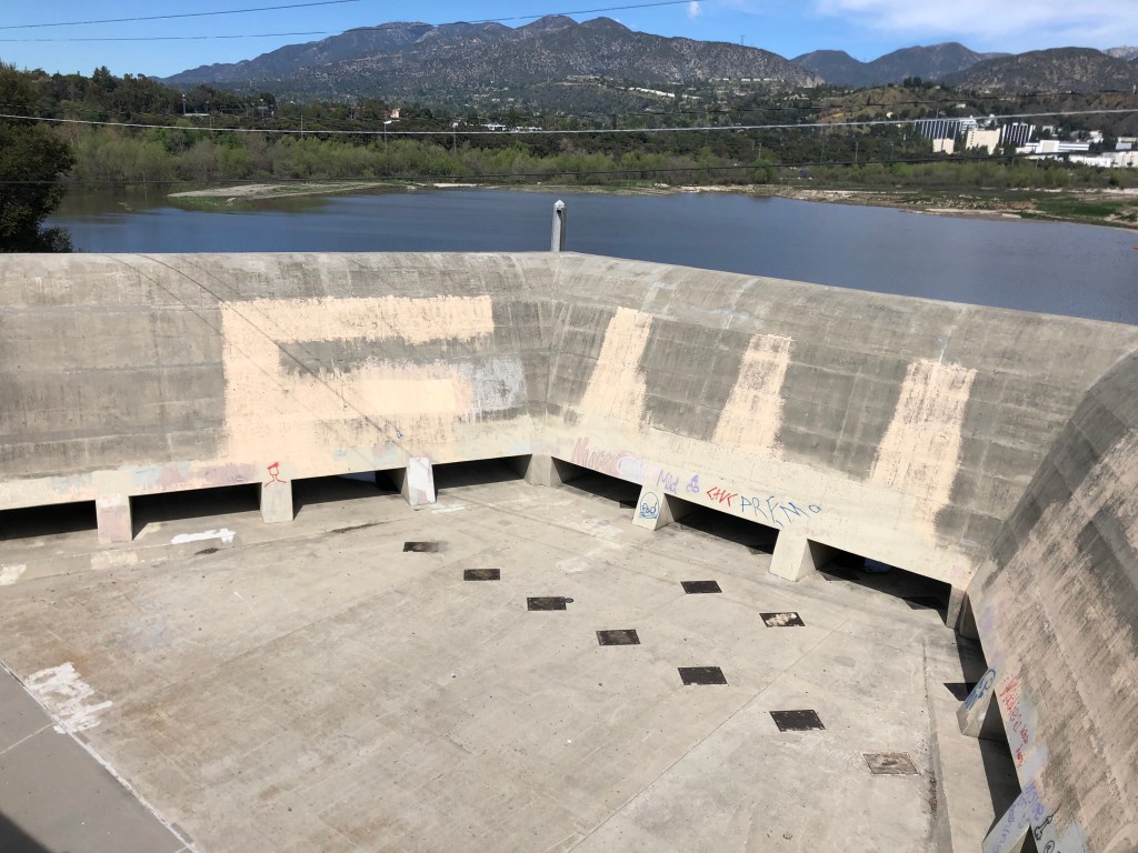
The dam itself is an attractive structure, designed with that classical vibe that characterizes most of LA’s water projects from the early 20th century.
You’d expect gladiators and lions to emerge from the portals at any moment… (This photo is from the Web; I couldn’t get this good of an angle.)
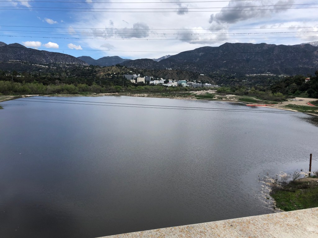
The reservoir behind the dam is not especially impressive. It’s pretty small, compared to other LA reservoirs. It’s also undergoing a major renovation, as the county removes 1.7 million cubic yards of sediment that had slid into the reservoir after the Station Fire of 2009.
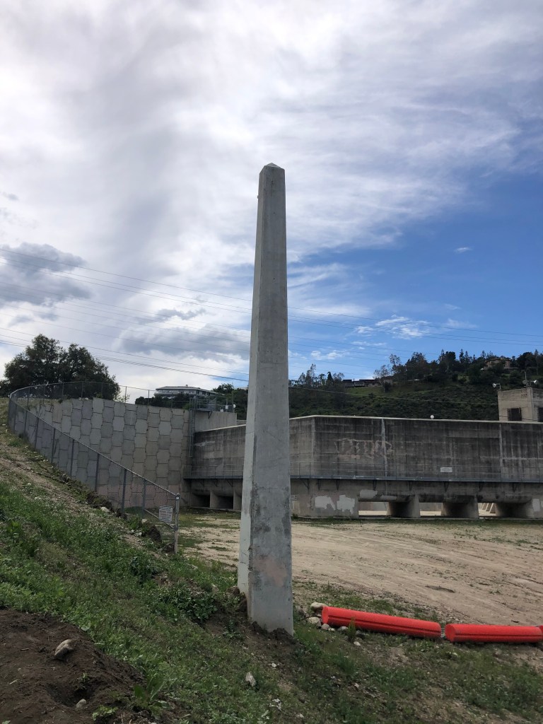
Jet Propulsion Laboratory is in the cluster of buildings in the background. Put a pin in that…The spillway is dry as a bone.Viewing the spillway from the reservoir side. The low water level allows a good view of this wanna-be Washington Monument.
OK, all this is good so far as it goes, and it certainly fits within my suite of LA water infrastructure blog postings. But where’s the namesake Devil’s Gate that I’ve heard so much about?
A little exploration downstream of the dam revealed the answer. Down a steep embankment and nestled among sickly trees and stagnant water I found this:
Abandon all hope, Ye who enter here.Not to put too fine a point on it, but….
OK, it’s a little creepy. But you ain’t heard nothing yet.
Shortly after the dam was built, people began to be intrigued by the rocky profile of Satan next to the hellish gates behind which was eternal darkness and slithering water. By the early 1940s, the tableau caught the attention of a local young man named Jack Parsons (1914-1952), who had recently converted to an occult religion called Thelema. Thelema is considered a proto-Wiccan religion, and some adherents also consider themselves Satanists. But far from being a loony, Jack Parsons was literally a rocket scientist. In fact, it was he who, with a few others, founded Jet Propulsion Lab on the far side of the Devil’s Gate Reservoir.
Parsons became the leader of the California branch of Thelema, and is said to have conducted orgies, practiced Black Magic, and otherwise engaged in occult shenanigans at his mansion, which became the “church” of the Thelema order. Some of Parson’s unearthly activities are said to have taken place at the Devil’s Gate. (Another figure related to these activities was future Scientology founder L. Ron Hubbard.) In 1944, Parsons was unceremoniously expelled from JPL due to his objectionable behavior.
A decade later, children began disappearing from the area. Speculation abounded about goings-on at the Devil’s Gate. A convicted serial killer named Mack Ray Edwards took credit for the killings, though none of the Devil’s Gate children was ever found. Edwards was a CalTrans worker, and one of his confirmed victims was discovered under the Santa Ana freeway. One wonders whether the Devil’s Gate children met a similar fate.
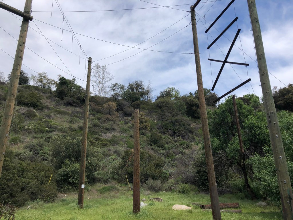
Feeling a bit uneasy in this isolated area, I figured it was time to go. I got a little turned around among the trees and bushes, and suddenly found myself in the center of some spindly wooden structures.
A sign suggested that this is a “challenge course.” But I’ve seen The Wicker Man…