Now, I know that some of my loyal readership doesn’t get too excited about obelisks. So you’re excused if you want to pass over this particular post. But if you want a refresher on why these interest me, please check out this post from last year.
A surprising number of readers have sent in their own obelisk sightings after that post, proving that obelisks aren’t immune to the Baader Meinhof effect. Just do a search on “obelisk” on my blog’s main page, and you can see the wonderful variety of obelisks that have been spotted.
Today we add two more sightings:
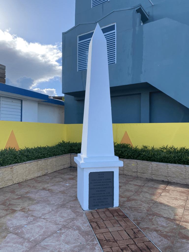
Friend Detlef K. was on vacation in Puerto Rico when he spied this simple obelisk in the town of Luquillo.
It’s a monument to Luquillo’s native son Rosendo Matienzo Cintrón (1855-1913). Cintrón was a lawyer who became something of a political firebrand. He seems to have held a broad range of political positions, many of which contradicted each other over time. He was imprisoned by the colonial government (Puerto Rico was under Spanish rule at the time) for being a Freemason, which evidently was illegal. After his release, he was elected to a local political office, and later helped establish the Puerto Rican Autonomist Party. Later, he welcomed the United States’ military intervention in the Spanish-American War, in which Spain ended up ceding Puerto Rico to the United States. In return, the US appointed Cintrón to important political positions over its new possession. Cintrón advocated for Puerto Rico to become a U.S. state, but later became a passionate proponent of Puerto Rican independence from the United States. Somewhere in all that, he earned himself an obelisk.
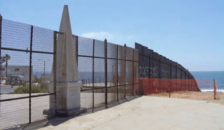
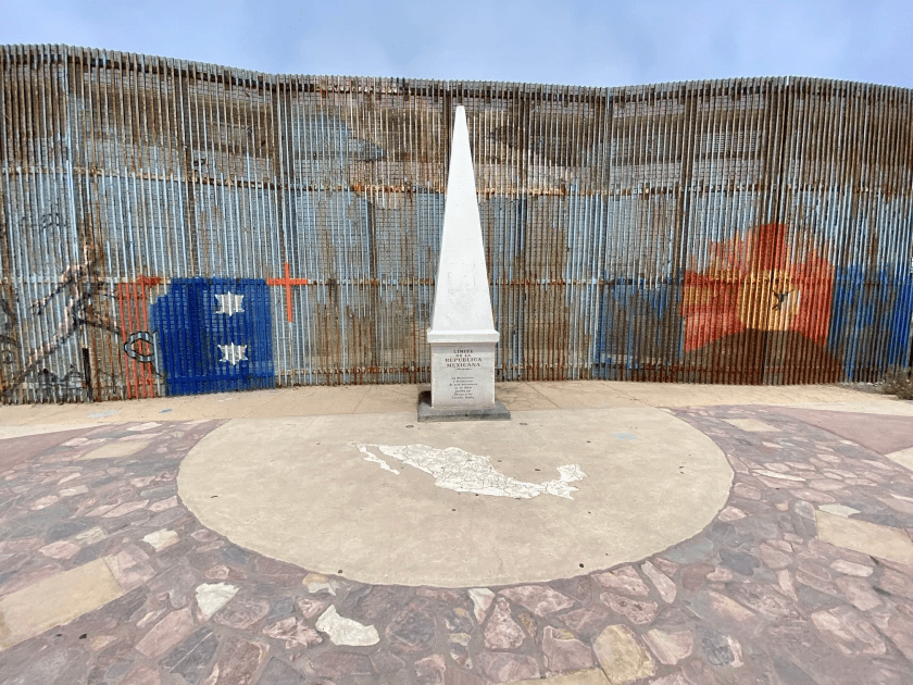
Meanwhile loyal reader Steve L. sent this picture of an obelisk in “Friendship Park,” which straddles the US-Mexican border near San Diego.
International Obelisk
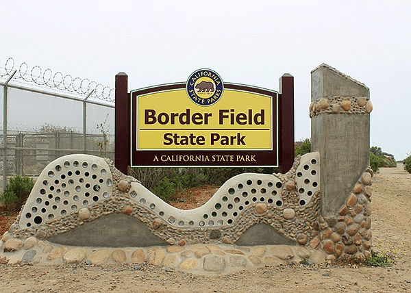
Friendship Park is part of a larger “Border Field State Park,” which makes every effort to look welcoming…notwithstanding various federal security measures that are in place.
The concertina wire is a nice touch.
Friendship Park was established in the 1971, and at the time the obelisk was not divided by a fence. (See historic photo, below.) The obelisk was originally erected in 1851 as a boundary marker after the Treaty of Guadalupe-Hidalgo.
But with rising concerns about illegal immigration in the 1990s, and then concerns about international terrorism after 9/11, security measures were put in place that changed the vibe of the park.
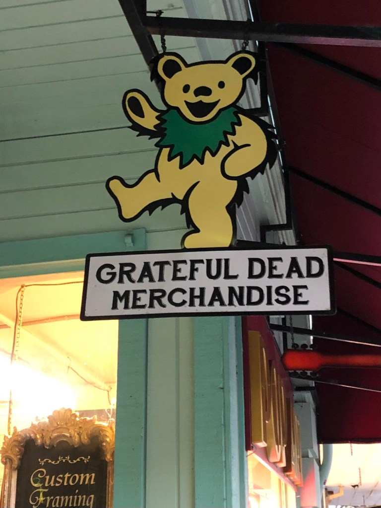
A few nights ago the wife and I were having dinner in downtown Placerville. We were sitting outdoors (as one does these days), watching the strollers stroll and the passersby pass by. Then what to my wond’ring eyes should appear but a bright, shiny sign with a gold, laughing bear.
Attentive readers will recall my mission to track down historic Golden Bear signs. I made a few subsequent discoveries here and here. Had I now stumbled across another one?
Sadly, upon closer inspection, I noted that this Laughing Bear was just an advertisement for another hippy-dippy store selling tie-dyed shirts and all manner of hemp products. For as we all know, The Grateful Dead appropriated the image many years ago as part of their brand.
No Birkenstocks, no service.
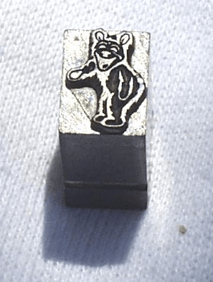
Now, to be fair, there is an alternative myth that the Grateful Dead’s bear was copied not from the Golden Bear signs, but from a “36 point lead slug” (that is, a piece of old printer’s type). Here is the slug in question:
The plot thickens
The story goes that an artist by the name of Bob Thomas found the slug somehow, and used it as an inspiration for the album design of The Dead’s 1973 album, The History of the Grateful Dead, Volume 1 (Bear’s Choice). (“Bear’s Choice” is a reference to Owsley “Bear” Stanley, who was the Dead’s sound engineer and, not incidentally, a major purveyor of LSD. I’m not making this up.)
Look carefully around the perimeter of the circle.
I’m of the opinion that the “36 point lead slug” may indeed have been Mr. LSD’s inspiration for the album art, but I suspect that the slug itself was designed from the historic Golden Bear logo. It may have been used for Golden Bear advertisements in the newspaper, for example.
Anyway, my point is this: If you need drug paraphernalia, there’s a place next to Bene Italian Restaurant in Placerville. In the meantime, please send me pictures of any authentic Golden Bear signs that you might come across.
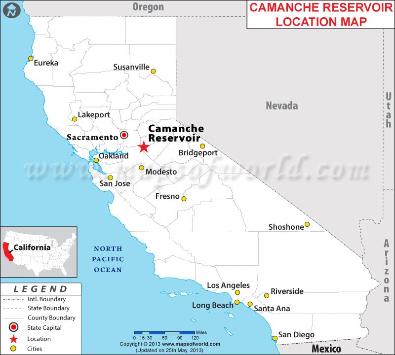
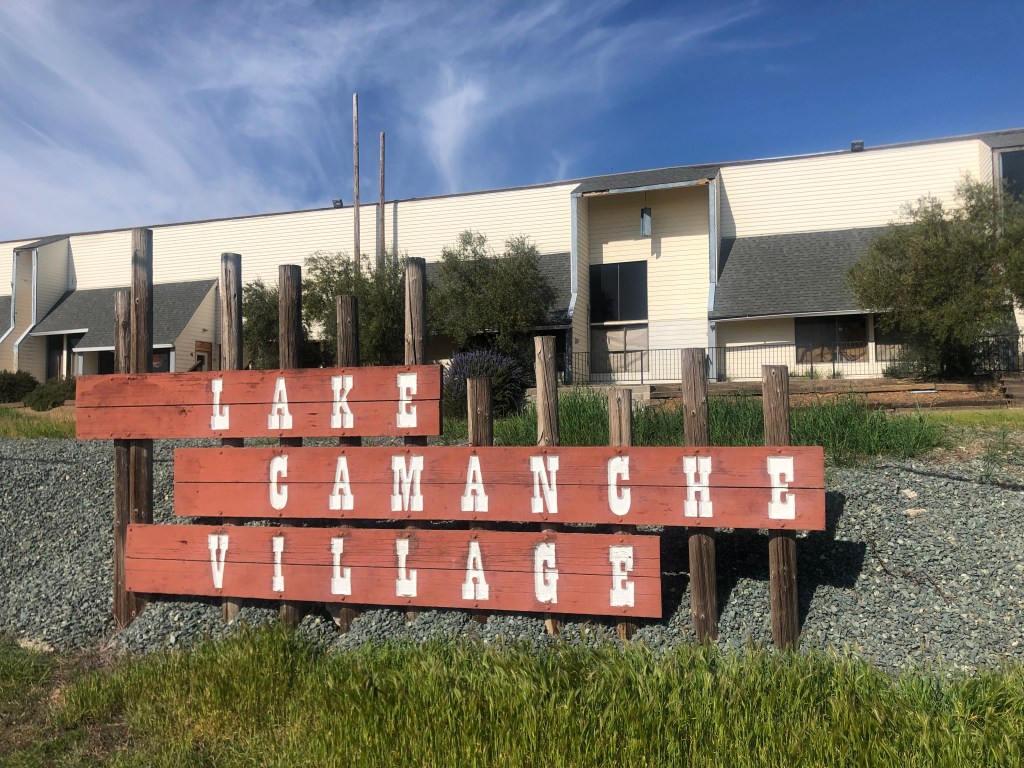
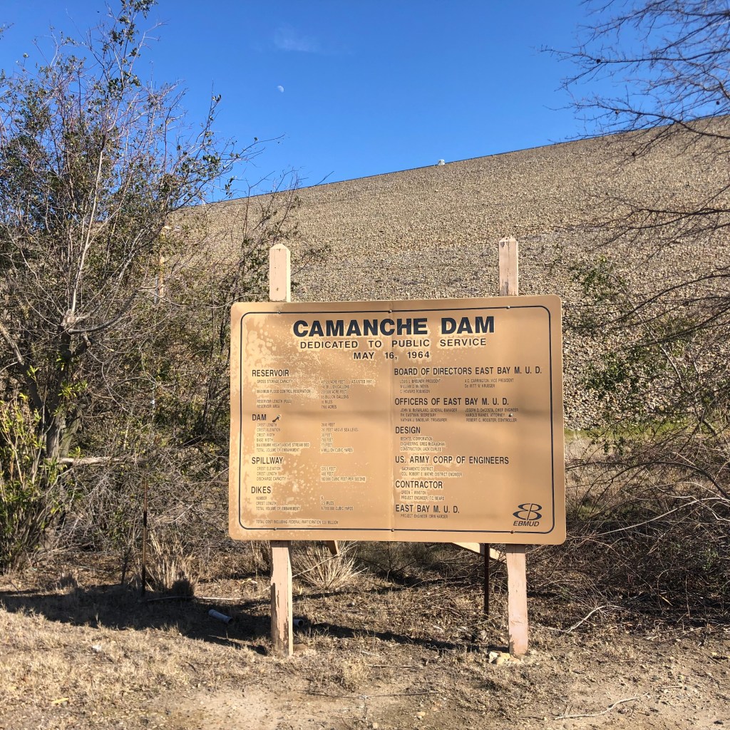
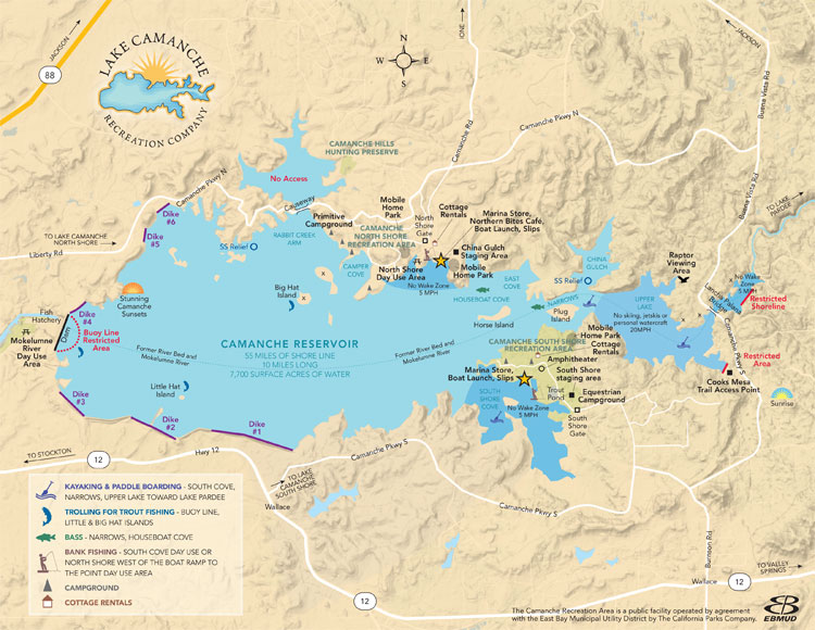
Back when I was a babe (shockingly, no one calls me this anymore), the good folks at the East Bay Municipal Utility District (East Bay MUD) decided to dam the Mokelumne River in the Sierra Foothills, thus creating a reservoir that would supply the growing population of the East Bay with reliable drinking water. They named the reservoir Lake Camanche.
I vaguely remember the too-good-to-be-true commercials, featuring over-excited sport fishermen and giddy children playing at the beach, that were broadcast over the fuzzy UHF stations on our ancient television set in the late 1960s. The commercials sought to entice families to buy undeveloped land that, thanks to the creation of the reservoir, had suddenly become beachfront property. The sales pitches belong to a mildly ineffable class of advertisements that evoke tropical beaches improbably appearing in the shrublands of California’s dry foothills or, say, the deserts of northern Arizona. Here’s a good example of the genre. For an illustration of how these schemes can go wrong, see my post on the Salton Sea.
Anyway, although new communities were springing up on the north and south shores of Lake Camanche, several historic settlements found themselves underwater–literally. By damming the Mokelumne River, East Bay MUD flooded several gold rush towns: Lancha Plana, Poverty Bar, and Camanche. The first two were unihabited ghost towns, but Camanche still had some residents and a functioning post office that had to be relocated. (Camanche had been named by settlers in the 1850s after their home town of Camanche, Iowa.) Today, the towns sit under about 150 feet of water. It’s said that scuba divers occasionally explore the submerged remnants of the old towns.
Now, the Sacramento region has been experiencing unusually warm temperatures this week, feeling more like mid-spring than mid-February. And if that’s not a good enough reason for a retired chap to take a little road trip down to Lake Camanche, I don’t know what is.
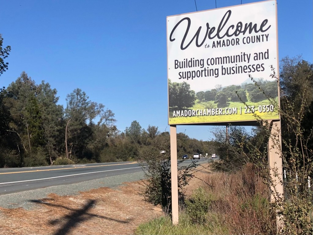
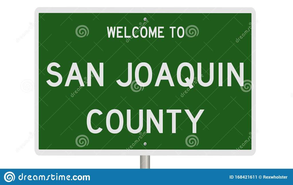
Thus I found myself heading south from my newish stomping grounds near Placerville, down to an area where Amador, San Joaquin, and Calaveras Counties meet. (Most of the trip followed Route 49, which I described in a recent blog post.)
(The San Joaquin sign is clip art; I didn’t actually pass any such sign today.)
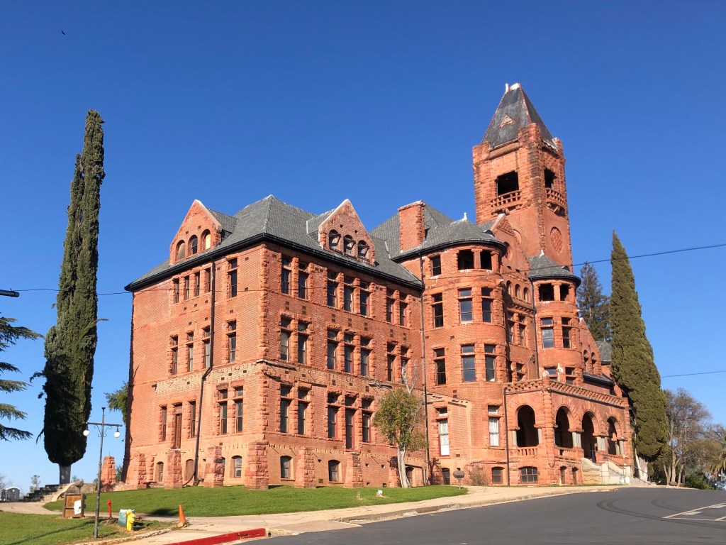
As I got close to Lake Camanche, I passed through the town of Ione (pop: 8,600). It’s a historic, quaint, and reasonably prosperous little community that no doubt will be the subject of a later blog. But for now, let’s just observe that Ione is home to the historic Preston Castle, which had been a reform school for boys that was built at the end of the 19th century. It’s said to be haunted, and for that it will likely be the subject of a blog in October.
You should see it at night.
When I finally arrived at Lake Camanche, I was somewhat disappointed. Let me enumerate the three reasons for my disappointment:
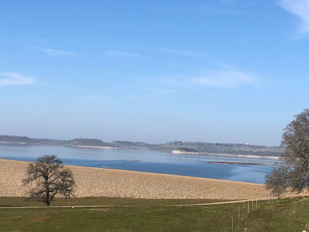
Camanche Reservoir, behind a dike.
There is limited public access to the lake itself. You can pay day use fees to enter at the boat launch, but I couldn’t find any shoreline drive to cruise along. I guess I should have brought a boat.
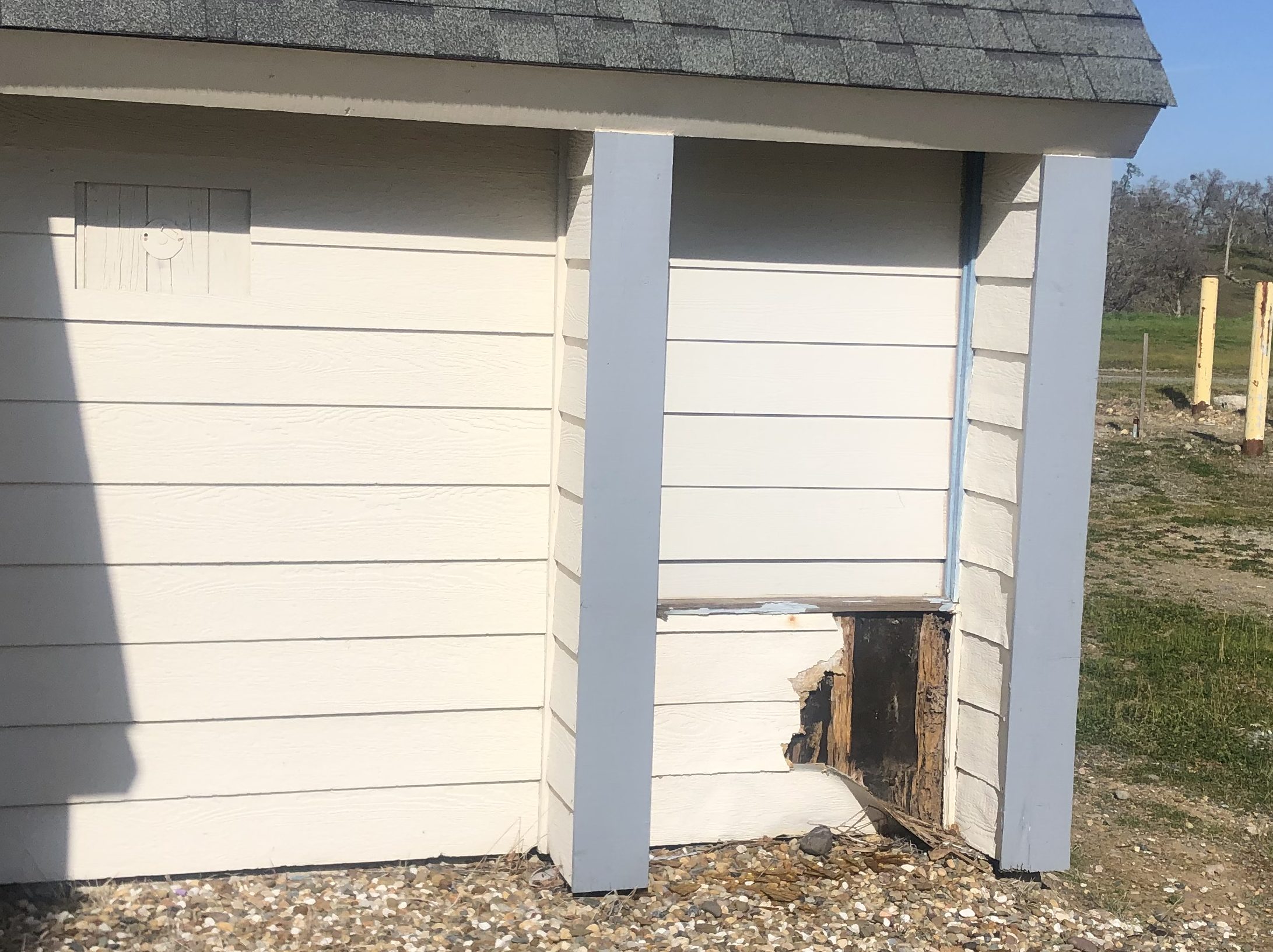
The communities around the lake never seem to have properly taken root. I saw no evidence of viable commercial districts, neighborhood parks, or even a decent brewpub. What little infrastructure I encountered was abandoned and/or decrepit.
Lake Camanche Village has seen better days…
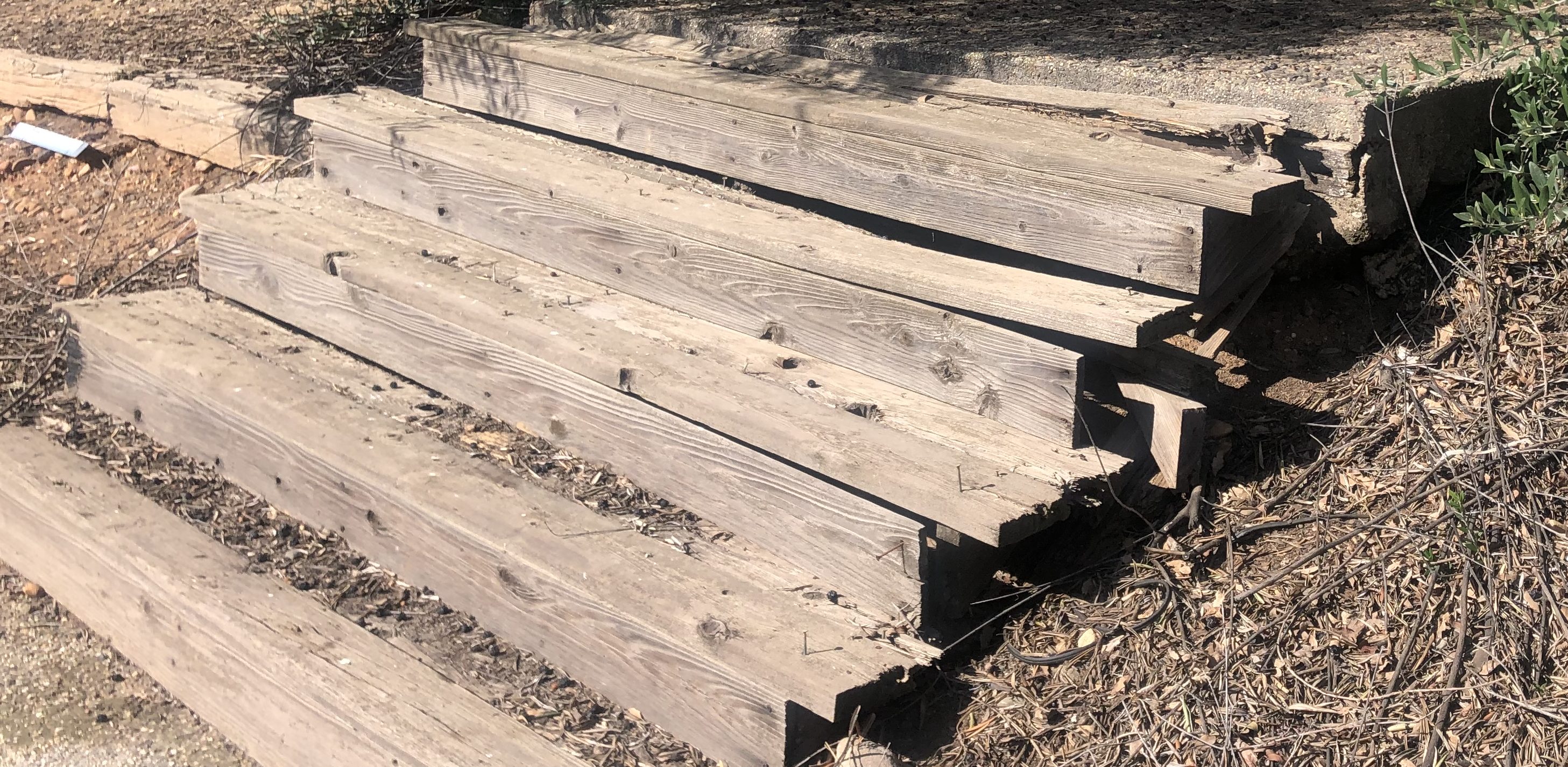
3. Although recent news items spoke of how California’s drought has exposed ruins that normally reside under water, major rains this past December re-covered those historic remains and I was unable to find any evidence of those three historic towns under Lake Camanche.
Somewhere under Lake Camanche
Incidentally, although Lancha Plana had no population when the reservoir was being developed, it did have a cemetery. East Bay MUD decided to move the graves to another location…as if somehow, after over a hundred years, it would be cruel to put a lake over the cemetery. But such are the expectations of civilized society. Let’s just hope they learned the lesson of Poltergeist.
Still, even without encountering drought-exposed ruins, the visit was a good one. I took a pleasant drive more or less around the lake, with glimpses of the blue water and, more often, views of the surrounding hills. Eventually I came to Camanche Dam, which stops the Mokelumne River in its tracks.
A few stats about the dam, which was constructed in 1964: it’s 2640 feet long and 261 feet high, holding back up to 241 billion gallons of water. For those of you who can’t wrap your head around that number, it equates to about 107 billion cases of beer.
Is it just me, or does anyone else think the reservoir is in the shape of a guppy?
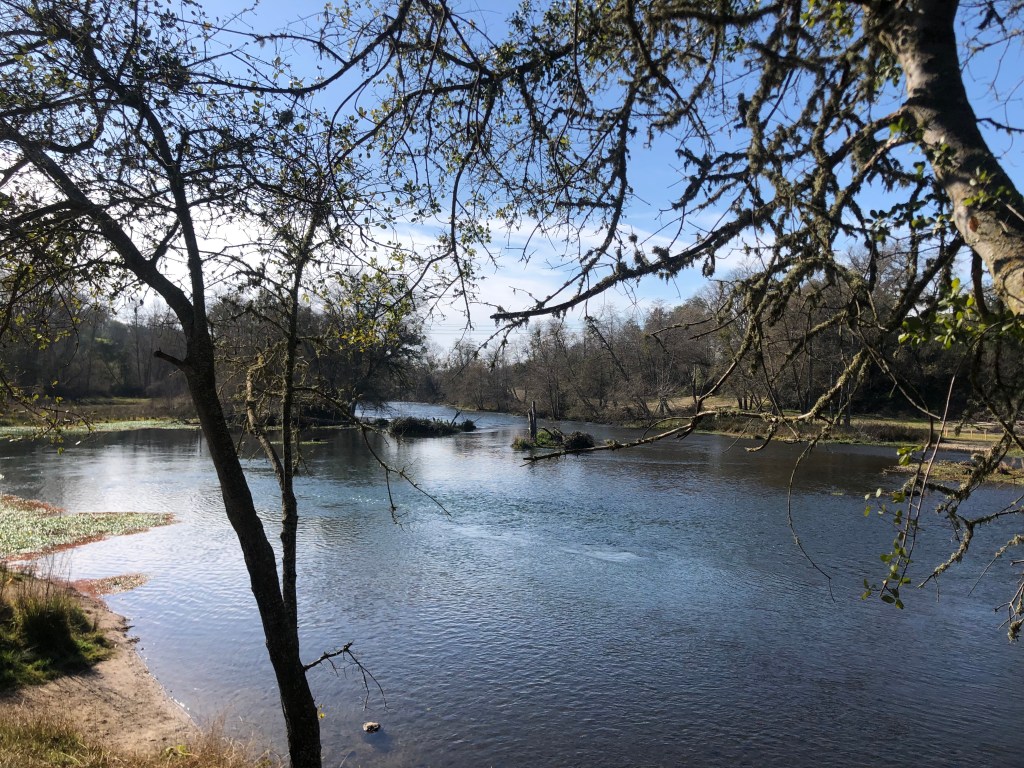
Here’s the placid Mokelumne River shortly after it passes through the dam.
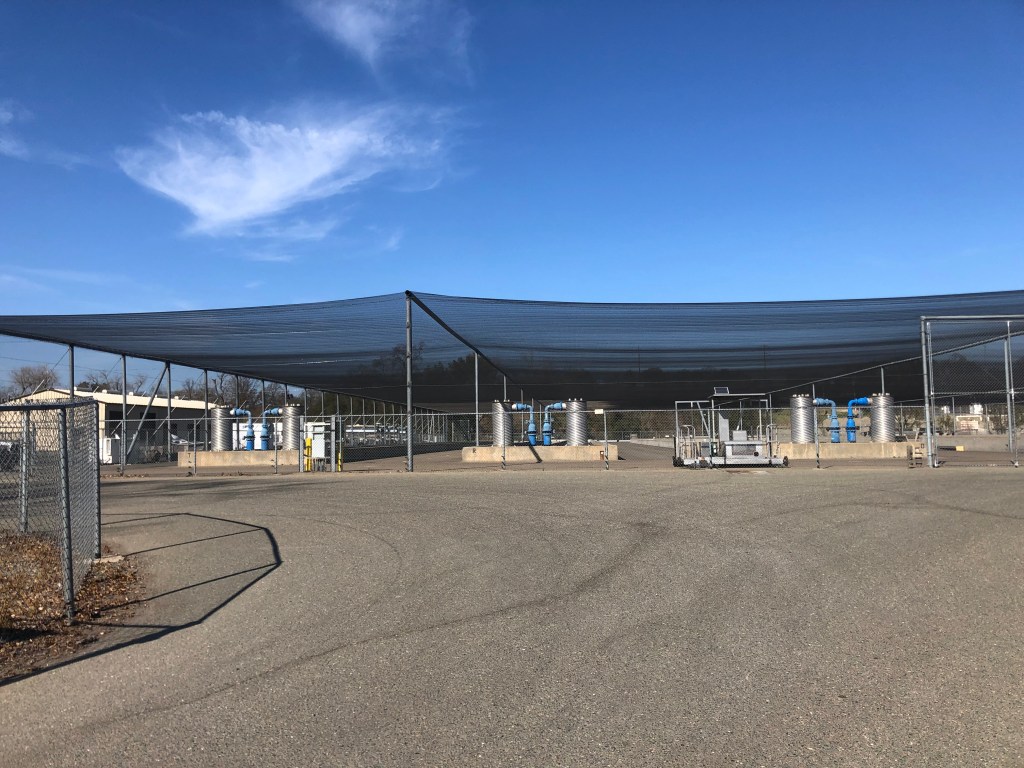
Near the reservoir there’s also a fish hatchery, which is used to restore Chinook salmon and steelhead whose kinky sex lives were impeded by the dam. Sadly, the facility is now “temporarily closed” to visitors.
Mokelumne Fish Hatchery, where salmon get it on. I couldn’t get confirmation on whether they pipe in Barry White music.
Well, that’s kind of it. Without a watercraft or scuba gear, there isn’t a whole lot to do around Lake Camanche. With a final glance at a few anglers attempting to hook, kill, and presumably devour some of the recent graduates from the fish hatchery, I got back on the Speedmaster and headed for home.
So, today is my birthday. I’m not going to dwell on that, other than to note it’s a prime number, and it earned me a free donut. Anyway, I figured that I’m not getting any younger, so I decided to spend the day exploring the back roads of the Sierra Foothills. The region is beautiful this time of year, with its rolling hills covered with deep green grass. And today was unseasonably warm, feeling much more like spring than winter. So I saddled up the Speedmaster and went to see what I could see.
Thank you, Totem Coffee in Placerville!
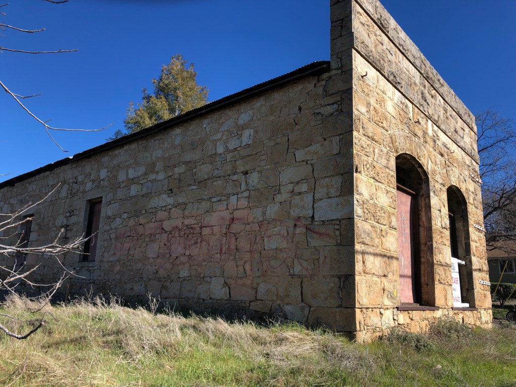
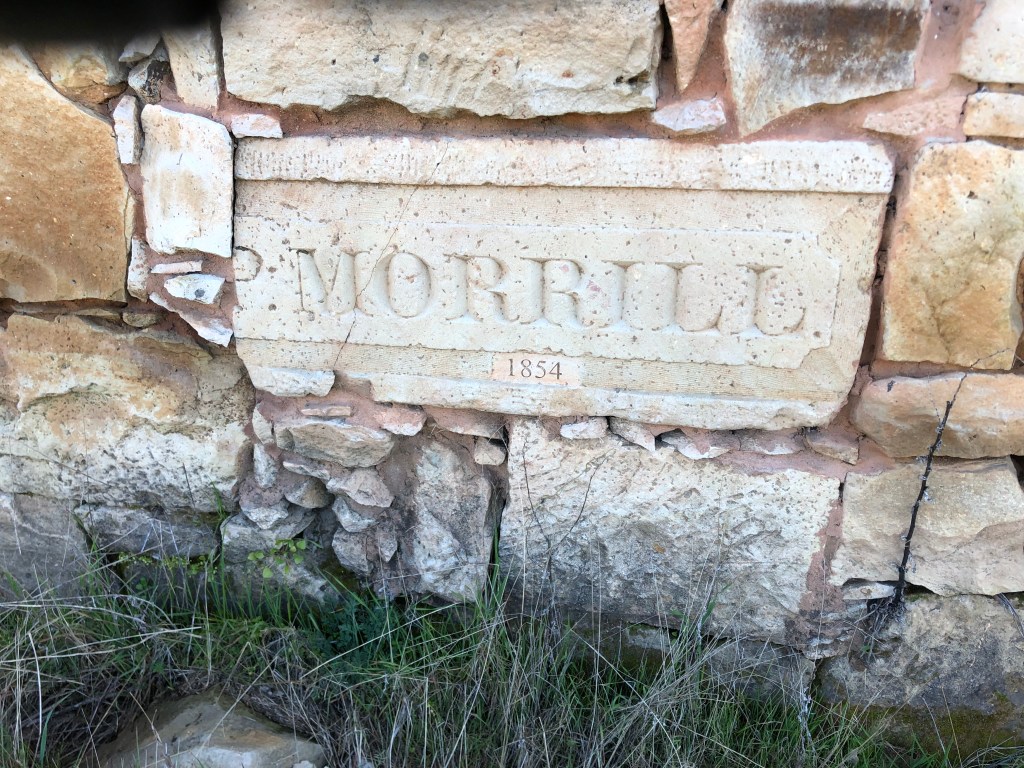
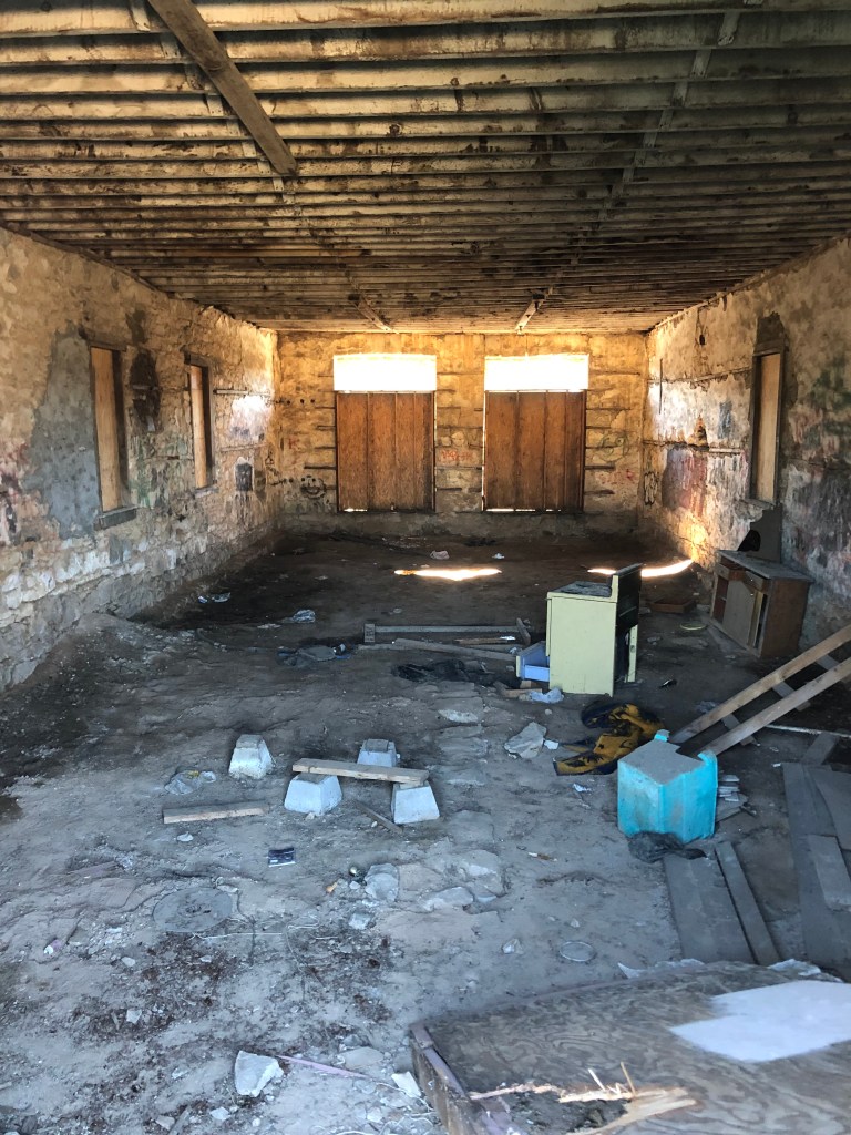
I found myself meandering along CA Route 49–a scenic, historic road that links a number of gold mining towns. (I wrote about an earlier trip along a stretch of it here.) This time I headed south on CA-49, starting around Coloma. I passed through the (relative) metropolis of Placerville, and soon came to Diamond Springs (pop: 11,000). To me, Diamond Springs is one of those gold rush towns that has somehow managed to maintain its historic charm while still being relevant in the 21st century. Its population has more than doubled since 2000. The most attractive business in town, for my money (literally), is Solid Ground Brewing. But the most picturesque building is the old General Store, from the 1850s. It’s for sale or lease, if any of my readers wants an investment property…
Interested? Call University Capital Management at 916-929-5433.Exterior detail of your future lease/purchase.Interior of the building. Like Charlie Brown’s Christmas tree, it just needs a little TLC.
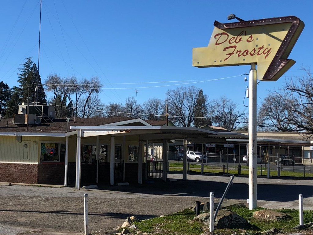
Now, in case you thought Diamond Springs was stuck in the Gold Rush era, it does have some “modern” buildings….from the 1950s. According to Yelp, Deb’s Frosty specializes in Mexican food. (??!)
The go-to spot for Chile Relleno.
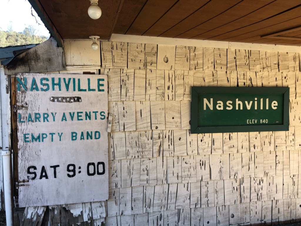
Somewhat further down 49 I entered Nashville. No, not the Nashville. But they do have their own music venue.
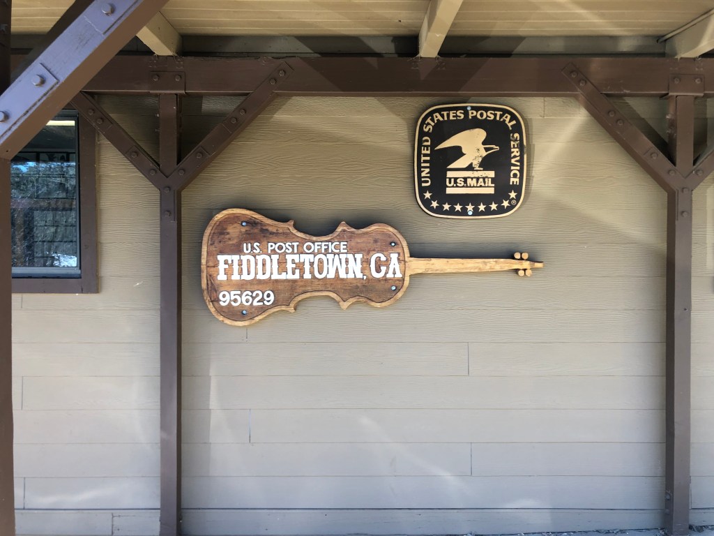
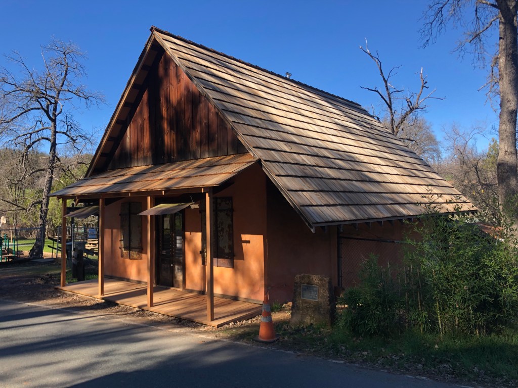
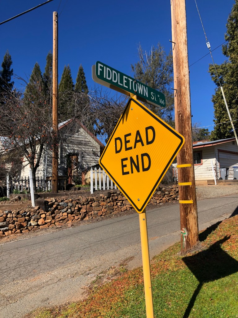
After a few random stops for gas, coffee, and Reeses (it’s my birthday, after all), ended up in Fiddletown (pop: 235). I spent several hours here. Fiddletown dates back to 1849, as do so many of the towns here in the Mother Lode Country. It didn’t start out as a particularly popular place to mine for gold, given that it didn’t have any year-round rivers or streams, which the miners needed for panning and placer mining.
Then, in 1852, gold was found in the region’s dry creekbeds, and everything changed. The town swelled with an influx of prospectors, and a canal was dug to divert water from the Cosumnes river into Fiddletown’s dry creekbeds. Not only did this facilitate easier gold mining, but it also opened the region to agriculture. By 1854 Fiddletown’s population exceeded 2000 souls.
With growth and wealth came the desire for respectability, which for some required changing the name to anything but “Fiddletown.” (It’s unclear where the original name came from, but one story suggests the original settlers from Missouri enjoyed playing fiddles in their spare time.) In any event, a decision was made in 1878 to change the name to “Oleta,” which was the name of a prominent resident’s daughter. Fortunately for those of us who appreciate local color, the original name was restored in 1932.
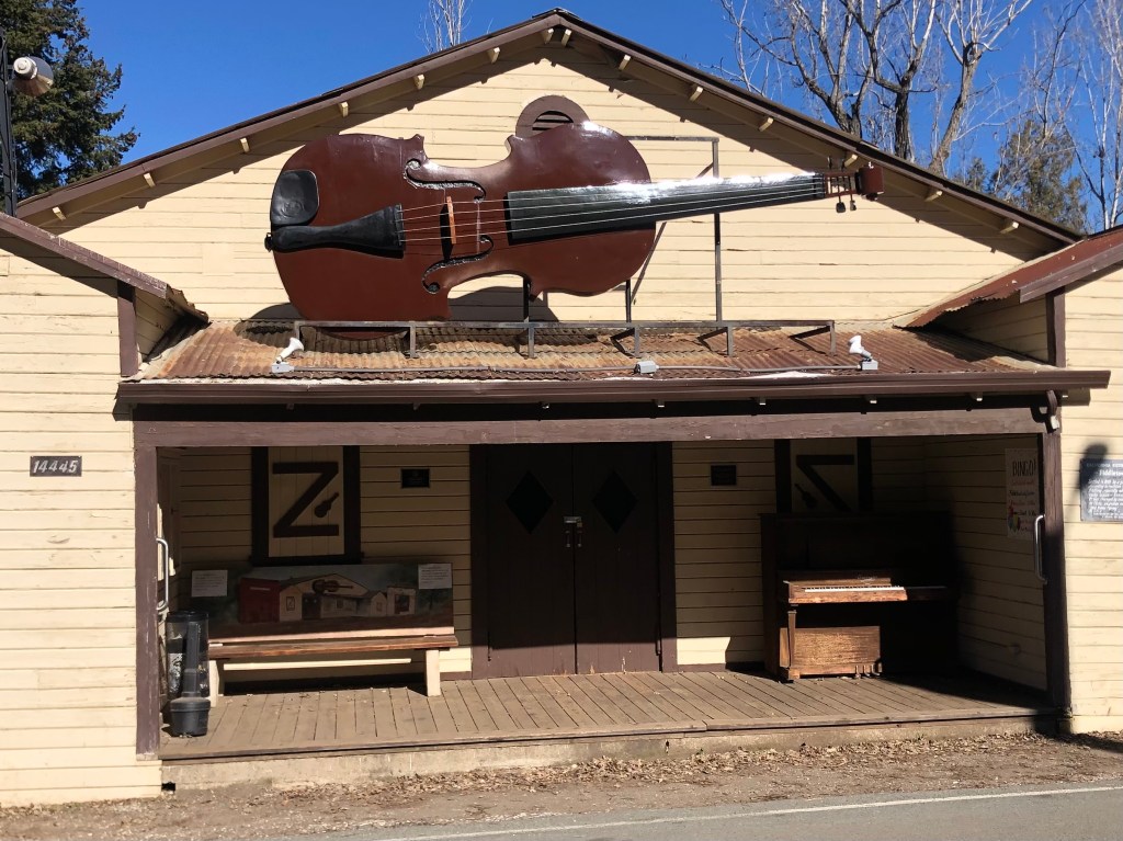
At some point, the town so embraced its name that it erected a huge fiddle over the community center. I’m told that there have been several iterations of this instrument. The latest version is made out of fiberglass.
It’s not a vile inn. It’s a fiddle.
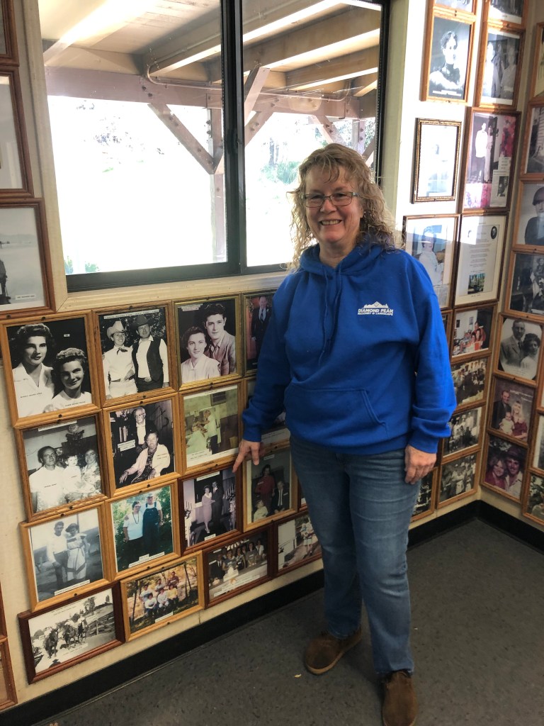
How do I know this? Because Michelle told me. I ran into Michelle at the town’s post office. The walls of the lobby are lined with historic photographs of the town’s residents, and I was perusing them when Michelle walked in to get her mail. There are literally hundreds of photos, so I asked her, “Is every resident in town pictured here? Where’s your photo?” She matter-of-factly told me that the post office ran out of wall space long ago, and replacing an old picture with hers “would require permission from the Post Mistress.”
Another Fiddle
Michelle then spent the next 20 minutes pointing out pictures of friends and relatives on the walls. She grew up in Fiddletown, and says it’s an wonderful place to live. She used to rollerskate in the community center (where the big fiddle is), and knows most of the residents. However, she said the town’s recent growth has made it difficult to keep track of everyone.
Michelle pointing to her grandparents’ wedding photo.
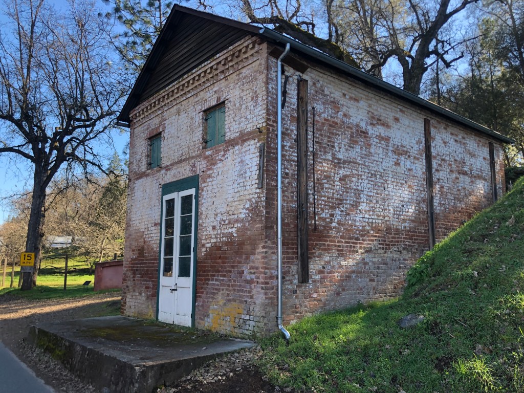
At some point Fiddletown became a major enclave for ethnic Chinese folks–in fact, for a time it boasted the state’s second-largest Chinese population, after San Francisco. Along the main street there are several well-preserved buildings that speak to the town’s Chinese heritage: A general store, a gambling hall, and an apothecary.
General store, built circa 1850.The “Fortune Peaceful Gambling House,” built circa 1852. It’s said that not only gambling but other vices–involving young women that weren’t your wife–took place within these walls.Apothecary, built from “rammed earth” in 1851.
The apothecary also serves as a museum (which, sadly, was closed when I visited). It contains personal effects from over 100 years of continuous habitation by Chinese “herb doctor” Yee Fung Cheung, his successor Chew Kee, and Chew Kee’s adopted son, Jimmie Chow. Jimmie Chow lived his entire life in Fiddletown, and was the town’s last Chinese resident when he died in 1965. Notably, Michelle (whom I’d met at the post office) had met Jimmie in the early 1960s. Her father and she took some fish heads to Jimmy’s house for his fish head soup. Michelle had thought it was a joke until she watched Jimmy add the heads to his soup pot. (If you’re interested, here is a recipe.) Michelle told me she was fascinated by the home/apothecary, and all the unusually artifacts therein.
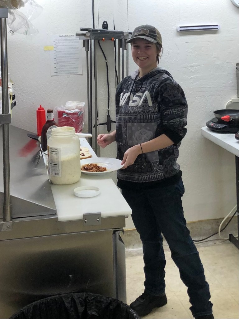
All this talk of fish heads was making me hungry, so I figured I’d scope out a place for lunch. There is exactly one place in town that will serve you a sandwich, so that made my choice easy. Improbably, it’s the Brown’s English Toffee store on Main Street. A young woman named Kailey, who’s been working there for the past two months, took my order. After a few false starts (they were out of the meat and the bread that I wanted. But other than that, they had just what I wanted for a sandwich!), she managed to produce a pulled pork sandwich with cole slaw.
Would you like mayo on that? I have plenty…
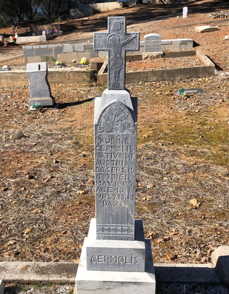
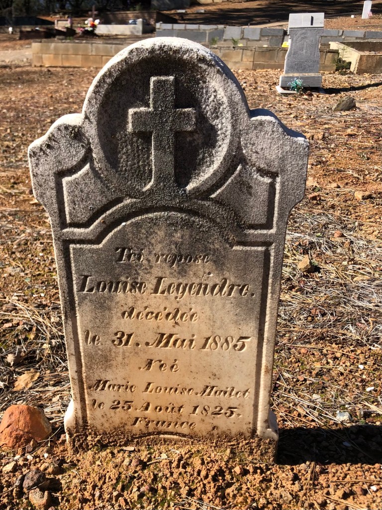
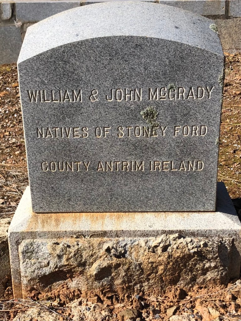
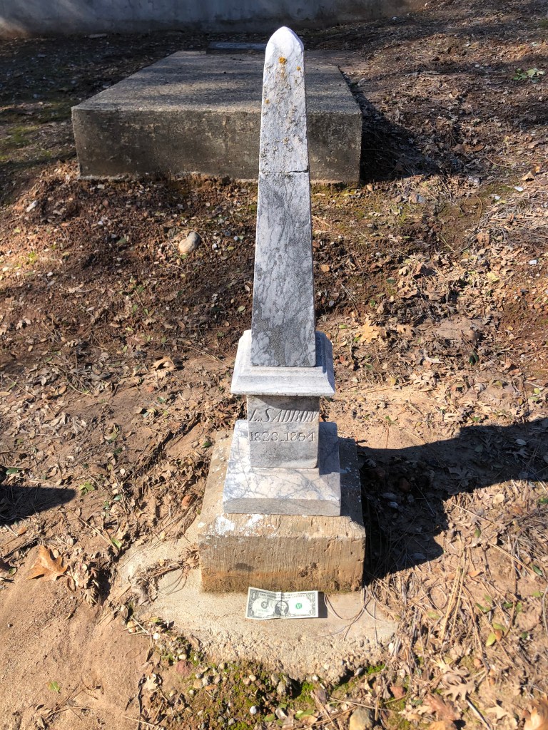
It was now time for my traditional cemetery visit. The Fiddletown Cemetery was established in 1870, and is the final resting place for a broad swath of humanity. The headstones offer testimony to the large number of countries from which the 49ers hailed:
Austrian, French, Irish….
And of course there’s an obelisk. This is tiny (see the dollar bill for scale). They couldn’t even fit on the poor guy’s first name!Everyone has an angle…
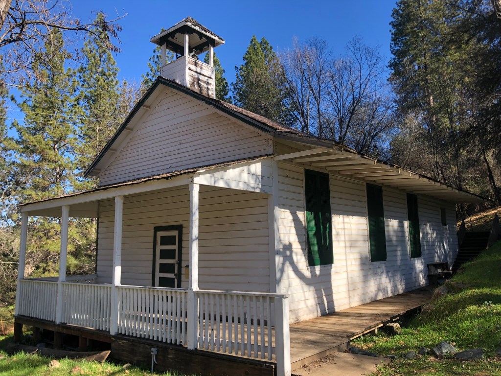
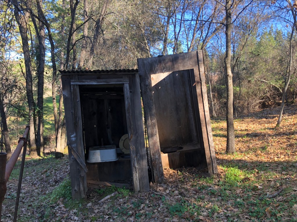
Across the street from the cemetery is Fiddletown’s historic one-room school. It was constructed in 1862 and was in operation until 1955, when the area schools were consolidated and relocated to the nearby town of Plymouth. The school had no running water, and featured outhouses (which are still extant) in the back.
The Schoolhouse….…and privies.
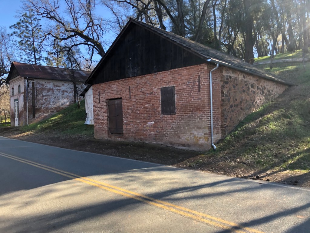
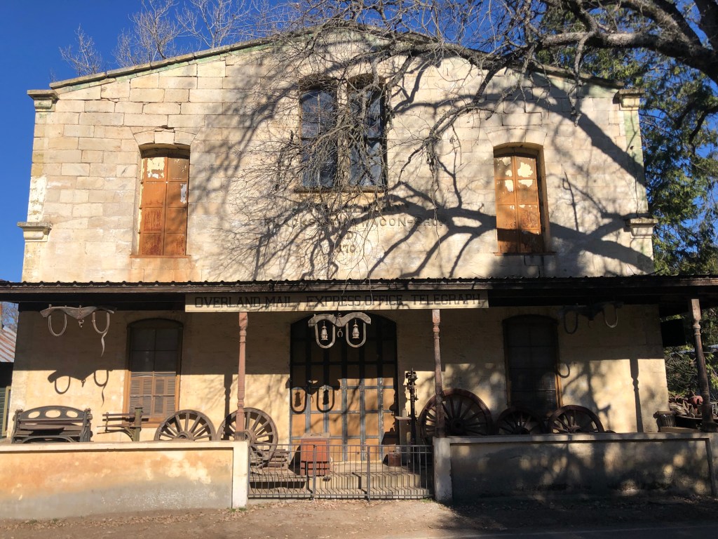
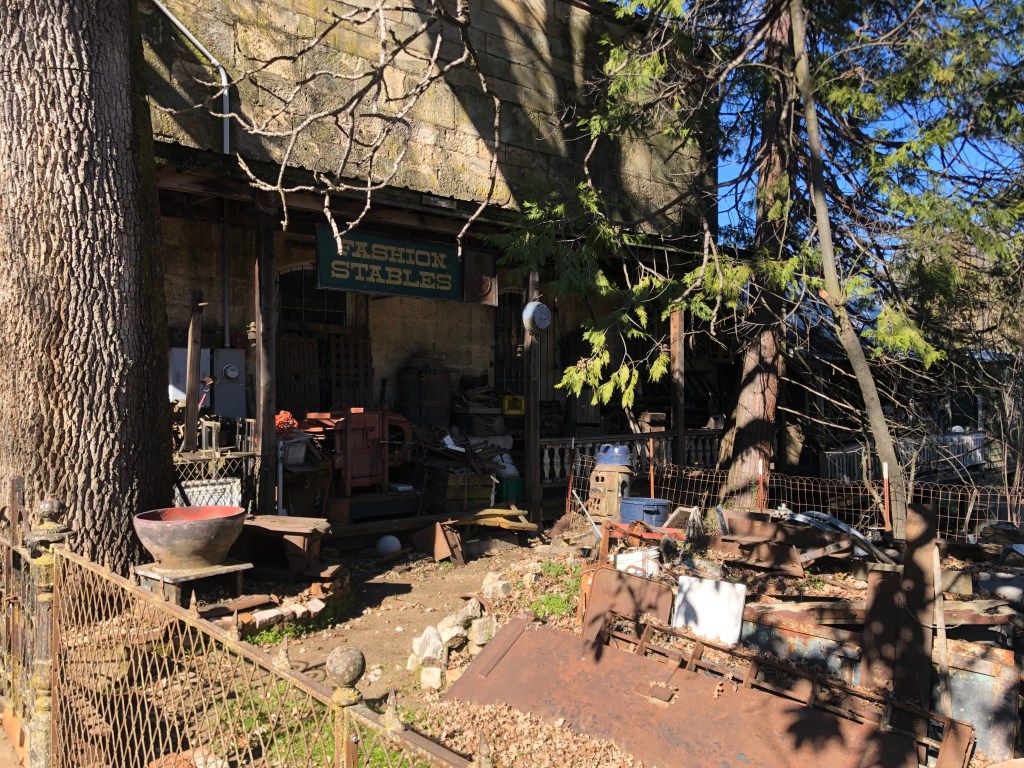
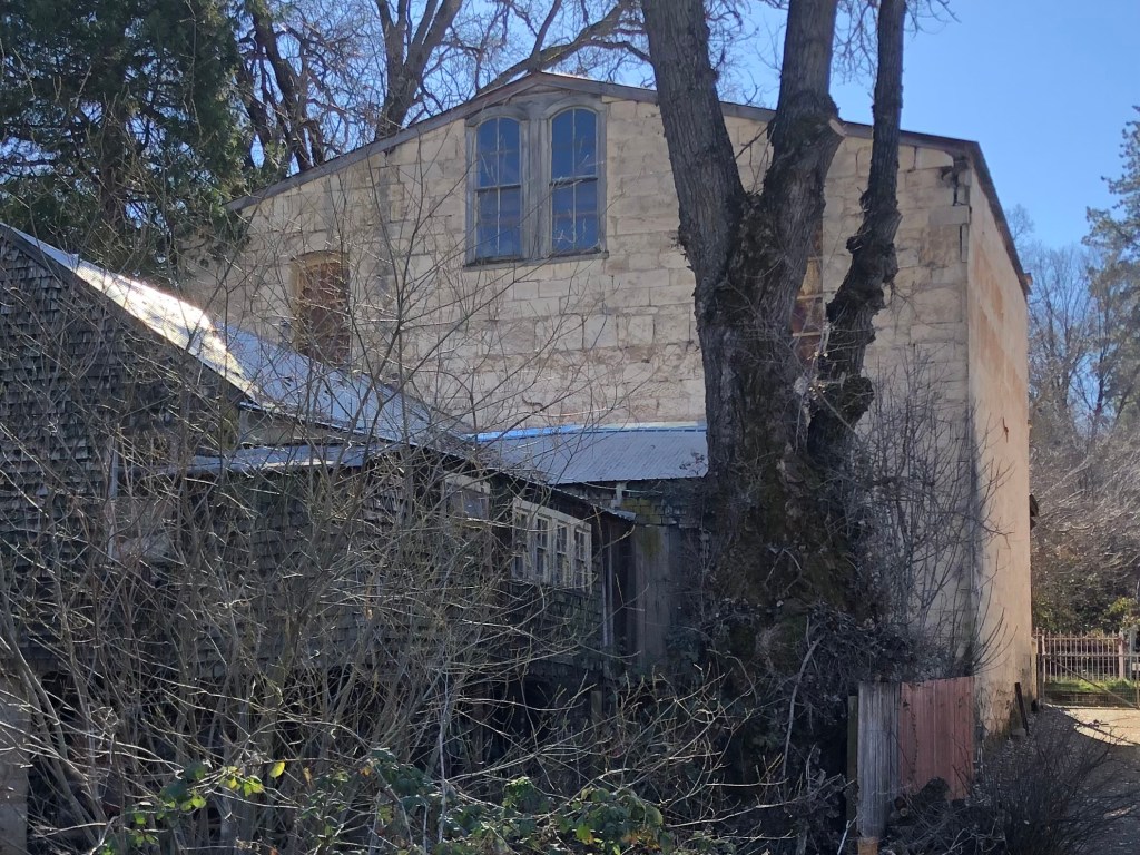
One other notable structure is the looming Schallhorn building, built in 1870. It was a long-time blacksmith’s shop and wagon repair facility, as well as a telegraph office and mail stop. Today it appears to be the site for accumulating various historic artifacts. The front porch is littered with wagon wheels, metalworking equipment, a safe, a old ovens, even a small railcar. Heaven knows what’s inside the massive building itself!
Front o the SchallhornMore junk on the sideBack view
It was beginning to get late, so I decided to head back home. One of my final glimpses of Fiddletown suggests a story that I honestly don’t really think pertains. If you ask me, I think this place has a future.
Unfair intimation.
So, that was my trip to Fiddletown. I managed to get home in the afternoon without incident. I wish you all a very happy Steve Boilard’s birthday. I suggest celebrating with the high-gravity imperial stout of your choice.
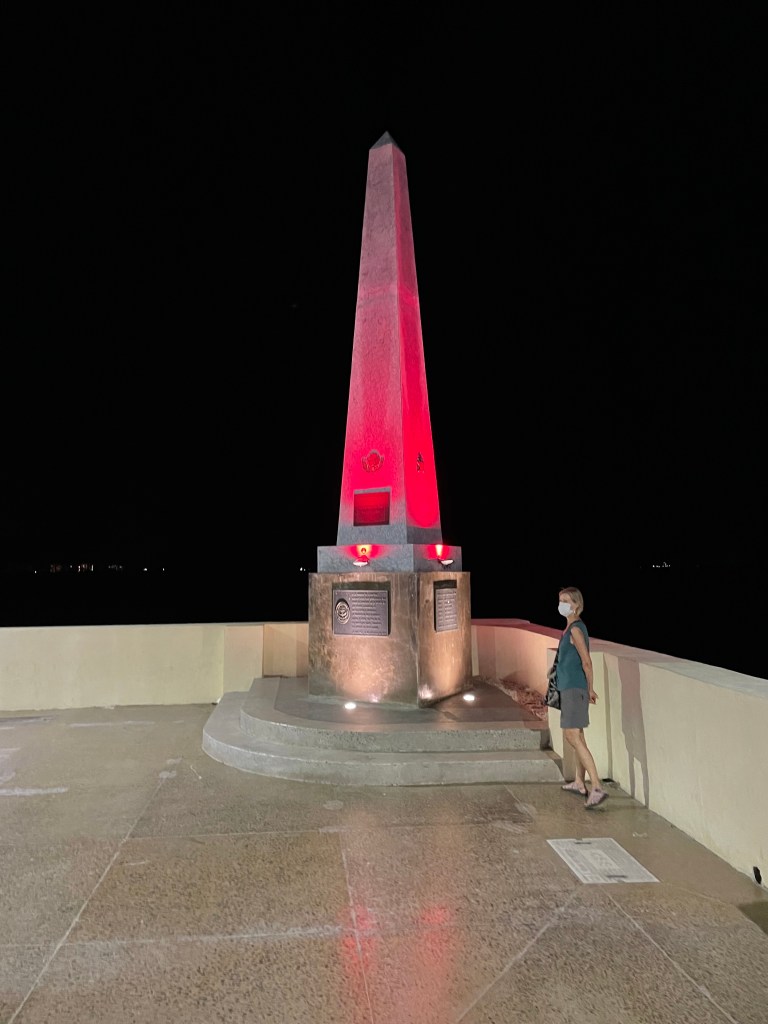
Loyal reader Brian W. recently shared this photo he took of a technicolor obelisk in La Paz, Mexico. He reports that the obelisk is a “memorial to the defenders of the homeland,” but he admits that his Spanish is a little rusty and it might actually commemorate the birthplace of disco.
This not the largest obelisk to appear in this blog, but it’s certainly the most colorful (at least, it’s decorated with a colorful light).
Send in your obelisk photos to keep this blog alive while our road trips are on hold during the winter.