bridges · California history · cemeteries · Road trips · trains

The Placerville Chronicles–Day 1

This morning I picked up my rental car in Placerville, California, and headed in the direction of Placerville, Colorado–some 900 miles to the east. (For those coming late to this story, the details are here.)

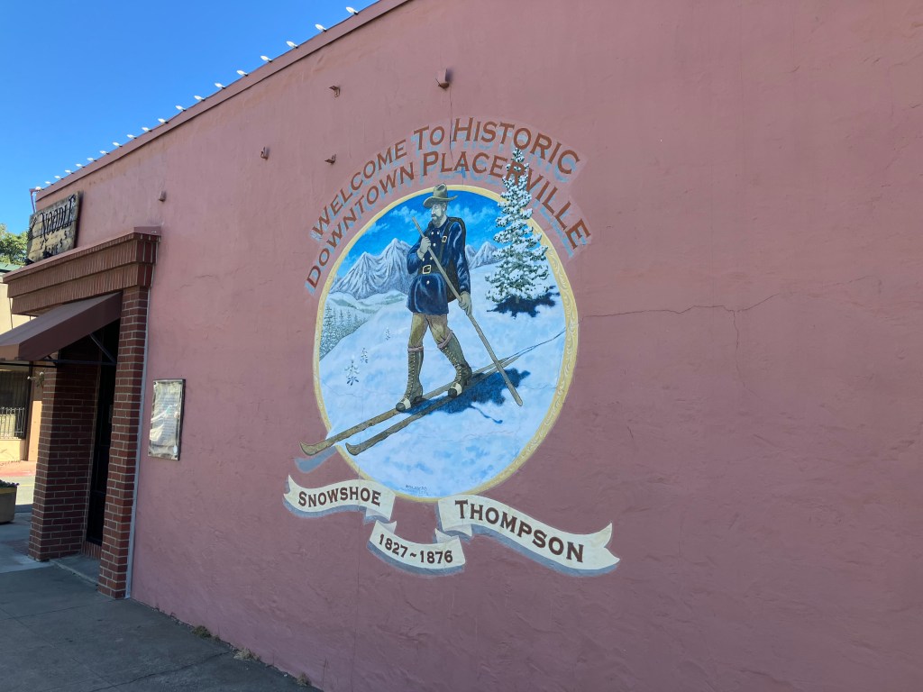
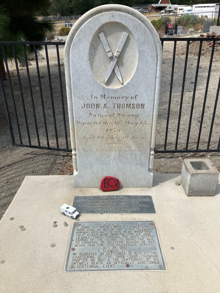
As I left Placerville I passed this mural that honors John Albert “Snowshoe” Thompson, a Norwegian immigrant who settled in Placerville in the mid 19th century. Every winter for 20 years (1856-1876) he made a twice-monthly trip over the Sierra Nevada range to deliver the mail. He made the 90-mile trek on skis (despite his “Snowshoe” nickname) from Placerville to settlements in Nevada.

Unlike Snowshoe Thompson, I chose an easier passage over the mountain, driving a Nissan on US 50 over Echo Summit. I ended up in a little tourist trap of a town called Genoa, NV (pop: 1,300). Genoa brags that it’s the oldest settlement in Nevada…but I was struck by something that’s more relevant to this journey: Genoa was the eastern terminus of Snowshoe Thompson’s mail delivery route. And they have a statue to commemorate the fact.

Snowshoe Thompson, doing his Gorton’s Fisherman impression.

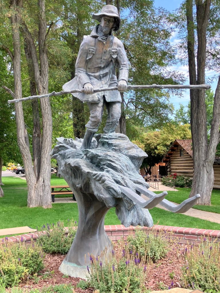
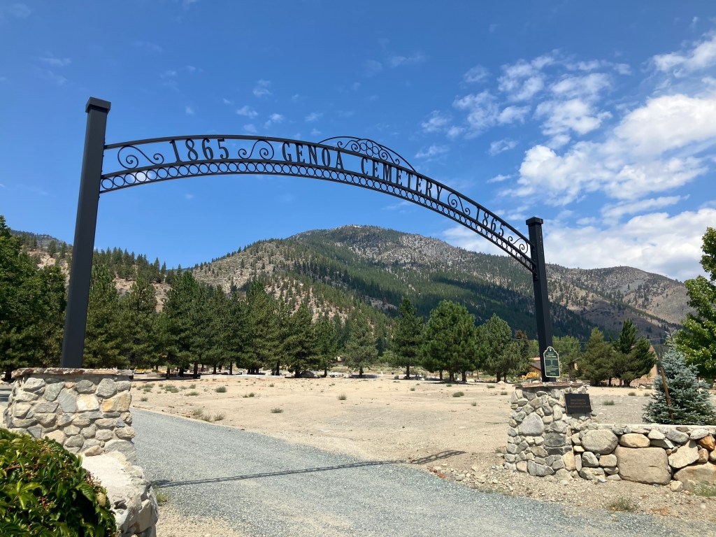
At some point Snowshoe Thompson moved his residence from Placerville to Genoa. In fact, Genoa became his final resting place.

The Postman Resteth.
Those pruning shears on the face of his tombstone presumably are meant to be skis. But who knows, given the misspelling of his last name.

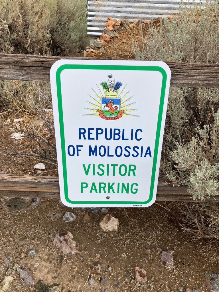
Having appropriately honored this (quasi-)native son of Placerville, CA, it was time to continue my journey toward Placerville, CO. To do this, I passed through the “independent and sovereign nation” of Molossia.

What, you’ve never heard of Molossia? Neither had I. But it seems that there are about 11 acres of land in the town of Dayton, Nevada, whose owner (Kevin Baugh) has declared to be a sovereign nation. Molossia claims to have its own currency, postal service, navy, railroad, and various other trappings of a proper nation. President Baugh does have to pay property taxes to the county assessor, but he calls this “foreign aid.” Molassia’s back story is actually quite interesting and entertaining; if you’re interested, you should check their Wikipedia entry or their actual website.

The president of Molossia is very clear that you need to arrange your visit ahead of time. So a few weeks I emailed His Excellency, and got this response:

Steve, Greetings, and thank you for your interest in visiting our nation as a part of your travel blog. It is an honor.

I regret that we will be unable to host your visit to our nation on that date. … There are other events and activities taking place in Molossia on those dates, thus we will not be able to welcome you to our nation. My apologies.  Hopefully you will make it back out this way on a future tour date and we will be more than happy to welcome you to Molossia then.

Regards,

His Excellency President Kevin Baugh
Republic of Molossia

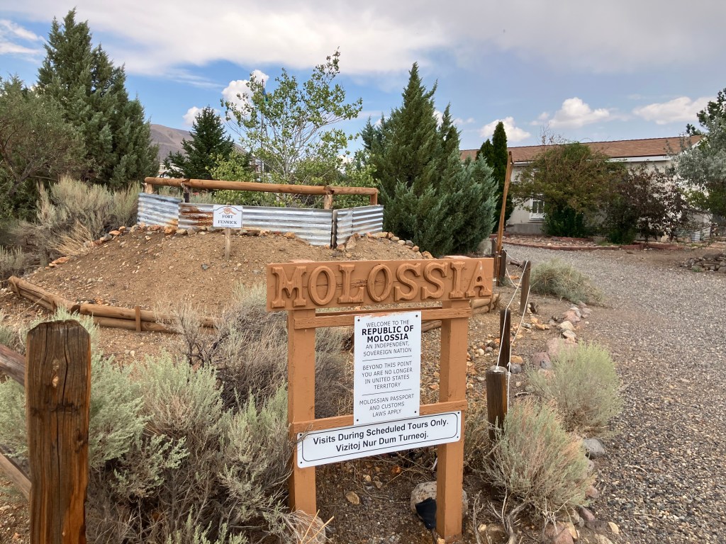
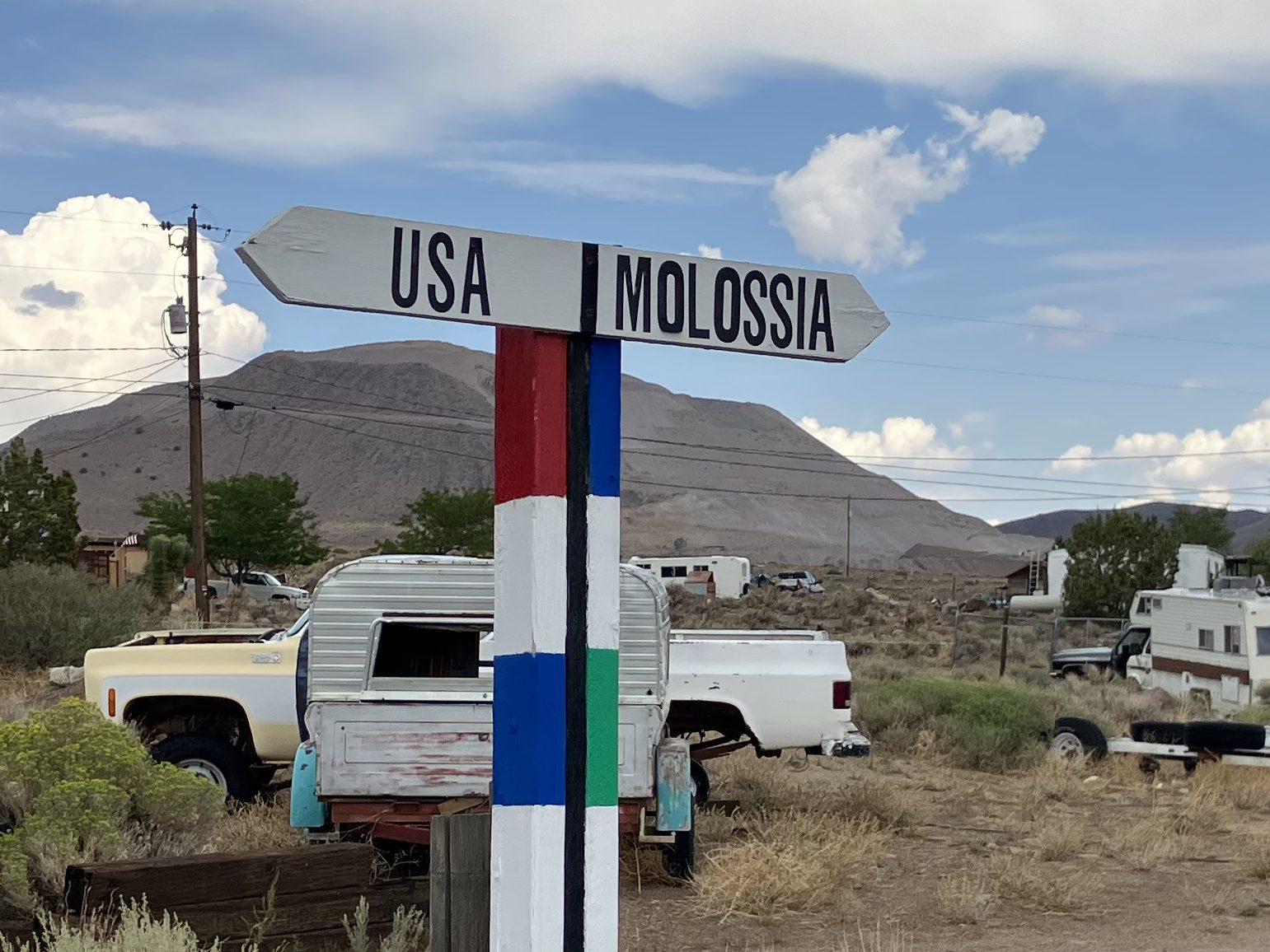
Undeterred, when I came to Dayton I drove up to the border of Molossia. Conveniently, there was an open parking spot.

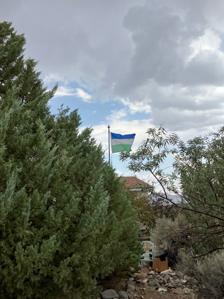
The Molossian flag was flying proudly, and a sign made clear that I was indeed about to leave the United States.

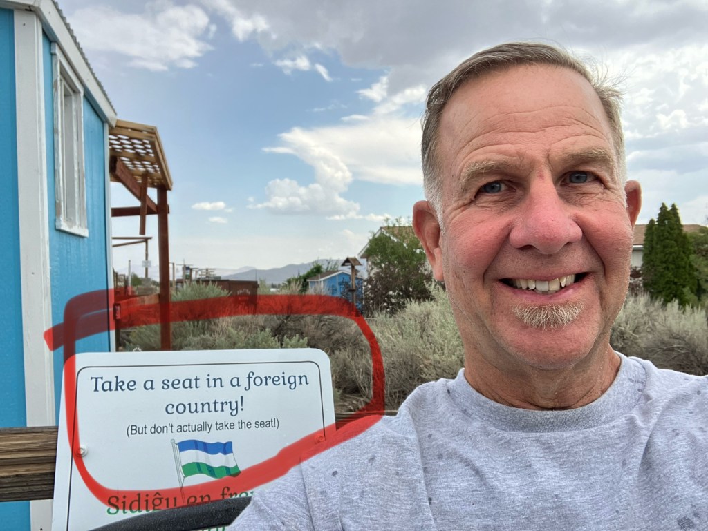
A sign next to a bench even invited me to “take a seat in a foreign country.”

Despite my inability to secure a reservation, I decided to approach the customs building. Alas, it was locked up.

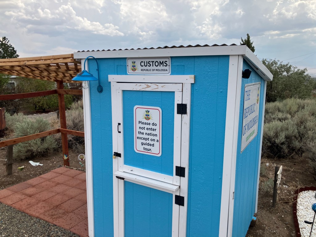
So I had no choice but to follow the signs back to the United States.

I plan to try to get on Molossia’s official tour list for 2026. When I have a date, I will announce it on this blog in case any of my loyal readers want to join my delegation. But for now, I had to bid a sad farewell to Molossia.

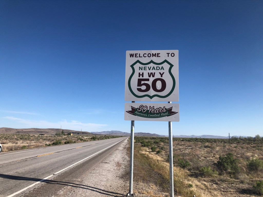
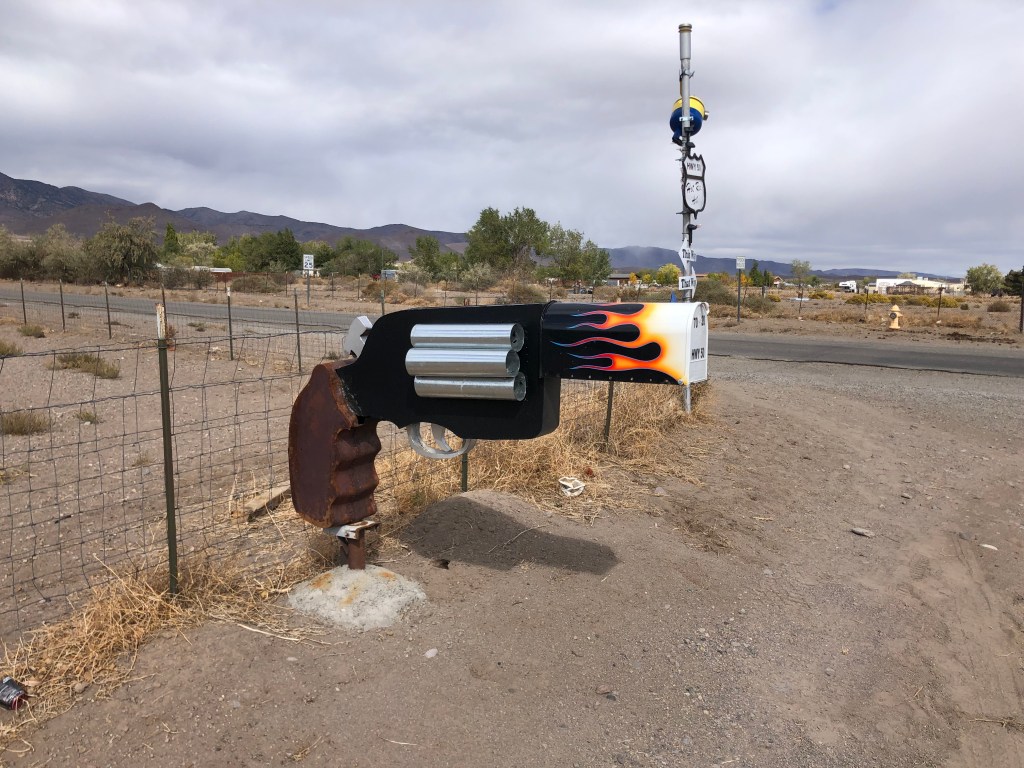
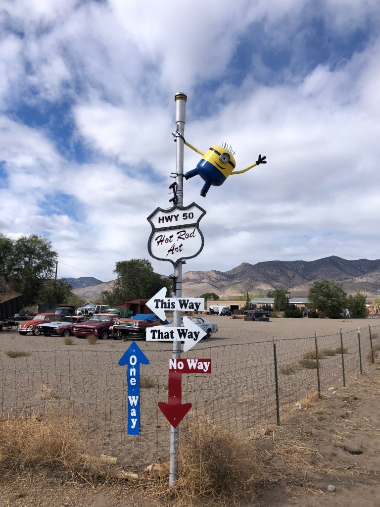
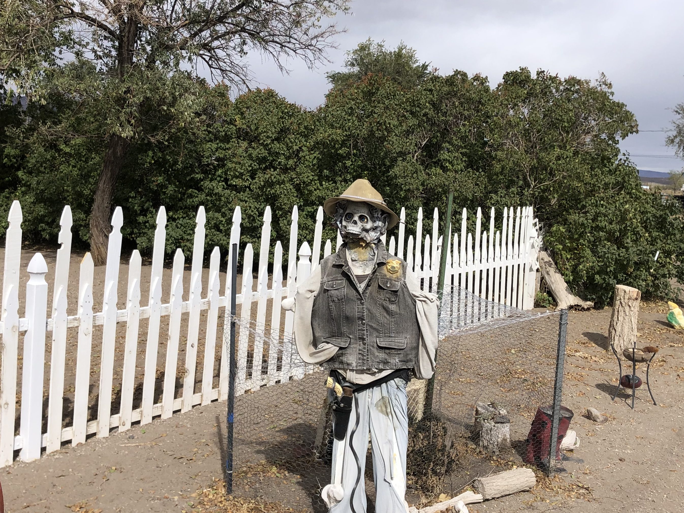
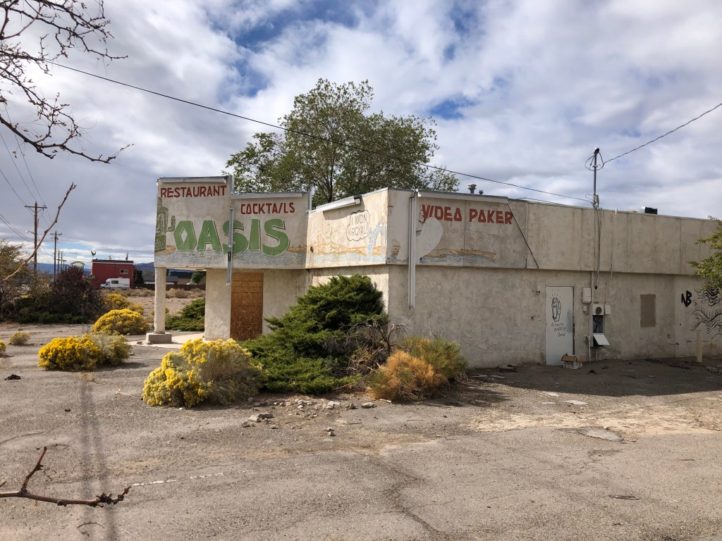
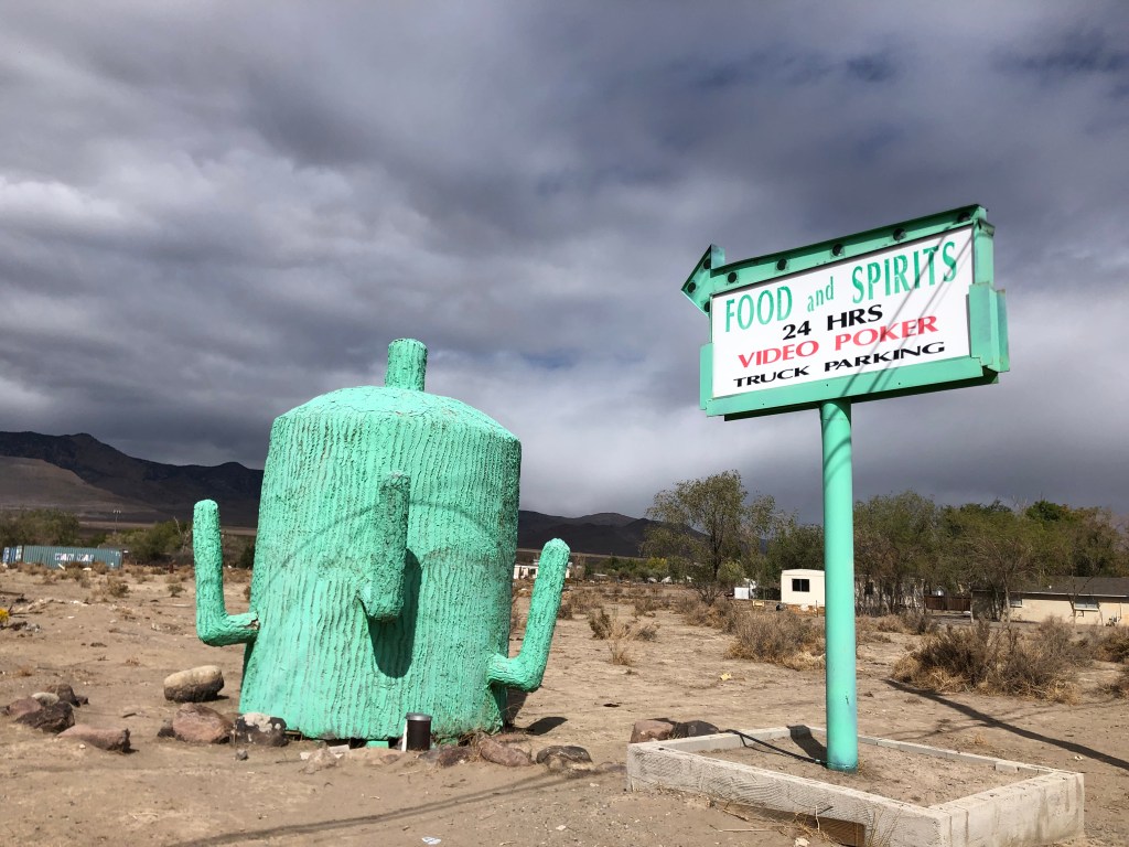
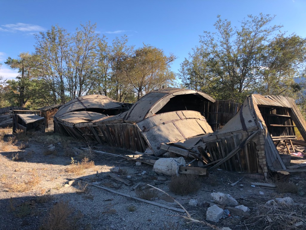
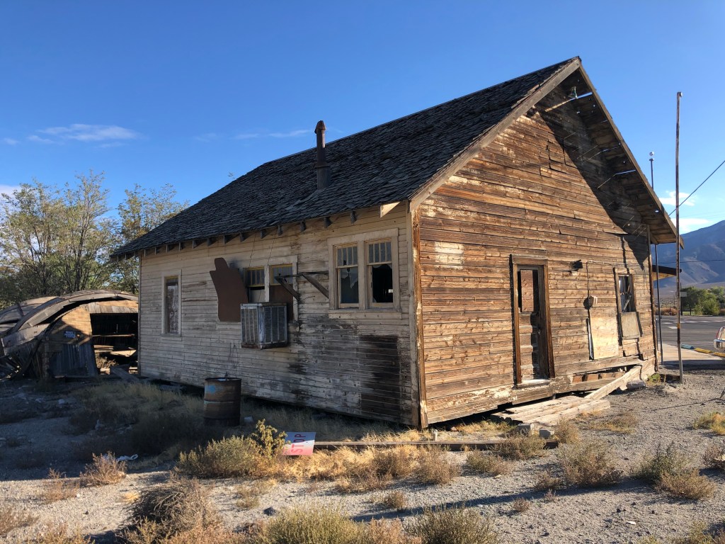
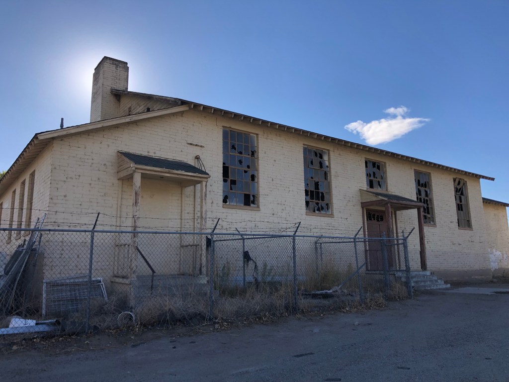
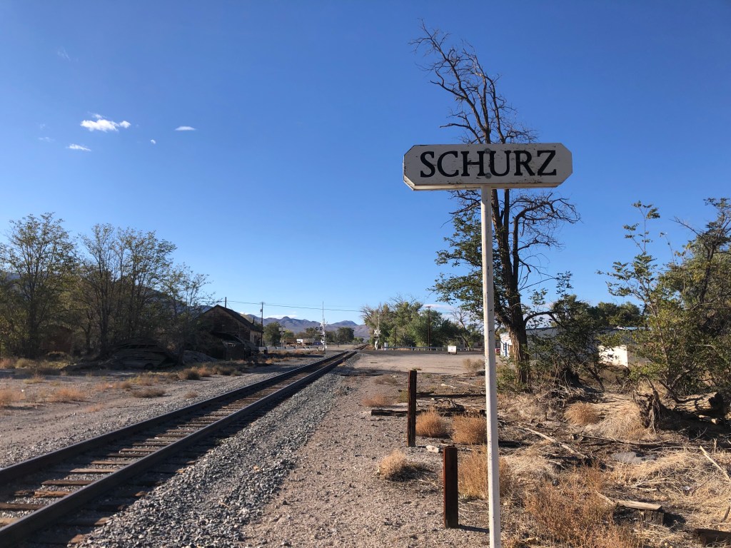
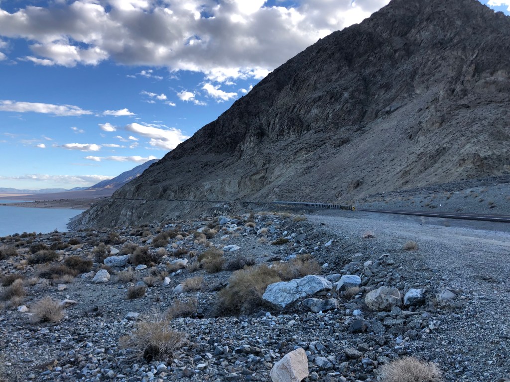
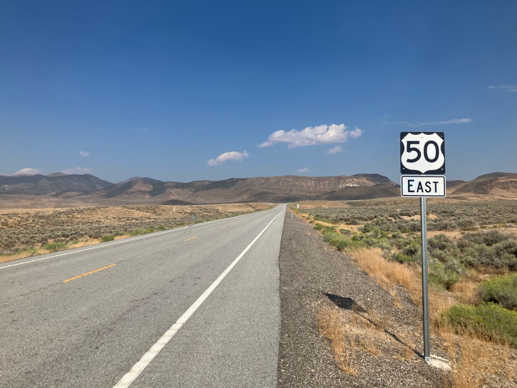
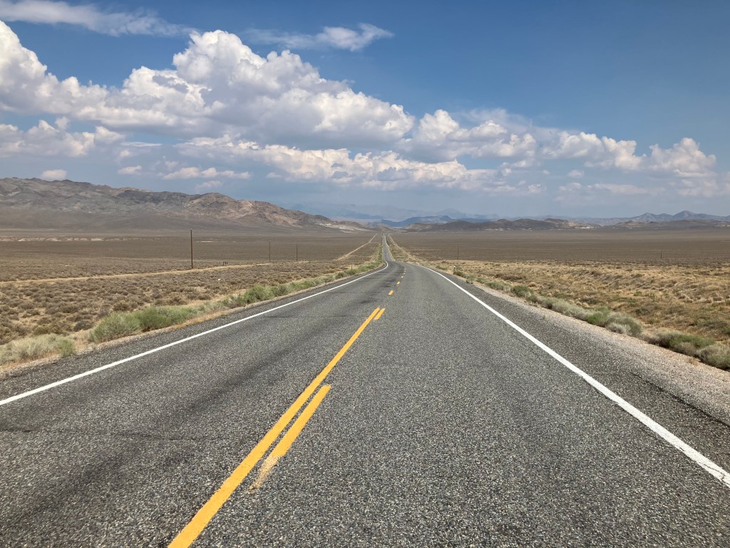
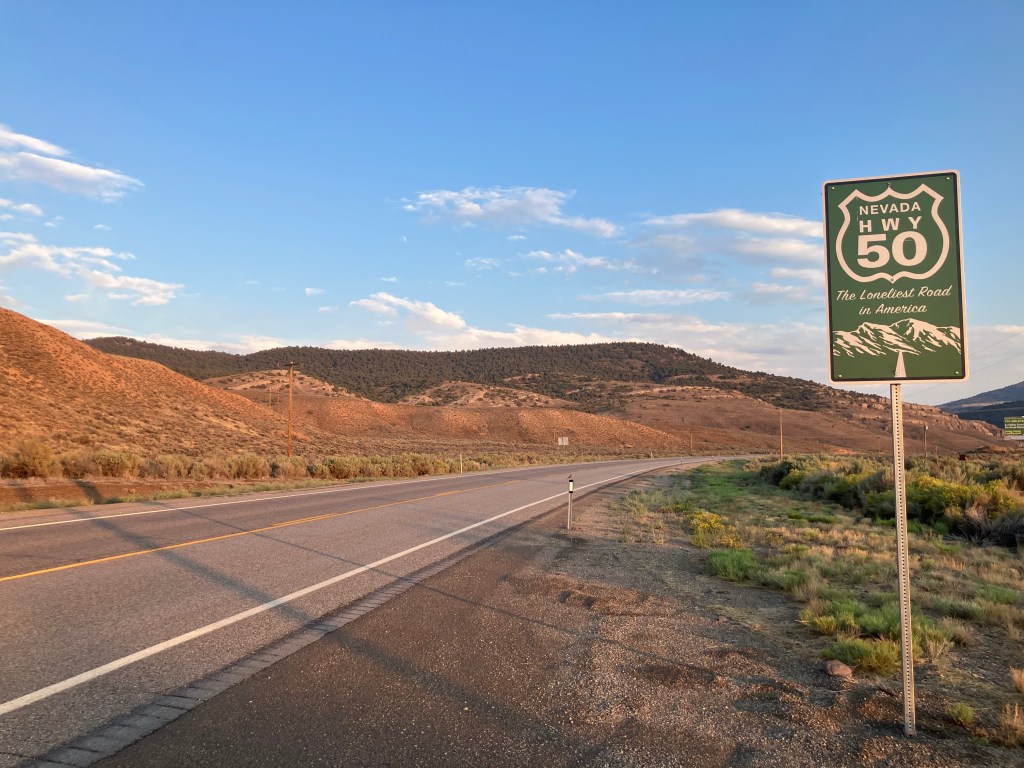
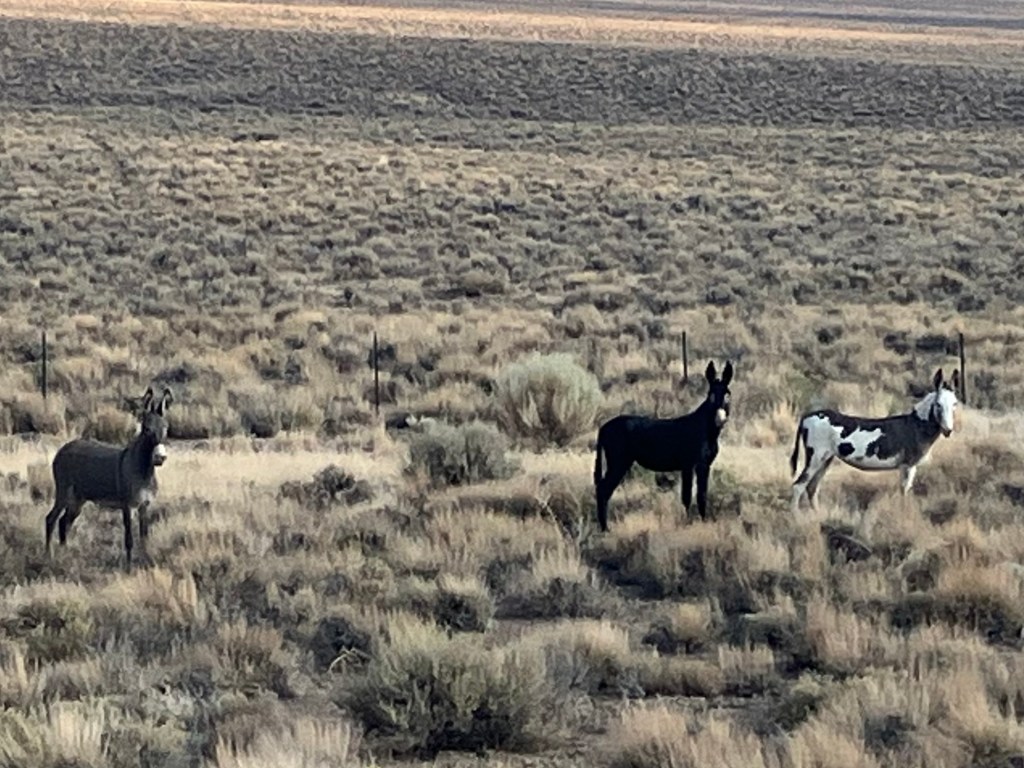
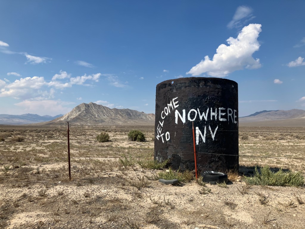
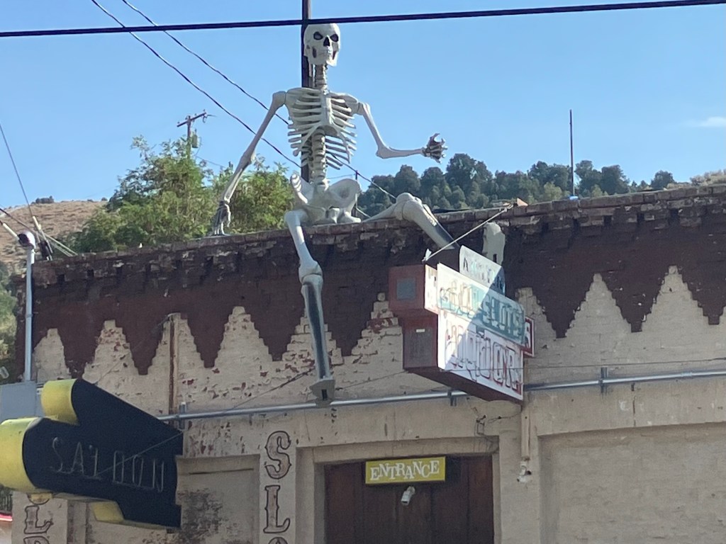
Almost all the remainder of today’s journey involved traveling US 50 across Nevada’s enchantingly bleak Great Basin. This stretch of highway is often called “The Loneliest Highway in America.” I’ve driven it several times (see my blog post here) and I always find it to be relaxing and contemplative. Today was no exception. Here are a few pictures to give you a sense of the landscape:

Inevitably, even out here in the middle of nowhere, you run into jackasses…
Speaking of the middle of nowhere…
One of the few watering holes along the way, in Austin, NV.

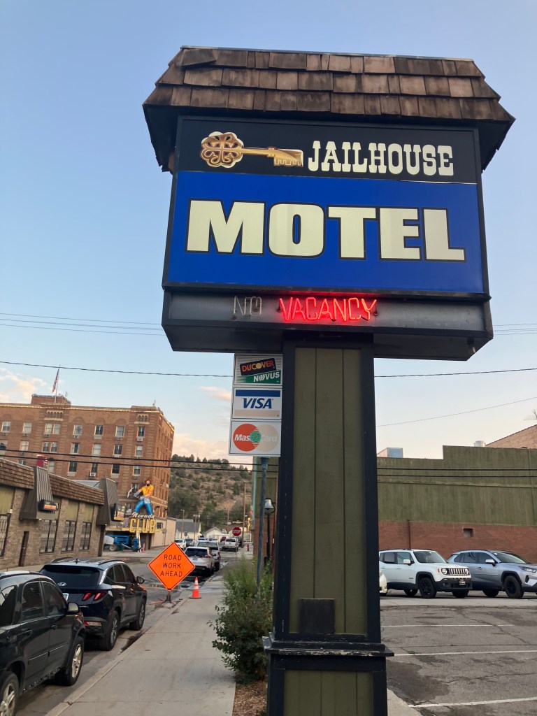
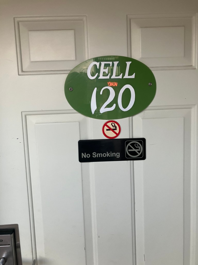
As the sunlight was wanting I stopped for the night in Ely, NV (pop: 3,900). Ely is well known for its superb railroad museum and heritage railway, but beyond that there isn’t much besides smoky casinos. I took a room at the Jailhouse Motel, whose reception desk is inside the adjoining smoky casino.

Also in the casino was something that passes for a bar, so I figured I’d try to get my Brew of the Day. But the beer selection was positively abysmal, and each seat at the bar was equipped with a huge, noisy video poker terminal. Looking at the bar’s sad patrons, I mumbled “terminal indeed,” and headed across the street to my room.
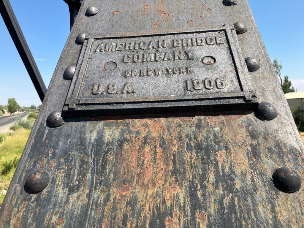
Hardy-har-har.

BRIDGE CORNER!

Although we don’t have a BOTD for today, we can offer you this 1906 railroad bridge over the Carson River in Fallon, NV:

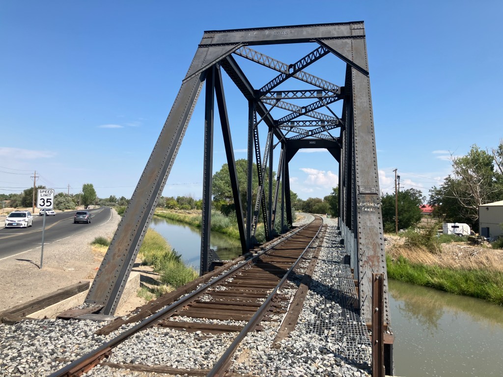
As should be painfully obvious, this is a Pratt subdivided through-truss bridge. And, as a steel marker certifies, it’s made by the American Bridge Company of New York.

OK…thanks for indulging me. Tomorrow we’ll return to the BOTD.

Road trips

US Route 95, Part I

In mid-October I snuck in a short road trip on the Triumph. But with the self-imposed task of reviewing 31 Frankenstein movies over the course of the month, I didn’t have time to write about it. Now, with that Frankenfoolery behind me, I can tell the story. (For those of you who missed any of the Frankenstein reviews, the full list of movies with links to the reviews is available here.)

The route I took came at the recommendation of my friend Chris P, who travels a couple of times a year between his homes in Lake Tahoe and in San Diego. (Life can be hard.) US 95 is a north-south highway, mostly with one or two lanes each direction, that runs from the Canadian border in western Idaho down to the Mexican border in western Arizona. I wish I’d had the time and inclination to ride the entire length, but it was getting late in the season, the days were short, and the temperatures were low. So I just took the segment of the highway that runs through the Nevada desert from Fallon to Las Vegas.

Map of Nevada Cities - Nevada Interstates, Highways Road Map - CCCarto.com
I wish I knew how to highlight highway 95 on this map. The segment I took runs along the western edge of Nevada, beginning just east of Reno.

Since I now call the Sacramento area my home, getting to US 95 means heading east on US 50 across the Sierras and skimming under south Lake Tahoe, then crossing about 75 miles of Nevada’s Great Basin Desert before connecting with US 95. The first leg of the trip provided dismal scenery, with evidence of the recent Caldor fire made manifest in large swaths of blackened forest. I encountered snow flurries going over Echo Summit, which reinforced my decision to make this the last road trip of the year. Thankfully, when I got into Nevada things warmed up a bit. I passed through Carson City (Nevada’s capital, pop. 55,000), after which US 50 palpably earns its moniker “The Loneliest Road in America.

Along this road you encounter scant traffic, and so you’re inclined to stop at virtually every one of the scarce, isolated towns just to remain connected with humanity. One such stop is the hamlet of Stagecoach (pop: 1,800).

Stagecoach, NV is one of those outposts that either attract or trap individuals who hang their hat outside the mainstream. This is often evident in their roadside folk art installations, of which Stagecoach boasts several.

I advise against stealing this guy’s mail.

Yes way.

The town’s law enforcement relies on a skeleton crew.

Stagecoach, as you might imagine, used to be a stagecoach stop (as well as a Pony Express stop). For many years, one of the main attractions was the Oasis Restaurant. Sadly, the Oasis seems to have fallen on hard times, and was not just closed but apparently abandoned.

The oasis has dried up

Road trippers along US 50 have long admired the odd, cactus-shaped water tank (?) on the Oasis’ property. Admittedly, it’s not especially well executed, and it’s not especially attractive. But out here there’s not a lot of competition for best-dressed water tank. So somehow I have admiration for this spearmint-colored cactus. I guess it’s because out here, in the middle of nowhere, with presumably no code enforcement and no competition from nearby businesses, there’s little reason to gussy up a water tank. But the good folks at the Oasis took it upon themselves to do so. I’ve commented before that there’s something about the desert that brings out this kind of whimsy.

Lookin’ “sharp”

Finally I connected with US 95 at the town of Fallon (pop: 8,600). By Nevada standards, Fallon is a decent-size city (#26 in population, out of 131 Nevada cities listed). The town’s main street is named “Maine Street.” At first I thought it was just a hilarious misspelling, but I later learned that the name is a reference to the home state of the town’s founder.

I spent an hour or so at the city’s history museum (whose collection is drawn from the entire county). According to the museum displays, Fallon was largely settled by would-be 49ers who stopped short of California’s gold fields. Fallon grew after the turn of the 20th century as a dam and various irrigation projects allowed the desert town to support farming and a larger population. Around World War II Fallon acquired a naval air station.

More recently, Fallon was home to the storied Fallon Shoe Tree. Ian and I managed to see it when we took a road trip through here some years back. Sadly, some miscreant cut town the tree. What a heel that guy was!

Legend of the Shoe Tree grows on the Loneliest Road in America
The Shoe Tree of yesteryear

The museum even has a display case with a small selection of shoes removed from the fallen tree.

The sole survivors

The museum’s docent, Brianna, was friendly and helpful, perhaps because the museum had until recently had only 2 visitors during the Covid era. Brianna originally hails from northern California, but the man she married originally comes from Fallon, and they had a kid and made a home here.

Docent Brianna

For a docent at the Fallon museum, she didn’t come across as a huge town booster. She prefers the coastal areas of northern California. “Someday I’ll move back to the west coast,” she said. Funny, her sense of being stuck sounds a lot like the waitress I talked to when I came through Fallon on my US 50 trip a few years ago. Here’s what I wrote at that time:

My waitress was very authentic and friendly, though. She saw me consulting my Rand McNally atlas at the table and asked me about my trip. It turns out that she is from Sacramento, and has noticed the same US 50 sign and wondered about Ocean City, MD as well. But here in Fallon is as far as she ever got. She’s raising an 11 year old, and hopes that, after he’s graduated from high school, she can do some travelling. By which she means getting an hour or two out of Fallon.

I did find that Fallon has some notable architecture. The Douglass Mansion is especially impressive. Built in 1904, it’s a classic example of Queen Anne style.

The Douglass Mansion

The house once had a detached garage, which the second owner (a physician) had outfitted with a turntable, much like the one in Batman’s Batcave, I imagine. Sadly (for me) that garage and turntable were torn down and replaced with a small hospital.

Robert L. Douglass House | Historic photograph ca.1904 ; cou… | Flickr
The house really hasn’t changed a lot in over 117 years.

Not far from the Douglass Mansion is the old high school. I know this because the building is helpfully labeled as such. The building dates back to 1917, so it has earned the moniker.

I wonder at what point they changed the lettering from “New” to “Old”?

Overall, the town feels well cared for, pleasant, and hardy. The same cannot be said for most of the other encampments along US 95.

Take, for example, the town of Schurz, named (for some reason) after the then-US Secretary of the Interior in 1891. Located within a Paiute Indian reservation, Schurz was once a viable town near Walker Lake, with homes, community buildings, parks, and services. Today is practically a ghost town. (Coincidentally, the town is the birthplace of the Paiute spiritual leader, Wovoka, who established the Ghost Dance movement in the late 1800s.) Everywhere you see abandoned or badly neglected buildings. And I didn’t see a single living soul on the streets.

I’ll bet the owners of these structures lost their Schurz.

Traveling a little further south along US 95 takes you along the steep shore of Walker Lake, which is Nevada’s second-largest natural lake (after Lake Tahoe).

About five miles past Walker Lake is the town of Hawthorne (pop: 3,300), which touts itself as “America’s Patriotic Home” (a claim which might rightly be challenged by any number of cities). Hawthorne’s claim is based on its hosting the US Army’s largest ammunition storage facility. From US 95 you can see some of the 2,500 bunkers which are used to store ammunition.

Naturally, most of the town’s households are connected in some way with the ammo storage facility. There’s an ordnance museum (which unfortunately was closed when I got there), and even the local park has playground equipment made out of bomb casings.

Hawthorne is da bomb

Other than zillions of tons of ammo and a faded casino, the only other notable sight in Hawthorne was the derelict Cactus Theatre. Built in the late 1940s out of a quonset hut, the 300-seat venue achieved notoriety in 1972 as one of only two theaters in the state of Nevada to show the pornographic film, Deep Throat. The theater closed in 1997, but reopened in 2005 as the Cinadome Theatre. (Look closely at the sign, and you can make out both its old and new names.) The Cinadome closed in 2012, but the waitress at the local pizza joint told me that there’s an effort to get it open again.

Speaking of the local pizza joint, I had one of the best pizzas of my life at Old Nevada Pizza. Seriously, their sweet and spicy pizza is to die for, with a perfect and unlikely balance of jalapenos, pineapple, bacon, and barbecue sauce.

[Special Update: As I write this, my son Ian is taking his own trip through western Nevada and he just passed through Hawthorne. He reports, and I quote, “Everyone there looked like they wanted to leave.”]

Hawthorne is where I laid my head for the night. Part II comes tomorrow!