I spotted him in someone’s yard on Wentworth Springs Road near Georgetown, which is about halfway between Placerville and Colfax in the Sierra foothills. I was heading home from Lake Tahoe, opting for the scenic route that cuts through the El Dorado National Forest rather than US 50.
Loyal readers familiar with this blog know of my appreciation for yard art. Especially in this era, where so many of us seem to be poised to pounce on each other for using the wrong word or drinking the wrong beer, yard art is a whimsical, unencumbered gift to passersby. It’s outward-facing, offering a brief distraction or a chuckle and asking for nothing in return. I think yard art does far more to improve the world than any political placard listing beliefs or principles.
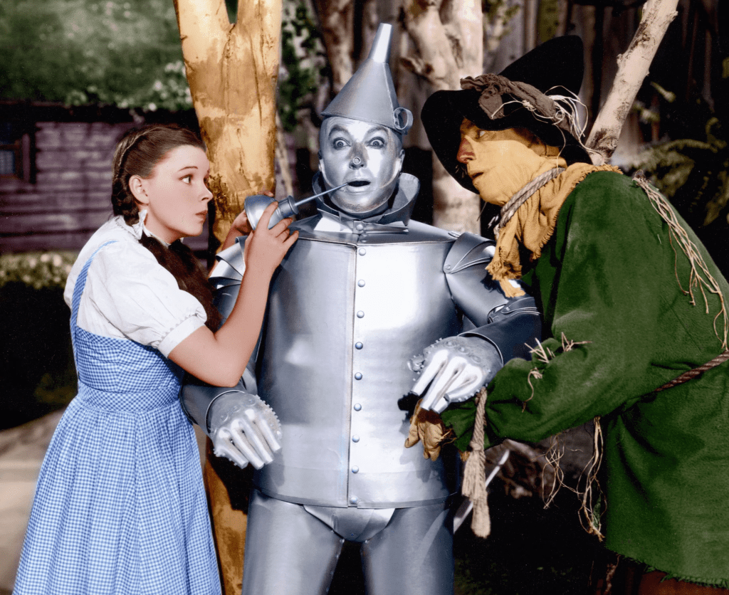
And yet I’m torn apart. Just because I’m presumin’ that I could be kind-a-human, If I only had a heart.
My friend W (whom you would have read about in my memoir) and I are planning a camping trip in the El Dorado National Forest. The weather has been absolutely beautiful of late, so today I took out the Speedmaster for some reconnaissance in the forested region between Auburn and Lake Tahoe, scouting out possible campsites.
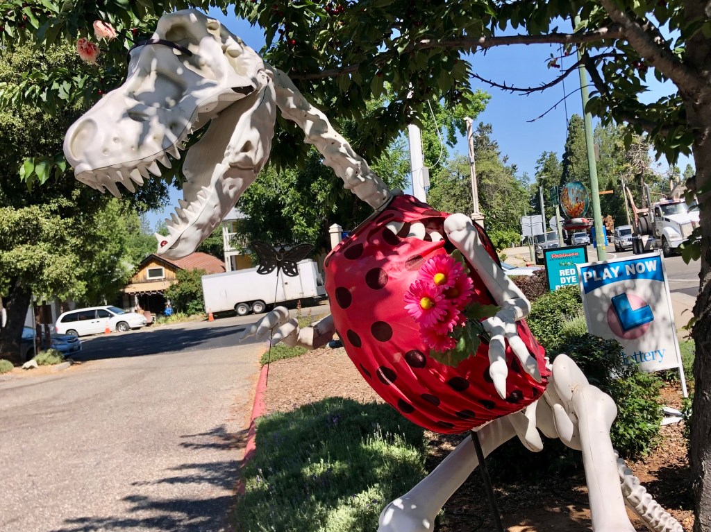
I began by cruising up CA 49 to Coloma (pop: 400, and the birthplace of California’s Gold Rush) then heading northwest to Georgetown (pop: 2,500 and one of the original Gold Rush towns). I had planned to get a bite at a local, historic cafe, but such a thing evidently doesn’t exist in Old Georgetown. Seriously, there’s very little going on in this place. Which puzzled me, because when I came through here a couple of years ago it seemed more viable.
Unexplained dinosaur with ladybug costume at a Chevron station in Georgetown.
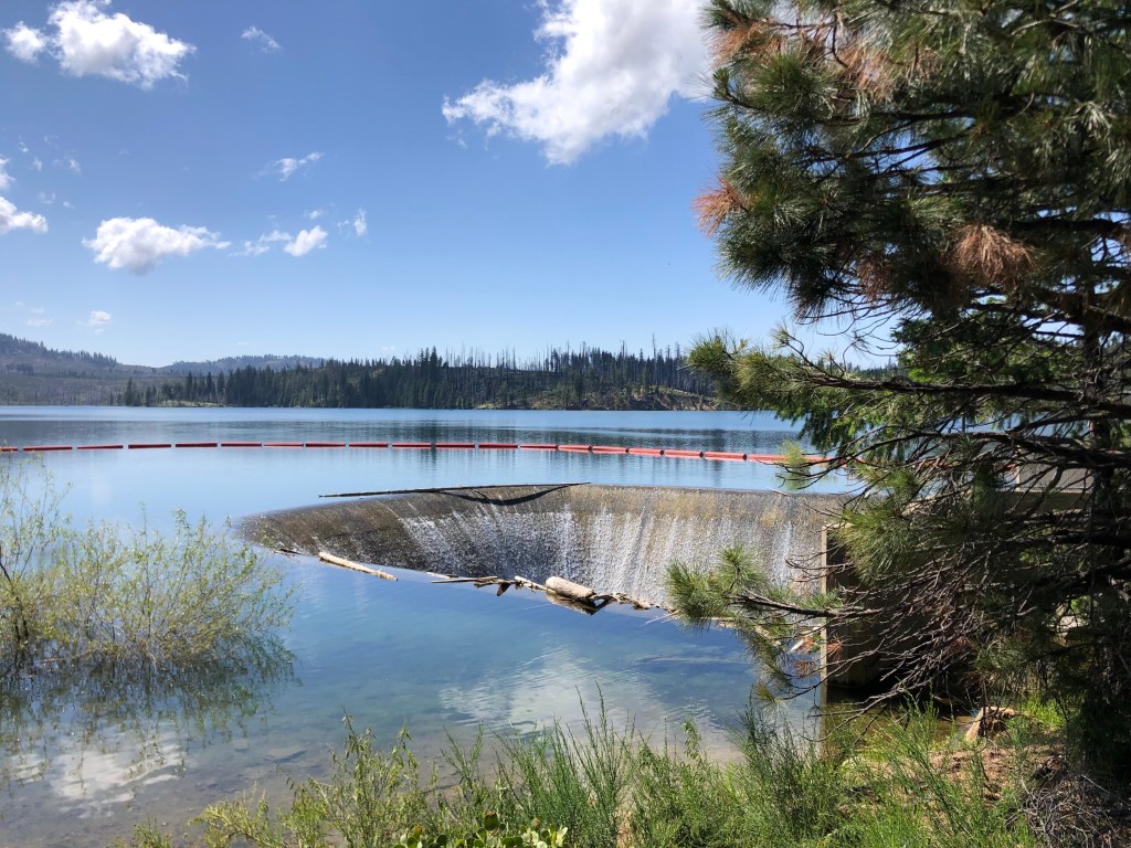
From Georgetown I continued east, immediately entering the El Dorado National Forest. Soon I encountered Stumpy Meadows Reservoir. It’s a peaceful, attractive spot with campsites and picnic facilities. As with many of California’s reservoirs, this one was created as part of the water infrastructure binge in the 1950s and 1960s. The Mark Edson Dam was constructed in 1960, and soon after the meadows were under a lake. Incidentally, the Edson dam is named after the first engineer at California’s Department of Water Resources. The reservoir was named after Edson at the same time, but soon thereafter, for reasons that are not entirely clear, descendants of the meadows’ original owner successfully lobbied to have the name changed to Stumpy Meadows Reservoir.
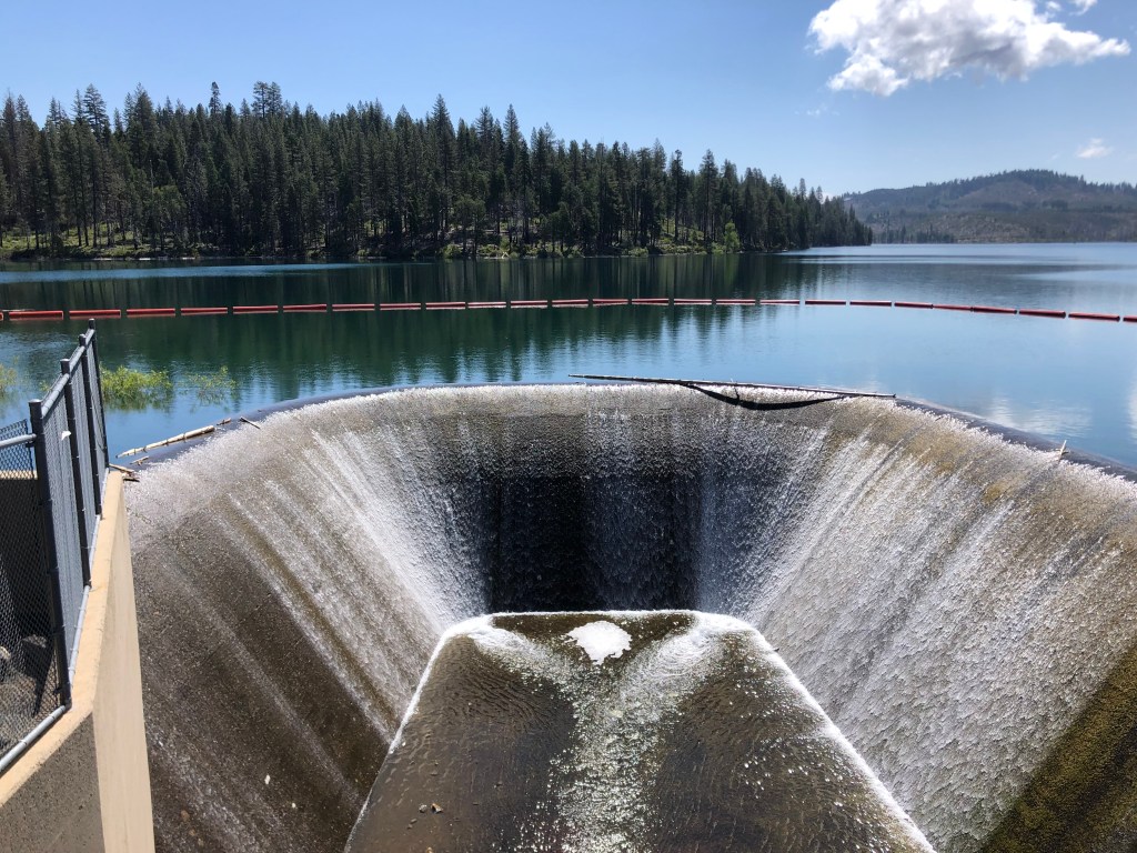
I was transfixed by this spillway on the edge of Stumpy Meadows Reservoir.
Another view of the spillway.
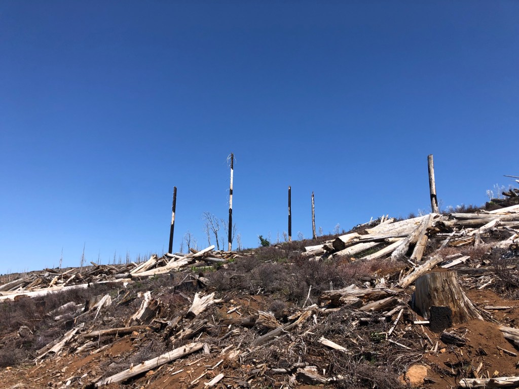
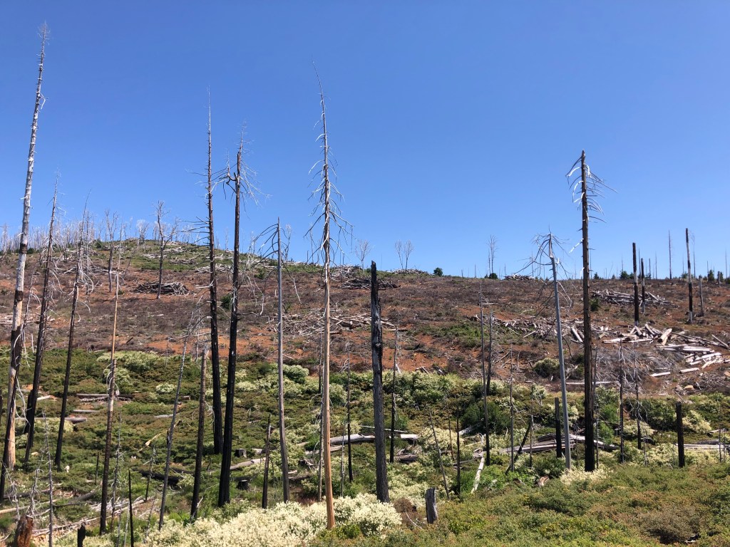
Continuing eastward I soon passed through huge swaths of charred forest that resulted from last year’s Mosquito Fire. That wildfire burned over 76,000 acres of land and destroyed or damaged almost 100 structures. It’s hard to wrap your head around the amount of destruction that can occur in just a short time…and how long it will take to grow back. No specific cause has been officially ascribed to the fire, although documents, news reports, and various lawsuits and criminal investigations all center on PG&E.
Thanks, PG&E.
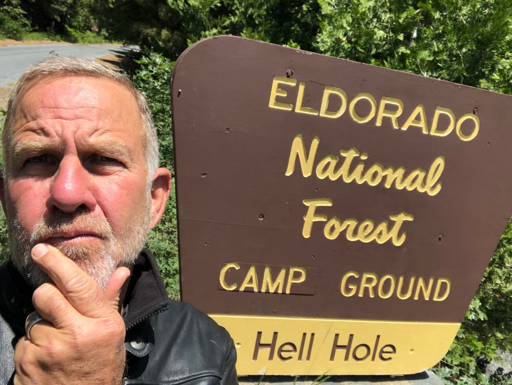
Eventually I passed beyond this hellscape and was again surrounded by green forest. I identified several prime camping spots that W and I might try out. And then I came upon something unusual:
I had a devil of a time finding this place…
The name Hell Hole certainly doesn’t conjure up idyllic landscapes the way the names Sugar Pine and Emerald Bay and even Stumpy Meadows do. In fact, it seems like the opposite of what you’d want for a campground. The name reminds me more of my first, cramped apartment, located in a shabby building in a gritty part of Sacramento. It also brings to mind a song by the fictitious heavy metal “band” Spinal Tap.
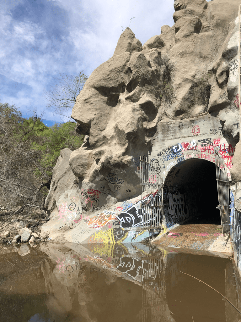
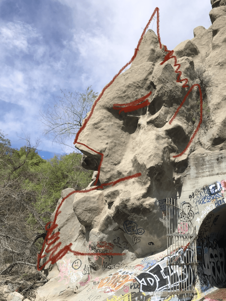
“Hell Hole” also got me thinking about an earlier trip to Devil’s Gate Dam in Pasadena, where a rock outcropping supposedly resembles a profile of the devil. Here’s my photo from that trip:
You don’t see it? How about now:
Anyway, the Hell Hole campground gets its name from the Hell Hole Reservoir, which got its name from Hell Hole canyon which it filled. Wikipedia gives this account of the name:
How the canyon came to be named Hell Hole is a combination of folklore and speculation. An early author, George Wharton James (1858–1923), visited the canyon in 1913.[2] He attributed the name to an unidentified miner seeking riches during the Squaw Valley mining excitement of 1862. It was “a hell of hole to get out of,” James wrote, but admitted his source for the place name was more speculative than the anonymous miner’s chances for riches at Squaw Valley.
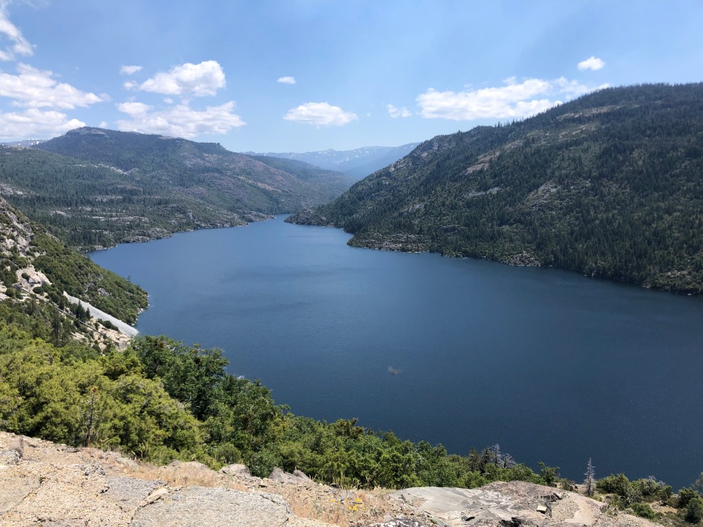
The reservoir was created in 1966 when the Placer County Water Agency dammed the Rubicon River. Covering about 1,250 acres, it’s a good-size reservoir. And despite its name, it’s a beautiful setting.
Dam this Hell Hole!
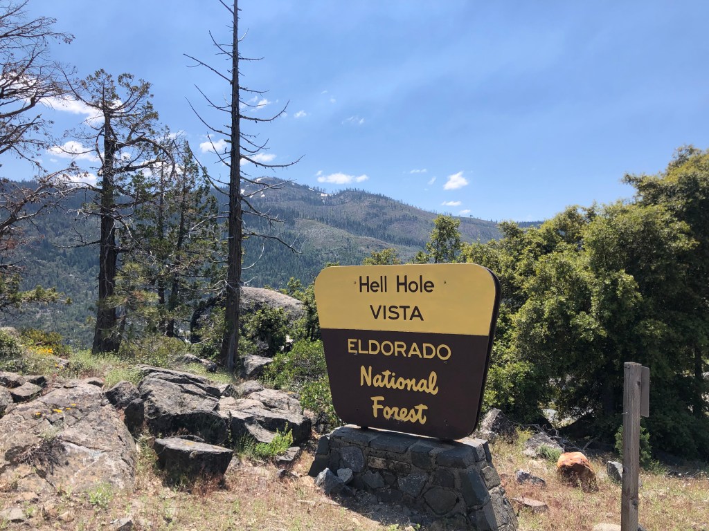
I hiked up to a scenic overlook, where I passed an enjoyable 30 minutes just looking at the scenery and enjoying the warm sunshine.
Three words that don’t normally go together.
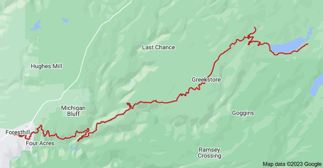
After chatting with some campers and making a mental note of this area for my outing with W, I figured it was time to start heading back. For my return trip, I planned to take Mosquito Ridge Road west to the town of Foresthill (pop: 1500), and then head home on CA-49 South. Mosquito Ridge Road is narrow and windy, and the asphalt is potholed and cracked, but the surrounding scenery made it worth the inconvenience.
Mosquito Ridge Road, in red. Hell Hole reservoir is on the center-right edge of the map.
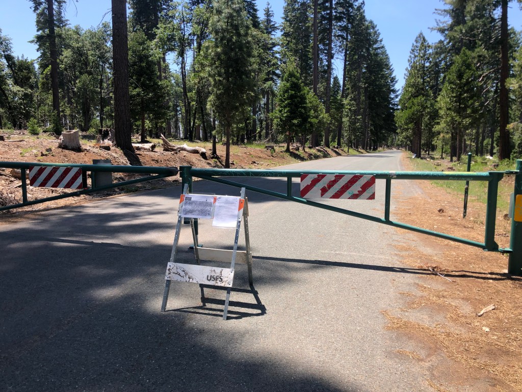
When I got on to Mosquito Ridge a sign informed me that Foresthill was 45 miles away, so I settled in for a long, slow ride. About halfway through my journey I encountered this unwelcome sight:
Not again…
Attentive readers will recall that I’ve run into numerous road closures in my travels. It’s especially inconvenient for me as I’m riding a motorcycle with a small gas tank, so unexpected backtracking in remote areas can be stressful. What’s more irritating is this closure came with no forewarning, and the roadblock itself doesn’t really explain what’s going on. Indeed, instead of a “road closed” sign or something equally straightforward, there’s just a xeroxed office memo tacked to a folding barricade.
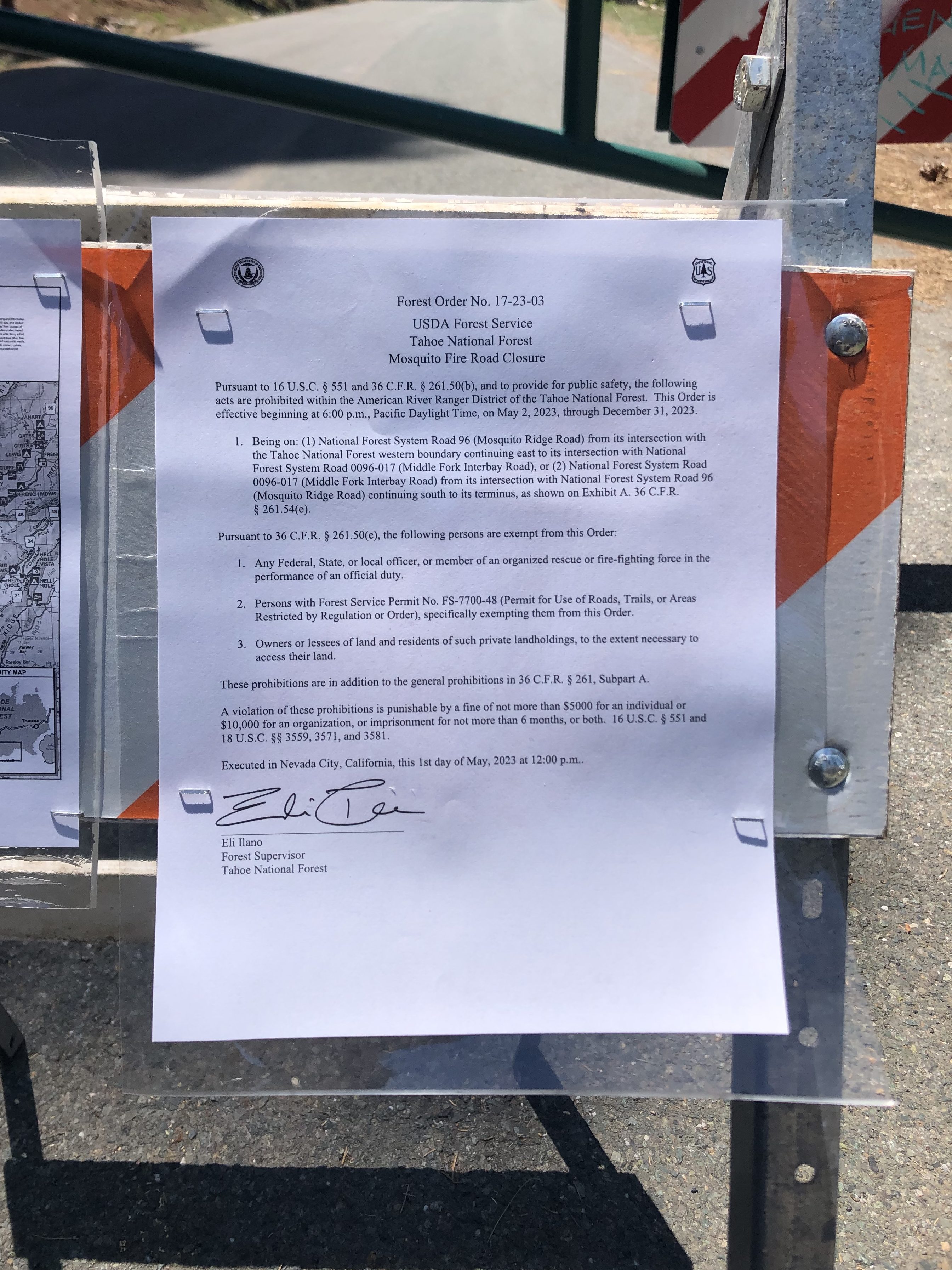
Excuse me while I consult with my lawyer…
This “forest order” cites “Section U.S.C. Sec. 551 and C.F.R….” blah blah blah… What caught my eye, though was the reference to a $5000 fine and 6 months in jail. Rather than figure out the specific coordinates of the prohibited zones and the details of the exemptions, I just turned around and went back towards the Hell Hole, and then retraced by initial route through the charred hellscape back to Georgetown, hoping I wouldn’t run out of gas.
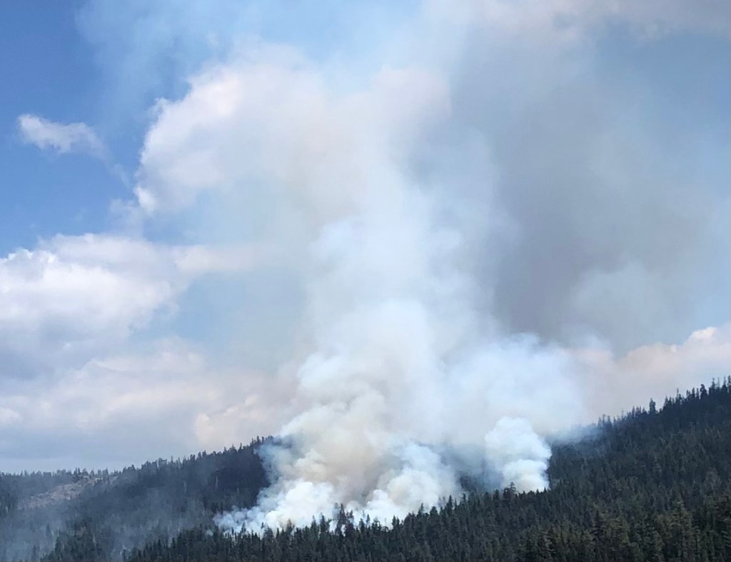
And then, as if on cue, I encountered a second unwelcome sight: A forest fire!
Where there’s smoke…
Feeling a little panicky, I got out my phone to call 911. But there’s no service out here in the middle of nowhere. I decided to find a ranger station at the Hell Hole. But then I noticed a portable, electronic sign board: “RX BURN. DO NOT REPORT.” I interpreted this to mean “prescribed burn,” even though technically their sign says “prescription burn.” What would Section U.S.C. 551 have to say about that?
The rest of the trip was uneventful. I got to Georgetown with 7 miles left in the tank, and I got home in time for cocktails. It was a hell of a trip.
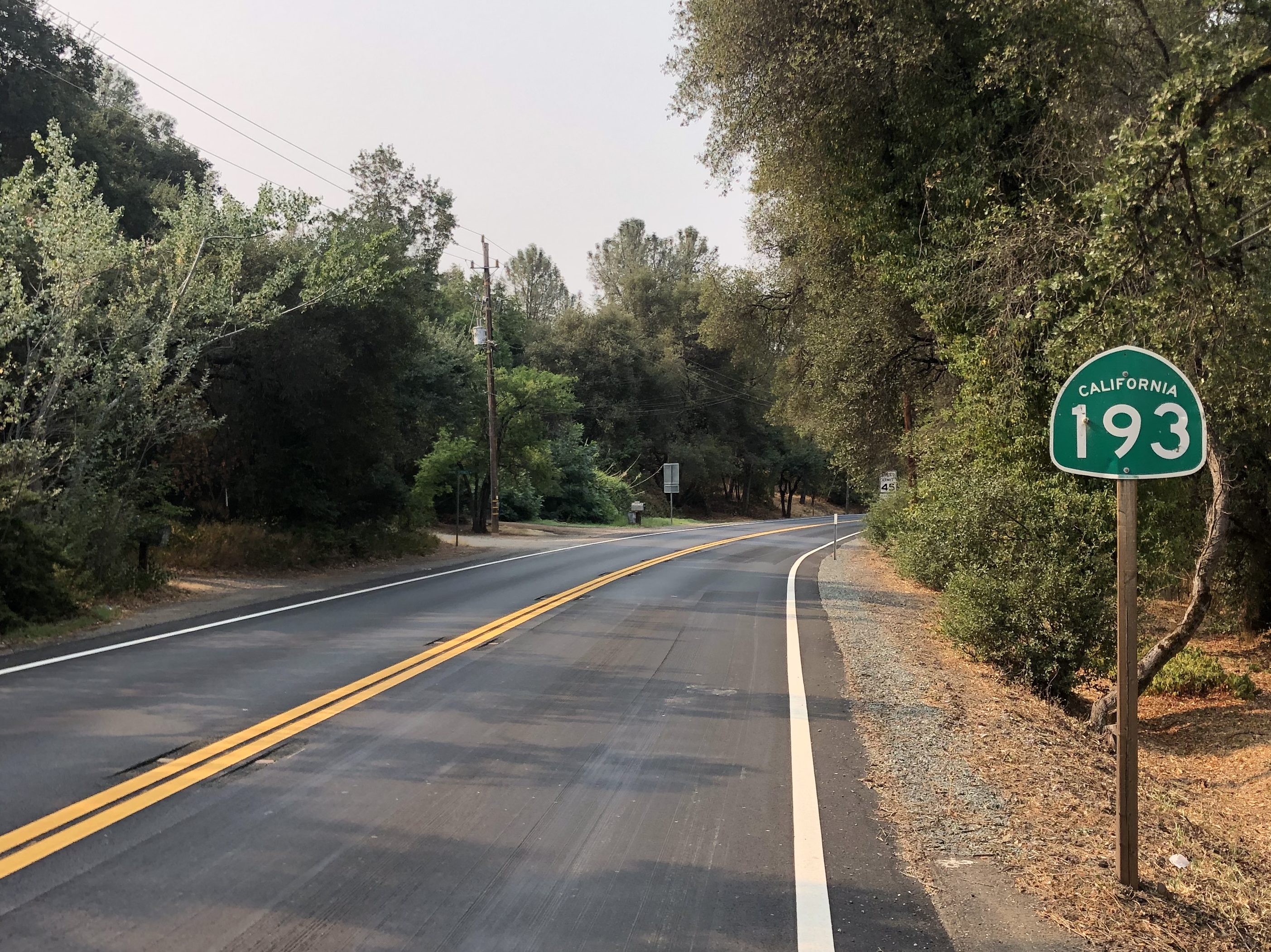
The other day I decided to take a spin along one of the lesser-known California State Routes in northern California. State Route 193 starts (or ends, depending on your perspective) in Lincoln, CA and runs generally east to south through Placer and El Dorado Counties.
For those times when a direct route just won’t do.
Most of Route 193 takes the form of a winding, rural, two-lane road through the Sierra foothills. It’s a wonderfully relaxing drive. As long as you don’t have to be anywhere in particular at any particular time, it’s an ideal roadway.
The land that time forgot.
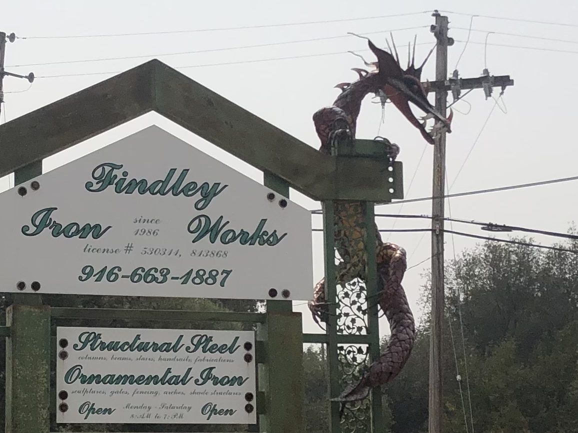
Route 193’s western terminus at Lincoln (pop: 50,000) began as a railroad town in the mid-1800s, and remained a fairly isolated and quiet community for almost 150 years. Then, in the 1990s, it became one of the fastest growing cities in the United States. The incessant expansion of the Sacramento metropolitan area, with families seeking out new suburbs and better schools, swallowed up Citrus Heights, Roseville, and eventually Lincoln. Lincoln’s (relatively) low cost of living and lower crime rate made it a desirable region for new families. Still, despite its railroad heritage, the town doesn’t seem to have a lot of historical interest to offer, at least not along the Route 193 corridor. The most notable roadside scene was the iron dragon at Findley Iron Works in Newcastle, a few miles down the road. The dragon reminds me a lot of Trogdor.
The Burninator stries again.
Route 193 winds through oak-studded hills for about a dozen miles, when it reaches the city of Auburn (pop: 14,000). From here 193 runs concurrently with CA Route 49 for seven or eight miles. (I covered this stretch of Route 49 in an earlier blog post, so I won’t review that stretch again here.) But I will note that I stopped in Auburn to have a burger and a beer with my friend Victor R. The beer appears at the end of this blog entry as my Brew of the Day.
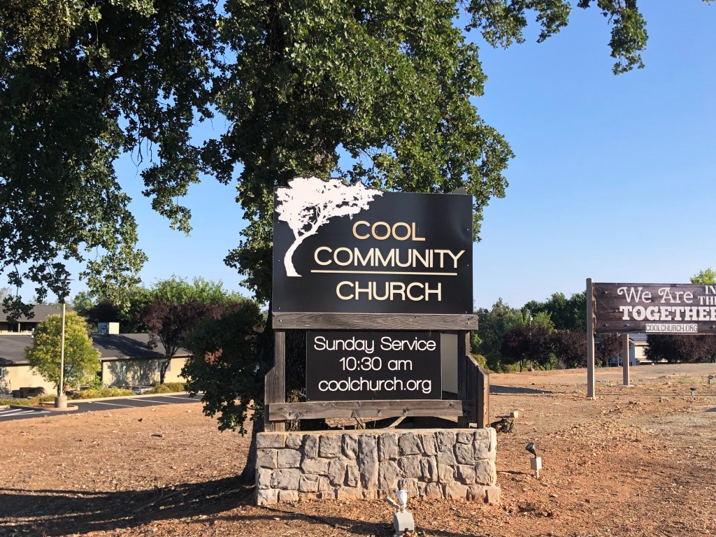
Route 193 again branches off Route 49 at the town of Cool (pop: 4,100). It’s not entirely clear how Cool got its name, but one theory holds that it is a reference to an itinerant preacher named Peter Y. Cool who frequented the area in the 1850s. As you might imagine, the businesses in Cool capitalize on the name’s adjectival properties. Like, “Cool Dentist” and “Cool Tobacco.”
Too Cool for School.Located just past the city limits. Hence, “beyond cool.”
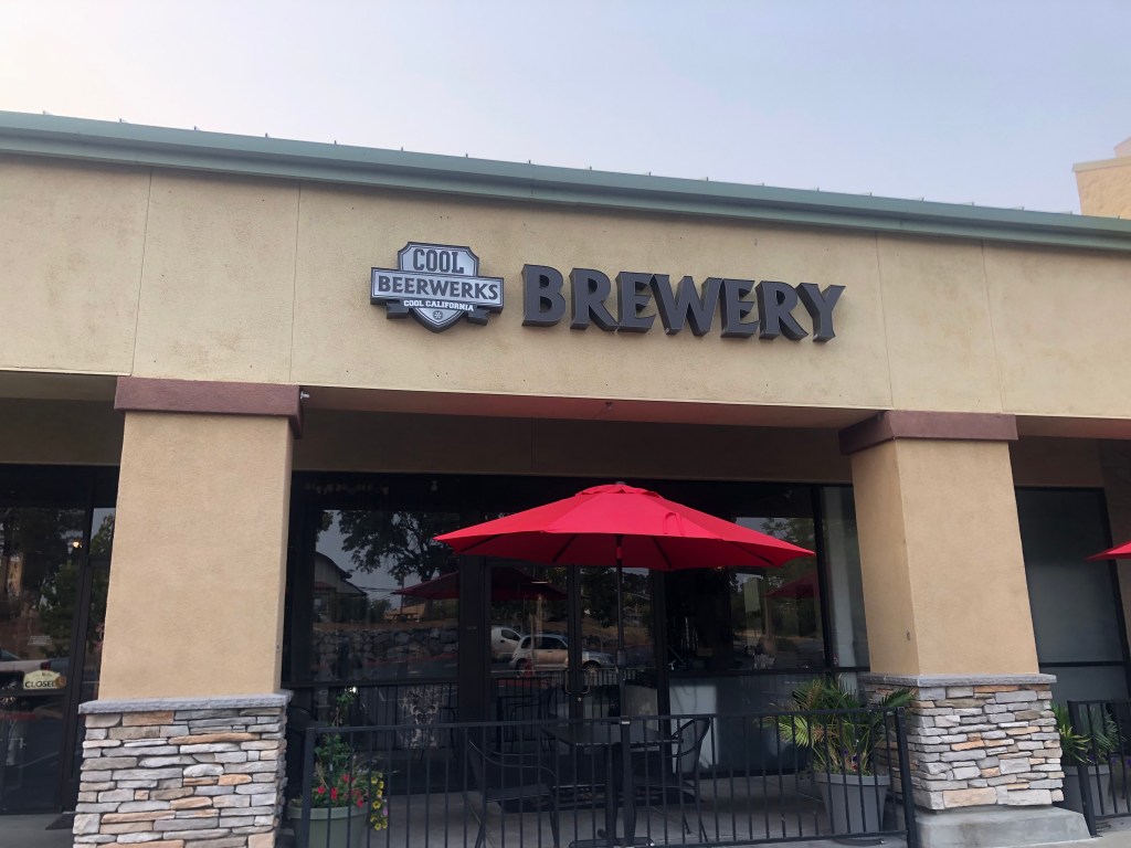
The most notable feature of Cool other than its name is the Cool Beerwerks, whose tagline is the unlikely-sounding “Rockin’ Sushi & Brews.” Fortunately, they were closed when I passed by.
When you’re hot you’re hot, when you’re not you’re cool.
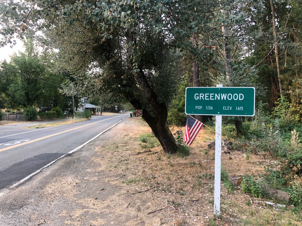
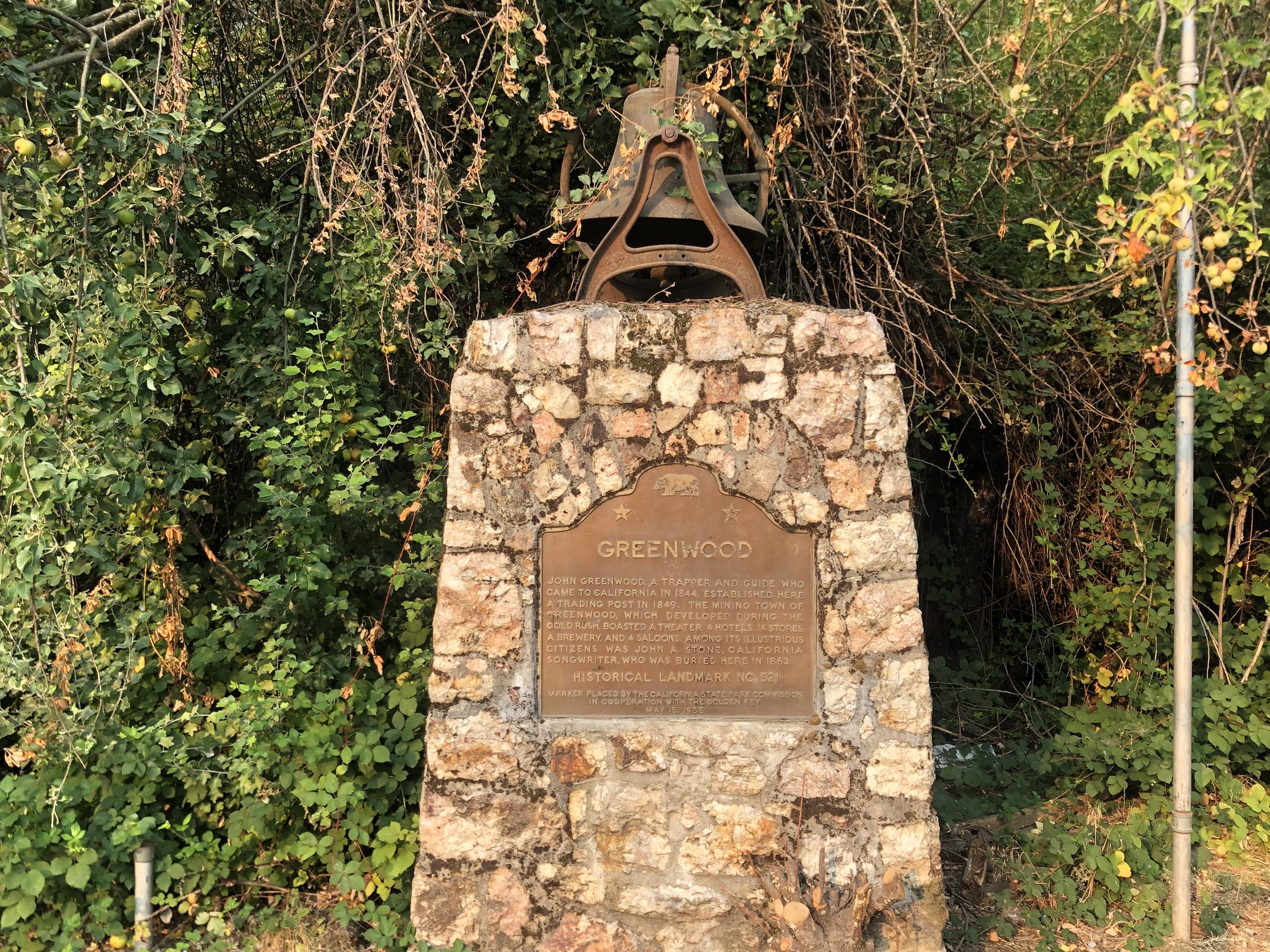
From Cool , Route 193 travels between the middle and south forks of the American River, a hilly area known as the Georgetown Divide. Horse pastures and the occasional farmhouse dot the landscape. The next town of any note is Greenwood (pop: 1,100), nestled among oaks and rolling hills.
Another of those towns where the elevation exceeds the population.
Near the entrance to the town is a stone memorial that was erected in 1955, along with a bronze plaque providing the briefest historical sketch of the town.
Other than the town’s namesake (a trapper named John Greenwood from the 1840s) the plaque mentions only one other famous resident: “John A. Stone, [a] California songwriter who was buried here in 1863.” It seems that Stone (who for some reason was known by the moniker “Old Put”) “wrote most of the songs we associate with the California Gold Rush.” Ummm, which songs would those be, exactly? Maybe My Darlin’ Clementine. Are there any others? Anyway, Old Put published a songbook (called a “Songster” at the time) in 1868.
Put-ting his money where his mouth is.
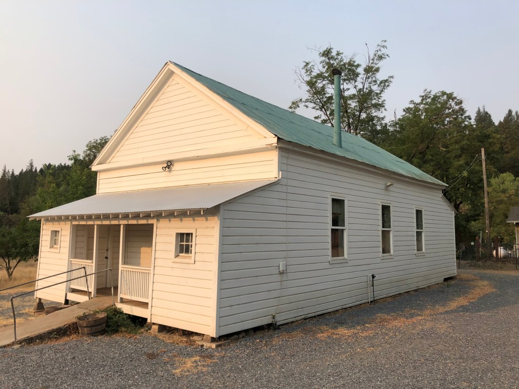
But let’s get back to the memorial plaque. Did you happen to notice the unexplained bell on top of the monument? Was it a fire bell? Is it even related to Greenwood? Well, a short while later I found the answer. A couple of blocks away from the stone memorial there sits an old schoolhouse that was originally constructed in 1858. The school operated for almost a century, until it closed in 1954. (Greenwood’s students thereafter attended in school in Cool, or “Cool School” as they must have called it). The bell on top of the school house was removed and placed on top of the stone memorial pictured above.
Greenwood School, sans bell.
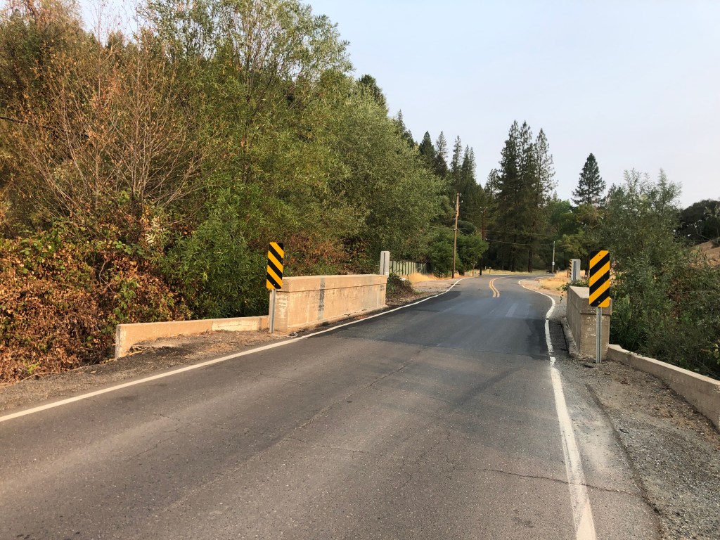
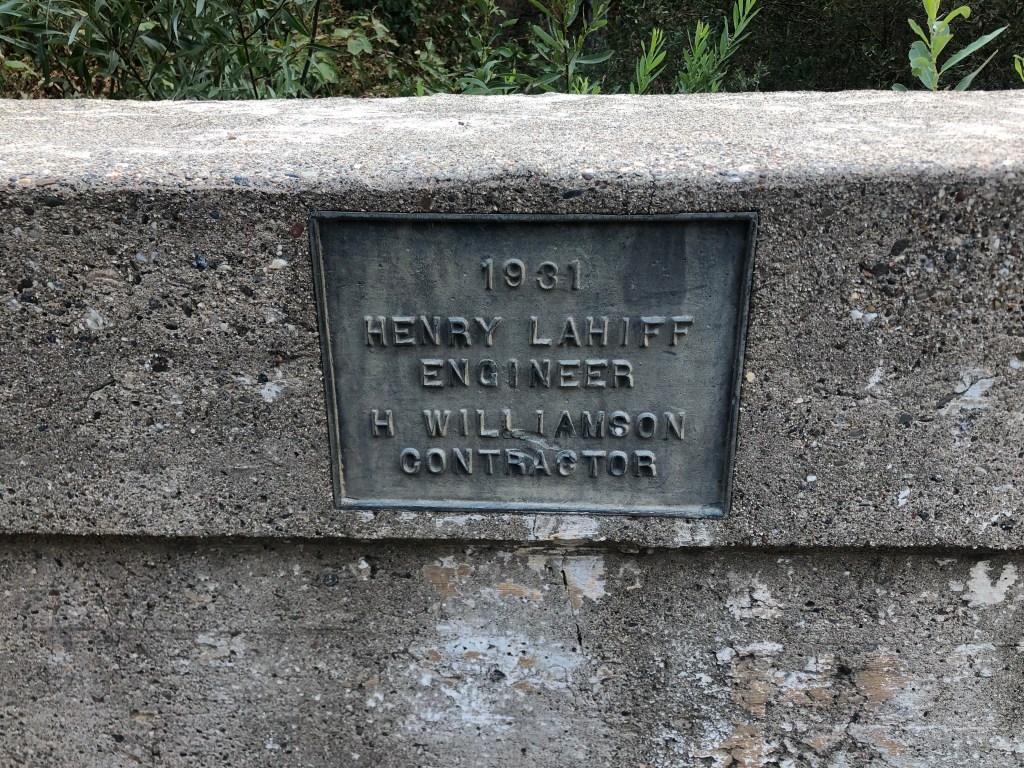
Now, let’s back up for a moment. In the same year (1868) that Old Put published his “Songster,” a man named Henry Lahiff was born in Ireland. He was educated as an engineer, and at age 20 he emigrated to Arizona to work at the Copper Queen Mining Company. He was a capable engineer, and soon was working on projects in other US cities, including a stint as the chief engineer on San Francisco’s Sutro Baths. Eventually he became the surveyor/engineer for El Dorado County, and in 1931 he designed this bridge that I crossed during my visit to Greenwood.
It’s not much to look at. But……it’s nice to still be recognized 80 years later.
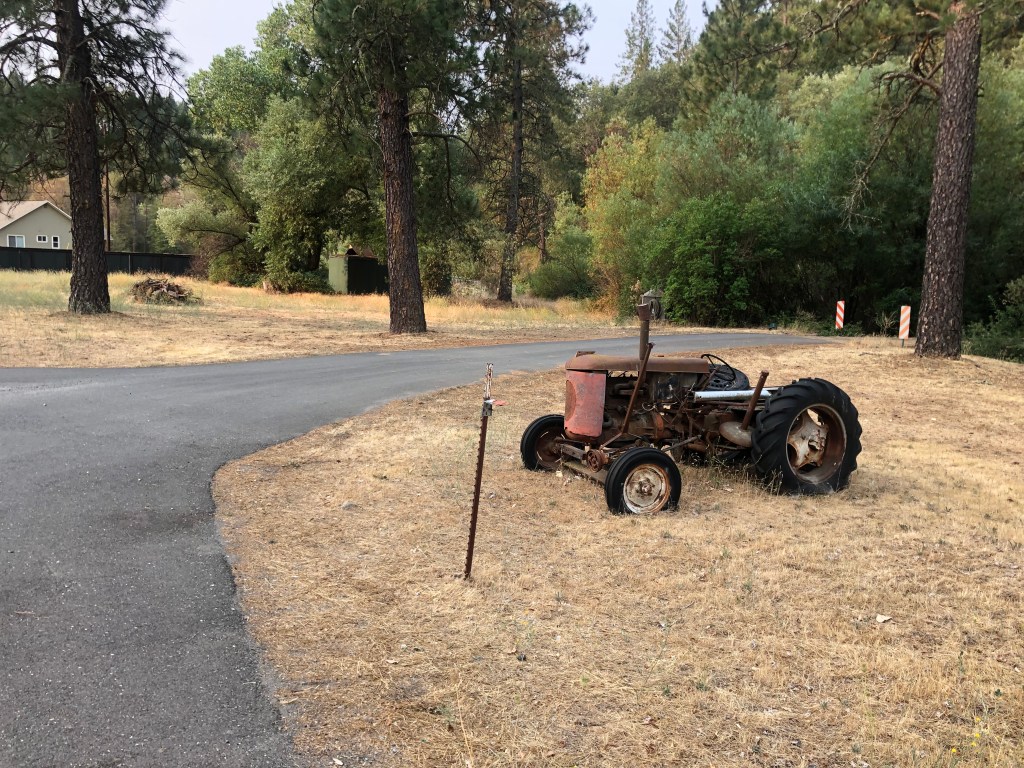
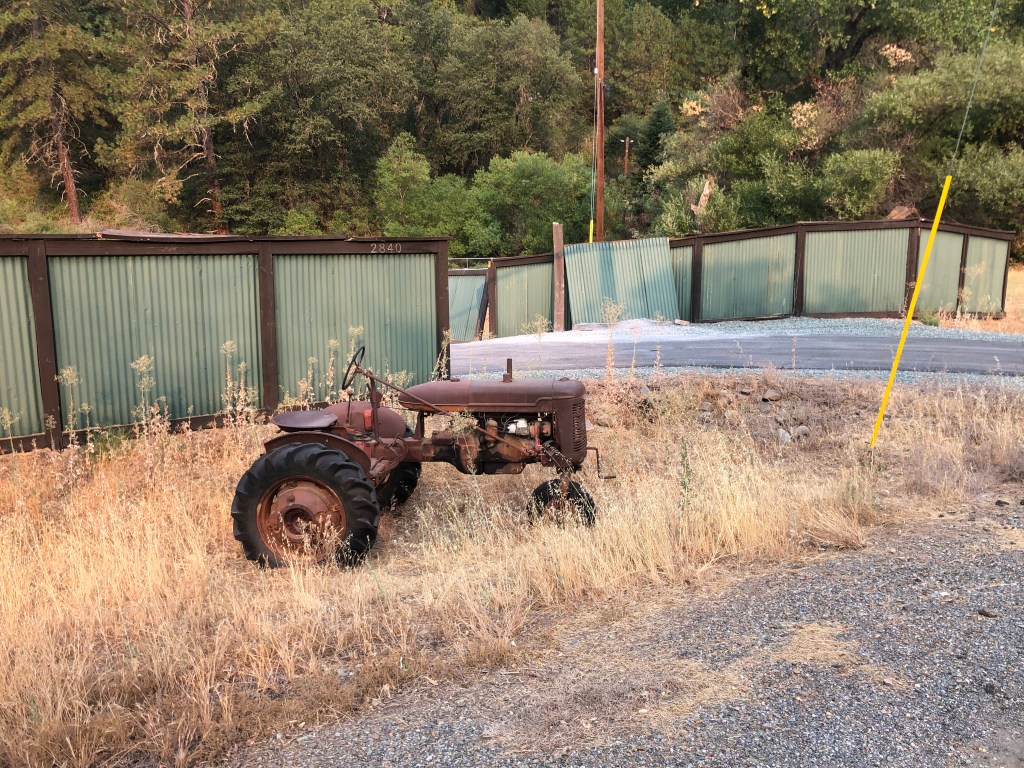
The other notable thing about Greenwood is the propensity for people to permanently park old tractors by the road in front of their property. I must have encountered over a half-dozen of these.
Greenwood’s answer to garden gnomes.
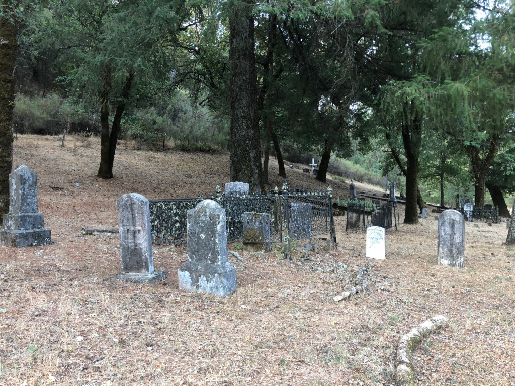
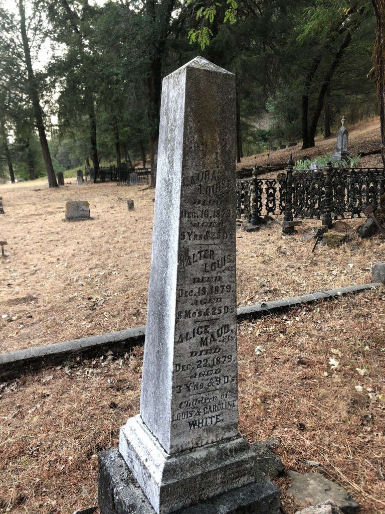
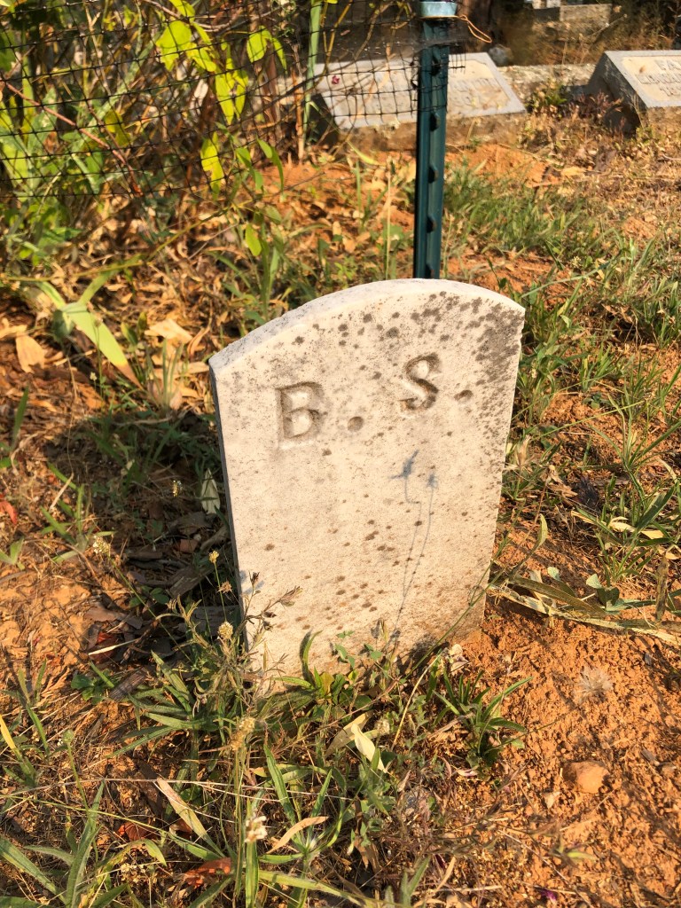
Just as I was leaving town I encountered Greenwood’s old Pioneer Cemetery, with graves dating back to the 1850s. I didn’t find the final resting places for engineer Henry Lahiff or John Stone (“Old Put”) but I did encounter a significant number of ancient gravesites set amid gloomy, drooping trees and weedy earth.
The end of the line for Greenwood’s pioneers.It’s notable that the early pioneers didn’t usually reach a ripe old age.
I found myself in a blue funk (or maybe it was a brown study), thinking about these lives that ended a century and a half ago. These forgotten, neglected markers of granite are all that remain. Or maybe that’s selling them short. I thought of Henry Lahiff, the bridge engineer. While he’s not a household name, and while few people probably even bother to look at the plaque on the local bridge he designed, he did literally leave his mark on this community. And if it weren’t for him, I wouldn’t now be able to cross that creek. Maybe that’s how we achieve immortality: Not be having our names remembered, but by affecting the world in ways, however tiny, that future generations might experience, even if they don’t pay attention.
With these thoughts in my head I re-mounted the trusty Speedmaster and headed west on 193 to the somewhat larger community of Georgetown (pop.: 2,500). As you might have surmised, the town is named after a guy named George. In fact, originally it was called “George’s Town.” I’m not making this up. George Phipps was a sailor who came to the area as a gold prospector, and he founded the mining town in 1849. Georgetown suffered a fire just a few years later, and was rebuilt in a more planned, logical, and attractive fashion than most of the other Gold Rush towns. Georgetown was also more prosperous than most of the others, which led to its being called “The Pride of the Mountains.”
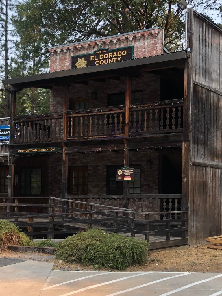
There’s clearly still a lot of pride in Georgetown. Much of the architecture recalls the town’s past. Even the County Sheriff’s Office looks like something out of a John Wayne movie.
Paging Sheriff John T. Chance…
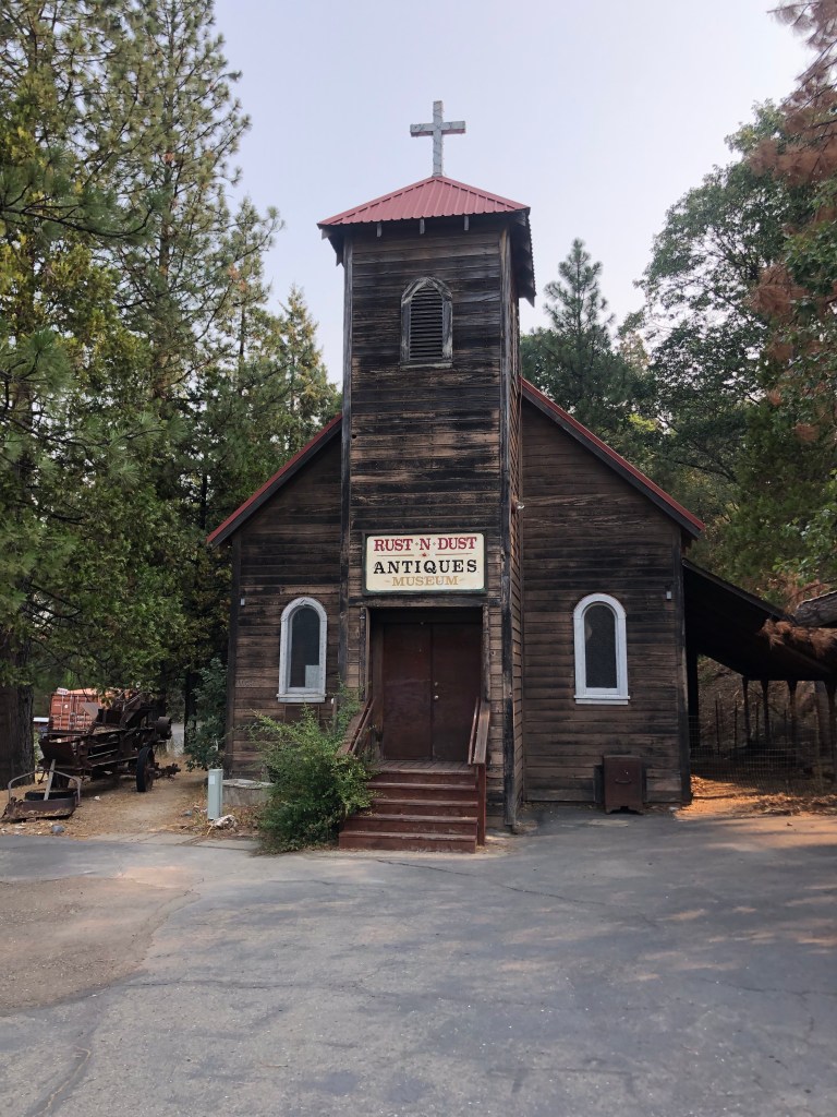
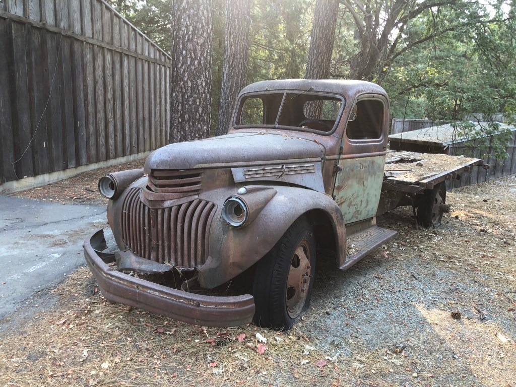
Georgetown seems to have two financial centers. One is a 12-acre commercial zone that calls itself Buffalo Hill. It was conceived and owned for many years by a local couple who wanted an attractive, thriving business node to keep local spending in the area. Most of the buildings display that same old-West style of the Sheriff’s Office, and the property doubles as an outdoor museum with dozens of antique vehicles and logging equipment. When I visited, the businesses looked well cared for and most seemed to be doing a steady business.
Buffalo Hill’s antique store used to be St. James Catholic Church (built in 1923).Buffalo Hill keeps on truckin’.
Georgetown’s second financial center is its Main Street. Dotted with Gold-Rush era buildings, small crowds of people walk along its covered sidewalks lined with cafes, art galleries, taverns, and small shops.
(Photo stolen from the Web–The one I took didn’t turn out.)
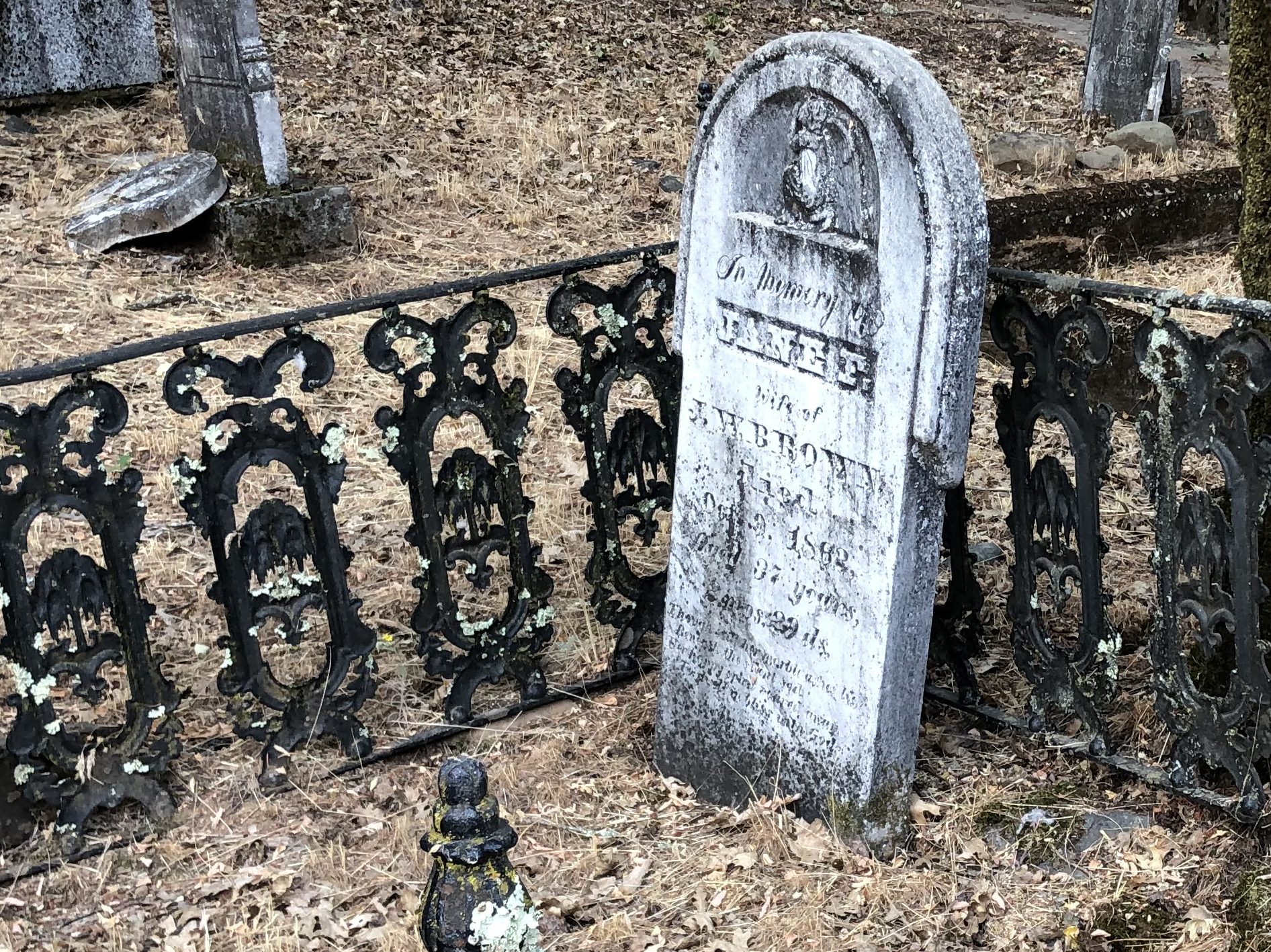
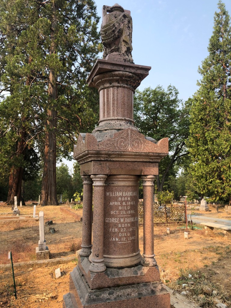
And, of course, Georgetown has its own pioneer cemetery. I suppose cemeteries are the most direct physical link we have with those individuals who came before us. Those from wealthy families often erect ornate monuments in the hope that they will continue to attract attention decades and even centuries later. Like this one from the Barklage family, which emigrated from Germany in the mid-19th Century and made their fortune from timber and mining.
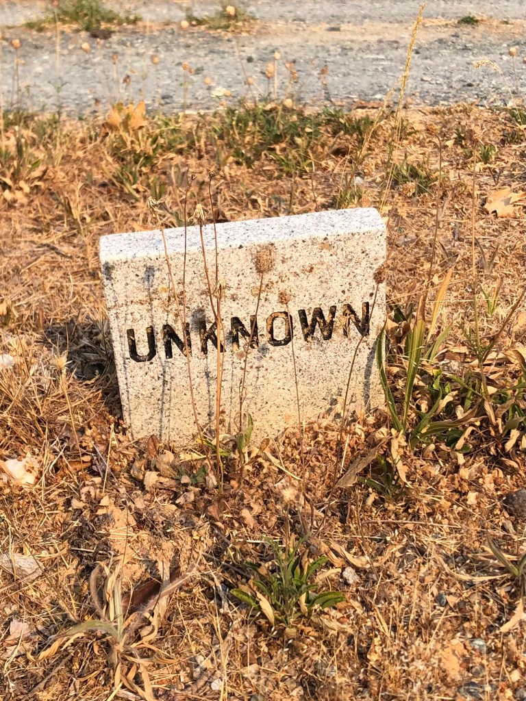
No doubt they expected this imposing monument would ensure their name would always be remembered. And yet, to the people who walk through Georgetown today, are the Barklages any more real than this poor fellow?
In fact, one wonders if the very idea of achieving immortality through stone monuments is summed up thus:
To my way of thinking, it’s people like engineer Henry Lahiff and even Old Put who live on through their efforts to better the world around them.
BREW OF THE DAY
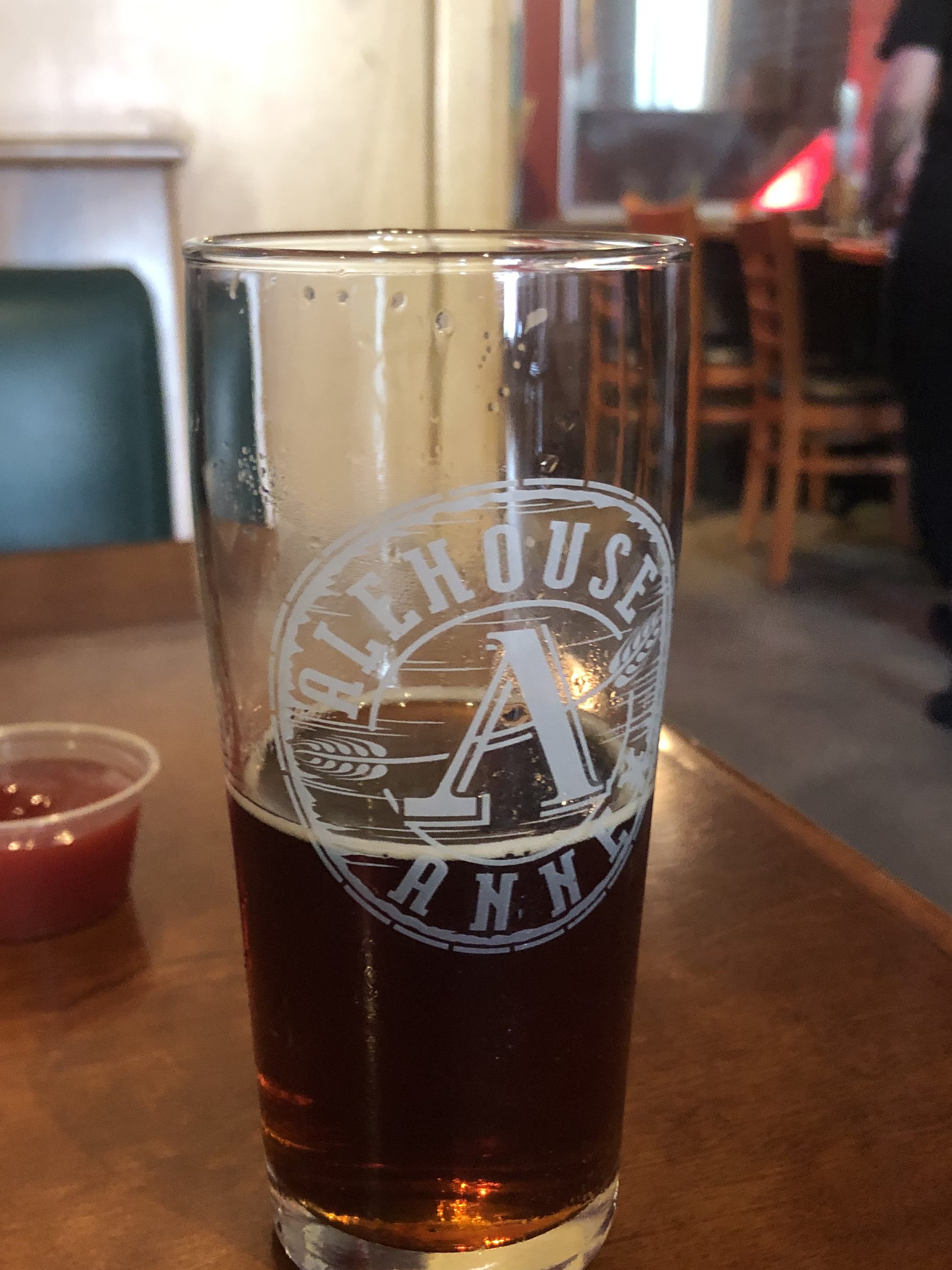
I stopped at the Auburn Alehouse in Auburn’s Old Town. It is located in the venerable structure that was built as a sixteen-room hotel in 1856. (The building has been home to the Auburn Alehouse since 2007.)
I selected the Hop Donkey, which is billed as an Imperial Red Ale. Now, in my experience, many red ales can be somewhat anemic and bitter. But the Hop Donkey is rich and flavorful. Its color reminds me of Starbucks, and its viscosity reminds me of Aunt Jemima. (I note, by the way, that that brand is being retired amid modern sensibilities.) This is an appealing beer. Its rich maltiness is perfectly balanced by its eponymous hops. It has a meaty palate, so much so that you practically chew your way through a glass of it.
Good for what ale you.
I was wanting a second glass of Hop Donkey by the time our meals arrived, but at 9.2 percent ABV, this is beer that requires some self-restraint. But you know that one day soon I’ll be coming back for more.