
…dwelt a miner forty-niner and his daughter Clementine. (Copyright 1884, Percy Montrose.)
The forty-niners, of course, got their name from the year in which most of them came to the gold fields of California. Hundreds of thousands came seeking their fortune, tripling the state’s population in just a few years. The original forty-niners are of course long gone, but the forty-niner cognomen lives in in various forms, including an NFL football team, an independent student newspaper at Cal State Long Beach, and an auto repair shop in Grass Valley.
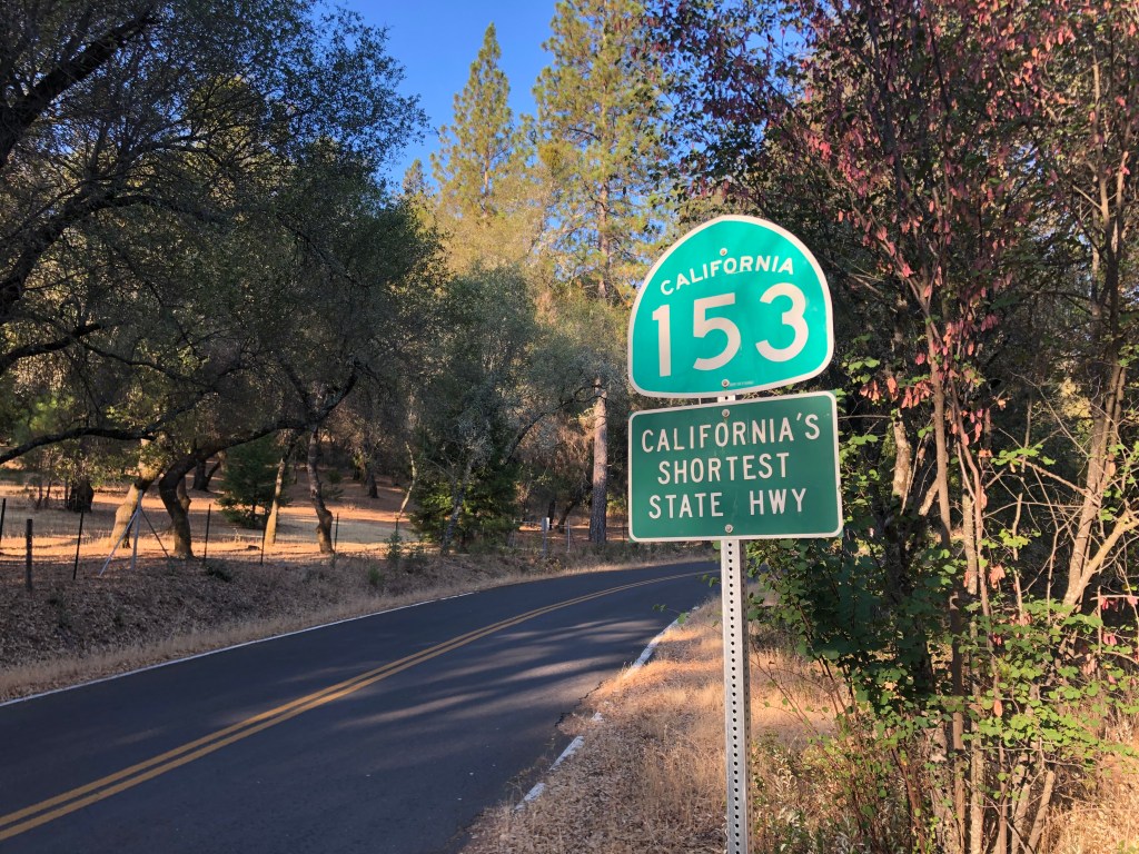
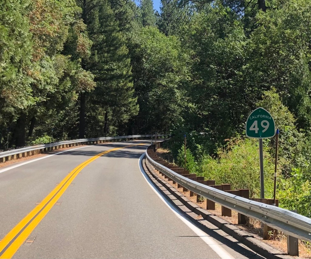
There’s also a state highway with the designation “49” that cuts through the old mining towns in the Sierra foothills. The route was established in 1934, and of course its number is a nod to the prospectors who came in search of gold. (The route also bears the official nickname “Golden Chain Highway,” but I’ve never heard anyone actually call it that.)
I tell you all this because yesterday morning I set out on a trip along a goodly portion of Route 49. I began in the Goldrush-era town of Placerville. Why did I start there? Because I recently moved to the area. There’s no need for this post to go into the sordid tale of why I moved there, but if you want the full story, ask my wife. And then tell me what she said; I’m still trying to figure it out.
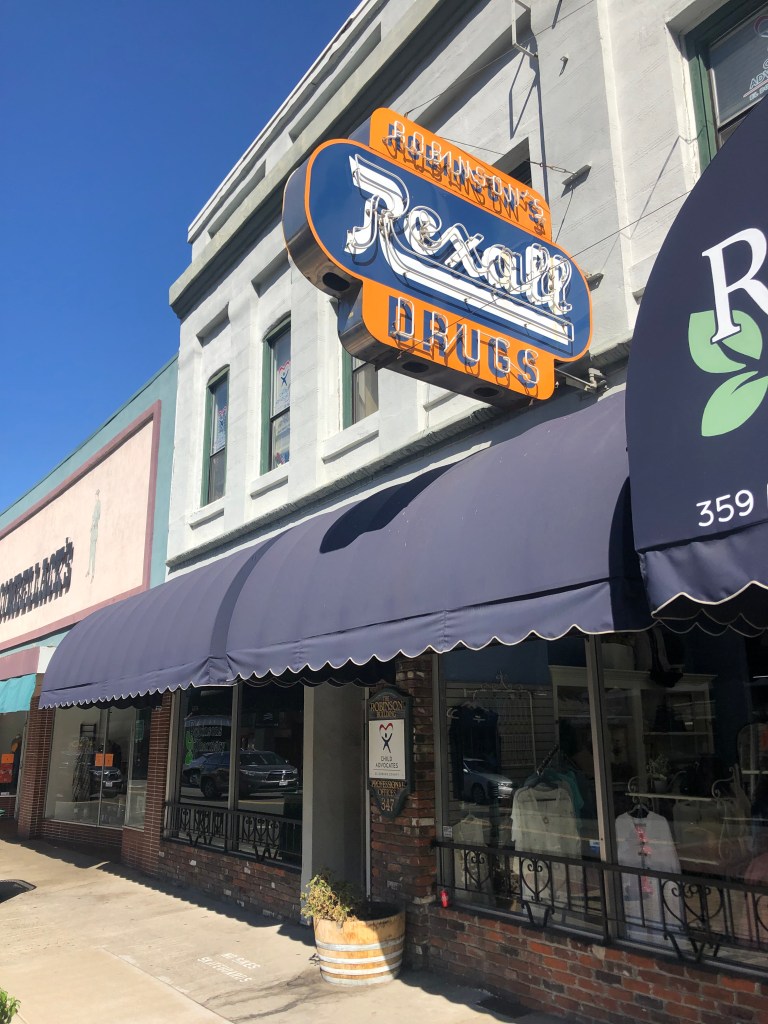
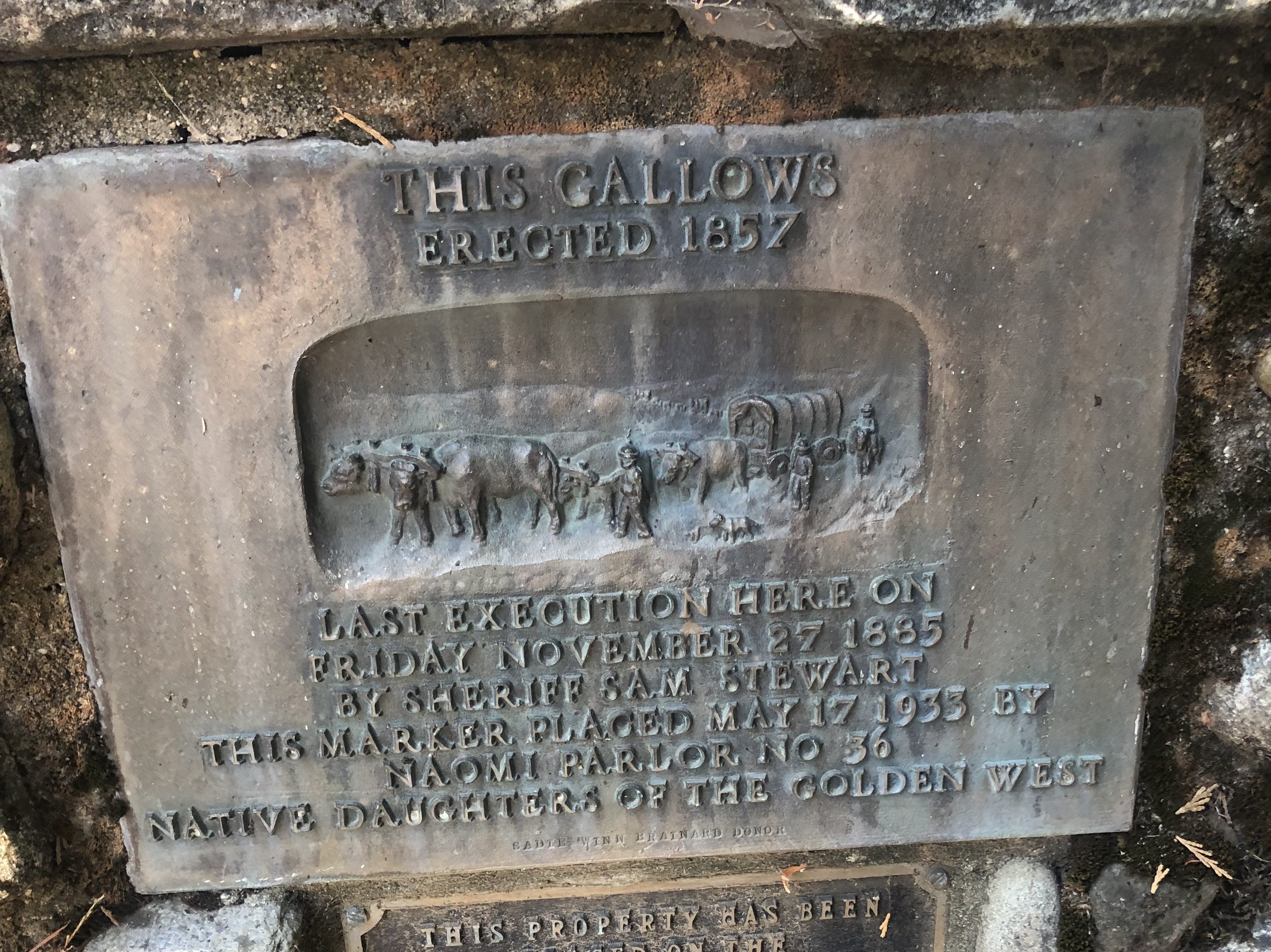
Anyway, I started my Route 49 trip in Placerville (pop: 10,000). Currently the county seat of El Dorado County, Placerville was originally established as a mining camp named Hangtown in 1849. The name referenced the vigilante justice that was meted out at the end of a rope attached to an oak tree on Main Street. After a few years some of the more sensitive souls in town called for a new and less gruesome name, and Hangtown was rechristened Placerville. The more colorful, earlier name still appears around town, including the town logo, complete with a noose. (I am not making this up.)
There’s even a saloon on Main Street called “The Hangman’s Tree.” It calls itself a “historic spot” because it’s built on top of the stump of that very tree that once bore the hangman’s noose. And in case the name is too subtle, the proprietors have hung the effigy of a man from a noose outside the second-story window, just to drive home the point.
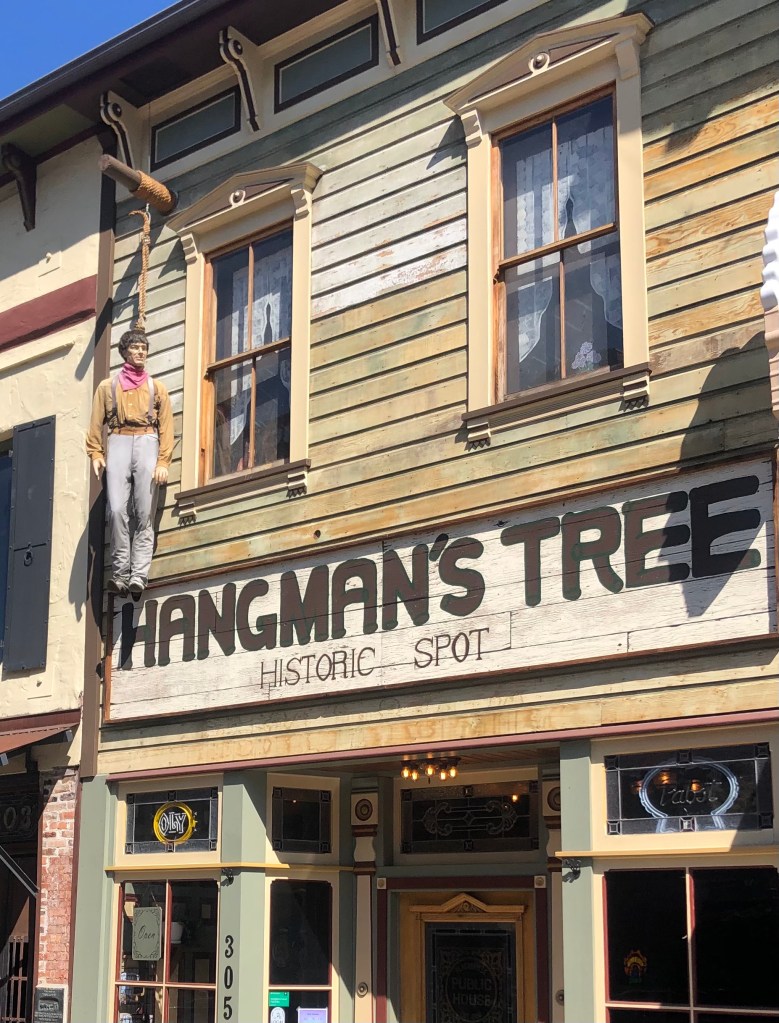
Of course, for a town that relies heavily on tourism, this whole gallows theme clashes uncomfortably with current political tides. And so the City Council recently voted to phase out the noose (but not the “Old Hangtown” moniker) from their logo.
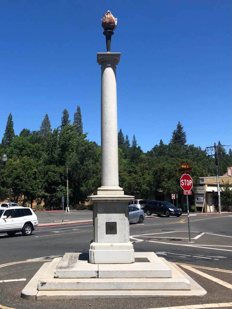
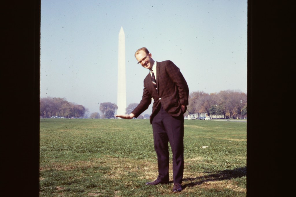
Naturally, Placerville tries to keep up with the likes of Denver, Colo., Trenton, Nebraska, and Boston, Mass. with its own wannabe Washington Monument obelisk. Actually, Placerville’s doesn’t look anything like the Washington Monument, but given my last post, it struck me as propitious that I’d encounter an obelisk at the beginning of my journey. Interestingly, this obelisk was erected by “The Druids of California” in 1926. I’m not making this up.
Incidentally, I feel compelled to share with you a Washington Monument photo from the Boilard Family Archives. This is my dad, Dennis Boilard, in the mid-1960s.
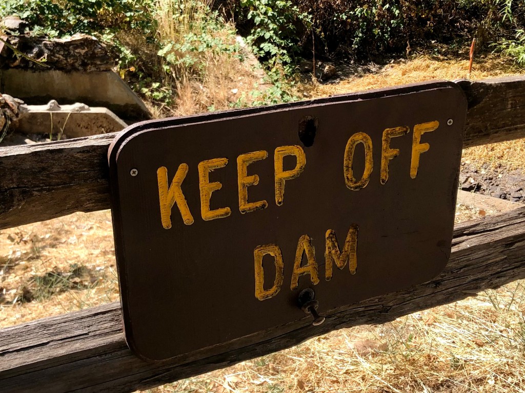
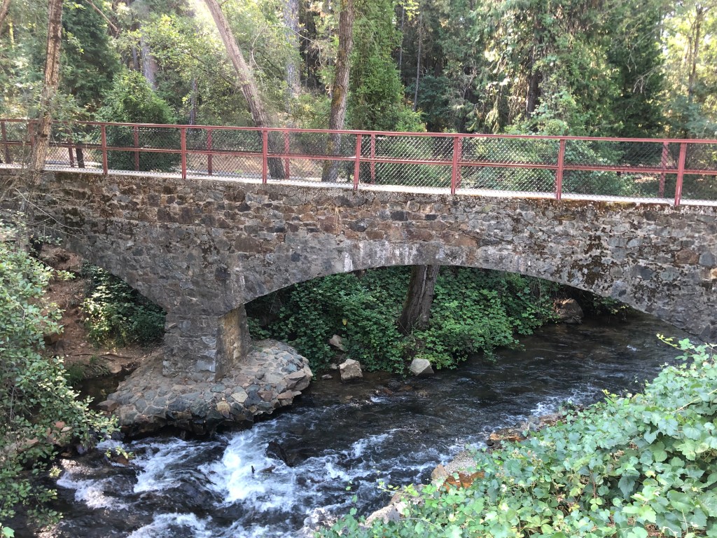
Back to Placervile: An especially tourist-friendly attraction is the town’s “Gold Bug Park,” which includes a historic mine you can walk through, a working blacksmith’s shop, a stamp mill, and other attractions. There’s even a small, historic dam on a stream that once saw hundreds of gold panners.
After a friendly chat with the docent at Gold Bug park (a matronly woman who’s been working there for 24 years), I set out north on Highway 49. An ancient sign beneath one of those El Camino Real mission bells pointed the way.
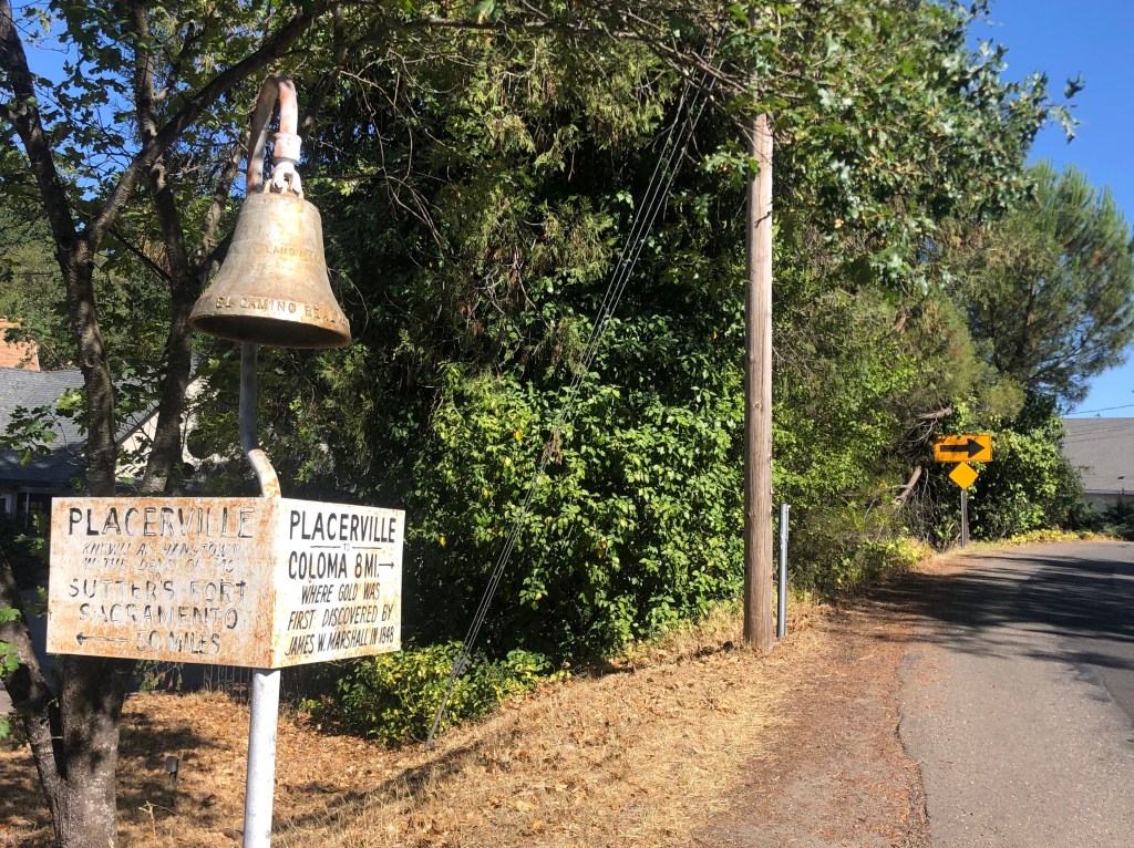
In 1906, cast iron mission bells were placed along the “El Camino Route” that joined California’s Franciscan missions. Much of that route is now modern-day US 101. Over the years many of those bells were damaged or stolen, but periodic efforts have been undertaken to repair or replace them. Today many of these bells can still be seen along US 101.
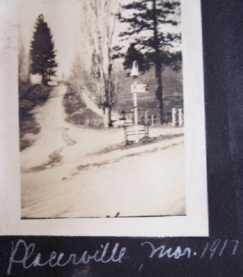
But what’s this bell doing along CA 49? As you can see in the photo above (those of you reading this on your smart phones may need to zoom in on the photo), it’s clearly inscribed as an El Camino Real bell. But Placerville is a long way from the El Camino Real. A little internet research found a historical marker database that claims the bell was placed there in 1948. But the photo below, dated as 1917, suggests the bell was installed much earlier. Anyone with information is encouraged to please contact me!
As I left the teeming metropolis of Placerville behind me, I settled into a comfortable cruise along the winding, oak-lined road that is Highway 49.
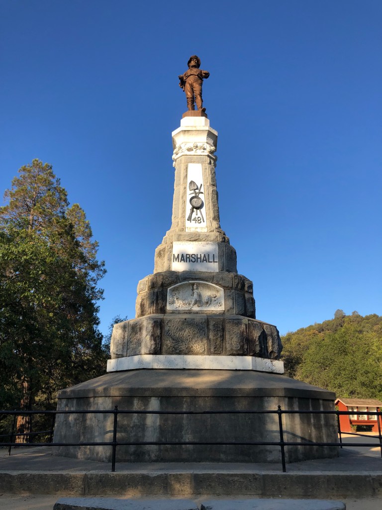
Soon I was passing through the historic town of Coloma (pop: 529) which is where, in January 1848, James Marshall discovered gold in the water channel serving Sutter’s Mill. Word of the find spread instantly, and within months California was inundated with would-be gold prospectors. Notably, Marshall himself never made much money on his discovery, and he eventually died penniless and largely unknown. A few years after his death, however, the state Legislature appropriated funds to have Marshall’s remains dug up and reinterred under a suitable monument. That monument sits just a mile or so off Highway 49, a distance that covers the entire length of CA Route 153. The sign below explains this conundrum.
The Marshall monument is indeed impressive. Installed in 1890, it features a larger-than-life statue of Marshall pointing at the spot where gold was discovered. The base of the monument includes all manner of symbolism, from gold mining implements to the California bear to Queen Calafia.
All along Highway 49 there are reminders of how California was fundamentally changed by Marshall’s discovery. Most of the towns along Highway 49 served miners in some way. And of course, California’s very statehood was accelerated by the country’s desire to latch onto the Sierra goldfields. And the throngs of people coming to California demanded improved transportation routes, which helped to spur the completion of of the Transcontinental Railroad in the 1860s.
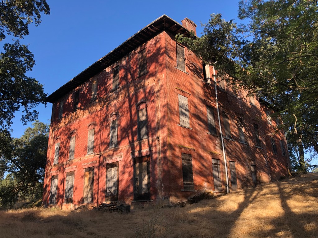
One of the first towns I encountered after Coloma was Pilot Hill (pop: 750), where in 1861 A.J. Bayley began constructing a 10,000 square foot, 22-room hotel to capitalize on what he assumed would be the construction of the Transcontinental Railroad right past his property. Indeed, the Central Pacific had been planning to use that route, but the plans where changed after an easier route was discovered through Auburn. The hotel was completed, but without easy access to the railroad it never saw the business Bayley had hoped for. The building still stands next to Highway 49 on a rise, and local organizations are hoping to renovate it.
One of the few “big” towns I encountered on this trip was Auburn (pop: 13,000). Auburn is in Placer County, and you’d of course expect Placerville to be the county seat of Placer County. But as we already learned, Placerville is the county seat of El Dorado County. Auburn is the seat of Placer County. To add to the confusion, Highway 49 also passes through Nevada County, which is a county of California.
Anyway, as 49 passes through Auburn is crosses the historic “Lincoln Highway.” The Lincoln Highway dates back to 1913, and was the country’s first coast-to-coast highway. It ran from Times Square to San Francisco’s Lincoln Park. When US highway numbering became a thing in the 1930s and 1940s, the portion of the Lincoln Highway passing through Auburn was designated as US Route 40. I tell you all this because in Auburn there is now a marker commemorating the Lincoln Highway and Route 40, with slabs of original pavement from the route.
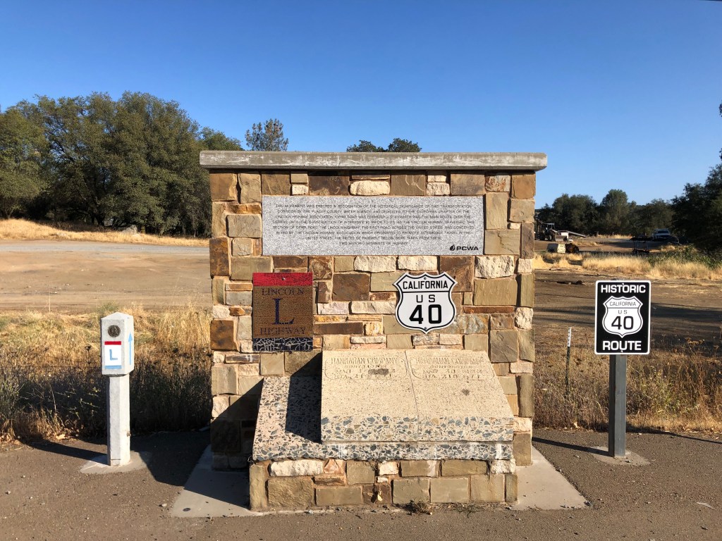
Incidentally, most of the Lincoln Highway has now been superseded by Interstate 80.
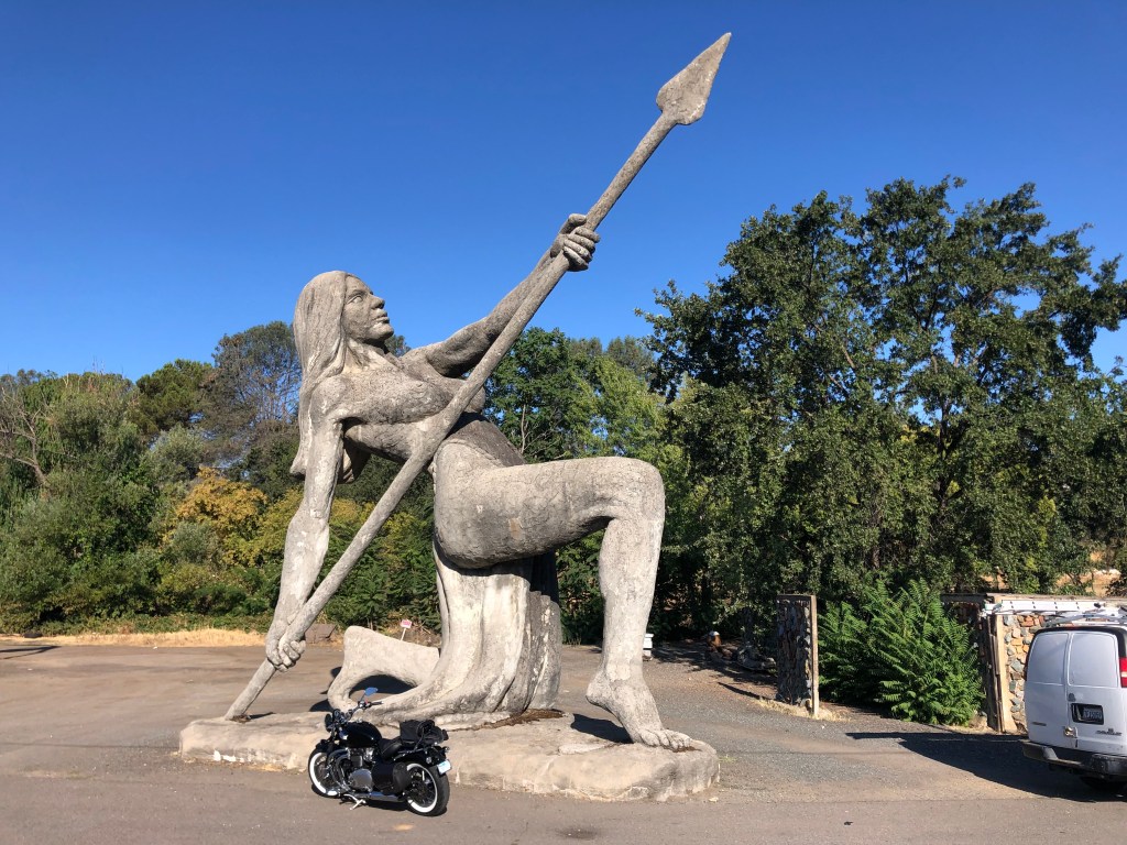
Before leaving Auburn, I took this picture of a roadside art installation. I’m told the statue was created by a local dentist. I’m not sure what it’s supposed to mean, but the sheer size is impressive.
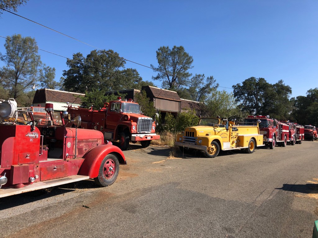
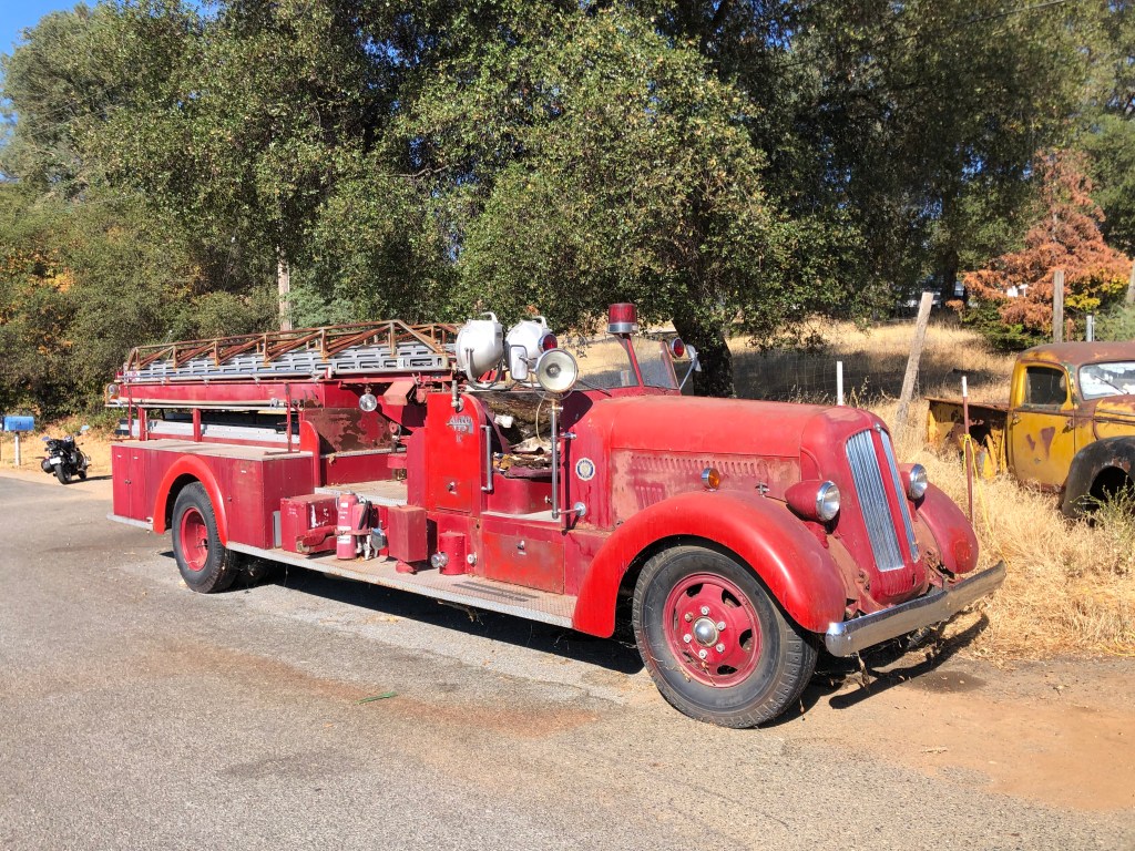
After Auburn, one just has to get through the rival cities of Grass Valley and Nevada City before highway 49 returns to a slow, winding, two-lane road. I didn’t feel much need to stop in those cities, given that they’ve become overrun with weekend tourists, posing hipsters, and college students showing off their starter tats. Between those two cities, though, I encountered a roadside collection of fire engines. They were parked in front of someone’s property, with no signs, no explanation, and no one to ask. Even an internet search came up empty.
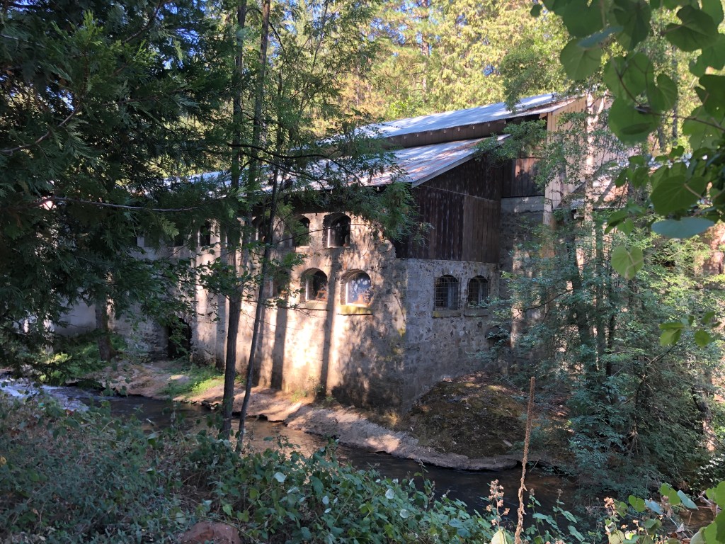
A bit further along the road I came upon the North Star Mine Powerhouse. It was constructed in 1895, and used water power from a neighboring creek to power a mining operation. Large mining operations were, of course, a direct outgrowth of the gold rush. The stone powerhouse building is situated among trees beside the stream, and looks like something out of a Robert Kinkade painting.
And now the road settled into an idyllic, meandering, quiet route that flirted with various forks and tributaries of the American and Yuba Rivers.
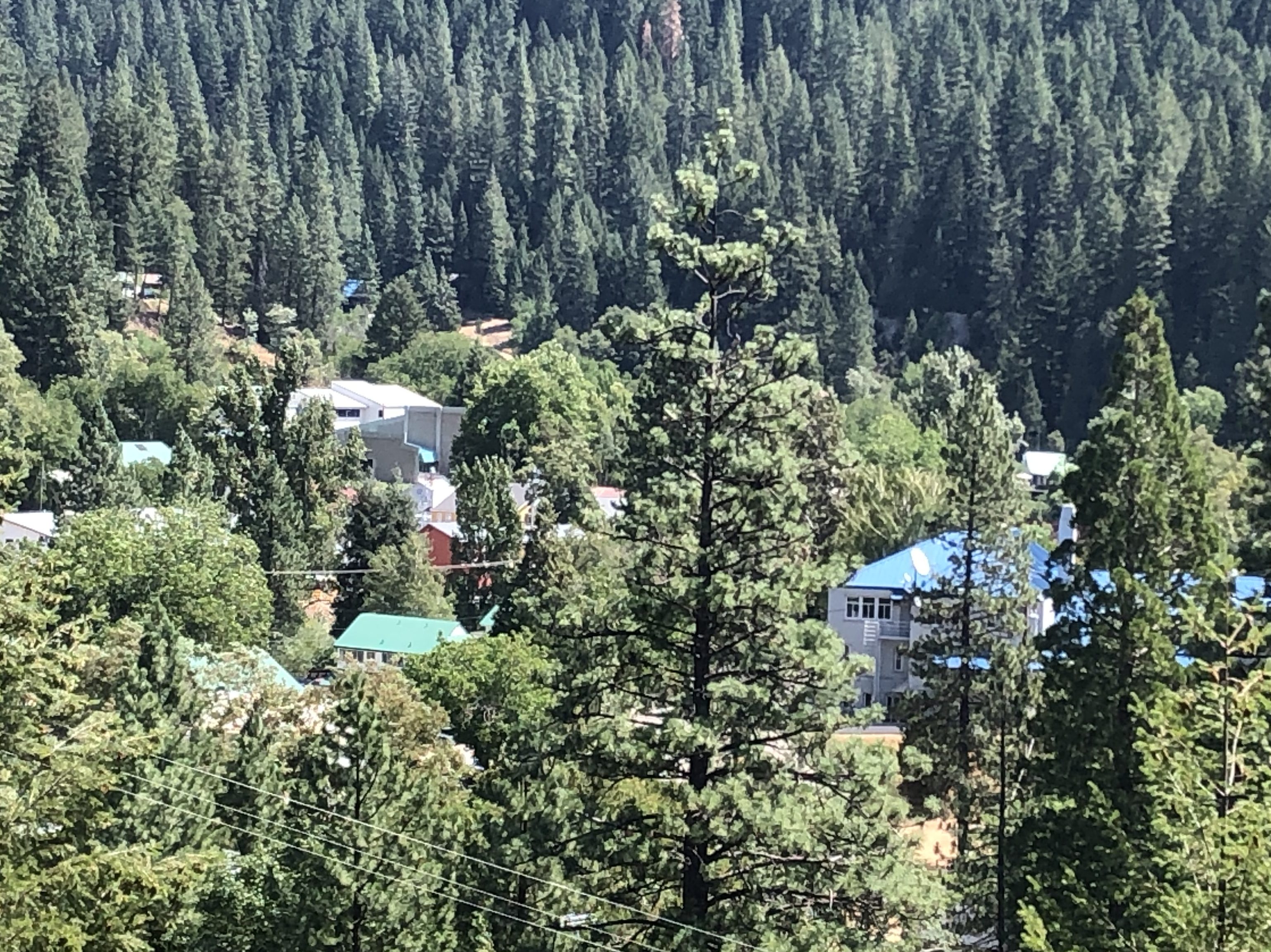
Eventually I came to a turnout that overlooked the town of Downieville (pop: 300). It’s not a big or even a substantial town by any measure, and yet Downieville feels solid if not prosperous, and picturesque if not beautiful.
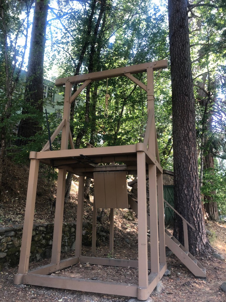
The town quickly arose in 1849 when a Scotsman named William Downie discovered gold in the area. The gold eventually played out, of course, but the isolated little town has refused to die. As the county seat of Sierra County, it does possess a handful of government buildings and a court house. It even has its own gallows, which was used only once, to hang a 20-year-old man for murder in 1881. A change to state law later that year ended local executions in California.
Continuing with our theme of hangings, in 1851 a young woman was hanged from the local bridge by a vigilante mob seeking justice for a murder. Josefa Segovia was the first woman to be executed by hanging in California. Her body rests in the local cemetery, not far from that of the man she supposedly murdered.
But let’s leave Downieville on a less gruesome note. I passed an enjoyable 30 minutes chatting with Carol at the town’s two-room museum. Carol’s husband (now 80) grew up in this town, and Carol has learned to love the place as her own. She admits that many of the town’s young people feel a need to “spread their wings” by leaving, at least for awhile. But she believes that most of them eventually come back, “at least to visit.” She says it’s a close community, and the residents take pride in the town’s ties to the Gold Rush. Her husband even paints river rocks with gold paint for Carol to give to young visitors at the museum.
The next town I encountered after Downieville was Sierra City (pop: 200). Like so many of the other settlements along Route 49, Sierra City saw its heyday during the Gold Rush. Today the town has only a handful of structures and few signs of life. The exception to this was an enormous barn with a cluster of people standing around its open doors. I stopped to check it out.
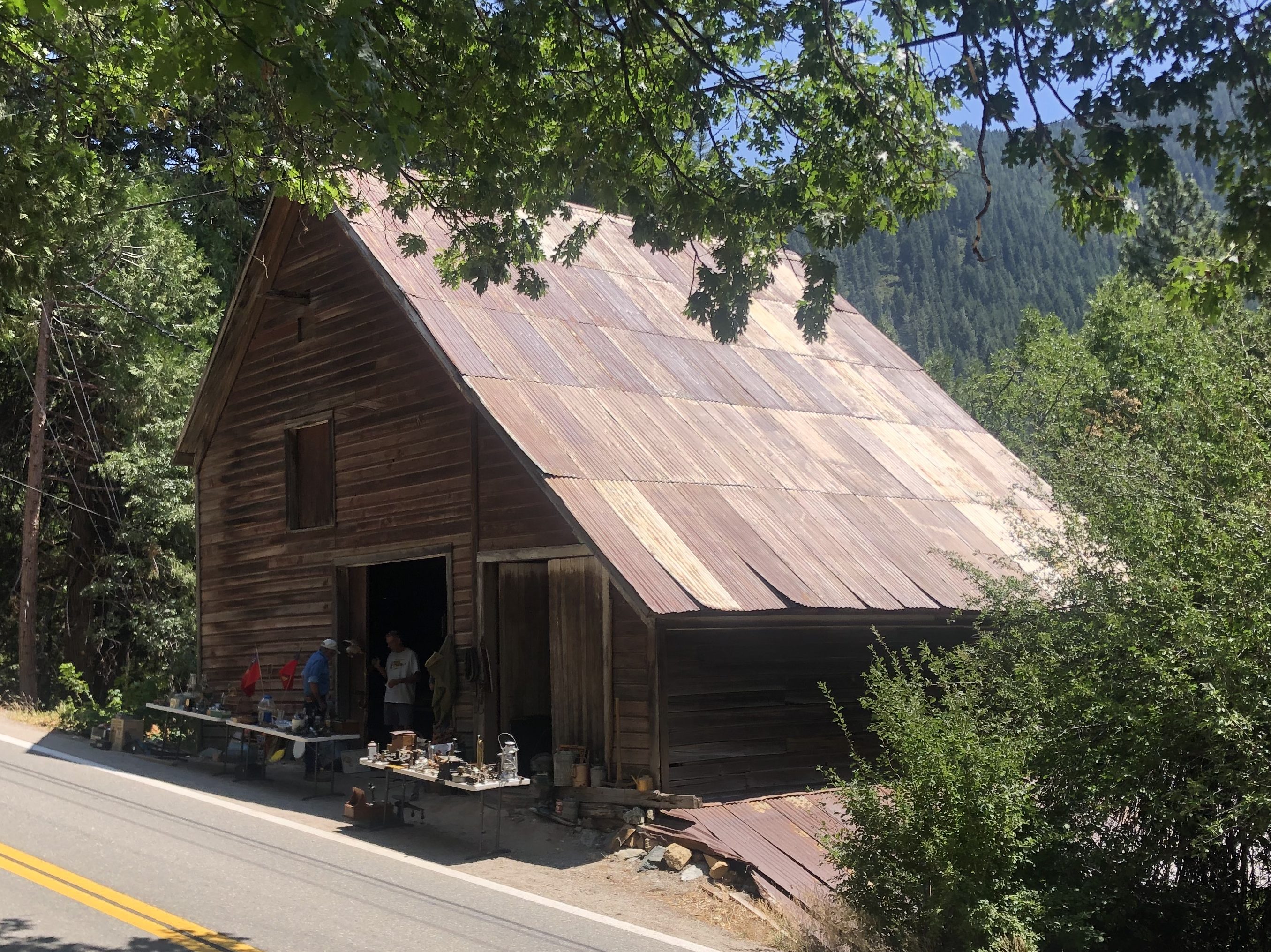
It turns out the barn’s owner, Joshua, was holding an estate sale to raise funds to open a museum in the barn. He told me that the barn was built in 1873, and when he purchased it a few years back it was full of various old (and I mean old) pieces of farm equipment, horse tack, tools, and the like. The barn is even bigger than it looks; it has two stories above ground, and another two floor below ground.
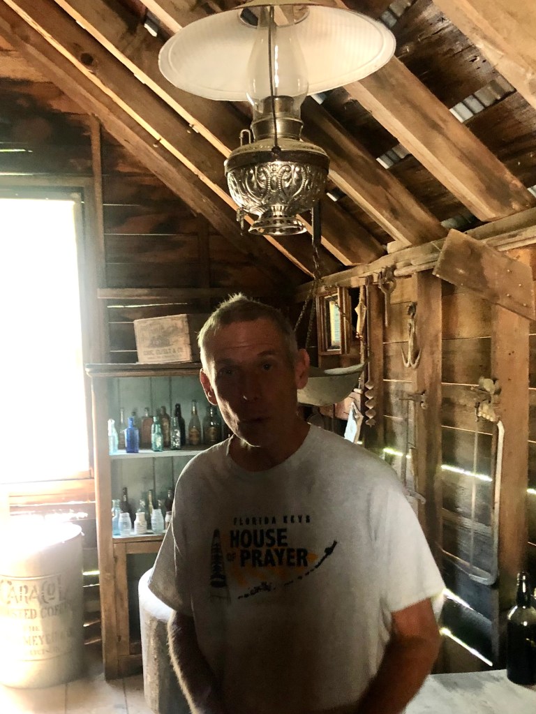
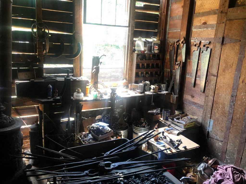
While we talked, cars would stop, people would get out and look at the stuff Joshua had out for sale, and they’d ask him what this doodad is or what that gimcrack does. Joshua had a detailed explanation for each item, including its origin, history, and purpose. (I ended up purchasing a mid-19th century equine curry comb for twenty bucks.) Joshua clearly enjoys history, and he was especially enthusiastic about getting the museum up and running. The barn itself holds a place-bound story about the town, and the artifacts tell stories about our ancestors, their culture, and their way of life. Joshua sees the importance of preserving those stories. Although he grew up in the Bay Area, he (like Carol the docent in Downieville) has come to greatly appreciate his new hometown, and he (like she) works to share it with others.
After awhile I got back on the road, and soon found myself heading north and south simultaneously.
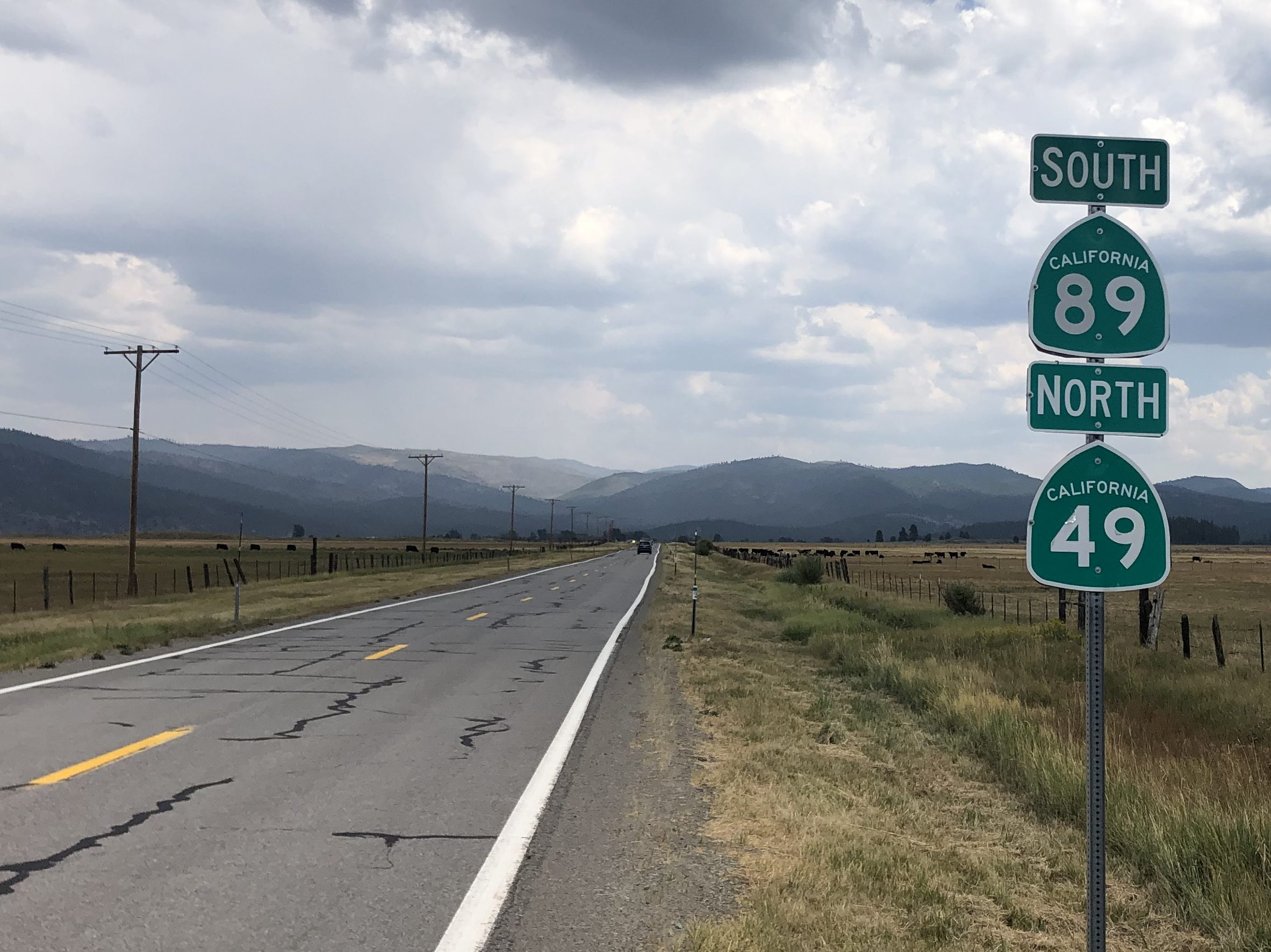
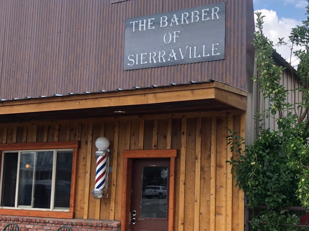
Finally I came to the town of Sierraville (not to be confused with the earlier Sierra City). The town’s barber had some fun referencing the town’s name.
I stopped at a small cafe for a java, and ended up chatting with a guy roughly my age who was getting a latte for his wife (or so he said). We got to talking, and he mentioned he lives in Reno. “What brings you all the way out here?” I asked. “That,” he answered, pointing across the street to a Mexican restaurant called Los Dos Hermanos. “It’s the best Mexican food in Reno,” he explained, and it took me a moment to understand what he meant. Evidently the place is so good he considers it his “local” Mexican restaurant.
I was noticing that the weather was starting to change, and there was a slight smell of smoke in the air. From Sierraville, highway 49 would head north toward the so-called Dixie fire that’s currently the state’s largest wildfire so far this year. Given my track record of encountering fire-related roadblocks on my road trips, I decided to instead head south on state highway 89 and spend the night on the north shore of Lake Tahoe. I was accommodated by my friend Chris P., who lives in Incline Village with his wife Carla. Chris and I got a couple of beers at the local brewery, then went back to his place for martinis, steaks, and red wine. I am grateful to them both for their hospitality.
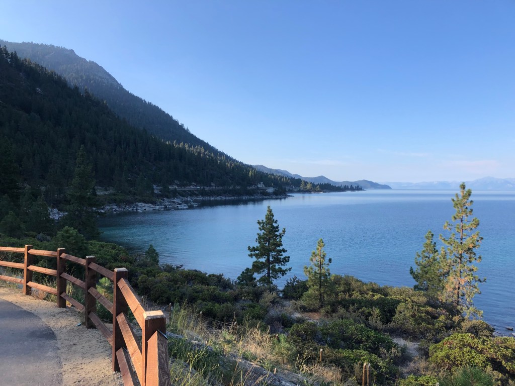
This morning I took a leisurely ride around the Lake Tahoe on the Nevada side, taking in the brisk morning air and enjoying the views. Mine was practically the only vehicle on the road.
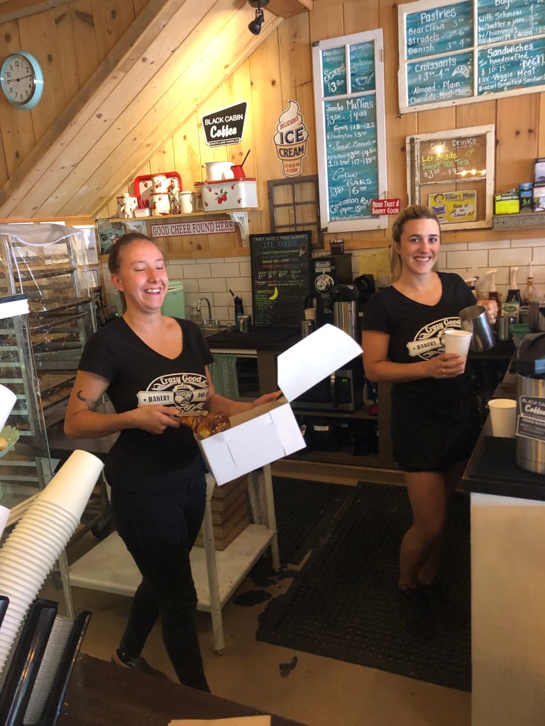
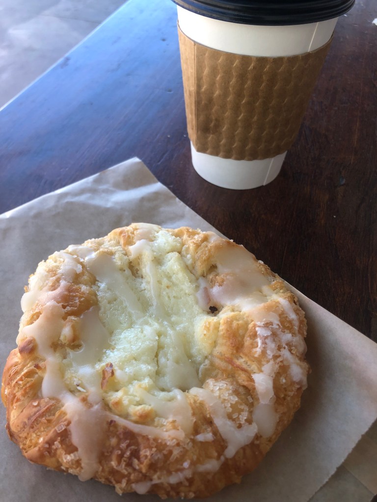
After passing the cluster of aging casinos near the state line, I re-entered California at South Lake Tahoe. I was experiencing a hankering for a good, rich cheese danish and a cup of strong coffee. I tried several local bakeries, and while the proprietors offered me all manner of bagels, scones, and (at the natural food bakery) a CBD muffin, there were no danishes to be had. As my final stop I went to a place called Crazy Good Bakery, where I got a delicious danish, a great cup of coffee, and a heart-warming smile from the owner’s daughter-in-law, who’s up here for the summer from San Diego.
Thus refueled, I got back on the road and rejoined Route 89 south toward Route 88 west. Almost immediately after joining Route 88 I saw a structure that resembled a fire lookout tower, but it was equipped with what appeared to be grenade launchers or mortars of some kind.
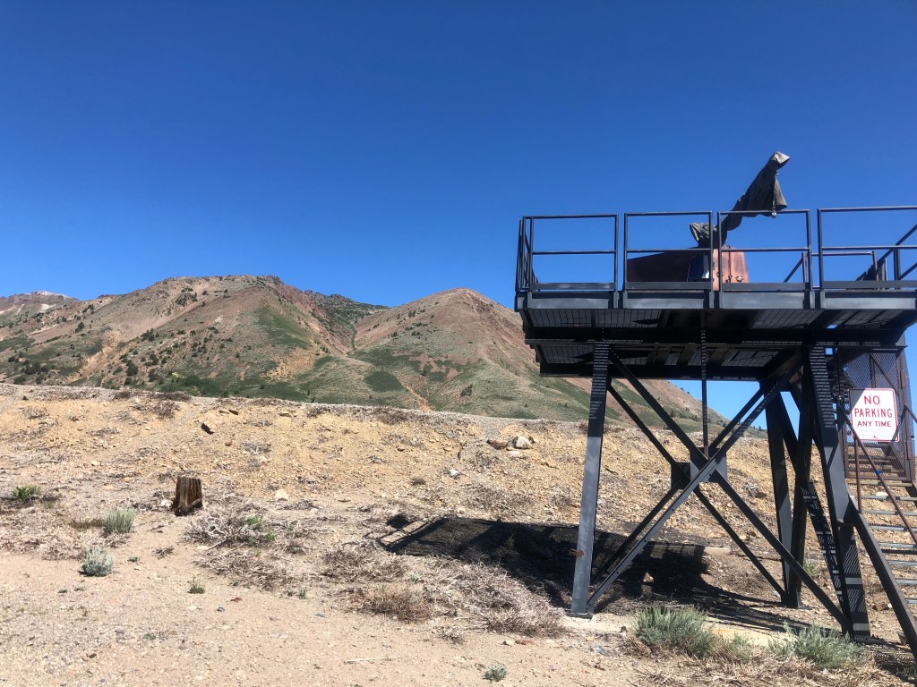
Closer inspection revealed a “Danger!” sign warning that “unexploded military shell and explosives used for snow avalanche control may be found in target areas.” Does this mean that the equipment on the tower is used to fire live ammunition at the nearby snow-covered mountain? This sounds like one of Peter D’s tall tales, but I’d appreciate it if someone could please explain.
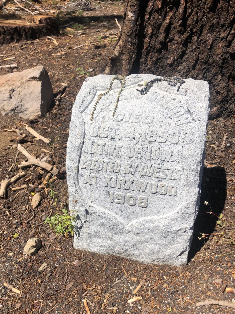
The rest of the trip home was relatively uneventful, with the following exception: Around Carson Pass I saw a sign for a historic site named “Maiden’s Grave.” Those are two words that really should never go together. But I was intrigued, and stopped to look at a small headstone that had been placed there in 1908.
The story goes like this: Remember all those immigrants coming to California during the Gold Rush? It was a hard, dangerous journey, marked with all manner of hardship, injury, and even death. One of those deaths was a young woman named Rachael, who was crossing Carson Pass with her family in 1850. Her parents buried her there near the pass. Half a century later, Rachael’s now-elderly mother came to the area looking for Rachael’s grave in order to bring her daughter’s remains “home.” She inquired of the locals, but no one could provide information on the grave’s whereabouts. The mother left, disappointed.
Word got around about the mother’s inquiries, and some visitors at Kirkwood recalled a grave in the area marked with a crude wooden cross naming its occupant as “Rachael Melton” and noting her death as 1850. They assumed this must be the daughter that the mother sought, and they raised funds to provide a headstone for the grave. Hence, the marker that I saw, placed in 1908.
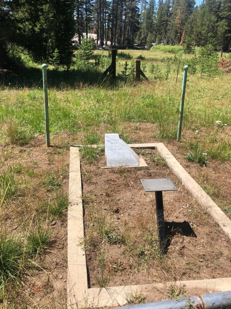
That would be the end of the story, but in 1986 (!) a landowner about 2 miles northeast of the putative maiden’s grave was clearing his land and came across a grave outlined with rocks. Historical records were consulted, research was performed, and it was determined that this was the actual location of Rachael’s remains. The landowner erected a marker for the “Real” maiden’s grave. Such was the postscript appended on a plaque near the marker I encountered along Route 88. So I did some quick Google searches, and armed with that information, I set out in search of the secondary marker. I found it on a nearby road called Tragedy Springs. Here it is:
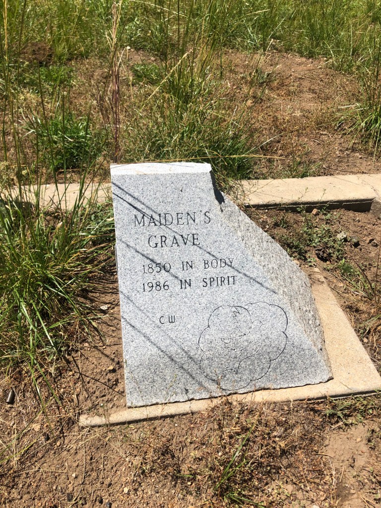
So, that may be the end of Rachael’s story, but then who is buried under the “Maiden’s Grave” on the side of CA-88? Most agree that it’s the body of Allen Melton, who hailed from “Henry County.” His story is all but forgotten, or ignored.
Still, the Maiden’s Grave story strikes me as a positive one. It highlights a mother’s love for her daughter, the decency of a group of strangers who volunteered to help mark (albeit erroneously) a girl’s grave, the decency of a local landowner to tried to right a historical wrong by placing a new marker on his land, and efforts by all of us, channeled through our state government, to remember and honor the hardships and losses experienced by the pioneers who founded this state. For a road trip focused on the Gold Rush, the importance of place, and the impact of history, I can’t imagine a more fitting final reflection.
