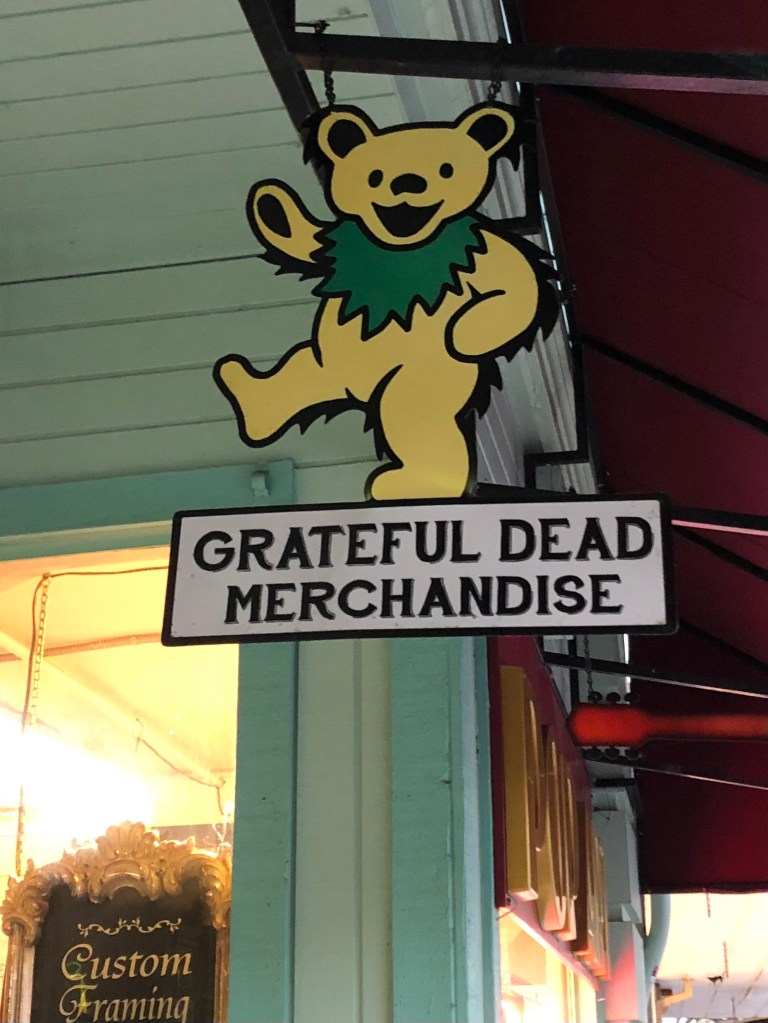
A few nights ago the wife and I were having dinner in downtown Placerville. We were sitting outdoors (as one does these days), watching the strollers stroll and the passersby pass by. Then what to my wond’ring eyes should appear but a bright, shiny sign with a gold, laughing bear.
Attentive readers will recall my mission to track down historic Golden Bear signs. I made a few subsequent discoveries here and here. Had I now stumbled across another one?
Sadly, upon closer inspection, I noted that this Laughing Bear was just an advertisement for another hippy-dippy store selling tie-dyed shirts and all manner of hemp products. For as we all know, The Grateful Dead appropriated the image many years ago as part of their brand.
No Birkenstocks, no service.
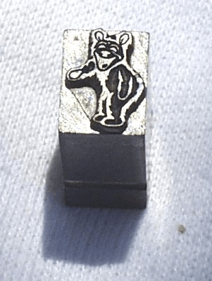
Now, to be fair, there is an alternative myth that the Grateful Dead’s bear was copied not from the Golden Bear signs, but from a “36 point lead slug” (that is, a piece of old printer’s type). Here is the slug in question:
The plot thickens
The story goes that an artist by the name of Bob Thomas found the slug somehow, and used it as an inspiration for the album design of The Dead’s 1973 album, The History of the Grateful Dead, Volume 1 (Bear’s Choice). (“Bear’s Choice” is a reference to Owsley “Bear” Stanley, who was the Dead’s sound engineer and, not incidentally, a major purveyor of LSD. I’m not making this up.)
Look carefully around the perimeter of the circle.
I’m of the opinion that the “36 point lead slug” may indeed have been Mr. LSD’s inspiration for the album art, but I suspect that the slug itself was designed from the historic Golden Bear logo. It may have been used for Golden Bear advertisements in the newspaper, for example.
Anyway, my point is this: If you need drug paraphernalia, there’s a place next to Bene Italian Restaurant in Placerville. In the meantime, please send me pictures of any authentic Golden Bear signs that you might come across.
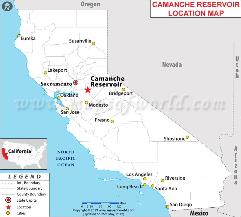
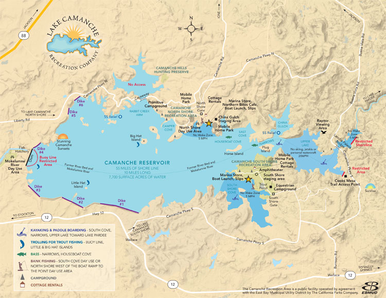
Back when I was a babe (shockingly, no one calls me this anymore), the good folks at the East Bay Municipal Utility District (East Bay MUD) decided to dam the Mokelumne River in the Sierra Foothills, thus creating a reservoir that would supply the growing population of the East Bay with reliable drinking water. They named the reservoir Lake Camanche.
I vaguely remember the too-good-to-be-true commercials, featuring over-excited sport fishermen and giddy children playing at the beach, that were broadcast over the fuzzy UHF stations on our ancient television set in the late 1960s. The commercials sought to entice families to buy undeveloped land that, thanks to the creation of the reservoir, had suddenly become beachfront property. The sales pitches belong to a mildly ineffable class of advertisements that evoke tropical beaches improbably appearing in the shrublands of California’s dry foothills or, say, the deserts of northern Arizona. Here’s a good example of the genre. For an illustration of how these schemes can go wrong, see my post on the Salton Sea.
Anyway, although new communities were springing up on the north and south shores of Lake Camanche, several historic settlements found themselves underwater–literally. By damming the Mokelumne River, East Bay MUD flooded several gold rush towns: Lancha Plana, Poverty Bar, and Camanche. The first two were unihabited ghost towns, but Camanche still had some residents and a functioning post office that had to be relocated. (Camanche had been named by settlers in the 1850s after their home town of Camanche, Iowa.) Today, the towns sit under about 150 feet of water. It’s said that scuba divers occasionally explore the submerged remnants of the old towns.
Now, the Sacramento region has been experiencing unusually warm temperatures this week, feeling more like mid-spring than mid-February. And if that’s not a good enough reason for a retired chap to take a little road trip down to Lake Camanche, I don’t know what is.
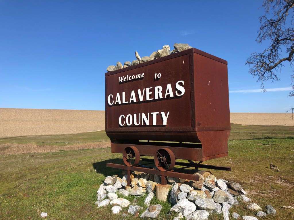
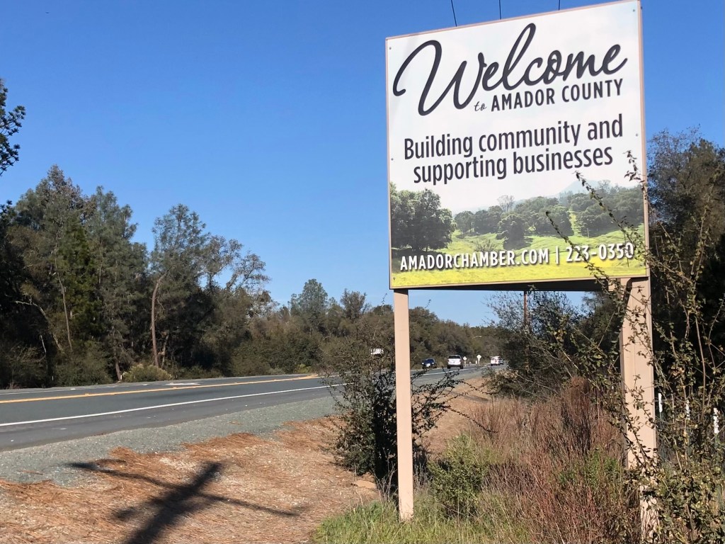
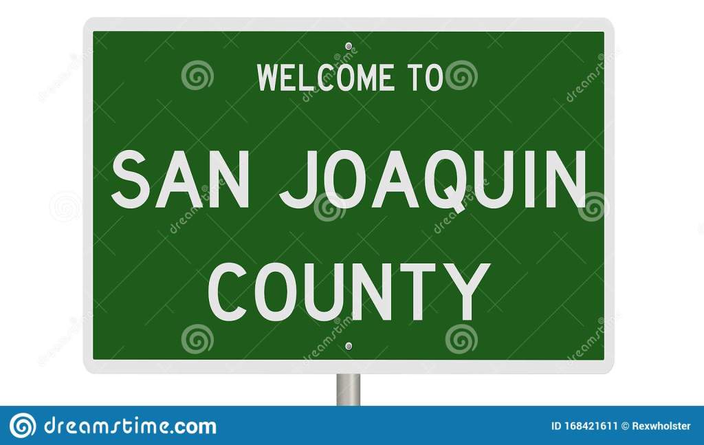
Thus I found myself heading south from my newish stomping grounds near Placerville, down to an area where Amador, San Joaquin, and Calaveras Counties meet. (Most of the trip followed Route 49, which I described in a recent blog post.)
(The San Joaquin sign is clip art; I didn’t actually pass any such sign today.)
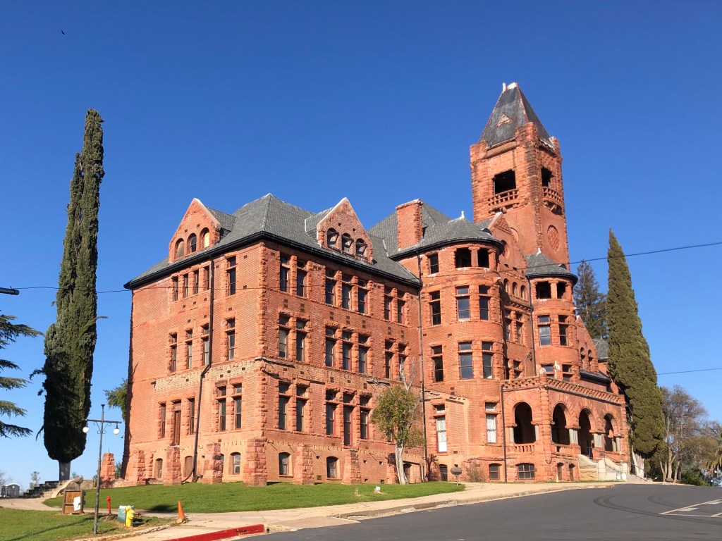
As I got close to Lake Camanche, I passed through the town of Ione (pop: 8,600). It’s a historic, quaint, and reasonably prosperous little community that no doubt will be the subject of a later blog. But for now, let’s just observe that Ione is home to the historic Preston Castle, which had been a reform school for boys that was built at the end of the 19th century. It’s said to be haunted, and for that it will likely be the subject of a blog in October.
You should see it at night.
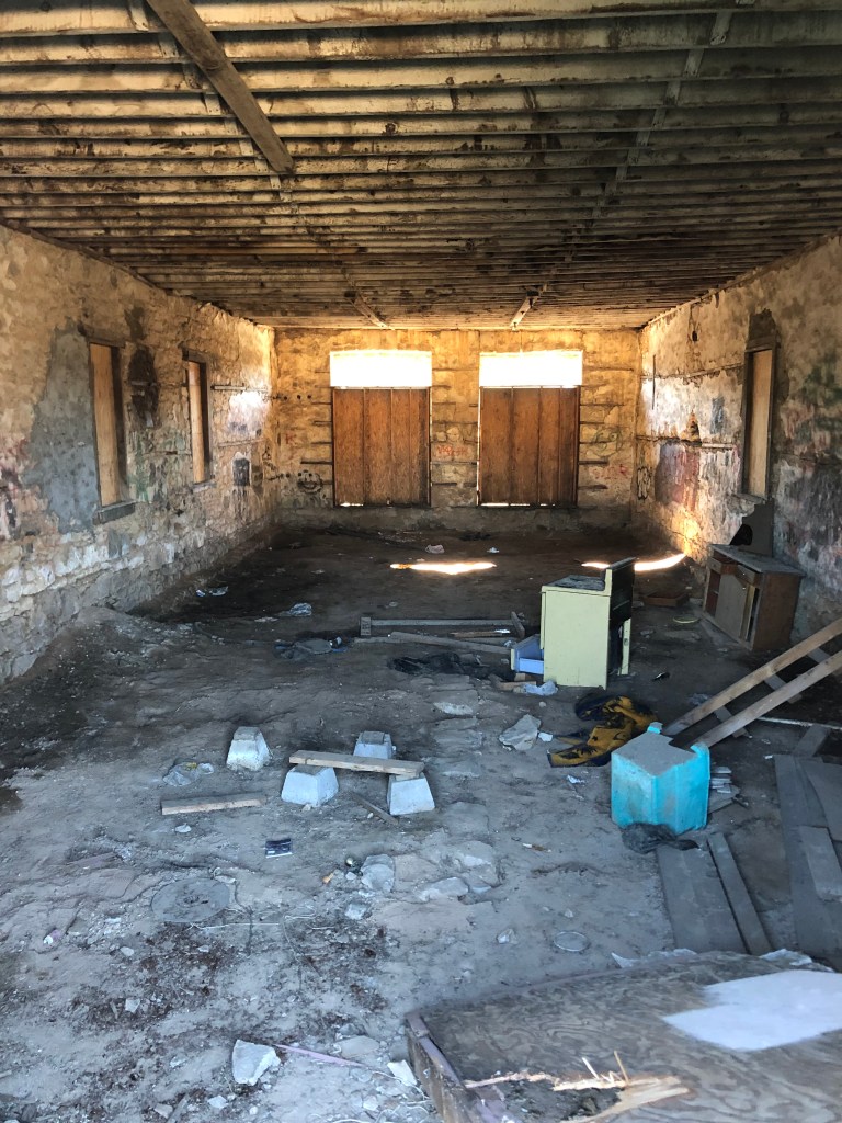
When I finally arrived at Lake Camanche, I was somewhat disappointed. Let me enumerate the three reasons for my disappointment:
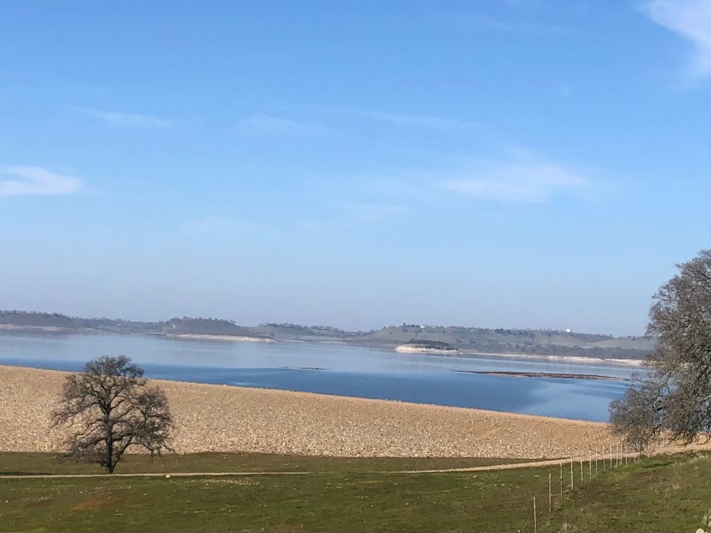
Camanche Reservoir, behind a dike.
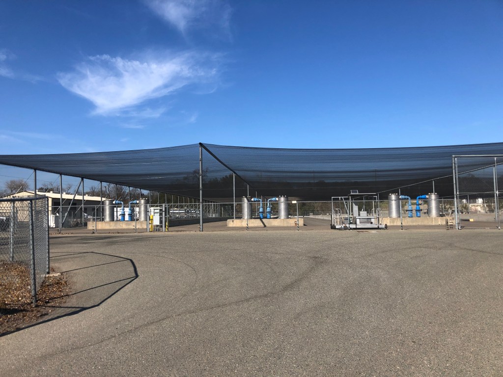
There is limited public access to the lake itself. You can pay day use fees to enter at the boat launch, but I couldn’t find any shoreline drive to cruise along. I guess I should have brought a boat.
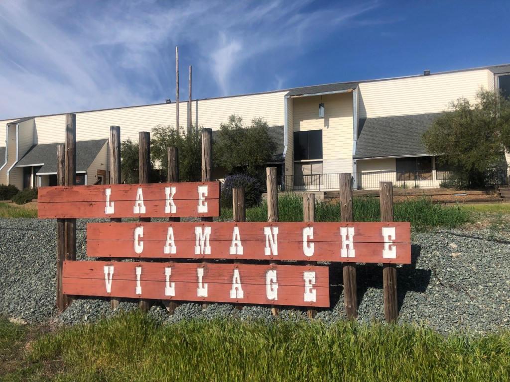
The communities around the lake never seem to have properly taken root. I saw no evidence of viable commercial districts, neighborhood parks, or even a decent brewpub. What little infrastructure I encountered was abandoned and/or decrepit.
Lake Camanche Village has seen better days…
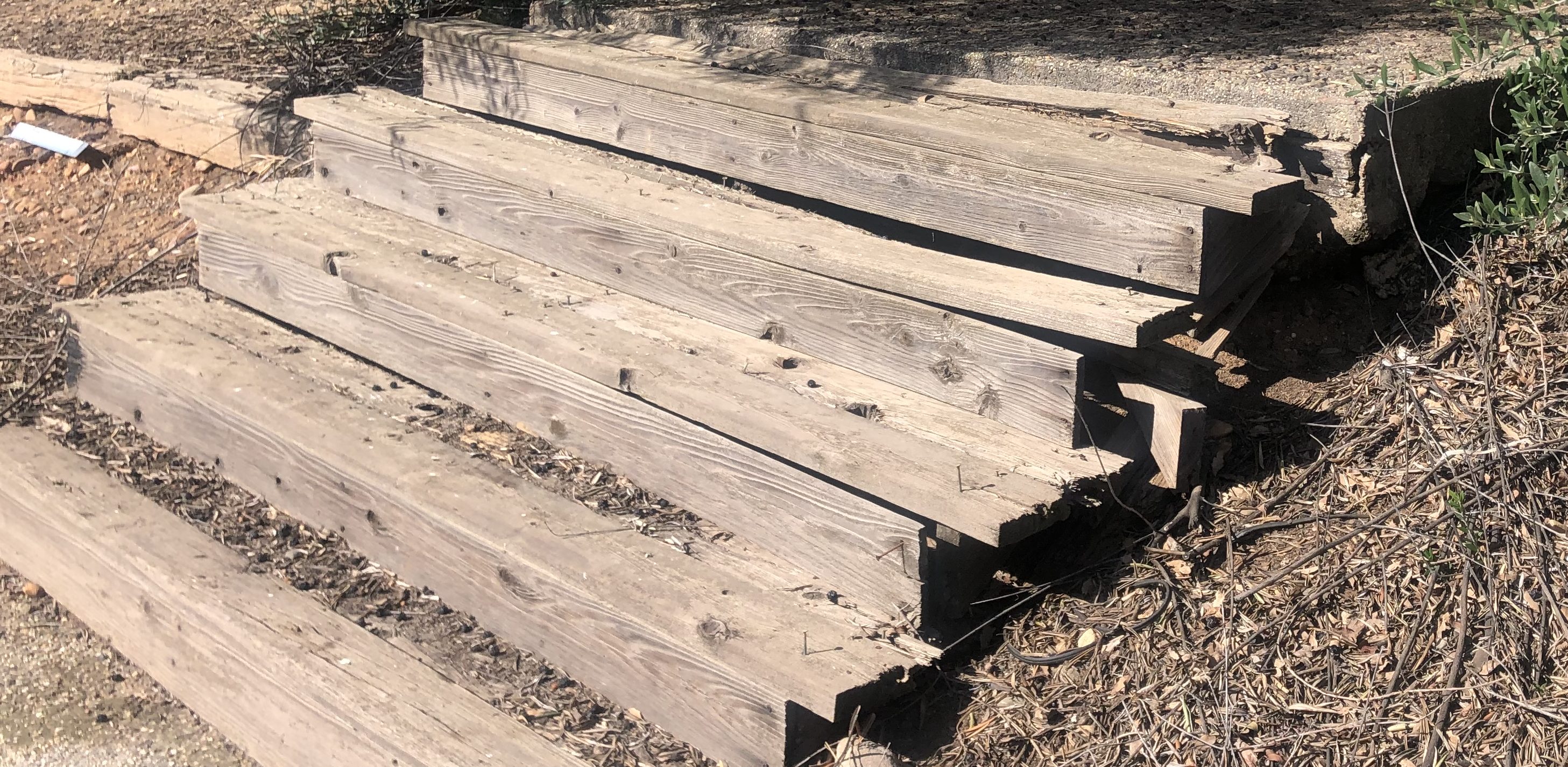
3. Although recent news items spoke of how California’s drought has exposed ruins that normally reside under water, major rains this past December re-covered those historic remains and I was unable to find any evidence of those three historic towns under Lake Camanche.
Somewhere under Lake Camanche
Incidentally, although Lancha Plana had no population when the reservoir was being developed, it did have a cemetery. East Bay MUD decided to move the graves to another location…as if somehow, after over a hundred years, it would be cruel to put a lake over the cemetery. But such are the expectations of civilized society. Let’s just hope they learned the lesson of Poltergeist.
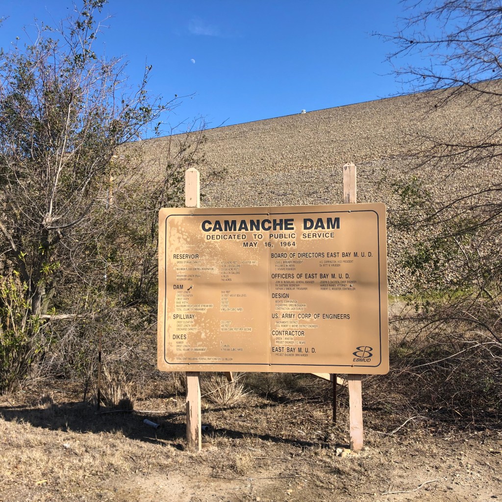
Still, even without encountering drought-exposed ruins, the visit was a good one. I took a pleasant drive more or less around the lake, with glimpses of the blue water and, more often, views of the surrounding hills. Eventually I came to Camanche Dam, which stops the Mokelumne River in its tracks.
A few stats about the dam, which was constructed in 1964: it’s 2640 feet long and 261 feet high, holding back up to 241 billion gallons of water. For those of you who can’t wrap your head around that number, it equates to about 107 billion cases of beer.
Is it just me, or does anyone else think the reservoir is in the shape of a guppy?
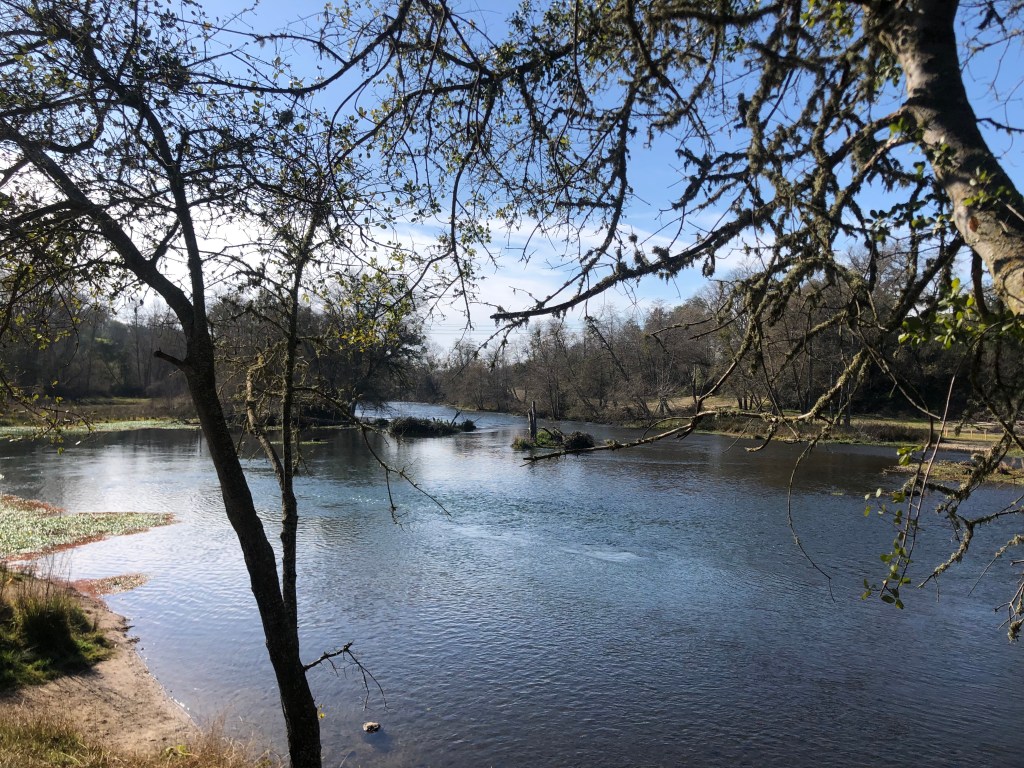
Here’s the placid Mokelumne River shortly after it passes through the dam.
Near the reservoir there’s also a fish hatchery, which is used to restore Chinook salmon and steelhead whose kinky sex lives were impeded by the dam. Sadly, the facility is now “temporarily closed” to visitors.
Mokelumne Fish Hatchery, where salmon get it on. I couldn’t get confirmation on whether they pipe in Barry White music.
Well, that’s kind of it. Without a watercraft or scuba gear, there isn’t a whole lot to do around Lake Camanche. With a final glance at a few anglers attempting to hook, kill, and presumably devour some of the recent graduates from the fish hatchery, I got back on the Speedmaster and headed for home.
So, today is my birthday. I’m not going to dwell on that, other than to note it’s a prime number, and it earned me a free donut. Anyway, I figured that I’m not getting any younger, so I decided to spend the day exploring the back roads of the Sierra Foothills. The region is beautiful this time of year, with its rolling hills covered with deep green grass. And today was unseasonably warm, feeling much more like spring than winter. So I saddled up the Speedmaster and went to see what I could see.
Thank you, Totem Coffee in Placerville!
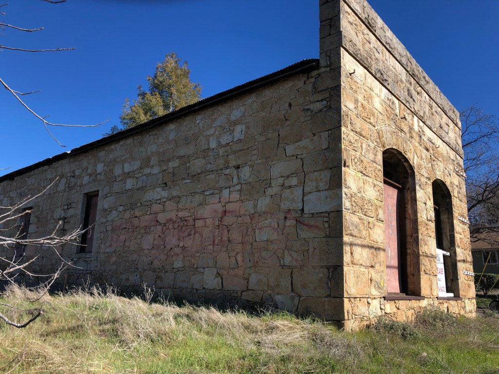
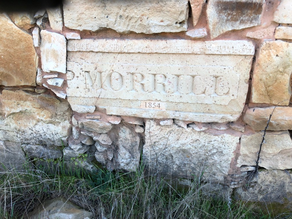
I found myself meandering along CA Route 49–a scenic, historic road that links a number of gold mining towns. (I wrote about an earlier trip along a stretch of it here.) This time I headed south on CA-49, starting around Coloma. I passed through the (relative) metropolis of Placerville, and soon came to Diamond Springs (pop: 11,000). To me, Diamond Springs is one of those gold rush towns that has somehow managed to maintain its historic charm while still being relevant in the 21st century. Its population has more than doubled since 2000. The most attractive business in town, for my money (literally), is Solid Ground Brewing. But the most picturesque building is the old General Store, from the 1850s. It’s for sale or lease, if any of my readers wants an investment property…
Interested? Call University Capital Management at 916-929-5433.Exterior detail of your future lease/purchase.Interior of the building. Like Charlie Brown’s Christmas tree, it just needs a little TLC.
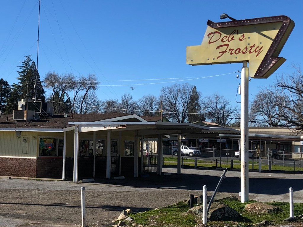
Now, in case you thought Diamond Springs was stuck in the Gold Rush era, it does have some “modern” buildings….from the 1950s. According to Yelp, Deb’s Frosty specializes in Mexican food. (??!)
The go-to spot for Chile Relleno.
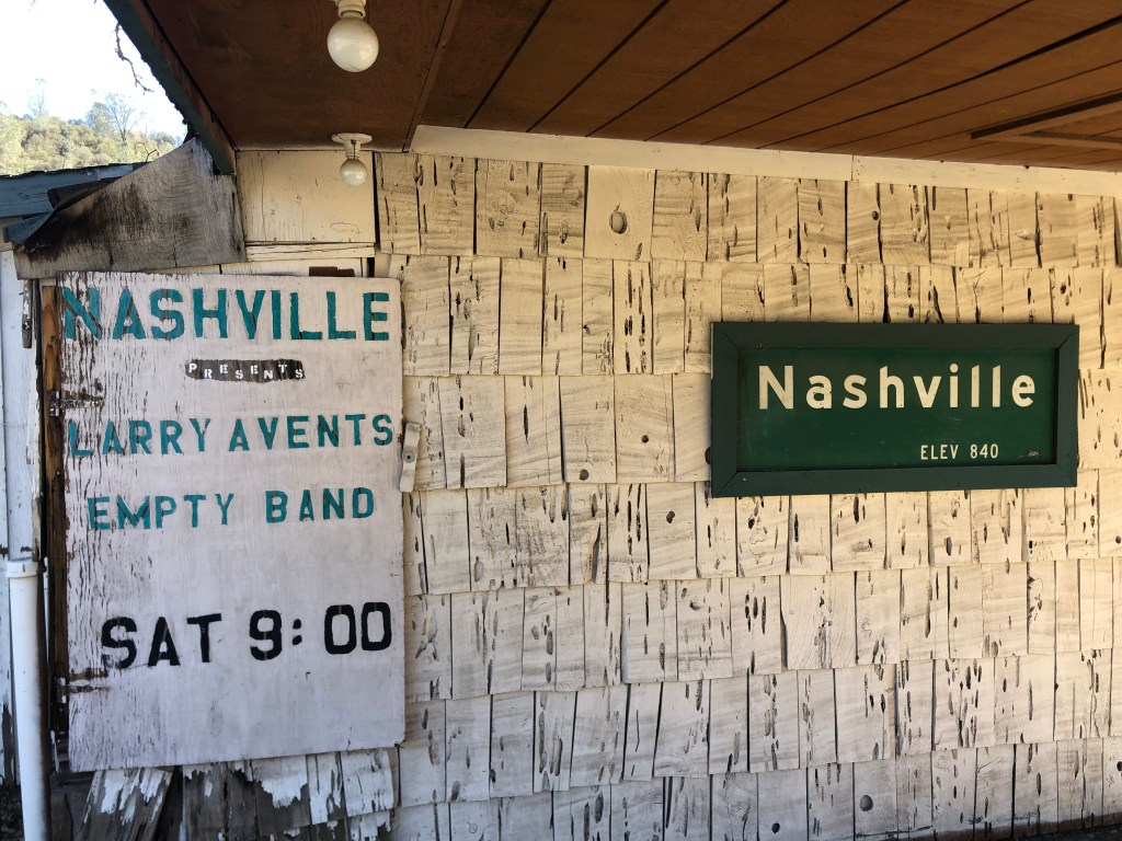
Somewhat further down 49 I entered Nashville. No, not the Nashville. But they do have their own music venue.
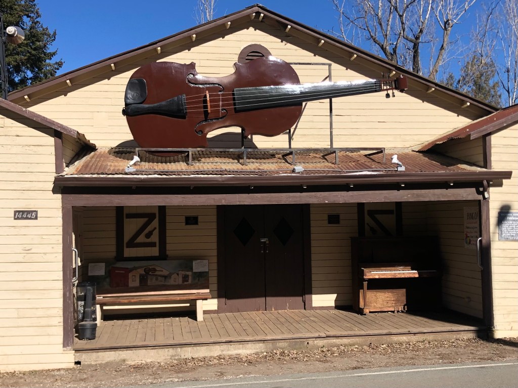
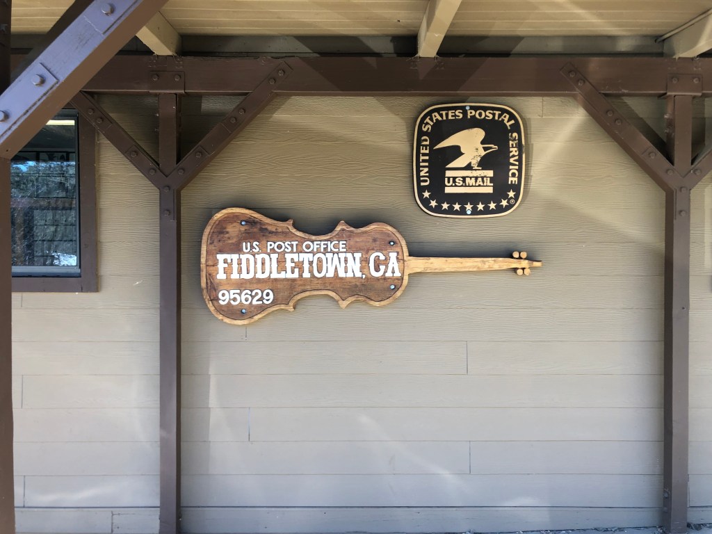
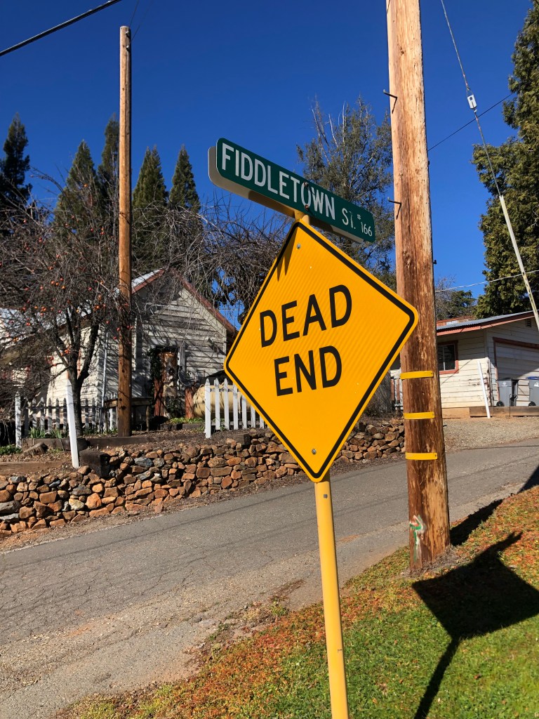
After a few random stops for gas, coffee, and Reeses (it’s my birthday, after all), ended up in Fiddletown (pop: 235). I spent several hours here. Fiddletown dates back to 1849, as do so many of the towns here in the Mother Lode Country. It didn’t start out as a particularly popular place to mine for gold, given that it didn’t have any year-round rivers or streams, which the miners needed for panning and placer mining.
Then, in 1852, gold was found in the region’s dry creekbeds, and everything changed. The town swelled with an influx of prospectors, and a canal was dug to divert water from the Cosumnes river into Fiddletown’s dry creekbeds. Not only did this facilitate easier gold mining, but it also opened the region to agriculture. By 1854 Fiddletown’s population exceeded 2000 souls.
With growth and wealth came the desire for respectability, which for some required changing the name to anything but “Fiddletown.” (It’s unclear where the original name came from, but one story suggests the original settlers from Missouri enjoyed playing fiddles in their spare time.) In any event, a decision was made in 1878 to change the name to “Oleta,” which was the name of a prominent resident’s daughter. Fortunately for those of us who appreciate local color, the original name was restored in 1932.
At some point, the town so embraced its name that it erected a huge fiddle over the community center. I’m told that there have been several iterations of this instrument. The latest version is made out of fiberglass.
It’s not a vile inn. It’s a fiddle.
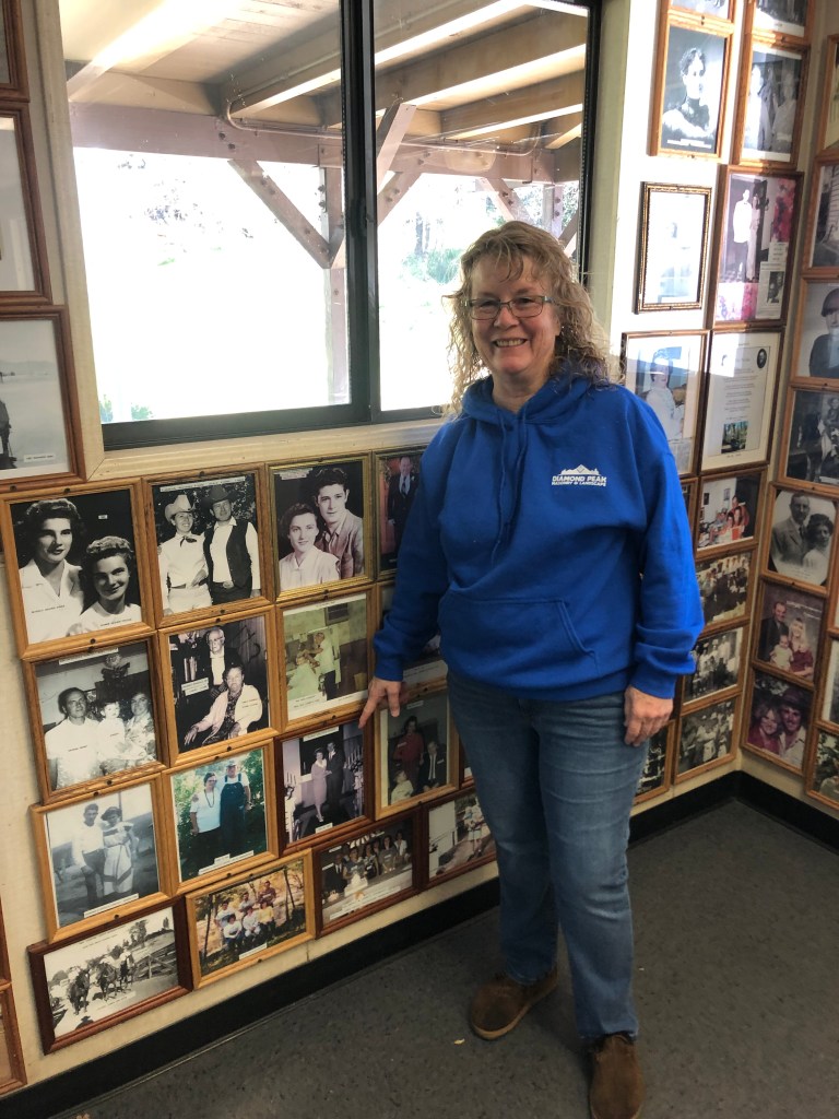
How do I know this? Because Michelle told me. I ran into Michelle at the town’s post office. The walls of the lobby are lined with historic photographs of the town’s residents, and I was perusing them when Michelle walked in to get her mail. There are literally hundreds of photos, so I asked her, “Is every resident in town pictured here? Where’s your photo?” She matter-of-factly told me that the post office ran out of wall space long ago, and replacing an old picture with hers “would require permission from the Post Mistress.”
Another Fiddle
Michelle then spent the next 20 minutes pointing out pictures of friends and relatives on the walls. She grew up in Fiddletown, and says it’s an wonderful place to live. She used to rollerskate in the community center (where the big fiddle is), and knows most of the residents. However, she said the town’s recent growth has made it difficult to keep track of everyone.
Michelle pointing to her grandparents’ wedding photo.
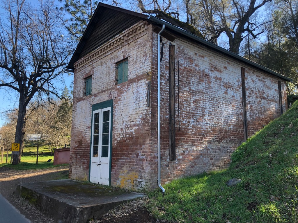
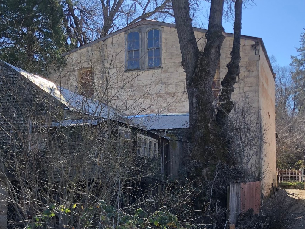
At some point Fiddletown became a major enclave for ethnic Chinese folks–in fact, for a time it boasted the state’s second-largest Chinese population, after San Francisco. Along the main street there are several well-preserved buildings that speak to the town’s Chinese heritage: A general store, a gambling hall, and an apothecary.
General store, built circa 1850.The “Fortune Peaceful Gambling House,” built circa 1852. It’s said that not only gambling but other vices–involving young women that weren’t your wife–took place within these walls.Apothecary, built from “rammed earth” in 1851.
The apothecary also serves as a museum (which, sadly, was closed when I visited). It contains personal effects from over 100 years of continuous habitation by Chinese “herb doctor” Yee Fung Cheung, his successor Chew Kee, and Chew Kee’s adopted son, Jimmie Chow. Jimmie Chow lived his entire life in Fiddletown, and was the town’s last Chinese resident when he died in 1965. Notably, Michelle (whom I’d met at the post office) had met Jimmie in the early 1960s. Her father and she took some fish heads to Jimmy’s house for his fish head soup. Michelle had thought it was a joke until she watched Jimmy add the heads to his soup pot. (If you’re interested, here is a recipe.) Michelle told me she was fascinated by the home/apothecary, and all the unusually artifacts therein.
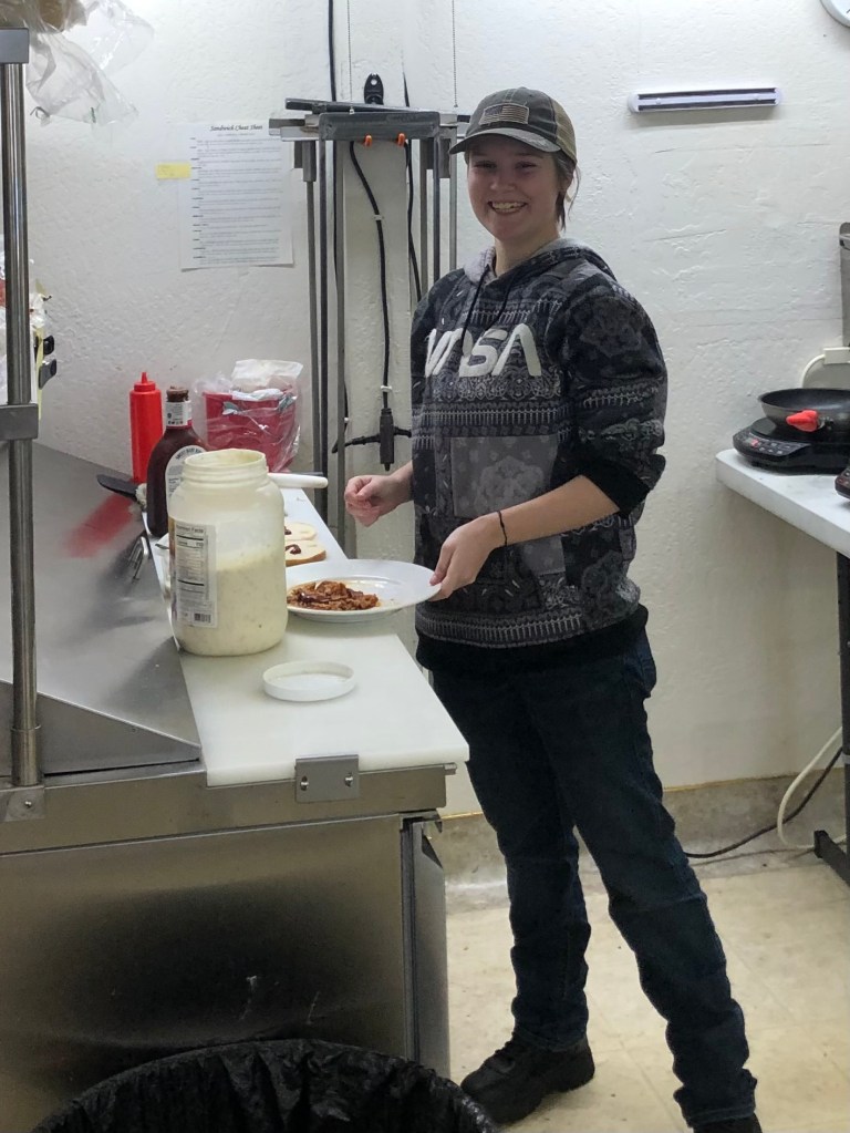
All this talk of fish heads was making me hungry, so I figured I’d scope out a place for lunch. There is exactly one place in town that will serve you a sandwich, so that made my choice easy. Improbably, it’s the Brown’s English Toffee store on Main Street. A young woman named Kailey, who’s been working there for the past two months, took my order. After a few false starts (they were out of the meat and the bread that I wanted. But other than that, they had just what I wanted for a sandwich!), she managed to produce a pulled pork sandwich with cole slaw.
Would you like mayo on that? I have plenty…
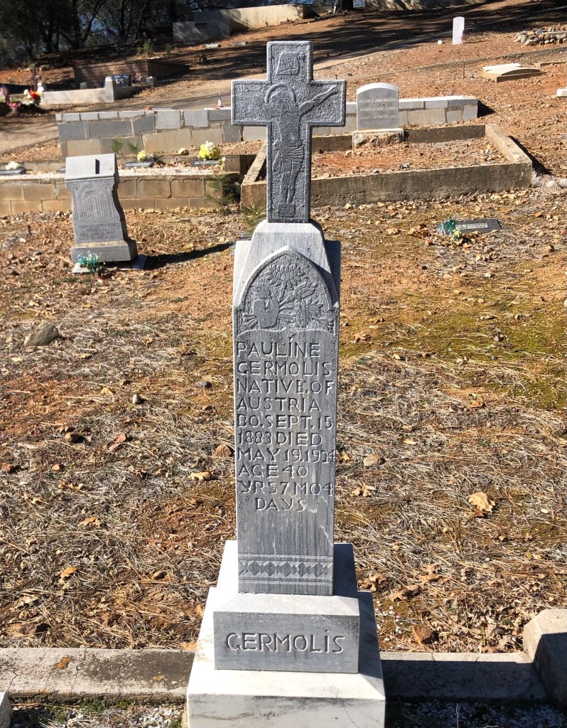
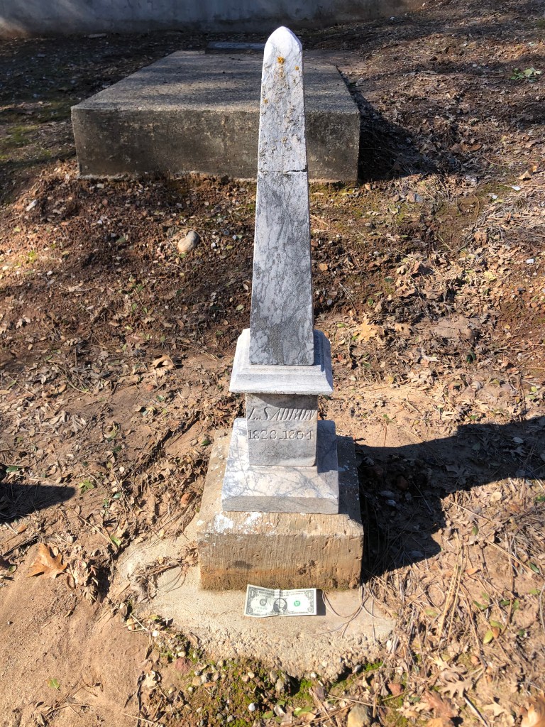
It was now time for my traditional cemetery visit. The Fiddletown Cemetery was established in 1870, and is the final resting place for a broad swath of humanity. The headstones offer testimony to the large number of countries from which the 49ers hailed:
Austrian, French, Irish….
And of course there’s an obelisk. This is tiny (see the dollar bill for scale). They couldn’t even fit on the poor guy’s first name!Everyone has an angle…
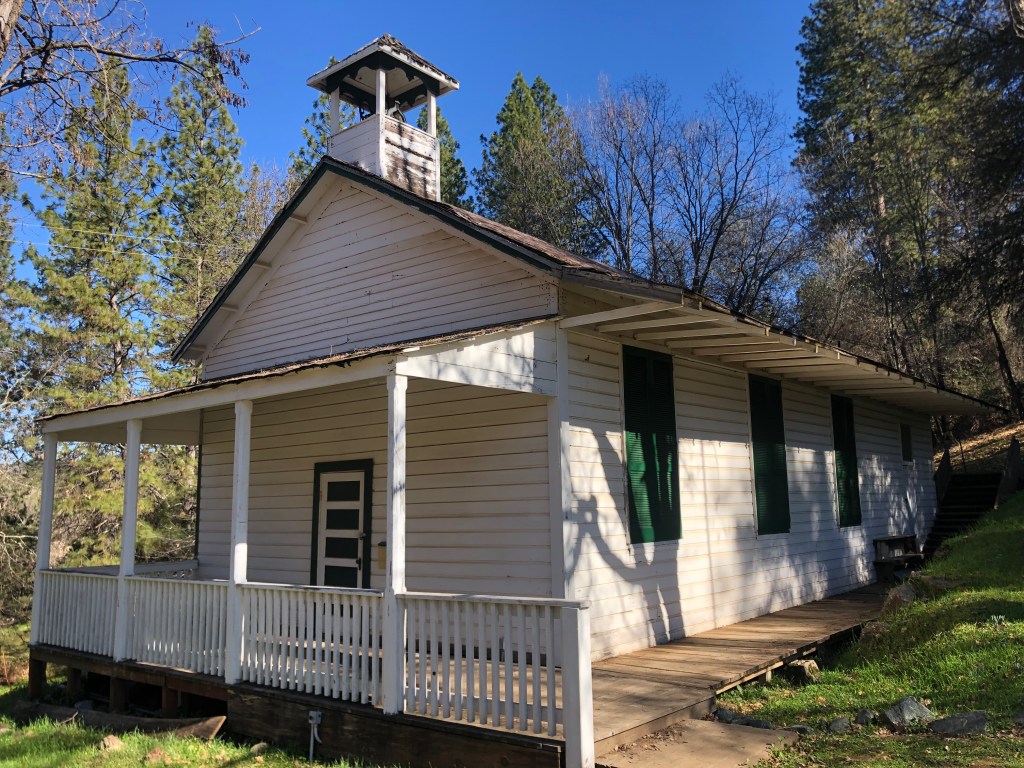
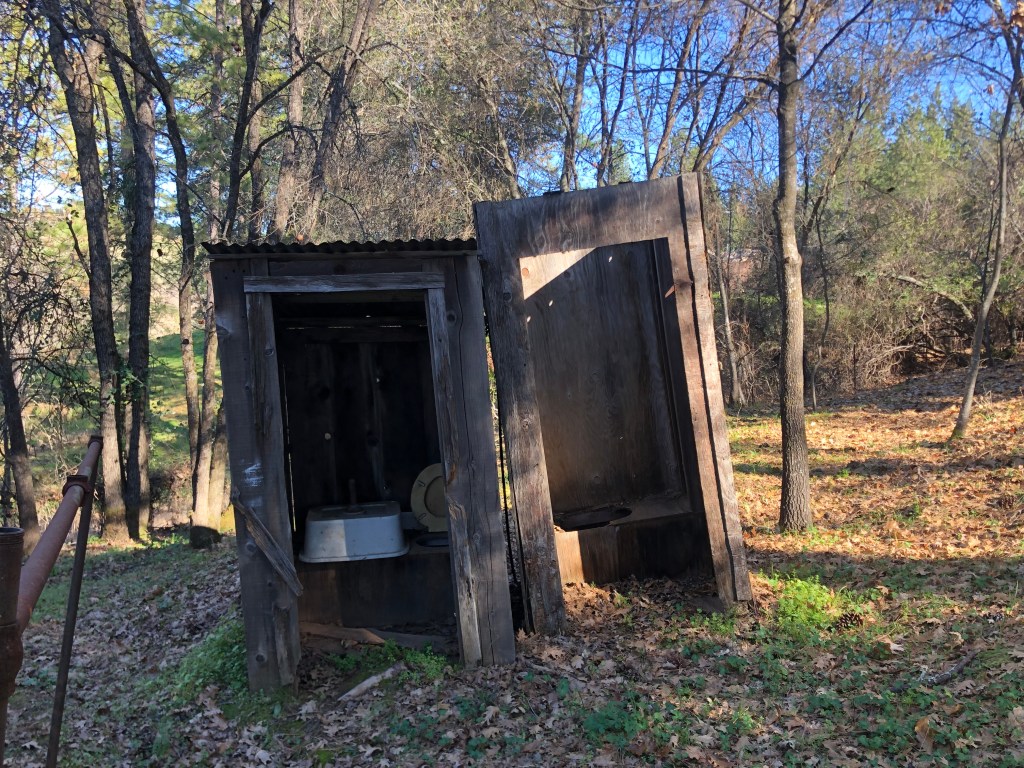
Across the street from the cemetery is Fiddletown’s historic one-room school. It was constructed in 1862 and was in operation until 1955, when the area schools were consolidated and relocated to the nearby town of Plymouth. The school had no running water, and featured outhouses (which are still extant) in the back.
The Schoolhouse….…and privies.
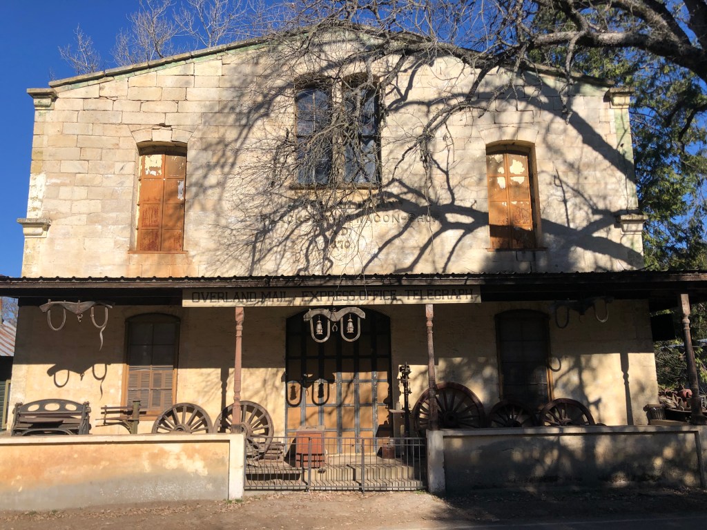
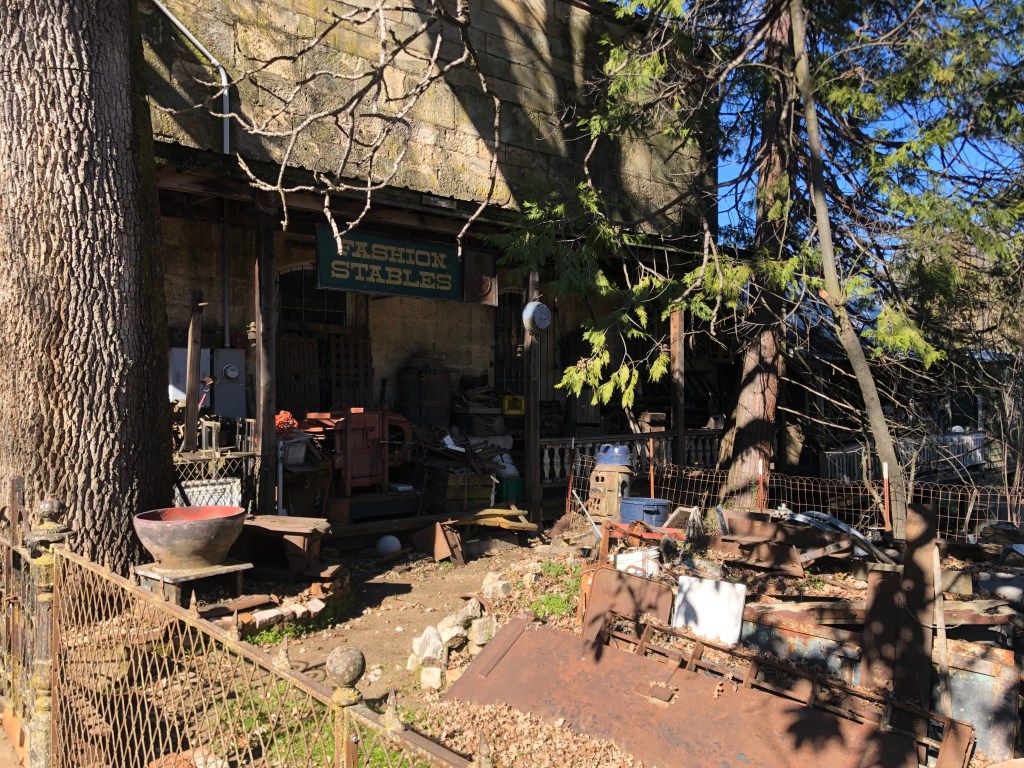
One other notable structure is the looming Schallhorn building, built in 1870. It was a long-time blacksmith’s shop and wagon repair facility, as well as a telegraph office and mail stop. Today it appears to be the site for accumulating various historic artifacts. The front porch is littered with wagon wheels, metalworking equipment, a safe, a old ovens, even a small railcar. Heaven knows what’s inside the massive building itself!
Front o the SchallhornMore junk on the sideBack view
It was beginning to get late, so I decided to head back home. One of my final glimpses of Fiddletown suggests a story that I honestly don’t really think pertains. If you ask me, I think this place has a future.
Unfair intimation.
So, that was my trip to Fiddletown. I managed to get home in the afternoon without incident. I wish you all a very happy Steve Boilard’s birthday. I suggest celebrating with the high-gravity imperial stout of your choice.
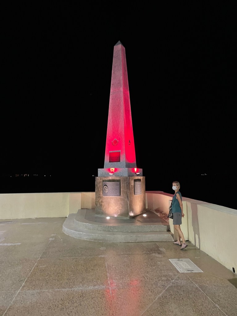
Loyal reader Brian W. recently shared this photo he took of a technicolor obelisk in La Paz, Mexico. He reports that the obelisk is a “memorial to the defenders of the homeland,” but he admits that his Spanish is a little rusty and it might actually commemorate the birthplace of disco.
This not the largest obelisk to appear in this blog, but it’s certainly the most colorful (at least, it’s decorated with a colorful light).
Send in your obelisk photos to keep this blog alive while our road trips are on hold during the winter.
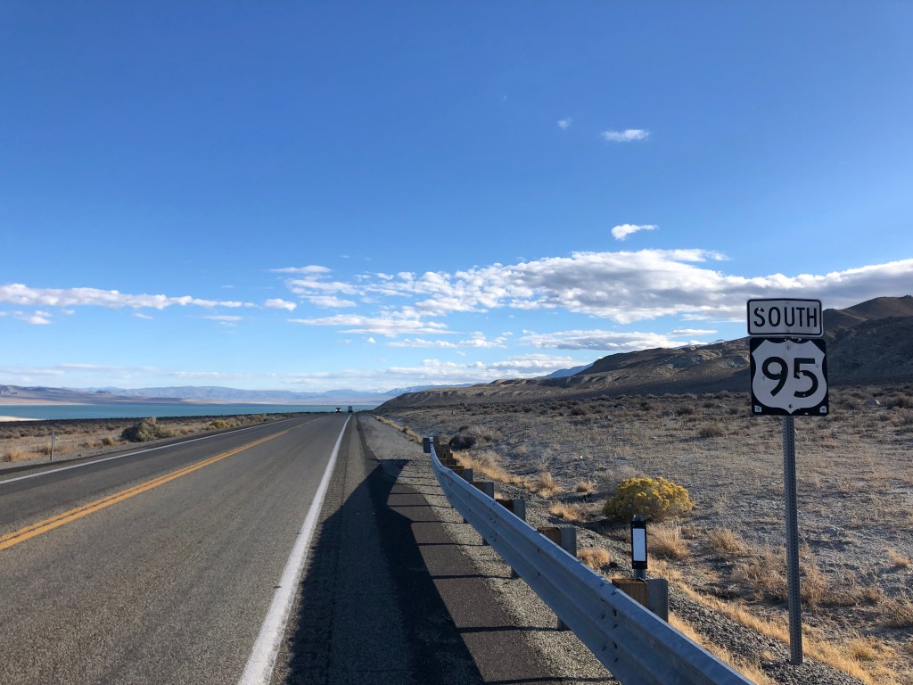
I awoke early in Hawthorne, got a decent breakfast at Mr. Beane’s coffee shop, and got back on the road. A short distance from Hawthorne US 95 takes a jog eastward, but otherwise today’s ride was looking a lot like yesterday’s.
Deja vu
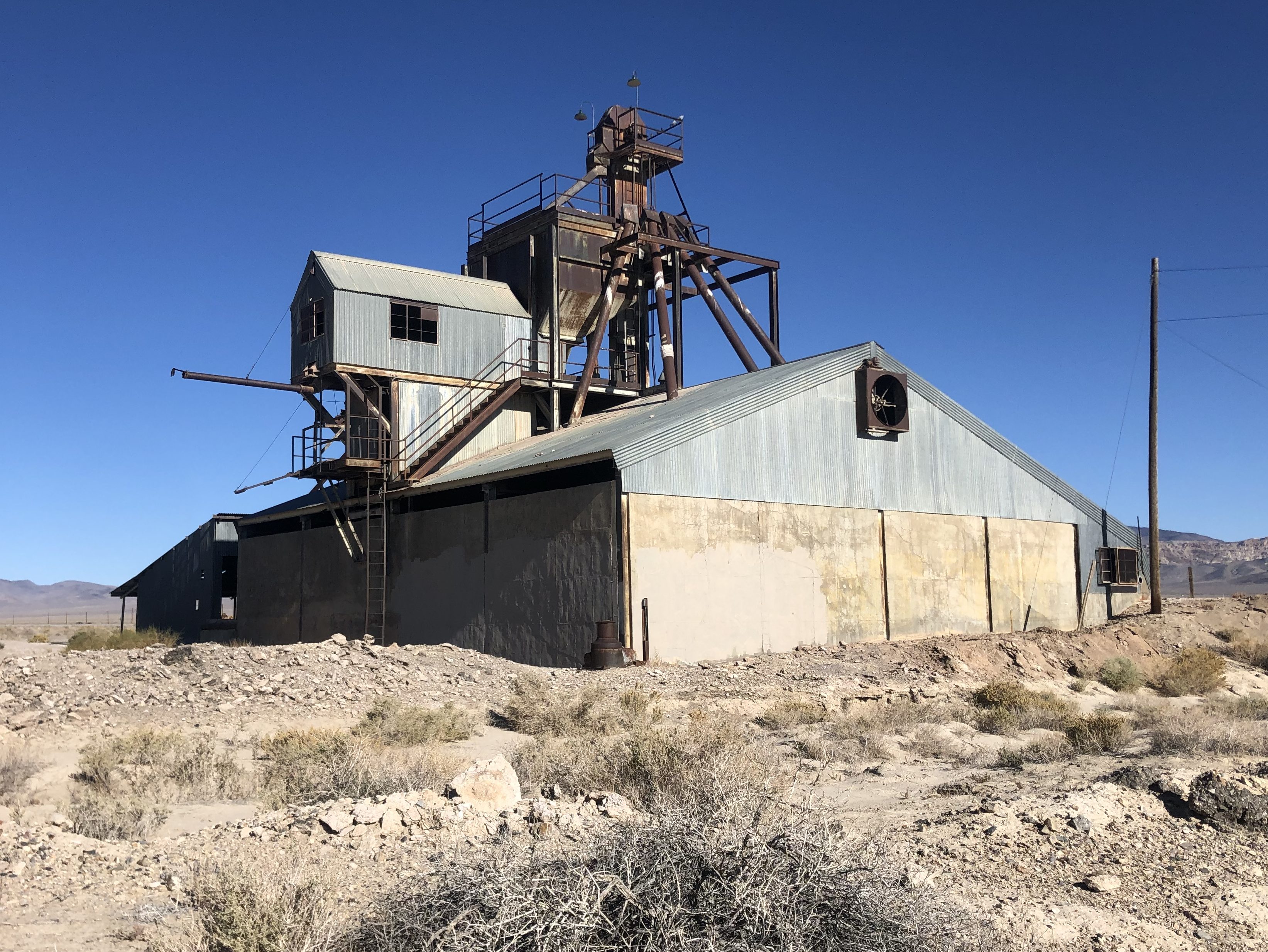
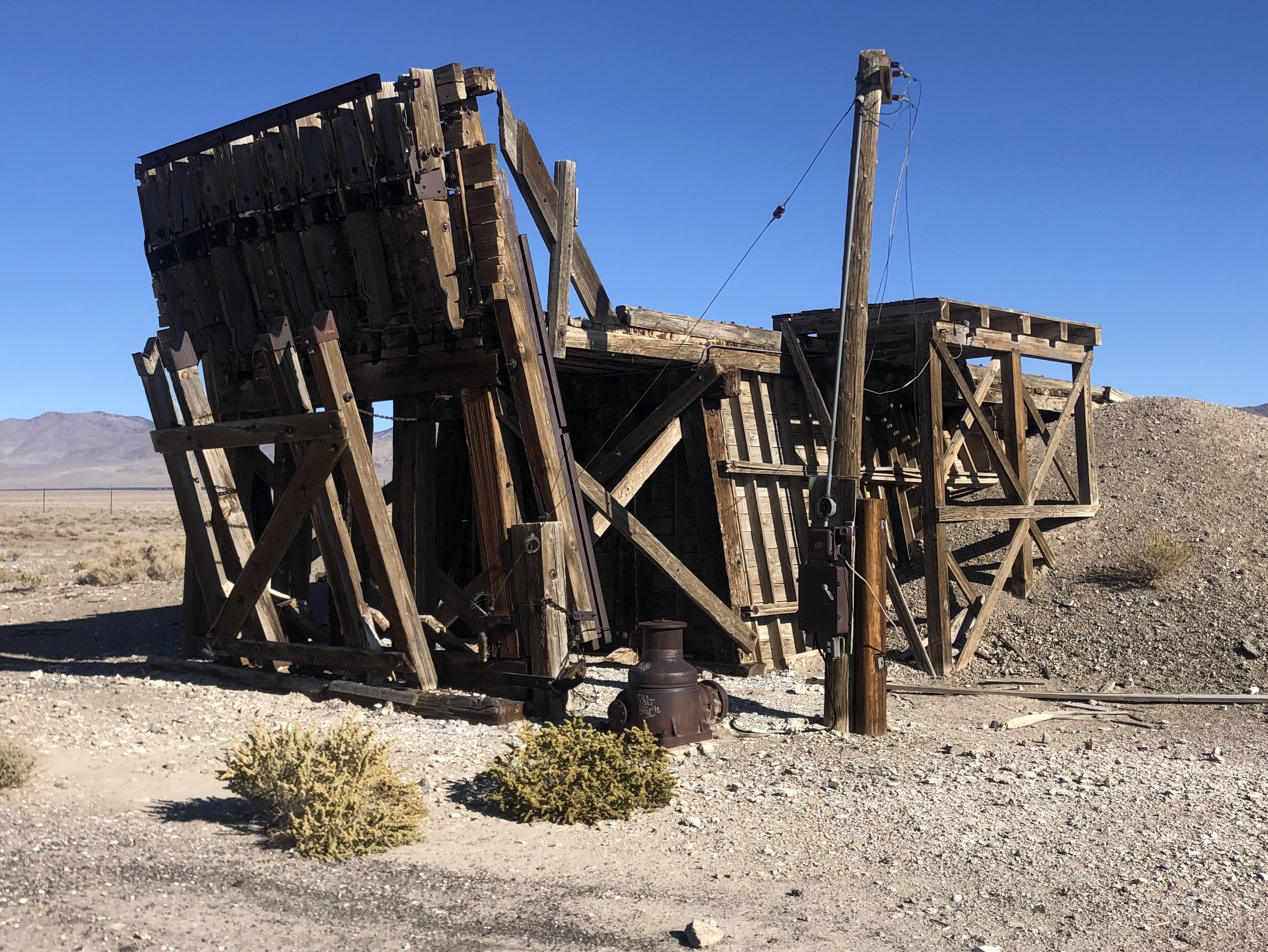
Then suddenly I found myself passing through another (nearly dead) town. Luning (pop: 87) was established in 1884 as a railroad town, with a trackside facility for loading magnesium ore onto freight cars. The once-active facility has long since shut down, but the main structures still stand, and I suspect the ghosts of long-since-passed stevedores still walk their creaky floors on moonlit nights.
Luning’s obsolete raison d’etre.
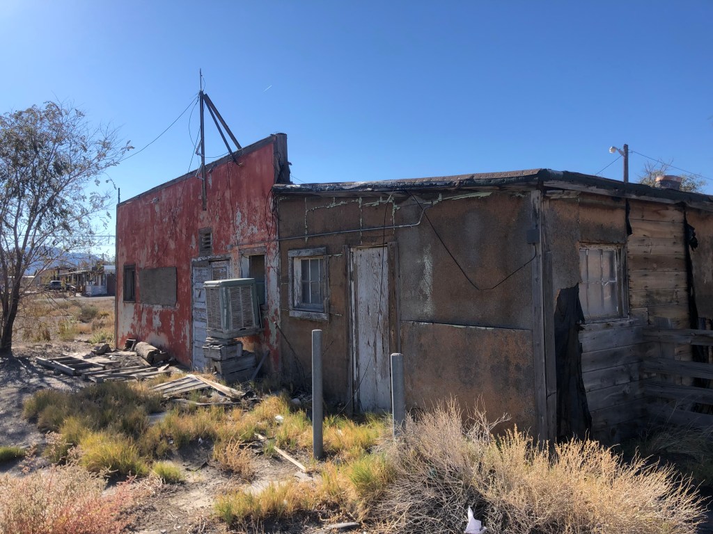
One wonders why 87 people still remain in this ghost town. From what I saw, the housing stock isn’t especially covetable.
Still inhabited.
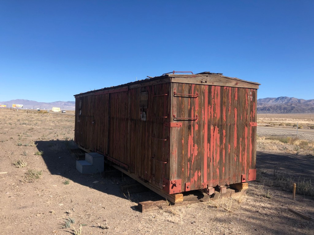
Some time after leaving Luning I came to a similar town. Like Luning, Mina (pop: 150) was founded as a railroad town over a century ago. As with so many Nevada towns, Mina owed its existence to mining operations. But the mines eventually played out, the residents began to move away, and the trains stopped coming through town.
Ancient railcar in Mina, now used for storage, apparently.
You’ve really got to wonder why anyone stays in this godforsaken place, with no working infrastructure to speak of, no job opportunities, and, to my eye at least, no pleasant surroundings. On top of all that, the nearest town with a gas pump and a mini mart is well over an hour away.
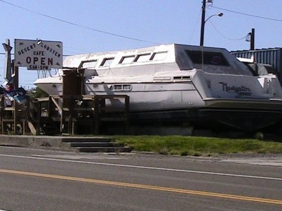
As far as I can tell, Mina is only known for two things. First, it used to have a restaurant named The Desert Lobster that was definitely unique. Owner Bob Eddy bought an old, damaged yacht he’d found in Texas and had it shipped to Mina, and this served as the front of his restaurant. But here was the genius of Bob’s plan: He would raise lobsters in greenhouses out in the desert, fed with water from a nearby spring. Sadly, wildlife officials eventually put an end to the lobster farm, and as of a few years ago the restaurant closed.
The Desert Lobster, back in the day. (Photo credit: Tom M., on Yelp)
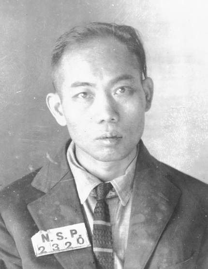
The other thing Mina is known for is its role in shaping America’s death penalty. In 1921 a Chinese immigrant by the name of Gee Jon was convicted of killing a laundry proprietor in Mina. He was sentenced to death, and was the first person to be executed by lethal gas. You can read the whole sordid tale here.
Gee Jon
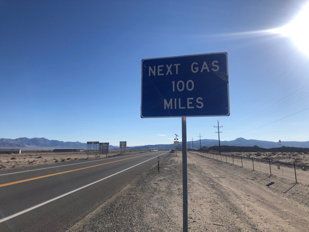
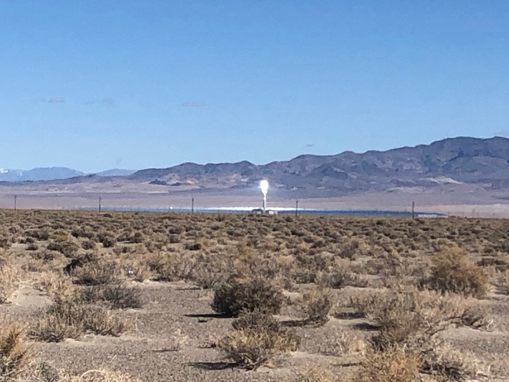
As I drove away from Mina I began to notice an intense point of light ahead of me on the left. For many miles the light kept getting brighter and closer. Finally I stopped at a rest stop near the light’s source and I learned that the light was coming from the Crescent Dunes Solar Energy Project. The project is essentially a huge array of mirrors sitting in the desert that concentrates sunlight at one point, creating enough heat to superheat liquid salt that is then used to produce steam and turn generators. (Think of it as frying an ant with a magnifying glass, on steroids.) Only about 6 years old, the plant has been beset with technical troubles and lawsuits. It was eventually shut down, but it appears to have been restarted by the time I drove by.
Not such a bright idea after all.
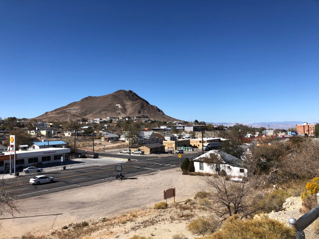
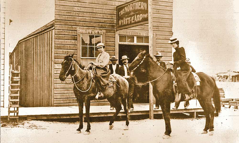
About an hour and half later I came upon the (relative) metropolis of Tonopah (pop: 2,500). Once the place that Wyatt Earp called home, Tonopah started out as a mining town around the turn of the 20th century. Like all the other mining towns it declined in the mid-century, but its location about halfway between Reno and Las Vegas seems to have helped it to survive as a convenient stopover location for those traveling between the two cities.
Downtown TonopahWyatt Earp’s bar in Tonopah
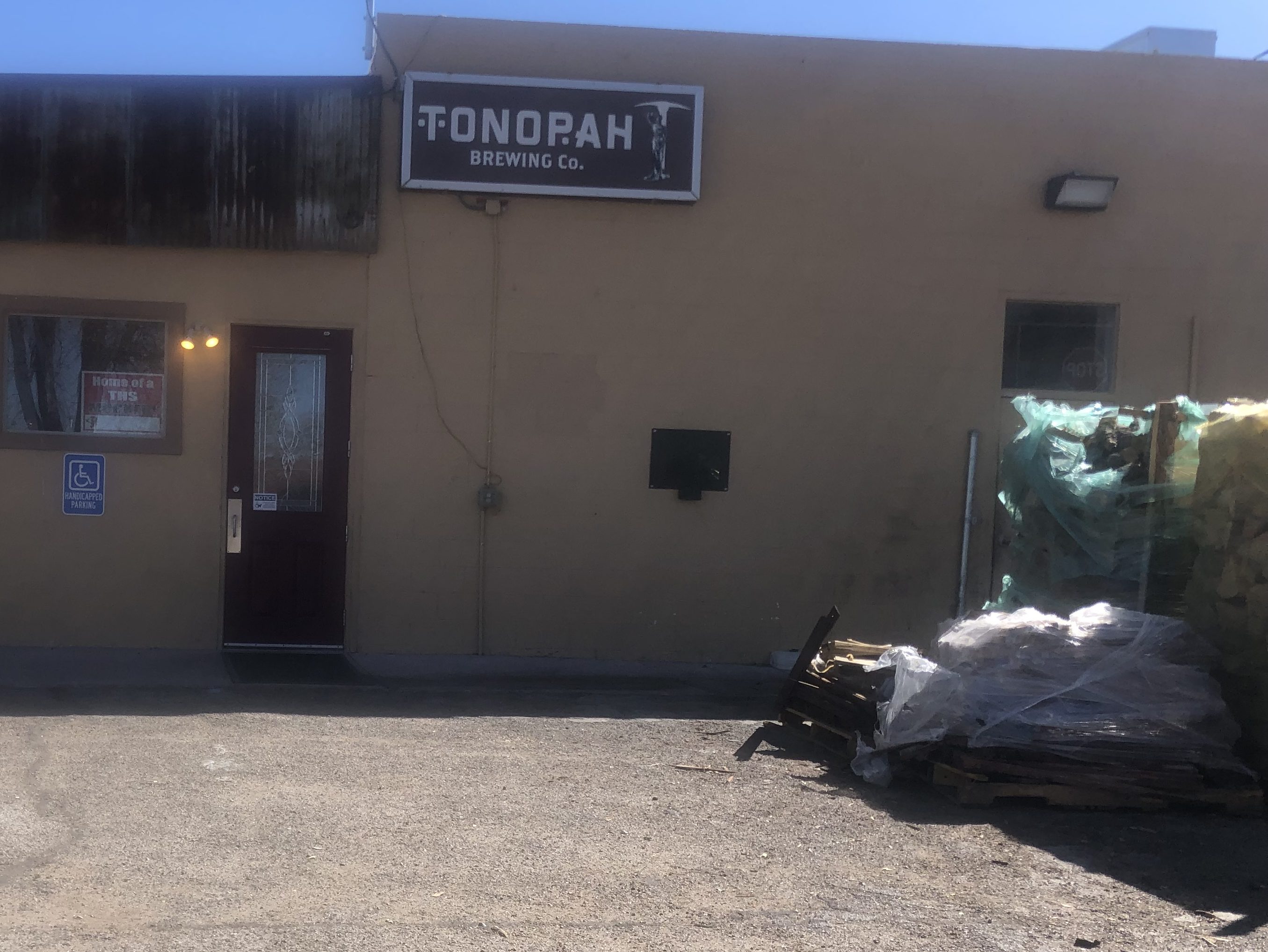
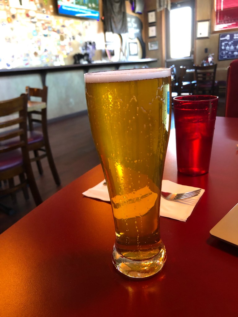
I stopped for lunch at the Tonopah Brewing Company, whose motto is “blood, sweat & beers” (seriously). I ordered their Double IPA, but managed to knock it over it before I’d had more than a sip. (The waitress was not happy with my clumsiness.) So I really can’t say much about the beer. But I can say that Tonopah Brewing Company is the absolute best brew pub in Tonopah. Of course, it’s also the absolute worst brew pub in Tonopah…because it’s the only brew pub in Tonopah. Perhaps because it’s the only game in town, the place seems to cater to every conceivable taste. The music is an unlikely combination of death metal, country&western, 1970s pop, and the Beastie Boys. And the television is tuned to a Spanish-language station.
Tonopah Brewing Company. Not much to look at from the outside.BOTD, moments before The Big Spill
They do have their own small-batch brewing setup, and they have their own smoker for in-house barbecue preparation. I had a decent pulled pork sandwich.
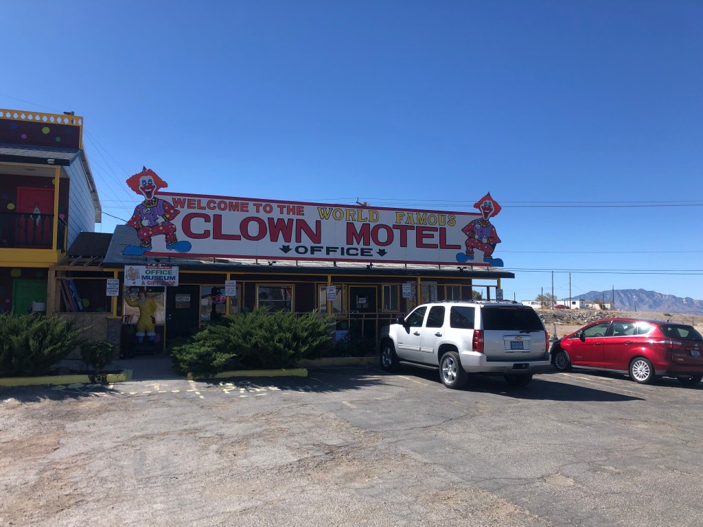
Thus fortified with smoked, cooked, dead animals and a sleeve soaked with beer, I got back on the familiar Route 95 and soon encountered what is surely the scariest part of this trip: Tonopah’s Clown Motel.
Please don’t kill me, Please don’t kill me….
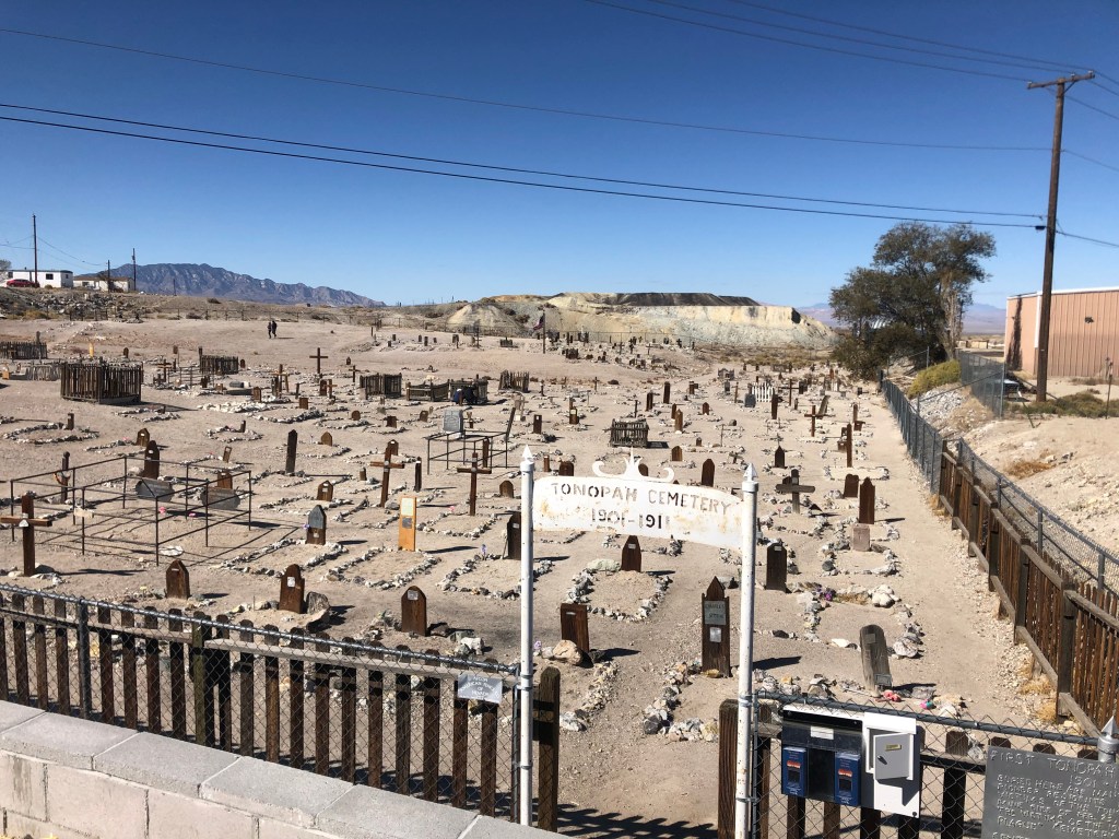
The hotel was originally opened in 1985, and it seems that the intent was innocent enough. The original owners, Leroy and Leona David, say they wanted to honor their late father who’d amassed a collection of about 150 clown figures (as one frequently does). The clown figures were used to decorate the property, and that’s about it. But over time the “creepy clown” trope became a thing, and books and movies like “It” pushed clowns into the realm of the truly scary. So the motel seems to have decided to swim with the tide and play up the creepy aspects of their clown theme. Oh, and did I mention that the motel sits right next door to an ancient cemetery? I’m not making this up.
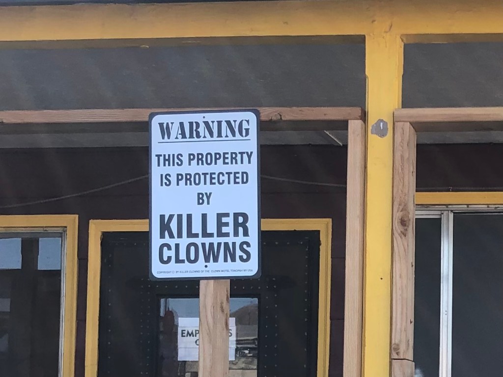
Sign in front of parking lot. Way to reassure the kids whose parents take them here!
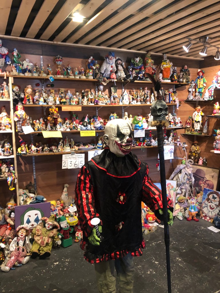
Over the years, the place has developed something of a cult following. Many people have sent in their own clown memorabilia, which now numbers over 2000 items. Many of the pieces are on display in the lobby, which doubles as a “clown museum.” The motel has also been featured on the television show “Ghost Adventures” in 2015. Supposedly a clown doll was caught on film moving by itself. You can judge for yourself!
In the lobby, which doubles as a “Clown Museum.”
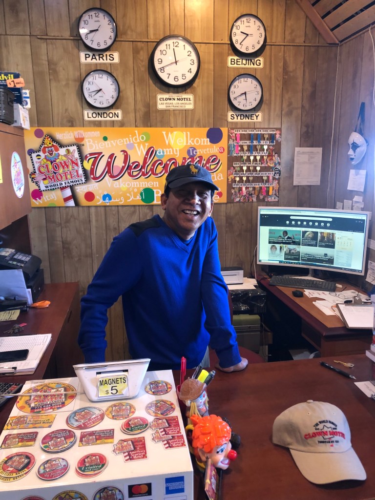
The current owner, Vijay Mehar, told me that Covid has really put a dent in business, but he’s making a go of it. He’s even amping up the scary clown vibe, decorating a few of the rooms with themes such as the “Halloween” room, the “Friday the 13th” room, and the “Exorcist” room. Again, I’m not making this up.
The man behind the clowns.
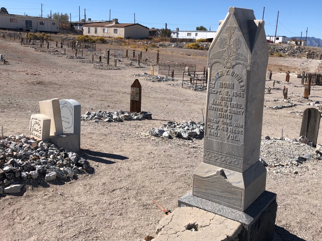
Vijay encouraged me to go take a walk through the neighboring graveyard, which butts up against the Clown Motel’s parking lot. It’s one of those desert cemeteries which lack trees, grass, or any other signs of life. I was surprised that Vijay hadn’t placed a few zombie clowns around the cemetery, in order to further advance the creepy clown vibe of his property.
Having pretty much exhausted the coulrobic aspects of Tonopah, I once again hit the road. Within 45 minutes I encountered the remarkably well-maintained, historic town of Goldfield (pop: 250). As the name suggests, Goldfield had started out as a gold mining encampment. The mines produced about $1 billion in gold (in today’s dollars.) The rich gold veins turned Goldfield into a boom town, and for a time it was Nevada’s largest city. Goldfield boasted some 20,000 residents at its peak in 1906. One of those residents in 1904 and 1905 was Virgil Earp (Wyatt’s brother), who was the town’s deputy sheriff.
A fire in 1923 destroyed much of Goldfield. Since gold production had become much less profitable by that point, there wasn’t much reason for people to rebuild their homes in the town. Those who did remain steadily declined until only a few hundred people were left in 1950, and Goldfield has limped along ever since.
Today Goldfield has just a handful of residents, but the town exudes a strength and robustness that belies its scant population. This is town that clearly values its history. The Goldfield Historical Society is a local nonprofit organization that actively works to preserve and restore Goldfield’s buildings and to promote its history. They’ve erected markers and plaques, organized walking tours, and held various fundraisers. You can see evidence of their work on almost every block.
Originally Goldfield’s elementary school, this building is now the town’s public library. The grounds (on the other side) serve as a “historic equipment park.”A few cars that look like they haven’t moved in awhile. (Goldfield’s courthouse is in the background.)
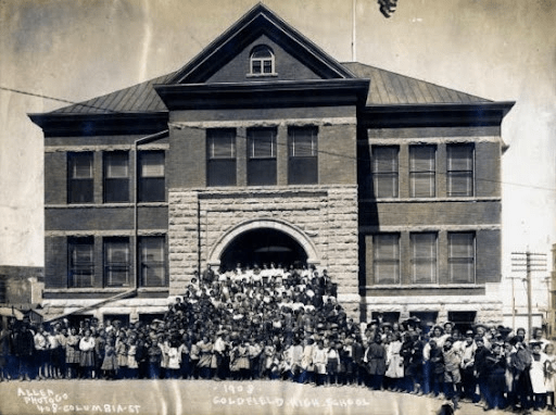
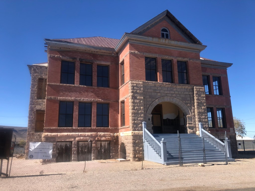
Goldfield High School is one of the historical society’s biggest projects. It was built in 1907, and its three stories served up to 450 high school students. The school closed in 1952, and it’s been shuttered ever since. After a half-century of neglect, the south wall collapsed, and efforts to save the structure finally began in earnest. The historical society has received grants and donations toward a full restoration of the building, which is ongoing.
Goldfield High School, back in the day.
Goldfield High School today.
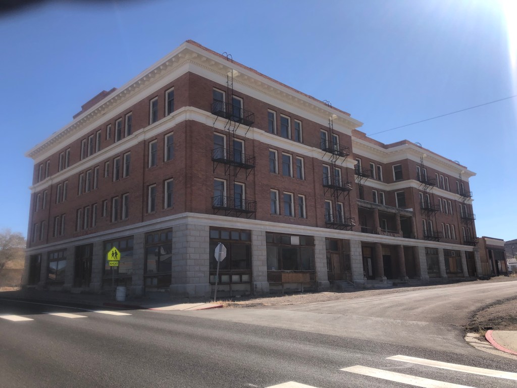
Another major restoration effort focuses on the Goldfield Hotel. It’s a huge structure, and in surprisingly good shape considering it was built in 1907, survived a flood and a fire, and has been vacant since World War II.
The Goldfield Hotel.
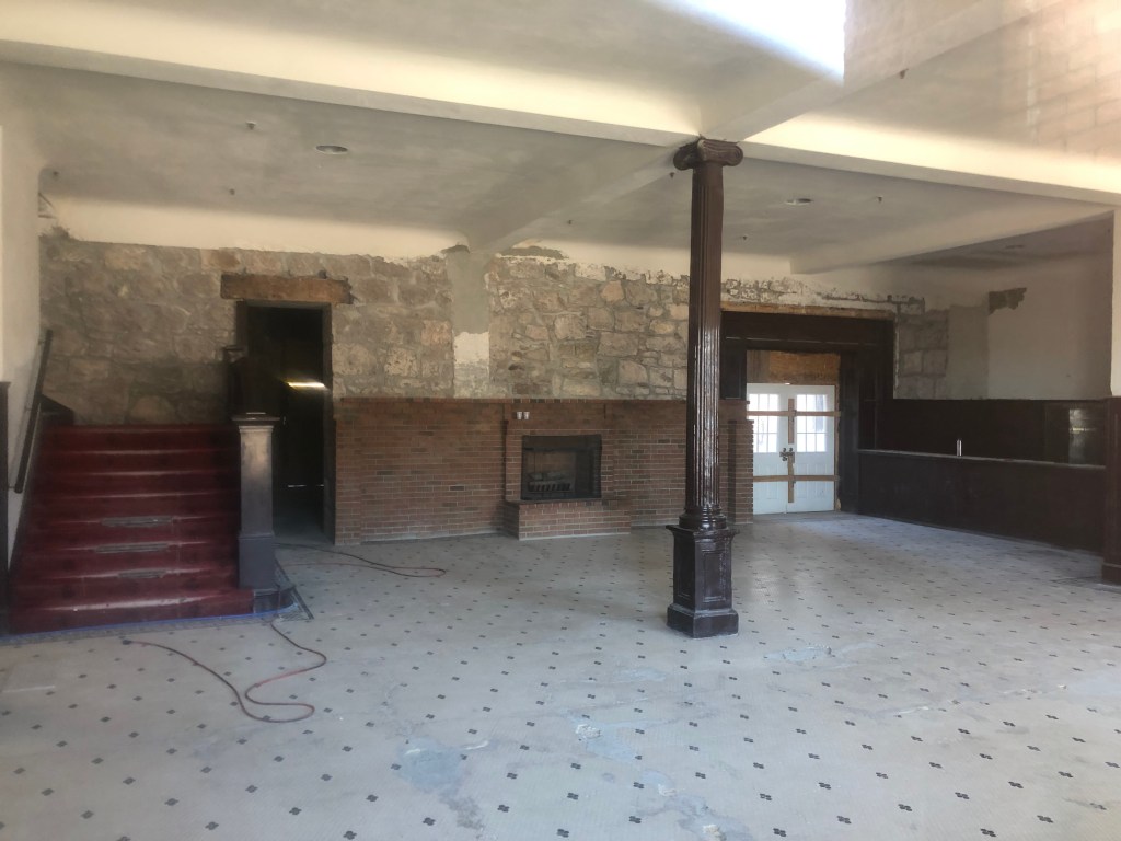
Inside the Goldfield Hotel. Don’t ask how I got this photo.
Ownership of the hotel has changed several times in recent years, and plans to make it into a boutique hotel seem to have fallen through. But I saw clear evidence of active restoration work when I visited. Oh, and that same Ghost Adventures show that went to the Clown Motel also has been to the Goldfield Hotel, and claim that they’ve seen evidence of hauntings. A local resident told me that the Ghost Adventures team had recently come back just a few months ago to do another feature on the hotel.
Anyway, it feels like there are historic structures all over this town. And I’m told that every single one of them has a current owner who’s either restored it or is planning to do so. Why does Goldfield have all this energy and civic pride, while towns like Luning and Mina have essentially disappeared?
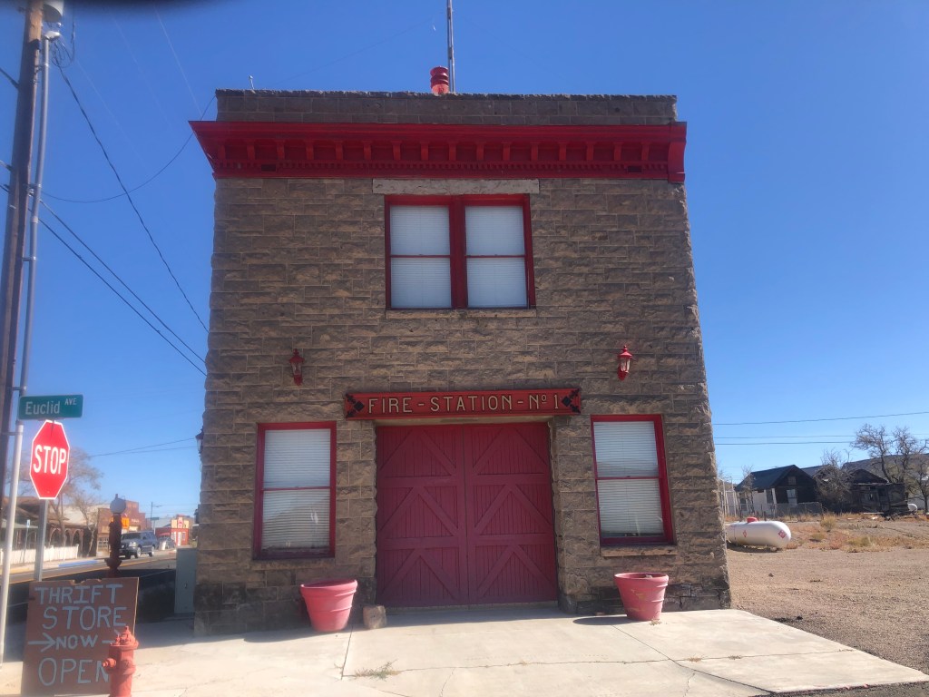
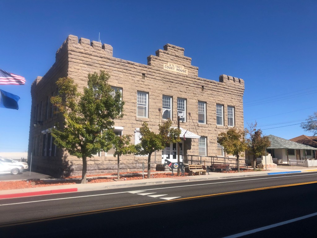
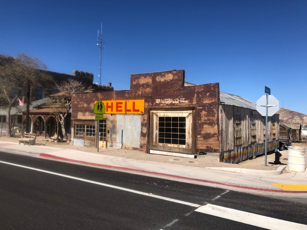
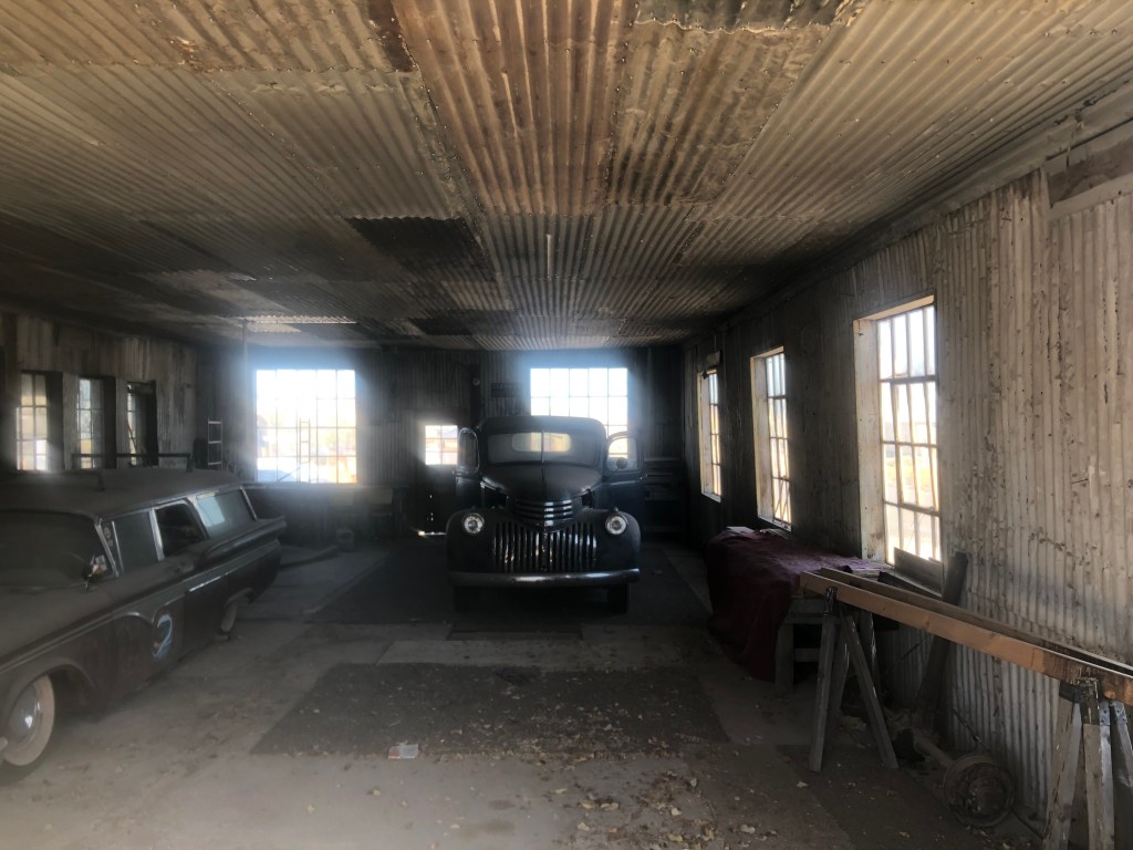
Goldfield’s fire station, from 1908. Beautifully restored, and now a museum (that’s only open by appointment).The Esmeralda County Courthouse in Goldfield, constructed in 1907Old filling station and garage, built around 1935. Inside the garageOf course, not everyone in Goldfield is on board with the historical society’s pleas for historical authenticity.
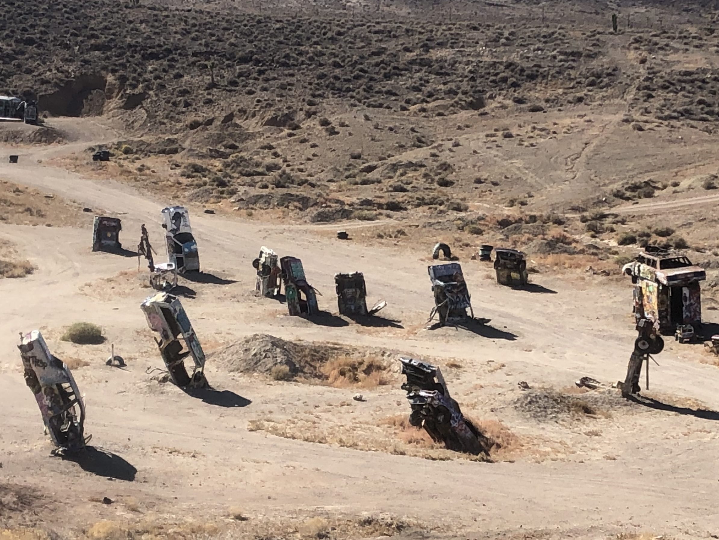
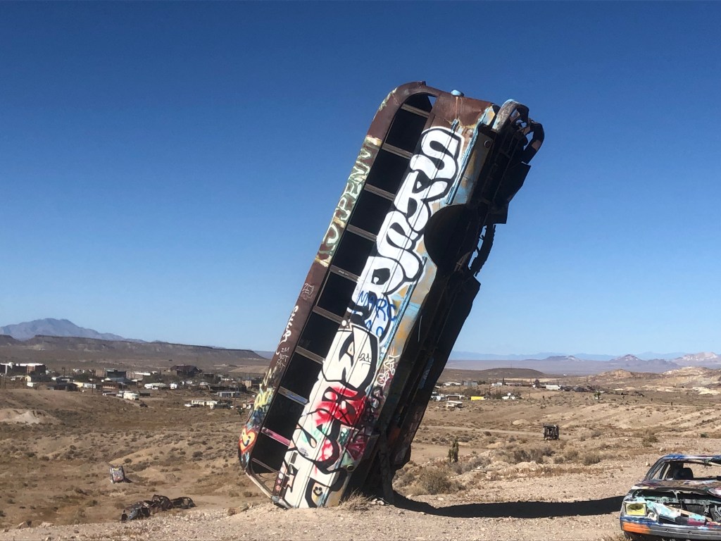
On the outskirts of town is a quite different type of attraction. The International Car Forest of the Last Church is a public art installation (I guess). It started when local resident Mark Rippie for some reason decided to stand a car on its nose in the desert outside Goldfield. This “art installation” was noticed by artist Chad Sorg as he was passing along Route 95, and Sorg was so taken by the piece that he settled in Goldfield to help Rippie expand the single car into a “forest” of abandoned cars. (I’m assuming that controlled substances played a part in the decisionmaking.) Today the “forest” includes over 40 vehicles, all of which are regularly covered and re-covered with graffiti by visitors. (The International Car Forest of the Last Church in fact encourages that behavior.) I hate to sound like a Philistine, but isn’t this all highly derivative of the much more famous and whimsical Cadillac Ranch?
Just a portion of the forestWon’t get fueled again
Yes. Well. So, after studying each vehicle with my arms behind my back and muttering “I can feel what the artist is trying to say,” like a hippie version of Woody Allen, I left the Forest and got back on US 95. After my enjoyable and engaging visit to Goldfield, I was back in the mode of speeding along endless miles of desert and an unchanging horizon. After a little over an hour I saw a large yellow sign ahead and, as I was about due for a break, I figured I’d make a stop.
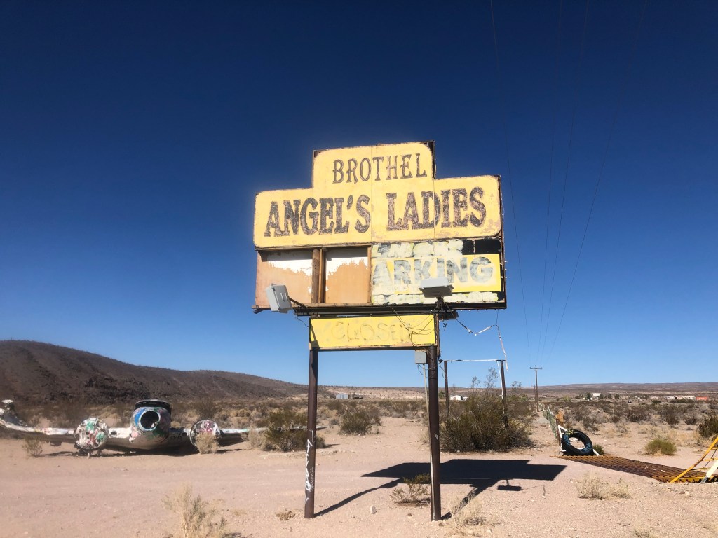
You at least have to admire the bluntness. No “Gentlemen’s Club” or similar euphemisms here!
As we all know, prostitution is legal in Nevada. Has been since 1971. You just have to conduct your activity in a licensed brothel. So, here we have the confusingly-punctuated “Angel’s Ladies” brothel, which has been around (under various names) for over a century. (Yes, evidently it operated illegally until 1971.) The place has been closed since 2014.
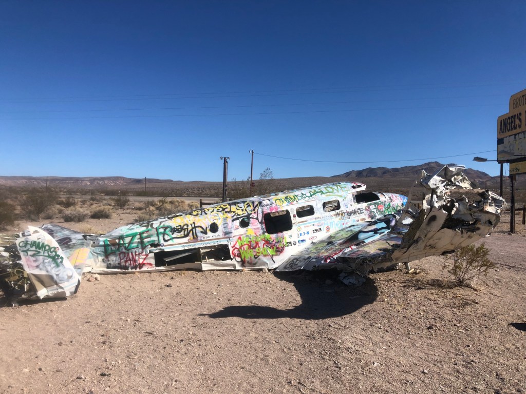
Alert readers might notice the wreckage of a small plane not far from the sign.
Well, there’s a story to it. It seems the brothel’s owners decided to run a promotion in 1978: They got this plane, and let volunteers parachute out of the plane from a low altitude over the property. If the jumper managed to land on a mattress that had been put on the ground, they won a free night at the brothel with the woman of their choice. Unfortunately, the pilot had some trouble during the promotion and crashed the plane right where you see it today. The owners evidently figured that it was worth more as a roadside attraction than as scrap, so they left it where it crash-landed. (News reports say that no one was hurt in the crash.)
Angel’s Ladies Brothel is just north of the town of Beatty, which is otherwise not notable. After passing Beatty, I started to plan (better late than never) on the remainder of my route. I decided that I didn’t want to go all the way to Las Vegas, as it really isn’t the kind of city that I’ve been seeking out on these trips. So I made a last-minute decision to leave US 95 and cut northwest through Death Valley and then take US 395 home. Those segments have been the subject of other blogs (like this and this), so I won’t detail the rest of the trip, except to say that Death Valley in the fall is stunning, and US 395 always affords awesome views of the eastern Sierras.
I’d also say that US 95 — at least the segment of it that I took through Nevada — is an interesting, stress-free, pleasant enough highway for those looking for such things. And I’m sure there were plenty of roadside attractions and stories that I missed, so I’d encourage you go out there and find some more!