cemeteries

Midcentury Matinee

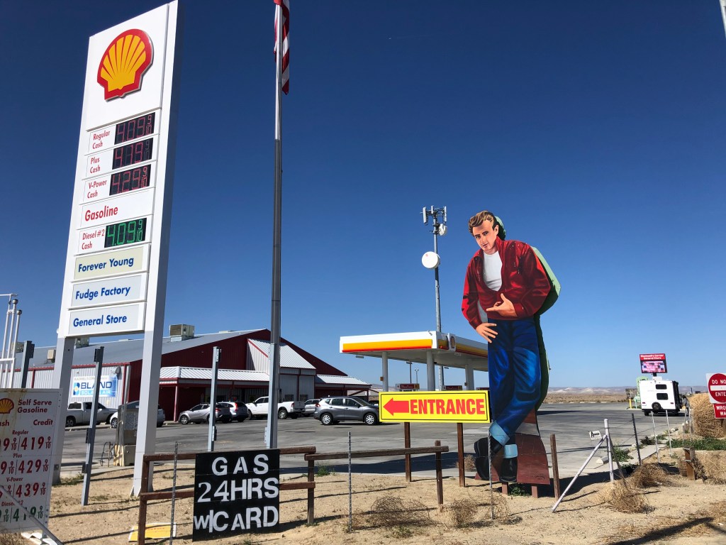
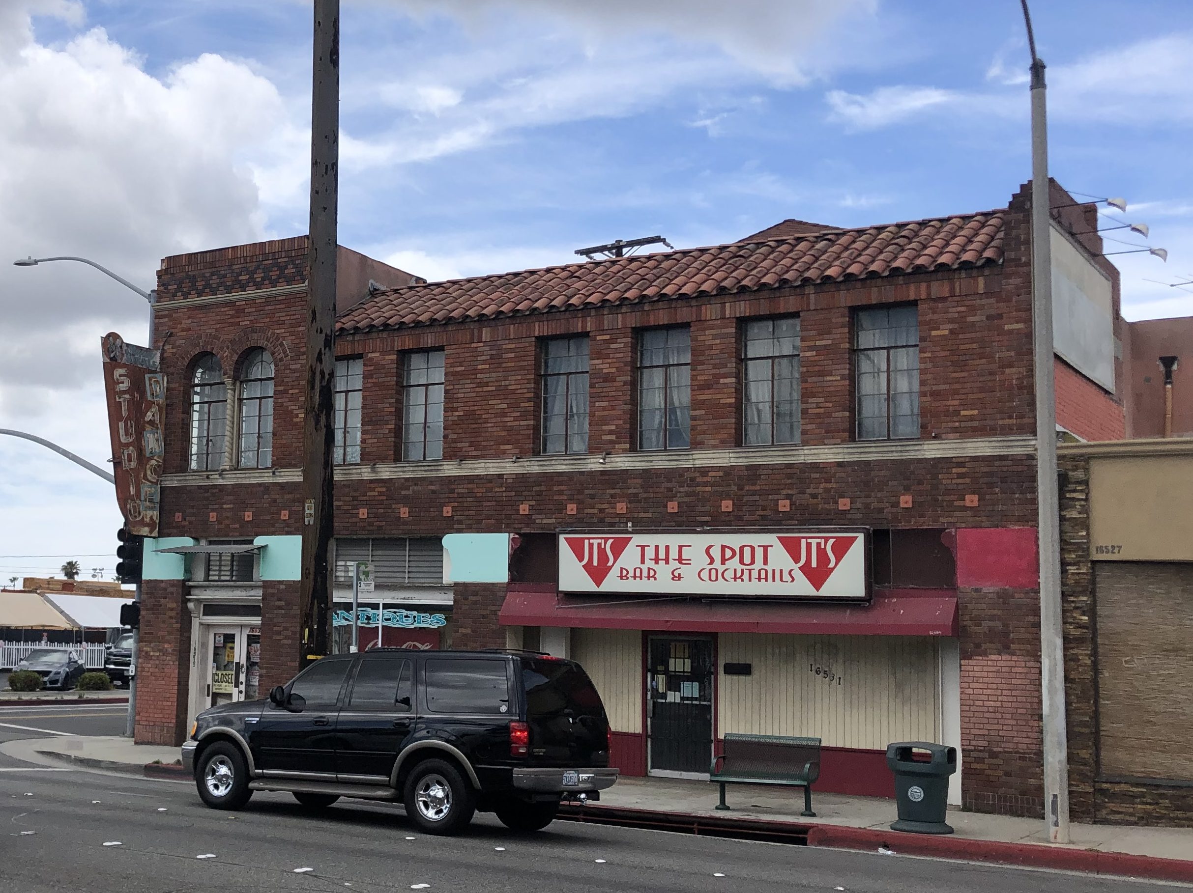
Today’s mild temperature and ocean-scented Southern California breeze compelled me to take a ride into the heart of Los Angeles. So I headed straight up Western Avenue, which is purported to be one of the longest north-south streets in the entire county. Originating not far from my house, Western passes through a number of distinct neighborhoods, including Koreatown, Little Armenia, South Central LA, Hollywood, and others. What especially caught my eye were several structures that clearly date back to the early postwar period. A prime example is the Sandy Vitale Dance Studio in Gardena. Surely that rusted and weatherbeaten sign exhibits scars acquired while witnessing some seventy-plus years of traffic going by.

Before straight lines were a thing.

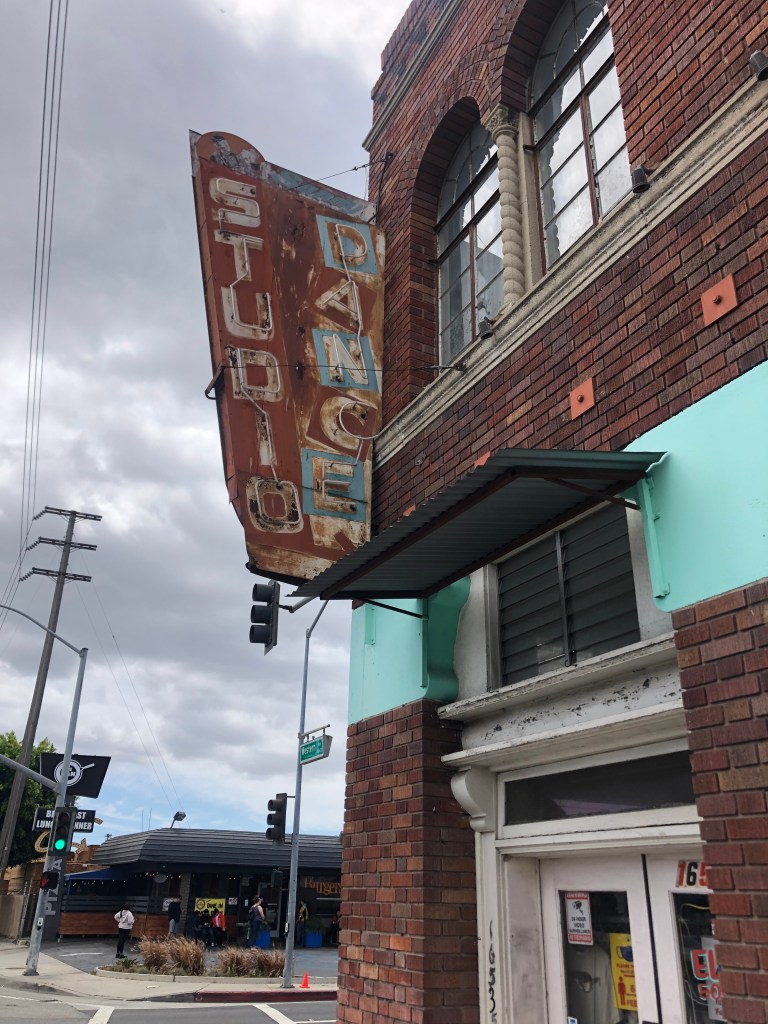
It appears that a dance studio is still operating on the upper floor. But I was unable to find out much about the business or the building online. It’s a very solid and well-preserved structure.

Bar and cocktails? That’s quite a combo!

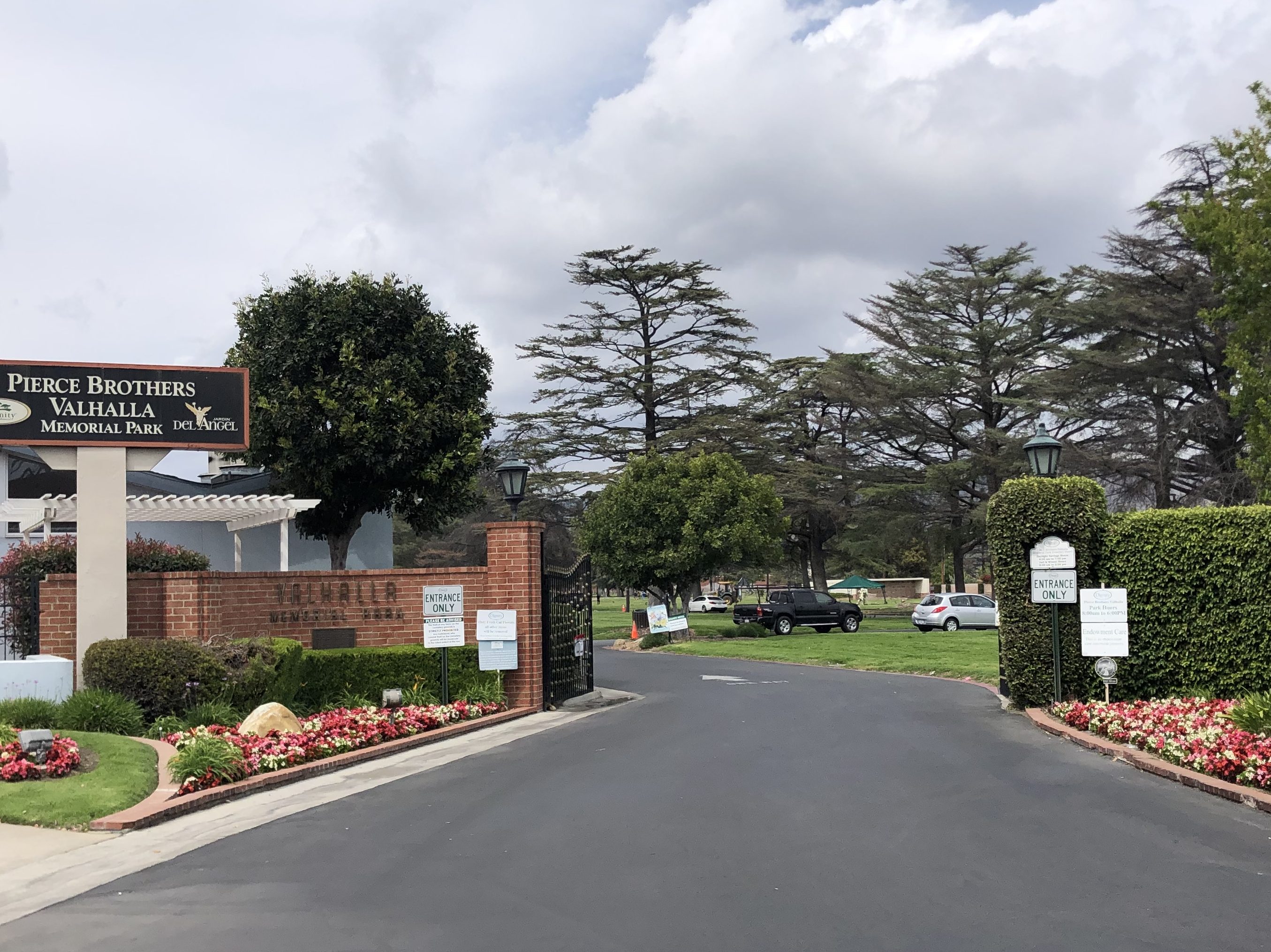
The old building must have put me in a mid-century frame of mind, for without really thinking about it, I eventually found myself near the Toluca Lake neighbhorhood where my mother-in-law and father-in-law met and dated in the 1950s. Toluca Lake is near the movie studios of the San Fernando Valley, and adjoins North Hollywood. I was not especially interested in fighting the crowds and congestion of Hollywood, so I took refuge in a nice, leafy area that turned out to be a place called Valhalla Memorial Park. It’s a cemetery that was originally constructed in 1923 and was considered a beautiful and stately setting at the time. Unfortunately, the owners had a habit of selling the same cemetery plots to multiple individuals — in some cases, to sixteen different parties. They were convicted of fraud and the State of California took over the cemetery for some years. Today it is again privately owned, and it still receives new “residents.”

Make sure you ask for a receipt.
Take a carnation, go to jail.

It turns out that, perhaps due to its proximity to the movie industry, Valhalla is the final resting place for a number of celebrities. Now, these aren’t the huge names like Errol Flynn or Humphrey Bogart or Cary Grant. But a few of them you may have heard of. Or surely your parents did. Let me focus on three of them:

First up is Curly-Joe DeRita. As noted on his grave marker, Curly-Joe was the last of the Three Stooges.

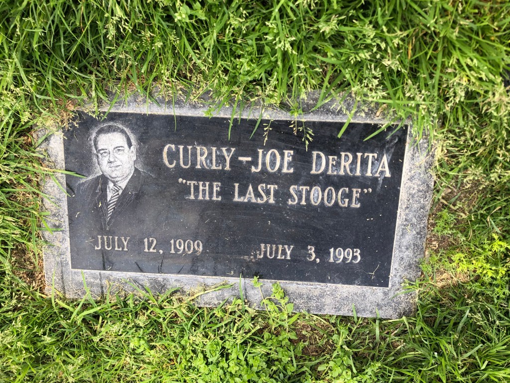
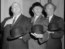
Moe and Larry were joined at various points by Curly, Shemp, and Joe and the third Stooge, until Joe quit the act in 1958. So a new fellow named Curly-Joe was hired to round out the threesome, just as the advent of television was making the Three Stooges bigger than ever. Curly-Joe rode this wave until Larry and Moe both died in 1975. Curly-Joe lasted another 18 years — hence, “The Last Stooge.”

“Hello–Hello–HELLO!”

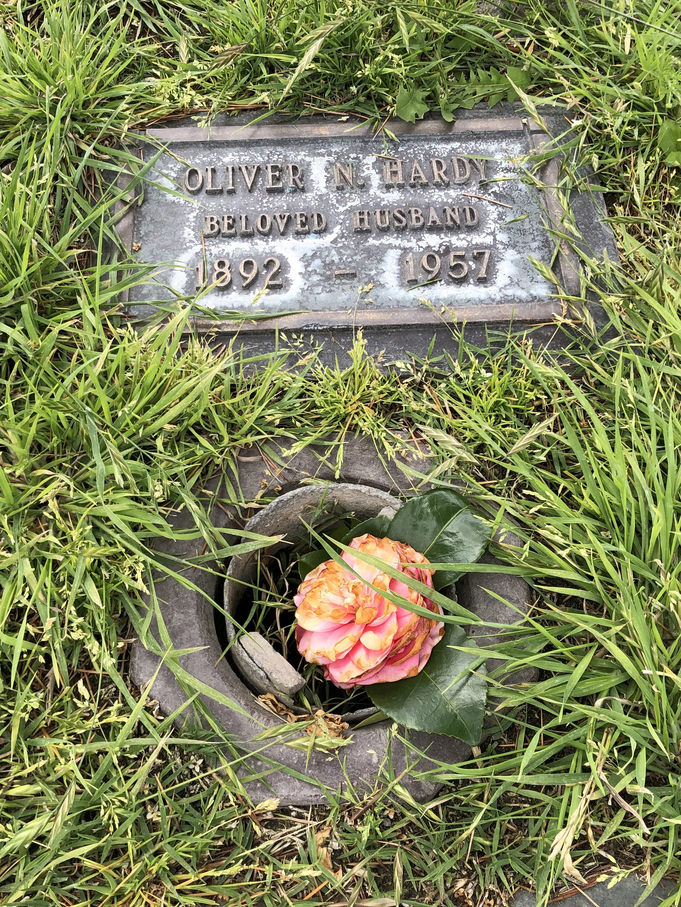
Buried not far from Curly Joe are the sizable remains of Oliver Hardy.

Well here’s another fine mess you’ve gotten me into.

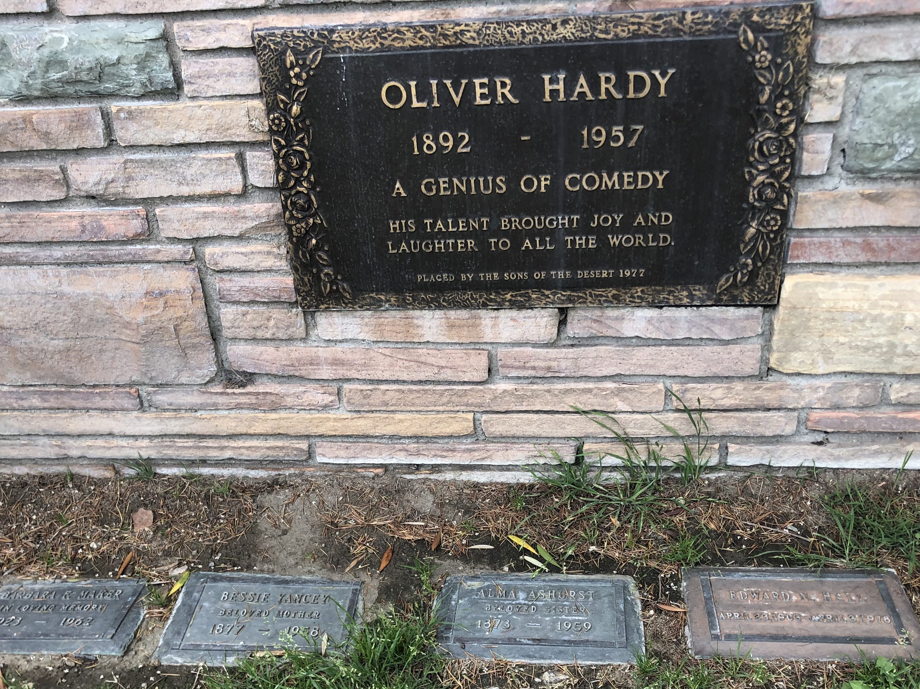
You know him from the Laurel and Hardy films (over one hundred of them!) that were made between the 1920s and the 1950s.

You might even be one of the seventeen people that saw the 2018 biopic about them, “Stan and Ollie.” (I do recommend that movie, by the way.) But in the meantime, check out their famous “Way Out West” number:

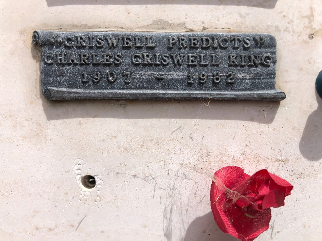
And now, we move on to someone more obscure, and yet more fascinating: The Amazing Criswell. Born Jeron Criswell Konig in 1907, Criswell fashioned himself as a psychic, making outlandish and unfailingly incorrect predictions about culture, fashion, technology, and almost everything else.

Criswell PREDICTS!! | Turner Watson
Can you spot the word that doesn’t belong?

I learned of Criswell when I watched the 1994 Tim Burton film about Ed Wood, entitled, “Ed Wood.” It turns out Criswell was a friend of schlock director Ed Wood, and appeared in a couple of his movies. Criswell wrote books and a weekly newspaper column, appeared on television programs, released a record, and often appeared at Hollywood parties. It’s unclear to me whether Criswell was knowingly putting on a camp act, or whether he considered himself to be a serious psychic. Either way, he’s quite entertaining, predicting that “education memory pills” will be given to schoolchildren in the 1970s, that the entire American population will become overwhelmed with an unquenchable lusty desire for sex in the late 1980s, and that the world will end on August 18, 1999. Of course, only one of these predictions came true.

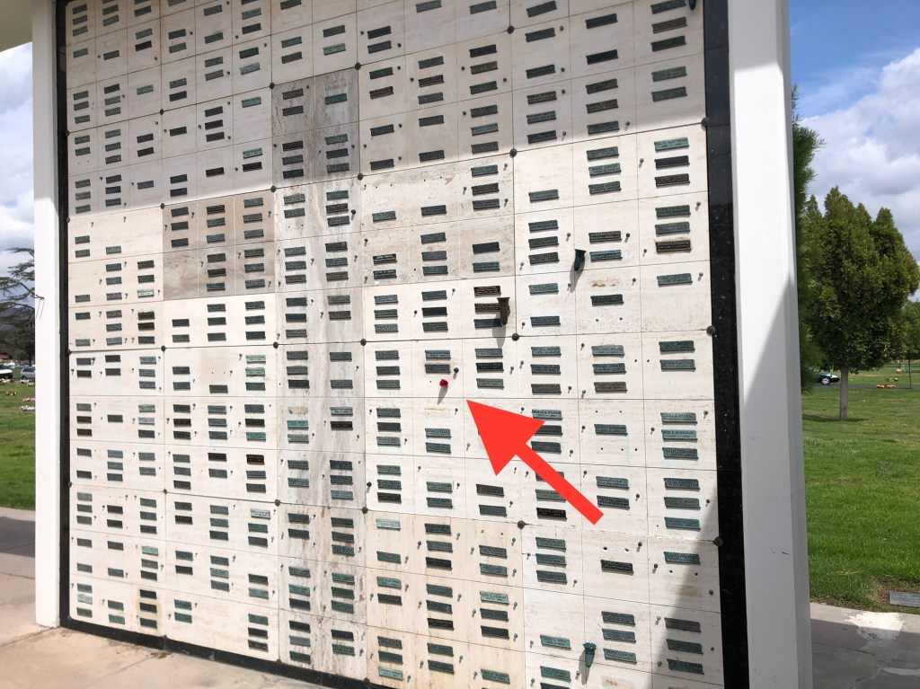
Criswell has a small niche in a columbarium at Valhalla. It’s not fancy by any stretch of the imagination. Maybe he figured it would be a waste of money to spurge on anything fancier, given that the entire world was scheduled to end 18 years after his death.

Just a face in the crowd. Shades of the final scene in Raiders of the Lost Ark

So there you have it: Three midcentury personalities, all spending the rest of eternity together at Valhalla Memorial Park. For me, they give rise to questions about mortality and purpose and legacy. Each of these three, of course, have long and complex back stories, and they’ve all had their time in the public spotlight. Sure, you don’t really think about these particular men very much, if at all. And yet, they’ve each made an imprint on our culture. I think we’re all a little bit richer for that.

bridges · California history · Cars · Road trips · trains · Uncategorized

Getting My Kicks

Some years ago, my replacement unit (son Ian) and I drove the entire length of Route 66, from Chicago to Santa Monica. As the reader no doubt knows, Route 66 was one of this country’s first highways, dating back to 1926. It also had been the main way to get to southern California from points east, starting with the dust bowl migration and extending to the car culture of the 1950s and 1960s. Just one or two lanes in each direction, the road has an unhurried and scenic charm. Alas, as depicted in the movie “Cars,” Route 66 was eventually bypassed by various interstates, and the towns and businesses along the old Route slowly declined and eventually dried up. When Ian and I took our trip, we saw plenty of derelict buildings on the side of the road: motels, gas stations, diners, and the like. I suspect that many of those old landmarks that we saw over a decade ago are now gone.

GKRep66W0.jpg

Anyway, Route 66 has always occupied a soft spot in my heart, so I was inspired when my good friend Detlef recommended that I explore an old segment of Route 66 that crosses Cajon Pass (where one crosses from the Mojave Desert to the LA Basin. Or vice versa.) Now, when Ian and I drove Route 66, we didn’t drive on much of this particular segment, because it had been blocked by Interstate 15 in the 1970s. However, a few years ago, the good people of CalTrans redesigned the freeway and reconnected the discontiguous parts of old Route 66 over the pass.

Cajon Pass, Route 66 California

I began today’s tour at the Cajon Summit (approx. 4000 feet above sea level). For over half a century, the Summit Inn stood as a well-known landmark here. The owner, Cecil Stevens, finally sold the place in 2016, and a few months later the structure was destroyed by the “Blue Cut Fire” that ravaged much of the area. Timing is everything. Sadly, Cecil died of Covid just a couple of months ago (February 5). He was 88.

Glory Days
Anyone want to go in with me?
On the site of the old Summit Inn. I have no idea what this is.

Now, the first part of Route 66 over the pass has been overlaid with Interstate 15. That’s not especially interesting. But you can take an old, rickety, rutted dirt road that had been used as a “shortcut” by motorists in the early years. This dirt road began as a wagon trail called the John Brown Toll Road. It was constructed in 1861–just as the Civil War was erupting. So I set out on this old original road.

…but the old dirt road begins!
View of Cajon Pass from John Brown Toll Road. Note I-15 to the right.

One wonders why this rutted, twisting road was ever considered a “shortcut” for Route 66. My understanding is that it used to be in better shape, and it even received pavement in 1914, but it’s narrow and steep and twisting. I was cruising along at about 5 mph.

Remnants of 1914 pavement.
This cut originally was dug by hand in 1861!

Now, there’s one thing you should know about Cajon Pass: It’s a Mecca for railroad enthusiasts. The railroad first crossed the pass in 1885, and today over 150 trains can pass through in a single day. As I made my way down the John Brown Toll Road, I encountered four sets of tracks, including a trip under these tracks from 1915.

Eventually the John Brown Toll Road reconnects with the old Route 66 proper. At this location, there are several notable markers. One commemorates Camp Cajon, which was a popular resting spot, with various facilities, for travelers coming over the pass. It was developed in 1919, but was destroyed by a flood in 1938.

“We have builded”??

Another marker identifies this spot as the junction of the Santa Fe Trail and the Salt Lake Trail. It honors “the brave pioneers of California,” and was erected in 1917 by a group of eight pioneers. Notably, one of these pioneers in John Brown (of the Wagon Toll Road, which I’d just come down). Two others (Sheldon Stoddard and Sydney Waite) had been members of the “Lost 49ers” through Death Valley. Coincidentally, I’ve run into this group on two earlier trips: Death Valley and, more recently, Walker Pass. These three individuals, along with the other five who sponsored the monument, were all present at the dedication ceremony in 1917.

Monument “to the brave pioneers of California.”

It was now time to get onto Route 66 proper. This segment parallels the modern Interstate 15. Now, as I mentioned, this is railroad country, and much of this road also parallels the old railroad line:

…or are you just happy to see me?

It struck me that this is the same segment of road where I’d camped out for over an hour, waiting for the Union Pacific’s restored “Big Boy” steam locomotive to come through in the fall of 2019. You can see my blog post about that event here.

The Big Boy on its way to through Cajon Pass in 2019.

What’s especially cool about this stretch of Route 66 is the good people at CalTrans have repaved the southbound lanes of the old road, and made them into a comfortable two-way road. Meanwhile, they’ve left the northbound lanes of Route 66 unrestored, with periodic K-rail barriers to prevent people from traveling along it, thus preserving it as an artifact. There are even some of the old, painted “Route 66” shields still extant on the original roadbed.

Original roadbed.

Also, some of the bridges from the early days are still in place, with their year of construction stamped in concrete:

From the Herbert Hoover administration.

A bit later I came to an old rest area that had been constructed in 1952. All that remains are some pavement markings and a memorial plaque.

Marker notes, among other things, that the tollhouse for the John Brown Toll Road was nearby.

Incidentally, this location sits on the San Andreas Fault, where the Pacific Plate and the North American Plate meet. In fact, it was the San Andreas Fault that created Cajon Pass in the first place.

On a hillside next to the road I saw the faintly visible number “66” somehow carved into the earth. I can’t find any information about who did this and when. Tips are welcome!

Can you see it?

Now, let me explain that on my drive from LA to the Pass I was listening to a podcast called “Stuff You Should Know.” (If you’re not already familiar with it I’d recommend it to you.) At the end of the podcast, the hosts always read a letter from a listener. In today’s episode they read a letter they received from the great-great-great niece of one Helen Boss, who caused the car accident in which Sammy Davis Jr. lost his eye in 1954. You can listen to the podcast here (listener mail starts at 59:40).

So imagine my surprise when, shortly after listening to that podcast, I found myself passing the exact place on Route 66 where Sammy’s accident occurred. I’m not making this up. The accident happened where the road passes under a railroad track. Evidently the 72-year-old Mrs Boss had missed her exit, and decided to back up in the early morning gloom. Sammy rear ended her and lost his left eye in the accident. Fortunately, no one was killed.

Where Sammy and Helen met.

Before long Route 66 completes its journey through Cajon Pass, and it enters the city of San Bernardino. At this point, almost no remnants of the old road and infrastructure remain. So I decided to jump back onto the interstate to head back home. But it’s worth noting that some other stretches of the original Route 66, along with some roadside structures, still exist on its final leg westward toward Santa Monica, on a road now named Foothill Boulevard. I drove that stretch a few years ago, and will assemble the photos into a blog entry at a later time.

So there you have it: A good stretch of the original Route 66 can still be driven over the Cajon Pass, bypassing the soulless and numbing Interstate. Thanks to Detlef for calling this to my attention!

California history · Cars · Golden Bear signs · Uncategorized

Another Laughing Bear

You’ll recall that about a month ago I posted a number of photos of the surviving “Laughing Bear” signs that advertised auto repair facilities whose mechanics were trained by Bear Manufacturing. I shared photos of these iconic signs that I’d encountered near my home. Well, today I came across another one: Irvine’s wheel alignment in Harbor City, CA.

My question is: Does the uppermost sign say “check smog”?

Word on the street (literally) is that this is not an original sign. The business is said to begun in the 1950s or 1960s, when they had a more traditional sign (see photo below). The new sign appeared within the last decade.

The original Irvine’s sign, now lost to history. (Photo courtesy of RoadsideArchicture.com.)

Please keep your eyes peeled for more such signs, and send me your photos!

Uncategorized

We Have A Winner!

Out of the thousands of entries (well, more like a dozen) for our “Identify that rusted old car in a field” contest, we had one correct answer. To jog your memory, here is said vehicle, on the side of State Route 33 near Maricopa:

I did not give you any hints about this vehicle’s identity, but if I were to have given you one, I would have mentioned Fozzie’s car in The Muppet Movie:

Jim Henson - The Muppet Master — Fozzie's Studebaker is the car  bequeathed...

So now, it all must be coming back to you. You’re hitting your head and saying “Oh, right! Of course! It’s a 1951 Studebaker Commander!”

Well, Ron Postrel knew it immediately, and he’s the winner of this contest, which earns him the remainder of my blue Peeps marshmallow abominations that I received for Easter.

Ron actually pegged the car as a 1951 Studebaker Champion. The two models look very similar. The differences primarily lay within their engines, brakes, and interior trim. So, with a rusted hulk in the field like this one, it’s really impossible to tell the difference. So Ron earns the prize.

Honorable mention goes to Peter Detwiler, who immediately identified it as a Studebaker Commander, although he was off by a couple of years. The key to the 1950-51 models was that “bullet nose” front. Here’s a picture of a properly restored model:

1951 Studebaker Commander coupé - Free high resolution car images

Stay tuned for more potentially enriching quizzes like this one!

California history · Cars · Road trips · trains · Uncategorized

From Oil to Oat Milk

Today’s travels focused primarily on CA Route 33. To get there I took an easy and leisurely route across the Central Valley floor to Blackwell’s Corner at the intersection of CA Routes 46 and 33. Blackwell’s corner is one of my favorite stops on California roadtrips, as it’s a friendly and well-provisioned oasis in the middle of nowhere. A single building is outfitted with a gas station, a diner, a grocery store, showers, bathrooms, an ice cream fountain, a homemade fudge kitchen, and a James Dean shrine. For it’s at this spot that James Dean was last seen alive before his fatal car crash a half-hour later on September 30, 1955. He was 24 years old.

Well, he did star in Giant, you know.

Blackwell’s Corner traces its lineage back exactly 100 years — to 1921 — when George Blackwell opened a rest stop on the site. I’ve stopped here many times. Sure, the gas is about a buck a gallon more expensive than elsewhere, and the snacks are severely overpriced. And the fudge doesn’t do much for me. But this place is an institution, it feels really earnest, and there’s really no other options for rest and refreshment in the region. It’s reassuring to know that it’s here. So I’m happy to support it.

Some years back Blackwell’s put in this 1950’s-themed diner to capitalize on its James Dean connection. Even before Covid, I’ve never seen anyone eating there.

So after gassing up and getting a bottle of juice for breakfast, I turned onto CA Route 33. Like Blackwell’s Corner, Route 33 reminds me of a reliable old friend. I’ve traveled segments of 33 on various occasions — particularly the stretch known as the Petroleum Highway. This segment is a hellscape of oil rigs and pipelines scattered willy-nilly across the parched and poisoned earth. It’s like something out of Mad Max, and somehow you can’t take your eyes off it.

“I’m just here for the gasoline.” — Mad Max

One of the notable intersections in the area is where Route 33 is crossed by “Brown Mat. Road.”

Wipe your feet.

At first I thought this meant the road was covered with brown mats, or appeared to be so covered. Then I noticed that “Mat.” is short for “Material.” So why would you name a road “Brown Material Road”? Is it simply an odd reference to a dirt road? Or a euphemism for something scatological?

Could you please be more specific?

After doing some research, I discovered that the name references a business that used to be on the road: A place called Brown’s Material Supply Company. So it’s really analogous to Magic Mountain Parkway in Santa Clarita.

Anyway, the Petroleum Highway is much more famous for its oil than for Brown Material. The scale of production is impressive. This region (Kern County) produces fully three- quarters of the state’s oil (and about a tenth of the country’s overall oil production). One of the major oil producers, Aera, takes great pride in showing off one of its old pumps, tarted up with Christmas lights next to the road.

Long since retired.

In the midst of these oilfields, I happened upon the Oakwood Bar-B-Q and Bar in the tiny town of McKittrick (pop: 115). Under the main yellow sign was a tarnished copper sign on the outer wall that read “Penny Bar.” Upon closer inspection, that entire sign was made of pennies.

I’m definitely not getting my BOTD here!

This seemed intriguing. A plaque informed me that the building’s owners have over time glued over a million pennies to the bar, walls, and other flat surfaces of the building. I didn’t take any photos inside the building, since the roughnecks (or whatever the oil workers call themselves these days) that populated the establishment didn’t look like they’d take too kindly to a stranger photographing them. But I did get this photo of the back entrance:

Penny for your thoughts?

A little further along Route 33 I came to the town of Taft (pop: 9,300). Taft is just about the most southern town of the San Joaquin Valley, nestled against the foothills of the Transverse Ranges. Taft was originally named “Moron” around 1900, but after it burned down in 1909 it was renamed after William Howard Taft, who became president that same year. Taft is one of the more substantial towns on Route 33, and has close ties to the oil industry. While its downtown still feels stuck in the mid-20th century, it still feels viable and maybe even prosperous. The Fox Theater dates back to 1918. It’s had ownership changes and was even closed for awhile, but on this trip it seemed to be fully restored and functioning. Indeed, it’s showing “Godzilla vs. Kong” tonight!

Would have been great if Mothra could have been part of the showdown.

It was now getting to be lunch time. Because there would be no towns of any substance for the next 75 miles or so, I decided to get lunch at a place called Roots Eatery. Even though it was plopped down in a strip mall, two elements spoke of promise: (1) the meat smoker puffing away in the parking lot, and (2) the promise of “Good, Bad, and Ugly” on the menu.

Roots’ smoker. Somehow I doubt that the county health department has inspected, let alone approved, the setup…
I wish they’d point out the “bad” part of the menu.

I had a toothsome smoked pastrami sandwich with smoked bacon and smoked gouda on grilled and buttered sourdough. It was just what the doctor ordered, even though my arteries didn’t approve.

On the outskirts of town I encountered two notable things. One was this car; Points will be awarded to the first person to identify the make and year.

Second was this homemade art installation. Alert readers will recall that I have a soft spot for folk art. This trip has been largely devoid of any such sightings…until now.

Shades of Almira Gulch…

It was now time to leave the valley are start climbing up over the Transverse Ranges. The last bit of Kern County is commemorated by the town of Ventucopa (pop: 92), which marks the transition from Kern’s Maricopa to the county of Ventura.

As if “Inyokern” weren’t bad enough…

I was entering my favorite part of Route 33: the climb over the Transverse Ranges and the Santa Ynez Mountains. It’s a meandering, little-traveled, two-lane road with grasslands, oaks, and commanding views. Plenty of switchbacks allowed me to take panoramic photos of the road I was travelling.

The red line marks Route 33 over the Transverse Ranges
Still chugging along…
On the way to Ojai

Finally I was delivered into the town of Ojai (pop: 7,500). If you’re wondering what happened to all the country’s hippies, I can report they’re alive and well and living in Ojai. Seriously. I’ve never seen so many healing crystals, incense shops, natural food coops, organic this and free-trade that. Ojai has a city ordinance banning chain stores, so the businesses are all pretty unique. I did find a decent brew pub, which I’ll mention in the BOTD at the end. (Famously, Ojai is also known for standing in for Shangri-La in Lost Horizon.)

Now, I’d planned to take 33 to its end near the oceanfront in Ventura about 25 miles away. But on a whim I instead headed out of Ojai on highway 150 east, which took me to Santa Paula (pop: 30,000). This was one of the few decent-size cities I encountered on this trip. I always associate Santa Paula with the St. Francis dam disaster of 1928. The dam was dozens of miles away, but when it failed in the middle of the night it unleashed a wall of water that passed through canyons and took out hundreds of structures before it reached the ocean. A year ago I made a visit to the dam site and described the disaster here. Today in Santa Paula, I saw this monument commemorating two motorcycle police officers who alerted townspeople of the impending disaster.

Latter day Paul Reveres.

But the real treasure in Santa Paula, for me, is the old Southern Pacific railroad depot. It was built in 1887 and served as the center of commerce and passenger travel for many years. Passenger service was halted in the 1930s and freight in the 1970s. But the structure has been lovingly restored and today serves as the Chamber of Commerce’s headquarters and an art gallery. I’ve seen a lot of restored railroad depots in my day, but this one is among the absolute best. It appears vibrant and solid, and is really a thing of beauty.

Soon after Santa Paula, I connected with Interstate 5. As soon as I get on a freeway, I consider the trip to be over…even though I still had another hour and a half of driving. As I fought the LA traffic, I was thankful for two days of two-lane roads in the deserts, valleys, and mountains of California.

BREW OF THE DAY

I had my BOTD at a place called Topa Topa Brewing Company in Ojai. The place is about 6 years old, and is named after the nearby Topa Topa Mountains. It’s got lots of outdoor seating a very laid-back vibe, which is typical for an Ojai business.

Nice day for a beer.

I chose the “Gadabout Stout.” Like yesterday’s BOTD, this is a nitro stout, which gives it a creamy mouthfeel. It’s brewed with coffee from the nearby Ragamuffin Roasters, and that gives it some decent roasty notes. But I have to say that I was underwhelmed by this beer. It’s made with oat milk, which while it may appeal to the Ojai hippies, seems to be an odd choice for beer. I suppose my main complaint is that the beer just feels flat and weak. It’s like drinking skim milk when you’re expecting a glass of whole milk. The beer doesn’t deliver much of a bite — either from hops or from alcohol. (It weighs in at 6% ABV). The main taste profile evokes corn cakes and unsalted tater tots. In a word, it’s bland. Definitely needs to be sharpened under a pyramid or healed with a crystal.

The Pone of Beers