Breweries · bridges · churches · Movies · Puns · Road trips

Searching For Something Knotty

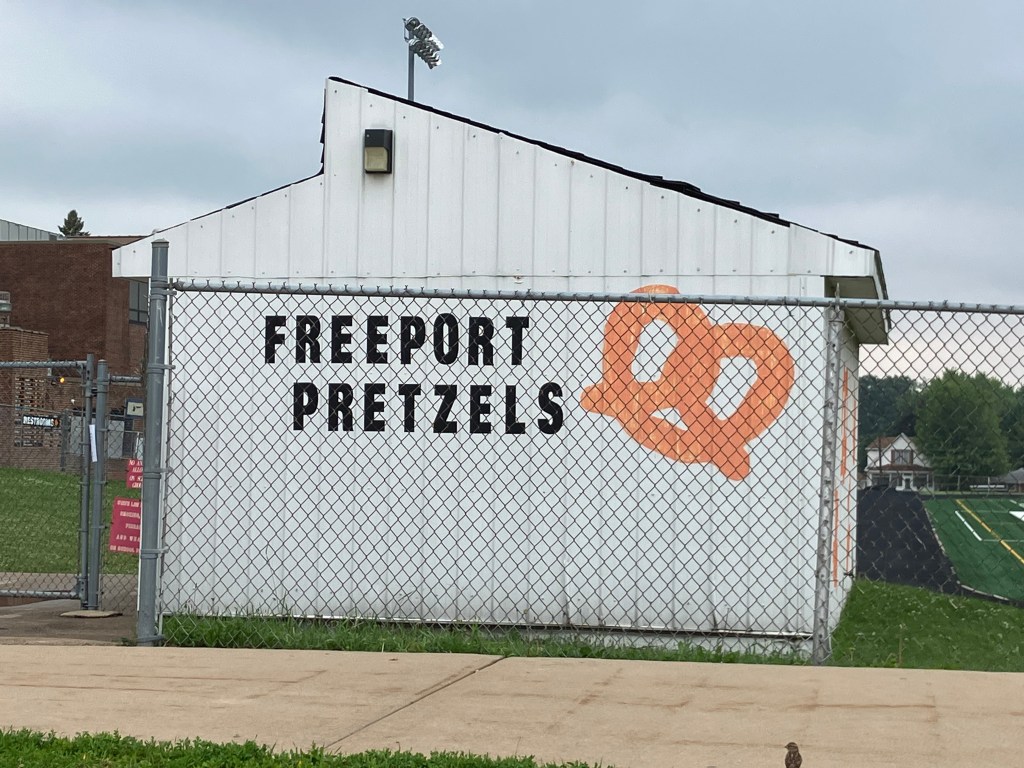
Today I took US 20 from Northlake, IL to Iowa Falls, IA. Near the beginning of the day’s drive I noticed this huge sign on a barn in the town of Freeport, Illinois (pop: 24,000).

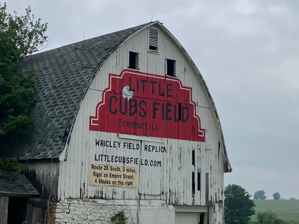
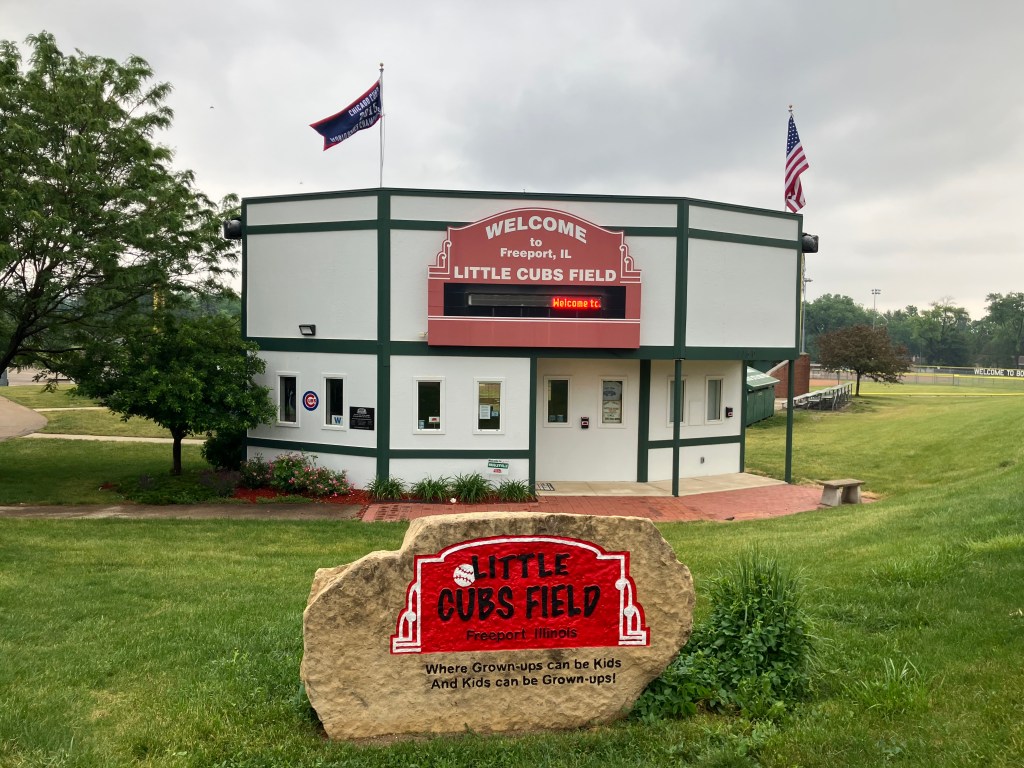
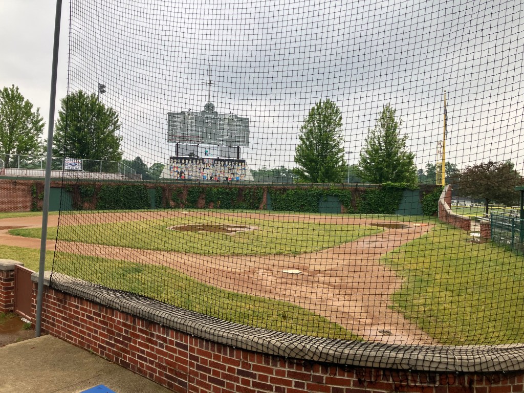
Why not? I followed the directions and was soon at this miniature version of Wrigley Field. It’s kind of cool–I’m sure a Little Leaguer would get a kick out of playing on that field.

The Friendly Confines.

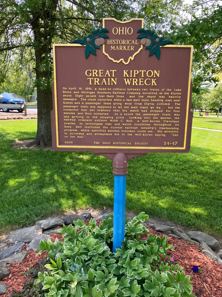
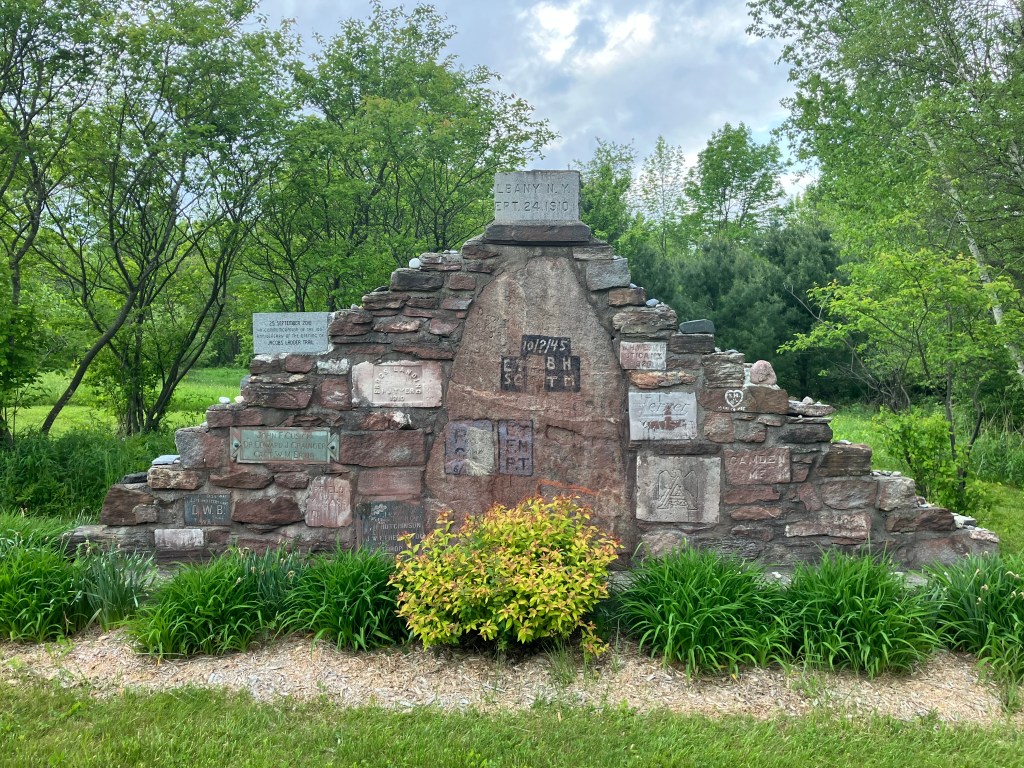
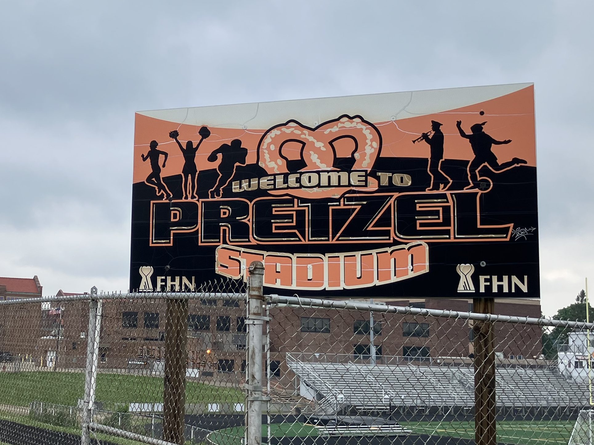
Now, while I was on Freeport’s surface streets I encountered this marker:

Knot your average city.

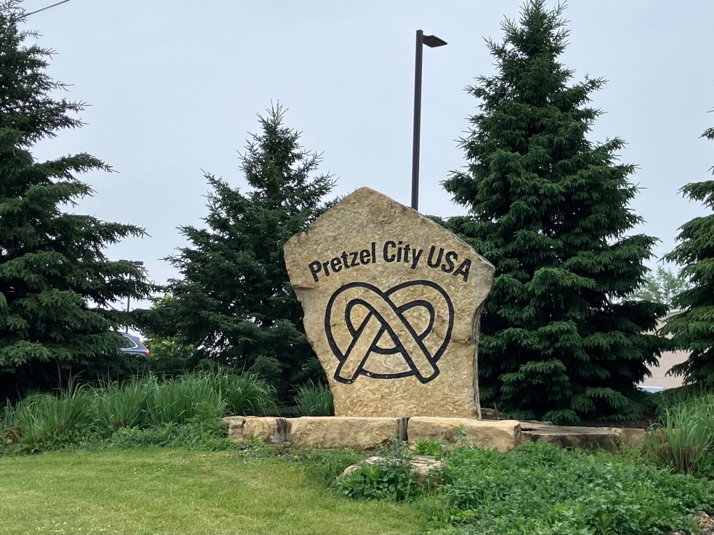
And do you know why Freeport calls itself “Pretzel City?” Is it because it produces more pretzels than anyone else? No. Is it because the roads twist and turn like a pretzel? No. Is it because the world’s pretzel production relies on Freeport’s proprietary yeast? No. In fact, it turns out that Freeport once had a German bakery that made pretzels. Like 150 years ago. That’s it.

And for that small and random fact, the local high school’s mascot is a pretzel. I’m not making this up.

I wonder if they’re sponsored by Snyder’s of Hanover?

Now, you may think I’m mocking Pretzel City. And I am. But I happen to love pretzels, and all this ruminating on the snack brought on a hankering for a big, soft pub pretzel with beer cheese. Surely I could get one here in Pretzel City.

No. “Pretzel City” does not sell big pretzels. There isn’t even an Auntie Anne’s in town.

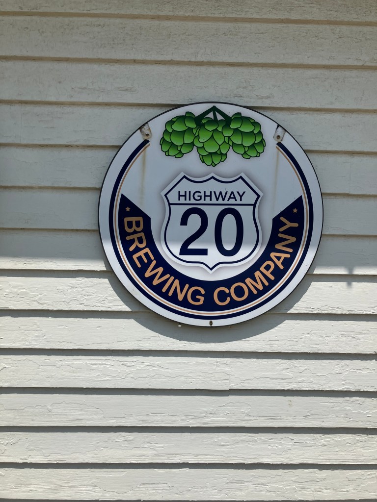
So I ended up scanning each town I passed through for either a German bakery (unlikely) or a brew pub (more likely). Around noon, when I was passing through the town of Elizabeth, Illinois (pop: 694), I hit the jackpot. Right next to the road was the Highway 20 Brewing Company.

Let us brew.

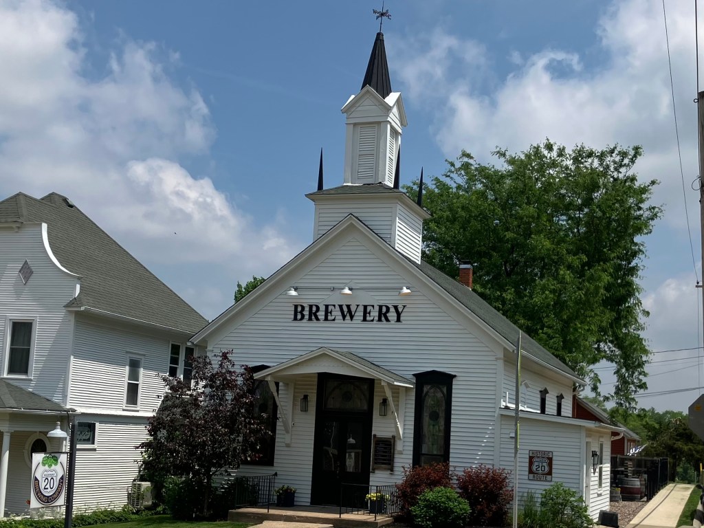
The brewery is in an 1875 Presbyterian church with beautiful stained glass and a large outdoor seating area. What could be better? I parked the car and strode up to the Narthex. And there I was foiled: The place didn’t open until 3 pm. I seriously thought about killing a few hours until they opened, but it was such a tiny town I couldn’t think of much more to do than drink a beer and eat a pretzel in a church. Muttering words that shouldn’t be spoken on church grounds, I got back in the Perigrinator (as I’ve taken to calling the Altima) and continued along Route 20.

Shortly before I got to the Iowa state line, I entered the town of Galena, Illinois (pop: 3,300). Now Galena is an interesting place. Most of the town is recognized as a National Historic Site, and just passing along the street feels like you’ve gone a century or two back in time. Virtually all the buildings in the downtown are historic, and most of them seem to cater to tourists. Among other things, Galena plays up the fact that General US Grant retired here after the Civil War, and his home is a major tourist draw.

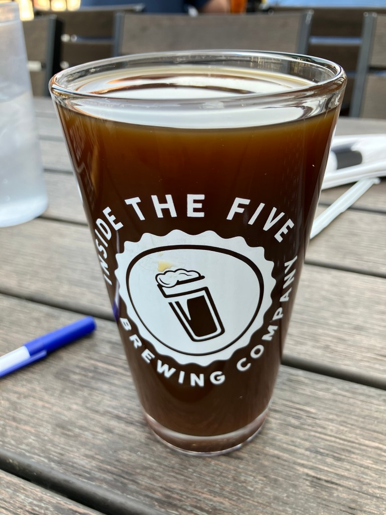
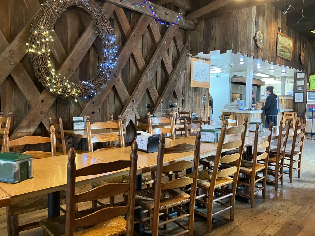
Of course, the main draw for me was a place called the Galena Brewing Company. It’s in an old building from 1849, that once housed a print shop. They make a good selection of interesting beers, and I’ll discuss my choice when we get to the BOTD. But my immediate goal was to get me a big pub pretzel. Voila!

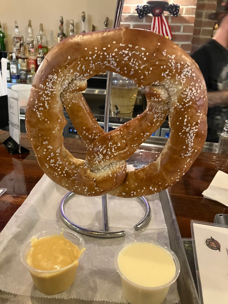
It’s a one-pound pretzel, which the brewery claims it is “famous” for. I don’t know about that, but I do know that it constituted my entire lunch. I was supremely happy.

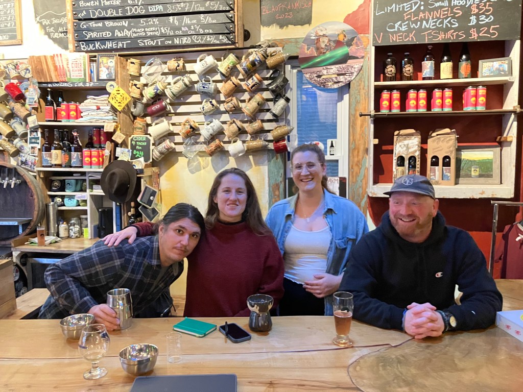
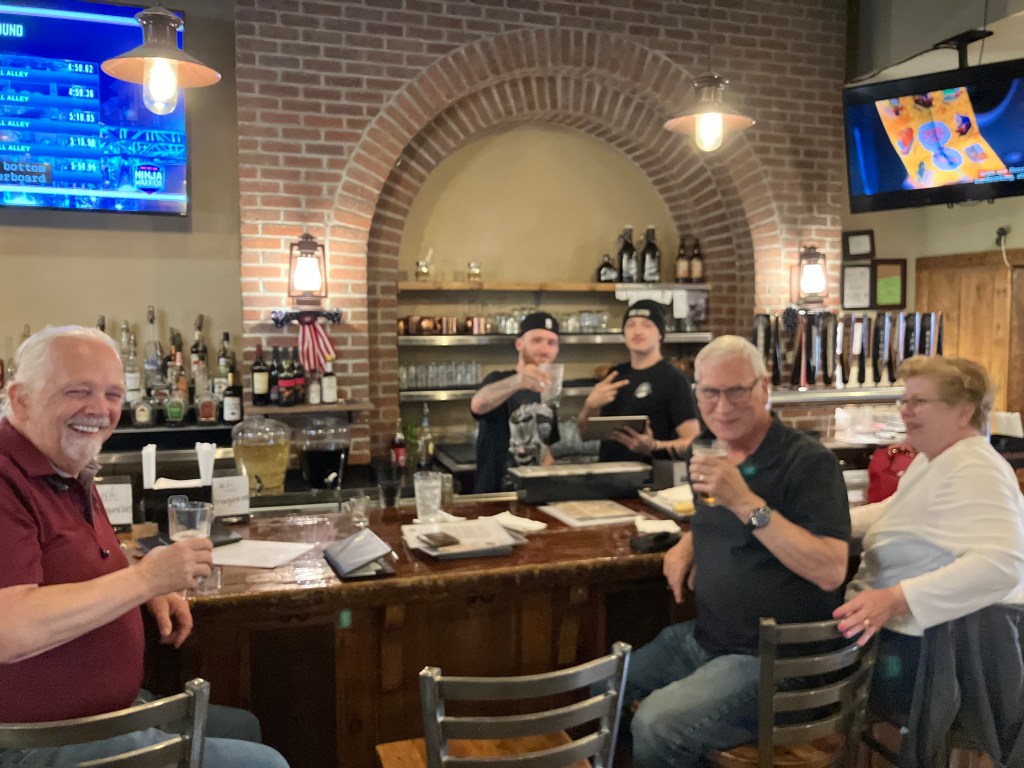
While scarfing my pretzel I chatted with a few other people at the bar. We were all out-of-town visitors. Tom had just visited his sister nearby, and had a 300-mile drive home in front of him. Steve and Ann had come over from the greater Rockford area to spend a few days, and this was their third trip to Galena Brewing Company. There was also a woman from Denver visiting a relative in the area. Bailey the Bartender kept us all happy. It was a very enjoyable hour. And that’s not just the pretzel talking.

Left to right: Tom, Bartender Bailey, mystery bartender, Steve, and Ann.

OK, now that I’m done with that twisty tale of pretzels (har!), let’s go back to a couple of other sites of note along today’s drive.

In Marengo, Illinois (pop: 7,600), I spied this mysterious old tower right next to the road. It abuts a decaying, old stone wall–like ancient Italian ruins. Is it a watchtower of some kind?

Mysterious Marengo Tower.
This wall behind the tower surrounds a plot of overgrown brush and random pieces of cast concrete.
Looking upward along an enclosed ladder on the side of the tower. You can see the enclosure above the door in the first photo. I considered climbing the ladder, but chickened out.

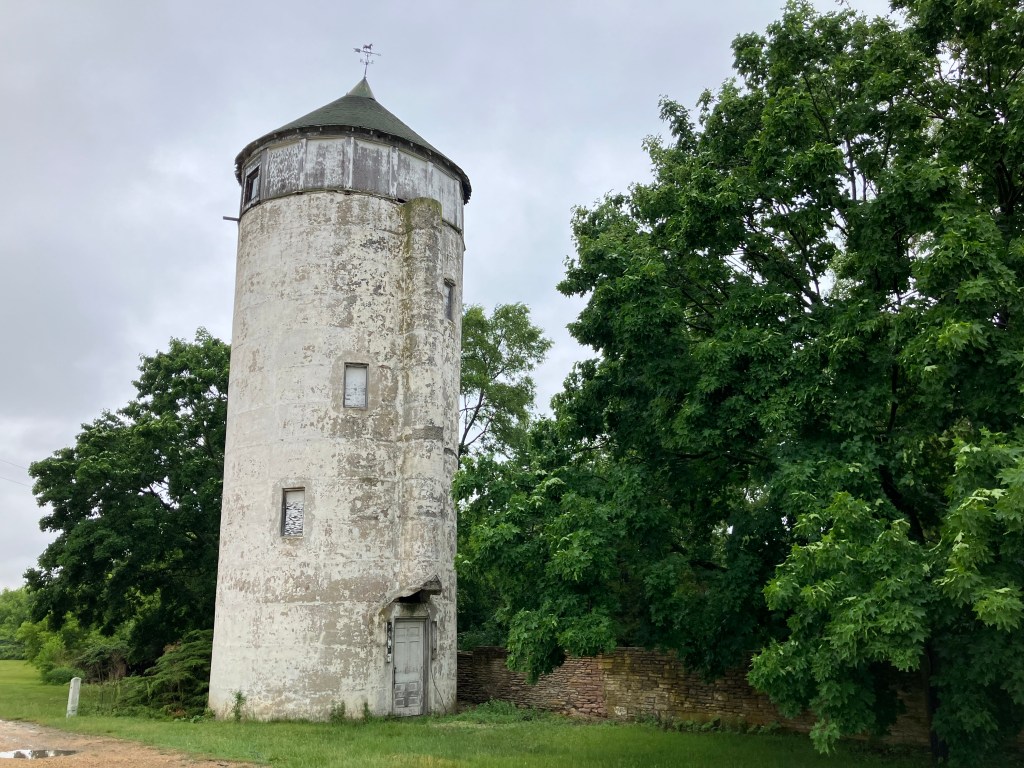
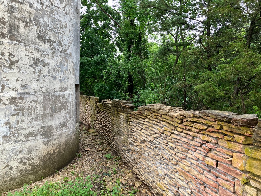
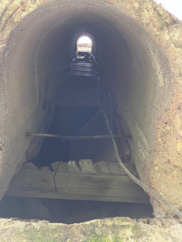
My internet sleuthing didn’t turn up anything definitive to explain what the heck I was looking at. ChatGPT thinks it’s a fire watchtower, but it seems to be confusing the structure with a steel tower not far from there. Anyone know what we’re looking at here?

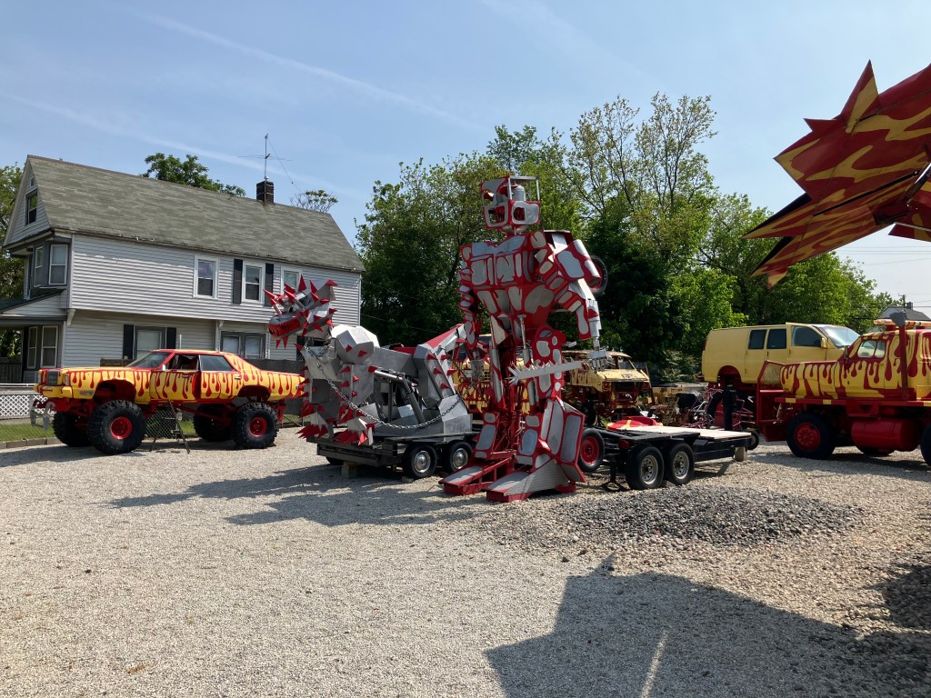
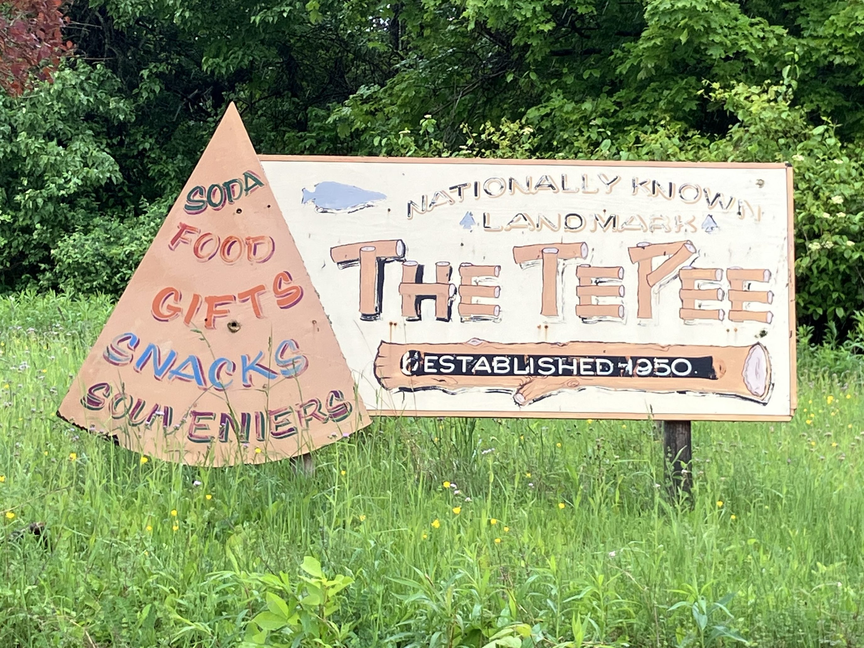
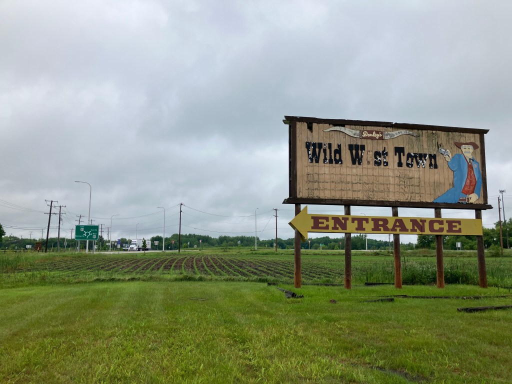
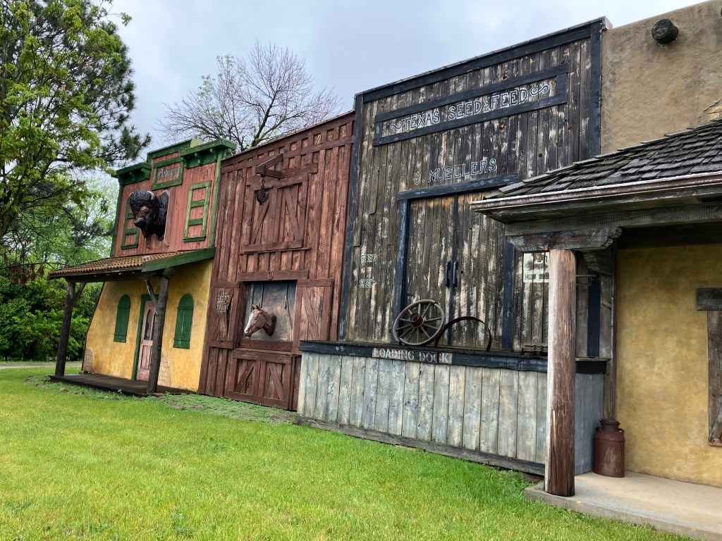
The most melancholy site of the day was Donley’s Wild West Town, also in Merango. This sign caught my attention:

Following the sign, I encountered what appeared to be a giant Frederic Remington sculpture:

The Four Horsemen of the Apocalypse?

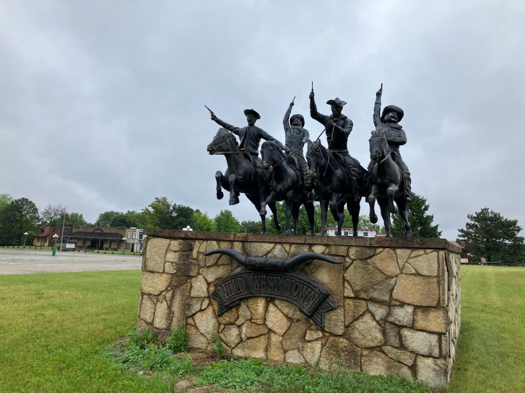
Judging from the iconography so far, I assumed this Wild West Town would be similar to a place near my childhood home, called Frontier Village. Frontier Village depicts a sanitized version of the Old West, with rodeos and bloodless shootouts and gold panning and alcohol-free saloons and pony rides and such. I remember it being great fun.

So, hoping to relive a few moments of my youth, I turned into the parking lot. The place was clearly closed for the day, and despite the presentable-looking front doors, the facade was looking a little long in the tooth.

Cue the whistle from The Good, the Bad, and the Ugly.
Must have been a pretty fun place, back in the day.
Peeking behind the fence.

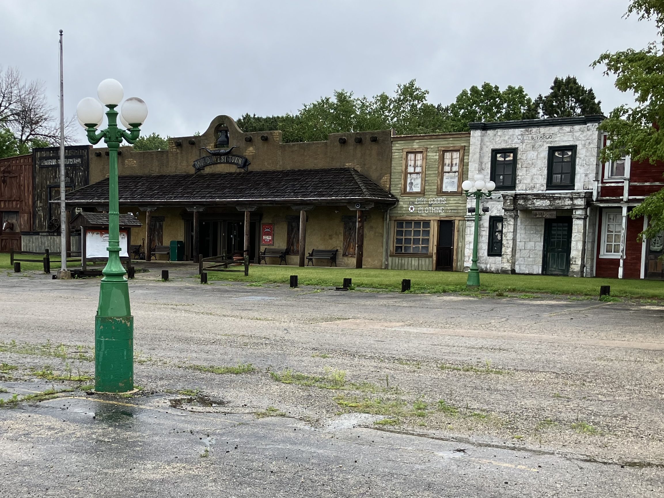
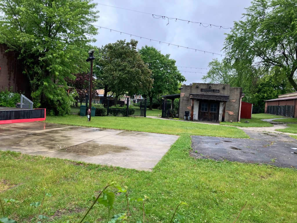
A search of the internet confirmed that the place is permanently closed. This made me feel kind of melancholy, for two reasons. First, it’s always poignant when someone’s dream dies. From the little I know about Wild West Town, it seems like it was a family-owned, family-friendly place with a lot of heart. It reminds me of an abandoned place in Wisconsin that I discovered in 2022. You can read my post about it here. And if you do, make sure you scroll all the way down to the comments at the end, where the son of the park’s founder makes a surprise appearance.

Anyway, the second reason the demise of a park like this saddens me is because it reminds me of the passing of an era. It seems that these low-tech, sweetly-corny, flesh-and-blood places aren’t popular in the modern, digital world. I know that makes me sound like a Luddite, or at least an old man. Which I am. But still.

I encourage you to watch this 2016 video of highlights from the Wild West Town. You’ll see what I’m talking about.

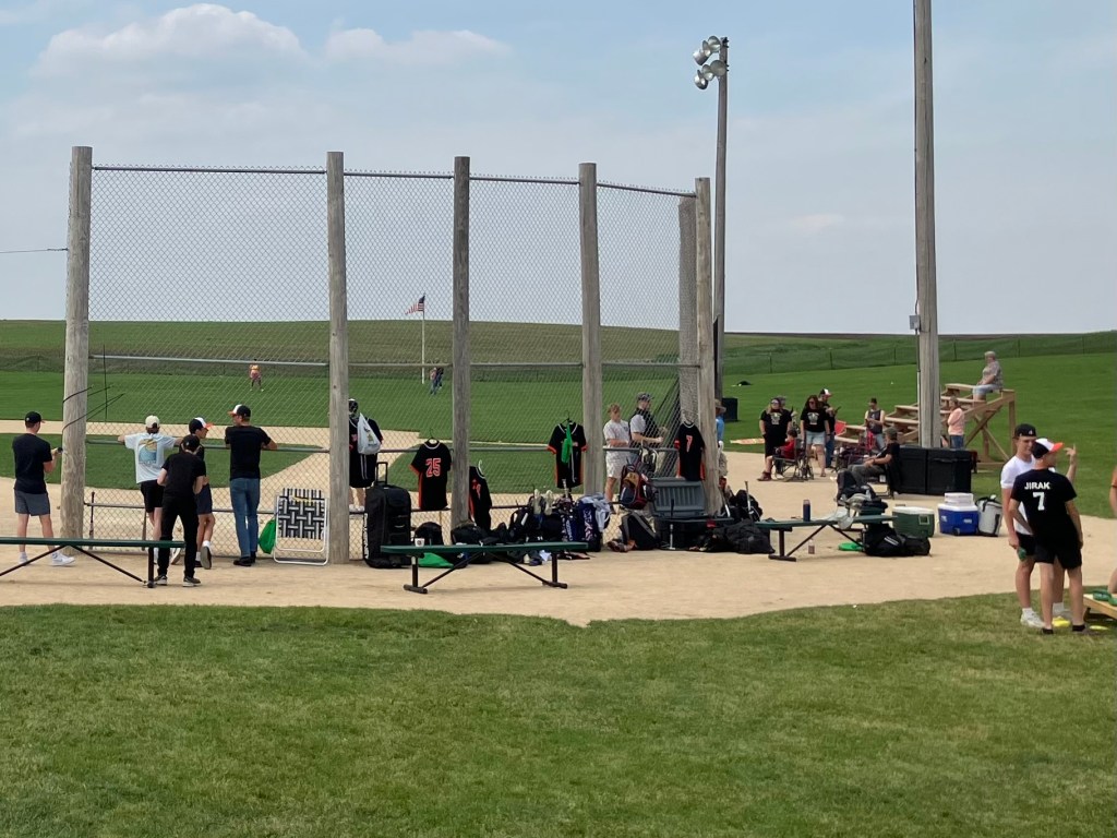
But let me end on a somewhat more inspiring note: Near the end of the day I saw a sign along US 20 urging me to visit the “Field of Dreams.” Yes, that Field of Dreams. It turns out that after they made the 1989 Kevin Costner movie, the town of Dyersville, Iowa (pop: 4,000) preserved the baseball diamond that was created in a cornfield. It’s now a tourist attraction.

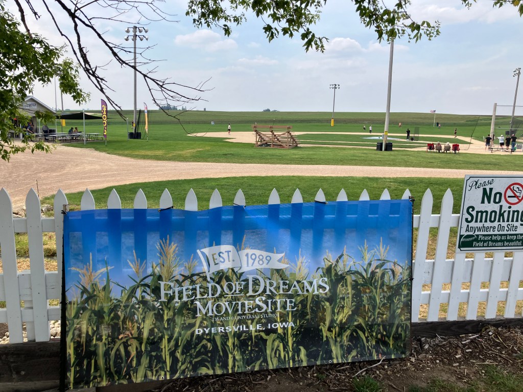
Sure, it’s a little corny (ha!), but it was heartwarming to see kids and families playing catch on the field. What a perfect bookend to a day that began at the Little League version of Wrigley Field.
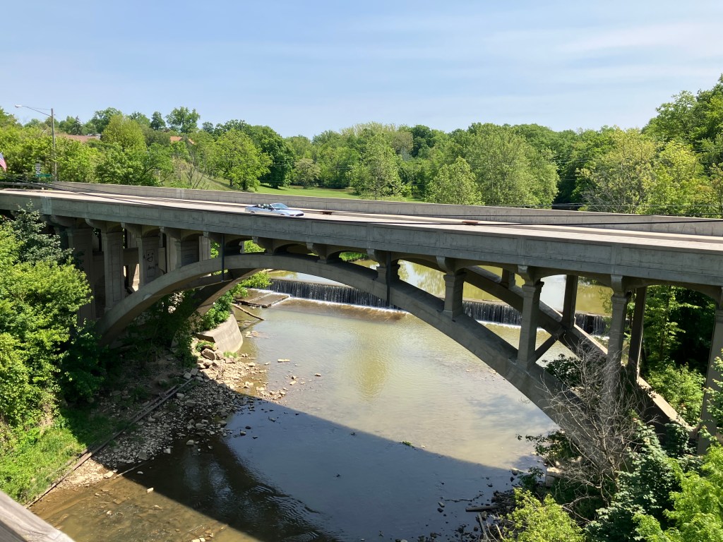
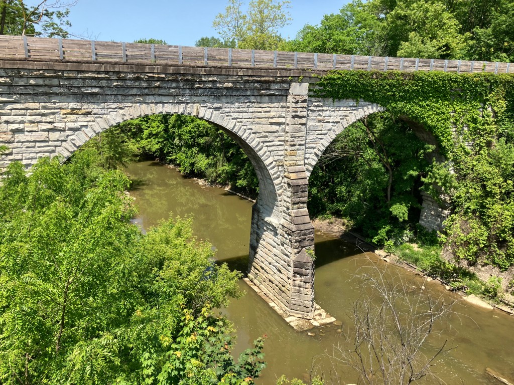
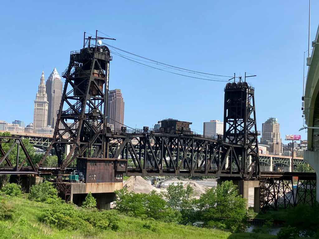
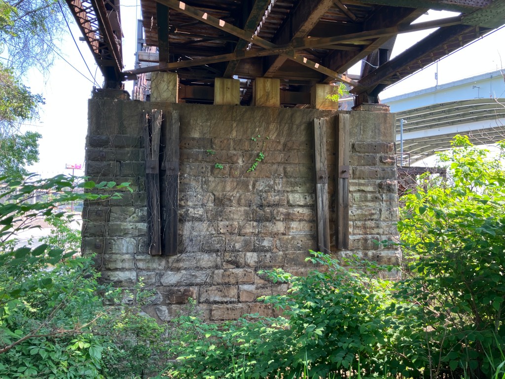
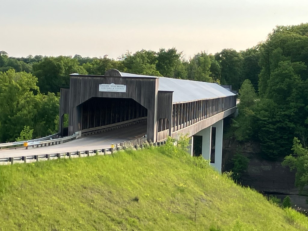
Build It and They Will Come indeed!

BRIDGE CORNER

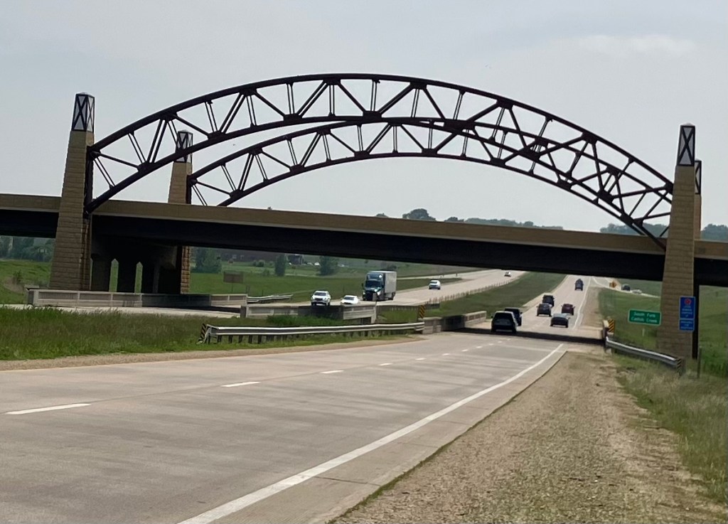
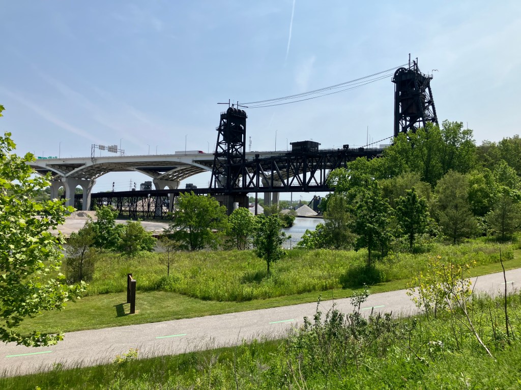
This overpass carries traffic from Seippel Street in Dubuque over US 20. To me it looks like a fairly new structure, and it seems to incorporate old steel arches from a prior bridge. I cannot confirm any of this with my research though. Our research team will keep working on it, but any tips would be appreciated!

BEER OF THE DAY

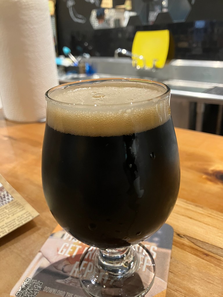
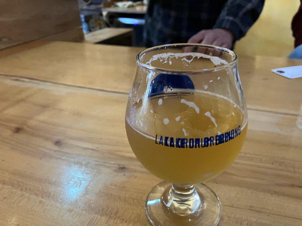
As noted early, the BOTD comes from Galena Brewing Company. I had the “All Day Reveille,” which is a black lager. It’s as dark as a stout, but with a much thinner body and less robust taste.

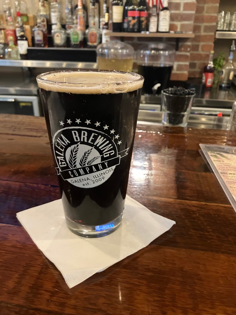
This beer is quite balanced, with a dark, malty base that’s countered with a moderate amount of hops. After fermentation, they add some cold-brewed espresso from a local coffee roaster. This gives the flavor a stronger backbone. Still, it’s not overpowering, and the flavor profile is fairly flat. The ABV is 5.7, which is about average. I’d call this a pseudo-stout for people who don’t like stouts. I’ll give it 3.5 stars, which means I wouldn’t go out of my way for one, but I’ll enjoy one if it’s in front of me. I give the accompanying pretzel a solid 5 stars.

Breweries · bridges · Movies · Road trips · trains · Yard art

Bridge-A-Palooza

You’ll recall that yesterday I filmed myself crossing the US’s longest covered bridge, and then ended the day in Geneva OH where I encountered the country’s shortest covered bridge. Loyal reader Detlef K. asked why I didn’t include footage of crossing the Geneva span. I can’t believe I didn’t think of that. So first thing this morning I returned to the Geneva bridge to correct my oversight. Here is the fruit of my labor:

Today actually turned out to be a bridge-filled day. Take, for example, this bridge that carries US Route 20 traffic over the Vermillion River in Wakeman, OH. It was built in 1933, and I’m told it’s an “open-spandrel, concrete-arch” design.

I’m no engineer, but I can appreciate how graceful that arch design is. And the fact it’s been there for almost a century is certainly impressive.

I took the picture from atop a pedestrian/bike bridge, and got to wondering what that bridge looks like from the side. So I moved over to the Wakeman (US 20) bridge and took this picture of the pedestrian bridge:

Is that impressive, or what?? It turns out the pedestrian/bike path was placed atop an 1872 railroad bridge. Trains haven’t come through here in decades, so about a decade ago the “rails to trails” people retrofitted it.

But then there’s Cleveland (pop: 363,000). US 20 cuts through the town on surface streets, and the experience of driving it is infinitely different from the peaceful cruise through innumerable small towns that I’d experienced the past few days. This morning’s drive through Cleveland was crowded, people were honking, blight was evident on both sides of the road. I did make a small detour to find the house that was used for the exterior shots of A Christmas Story (1983). But I got lost and found myself in a jungle of massive, looming bridges that cross the river at all angles. And that’s when the magic happened: I saw what makes Cleveland unique. I saw 200 years of history. Would it be going to far to say I saw its heart?

I took most of the following photos from a trail that was once the “towpath” along the Ohio and Erie Canal. Mules labored along these paths pulling boats and barges up the canal via ropes. The modern trail/historic towpath runs alongside the canal for about 100 miles. I walked less than a mile of this path, passing under and next to innumerable bridges–some still in service, and some decommissioned.

I was wondering if the rusty old Nickel Plate Road High Level Bridge was still operational, and suddenly a Norfolk Southern train clattered over it.
Detail of one of the eight “Guardians of Traffic” on the 1932 Hope Memorial Bridge. Note that he’s holding a truck.
Railroad center-lift bridge, now decommissioned.

Want to see one of these types of bridges in operation? Here I am waiting in traffic for an automobile bridge to return to earth:

One of the modern spans. (Can one of my loyal readers identify it for me?)
A remnant of the 1888 Central Viaduct.
Rubble from the demolition of old bridges and associated structures, now used as ground cover next to the Towpath.
The modern towpath in foreground, with old and new bridges in background.

Evidently Cleveland has over 300 bridges, many of which cross the Cuyahoga River. I’m not going to make you view them all. But you’ve got to admire the engineering and the grit that went into building these over the past two centuries. And you also have to admire how modern Clevelanders somehow navigate daily through this confusing labyrinth.

We now move on to the non-bridge-related part of the day:

Here’s a different kind of engineering project, carried out by a high-school dropout who taught himself welding, electronics, power delivery, and a ton of other stuff:

Corporation yard from hell.

This is all on a lot on a residential street. Let’s look a little closer:

Jiang.
“More than meets the eye.”

It’s all the work of local artist Tim Willis. And those robots and dragons actually move with electric servos, and the trucks have powerful engines that presumably could get them into a monster truck show. My readers will recall that I have a soft spot for yard art; this is incredible. Spend a minute or two hearing from Tim himself:

Sadly, he wasn’t available when I dropped by.

Next up was the town of Kipton, OH. A new reader named Bob suggested I check out the site of the “Great Kipton Train Wreck of 1891.” There’s a marker at the site explaining how a head-on railroad collision occurred because the watch of one of the conductors was four minutes slow. Leaving aside the issue of whether it’s wise to create railroad schedules that have two trains occupying the same space just minutes apart, this accident prompted the railroads to adopt strict standards for railway timepieces.

The marker sits in a park/bike trail that used to be the rail line where the accident occurred.

Finally, can anyone identify the building below? (You already had a hint.)

“You’ll shoot your eye out!”

Beer of the Day

I nabbed my BOTD at the Inside the Five Brewing Company, just west of Toledo, Ohio. It’s owned by two retired NFL players: Chris Morris (Oakland Raiders) and Brandon Fields (Miami Dolphins). They both retired in the Toledo area, and started this brew pub in 2018. I’m told “Inside the Five” is reference to the last 5 yards of the gridiron. But it’s all Greek to me.

Anyway, the place is evidently very popular–it was packed when I got there on a Monday evening. They have a big space, with comfortable outdoor seating on a deck that overlooks the street. They also have friendly servers, and the weather was perfect. What better place to get the BOTD?

I had a pint of their Deimos, which is an American Porter. As we all know (after consulting Wikipedia), in Greek mythology Deimos was the son of Ares (god of war) and Aphrodite (goddess of love). Somehow he turned out to be the god of dread and terror. Should I be worried for ordering this beer?

Deimos is made by brewing a traditional Porter and adding local coffee and vanilla. Both of these tastes are prominent in the beer, though the vanilla is more prominent on the nose than on the palate. The mouthfeel is incredibly smooth. It’s very lightly carbonated, and has no foam to speak of. The ABV is 6.5 percent. The color is quite light for a porter–it’s the color of honey, or maybe the color of coffee when you use the Kuerig pod a second time.

Speaking of coffee: The coffee flavor is not particular roasty; instead it reminds me of Coffee Nips (TM) candy. There’s also a sweetness to this beer that is just this side of cloying. The beer seems to have no bitterness at all, with just the slightest evidence of hops on the finish. I’d say this is more of a dessert beer, that wears out its welcome as you move through a full pint of it. I’d give the first half 4.5 stars, and the second half 3 stars. I guess that means the overall score is 3.75.

Breweries · bridges

A Geneva Convention

When I awoke in Geneva NY this morning I was relieved to discover that yesterday’s rain had stopped. It was going to be a good day.

After my morning ablutions I eased the Altima back onto US 20, which at this point was feeling like an old friend. Those iconic white-and-black shield signs, with the reassuring “West” designation, appear every few miles, or even more frequently when encountering some complicated twists and turns through the towns. For it’s worth remembering this 3,365-mile road was largely assembled from preexisting roadways which didn’t always line up perfectly. I have to admit, though, the USDOT has done a great job of making the route clear. I have hardly used a map or nav at all, instead relying almost exclusively on the road signs.

I encountered today’s first sight of note in the town of LeRoy NY (pop: 7,700). Do you recognize this?

Doesn’t it reminds you a lot of this?

Surely you remember Mike Mulligan and his steam shovel. The rusty hulk I saw in LeRoy this morning was made by the Marion Steam Shovel Company in 1906. (Notably, the name of Mike Mulligan’s steam shovel was Mary Anne-almost certainly a nod to the Marion company.) For decades the LeRoy shovel worked in a quarry across the street from where it now stands. It was retired to that spot in 1949…just a few years after Mike Mulligan’s Mary Anne was converted into a boiler for a building’s heating system. I’m just impressed with the scale of this beast. It took a crew of four men just to operate the thing!

Next up was the town of East Aurora, NY, where I saw the first of several giant sculptures. This first one is affectionately known as Vidler on the Roof:

Vidler’s is an old-timey five and dime store founded by Robert Vidler in 1930. This East Aurora location was established 65 years ago by Robert’s son, Ed. The inside of the store still looks very much like the old five and dimes…except the prices are much higher. The statue of Ed was placed on top of the building in 2009; Ed died ten years later, at age 90.

And yet I still couldn’t find a perpetual-motion bird!

It seems that this part of the country really likes to place giant objects on their buildings. A few other examples from today:

In East Aurora. Is that a phone number on the sign or is it the Klingon word for “gum recession”?
Giant coffee cup in the town of North East, PA.
In front of a pizzeria in Erie, PA. The handle is 8 feet long, and the stainless steel wheel is 5 feet in diameter.

My main objective of the day was to see some lighthouses on Lake Erie. Alert readers will recall that I’ve had a passing interest in lighthouses as interesting pieces of history, architecture, and (possibly) ghost lore. More to the point, though, last time I visited a light house I bought one of those souvenir “passports” that can be stamped at all the lighthouses in the US. I’ve already got five stamps. I only have 772 more to go…

Anyway, today I climbed to the top of the Dunkirk Lighthouse and the Barcelona Lighthouse. Both had docent-led tours, but I had to fake an emergency to escape the endless, meandering stories and dad jokes from one of the docents. I’m not making this up. Anyway, both lighthouses date from the 19th century, and the Dunkirk Lighthouse is still active. The Barcelona Lighthouse had the world’s first natural-gas powered lighthouse light. It hasn’t been active for well over a century, and is now run by the NY Parks Department. It was recently renovated and re-opened just this week!

Dunkirk NY Lighthouse.
Dunkirk Light’s Fresnel lens (from 1857) is still in use.
View of Lake Erie from Dunkirk’s light tower.
Barcelona, NY Lighthouse, freshly restored.

It was now getting close to dinnertime, so I went to a pizzeria in Ashtabula, PA that’s situated entirely within a covered bridge. Seriously. The 1862 town truss bridge was originally located about 11 miles south of its current location until it was slated for replacement in 1972. It was auctioned off, and the highest bidder was Gary Hewitt. His bid was five bucks. Gary had the bridge disassembled and then reassembled on its current site. He named the place Covered Bridge Pizza Parlour, which is kind of on the nose.

“The Pizzas of Madison County.”

Sitting in the dining room of Gary’s restaurant you’re surrounded entirely by the bridge. It’s a neat and well-executed concept. I wish I could say the same for the pizza.

Now here’s where things start to get a little weird. Just minutes after leaving the covered bridge restaurant, I encountered this monster of a covered bridge:

I stopped to get a better view, but couldn’t find a decent angle.

From here it looks like an elevated BART trackbed.

A nearby kiosk explains that this is the longest covered bridge in the entire country, at 613 feet long. It was built in 2008. Come with me as I drive over it!

Now, a few minutes after crossing the country’s longest covered bridge, I enter the next town and decide to get a motel for the night. During my search I encounter another covered bridge. This time it’s the shortest covered bridge in the US!

I’ve seen Eagle Scout projects more ambitious than this…

What are the odds of the country’s shortest and longest covered bridges being within a few miles of each other along Route 20?? Of course, this is easily explained: Shortly after Ashtabula got all the attention for building the longest covered bridge in 2008, the folks in this neighboring town decided to replace an old cement culvert with an 8-foot-long covered bridge. It’s not a joke, exactly, but it’s certainly a lighthearted statement piece.

And what’s the name of this town where I’m ending my day’s travels? Geneva, Ohio. Which is fitting, since I started the day in Geneva, New York. There’s been a lot of doppelgangers today…

BOTD

I got my Beer of the Day here in Geneva, OH, close to the banks of Lake Erie. It’s a brewery called The Darkroom Brewing Company, for the space it occupies used to be a commercial photography darkroom. (Note to you young ones: In the old days, before pics were digital, you had to develop your photographs on paper with chemicals in the dark.)

I had something called “Nachthexen” Russian Imperial Stout. The name–which translated from German means something like “Night Witches”–was a term the Germans used to describe a special all-female bombing unit in the Soviet air force during the Second World War. So that’s cool.

Bombs away!

The Nachthexen is very approachable for an imperial stout. It’s not as sweet or as heavy as some renditions of this style can be. It has decent carbonation, and it has 10% alcohol by volume..which may sound like a lot, but I typically encounter imperial stouts that have ABVs of 12, 13, even 15 percent.

This is an interesting beer. The nose is very malty, and a bit like unfermented wort. On the tongue it’s roasty almost to the point of burned. It starts out like dark coffee, but midpalate you get hints of burned popcorn, cork, and pencil lead. The finish has some bitterness and astringency, somewhat reminiscent of the volatile organic compounds in PVC pipe glue. Somehow, when you put it all together, it’s pleasantly interesting and strangely balanced. I give it 4.5 out of 5 stars.

Breweries · bridges · cemeteries · Road trips · trains

Rain Man

This morning I awoke in Great Barrington to pouring rain. It lasted all day, which, to say the least, put a damper on the day. Har.

Because of the weather I didn’t get out of the car as much as I’d have liked. So allow me to finish up my story of yesterday’s travels:

Around 4 pm I was passing the town of Chester, Mass. (pop: 1,300). A sign advertised a historic railroad depot and museum just a few blocks away, so I figured I’d make a quick stop. Alas, the station–which is beautifully restored–was closed for the day. Disappointed, I sat on a bench on the station’s front porch and began to consult my map to figure out where I’d get dinner.

Chester Depot, which dates back over 150 years.

Then a man approached me from a house directly across the street. Dave (for that was his name) turns out to be a long-time volunteer at the station who frequently gives tours. Since he lives across the street, he’s able to come out and greet visitors even when the place is supposedly closed. And so, for the next hour or so, I got a private tour of the depot.

Dave, showing off his baby.

The depot has been lovingly restored since it was acquired from the railroad in quite rough condition. After the railroad stopped running passenger service, the station was used as a maintenance and storage facility, which means the walls and hardwood floor literally took a beating. But look at it today:

The railroad and depot are notable for a number of reasons (believe me, I heard them all!) but most notable is that the station is situated at the bottom of a mountain. The rail line had a steep grade, so trains would stop here while “helper” engines were added to push or pull the train over the mountain. Another notable aspect of the railroad is a series of 10 stunning keystone arch bridges, built in the 1840s, that still carry trains over the Westfield River. Oh, and the railroad was surveyed and/or engineered by George Washington Whistler…that is, the painter Whistler’s father. (Everyone only knows Whister’s mother.)

At Dave’s urging I visited one of these keystone arch bridges, only a few miles from the depot. It’s picturesque and impressive from an engineering perspective.

Finally, I got back onto Route 20 and headed up that self-same mountain that necessitated the helper engines years ago. An automobile road over the mountain was added in 1910, though it was a primitive, difficult drive. Modern Route 20 parallels that original road, and arrives at the same 1,775-foot summit. And so, when I arrived at the summit, I encountered a stone cairn monument that was originally placed there in 1910. It was made from stones collected from roadway infrastructure from all over the world.

1910 monument.

So much for yesterday. Today, as I mentioned, I spent the day driving through rain. But I did manage to make a couple of worthwhile stops. One was The Tepee–a classic roadside attraction from the Golden Age of road trips.

The Tepee is a souvenir shop that dates back to 1950. It’s the kind of place that my brother and I always begged our parents to stop at, so we could get Big Hunk candy bars, “perpetual motion” drinking birds, paperweights with the name of the state we were visiting, and suchlike.

Inside the Tepee.

The Tepee is owned by sisters Dale and Donna, who bought it from their father over a decade ago. So it’s definitely a family operation. Dale is the friendliest person you’d ever want to meet, and exudes a love for her business and her customers. She also really knows her Route 20 trivia, which kept me entertained for quite awhile. This place embodies the reasons that I value these road trips.

Dale, ever the show woman.

At Dale’s urging I took the US 20 “scenic bypass” that was the original route 20 alignment. It’s a little narrower and hillier than the new alignment, but it’s also greener and it passes through the village of Cherry Valley (pop: 2,300).

Beautiful Bypass.

Cherry Valley is a cozy little town, nestled amid trees and hills. I stopped in at a used bookstore that, to me, looks like it came out of a Dickens novel It was built in 1840, and the current owner told me Samuel Morse (inventor of the eponymous Morse Code) developed his telegraph here in the late 1840s.

An old curiosity shop…

The bookstore owner (whose name I failed to get) told me that Cherry Valley used to be a thriving community until US 20 was re-routed, taking all the drive-through traffic with it. He told me the highway was moved in order to satisfy a powerful state legislator whose own property would benefit from the change. I have been unable to corroborate this.

Before long I crossed the state line into New York. Driving through this part of the country feels like going back in time.

Old farrier/blacksmith along the roadside, dating back before automobiles. The owner gave me an affogato, God bless her!

1893 Burrow Chapel in Lake View Cemetery, Skaneateles, NY.
Paging Waldo Pepper…
Railroad depot in Seneca Falls.

Finally, I arrived in Seneca Falls, NY (pop: 7,000). It’s a pleasant town situated on the shore of Seneca Lake (the largest of the Finger Lakes). Seneca Falls was the site of the first women’s rights convention (in 1848), and it continues to play up that role with a major Women’s Rights Museum. It also claims to be the inspiration for the fictional town of Bedford Falls from Frank Capra’s It’s a Wonderful Life. Among other things, the bridge where Jimmy Stewart’s character tried to kill himself was supposedly modeled on Seneca Fall’s Bridge Street Bridge (I’m not making up that name). I visited the bridge today, and I do see the resemblance…but I could say that about many other bridges as well.

In the 1946 movie, George Bailey jumps off the bridge to save someone in the water. In 1917, real-life Antonio Varacalli jumped off the Seneca Falls bridge to save someone in the water.
“Bridge Street Bridge” in Seneca Falls.

Finally, I stopped for the night in Geneva, NY (pop: 13,000). It is here I had my….

Brew of the Day

I got my BOTD Geneva’s Lake Drum Brewing. It’s one of the friendliest, most laid-back breweries I’ve been to. I ended up spending two hours chatting with the bartender(s) and a couple of regulars, while I worked my way through a flight of beers and the BOTD…which we’ll get to in a moment.

Steve, Laura, Sam, and Aaron–my new friends at Lake Drum Brewing.

But first let me describe this place. They brew their own beer (with about eight beers currently on tap), plus they brew their own cider, plus they even make a couple of wines. They have an extensive (and I mean massive) collection of vinyl records that they play on a turntable that resides in an old wine barrel.

Now do you believe me?

They have patio seating for when it’s not raining, and endless free popcorn. But what’s most important is that they made me feel welcome, including me in a meandering conversation that touched on fishing, equine care, cross-breeding of cats, the best burger places in the region, music, foreign travel, and funding of the arts. Anyone in the food/drink business should take note: what gets people coming back is not what you’re serving, but how you treat your customers.

Anyway, speaking of serving drinks: today’s Brew of the Day was not a beer, but a kombucha. Now, I know kombucha has been popular for some years now, but I’d never tasted one until now. For those few of you (like me) that missed the kombucha train, it’s essentially fermented tea. Which maybe doesn’t sound that great, but this was refreshing and delicious. It was flavored with ginger and mint, and it’s just as refreshing as it sounds it would be. It’s got light carbonation, but almost no alcohol, so you could throw it back like iced tea on a hot day. I feel I have no standing to actually rate this drink, since it’s the only one I’ve ever had. But I enjoyed it immensely. I do worry, however, the Marianne’s Phenomenon could be at play. (I describe the Marianne’s Phenomenon in my memoir…but essentially it refers to one’s enthusiastic experience with a new food resulting in large part from being hungry or otherwise affected by the setting.)

New fave, or one-night-stand?

Tomorrow’s BOTD will return to actual beer.

bridges · California history · Road trips · trains

A Penny Saved…

Regular readers of this blog will recall that, a few years back, I became intrigued with the Lincoln Highway. To refresh your memory, the Lincoln Highway was the country’s first transcontinental automobile route, dating back to 1913. It ran from Times Square, NY to Lincoln Park, CA.

Why is this car driving on the wrong side of the road?

Today, most of the original route is long gone, largely superseded by modern interstates. But a handful of the original segments remain, like this crumbling roadway in the woods near Donner Pass that I (literally) stumbled upon in 2022:

Beware of trip hazards…

You may also recall that I once discovered a roadside memorial commemorating the Lincoln Highway and US Route 40, in Auburn CA. (In 1926, the feds adopted a numbering system for all US highways. The segment of the Lincoln Highway that passed through Auburn was rechristened with the unromantic name “U.S. 40.”)

A number of other remnants of the old Lincoln Highway remain. I’ve driven over segments in other states, such as Pennsylvania and Wyoming. And in an earlier blog, I shared this photo that loyal reader Brian W. took in Tama, Iowa.

Photo courtesy of Brian Weberg.

But it wasn’t until just recently that I realized the Lincoln Highway passes within just a few miles of my house. In fact, my favorite coffee place sits alongside the historic route, in a building that actually predates the Lincoln Highway. More on that in a moment.

It should be noted that the Lincoln Highway forked in Reno, providing two routes into California. One (“the Pioneer Route”) went over Donner Pass and roughly followed modern Interstate 80. The other (“the Scenic Route”) passed south of Lake Tahoe and then roughly followed modern US 50. The two segments linked up again in Sacramento.

Map from the website “Adventures in California History.”

This came to my attention because last month the local historical society held a special program next to one of the longest original pavement sections of the Lincoln Highway, in El Dorado Hills. They even brought out a score of antique cars for the occasion. You can read the newspaper article here.

So my friend Bill P. and I decided to follow more of the original route here in El Dorado County. Using the El Dorado Hills segment as our starting point, we headed east toward Placerville.

Bill, astride an original segment of the Lincoln Highway that dates back to at least 1913. Note the distinctive Lincoln Highway logo.

The surrounding countryside in this area looks, I presume, pretty much as it did a century ago, when a young Army officer named Dwight Eisenhower traveled the entire route in a military caravan. Even the bridges date to that era, I’d reckon.

Dwight probably crossed over this bridge in 1919.

After a brief, unavoidable jaunt along US 50, we were back on the original alignment of the Lincoln Highway. There’s even signage to prove it!

Note the distinctive red, white, and blue sign.

The historic Lincoln Highway route in western El Dorado County is moderately traveled and is flanked with a mix of modern buildings and historic structures dating back a century or more. An example of the latter is this 1896 freight depot in Shingle Springs:

Since last December this depot has been home to Wise Gals Coffee. It’s become a popular community gathering spot and my favorite place to get coffee. I hadn’t realized it’s also on the Lincoln Highway! If you find yourself anywhere on the 3000-mile route, I insist that you stop in for a cappuccino.

Rachel Bezdek and Brylee Lance, the eponymous “Wise Gals.”

Oh, and not only is the original depot still standing; they’re still running trains! Southern Pacific abandoned the line forty years ago, but the tracks were taken over by the local historical society, and volunteers run trains on the weekends.

Railroad equipment next door to the depot.

After paying homage to coffee and trains, Bill and I headed back out on the old Lincoln Highway (signed as Mother Lode Drive in Shingle Springs.)

When we got to the town of El Dorado (pop: 4,000) the old Lincoln Highway (now called Pleasant Valley Road) took us right by the storied Poor Red’s BBQ. Allow me to quote directly from Poor Red’s website:

“Originally constructed as a weigh station for Wells Fargo, it previously operated under the name Kelly’s Bar from 1927 until 1945. Poor Red won the bar in a game of dice, and he and his wife and bookkeeper Rich Opal took it. The murals currently on the walls of Poor Red’s were installed in the 1940’s. They depict former employees and patrons, including their dog, which used to sit out front. It is rumored his dog ran for office, but he lost.”

Photo from S.F. Gate.

Poor Red’s, as you might know, is famous for the Golden Cadillac, a sweet cocktail with equal parts Galliano, cream, and creme de cacao. They claim to have invented the drink in 1952, and to be the world’s largest consumer of Galliano. Bill and I stopped in for lunch…

Next up, we stopped in at the El Dorado County Museum, which we knew has two original Lincoln Highway markers in its collection. One morning in 1927, exactly 2,436 of these cast cement markers were placed along the entire cross-country route by local Boy Scouts. (You can see one of the markers in my earlier photo of the Lincoln/US 40 memorial in Auburn.) Almost all the original markers are now gone, succumbing to road-widening operations, vandals, or weather. Given how iconic they are, Bill and I felt it important to see one “in the flesh,” as it were.

Poor little bastards.

We were met at the museum gate by one of the least helpful docents you’d ever want to meet. Us: “Hi! We understand you have a couple of historic Lincoln Highway markers on display!” Him: “Yes. They’re over there.” He gestured vaguely behind him to a bunch of clutter in a courtyard in front of the museum. But he continued to block the gate. Us: “Uh, could we see it?” Him: “We’re closed.” Us: (disappointed looks). Him: “You might be able to see it through the fence of the parking lot.” And with that he went back to torturing kittens or whatever it is he does for fun.

We did manage to take a photo through the metal fence. God forbid that we would have been allowed to set foot for a moment on the other side of the fencing.

Note that the Lincoln head near the top is embossed. This seems odd; in all the other photos I’ve seen of these, the Lincoln head is on a round, bronze plaque.

We returned to the Lincoln Highway, and once again felt like we’d been transported to the early 20th century. As we approached Placerville we crossed over the historic Weber Creek Bridge, which dates to 1914.

The bridge is in remarkably good shape for over 110 years old. A little research revealed that it’s one of only two “Turner Mushroom Slab” bridges in California. Evidently an engineer named Claude Allen Porter Turner patented a “flat slab support system” (which my wife tells me I could benefit from). But I think it actually has something to do with the way the concrete slabs are designed and assembled. Coincidental fun fact: Turner was born in 1869 in Lincoln, Rhode Island!

Quick! Find the “flat slab support.”

Finally we were approaching Placerville, which meant we had one more opportunity to get up close and personal with a Lincoln Highway marker. The Lincoln Highway through downtown Placerville is now Main Street, and our research suggested that one of the original markers had been discovered during an earlier road-widening, and cemented into the face of a brick wall. After a few false leads and a couple of illegal maneuvers, we found what we were looking for in the external wall of a restaurant:

The real deal!

It’s quite surprising how many of these remnants of a century-old highway remain, largely invisible or unacknowledged by galoots such as myself. My two recommendations to you, gentle reader, are (1) pay attention to the history near you; who knows what’s in your backyard!, and (2) ease onto the Lincoln Highway and make your way to Wise Gals for a cappuccino.