Breweries · bridges · cemeteries · Obelisks · Road trips · trains

Redenbacher’s Revenge

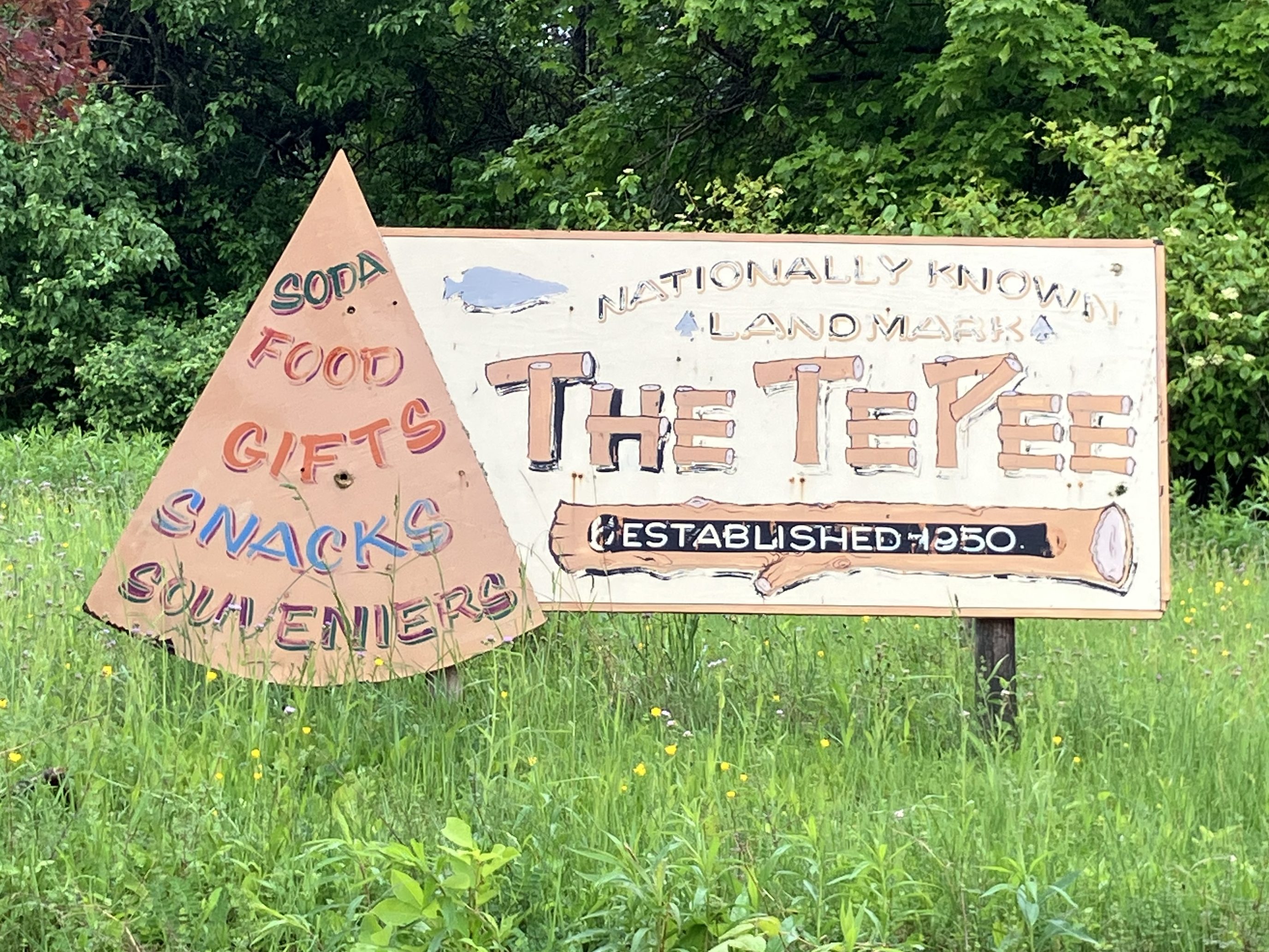
Today’s segment of Route 20 took me from Iowa Falls, Iowa to O’Neill, Nebraska–a distance of almost 300 miles. But while I covered more distance than usual today, I spent less time on the road. This is because I’m now in the Midwest/Great Plains part of the country, where US 20 runs straight and fast. Plus, frankly, there isn’t as much to see here, meaning fewer stops. This part of the drive is more meditative, with mile after mile of farmland, a big open sky, and almost no other traffic on the road.

As I left Iowa Falls, I noticed this popcorn stand on a downtown corner.

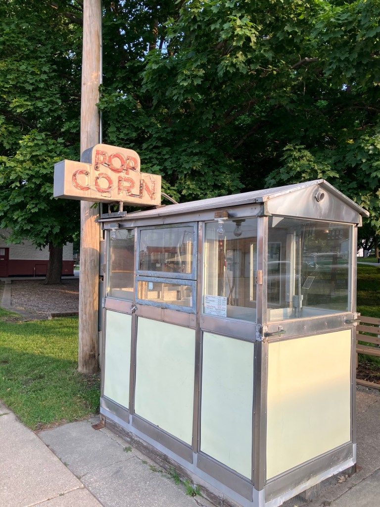
That neon sign looked pretty antique, and a little research revealed that there’s been a popcorn stand in Iowa Falls since the 1870s. The current incarnation has reportedly been around since 1947, though it looks like the wall panels have been replaced fairly recently. Unfortunately, I arrived too early in the morning to get a bag of popcorn. But it still made me smile to see such a simple, old-fashioned treat prominently featured downtown.

About 100 miles to the west I encountered a place called Sac City (pop: 2,000) (har!) I say “har” because Sac City has decided to promote itself through the currency of popcorn. Specifically, right on the side of US 20 (which is also Sac City’s Main Street), a four-and-a-half-ton popcorn ball is on display.

Ummmm…. OK….

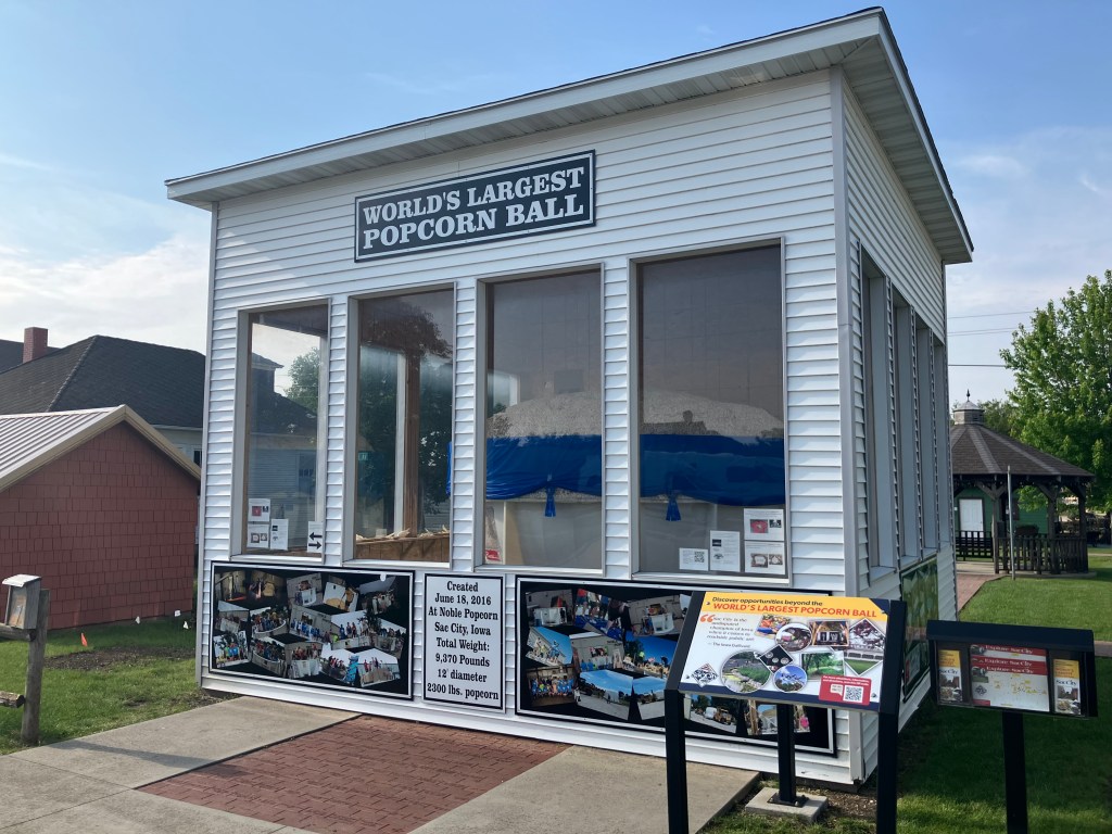
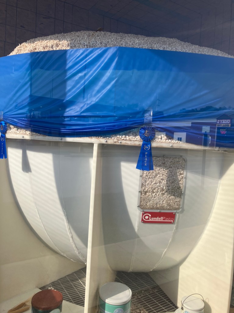
Now, this had me scratching my head. Of all the things you could do to put yourself on the map, creating the world’s largest popcorn ball and putting it in a roadside hut doesn’t seem like a huge tourist draw. Especially since it doesn’t seem to relate to the city’s history or industry in any way. What’s more, it seems like the shelf life of a giant popcorn ball would be somewhat limited. But most damning, this isn’t really even a popcorn ball–it’s just a bunch of popcorn dumped into a giant plastic bowl. The top of the popcorn “ball” is almost completely flat. The arrangement of the windows made it difficult for me to get a good shot (which points to another problem with this tourist “attraction”), but you get the general idea:

Popcorn “ball,” my eye!

Still, I give Sac City an A for effort. They have brochures promoting the city next to the popcorn ball, there’s a QR code, there’s signage to other nearby points of interest…They’re really doing a lot to promote their city. I just question their choice of roadside attraction. Quite frankly, I liked Iowa Falls’ popcorn stand a lot better.

Now, the real head-scratcher today was this place:

…Home of Wite-Out (TM)

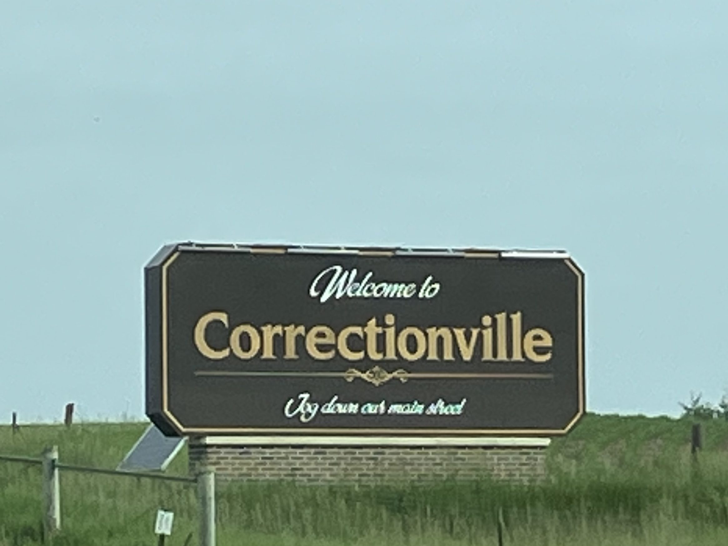
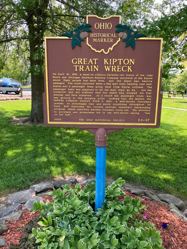
Now that’s an odd name for a town. Is it build around a state prison? I didn’t realize at the time but the sign’s tagline–“Jog down our main street”–was a clue.

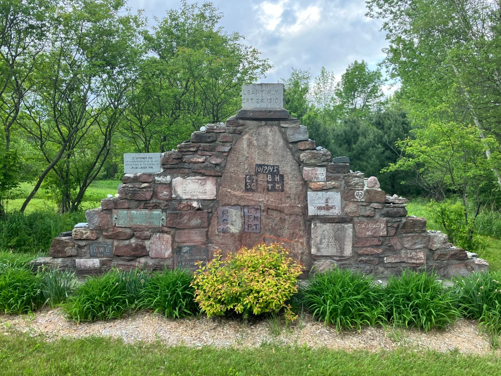
I “jogged down” the Main Street and encountered a monument that explained the name. The town’s name references a land surveying term called “correction lines.” Because of the curvature of the earth, north-south lines are adjusted with “jogs” every 24 miles. In Correctionville, this means that all the north-south streets “Jog” horizontally at 5th Street. Don’t ask me to explain it any further.

It’s actually a pretty clever design.

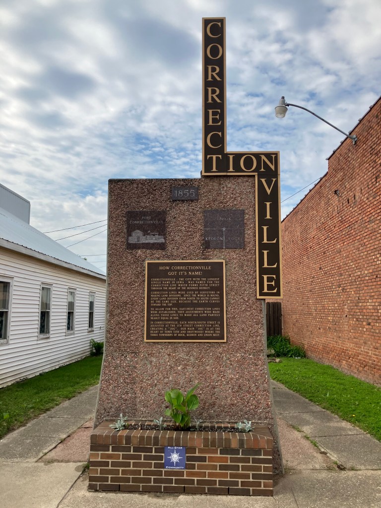
You can read more about correction lines on this close-up of the plaque. But do you notice anything unusual about it?

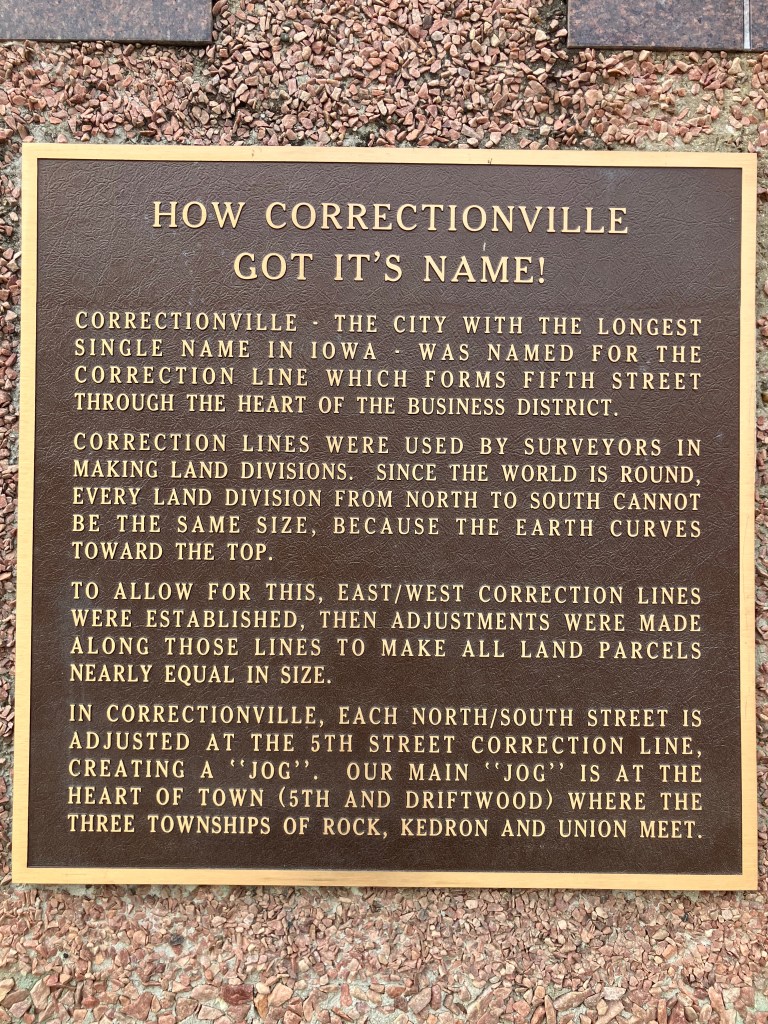
That’s right–Correctionville needs to “correct” the punctuation in the heading on this plaque. How embarrassing.

Oh, and speaking of Corrections: in yesterday’s blog post, the link to my story about the Wisconsin Wild West Town was left out. Here’s the link.

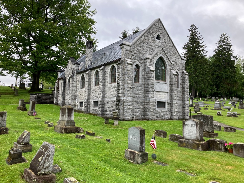
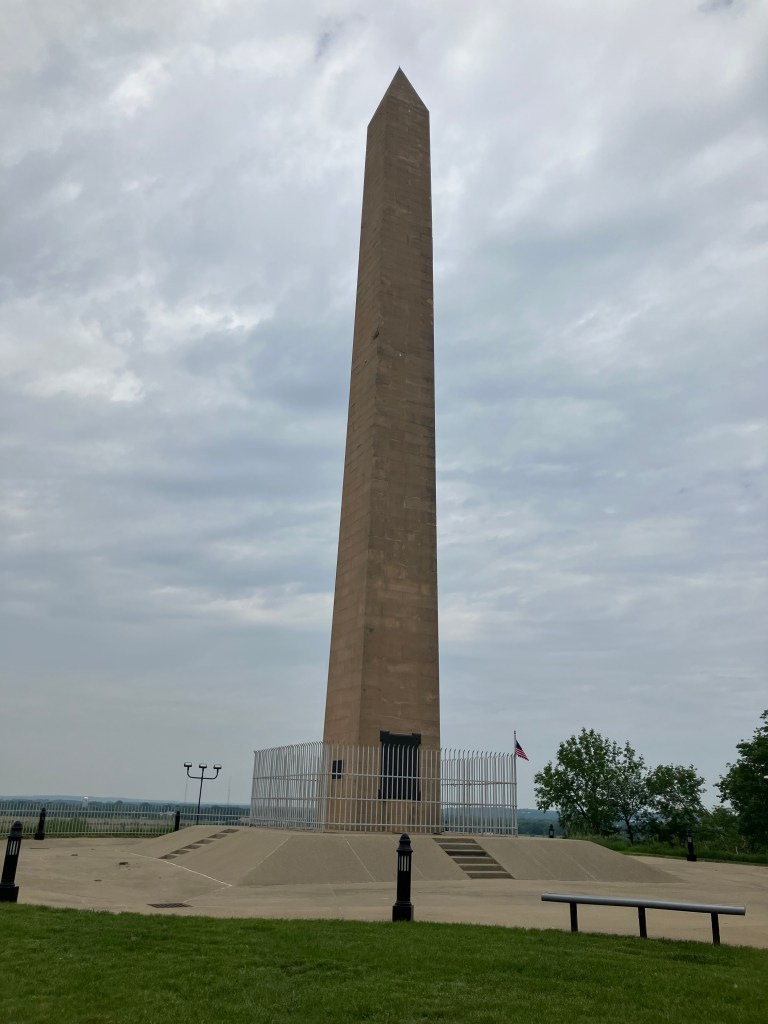
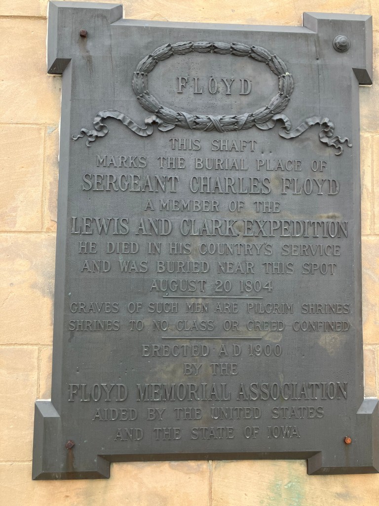
I returned to the road and eventually arrived in Sioux City, Iowa (pop: 86,000), on the banks of the Missouri River. It was here that the Lewis and Clark expedition (which was following the River toward its headwaters in the Rocky Mountains) buried Sgt. Charles Floyd, the only member of the expedition to die on the journey. He was buried on a bluff overlooking the river. This was in 1804.

RIP, Sgt Floyd.

Unfortunately, the river eroded the bluff where Floyd was buried, and exposed part of his grave. His skeleton was salvaged and reburied a bit further inland. Then, roughly 100 years after his death, Sgt Floyd was reburied again and his grave was marked with a 100-foot obelisk. (And you know how I’m a sucker for an obelisk!)

Sepulchre for a Sergeant.

After paying my respects to Sgt Floyd, I returned to US 20 and crossed the Missouri River into Nebraska. This is the point in the trip where one needs lots of coffee. The road is straight and monotonous, but not without a stark beauty of its own.

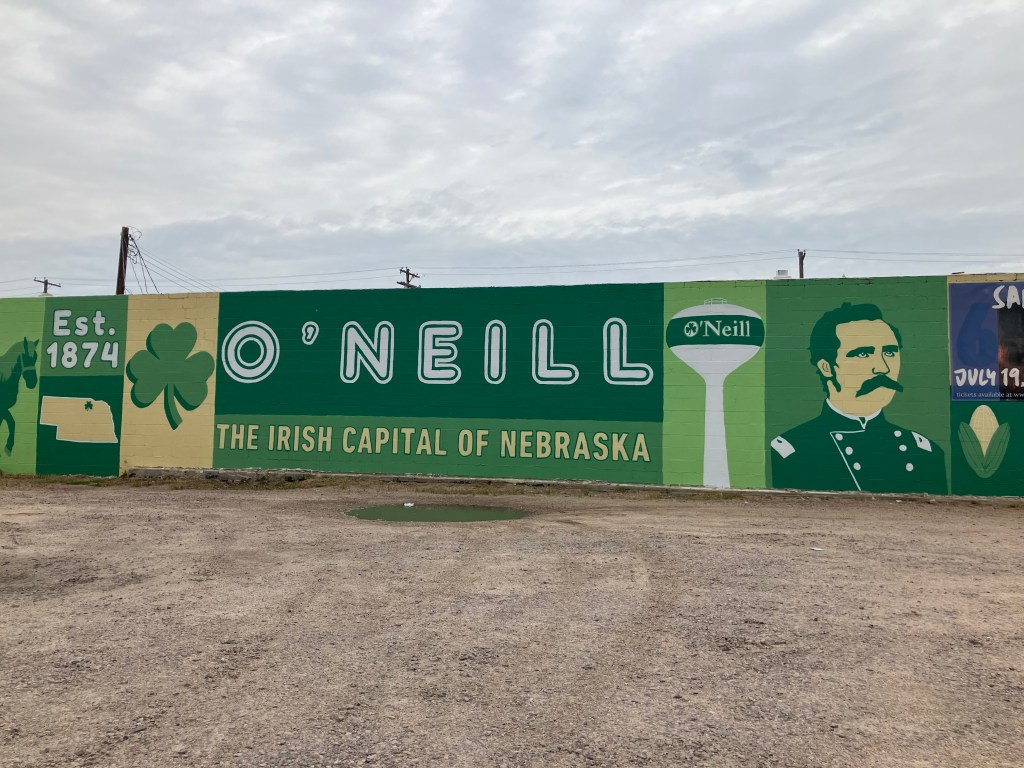
I stopped for the night in one of the few towns of any size, a place called O’Neill (pop: 3,575). As you might guess by the name, O’Neill is named after an Irish immigrant by the name of John O’Neill. Incorporated in 1882, the town was settled mainly by Irish immigrants. Today, it takes that heritage quite seriously. Shamrocks adorn the local fire station, the school, the bank, even the local Subway sandwich shop. The pubs all seem to be Irish themed, and there are several Catholic churches and a Catholic school.

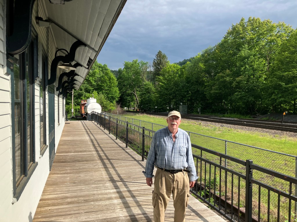
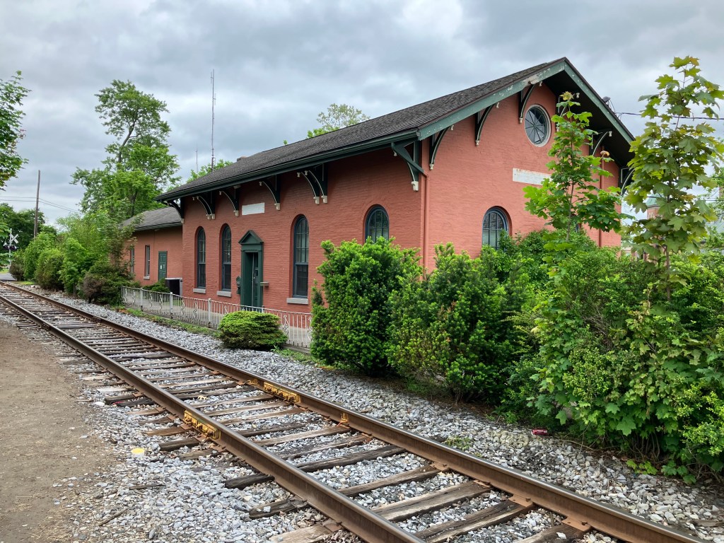
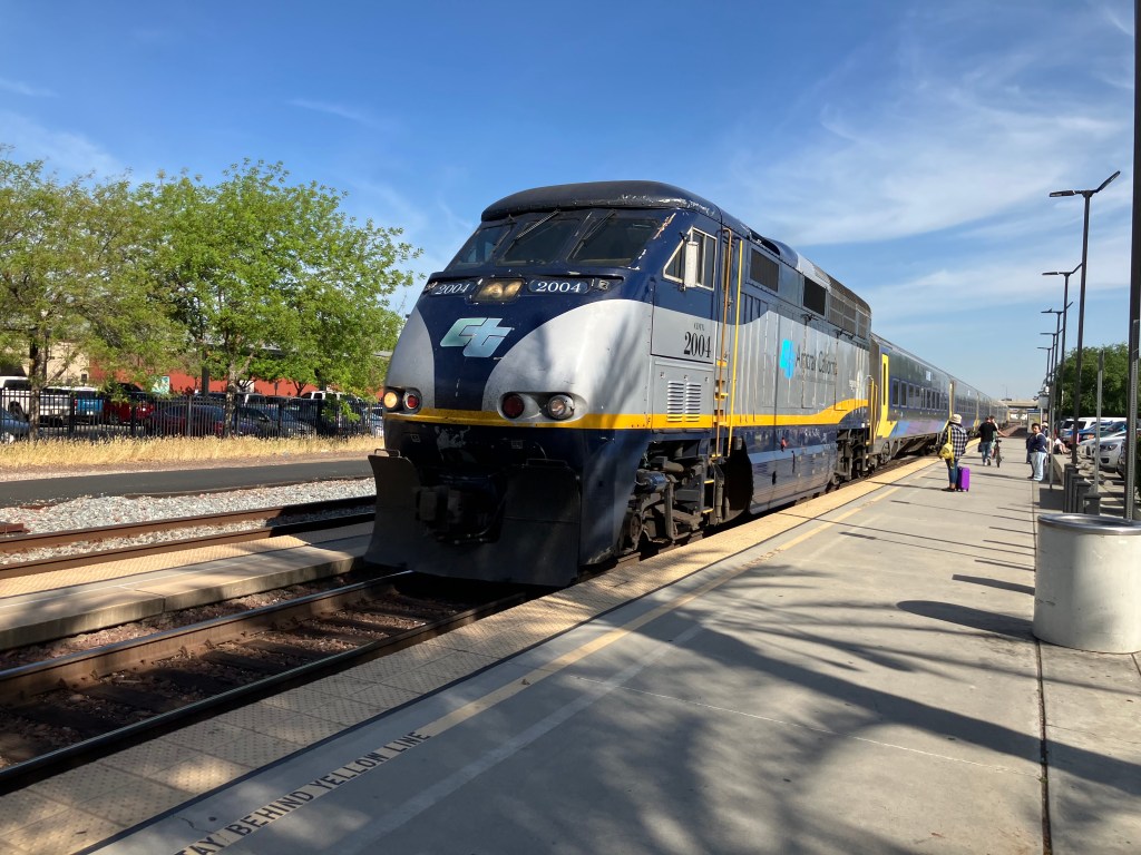
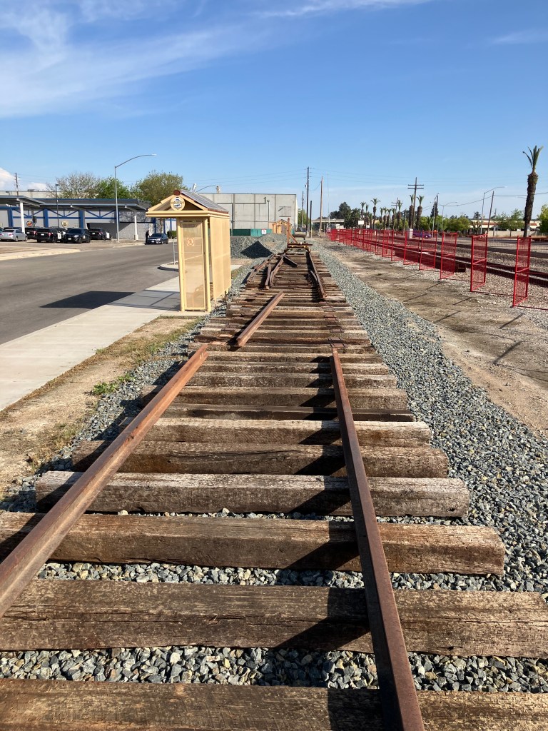
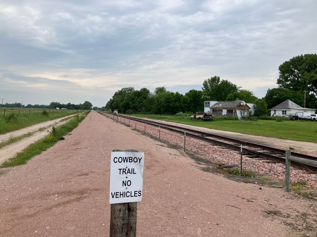
At this point in the trip I was feeling a need for a long walk, and fortunately O’Neill has something called the Cowboy Trail. This is one of those “Rails to Trails” arrangements, where an abandoned railroad right-of-way is converted into a hiking and biking trail.

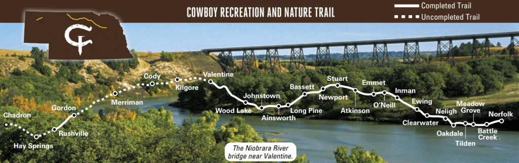
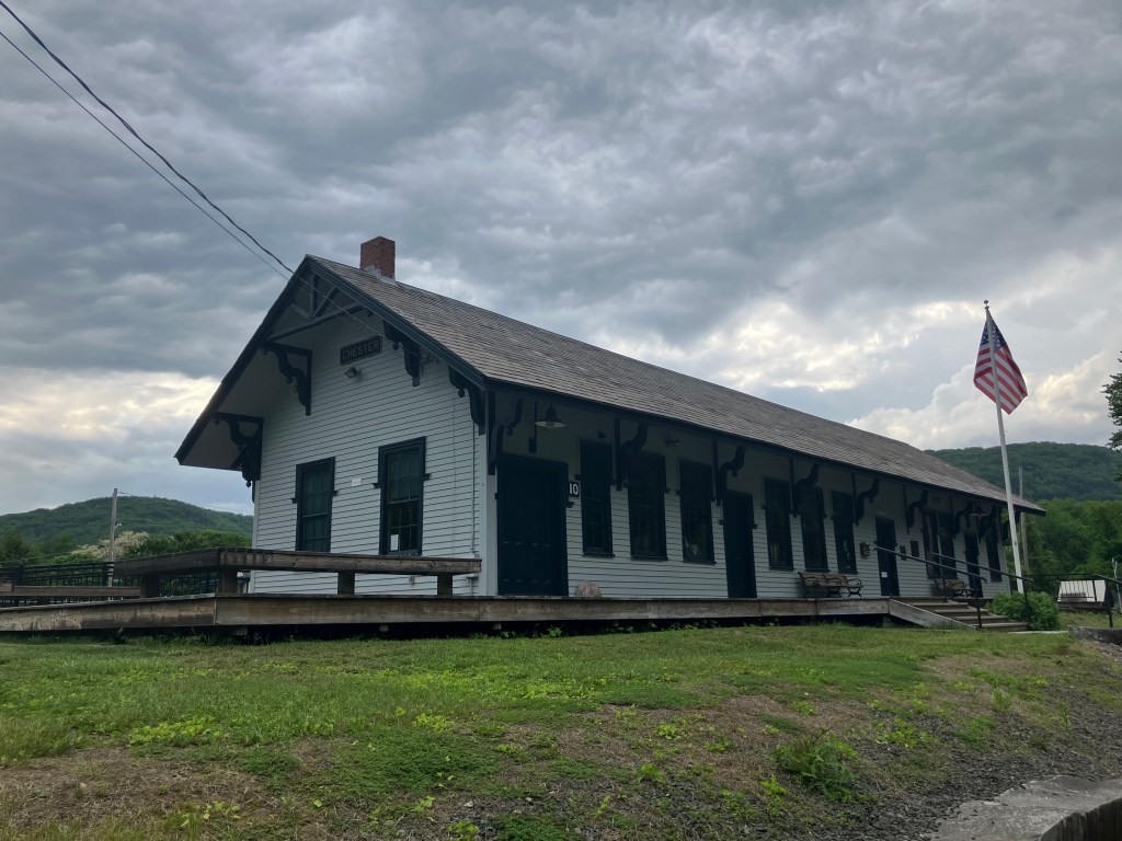
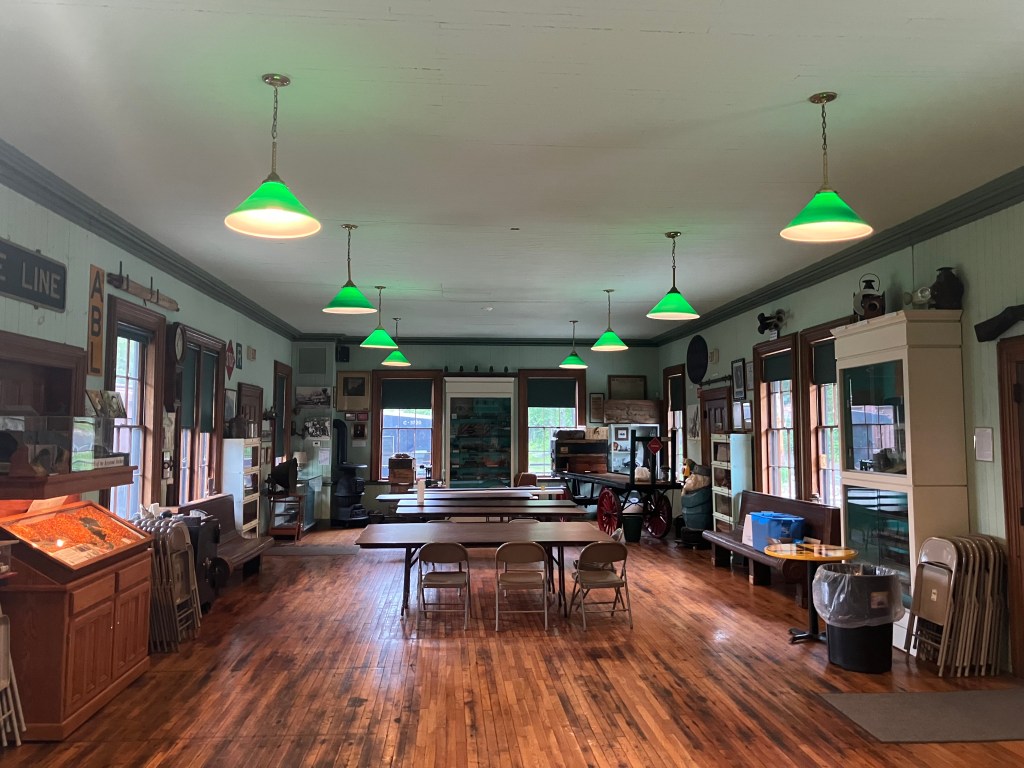
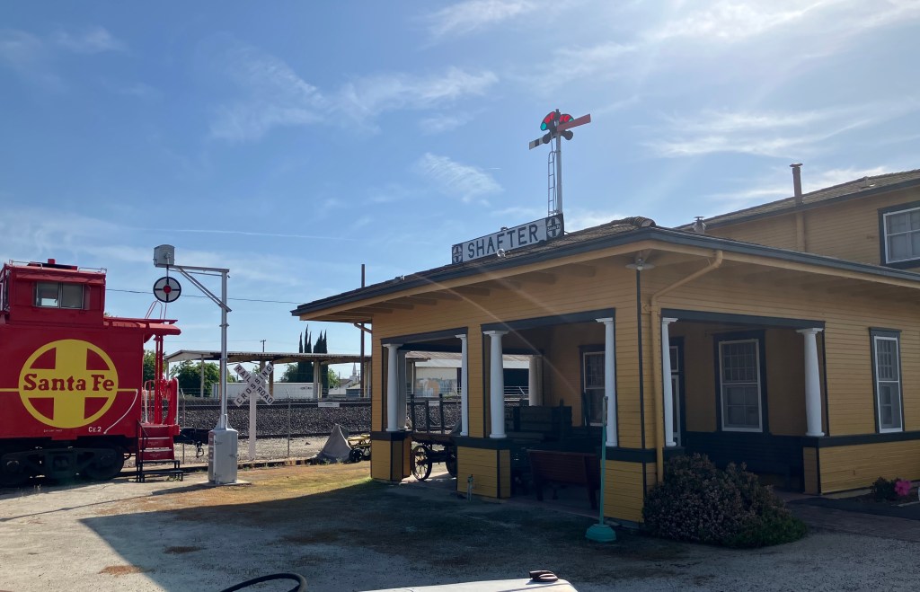
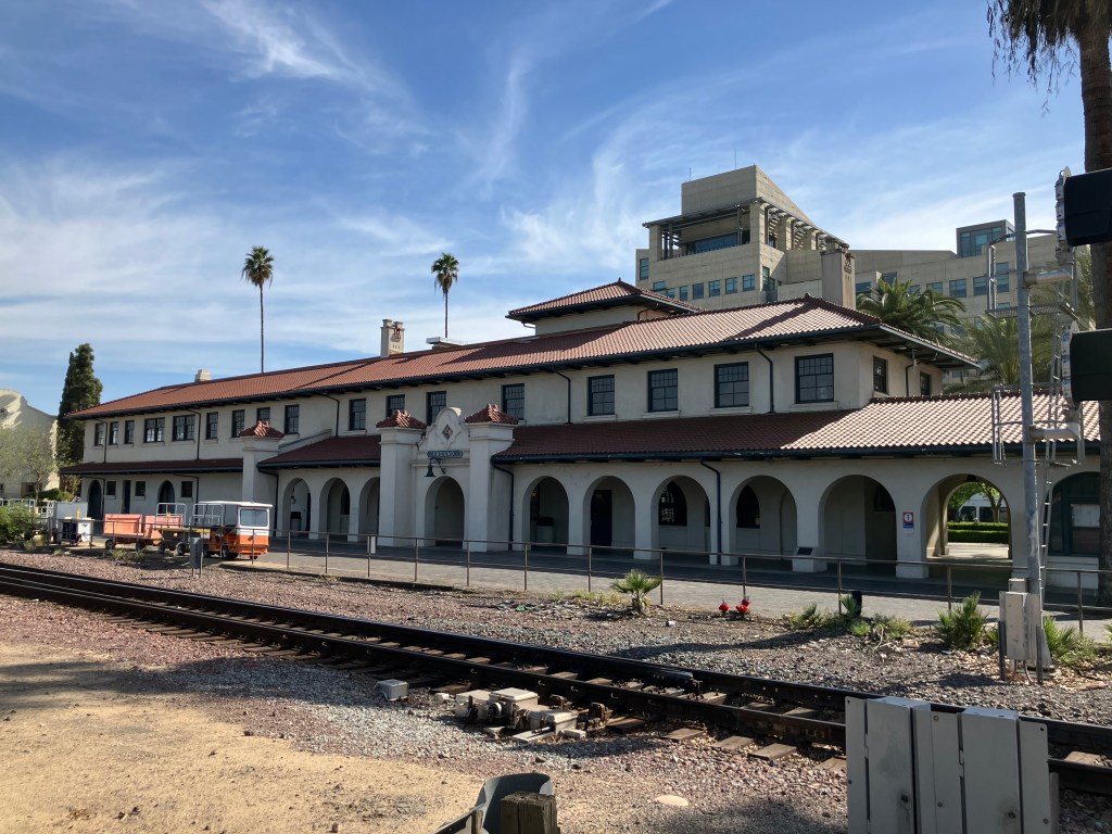
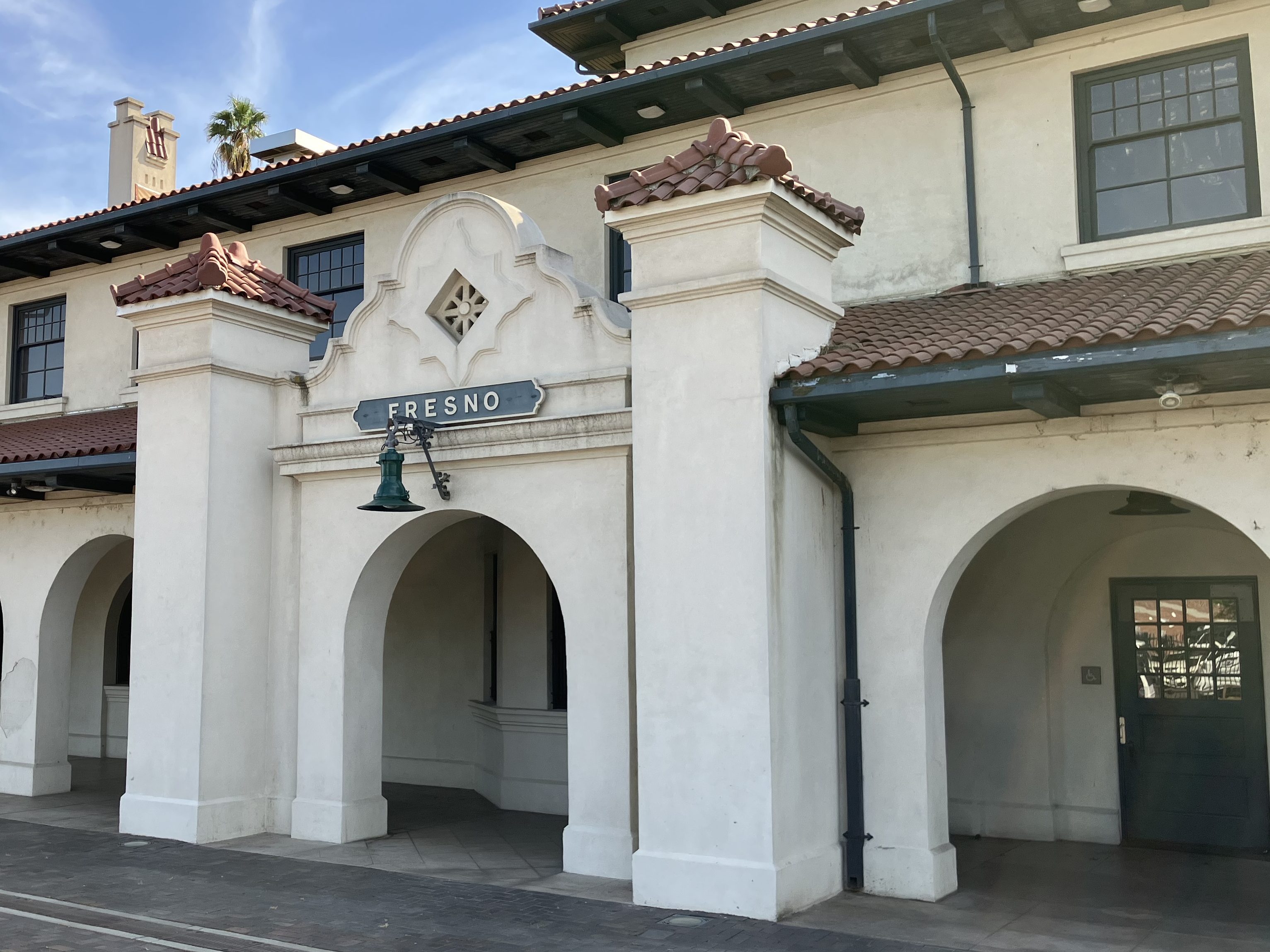
The Cowboy Trail runs 317 miles along the old Chicago & Northwestern railroad route from Norfolk, Nebraska to Chadron, Nebraska. There’s only one railroad station still standing on the route, and as luck would have it it’s here in O’Neill.

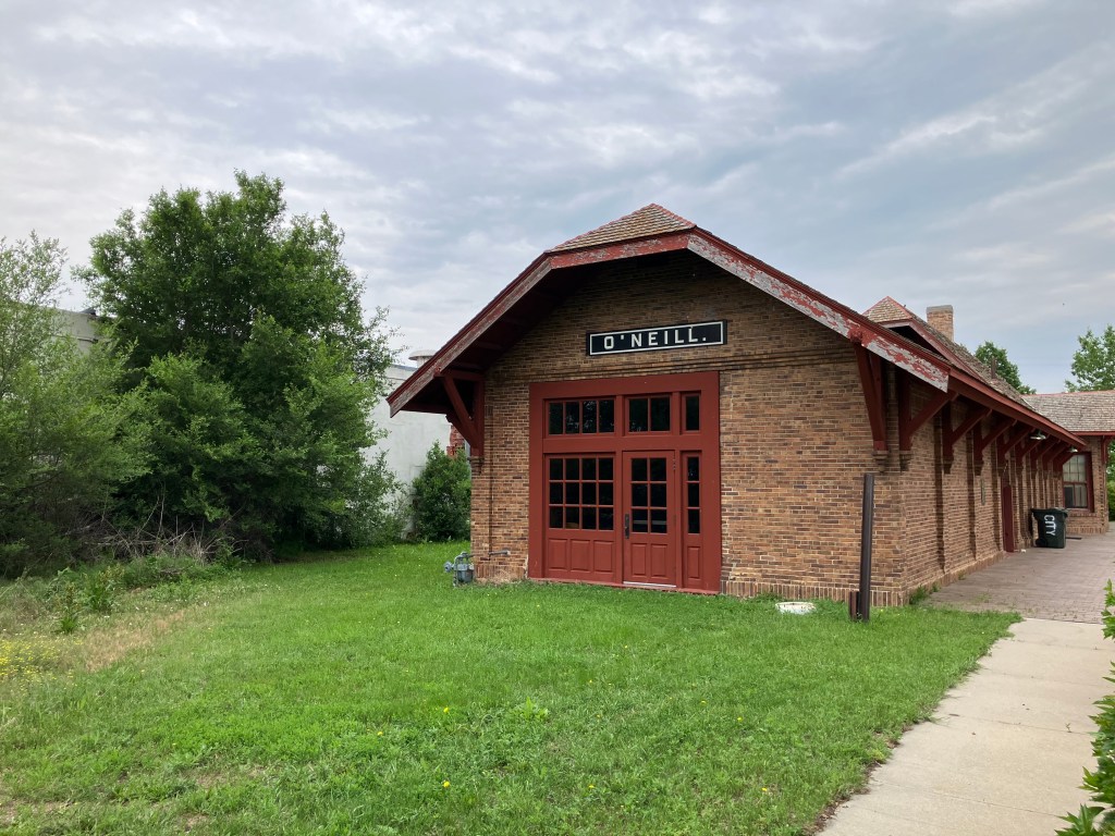
After visiting the station, I spent an hour walking along the trail. It’s a quiet and pleasant walk along a crushed limestone path, with plenty of trees and wildlife. Who knows what the other 300-plus miles look like, but I think it would make for an enjoyable mountain bike trip over a couple of weeks. Towns and sleeping facilities are located all along the route.

But that’s another trip. Tomorrow I’ll again be heading west on Route 20.

BRIDGE CORNER

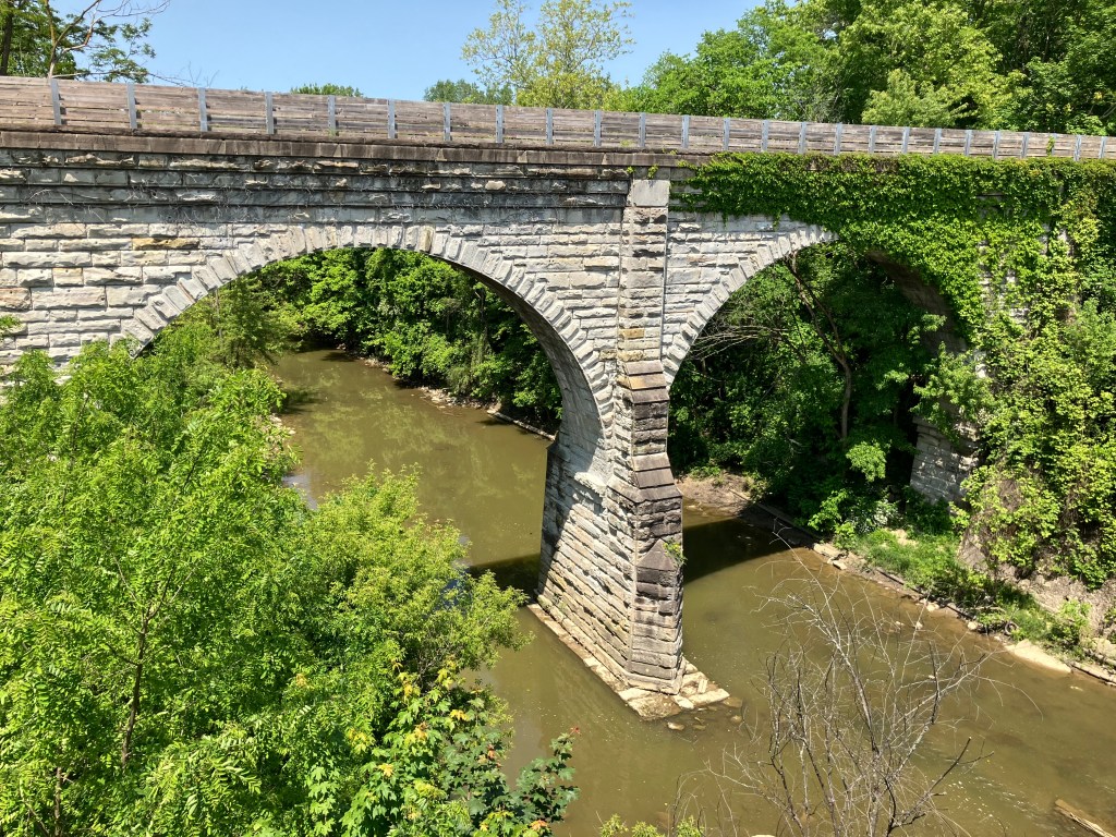
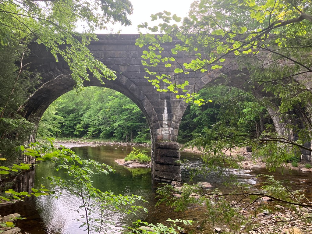
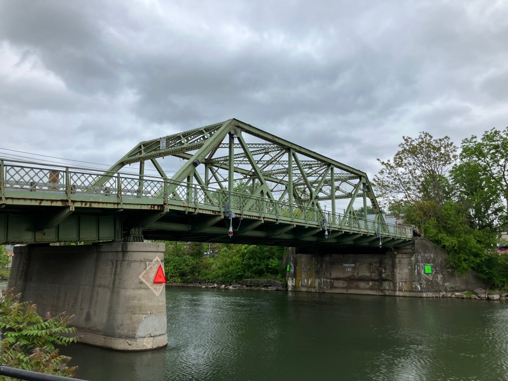
At the suggestion of loyal reader Peter D, this morning I walked across the so-called Swinging Bridge of Iowa Falls. I say “so-called” because it doesn’t really swing. But then neither do I…

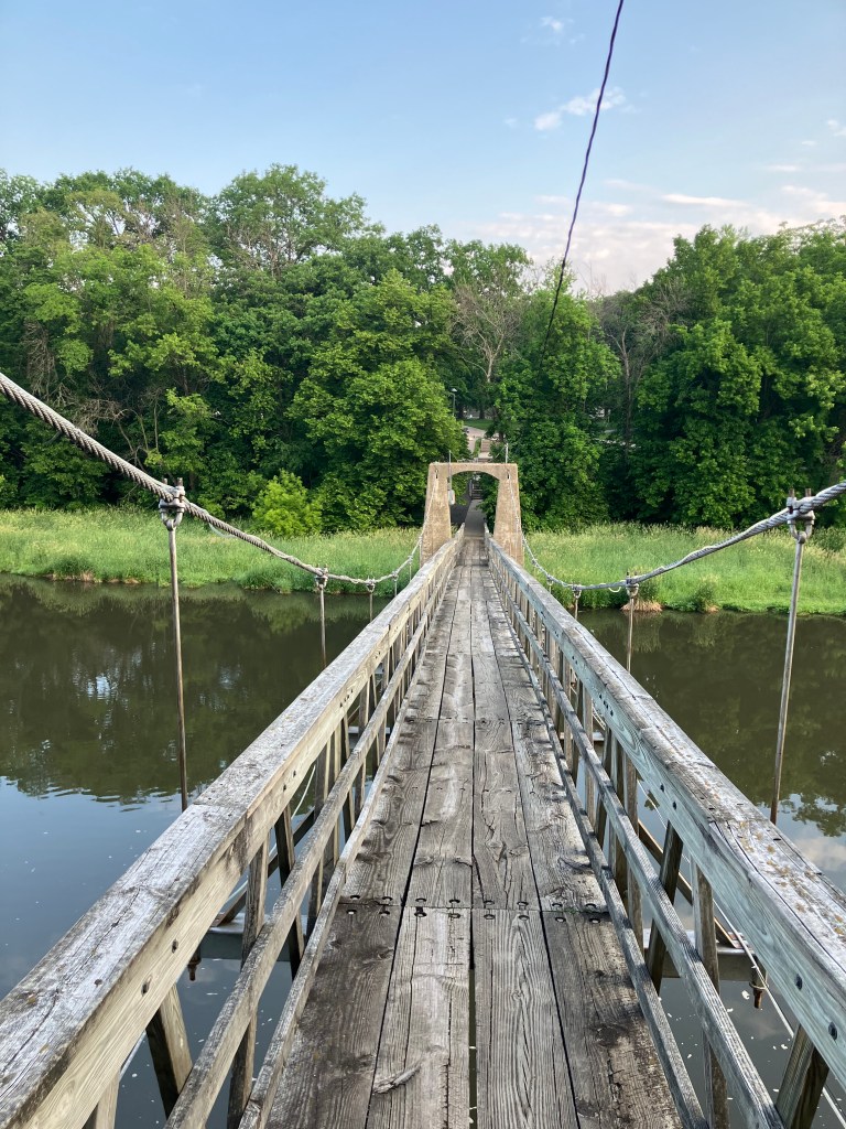
Anyway, it’s a pedestrian suspension bridge across the Iowa River. It was originally constructed in 1897, and then re-built in 1909, 1925, 1956, and 1989. In other words, the bridge has been rebuilt every 23 years (on average). It’s now been 36 years since the last rebuild. But why worry about these things?

A good place for the Billy Goats Gruff to cross.

I crossed the Iowa River on the bridge, and returned to my starting point without incident. It’s actually very pleasant out there in the morning. Here’s a video of the peaceful scene.

My only complaint is that the bridge barely flexes while you walk on it. It certainly doesn’t live up to its “Swinging Bridge” moniker.

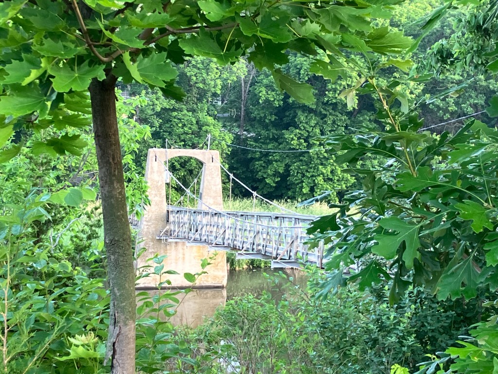
Deep cut: Now here’s a real swinging bridge that I crossed in Montana in 2022. It’s the Kootenai Swinging Bridge. The full blog post is here.

BEER OF THE DAY

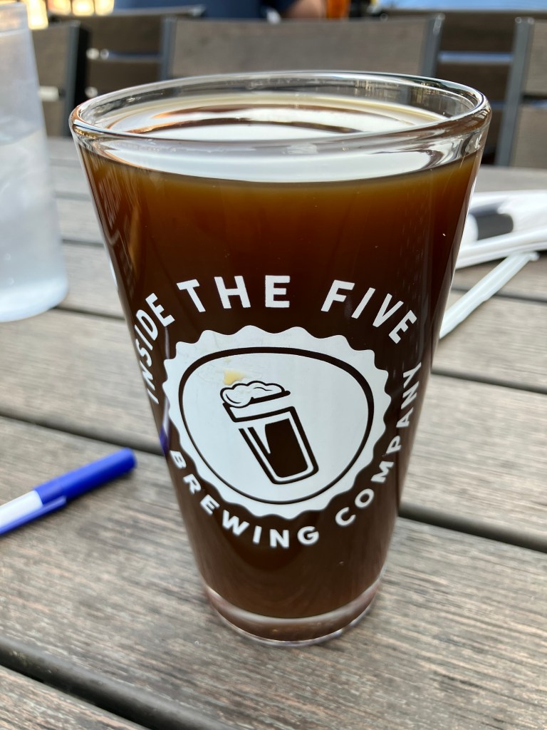
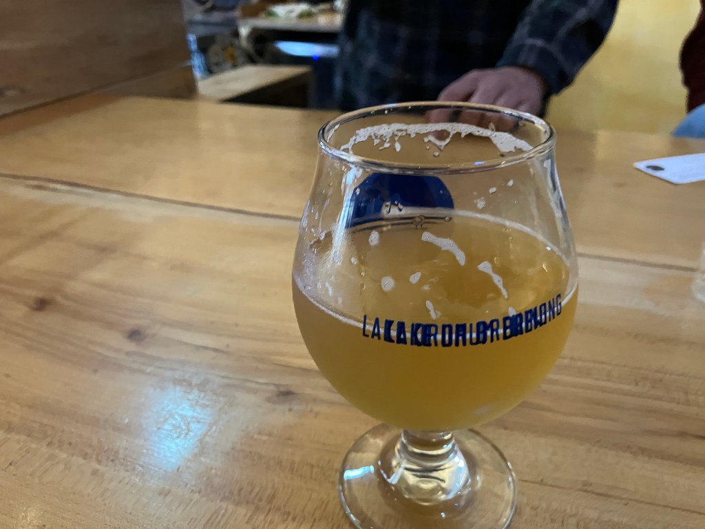
I really wanted to get the BOTD at Brioux City Brewery in Sioux City. The name alone makes the place worthy. Alas, they were not open when I got there. So instead the BOTD comes courtesy of Marto Brewing Company in Sioux City, Iowa. Though “courtesy” is probably not the right word, as will quickly become evident.

Sioux City actually has several craft breweries, but Marto was distinguished simply by dint of being open at 11:30 am when I came through town. Though “open” is probably not the right word, because they couldn’t be bothered to unlock their doors until well past opening time. At any rate, I eventually got inside and bellied up to the bar. I greeted the bartender behind the counter, though “bartender” is probably not the right word. He was occupied washing out a big plastic bucket in the sink behind the bar, and explained to me “I don’t work here.” He eventually disappeared. Meanwhile, there were approximately a half-dozen servers standing around a table where (I later learned) various new foods were laid out for them to sample so they could speak with authority to the customers. Which presumes, of course, that they actually bother to talk to a customer. The servers filled their plates and went to various corners of the (otherwise empty) restaurant to eat their free food.

Finally a young woman wandered behind the counter and I asked her for the barrel-aged stout. She disappeared and returned with a glass of water. Just when I was going to repeat my request she asked whether I wanted the “Art of Survival” or the “Maple Fluff.” Going against my better judgment, I chose the latter.

That faucet in the background is where the random worker was washing out his bucket.

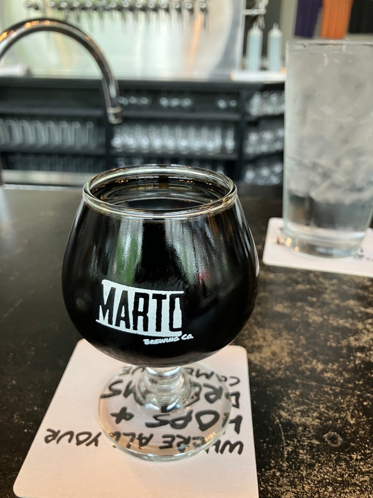
I tell you all this backstory because I want to acknowledge that I wasn’t in the best mood to review their beer. Anyway, here we go:

The Maple Fluff is billed as a chocolate stout made with peanuts and marshmallows and aged in Jim Beam barrels for over two years. It’s also billed as 13.5 percent alcohol, which is why it comes in a small, 5-ounce goblet. Sounds promising, no?

From the very first sip, it’s clear that this is a case of false advertising. I don’t taste any marshmallow or peanuts. Without exaggeration, this tastes like I’m drinking molasses diluted with Trader Joe’s teriyaki marinade. I can’t overstate how sickeningly sweet this is. There is no trace of hops to even slightly counterbalance the unfermented sugars. And while I like robust, meaty stouts, this has the consistency of Pennzoil. Even after I finished the glass, the sides remained coated with a thick layer of the high-viscosity beer. You know how old glass window panes in a Victorian mansion are thicker at the bottom due to the gradual “flow” of glass downward in the course of a century or two? I suspect that’s how long it would take for this beer to drain from the sides to the bottom of the goblet.

Now, to be fair, a tablespoon or two of this beer would be good over vanilla ice cream. It also might make a good additive to your car’s crankcase if the piston rings are worn. But under no circumstances would you ever want to drink a full glass of this sweet sludge. Actually, that would be a good name for it: Marto’s Sweet Sludge. 1 star.

Breweries · bridges · Movies · Road trips · trains · Yard art

Bridge-A-Palooza

You’ll recall that yesterday I filmed myself crossing the US’s longest covered bridge, and then ended the day in Geneva OH where I encountered the country’s shortest covered bridge. Loyal reader Detlef K. asked why I didn’t include footage of crossing the Geneva span. I can’t believe I didn’t think of that. So first thing this morning I returned to the Geneva bridge to correct my oversight. Here is the fruit of my labor:

Today actually turned out to be a bridge-filled day. Take, for example, this bridge that carries US Route 20 traffic over the Vermillion River in Wakeman, OH. It was built in 1933, and I’m told it’s an “open-spandrel, concrete-arch” design.

I’m no engineer, but I can appreciate how graceful that arch design is. And the fact it’s been there for almost a century is certainly impressive.

I took the picture from atop a pedestrian/bike bridge, and got to wondering what that bridge looks like from the side. So I moved over to the Wakeman (US 20) bridge and took this picture of the pedestrian bridge:

Is that impressive, or what?? It turns out the pedestrian/bike path was placed atop an 1872 railroad bridge. Trains haven’t come through here in decades, so about a decade ago the “rails to trails” people retrofitted it.

But then there’s Cleveland (pop: 363,000). US 20 cuts through the town on surface streets, and the experience of driving it is infinitely different from the peaceful cruise through innumerable small towns that I’d experienced the past few days. This morning’s drive through Cleveland was crowded, people were honking, blight was evident on both sides of the road. I did make a small detour to find the house that was used for the exterior shots of A Christmas Story (1983). But I got lost and found myself in a jungle of massive, looming bridges that cross the river at all angles. And that’s when the magic happened: I saw what makes Cleveland unique. I saw 200 years of history. Would it be going to far to say I saw its heart?

I took most of the following photos from a trail that was once the “towpath” along the Ohio and Erie Canal. Mules labored along these paths pulling boats and barges up the canal via ropes. The modern trail/historic towpath runs alongside the canal for about 100 miles. I walked less than a mile of this path, passing under and next to innumerable bridges–some still in service, and some decommissioned.

I was wondering if the rusty old Nickel Plate Road High Level Bridge was still operational, and suddenly a Norfolk Southern train clattered over it.
Detail of one of the eight “Guardians of Traffic” on the 1932 Hope Memorial Bridge. Note that he’s holding a truck.
Railroad center-lift bridge, now decommissioned.

Want to see one of these types of bridges in operation? Here I am waiting in traffic for an automobile bridge to return to earth:

One of the modern spans. (Can one of my loyal readers identify it for me?)
A remnant of the 1888 Central Viaduct.
Rubble from the demolition of old bridges and associated structures, now used as ground cover next to the Towpath.
The modern towpath in foreground, with old and new bridges in background.

Evidently Cleveland has over 300 bridges, many of which cross the Cuyahoga River. I’m not going to make you view them all. But you’ve got to admire the engineering and the grit that went into building these over the past two centuries. And you also have to admire how modern Clevelanders somehow navigate daily through this confusing labyrinth.

We now move on to the non-bridge-related part of the day:

Here’s a different kind of engineering project, carried out by a high-school dropout who taught himself welding, electronics, power delivery, and a ton of other stuff:

Corporation yard from hell.

This is all on a lot on a residential street. Let’s look a little closer:

Jiang.
“More than meets the eye.”

It’s all the work of local artist Tim Willis. And those robots and dragons actually move with electric servos, and the trucks have powerful engines that presumably could get them into a monster truck show. My readers will recall that I have a soft spot for yard art; this is incredible. Spend a minute or two hearing from Tim himself:

Sadly, he wasn’t available when I dropped by.

Next up was the town of Kipton, OH. A new reader named Bob suggested I check out the site of the “Great Kipton Train Wreck of 1891.” There’s a marker at the site explaining how a head-on railroad collision occurred because the watch of one of the conductors was four minutes slow. Leaving aside the issue of whether it’s wise to create railroad schedules that have two trains occupying the same space just minutes apart, this accident prompted the railroads to adopt strict standards for railway timepieces.

The marker sits in a park/bike trail that used to be the rail line where the accident occurred.

Finally, can anyone identify the building below? (You already had a hint.)

“You’ll shoot your eye out!”

Beer of the Day

I nabbed my BOTD at the Inside the Five Brewing Company, just west of Toledo, Ohio. It’s owned by two retired NFL players: Chris Morris (Oakland Raiders) and Brandon Fields (Miami Dolphins). They both retired in the Toledo area, and started this brew pub in 2018. I’m told “Inside the Five” is reference to the last 5 yards of the gridiron. But it’s all Greek to me.

Anyway, the place is evidently very popular–it was packed when I got there on a Monday evening. They have a big space, with comfortable outdoor seating on a deck that overlooks the street. They also have friendly servers, and the weather was perfect. What better place to get the BOTD?

I had a pint of their Deimos, which is an American Porter. As we all know (after consulting Wikipedia), in Greek mythology Deimos was the son of Ares (god of war) and Aphrodite (goddess of love). Somehow he turned out to be the god of dread and terror. Should I be worried for ordering this beer?

Deimos is made by brewing a traditional Porter and adding local coffee and vanilla. Both of these tastes are prominent in the beer, though the vanilla is more prominent on the nose than on the palate. The mouthfeel is incredibly smooth. It’s very lightly carbonated, and has no foam to speak of. The ABV is 6.5 percent. The color is quite light for a porter–it’s the color of honey, or maybe the color of coffee when you use the Kuerig pod a second time.

Speaking of coffee: The coffee flavor is not particular roasty; instead it reminds me of Coffee Nips (TM) candy. There’s also a sweetness to this beer that is just this side of cloying. The beer seems to have no bitterness at all, with just the slightest evidence of hops on the finish. I’d say this is more of a dessert beer, that wears out its welcome as you move through a full pint of it. I’d give the first half 4.5 stars, and the second half 3 stars. I guess that means the overall score is 3.75.

Breweries · bridges · cemeteries · Road trips · trains

Rain Man

This morning I awoke in Great Barrington to pouring rain. It lasted all day, which, to say the least, put a damper on the day. Har.

Because of the weather I didn’t get out of the car as much as I’d have liked. So allow me to finish up my story of yesterday’s travels:

Around 4 pm I was passing the town of Chester, Mass. (pop: 1,300). A sign advertised a historic railroad depot and museum just a few blocks away, so I figured I’d make a quick stop. Alas, the station–which is beautifully restored–was closed for the day. Disappointed, I sat on a bench on the station’s front porch and began to consult my map to figure out where I’d get dinner.

Chester Depot, which dates back over 150 years.

Then a man approached me from a house directly across the street. Dave (for that was his name) turns out to be a long-time volunteer at the station who frequently gives tours. Since he lives across the street, he’s able to come out and greet visitors even when the place is supposedly closed. And so, for the next hour or so, I got a private tour of the depot.

Dave, showing off his baby.

The depot has been lovingly restored since it was acquired from the railroad in quite rough condition. After the railroad stopped running passenger service, the station was used as a maintenance and storage facility, which means the walls and hardwood floor literally took a beating. But look at it today:

The railroad and depot are notable for a number of reasons (believe me, I heard them all!) but most notable is that the station is situated at the bottom of a mountain. The rail line had a steep grade, so trains would stop here while “helper” engines were added to push or pull the train over the mountain. Another notable aspect of the railroad is a series of 10 stunning keystone arch bridges, built in the 1840s, that still carry trains over the Westfield River. Oh, and the railroad was surveyed and/or engineered by George Washington Whistler…that is, the painter Whistler’s father. (Everyone only knows Whister’s mother.)

At Dave’s urging I visited one of these keystone arch bridges, only a few miles from the depot. It’s picturesque and impressive from an engineering perspective.

Finally, I got back onto Route 20 and headed up that self-same mountain that necessitated the helper engines years ago. An automobile road over the mountain was added in 1910, though it was a primitive, difficult drive. Modern Route 20 parallels that original road, and arrives at the same 1,775-foot summit. And so, when I arrived at the summit, I encountered a stone cairn monument that was originally placed there in 1910. It was made from stones collected from roadway infrastructure from all over the world.

1910 monument.

So much for yesterday. Today, as I mentioned, I spent the day driving through rain. But I did manage to make a couple of worthwhile stops. One was The Tepee–a classic roadside attraction from the Golden Age of road trips.

The Tepee is a souvenir shop that dates back to 1950. It’s the kind of place that my brother and I always begged our parents to stop at, so we could get Big Hunk candy bars, “perpetual motion” drinking birds, paperweights with the name of the state we were visiting, and suchlike.

Inside the Tepee.

The Tepee is owned by sisters Dale and Donna, who bought it from their father over a decade ago. So it’s definitely a family operation. Dale is the friendliest person you’d ever want to meet, and exudes a love for her business and her customers. She also really knows her Route 20 trivia, which kept me entertained for quite awhile. This place embodies the reasons that I value these road trips.

Dale, ever the show woman.

At Dale’s urging I took the US 20 “scenic bypass” that was the original route 20 alignment. It’s a little narrower and hillier than the new alignment, but it’s also greener and it passes through the village of Cherry Valley (pop: 2,300).

Beautiful Bypass.

Cherry Valley is a cozy little town, nestled amid trees and hills. I stopped in at a used bookstore that, to me, looks like it came out of a Dickens novel It was built in 1840, and the current owner told me Samuel Morse (inventor of the eponymous Morse Code) developed his telegraph here in the late 1840s.

An old curiosity shop…

The bookstore owner (whose name I failed to get) told me that Cherry Valley used to be a thriving community until US 20 was re-routed, taking all the drive-through traffic with it. He told me the highway was moved in order to satisfy a powerful state legislator whose own property would benefit from the change. I have been unable to corroborate this.

Before long I crossed the state line into New York. Driving through this part of the country feels like going back in time.

Old farrier/blacksmith along the roadside, dating back before automobiles. The owner gave me an affogato, God bless her!

1893 Burrow Chapel in Lake View Cemetery, Skaneateles, NY.
Paging Waldo Pepper…
Railroad depot in Seneca Falls.

Finally, I arrived in Seneca Falls, NY (pop: 7,000). It’s a pleasant town situated on the shore of Seneca Lake (the largest of the Finger Lakes). Seneca Falls was the site of the first women’s rights convention (in 1848), and it continues to play up that role with a major Women’s Rights Museum. It also claims to be the inspiration for the fictional town of Bedford Falls from Frank Capra’s It’s a Wonderful Life. Among other things, the bridge where Jimmy Stewart’s character tried to kill himself was supposedly modeled on Seneca Fall’s Bridge Street Bridge (I’m not making up that name). I visited the bridge today, and I do see the resemblance…but I could say that about many other bridges as well.

In the 1946 movie, George Bailey jumps off the bridge to save someone in the water. In 1917, real-life Antonio Varacalli jumped off the Seneca Falls bridge to save someone in the water.
“Bridge Street Bridge” in Seneca Falls.

Finally, I stopped for the night in Geneva, NY (pop: 13,000). It is here I had my….

Brew of the Day

I got my BOTD Geneva’s Lake Drum Brewing. It’s one of the friendliest, most laid-back breweries I’ve been to. I ended up spending two hours chatting with the bartender(s) and a couple of regulars, while I worked my way through a flight of beers and the BOTD…which we’ll get to in a moment.

Steve, Laura, Sam, and Aaron–my new friends at Lake Drum Brewing.

But first let me describe this place. They brew their own beer (with about eight beers currently on tap), plus they brew their own cider, plus they even make a couple of wines. They have an extensive (and I mean massive) collection of vinyl records that they play on a turntable that resides in an old wine barrel.

Now do you believe me?

They have patio seating for when it’s not raining, and endless free popcorn. But what’s most important is that they made me feel welcome, including me in a meandering conversation that touched on fishing, equine care, cross-breeding of cats, the best burger places in the region, music, foreign travel, and funding of the arts. Anyone in the food/drink business should take note: what gets people coming back is not what you’re serving, but how you treat your customers.

Anyway, speaking of serving drinks: today’s Brew of the Day was not a beer, but a kombucha. Now, I know kombucha has been popular for some years now, but I’d never tasted one until now. For those few of you (like me) that missed the kombucha train, it’s essentially fermented tea. Which maybe doesn’t sound that great, but this was refreshing and delicious. It was flavored with ginger and mint, and it’s just as refreshing as it sounds it would be. It’s got light carbonation, but almost no alcohol, so you could throw it back like iced tea on a hot day. I feel I have no standing to actually rate this drink, since it’s the only one I’ve ever had. But I enjoyed it immensely. I do worry, however, the Marianne’s Phenomenon could be at play. (I describe the Marianne’s Phenomenon in my memoir…but essentially it refers to one’s enthusiastic experience with a new food resulting in large part from being hungry or otherwise affected by the setting.)

New fave, or one-night-stand?

Tomorrow’s BOTD will return to actual beer.

California history · Road trips · trains

Central Controversy

In a recent blog post, I asserted that Kingsburg, CA is “smack-dab in the middle of” California. I based this assertion on nothing more than a quick glance at a map.

Several alert readers called out my unsubstantiated claim. The reader with the best case was Jeff N., who wrote: “To go to the official center of the state, head a little North out of Fresno to a spot near the town of North Fork. There’s an official surveyors mark noting the exact center of the state.”

A quick search of various sources provided unanimous corroboration of Jeff’s claim. For instance, check out this newspaper article from the Desert Sun.

Coincidentally, I did stumble across a (sort of) competing claim in the town of Shafter, CA (pop: 22,000). Shafter is home to a 1917 Santa Fe railroad depot, which now serves as a railroad museum. I visited the station because the folks at the Kingsburg Depot meeting I attended the other evening told me that Shafter was their “sister depot”…whatever that means. So I made a quick visit.

Kingsburg’s “sister.”

Anyway, during my visit I noticed this marker, which proudly boasts “California 2010 Center of Population.” So while North Fork is the geographical center of California, Shafter is the population center…at least based on the 2010 census.

“Center of Population” marker on the ground.

But upon closer inspection, the plaque above the marker reads:

The survey monument below commemorates the geographic location of the center of population of the State of California for the 2010 Census. The actual location of the 2010 center lies in a farmer’s field on the south side of San Diego Street and 2,132 feet east of Wasco Avenue, four miles southwest of this point.

All of which raises the obvious question: Why couldn’t they put the marker any closer than 4 miles from the proper location???

Incidentally, the 2020 census still places California’s population center in the town of Shafter. Here’s a good article, for context.

As an aside: close to the Shafter depot is this historic middle school, the facade of which reminds me of a creepy Twilight Zone episode where the school messed with the students’ minds.

An impressive edifice….
…But aren’t these column-topping figures a little creepy?

But to return to the competing claims as the “center” of California: I would be remiss if I didn’t reprise this 2022 photo I took in Glasgow, MT. Few could argue with their claim!

California history · movie theaters · Road trips · trains

Tale of two cities

Today I took a ride down to the city of Kingsburg, CA (pop: 13,000). Kingsburg sits on highway 99, smack-dab in the middle of the state.

Kingsburg is the big red dot blotting out Fresno.

Alert readers will recall that I came through Kingsburg last fall and fell in love with its historic railroad depot. I ended up making a small contribution toward their “1238 Project,” in which they are taking possession of a 1918 Southern Pacific steam locomotive that’s been sitting in a park in Fresno since 1956. As a bonus, my humble contribution earned me membership in the “Friends of the Historic Kingsburg Depot,” which holds monthly meetings about their activities at the depot. So today I said “What the heck; I’ll make the 200-mile drive for this evening’s meeting and get the latest update on the 1238 Project.”

I was running a little ahead of time, so I killed an hour and a half exploring the city of Fresno (pop: 546,000), which is about 20 miles north of Kingsburg. Now, Fresno is a much-maligned city, frequently appearing on lists of the worst places to live in California. It has above-average levels of homelessness, drug use, air pollution, and unemployment. Like much of the Central Valley it experiences extreme temperatures in the summer and winter. And much of the city comprises a run-down urban core surrounded by ugly sprawl. But despite all this, Fresno has a plucky population and a rich history that is, to greater and lesser extents, being preserved. Here are just a few examples that I saw today:

Civic pride is evident in this mural on Tuolumne Street in downtown Fresno.

Fresno has several historic movie palaces in various states of preservation. Two of them (the Crest and the Tower) share names with two semi-famous theaters in Sacramento. Fresno’s 1948 Crest Theater is in particularly rough shape; the exterior is pretty shabby, and the air conditioning doesn’t work. And yet, they show movies every weekend for five bucks!

The terrazzo floor is nice, though.

I wasn’t able to get inside, but I’m told the interior is in better shape than the exterior. And I do appreciate that they’re keeping the theater open, even though they obviously have a lot of deferred maintenance. It’s lovable in a “little engine that could” kind of way.

Next up is the Tower Theater. It’s the centerpiece of Fresno’s “Tower District”–an artsy neighborhood with coffee shops, art galleries, restaurants, and other businesses that give the area a modest but palpable energy. It’s still a little gritty, but it’s definitely a viable destination for an evening out. The Tower Theater itself is an art deco movie palace built in 1939, that now serves as a 761-seat performing arts center.

I didn’t have time to stick around til nightfall, but I’m told the Tower’s neon dominates the district at night. Here’s a photo from a local Fresno news station.

File photo from Fox26 News.

We now move to the most striking movie palace I saw today in Fresno: The Warnors Theater. Opened in 1928, it was owned by the renowned Alexander Pantages. (Surely you’ve heard of the Pantages Theater in Los Angeles?) The theater originally was called The Pantages Theater, then changed to The Warner Theater in 1929, when Warner Brothers bought it. Warner Bros sold it in the 1960s, and the new owners changed the “e” to an “o” in a half-hearted concession to trademark requirements.

Pantages’ fortress.
Sometimes more is more. Or Moor, if you catch my drift.
Box office and lobby. Check out that ceiling!

Warnors has a large stage, seating for 2,100 people(!), and the original 1928 Robert Morgan pipe organ. The theater serves as a popular performing arts center bringing many national and international acts to Fresno.

So, I think it’s fair to say that Fresno is making an effort to support the arts. I think this is a key component to revitalizing the city.

I did encounter other examples of civic pride–here I’ll share just two more. First, there’s an impressive, beautifully-restored 1894 water tower. Originally owned by a private water utility, the tower’s 250,000-gallon tank was drained in the 1960s and sold to the city. It was restored about 25 years ago, and has served as a visitor’s bureau and, most recently, as the Frida Cafe.

Now that’s a water tower.

My final example of Fresno’s civic pride is its historic railroad depot. It was constructed by the Atchison, Topeka & Santa Fe in 1899. Santa Fe stopped passenger service to the station in 1966 and completely shuttered the station in the early 1990s. Fresno civic leaders, God bless ’em, purchased the decaying the station in 2003, spent 6 million bucks restoring it, and re-opened it for Amtrak service in 2005.

Fresno Depot, looking a bit like a La Quinta Inn.

Just as I was leaving, the San Joaquin arrived. There was a good crowd of people boarding at the platform. The station seems to be a very solid transportation hub for the city.

And this mention of trains brings us back to the original purpose of this trip. Twenty minutes after I left Fresno I arrived in Kingsburg, just in time for the Friends of the Historic Kingsburg Depot meeting. It’s a friendly and dedicated group of people, all donating their time toward the betterment of their community. And I think that’s the moral of today’s blog post.

At the meeting I learned that the 1238 steam locomotive is scheduled to be trucked to Kingsburg on two flatbed trailers in early May. I hope I’ll be able to return for that operation, which is something you don’t see every day. I’ll leave you with a photo I took of the space next to the depot that volunteers are preparing for the steam locomotive, complete with some fancy red fencing. Beneath that is a photo of the locomotive itself, still cooling its heels in Fresno, waiting.

Paging John Henry…
Photo from GV Wire.