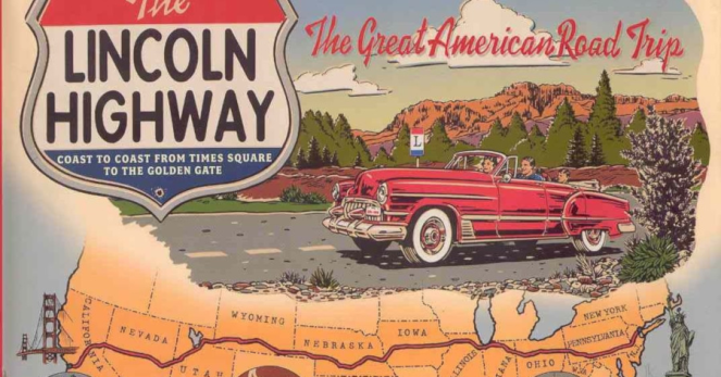
Regular readers of this blog will recall that, a few years back, I became intrigued with the Lincoln Highway. To refresh your memory, the Lincoln Highway was the country’s first transcontinental automobile route, dating back to 1913. It ran from Times Square, NY to Lincoln Park, CA.
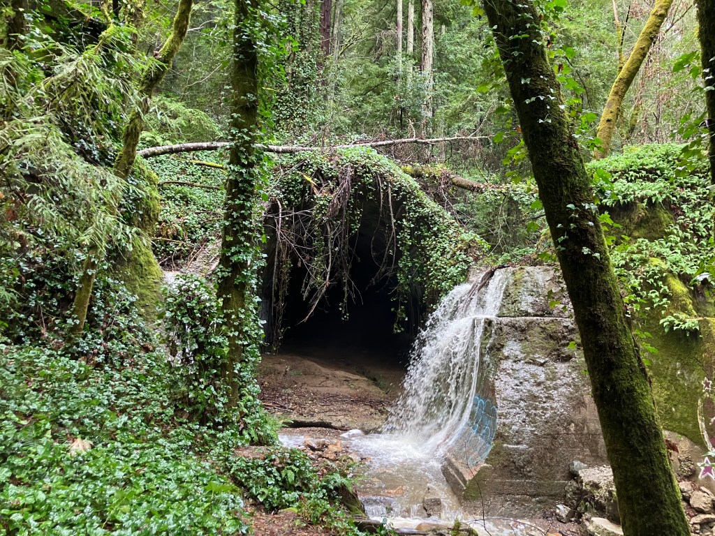
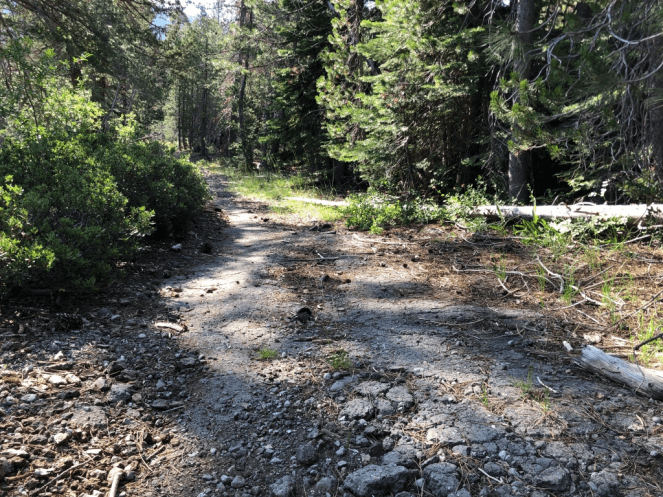
Today, most of the original route is long gone, largely superseded by modern interstates. But a handful of the original segments remain, like this crumbling roadway in the woods near Donner Pass that I (literally) stumbled upon in 2022:
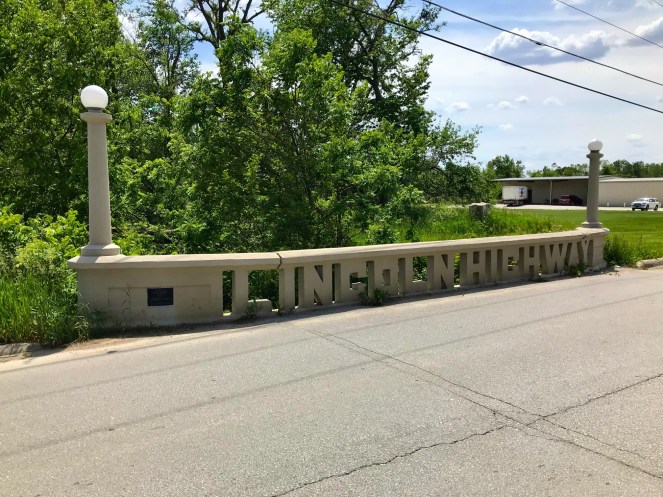
You may also recall that I once discovered a roadside memorial commemorating the Lincoln Highway and US Route 40, in Auburn CA. (In 1926, the feds adopted a numbering system for all US highways. The segment of the Lincoln Highway that passed through Auburn was rechristened with the unromantic name “U.S. 40.”)

A number of other remnants of the old Lincoln Highway remain. I’ve driven over segments in other states, such as Pennsylvania and Wyoming. And in an earlier blog, I shared this photo that loyal reader Brian W. took in Tama, Iowa.
But it wasn’t until just recently that I realized the Lincoln Highway passes within just a few miles of my house. In fact, my favorite coffee place sits alongside the historic route, in a building that actually predates the Lincoln Highway. More on that in a moment.
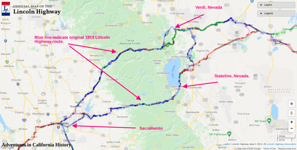
It should be noted that the Lincoln Highway forked in Reno, providing two routes into California. One (“the Pioneer Route”) went over Donner Pass and roughly followed modern Interstate 80. The other (“the Scenic Route”) passed south of Lake Tahoe and then roughly followed modern US 50. The two segments linked up again in Sacramento.
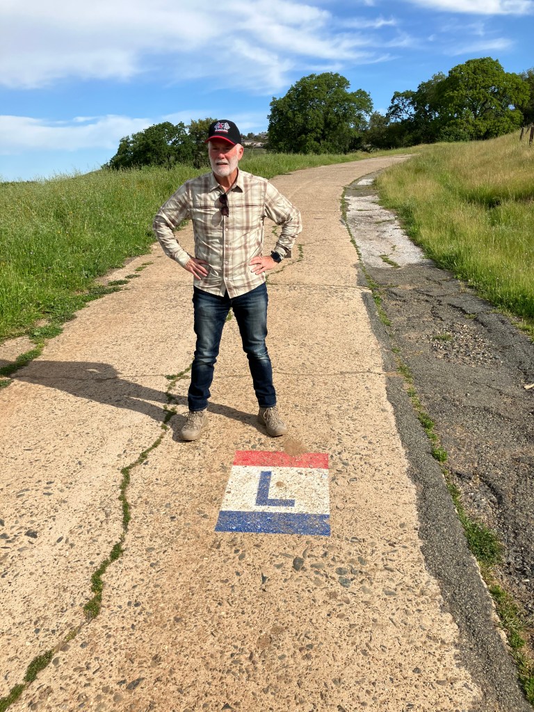
This came to my attention because last month the local historical society held a special program next to one of the longest original pavement sections of the Lincoln Highway, in El Dorado Hills. They even brought out a score of antique cars for the occasion. You can read the newspaper article here.
So my friend Bill P. and I decided to follow more of the original route here in El Dorado County. Using the El Dorado Hills segment as our starting point, we headed east toward Placerville.
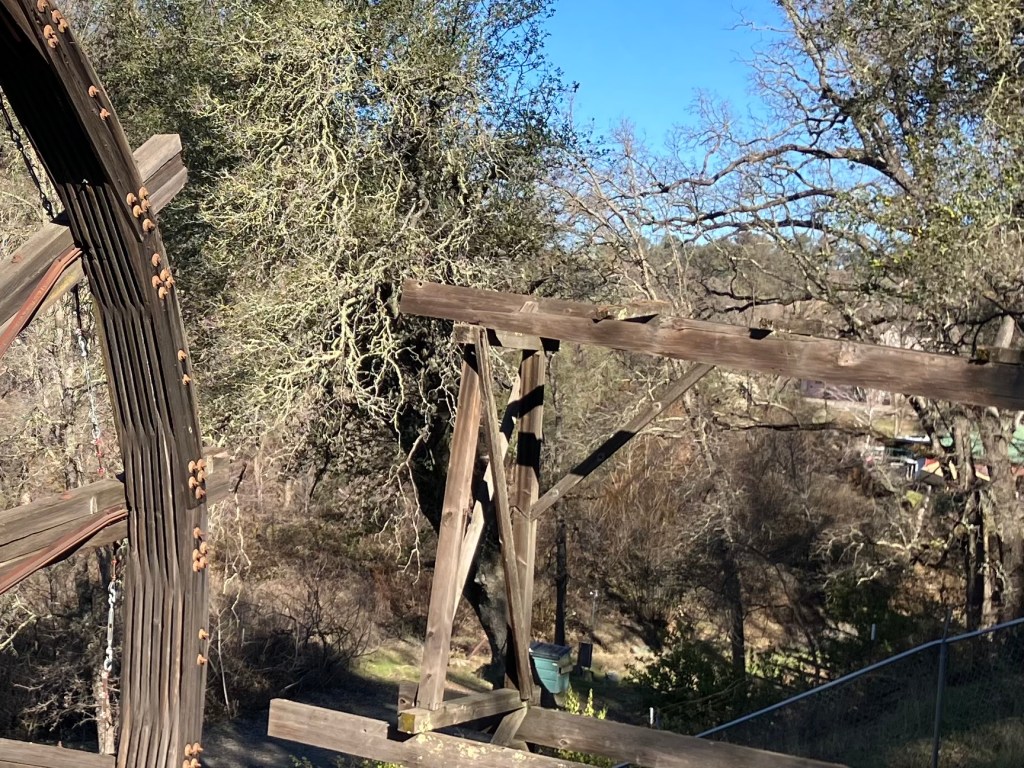
The surrounding countryside in this area looks, I presume, pretty much as it did a century ago, when a young Army officer named Dwight Eisenhower traveled the entire route in a military caravan. Even the bridges date to that era, I’d reckon.
After a brief, unavoidable jaunt along US 50, we were back on the original alignment of the Lincoln Highway. There’s even signage to prove it!
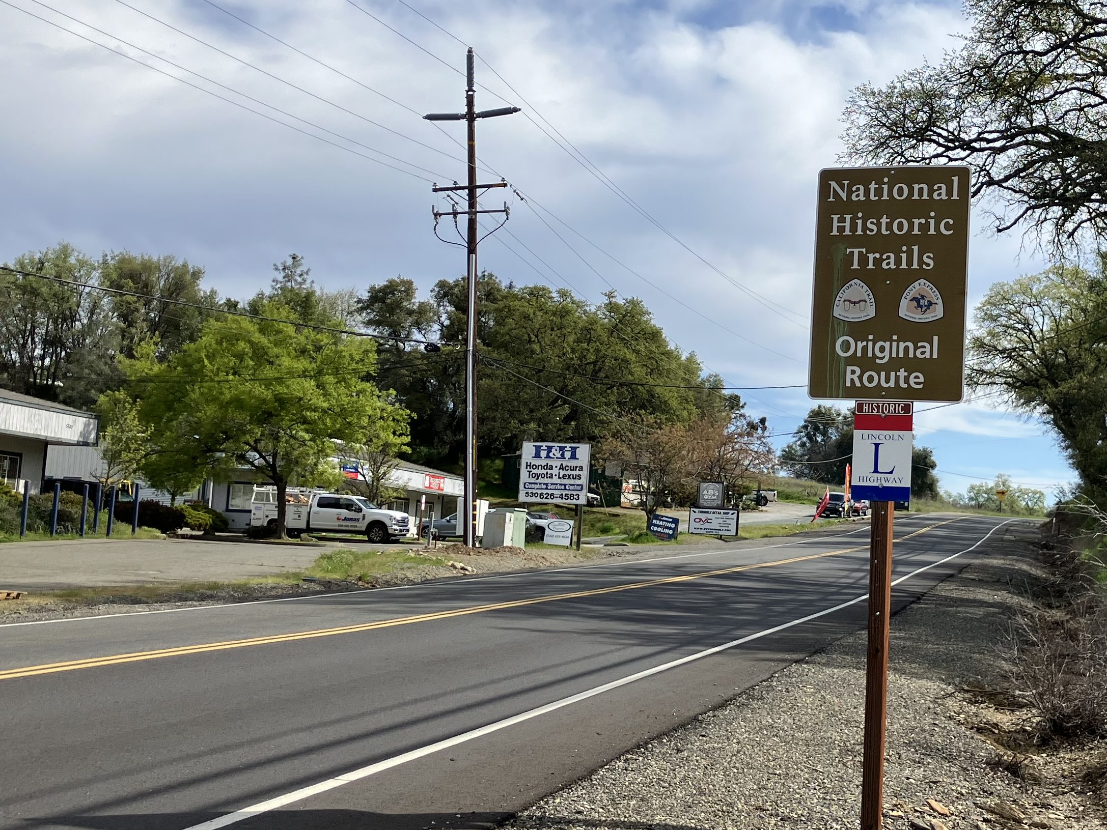
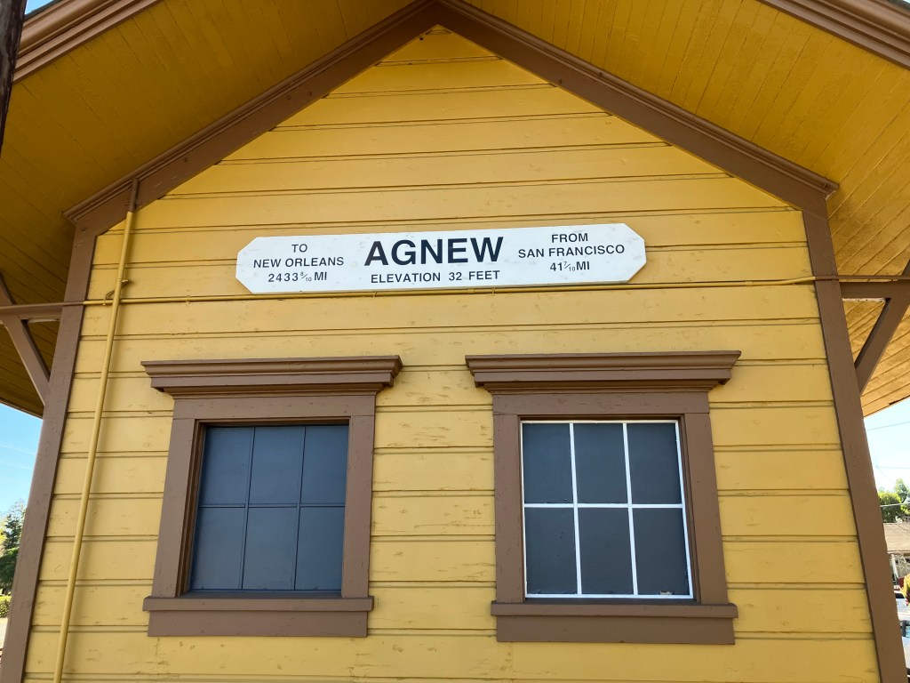
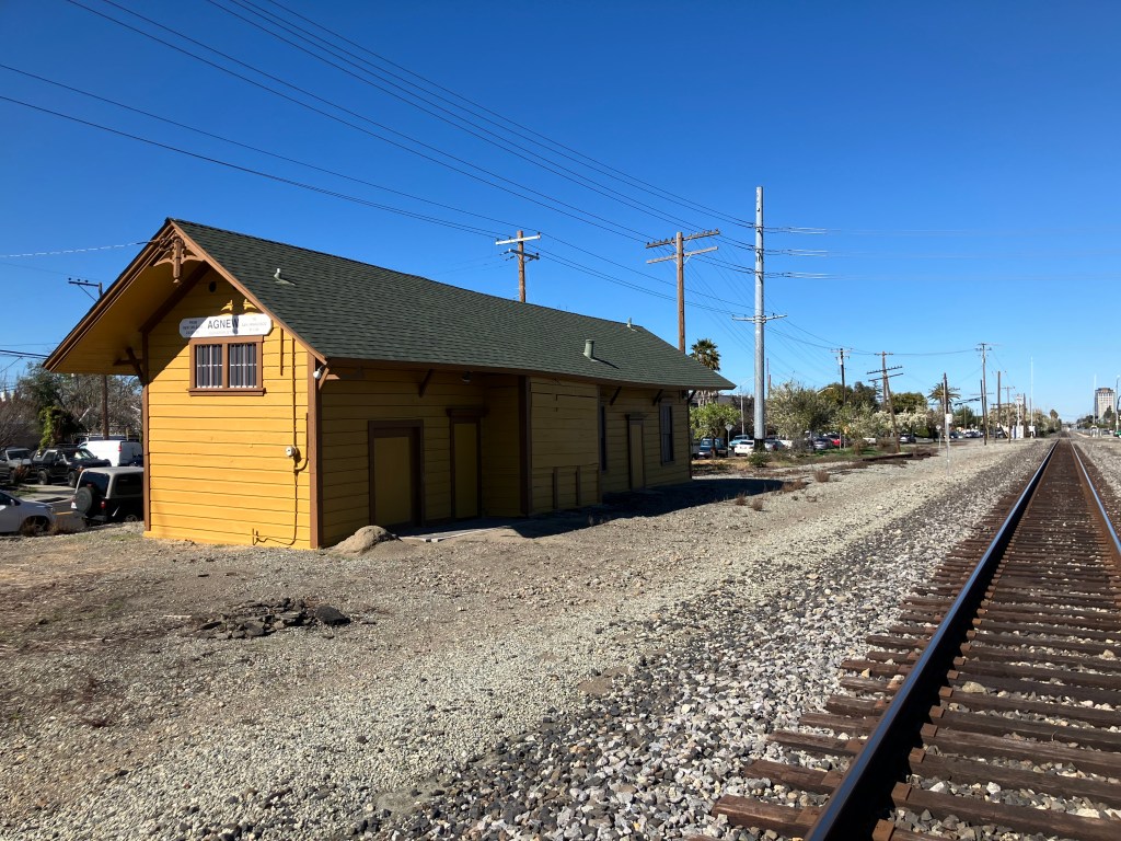
The historic Lincoln Highway route in western El Dorado County is moderately traveled and is flanked with a mix of modern buildings and historic structures dating back a century or more. An example of the latter is this 1896 freight depot in Shingle Springs:
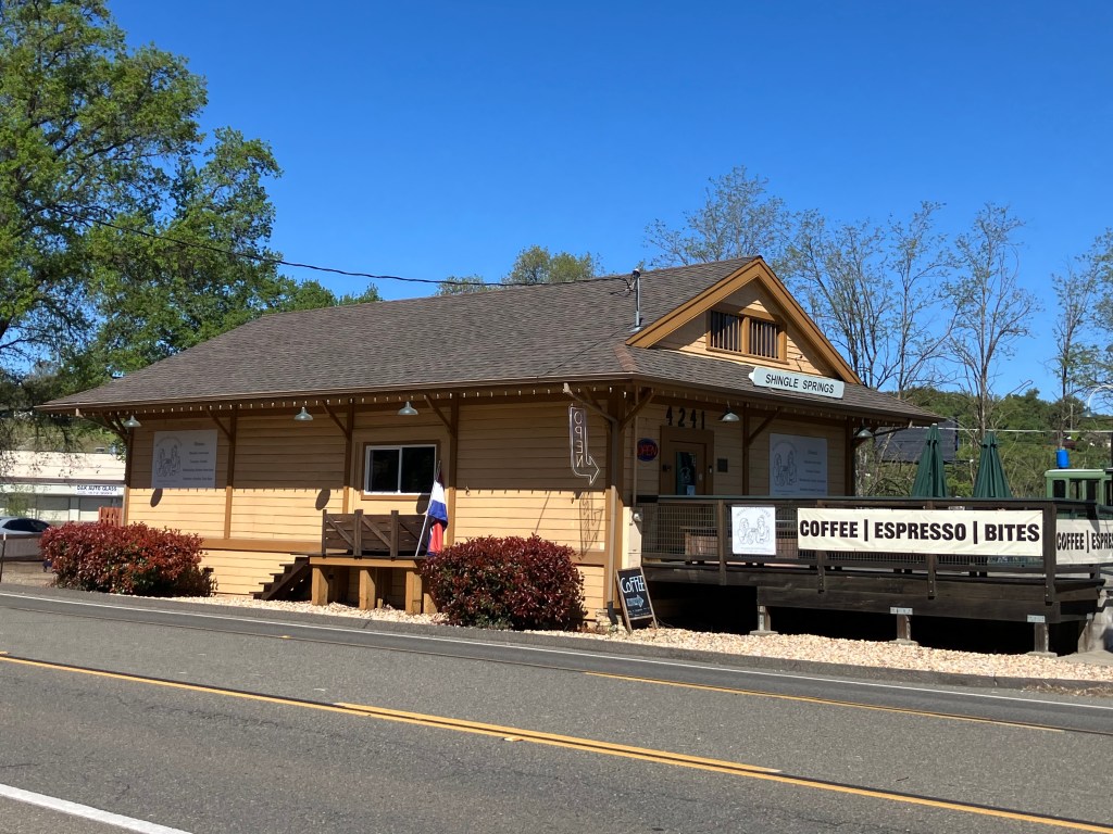
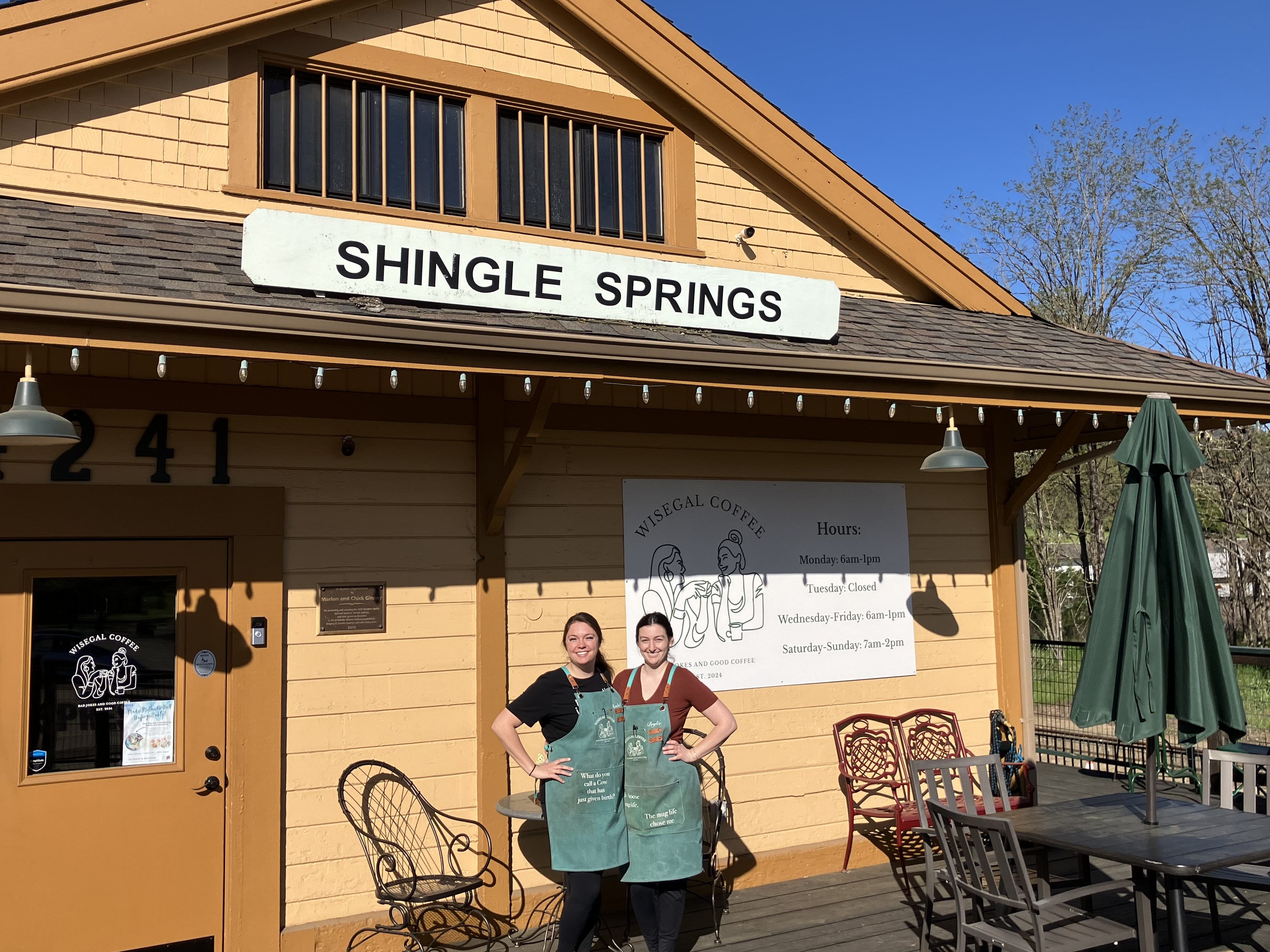
Since last December this depot has been home to Wise Gals Coffee. It’s become a popular community gathering spot and my favorite place to get coffee. I hadn’t realized it’s also on the Lincoln Highway! If you find yourself anywhere on the 3000-mile route, I insist that you stop in for a cappuccino.
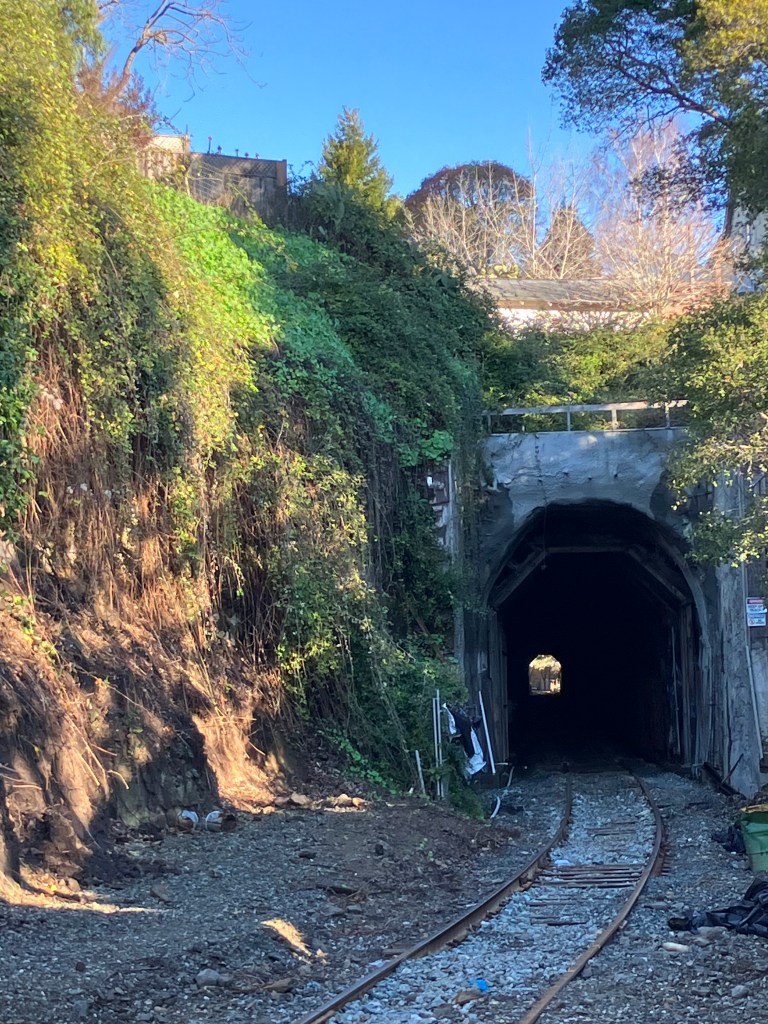
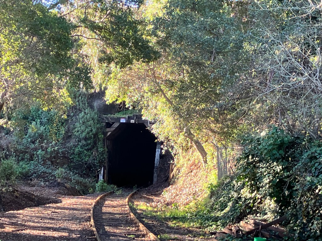
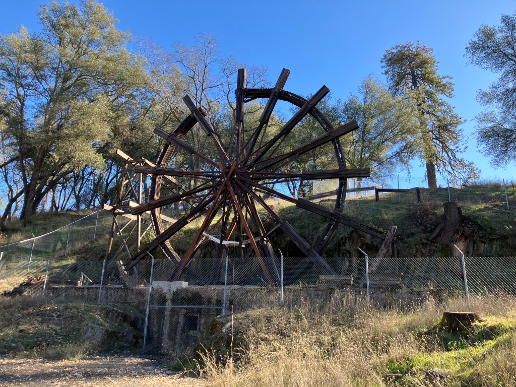
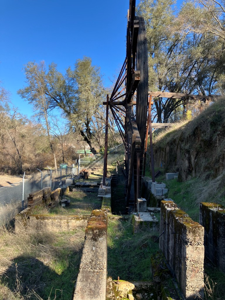
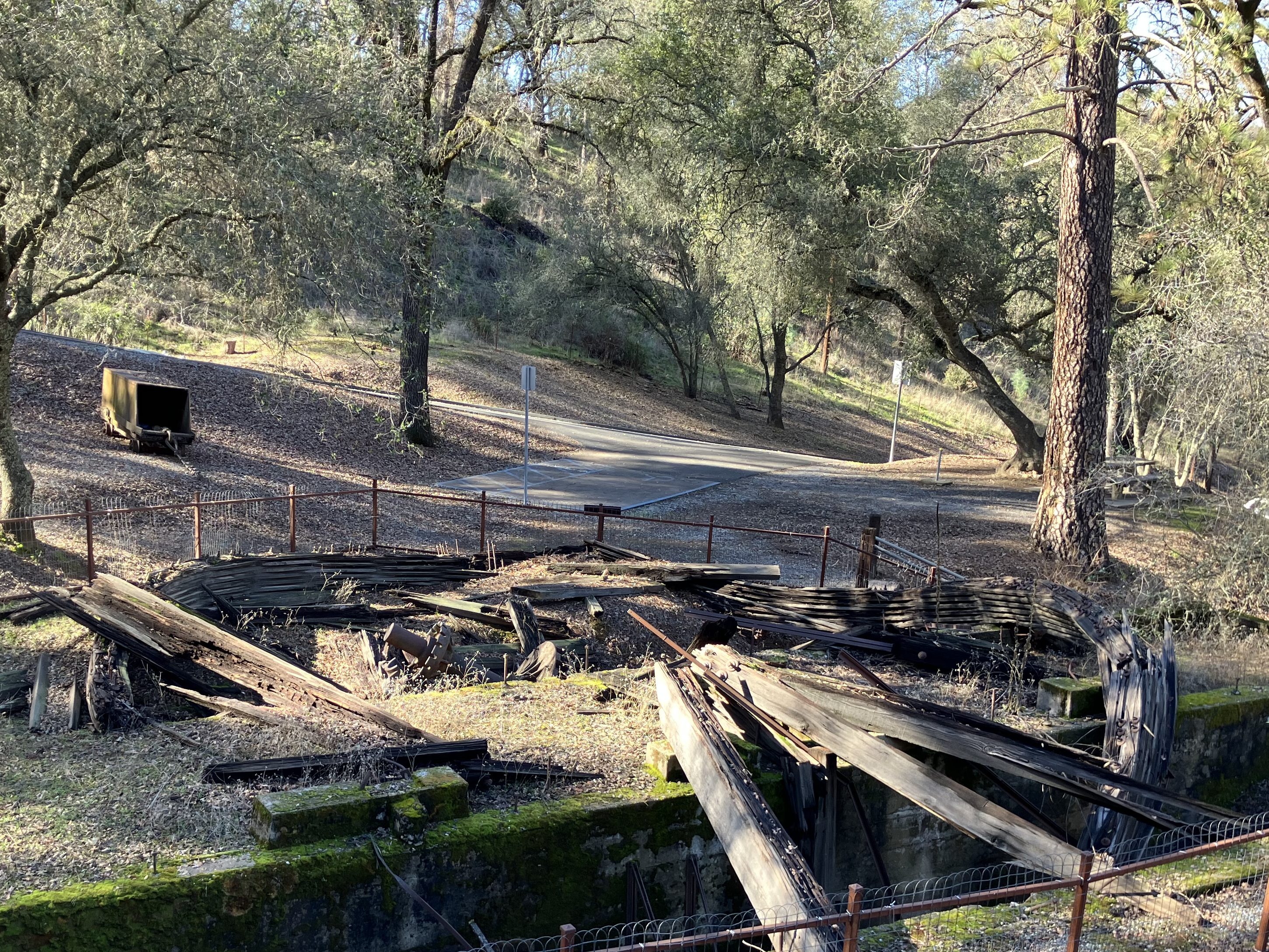
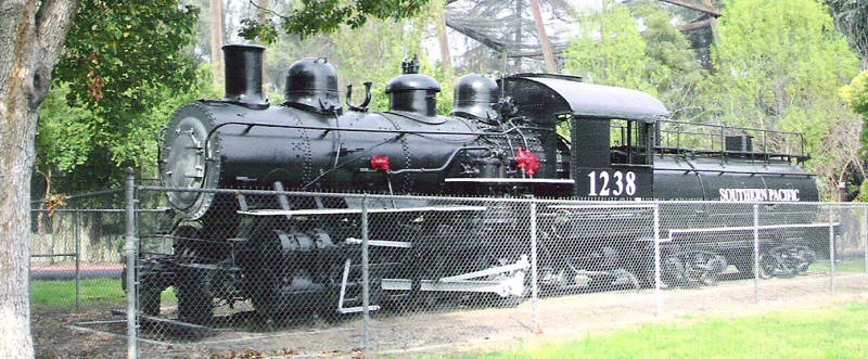
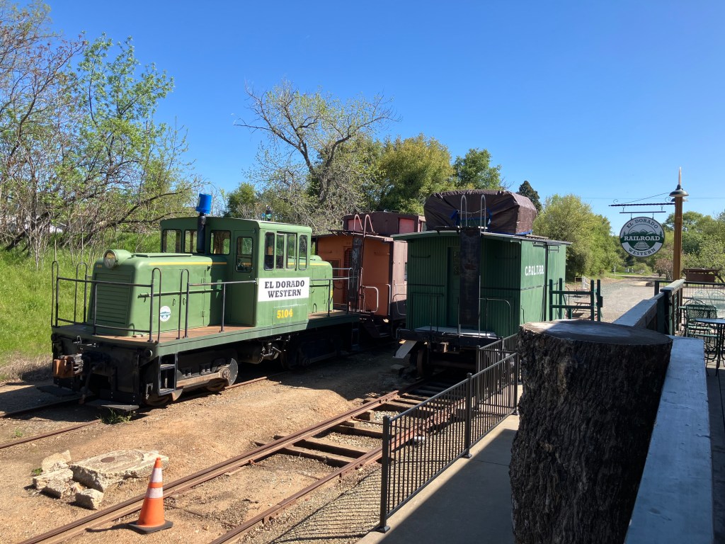
Oh, and not only is the original depot still standing; they’re still running trains! Southern Pacific abandoned the line forty years ago, but the tracks were taken over by the local historical society, and volunteers run trains on the weekends.
After paying homage to coffee and trains, Bill and I headed back out on the old Lincoln Highway (signed as Mother Lode Drive in Shingle Springs.)
When we got to the town of El Dorado (pop: 4,000) the old Lincoln Highway (now called Pleasant Valley Road) took us right by the storied Poor Red’s BBQ. Allow me to quote directly from Poor Red’s website:
“Originally constructed as a weigh station for Wells Fargo, it previously operated under the name Kelly’s Bar from 1927 until 1945. Poor Red won the bar in a game of dice, and he and his wife and bookkeeper Rich Opal took it. The murals currently on the walls of Poor Red’s were installed in the 1940’s. They depict former employees and patrons, including their dog, which used to sit out front. It is rumored his dog ran for office, but he lost.”
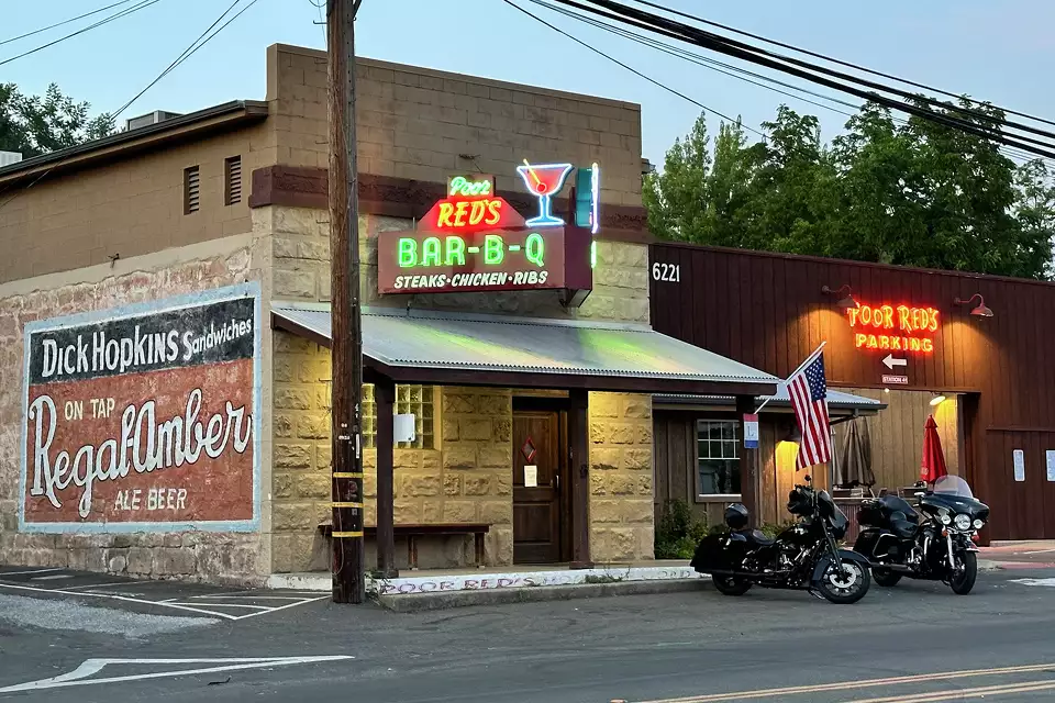
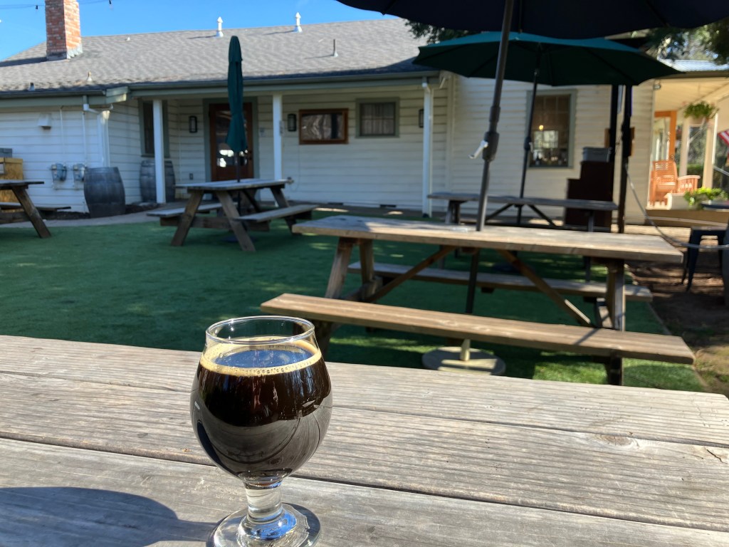
Poor Red’s, as you might know, is famous for the Golden Cadillac, a sweet cocktail with equal parts Galliano, cream, and creme de cacao. They claim to have invented the drink in 1952, and to be the world’s largest consumer of Galliano. Bill and I stopped in for lunch…
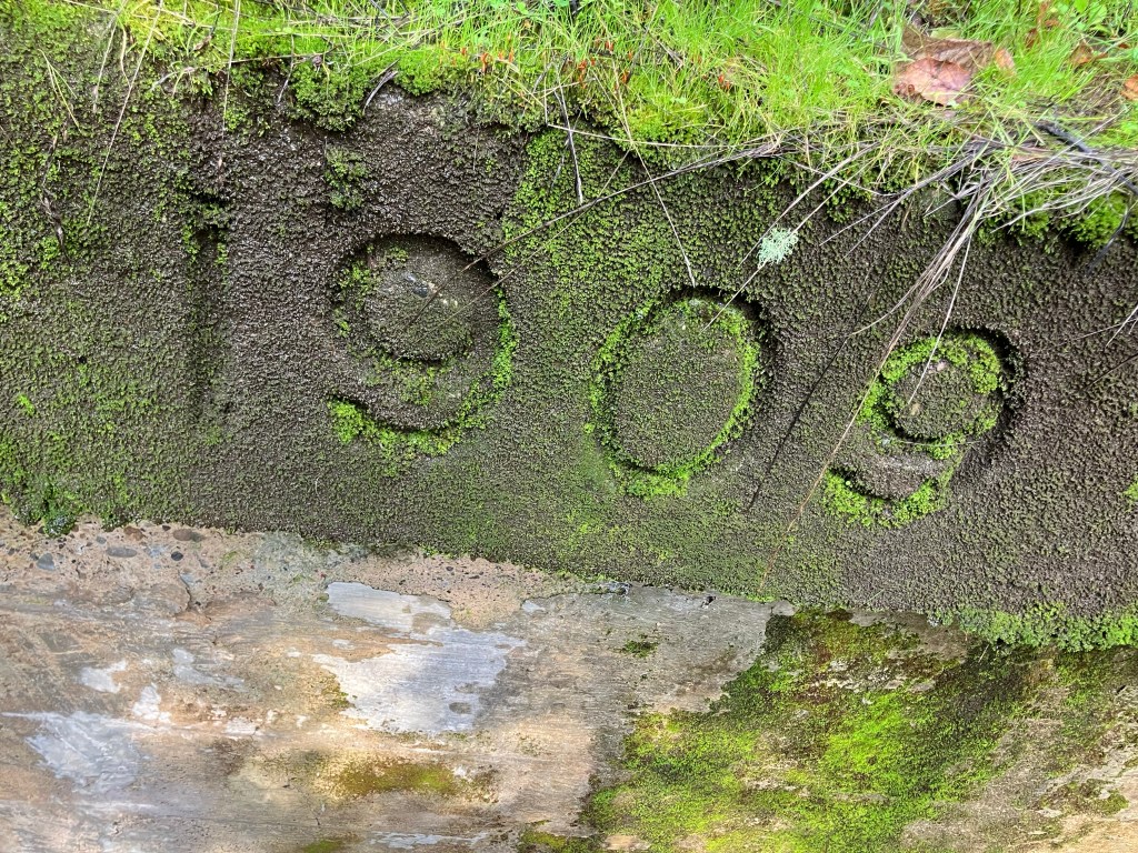
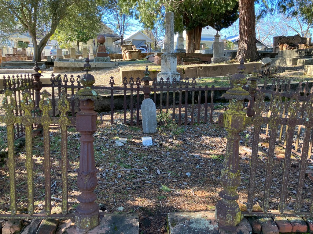
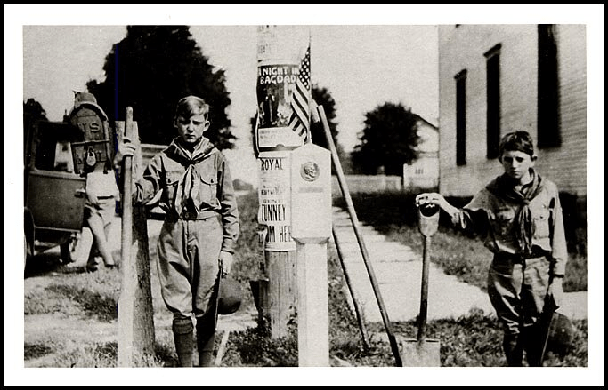
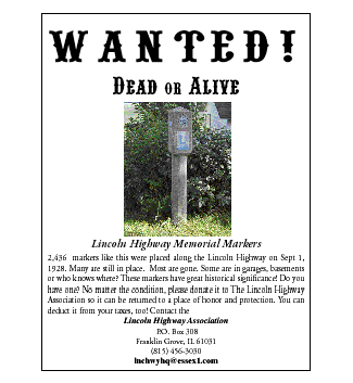
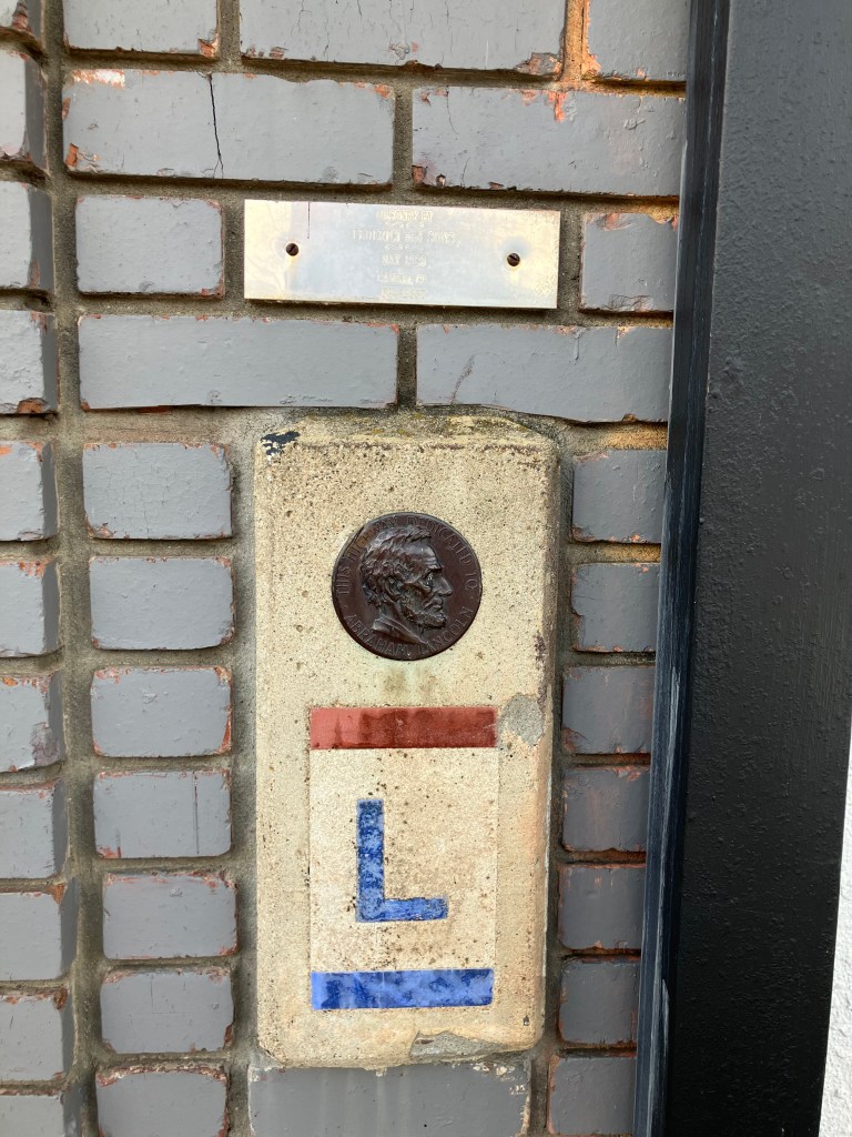
Next up, we stopped in at the El Dorado County Museum, which we knew has two original Lincoln Highway markers in its collection. One morning in 1927, exactly 2,436 of these cast cement markers were placed along the entire cross-country route by local Boy Scouts. (You can see one of the markers in my earlier photo of the Lincoln/US 40 memorial in Auburn.) Almost all the original markers are now gone, succumbing to road-widening operations, vandals, or weather. Given how iconic they are, Bill and I felt it important to see one “in the flesh,” as it were.
We were met at the museum gate by one of the least helpful docents you’d ever want to meet. Us: “Hi! We understand you have a couple of historic Lincoln Highway markers on display!” Him: “Yes. They’re over there.” He gestured vaguely behind him to a bunch of clutter in a courtyard in front of the museum. But he continued to block the gate. Us: “Uh, could we see it?” Him: “We’re closed.” Us: (disappointed looks). Him: “You might be able to see it through the fence of the parking lot.” And with that he went back to torturing kittens or whatever it is he does for fun.
We did manage to take a photo through the metal fence. God forbid that we would have been allowed to set foot for a moment on the other side of the fencing.
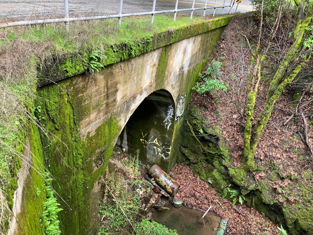
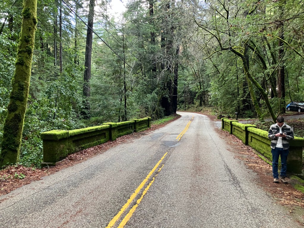
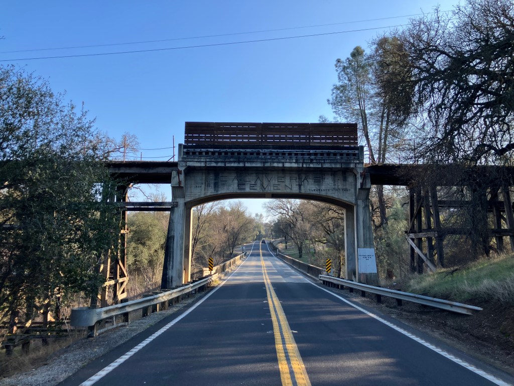
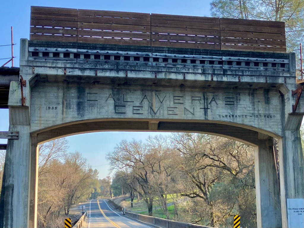
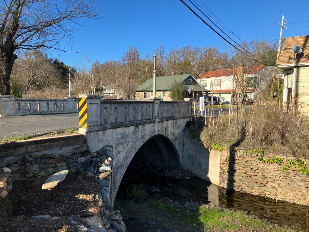
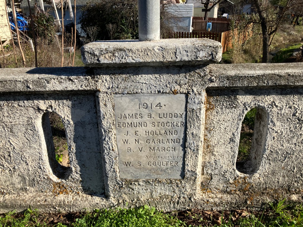
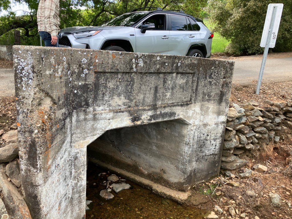
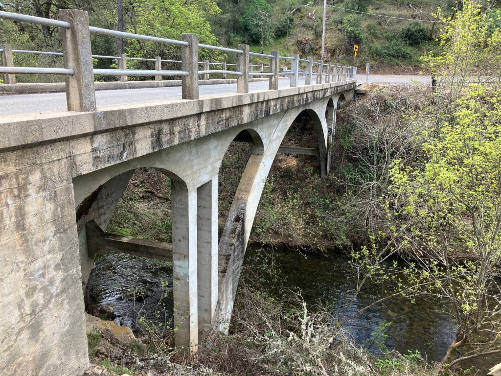
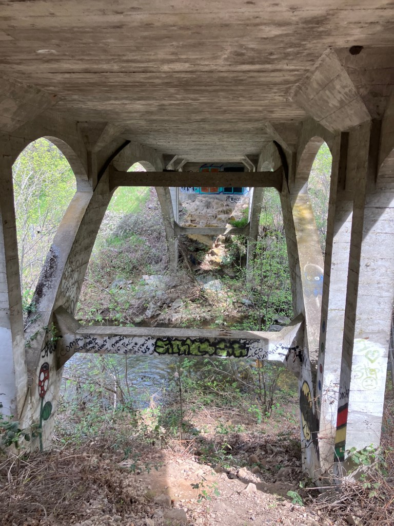
We returned to the Lincoln Highway, and once again felt like we’d been transported to the early 20th century. As we approached Placerville we crossed over the historic Weber Creek Bridge, which dates to 1914.
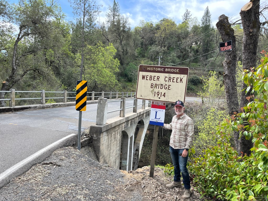
The bridge is in remarkably good shape for over 110 years old. A little research revealed that it’s one of only two “Turner Mushroom Slab” bridges in California. Evidently an engineer named Claude Allen Porter Turner patented a “flat slab support system” (which my wife tells me I could benefit from). But I think it actually has something to do with the way the concrete slabs are designed and assembled. Coincidental fun fact: Turner was born in 1869 in Lincoln, Rhode Island!
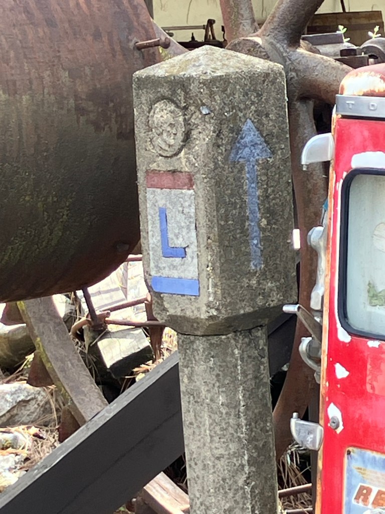
Finally we were approaching Placerville, which meant we had one more opportunity to get up close and personal with a Lincoln Highway marker. The Lincoln Highway through downtown Placerville is now Main Street, and our research suggested that one of the original markers had been discovered during an earlier road-widening, and cemented into the face of a brick wall. After a few false leads and a couple of illegal maneuvers, we found what we were looking for in the external wall of a restaurant:
It’s quite surprising how many of these remnants of a century-old highway remain, largely invisible or unacknowledged by galoots such as myself. My two recommendations to you, gentle reader, are (1) pay attention to the history near you; who knows what’s in your backyard!, and (2) ease onto the Lincoln Highway and make your way to Wise Gals for a cappuccino.