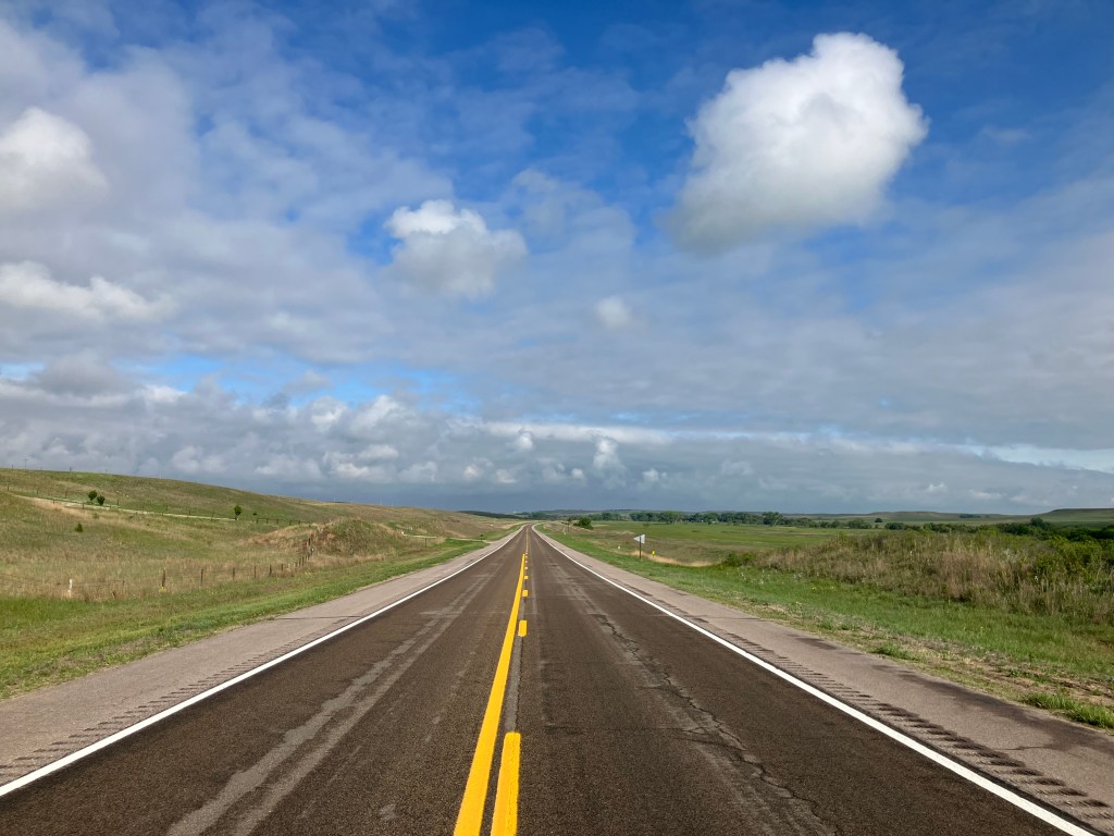
Now that I’ve managed to claw my way out of the Mojave desert, I thought I’d post a few additional photos that didn’t fit neatly into my scintillating narrative. Maybe think of these as “bonus features.”
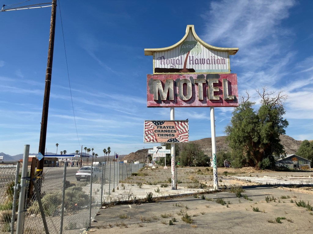
This first photo is of the Royal Hawaiian Motel in Baker, CA…which is not royal, not Hawaiian, and not even a motel anymore. It opened in 1957 and closed in 2009. It sat vacant until just last year, when the building was demolished. I’m told that, just before it was demolished, it appeared in the Amazon Prime series “Fallout” (Season 2, Episode 1). But I can’t vouch for that, as I haven’t watched TV since they cancelled Happy Days.
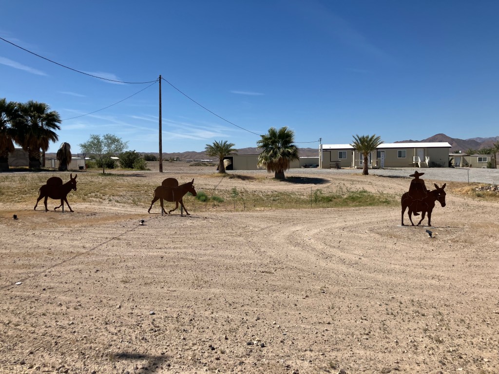
At first I thought the art installation featured here was the three wise men. But the “camels” are actually mules (donkeys? burros?) with packs on their backs. I took this photo near the Old Spanish Trail in Tecopa.
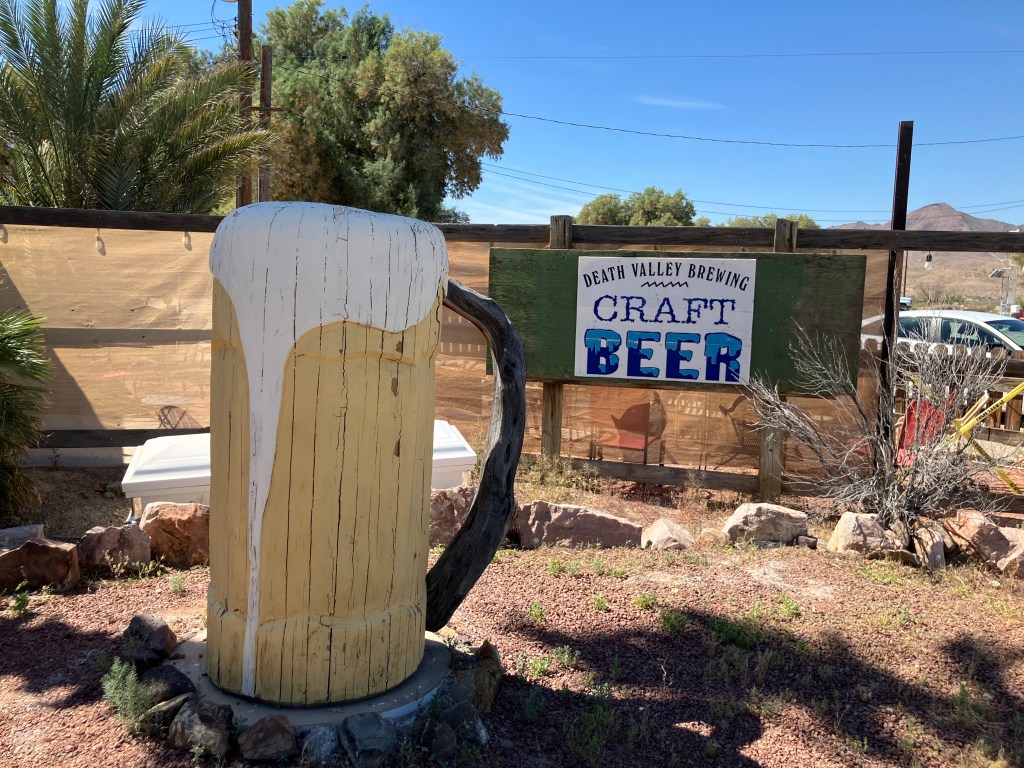
This beer mug is crafted out of wood. I guess that’s why I took the photo. Sorry–I don’t have any other info on this.
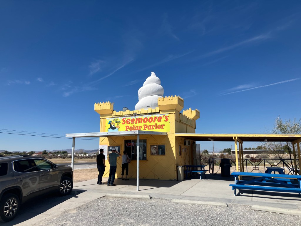
Seemoore’s Polar Parlor sits on the main highway into Pahrump, NV. A nice, cold softserve is of course welcome in the desert. But Seemoore’s real claim to fame (according to the teenager serving me at the window) is that it’s the “world’s tallest ice cream stand.” I expressed my incredulity, for this place is barely two stories tall. His deadpan response: “Yeah, but all the other ones are one story. They don’t have a giant ice cream on the top.”
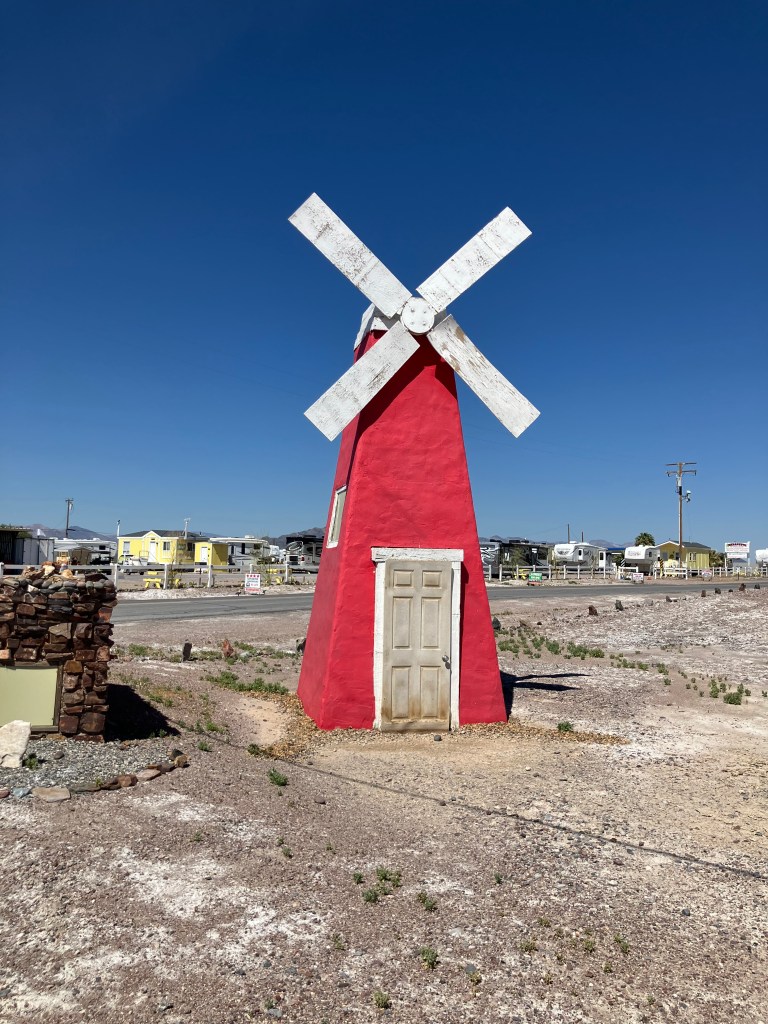
Unexplained “windmill”in Tecopa Hot Springs.
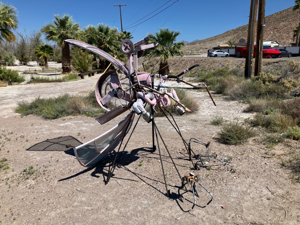
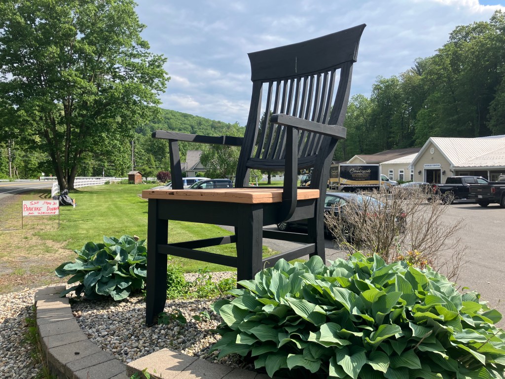
I’ve commented before that people in the desert have a special talent for yard art. I’m not sure what this is supposed to be–Maybe Watto from Star Wars Episode 1?
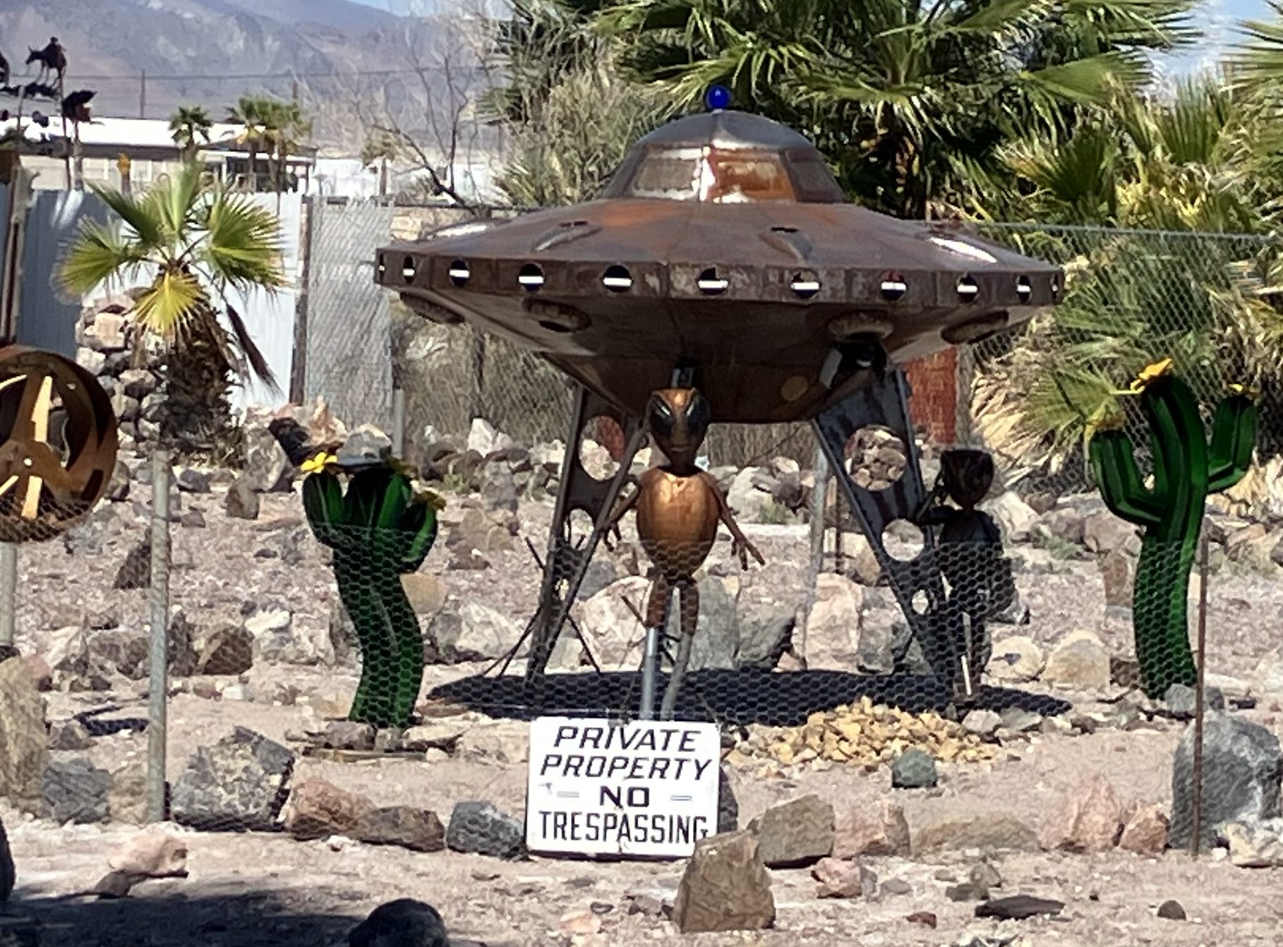
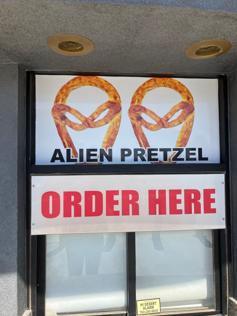
Speaking of aliens and yard art…
Sticking with the alien theme a little longer, these were advertised at the Alien Fresh Jerky store Baker. Sadly, they were out of them when I was there.
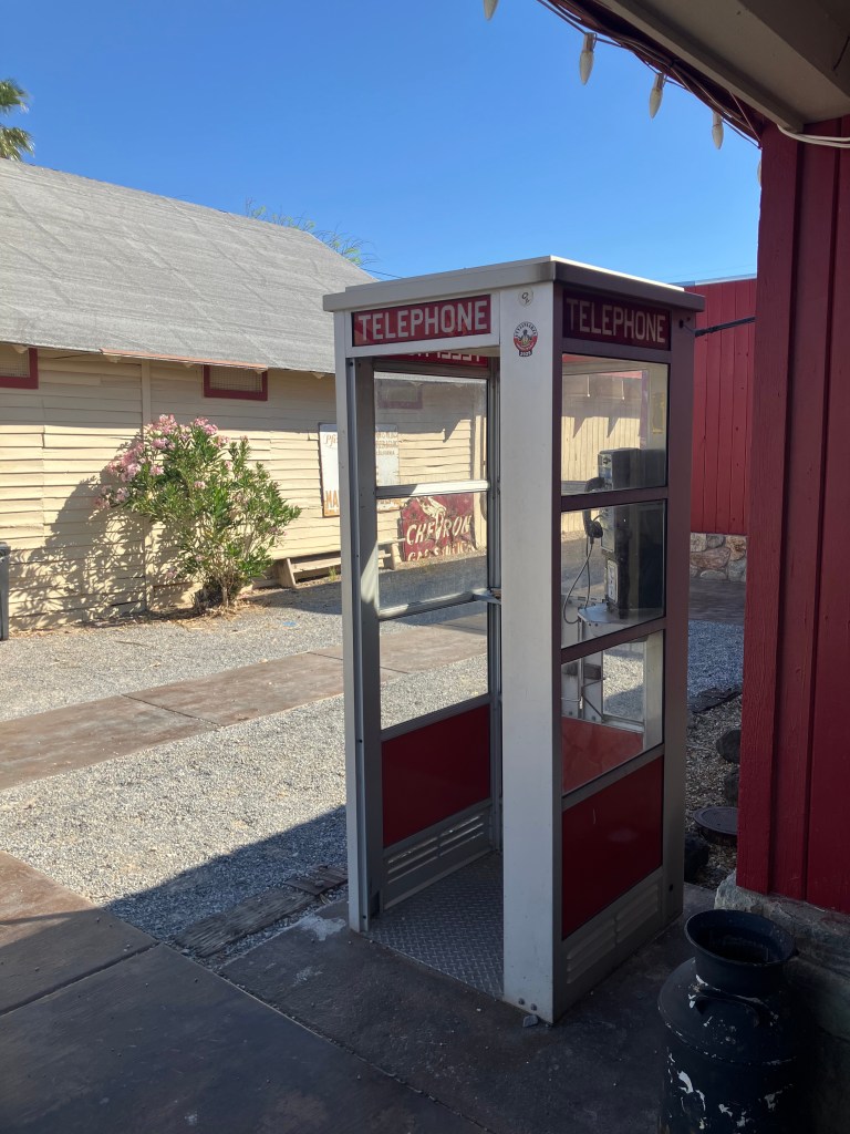
Younger readers might not recognize this photo. In the old days, people would actually go inside these glass boxes, deposit little metal discs called “coins,” and make a phone call from a clunky “handset” connected to a wire. This phone was still intact, but there was no dial tone. It got me wondering if there are any working pay phones anymore.
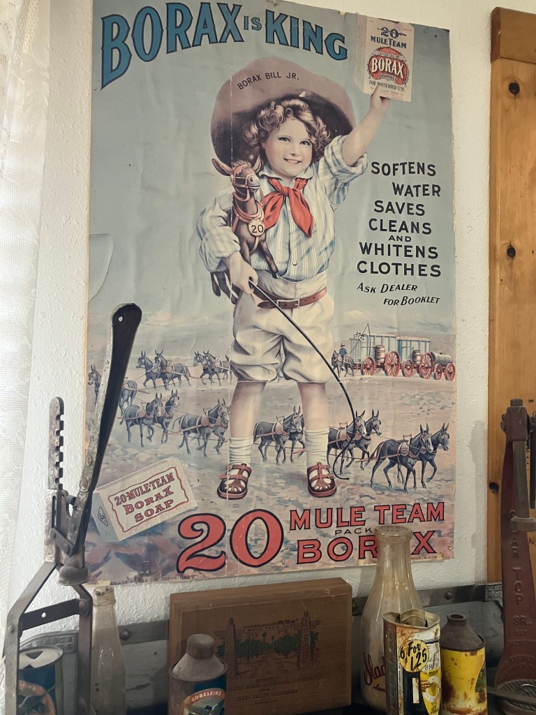
Another of the many advertisements for borax that one encounters around Death Valley.
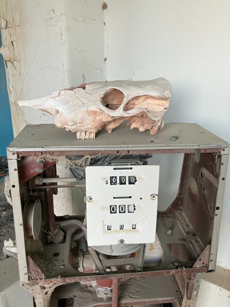
This may or may not be an example of desert folk art.
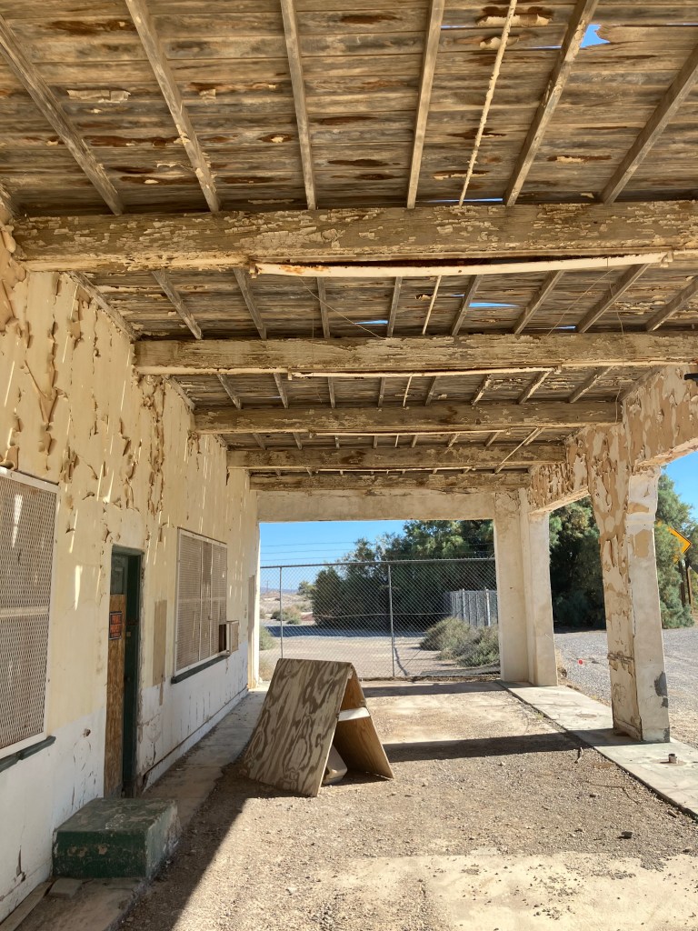
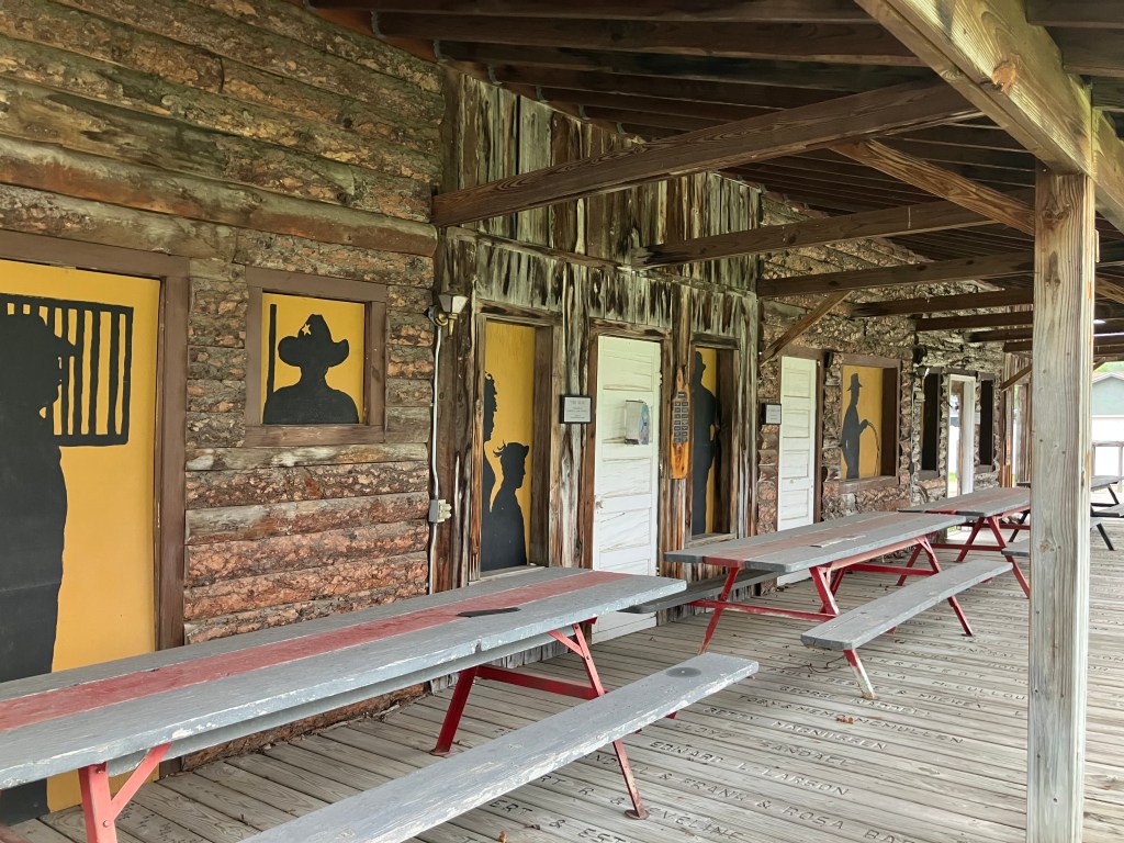
The covered porch of the service station at Death Valley Junction where Marta Becket had her car repaired and envisioned the Amargosa Opera House.
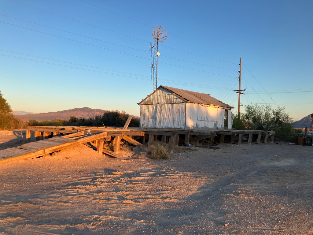
Finally, here’s the borax loading dock at Death Valley Junction/Amargosa. I just liked the lighting.
Thus concludes my Mojave trip. Mark your calendars for my visit to the Republic of Molossia on April 25. Until then, remember: Borax is King!
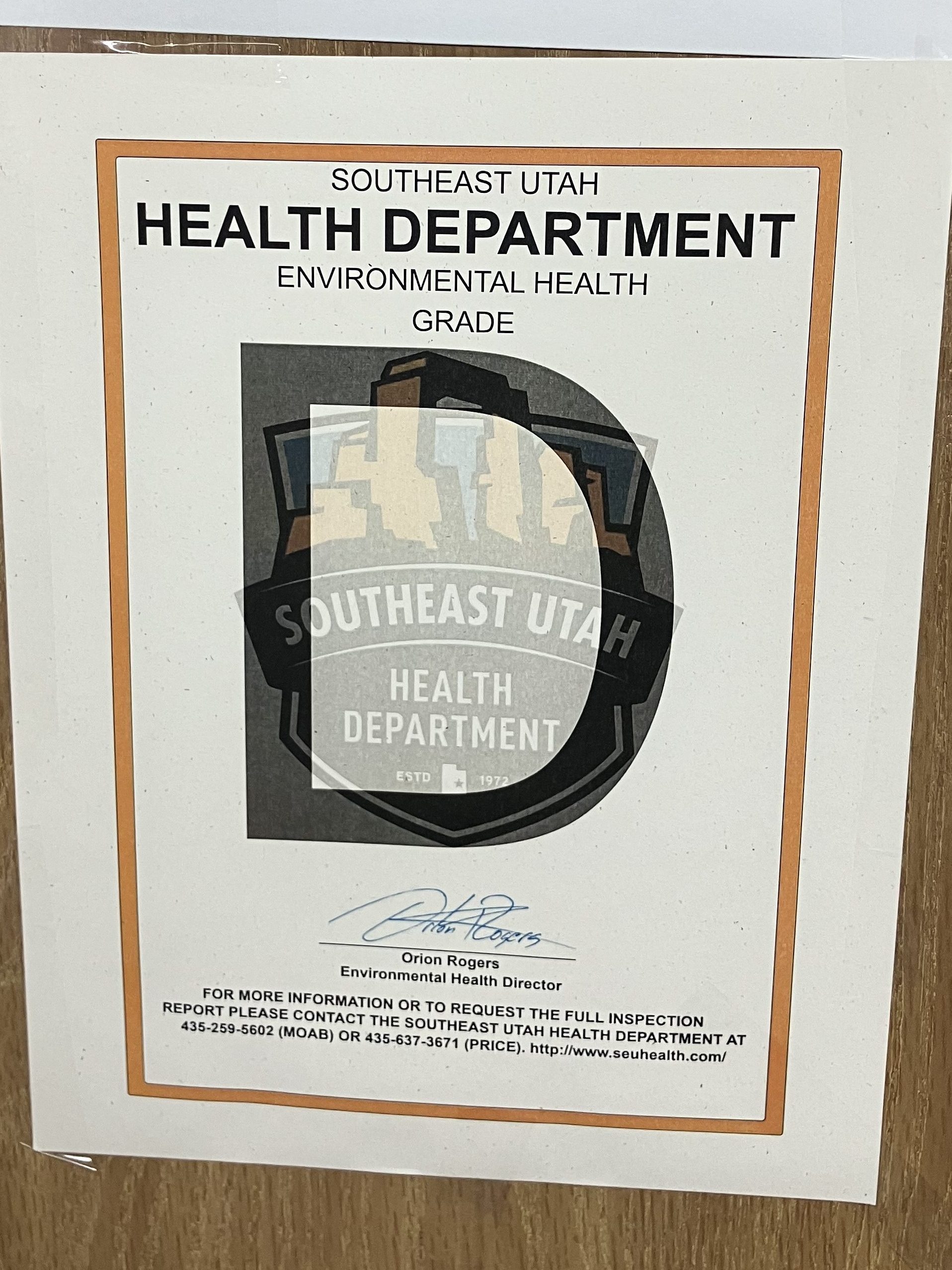
This morning I headed downstairs from my motel room to partake of the “free” breakfast. Then I spotted this sign in the breakfast room:
But a “D” is technically passing right? At least that’s what I used to tell my parents when I brought home my report card.
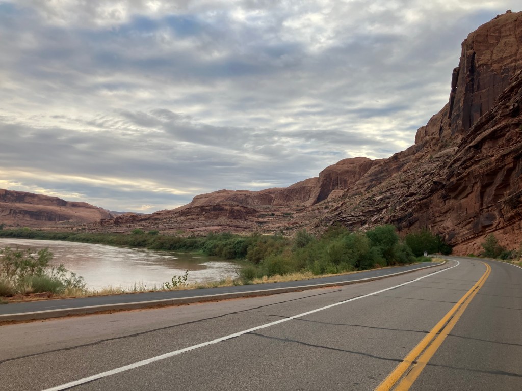
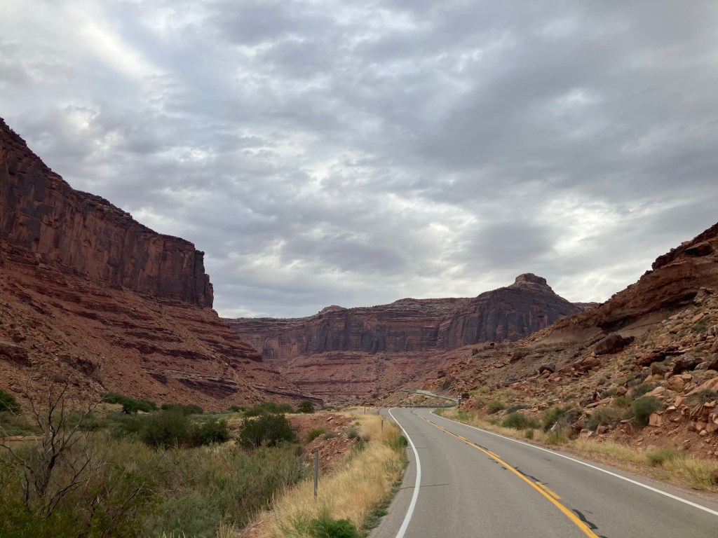
Instead of the motel breakfast, I got a gas-station coffee and donut. I then got onto the U-28 scenic byway, which carves its way through the Colorado River gorge towards Grand Junction. It was so spectacular it even made my donut taste good.
That’s the muddy Colorado River on the left.
A perfect setting for a Western…which it has been, many times.
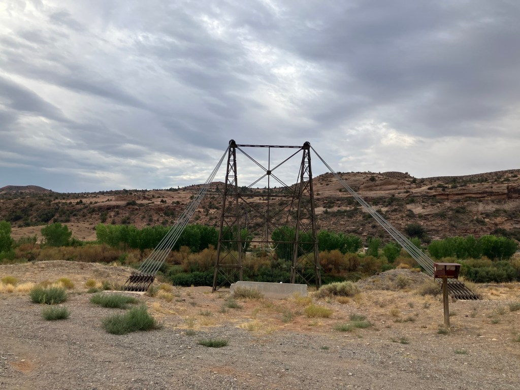
After maybe half an hour of driving I came across a pedestrian suspension bridge that crosses the Colorado River. Attentive readers will recall that I’m a sucker for these things, so I looked for a place to pull over and sway my way across the (not-so-) mighty Colorado.
So far so good…
So imagine my disappointment when I discovered that the bridge’s decking was entirely missing.
…but wait–what’s wrong with this picture?
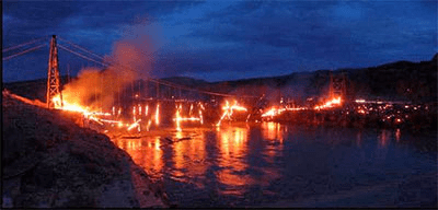
Turns out the Dewey Bridge (for that’s its name) was built in 1916 and is Utah’s longest suspension bridge. It was fully restored in 2000….and eight years later some kid was playing with matches and the whole thing went up in flames.
Kids, don’t play with matches! (2008 photo from Wikipedia Commons.)
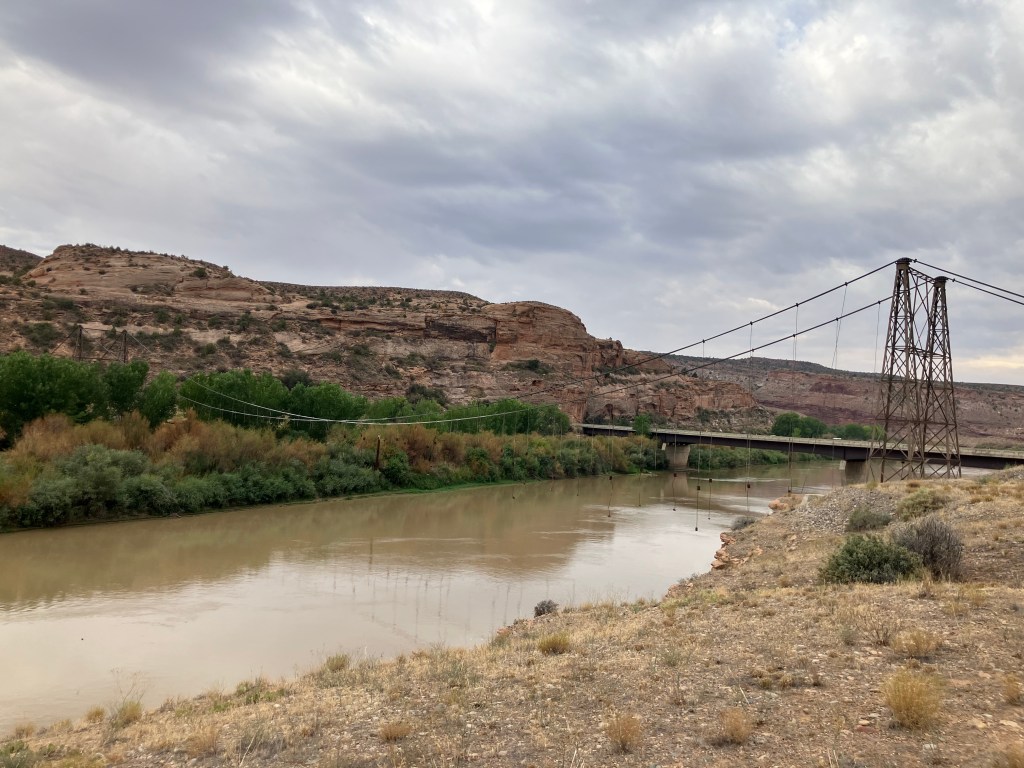
A sad and ghostly air hangs about the skeleton of the Dewey Bridge. It set back my good mood a bit.
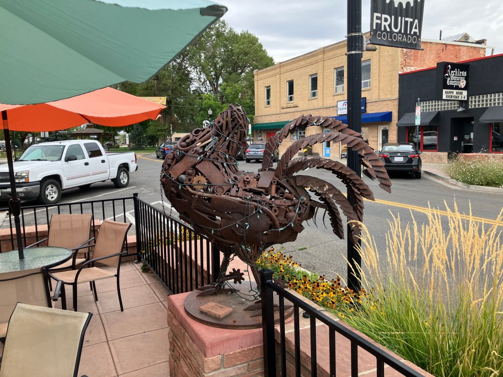
A little later I came to the town of Fruita, Colorado (pop: 13,400). I could live in this town. It’s one of those places that’s figured out how to preserve its history, cater to modern tastes, create a livable community, and attract tourists. The town is jammed with public art, and the main street has plenty of outdoor cafes and benches to relax, have a cup of coffee, and watch the world go by. It seems that most of the buildings along Main Street are historic and well-preserved or restored.
One public art installation that made me scratch my head was this rooster with no head:
A friendly fellow drinking coffee at an outdoor table noticed me photographing the sculpture and gave me the story of Mike the Headless Chicken. (Trigger warning for those sensitive about food preparation by carnivores.) It seems that in 1945, a local farmer by the name of Lloyd Olsen was attempting to behead one of his chickens for dinner. His aim was a little off, and most of the chicken’s brain stem remained with the body. The chicken survived his beheading, flapping his wings and running around headlessly. What was Lloyd to do? He spent the next year and a half carefully feeding Mike (for that was the chicken’s name) individual kernels of corn through the throat and addressing Mike’s thirst with milk and water from an eyedropper. Mike became a sideshow attraction and gained national fame. Indeed, I remember reading about Mike in a “Ripley’s Believe It Or Not” paperback in the 1960s. Fruita still remembers Mike with the sculpture, T-shirts and other souvenirs, and an annual “Mike the Headless Chicken Festival” each spring. I am not making this up.
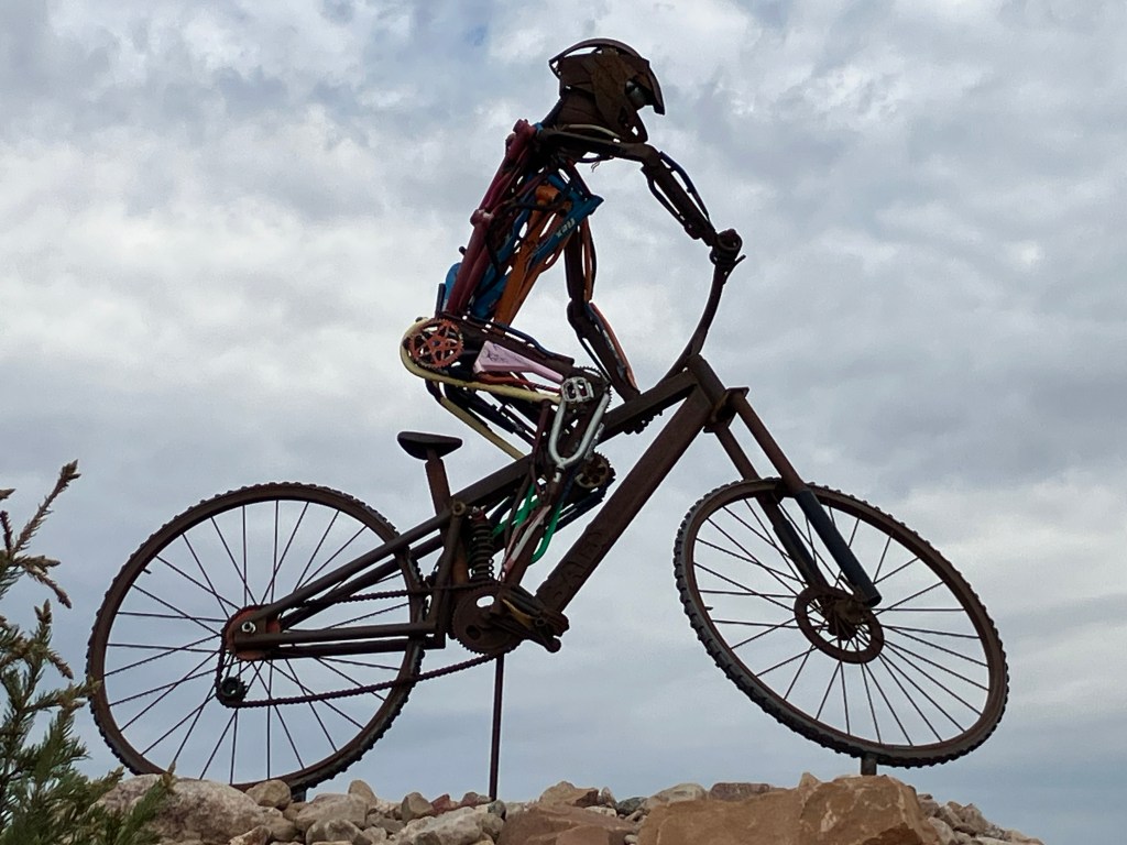
Fruita also has a lot of non-headless-chicken art around town. In fact, I noticed that many of the towns in eastern Utah and western Colorado feature interesting public art installations. Here is a sampling:
Bionic bicyclist in Fruita.
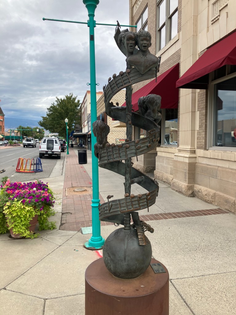
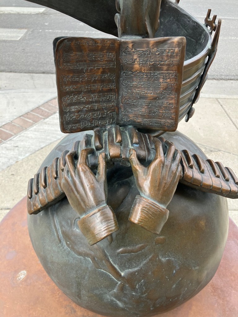
Sculpture honoring children’s music teacher David Carl Moore in Delta, Colorado.
Detail of the Moore sculpture.
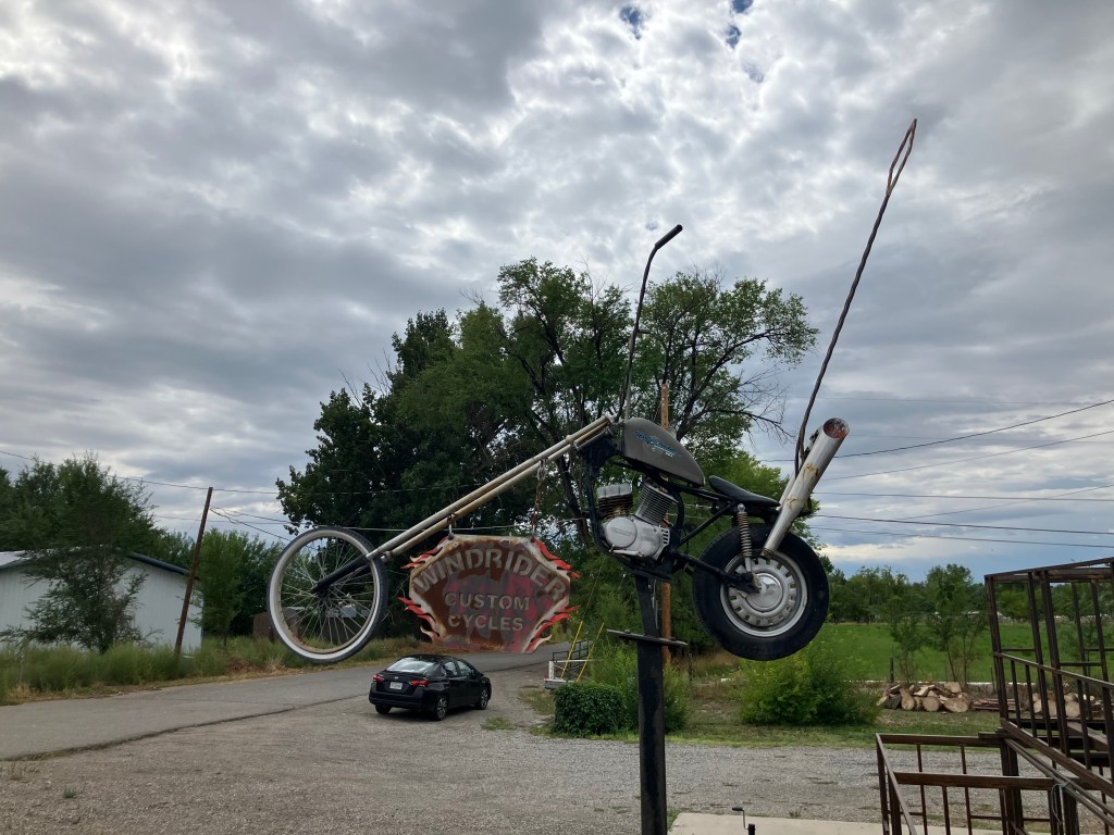
Windrider Custom Cycles sculpture in Delta.
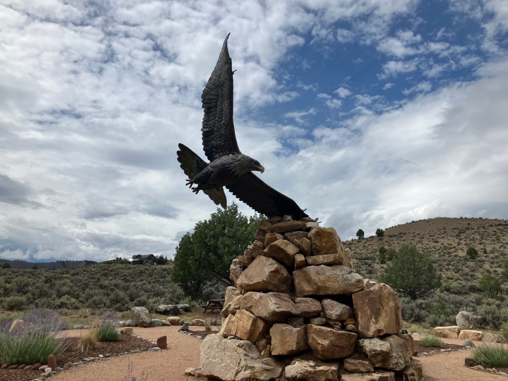
Sculpture at Dennis Weaver Memorial Park in Ridgway, Colorado. Dennis Weaver (I remember him as McCloud from the NBC television series) reportedly loved eagles and lived in Ridgway for many years.
I also randomly ran into these women playing the tubular bells (?) xylophones(?) that are installed at the park. Somehow I think Dennis Weaver would have appreciated it.
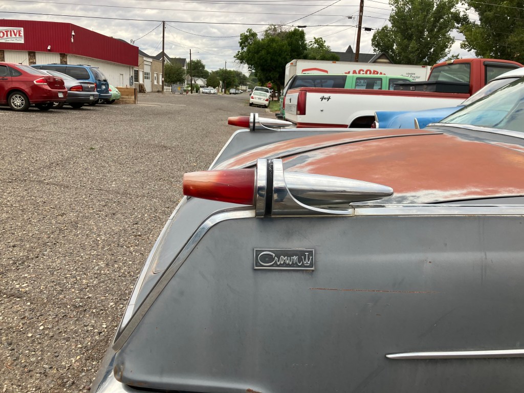
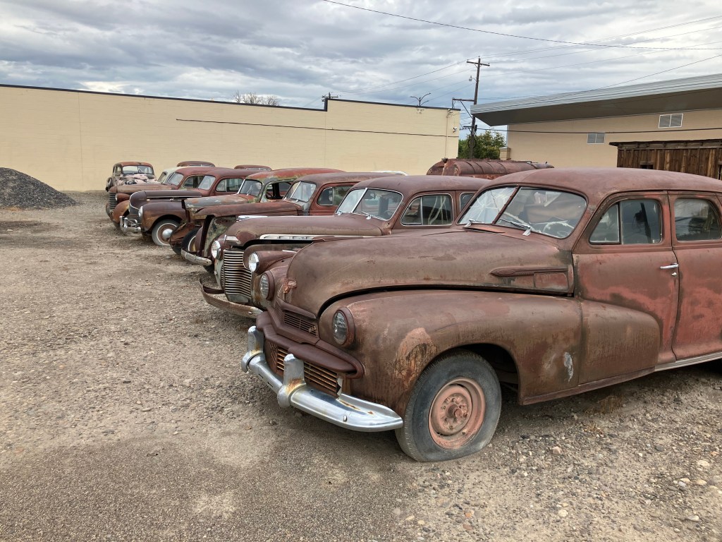
I’m not sure if it technically qualifies as art, but there is a large number of long-parked classic cars on both sides of the street in downtown Delta, Colorado.
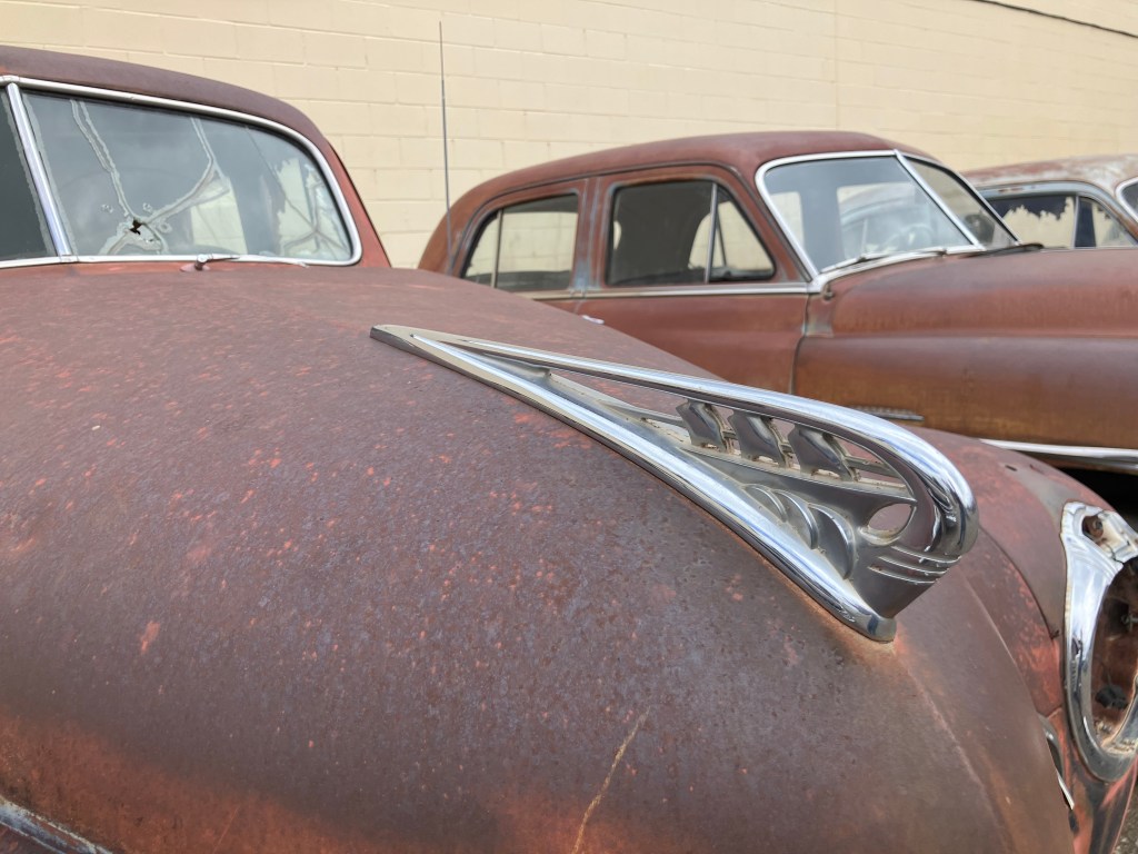
Artistic Chrysler hood ornament.
Used car lots, frozen in time.
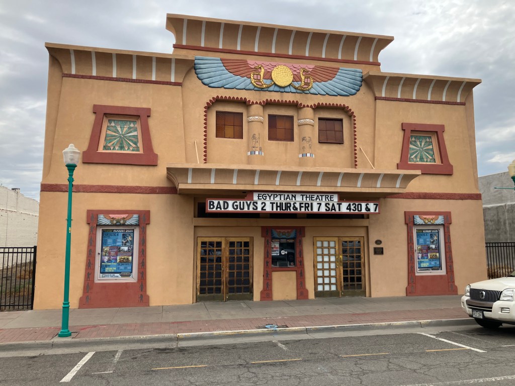
Also related to this theme of public art is the 1928 Egyptian Theater in Delta. It’s obviously been loving restored, and it regularly shows movies and hosts performances. It’s much smaller than the Egyptian Theater in Hollywood, but it similarly reflects the fascination with all things Egyptian in that era.
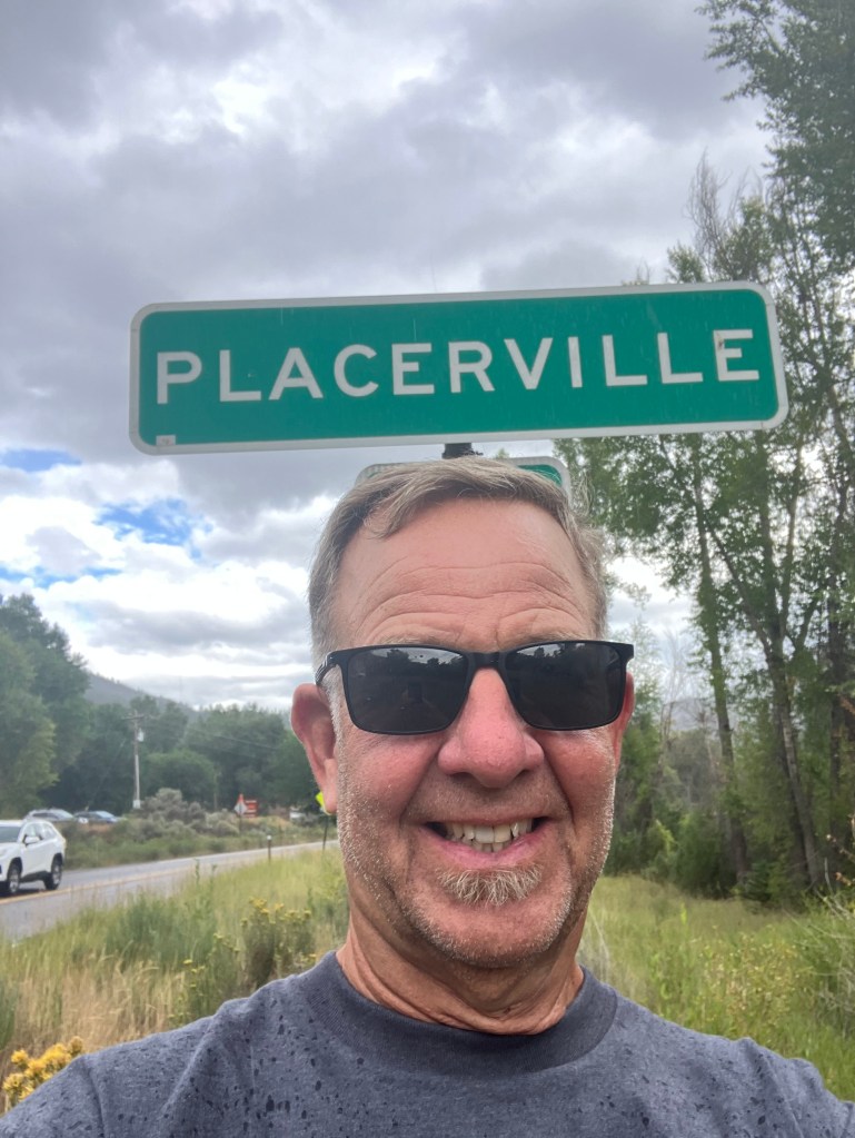
But let’s get back to the purpose of today, which was to complete my trek to Placerville, Colorado. You’ll recall that the California version of Placerville was originally called Hangtown, and the tree where those hangings took place (in 1849) stood on Main Street for many years. Even though it was cut down in 1853, the stump remains in the basement of an old Main Street building, where a dummy perpetually hangs from a noose.
Photo by the author, from my 2021 blog post about Placerville, CA.
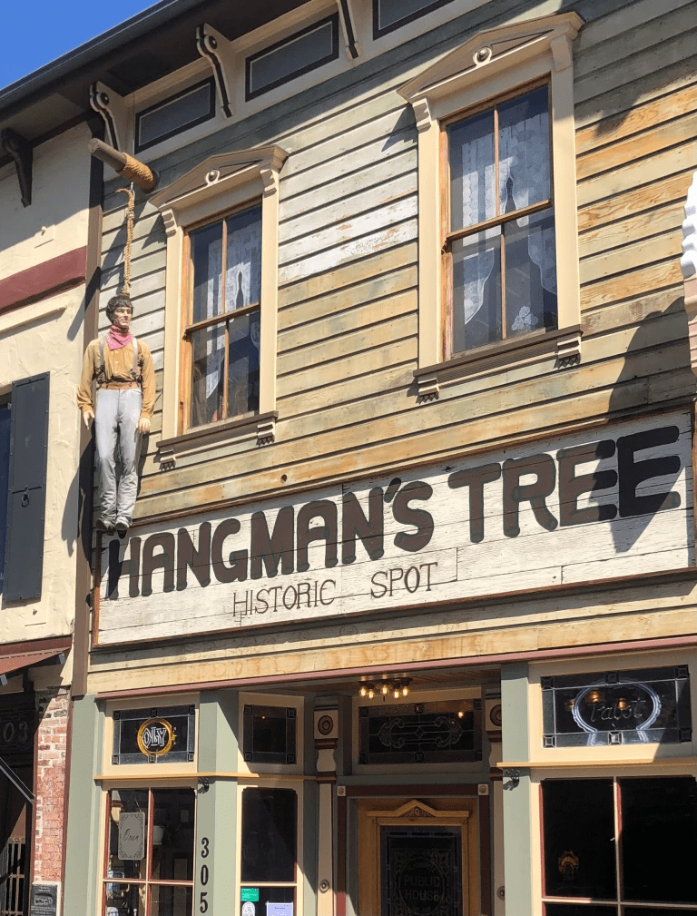
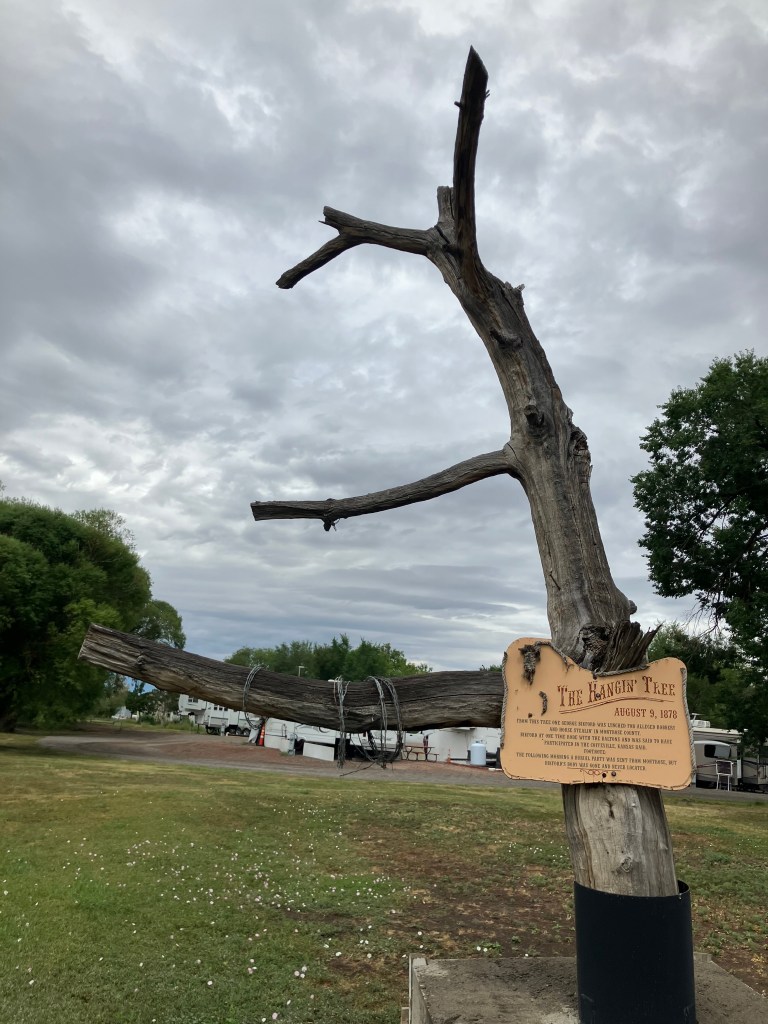
So it was auspicious that, just as I was getting close to Placerville, Colorado, I spotted this hangman’s tree in the town of Montrose:
According to the sign, George Bikford was hanged from this tree for robbery and “horse stealin'” in 1878.
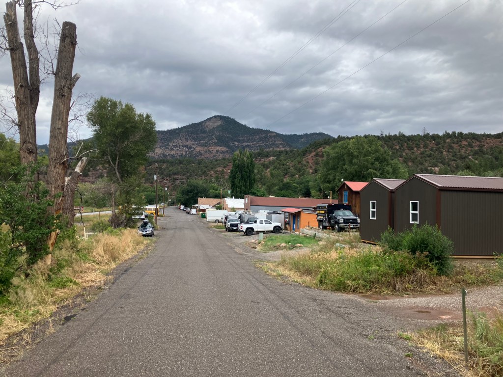
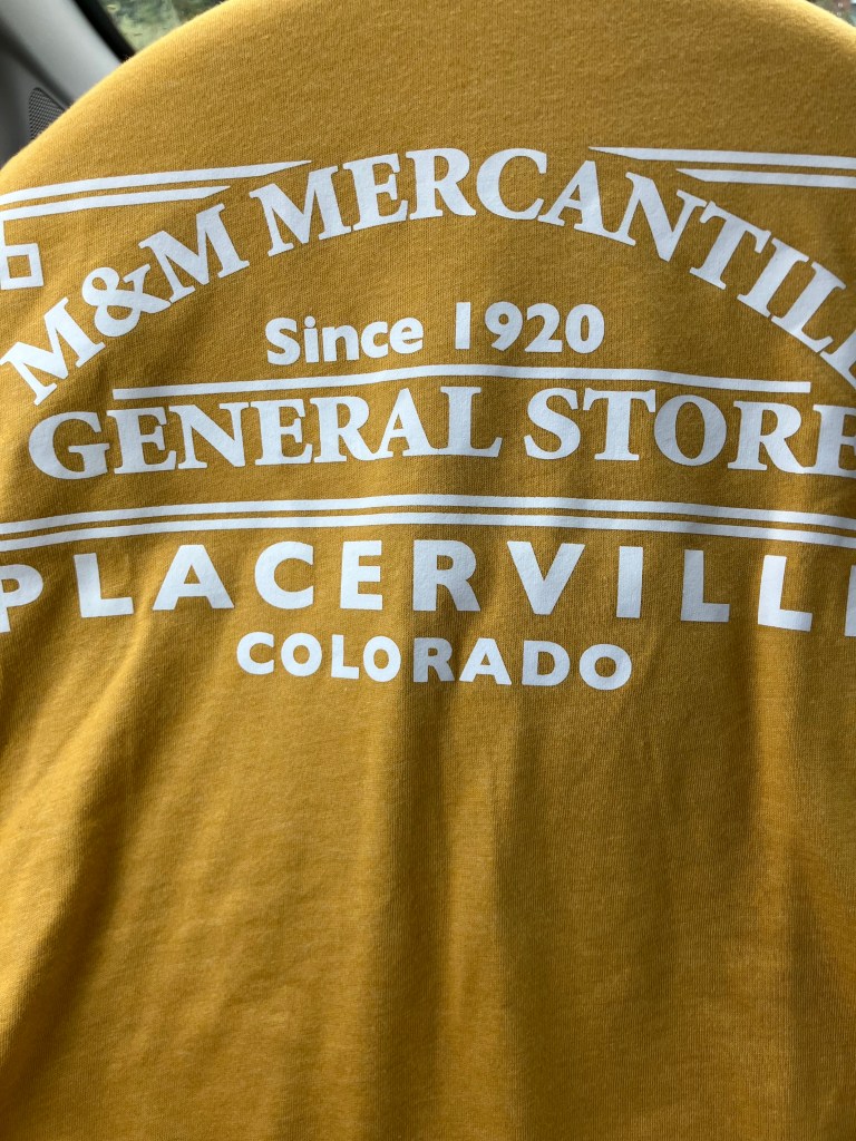
And so, with that preface, I finally came to the storied town of Placerville, Colorado. Let’s just say it wasn’t exactly El Dorado.
This is seriously about all there is to the town.
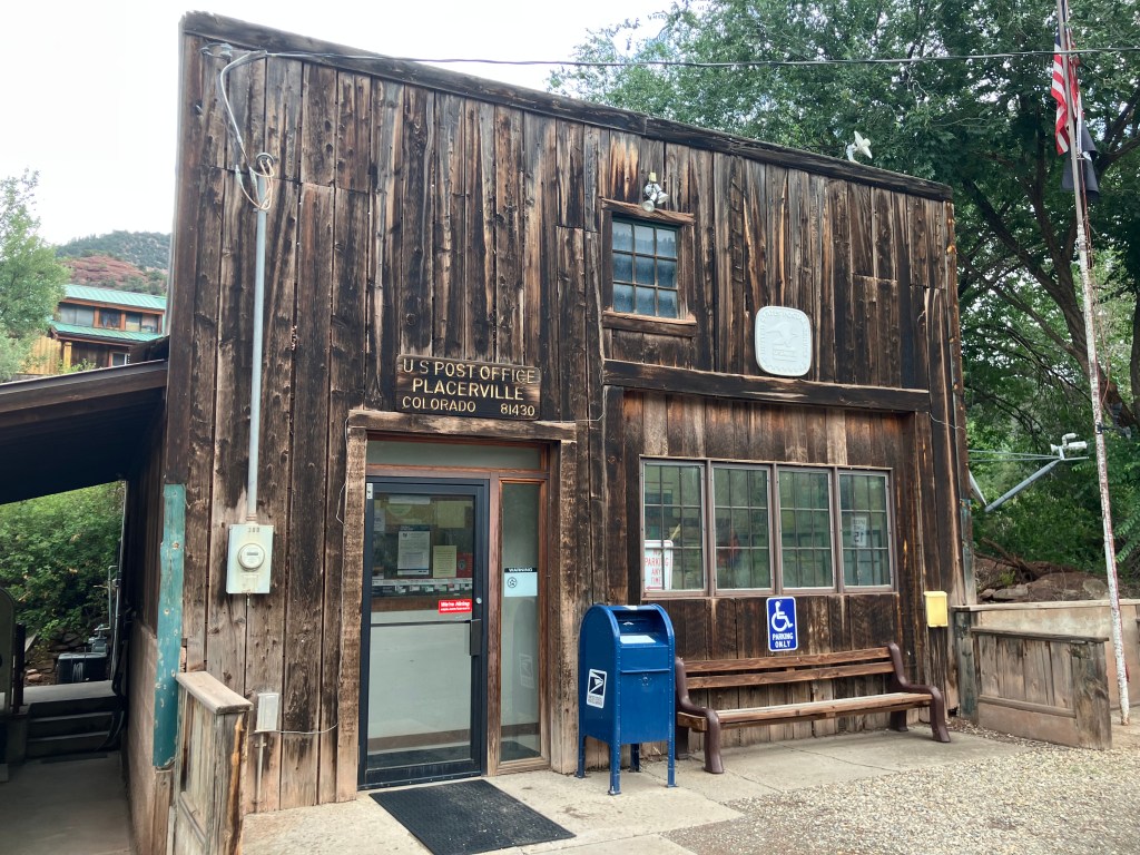
Pretty much all that makes up Placerville is a post office, a general store, a storage facility, and a few houses. In the 1800s it was a mining boom town, but as with many boom towns, the mines dried up and the population went elsewhere. Later, the failure of the local Trout Lake Dam in 1909 wiped out most of what remained.
But be that as it may, I think we can declare this mission a success.
And (shockingly) I was even able to purchase Placerville merch at the general store!
I was hoping for “My husband drove from Placerville to Placerville and all I got was this stupid T-shirt.”
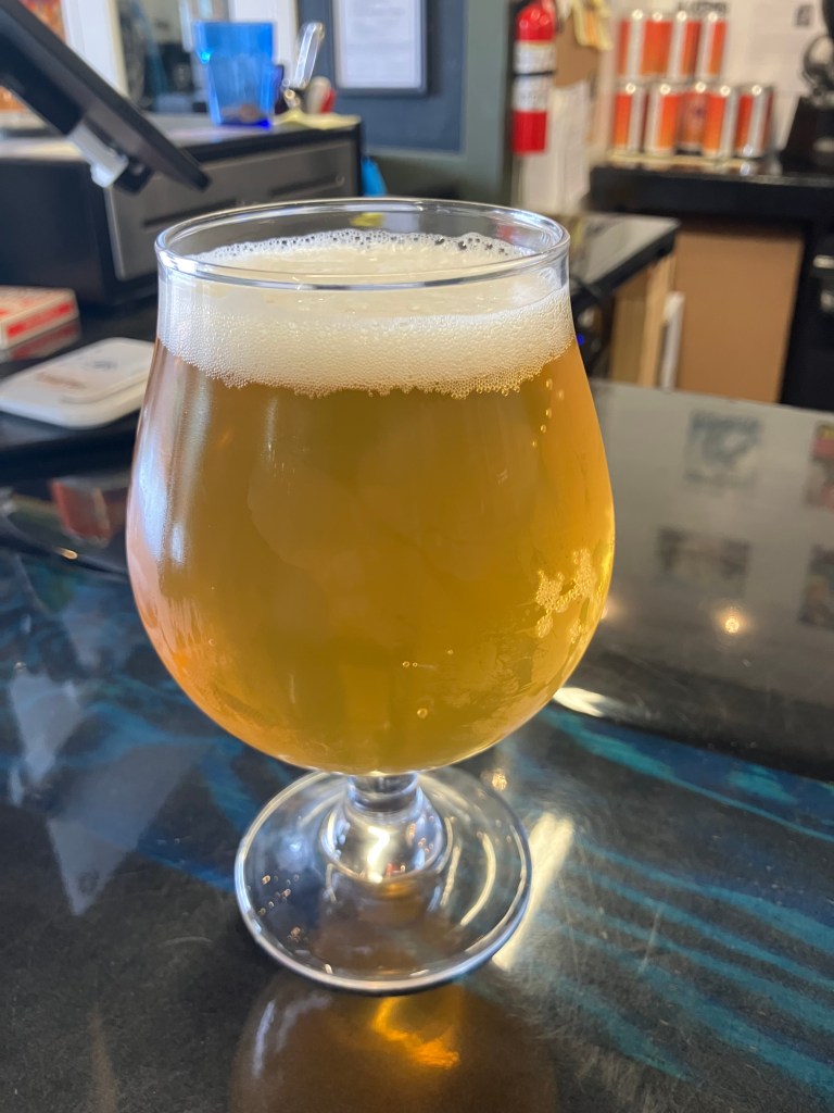
BREW OF THE DAY
We have a winner!
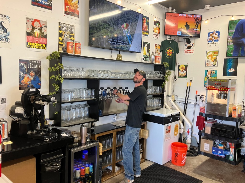
In the town of Ridgway, Colorado (pop: 1,300) I stopped in at the Floating Lotus Brewery. It’s a friendly, casual place with an airy atmosphere, two outdoor patios, a stage for live music, and a great view of the neighboring property where John Wayne filmed some scenes from True Grit. Owner/Brewmaster Kenny Conley hooked me up with his favorite beer: the Blastoplast IPA.
This was hands down the best beer I’ve had on this trip. Of course, that’s an admittedly low bar. But this is seriously a tasty brew. Unlike so many modern IPAs, this one is perfectly balanced. It’s not too hoppy, not to carbonated, not too pungent. At the same time, it’s flavorful and a bit “richer” than you’d expect from an IPA, without the astringent IPA afterburn you sometimes experience by the end of the glass. And at 6.3 percent ABV, I’d say the alcohol content is right where it should be. This is a five-star brew.
Kenny at his post. If you ever find yourself in Ridgway, or even in the vicinity of Telluride, pay him a visit!
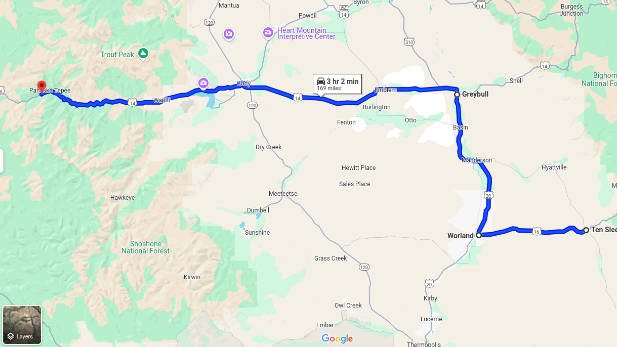
Today I drove the final stretch of Route 20’s original route, which terminates at the eastern entrance to Yellowstone. I left the lads in TenSleep this morning, and rejoined US 20 at Worland, Wyo. From there I headed north to Greybull, and then east to Yellowstone. The whole drive was about 170 miles…and then another 170 miles to get back to TenSleep!
Westward Ho.
It was a great day for a drive. The weather was perfect, and there was no traffic. It was just me and the open skies. This part of the country, with its solitude and natural beauty, is growing on me.
Idyllic drive.
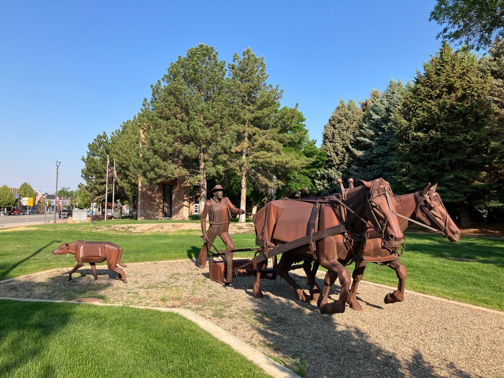
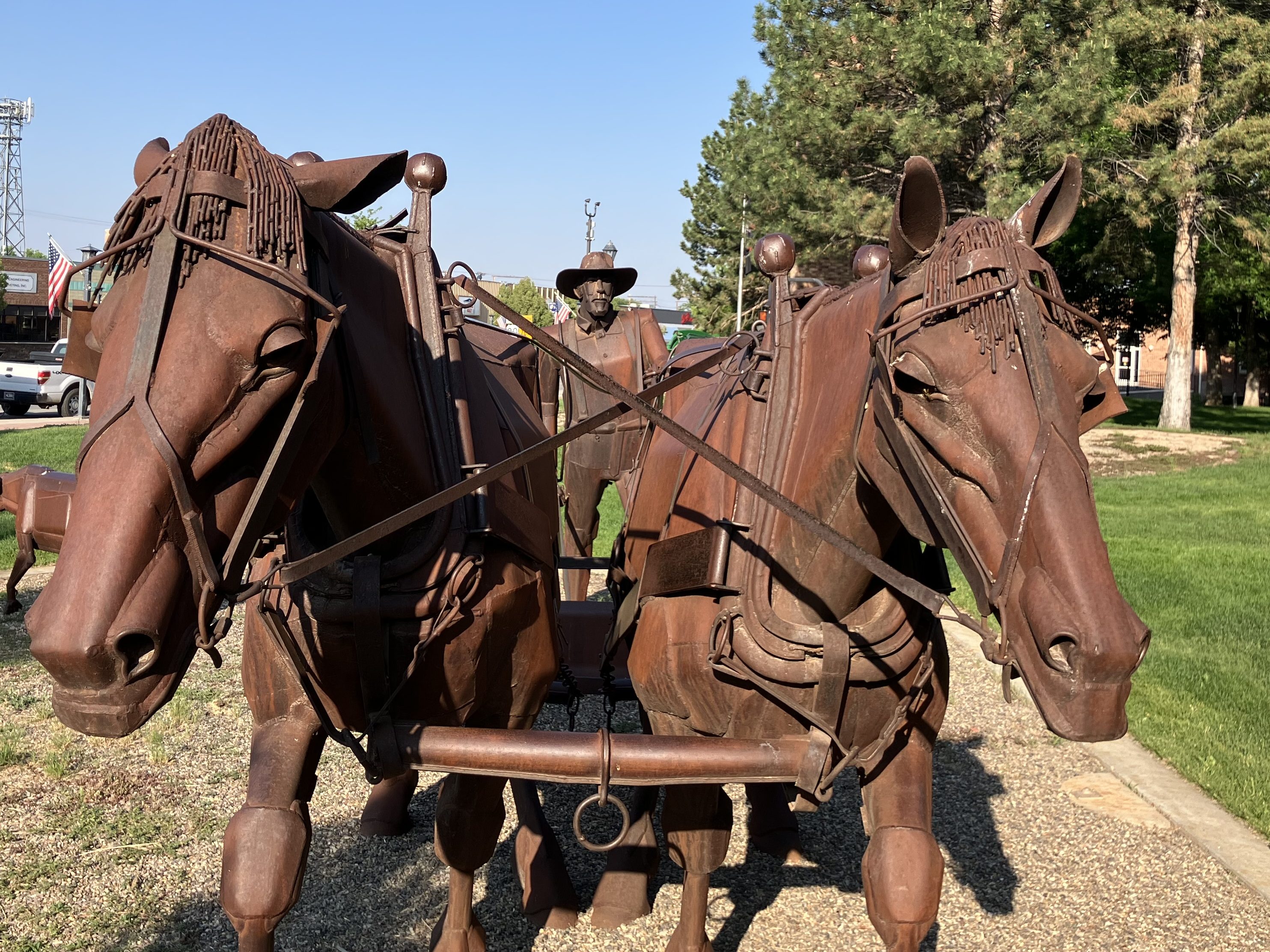
I picked up where I’d left off a couple of days ago at Worland (pop: 4,800). Worland is a tidy and practical town, where the good folks of TenSleep and other surrounding communities go when they need a supermarket or various specialty stores. It’s also a reasonably attractive community, with a number of western art installations like this one that commemorates the pioneers.
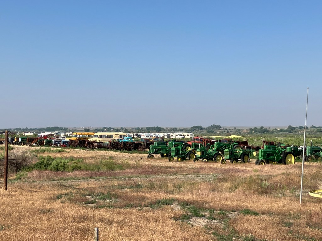
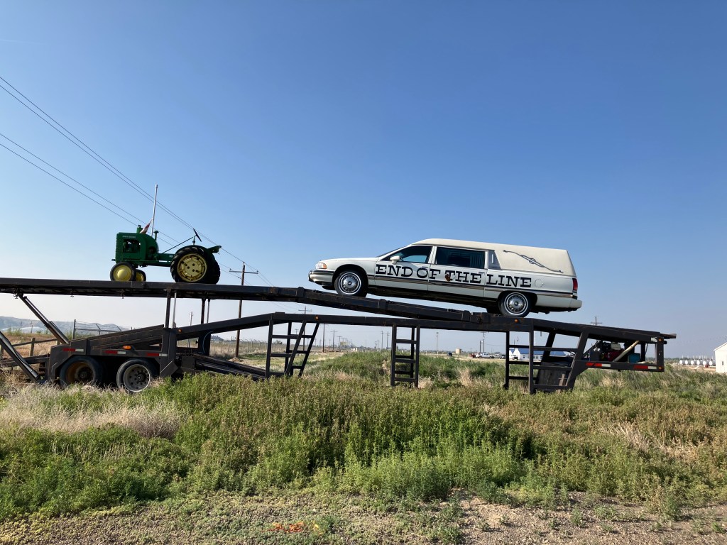
It felt good to be back on US 20 West, with the familiar white signs and the commodious US-standard lanes. Early in today’s trip I came to Manderson, Wyoming (pop: 3,900), where a veritable graveyard of old farm equipment and buses stretches along the side of the road. It’s evidently a vehicle recycling and/or consignment operation, where tractors go to die. The hearse at the edge of the property seems to drive home the point.
Just a small portion of their collection.
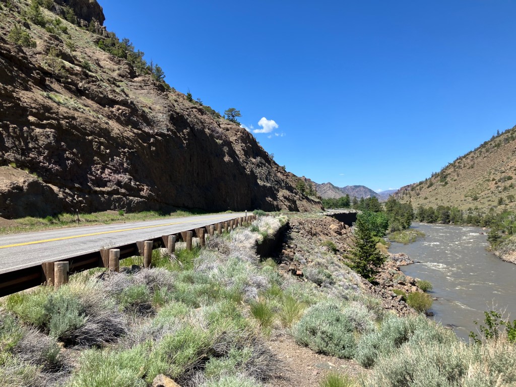
Once I was heading east out of Greybull, the endless prairie began to give way to the peaks and crags of the Bighorn and Owl Creek mountain ranges, and fast-flowing Shoshone River gorge. The passing scenes reminded me of the settings for a John Ford movie.
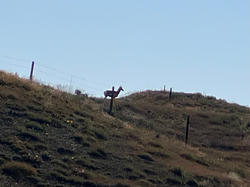
A speed goat keeps watch over US 20.
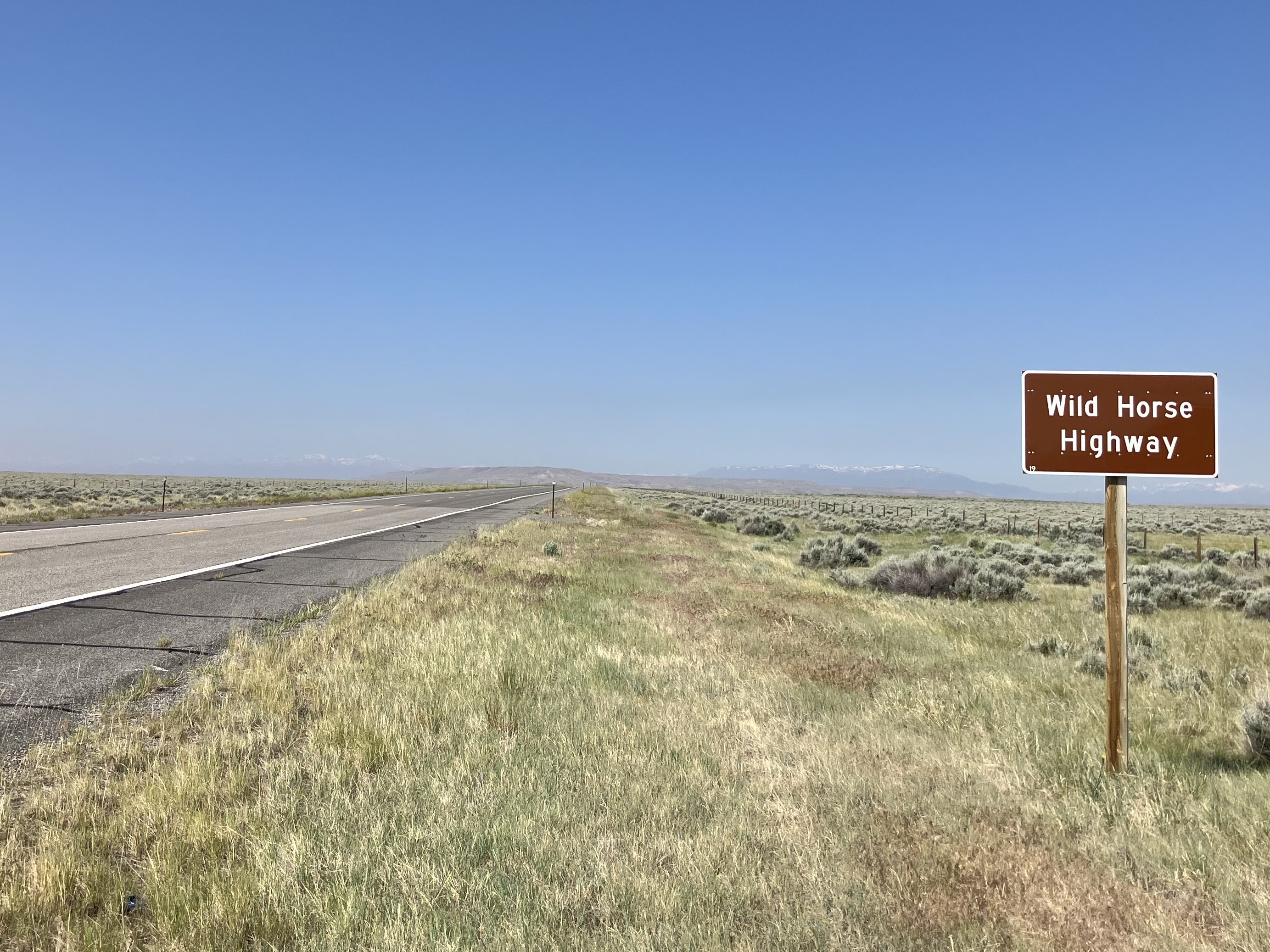
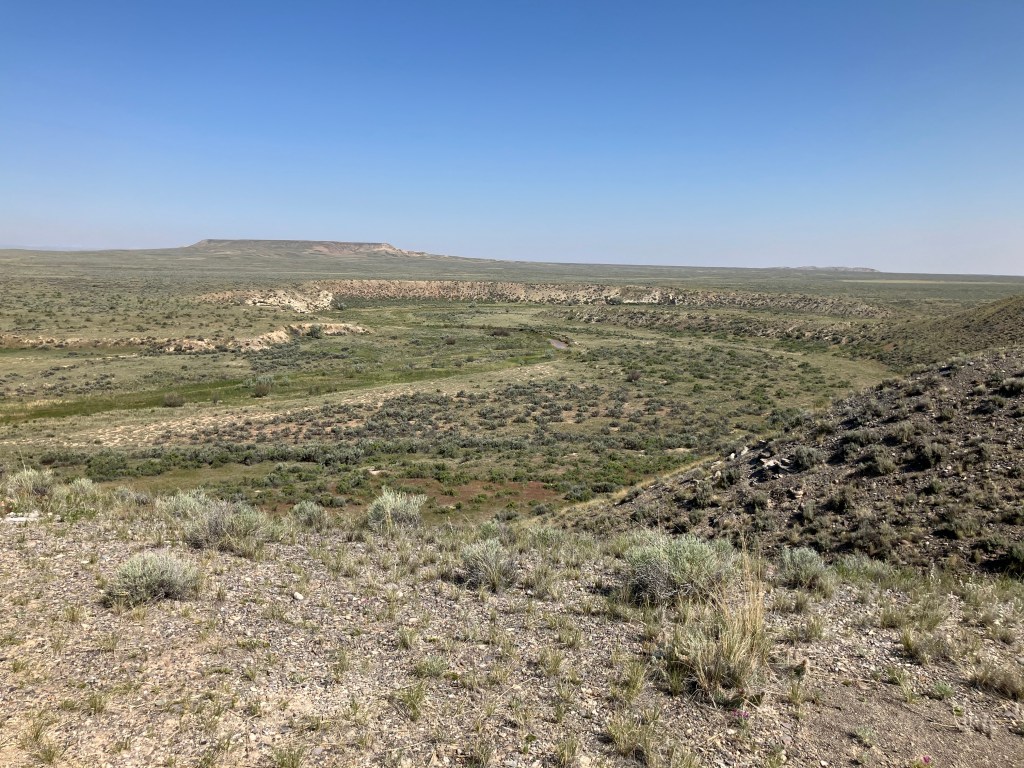
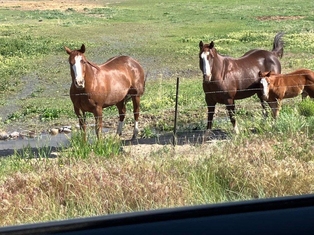
Even though most of US 20 is designated the Medal of Honor Highway, a segment east of Cody was designated the Wild Horse Highway just a few years ago. This segment borders BLM lands where a herd of about 100 wild mustangs still roam the McCullough Peaks range.
Horses are of course an iconic element of the West. They were brought to the Americas by Spanish missionaries and explorers several hundred years ago. Evidently a number of those horses escaped during the pueblo revolts, and descendants of those horses still roam the plains. In 1971 the US Congress passed the Wild Free-Roaming Horses and Burros Act, which provides for the protection of those horses.
Where the wild horses roam.
Horses along the Wild Horse Highway.
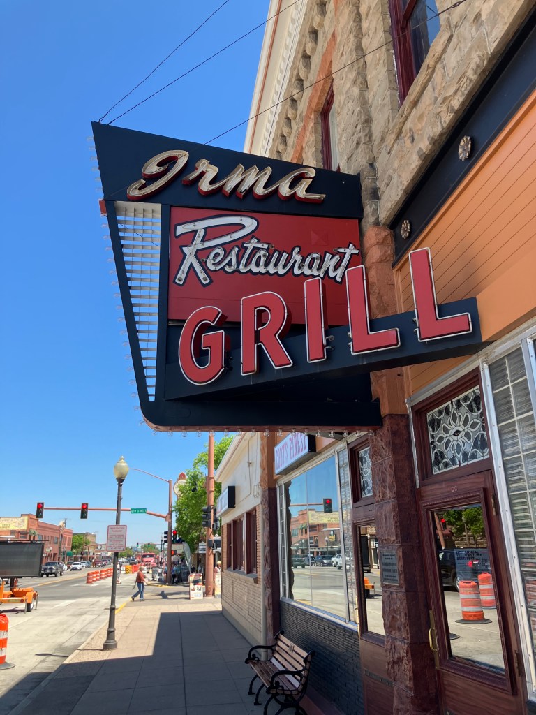
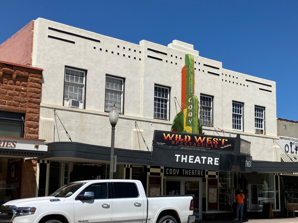
After the Wild Horse Highway I came to the “big city” of today’s trip. Cody, Wyo (pop: 10,250) is one of those larger-than-life towns that inevitably become tourist trips. “Buffalo” Bill Cody founded Cody City in 1895. It was intended as a resort community, near the Demaris mineral hot springs. It was also conveniently located near the eastern entrance to the recently-created Yellowstone National Park. However, just about a year after Buffalo Bill founded Cody City, someone named George Beck established a second city just to the west. It’s this second city that kind of swallowed up Cody City and grew up to be today’s Cody. Ever the entrepreneur, Buffalo Bill embraced the new city and opened a hotel (the Irma) in 1902 that still stands today.
Today’s Cody is a tourist town that leans into its history and western lore. There’s a major museum complex called the Buffalo Bill Center of the West. There are numerous businesses that claim to have authentic links to Buffalo Bill. And the 1936 Cody Theater currently hosts a live musical called the “Wild West Spectacular.”
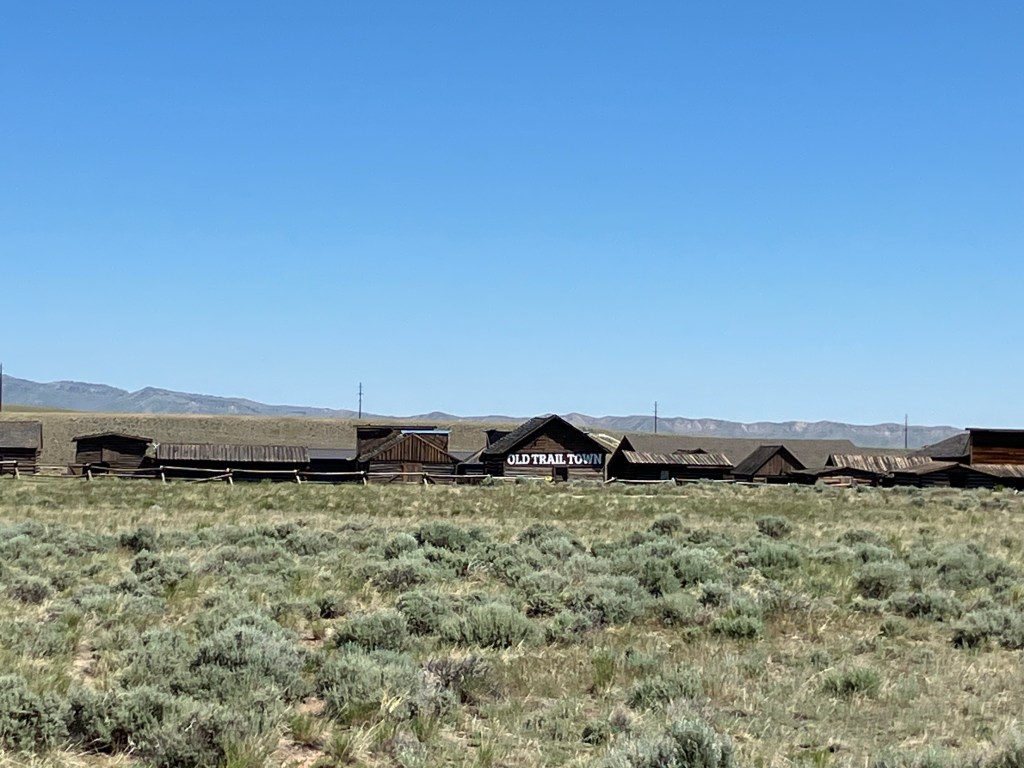
“Old Trail Town,” which purports to be a semi-authentic reconstruction of the original Cody City. It’s comprised of historic structures from across the region.
The Irma–built by Buffalo Bill and named after his daughter.
Active 1936 theater, showing live stage productions.
After getting my BOTD (more on this below), I left Cody and tackled the final segment of US 20. This stretch, which runs 27 miles from Cody westward to Yellowstone, is designated the Buffalo Bill Cody Scenic Byway.
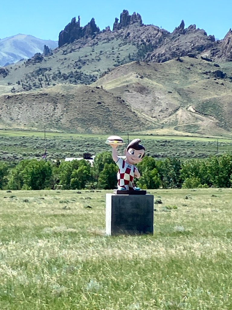
This Bob’s Big Boy in a field on the side of the Buffalo Bill Scenic Byway is completely unexplained.
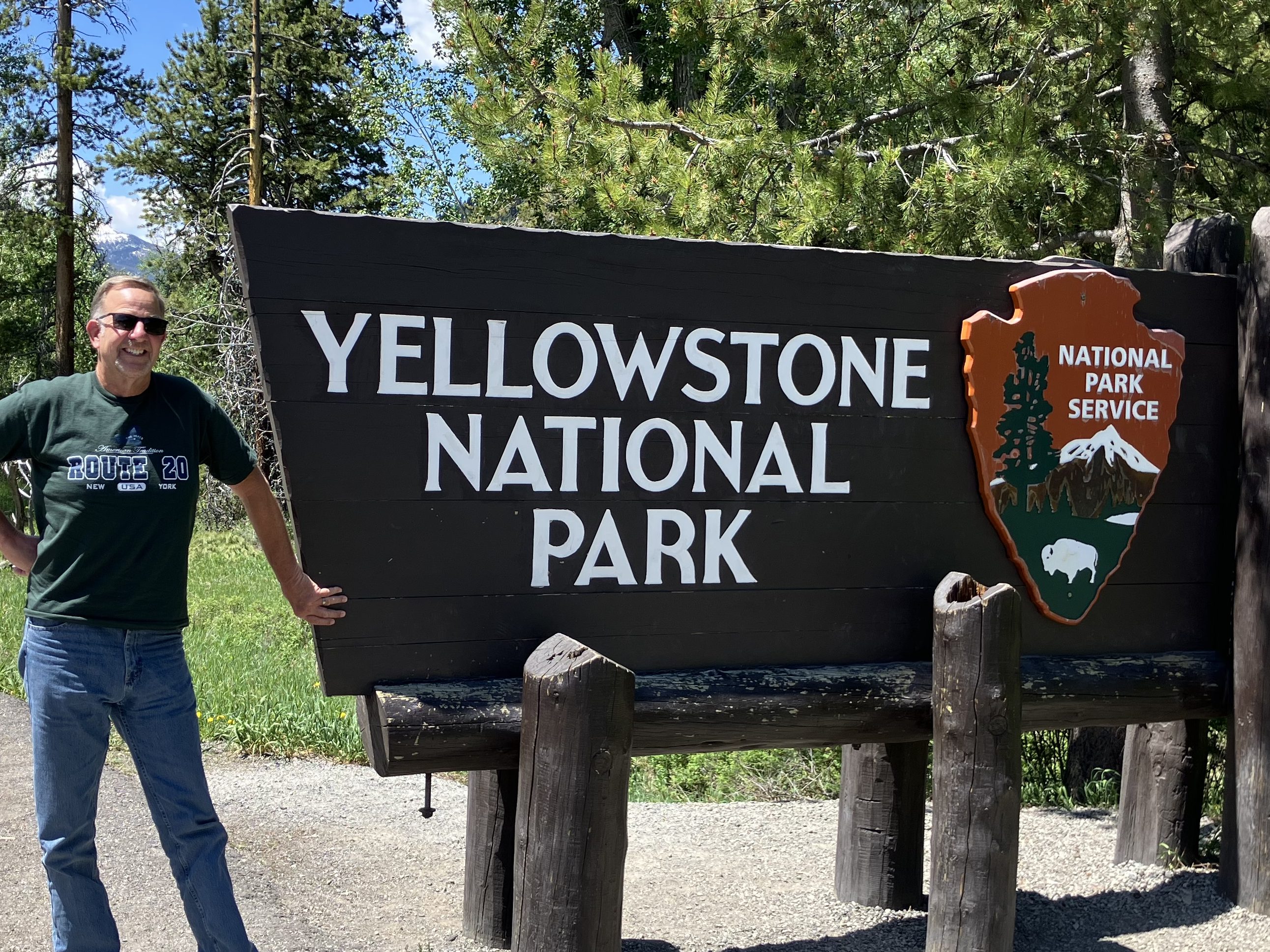
Finally, after about 2,500 miles and a dozen days of driving, I arrived at the end of (original) US 20!
My Route 20 shirt is courtesy of The Tepee near Cherry Valley, NY.
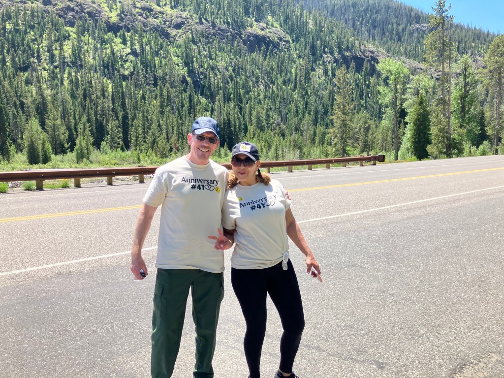
That Yellowstone photo comes courtesy of Harry and Xiomata, who were celebrating their 41st anniversary.
Happy Anniversary!
With the road trip complete, there are just a few items left to round out this blog post. Here we go:
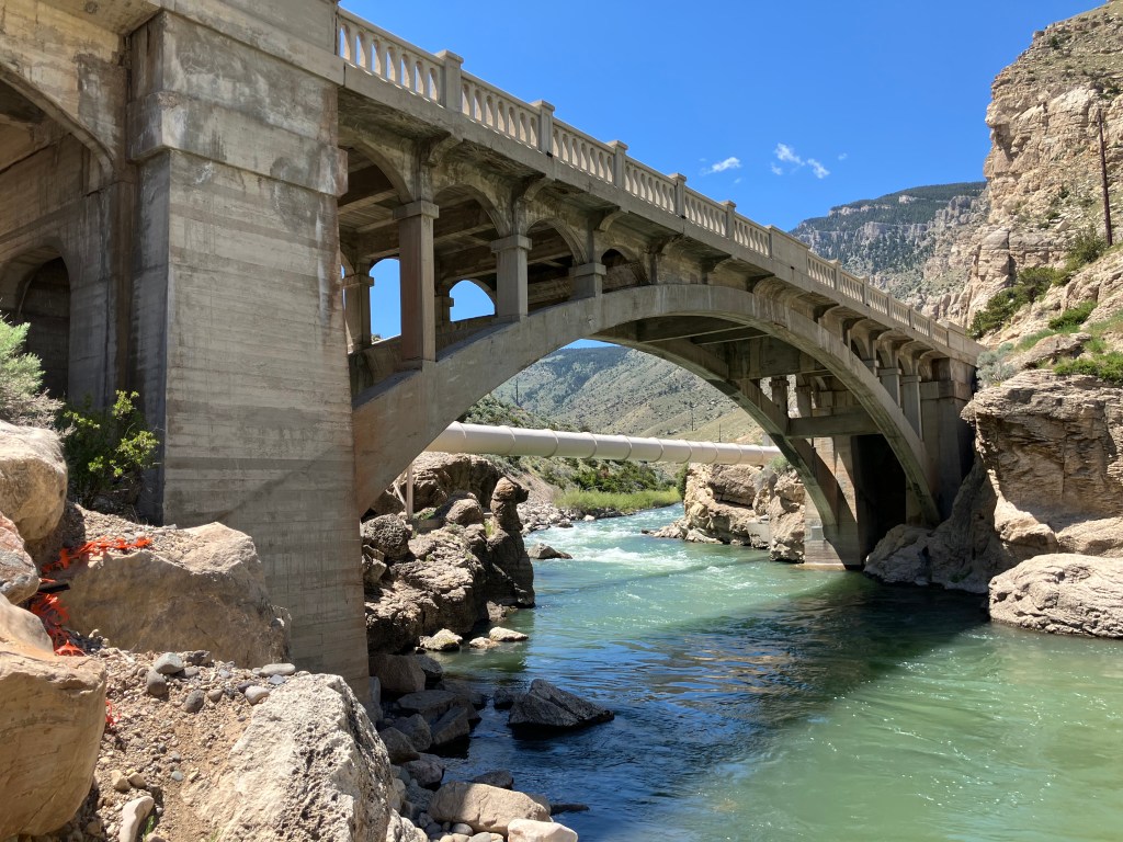
BRIDGE CORNER
Today I passed what I consider to be a picturesque, historic bridge that deserves mention. The century-old Hayden Arch Bridge crosses Shoshoni creek near just west of Cody. It’s billed as “Wyoming’s only medium span concrete arch vehicular bridge.” Alas, I arrived just a few days too early for a big celebration. According to a recently-posted notice, “The Cody Country Chamber of Commerce invites the public to a special centennial celebration marking 100 years of Hayden’s Arch, one of Wyoming’s most iconic bridges. The commemorative ceremony will take place Saturday, June 21, 2025, at 4:00 PM, at the historic Hayden Arch Bridge.” It’s not to late to plan your trip!
Wyoming’s iconic Hayden Arch Bridge turns 100!
BEER OF THE DAY
I wanted to do something special for the last BOTD for this trip, so I bellied up to the bar at the Hotel Irma, which Buffalo Bill himself had built in 1902. It’s named after his youngest daughter.
Sadly, I wasn’t able to secure a seat at the bar–there was considerable disagreement among the barflies as to whether “Jack” was going to return to the seat he had earlier vacated. And the wait staff and bartenders–all of whom seemed to have been holdovers from the days of Buffalo Bill–seemed irreparably confused. I left.
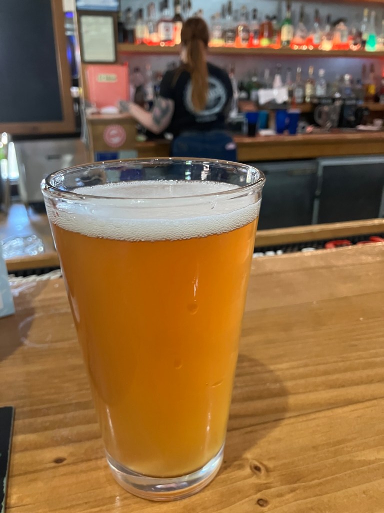
Instead I chose the considerably less historic Millstone Pizza Company and Brewery that sits just across the street from the Irma. On advice of Doogie Howser’s doppelganger who was working behind the bar, I had the Pineapple and Jalapeno Ale.
Doogie’s Fave.
Now, this was a reasonably well-made beer, with smooth body, good hoppiness, nice color, and a delicate foam head. The only thing this beer didn’t have was the taste of pineapple or jalapeno. Which would seem to be a problem for a beer billed as a pineapple/jalapeno beer. There was no sweetness and no heat whatsoever. When I brought this to Doogie’s attention, he kind of shrugged and said, “yeah, I’ve complained to the brewmaster about that myself.” (And yet he’d recommended it to me?!) He also hinted that the brewmaster used green peppers rather than jalapenos. Zero stars for false advertising. It’s a disappointing end to a good string of BOTDs.
DELETED SCENES
Finally, we end with a handful of photos from all along US 20 that largely speak for themselves. Is this a great country, or what?
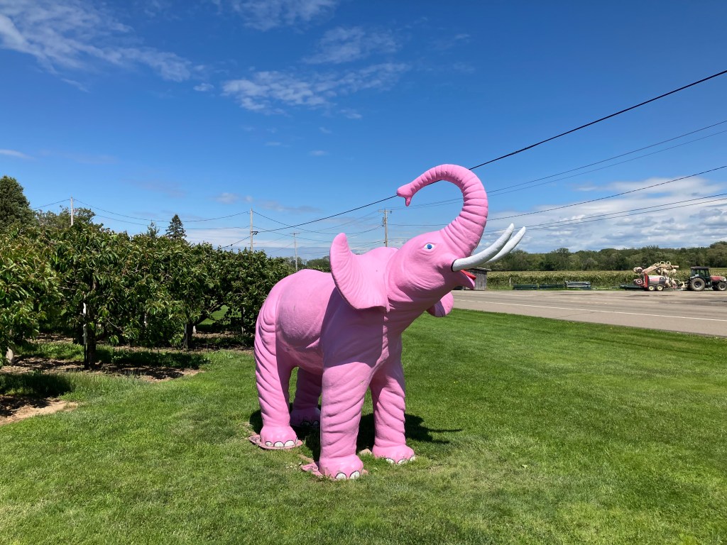
(The pink elephant has become a theme of my trips. For other sightings see here and here and here and here.)
You’ll recall that yesterday I filmed myself crossing the US’s longest covered bridge, and then ended the day in Geneva OH where I encountered the country’s shortest covered bridge. Loyal reader Detlef K. asked why I didn’t include footage of crossing the Geneva span. I can’t believe I didn’t think of that. So first thing this morning I returned to the Geneva bridge to correct my oversight. Here is the fruit of my labor:
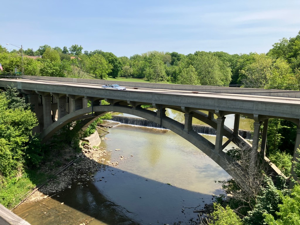
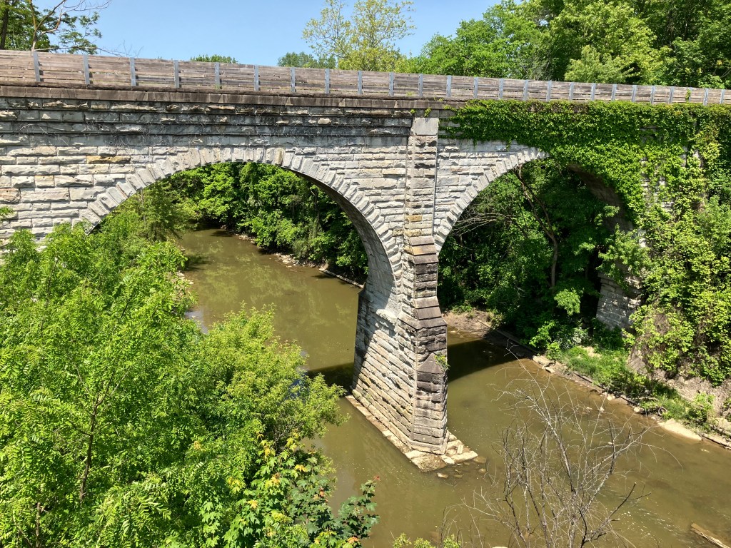
Today actually turned out to be a bridge-filled day. Take, for example, this bridge that carries US Route 20 traffic over the Vermillion River in Wakeman, OH. It was built in 1933, and I’m told it’s an “open-spandrel, concrete-arch” design.
I’m no engineer, but I can appreciate how graceful that arch design is. And the fact it’s been there for almost a century is certainly impressive.
I took the picture from atop a pedestrian/bike bridge, and got to wondering what that bridge looks like from the side. So I moved over to the Wakeman (US 20) bridge and took this picture of the pedestrian bridge:
Is that impressive, or what?? It turns out the pedestrian/bike path was placed atop an 1872 railroad bridge. Trains haven’t come through here in decades, so about a decade ago the “rails to trails” people retrofitted it.
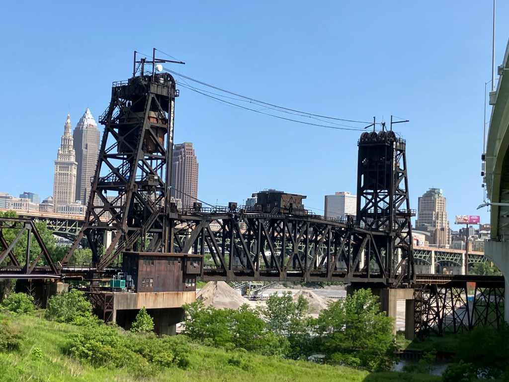
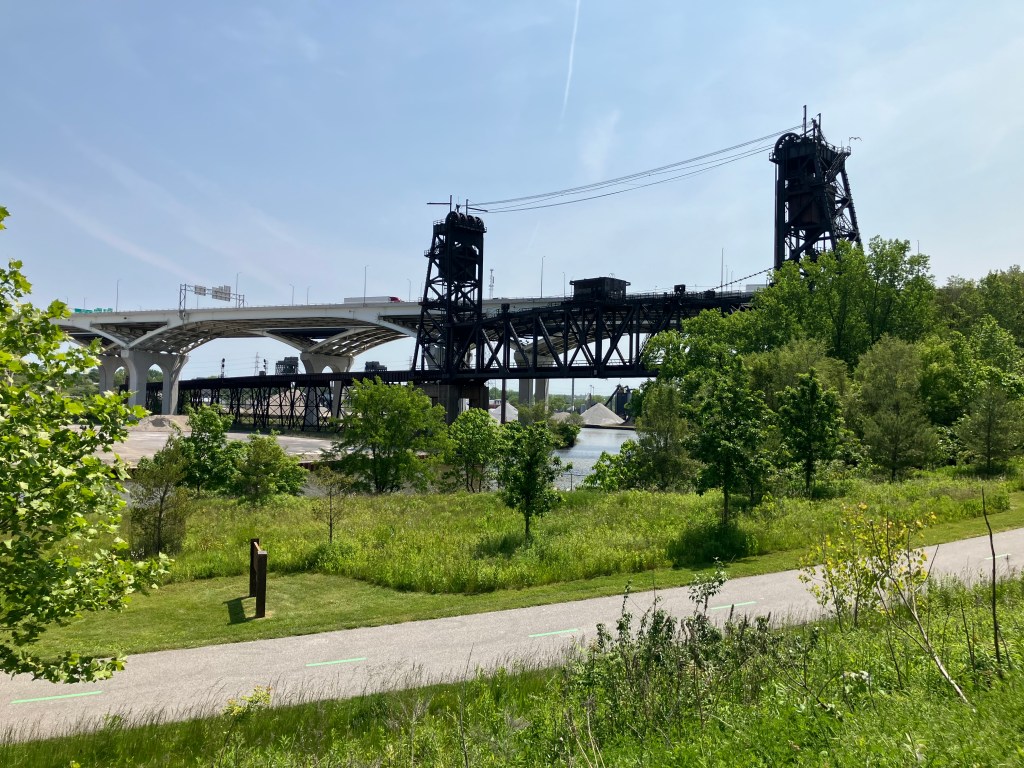
But then there’s Cleveland (pop: 363,000). US 20 cuts through the town on surface streets, and the experience of driving it is infinitely different from the peaceful cruise through innumerable small towns that I’d experienced the past few days. This morning’s drive through Cleveland was crowded, people were honking, blight was evident on both sides of the road. I did make a small detour to find the house that was used for the exterior shots of A Christmas Story (1983). But I got lost and found myself in a jungle of massive, looming bridges that cross the river at all angles. And that’s when the magic happened: I saw what makes Cleveland unique. I saw 200 years of history. Would it be going to far to say I saw its heart?
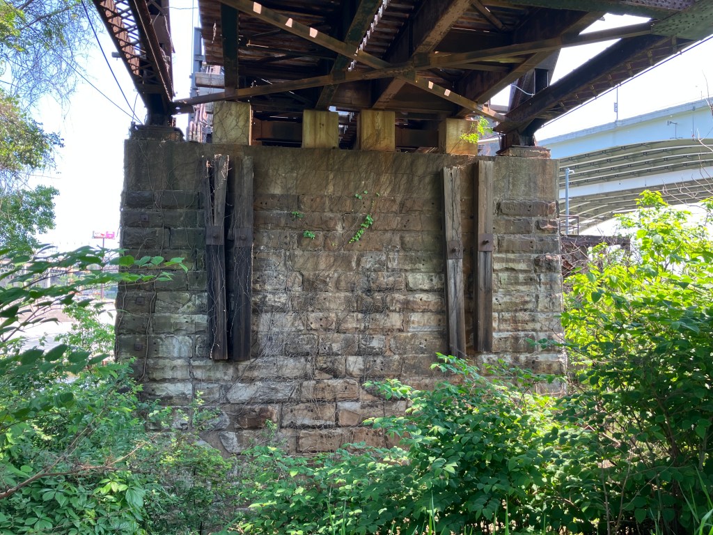
I took most of the following photos from a trail that was once the “towpath” along the Ohio and Erie Canal. Mules labored along these paths pulling boats and barges up the canal via ropes. The modern trail/historic towpath runs alongside the canal for about 100 miles. I walked less than a mile of this path, passing under and next to innumerable bridges–some still in service, and some decommissioned.
I was wondering if the rusty old Nickel Plate Road High Level Bridge was still operational, and suddenly a Norfolk Southern train clattered over it.
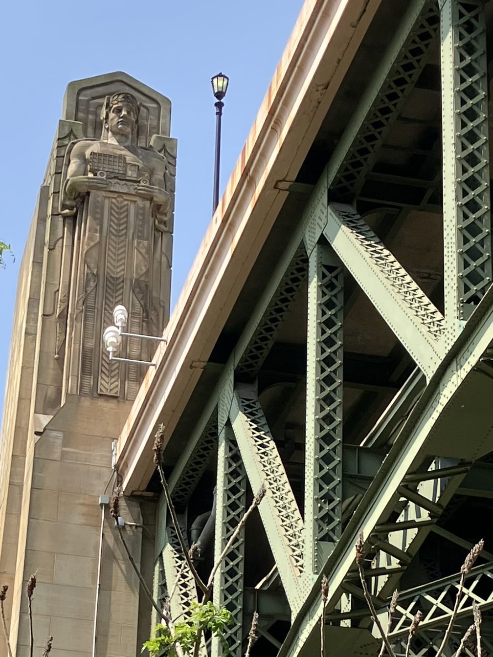
Detail of one of the eight “Guardians of Traffic” on the 1932 Hope Memorial Bridge. Note that he’s holding a truck.
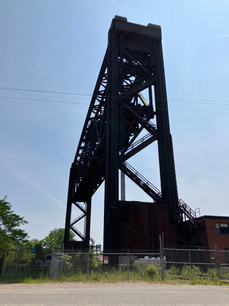
Railroad center-lift bridge, now decommissioned.
Want to see one of these types of bridges in operation? Here I am waiting in traffic for an automobile bridge to return to earth:
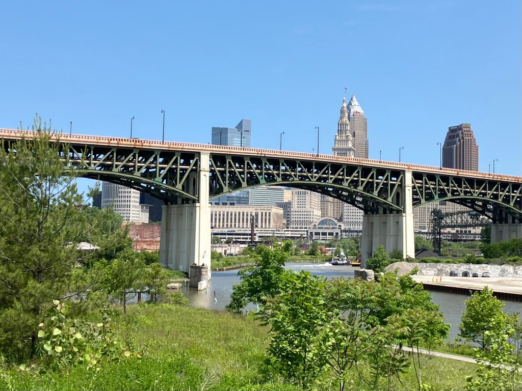
One of the modern spans. (Can one of my loyal readers identify it for me?)
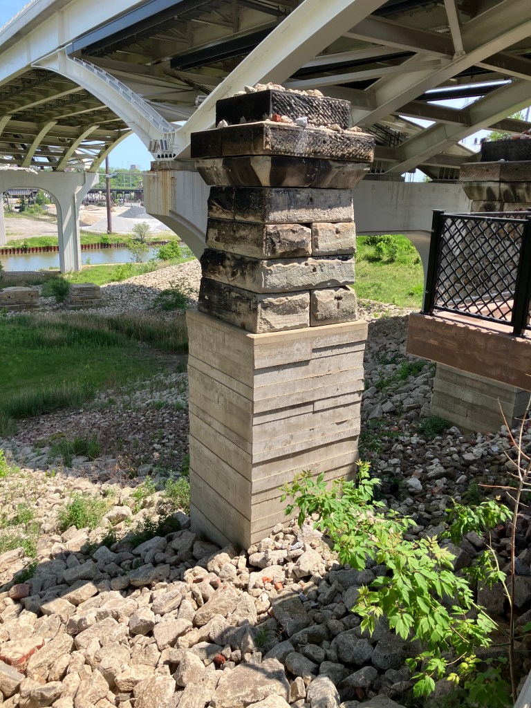
A remnant of the 1888 Central Viaduct.
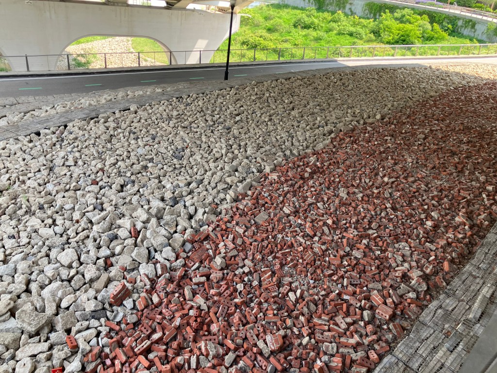
Rubble from the demolition of old bridges and associated structures, now used as ground cover next to the Towpath.
The modern towpath in foreground, with old and new bridges in background.
Evidently Cleveland has over 300 bridges, many of which cross the Cuyahoga River. I’m not going to make you view them all. But you’ve got to admire the engineering and the grit that went into building these over the past two centuries. And you also have to admire how modern Clevelanders somehow navigate daily through this confusing labyrinth.
We now move on to the non-bridge-related part of the day:
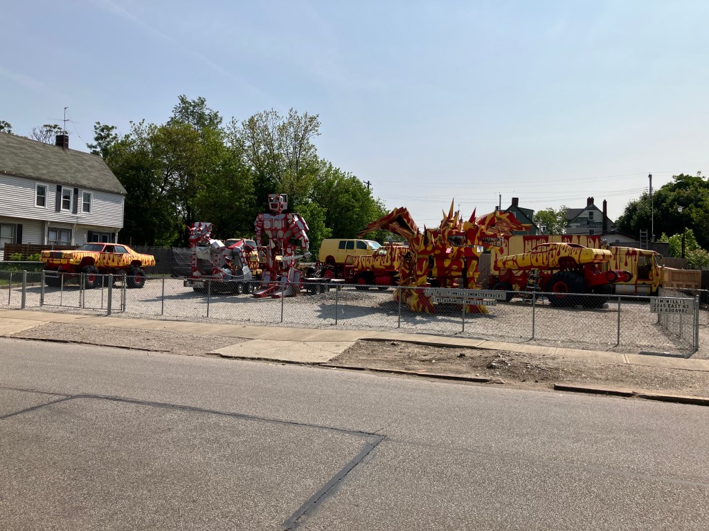
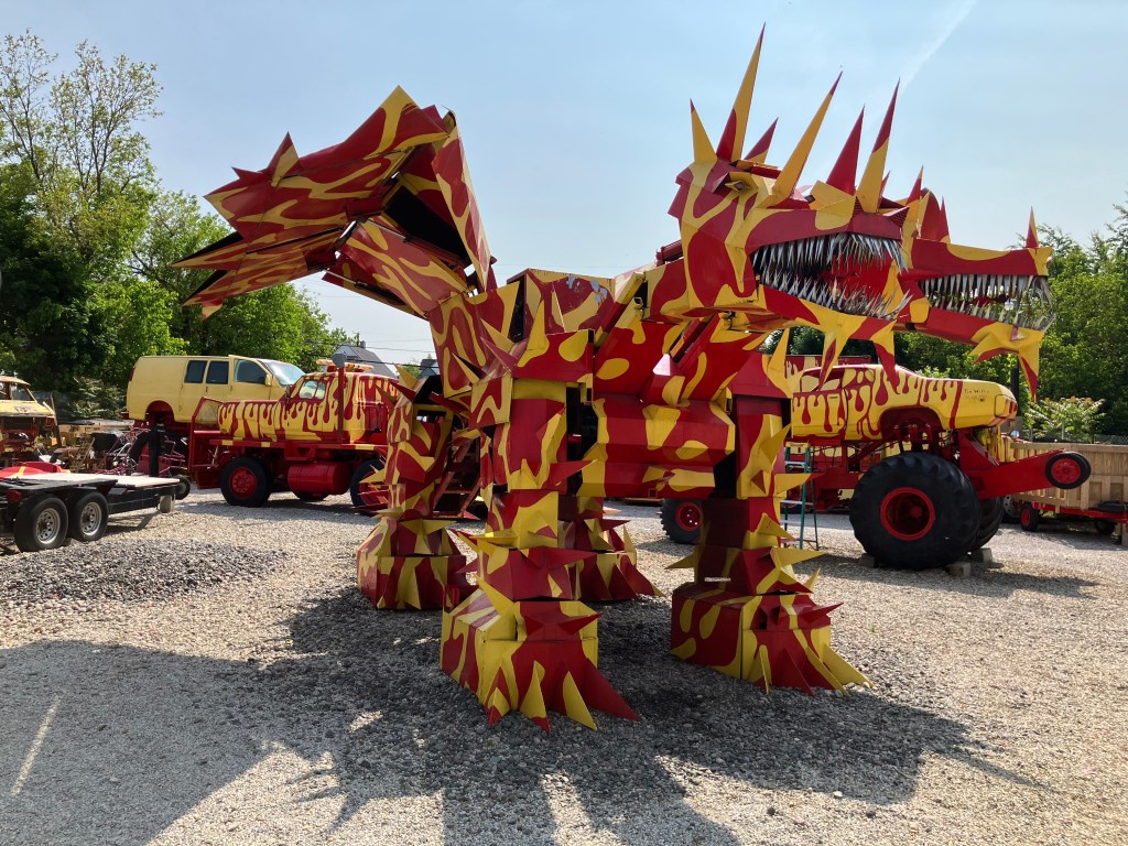
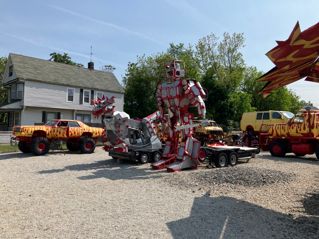
Here’s a different kind of engineering project, carried out by a high-school dropout who taught himself welding, electronics, power delivery, and a ton of other stuff:
Corporation yard from hell.
This is all on a lot on a residential street. Let’s look a little closer:
Jiang.
“More than meets the eye.”
It’s all the work of local artist Tim Willis. And those robots and dragons actually move with electric servos, and the trucks have powerful engines that presumably could get them into a monster truck show. My readers will recall that I have a soft spot for yard art; this is incredible. Spend a minute or two hearing from Tim himself:
Sadly, he wasn’t available when I dropped by.
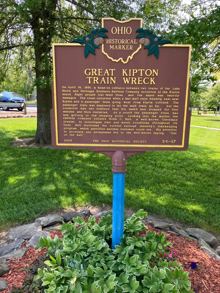
Next up was the town of Kipton, OH. A new reader named Bob suggested I check out the site of the “Great Kipton Train Wreck of 1891.” There’s a marker at the site explaining how a head-on railroad collision occurred because the watch of one of the conductors was four minutes slow. Leaving aside the issue of whether it’s wise to create railroad schedules that have two trains occupying the same space just minutes apart, this accident prompted the railroads to adopt strict standards for railway timepieces.
The marker sits in a park/bike trail that used to be the rail line where the accident occurred.
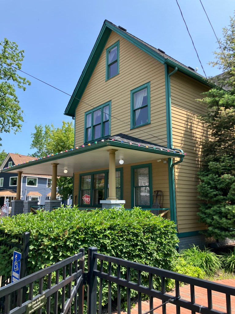
Finally, can anyone identify the building below? (You already had a hint.)
“You’ll shoot your eye out!”
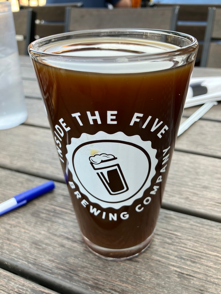
Beer of the Day
I nabbed my BOTD at the Inside the Five Brewing Company, just west of Toledo, Ohio. It’s owned by two retired NFL players: Chris Morris (Oakland Raiders) and Brandon Fields (Miami Dolphins). They both retired in the Toledo area, and started this brew pub in 2018. I’m told “Inside the Five” is reference to the last 5 yards of the gridiron. But it’s all Greek to me.
Anyway, the place is evidently very popular–it was packed when I got there on a Monday evening. They have a big space, with comfortable outdoor seating on a deck that overlooks the street. They also have friendly servers, and the weather was perfect. What better place to get the BOTD?
I had a pint of their Deimos, which is an American Porter. As we all know (after consulting Wikipedia), in Greek mythology Deimos was the son of Ares (god of war) and Aphrodite (goddess of love). Somehow he turned out to be the god of dread and terror. Should I be worried for ordering this beer?
Deimos is made by brewing a traditional Porter and adding local coffee and vanilla. Both of these tastes are prominent in the beer, though the vanilla is more prominent on the nose than on the palate. The mouthfeel is incredibly smooth. It’s very lightly carbonated, and has no foam to speak of. The ABV is 6.5 percent. The color is quite light for a porter–it’s the color of honey, or maybe the color of coffee when you use the Kuerig pod a second time.
Speaking of coffee: The coffee flavor is not particular roasty; instead it reminds me of Coffee Nips (TM) candy. There’s also a sweetness to this beer that is just this side of cloying. The beer seems to have no bitterness at all, with just the slightest evidence of hops on the finish. I’d say this is more of a dessert beer, that wears out its welcome as you move through a full pint of it. I’d give the first half 4.5 stars, and the second half 3 stars. I guess that means the overall score is 3.75.
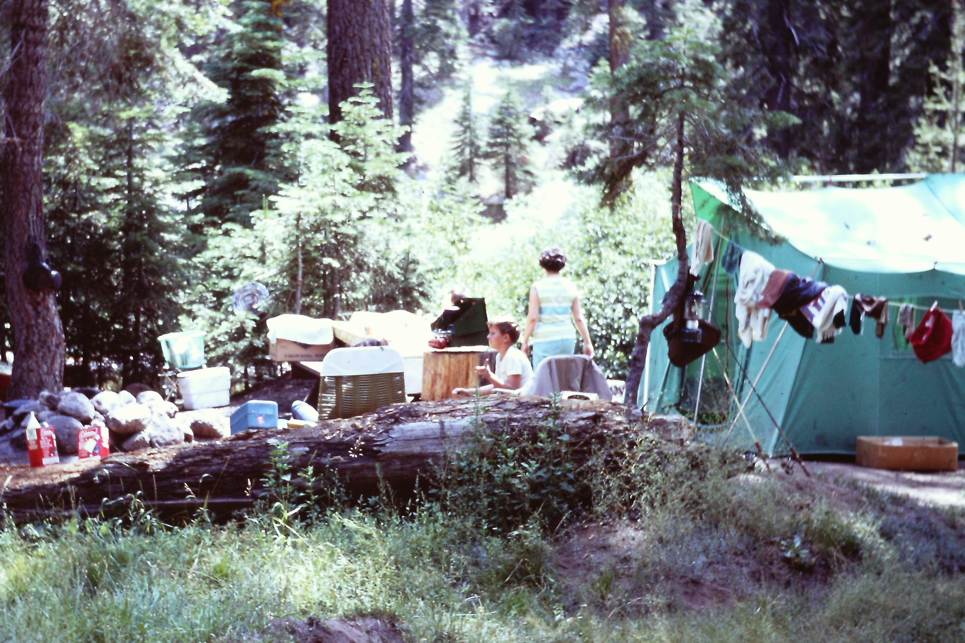
When I was a kid, my family would go camping each summer in California’s gold country. We’d hike to open mineshafts, visit countless museums featuring Gold Rush artifacts, and clamber around decaying miner’s cabins and rusty hydraulic mining equipment that had been abandoned in the foothills. My dad would collect antique square nails (a practice that we later learned was unlawful) and occasionally we’d try our hands panning for gold. My mom would stay back at the campsite, cooking meals, sweeping the tent, and wishing we soon would return to suburbia.
Not exactly glamping
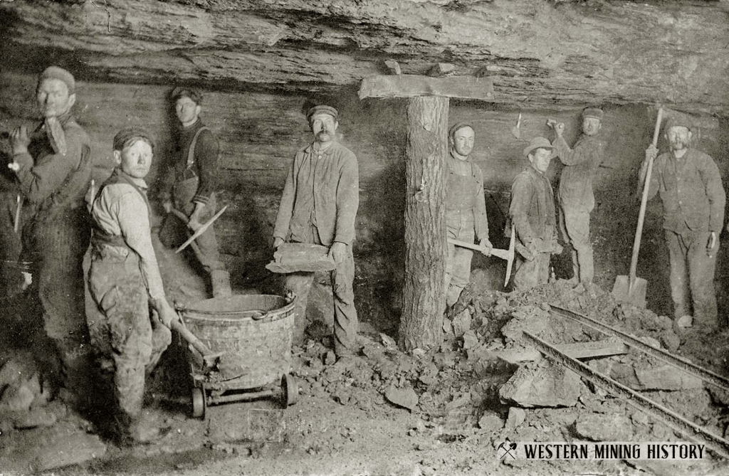
Even as a kid I was impressed by how these relics of the Gold Rush could be seen and touched out in the wild, even after more than a century. To a kid like me in the 1960s, the Gold Rush seemed like ancient history. And now it’s been another half-century since I was a kid! It’s hard for me to explain, but today, as I examined old stone buildings from the 1850s and hillside scars created in the 1860s, I felt a connection with a longer arc of history. The State of California was in its infancy then, and they didn’t call it the Wild West for nothing. We’ve come a long way since we routinely dumped cyanide and mercury into waterways, since we carved into hillsides with powerful water canons, since thousands of miners daily breathed toxic fumes and hundreds of them died in fires and cave-ins. That’s not to say we have no problems today; far from it. But clearly there’s been progress.
California’s Gold Country is a reminder both of how our civilization has changed, and how as humans we’re largely unchanged. There’s a persistent 49er spirit in those small towns that still dot the Mother Lode. You can sense the tenacity, patience, perseverance in your average Amadorian or Calaverasian. Take the owner of a coffee shop named Moke-A-Java in Mokelumne Hill. She told me she opened the place in 2019…just before Covid shut everything down. Somehow she managed to keep the business afloat with mail-order candy sales and catering. Today business is finally picking up, and she’s grateful. She’s a latter-day version of a patient prospector.
There’s also something very soul-soothing about the rolling, oak-covered hills in this part of the state. There’s plenty of space and natural beauty, and no one seems to be in a hurry. Take for example the owner of the B&B where I stayed in San Andreas. He sat in conversation with me through the three-course breakfast he’d cooked for me, then spent half an hour showing me his workshop and his Harley. It was as though nothing mattered more to him than visiting with his guests. You can be sure I’ll be back.
About 10 am I got back on Highway 49 and fired up the driving app I’d purchased specifically for this trip. The idea was to have a knowledgeable guide direct me through a handful of small towns from Angels Camp to Jamestown. While the concept of the guide was a good one, I found it to be a bit clunky and fussy. And not only was the app awkward to navigate (a process which is admittedly complicated on a motorcycle), but the interstitial diary readings by overly-enthusiastic community-theater actors were not my cup of tea. So the app was quickly bagged.
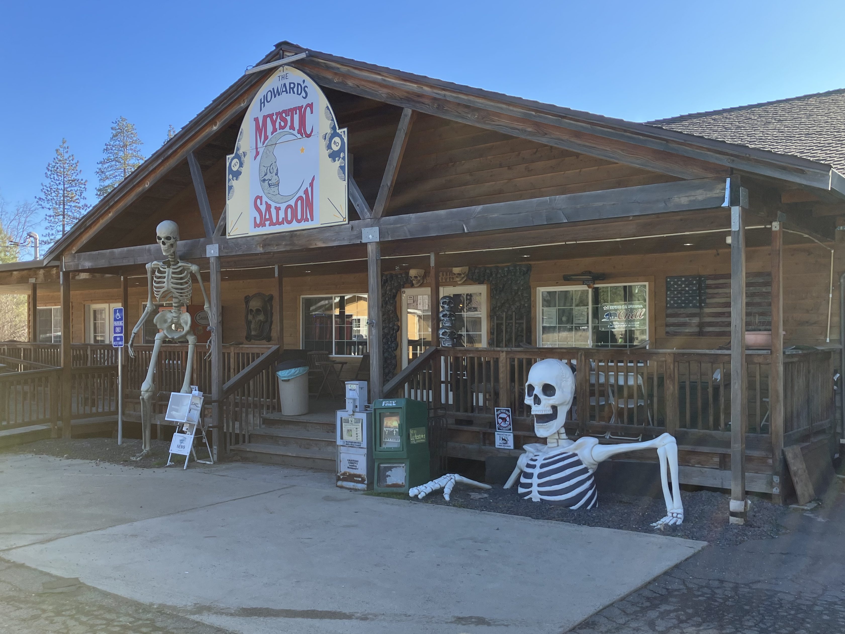
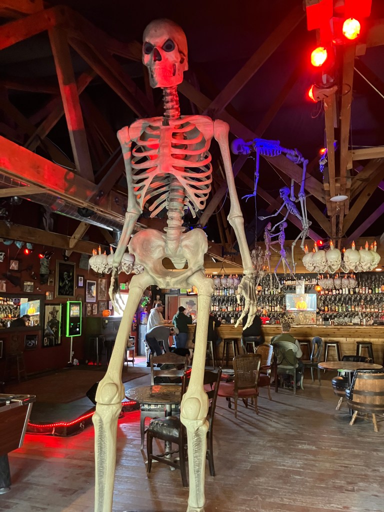
I did learn from the app that Calaveras County gets its name from the Spanish word for “skulls,” a quantity of which were discovered by early explorers along local riverbanks. And at almost the moment I learned that fact my eyes beheld this:
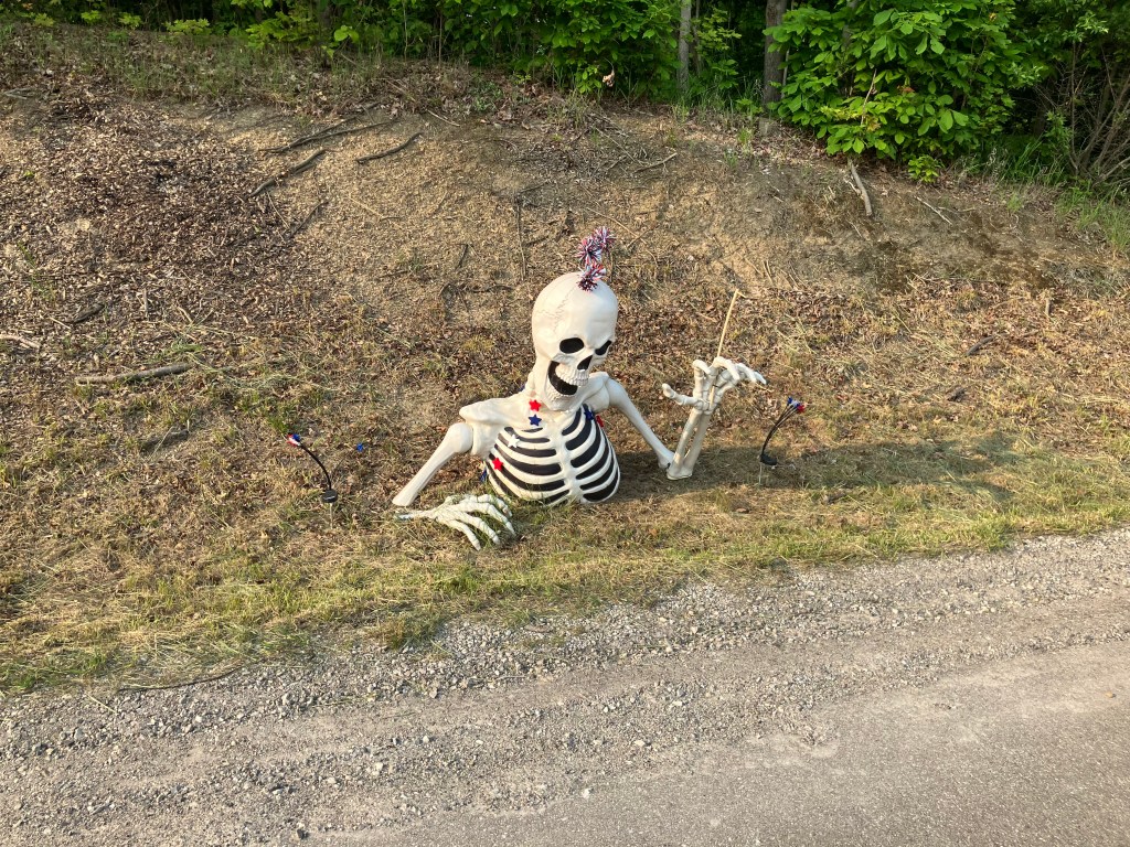
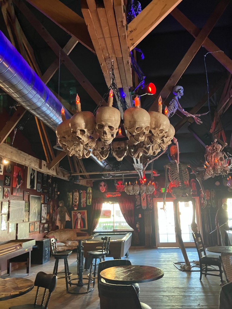
Walking into Howard’s Mystic Saloon is like entering an ossuary. You’re greeted by a giant skeleton standing just inside the door, and as your eyes adjust to the darkness you notice that all the chandeliers are decorated with skulls and bones. More skeletons hang from the ceiling, and the entire wall behind the wall is covered with black skulls.
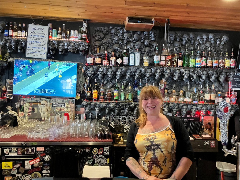
I asked the bartender, Ivory, for the story, and she told me the skulls are not meant as a reference to Calaveras County. In fact, the owners (Curtis and Tana Howard) own another skeleton-themed bar in Oakland. At this point a jovial man with a beard and a cowboy hat sitting at the end of the bar said “This place is tame compared to their Oakland place!”
Ebony and Ivory
True to my theory about folks in the Gold Country, and despite being surrounded by skeletons, I found this to be one of the friendliest places I’ve been to in years. I chatted with the locals at the bar for the better part of an hour while nursing my hot apple cider. I had eschewed a higher-octane drink because I’d already had my beer of the day earlier in Murphys.
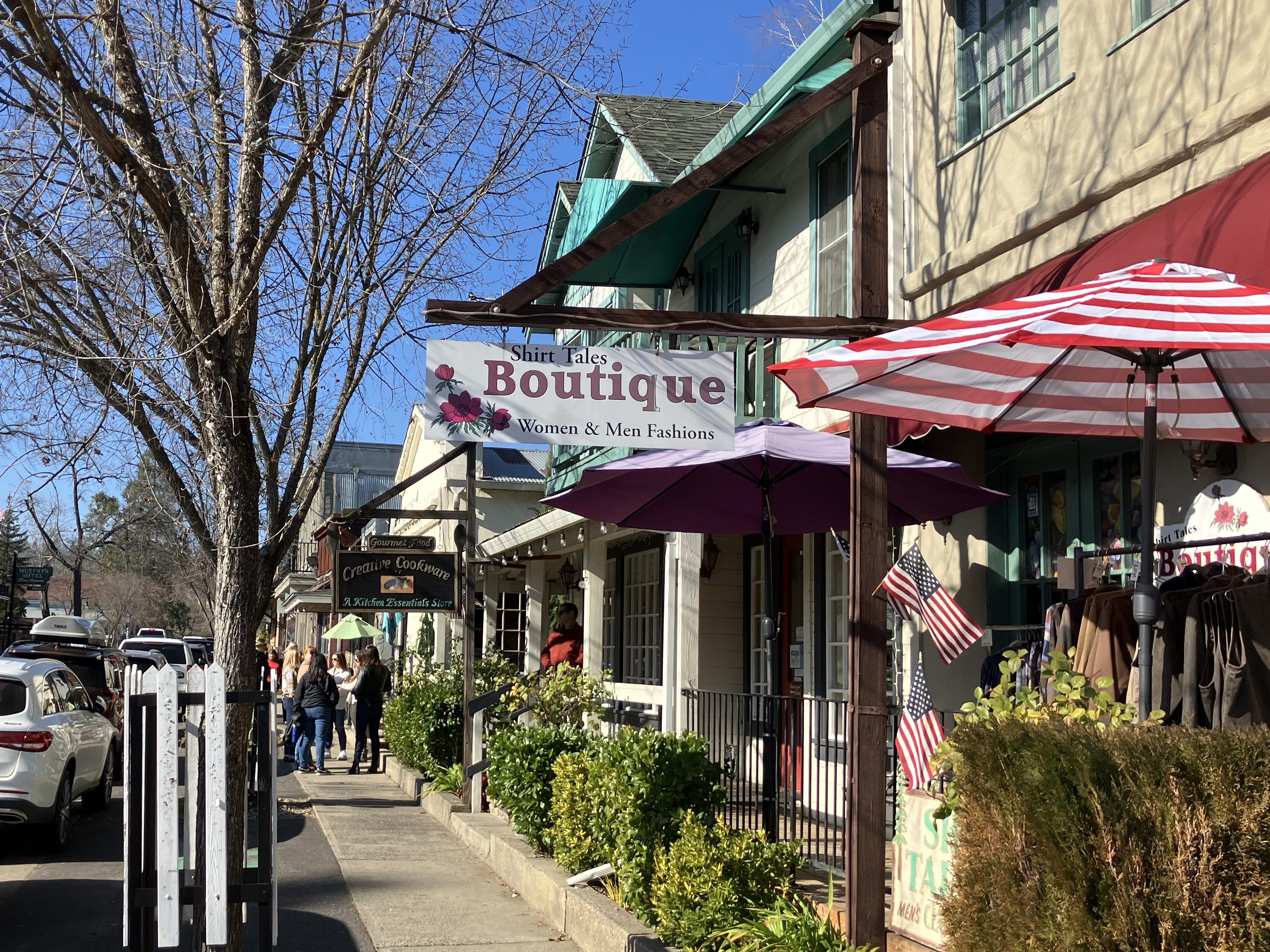
We’ll get to the BOTD shortly, but Murphys (pop: 2,000) was the one stop that didn’t feel authentic to me. At some point they went all-in as a wine tasting destination. According to Wikipedia, Main Street has at least two dozen wine tasting establishments. In between are boutique-y places selling scented candles, panini presses, and other appurtenances that a miner would never recognize.
An example of Murphy’s Law
Murphys is evidently quite prosperous, and I don’t knock their business model. But this is not the Gold Country experience I was looking for.
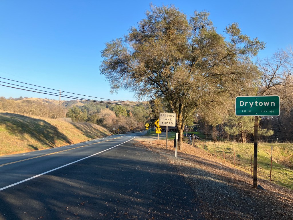
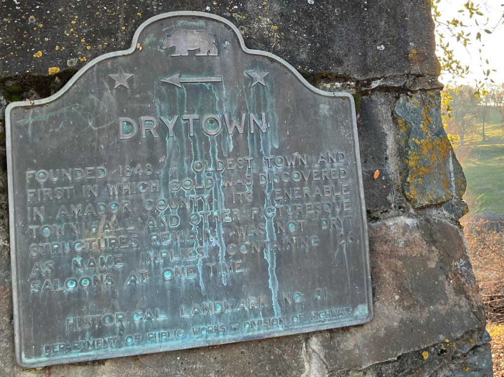
More authentic are places like Drytown (pop: 186).
During the Gold Rush it was home to some 10,000 souls, and despite the name, it also had 26 saloons. (The name refers to a dry creek.) It burned down in 1857, and never really recovered. But there’s a roadside marker and occasional artifacts among the rolling hills and oak trees.
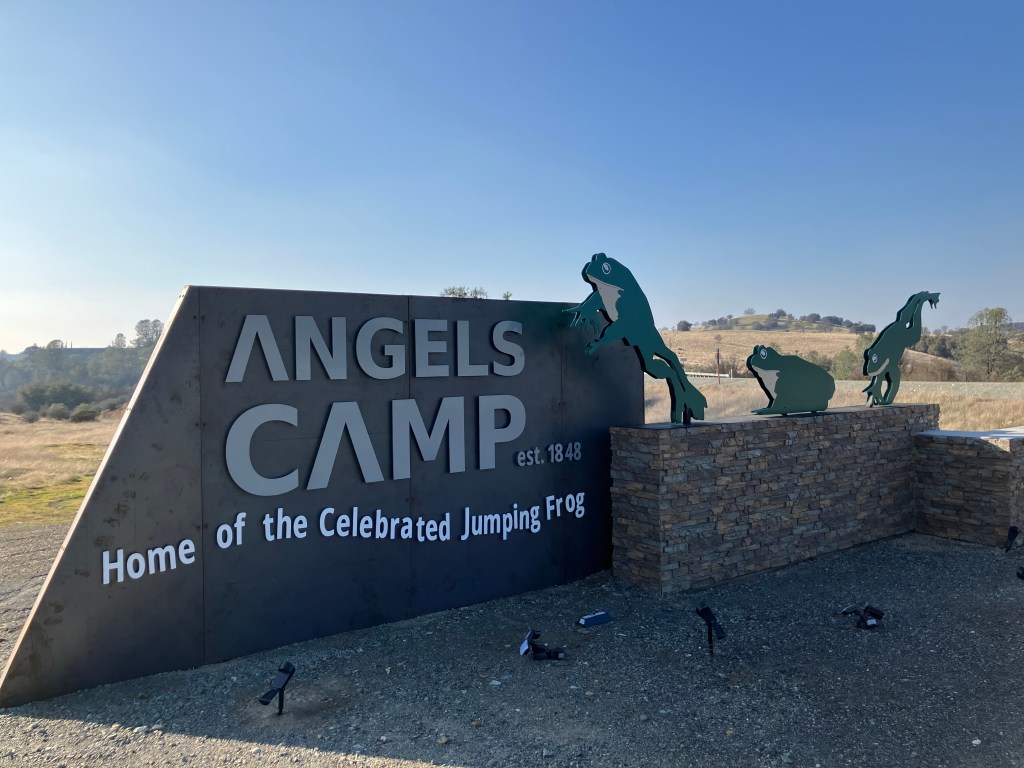
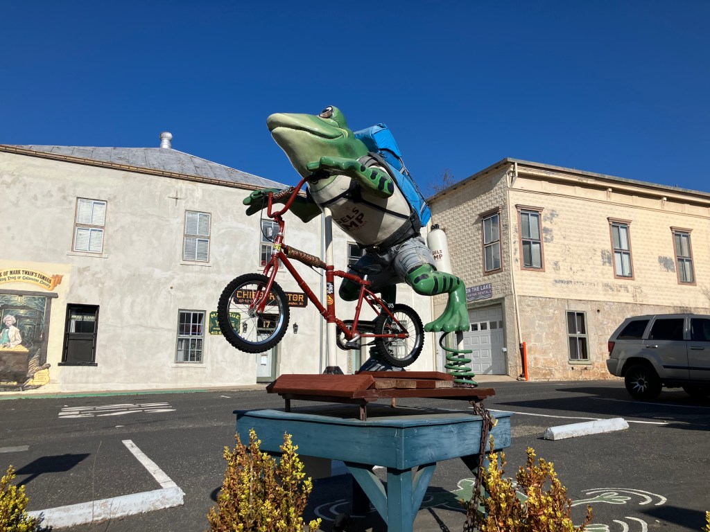
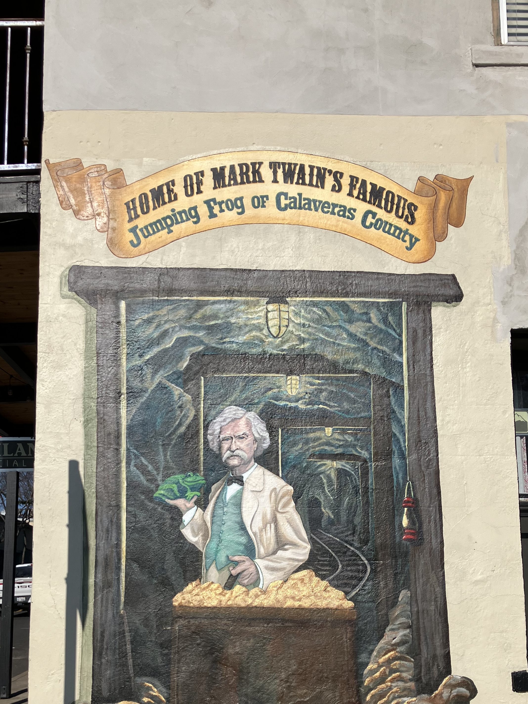
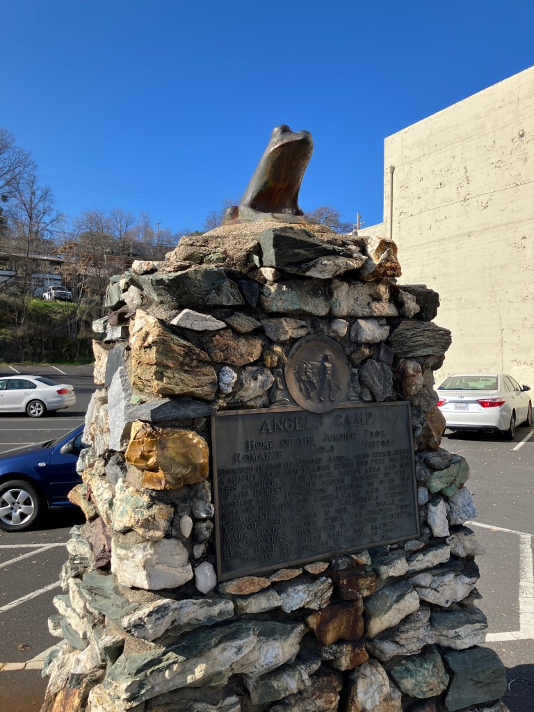
I also appreciate how Angels Camp (pop: 3,700 and the only incorporated city in Calaveras County) has leveraged its purported role in Mark Twain’s story “The Celebrated Jumping Frog of Calaveras County.” The little buggers are everywhere!
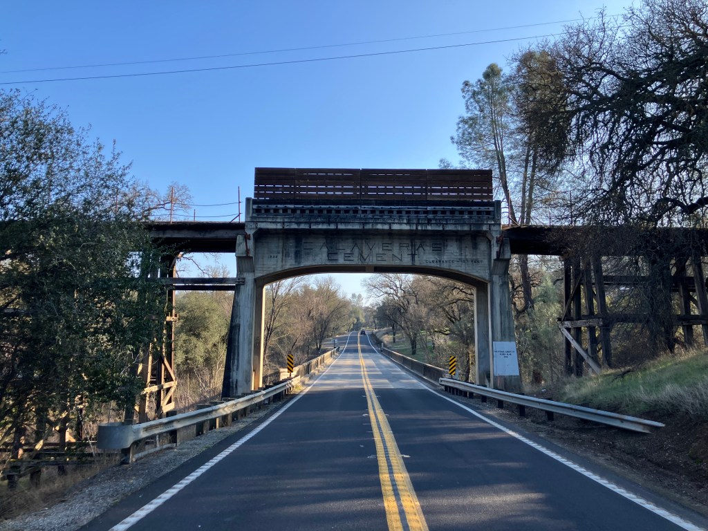
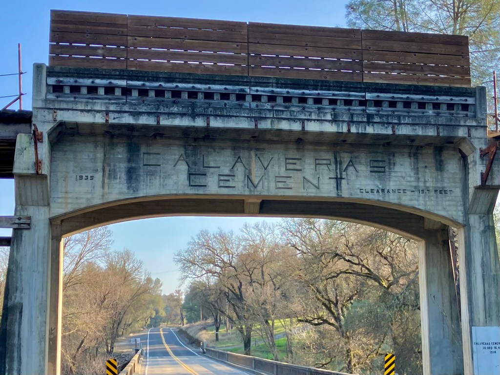
Now, if I had been in charge of that driving app I would have featured a Depression-era railroad bridge that crosses Highway 49 just south of San Andreas. It was part of a railroad short line that connected the Calaveras Cement plant to several local quarries. Calaveras Cement Co. produced material that built dams, freeways, and other infrastructure throughout northern California. The company shut down in 1983 as Chinese imports undercut domestic cement production. But the bridge remains as a proud (and shockingly graffiti-less) relic of a major local industry.
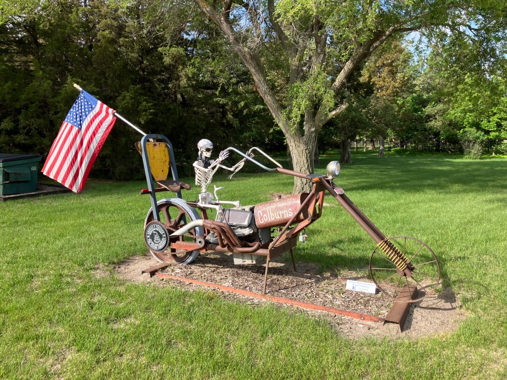
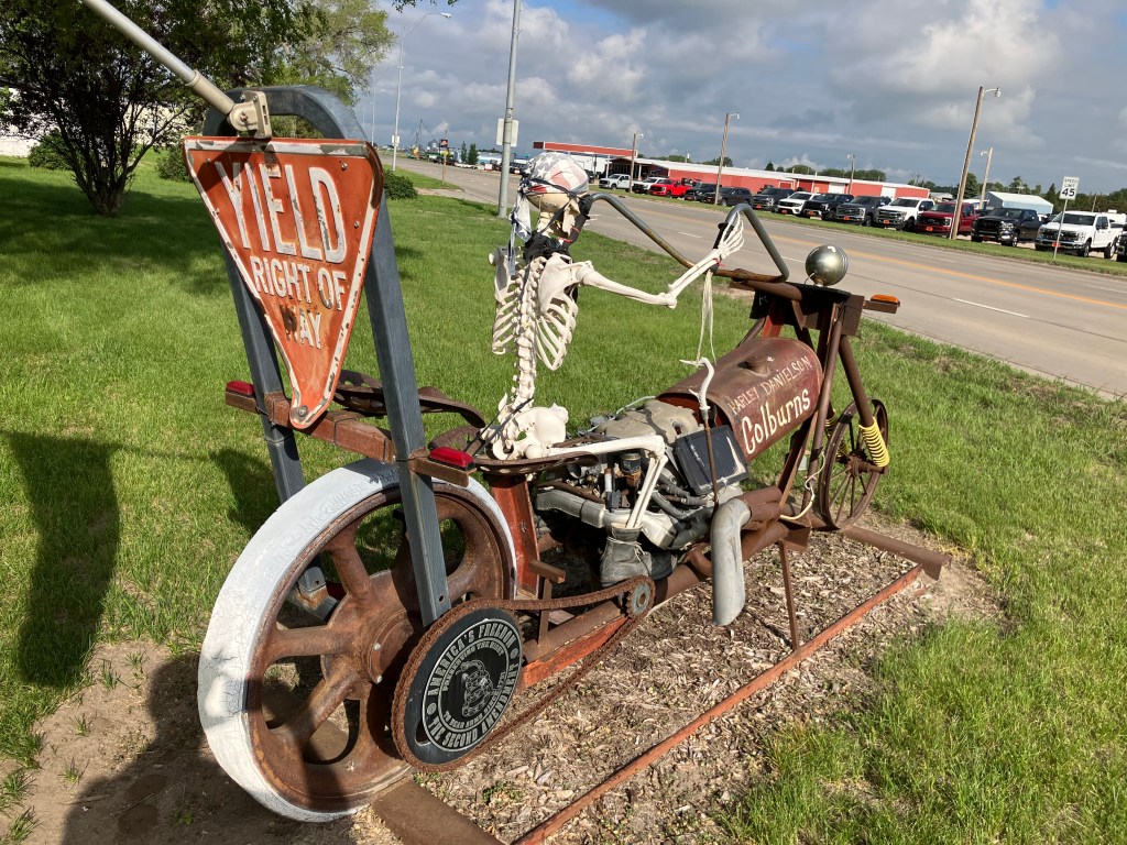
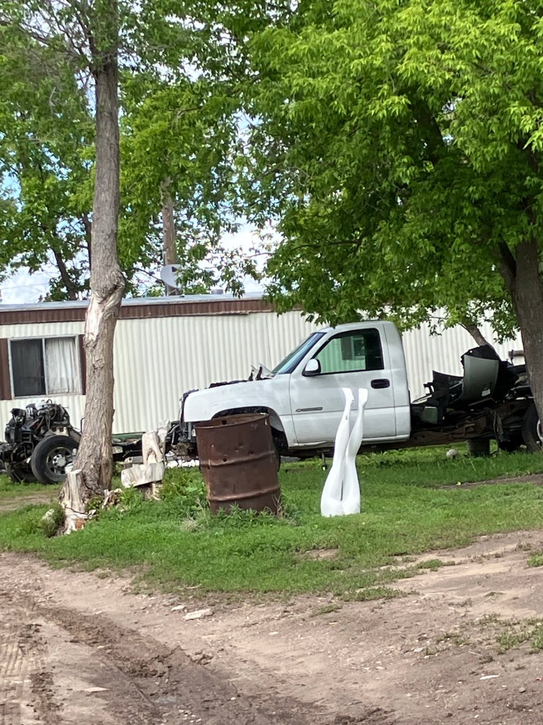
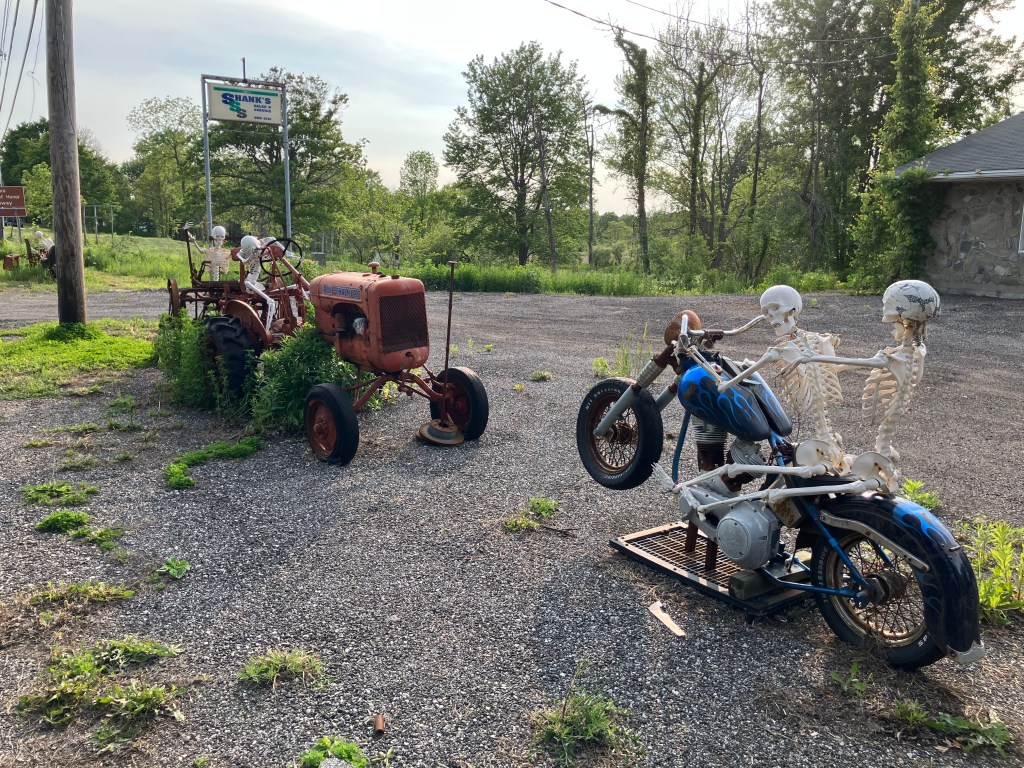
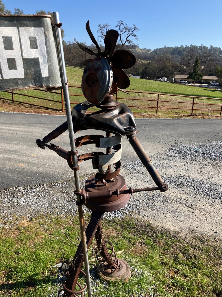
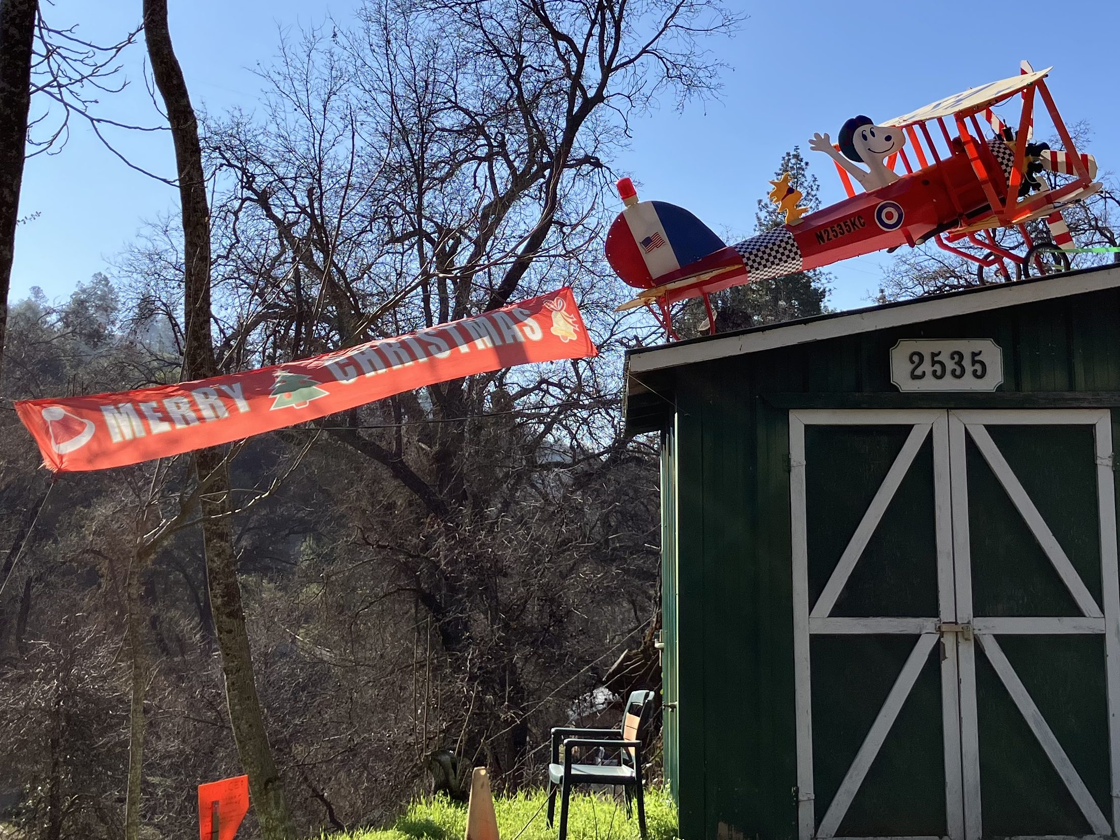
Before we get to the BOTD, let me leave you with a couple of photos of yard art I saw a long the way. These people are true artists.
How many different car parts can you identify?
Please don’t tell the Charles Schultz estate about this one.
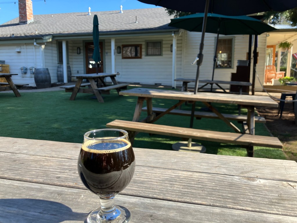
BEER OF THE DAY
Just because I’m a cranky contrarian, I walked right past all the wine shops in Murphys and snagged myself a brew at Murphy’s Pourhouse. It’s an open, friendly place with outdoor seating and 16 beers on tap. I chose the rare and coveted Anniversary XXVI Strong Ale from Firestone Walker.
Even if you don’t like dark beer, you should try this. It’s aged in bourbon and brandy barrels, and if that doesn’t guarantee a symphony of flavors, it at least delivers a cacophony of flavors. We’re talking anise, black strap molasses, oak, Christmas fruitcake, semi-sweet chocolate, toasted pecans, vanilla extract, cherry sucrets, Worcestershire sauce, and those spent “grounds for your garden” you get at Starbucks. It’s on the sweet side, but there’s just enough hops to prevent it from becoming cloying. Well-carbonated but no head. 11 percent ABV, so if you are riding a motorcycle and find yourself at Howard’s Mystic Saloon shortly thereafter, have yourself a hot apple cider. I give this beer 5 points out of 5.
MAIL BAG
Faithful reader Peter D pointed out that I walked right past a pun opportunity in my post about the tailing wheels at the Kennedy Mine. I had explained that, despite their shape, they’re not Ferris wheels. Peter’s response: Of course they aren’t Ferrous Wheels; they’re made of wood! Peter also helpfully includes this newspaper report on the bordellos of Jackson, CA.
Finally, Sherrill J informs me that the third book in her mystery series discusses mining for gold in southern California–a topic I confess to knowing almost nothing about!