Breweries · bridges · Cars · Gas stations · movie theaters · Road trips · trains

Cowboy Country

In all my jaunts along the various blue highways criss-crossing the map, it never ceases to amaze me how varied this country is. Just over the past week I’ve gone from coastal New England, through the green hills of the Berkshires, into lighthouses on the Great Lakes, through the rust belt of South Bend and Chicago, between the manicured fields of Iowa farms, and under the leaden skies of the Great Plains.

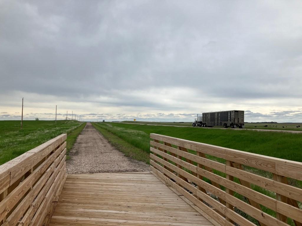
In all honesty, there hasn’t been a single segment that I haven’t enjoyed, that I haven’t experienced beauty, that I haven’t met wonderful people. And yet, today’s segment was characterized by lots of long, straight stretches at freeway speeds across the plains of Nebraska. Faithful reader Brian W. had encouraged me to “enjoy the unique look and solitude” of western Nebraska. And I did. The sheer scale of its open space forces one to relax, and the solitude is conducive to contemplation.

Cheap therapy.

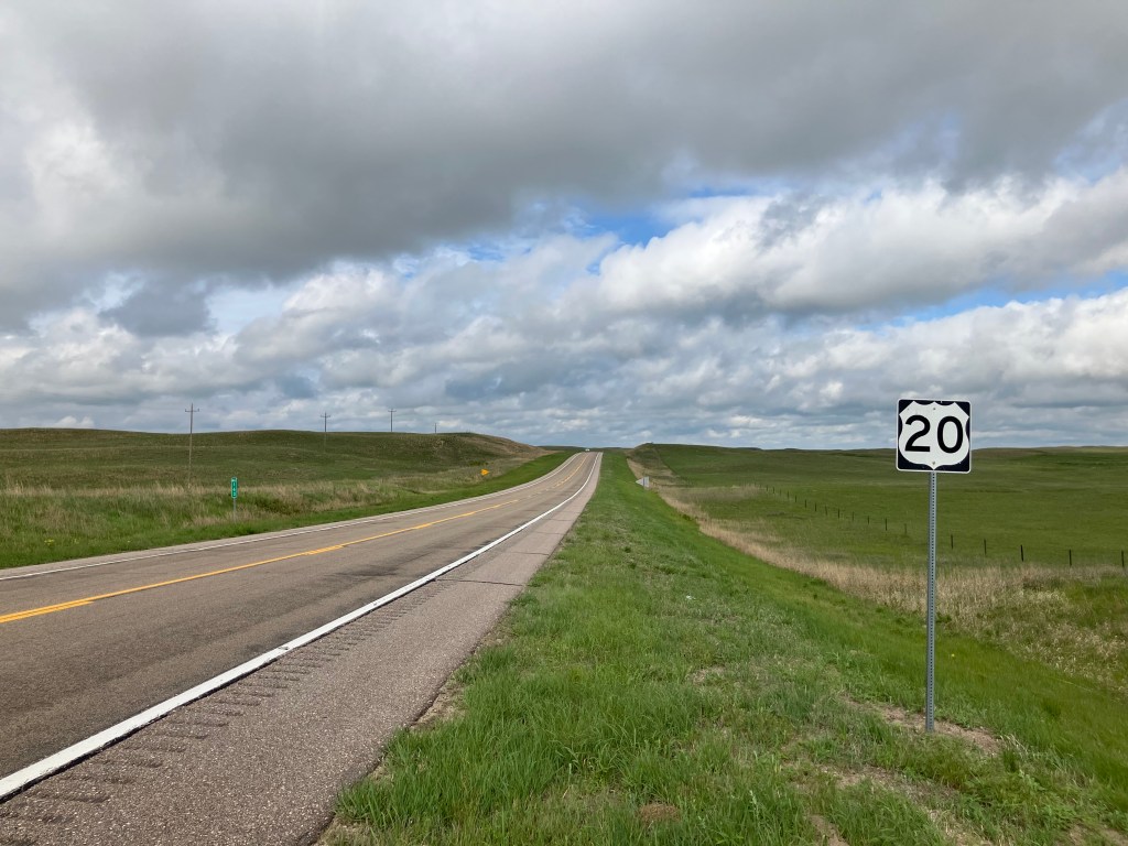
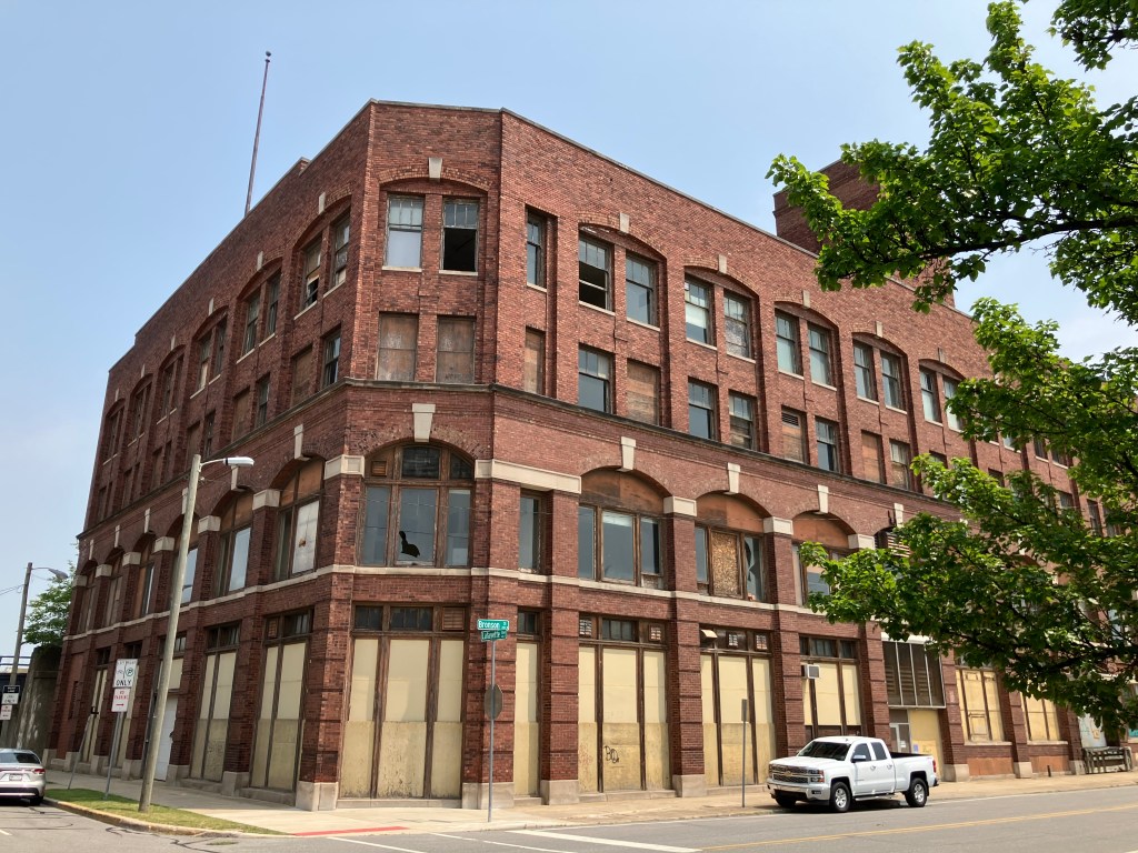
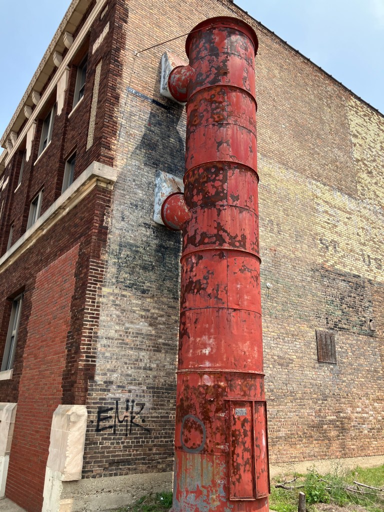
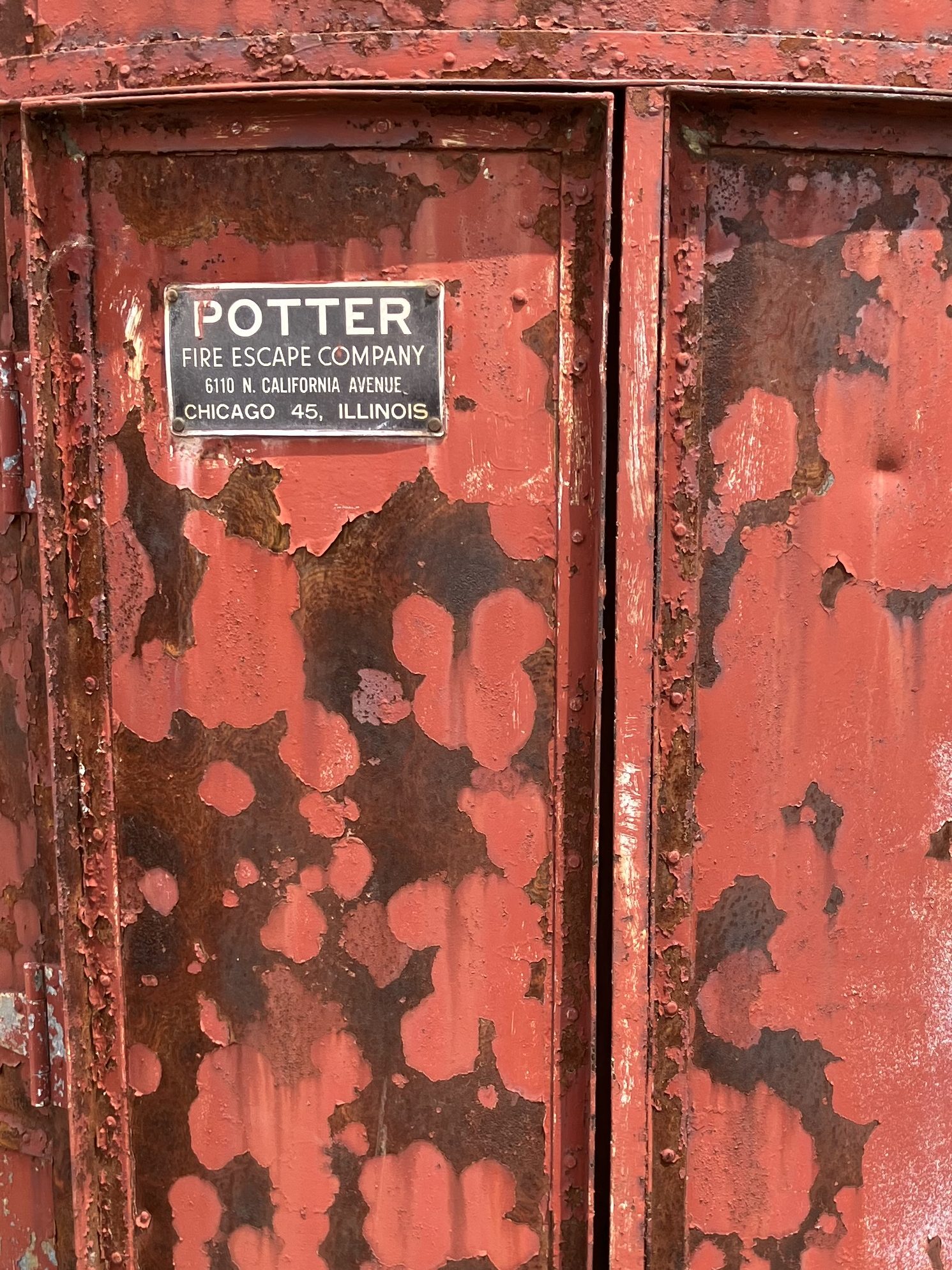
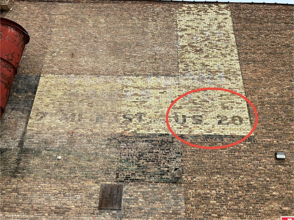
US 20 is the only major east-west route in the northern half of Nebraska. (Interstate 80 runs along the lowest third, through Lincoln and Omaha. For this reason, there has historically been a good amount of services along US 20. I encountered a surprising number of old garages and gas stations that have been preserved or restored to their vintage look. I peeked in the garages and saw walls lined with fan belts, racks of oil, piles of tires, and other evidence that these places still do business.

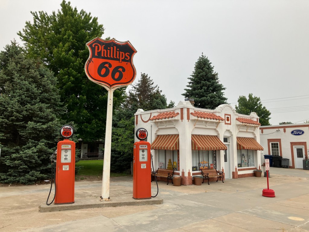
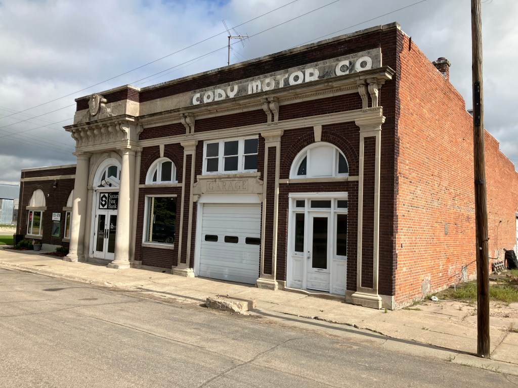
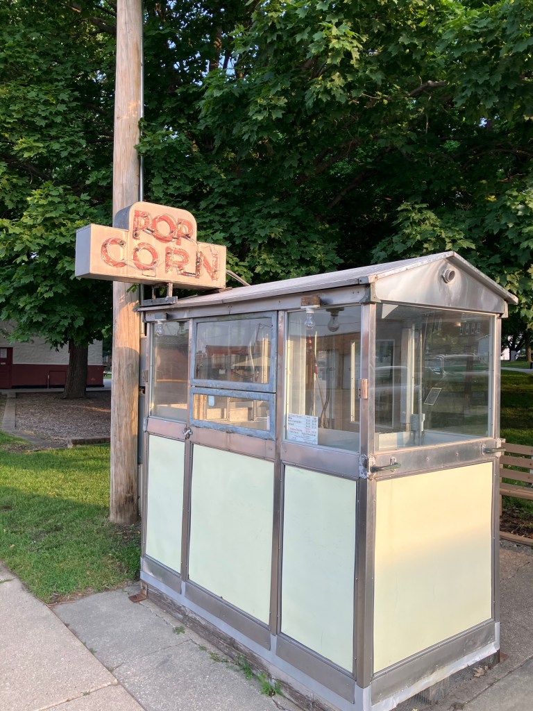
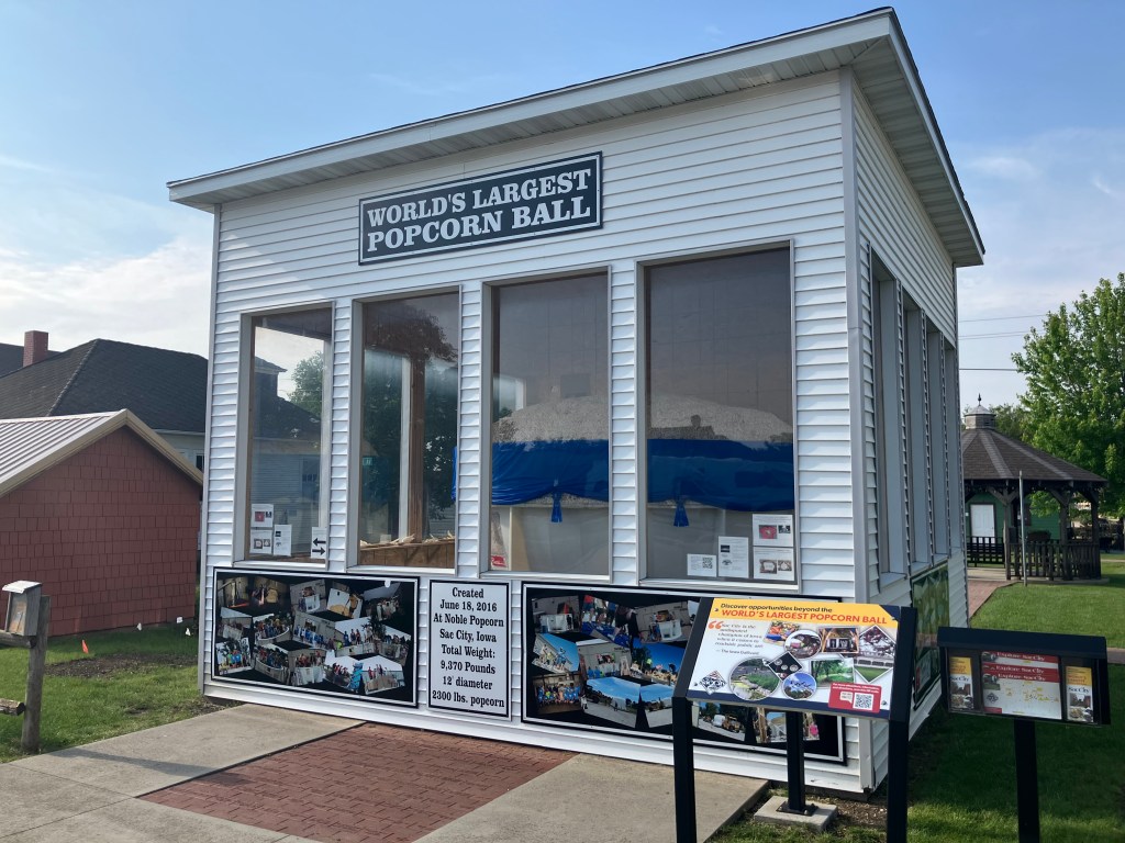
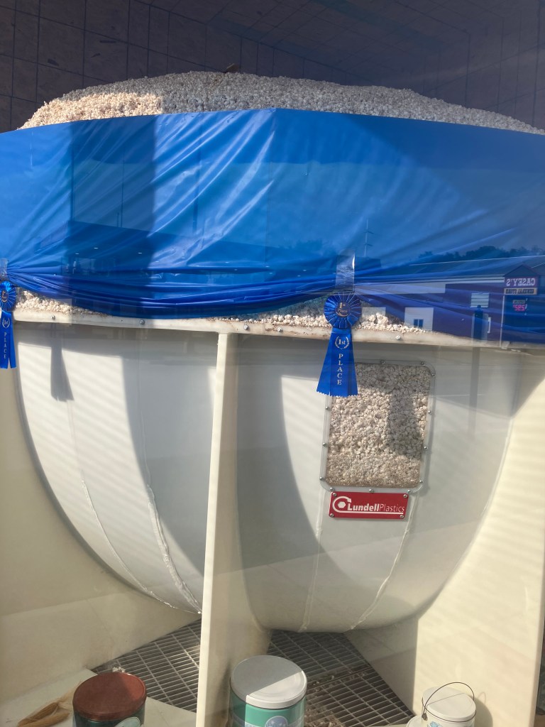
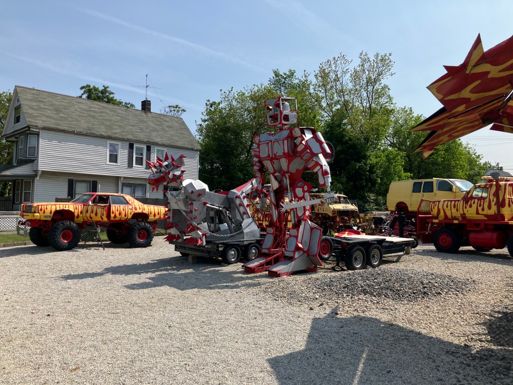
But what I appreciate more than the restored buildings are the historic roadside attractions that have just kept going, year after year, with just enough maintenance to stay in the game. That seems to be more the rule out in this part of the country. I’m sure part of the reason is that the local economy can’t support the wholesale replacement of infrastructure unless there’s a good reason. And there’s not enough population to entice national chain stores to locate their businesses here. The result is a “time warp” situation in many of these towns. Here are a few examples:

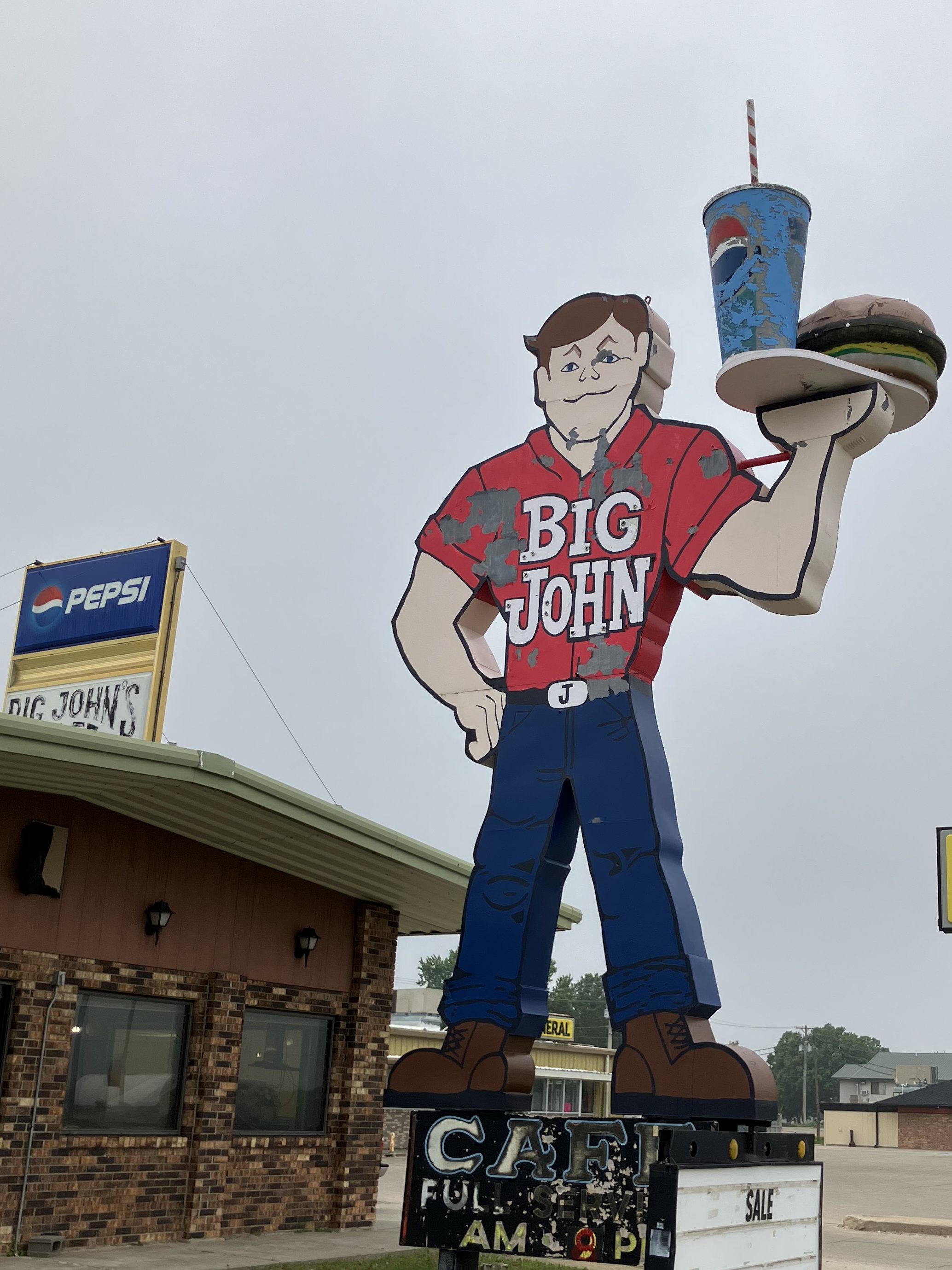
“Big John’s” had been a local burger chain in the 1960s that never caught on. This is evidently the only remaining sign–some sixty years old. The current business is an independent cafe in Ainsworth, Nebraska (pop: 1,600).

Big John doesn’t look amused.

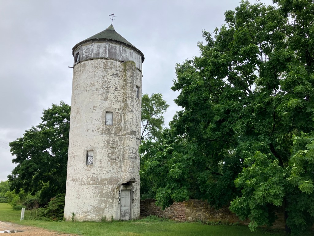
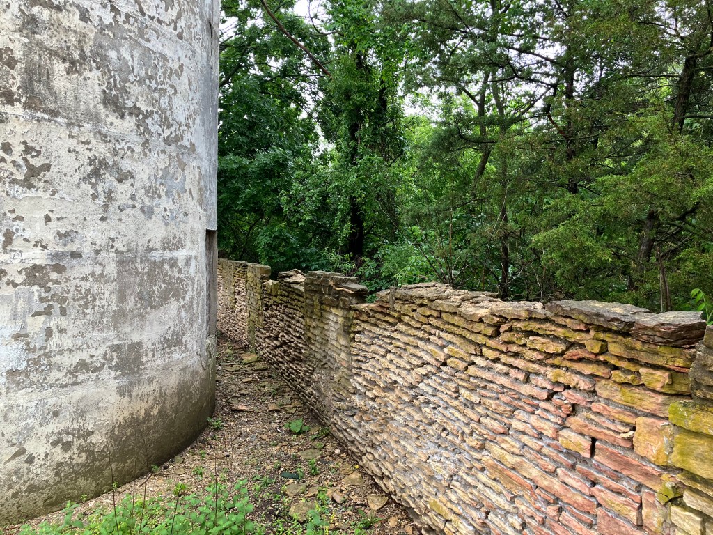
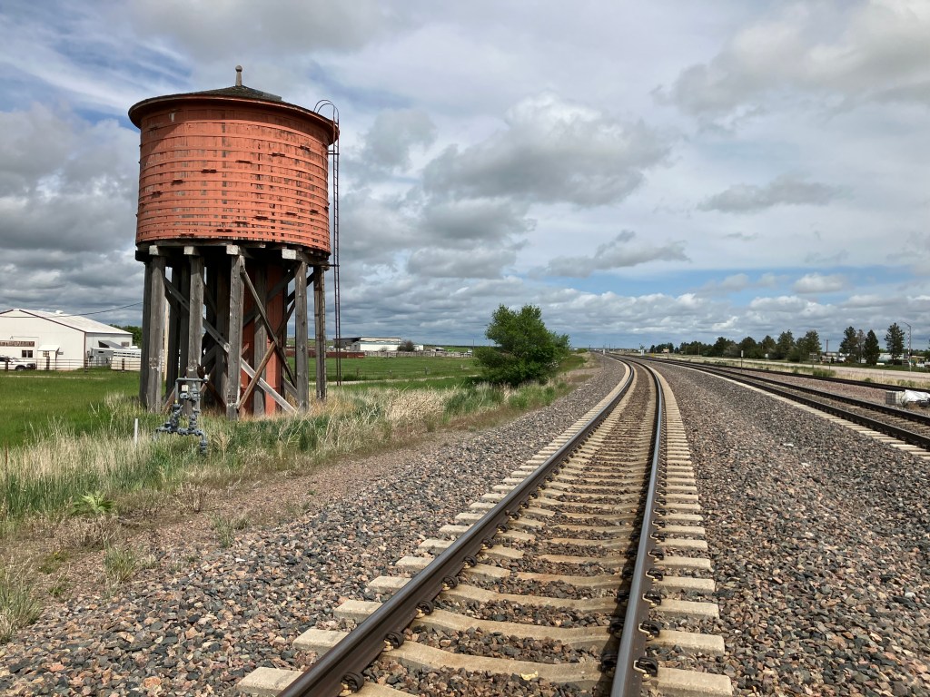
In the town of Lusk, Wyoming (pop: 1,500) a redwood water tower still stands next to the railroad tracks. It dates to 1886, and used to provide water to the steam locomotives. They moved it once, in 1919, in line with changes in the railroad. The Tower is now something of an icon for the town, but it’s authentic and as you can see in the photo, the whole scene could be from a century ago.

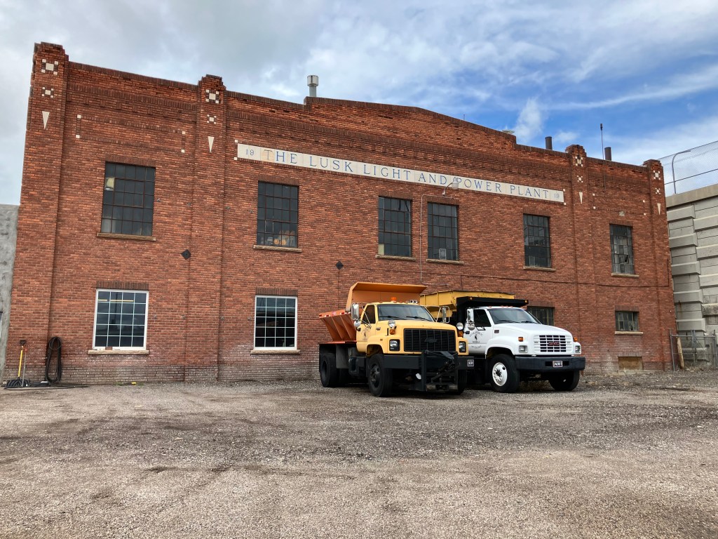
The Lusk Light and Power Plant also looks to be a historical relic, but I couldn’t find any information on it

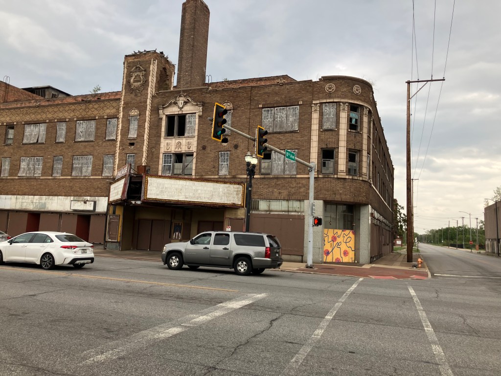
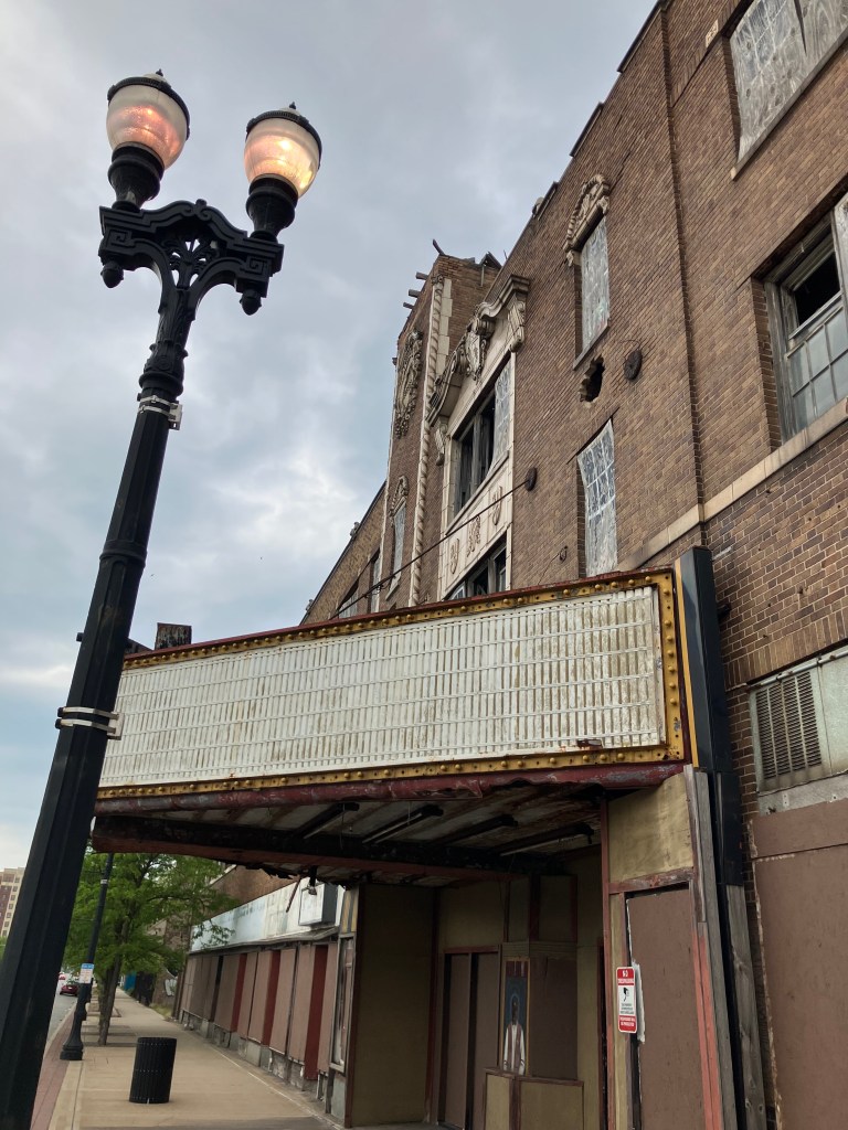
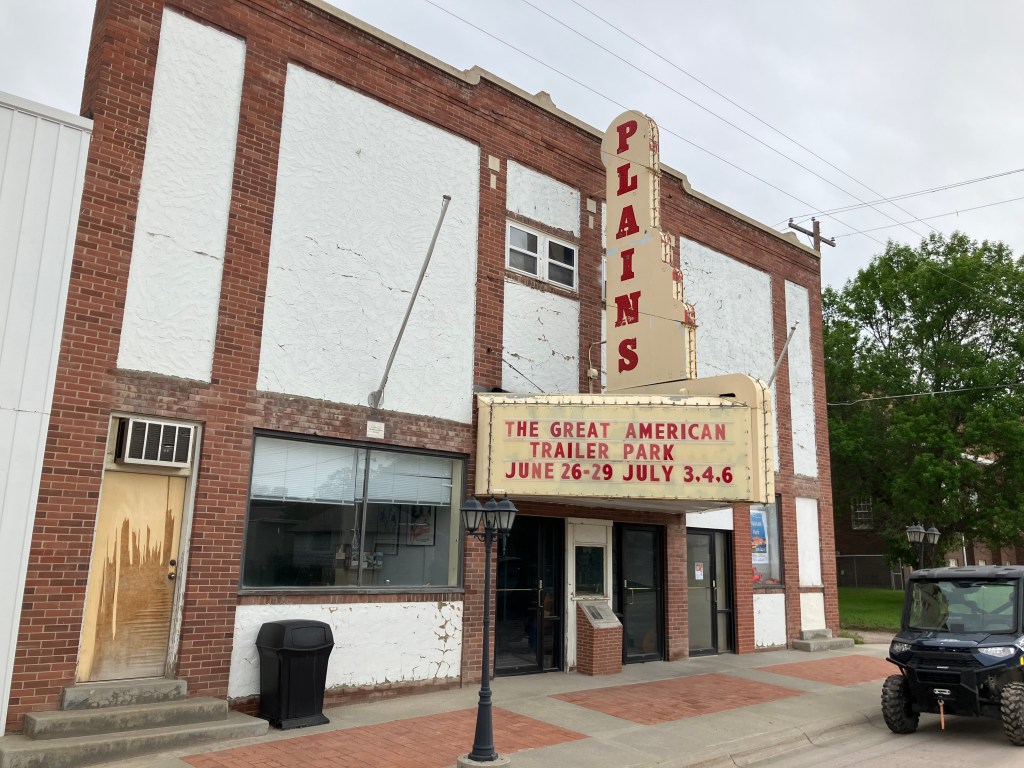
The Plains theater in Rushville, Nebraska (pop: 784) dates back to 1914. It’s gone through a number of different iterations, including a movie theater and a church. Today it is a live theater venue.

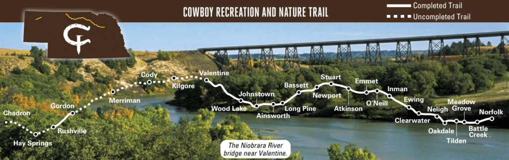
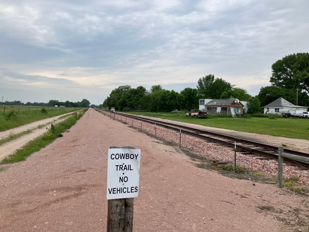
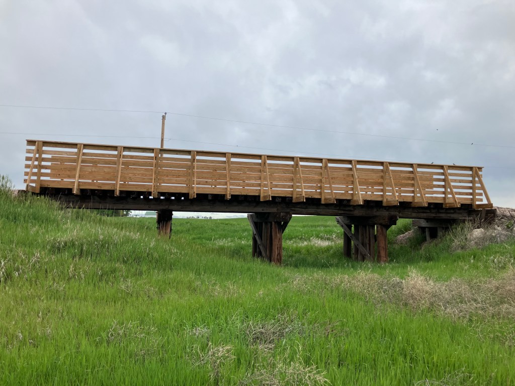
But let’s get back to US 20 itself. For the first 250 miles of today’s drive, the Cowboy Trail (that I mentioned in yesterday’s blog) runs alongside the highway. You’ll recall that the Cowboy Trail used to be a railroad line that’s been replaced with a hiking/biking path. I was surprised that I didn’t see a single person on the trail, but it’s still pretty new and maybe word hasn’t gotten around. But it’s interesting to see how all the old railroad bridges have been replaced with pedestrian bridges.

The lower pilings are left over from the railroad; the new wood slats on the upper sides were added for the Cowboy Trail.
The old railroad roadbed has been covered with crushed granite.

The reassuring monotony of the plains and the cloudy sky, with the Cowboy Trail close by at my right, had something of a lulling effect that required periodic infusions of coffee. But suddenly, in the mid-afternoon, I spotted some sharp buttes rising from the plains. These were most welcome after The Unbearable Flatness of Being that characterized most of the day’s drive.

Where did you come from?

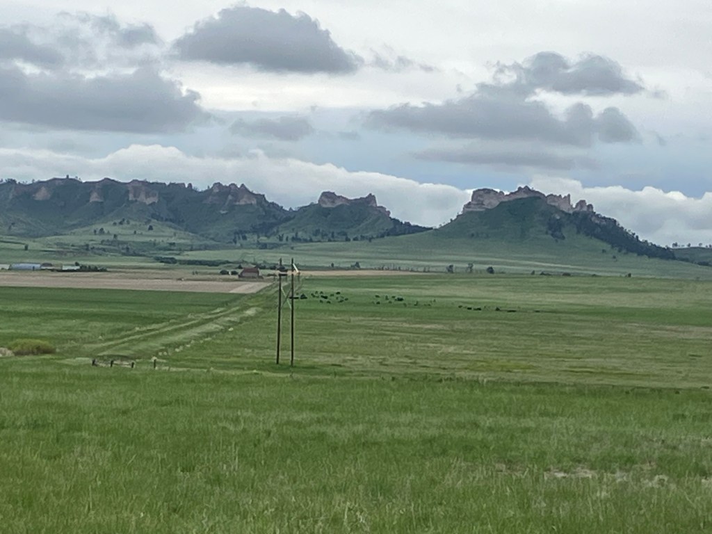
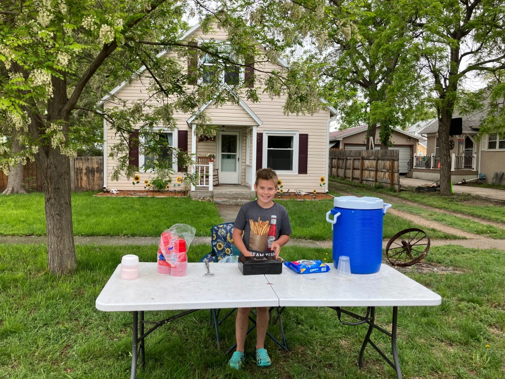
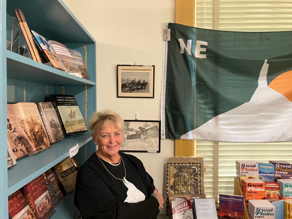
I stopped at the nearby town of Crawford, Nebraska (pop: 1,000) to see if I could learn more about the buttes. My first stop was to get a refreshing beverage from a young entrepreneur named Case.

No BOTD, sadly.

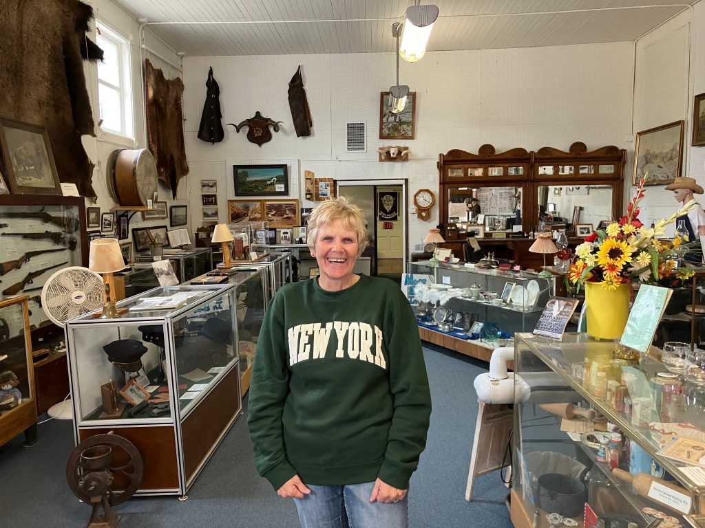
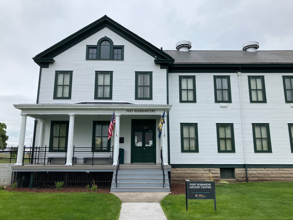
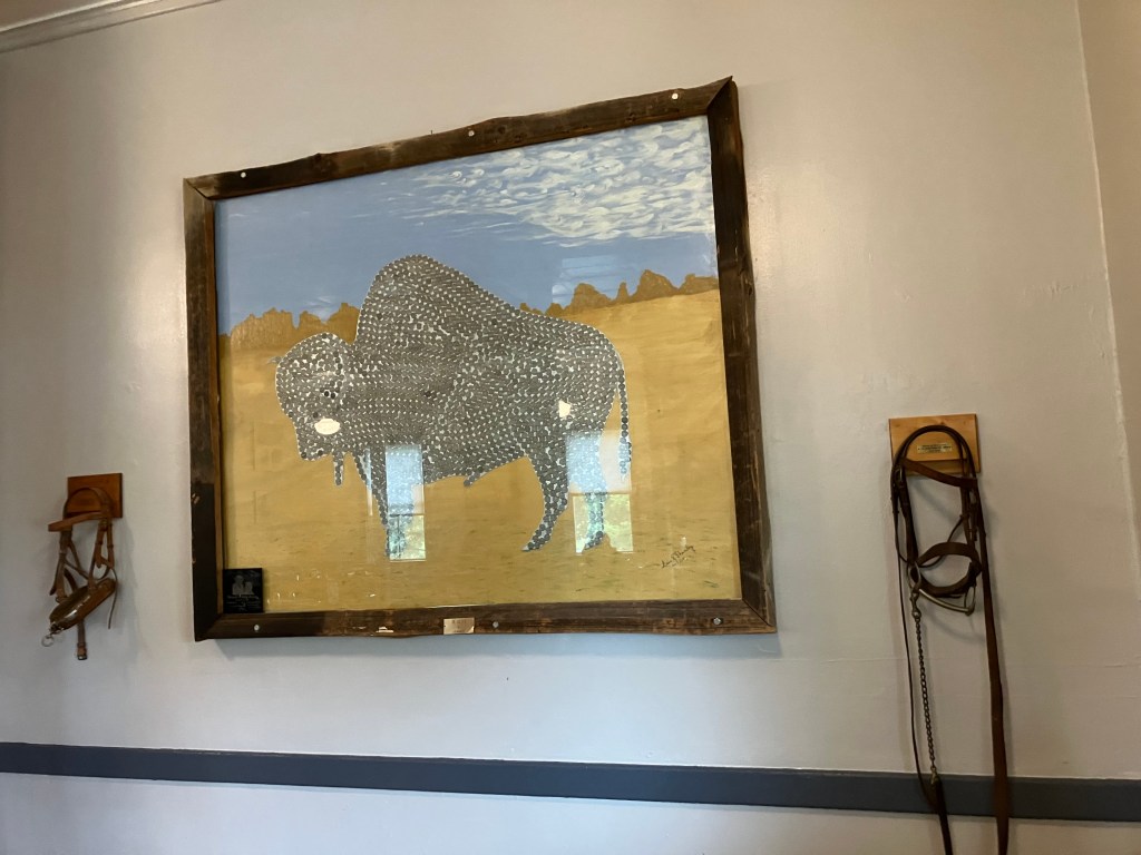
Then, in the center of town, I found the local tourist bureau/museum. The door was open wide, and as I entered I was greeted by a docent named Cathy. She didn’t have a lot to say about the buttes, but she did encourage me to visit Fort Robinson, just a couple of miles up the road. Her father had been stationed there once upon a time, and a couple of family heirlooms are in the lodge.

Cathy is retired and volunteers at several places in town.

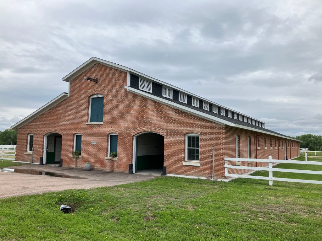
Fort Robinson has been around since the 1870s, playing a major role in the so-called Indian Wars, as well as the First and Second World Wars. The “Buffalo Soldiers” were stationed here, horses and mules were bred here, military canines were trained here, and it even served as a POW camp for German prisoners. The army decommissioned the fort in 1947, and it was converted into a state park in 1956.

1905 Headquarters Building, now repurposed as a visitors center.
One of a number of large horse barns, from when Ft Robinson was a “remount depot.”

Per Cathy’s suggestion I visited Fort Ross and tracked down the family heirlooms–these consisted of a “shadow box” with mementos from Cathy’s father, and a large art piece shaped like a buffalo, made entirely of buffalo nickels that Cathy’s family had collected from a bar they used to run.

Cathy’s father was on the camp’s polo team.
A small fortune in buffalo nickels. (Apologies for the unavoidable reflection in the glass.)

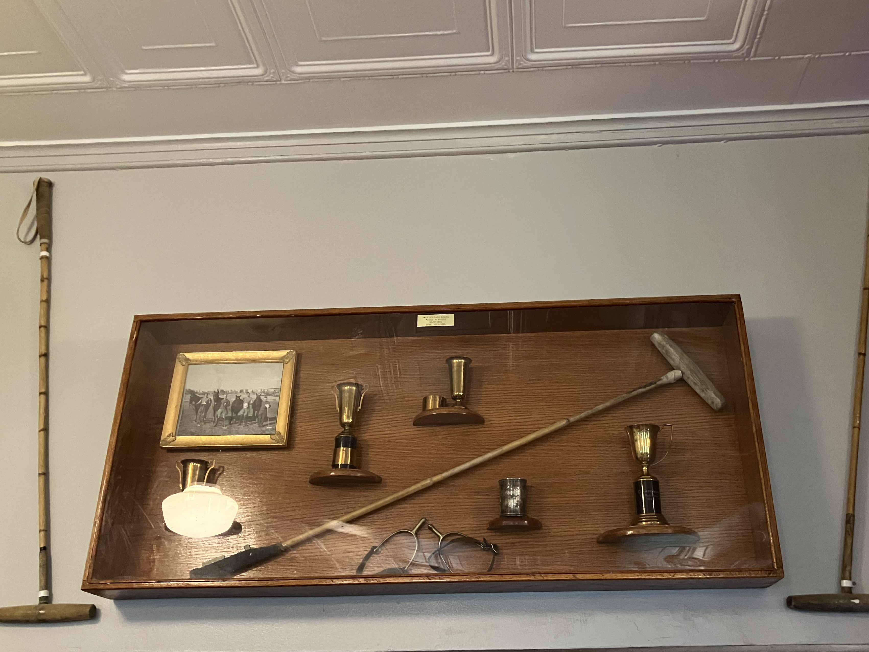
A kind lady at the lodge helped me locate these items…and she turned out to be Cathy’s sister Diana. The resemblance is obvious.

Sister Diana.

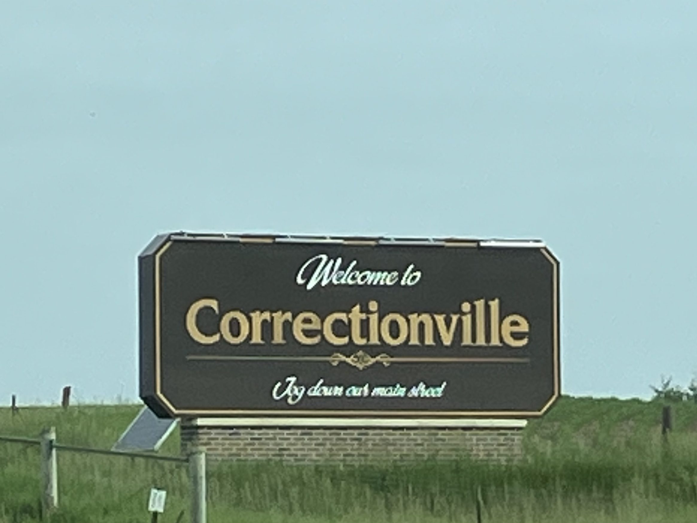
By now it should be pretty obvious that most of the towns along this stretch of Route 20 are quite small and spaced far apart. It’s certainly a big change from California, where I come from. The population density in California is 254 people per square mile. In Nebraska it is one tenth of that, at 25 people per square mile. In Wyoming it’s 6 people per square mile. You have to wonder what kind of impact these differences have on a person’s sense of self, sense of society, sense of independence.

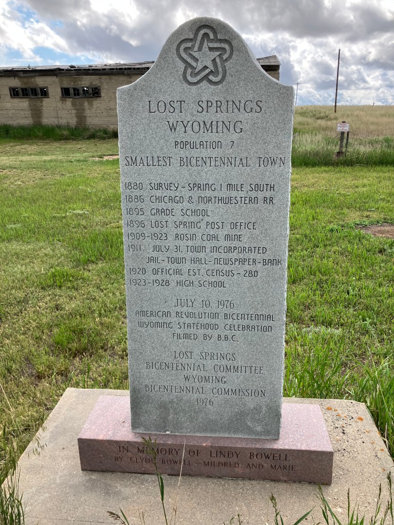
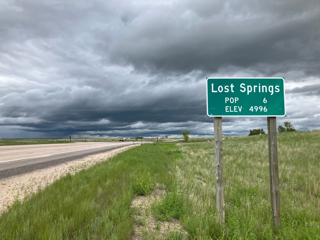
The smallest town that I passed today was Lost Springs, Wyoming. For some reason that I can’t fathom, they really leaned into their smallness when they commemorated the country’s bicentennial in 1976. At that time they erected this marker (which to me looks like a tombstone) that declares they are the “smallest bicentennial town.” According to the US Bicentennial Commission, in 1976 Lost Springs –with a population of 7–was the smallest incorporated town in the entire country.

They’re even smaller now:

BRIDGE CORNER

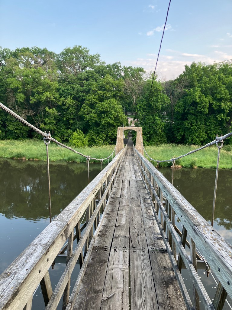
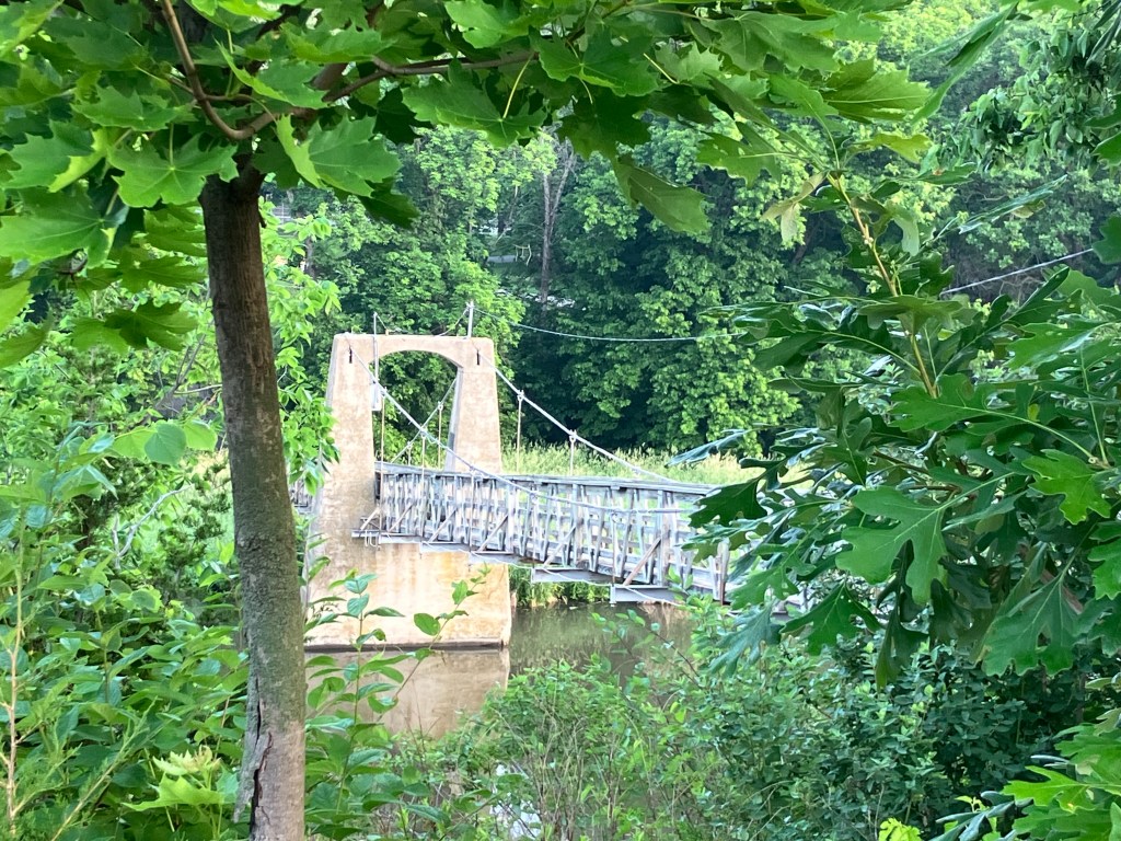
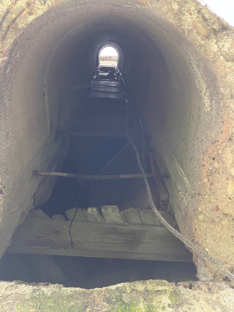
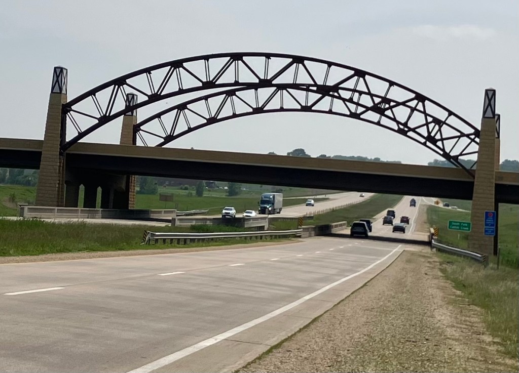
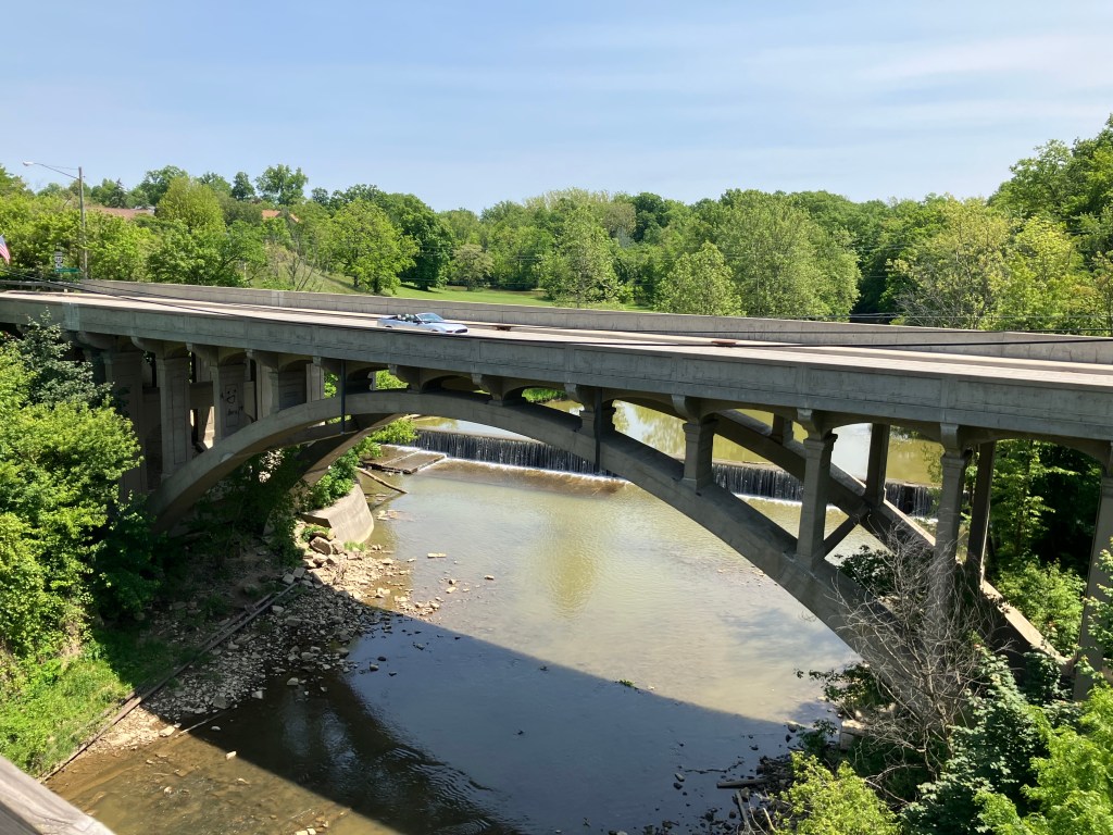
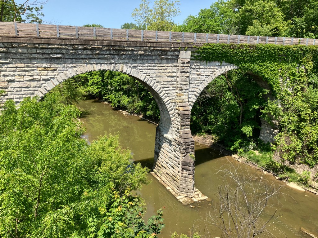
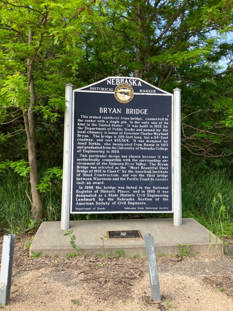
Near the town of Valentine, NE (pop: 2,600) a roadside sign directed me to a “historical bridge.”

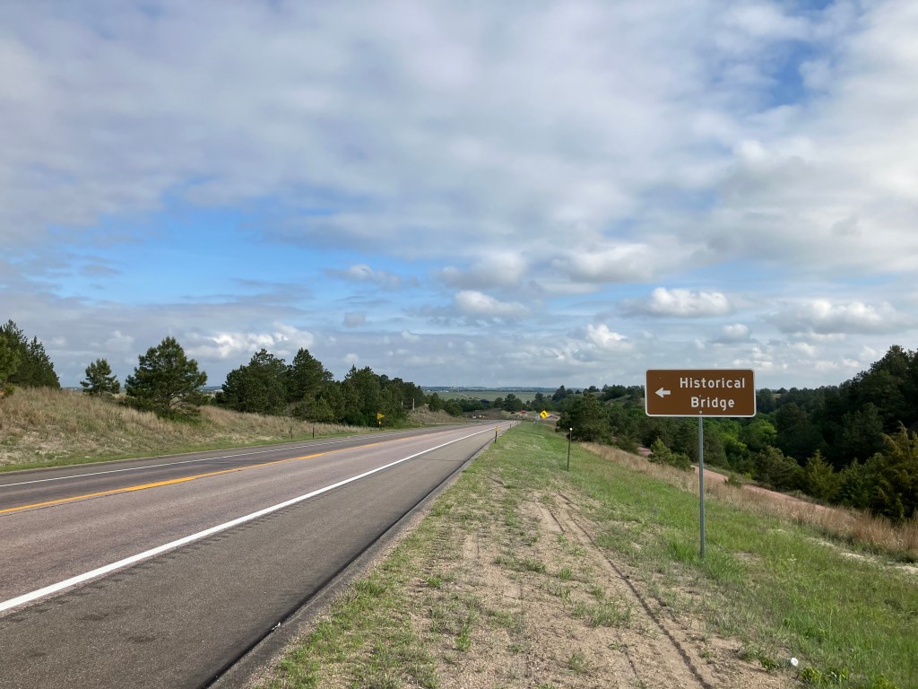
A marker explained that this is the Bryan Bridge, which is the country’s only “arched cantilever truss bridge connected by a single pin.” Whatever that means. It was also designated “the most beautiful steel bridge of 1932 in class C,” which sounds like it might be a narrow category, but what do I know?

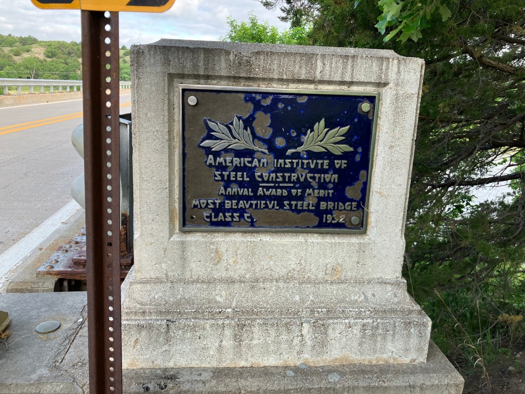
To test the “most beautiful” claim, I scrambled down the embankment and risked life and limb and tick bites to take the below photo from the bank of the Niobrara River.

Most beautiful of all the class Cs in 1932? You be the judge.

BREW OF THE DAY

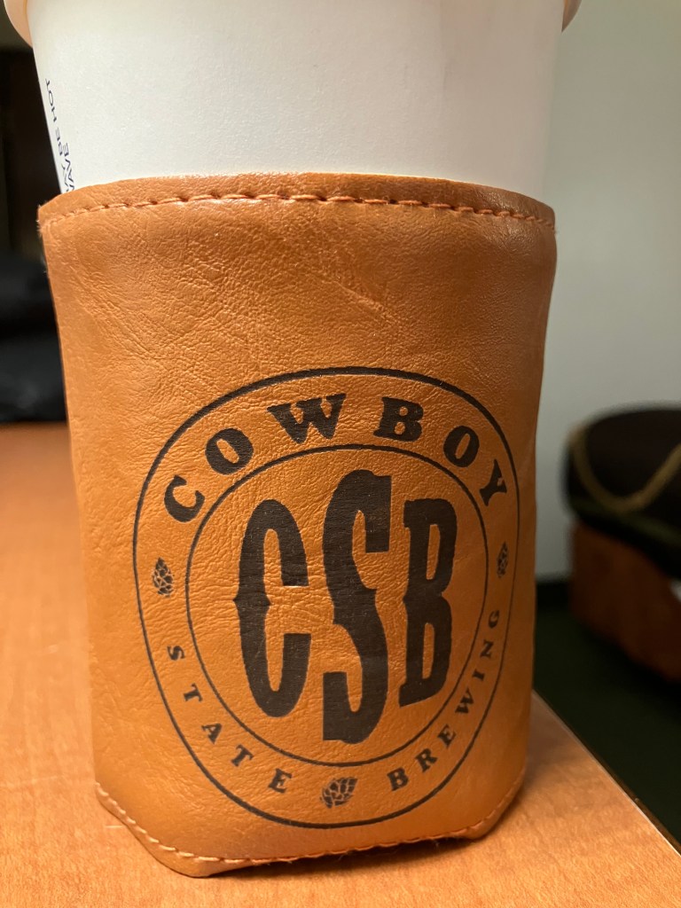
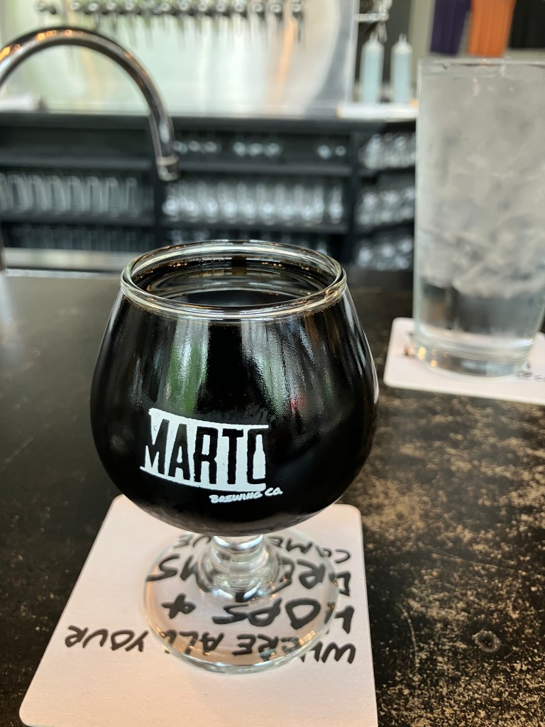
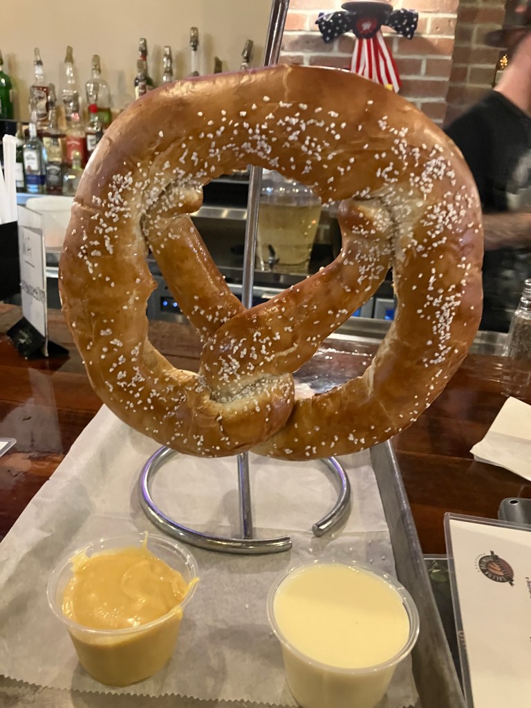
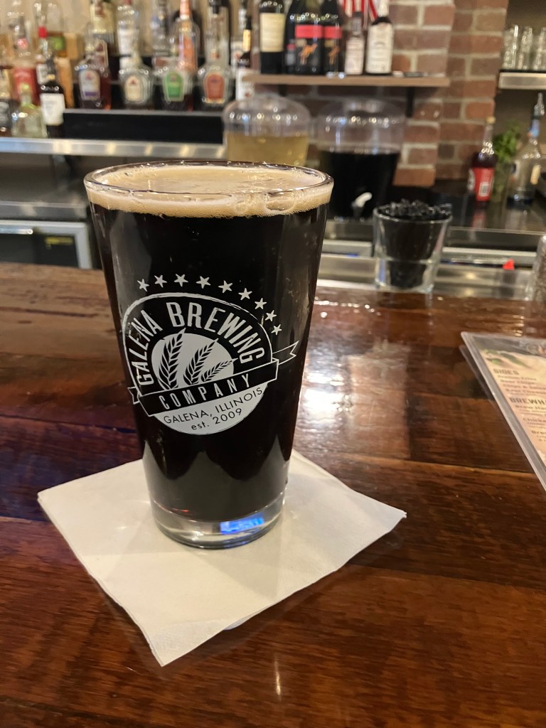
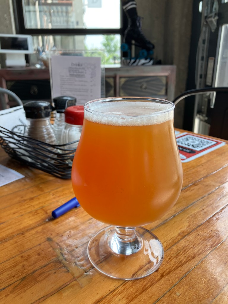
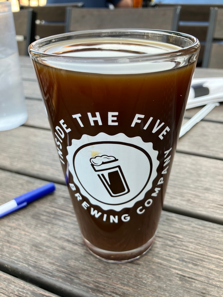
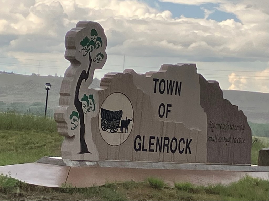
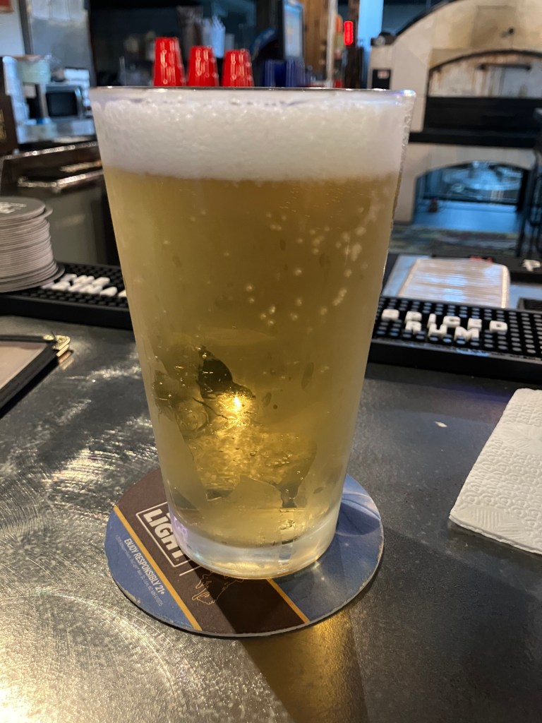
There aren’t many brew pubs along this stretch of US 20. But I did find a place called “Cowboy State Brewing Company” in Glenrock, Wyo (pop: 2,400). Long-time reader Peter D. had recommended the town to me, as it was his father’s and his grandmother’s home town.

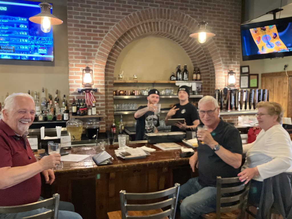
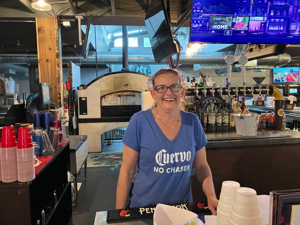
Now, Cowboy State is not your typical California-style brew pub. It’s a bar that dates back to the mid-1970s, with dim lighting, pool tables, and a bar stocked with gin and vodka. The place reeks of cigarette smoke, which might be because Nebraska allows smoking in bars, or maybe because 50 years of smoke can’t be eradicated from the pores of the room.

The 1970s called and they want their bar back.

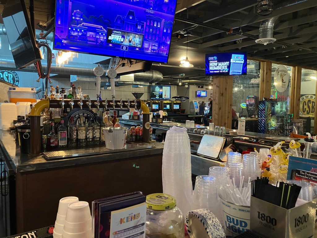
Now if you think this doesn’t sound like my kind of brew pub, you’re right. I asked the bartender, Billie, if this was really a place where they brewed their own beer. She said yes, but then admitted that they “had to let the brewer go,” and thus they aren’t making beer right now. Nevertheless, she still had some of the Cowboy Cream Ale that they had made for the State Fair last year. Did I want to try it? Now, I’m not sure what the shelf life is for beer, but I suspect it’s somewhat less than a year. Nevertheless, I told her to pour me one–I had a blog to write!

Before I get to the beer, let me just say that Billie is one of those people who make you feel welcome at a bar. She came here from Louisiana just about a year ago, and took over as the manager. She says she puts in about 70 hours a week, but she’s still all smiles and energy.

However, the beer wasn’t very good. Maybe it’s because it was old. Maybe it’s because it’s a weird recipe. Maybe it’s because it’s just not my style. But to me it tasted like Budweiser–that kind of skunky, watery, feed-grainy, metallic taste that mystifyingly is popular with 32 percent of American beer drinkers. I can’t in good conscience give it any stars. But I do need to acknowledge that it was popular at the Nebraska State Fair and is a favorite with the locals. So maybe it’s just me.

I should point out, though, that the beer was only $2 (which is just 50 cents more than Case’s lemonade). And Billie gave me a branded beer cozy!

Breweries · bridges · cemeteries · Obelisks · Road trips · trains

Redenbacher’s Revenge

Today’s segment of Route 20 took me from Iowa Falls, Iowa to O’Neill, Nebraska–a distance of almost 300 miles. But while I covered more distance than usual today, I spent less time on the road. This is because I’m now in the Midwest/Great Plains part of the country, where US 20 runs straight and fast. Plus, frankly, there isn’t as much to see here, meaning fewer stops. This part of the drive is more meditative, with mile after mile of farmland, a big open sky, and almost no other traffic on the road.

As I left Iowa Falls, I noticed this popcorn stand on a downtown corner.

That neon sign looked pretty antique, and a little research revealed that there’s been a popcorn stand in Iowa Falls since the 1870s. The current incarnation has reportedly been around since 1947, though it looks like the wall panels have been replaced fairly recently. Unfortunately, I arrived too early in the morning to get a bag of popcorn. But it still made me smile to see such a simple, old-fashioned treat prominently featured downtown.

About 100 miles to the west I encountered a place called Sac City (pop: 2,000) (har!) I say “har” because Sac City has decided to promote itself through the currency of popcorn. Specifically, right on the side of US 20 (which is also Sac City’s Main Street), a four-and-a-half-ton popcorn ball is on display.

Ummmm…. OK….

Now, this had me scratching my head. Of all the things you could do to put yourself on the map, creating the world’s largest popcorn ball and putting it in a roadside hut doesn’t seem like a huge tourist draw. Especially since it doesn’t seem to relate to the city’s history or industry in any way. What’s more, it seems like the shelf life of a giant popcorn ball would be somewhat limited. But most damning, this isn’t really even a popcorn ball–it’s just a bunch of popcorn dumped into a giant plastic bowl. The top of the popcorn “ball” is almost completely flat. The arrangement of the windows made it difficult for me to get a good shot (which points to another problem with this tourist “attraction”), but you get the general idea:

Popcorn “ball,” my eye!

Still, I give Sac City an A for effort. They have brochures promoting the city next to the popcorn ball, there’s a QR code, there’s signage to other nearby points of interest…They’re really doing a lot to promote their city. I just question their choice of roadside attraction. Quite frankly, I liked Iowa Falls’ popcorn stand a lot better.

Now, the real head-scratcher today was this place:

…Home of Wite-Out (TM)

Now that’s an odd name for a town. Is it build around a state prison? I didn’t realize at the time but the sign’s tagline–“Jog down our main street”–was a clue.

I “jogged down” the Main Street and encountered a monument that explained the name. The town’s name references a land surveying term called “correction lines.” Because of the curvature of the earth, north-south lines are adjusted with “jogs” every 24 miles. In Correctionville, this means that all the north-south streets “Jog” horizontally at 5th Street. Don’t ask me to explain it any further.

It’s actually a pretty clever design.

You can read more about correction lines on this close-up of the plaque. But do you notice anything unusual about it?

That’s right–Correctionville needs to “correct” the punctuation in the heading on this plaque. How embarrassing.

Oh, and speaking of Corrections: in yesterday’s blog post, the link to my story about the Wisconsin Wild West Town was left out. Here’s the link.

I returned to the road and eventually arrived in Sioux City, Iowa (pop: 86,000), on the banks of the Missouri River. It was here that the Lewis and Clark expedition (which was following the River toward its headwaters in the Rocky Mountains) buried Sgt. Charles Floyd, the only member of the expedition to die on the journey. He was buried on a bluff overlooking the river. This was in 1804.

RIP, Sgt Floyd.

Unfortunately, the river eroded the bluff where Floyd was buried, and exposed part of his grave. His skeleton was salvaged and reburied a bit further inland. Then, roughly 100 years after his death, Sgt Floyd was reburied again and his grave was marked with a 100-foot obelisk. (And you know how I’m a sucker for an obelisk!)

Sepulchre for a Sergeant.

After paying my respects to Sgt Floyd, I returned to US 20 and crossed the Missouri River into Nebraska. This is the point in the trip where one needs lots of coffee. The road is straight and monotonous, but not without a stark beauty of its own.

I stopped for the night in one of the few towns of any size, a place called O’Neill (pop: 3,575). As you might guess by the name, O’Neill is named after an Irish immigrant by the name of John O’Neill. Incorporated in 1882, the town was settled mainly by Irish immigrants. Today, it takes that heritage quite seriously. Shamrocks adorn the local fire station, the school, the bank, even the local Subway sandwich shop. The pubs all seem to be Irish themed, and there are several Catholic churches and a Catholic school.

At this point in the trip I was feeling a need for a long walk, and fortunately O’Neill has something called the Cowboy Trail. This is one of those “Rails to Trails” arrangements, where an abandoned railroad right-of-way is converted into a hiking and biking trail.

The Cowboy Trail runs 317 miles along the old Chicago & Northwestern railroad route from Norfolk, Nebraska to Chadron, Nebraska. There’s only one railroad station still standing on the route, and as luck would have it it’s here in O’Neill.

After visiting the station, I spent an hour walking along the trail. It’s a quiet and pleasant walk along a crushed limestone path, with plenty of trees and wildlife. Who knows what the other 300-plus miles look like, but I think it would make for an enjoyable mountain bike trip over a couple of weeks. Towns and sleeping facilities are located all along the route.

But that’s another trip. Tomorrow I’ll again be heading west on Route 20.

BRIDGE CORNER

At the suggestion of loyal reader Peter D, this morning I walked across the so-called Swinging Bridge of Iowa Falls. I say “so-called” because it doesn’t really swing. But then neither do I…

Anyway, it’s a pedestrian suspension bridge across the Iowa River. It was originally constructed in 1897, and then re-built in 1909, 1925, 1956, and 1989. In other words, the bridge has been rebuilt every 23 years (on average). It’s now been 36 years since the last rebuild. But why worry about these things?

A good place for the Billy Goats Gruff to cross.

I crossed the Iowa River on the bridge, and returned to my starting point without incident. It’s actually very pleasant out there in the morning. Here’s a video of the peaceful scene.

My only complaint is that the bridge barely flexes while you walk on it. It certainly doesn’t live up to its “Swinging Bridge” moniker.

Deep cut: Now here’s a real swinging bridge that I crossed in Montana in 2022. It’s the Kootenai Swinging Bridge. The full blog post is here.

BEER OF THE DAY

I really wanted to get the BOTD at Brioux City Brewery in Sioux City. The name alone makes the place worthy. Alas, they were not open when I got there. So instead the BOTD comes courtesy of Marto Brewing Company in Sioux City, Iowa. Though “courtesy” is probably not the right word, as will quickly become evident.

Sioux City actually has several craft breweries, but Marto was distinguished simply by dint of being open at 11:30 am when I came through town. Though “open” is probably not the right word, because they couldn’t be bothered to unlock their doors until well past opening time. At any rate, I eventually got inside and bellied up to the bar. I greeted the bartender behind the counter, though “bartender” is probably not the right word. He was occupied washing out a big plastic bucket in the sink behind the bar, and explained to me “I don’t work here.” He eventually disappeared. Meanwhile, there were approximately a half-dozen servers standing around a table where (I later learned) various new foods were laid out for them to sample so they could speak with authority to the customers. Which presumes, of course, that they actually bother to talk to a customer. The servers filled their plates and went to various corners of the (otherwise empty) restaurant to eat their free food.

Finally a young woman wandered behind the counter and I asked her for the barrel-aged stout. She disappeared and returned with a glass of water. Just when I was going to repeat my request she asked whether I wanted the “Art of Survival” or the “Maple Fluff.” Going against my better judgment, I chose the latter.

That faucet in the background is where the random worker was washing out his bucket.

I tell you all this backstory because I want to acknowledge that I wasn’t in the best mood to review their beer. Anyway, here we go:

The Maple Fluff is billed as a chocolate stout made with peanuts and marshmallows and aged in Jim Beam barrels for over two years. It’s also billed as 13.5 percent alcohol, which is why it comes in a small, 5-ounce goblet. Sounds promising, no?

From the very first sip, it’s clear that this is a case of false advertising. I don’t taste any marshmallow or peanuts. Without exaggeration, this tastes like I’m drinking molasses diluted with Trader Joe’s teriyaki marinade. I can’t overstate how sickeningly sweet this is. There is no trace of hops to even slightly counterbalance the unfermented sugars. And while I like robust, meaty stouts, this has the consistency of Pennzoil. Even after I finished the glass, the sides remained coated with a thick layer of the high-viscosity beer. You know how old glass window panes in a Victorian mansion are thicker at the bottom due to the gradual “flow” of glass downward in the course of a century or two? I suspect that’s how long it would take for this beer to drain from the sides to the bottom of the goblet.

Now, to be fair, a tablespoon or two of this beer would be good over vanilla ice cream. It also might make a good additive to your car’s crankcase if the piston rings are worn. But under no circumstances would you ever want to drink a full glass of this sweet sludge. Actually, that would be a good name for it: Marto’s Sweet Sludge. 1 star.

Breweries · bridges · churches · Movies · Puns · Road trips

Searching For Something Knotty

Today I took US 20 from Northlake, IL to Iowa Falls, IA. Near the beginning of the day’s drive I noticed this huge sign on a barn in the town of Freeport, Illinois (pop: 24,000).

Why not? I followed the directions and was soon at this miniature version of Wrigley Field. It’s kind of cool–I’m sure a Little Leaguer would get a kick out of playing on that field.

The Friendly Confines.

Now, while I was on Freeport’s surface streets I encountered this marker:

Knot your average city.

And do you know why Freeport calls itself “Pretzel City?” Is it because it produces more pretzels than anyone else? No. Is it because the roads twist and turn like a pretzel? No. Is it because the world’s pretzel production relies on Freeport’s proprietary yeast? No. In fact, it turns out that Freeport once had a German bakery that made pretzels. Like 150 years ago. That’s it.

And for that small and random fact, the local high school’s mascot is a pretzel. I’m not making this up.

I wonder if they’re sponsored by Snyder’s of Hanover?

Now, you may think I’m mocking Pretzel City. And I am. But I happen to love pretzels, and all this ruminating on the snack brought on a hankering for a big, soft pub pretzel with beer cheese. Surely I could get one here in Pretzel City.

No. “Pretzel City” does not sell big pretzels. There isn’t even an Auntie Anne’s in town.

So I ended up scanning each town I passed through for either a German bakery (unlikely) or a brew pub (more likely). Around noon, when I was passing through the town of Elizabeth, Illinois (pop: 694), I hit the jackpot. Right next to the road was the Highway 20 Brewing Company.

Let us brew.

The brewery is in an 1875 Presbyterian church with beautiful stained glass and a large outdoor seating area. What could be better? I parked the car and strode up to the Narthex. And there I was foiled: The place didn’t open until 3 pm. I seriously thought about killing a few hours until they opened, but it was such a tiny town I couldn’t think of much more to do than drink a beer and eat a pretzel in a church. Muttering words that shouldn’t be spoken on church grounds, I got back in the Perigrinator (as I’ve taken to calling the Altima) and continued along Route 20.

Shortly before I got to the Iowa state line, I entered the town of Galena, Illinois (pop: 3,300). Now Galena is an interesting place. Most of the town is recognized as a National Historic Site, and just passing along the street feels like you’ve gone a century or two back in time. Virtually all the buildings in the downtown are historic, and most of them seem to cater to tourists. Among other things, Galena plays up the fact that General US Grant retired here after the Civil War, and his home is a major tourist draw.

Of course, the main draw for me was a place called the Galena Brewing Company. It’s in an old building from 1849, that once housed a print shop. They make a good selection of interesting beers, and I’ll discuss my choice when we get to the BOTD. But my immediate goal was to get me a big pub pretzel. Voila!

It’s a one-pound pretzel, which the brewery claims it is “famous” for. I don’t know about that, but I do know that it constituted my entire lunch. I was supremely happy.

While scarfing my pretzel I chatted with a few other people at the bar. We were all out-of-town visitors. Tom had just visited his sister nearby, and had a 300-mile drive home in front of him. Steve and Ann had come over from the greater Rockford area to spend a few days, and this was their third trip to Galena Brewing Company. There was also a woman from Denver visiting a relative in the area. Bailey the Bartender kept us all happy. It was a very enjoyable hour. And that’s not just the pretzel talking.

Left to right: Tom, Bartender Bailey, mystery bartender, Steve, and Ann.

OK, now that I’m done with that twisty tale of pretzels (har!), let’s go back to a couple of other sites of note along today’s drive.

In Marengo, Illinois (pop: 7,600), I spied this mysterious old tower right next to the road. It abuts a decaying, old stone wall–like ancient Italian ruins. Is it a watchtower of some kind?

Mysterious Marengo Tower.
This wall behind the tower surrounds a plot of overgrown brush and random pieces of cast concrete.
Looking upward along an enclosed ladder on the side of the tower. You can see the enclosure above the door in the first photo. I considered climbing the ladder, but chickened out.

My internet sleuthing didn’t turn up anything definitive to explain what the heck I was looking at. ChatGPT thinks it’s a fire watchtower, but it seems to be confusing the structure with a steel tower not far from there. Anyone know what we’re looking at here?

The most melancholy site of the day was Donley’s Wild West Town, also in Merango. This sign caught my attention:

Following the sign, I encountered what appeared to be a giant Frederic Remington sculpture:

The Four Horsemen of the Apocalypse?

Judging from the iconography so far, I assumed this Wild West Town would be similar to a place near my childhood home, called Frontier Village. Frontier Village depicts a sanitized version of the Old West, with rodeos and bloodless shootouts and gold panning and alcohol-free saloons and pony rides and such. I remember it being great fun.

So, hoping to relive a few moments of my youth, I turned into the parking lot. The place was clearly closed for the day, and despite the presentable-looking front doors, the facade was looking a little long in the tooth.

Cue the whistle from The Good, the Bad, and the Ugly.
Must have been a pretty fun place, back in the day.
Peeking behind the fence.

A search of the internet confirmed that the place is permanently closed. This made me feel kind of melancholy, for two reasons. First, it’s always poignant when someone’s dream dies. From the little I know about Wild West Town, it seems like it was a family-owned, family-friendly place with a lot of heart. It reminds me of an abandoned place in Wisconsin that I discovered in 2022. You can read my post about it here. And if you do, make sure you scroll all the way down to the comments at the end, where the son of the park’s founder makes a surprise appearance.

Anyway, the second reason the demise of a park like this saddens me is because it reminds me of the passing of an era. It seems that these low-tech, sweetly-corny, flesh-and-blood places aren’t popular in the modern, digital world. I know that makes me sound like a Luddite, or at least an old man. Which I am. But still.

I encourage you to watch this 2016 video of highlights from the Wild West Town. You’ll see what I’m talking about.

But let me end on a somewhat more inspiring note: Near the end of the day I saw a sign along US 20 urging me to visit the “Field of Dreams.” Yes, that Field of Dreams. It turns out that after they made the 1989 Kevin Costner movie, the town of Dyersville, Iowa (pop: 4,000) preserved the baseball diamond that was created in a cornfield. It’s now a tourist attraction.

Sure, it’s a little corny (ha!), but it was heartwarming to see kids and families playing catch on the field. What a perfect bookend to a day that began at the Little League version of Wrigley Field.

Build It and They Will Come indeed!

BRIDGE CORNER

This overpass carries traffic from Seippel Street in Dubuque over US 20. To me it looks like a fairly new structure, and it seems to incorporate old steel arches from a prior bridge. I cannot confirm any of this with my research though. Our research team will keep working on it, but any tips would be appreciated!

BEER OF THE DAY

As noted early, the BOTD comes from Galena Brewing Company. I had the “All Day Reveille,” which is a black lager. It’s as dark as a stout, but with a much thinner body and less robust taste.

This beer is quite balanced, with a dark, malty base that’s countered with a moderate amount of hops. After fermentation, they add some cold-brewed espresso from a local coffee roaster. This gives the flavor a stronger backbone. Still, it’s not overpowering, and the flavor profile is fairly flat. The ABV is 5.7, which is about average. I’d call this a pseudo-stout for people who don’t like stouts. I’ll give it 3.5 stars, which means I wouldn’t go out of my way for one, but I’ll enjoy one if it’s in front of me. I give the accompanying pretzel a solid 5 stars.

Breweries · Cars · movie theaters · Road trips

Wow! Great Lakes!

Today’s drive along highway 20 was reflective. The route took me from Toledo Ohio (at the west end of Lake Erie), around the bottom of Lake Michigan, and up to the town of North Lake, Illinois, which is just west of Chicago. Here’s a map:

Though it doesn’t show up on this map, Route 20 passes through the city of South Bend, Indiana (pop: 103,400). Named after the southernmost bend of the St. Joseph River, South Bend has an interesting history. It’s been home to Notre Dame University since 1842 (Go Fighting Irish!), of course. But ten years later the Studebaker Brothers came to town and established a very successful wagon manufacturing plant that, around the turn of the century, switched to building automobiles. Studebaker was one of the larger “independent” auto manufacturers, and at its peak it employed 22,000 workers in South Bend. It would be stretching things to say that South Bend was a company town, but Studebaker certainly was a major contributor to the local economy.

Studebaker factory in South Bend, circa 1940.

Some of you young ones might never have heard of Studebaker; it closed its doors in South Bend in 1963, and then shut its last remaining facility in Canada three years later. But I actually owned one. It was my first car, which I bought in 1978. Behold!

Parked at stately Boilard Manor around 1980.

I owned that car for about 25 years, and then, in a rash act, I sold it. Recently I’ve been wondering if I should have kept it. I’ve even had dreams about it. And then, a couple of days ago, I spotted what at first glance appeared to be my old car on the side of US 20 in New York:

Back from the dead, like Christine?

A couple of telltale signs convinced me this wasn’t the same car. But it was eerie nonetheless. And it was eerier still to see a version of the car again today, in the Studebaker National Museum in South Bend:

But I digress. My point was that Studebaker was a major contributor to South Bend’s economy. And so when it shut down in the 1960s, it had a major negative impact on unemployment. It’s estimated that, at the time of its closure, Studebaker employed two thirds of the city’s African-American labor force. To make matters worse, South Bend was already suffering from the general effects of deindustrialization that were besetting towns throughout the Rust Belt.

Terra Cotta logo that once graced the Studebaker factory.

South Bend gained national prominence with presidential candidate Pete Buttigieg as mayor from 2011-2018. He and others have worked to gain investment in the city’s businesses and infrastructure. But I can report from my visit today there’s still a long way to go. Block after block has vacant and dilapidated buildings. The area around the old Studebaker factory is especially rough. Most of the Studebaker buildings have been torn down, but a few, such as Studebaker’s main administration building, still stand, albeit to no good purpose.

Used to be the nerve center of the Studebaker empire.

Here’s another random, old building on Michigan Street that appears to be serving no purpose. It caught my eye for two reasons: First, because of the tubular external fire escape.

I wonder if this is where the McDonald’s folks got the idea for their Playplace (TM)?
And Potter seems to still be in business today!

Second, and more importantly, the building caught my eye because of this barely-legible painted signage facing the road:

“US 20” is still clearly visible. (Less clearly, it seems to read “7 MICH ST.”) Funny thing, though, I had to turn off US 20 to drive down this road (on my way to a brew pub. More on that later). It turns out that US 20 used to be routed through here, before being re-routed around the downtown in the 1960s.

Now, some of you know my pet theory that you can tell a lot about the health of a town by its historic theaters. Almost all older towns have had a theater or two along the way. And almost all theaters declined with the advent of television and VCRs and such. But what did the towns do with their old theaters? Did they knock them down to make way for “progress”? Did they let them decay? Did they repurpose them? The answers to these questions tell a lot about the priority of the arts in the community, the extent of civic pride in the city’s history, the functionality of local government, and so forth. And I’m happy to report that South Bend has restored and preserved its beautiful, large, historic Morris Theater. The original theater opened in 1922 as a vaudeville house. It’s now a performing arts center that seats over 2,500. It’s home to the South Bend Symphony Orchestra, and it hosts broadway shows.

And the inside is even more beautiful than the outside!

What’s more, South Bend has a second historic theater that it’s actively working to restore. The 1919 Blackstone-State theater was operating on and off up until 2016. As of a couple of months ago, the South Bend Redevelopment Commission approved the City’s purchase of the building for $800,000. Presumably, as a city-owned property, it will have more stability going forward.

Note the non-Potter fire escape.

So I judge South Bend to be on an upward trajectory, despite the significant challenges it still faces.

I’m less bullish on the next major town I drove through today: Gary, Indiana. I became quite depressed just passing through. Broadway was once a grand boulevard, but now it looked like it’d been bombed, with half-standing buildings, vacant lots, and rubble lining the street. People roamed the sidewalks in a fashion that seemed aimless and hopeless. And, most damningly, the historic theaters looked like they weren’t ever going to be saved.

Gary’s Palace Theater.
Detail of the marquee. That street lamp looks good, at least.

While I was taking a picture of the Palace theater (above) a man who was passing by stopped to tell me about how it used to be his favorite movie theater. “Apple” (as he called himself) used to sit up in the balcony and watch double features in the 1960s. He was sorry to see it go. Now, he says, he lives in an “old people’s home” and walks past the theater every day on his way to the corner store. He was a kind and sympathetic man, but he didn’t seem to have any spark in his eyes.

Apple, waving ciao.

Now, you probably know Gary Indiana for one of two things: the song from The Music Man (sung by a young Ron Howard), or the birthplace of Michael Jackson.

In fact, while driving through the town I passed a sign directing me to the Jackson House. I dutifully followed the sign and ended up on Jackson Street (whose name, I assume, was changed after the Jacksons became famous. Otherwise it would be too much of a coincidence!) The neighborhood is severely run down, and seems to be populated by people who haven’t had a break. There’s no obvious signs of graffiti or gangs or drugs or anything like that; just poverty and neglect. Many houses are boarded up and/or abandoned.

Sad state of affairs.

But then you come to the Jackson place. It’s a tidy and tiny (two-bedroom) bungalow, in which the eleven Jackson family members somehow lived. It makes me glad to know they hit the big time, but my heart goes out to the rest of the folks around here who didn’t.

Stately Jackson Manor.
Memorials in the driveway. I don’t think I’d hire Diamond Yard Bricks to do any installation work.

Anyway, I left Gary feeling sad for a dead city and the people who still live in it.

After passing through Gary Indiana, Route 20 skirts around the edge of Chicago. I happen to love Chicago as a city, but visiting it is a commitment, and this is not that kind of road trip. So I stuck to Route 20, skirting around the outer edges of the city. I’ve parked myself in a nondescript town called North Lake, about 13 miles west of Chi-Town. Tomorrow I should finish crossing Indiana.

BEER OF THE DAY

I nabbed my BOTD at the South Bend Brew Werks. It’s another example of how South Bend is on the way up: It’s a nice, bright, new space with art on the walls and a big outdoor patio. They’re part of an energetic business district near the Morris Theater. They take their beer and their food seriously.

My server–Jason–was incredibly knowledgeable about beer, not just the stuff they brew but also the beers at breweries throughout the region. He’s also a rubber-stamp artist, and his work is currently hanging in this restaurant.

Jason, beer-savant.

On Jason’s recommendation, I had the “Disinhibited Ep. IV: A New Haze.” It’s a double hazy IPA.

It’s a highly drinkable beer, though it clocks in at 8 percent ABV. The appearance, as you would expect, is hazy. And as an IPA, it has the expected piney hoppiness and medium carbonation. But the flavor is more interesting than your average IPA. It has notes of grapefruit and dandelion, balanced by the aforementioned hops. There’s just a suggestion of sweetness. Overall, the flavor is more sunny than bright, and more juicy than refreshing. It’s a very solid effort and manages to stand out in a world dominated by endless IPAs. 4 stars.

COINCIDENCE CORNER:

Yesterday I posted a picture of the Christmas Story house in Cleveland. Today I saw this in the corner of the South Bend Brewing Company:

Also, in April I did a blog post about the stretch of the Lincoln Highway that runs near my home in El Dorado County, CA. Today I saw this on a street corner in downtown South Bend:

Breweries · bridges · Movies · Road trips · trains · Yard art

Bridge-A-Palooza

You’ll recall that yesterday I filmed myself crossing the US’s longest covered bridge, and then ended the day in Geneva OH where I encountered the country’s shortest covered bridge. Loyal reader Detlef K. asked why I didn’t include footage of crossing the Geneva span. I can’t believe I didn’t think of that. So first thing this morning I returned to the Geneva bridge to correct my oversight. Here is the fruit of my labor:

Today actually turned out to be a bridge-filled day. Take, for example, this bridge that carries US Route 20 traffic over the Vermillion River in Wakeman, OH. It was built in 1933, and I’m told it’s an “open-spandrel, concrete-arch” design.

I’m no engineer, but I can appreciate how graceful that arch design is. And the fact it’s been there for almost a century is certainly impressive.

I took the picture from atop a pedestrian/bike bridge, and got to wondering what that bridge looks like from the side. So I moved over to the Wakeman (US 20) bridge and took this picture of the pedestrian bridge:

Is that impressive, or what?? It turns out the pedestrian/bike path was placed atop an 1872 railroad bridge. Trains haven’t come through here in decades, so about a decade ago the “rails to trails” people retrofitted it.

But then there’s Cleveland (pop: 363,000). US 20 cuts through the town on surface streets, and the experience of driving it is infinitely different from the peaceful cruise through innumerable small towns that I’d experienced the past few days. This morning’s drive through Cleveland was crowded, people were honking, blight was evident on both sides of the road. I did make a small detour to find the house that was used for the exterior shots of A Christmas Story (1983). But I got lost and found myself in a jungle of massive, looming bridges that cross the river at all angles. And that’s when the magic happened: I saw what makes Cleveland unique. I saw 200 years of history. Would it be going to far to say I saw its heart?

I took most of the following photos from a trail that was once the “towpath” along the Ohio and Erie Canal. Mules labored along these paths pulling boats and barges up the canal via ropes. The modern trail/historic towpath runs alongside the canal for about 100 miles. I walked less than a mile of this path, passing under and next to innumerable bridges–some still in service, and some decommissioned.

I was wondering if the rusty old Nickel Plate Road High Level Bridge was still operational, and suddenly a Norfolk Southern train clattered over it.
Detail of one of the eight “Guardians of Traffic” on the 1932 Hope Memorial Bridge. Note that he’s holding a truck.
Railroad center-lift bridge, now decommissioned.

Want to see one of these types of bridges in operation? Here I am waiting in traffic for an automobile bridge to return to earth:

One of the modern spans. (Can one of my loyal readers identify it for me?)
A remnant of the 1888 Central Viaduct.
Rubble from the demolition of old bridges and associated structures, now used as ground cover next to the Towpath.
The modern towpath in foreground, with old and new bridges in background.

Evidently Cleveland has over 300 bridges, many of which cross the Cuyahoga River. I’m not going to make you view them all. But you’ve got to admire the engineering and the grit that went into building these over the past two centuries. And you also have to admire how modern Clevelanders somehow navigate daily through this confusing labyrinth.

We now move on to the non-bridge-related part of the day:

Here’s a different kind of engineering project, carried out by a high-school dropout who taught himself welding, electronics, power delivery, and a ton of other stuff:

Corporation yard from hell.

This is all on a lot on a residential street. Let’s look a little closer:

Jiang.
“More than meets the eye.”

It’s all the work of local artist Tim Willis. And those robots and dragons actually move with electric servos, and the trucks have powerful engines that presumably could get them into a monster truck show. My readers will recall that I have a soft spot for yard art; this is incredible. Spend a minute or two hearing from Tim himself:

Sadly, he wasn’t available when I dropped by.

Next up was the town of Kipton, OH. A new reader named Bob suggested I check out the site of the “Great Kipton Train Wreck of 1891.” There’s a marker at the site explaining how a head-on railroad collision occurred because the watch of one of the conductors was four minutes slow. Leaving aside the issue of whether it’s wise to create railroad schedules that have two trains occupying the same space just minutes apart, this accident prompted the railroads to adopt strict standards for railway timepieces.

The marker sits in a park/bike trail that used to be the rail line where the accident occurred.

Finally, can anyone identify the building below? (You already had a hint.)

“You’ll shoot your eye out!”

Beer of the Day

I nabbed my BOTD at the Inside the Five Brewing Company, just west of Toledo, Ohio. It’s owned by two retired NFL players: Chris Morris (Oakland Raiders) and Brandon Fields (Miami Dolphins). They both retired in the Toledo area, and started this brew pub in 2018. I’m told “Inside the Five” is reference to the last 5 yards of the gridiron. But it’s all Greek to me.

Anyway, the place is evidently very popular–it was packed when I got there on a Monday evening. They have a big space, with comfortable outdoor seating on a deck that overlooks the street. They also have friendly servers, and the weather was perfect. What better place to get the BOTD?

I had a pint of their Deimos, which is an American Porter. As we all know (after consulting Wikipedia), in Greek mythology Deimos was the son of Ares (god of war) and Aphrodite (goddess of love). Somehow he turned out to be the god of dread and terror. Should I be worried for ordering this beer?

Deimos is made by brewing a traditional Porter and adding local coffee and vanilla. Both of these tastes are prominent in the beer, though the vanilla is more prominent on the nose than on the palate. The mouthfeel is incredibly smooth. It’s very lightly carbonated, and has no foam to speak of. The ABV is 6.5 percent. The color is quite light for a porter–it’s the color of honey, or maybe the color of coffee when you use the Kuerig pod a second time.

Speaking of coffee: The coffee flavor is not particular roasty; instead it reminds me of Coffee Nips (TM) candy. There’s also a sweetness to this beer that is just this side of cloying. The beer seems to have no bitterness at all, with just the slightest evidence of hops on the finish. I’d say this is more of a dessert beer, that wears out its welcome as you move through a full pint of it. I’d give the first half 4.5 stars, and the second half 3 stars. I guess that means the overall score is 3.75.